Categories
High Cascades Hiking Mt. Hood Area Oregon Trip report

Salmon Butte

It’s raining mice! We’ve all heard the saying “It’s raining cats and dogs” but on our last hike it rained mice (well a mouse anyway). I’ll explain that later, but for now let me tell you where we were. For Father’s Day we headed toward Mt. Hood and the Salmon-Huckleberry Wilderness. Our plan was to head to the top of 4877′ Salmon Butte where we hoped to have a view of about a half dozen Cascade peaks.

The trail head is located next to the Salmon River, a fork of which it quickly crosses on a old bridge. The river is left for good here as the path follows an abandoned road up toward a former trail head. The road was closed down due to repeated washouts which we could see evidence of as we passed over numerous small creeks. The roadbed was fairly overgrown with green grasses and many small flowers. After travelling on the road for a little over a mile we reached the former trail head and turned into the forest. Not long after entering the forest a we came to a sign announcing the boundary of the wilderness. This was our first visit to the 62,455 acre Salmon-Huckleberry Wilderness which is part of the Mt. Hood National Forest.

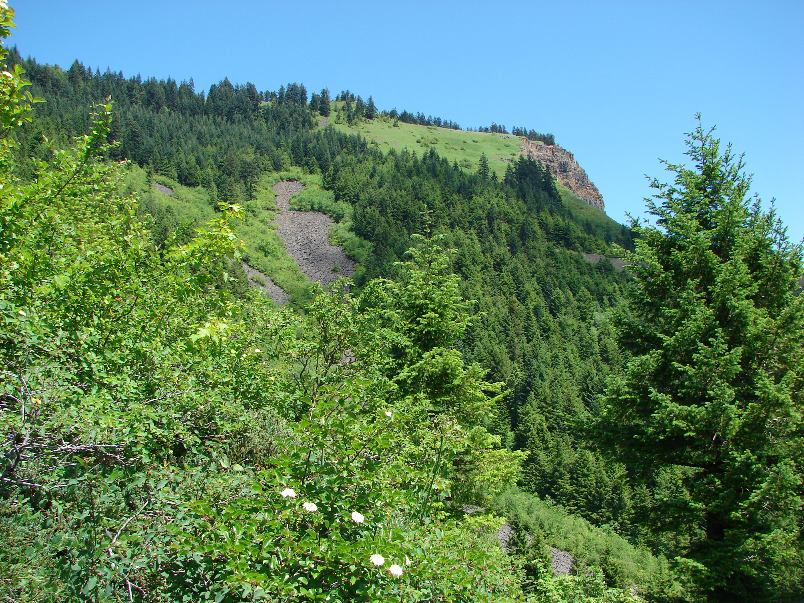
The trail offered no real views for the first 2.5 miles as it steadily climbed up through the forest. Rhododendrons lined the trail, many of which were in bloom adding a splash of pink amid the green. Although the total elevation gain for the trail is almost 3200′ it was rarely steep and never for very long which was a welcome change to last week’s trudge up Heartbreak Ridge. At the 2.6 mile mark a viewpoint at a rocky ridge end opens across the Mack Hall Creek Valley and to Salmon Butte itself. The ridge end was home to a small but diverse number of flowers. There were a couple red paintbrush, a single lupine, a lone cats ear, a couple of yellow flowers, and a blue filed gilia which was a first for us.
290

Leaving the viewpoint the trail reentered the forest and climbed along the west side of a ridge for 2 miles before we would reach the next viewpoint. Still there was plenty to keep us entertained which is where the mouse rain incident occurred. As we were walking along I saw something out of the corner of my eye and heard a “thump” on the hillside just to the left of us. My first thought was pine cone, but the thump was too loud and the color wrong for a cone so my next thought was that someone had thrown a rock at us. It nearly rolled into Heather. As she attempted to avoid it we realized it was an animal. The poor mouse got its bearings and scurried off the side of the trail and disappeared into the brush. We have no idea where it came from, if it just slipped or possibly escaped from a bird in the trees above, but we certainly won’t forget our first encounter with mouse rain.

At a switchback near the 3.9 mile mark a short side path extended out to a small but amazing hillside meadow. There was no view to speak of but the hill side was carpeted with plectritis, larkspur, and little yellow monkeyflowers.
109

The trail eventually moved from the west side of the ridge to the east and shortly after reached a viewpoint with the first view of Mt. Hood. Here beargrass and rhododendrons lined the trail in various states of bloom. For the next half mile the trail climbedd gently along the top of the ridge before a couple of steep switchbacks reached a second abandoned road. This was the road to the former lookout tower that no longer exists on Salmon Butte. As the road curved up around the summit Mt. Jefferson came into view to the south followed by Mt. Hood to the north. After .3 miles we reached the summit and sweeping across the Salmon-Huckleberry Wilderness to the north, south, and east.

Although there were a few clouds in the sky we had an excellent views of Mt. Hood and Mt. Jefferson.

Mt. Hood
Mt. Hood

Mt. Adams and Mt. St. Helens were clearly visible in Washington and the North Sister was peaking over the shoulder of Mt. Jefferson to the south. With an assist from the binoculars we were finally able to identify Mt. Rainier as well. We enjoyed a peaceful lunch as the only people on the summit. We were not alone though. A couple of swallowtail butterflies flitted around the summit and a gray jay flew up to check us out. There was also a chipmunk busy eating seed on a tree trunk, obviously knowing this was a perfect spot for lunch.

We passed several hikers on our way back down but no more falling mice. When we rejoined the old road near for the final 1.2 miles the scenery had changed. Scores of white candy flowers had opened to the sun and now dotted the green grass along the path. This was a really nice hike and in the end didn’t feel like we’d gone 3170′ in 11.2 miles. Until next time – Happy Trails (and watch out for falling mice :))

Categories
Columbia Gorge North Hiking Trip report Washington

Table Mountain

If at first you don’t succeed, try, try again. After our recent string of cloud obscured views I was determined to break the streak. I had been watching the weather forecast all week and decided everything was lining up perfectly for a return to the Columbia Gorge and another attempt at a view of the Cascades. The nasty weather and the poncho attack on Hamilton Mountain needed to be avenged so for this hike I picked Table Mountain.

Table Mountain is located less than 5 miles east of Hamilton Mountain. It should have been what I was looking at from the saddle when I was sucker punched by the poncho during that hike. Much of Table Mountain collapsed into the Columbia River centuries ago leaving dramatic cliffs on the south face. With an elevation of 3417′ it is nearly 1000′ taller than Hamilton Mountain so the potential for views is great.

We woke up to a beautiful sunny morning but as we approached Portland an ominous cloud hung to the east of the city. The skies all around were blue and we hoped that Table Mountain was far enough to the east to be clear of the cloud. We formulated a plan b just in case when we reached Hamilton Mountain which was once again covered in clouds, but when we arrived at the trail head behind Bonneville Hot Springs the summit of Table Mountain was cloud free. With blue skies to the north and east we decided to give it a try.

The first 2.2 miles of the trail pass through a pretty forest, first on a volunteer created trail, then following an old road up to the Pacific Crest Trail (PCT). This first section was nice but unremarkable although we did come across some ripe salmonberries to sample. After a short walk on the PCT we reached the sign for the loop trail to the summit of Table Mountain. The aptly named Heartbreak Ridge Trail gains 1770′ in 1.5 miles. In order to do this the trail heads up with a vengeance. After 0.6 miles (and 800′ of elevation) the trail arrived at a saddle viewpoint. To my dismay the clouds that had been to the west were now heading east obscuring much of the view and had now covered Table Mountains summit. The trail then dipped down to the base of a 500 yard long rock slide where we spotted our first beargrass bloom of the year (on a hike not from the car).

The trail appears to end at the rock slide but the rocks are the trail. Following poles we scrambled up the rocks to the continuation of the trail. This part proved to be quite fun. Just a few tenths of a mile after reaching the trails continuation we reached the meadows on the summit. An all to familiar view greeted us here. We had come all this way and couldn’t see more than a few hundred feet due to clouds. The meadows were filled with various wildflowers creating a colorful display and many plumes of beargrass stood at attention along the meadows edges.

As we headed south along the summit trail toward the viewpoint at that end a faint window opened in the clouds and there stood Mt. Hood. The clouds had begun to slowly break up and by the time we reached the viewpoint better and better views were opening up.
201
We could now see Mt. Hood and the tip of Mt. Jefferson at times. Below we could see the Bonneville Dam on the Columbia River and the Heartbreak Ridge trail as it crossed the viewpoint saddle. We spent awhile here waiting for the openings and then headed back down the trail to find a spot for lunch.

We chose a spot that offered a view to the north and east in addition to Mt. Hood to the south. As we ate glimpses of Mt. Adams and Mt. Rainier began to appear. We eventually traveled further north on the summit loop to a second viewpoint at that end. There we discovered a beargrass meadow and ever improving views of Mt. Adams, Mt. Rainier, and also the rim of Mt. St. Helens.

Mt. Adams
Mt. Adams

We never quite got a clear view of any of the Washington peaks due to a pesky line of little clouds but after getting our fill of the view we headed down the west ridge. This trail was almost as steep as it made its way down and contained a lot of loose rocks. In addition it traveled close enough to the edge of the ridge that anyone with a fear of heights might really have a hard time. That being said the views from this trail were great. Mt. Hood lay ahead while behind was Table Mountain and the rock slide we had scrambled up.
521
The going was slow but we eventually made it down to the PCT. I had no takers when I asked if anyone wanted to go around again when we reached the Heartbreak ridge junction so we returned to our car satisfied with the days views and ready to plan our next adventure. Happy Trail.

facebook photos: https://www.facebook.com/deryl.yunck/media_set?set=a.10201335132527489.1073741836.1448521051&type=3
way too many flickr photos: https://www.facebook.com/deryl.yunck/media_set?set=a.10201335132527489.1073741836.1448521051&type=3