
After getting replacement tires and hiking some of the trails in the Paradise Area on Monday (post) we headed for Mount Rainier’s Sunrise Area early Tuesday morning. Timed entry reservations are required to enter the Sunrise Corridor from 7am thru 5pm in 2025, so we made sure we were plenty early to avoid needing one.
We left Packwood, WA a little before 5am and stopped at Sunrise Point just before 5:45am to catch the tail end of the actual sunrise.

Alpenglow on Mt. Rainier.


Mt. Adams behind Barrier Peak

The view NE.
After the spectacular sunrise we continued up Sunrise Road and parked near the Sunrise Visitor Center.

Our first visit to Mount Rainier had been a 4-day backpacking trip (post) on the Northern Loop which began from Sunrise. Our first 1.6-miles followed our route from that trip following a “Trail Access” pointer to a wide trail next to a signboard.


There was no fog as there had been the day before, so we had good views as we climbed through open meadows toward Frozen Lake.

Looking back at the Sunrise Day Lodge.

Western pasque flowers and Mt. Rainier.

There is good signage throughout the park.


Parry’s arnica

Pine siskin
We went left when we reached the top of Sourdough Ridge.

A short distance along the ridge we were alerted to a herd of elk below in Huckleberry Basin.


There are at least seven elk visible in this photo.

A cow and three calves.
The trail climbed up along Sourdough Ridge and past Frozen Lake to a 5-way junction. The wildflowers on this side of the mountain are not as profuse as they are in the Paradise Area but there was still a nice variety of flowers in bloom.

False hellebore

A few remaining phlox flowers.

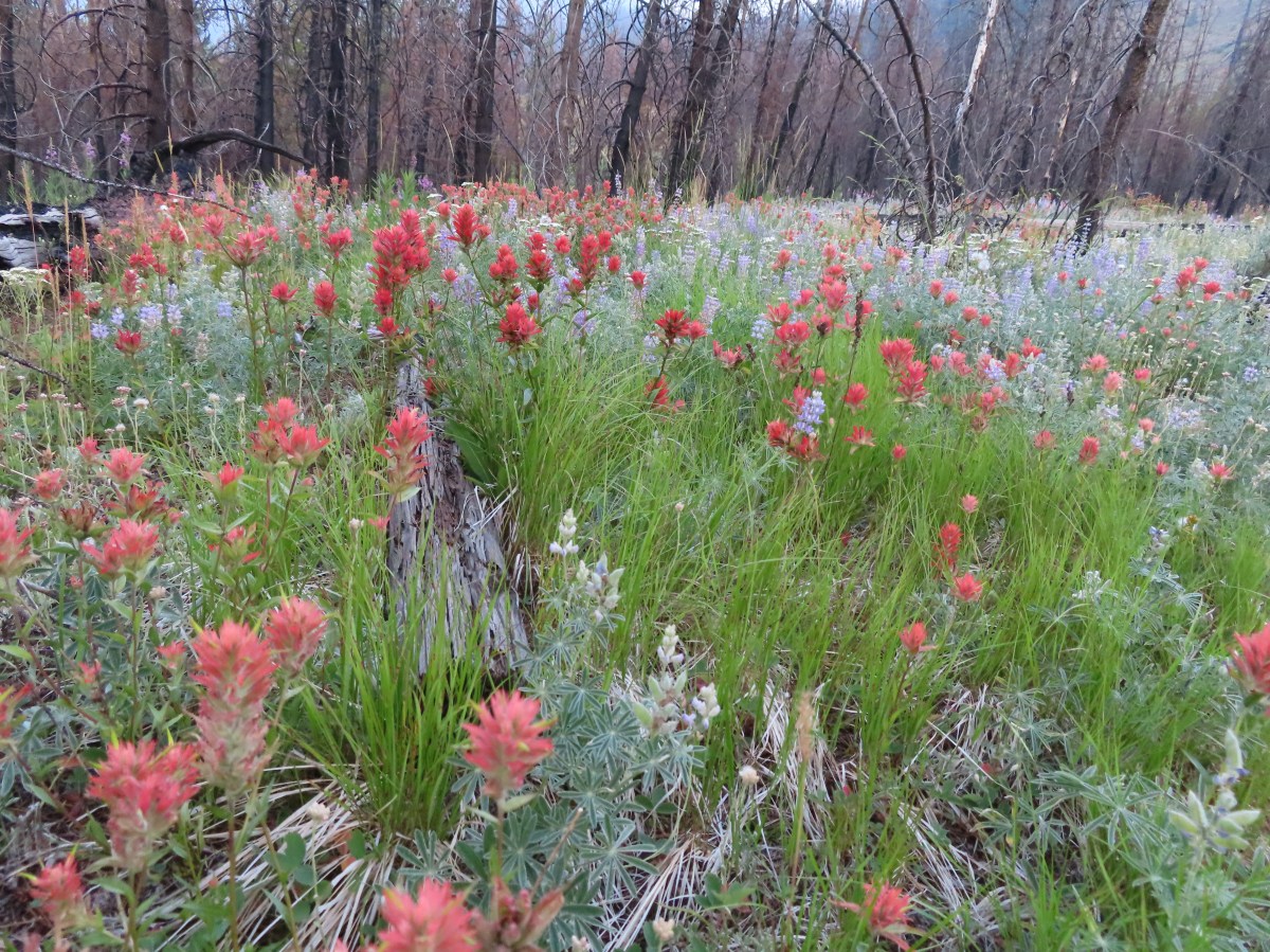
Paintbrush and aster


Rainiera


Pearly everlasting with a few paintbrush intermixed.

Harebells


Alumroot

Goldenrod

Lousewort and partridgefoot

First pika of the day.

Golden fleabane

Dwarf lupine

Penstemon and alpine false dandelions.

Catchfly

Frozen Lake which supplies water to the Sunrise area and is off-limits to visitors.

The 5-way junction. The Wonderland Trail is the first to the left and continues straight ahead. The Burroughs Mountain Trail is the second to the left heading uphill toward Mt. Rainier. To the right is the Mount Fremont Trail.
When we hiked the Northern Loop we had gone straight on the Wonderland Trail from this junction. Today’s plan was to head right to the Fremont Lookout then return to this junction and head out the Burroughs Mountain Trail returning to Sunrise via Shadow Lake.
We headed for the Fremont Lookout which was 1.3-miles away. After a brief initial steep climb the trail eased up and gradually climbed along the open hillside.

We took the righthand fork.

Passing above Frozen Lake.

Shrubby cinquefoil

The Burroughs Mountain Trail on the far hillside.

Heading up.

Frozen Lake behind.

The Fremont Lookout at the end of the ridge ahead.
The views from this trail were impressive as was the number of pikas living along the rocky hillside.

Looking back at Mt. Rainier.

Skyscraper Mountain directly ahead.

Pika

The rock fin in the foreground was pretty cool.

Yellow-bellied marmot

Penstemon
The trail eventually came to the top of the ridge as it neared the lookout.

The lookout is on the other side of the knoll ahead.
From the ridge we could see a ridge to the east where a herd of mountain goats was hanging out.


Heather pointed out this group in the rocks.

We took a break at the lookout taking in the views. It was chilly enough that we were eventually prompted to continue on.


Mount Rainier from the Fremont Lookout. Berkley Park is the green area below where the Northern Loop Trail climbs up to meet the Wonderland Trail.

The West Fork White River (post) below to the left. The plateau to the right is Grand Park (post).

The Mount Fremont Trail along the hillside with Little Tahoma to the right.

Chipmunk. Always begging but we will not be swayed. Please do not feed the animals no matter how cute they are.

Golden-mantled ground squrriel

Rocky Mountain goldenrod and alpine sandwort.

Paintbrush

Talus collomia
We made our way back down to the Burroughs Mountain Trail and began another 1.3-mile climb to Second Burroughs Mountain.


Bird’s beak lousewort

Cusick’s speedwell and white mountain heather.

Mt. Rainier beginning to come into view.

Looking across at the Mount Fremont Trail. The lookout is visible on the left shoulder of the middle peak.


Mount Rainier and Second Burroughs Mountain from First Burroughs Mountain.
I had gotten ahead of Heather and missed a mountain goat that peered over the hillside above her on the trail.

Our return trail, the Sunrise Rim Trail, met the Burroughs Mountain Trail on First Burroughs Mountain.


Berkeley Park from First Burroughs.
The Burroughs Mountain Trail dropped to a saddle between First and Second Burroughs Mountains then made a relatively steep climb to the top of Second Burroughs Mt.

Looking back at the saddle.

Heading up Second Burroughs.

The Goat Rocks (post) to the south.

Gilbert Peak, Goat Citadel, Littel Horn, Chimney Rock and Old Snowy Mountain in the Goat Rocks Wilderness.

Glacier Peak to the north beyond the Fremont Lookout.

All of my maps showed the Burroughs Mountain Trail dropping down from Second Burroughs and steeply descending to the Inter Fork River below Glacier Basin, however a trail does extend to Third Burroughs Mountain. That would have added three miles and over 1150′ of cumulative elevation gain to the day. That would have been tempting had we not already hiked up to the lookout, but since we had and we had another three days of hiking ahead of us we declared victory at Second Burroughs.

First Burroughs and the Inter Fork.

Emmons Glacier

Old Desolate Mountain to the left and Sluiskin Mountain to the right.

Bench on Second Burroughs.

Not sure if this is a thrush or something else (Merlin thought it was a horned lark but that doesn’t look right at all.)
After a nice break on Second Burroughs we headed back to First Burroughs and the Sunrise Rim Trail.


Pink mountain heather

Tundra aster

Lenticular cloud forming over Mt. Rainier.

The Sunrise Rim Trail junction.
We turned right on the Sunrise Rim Trail. This trail descended for 1.4-miles to the Wonderland Trail near Sunrise Camp and Shadow Lake.


A buckwheat

The lenticular cloud was growing.

Lupine and lousewort covered the hillside in spots.

Goldenrod and yarrow


As far as I can tell this unnamed lake isn’t shown on any maps.

Silverback luina


Dwarf mountain ragwort

Narrow sepal phacelia

Sourdough Ridge ahead.

Aster

Orange agoseris


Checkerspot
As we neared the Wonderland Trail we reentered the tree line where the wildflower display really picked up.


Sunrise Camp below along with the Wonderland Trail.

Old cabin near Sunrise Camp.

The Wonderland Trail heading toward Frozen Lake.
A short distance beyond Sunrise Camp we arrived at Shadow Lake.


Bistort and other flowers at Shadow Lake.

Lupine and elephants head

Shadow Lake
We stayed on the Wonderland Trail for another 0.7-miles beyond Shadow Lake then forked left for 0.6-miles to return to the Sunrise parking area.


Cinquefoil


More clouds forming. As nice as it was today Wednesday’s forecast called for showers all day with a chance of thunderstorms in the afternoon.

Clark’s nutcrackers

We forked left a second time at a junction with the Silver Forest Trail.

Sunrise Visitor Center
After dropping off our packs we took a moment to explore the Visitor Center before heading back to Packwood.


This was interesting although neither of us had it in us to actually attempt to jump.
This hike clocked in at 9.3-miles with a little over 2000′ of elevation gain.

This was another amazing hike with huge views, plenty of wildflowers, and a lot of wildlife. It was also less crowded than the Paradise Area had been. I don’t know if that is a result of the timed entry reservation system or simply our choice of trails but there were plenty of moments of solitude during this hike. We had an early dinner at Cruiser’s Pizza back in Packwood (they have a full menu in addition to pizza) and worked on finalizing our plan for Wednesday’s hikes. With rain showers in the forecast for the entire day we did some shuffling of our planned hikes and made Wednesday a waterfall Wednesday. We were happy with our new schedule for the remainder of the week and were looking forward to the rest of the hikes. Happy Trails!


 This trail is part of the
 Damaged footbridge over Morganroth Creek at the 0.2-mile mark.
 The Wetland Loop Trail split off just beyond Morganroth Creek. I stayed right and planned on returning via the loop.
 This was a muddy trail which isn’t surprising for an area that receives 120″ of rain (3 meters) on average annually.
 Youth-on-Age
 Approaching the Bogachiel River.
 Bogachiel River
 The other end of the Wetland Loop was approximately a half mile from the Olympic National Park boundary.
 Kahkwa Creek. The log down in the distance was crossable but I opted to ford the creek on my first pass.
 Ford at Kahkwa Creek.
 Signs at the park boundary. The trail name changes here to the Bogachiel River Trail.
 Wilderness permits for back country camping. At this point I was not only in the park but also the

 The dry creek where I turned around.
 The log crossing over Kahkwa Creek.
 The Wetland Loop Trail junction was near the Kahkwa Creek crossing.
 The Wetland Loop began along Kahkwa Creek.

 Skunk cabbage
 The Wetland Loop traversed up and down along a hillside above some wetlands.
 Scouler’s corydalis
 Wetlands below the loop trail.
 Completing the loop.
 Fairy lanterns


 Notice regarding the petroglyphs on Wedding Rocks. By the time we were on the beach we’d completely forgot to look for these. We did run into another hiker who had seen them on a prior trip, but he couldn’t remember where. He thought they were located at some rocks near where we’d run into him, so we searched those rocks for several minutes with no luck. As it turns out he was mistaken as to where Wedding Rocks was, it is located on the first rocky headland nearest Cape Alava at the northern end of the triangle hike. We were much closer to the southern end.
 Ozette River leaving Ozette Lake.

 Bunchberry
 Slug on a skunk cabbage leaf.
 Skunk cabbage
 Bog laurel along the trail.
 Closer look at the bog laurel blossoms.
 Squirrel
 First view of the ocean.
 Beach bunny
 Ozette Island. The signpost is used to identify inland trails that bypass the beach.
 Bodelteh Islands
 Heading south along the beach.
 We had heard sea lions somewhere in the direction of Ozette Island as we were approaching the beach.
 There is a seal in the foreground and a couple of sea lions on the rocks beyond.
 Seals lounging on the rocks.
 One of several campsites along the beach.

 Approaching Wedding Rocks. There is a bypass sign ahead if you look closely. At higher tides it is not possible to go around the rocks along the beach.
 A couple of crabs taking a defensive position as we were passing by.
 Wedding Rocks
 On the other side of the Wedding Rocks. As I mentioned before this is where the petroglyphs are, but we’d already forgotten to be looking for them. In Heather’s defense she had started to come down with a cold the previous day and was not feeling 100%. I however had no excuse.

 Looking back at the Wedding Rocks.
 Robin
Robin Bald eagle
 Whimbrel
 Hole in a sea stack.
 Seals and cormorants
 The second rocky headland where there was an inland bypass route. On the far side is where we ran into the hiker who thought these were the Wedding Rocks where he’d seen the petroglyphs before.
 Path through the rocks. It made sense to us that this would be where the petroglyphs were given there were several passages between the rocks here.
 Coming out the other side.
 Looking back at the rocks that weren’t the Wedding Rocks.
 Sandpoint ahead.
 Semipalmated plover
 View south
 One of the groups of backpackers heading north from Sand Point.
 Chickweed on the headland.


 Evergreen huckleberry blossoms.
 Bench along the trail.
 Groundcone. Heather had a sharp eye to pick this up on the forest floor.
 There were a couple of missing sections of boardwalk along this side of the triangle.
 Ozette Lake


 James and Little James Islands
 The beach was mostly small pebbles to start. Our steps often sunk more than expecting requiring more effort than we’d have guessed. We spent quite a bit of time trying to find the most solid ground.
 Our footsteps on the beach.
 Stump in the sand.
 Ellen Creek. The creek flowed under the beach and emerged shortly before the ocean.
 Seagull
 Bald eagle


 Looking back through the arch.


 This racoon was searching the tide pools for breakfast.
 Looking back toward Hole-in-the-Wall.

 Many of the dark spots on these rocks are the small crabs.
 Does anyone know what this is?

 Oyster catcher
 Cormorants
 Cape Johnson in the distance.
 Paintbrush
 Unnamed creek not quite making it to the ocean above ground.
 Cape Johnson

 I turned around at the slide ahead.
 Hermit crab shells
 A good example of the challenging terrain.
 Seagull, oyster catchers, and a cormorant.
 Paintbrush on the cliffs above the beach.
 Hole-in-the-Wall and James Island back in view.
 Not a great picture due to the extreme zoom and low lighting. After looking closer at this photo I began thinking it was just a rock in the surf. Then I looked at the next photo and what would be the foot and the head were in different positions.
 Possible sea otter.
 The area around Hole-in-the-Wall was a lot busier on the way back.
 Driftwood on the beach.
 Heather spotted this little starfish while exploring the tide pools near the arch.
 Heather also spotted this which we believe is a velella velella.
 Starfish and anemones
 Bald eagels
 On the jetty looking at James Island.
 La Push across the river.
 Sea lion in the river.
 Heading back to the trailhead along the jetty.
 The jetty is actually part of the Quileute Indian Reservation.

 Map of the area trails at the trailhead.
 Anyone know why the spelling on the sign is different?
 Violets
 Bridge over an unnamed creek.
 Trillium
 Coltsfoot
 Fairy bells


 Depending on the volume of water there are up to four channels which was the situation on this day.
 Heather on the bridge above the falls.


 Storm King Ranger Station
 Forget-me-nots (non-native) along the trail.
 Lake Crescent

 Storm King Trail to the left.
 Marymere Falls Trail junction with the Barnes Creek Trail.
 Footbridge over Barnes Creek.
 Barnes Creek
 Trillium
 Footbridge over Falls Creek almost immediately after crossing Barnes Creek.
 Falls Creek
 Start of the clockwise loop.

 Marymere Falls
 The trail climbing up from the first viewpoint.
 Marymere Falls from the second viewpoint.
 Final viewpoint before the loop curved away from the falls and descended back to its start.
 The footbridges over the two creeks.
 Unnamed fall on Falls Creek from the footbridge.
 It was now almost 9am so there were a few cars parked here already.

 Various poems were located along the first mile of the trail.
 This trail is open to a variety of users.
 Haiku
Haiku

 A second haiku.
 Common whipplea
 Starflower
 Valerian
 Clear water in Lake Crescent.
 Paintbrush
 Something in the pea family.
 Nearing Devil’s Punchbowl.
 Devil’s Punchbowl
 There was a fair amount of poison oak along the trail to Devil’s Punchbowl.
 Madrones
 Honeysuckle
 Common cryptantha
 Rejoining the railroad trail on the far side of the tunnel.
 Butterfly
 Another type of trail user.
 View west.
 View east.
 Big deervetch
 Fairy slippers
 Chipmunk
 Woodpecker
 Lake Crescent Lodge on the far side of the lake.
 Squirrel
 Wallflower
 The second tunnel.
 Thimbleberry
 White crowned sparrow
 Going through the tunnel.
 I went a little further around this bend while Heather took a seat on a log after exiting the tunnel.
 Paintbrush
 View across the lake toward the Barnes Creek Valley.
 I believe the snowiest peak is Lizard Head Peak.
 Saxifrage
 Chickweed
 Swallow
 Oregon sunshine
 Lupine
 Stonecrop
 Variable-leaf collomia

 This was a longer tunnel and had little light near the middle.
 Descending to the trailhead.

 The lake from the picnic table.
 Common loon
 These mallards came flying in then waddled up to see if they could scrounge something from us, but we explained that we do not feed the wildlife (
 Stellar’s jay
 Trying to find the route to the lodge.
 Mushroom
 The lodge is just on the other side.


 Interpretive signs explaining the creation of Lake Crescent by glaciers.
 This trail had good signage unlike the area near Bovee’s Meadow.

 Chair near the lodge.
 Lake Crescent Lodge.


 Hall of Mosses pointer.
 Spring fed Taft Creek.
 Start of the one-way loop.
 Interpretive sign along the loop.
 Looking up from the interpretive sign.
 Maple Grove
 Nursery log

 Fallen sign for the Spruce Nature Trail.

 This was another interpretive loop.
 Hoh River from the trail.
 This huge root ball was hosting its own mini forest.
 Taft Creek
 The trail extends all the way up to Glacier Meadows below Mt. Olympus.
 Violet
 Fungi
Fungi
 Another type of violet.
 Hoh River
 Bunchberry and strawberry bramble
 Slug
Slug Trillium
 Squirrel
 One of the “ups”.
 Star flower
 Hoh River
 Mineral Creek
 Scouler’s corydalis along Mineral Creek.
 Mineral Creek Falls
 Unnamed creek a short distance beyond Mineral Creek.
 Waterfall on the unnamed creek.
 Sign for the spur trail to Mount Tom Creek Camp.
 Wren
Wren
 Vanilla leaf
 Water droplet on a vanilla leaf.
 More violets
 Salmonberry along the trail.
 Big leaf maple canopy.
 There were a few obstacles such as this closer to 5 Mile Island.
 Cougar Creek crossing.
 Marker at the spur trail for 5 Mile Island Camp.
 Hoh River at 5 Mile Island Camp.
 View upriver from the same spot.
 Privy at 5 Mile Island Camp.
 Crow
Crow Cat Peak, Mount Carrie, and Ruth Peak partly under clouds.
 Cat Peak
 We saw a lot of robins, on this hike and the over the next four days.
 Slug
Slug
 Candy flower
 Almost back to the trailhead.


 Atwood Road
 Death camas
 Saxifrage and a yellow bells.
 Grass widows
 Gold stars, wood-land stars, and blue-eyed Mary.
 Catherine Creek from Atwood Road.
 Pungent desert parsley

 Closer look at the arch.
 Buttercup
 I believe this was just our second time coming across these flowers.
 Closer look at the Dutchman’s breeches.
 Hairy bittercress (non-native)
 Entering the sunlight.
 Glacier lilies
 wood-land stars
 Toothwort
 Columbia desert parsley

 Heading through the forest.
 Looking east as the road emerged from the forest.
 Grassy hillside
 Mt. Hood behind a few clouds.
 Mt. Hood
 Popcorn flower
 Rowland Creek
 Another user trail on the left, referred to as the Shoestring Trail by the Oregonhikers Field Guide. This trail is not shown on the Forest Service map nor is it mentioned on their website.
 Coastal manroot
 Grass widows
 View of Mt. Hood’s summit.
 Robin hunting worms.
 Daffodils
 The Upper Labyrinth Trail (aka Co8) joining from below. This was the first junction with signs naming official trails.
 Labyrinth Creek below Atwood Road.
 The Labyrinth Creek crossing.
 Wet trail climbing away from Labyrinth Creek.
 Red-tailed hawk


 Yellow bells

 We stayed left here.
 We ignored the singletrack leading right on the far side of this unnamed stream.
 Here we veered right on the single track. I believe the single track is the “official trail” although both paths led to the signed junction.
 A multitude of tracks near the junction.
 On one of the switchbacks.
 Turkey vulture
 The upper viewpoint.
 Balsamroot
 Looking east over the Columbia River.
 Gold stars

 The
The  Woolly-pod milk-vetch
 Miniture lupine, redstem storksbill and a popcorn flower.
 Fiddleneck
 We turned right at this junction with the Old Ranch Trail to continue downhill.
 Naked broomrape and redstem storksbill

 Tomcat clover and redstem storksbill


 We ignored the Little Maui Connector Trail on the left near the old highway.
 Larkspur


 Crossing for Labyrinth Creek.


 First view of the Catherine Creek Trailhead on the plateau ahead.

 Hound’s tongue
 Rowland Creek
 Rowland Basin

 Lupine and balsamroot


 The Rowland Pinnacle


 Ocean spray – August 4th – Wizard Island (Crater Lake NP), OR
 Olympic onion – June 8th – Cedar Butte, OR
 One-sided wintergreen – July 25th – Minam River Trail, OR
 Tapertip onion – July 21st – Granny View Overlook (Hells Canyon), OR
 Ookow – June 1st – Cook Hill, WA
 Orange agoseris – June 29th – Grasshopper Mountain, OR
 Orange globe mallow- May 25th – Barnes Butte (Prineville), OR
 An orchid – July 22nd – Hurricane Creek Trail (Eagle Cap Wilderness), OR
 Oregon bluebells – June 29th – Grasshopper Mountain Trail, OR
 Oregon grape – March 30th – Mulkey Ridge Trail (Corvallis), OR
 Oregon sunshine – July 13th – Nasty Rock Trail, OR
 Pacific coralroot – July 13th – Joyce Lake Trail, OR
 Pacific hound’s tongue – March 30th – Mulkey Ridge Trail (Corvallis), OR
 Pacific waterleaf – May 12th – Cathedral Tree Trail, OR
 Indian paintbrush – May 25th – Willow Creek Canyon, OR
 Paintbrush – probably scarlet (Castilleja miniata) – August 18th – Cliff Creek Trail (Wallowa-Whitman National Forest), OR
 Parry’s arnica – July 21st – Hat Point, OR
 Patridge foot – September 13th – Pacific Crest Trail (Mt. Jefferson Wilderness), OR
 Gray sagewort – July 21st – Granny View Overlook (Hells Canyon), OR
 Pea-vine – May 26th – Madison Butte, OR
 Pearly everlasting – June 19th – Deception Butte Trail, OR
 Woolly head clover – July 24th – Tenderfoot Wagon Road Trail (Eagle Cap Wilderness), OR
 Pennycress – July 23rd – McCully Creek Trail (Eagle Cap Wilderness), OR
 Penstemon – May 25th – Barnes Butte (Prineville), OR
 Penstemon – June 1st – Cook Hill, WA
 Pestemon – July 13th – Nasty Rock Trail, OR
 Venus penstemon – July 21st – Granny View Overlook (Hells Canyon), OR
 Globe penstemon – July 24th – Tenderfoot Wagon Road Trail (Eagle Cap Wilderness), OR
 A phacelia – July 26th – East Peak (Eagle Cap Wilderness), OR
 Phantom orchid – June 1st – Cook Hill, WA
 Phlox – June 1st – Cook Hill, WA
 Pinedrops – August 3rd – The Pinnacles Trail (Crater Lake NP), OR
 Pink pyrola – June 19th – Deception Butte Trail, OR
 Pioneer violet – April 13th – Wind Mountain, WA
 Woolly goldenweed? (If so this was a first for us.) – May 26th – Madison Butte, OR
 Prairie smoke – May 26th – Bull Prairie Lake, OR
 Prince’s pine – July 22nd – Hurricane Creek Trail (Eagle Cap Wilderness), OR
 Purple dead-nettle – February 24th – Fernhill Wetlands, OR
 Purpleflower honeysuckle – June 29th – Grasshopper Mountain, OR
 Pussypaws – July 26th – Mount Howard, OR
 Pussytoes – July 13th – Nasty Rock Trail, OR
 Queen’s cup – June 22nd – Big Huckleberry Mountain, WA
 Raceme pussytoes – June 29th – Grasshopper Mountain, OR
 Rosy pussytoes – June 22nd – Big Huckleberry Mountain, WA
 Ragwort – May 26th – Madison Butte, OR
 Red clover – July 24th – Tenderfoot Wagon Road Trail (Eagle Cap Wilderness), OR
 Red flowering currant – April 13th – Wind Mountain, WA
 Rhododendron – June 15th – O’Leary Mountain Trail, OR
 Rockcress – May 26th – Madison Butte, OR
 Rose campion (non-native) – June 19th – Buckhead Nature Trail, OR
 Rosy bird’s-foot trefoil – June 8th – Kilchis Forest Road, OR
 Sagebrush mariposa lily – July 22nd – Hurricane Creek Trail (Eagle Cap Wilderness), OR
 Salal – June 8th – Kilchis Forest Road, OR
 Salmonberry – April 13th – St. Cloud Trail, WA
 Sandwort – July 24th – Bonny Lakes Trail (Eagle Cap Wilderness), OR
 Saxifrage – July 24th – Tenderfoot Wagon Road Trail (Eagle Cap Wilderness), OR
 Scarlet gilia – July 4th – Horsepasture Mountain, OR
 Scouler’s bluebell – June 19th – Deception Butte Trail, OR
 Scouler’s corydalis – April 13th – Lower Archer Falls, WA
 Scouler’s woollyweed – July 24th – Bonny Lakes Trail (Eagle Cap Wilderness), OR
 Seaside bittercress – May 11th – Ecola State Park, OR
 Self-heal – June 19th – Deception Butte Trail, OR
 Serviceberry – May 26th – Madison Butte, OR
 Shooting star – May 26th – Madison Butte, OR
 Silverleaf phacelia – May 25th – Willow Creek Canyon, OR
 Silvery raillardella (new to us) – August 4th – Crater Lake National Park, OR
 Sitka mist-maidens – April 27th – Wahkeena Trail, OR
 Skunk cabbage – May 11th – Ecola State Park, OR
 Slender phlox – May 26th – Madison Butte, OR
 mall-flowered woodland-star – May 26th – Madison Butte, OR
 Small bluebells – May 26th – Madison Butte, OR
 Snowberry – June 19th – Deception Butte Trail, OR
 Solomonseal – April 20th – Jackson Bottom Wetlands, OR
 Oregon oxalis – April 13th – Lower Archer Falls, WA
 Spirea betulifolia – June 22nd – Big Huckleberry Mountain, WA
 Spiraea douglasii – July 6th – Independence Riverfront Park, OR
 Spiraea splendens – July 25th – Minam River Trail, OR
 Spotted coralroot – June 1st – Cook Hill, WA
 Spreading dogbane – July 22nd – Hurricane Creek Trail (Eagle Cap Wilderness), OR
 Spreading stickseed? – June 1st – Cook Hill, WA
 Star-flowered false solomonseal – June 8th – Cedar Butte, OR
 Starflower – June 1st – Cook Hill, WA
 Stonecrop – June 1st – Cook Hill, WA
 Wormleaf stonecrop – July 13th – Nasty Rock, OR
 Strawberry – March 30th – Mulkey Ridge Trail (Corvallis), OR
 Streambank globe-mallow – July 24th – Tenderfoot Wagon Road Trail (Eagle Cap Wilderness), OR
 Sub-alpine mariposa lily – June 19th – Deception Butte Trail, OR
 Sugar sticks – July 4th – Olallie Trail, OR
 Swamp onion – July 24th – Bonny Lakes Trail (Eagle Cap Wilderness), OR
 Chicory (non-native) – August 18th – Cliff Creek Trail (Wallowa-Whitman National Forest), OR
 Sweet coltsfoot – April 27th – Wahkeena Trail, OR
 Tall bluebells – June 29th – Grasshopper Mountain Trail, OR
 Tansy ragwort (non-native) – July 6th – Independence Riverfront Park, OR
 Tasselflower brickellbrush – July 22nd – Hurricane Creek Trail (Eagle Cap Wilderness), OR
 Thimbleberry – April 20th – Jackson Bottom Wetlands, OR
 Thistle – June 8th – Kilchis Forest Road, OR
 Thistle (non-native) – July 6th – Independence Riverfront Park, OR
 Greene’s thistle (Cirsium inamoenum) – July 26th – Mount Howard, OR
 Threadleaf phacelia – May 25th – Barnes Butte (Prineville), OR
 Tiger lilies – June 19th – Deception Butte Trail, OR
 Dalmation toadflax (non-native) – May 25th – Willow Creek Trail (Madras), OR
 Tolmie’s mariposa lily – June 19th – Deception Butte Trail, OR
 Toothwort – March 30th – Mulkey Ridge Trail (Corvallis), OR
 Trillium – March 30th – Mulkey Ridge Trail (Corvallis), OR
 Twinberry – April 20th – Jackson Bottom Wetlands, OR
 Twin flower – July 4th – Olallie Trail, OR
 Valerian – June 8th – Kilchis Forest Road, OR
 Vanilla leaf – June 1st – Cook Hill, WA
 Variable-leaf collomia – June 8th – Cedar Butte Road, OR
 Vetch – May 28th – Baskett Slough National Wildlife Refuge, OR
 Vine maple – April 13th – Lower Archer Falls, WA
 Violet – March 6th – Dorris Ranch (Eugene), OR
 Violet – July 25th – Minam River Trail, OR
 Canary violet – May 26th – Madison Butte, OR
 Hookedspur violets – May 26th – Madison Butte, OR
 Wallflower – June 8th – Kilchis Forest Road, OR
 Wallowa paintbrush – July 25th – Minam River Trail, OR
 Washington lily – July 4th – Olallie Trail, OR
 Western buttercups – March 16th – Middle Fork Willamette Path (Eugene), OR
 Western clematis – August 19th – Pine Lakes Trail (Eagle Cap Wilderness), OR
 Western featherbells – July 13th – Nasty Rock Trail, OR
 Western Labrador tea – July 25th – Minam River Trail, OR
 Western meadowrue – April 27th – Angel’s Rest Trail, OR
 Western snakeroot – August 4th – Wizard Island (Crater Lake NP), OR
 White mariposa lily – July 24th – Bonny Lakes Trail (Eagle Cap Wilderness), OR
 Bushy blazing-star (Mentzelia dispersa) – July 24th – Tenderfoot Wagon Road Trail (Eagle Cap Wilderness), OR
 Tough-leaved iris – March 30th – Mulkey Ridge Trail (Corvallis), OR
 Wild onion (Tolmie’s?) – May 26th – Madison Butte, OR
 Wild roses – May 28th – Baskett Slough National Wildlife Refuge, OR
 Willowherb – July 24th – Tenderfoot Wagon Road Trail (Eagle Cap Wilderness), OR
 Wintergreen – July 13th – Nasty Rock Trail, OR
 Possibly woolly groundsel – July 24th – Tenderfoot Wagon Road Trail (Eagle Cap Wilderness), OR
 Yarrow – June 22nd – Big Huckleberry Mountain, WA
 Yellow bell – May 26th – Madison Butte, OR
 Yellow columbine – July 22nd – Hurricane Creek Trail (Eagle Cap Wilderness), OR
 Yellowleaf iris – June 15th – O’Leary Mountain Trail, OR
 Yellow sweet clover (non-native) – Hurricane Creek Trail (Eagle Cap Wilderness), OR
 Youth-on-age – June 8th – Kilchis Forest Road, OR
 Zigzag groundsmoke – August 3rd – The Pinnacles Trail (Crater Lake NP), OR
 Invasive Queen Anne’s Lace lower right corner.
