It had been a couple of weeks since we’d had a chance to hit the trails, but a favorable forecast gave me an opportunity to check out the Monument Peak Trail system in the Santiam State Forest just south of Gates, OR. Heather would not be joining me on this outing as she had some Christmas preparations to attend to.
There isn’t a lot of information online about the trail system. Oregon.gov has a pdf trail map and the Statesman Journal recently featured the area in a story, but outside of that not much came up in searches. The trails are shown on both CalTopo and Gaia GPS. Interestingly both of these mapping apps showed the various trail names while the trail names on the current Oregon Department of Forestry pdf rarely lined up with the trail signs on the ground. On the other hand, the ODF’s Santiam Horse Camp Brochure does contain a map with all the trail names, however it does not show the most recent addition, the Bobcat Trail at all. Regardless of the trail names the locations of the trails shown were correct on all of the maps.
There are two official trailheads serving the area, Santiam Horse Camp and the Monument Peak Trailhead. The road to the horse camp is closed seasonally from November through April so that left the Monument Peak Trailhead for my starting point. (It’s possible to start at several of the road crossings by parking along the shoulder of either Monument Peak or Mad Creek Roads.)

I was the first car at the trailhead.


The trail map at the trailhead matched the online pdf.
My plan was to take the 1.1-mile Magic Trail (Monument Peak Trail on the signboard map) up to the Monument Peak Loop and start the loop in a counterclockwise direction. Instead of simply hiking the loop though I intended to do a figure eight by cutting across the loop on the Bobcat Trail then looping back around to that trail in a clockwise direction. I would then re-hike the Bobcat Trail and turn left to complete the Monument Peak Loop creating the figure 8. While this would add 3.6-miles and a several hundred feet of elevation gain I wanted to take the opportunity to check out as much of the trails as possible.

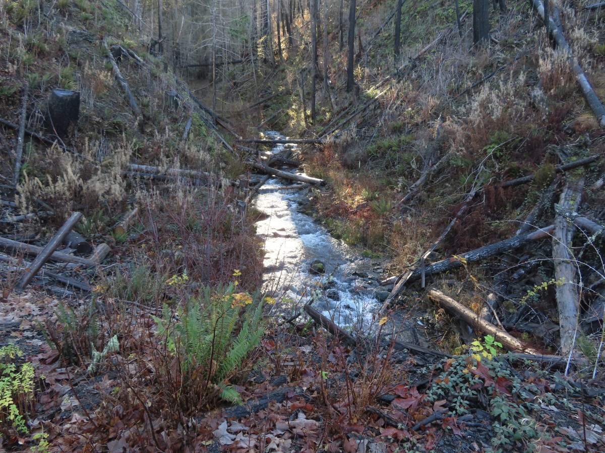
The Magic Trail began along an unnamed creek before switching back uphill through forest affected by the 2020 Beachie Creek Fire.


The trail crossed two gravel roads before ending at the Monument Peak Loop Trail.

The second road crossing.

Trail signs at the junction with the Monument Peak Loop.

Here the trail sign agreed with the signboard map calling this the Monument Peak Loop. It is also referred to as the Wild Boar Trail on the older ODF map. I headed right here toward the Santiam Horse Camp.

There was a lot of recent and/or future logging activity in the area, partly a result of the fire.

A lone bleeding-heart blossom.
It was a half mile from the Magic Trail junction to the horse camp. As I neared the horse camp the trail arrived at the edge of a clearcut that provided views across the Santiam River Canyon.


Looking west toward Salem and the Willamette Valley which was covered by low lying clouds. The Coast Range is visible on the far side of the clouds.

The city of Gates in the shadow below. The aftermath of the Beachie Creek Fire is on full display on the opposite side.

The high peak at the center (behind the lone snag) is Rocky Top (post) and high peak near the right side is Sardine Mountain (post).

One of the corrals at the horse camp.

The horse camp opened in 2006 and the trails developed with equestrian use in mind however they are open to all non-motorized use.
I passed by the horse camp and continued along the loop. The trail gradually climbed for 2.3-miles to the unsigned junction with the Bobcat Trail. Along the way the trail passed the historic Quartzville Trail which I haven’t been able to find much about online other than Judge John B. Waldo, Oregon’s first Supreme Court justice, used the route to travel from Gates to presumably the Quartzville district where mining activity was prevalent.


Hawk in the shadows.

There were a few obstacles on this side of the loop, but all were easy to navigate.

A bit of forest that was spared from the 2020 fire.

Market at the site of the historic trail.


The trail joined an old roadbed for a portion of this section.


The trail sign at this road junction was hidden behind the downed tree. The loop continues to the left here.

At the next road junction the trail went right.


The trail leaving the roadbed. The post on the left names this the Radio Flyer Trail while the trail sign on the right says Monument Peak Loop. At this point the trail had left the fire scar and now continued through nice second growth forest.


Flooded trail from the atmospheric river that passed over the PNW at the beginning of the week.

Just before reaching Wagon Road, I came to the unsigned Bobcat Trail forking off to the left.


Wagon Road from the junction. You can see the back end of a mushroom hunter’s car that was parked along the shoulder.
I turned left onto the Bobcat Trail which provided a mostly downhill break from the steady climb I had been doing since starting my hike.


Rhododendron
I encountered the first major obstacle of my hike on this trail; a good-sized tree had fallen along the trail on a slight downhill. I wound up walking on top of the tree for a bit to get around some of the larger limbs then spent some time clearing some of the broken branches from the trail before continuing on.


Coming up on Monument Peak Road.

The Bobcat Trail continuing on the other side of the road.


The Bobcat Trail dropped down to Mad Creek Road which I had to cross and then follow road MC100 for a little over 100′ to find the continuation of the trail.

Mad Creek Road is running left to right with MC100 straight ahead.
I had to walk down MC100 a bit to pick up the continuation of the trail.

There was a lot of target shooting happening just up Mad Creek Road which prompted me to speed up a bit as I continued on the final half mile to the junction with the Monument Peak Loop.

Back in the fire scar.

Dropping down to the trail junction.

Looking back at the Bobcat Trail.
I turned right at the junction and headed toward the gunfire. While I was fairly certain they were using an appropriate gravel pit I was a little more comfortable now that I was well below the road in a bit of a canyon. Below the trail Mad Creek was occasionally visible.


The trail turned away from Mad Creek near one of its tributaries which had a nice little waterfall boosted by the recent rains.


The trail climbed out of the canyon and crossed Mad Creek Road near the gravel pit where I could see the target shooters.

The maps all showed two road crossings along this section, Mad Creek Road and MP 800, before arriving at Monument Peak Road. That being said I crossed at least four roads and a fire break in the 1.3-miles to Monument Peak Road.

I’m not sure if this is MP800 or if it was the next one.


The fire break.


Woodpecker

Another road that isn’t on any of the maps to the right with Coyote Rock on the far side. (I assume this is Coyote Rock as this section of trail is also known as the Coyote Rock Trail.)

Coyote Rock

The trail crossing the mystery road.
The trail then made a steep descent below Coyote Rock to Monument Peak Road.


The trail is to the right here. The road straight ahead is also not shown on the maps.
After crossing Monument Peak Road the trail descended another half mile descent to Wagon Road where I had turned onto the Bobcat Trail earlier.


Another woodpecker

Arriving at Wagon Road. You can see a trail sign through the trees to the left. The mushroom hunter was here at his car, and we spoke for a moment before I continued on.
I turned onto the Bobcat Trail for the second time and followed it back to the Monument Peak Loop, this time without the sound of gunfire. This time I went left at the junction.

This portion, the Rhody Ridge Trail, of the loop began with a climb up what I assume is Rhody Ridge after crossing a gravel road.


This section had the most and trickiest blowdown of the day. I didn’t take pictures of most of it as I was too busy trying to figure out how to get over, through or around it.


After passing over the top of the ridge the trail switched back down the far side before crossing another gravel road.


Blowdown just before the gravel road. It would have been easier had I simply turned left at the first road crossing and followed the roads around the ridge to this point, but I had no way of knowing how bad the conditions were on the trail.
The trail continued through the burned forest before rejoining the gravel road for a short stretch.


Turky tails

At a point the trail veered left leaving the road. This section was also called the Pine Trail.


Signs for the Pine Trail at the end of a gravel road.


Approaching an old clearcut.

Rough-skinned newt crossing

More blowdown in the clearcut.

I was shocked to find some frost/ice here given my car had shown the temperature as 46 degrees Fahrenheit when I’d arrived at 7:45am. It certainly didn’t feel cold enough for anything to be frozen.

The Pine Trail section ending at MP400.
I turned left onto road MP400 and followed it for 0.7-miles to Monument Peak Road.


Little Rock Creek

Little Rock Creek


Trail signs at the junction with Monument Peak Road.
I turned right onto Monument Peak Road for a little over 100′ then picked up the continuation of the loop.

There were vehicles parked in a turnout across the road here and I’d seen both hikers and cyclist heading up Monument Peak Road from MP400.
I followed this section of trail (Wild Boar) three quarters of a mile to complete the loop. This section was through a clearcut which allowed for some views.


Daisies

Rocky Top over the trees.

It was a bit of a climb to get back up to the junction.

The trail intersected an old logging road where I turned right along a wall of rock.

Rocky Top and Sardine Mountain up the Santiam Canyon.

Looking back along the old logging road.

Thistle

Sign post at the Magic Trail junction ahead.
I turned right onto the Magic Mile Trail and shuffled my way back to the trailhead. My feet and legs had apparently gotten soft during the couple of weeks off from hiking.


Stellar’s jay

Today’s hike wound up showing 14.5-miles on the GPS. Cumulative Elevation Gain was in the 3000′ range.

I would have saved myself 3.6 miles and at least 700′ of elevation gain by just doing the loop and skipping the Bobcat Trail. Starting at the horse camp when it is open would reduce the distance by another 2.2 miles. All that to say that there are options for shorter outings than what I wound up doing. While the area doesn’t have any major features that tend to draw crowds it was an enjoyable hike with just enough variety to keep things interesting. Given the relatively low elevation it is another nice option for the winter and early spring months when higher elevation trails are not yet accessible. Happy Trails and Merry Christmas!
Flickr: Monument Peak Loop




 Cow Creek Gorge

 Prince’s pine


