The final outing of Wildlife Week fell on Saturday, so Heather was able to join me. I’d picked the Fern Ridge Wildlife Area west of Eugene, OR for this final outing, in part because it gave us an excuse to check out a pair of waterfalls SW of Eugene between Reedsport and Drain.
The forecast called a chance of showers through early afternoon, and we drove through several along Interstate 5 before exiting the freeway on Highway 38 south of Cottage Grove. As we headed west on Hwy 38 the showers eased and we even had some blue sky by the time we parked at the gated entrance to Loon Lake Recreation Site.

With the campground still closed for the season we parked at a pullout next to a bridge over Mill Creek and then hiked past the gate to the day use area.
 Mill Creek from the bridge.

 Stellar’s jay
 Chipmunk
 Loon Lake
 The lake was formed by a landslide. The boulders in the Mill Creek picture above were part of that landslide.
At the end of the day use area we picked up a paved path that led into the forest.

 Trillium

We veered right at a hiker symbol onto a short path (about a quarter mile) that led into the Elliott State Research Forest and ended at Loon Lake Falls.
 This was our first hike in the Elliott State Forest and possibly only hike given the forest webpage states under “There are no established trails, restrooms, or trash receptacles.”

 Fairy lanterns

 Given that the unnamed stream that feeds the waterfall appears to start just a bit further uphill I suspect it doesn’t often have much of a flow, but it was a decent waterfall in a lovely setting.
After admiring the waterfall we hiked back to the car. This stop was just 1.5-miles with 200′ of elevation gain.

Quite a bit of the distance was walking from the road to the day use area.
The next waterfall we visited was Camp Creek Falls. This waterfall is on private timberland just off of a BLM road. The timberland company’s public access map available online currently shows the area as open to the public but that could change at any time. Because of this I am not going to go into detail for the location but there is information online from other sources. If you do plan on trying to visit the waterfall, I highly suggest looking up the current land ownership through the Douglas County Assessor (Douglas County GIS| County Map) and then looking up the current owner online to find out about public access.
 A very short path led down to the waterfall.
 Camp Creek Falls. The rock here is sandstone which creates the 31′ stairstep cascade.

 Snail
Snail
This was a very pretty waterfall. There were however a few beer cans and bottles around and a fire pit along the creek which were disappointing. We’ll never understand why someone would take the time to visit such a beautiful location and mar it.
With the waterfall visits checked off we headed back to Highway 38 then made our way north to the Fern Ridge Wildlife Area.
 Before reaching Highway 38 I had to pull over to get a couple of photos of an elk herd.

We started our hikes at Fern Ridge WLA by parking along Cantrell Road at a pullout for the West Coyote Unit.

The wildlife area maps showed loops on both sides of Coyote Creek. We set off on a trail leading off from the pullout which followed an old roadbed.

 Camas
Camas
 Not sure why this was lying on the side of the trail away from the trailhead, but it provides information on the seasonal allowed usage of the units.
The trail led to a grassy track along Coyote Creek.

 Geese
Geese

The maps showed the trail then looping back closer to the creek and returning to Cantrell Road at the Coyote Creek Canoe Access. There was a bench right next to the creek near the mowed track but we didn’t see any sign of a trail here, so we continued another 0.2-miles on the grassy tack before deciding we’d for sure missed the return trail, if it even still existed.
 Roses
Roses
 Channel along the dikes.
We turned around and returned to the bench where, coming from this direction, we could make out a faint trail leading into the woods.


This trail was muddy with vegetation encroaching on it, including an alarming amount of poison oak.


 Rough-skinned newt
 Slug
Slug
 Snail
Snail
 Made it out.
Dodging poison oak isn’t either of our favorite pastimes so we were hesitant about the trail in the Coyote East Unit. Nevertheless we crossed Coyote Creek on Cantrell Road where large signboards announced the Nature Trail. (FYI there are no parking pullouts on this side of the creek.

We walked up the trail a short distance to the start of the loop where Heather said thanks but no thanks and headed back to the car.

I opted to give it a try and set off to the right on the more obvious trail. There was a bit of poison oak but on this trail it wasn’t encroaching as much as it had in the Coyote West Unit.

Western meadowrue
 Bench along Coyote Creek

The Nature Tail also emerged onto a mowed track where I messed up the route.

If I had consulted the map I would have realized the trail continued left on the grass for a short distance before returning to the woods and looping back around to mowed tracks. The trail then sticks to the grass as it heads south before turning back to the west. I turned right mistakenly thinking I was further along the route and having not paid attention to the mix of grass tracks and woods.
 I should have gone this direction. The presence of the bench should have tipped me off.
I kept my eyes out for a trail on my right and after 0.2-miles I spotted a possibility.
 Overgrown but in the right spot.
I was now paying closer attention to the map compared to the GPS and realized my mistake of turning right, but I could also see that this overgrown path must be the continuation of the loop. It was muddy and overgrown but in just 370′ I was back at the start of the loop.

After completing my “modified” loop I road walked back to Heather and the car. This hike wound up being two miles with no elevation gain.
 The orange section is where I turned right instead of left as I should have. I estimate that going the correct way would have added approximately 0.75-miles. I don’t know what type of condition the other section of trail through the woods is in.
These were an odd couple of trails, possibly more useful for hunters during hunting seasons. We had one more stop at planned at Fern Ridge WLA at the https://myodfw.com/sites/default/files/2019-02/Fisher%20Butte.pdf. We parked at the large trailhead off Highway 126 and set off past a large signboard.

We’d spent time in this unit in November 2021 when we started from a different trailhead along Royal Avenue (post). The “trails” here are a series of dikes through the wetlands creating multiple route opportunities. We wound up with a 4.3-mile hike consisting of two loops.

 Road to Fisher Butte,
We spotted quite a few different species of birds and heard a lot of bull frogs. There were also some impressive camas fields in some of the wetlands.
 Camas
Camas
 Bird viewing platfrom.
 Red-winged blackbird
 Bullfrog. They were everywhere and continuously startled us when they would make a loud “alarm” sound before jumping into the water.
 We turned left at the platform onto this dike.
 Sparrow
 Blue-winged teals. This was the first time seeing this species during Wildlife Week. We had seen a couple of these ducks back in 2021 at Cold Springs National Wildlife Refuge in Eastern Oregon (post).
 Another big field of camas.
 Fisher Butte at the end of another dike.
 Geese in formation.
 Checkerbloom
 Blue sky, a far cry from the low clouds and showers we’d driven through in the Eugene area earlier in the morning.
 Geese and cinnamon teals.
 I needed a more powerful camera to make out the various ducks and other birds we were seeing in the distance.
 There were a number of great blue herons hunting in the wetlands.
 Another viewing platfrom.

 Looking toward the Royal Avenue Unit.
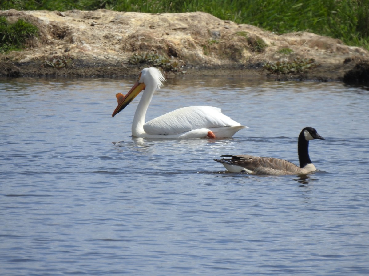
 Pelicans. Another species that I hadn’t seen at any other wildlife area this week.

 Purple martin
 One of at least a half dozen American bitterns that we saw in flight. We were unable to spot any before or after they were in flight.
 Swallows in flight
 There was a lot happening in this part of the unit.
 White pelicans and a mute swan (non-native)
 Geese
Geese
 Another first this week – greater white fronted geese. It’s a blurry photo but it was the best I could do given their distance.
 Goose passing the swan.
 Same goose passing a pelican.
 Northern shoveler
 Hawk
Hawk
 Another large group of various ducks and other birds.
 Bald eagles
 Two types of camas
 Heading back to the trailhead along the side of Fisher Butte.
 Flax
Flax
 The final stretch of Wildlife Week.
The showers never materialized, and the wildlife was abundant making this a great end to Wildlife Week. Over the seven days I visited five national wildlife refuges, two state wildlife areas, and two wetlands covering nearly 60-miles of hiking. I got to see a great variety of wildlife and know I missed so much more. Happy Trails!
Flickr: Fern Ridge WLA plus waterfalls


 All trails are open from February 1st through September 30th, then from October 1st through November 30th the final 1.3-mile stretch to the right (south) is closed, and there is no hiking allowed during hunting season from December 1st to January 31st.
 Geese
Geese Osprey
 Killdeer
 Meadow checker-mallow
 Wood ducks
 Northern shovelers
 Ducks, geese, and a heron.
 Scrunched heron
 Stretched heron (same heron)
 Sparrow
 A different heron and a duck.
 Yep, it’s a nutria.
 Spotted sandpiper
 One of several benches located along the dikes.
 American coot
 Gadwall
 Dove
Dove Crow
Crow American kestrel
 Swallow
 Cinnamon teals having a disagreement.
 End of the trail to the south.
 View from the end of the trail.
 Wood ducks
 Robin
Robin Short billed dowitchers
 Green winged teal
 Hooded merganser and a gadwall
 Ring-necked ducks
 Heading to the left (NNE) now.
 Red-winged blackbird
 Egrets, herons, and ducks.
 Great blue heron and egret
 Cinnamon teal and northern shoveler
 Hooded mergansers and a cinnamon teal
 Northern shovelers and a northern pintail on the right.
 California quail
 End of the trail in this direction.
 My 3.3-mile track with minimal elevation gain.
 Swallow
 Osprey
 Killdeer
 American coot
 Mallard
 Anna’s hummingbird
 A bit of the pink on it’s throat.
 Ring-necked ducks
 Bald eagle
 Gadwalls
 Song sparrow
 Purple martins
 Pied billed grebe
 Mallard and ducklings
 Mallards
 Fringecup
 Rabbit
 Sandpipers
 Ground squirrel
 American goldfinch. I’d seen a number of these this week but had only managed a picture of the back of one at Finley Wildlife Refuge.

 The orange track is a portion of the Wetland Trail that I had not previously hiked.
 Mt. Hood from the Wetlands Trail.
 I spotted a couple of deer shortly after setting out.

 I believe this is a savannah sparrow.
 Geese families
 Killdeer
 It was just under 40 degrees Fahrenheit when I started, but the forecast called for temperatures to reach 80 by the afternoon.
 Geese, goslings, and goose eggs.
 Sandpiper
 Not sure what type of fish this is but they were thrashing about near the shoreline, and I had seen similar behavior the day before in McFadden Marsh at Finley NWR.
 Duck and ducklings
 Sleeping nutria
 Purple martins and a swallow (bottom left).
 Egrets and a great blue heron.
 Closer look at the egrets and heron.
 Robin
Robin


 Mallard
 Sandpipers
 Riverside Trail
 Tualatin River
 Song sparrow
 Inside-out flower
 The Ridgetop Trail to the left. There is a bench and railed overlook but the view is blocked by trees. If there hadn’t been any leaves there may have been a view but today there wasn’t.
 The only trillium I saw with any petals left.
 Bleeding heart
 Northern flicker
 I spotted an American kestrel in this snag. I had been hoping to see one during this week’s hikes.
 American kestrel
 Crow
Crow Northern shoveler
 Wildflowers near the trailhead.
 Lupine, plectritis, checkerbloom, and golden paintbrush.
 This route came to 4.4-miles and just 35′ of elevation gain.
 Camas
Camas
 Larkspur
 Not a native wildflower but pretty.
 Columbine
 Rabbit
 The look on their faces seems to indicate they were not expecting to see me there.
 Going back the other way.
 Karaoke
 Helpful maps and/or pointers are located at trail junctions.
 Swallow
 Swallows
 Cinnamon Teal
 Ring-necked ducks
 Purple martins
 Canada geese
 Jackson Bottom Wetlands Trail passing Oak Island Marsh.
 Crow harassing an osprey over Oak Island Marsh.
 I thought flamingos were pink.
 American coot in NW Pond.
 Another napping nutria.
 Robin
Robin Gadwall
 Egrets at Wapato Marsh.
 Great blue heron in Pintail Pond.
 Lupine along the trail.
 Green winged teal
 Heading toward Salamander Slough.
 Two turtles and a mallard.
 Long billed dowitcher
 Cabbage white?
 Checkerbloom along the Coyote Hill Trail.
 Common yellowthroat
 Savannah sparrow
 Spotted towhee
 Tualatin River
 Deer crossing Pintail Pond. I think these are the same three I saw earlier.
 I’ve been spotted.
 Rabbit on the left along the River Trail.
 Salmonberry
 Western meadowrue
 Wild rose
 Stairs leading to the trail on the River Trail.
 The orange loop is the Mill Hill Loop.
 The orange section on the right is my detour with the solid cyan representing the 2024 route. (Other colored lines are from the other previous visits.)
 Rabbit
 Sunrise view
 Mt. Jefferson
 I hadn’t gotten very far before I spotted a couple of elk ahead.
 Coyote


 I stopped here not wanting to get any closer and waited to see what the elk would do.
 The lead bull here seemed to have a leadership role because once he emerged and headed across the field the herd followed and then circled up.


 On my 2024 hike I had turned left here on the track at the edge of the photo, but with the elk out there I stayed straight(ish) along the tree line. Apparently that is part of the Prairie Extension Trail, but it was a more obvious path and there was an equally obvious path that angled off the extension trail back to the main Prairie Trail.
 It was a wet muddy hike this time of year.
 Camas and buttercups
 McFadden Marsh sending up a light fog.
 Wood ducks
 Northern shoveler
 Mallards, a green winged teal, a cinnamon teal, and a wood duck.
 Ruddy duck
 I’m sure it’s a nutria, it’s almost always a nutria.
 Cinnamon teals
 Female wood duck
 Bald eagles on the far side of the marsh.
 Blackbird
 Buffleheads
 Great blue heron
 Green winged teals and American wigeons
 Dove
Dove Marsh wren
 Heron hanging out near the Mcfadden Marsh blind.
 Egrets and ducks
 Egrets
 Robin
Robin

 There were actually two bitterns.
 Their camo is so good.
 American coot
 Swallows
 Pied billed grebe
 Ring-necked duck
 Cinnamon teals
 Manroot and the Cheadle Barn
 California scrub jay
 Bittern flying over the Cheadle Barn Pond with Pigeon Butte in the background.
 Iris and golden paintbrush on the side of Pigeon Butte.
 Golden paintbrush and I guess the beetle counts as wildlife.
 Savanah sparrow near the Finger Ponds.
 Geese in a field near the Finger Ponds.
 Turkey vulture
 Goose and goslings in Cabell Marsh.
 Great blue heron at Cabell Marsh.
 American goldfinch near Cabell Marsh.
 California quail near Cattail Pond.
 Pied billed grebe at Cattail Pond.
 Camas along the Cattail Pond Trail.
 Pacific waterleaf along the Beaver Pond Trail.
 Checker lily along the Beaver Pond Trail.
 Fairy lanterns along the Beaver Pond Trail.
 Giant white wake-robin along the Beaver Pond Trail.
 Bullfrogs and blackbirds were all I saw at the Beaver Pond.
 Turkeys along the Beaver Pond Trail near Park Headquarters.
 The start and end of the Mill Hill Loop.
 Yellow violets in the midst of invasive herb robert.
 Bleeding heart
 Gray squirrel
 Star flower
 Spotted coralroot
 I’d once spotted a turtle on this log in a pond below the Mill Hill Loop so I took a picture hoping for another one. Instead I got a bullfrog.
 Mallards in the same pond.
 Solomonseal
 Tolmie’s mariposa lily
 The forest is pretty along the Mill Hill Loop.
 Poet’s shooting star
 Small-flowered woodland-star
 The end and start of the Mill Hill Loop.
 Tough-leaved iris
 There were a bunch of bullfrogs sunning at the little pond along the Woodpecker Loop.
 Lomatium on the Woodpecker Loop.
 Woodpecker Loop Overlook. I took a break on the bench here and changed into dry socks after having a snack.
 This northern harrier was putting on an aerial display while I took my break.
 Wildflowers along Bald Hill.
 Wild rose
 Checkerbloom
 Tough-leaved iris and golden paintbrush
 More turkeys along Finley Refuge Road.

 Cabell Barn across from the entrance road to the Cabell Marsh Trail.
 Honeybee swarm along the road to the Cabell Marsh Trail. It looks a little like a heart.
 This end of Cabell Marsh was practically deserted. My guess was that there was plenty of water right now in less visited areas, so the birds were avoiding this area for now.
 You can almost always count on a coot though.
 Cormorants out on a log in the middle of the marsh.
 Homer Campbell Boardwalk
 Wood ducks. These might have been the first significant wildlife I’d seen from the boardwalk. It’s a really neat trail I just rarely see any wildlife from it (with the exception of the shelter).
 Turkey vulture flying over Turtle Flats.
 Turtles at Turtle Flats!


 You can actually see some of the route I explored on the left side between Parvipes Marsh and the butte and at the bottom of the picture wrapping around the butte.
 Manroot
 Camas
Camas Plectritis
 Checkerbloom
 Tolmie’s mariposa lilies


 Morgan Lake with a bit of Moffitti Marsh to the left.
 Columbine
 Iris
Iris
 Robin
Robin Sparrows
 Gold crowned sparrow
 The grass was low enough that the lake was fairly visible. Later in Spring you’re lucky to see any water from the trail.
 Not a great picture due to the distance and light, but there are a couple of ruddy ducks to the left hanging out with some ring-necked ducks.
 Mallards
 American coot
 Gadwalls
 Buffleheads
 Common yellowthroat
 Looking for a bittern.
 American bittern. I could only see the bittern from a very short section of trail and as soon as I lost a little elevation it disappeared from sight. It never flew off, but I couldn’t see it even knowing where it was.
 Following the trail next to Smithfield Road.
 Lots of red-winged blackbirds near the trailhead.
 Finch
Finch Heading back toward Baskett Butte and Moffitti Marsh.
 Northern flicker
 Moffitti Marsh
 American wigeons
 Female common yellowthroat
 Spotted towhee
 I watched a crow chase off a hawk that had apparently gotten too close.
 The official trail heads up the hill to the left. I veered right just beyond the trail sign pointing toward Moffitti Marsh.
 Lilac
Lilac Parvipes Marsh ahead to the right.
 The tractor turned right and drove over a dike at the end of Parvipes Marsh to a field on the other side.
 Deer farther up the hillside.

 This appears to be balsamroot. There were just a couple of patches on the SW side of the butte.
 Cottonwood Pond
 Buttercups and miniature lupine
 Meadow checker-mallow
 Lomatium and plectritis
 South Slough Pond
 I was a bit surprised to find a bench along this route given it isn’t shown as an official trail.
 Grass pea
 More checkerbloom
 Golden paintbrush
 If I hadn’t been looking for the tread I don’t think I would have noticed it.
 Lupine
 Another Tolmie’s mariposa lily
 Western meadowlark
 The overlook ahead.
 The obligatory photo from the overlook.
 Lots of patches of plectritis on the butte.
 Ground squirrel
 Swallow
 Baskett Butte from the Cottonwood Pond parking area.
 Mallards
 Northern pintails
 Northern shovelers
 Lesser scaup. They look a lot like ring-necked ducks only without the ring.
 Ring-necked ducks
 Nap Time.
 The route included two short road walks along Buena Vista and Wintel Roads.
 Ring-necked ducks
 Much of the area, and most trails, are closed between October 1st and April 1st each year.
 Ring-necked ducks and a very out of focus pied billed grebe.
 Willow Marsh
 Northern filckers
 Geese
Geese Teal Marsh
 Pied billed grebe
 Common yellowthroat
 Pair of bald eagles in the snag.
 One of the eagles.
 I believe this is a greater yellowlegs.
 Bufflehead
 Green-winged teals
 Killdeer
 Leaving Eagle Marsh. Even over an hour after sunrise there wasn’t much light.
 Robin
Robin The mudflats at Mallard Marsh were busy.
 Green-winged teals and several species of shore birds. I think the darker, larger birds are short billed dowitchers, the smallest are sandpipers and there is one with a black mark on its underside which may be a dunlin.
 Better look at the short billed dowitchers.
 A little better look at what I think might be dunlins.
 I see you.
 This American bittern saw me way before I saw it. It had flown up earlier and landed in the vegetation and even though I watched where it landed, I couldn’t make it out until it took flight again.
 Savanah sparrow that appears as annoyed with the bugs as I was.
 Not a great photo but there is a northern pintail lower right.
 A sandpiper, my guess is a least sandpiper.
 American wigeons. Another not great shot but they were all sticking close to the far shore of Mallard Marsh.
 Mallards hanging out at Mallard Marsh.
 Nearing the 4-way junction.
 Northern shoveler
 Pintail Marsh from the trailhead along Wintel Road.
 Cinamon Teal
 Camas
Camas Hawk
Hawk Song sparrow
 Spotted towhee
 Common vetch

 Avens
Avens Western meadowrue
 Obstacle
 Newer looking bridge.
 Older bridge.
 End of the Woodland Loop.
 The boardwalk to the left.
 The one trying to land was apparently not invited to the party.

 There are 3 immature and 2 adult eagles in the trees. Then there was the juvenile that wasn’t welcome and possibly another juvenile that had been flying around. I was having a hard time keeping track of just how many there were.
 Grey ghost
 Dunlin Pond
 These may be the two juveniles that were not allowed at the meeting.
 A nearly dry South Pond on the right after having looped around Killdeer Marsh.
 The start of the boardwalk.
 Dove
Dove Song sparrow
 Wood ducks
 Mallard
 Swallow
 Cinnamon teal
 Woodpecker
 Pintail Marsh (all the black specs are insects)
 Female red-winged blackbird
 Male red-winged blackbird
 American coot
 The highly invasive American bullfrog.
 A good look at the size difference between a Canada goose (left) and cackling geese.
 Sunning snake
 Canada goose
 The heron’s head between the interpretive signs.


 The landfill to the left.
 One of two pointers to keep hikers on track.
 Sign at the viewpoint.
 The remains of a bench at the viewpoint.
 Buttercups and iris
 The sign announces the “Summit 604′”, but the actual summit is further along the ridge on private property meaning the trail ends here.
 A mariposa lily surrounded by poison oak.
 The busy parking area.
 My route and the Coffin Butte Trail.
 Wandering on trails to the NE of the parking lot.
 Apple blossoms?
 Concrete structure left over from Camp Adair.
 Turkey vultures
 Turkey vulture
 Heading for the pond.
 There were all kinds of birds singing in the trees but nary a feather to be seen.
 Iris
Iris I believe this walkway is new since or previous visit.
 There were quite a few folks fishing around the pond, and one great blue heron.

 Wetlands across the trail from the pond.
 Buffleheads
 Pied billed grebe
 Camas
Camas Hooded merganser drake
 Mallards
 Killdeer and hooded mergansers
 Sandpiper
 Heading west through the wildlife area.
 Hummingbird
 Family of geese
 Robin
Robin Black capped chickadee
 Northern flicker
 Wetlands
 Blackbird
 Groundsquirrel


 Duck and ducklings along with a killdeer.


 Chickadee
 Mallards
 Fanno Creek
 Thimbleberry and service berry

 Northern flicker
 Hummingbird
 Red-winged blackbird

 Squirrel
 The Greenway Loop Trail had the only flooded section on this day.
 Wetlands along the Greenway Loop Trail.
 Goose
Goose
 Hooded mergansers
 This is another section that may flood at high water times.


 We spent some time here watching a female mallard attempt to join the drakes along with her ducklings only to be repeatedly chased off.
  Mallards ducklings
 The ducklings finally making it across the trail.
 Goose and gosling
 Avens
Avens
 Camas
Camas Dirksen Nature Park
 Viewing platform
 Wetlands from the viewing platform.
 Dove
Dove Finch
Finch Robin
Robin
 Lupine
 Woodard Park Trailhead.
 This may be a lesser goldfinch, I wasn’t able to see anything but its rear end though.

 Spotted towhee
 Wood duck


 The trails were well marked with plenty of reminders which users were allowed on them.
 Giant white wakerobin (Trillium albidum)
 The only columbine we spotted.
 Fairy lanterns
 In addition to identifying the trails by name, several had mile markers.
 Trillium

 Solomon’s seal
 Toothwort
 Largeleaf sandwort
 Bleeding heart

 Old fungus
 Oregon grape
 The 2.5-mile marker on the Mossy Maple Trail.
 Seasonal closure sign and map at the upper junction with the bike only Yee-Haw Trail.
 Pacific hound’s tongue
 Fairy slippers
 Star flowered solomon’s seal
 Iris
Iris Vetch
Vetch
 Fringecup
 Strawberry
 Shooting star
 Spotted towhee

 Small-flowered woodland-stars
 Checker lily and baby blue eyes (Nemophila menziesii)
 Manroot
 Red-flowering currant
 Dogwood
 On the Cervus Road passing an old quarry on the right.
 The Basalt Rim Trail.
 The lupine is still a week or so away from blooming.
 Basalt columns


 Fawn lily
 Springfield from the trail.
 There is a short one-way loop at the top.
 Looking down from one of the viewpoints.
 The highest peak to the left in the distance is Mount June (
 Mt. Pisgah (
 Biscuitroot
 Another viewpoint along the loop.
 The peak with two humps is Mount Nebo. With the naked eye we could just make out Tidbits Mountain (
 Camas (and poison oak) near the viewpoint.
 Finishing the loop.
 Stripped coralroot.
 Switchbacks leading down to the Basalt Rim Trail.
 Wren
Wren Violets
 Basalt outcrops
 Ginger
 Arriving back at the Mossy Maple Trail.
 Starflower
 Dunn’s salamander
 Mossy Maple Connector Trail (left).
 The Yee-Haw Trail coming down from the left to the Mossy Maple Connector Trail.
 Buttercups
 Fairy bells
 Meadow near the trailhead.


 Menzies’ larkspur
 Western meadowrue
 Bleeding heart and purple deadnettle
 Completing the loop.
 Faint grassy path.
 Golden crowned sparrow
 A section of obvious trail.
 The faint path disappeared near the fenced off-leash dog area. The AllTrails loop appeared to turn around here, but since we couldn’t see even a faint path leading back around closer to the parking areas we turned around and followed the river back.
 We did find this short section of what appears to have been a paved path in the grass.


 An example of the posts. Every directional arrow, including the far side that you can’t see, was for the “Elk Trail”.
 Cedar along the Elk Trail.
 Candy flower and woodland buttercups
 Picnic tables near Lost Creek.
 Lost Creek
 Not a signed junction so this is the one time we veered right.
 Middle Fork Willamette River.
 I was hoping that there might be a turtle hiding in this photo but alas it does not appear that is the case.
 We veered left here leaving the River Trail briefly to actually get a view of the river.
 We hadn’t noticed the goslings in the grass until seeing the picture of the parents.
 Another look at the river shortly before the River Trail turned away.
 Barrow’s goldeneye
 Left here as right led to a picnic area at the end of the entrance road.
 Signpost at the second junction where we kept right.
 The clouds had been stubborn all morning but by early afternoon they had mostly burned off.
 We stayed left on the trail near the entrance road (across from the

 ADA accessible path to a brushy wildlife viewing spot along a backwater channel.
 Bufflehead and at least three turtles on the logs behind.
 The Lost Creek Trailhead on the far side of the entrance road.


 The North Rim Trail heads left at a fork with the Twin Falls Trail a short distance from the parking lot.
 I stuck to the North Rim Trail here leaving another (short) trail to do next time.
 The Nature Play Area along the loop trail I didn’t take.
 One of two bridges along the North Rim Trail.
 Railing near the North Falls Viewpoint.
 North Falls from the viewpoint.
 North Falls
 Map located at the North Falls Trailhead.
 Upper North Falls from the Upper North Falls Trail.
 Upper North Falls.
 The split in the Trail of Ten Falls where the Canyon Trail heads down to North Falls.
 North Falls
 Trail behind North Falls.
 Behind North Falls.
 I will always take pictures of these large boulders in the creek.
 Trail marker at the Twin Falls Trail junction.
 Twin Falls
 Twin Falls is a tough one to get a good clear view of the full waterfall. Recent rainfall had provided good flow for this fall which helps with the visibility.
 This is Twin Falls on July 7, 2006.
 All the rain had the side creeks and falls flowing as well.
 Nearing the Winter Falls Trail and its bridge over the creek.
 The view from the bridge.
 Winter Falls from the Winter Falls Trail.
 Winter Falls

 The forecast had called for sunny skies, but we were also dealing with an air stagnation warning. For a brief moment I thought the fog might burn off, but that never materialized and by the time I arrived at South Falls more fog had rolled in.
 There are some nice big trees scattered throughout the park.


 Trail of Ten Falls/Canyon Trail above South Falls.
 South Falls
 Behind South Falls
 For a short loop just to South Falls you can cross the bridge and return to the rim.

 The trail below heading for Lower South Falls.
 From behind Lower South Falls. I scared a poor woman so badly as I neared the falls. She was setting her phone up on a tripod for a selfie and didn’t see me coming nor could she hear me with the roar of the falls until I was just a couple of feet away. When I said that I was just going to sneak behind her she let out the loudest scream I’ve heard in a while.
 Ankle deep pools behind the falls.
 Lower South Falls
 The mile long Maple Trail (right) allows for a shorter loop to both the falls on South Fork Silver Creek.
 This is now the North Fork Silver Creek.
 Unnamed falls on a side creek.
 The footbridge over the North Fork Silver Creek.
 Pool below the bridge.
 Lower North Falls
 Footbridge over Hult Creek and the spur trail to Double Falls.
 Double Falls
 Back on the Canyon Trail.
 More fog.
 Drake Falls
 Middle North Falls
 Spur trail (right) to Middle North Falls.
 Behind Middle North Falls.
 Splash pool
 The Winter Falls Trail footbridge spanning the creek ahead on the right.
 Chipmunk.
 Twin Falls again which meant I was nearly to the Twin Falls Trail.
 Twin Falls Trail junction.

 The Twin Falls Trail leveled out near its end.
 Arriving back at the junction with the North Rim Trail.
 I spotted several ruffed grouse as I was driving out of the trailhead.
