Categories
Hiking Mt. St. Helens Trip report Washington Washington Cascades

Lewis River and Curly Creek Falls

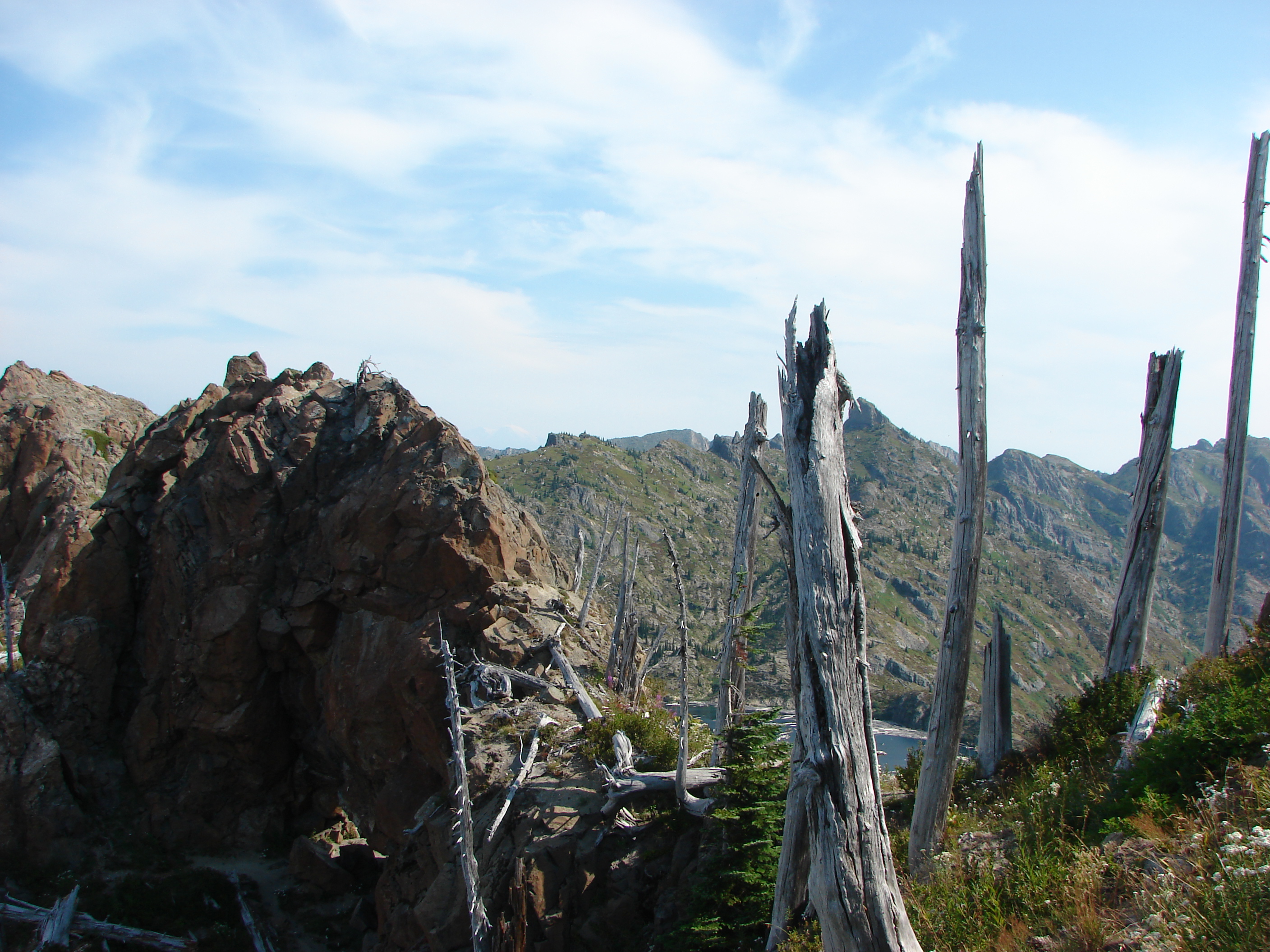
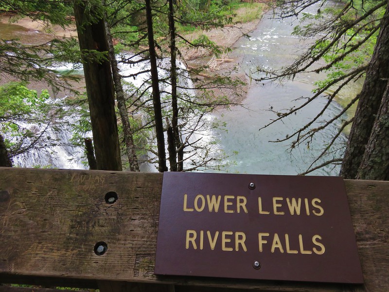
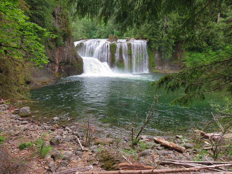
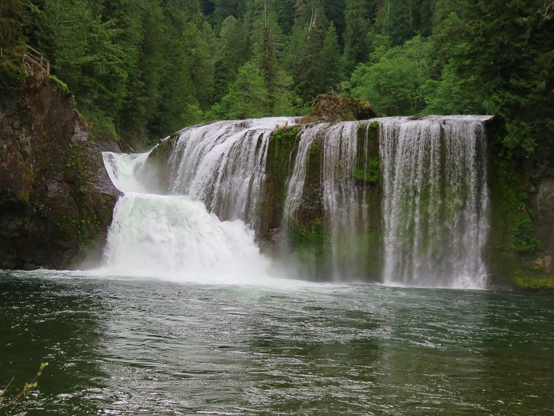
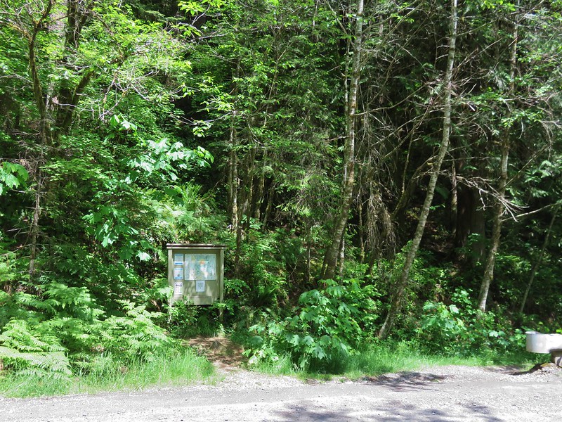
After our vacation in Gold Beach, OR we began our next hike 300 miles away along the Lewis River in Washington’s Gifford-Pinchot National Forest. The Lewis River Trail is one of those very popular trails that we had not yet been to. We hoped an early start would help avoid the bulk of the Memorial Day Weekend crowds. We parked at the Lower Falls Recreation Area just a short distance from the first of the days waterfalls.
Trail sign at the Lower Falls Recreation Area

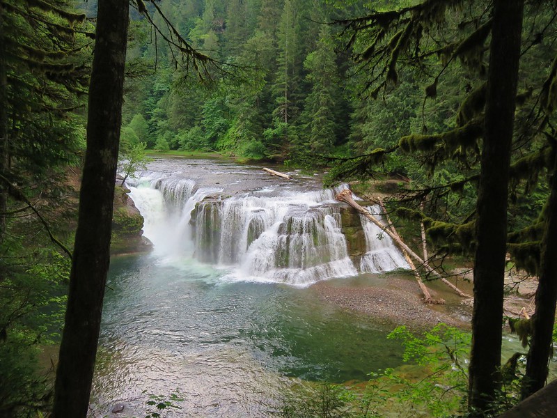
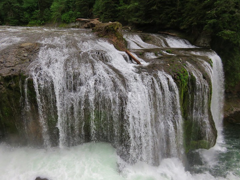
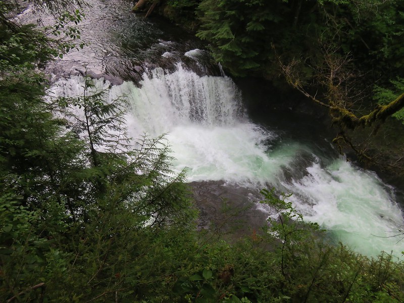
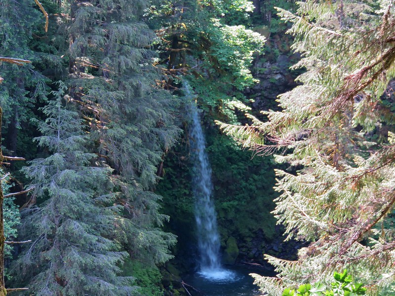
We walked down to a platform overlooking the Lower Falls. This was another waterfall that was much larger in person than it had looked in pictures.
Lower Falls viewing platform

Lower Lewis River Falls

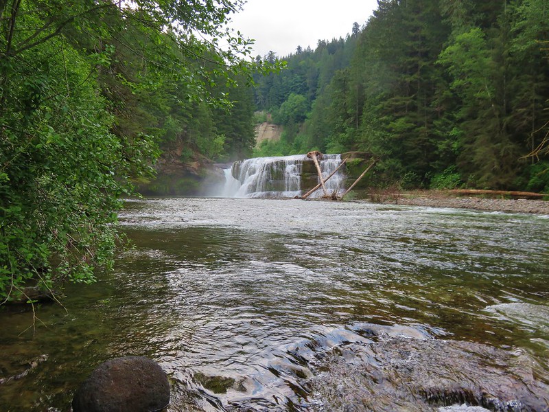
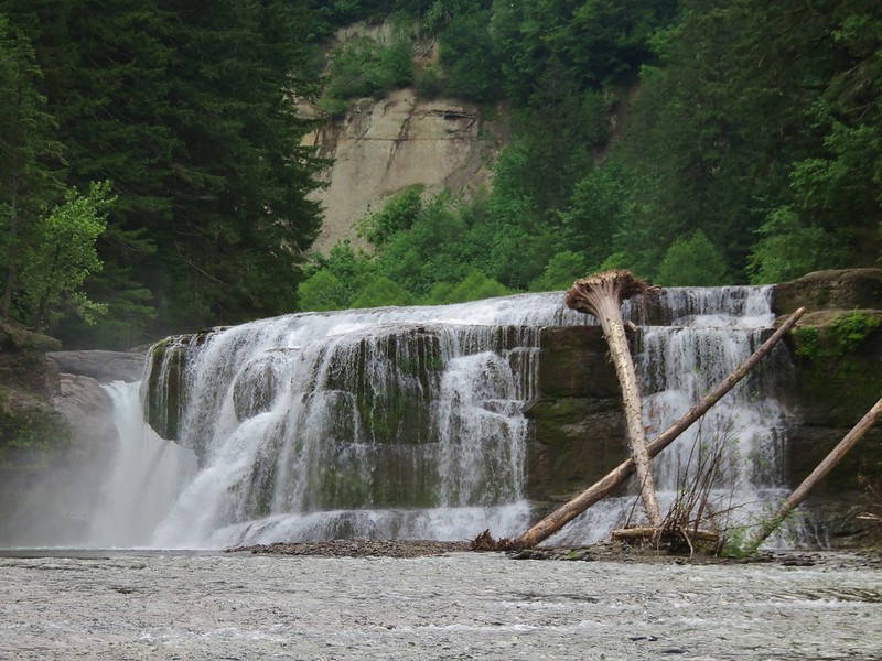
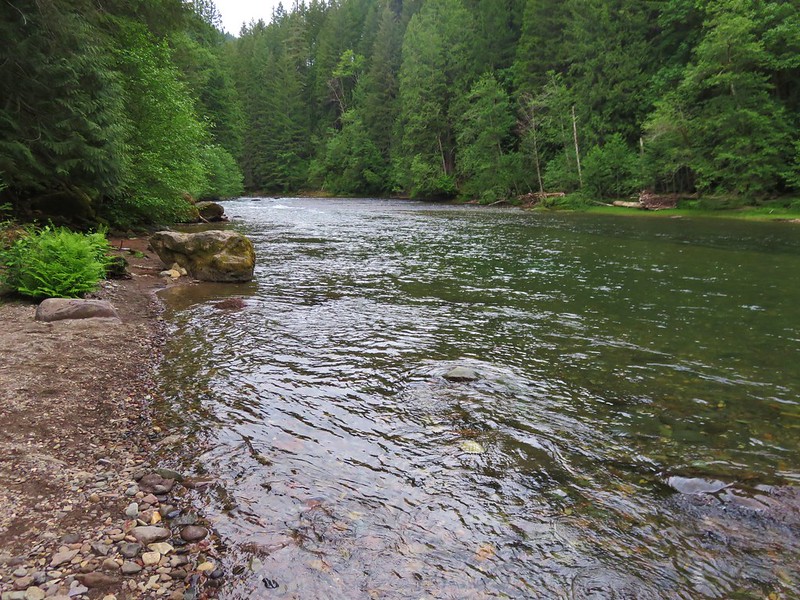
We then headed down to river level to see what the falls looked like from that angle.
Lower Lewis River Falls

Lower Lewis River Falls

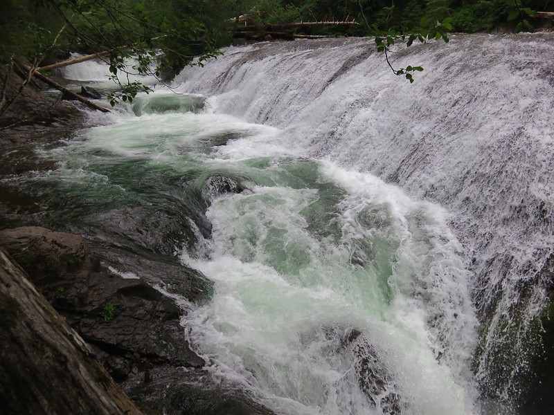
After getting the view from below we climbed back past the first platform and headed NE along the Lewis River Trail. A second viewpoint looked down from above the falls.
Lower Lewis River Falls

A couple of wooden staircases led down to little beaches along the river.
Stairs to the bank of the Lewis River

Lewis River

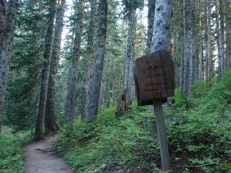
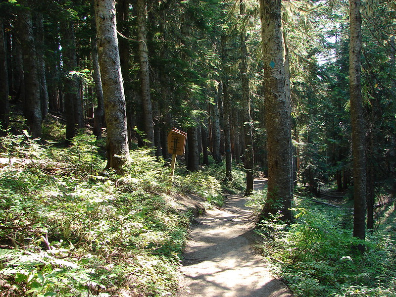
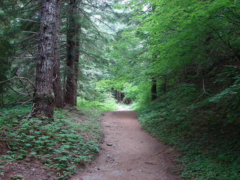
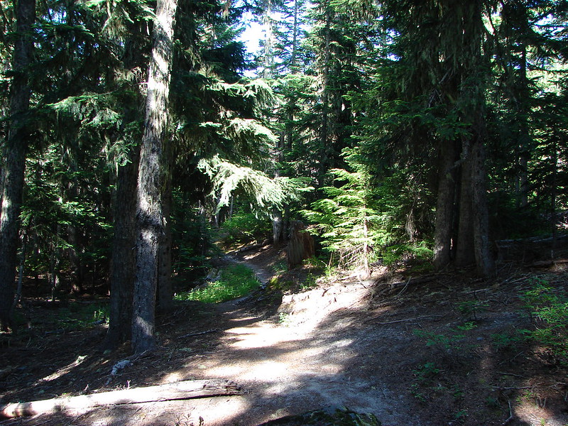
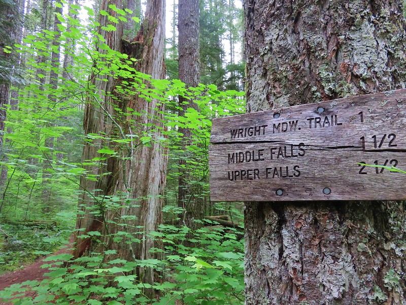
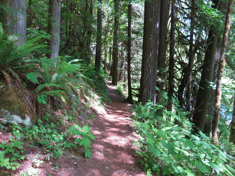
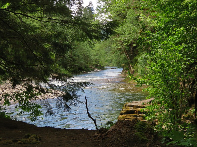
We followed the trail between the river and the Lewis River Campground then deeper into the forest toward the Middle and Upper Falls.
Trail sign along the Lewis River Trail

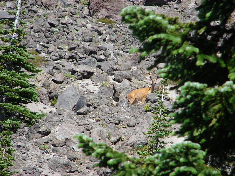
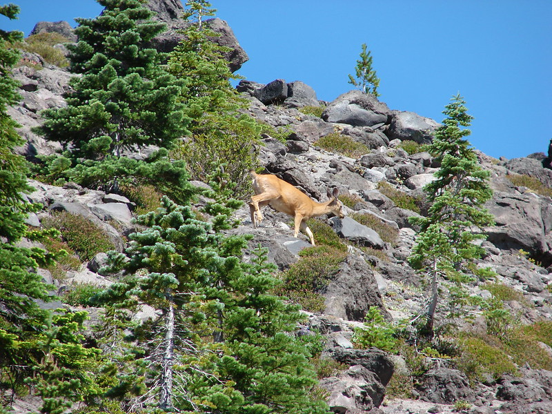
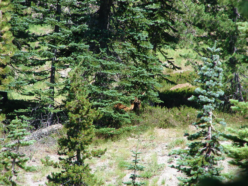
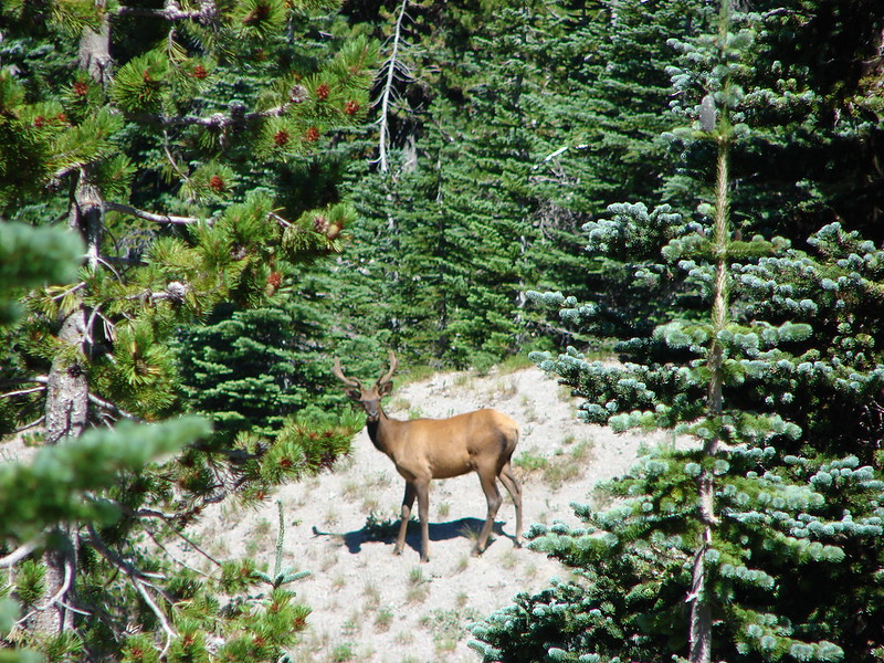
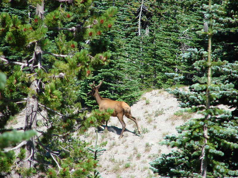
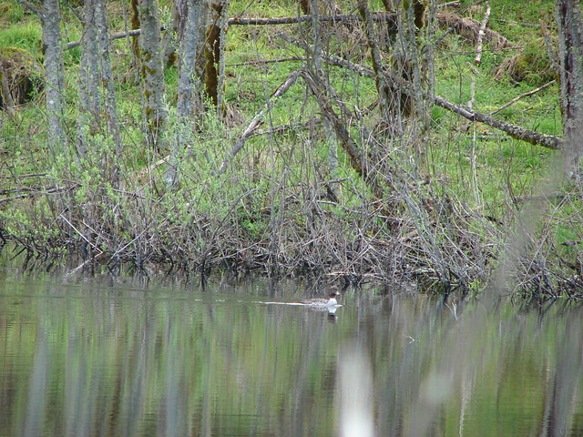
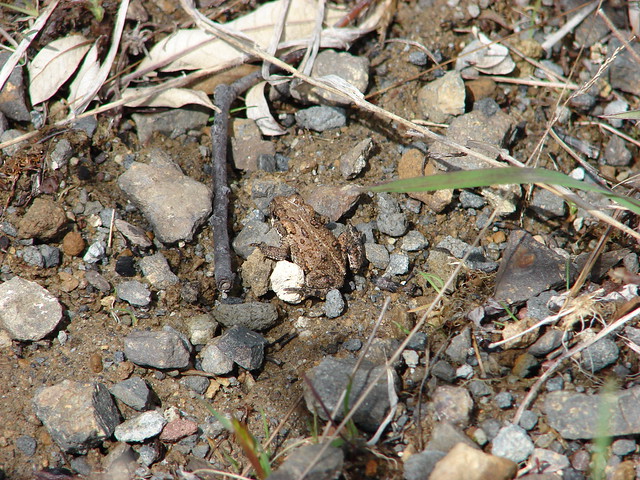
As we were crossing a footbridge Heather noticed something along the side creek. She said she almost mistook it for a statue because of how still it was standing but then the doe began heading back up the creek.
Deer along a small creek

Doe

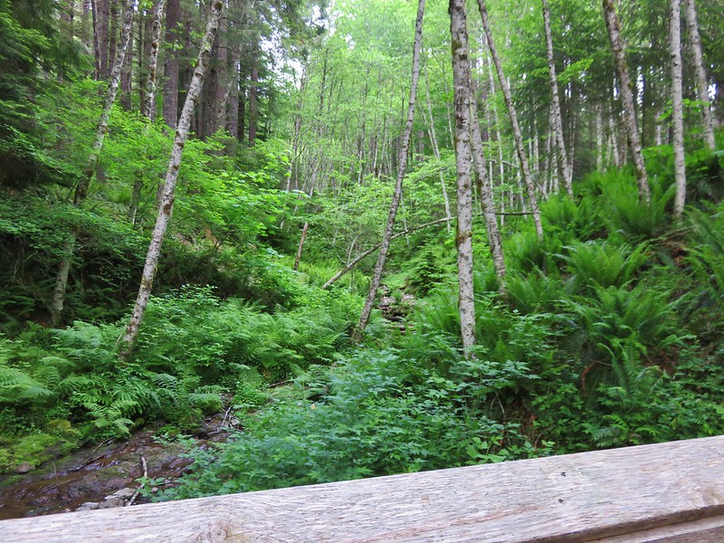
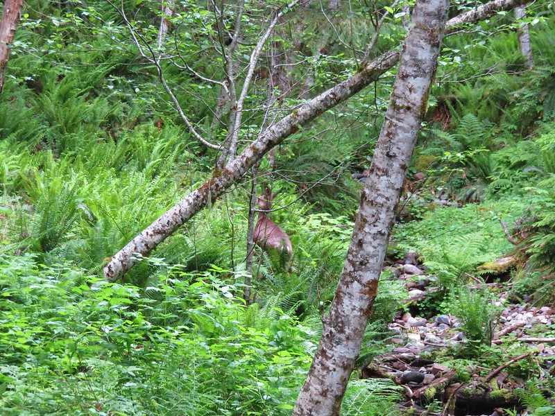
As she retreated we noticed more movement in the underbrush. A pair of wobbly young fawns had been with the doe.
Fawns

After snapping a couple of quick pictures we continued on so mom could get back to her fawns.

A section of trail was closed near Middle Falls but a detour was in place using the Middle Falls Parking Area.
Trail reroute due to slides

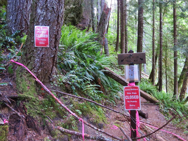
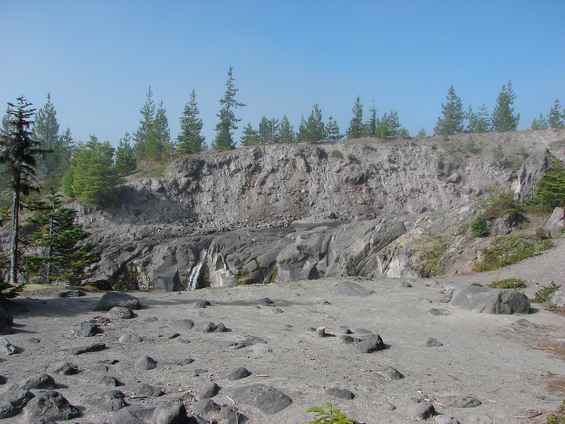
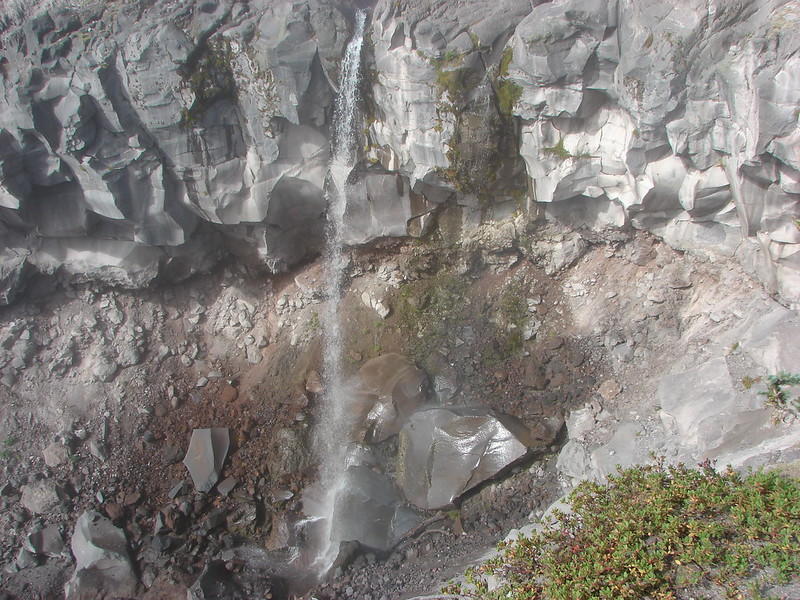
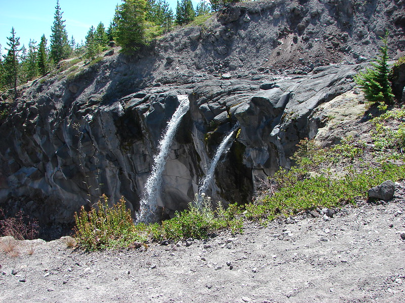
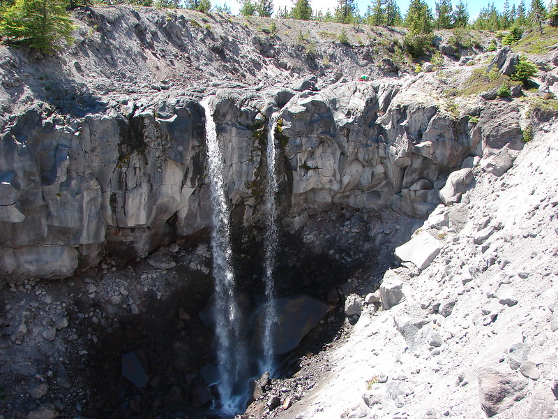
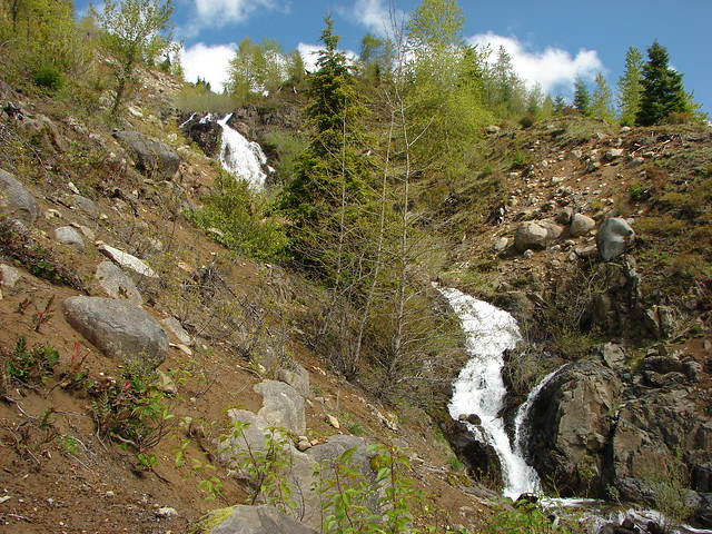
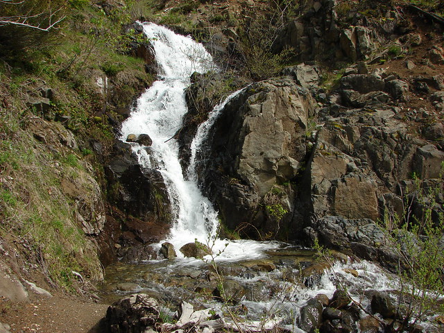
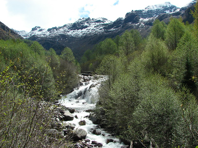
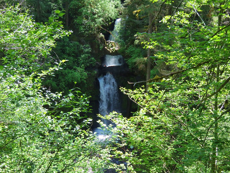
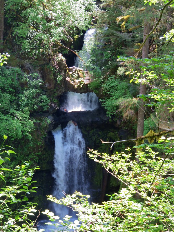
We had been planning on taking this route anyway since it passed another waterfall along Copper Creek.
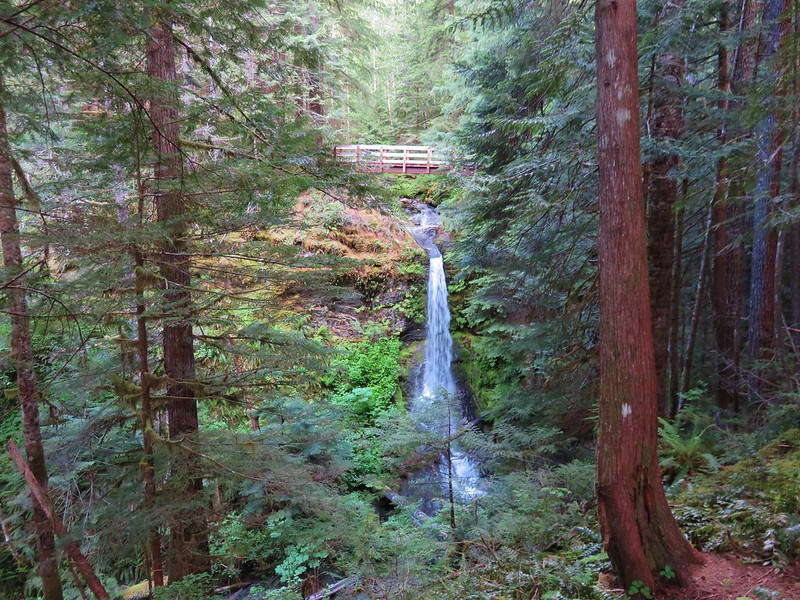
Copper Creek Falls
Copper Creek Falls

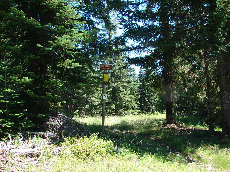
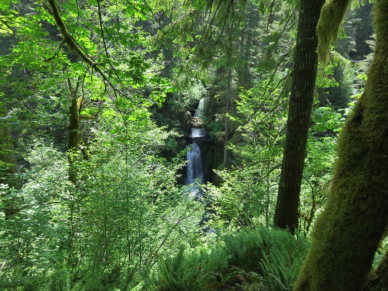
When we were back on the Lewis River Trail we followed a sign for Middle Falls.
Lewis River Trail

Middle Lewis River Falls

Middle Lewis River Falls

Middle Lewis River Falls

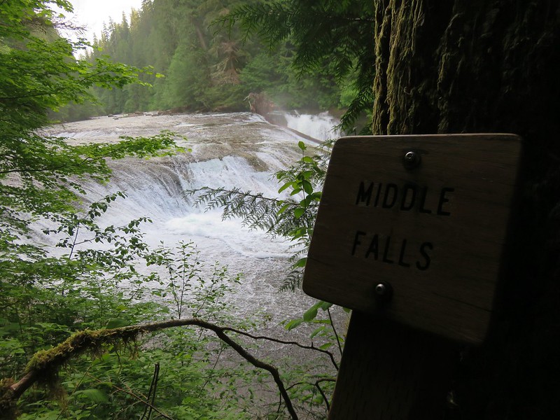
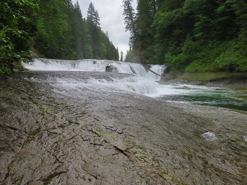
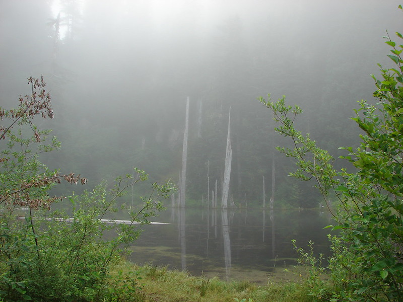
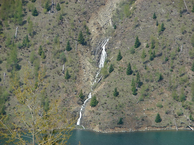
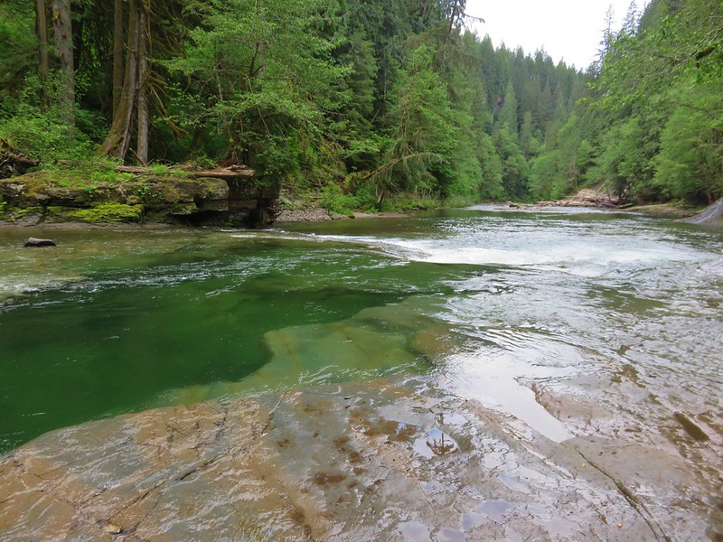
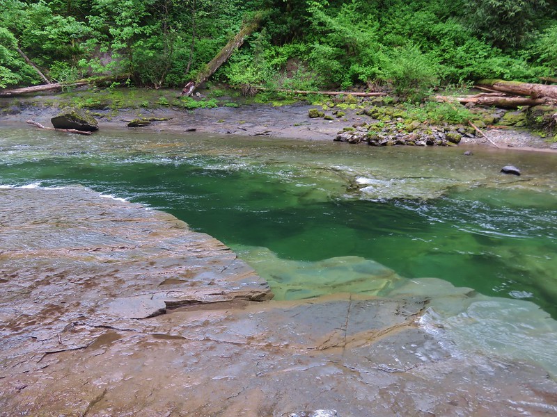
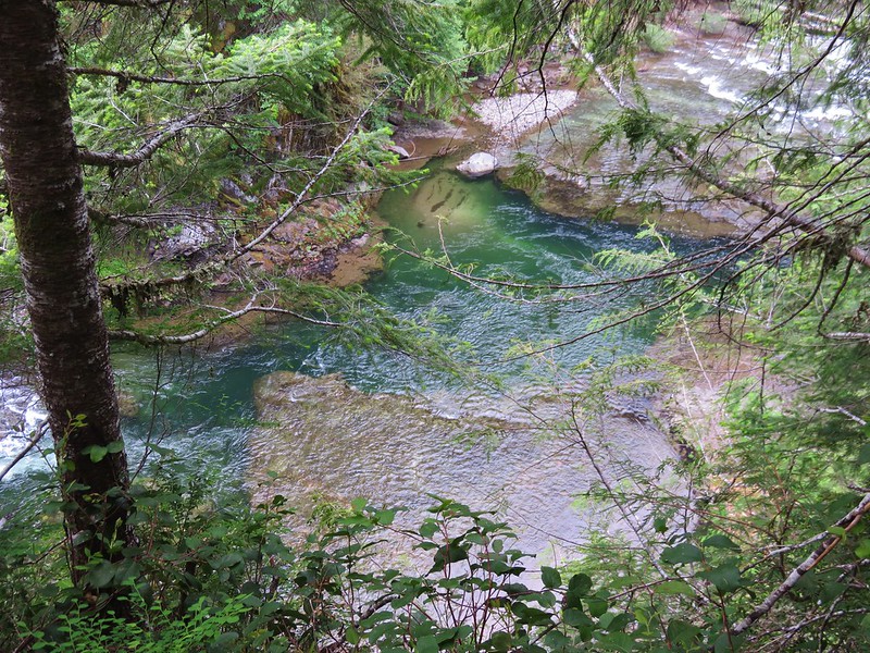
In addition to the waterfalls the Lewis River had some beautiful colored water due to the presence of rock shelves which created some deep green pools.
Lewis River

Lewis River

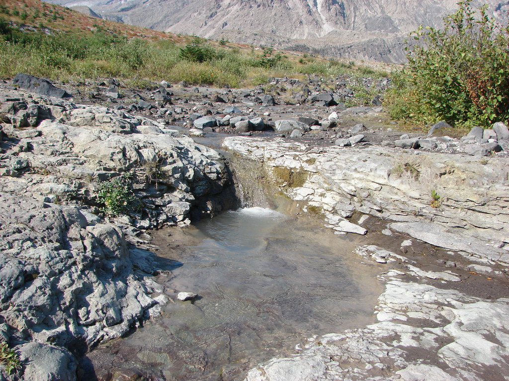
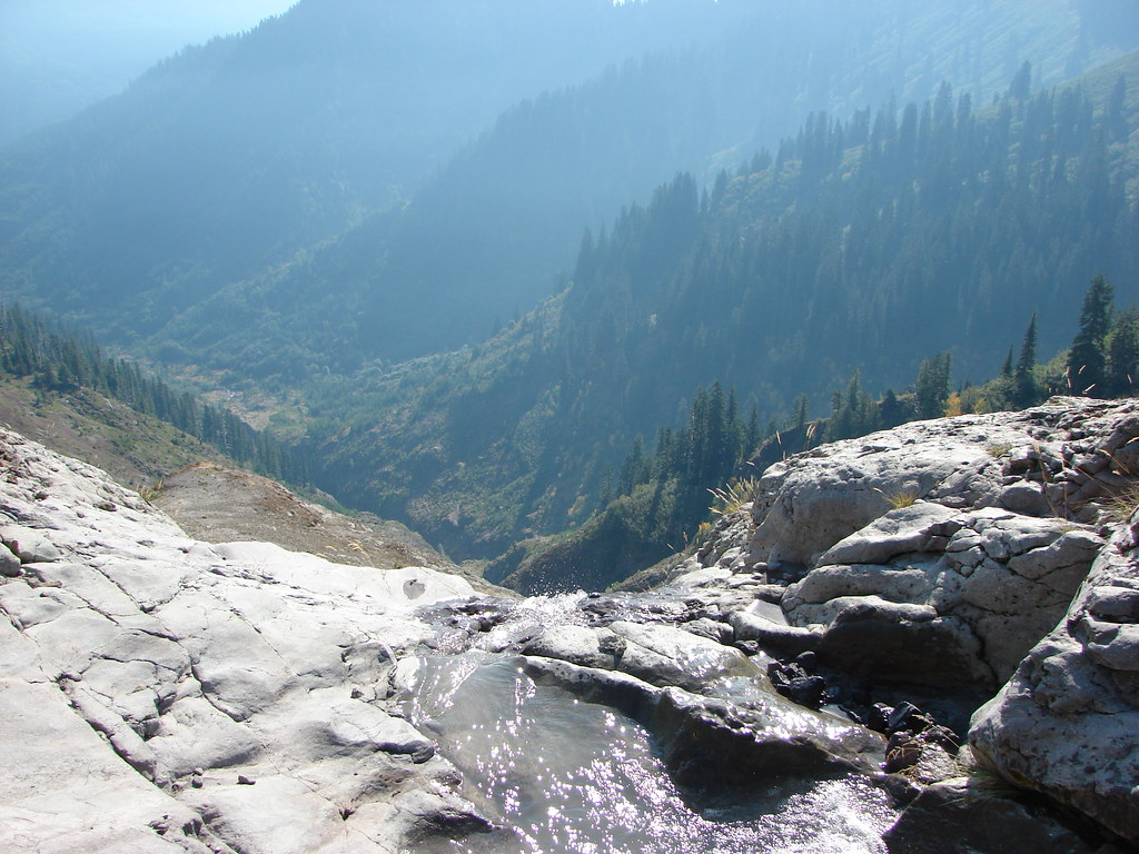
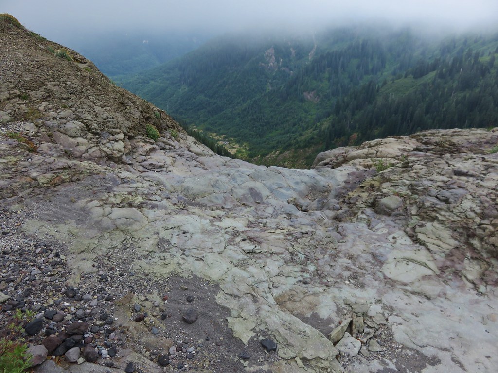
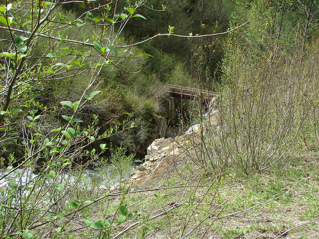
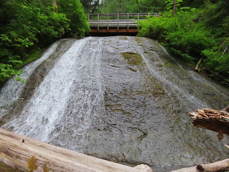
Before continuing on to Upper Falls we headed for the bridge over Copper Creek. The trail closure was posted at the bridge but below the bridge was a scenic water slide.
Slide on Copper Creek

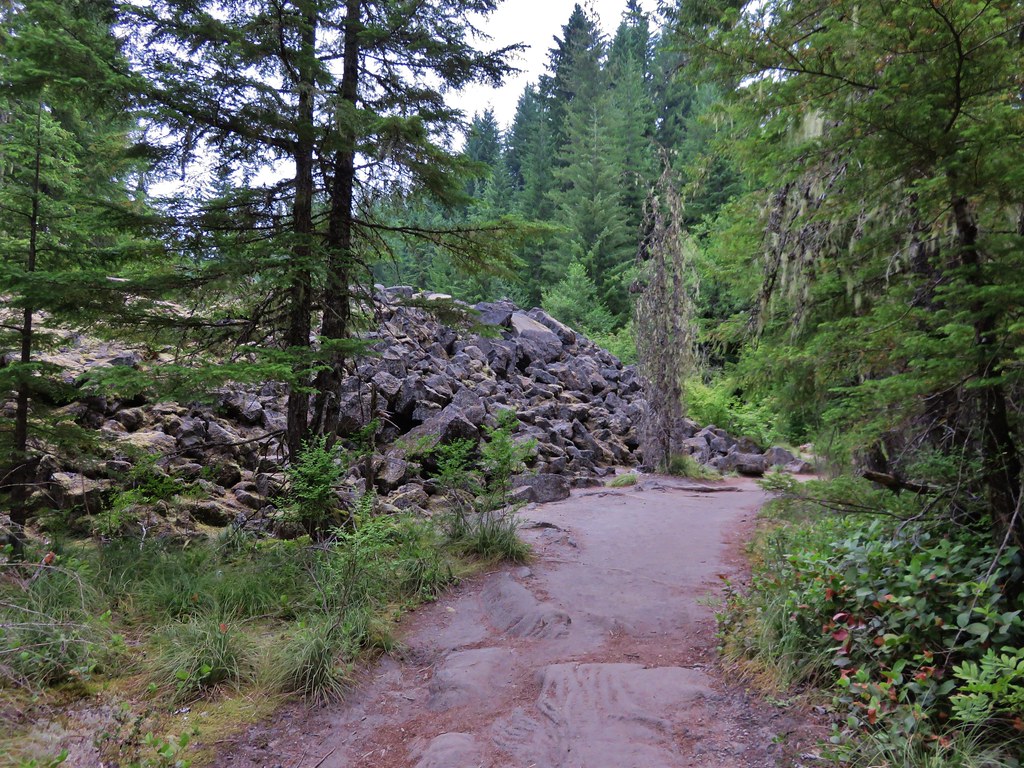
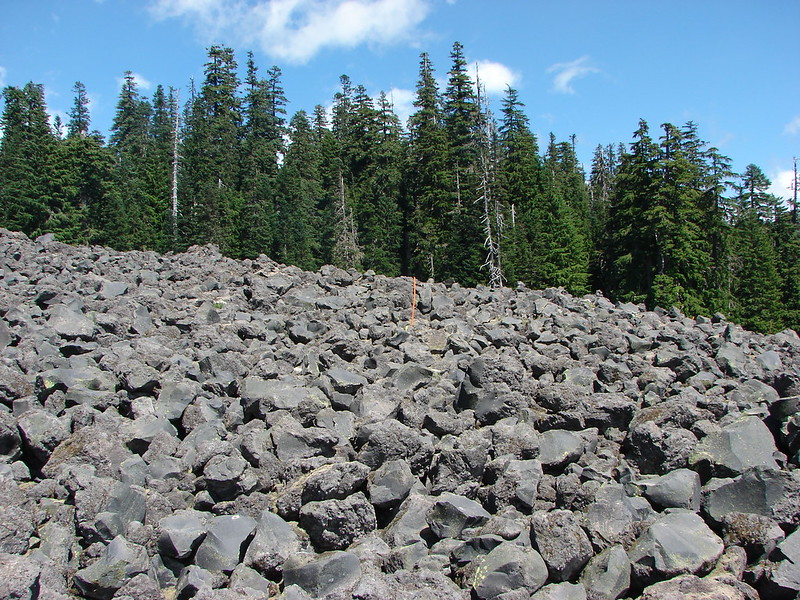
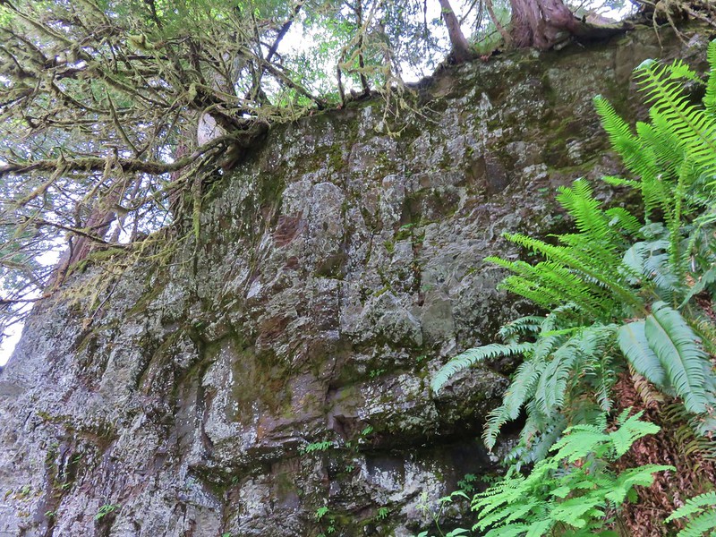
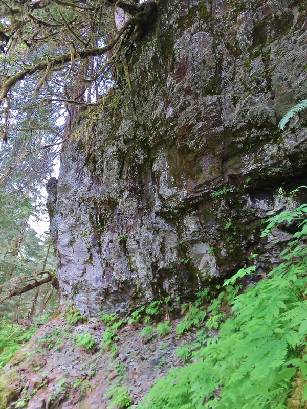
Continuing on the Lewis River Trail we passed some large cliffs covered in green lichen.
Lichen covered rocks along the Lewis River Trail

Lewis River Trail

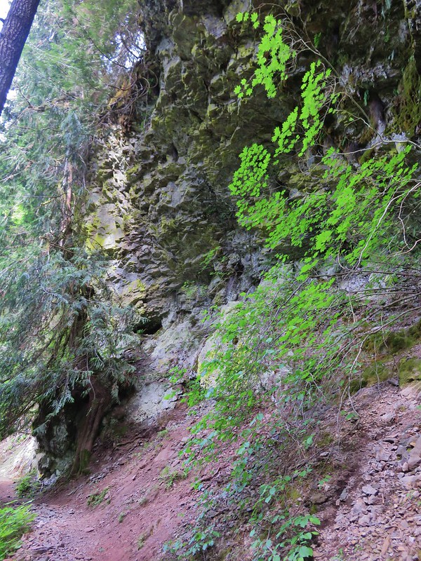
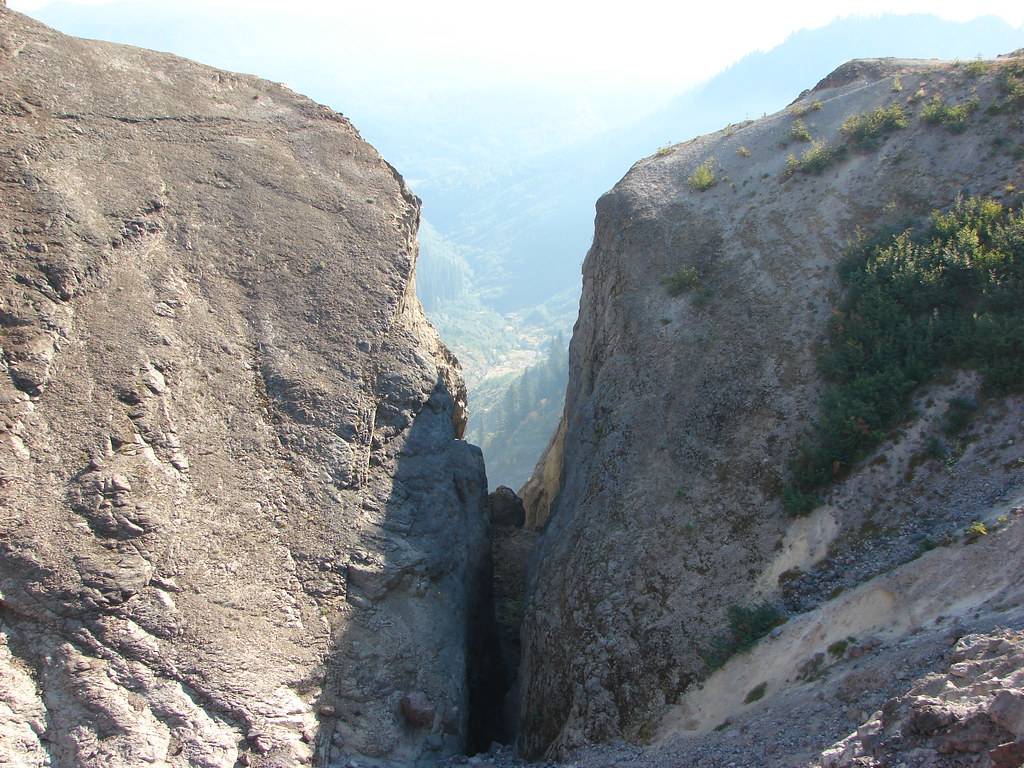
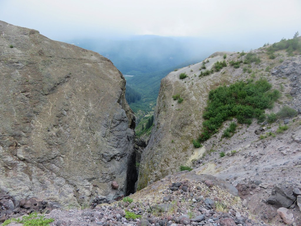
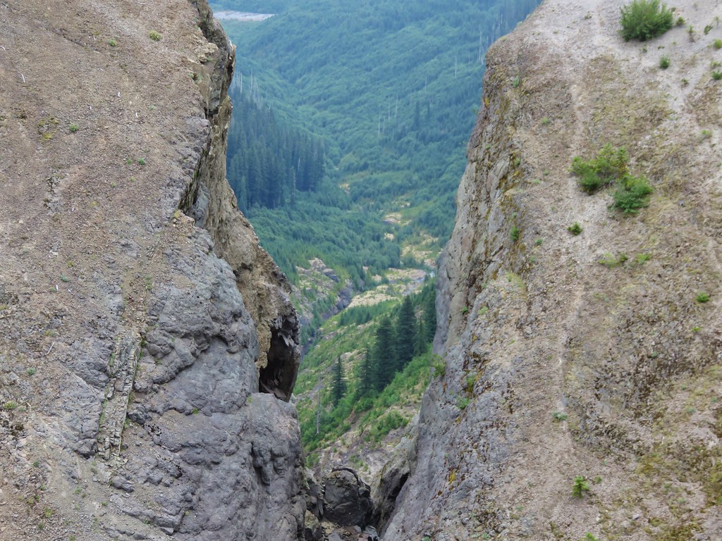
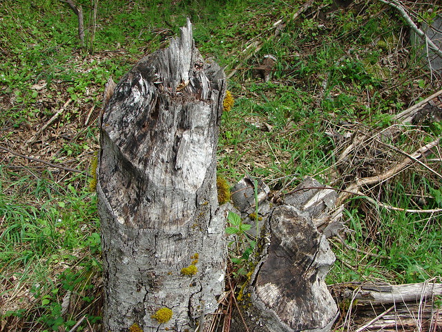
Another section of cliffs were of particular interest. Several trees were perched along the cliff edge with exposed roots high in the air. The rock showed clear signs of having been worn by the river which seemed to indicate that the roots of these trees had once been under the river bank, but as the river eroded the banks and deepened it’s canyon, the roots were left exposed. Given how far above the current river these trees were, we wondered how old they were.
Tree roots showing where the Lewis River once was.

Tree roots showing where the Lewis River once was.

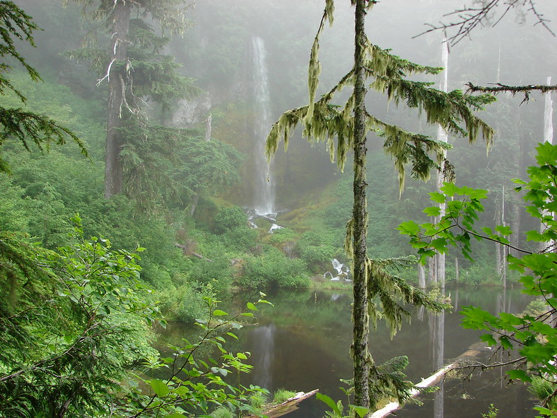
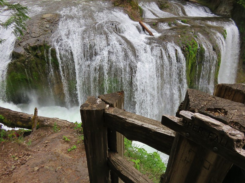
The Upper Falls was another impressive, thundering waterfall.
Upper Lewis River Falls

Upper Lewis River Falls

Upper Lewis River Falls

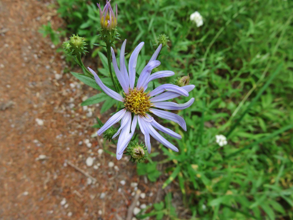
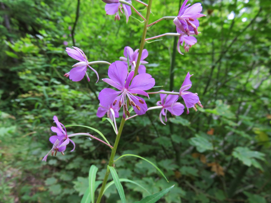
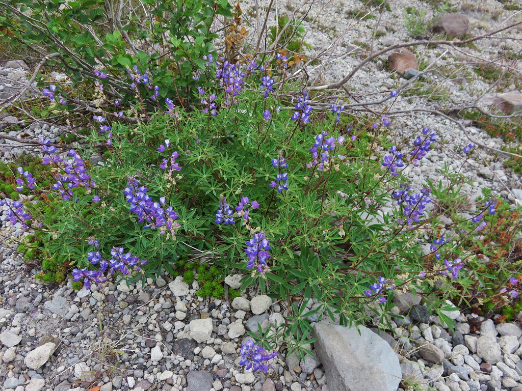
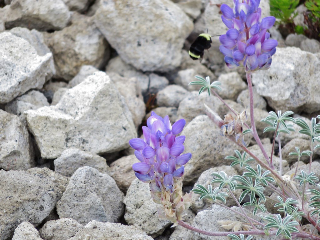
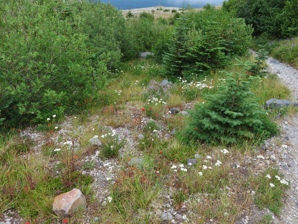
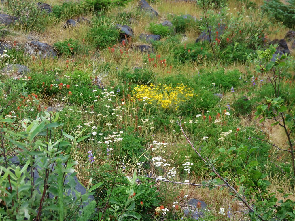
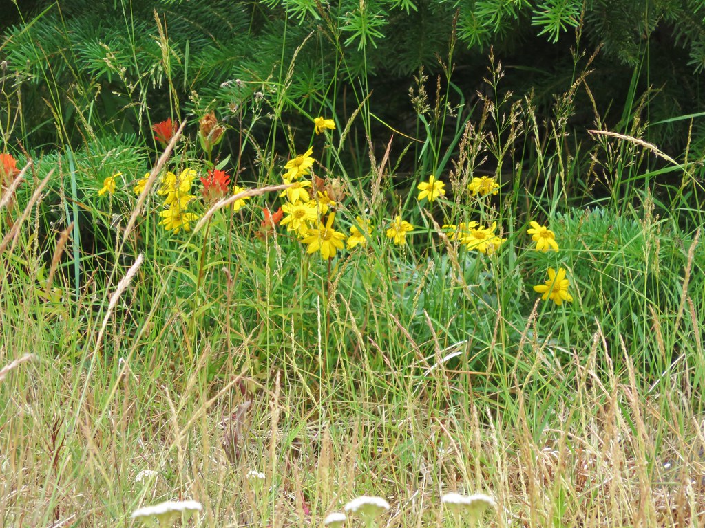
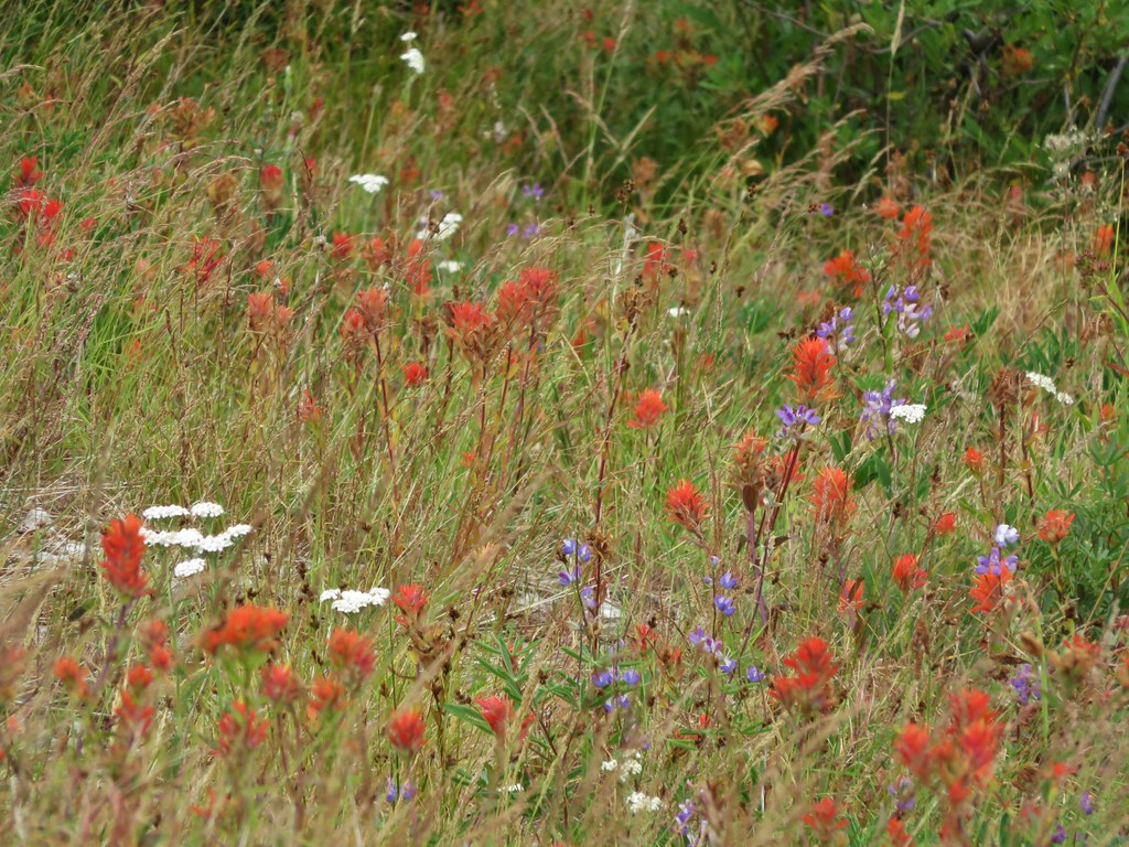
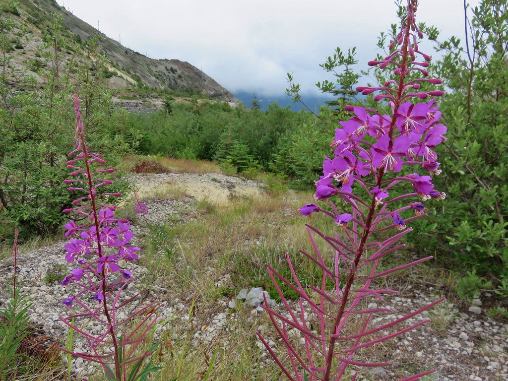
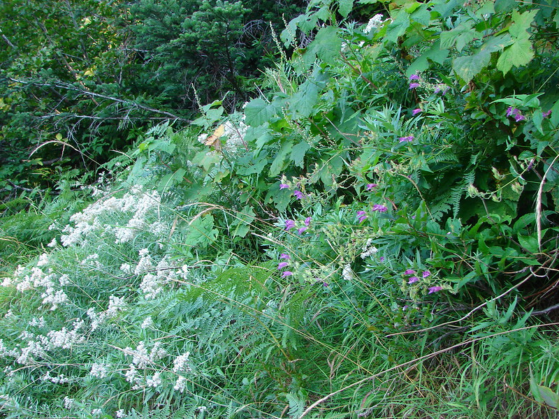
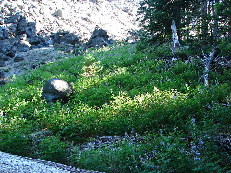
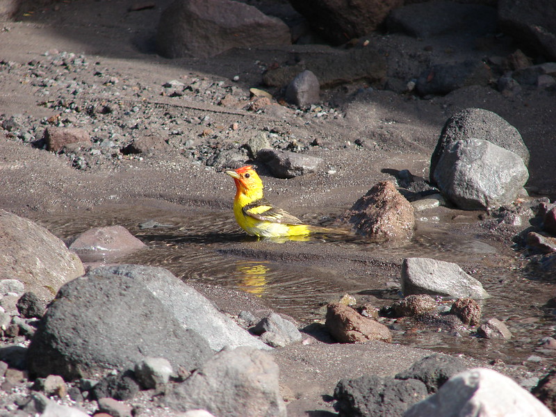
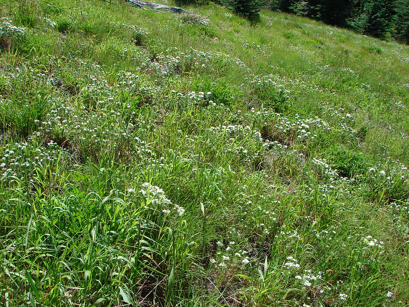
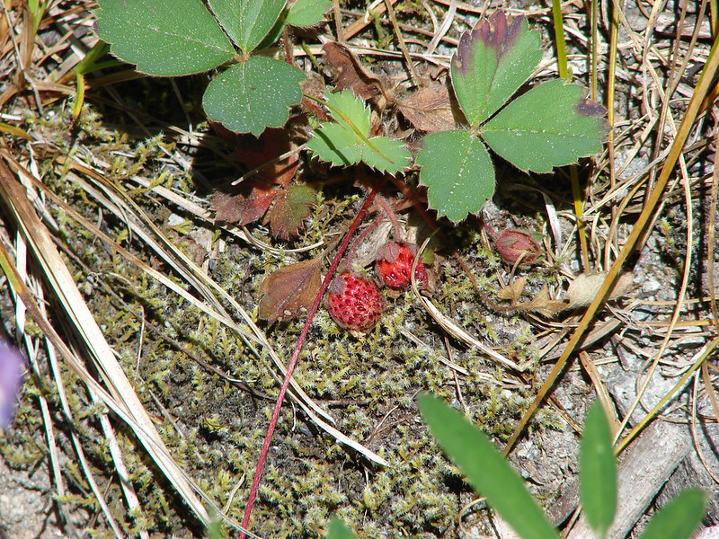
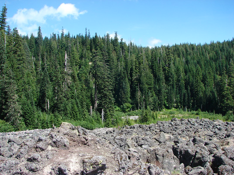
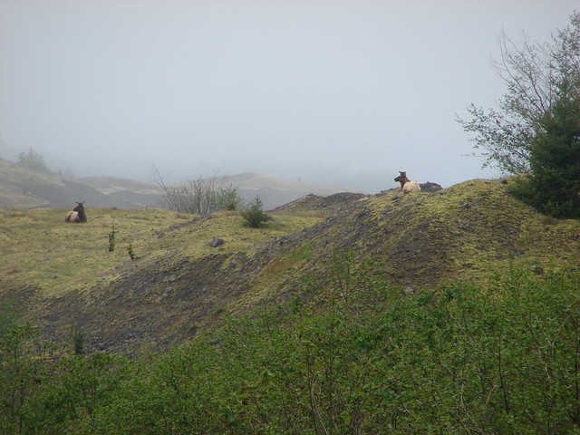
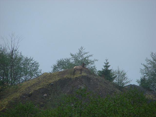
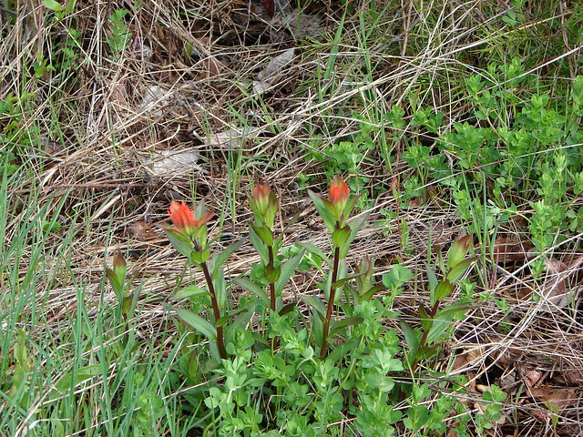
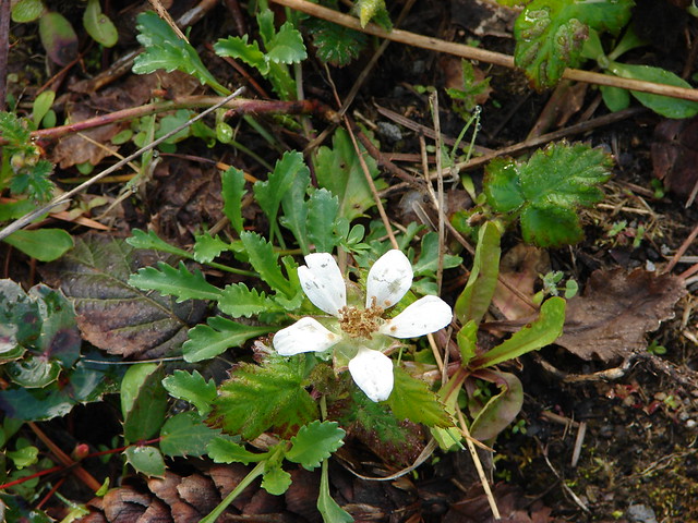
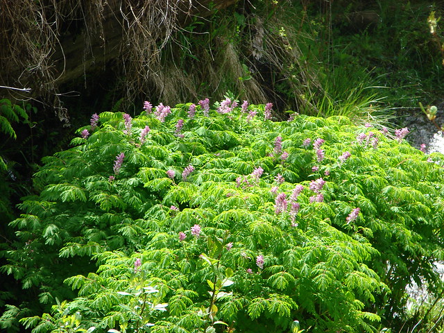
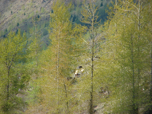
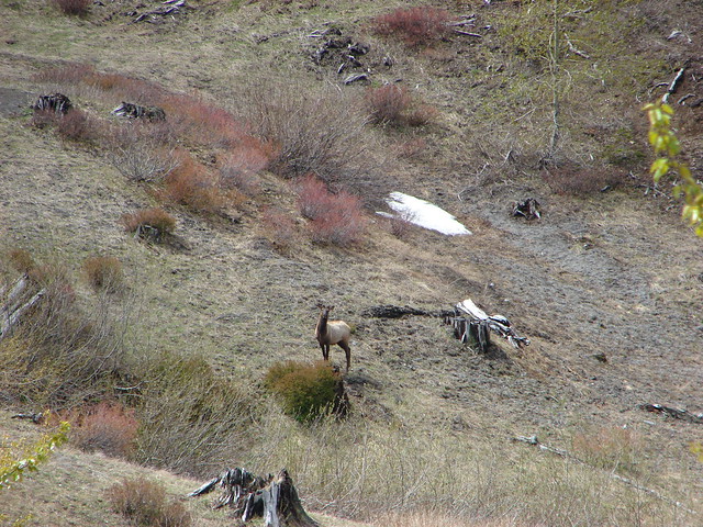
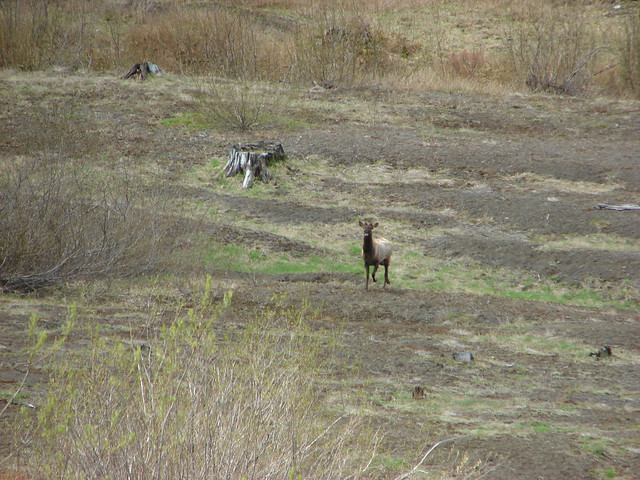
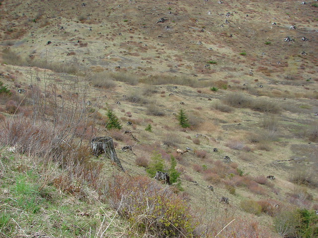
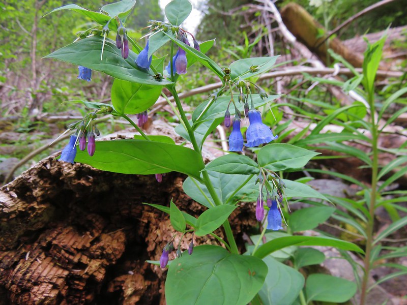
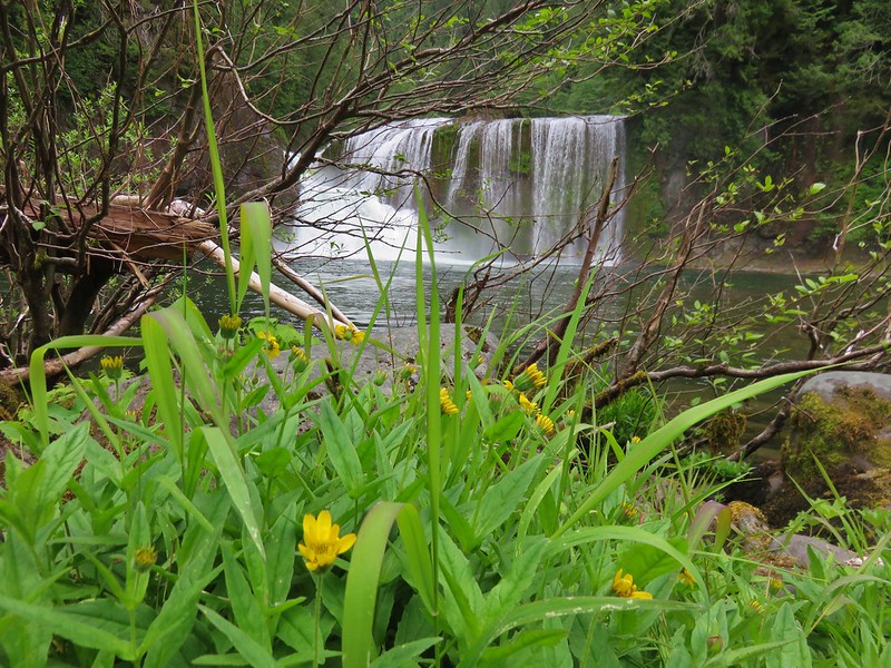
We made our way out onto a gravel bar for a better view and found a few flowers as well as some elk sign.
Tall bluebells

Upper Lewis River Falls

The trail then climbed up to an upper viewpoint via a wide arc around some rock outcroppings.
Upper Lewis River Falls

Upper Lewis River Falls

Upper Lewis River Falls

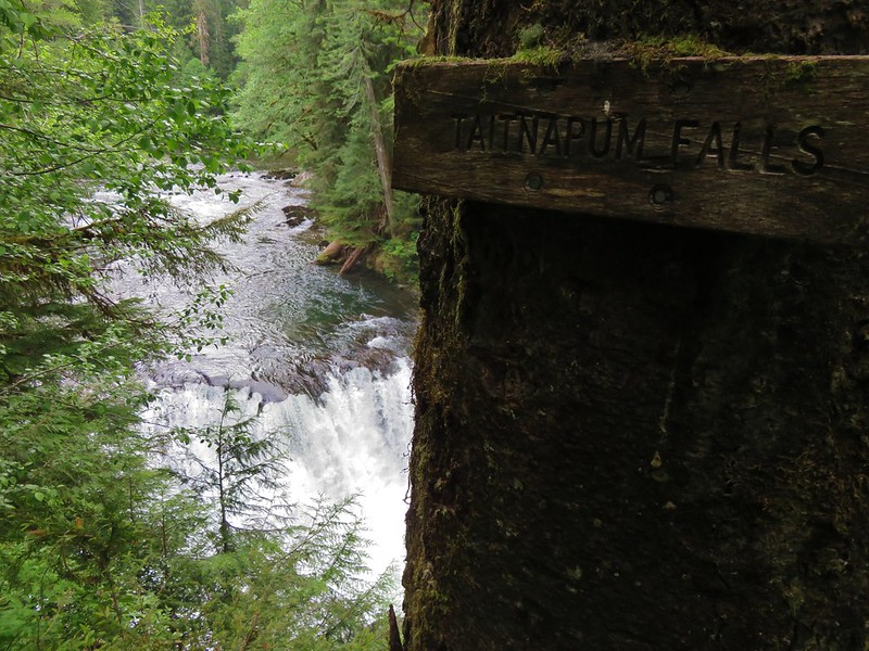
Continuing on we passed a spectacular green pool before reaching Taitnapum Falls.
Lewis River

Taitnapum Falls

Taitnapum Falls

We turned around after reaching the end of the Lewis River Trail and NF Road 90. The Quartz Creek Trail continued on the far side but for us it was time to head back and get to our second hike.

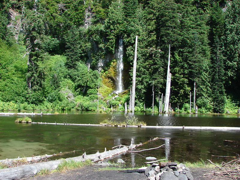
We had seen a handful of people on our way out along the trail and wound up having each of the falls to ourselves, but on the way back it was a steady stream of people. The Recreation Area parking lot was packed as we left making us glad we had started with this hike. We drove back towards Cougar, WA on forest road 90 turning right on road 9039 at a sign for the Curly Creek Trailhead. We parked in a gravel lot just before reaching a bridge across the Lewis River. The trail was on the far side of the bridge so we crossed on foot and headed downstream to the West. A platform along the trail offered views across the Lewis River to the unique Curly Creek Falls with its pair of rock arches.
Curly Creek Falls

Curly Creek Falls

Curly Creek Falls

Just a short distance further was another viewpoint. This time for Miller Falls.
Miller Falls

Miller Falls

One of the reasons we had not done these hikes before was due to the length of the drive vs. the amount of  hike time. At 3 hours one way the 9-10 miles would cause us to spend more time in the car than on the trail. Our solution was to visit the Bolt Camp Shelter after Curly Creek and Miller Falls. To do this we returned along the trail to the road 9039 bridge, crossing the road and continuing on the Lewis River Trail.

Lewis River Trail

Lewis River Trail

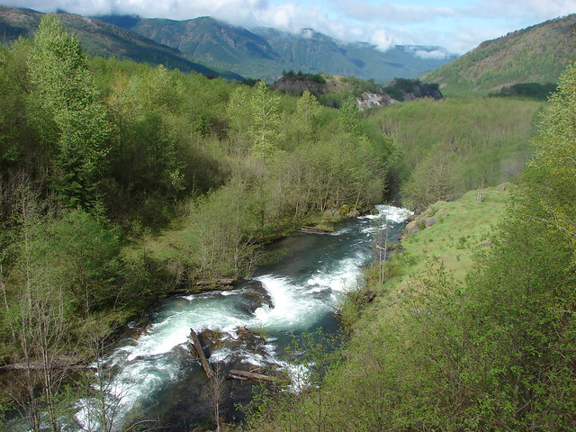
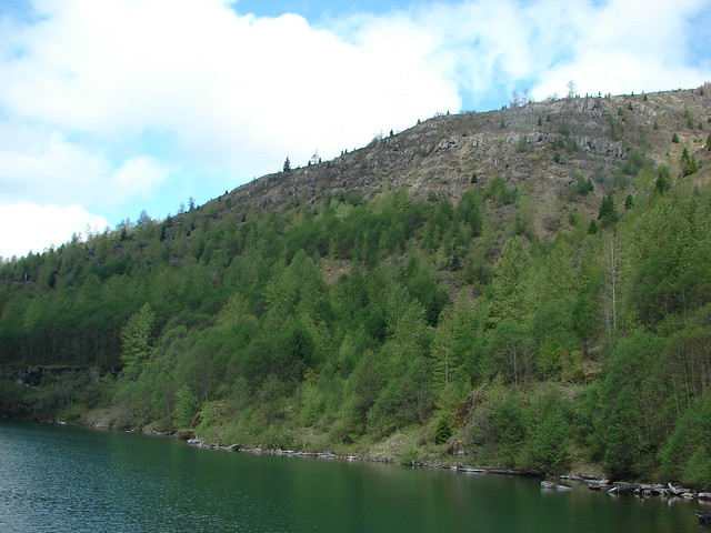
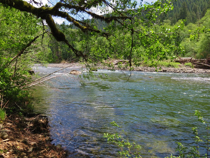
This portion of the Lewis River Trail was along a calmer section of the river offering plenty of access to the river.
Lewis River

Lewis River

We stopped for a short rest along the river at the Bolt Camp Shelter before returning to the trailhead.
Bolt Camp sign

Bolt Camp Shelter along the Lewis River

When it was all said and done we’d spent 6 hours and 42 minutes on the trail which meant we hadn’t violated our rule of not spending more time driving than hiking. It was easy to see why this area is so popular, but even with all the people we had still found some solitude along the trails and at every waterfall we’d visited. We couldn’t have asked for more. Happy Trails!

Flickr: https://www.flickr.com/photos/9319235@N02/albums/72157668708267141

Categories
Hiking Mt. St. Helens Trip report Washington Washington Cascades

Ape Cave and Ape Canyon

We are in the midst of revisiting several trails that we first hiked in 2012. Next up after our return trip to the Table Rock Wilderness we headed to the Mt. St. Helens National Volcanic Monument for a second hike on the Ape Canyon Trail. In 2012 we had done a second short hike along Lava Canyon after finishing the Ape Canyon Trail and this time we decided to add a visit to Ape Cave to the agenda.

At 12,810 feet long Ape Cave is the longest known Lava Tube in North America. It is also one of the more popular places to visit in the monument so we decided to tackle this trail first in an attempt to beat the crowds. A staffed information booth awaits at the trailhead, but we had arrived before it opened for the day.
IMG_5518

A short paved trail leads to an kiosk with signboards and the lower cave entrance.
IMG_5521

IMG_5593

IMG_5594

IMG_5595

IMG_5523

An above ground trail leads past the lower entrance to an upper entrance (or exit).
IMG_5525

We decided to hike up to the upper entrance and then descend down the lava tube to it’s end 3/4miles past the lower cave entrance. The trail to the upper entrance passed through the forest before skirting a lava flow and passing some smaller lava tubes that were not part of the cave.
IMG_5526

IMG_5527

IMG_5528

IMG_5529

The trail actually did pass over the cave three times before arriving at the site of the upper entrance. We walked passed the entrance initially following a well used path about 50 yards too far before realizing our mistake. There was no sign marking the upper entrance and the hole was much smaller than the lower entrance. It took a moment for us to spot the metal ladder barely sticking up from out of the dark hole.
IMG_5531

IMG_5533

Climbing down the ladder was interesting as the first 17 steps angled downward before the ladder suddenly dropped straight down for the final 10 or 12 rungs.
IMG_5536

The cave extends another .1 miles or so beyond the upper entrance so we turned north and walked to the end before turning around and heading for the lower entrance.
IMG_5537

The cave was really neat. The rock surrounding the tube was full of colors and different textures. White portions of rock reflected our headlamps imitating rays of sunlight along the walls and ceiling.
IMG_5541

IMG_5544

IMG_5547

A third of a mile from the upper entrance the trail past under a skylight where green ferns and mosses grew on the rocks.
IMG_5553

The lower entrance was another 1.1 miles beyond the skylight. This section of the lava tube was a workout. Ten different rock falls required scrambling over and around piles of lava rock and a pair of lava falls, drops of around 8 feet, proved a challenge to descend. The second lava fall was particularly difficult requiring us to slowly lower ourselves down using small nubs on the cave floor as handholds. The scenery of the cave was worth the effort and we wondered if climbing up would have been easier than coming down as we had.
IMG_5557

IMG_5563

IMG_5565

IMG_5577

It was fairly slow going but we eventually made it to the base of the staircase leading down from the lower entrance.
IMG_5582

IMG_5579

We headed down the lower end of the cave which was, as the sign said, a relatively easy walk. We turned around when the cave had become small enough that we would have had to crawl to continue any further.
IMG_5584

IMG_5586

IMG_5588

We had started to run into a few more people near the end of the lower cave and on the way back to the lower entrance the number of people increased dramatically. We exited up through the lower entrance and headed for the car.
IMG_5590

In hindsight we should have descended through the lower entrance as it seemed like it would have been easier to ascend up through the cave and it would likely have avoided the crowds that had formed later in the morning in the lower cave.

We drove from the Ape Cave parking area to the Ape Canyon Trailhead for our second hike of the day. On our previous visit we had taken the Ape Canyon Trail to the Loowit Trail and then followed that trail to a junction with the Abraham Trail which covered a total of 12.7 miles. Our second hike that day at Lava Canyon was only 1.3 miles for a 14 mile total. This time around we had already done nearly 5 miles at Ape Cave so the plan was to stop at a spring along the Loowit Trail in the Plains of Abraham. The small parking lot at the Ape Canyon Trailhead was full so we parked along road 83 and walked to the start of the trail.
IMG_5596

IMG_5598

We were on high alert as we started the trail due to warnings about local wildlife.
IMG_5601

The Ape Canyon Trail starts in the forest next to a lahar created by the Muddy River when the mountains 1980 eruption sent a large portion of the Shoestring Glacier down the valley. Our previous visit had been on a clear day in Mid-September where the views across the lahar to Mt. St. Helens were spectacular.
021

We were not to be so lucky on this day with our Mt. St. Helens views but the temperature was pleasant and we hoped to see more flowers this time than we had previously.
IMG_5602

IMG_5606

We did see more flowers along the lower section but we were a little late due to the weather we’d been having this year.
IMG_5614

IMG_5619

IMG_5620

IMG_5635

The trail passes through an old growth forest starting at the 1.4 mile mark then climbs a series of switchbacks as it heads up a ridge toward the Loowit Trail. We passed a few viewpoints that had provided impressive views on our first visit but today we had to rely on those memories to picture the mountain.
157

IMG_5633

After 4 miles the trail enters the blast zone from the 1980 eruption. The trail spends winds a half mile through the blast zone above forested Ape Canyon.
IMG_5712

A narrow slot at the top of the Canyon frames the creek below and apparently Mt. Adams in the distance. I say apparently because we have not been able to confirm this on either of our visits. In 2012 the Cascade Creek Fire was burning on the slopes of Mt. Adams filling the sky with smoke and clouds were now playing the same role on this day.
087

IMG_5645

IMG_5647

The trail ends after 4.5 miles at the Loowit Trail which circles the entire mountain.
IMG_5650

IMG_5651

We turned right here heading for the Spring .8 miles away. This section of the Loowit Trail passes through the Plains of Abraham, a pumice plain with a barren looking landscape which is really fascinating. Heading NE Mt. St. Helens looms on the left across the broad plain while hills on the right reveal the force of mountains eruption. Trees lay blown down on the hillsides facing the mountain while other sides are striped away exposing various layers of rock. Other areas green with trees and other vegetation.
IMG_5657

Flowers are sparse but some still manage to bloom in what looks like the most improbably conditions.
IMG_5653

IMG_5654

IMG_5656

IMG_5659

IMG_5679

One thing that didn’t change from our previous visit was being greeted by a marmot as we crossed this section. We couldn’t help but wonder if it was the same furry little guy.
IMG_5661

IMG_5664

When I had added this hike to the schedule I had hoped to find flowers near the spring where we would turn around, but with the timing being so far off this year due to the weather I wasn’t sure what we’d find. It wound up working out even though things were beginning to dry out. We spoted several different types of flowers including a nice clump of bluebell-of-Scotland.
IMG_5694

IMG_5690

IMG_5706

IMG_5693

IMG_5700

IMG_5688

IMG_5685

It was no apline wildflower meadow but considering the area it was an impressive display. What surprised us was the lack of water from the spring. Despite it being September on our previous visit a small steady stream of water was flowing down the rocks and into Ape Canyon, but this time the only water was a small pool left filling a depression in the rock.

2012
Spring fed stream

119

2015
IMG_5705

After resting a bit, and starting to get chilly due to a nice breeze and cooling our sweat, we headed back down. The clouds had only lifted a little as we passed the lower viewpoints and small pockets of blue sky teased us from above the mountain.
IMG_5730

It had been a long but interesting day of hiking. It was also our first visit of the year to one of the major Cascade mountains and it had been a good reminder of just how much we enjoyed our hikes on them. Happy Trails!

Flickr: https://www.flickr.com/photos/9319235@N02/sets/72157655789278375

Categories
Hiking Mt. St. Helens Trip report Washington Washington Cascades

Mt. St. Helens Rim

We kicked off our September hiking with the steep rocky climb to the rim of Mt. St. Helens. After missing out on climbing permits last year (The passes are limited to 100 per day from April 1st through October.) we had scooped up this years permits as soon as they went on sale in February. We were fortunate to have wound up picking a day with a forecast for clear skies and mild temperatures.

After picking up our permits and signing the climbers register at the Lone Fir Resort in Cougar, WA we drove up to the Climbers Bivouac and got ready to climb. The first 2 miles of trail climbed gradually through a forest. There were just a few flowers and a couple of berries left here and there. We had blue skies above us but the sky was hazy to the East and South hiding Mt. Hood and Mt. Adams from view.
DSC06250
DSC06253
DSC06254
DSC06263

At the 2 mile mark we crossed over the Loowit Trail and continued up the mountain.
DSC06255
Going up

The trail quickly emerged from the trees and headed for the lava flow on Monitor Ridge.
DSC06261
DSC06262

Posts indicated the general path to follow up the lava, but it was nearly impossible to tell where the optimal route was. It seemed like no matter where we were a better looking route was just to the left or right.
Following the posts up Monitor Ridge
DSC06269
DSC06272

We picked our way up and over the rocks as best as we could passing the first monitor (yes there are actually monitors on monitor ridge) and gaining ever better views of Goat Mountain just to the SE of Mt. St. Helens.
DSC06266
DSC06275

Just under 2 miles from the Loowit Trail we found the second monitor. Used for monitoring any swelling of the mountain we used it as proof that we were actually getting somewhere.
The 2nd of the two monitors
DSC06289
DSC06292

From the second monitor there was one final pile of lava rocks before a final stretch of loose rock and ash.
DSC06295
Final stretch up to the rim of Mt. St. Helens

The sky above the rim was a clear blue and we had hopes that maybe the view North would be clearer than the rest of the horizon, but from the rim the view in that direction looked like the others.
Mt. St. Helens Rim 2

There was one big difference, the view down into the crater was unobstructed and Spirit Lake lay beyond with its flotilla of logs.
Lava dome in the crater of Mt. St. Helens
DSC06319
More of the crater
DSC06351

We sat on the rim for awhile catching our breath and resting our legs. The steam rising from the lava dome coupled with the nearly constant sound of rocks falling down into the crater gave us plenty of entertainment.
Somewhere out there is Mt. Rainier
DSC06364
DSC06371

Once we had sufficiently recovered we began our descent.
DSC06372

Going down was just as difficult as climbing up. We slowly made our way back down though and wound up back in the trees. The final 2 miles seemed to fly by compared to how long it took to come down the lava flow and we were soon leaving the volcanic monument.
DSC06404

Back at the car we had one final look at the rim we had been on just a few hours earlier. It had been an interesting hike, arguably the most difficult we’ve done, but worth the effort.
Mt. St. Helens from the parking lot

Happy Trail!

Flickr:https://www.flickr.com/photos/9319235@N02/sets/72157647296074376/
Facebook:https://www.facebook.com/media/set/?set=a.10204963823042484.1073741907.1448521051&type=1

Categories
Hiking Mt. St. Helens Trip report Washington Washington Cascades

June Lake

One of the things that makes for a good hike is variety. We have often commented on how much variety can be packed into just several miles of hiking. The terrain, vegetation, wildlife and views can vary drastically in a relatively short distance. That was the case on our most recent hike in the Mt. St. Helens National Volcanic Monument.

We had toyed with the idea of making this an overnight trip but the uncertainty of suitable water sources gave us pause so we amended our plans to make a day hike out of it. We stuck with our original plan to start at the June Lake trail head and headed up to the Loowit Trail from there. Originally we planed on turning right on the Loowit and heading over to the Plains of Abraham to find a camp spot and then explore further on down to Loowit Falls, but that would be too far for a day hike so instead we decided to go left and check out Dryer Creek Meadows.

It was a cloudy morning as we set off on the June Lake Trail. From the trail head it was a mere 1.3 miles to June Lake on a nice wide trail that gently climbed through a forest with plenty of ripe berries to snack on.
DSC01371
DSC01354

We were surrounded by fog when we arrived at June Lake which made it difficult to get a good view of the 40′ waterfall that falls on the far shore of the lake.
DSC01385

While exploring the small lakes shore we spotted a couple of frogs in the muddy water.
Frogs at June Lake

The best view of the falls came from a side trail at the north end of the lake shortly after a switchback. The reflection of the falls created the illusion of water both falling and rising to the surface of the lake.
DSC01396

About a quarter mile from the side trail we arrived at the junction with the Loowit Trail which circles the entire mountain on a 29.5 mile loop. We turned right and quickly emerged from the forest and began crossing the first of three lava flows that make up the “Worm Flows”. Unlike some of the other lava fields we have hiked over there was no visible trail in many places, just a series of posts and rock cairns to aim for.
DSC01408

It meant a lot of rock hopping and scouting for the best looking route to the next marker. While we were working on making our way over the lava the clouds began to give way and we were treated to a clear view of Mt. St. Helens.
DSC01432
Mt. St. Helens

After crossing the Worm Flows the trail began descending into Swift Creeks canyon where we would find Chocolate Falls. On our way down a colorful western tanager posed for some pictures.
Western Tanager
DSC01474

Before reaching swift creek we passed through a small pocket of vegetation.
DSC01479
DSC01478

We were happy to find water flowing over Chocolate Falls as Swift Creek often dries up overnight and doesn’t begin flowing again until after 11AM on some days.
DSC01481
DSC01482

We took a snack break at the falls and while we were relaxing we were joined by what I think was the same western tanager who decided it was time for a bath.
Western Tanager
Western Tanager

We continued on the Loowit Trail from Swift Creek and began a steep climb that passed through forest and meadows. We also were treated to a great view of Mt. Adams and a descent view of Mt. Hood looming above the clouds.
Mt. Adams
Mt. Adams
Mt. Hood
DSC01550
Meadow filled with nuttall’s linanthus
DSC01585
Mt. Adams from one of the meadows
DSC01611
Passing through a meadow
DSC01612
Mt. Hood from the meadow
DSC01613
Mountain heather and a blue copper butterfly
DSC01608

Two miles from Chocolate Falls we crossed the Ptarmigan Trail which climbs up Monitor Ridge to the Rim of Mt. St. Helens.
DSC01620
We have a date with that trail later this year.

We crossed the trail and shortly came to the edge of another lava flow. A doe was making her way up toward Monitor Ridge showing off her superior rock hopping skills.
Doe
DSC01635

This crossing was .9 miles of post to post travel.
DSC01646
From this section we had a great view of Mt. St. Helens, Monitor Ridge, and the Green Knob.
DSC01648

After navigating the lava flow we were once again in a forest. This one was drier and the trees more sparse than the previous sections we’d passed through. Cicadas chirped loudly from the pine trees and scattered flowers dotted the sandy landscape.
DSC01664
DSC01665
DSC01666

The trail then began alternating between trees and meadows.
DSC01673
DSC01674

As we came around a corner I noticed something peering out of a tree further up along the trail.
DSC01680
A bull elk emerged and gave us a quick look before heading downhill deeper into the trees.
DSC01683
Elk

We turned around at the dry Dryers Creek and retraced our steps back toward Chocolate Falls.
Mt. St. Helens from the dry bed of Dryers Creek
DSC01692

Mt. Adams had been hidden by clouds while Mt. Hood had nearly fully emerged from them.
DSC01715
DSC01716

There was evidence of the increased afternoon snow melt when we arrived back at Chocolate Falls.
DSC01740
Chocolate Falls
We took our shoes and socks off and soaked our feet for a bit in the creek before setting off from the falls. When we did get going we left the Loowit Trail and turned right along Swift Creek on the Swift Ski Trail.
DSC01754
Chocolate Falls and Mt. St. Helens

It was an easy trail to follow and we quickly descended .5 miles to the Pika Ski Trail which we took and headed back toward June Lake.
DSC01764

The Pika Trail was easy to follow for the first few tenths of a mile plus it was lined with ripe blueberries, huckleberries, and a few strawberries.
DSC01770
DSC01772
DSC01761

The easy trail didn’t last long though as we still had to cross part of the Worm Flows to return to June Lake. The crossing here was the most difficult of the day as there was no sign of any trail at all and the few orange poles ended halfway across the lava flow.
DSC01774

Luckily from the final pole June Lake was visible on the other side of the flow.
DSC01776

We headed for the lake and eventually made it down to the sandy bed of a dry creek which we climbed out of and returned to the June Lake Trail. The lake was clear now so we stopped to get some unobstructed photos of the waterfall and lake before beginning the final leg of our hike.
June Lake

We took our time on the final 1.3 miles partly due to being tired from all the rock hopping and partly because we were picking berries as we went. The hike had totaled 13.4 miles and in that distance we’d passed two waterfalls, a lake, several creeks (dry and flowing), through several sections of forest, multiple meadows, and over four different lava flows. We’d seen an elk, a deer, chipmunks, golden-mantled squirrels, frogs, and various birds. We sampled at least 6 different kinds of berries, saw a variety of wildflowers, and had views of three cascade volcanoes. It had been worth the effort. Happy Trails!

flickr: https://www.flickr.com/photos/9319235@N02/sets/72157645372723387/
Facebook: https://www.facebook.com/media/set/?set=a.10204499327590388.1073741894.1448521051&type=1

Categories
Hiking Mt. St. Helens Trip report Washington Washington Cascades

Coldwater Lake & The Hummocks

We ended our “Creek Week” vacation by changing things up a bit and heading to the Mt. St. Helens National Volcanic Monument hoping to see some snowy mountains. Our creek theme wasn’t totally abandoned though. Our destination was Coldwater Lake which was formed during the 1980 Mt. St. Helens eruption when Coldwater Creek was blocked by debris from the mountain. The creek still flows into and out of the lake on it’s way to the North Fork Toutle River.

The slide that created Coldwater Lake also created the Hummocks which are piles of rock, ash, and other debris that was washed down and deposited along the Toutle River. A 2.5 mile trail loops through these mounds and that was where we decided to start our hike. Our plan was to hit that popular trail first before it got crowded then walk back along the shoulder of Highway 504 for a quarter mile to the entrance to Coldwater Lake and once there either do an 8.8mi out and back to a footbridge over Coldwater Creek or continue over the bridge on a longer loop up and around the lake. We decided to wait until we got closer to the bridge before choosing which option we would take.

It was quite foggy when we arrived at the trailhead for the Hummocks loop making it pretty clear that we wouldn’t be seeing Mt. St. Helens for awhile at least.
The Hummocks trailhead

The scenery along the trail deserved our attention anyway with many ponds and streams nestled between the various mounds.
Ducklings on one of the ponds
DSC04973

As we were making our way through the strange landscape we spotted some elk on one of the Hummocks a short distance away.
DSC04984
DSC04989
They didn’t seem to be the least bit concerned with us. There were also numerous ducks, geese, and other birds enjoying the ponds and marshes along the trail.
DSC05009
DSC05040
DSC05057
DSC05059
DSC05069

The trail also passes a nice viewpoint above the North Fork Toutle River where Mt. St. Helens would be visible on a clear day. We settled for the river and another group of elk grazing on the far bank.
DSC05032
DSC05026
Shortly after leaving the viewpoint we were passing through a wooded area when I noticed an elk around 30′ away standing in the trees. Before I could get the camera up it disappeared but that had been the closest we’d come to an elk yet.

The clouds were beginning to clear up when we made it back to the parking lot and set off along the highway toward the Coldwater Lake entrance. We passed over Coldwater Creek on it’s way from the lake down into the Toutle Valley and then crossed the road and headed down to the lake.
Coldwater Creek

The view across the lake was spectacular from the trailhead. Minnie Peak lay ahead with a dusting of snow and a misty covering of clouds.
Coldwater Lake
DSC05091

A little island was a popular spot for geese and ducks. I am sure they were there for the views.
DSC05102

As we traveled along the north shore of the lake the views both ahead and behind kept getting better. The clouds were lifting revealing more and more snow covered peaks.
Coldwater Lake
DSC05110

A few flowers were ahead of schedule giving us a taste of what will be coming in the next few weeks.
DSC05115
DSC05106
DSC05117
Scouler's Cordaylis

I had my eyes on Minnie Peak waiting for the last cloud to finally let go. It was a stubborn one though and just wouldn’t quite disappear.

DSC05149

The trail crosses several small streams before reaching what was a very nice waterfall on this day. Rock Gully Falls, as it’s called in Sullivan’s book, was swollen with melt water making it a damp crossing since there is no bridge.
Rock Gully Falls
The crossing
DSC05166

We spotted several more elk above us on the hillside as we rounded a small peninsula shortly after passing the falls. It was amazing watching them quickly traverse the steep hillside.
DSC05188
Can you spot them here?
DSC05192

The next marker along the trail was a fan of rocks that had been part of a slide into the lake.
DSC05222
DSC05227

Near the end of Coldwater Lake we came to a shallow pool of water that was, at least at one time, home to a beaver. We didn’t see one but we did see plenty of ducks and geese here.
DSC05276
DSC05269
Evidence of Beaver work
DSC05272

The cloud had finally left Minnie Peak revealing the craggy mountain top by the time we reached the trail junction just above the bridge over Coldwater Creek.
DSC05284
DSC05306
Coldwater Creek came raging down the valley putting on an impressive show.
DSC05297

We had decided to do the full loop as it appeared that snow would not be an issue and loops are generally more fun than retracing your steps so we crossed the bridge and began to climb the ridge on the south side of Coldwater Lake. The views behind us as we climbed just kept getting better.
DSC05315
DSC05318
DSC05332
The rock fan
DSC05362

It was a stiff climb but the views eased the pain some. As the trail began to become more gradual, we could see the Coldwater Visitor Center far off in the distance on the opposite hillside.
DSC05369
Down in the little valley Heather spotted more elk moving in the trees.
DSC05377

Just a short while later she spotted another elk heading our way. It stopped in a little bowl below us to check us out.
DSC05396
Nique correctly identified it as a young bull as it began to come toward us again.
DSC05400
He then veered slightly away from us and crossed the trail a ways ahead and disappeared behind a small rise. I kept looking up the hillside to see if I could see where he was heading.
DSC05404
Just moments after taking the above picture he popped his head up over the rise and looked right down at us. As I fumbled with the camera he jumped down onto the trail no more than 10 yards in front of us and sped off back the way he had come originally. By the time I got a picture he was quite a ways down the into the bowl.
DSC05407

That had gotten my heart racing as I wasn’t sure if he had decided to turn aggressive. I had been expecting him to run away from us not at us. After the excitement we continued on to tractor junction where a trail leads up to Coldwater Peak. The junction is named for the piece of logging equipment that was laid to rest there by the eruption.
DSC05415

We had finally found a little snow in this area but not much was left.
DSC05418
After curving around the trail came to a great open viewpoint.
DSC05432
DSC05446
DSC05455

We could see Rock Gully Falls and the North Coldwater Lake trail really well.
Rock Gully Falls

We had heard a lot of croaking on the Hummocks trail but hadn’t seen any frogs or toads there or along the lake, but now at almost 3500′ Nique spotted one.
DSC05490

Coldwater Peak became visible as we made our way back toward the west end of the lake. It was interesting to see this side of it after having hiked up it last year.
DSC05500
DSC05508

Just as the trail began to descend we came to more logging equipment that didn’t survive the eruption.
DSC05533
DSC05550
DSC05555
DSC05558

From here we could also see the Hummocks parking lot and our car.
DSC05563
DSC05564
We still had a ways to go.

Our last elk sighting was a big one. As we were coming down, the largest herd we’d seen was scrambling to stay ahead of us and dropping down over the hillside.
DSC05571
DSC05578
What a sight 🙂
DSC05584

We made it down to the South Trailhead and began our road walk back to our car. Mt. St. Helens finally decided to make an appearance at this point.
DSC05600
When we got back to the car I dropped off my pack and jogged down the Hummocks Trail to the first good viewpoint to get my volcano pictures.
DSC05607
DSC05614
Now that’s the way to end a hike – Happy Trails indeed! 🙂

flickr: https://www.flickr.com/photos/9319235@N02/sets/72157644218596998/
facebook: https://www.facebook.com/deryl.yunck/media_set?set=a.10203973677849473.1073741876.1448521051&type=1

Categories
Hiking Mt. St. Helens Trip report Washington Washington Cascades

Johnston Ridge Observatory & Coldwater Peak

We took advantage of a day off recently and headed up to the Johnston Ridge Observatory at Mt. St. Helens. This was the farthest north we have traveled for a hike and would be the first time we would be able to see the collapsed side of the volcano. We were a bit disappointed when we arrived and realized that the winds had shifted and were blowing from the south east causing a hazy sky due to smoke from a wildfire near The Dalles Oregon. We parked in the observatory parking lot and surveyed our hike’s destination, Coldwater Peak.

Coldwater Peak from the parking lot.

The observatory was not open yet (It opens at 10:00am) but we walked around the paved loop trail there before setting off on the boundary trail. Good views of Mt. St. Helens were plentiful despite the blue haze from the smoke.
004
I had us all on the lookout for elk down in the valley below and it wasn’t long before we spotted a small group.
030
It appeared to be a small heard of about 15 elk but as we worked our way along the trail and got a better view of the valley below we saw the rest of the heard.
041

As we rounded a ridge end we got our first view of Spirit Lake and it’s floating trees. Mt. Adams was visible through the haze further to the east.
082
The trail then dipped slightly to a jct with the Truman Trail and continued on behind Harry’s Ridge. Here there was a decent variety of flowers that were growing in the mud and ash that had spilled over the ridge here during the 1980 eruption.
106
We also began to find berries :). Here were mostly thimble and huckleberries but we even found a few ripe salmon berries.

Thimble & huckleberries

Later we would add strawberries to the menu.

Just after we had reached the Harry’s Ridge trail we spotted another half dozen elk running up a game trail below us. The trail was now gaining elevation providing better views of Spirit Lake and distant Mt. Adams.
133
When the trail crested we had a nice view of St. Helens Lake below. The trail then drops down in order to pass through a rock arch before continuing above the west side of the lake.

The rock arch that the trail passes through and St. Helens Lake

Near the north end of St. Helens Lake was the sign for the Coldwater Peak Trail which we turned up to begin our climb. We were so busy looking for berries (which we had all been snacking on as we hiked) that we somehow walked right off the trail at a switchback. It took a moment but I finally spotted it across the hillside going up so we headed cross country until we intersected it. Back on the trail we continued our climb up amid an increasing number of flowers (and plenty of berries).
266

The views from the summit were good despite the persistent haze which had now completely hidden Mt. Adams.

Mt. St. Helens from Coldwater Peak


Johnston Ridge Observatory from Coldwater Peak


Mt. Rainier from Coldwater Peak

We couldn’t get to the highest point on the rocks of Coldwater Peak though. We found that we were greatly outnumbered on the summit by flying ants!

Flying ants filling the sky and covering the rocks on Coldwater Peak

They were sticking to the west side of the peak and as long as we remained a few feet from that edge they left us alone so we were able to eat in peace.

We headed back down the trail and tried to figure out where we had lost it on the way up but we never did figure that mystery out. The smoke had gotten worse and it could now be faintly smelled in the air. We ate more berries on the way back and stopped to watch the elk heard again before dropping our packs off at the car and heading to the now open observatory to pay for the passes that we were supposed to have in order to hike in the area. Since we were there we took a tour around the small but interesting observatory before getting in the car and daring Portland’s rush hour traffic. Happy Trails

Facebook photos: https://www.facebook.com/media/set/?set=a.10201951052645107.1073741851.1448521051&type=1
Flickr: http://www.flickr.com/photos/9319235@N02/sets/72157635195793722/

Categories
Hiking Mt. St. Helens Trip report Washington Washington Cascades

Sheep Canyon

So after a couple of months of taking pictures of the major Cascade peaks it was finally time to visit one. Our most recent hike brought us to the volcanic landscape of Mt. St. Helens. Our plan was to hike a loop on the SW side of the mountain starting at the Blue Lake trail head.

For the second week in a row we spotted elk from the car on the way to the trail, but were skunked while actually hiking. We arrived at the current Blue Lake trail head (washouts occasionally relocate it) and headed across a rocky washout to the Toutle Trail. The washout provided a view ahead to the mountain while forest lined each side. At the Toutle Trail we turned left and headed toward Blue Lake. Coldspring Creek flowed along the edge of the washout creating a dividing line between the grey rocks and old growth forest on the other side. Shortly after crossing the creek and entering the forest we came within sight of Blue Lake. The forest here survived the 1980 eruption leaving old growth trees, but a mudflow dammed the creek creating the lake. The forest was peaceful and carpets of white flowers covered much of the ground.

After 2.5 miles in the forest we began to descend into Sheep Canyon. Here the Toutle Trail intersects the Sheep Canyon trail which climbs the mountain on the south side of Sheep Canyon up to the Loowit Trail which circles the entire mountain. We continued on the Toutle and crossed Sheep Canyon on a scenic footbridge and continued on toward the South Fork Toutle River.
056

This section of trail was not very well maintained so we had to do a lot of stepping over and under along the way. After 1.5 miles we made it to the Toutle Trail’s own jct with the Loowit Trail at the edge of the S. Fork Toutle River’s canyon. This wide canyon was affected by the eruption when snow from Mt. St. Helens’ glaciers rapidly melted sending a huge mudslide down the valley. The river now is a small ribbon of water in the wide canyon. Here we turned right on the Loowit and started to climb the side of the mountain.
096

As we climbed we left the forest and entered the blast zone where the trees did not survive the eruption. Here increasingly better views opened up of the mountains rim and to the north the top of Mt. Rainier. Wildflowers surrounded the trail taking advantage of the clearings created by the blast. We passed through some excellent bear grass stands and large numbers of orange tiger lilies, purple penstemon, red columbine & paintbrush, and various colors of phlox. Some small patches of snow lingered in gullies along the way.
170

The trail eventually leveled out and began traversing along the mountains flank to the south. We dipped in and out of the tree line passing a number of different landscapes. We passed the Sheep Canyon Trail choosing instead to continue to the Butte Camp Trail. As we traveled on we crossed several rocky outwash gullies and eventually worked our way far enough around to the south to see Mt. Hood and Mt. Jefferson in the distance. Pink mountain-heather and dwarf lupine bloomed along this portion of the trail.
277

When we reached the Butte Camp Trail we turned right and started our descent back to the Toutle Trail. This trail passed through a dry lodgepole pine forest before reaching the meadow at Butte Camp. Recent snow melt had left the meadow flooded. The trail got us down fairly quickly without being steep and soon we were back on the Toutle Trail ready for the last leg of our hike.

The Toutle Trail was mostly level as it passed through the forest which was nice because we were all starting to feel tired. We pressed on and eventually reached the washout and the junction with the Blue Lake Trail and hustled the final 3/4 miles back to the car. I had chalked our fatigue up to the 10k we had all run the day before, as we seemed to have been much slower than normal. I got a possible answer to why when we got home and I checked the GPS which had us going a total of 16.1 miles :). I’m still not quite sure where the extra 2.6 miles came in but the track from the gps looks right so all I know to say is “Happy Trails”.

Photos -Facebook: https://www.facebook.com/media/set/?set=a.10201590209464253.1073741842.1448521051&type=1
Flickr: http://www.flickr.com/photos/9319235@N02/sets/72157634653720111/