Categories
Columbia River Gorge South Hiking Oregon Throwback Thursday Trip report

Throwback Thursday – Oneonta Falls

This weeks Throwback Thursday hike took place on 7/2/2012 and holds the distinction of being our first in the Columbia Gorge as well as the first for which we used our “100 Hikes in Northwest Oregon & Southwest Washington” guidebook by William L. Sullivan.

One of the many reasons that we appreciate his guidebooks so much is the number of options he provides. In addition to the 100 featured hikes each book lists several barrier free options and contain up to 108 additional hikes with much briefer descriptions in the back of the book. To top it off he often provides information on multiple options within a featured hike which is what we followed on this trip.

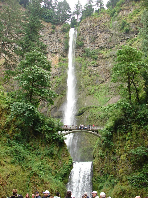
The hike to Oneonta and Horsetail Falls is listed as a 2.7 mile loop in our 2011 3rd edition of the NW guidebook which would have been too short a loop to warrant our drive to the trailhead but another option was listed at the end of the hike description, a 12.2 mile loop passing more waterfalls including Multnomah Falls, Oregon’s tallest waterfall.

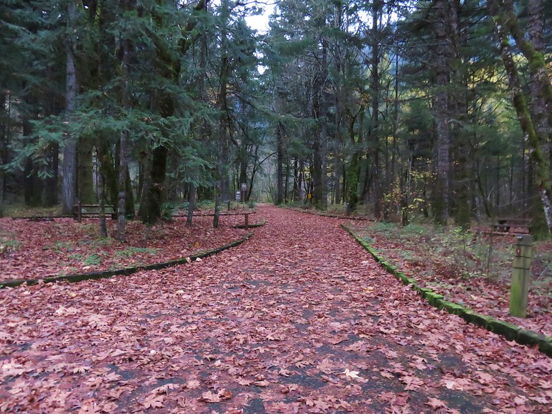
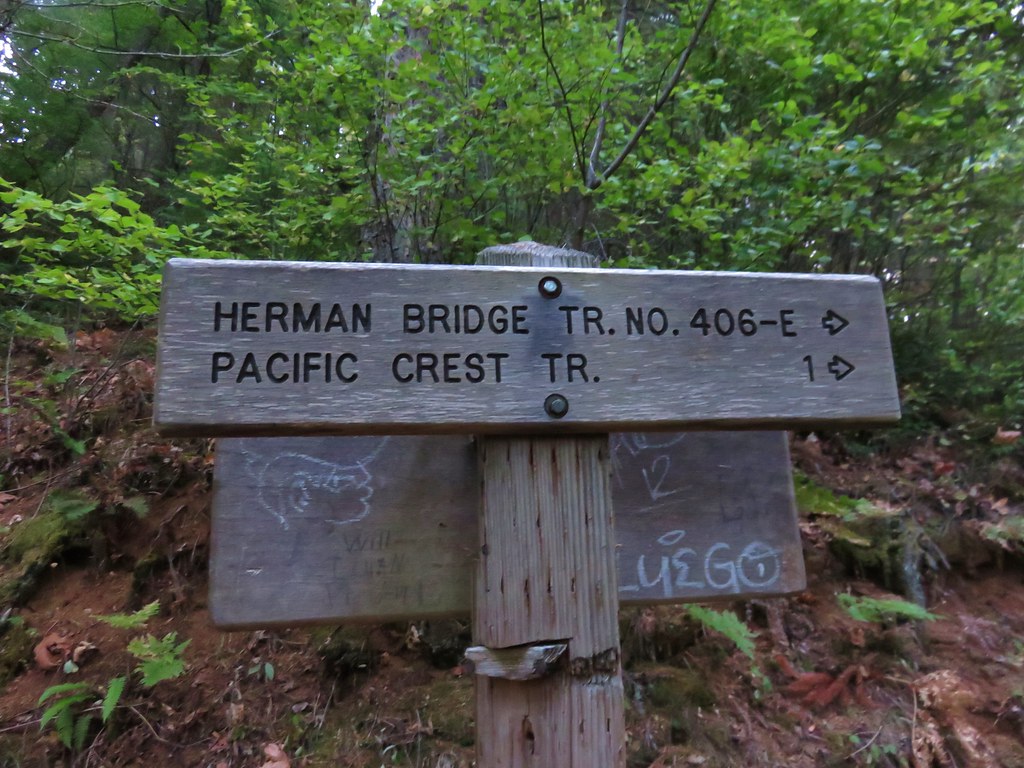
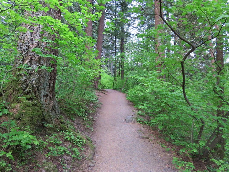
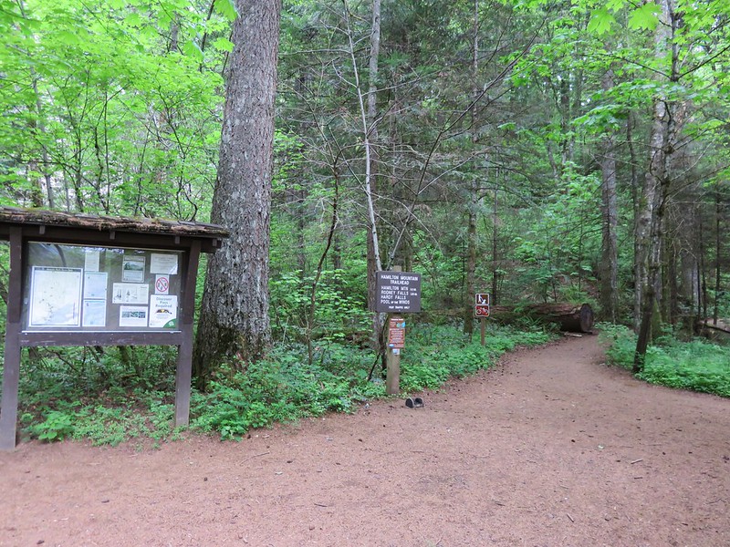
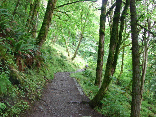
Our hike started at the Horestail Falls Trailhead along the Historic Columbia River Highway. Horestail Falls is literally right there and the trail starts beside it.

Horsetail Falls

Horsetail Falls

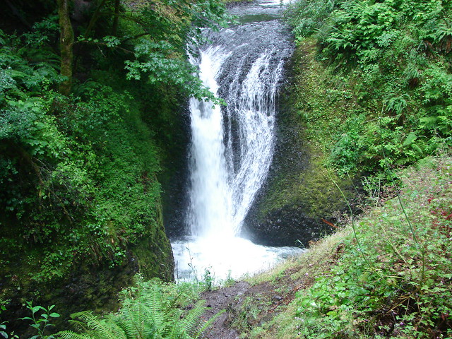
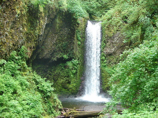
The trail climbed for .2 miles to a junction with the Gorge Trail where we turned right promptly arriving at Ponytail Falls.

Horsetail Falls Trail

Ponytail Falls

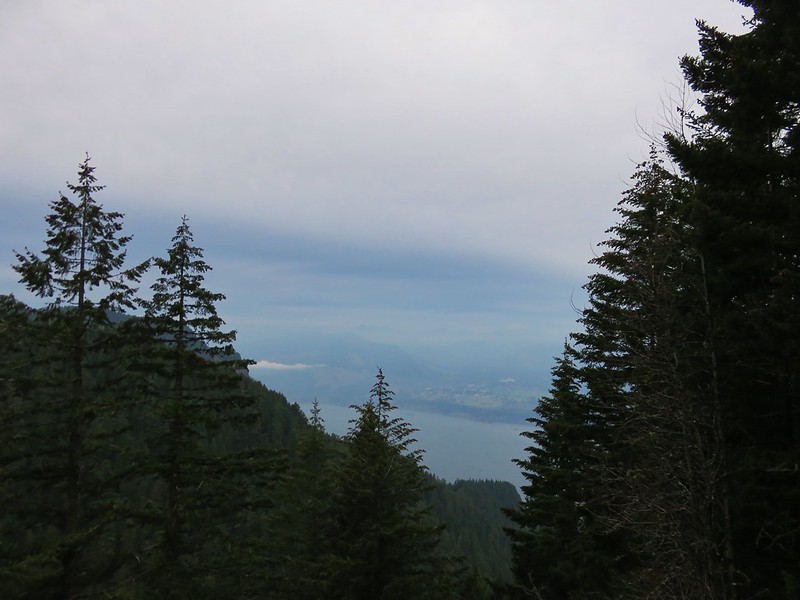
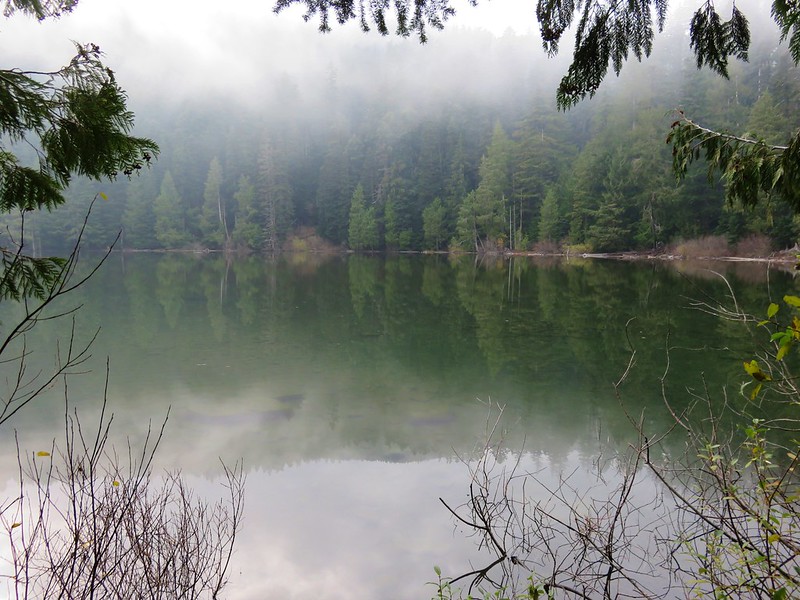
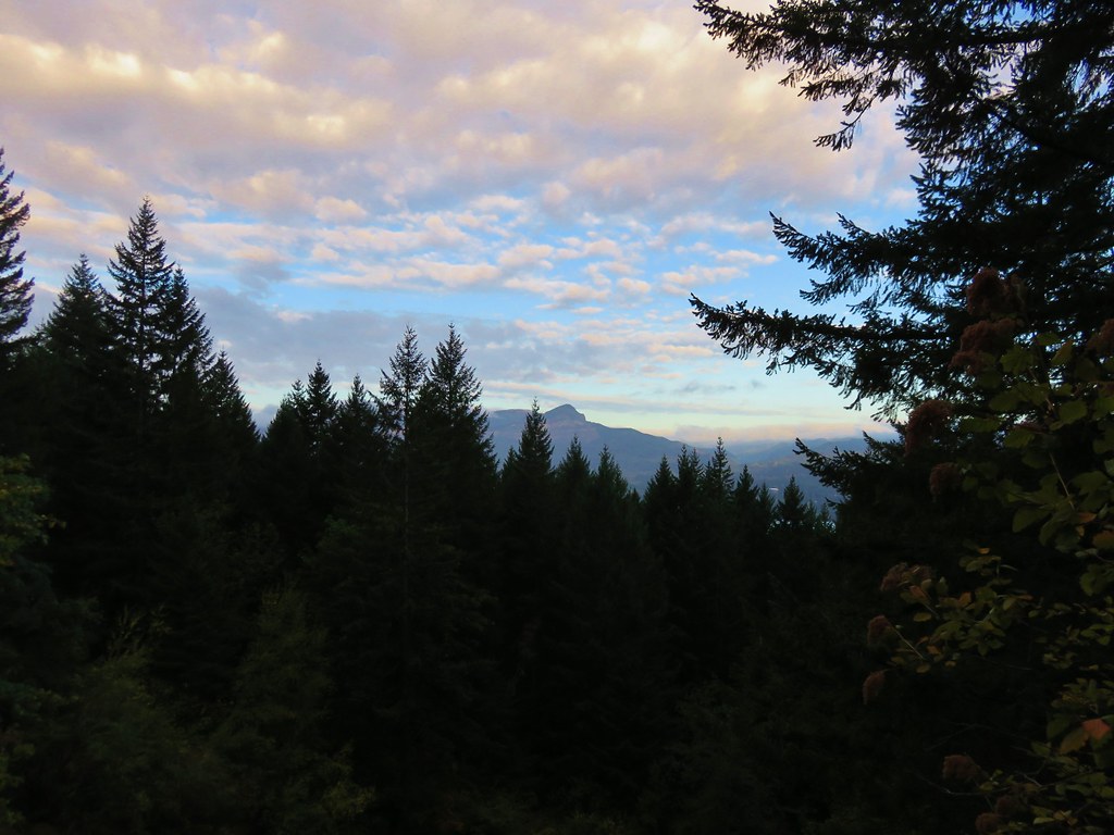
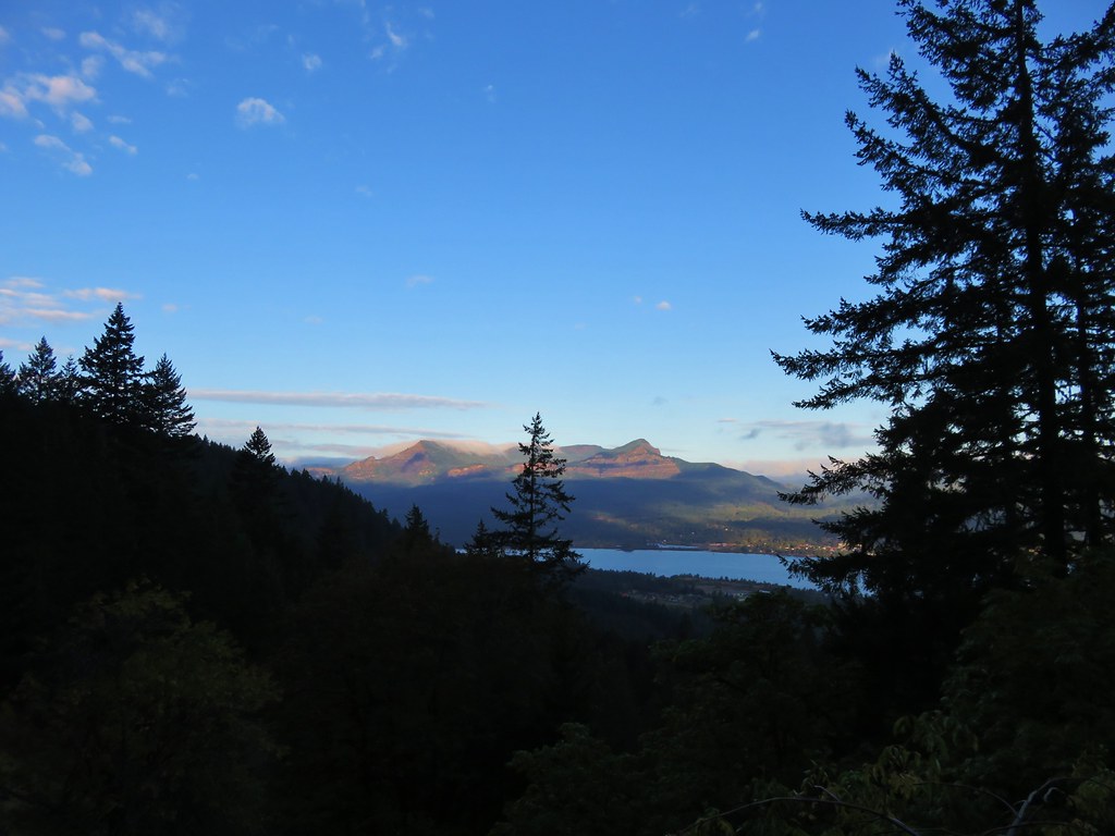
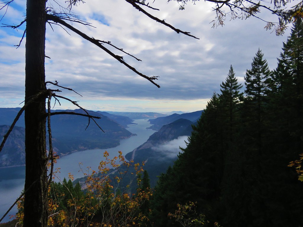
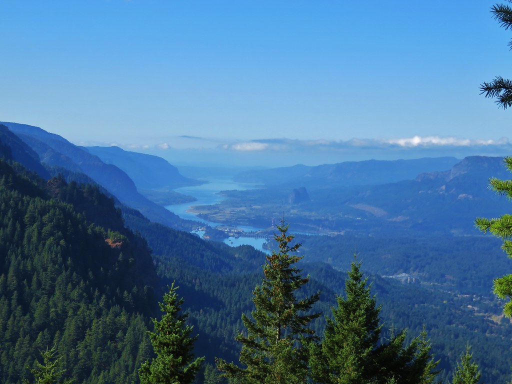
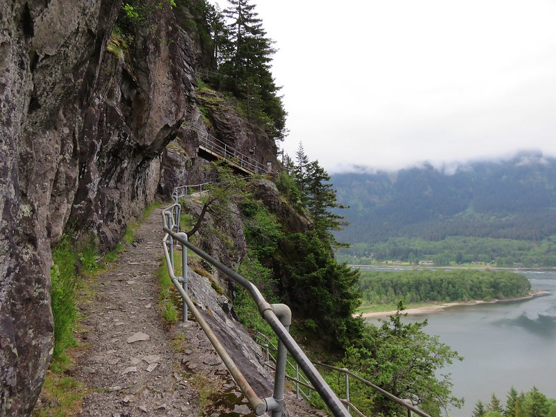
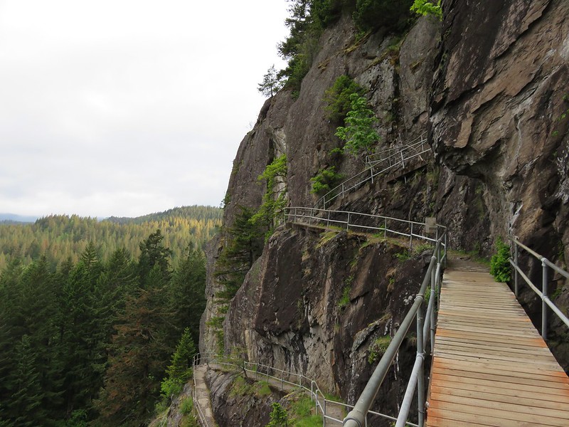
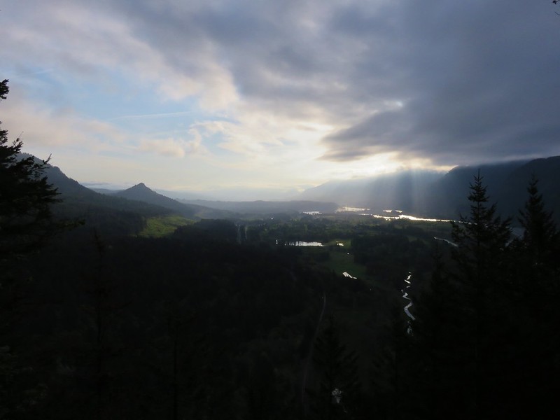
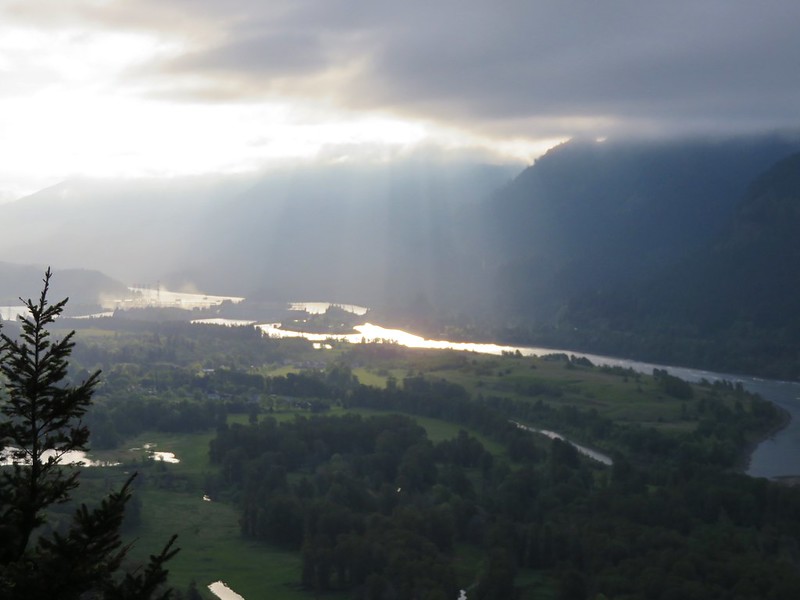
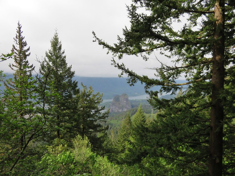
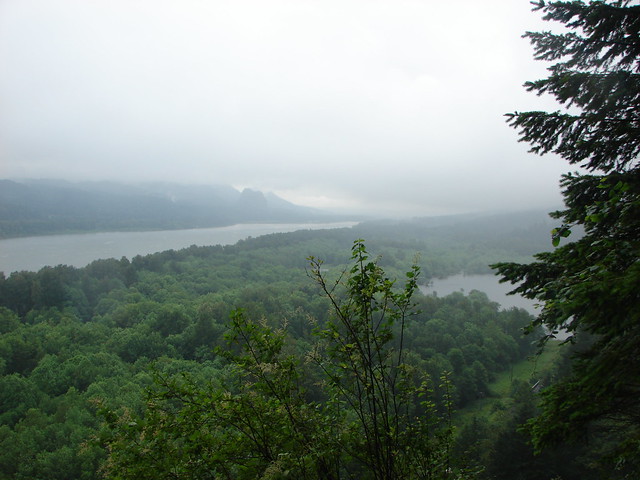
We followed the Gorge Trail behind the falls, which is always a fun thing to do, and continued to a viewpoint overlooking the cloud covered Columbia River.

Ponytail Falls

Ponytail Falls

Columbia River and Beacon Rock

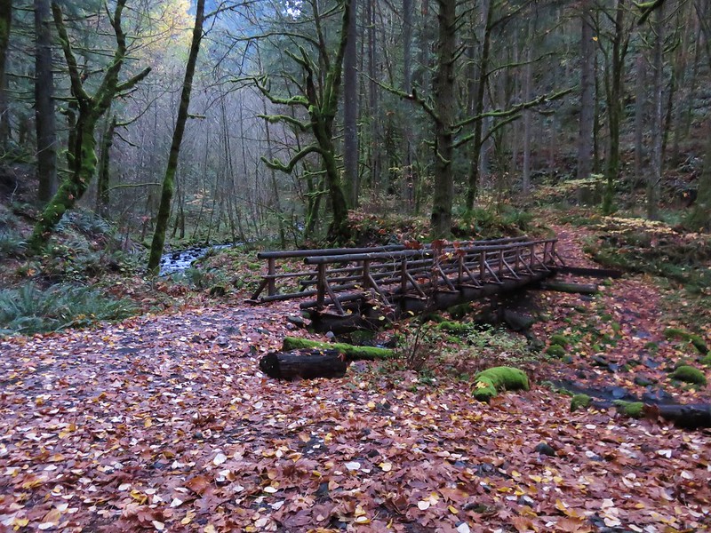
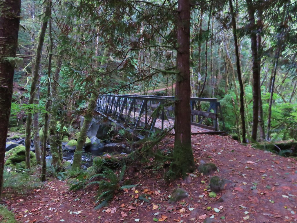
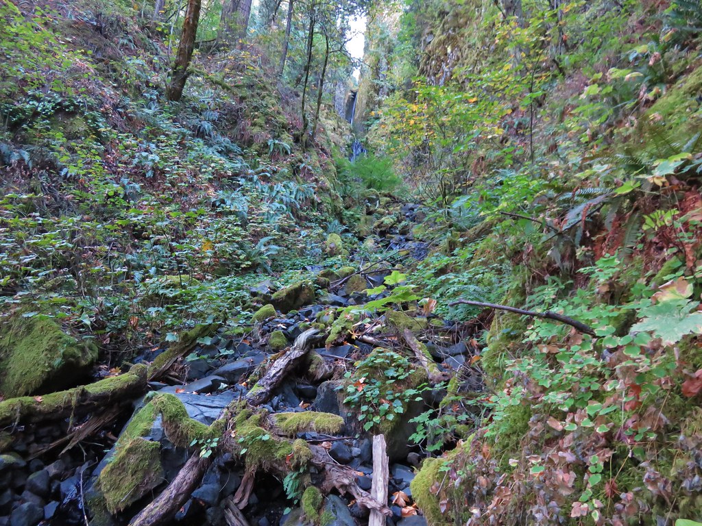
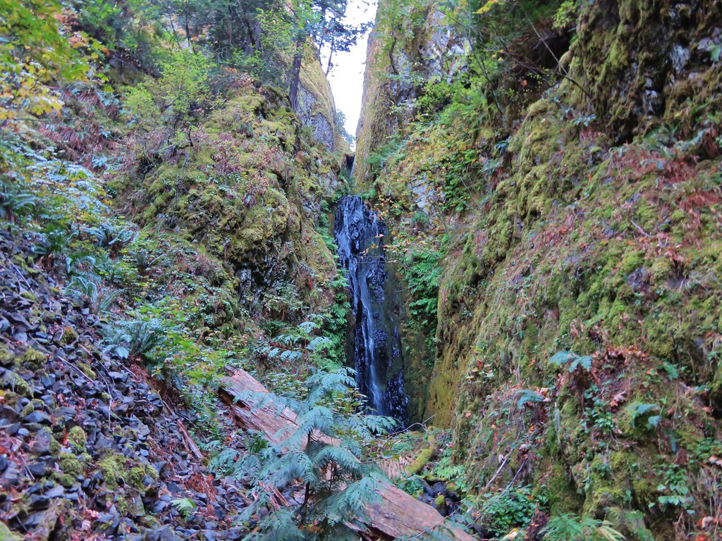
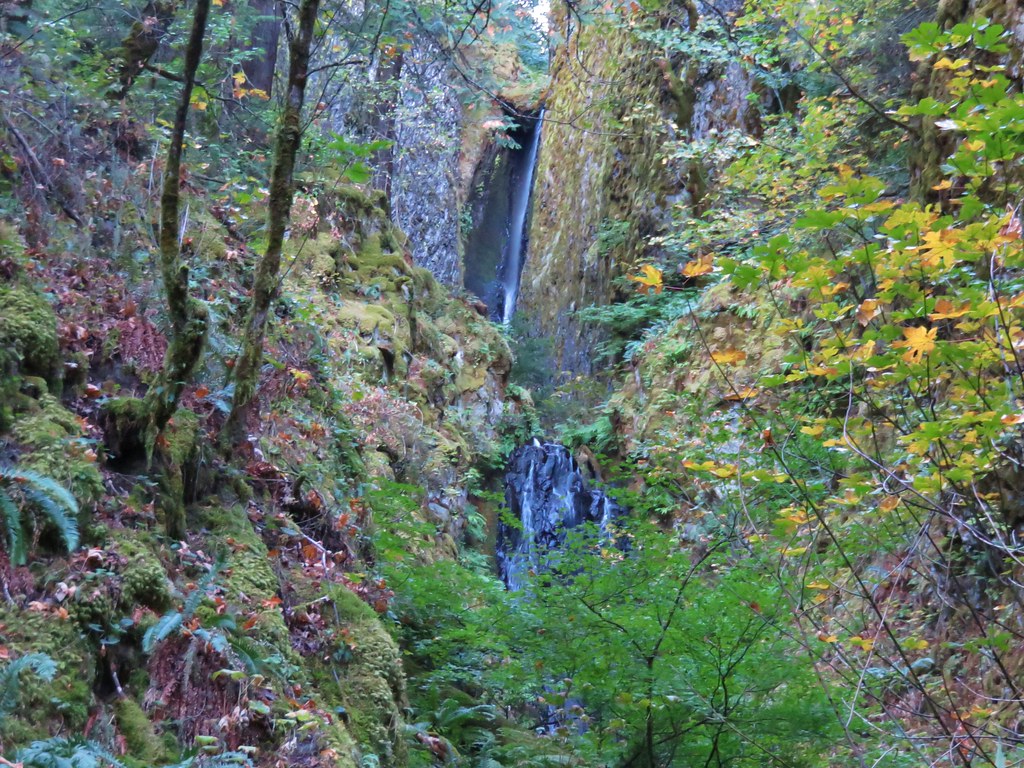
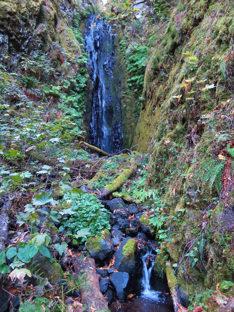
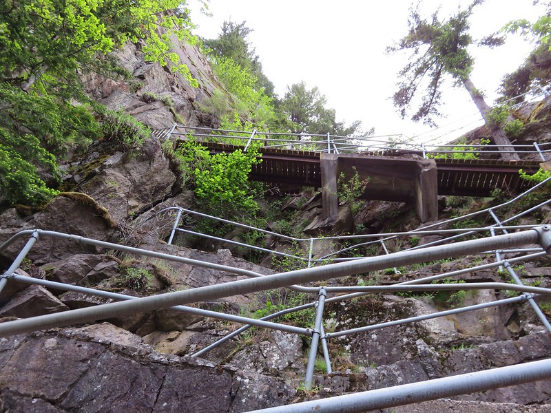
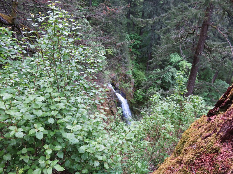
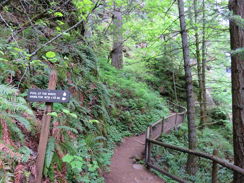
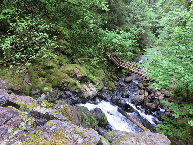
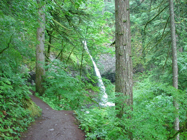
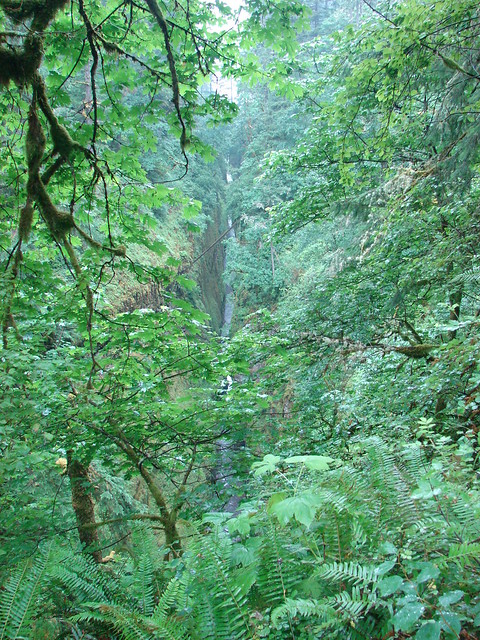
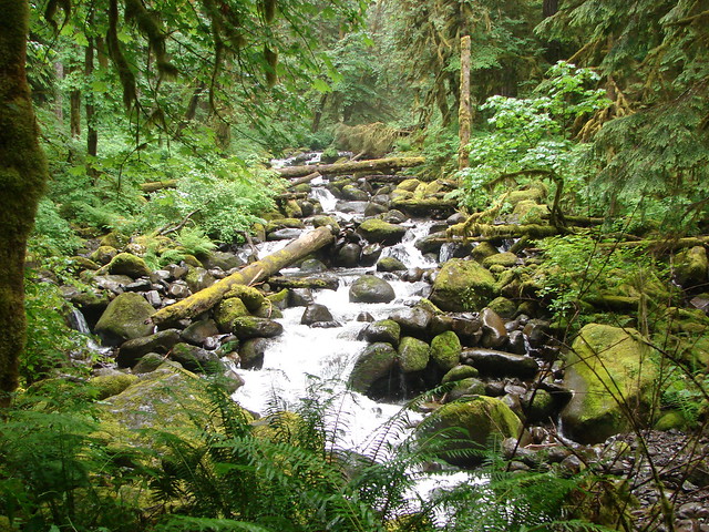
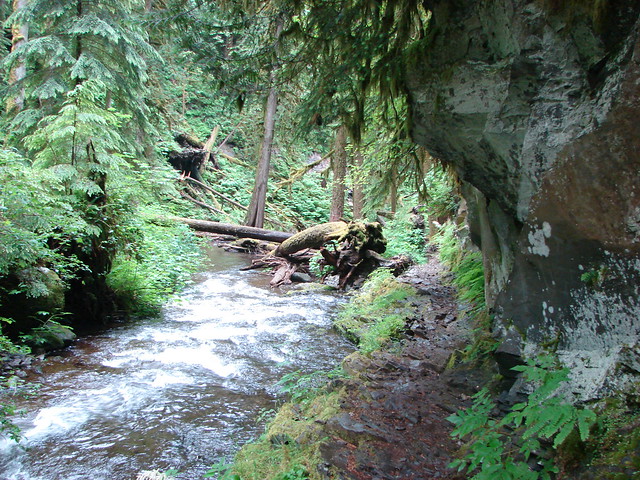
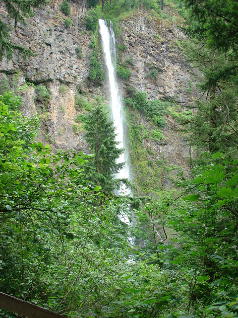
The trail then followed the Oneonta Gorge to a footbridge over the creek near Oneonta Falls.

Oneonta Gorge

Footbridge over Oneonta Creek

Oneonta Falls

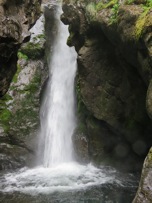
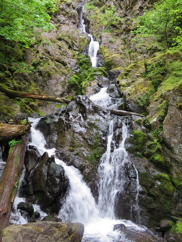
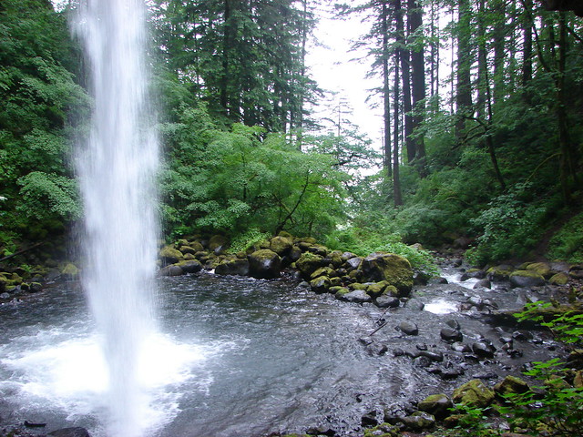
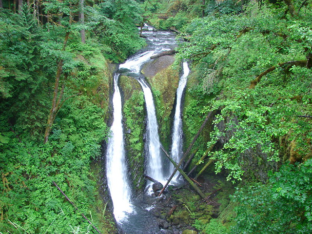
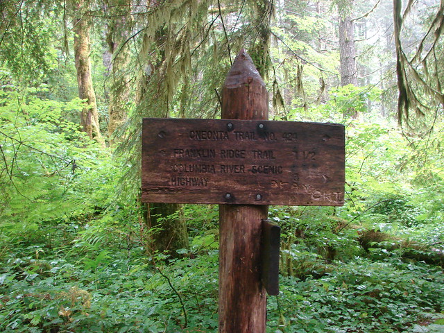
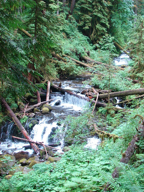
On the far side of the bridge the trail climbed to a junction with the Oneonta Trail. The short 2.7 mile loop described in the guide book turned right here and descended .9 miles to the old highway for a half mile road walk back to the trailhead. The other option had us turn left on the Oneonta Trail and climb up along Oneonta Creek where in just under a mile we came to the aptly named Triple Falls.

Triple Falls

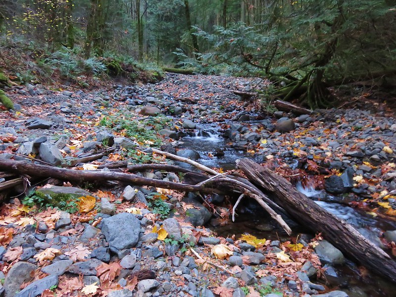
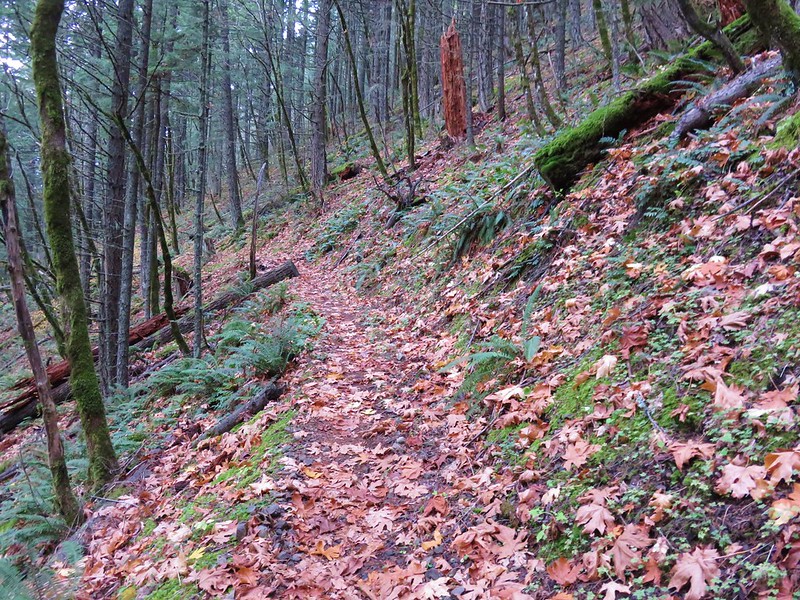
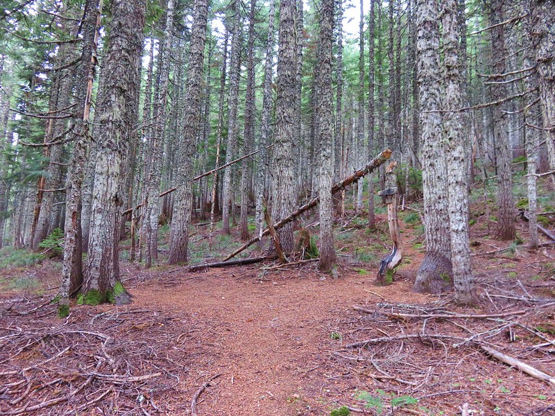
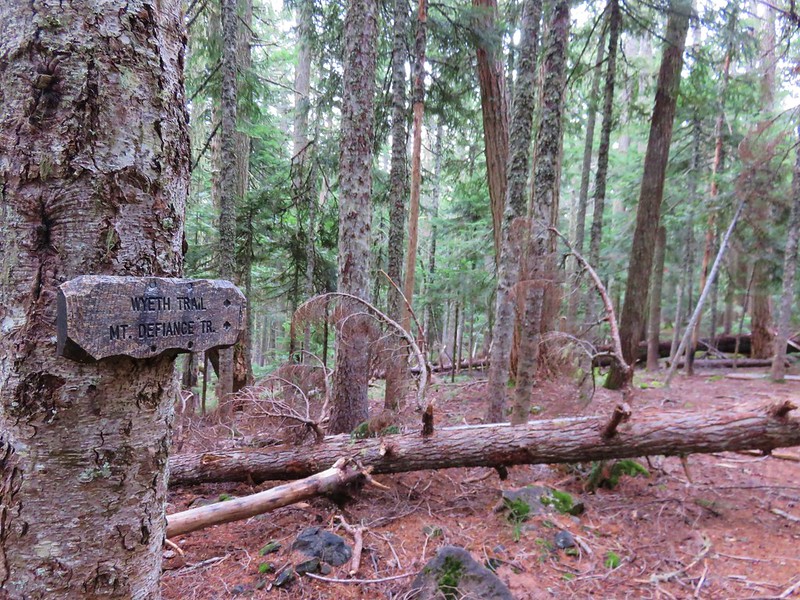
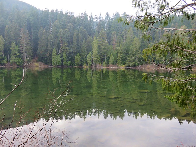
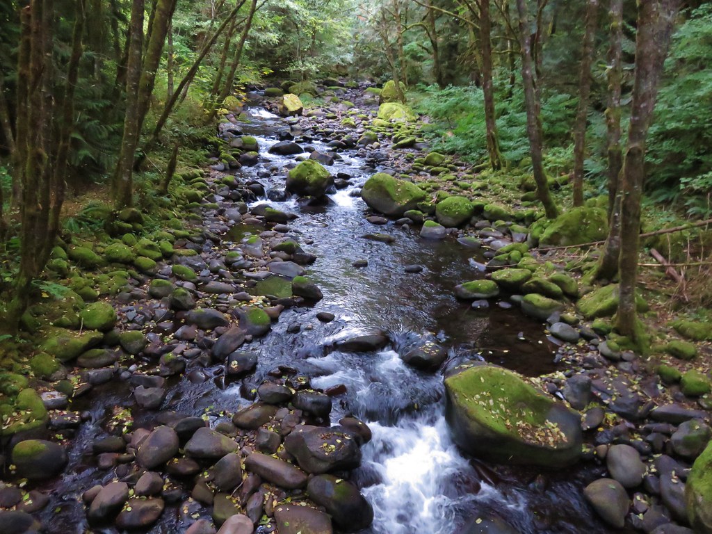
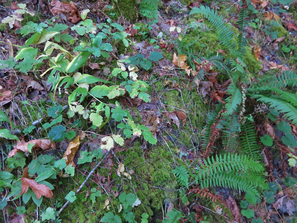
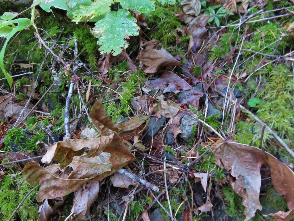
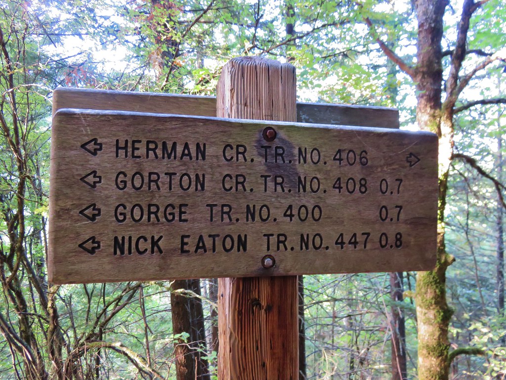
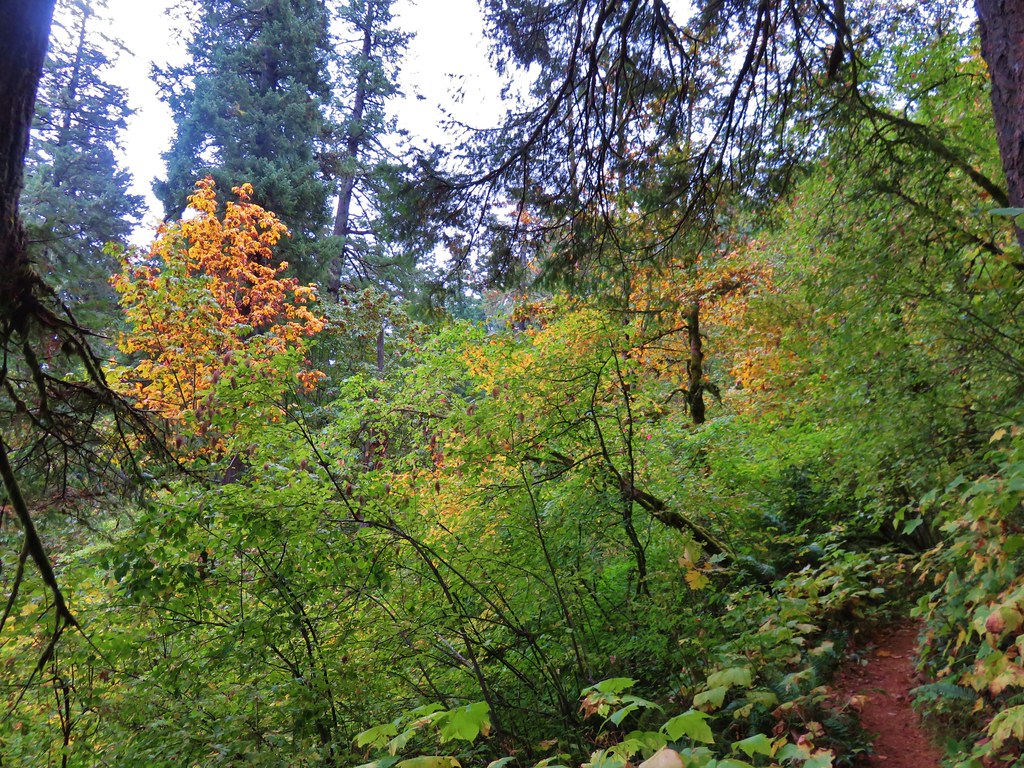
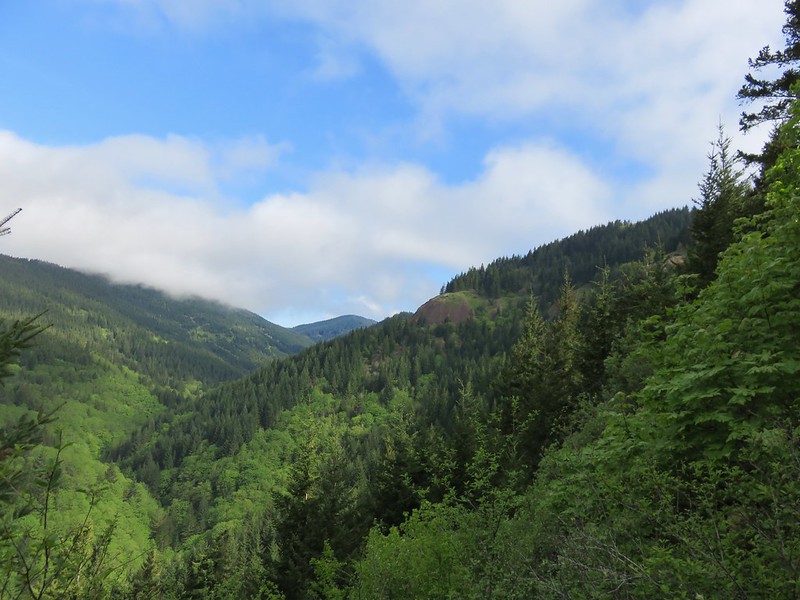
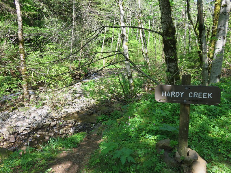
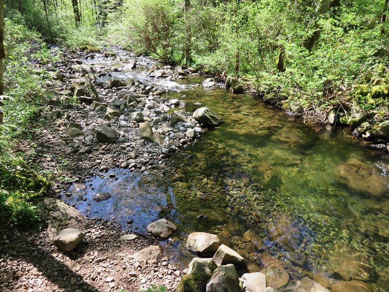
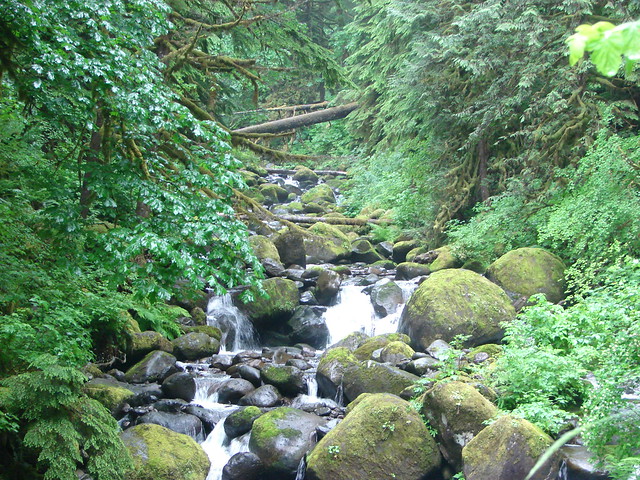
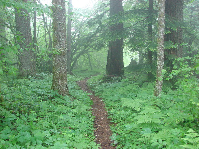
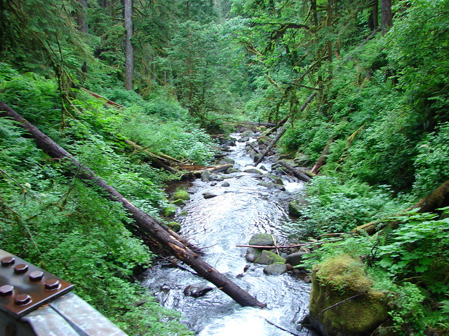
We followed the Oneonta Trail along the creek for nearly 3 more miles passing a junction with the Horestail Creek Trail just over a mile from Triple Falls. The forest was wonderfully green surrounding the creek with smaller side creeks all around.

Oneonta Creek

Small fall along the Oneonta Trail

Oneonta Creek

Creek along the Oneonta Trail

Junction with the Horsetail Creek Trail

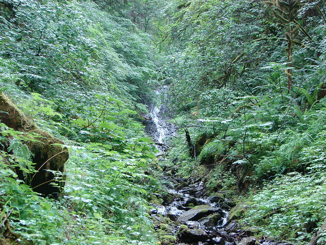
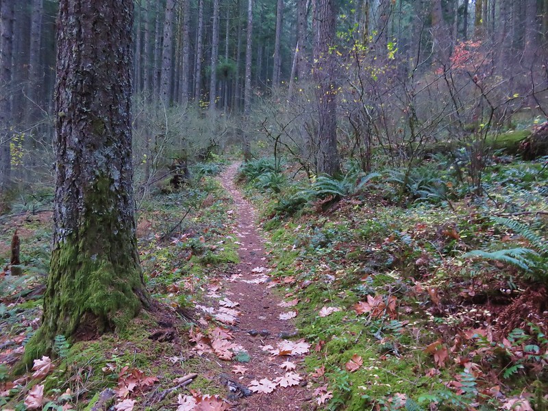
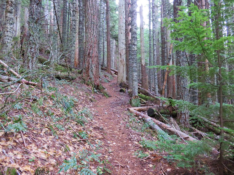
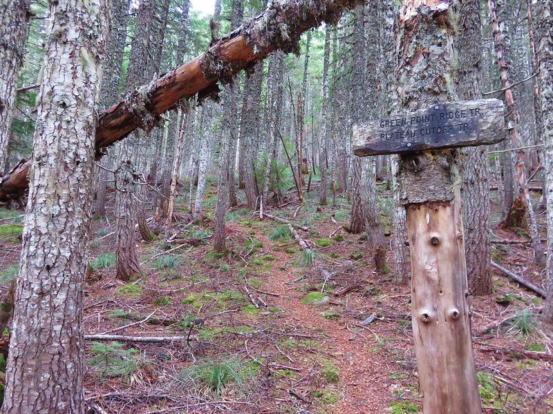
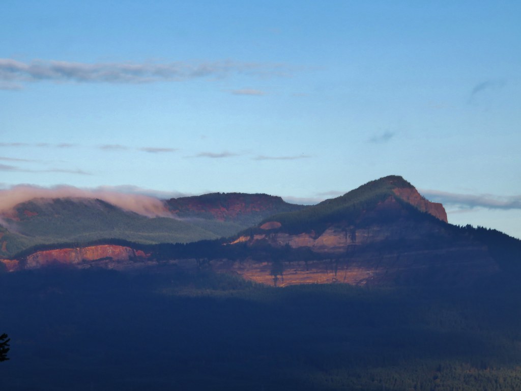
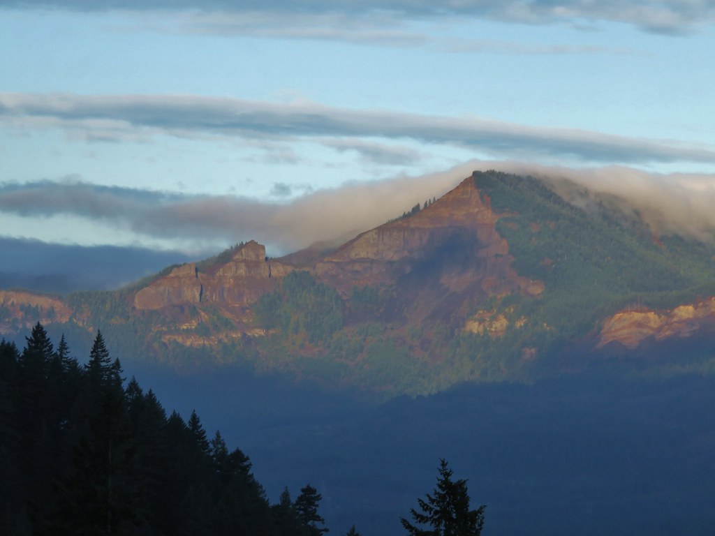
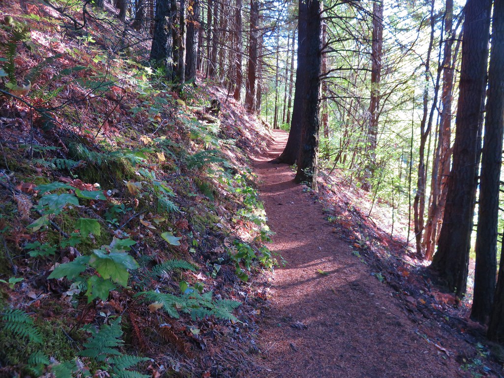
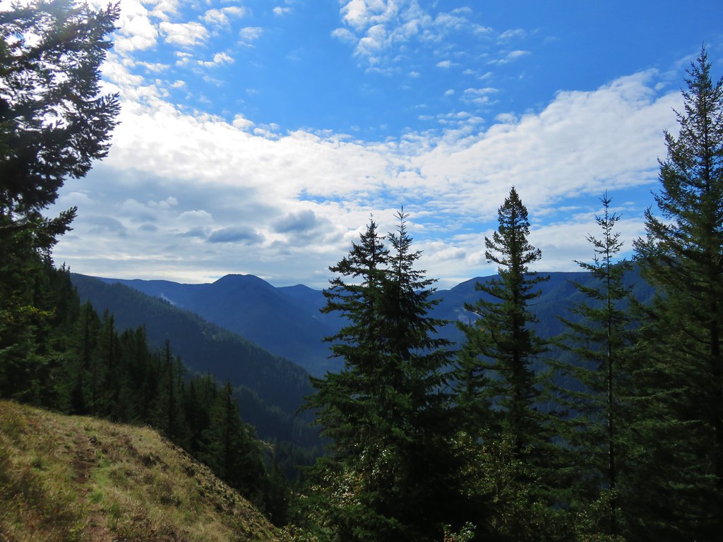
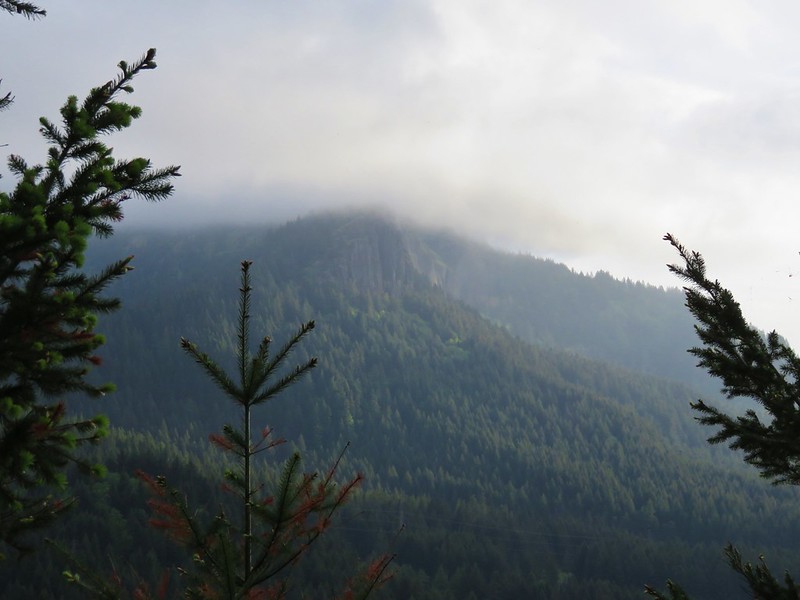
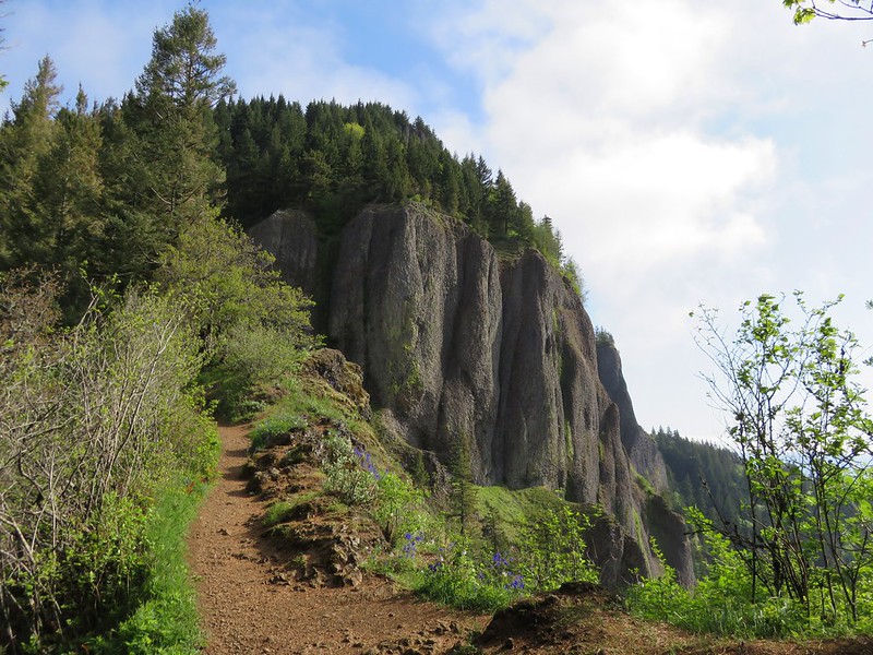
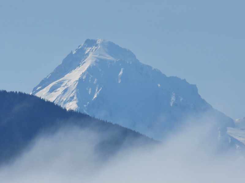
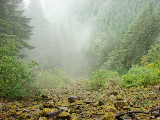
Beyond the junction with the Horestail Creek Trail the Oneonta Trail veered away from the creek and began to climb up to Franklin Ridge. We were headed into the clouds as we climbed past some talus slopes to the next trail junction.

Talus

Forest along the Oneonta Trail

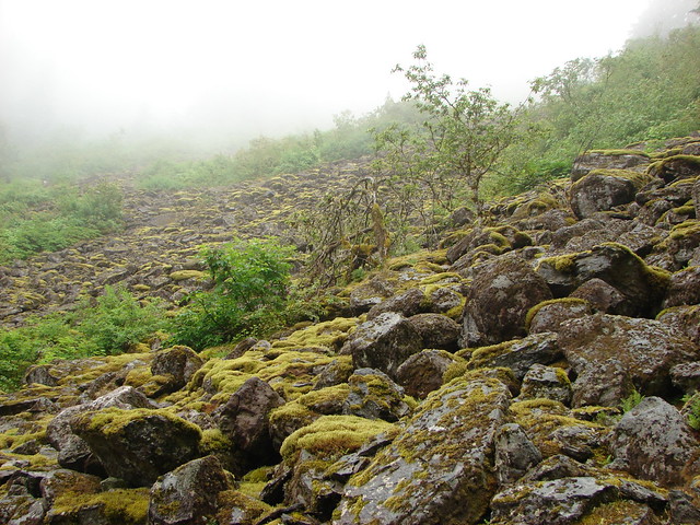
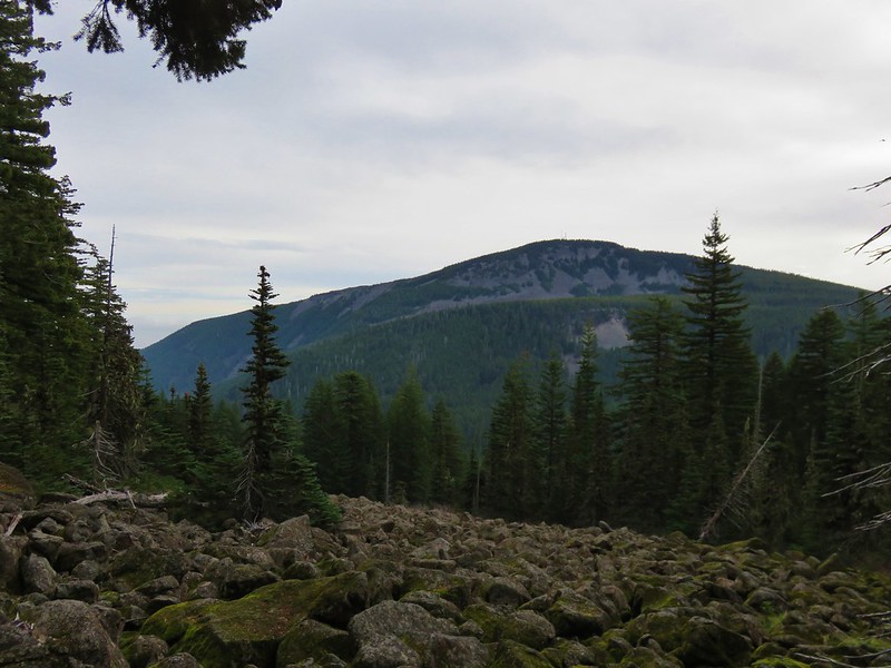
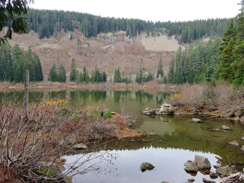
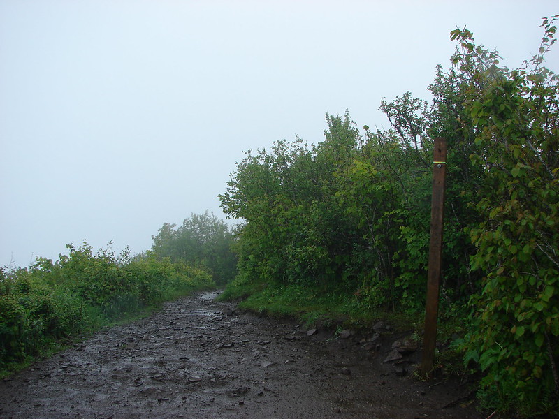
At the junction with the Franklin Ridge Trail we found ourselves in a forest wholly different than the lush green one we’d climbed from.

Forest along the Oneonta Trail

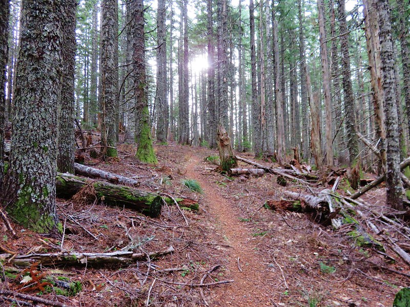
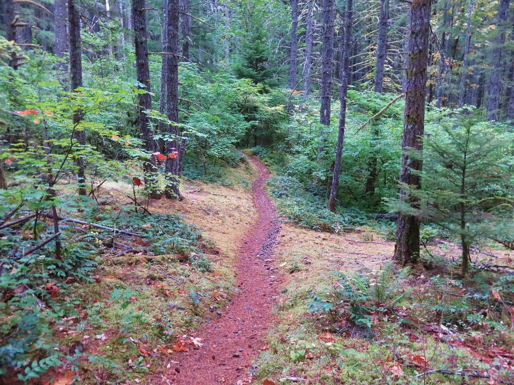
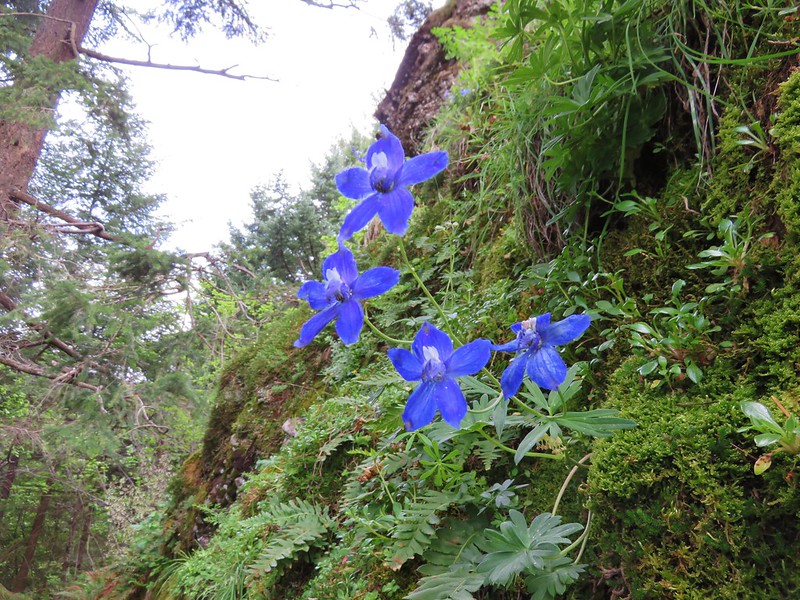
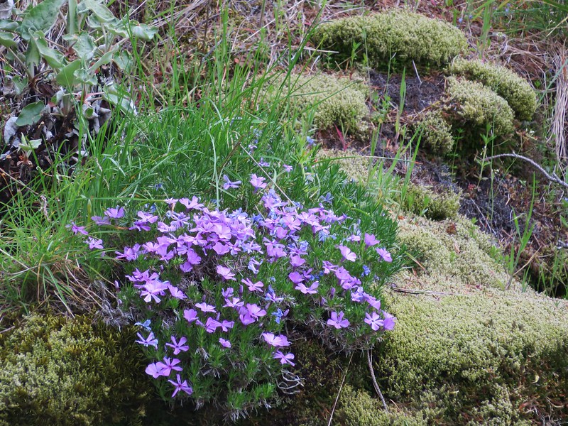
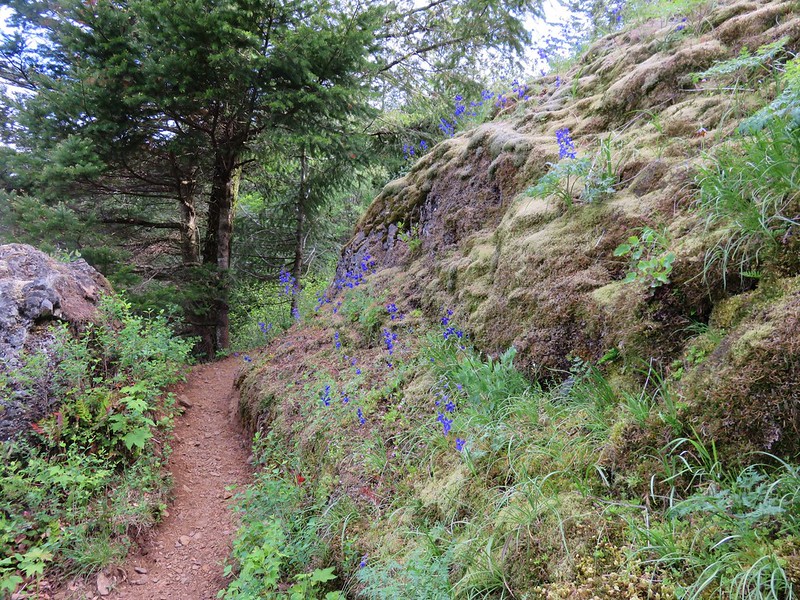
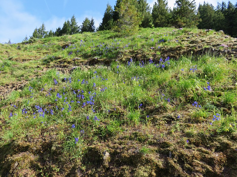
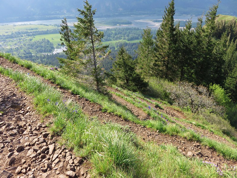
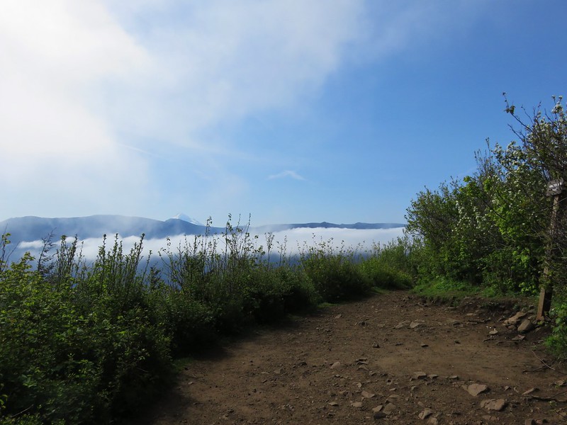
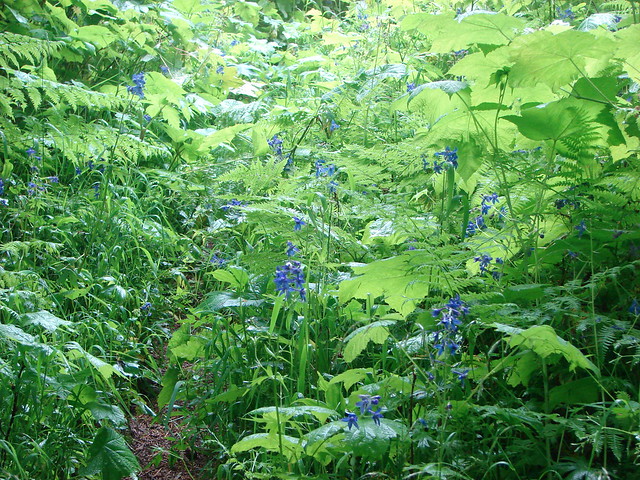
We turned right onto the Franklin Ridge Trail and began passing through the cold gray forest. It didn’t stay gray forever though and we soon found ourselves on an overgrown trail in a meadow full of purple larkspur.

Franklin Ridge Trail

Larkspur along the Franklin Ridge Trail

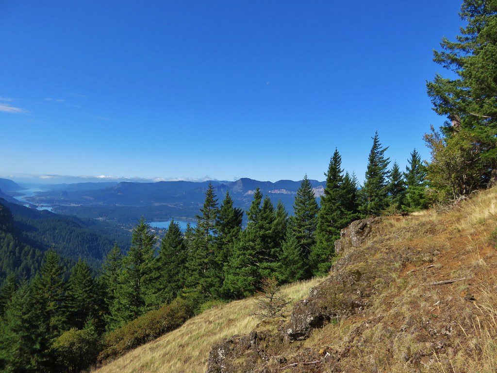
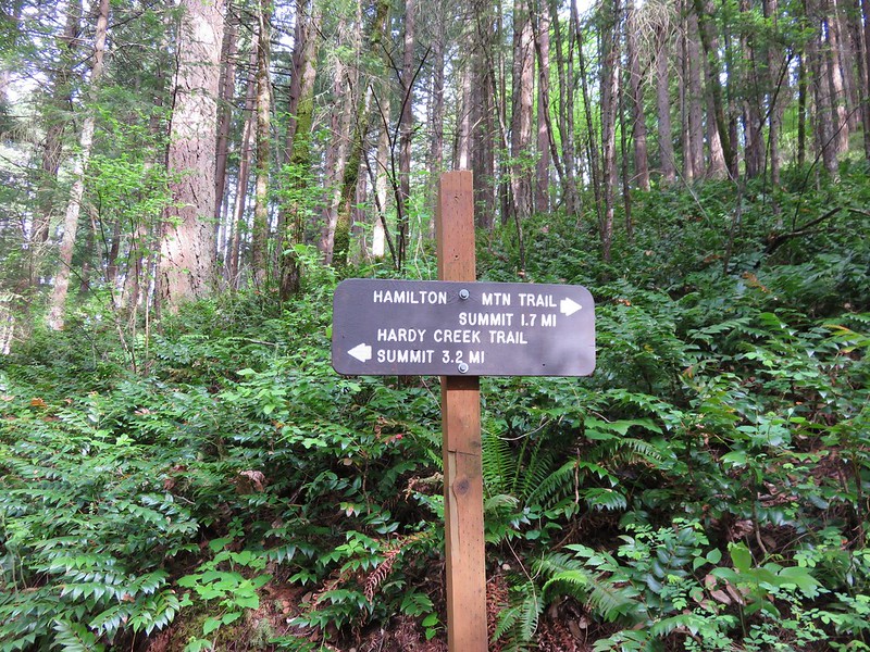
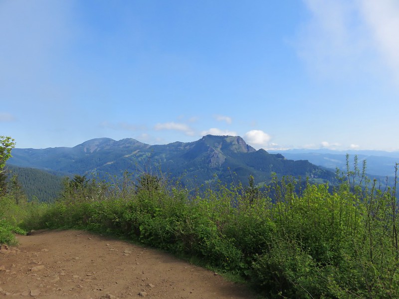
Near the end of Franklin Ridge the trail descended to a junction with the Larch Mountain Trail, just over two miles from where we had picked up the trail and 3 miles from the Multnomah Lodge.

Larch Mountain Trail sign

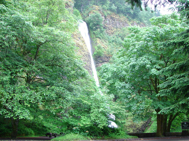
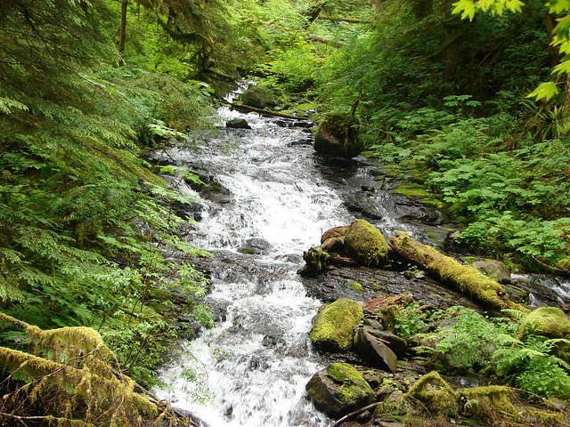
The hike down the Larch Mountain Trail along Multnomah Creek was gorgeous. Green forests and a series of waterfalls awaited as we made our way down to the top of Multnomah Falls.
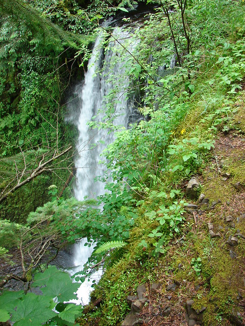
Multnomah Creek

Multnomah Creek

Multnomah Creek

Multnomah Creek

Ecola Falls

Ecola Falls

Weisendanger Falls

Weisendanger Falls

Middle and Lower Dutchman Falls

Dutchman Falls

As we got closer to the upper viewpoint the number of other hikers grew exponentially. The upper viewpoint was closed off but as we made our way further down toward the lodge the falls came into view.

Multnomah Falls

To finish our loop we would need to take the Gorge Trail which split off from the Larch Mountain Trail .6 miles from the upper viewpoint. That split was before the Larch Mountain Trail reached the Benson Bridge below Multnomah Falls and since we were that close to the bridge and the lodge we decided to check them out before completing the loop.

Crossing the Benson Bridge was a nightmare. A mass of humanity was stopped on the bridge trying to get pictures while others were trying to get across it to go up the trail, we were salmon swimming against the current and by the time we’d made it down to the lodge I was done with people. I took a couple of photos, used the facilities inside the lodge, then we headed back up through the quagmire of bodies to the Gorge Trail.

Multnomah Falls

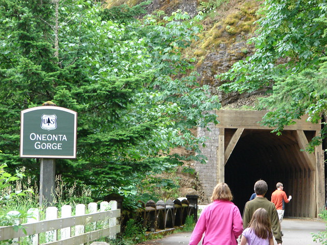
What the Gorge Trail lacked in scenic creeks and waterfalls it made up for in solitude. We followed it to a junction with the return route of the 2.7 mile loop option where we forked left and followed it down to the old highway. As we followed the highway the number of people began to increase, especially as we neared the Oneonta Gorge. Unfortunately this beautiful canyon was already becoming and now is too popular for it’s own good. It’s possible to wade upstream and so many people do so now that lines form as people wait to clamber over a resident log jam. We skipped the side trip that day and have yet to venture in.

After passing the mouth of the gorge the path passed through a tunnel left over from the early days of the old highway. A bridge later replaced the tunnel but it was reopened for foot traffic.

Oneonta Gorge tunnel

Our first hike in the Columbia River Gorge had given us a taste of a little of everything the area has to offer. Amazing waterfalls, lush green forests, talus slopes, wildflower meadows, massive crowds at popular spots, and wonderful solitude further up trail. It’s an amazing area in an amazing state. Happy Trails!

Flickr: https://www.flickr.com/photos/9319235@N02/albums/72157632954287431

Categories
Columbia River Gorge South Hiking Oregon Trip report

Wyeth Trail To North, Rainy, and Black Lakes

This past Veterans Day we celebrated our 21st wedding anniversary with a hike. Heather had spent the first part of the week in Las Vegas attending a convention for her work so we were looking to spend some quality time together and what better way than out on the trail away from distractions.

Our hike on the schedule for this month was to be a lollipop loop starting at Wyeth Campground in the Columbia Gorge and passing North, Rainy, and Black Lakes before returning via Green Point Ridge. I had originally estimated this hike to be a little over 16 miles with around 4000′ of elevation gain. Both of these figures turned out to be low. The total elevation gain was closer to 5000′ and the GPS read 21.5 miles when all was said and done.

The Wyeth Trail begins at Wyeth Campground which was gated closed for the season so we parked near the gate on the side of the Wyeth Road (Exit 51 off of I-84) and walked through the empty campground.
Sunrise from Wyeth Campground

Wyeth Campground

The campground is the eastern terminus for the Gorge Trail #400 which we followed briefly to a signed junction near a footbridge over Gorton Creek.
Footbridge over Gorton Creek

Wyeth Trail junction with the Gorge Trail

We turned left following the pointer for the Wyeth Trail passing under a set of power lines before the bridge-less crossing of Harphan Creek.
Creek crossing

Not long after crossing Harphan Creek the Wyeth Trail began its climb. The trail gained approximately 3500 over the next 4.8 miles. This mostly forested section used numerous switchbacks to keep from ever being too steep.
Wyeth Trail

Wyeth Trail

Wyeth Trail

Wyeth Trail

There were a couple of open areas which offered small views across the Columbia River toward Mt. St. Helens. Although the mountain was free of clouds the gray skies above and behind it provided a good camouflage from the camera.
Columbia River from the Wyeth Trail

The trail leveled off at a saddle where it began following the ridge south to the Green Point Ridge Trail junction.
Wyeth Trail juntion with the Green Point Ridge Trail

Green Point Ridge Trail

The Green Point Ridge Trail was our return route so we stayed left and continued 1.4 miles to North Lake. Along the way there was a nice view of Mt. Defiance from a rock field.
Mt. Defiance from the Wyeth Trail

To see North Lake we followed an unsigned trail to the right at a junction where signs pointed back to the Wyeth Campground and ahead to the Mt. Defiance Trail.
Wyeth Trail

Wyeth Trail sign for the Mt. Defiance Trail

North Lake
North Lake

After sitting for a bit on some rocks along North Lake we continued along it’s shore back to the the Wyeth Trail at a junction with the North Lake Trail.
North Lake Trail

We took the North Lake Trail following it for a mile past a small pond to another trail junction.
Pond along the North Lake Trail

North Lake Trail junction with the Rainy Lake Trail

We headed to the left onto the Rainy Lake Trail.
Rainy Lake Trail

A quick .4 miles brought us to Rainy Lake with a view of Green Point Mountain on the far side.
Rainy Lake

Green Point Mountain from Rainy Lake

Green Point Mountain

A tenth of a mile beyond the lake the trail left the Mark O. Hatfield Wilderness and ended at the Rainy Lake Campground, which can be driven to. Directions

Mark O. Hatfiled Wilderness boundary near the Rainy Lake Campground

We walked through the campground passing the unique outhouse to the Rainy-Wahtum Trail.
Outhouse at the Rainy Lake Campground

Rainy Lake Trail

The Rainy-Wahtum Trail would lead us up to a junction with the Gorton Creek Trail where we would begin our return to the Wyeth Campground but before we did that we had wanted to visit nearby Black Lake. Both the North Lake Trail map available on the Mt. Hood Forest Service website and Google showed a trail descending to Black Lake from the Rainy-Wahtum Trail. We were keeping our eyes out for this trail and just when we began to think we had missed it we spotted a path near a small cairn.
We thought this was marking the trail to Black Lake

We turned left onto this faint path passing the remnants of an old sign that could no longer be read. All traces of the path soon disappeared and we looked around for old blazes or any other sign of the correct route. With nothing to be seen we pulled out the Forest Service map and compared it the map shown on the Garmin. The GPS didn’t show the trail but we could compare the topography of the two maps to get a good idea of where the trail should be. We bushwacked downhill using the topographic maps in an attempt to pick up some sort of trail but weren’t having any luck so we finally decided to follow a decommissioned logging road down to its junction with Dead Point Road which went by Black Lake after passing the Rainy Lake Campground.
Road to Black Lake

We found a few flowers along the road before arriving at the Black Lake Campground.
Thistle

Black Lake Campground

Black Lake

Black Lake

We took a break at one of the picnic tables which we shared with a caterpillar.
Caterpillar

We followed the road back to the Rainy Lake Campground and set off once again on the Rainy-Wahtum Trail. We watched again for any signs of a different trail to Black Lake both before and after the one we’d turned down but never saw anything.

The Rainy-Wahtum Trail followed what was once Wahtum Road up to a 4-way trail junction.
Rainy-Wahtum Trail

The junction is the meeting point of the Rainy-Wahtum, Gorton Creek, and Herman Creek Cutoff Trails.
Rainy-Wahtum Trail junction with the Gorton Creek, and Herman Creek Cutoff Trails

Gorton Creek Trail

WWII signal Hut

Our route was to follow the Gorton Creek Trail but first we took a very short detour on the Herman Creek Cutoff Trail to check out a WWII signal hut which seemed fitting on Veterans Day.
WWII signal Hut

We started down the Gorton Creek Trail reentering the Mark O. Hatfield Wilderness and gradually climbing Green Point Ridge.
Wilderness sign along the Gorton Creek Trail

As we approached Green Point Mountain, which is really just the highest point on the ridge, the first view to open up was of Rainy Lake and Mt. Defiance beyond.
Mt. Defiance and Rainy Lake

Rainy Lake

The Oregon Hikers Field Guide entry for  Green Point Mountain mentions views of Mt. Defiance, Rainy Lake, and Mt. Adams but we quickly found that there were more views than that. Before we were able to see Mt. Adams to the north a glance behind us to the south revealed Mt. Hood rising above the tress.
Mt. Hood

A viewpoint near the summit offered the Mt. Adams, Mt. Defiance, and Rainy Lake view.
Mt. Adams, Mt. Defiance and Rainy Lake

Mt. Adams
Mt. Adams

The view of Mt. Hood was especially nice with a layer of clouds in the valley below it and an opening of blue sky in the clouds above.
Mt. Hood from Green Point Mountain

When we reached the summit we were a bit surprised to see Mt. Rainier join the view to the north and Mt. Jefferson to the south.
Mt. Rainier from Green Point Mountain

Mt. Jefferson and Olallie Butte
Olallie Butte and Mt. Jefferson from Green Point Mountain

Mt. Hood & Mt. Jefferson
Mt. Hood and Mt. Jefferson from Green Point Mountain

In addition the Goat Rocks were also visible between Mt. Rainier and Mt. Adams.
Goat Rocks from Green Point Mountain

After enjoying the surprisingly good view we began our descent. It was nearly 2pm and we’d been hiking for almost 7 hours already. I was beginning to suspect that the hike was going to be longer than what I had estimated. We tend to average right around 2mph so a 16 mile hike should take us 8 hours. We hadn’t taken any extended breaks and it didn’t feel like we’d been going particularly slowly on the climb up so extra distance was the only explanation for the time. We picked up the pace on the way down not wanting to have to rely on using lights to finish the hike in the dark.

A quarter mile from the summit we left the Gorton Creek Trail at a three-way junction. The Gorton Creek Trail headed downhill to the left and on the right the North Lake Trail came up from the lake. We stayed straight on the Green Point Ridge Trail.
Green Point Ridge Trail

We followed the wooded ridge another 2.5 miles ignoring the Plateau Cutoff Trail to the left after 1.5 miles.
Green Point Ridge Trail

The steepest section of trail we’d been on all day was the final descent down to the Wyeth Trail.
Green Point Ridge Trail descending to the Wyeth Trail junction

Once we were back on the Wyeth Trail we retraced our steps down to the power lines. Mt. St. Helens was a little more visible on our way down in the afternoon light.
Mt. St. Helens in the distance

Mt. St. Helens from the Wyeth Trail

That morning we had noticed a trail coming up from the Wyeth Campground at the power lines which appeared to be a shorter route than what we had done so when we spotted it on the way down we followed it into the campground arriving back at our car ten minutes before 5pm.

We had hiked from dawn to dusk (nearly 10 hours) without seeing anyone else on the trails. The views had been much better than expected and the lakes were all nice. One of the things that held our interest was the amazing variety of mushrooms along the way. The various colors, shapes, and sizes were impressive. Here is a small sample of that variety.
Mushrooms along the Wyeth Trail

Mushrooms

Mushroom

Mushrooms

Mushroom

Green mushrooms

Mushroom

Red mushroom

Another mushroom

Orange mushroom

Yellow mushrooms

Mushroom on a log

Mushroom groud near Black Lake

Mushrooms along the Wyeth Trail

Despite the hike turning out to be a lot longer than planned it was a great way to spend our anniversary. Happy Trails!

Categories
Columbia River Gorge South Hiking Oregon Trip report

Indian Point and Pacific Crest Falls

My Grandmother recently celebrated her 91st birthday and we wanted to take her out for a birthday dinner in Portland so we planned a trip up to the Columbia River Gorge to check another of the many area hikes off our to-do list. We chose a pair of hikes beginning at the same trailhead for the Herman Creek Trail.

Our plan was to start at the Herman Creek Campground near Cascade Locks visiting Pacific Crest Falls and then hiking out to Indian Point. We set off on the Herman Creek Trail and followed it for .6 miles to a fork where we headed right on the Herman Bridge Trail toward the Pacific Crest Trail.
IMG_1064//embedr.flickr.com/assets/client-code.js

IMG_1072//embedr.flickr.com/assets/client-code.js

The Herman Bridge Trail descended .4 miles to a footbrdige over Herman Creek. This was the only place that we would encounter the creek on the trails.
IMG_1079//embedr.flickr.com/assets/client-code.js

IMG_1080//embedr.flickr.com/assets/client-code.js

We reached the Pacific Crest trail in another .8 miles passing through some nice forest and getting some decent views.
IMG_1087//embedr.flickr.com/assets/client-code.js

IMG_1088//embedr.flickr.com/assets/client-code.js

The views improved after we turned right on the PCT with Table Mountain and Greanleaf Peak visible across the river.
IMG_1096//embedr.flickr.com/assets/client-code.js

Greenleaf Peak
IMG_1093//embedr.flickr.com/assets/client-code.js

Table Mountain
IMG_1097//embedr.flickr.com/assets/client-code.js

We weren’t sure what we would find when we arrived at Pacific Crest Falls just .4 miles up the PCT. It was October in an unusually dry year so we weren’t too surprised when we arrived at a nearly dry creek bed. We couldn’t see the falls as we approached but we could hear them up the narrow canyon. From the far side of the creek we could see the two tiered fall back in the canyon and we decided to scramble up the creek bed for a closer look.
IMG_1100//embedr.flickr.com/assets/client-code.js

IMG_1113//embedr.flickr.com/assets/client-code.js

IMG_1102//embedr.flickr.com/assets/client-code.js

IMG_1104//embedr.flickr.com/assets/client-code.js

Despite there not being much water the musical sound of the cascade was relaxing. As we were making our way back from the falls we spotted a frog that really blended in with the fallen leaves.
IMG_1118//embedr.flickr.com/assets/client-code.js

IMG_1121//embedr.flickr.com/assets/client-code.js

IMG_1122//embedr.flickr.com/assets/client-code.js

We had gone a little under 4 miles when we arrived back at the fork with the Herman Creek Trail which is why we had made Indian Point our second goal for the day. We took the Herman Creek Trail uphill toward a large trail junction .7 miles away.
IMG_1126//embedr.flickr.com/assets/client-code.js

IMG_1127//embedr.flickr.com/assets/client-code.js

Several trails arrived at the trail junction near Herman Camp. The left hand trail was the Gorge Trail which led to Wyeth while the right hand trail was the continuation of the Herman Creek Trail. We took the Gorton Creek trail which was the middle trail .
IMG_1128//embedr.flickr.com/assets/client-code.js

This trail climbed gradually offering occasional glimpses across the Columbia River to Washington.
IMG_1129//embedr.flickr.com/assets/client-code.js

IMG_1134//embedr.flickr.com/assets/client-code.js

IMG_1138//embedr.flickr.com/assets/client-code.js

Along the way we had a momentary standoff on the trail with a rough skinned newt that wasn’t about to budge.
IMG_1131//embedr.flickr.com/assets/client-code.js

We arrived at the Ridge Cutoff Trail after 2.6 miles which we would take for a loop back to the junction near Herman Camp, but before heading uphill on that trail we continued a short distance on the Gorton Creek Trail to an unsigned path on the left.
IMG_1140//embedr.flickr.com/assets/client-code.js

The side path led steeply downhill to a ridge which we followed out to a rocky saddle below Indian Point.
IMG_1157//embedr.flickr.com/assets/client-code.js

IMG_1149//embedr.flickr.com/assets/client-code.js

Several prominent landmarks were visible from the saddle.
Wind and Dog Mountians
IMG_1151//embedr.flickr.com/assets/client-code.js

Mt. Adams
IMG_1148//embedr.flickr.com/assets/client-code.js

Mt. St. Helens
IMG_1159//embedr.flickr.com/assets/client-code.js

We declared victory at the end of the saddle directly below Indian Point and enjoyed a surprisingly wind free break before climbing back up to the Gorton Creek Trail. We then returned to the Ridge Cutoff Trail and headed uphill toward the Nick Eaton Ridge Trial. The cutoff trail climbed for a bit then leveled off before reaching the Nick Eaton Trail in a total of .6 miles.
IMG_1167//embedr.flickr.com/assets/client-code.js

We turned right on the Nick Eaton Ridge Trail and continued our loop heading downhill at an impressive clip. The trail popped out into some grassy hillside meadows before beginning a series of unrelentingly steep switchbacks.
IMG_1170//embedr.flickr.com/assets/client-code.js

IMG_1171//embedr.flickr.com/assets/client-code.js

IMG_1178//embedr.flickr.com/assets/client-code.js

IMG_1175//embedr.flickr.com/assets/client-code.js

It quickly became obvious why our guidebook recommended doing the loop clockwise as we descended the seemingly never ending switchbacks. After two miles of downhill hiking we arrived back at the Herman Creek Trail just a few hundred yards from Herman Camp. After retracing our steps back to the trailhead we drove to Grandma’s house ending our day with a nice visit and dinner. Happy Trails!

Flickr: https://www.flickr.com/photos/9319235@N02/albums/72157659046209928

Categories
Columbia Gorge North Hiking Trip report Washington

Beacon Rock State Park – The Return to Hamilton Mountain

Almost two years ago we traveled to Beacon Rock State Park to hike the Hamilton Mountain Trail. https://wanderingyuncks.wordpress.com/2013/05/ It was and still is the worst weather that we have ever encountered during a hike. Well enough time had passed and it was time for us to give this hike a second chance. We double checked the weather forecast before heading out which showed some morning clouds clearing up by mid-morning with little to no chance of rain and calm winds. That was good enough for us to give it a go so we got in the car and headed up to the Columbia Gorge once more. For most of the drive we were under a solid mass of clouds but as we headed east along Highway 14 toward Beacon Rock State Park rays of sunlight were shining down on the Columbia River in the distance. The edge of the clouds was just a bit further east than Hamilton Mountain so we decided to warm up on another trail in park, the .8mi Beacon Rock Trail, hoping to give the clouds more time to lift.

Parking for this trail is right along the highway and requires a Discovery Pass which can be purchased at the trailhead (currently $10/a day per vehicle). The trail begins almost directly below Beacon Rock itself.
Beacon Rock Trailhead

After a very short walk through woods the trail begins to switchback up Beacon Rock.
IMG_1584

IMG_1586

In fact the trail switchbacks 52 times on its way up to the top of the rock. (I lost count but that is the number that was on one of the signs at the trailhead.)
Beacon Rock Trail

IMG_1590

When we reached the summit the edge of the clouds was still to the east above Bonneville Dam.
IMG_1593

IMG_1599

We could also see that Hamilton Mountain still had a cloudy top making us wonder what the conditions would be by the time we got up there.
IMG_1600

On the way back down we watched a number of Turkey Vultures circling above the river as well as a lone Bald Eagle.
IMG_1605

IMG_1609

After completing our warm-up we hopped back in the car and crossed the Highway following a campground sign to the trailhead parking area. The trail sets off at a signboard behind the restrooms.
Hamilton Mountian Trailhead

After a gradual .5 mile climb through forest the trail emerges to views of Hamilton Mountain from under some power lines.
IMG_1623

The summit was still in the clouds but they did seem to be breaking up and we still had over 2.5 more miles to climb before reaching the top. After another half-mile a sign announces a viewpoint for Hardy Falls. A narrow path leads down a ridge to a platform that has no view of Hardy Falls at all. The only views are along the ridge prior to reaching the platform, and they are not great.
IMG_1632

The disappointing viewpoint of Hardy Falls is quickly forgotten after just another tenth of a mile on the trail. Here another sign points up to Pool of the Winds.
IMG_1636

This short path leads to another railed viewpoint, but this time there is really something to see. The upper portion of Rodney Falls splashes into a rock enclosed splash pool. The force of the water falling into the pool combined with the narrow opening in the rocks causes wind to funnel out giving the pool its name.
Pool of the Winds

IMG_1655

The view down is also nice as the trail crosses the creek on a footbridge below Rodney Falls.
IMG_1650

After spending some time enjoying the pool we continued on the trail passing below the falls. Rodney Falls is one of the more complicated falls we have seen. With the Pool of the Winds at the top followed by several smaller sections and then fanning out at the bottom it just has a lot going on. It also changes directions a couple of times which makes it difficult to capture it all well in a photo.
IMG_1665

Just over a quarter mile from Rodney Falls the trail splits allowing for a loop over Hamilton Mountain.
IMG_1680

We headed right which is the shorter but steeper way to the summit. We tend to prefer to go up rather than down steeper trails because it’s easier on our knees. Heading up the right fork the trail passes an increasing number of meadows where we were met with views and wildflowers. In 2013 the views consisted almost entirely of clouds so much of this we were seeing for the first time.

Beacon Rock from the trail.
IMG_1684

Larkspur
IMG_1683

Chocolate Lily
IMG_1686

Indian Paintbrush
IMG_1687

Phlox
IMG_1690

A side trail to the right leads to a rocky outcrop with even more views.
IMG_1702

Then the trail passes behind a knoll where more trees await.
IMG_1710

Larkspur along the Hamilton Mountain Trail

After making its way around the knoll the trail crosses a ridge between the knoll and Hamilton Mountains summit which looms ahead.
Hamilton Mountain

The view of the Columbia River along this ridge is very nice.
IMG_1718

The trail then begins its final ascent switchbacking up through open meadows of flowers. Larkspur and Chocolate Lilies were the predominate flowers blooming at this time of the year.
Chocolate Lilies

IMG_1723

IMG_1727

As we continued to climb the clouds continued to burn off and Mt. Hood suddenly appeared across the river.
IMG_1735

IMG_1738

To reach the actual summit take a side path to the right near the top of the mountain. Here the view was vastly different from our previous visit.

2013
151

2015
Mt. Hood from the summit of Hamilton Mountain

There were only a few bands of clouds left when we arrived at the summit and in addition to the view of Mt. Hood to the south Table Mountain and some of Mt. Adams were visible to the east.
Table Mountain and Mt. Adams from the summit of Hamilton Mountain

Mt. Adams

We took a short break and watched the clouds as they passed by. A few hikers and some other critters kept us company.
IMG_1785

We continued on the loop looking forward to reaching an exposed ridge that was the site of my infamous poncho battle in 2013. Wind and rain were whipping up and over the ridge on that visit but this time it was just sunshine and flowers.
IMG_1798

IMG_1799

At the far end of the ridge we looked back to soak in the view that we missed the first time.

2013
158

2015
Hamilton Mountain trail

Several paths lead off from the far end of the ridge, but we simply took a sharp left and headed down an old road toward Hardy Creek.
IMG_1809

The road leads downhill for a mile to Hardy Creek.
IMG_1810

IMG_1811

Signs at Hardy Creek point to the 1.1 mile hiker-only trail that completes the loop .3 miles from Rodney Falls. By the time we arrived back at the falls a steady stream of people were coming up from the trailhead. We were once again glad we’d gotten an early start and made our way past a traffic jam at the footbridge. With the number of hikers and dogs coming up the trail we were surprised when Heather spotted a garter snake on the path. It took cover in a stump but then came out to take a closer look at us.
IMG_1817

IMG_1821

We were really happy with the way this hike turned out. We had gotten the views we’d missed out on during our previous visit and the Beacon Rock warm-up was entirely new. Another great day in the Pacific Northwest. Happy Trails!

Flickr: https://www.flickr.com/photos/9319235@N02/sets/72157652309236702/