A couple of my favorite posts to put together every year is our wildlife galleries. Seeing animals on our hikes is always a highlight. (Maybe not rattlesnakes, but in 15 years of hiking we’ve still only seen one on trail.) A couple of years back we spilt our gallery post into two, feathered and featherless. This helps keep the number of pictures to a more reasonable number. While we do our best at identification, we are not experts’ Any corrections or further identification of species are appreciated.
A couple of other notes, while we really enjoy taking pictures as a way to record what we see on our hikes, we are by no means photographers. We use our phones and a point and shoot camera on the auto setting, so the pictures are far from professional, but we hope you enjoy them. We also practice Leave No Trace Principles including Principle 6: Respect Wildlife which means observing from a distance, never feeding, and respecting any area wildlife closures.
 Acorn woodpecker – 3/30/24 Mulkey Ridge Trail, Corvallis, OR
 Lewis’s woodpecker – 8/31/24 Sky Lakes Wilderness, OR
 Northern flicker – 6/19/24 Deception Butte, OR
 Black-backed woodpecker? – 9/13/24 Mt. Jefferson Wilderness, OR
 Hairy? woodpecker (I have a hard time with Hairy vs Downy woodpeckers) – 6/19/24 Deception Butte Trail, OR
 Anna’s hummingbird – 2/24/24 Fernhill Wetlands, Forest Grove, OR
 Rufous hummingbird – 8/3/24 Crater Lake National Park, OR
 American goldfinch – 4/20/24 Jackson Bottom Wetlands, Hillsboro, OR
 American robin – 4/20/24 Jackson Bottom Wetlands, Hillsboro, OR
 American dippers (ouzels) – 5/12/24 Lee Wooden Fishhawk Falls County Park, Clatsop County, OR
 Black-headed grosbeak – 6/8/24 Cedar Butte (Tillamook State Forest), OR
 Bullock’s oriole (top of photo) – 5/25/24 Willow Creek Trail, Madras, OR
 LOL! This is the best photo of a varied thrush I could get this year. 2/3/24 Forest Park, Portland, OR
 Hermit thrush – 6/15/24 O’Leary Mountain Trail (Willamette National Forest), OR
 Chickadee – 9/9/24 Hidden Lake Trail (Eagle Cap Wilderness), OR
 Dark-eyed junco – 3/30/24 Mulkey Ridge Trail, Corvallis, OR
 Common yellowthroat – 5/28/24 Baskett Slough National Wildlife Refuge, OR
 Dusky flycatcher – 8/19/24 Pine Lakes Trail (Eagle Cap Wilderness), OR
 Hammond’s flycatcher – 8/22/24 East Fork Wallowa River Trail (Eagle Cap Wilderness), OR
 Ash-throated flycatcher – 5/25/24 Willow Creek Trail, Madras, OR
 Lazuli bunting – 5/25/24 Willow Creek Trail, Madras, OR
 Mountain bluebirds – 8/18/24 Cliff Creek Trail (Eagle Cap Wilderness), OR
 Western bluebirds – 3/16/24 Middle Fork Path, Eugene, OR
 Cedar waxwing – 5/28/24 Baskett Slough National Wildlife Refuge, OR
 California jay – 3/30/24 Mary’s River Natural Park, Corvallis, OR
 Canada jay – 6/19/24 Deception Butte Trail, OR
 Stellar’s jay – 10/10/24 William L. Finley National Wildlife Refuge, OR
 Crow – 4/20/24 Jackson Bottom Wetlands, Hillsboro, OR
 Raven – 5/11/24 Ecola State Park, OR
 Sage thrasher (new sighting for us) – 9/8/24 National Historic Oregon Trail Interpretive Center, OR
 Western meadowlark – 5/28/24 Baskett Slough National Wildlife Refuge, OR
 Western tanager – 7/24/24 Tenderfoot Wagon Road Trail (Eagle Cap Wilderness), OR
 Pine siskins – 8/20/24 Chimney-Wood Trail (Eagle Cap Wilderness), OR
 Ruby-crowned kinglet – 3/16/24 Middle Fork Path, Eugene, OR
 Spotted towhee – 5/28/24 Baskett Slough National Wildlife Refuge, OR
 Townsend solitaire – 9/13/24 Mt. Jefferson Wilderness, OR
 Yellow-rumped warbler – 4/20/24 Jackson Bottom Wetlands, Hillsboro, OR
 Orange-crowned warbler – 4/20/24 Jackson Bottom Wetlands, Hillsboro, OR
 Wilson’s warbler – 6/8/24 Kilchis Forest Road (Tillamook State Forest), OR
 Purple martins – 4/20/24 Jackson Bottom Wetlands, Hillsboro, OR
 Tree swallows – 4/20/24 Jackson Bottom Wetlands, Hillsboro, OR
 Barn swallows – 5/11/24 Fort Stevens State Park, OR
 European starling – 2/24/24 Fernhill Wetlands, Forest Grove, OR
 Brewer’s blackbird – 5/27/24 Crooked River Wetlands, Prineville, OR
 Yellow-headed blackbird – 5/27/24 Crooked River Wetlands, Prineville, OR
 Red-winged blackbird – 2/10/24 Wapato Lake National Wildlife Refuge
 Bushtit – 7/6/24 Independence River Front Park, Independence, OR
 Brown creeper – 6/19/24 Deception Butte Trail, OR
 White-breasted nuthatch – 3/16/24 Middle Fork Path, Eugene, OR
 Red-breasted nuthatch – 7/23/24 McCully Creek Trail (Eagle Cap Wilderness), OR
 Pacific wren – 3/16/24 Middle Fork Path, Eugene, OR
 Marsh wren – 5/27/24 Crooked River Wetlands, Prineville, OR
 Rock wren – 5/25/24 Willow Creek Trail, Madras, OR
 Golden-crowned sparrow – 4/20/24 Jackson Bottom Wetlands, Hillsboro, OR
 Savanah sparrow – 4/20/24 Jackson Bottom Wetlands, Hillsboro, OR
 Song sparrow – 4/20/24 Jackson Bottom Wetlands, Hillsboro, OR
 Chipping sparrow – 4/13/24 Sams-Walker Day Use Area, WA
 White-crowned sparrow – 4/13/24 Sams-Walker Day Use Area, WA
 House finch – 5/28/24 Baskett Slough National Wildlife Refuge, OR
 Cassin’s finch – 8/4/24 Crater Lake National Park, OR
 Cassin’s vireo – 8/21/24 Maxwell Lake Trail (Eagle Cap Wilderness), OR
 American kestral – 2/24/24 Fernhill Wetlands, Forest Grove, OR
 Peregrine falcon – 10/10/24 William L. Finley National Wildlife Refuge, OR
 Copper’s hawk – 3/16/24 Middle Fork Path, Eugene, OR
 Red-tailed hawk – 5/25/24 Willow Creek Trail, Madras, OR
 Northern harrier – 5/28/24 Baskett Slough National Wildlife Refuge, OR
 Osprey – 5/27/24 Crooked River Wetlands, Prineville, OR
 Bald eagles – 2/24/24 Fernhill Wetlands, Forest Grove, OR
 Turkey vulture – 3/16/24 Middle Fork Path, Eugene, OR
 Dusky grouse – 7/23/24 McCully Creek Trail (Eagle Cap Wilderness), OR
 Sooty grouse – 8/31/24 Sky Lakes Wilderness, OR
 Ruffed grouse – 11/28/24 Silver Falls State Park, OR
 California quail – 10/10/24 William L. Finley National Wildlife Refuge, OR
 Dove – 5/27/24 Crooked River Wetlands, Prineville, OR
 Pigeons – 9/8/24 National Historic Oregon Trail Interpretive Center, OR
 Band-tailed pigeons – 6/8/24 Kilchis Forest Road (Tillamook State Forest), OR
 Pigeon guillemont – 5/11/24 Ecola State Park, OR
 Oyster catcher – 5/11/24 Ecola State Park, OR
 Whimbrel – 5/11/24 Ecola State Park, OR
 Seagull – 5/11/24 Ecola State Park, OR
 Spotted sandpiper – 7/24/24 Bonny Lakes (Eagle Cap Wilderness, OR
 Wilson’s phalarope (another first for us) – 5/27/24 Crooked River Wetlands, Prineville, OR
 Double-crested cormorant – 2/24/24 Fernhill Wetlands, Forest Grove, OR
 American bittern – 5/28/24 Baskett Slough National Wildlife Refuge, OR
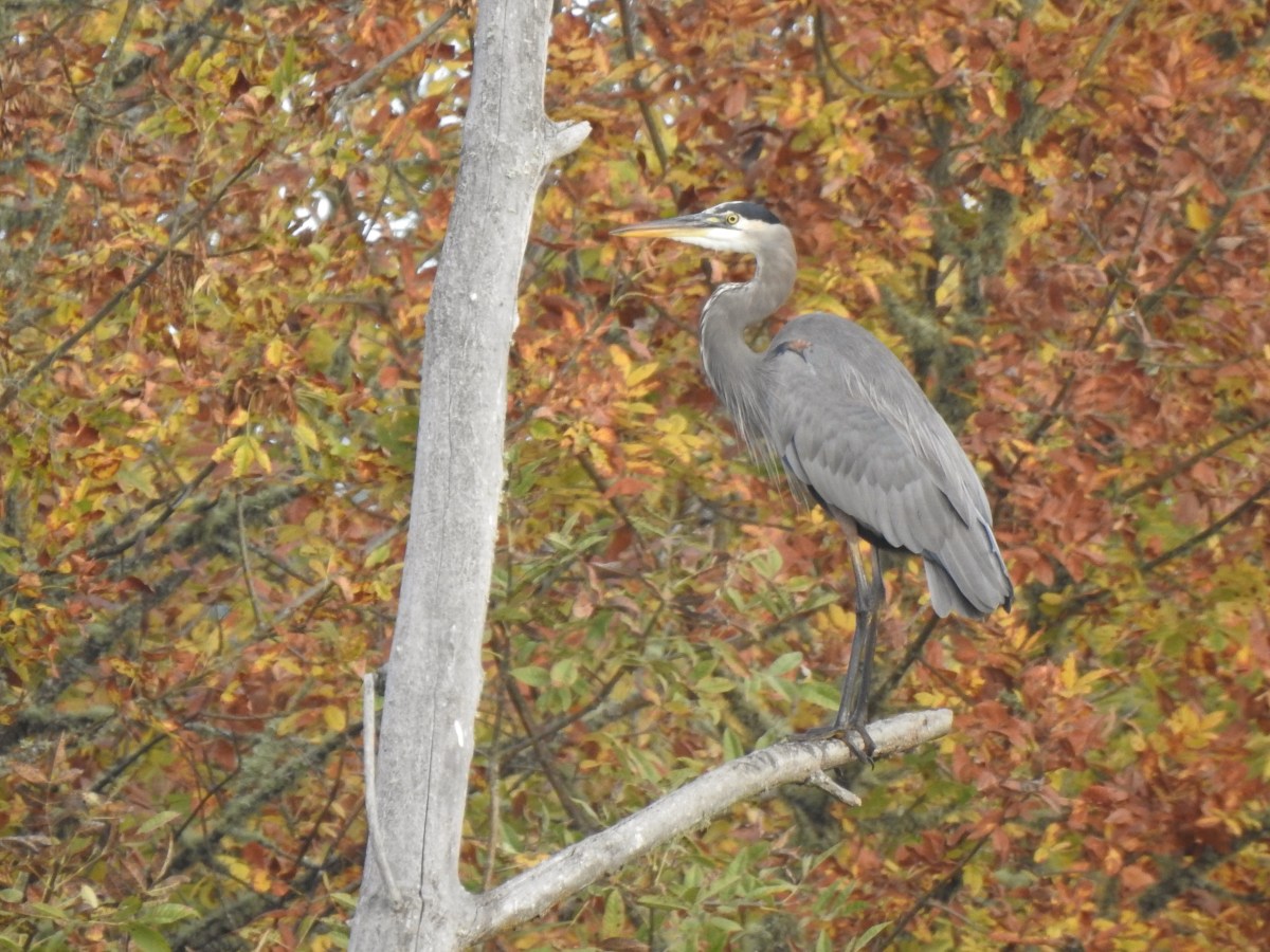
 Great egret, female mallard, and great blue heron – 10/10/24 William L. Finley National Wildlife Refuge, OR
 Mallard drake – 2/24/24 Fernhill Wetlands, Forest Grove, OR
 Ruddy ducks – 2/24/24 Fernhill Wetlands, Forest Grove, OR
 Northern shoveler – 2/24/24 Fernhill Wetlands, Forest Grove, OR
 Buffleheads – 2/24/24 Fernhill Wetlands, Forest Grove, OR
 Green-winged teal – 2/24/24 Fernhill Wetlands, Forest Grove, OR
 Northern pintail and American wigeons – 2/10/24 Wapato Lake National Wildlife Refuge
 Canvasbacks (first time sighting for us) – 2/10/24 Wapato Lake National Wildlife Refuge
 Common merganser drake – 3/16/24 Middle Fork Path, Eugene, OR
 Hooded mergansers – 3/16/24 Middle Fork Path, Eugene, OR
 Cinnamon teal – 4/20/24 Jackson Bottom Wetlands, Hillsboro, OR
 Lesser scaups – 4/20/24 Jackson Bottom Wetlands, Hillsboro, OR
 Greater scaup – 5/11/24 Skippanon River, Warrenton, OR
 Ring-necked duck – 5/26/24 Bull Prairie Lake (Umatilla National Forest), OR
 Gadwalls – 5/27/24 Crooked River Wetlands, Prineville, OR
 Barrow’s goldeneye – 9/11/24 Pyramid Lake (Mt. Hood National Forest), OR
 American coot – 2/24/24 Fernhill Wetlands, Forest Grove, OR
 Pie-billed grebe – 2/24/24 Fernhill Wetlands, Forest Grove, OR
 Eared grebe – 5/26/24 Bull Prairie Lake (Umatilla National Forest), OR
 Horned grebe – 2/10/24 Wapato Lake National Wildlife Refuge
 Canada geese – 4/20/24 Jackson Bottom Wetlands, Hillsboro, OR
 Cackling geese – 2/24/24 Fernhill Wetlands, Forest Grove, OR
 Tundra swans (first sighting for us) – 2/24/24 Fernhill Wetlands, Forest Grove, OR


 Duck and ducklings along with a killdeer.


 Chickadee
 Mallards
 Fanno Creek
 Thimbleberry and service berry

 Northern flicker
 Hummingbird
 Red-winged blackbird

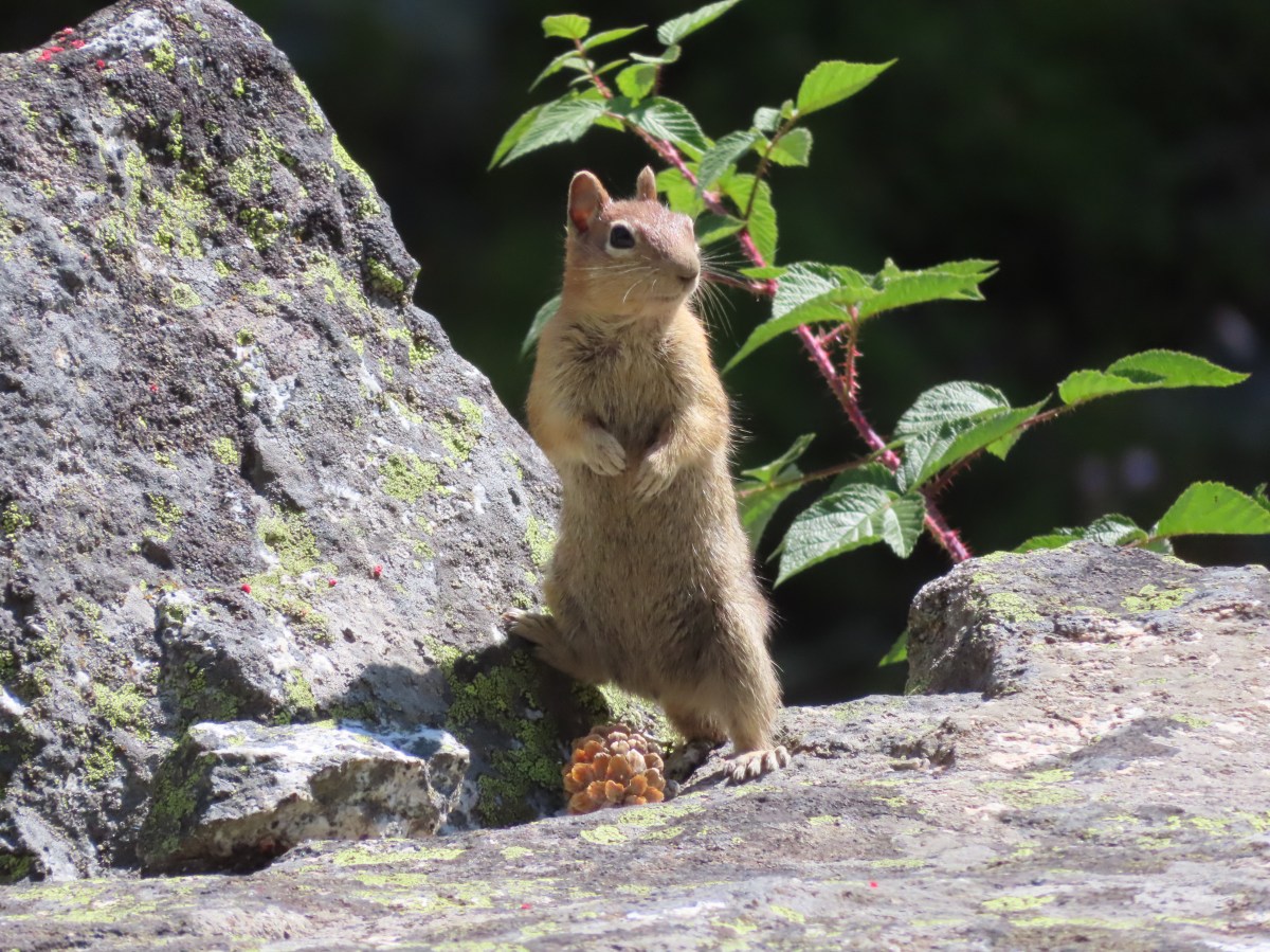
 Squirrel
 The Greenway Loop Trail had the only flooded section on this day.
 Wetlands along the Greenway Loop Trail.
 Goose
Goose
 Hooded mergansers
 This is another section that may flood at high water times.


 We spent some time here watching a female mallard attempt to join the drakes along with her ducklings only to be repeatedly chased off.
  Mallards ducklings
 The ducklings finally making it across the trail.
 Goose and gosling
 Avens
Avens
 Camas
Camas Dirksen Nature Park
 Viewing platform
 Wetlands from the viewing platform.
 Dove
Dove Finch
Finch Robin
Robin
 Lupine
 Woodard Park Trailhead.
 This may be a lesser goldfinch, I wasn’t able to see anything but its rear end though.

 Spotted towhee
 Wood duck


 The trails were well marked with plenty of reminders which users were allowed on them.
 Giant white wakerobin (Trillium albidum)
 The only columbine we spotted.
 Fairy lanterns
 In addition to identifying the trails by name, several had mile markers.
 Trillium

 Solomon’s seal
 Toothwort
 Largeleaf sandwort
 Bleeding heart

 Old fungus
 Oregon grape
 The 2.5-mile marker on the Mossy Maple Trail.
 Seasonal closure sign and map at the upper junction with the bike only Yee-Haw Trail.
 Pacific hound’s tongue
 Fairy slippers
 Star flowered solomon’s seal
 Iris
Iris Vetch
Vetch
 Fringecup
 Strawberry
 Shooting star
 Spotted towhee

 Small-flowered woodland-stars
 Checker lily and baby blue eyes (Nemophila menziesii)
 Manroot
 Red-flowering currant
 Dogwood
 On the Cervus Road passing an old quarry on the right.
 The Basalt Rim Trail.
 The lupine is still a week or so away from blooming.
 Basalt columns


 Fawn lily
 Springfield from the trail.
 There is a short one-way loop at the top.
 Looking down from one of the viewpoints.
 The highest peak to the left in the distance is Mount June (
 Mt. Pisgah (
 Biscuitroot
 Another viewpoint along the loop.
 The peak with two humps is Mount Nebo. With the naked eye we could just make out Tidbits Mountain (
 Camas (and poison oak) near the viewpoint.
 Finishing the loop.
 Stripped coralroot.
 Switchbacks leading down to the Basalt Rim Trail.
 Wren
Wren Violets
 Basalt outcrops
 Ginger
 Arriving back at the Mossy Maple Trail.
 Starflower
 Dunn’s salamander
 Mossy Maple Connector Trail (left).
 The Yee-Haw Trail coming down from the left to the Mossy Maple Connector Trail.
 Buttercups
 Fairy bells
 Meadow near the trailhead.


 Menzies’ larkspur
 Western meadowrue
 Bleeding heart and purple deadnettle
 Completing the loop.
 Faint grassy path.
 Golden crowned sparrow
 A section of obvious trail.
 The faint path disappeared near the fenced off-leash dog area. The AllTrails loop appeared to turn around here, but since we couldn’t see even a faint path leading back around closer to the parking areas we turned around and followed the river back.
 We did find this short section of what appears to have been a paved path in the grass.


 An example of the posts. Every directional arrow, including the far side that you can’t see, was for the “Elk Trail”.
 Cedar along the Elk Trail.
 Candy flower and woodland buttercups
 Picnic tables near Lost Creek.
 Lost Creek
 Not a signed junction so this is the one time we veered right.
 Middle Fork Willamette River.
 I was hoping that there might be a turtle hiding in this photo but alas it does not appear that is the case.
 We veered left here leaving the River Trail briefly to actually get a view of the river.
 We hadn’t noticed the goslings in the grass until seeing the picture of the parents.
 Another look at the river shortly before the River Trail turned away.
 Barrow’s goldeneye
 Left here as right led to a picnic area at the end of the entrance road.
 Signpost at the second junction where we kept right.
 The clouds had been stubborn all morning but by early afternoon they had mostly burned off.
 We stayed left on the trail near the entrance road (across from the

 ADA accessible path to a brushy wildlife viewing spot along a backwater channel.
 Bufflehead and at least three turtles on the logs behind.
 The Lost Creek Trailhead on the far side of the entrance road.


 \
\


 Moss carpet
 The first of several road and/or OHV trail crossings.
 Skunk cabbage
 Coming to an OHV trail crossing.
 Violet
 Another OHV crossing.
 Trillium
 Mushrooms
 Approximately 1.4-miles along the Wilson River Wagon Road the trail followed Saddle Mountain Road for 150 yards before resuming on the far side.
 The trail resuming on the left off Saddle Mountain Road.
 Deyoe Creek


 The Wilson River Wagon Road Trail arriving at University Falls Road across from the University Falls Trailhead.
 University Falls Trailhead.

 There was a clearcut on the right-hand side of the trail.
 The Gravelle Brothers Trail joined from the right after 0.2-miles. This is the trail we’d used to reach the falls in 2015.
 Salmonberry blossoms

 Trillium near the falls.
 Heading down the road from the trailhead.
 Coltsfoot


 Wood sorrel
 University Falls Road below to the right.
 This appeared to be a new section of trail replacing the old alignment on the north side of the road.
 The closed section of the trail that remains on the north side of the road.
 The closed section of trail coming up on the right with the continuation of the trail ahead on the left.
 The other end of the closed section.
 This section was open so I waved Heather on and we headed down through the clearcut to the horse camp.
 A lot more hikes may look like this if the current administration gets its way.
 The horse camp in the trees.


 Footbridge over Deyoe Creek.
 Rough skinned newt.
 In true Oregon fashion the weather was a mix of sprinkles and blue skies.
 Violet enjoying some sunlight.
 This stump looked suspiciously like Davey Jones from the Pirates of the Carribean movies to us.
 Huckleberries
 Devil’s Fork

 I had arrived just after 6:30am so it was still a little dark as I set off.

 Please respect private landowners wishes when recreating to ensure that public access continues to be allowed.
 Looking back at the sunrise.

 Entering the clearcut.
 Bleeding heart
 The OCT is well marked.
 Woodpecker
 Back in the forest.
 Interpretive signs in the preserve.
 Bench at a viewpoint.
 Nehalem Bay (
 Salmonberry blossom
 Leaving the preserve.
 Violets and pink fawn lilies. These were the first pink fawn lilies I had seen, it seems that we hadn’t timed our coastal hikes right to catch their bloom in the past.


 Trillium
 Fringecup
 Toothwort


 I made use of this bench on the way back to take a break and do some stretching.
 View to the north.
 Tillamook Head (
 It was obvious that there had been some work done to try and shore up this section of trail.
 The view south from the viewpoint.
 Cape Meares (
 Cascade desert parsley near the summit.
 Looking up at the viewpoint from the OCT.
 Trillium
 This was the only obstacle that required any sort of maneuvering.
 There are some great trees along the upper section of the trail.
 Violets
 Recent trail work.
 Anemones and violets.
 Entering the storm damaged area.
 Angora Peak (
 Getting creative with the trail route.
 Out of the storm damage.
 Skunk cabbage
 Cape Falcon from the trail.
 Pink fawn lilies
 Arriving at Highway 101 near the North Neahkahnie Mountain Trailhead.


 Snow queen
 He may have been moving faster than I was.
 There is nothing better than hearing wrens sing in the forest.
 More creative trail in the storm damaged area.
 Wood sorrel
 The view if you don’t scramble up the spine.
 Trillium with a touch of pink.
 Arriving at the packed trailhead.
 Leaving the crowds behind.
 Big patch of pink fawn lilies.
 Highway 101 from the powerline corridor.
 Margined white
 One of the more impressive trees in the preserve.
 Nearing the Highway 101 crossing. I arrived just as a long line of traffic was passing by but was able to safely cross shortly afterward.


 Atwood Road
 Death camas
 Saxifrage and a yellow bells.
 Grass widows
 Gold stars, wood-land stars, and blue-eyed Mary.
 Catherine Creek from Atwood Road.
 Pungent desert parsley

 Closer look at the arch.
 Buttercup
 I believe this was just our second time coming across these flowers.
 Closer look at the Dutchman’s breeches.
 Hairy bittercress (non-native)
 Entering the sunlight.
 Glacier lilies
 wood-land stars
 Toothwort
 Columbia desert parsley

 Heading through the forest.
 Looking east as the road emerged from the forest.
 Grassy hillside
 Mt. Hood behind a few clouds.
 Mt. Hood
 Popcorn flower
 Rowland Creek
 Another user trail on the left, referred to as the Shoestring Trail by the Oregonhikers Field Guide. This trail is not shown on the Forest Service map nor is it mentioned on their website.
 Coastal manroot
 Grass widows
 View of Mt. Hood’s summit.
 Robin hunting worms.
 Daffodils
 The Upper Labyrinth Trail (aka Co8) joining from below. This was the first junction with signs naming official trails.
 Labyrinth Creek below Atwood Road.
 The Labyrinth Creek crossing.
 Wet trail climbing away from Labyrinth Creek.
 Red-tailed hawk


 Yellow bells

 We stayed left here.
 We ignored the singletrack leading right on the far side of this unnamed stream.
 Here we veered right on the single track. I believe the single track is the “official trail” although both paths led to the signed junction.
 A multitude of tracks near the junction.
 On one of the switchbacks.
 Turkey vulture
 The upper viewpoint.
 Balsamroot
 Looking east over the Columbia River.
 Gold stars

 The
The  Woolly-pod milk-vetch
 Miniture lupine, redstem storksbill and a popcorn flower.
 Fiddleneck
 We turned right at this junction with the Old Ranch Trail to continue downhill.
 Naked broomrape and redstem storksbill

 Tomcat clover and redstem storksbill


 We ignored the Little Maui Connector Trail on the left near the old highway.
 Larkspur


 Crossing for Labyrinth Creek.


 First view of the Catherine Creek Trailhead on the plateau ahead.

 Hound’s tongue
 Rowland Creek
 Rowland Basin

 Lupine and balsamroot


 The Rowland Pinnacle


 The small blue sign on the left provides the pay by phone information. This was one of two such signs in the parking area.

 Little Joe Creek
 The pointer to the right was for the Sandy and Salmon Rivers (.25 miles) while continuing another .18 miles would bring us to the Sandy Ridge Trail System.


 Start of the Falls Looop.
 Primitive Trail number 2 with the Falls Loop continuing to the left.

 This was a nice little cascade this time of year. Later in the Summer the flow reportedly drops down to a trickle.
 The self-guided nature tour follows the Northern Loop Trail here as well.
 Passing stop #6 on the self-guided tour (Forested Headwaters).
 One of the creeks flowing from the forested headwaters.


 There are a few Eagle Creeks in Oregon, this is the Eagle Creek that originates in the Salmon-Huckleberry Wilderness (


 Snow queen
 One of several switchbacks.
 Rough-skinned newt and snow queen.
 Closer look at the newt.
 Blue sky
 Traversing the hillside.
 The trail below as we neared a switchback to begin descending.


 Viewpoint near the end of the loop.
 The start of Loop D from Kitzmiller Road.
 The remains of former signs can be seen at the split ahead.
 The trail made a steady climb to the junction with the supposed Lollipop Loop.
 The lower portion of the tree across the switchback.
 Left is the continuation of Loop D. We stayed right to attempt the Lollipop Loop.
 There were some cut trees along the trail mixed with more recent blowdown but nothing was particularly difficult to navigate.
 Wren
Wren There was a lot of snow queen.
 The footbridge with a large tree across it.
 Look back along the bridge.
 The older blowdown had all be cut.
 I made it through this muddy mess but couldn’t find any sign of tread on the opposite side.


 Swagger Creek
 Song sparrow (according to Merlin)

 The second unsigned junction.


 Swagger Creek (right) joining Clear Creek at the suspension bridge.
 The Nature Trail wasn’t signed other than some “No Motor Vehicles” signs.
 The old roadbed.
 Relative locations of the three stops plus Milo McIver from our previous outing.


 McIver Memorial Viewpoint
 Clackamas River from the viewpoint.
 The small trail sign on the left is labeled “Viewpoint Trail”.
 Map on the signboard. Oddly the Viewpoint Trail is not shown on this map even though the trail continues past the signboard.
 The Vortex Meadow through the trees.


 Former model airplane landing strip in the meadow.

 There were some limited views of the Clackamas River from this trail.
 While we were happy to see trail signs again it was a little confusing to see the Riverbend Trail pointer here. Here again the maps that we had did not show this junction. They did show a 4-way junction between the Riverbend Trail and Vortex Loop but only after crossing a road which we had not done.


 Viewpoint near the group camp.

 Had we not backtracked through the group camp we would have connected with the Riverbend Trail after crossing a road then turned right on the Riverbend Trail, recrossed the road, and arrived at this junction on that trail which was now on our left.


 Stellar’s jay

 We stumbled on a one-leg standing competition that the local geese were engaged in.
 The mallards seemed unimpressed with the geese’s balancing abilities.
 Common mergansers


 Common merganser drake
 We found this nice little bridge wandering around the disc golf course attempting to connect with the Maple Ridge Trail.


 The Cedar Knoll Trail connects the upper and lower segments of the Maple Ridge Trail. We stayed right on the Maple Ridge Trail.
 Colorful fungi
 Wood ducks on Wood Duck Pond. It’s pretty rare that the animal a feature is named after is actually present.


 Not sure if this is just the biggest rough-skinned newt we’ve ever seen or a different type of salamander.
 Great blue heron by a small pond. It was probably hunting the frogs that were croaking loudly here.
 The sign ahead is for the Cedar Knoll Trail joining from the left.
 Dropping down to the Riverbend Loop Trail junction.
 The Maple Ridge Trail makes another nearly 180 degree turn here and drops down to the parking area a short distance from its other end.
 We stayed right here again at a junction with a trail leading to the Maple Ridge Picnic Shelter.
 I believe these are sweet coltsfoot starts.
 There was a bench next to this nice little creek.
 Nearing the Riverbend Day Use Area entrance road.


 Song sparrow

 It’s hard to make out but there is a coyote in this photo.
 I have no idea what’s going on with this photo of the coyote as it was trotting away from us. Shortly after this it popped out from behind some brush and jumped into the air to pounce on something. That was the last we saw of it.
 Squirrel
 Left to right: Silver Star Mountain, Little Baldy, and Bluff Mountain (
 Mt. Hood making a partial appearance.


 1930 Caterpillar Model 30
 Bridge over Cedar Creek.
 Cedar Creek
 North Scappoose Creek
 Sun hitting the top a hill in the distance.
 There was a lot of
  Forest along the trail.
 One of several interpretive signboards along this segment.
 While the Sun was out the trail remained mostly shaded and therefore cold. We both would have benefited from some slightly warmer layers.
 Hair ice
 More hair ice
 Another interpretive sign ahead.
 MP 13
MP 13 The Nehalem Divide TH on the left and the Crown Z Trail continuing on the right.
 I believe that is Silver Star Mountain (

 North Scappoose Creek winding past a private home.
 The Ruley Trailhead ahead.
 Starfish, anemones, and mussels – 5/11/24 Crescent Beach, OR
 Crab – 5/11/24 Crescent Beach, OR
 Trout – 7/13/24 Joyce Lake, OR
 Fish – 10/7/24 Salmon River, OR
 Frog – 9/13/24 Sprague Lake (Mt. Jefferson Wilderness), OR
 Toad – 8/31/24 Deep Lake (Sky Lakes Wilderness), OR
 Western toad – 7/23/24 McCully Creek Trail (Eagle Cap Wilderness), OR
 Rough-skinned newt – 1/27/24 Corvallis to Coast Trail, OR
 Sagebrush lizard – 6/19/24 Deception Butte, OR
 Western fence lizard – 5/25/24 Barnes Butte Recreation Area, Prineville, OR
 Snake – 6/8/24 Tillamook State Forest, OR
 Snake – 6/8/24 Tillamook State Forest, OR
 Snake – 7/4/24 Horsepasture Mountain Trail, OR
 Townsend’s chipmunk – 9/13/24 Mt. Jefferson Wilderness, OR
 Least chipmunk – 8/20/24 Eagle Cap Wilderness, OR
 Golden-mantled ground squirrel – 8/20/24 Eagle Cap Wilderness, OR
 Columbian ground squirrels – 8/18/24 Eagle Cap Wilderness, OR
 California ground squirrel – 5/25/24 Willow Creek Trail, Madras, OR
 Red squirrel – 9/9/24 Eagle Cap Wilderness, OR
 Douglas squirrel – 2/3/24 Forest Park, Portland, OR
 Yellow-bellied marmot – 5/25/24 Willow Creek Trail, Madras, OR
 Leaning toward muskrat but it could be a nutria. – 10/10/24 William L. Finley National Wildlife Refuge, OR
 This one is for sure a nutria (invasive). – 2/24/24 Fernhill Wetlands, OR
 Pika – 7/24/24 Eagle Cap Wilderness, OR
 Cottontail – 9/8/24 National Historic Oregon Trail Interpretive Center, Baker City, OR
 Rabbit – 2/24/24 Fernhill Wetlands, OR
 Roosevelt elk – 5/11/24 Ecola State Park, OR
 Black-tailed deer – 3/30/24 Corvallis, OR
 Black-tailed deer – 10/10/24 William L. Finley National Wildlife Refuge, OR
 Mule deer – 8/22/24 Eagle Cap Wilderness, OR
 Mountain goat – 8/19/24 Eagle Cap Wilderness
 Coyote – 10/5/24 Mt. Hood Wilderness, OR
 Black bear – 8/22/24 Eagle Cap Wilderness, OR
 Cows – 5/27/24 Crooked River Wetlands, Prineville, OR
 Snail – 6/19/24 Buckhead Nature Trail, Westfir, OR
 Beetle – 6/8/24 Tillamook State Forest, OR
 Beetle – 8/31/24 Sky Lakes Wilderness, OR
 Beetles – 7/22/24 Hurricane Creek Trail (Eagle Cap Wilderness), OR
 Cricket – 9/9/24 Eagle Cap Wilderness, OR
 Cicada – 6/29/24 Grasshopper Mountain, OR
 Crane flies – 3/16/24 Middle Fork Path Eugene, OR
 Dragon fly – 6/19/24 Deception Butte Trail, OR
 Dragonfly – 8/31/24 Sky Lakes Wilderness, OR
 Dragonfly – 10/10/24 William L. Finley National Wildlife Refuge, OR
 Flying ants – 7/13/24 Nasty Rock, OR
 A pollinator – 6/29/24 Grasshopper Mountain, OR
 A pollinator – 6/29/24 Grasshopper Mountain, OR
 Seet bee – 8/18/24 Cliff Creek Trail, OR
 Bees – 6/29/24 Grasshopper Mountain, OR
 Spider – 4/13/24 Sams-Walker Day Use Area
 Find the crab spider (hint: one of the white blooms). – 7/4/24 Olallie Trail, OR
 Spider hunting a moth. – 7/22/24 – Hurricane Creek Trail (Eagle Cap Wilderness), OR
 Millipede – 6/19/24 Deception Butte, OR
 Caterpillar – 6/22/24 Big Huckleberry Mountain, OR
 Caterpillars – Pine Lakes Trail, OR
 Woolly bear caterpillar – 10/10/24 William L. Finley National Wildlife Refuge, OR
 Crescent butterfly and another pollinaotr – 7/23/24 McCully Creek Trail, OR
 Skipper and flies – 5/25/24 Barnes Butte Recreation Area, Prineville, OR
 Arctic skipper – 6/1/24 Cook Hill, WA
 Northern cloudywing – 6/19/24 Deception Butte, OR
 Persius duskywing (Erynnis persius) – 7/4/24 Horsepasture Mountain, OR
 Possibly a Pacuvius duskywing – 7/23/24 McCully Creek Trail (Eagle Cap Wilderness), OR
 Western meadow fritillary – 6/29/24 Grasshopper Mountain, OR
 Fritillary – 7/13/24 Nasty Rock, OR
 Fritillary – 8/22/24 Eagle Cap Wilderness, OR
 Myllita crescent (female) – 7/22/24 Eagle Cap Wilderness, OR
 Myllita crescent (male) – 7/24/24 Eagle Cap Wilderness, OR
 Field crescent – 9/13/24 Mt. Jefferson Wilderness, OR
 Edith’s checkerspot – 6/29/24 Grasshopper Mountain, OR
 Snowberry checkerspot (male) – 7/13/24 Nasty Rock, OR
 Snowberry checkerspot (female) – 7/13/24 Nasty Rock, OR
 Green comma – 8/20/24 Eagle Cap Wilderness, OR
 Painted lady – 9/13/24 Mt. Jefferson Wilderness, OR
 California tortoiseshell – 7/23/24 Eagle Cap Wilderness, OR
 Milbert’s tortoiseshell – 5/26/24 Madison Butte, OR
 Common woodnymph – 7/22/24 Eagle Cap Wilderness, OR
 Great arctic – 6/29/24 Grasshopper Mountain, OR
 Monarch butterfly – 7/24/24 Eagle Cap Wilderness, OR
 Orange tip – 5/26/24 Madison Butte, OR
 Pine white – 8/31/24 Sky Lakes Wilderness, OR
 Becker’s white – 8/18/24 Cliff Creek Trail, OR
 Clodius parnassian – 6/29/24 Grasshopper Mountain, OR
 Margined white? – 7/23/24 McCully Creek Trail, OR
 Not sure which sulphur this is – 7/22/24 Hurricane Creek Trail (Eagle Cap Wilderness), OR
 Also unsure which sulphur this is – 8/20/24 Chimney-Wood Trail (Eagle Cap Wilderness), OR

 Oregon swallowtail – 5/26/24 Madison Butte, OR
 Western tiger swallowtail – 7/23/24 McCully Creek Trail, OR
 6/29/24 Grasshopper Mountain, OR
 6/29/24 Grasshopper Mountain, OR
 8/18/24 Cliff Creek Trail, OR
 7/22/24 Hurricane Creek Trail (Eagle Cap Wilderness), OR
 7/24/24 Eagle Cap Wilderness, OR
 8/20/24 Chimney-Wood Trail (Eagle Cap Wilderness), OR
 7/23/24 McCully Creek Trail, OR
 Echo azure? – 4/13/24 Beacon Rock State Park, WA
 Moth – 06/08/24 Tillamook State Forest, OR
 Moth – 6/29/24 Grasshopper Mountain, OR
 Moth – 6/29/24 Grasshopper Mountain, OR
 Moth – 7/21/24 Hat Point, OR
 Eight-spotted forester moth – 7/4/24 Olallie Trail, OR