
A heat dome was forecasted to arrive on Independence Day with the hottest temperatures expected over the weekend. We were hopeful that we could sneak our traditional 4th of July hike in before the heat arrived as it had been a fairly mild week leading up to the holiday. The hike we had planned was to take the Olallie Trail to Horsepasture Mountain starting at the Olallie North Trailhead.

We had visited Horsepasture Mountain back in 2018 via the Saddle Trail (post) which is a shorter approach by approximately five miles with 1000′ less elevation gain. Shorter still is starting at the Horsepasture Trailhead, but that is a longer drive and would have meant missing out on the section of the Olallie Trail that we hadn’t hiked before.
 Trail map at the trailhead.
From the trailhead the Olallie Trail switchbacked up a ridge through a mixed forest before straightening out and following the ridge SE.

 Rhododendron

Scouler’s bluebells

 Twinflower and fringed pinesap
 Sugar sticks
A section of the trail passed through the 2017 Avenue fire scar, but the tread was in good shape and all trees were cleared from the trail.


Mt. Washington was the first high Cascade Peak we obtained a view of.
 North and Middle Sister followed next.
 The trail spent some time on top of the ridge as well as each side as it gradually climbed.

Tiger lilies

Washington lilies were blooming along a section of the trail.
 Washington lilies

 Paintbrush
 Northern phlox
 Penstemon
 Garter snake
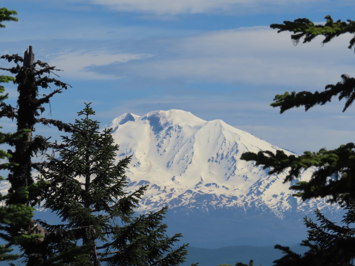
 Mt. Jefferson and Three Fingered Jack
 Entering trees that survived the 2017 fire.
 The hillsides that the trail traverses are pretty steep.
 Common whipplea

Regaining the ridge top.
 Better view of Mt. Jefferson and Three Fingered Jack with Maxwell Butte (post) and South Cinder Peak (post) in between.
Shortly after leaving the fire scar the trail began to steepen a bit.

 Bunchberry, queen’s cup, and foam flower.
Near the 3.5-mile mark the trail crossed an abandoned forest road and steepened again

It had been warming up quickly and Heather and I had decided to split a little below this road crossing. Despite not being able to spell “Heather” without “Heat” it is her hiking nemesis. We set a time that would be the latest I headed back at and chose the road crossing as a meeting point. Heather planned on continuing but wasn’t sure how far she would feel comfortable going. We set the road as a meeting point so that if she didn’t make it up Horsepasture Mountain before I headed back I would know I’d missed here somewhere along the trail if I got to the road and she wasn’t there.
A tenth of a mile beyond the road crossing the O’Leary Mountain Trail joined from the right.
 We had hiked to MacDuff Mountain on the O’Leary Trail just a few weeks earlier (post).
Beyond the junction the Olallie Trail leveled out then slowly descended 200′ over the next 1.1 miles to a junction with the Saddle Trail. The hillsides along this section were fairly exposed to the Sun which warmed things up even more, but also provided some nice wildflower displays.

This section also had a few smaller trees down over it.

 Columbine
 Mt. Hood, Mt. Jefferson, Three Fingered Jack, Mt. Washington, and Scott Mountain (post).
 Trillium
 Valerian
 Wallflower and buckwheat
 Purple larkspur, yellow cinquefoil, and white sub-alpine mariposa lilies

 Paintbrush and lupine
 North and Middle Sister with Horsepasture Mountain on the right.

 Oregon bluebells
 Penstemon
 Butterfly on bistort
 Musk monkeyflower
 A stalk of beargrass along the trail.
 Jacob’s-ladder
 Bane berry and solomonseal
 Vanilla leaf
 The Saddle Trail arriving from the right.
One hundred yards downhill from the Saddle Trail junction I arrived at a 4-way junction with the Horsepasture Mountain Trail.
 Downhill to the left is the Horsepasture Trailhead, uphill to the left is Horsepasture Mountain and the Olallie Trail continues along the righthand fork.
From the junction the Horsepasture Mountain Trail climbs over 850′ in a little under a mile and a half. The trail begins with a steady traverse along the side of Horsepasture Mountain before switching back after a litte more than three quarters of a mile.

 Arnica, bunchberry and vanilla leaf

 Fleabane

Often switchbacks allow for a more gradual climb but here the trail launched steeply uphill through small meadows switching back two more times before heading steeply up the open shoulder of Horsepasture Mountain.
 It was not a big year for beargrass but if you pick the right year there is an impressive amount along this trail.
 Second snake of the day. I wound up seeing three on the day which was two more than other trail users, excluding Heather.

If you look closely you might pick out the blue shirt worn by the only other hiker I encountered.

Mt. Bachelor from the shoulder of Horsepasture Mountain.

Final pitch to the top.
The wildflowers were near peak, and the hillside was literally buzzing with pollinators busy flying from flower to flower. The views extended from Mt. Hood in the north and south to Diamond Peak.
 Pollinator photobomb in the upper left.


Diamond Peak to the south.
 The Three Sisters and Mt. Bachelor on the horizon.
 Lupine, bluehead gilia, paintbrush, and pussytoes?

 The former lookout site with Mt. Hood and Mt. Jefferson behind.
 The summit
 Survey marker
 Diamond Peak from the summit.
 The Three Sisters
 Mt. Washington, Scott Mountain, Belknap Crater (post), and Black Crater (post).
 Mt. Hood, Mt. Jefferson, and Three Fingered Jack
I had passed the other gentleman on the switchbacks, but we spoke briefly at the summit. He remarked how it isn’t often that you get both a great view and peak wildflowers on the same hike in Oregon. We both searched out spots with a little shade for a much-needed respite from the heat. While I put on a new pair of socks and had a snack I was able to message with Heather who was almost to the switchbacks. I wandered around the summit for a few minutes admiring the flowers and then got another message from Heather that she was wisely not going to attempt the final steep climb so I headed back to her.

 Scarlet gilia
 Buckwheat and bluehead gilia
 An aster or fleabane
 Paintbrush with penstemon in the background.
 Butterfly on bluehead gilia
 Butterfly and bees
 I believe this is a persius duskywing (Erynnis persius)
 Vetch?
 This outcrop is just slightly lower than the summit.

 Cliff beardtongue on the rocks with the Three Sisters and Mt. Bachelor behind.


 Phlox
Phlox
 Bastard toadflax
I met Heather at the switchbacks and we headed back together. We stopped at the 4-way junction for a short break which I used to hike 50 yards down to the Horsepasture Trailhead.


The 200′ climb from the 4-way junction to the O’Leary Trail junction was hot, but thankfully that was it as far as climbing went for the day and the remaining 3.5-miles were downhill. The combination of going downhill and a slight breeze provided a little relief to the heat.
 Passing the Saddle Trail on the way back.
 Eight-spotted forester
 Blue-eyed Mary
 Horsepasture Mountain
 Waterleaf
 Mt. Hood, Mt. Jefferson, Three Fingered Jack, and Mt. Washington
 North and Middle Sister
 Larkspur

Anemones and spotted coralroot
 Pink pyrola
 Clodius parnassian on a tiger lily.
 Fireweed

The lower portion of the trail included some madrone trees.
 It was right around 90 degrees at the trailhead when we got back at 2:30pm.
I had expected this hike to be a little under 12 miles with approximately 3200′ of elevation gain. My GPS ended up with 12.5 miles, most of which can be attributed to my wandering around at the summit. The detour down to the Horsepasture Trailhead added less than a tenth of a mile.

This was a great hike that only missed spectacular due to how hot it was. The Olallie Trail was in good shape and the climb was extremely well graded. The view from Horsepasture Mountain is a good one and hitting the peak wildflower display only enhances it. We were really shocked to have only seen the one other person, but maybe, just maybe most other people are smarter than we are. With the heat dome expected to continue for several days the 2024 wildflower show will most likely be over quickly, but there is always next year. Happy Trails!
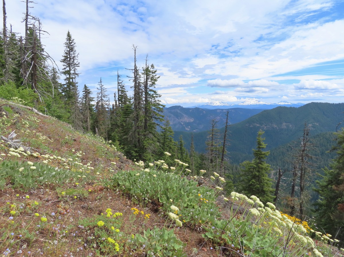

 Valerian along the trail.
 Vanilla leaf and anemones carpeting the forest floor.
 Star-flowered false solomonseal.
 Coneflower with lupine behind.
 Penstemon


 Monkeyflower
 Lupine
 Sub-alpine mariposa lily
 Moth on fleabane.
 Waterleaf
 Tiger lily
 Pussytoes
 From left to right the peaks with snow are: The Twins (
 Diamond Peak
 Grasshopper Mountain above the meadow.
 The post in the rocky area.
 When we visited in 2017 it had been mid-July, and the larkspur show was over.
 A cairn marks the Grasshopper Mountain Trail.

 Looking out over the meadow.
 Fuji Mountain and Diamond Peak
 The saddle below Grasshopper Mountain.
 The Three Sisters and Broken Top
 Mt. Bachelor
 The last of the snow, at least it is all we saw.
 Glacier lilies near the tiny snow patch.
 It was evident that the trail does get maintained on occasion, but none of it appeared recent near Grasshopper Mountain.
 Anemone
 Violets
 Bleeding heart
 Oregon bluebells
 The Three Sisters and Broken Top were visible from this area.
 Back on the slightly overgrown trail.
 Mt. Jefferson and Three Fingered Jack
 Bears appear to use the trail more than hikers. This was the largest of three piles we’d pass on the day.
 Arnica
 This is both the trail and a front (back) door.
 Valerian and tall bluebells
 Fairy bells
 Meadowrue
 Moth on valerian.
 Jacob’s-ladder
 While the trail was overgrown in places it was passable and the tread was in pretty good shape.
 Fringecup
 Possibly a speedwell but unsure and it was the only one we saw.
 More blowdown to maneuver around.
 Edith’s checkerspot
 Trail passing through an area full of monkeyflower and larkspur.
 Cinquefoil, larkspur, and buckwheat
 Scarlet gilia
 Paintbrush
 Bluehead gilia and silverleaf phacelia
 The rocky area from the trail as it crossed the ridge.
 Columbine crowding the trail.
 The wildflower covered rocks on the way back.
 Arrowleaf buckwheat and Oregon sunshine
 The Three Sisters and Broken Top with some clouds moving in.

 Paintbrush surrounded by buckwheat, bluehead gilia, and stonecrop.
 Scarlet gilia
 Wallflower
 Wild rose
 Beargrass near the outcrop.
 The outcrop from the trail.
 Blowdown
 More blowdown
 Western meadow fritillary
 Bunchberry
 Recent trail maintenance! There were a couple of cut trees in the final mile, but there were also still many to step over.
 The trail dropped low enough that there were several rhododendron blooming.
 Queen’s cup.
 South Sister (

 Had I not just come down the trail I might not have even noticed it was there.
 Cardwell’s penstemon
 Starflower
 Ginger
 Mt. Bachelor through the trees.
 Musk monkeyflower
 Grasshopper Mountain from the outcrop.
 Cliff beardtongue
 Blue-eyed Mary
 Cicada, not a pollinator but interesting to see.
 Solomonseal
 Variable-leaf collomia
 Honeysuckle
 Oregon grape
 Pollinator 1
 Pollinator 2
 Pollinator 3 (Clodius parnassian)
 Bees on bastard toadflax
 Checkerspot on groundsel
 Naked broomrape (Aphyllon purpureum)
 Penstemon
 Our guess is this is mile three from Grasshopper Saddle. We didn’t notice any other numbers and missed this one on our first pass.
 Dwarf bramble
 Strawberry
 Cinquefoil
 It started clouding up in the afternoon.
 Back at the saddle below Grasshopper Mountain.
 Great artic butterfly. There were a lot of these flying about. Their dorsum is a bright orange, but they rarely would open their wings when they landed.
 The checkerspots on the other hand are happy to open their wings.
 False hellebore
 It clouded up over Diamond Peak as well.
 Lewis flax
 Orange agoseris
 A Lycaendae on a lupine leaf.
 Moth on a mariposa lily.
 Butterflies gathering at the spring.
 The Prius at the TH. We parked on the shoulder in a pullout.
 Looking down at the pullout from the PCT on the way back.


 Phantom orchid
 Spotted coralroot
 Finetooth beardtongue
 Mt. Hood through a window in the trees.
 Finetooth beardtongue along the trail.
 White spiraea
 Bluehead gilia
 Paintbrush
 Some yellow balsamroot along the trail.
 Columbine
 Inside-out flower
 Queen’s cup
 Bunchberry
 Vanilla leaf
 Arnica
 Approaching the landslide area.
 Starting at the green up to the left is Augspurger Mountain (
 Mt. Hood from the viewpoint.
 Lomatium, bluehead gilia, and arrowleaf buckwheat in the bowl.
 Honeysuckle


 Wild onion mixed in with bluehead gilia.
 Bluehead gilia
 Lupine
 Catchfly
 Arnica and beargrass in the forest.
 Nearing one of the little meadows.

 Sub-alpine mariposa lilies
 Bluehead gilia
 Sub-alpine mariposa lilies
 A closer look shows why these are also known as cat’s ear lilies.
 Buckwheat
 Onion
Onion
 Bastard toadflax behind a cat’s ear lily.
 Rosy pussytoes
 Yarrow
 Looking back from the meadow.
 I believe these are some type of microseris.
 Boundary sign for the
  Broadleaf arnica
 Star-flowered false solomonseal
 The Cedar Creek Trail coming up from the right.
 Anemones
 Wallflower
 White groundsel
 Cliff beardtongue
 Cliff beardtongue
 Wild rose
 Larkspur
 Mt. Hood from the viewpoint.
 Spotted coralroot
 Oregon sunshine and wild onions
 Chickweed
 Arriving at another small clearing with flowers.
 Phlox, penstemon, lomatium, onion, and mariposa lilies.
 Another little meadow.
 Larkspur and balsamroot
 This was the only time we spotted Mt. St. Helens on the hike.


 Mt. Adams from the former lookout site.
 There was a lot of phlox in bloom.
 Table Mountain (
 Mt. Hood
 Mt. Hood with Mt. Jefferson behind to the right.
 Balsamroot and groundsel
 Mt. Adams
 Phlox
Phlox
 Paintbrush and cliff beardtongue
 Another view of Mt. Hood.

 Sandwort
 Chickweed
 Balsamroot
 Some of the smaller flowers present on the summit.
 Finetooth beardtongue
 Wallflower
 Wild onion
 The end of the ridge is about three quarters of a mile from the lookout site.
 Heather on the outcrop.
 Painted lady
 Larkspur
 Swallowtail
 Chickweed in some phlox.

 Wallflower
 Colubmine
 Bluehead gilia
 Beargrass along the PCT.
 Heading down to the trailhead.


 Signboard about a tenth of a mile from the trailhead.
 The loop began on the far side of the footbridge.
 As far as we could remember we’d never seen a bench on the other side of a fence before.
 Middle Fork Willamette River through the vegetation.
 Tiger lily
 Self-heal
 Snail
Snail Mock orange

 Anemone
 There are a few junctions prior to reaching the footbridge. The first was the only one with any signage. We stayed on the correct trail by ignoring side trails to the left that headed uphill and on the right that led down to Deception Creek.
 We turned left at the signed junction following half a sign for the Deception Butte Trail.

 At the last unsigned junction there was a signboard, but with nothing on it. (We went straight.)
 Warning sign for the burned area ahead.
 The footbridge over Deception Creek.
 Deception Creek

 The amount of trail work needed to clear the trail was evident by the sheer number of cut trees along the length of the trail.
 This was from 2017 near the same stretch of trail.
 View up the canyon from the trail.
 Clodius parnassian
 There was a lot of vegetation along the trail, so we had to keep an eye out for poison oak which was present at times on the lower two-thirds of the trail. It was never much of a problem, but there were a couple of plants crowding the trail that we had to maneuver around.
 Moth
Moth Starflower
 Rhododendron
 Northern cloudywing
 Big deervetch
 Hummingbird
 Groundsel
 One of the damaged sections of trail.
 There was some forest that survived the fire starting near the 3.5-mile mark where the fire burned less intensely.
 Townsend’s solitaire
 Canada jay
 There were a few views of the Three Sisters through the remaining trees. (Middle & South Sister here)
 Inside-out flower
 Looking up as the trail neared the summit.
 Woodpecker
 Common whipplea
 Anemone
 The Deception Butte Trail arriving at Deception Butte.
 Beargrass


 Looking down at the saddle and wondering if it was really worth having to climb back up.
 Northern flicker
 Lizard
 Rock outcrop on the other side of the saddle.
 Tolmie’s mariposa lilies
 Bluehead gilia
 Squirrel
 Oakridge in the valley below with Diamond Peak (
 Diamond Peak
 Oakridge
 Leafy fleabane
 Oregon sunshine on the hillside looking up Deception Butte from the saddle.
 Wild onion
 One of the fritillary butterflies.
 Fly inside a Tolmie’s mariposa lily.
 There is a very steep trail just below the summit that leads to an upper trailhead. The Forest Service does not recommend using these though as the trail is said to be slippery and steep. We can vouch for the steep just by having looked down from the Deception Butte Trail.
 Plectris and stonecrop
 Coralroot
 The best view of the Three Sisters that we got all day.
 Butterflies enjoying some vetch. There were at least a half dozen butterflies visiting this patch.
 Brown creeper
 Pink pyrola

 Pearly everlasting
 Turkey vulture
 Fireweed
 Entering the trees near the footbridge over Deception Creek.
 Columbine
 Tiger lilies


 There were some nice rhododendron blooms along the trail.
 Spotted coralroot
 The first of three crossings of FR 411, this is at the 0.4-mile mark.
 Inside-out flower
 Starflower
 Yellowleaf iris
 The trail is narrow at times but well maintiained.
 Forest filled with rhododendron.
 A closer look at the rhodies.
 There were several madrones in the forest.
 Little prince’s pine
 Sugar sticks
 There were a few places where we might have had a view if not for the clouds.
 Stonecrop
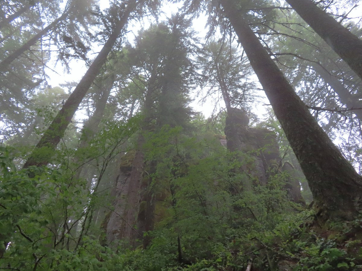
 Passing below some of the rock formations.


 Anemones
 Bleeding heart

 The first small meadow that the trail passed through was full of blue-eyed Mary.

 Northern phlox
 Coming up on another small meadow.
 Subalpine mariposa lily
 Beargrass
 The fog didn’t help with our trying to find the trail. There was enough room along this section of road that parking and starting the hike from here would be possible.
 Back on trail.
 Honeysuckle
 More northern phlox
 This meadow was full of bluehead gilia.


 The trail dropped steeply as it rejoined FR 411.
 There was no parking room that we could see near this area.
 Vanilla leaf along the trail.

 Bunchberry
 Trillium
 We stopped when we spotted something in the trail ahead that looked like it might be an animal. Using the camera to zoom we realized it was a grouse hen with her little chicks.
 The hen got up and then the chicks headed into the underbrush. We felt bad having disturbed them, but once they’d moved, we calmly passed by while momma came back to gather her little ones.
 This was all beargrass, but none of the plants in this area appeared to be planning on blooming this year.
 Hermit thrush
 The rocky summit of MacDuff Mountain.
 A lot of larkspur.
 Subalpine mariposa lilies
 Paintbrush and buckwheat
 Cinquefoil
 A penstemon


 The view from the top.
 No blue sky that way.
 No sign of clearing this way either.
 Cliff beardtongue
 Woodland-stars
 Paintbrush
 Hey look, there is another ridge over there.
 Ookow just starting to open up.
 Steep climb or road walk? We chose the trail again on the way back.
 A wetter road now thanks to the rain shower.
 Blue sky, it does exist.
 The clouds got a late start but eventually started lifting.
 From this angle it looks like a statue.
 Looking down from some of the switchbacks.
 Cougar Reservoir
 Pyrola
 Sunlight!
 I’ve never seen a track this far off.
 The track after manually editing it.
 From the saddle South Triangulation Point, the highpoint of the loop, is to the right.
 Bleeding heart
 Fairy lanterns
 Solomonseal
 Inside-out flower
 Paintbrush
 Lupine
 Starflower
 Salmonberry
 Cardwell’s penstemon
 Beargrass
 Wallflower
 Little-leaf montia
 Fringecup
 Salal
Salal Rosy bird’s-foot trefoil
 Band-tailed pigeons
 Looking back at the saddle before heading into the trees.
 Vetch
Vetch Leaving the clearcut.
 Rock cliffs marking the location of Kilchis Falls.
 Located on a tributary of the North Fork Kilchis River the falls reportedly seldom have much flow, but there was enough water today to make for a pretty sight.
 The small pool below the falls.
 Avens
Avens Spider hiding on a columbine.
 Scouler’s corydalis
 Youth-on-age
 Valerian

 Hedgenettle
 Waterfall on an unnamed creek. It was quite a way back in thick vegetation.
 The above waterfall sans zoom.
 Buttercup
 Fick Creek joining the river.
 Potholes on the North Fork Kilchis River.
 Triangulation Creek flowing into the river.


 Snail shadow on a iris.
 Middle Road coming downhill on the right. This is the

 A very blurry picture of a doe that was way down the hillside in the forest.
 Large rock and log in the middle of Middle Road.
 Monkeyflower surrounded by candyflower
 Paintbrush on some cliffs above Middle Road.
 Thistle
 The road at the 1.3-mile mark along Middle Road.
 The saddle at the 1.6-mile mark.
 Memorial at the saddle.
 Middle Road continuing on from the saddle.
 Beargrass
 The road on the left at the 2.1-mile mark.
 Iris
Iris Stream flowing down the road.
 Coming up to the 4-way junction.
 Middle Road from the 4-way junction.
 The two lefthand forks at the 4-way junction.
 FB3
FB3


 Monkeyflower
 Beargrass, paintbrush and penstemon
 More flowers on a rocky outcrop along FB3.
 A bunch of monkeyflowers.
 Springs along the road.
 Snake cooling off in the mud.
 The snake didn’t budge as we passed around it.
 This fork is approximately 4.2 miles from the Middle Road Trailhead.
 Snake number two on the day.
 This one didn’t budge either.
 Switchback below the saddle.
 Approaching the saddle.
 Gated road up Triangulation Point.
 South Triangulation Point
 Serviceberry, paintbrush, yarrow, and iris.
 Paintbrush and Cardwell’s penstemon
 Iris
Iris Broadleaf arnica, paintbrush and penstemon
 Columbine among others.
 Broadleaf arnica
 Final pitch to the summit.
 We could see our car parked at the saddle below Cedar Butte from South Triangulation Point.
 Motorcycle track heading down from the summit with Triangulation Point on the other side of the saddle.
 Looking to the NW you can see out to the Pacific Ocean. The line of peaks furtherst back staring from left to right consists of Neahkahnie Mountain (
 Closer look at Surgarloaf Mountain and Kidder Butte.
 Wildflowers on South Triangulation Point.

 Another nice clump of wild iris.
 Lupine
 Flowers lining the road.
 More motorcycles at the 5-way junction.

 Variable-leaf collomia
 The road briefly followed a narrow ridge.
 Anemones
 Moth
Moth
 Heather spotted this little one. Not sure if it’s a vole, pocket gopher, or something else.
 Silverleaf phacelia and chickweed
 A lomatium

 Larkspur and monkeyflower
 This pink larkspur really stood out on the cliffs.
 Littleleaf miner’s-lettuce
 Several types of yellow wildflowers.
 Still dropping a little after the cliffs.
 Bleeding heart and candyflower
 Climbing the road at the edge of the clearcut.
 The saddle where our car was parked across the clearcut.
 South Triangulation Point from Cedar Butte Road.
 South Triangulation Point
 Looking down the North Fork Kilchis River valley from the saddle.
 The trail information lists the hike as “difficult” due to the amount of elevation gained over just three quarters of a mile to the summit.
 The start of the Cedar Butte Trail.
 Star-flowered false solomonseal
 Black-headed grosbeak
 False lily of the valley
 The trail was in good shape with just one small tree down over it.
 Blue-eyed Mary
 Small saddle below the summit.
 Beargrass
 Phlox
Phlox Final pitch to the summit.
 Wild onion
 Benches at the former lookout site.
 View from the summit.
 Wildflowers at the summit.
 Kings Mountain is the high point to the right along the ridge.
 Fairy bells and vanilla leaf
 Almost back

 The trailhead is just a large gravel pullout along Cook-Underhill Road.
 There is no parking for the trail anywhere along Jackson Rd.


 Ookow surrounded by poison oak.
 Mt. Defiance (
 Large-flower triteleia
 Monkeyflower along the road.
 Ookow
Ookow
 Small waterfall through the vegetation.
 The first of two crossings of this unnamed creek.
 There was a lot of spotted coralroot along the road.
 Most of the trees had been cleared from the road, those that remained were easily stepped over.
 Anemones
 The second creek crossing.
 Lupine
 White groundsel
 Small spring near the junction with the start of the loop.
 Reeder mentioned a rock cairn at the start of the loop which was still present, but now there were signs too.
 Going counterclockwise seemed to be preferred direction based on trip reports. This was also the shorter distance to the summit at 1.6-miles.
 The clockwise sign listed the summit as 2.8-miles away in that direction.
 Arriving at the lower meadow.
 Balsamroot
 Groundsel and balsamroot
 Lupine
 Death camas
 The rocks up ahead made for some nice seats to take in the view from.
 Mt. Hood peaking over the ridge to the left with Mt. Defiance to the right.
 Mt. Hood
 Vanilla leaf
 Starflower
 Fairybells
 The start of the long upper meadow.
 Larkspur
 Violets
 Slender phlox and blue-eyed Mary
 Phlox
Phlox Balsamroot surrounded by larkspur and coastal manroot.
 Coastal manroot
 Groundsel
 Dog Mountain from the meadow.
 Chocolate lily
 This was the closest lupine to blooming in the upper meadow.
 Chickweed
 Oregon sunshine yet to boom.
 Mt. Hood from the meadow.
 Woodland stars, larkspur, and lomatium.
 Yellow buttercups lining the trail.
 Mt. Hood and Mt. Defiance
 Mt. Hood
 Mt. Defiance
 Alpine pennycress
 Larkspur and lomatium

 Chocolate lily eating a buttercup.
 Largeleaf sandwort
 The final stretch of the upper meadow.
 Violets
 Phlox
Phlox Dog Mountain
 Mt. Hood and Mt. Defiance from the upper meadow.
 Table Mountain (
 Phlox, paintbrush, and lomatium


 Mt. Adams from between trees.
 Arnica
 The final stretch of the steep descent was through this forest with no understory.
 Vine maple overhanging the trail.
 It’s hard to tell from the photo but these were huge paintbrushes.
 Another view of Mt. Hood and Mt. Defiance.
 Dogwood
 Trillium
 The first tower.

 Looking toward Mt. Adams from beneath the powerlines.
 Mt. Adams
 Wind Mountain (
 The faint roadbed heading left back toward the forest.

 Wild ginger
 Candyflower
 The trail passed under a talus slope where a fair number of flowers were present.
 Lupine and yarrow
 Stonecrop
 Bee visiting penstemon.
 The talus slope.
 Descending to the junction.
 Ookow and bachelor buttons along the trail.
 Bachelor button
 Heather spotted this arctic skipper on some vetch.
 Clarkia. It wasn’t open yet when we’d passed by in the morning.
 There were a lot of phantom orchids starting along the lower portion of the hike, but this was the only one with any flowers opened.
 Cook-Underhill Road from Jackson Road.


 The best of the color was while I was still at the trailhead.
 Checkerbloom
 Common madia
 Meadow checker-mallow and vetch
 The platform
 Too late for any color.
 There always seems to a western meadowlark or two on Mt. Baldy.
 Spotted towhee
 I went left to hike the loop clockwise.
 Moffitti Marsh in the distance.
 Geese flying over.
 Snake in the grass.
 Pied-billed grebes
 Common yellowthroats
 Gadwalls
 Moffitti Marsh
 Dove
Dove


 House finch
 Swallow
 Sparrow

 Crow
Crow Goose family
 Common yellow-throat (female)
 Roses
Roses
 Columbine
 White-crowned sparrow
 Ookow
Ookow Tolmie’s mariposa lily
 Waxwing


 Cottonwood Pond is in the lower left corner.


 The yellow-headed blackbirds were particularly noisy.
 A cinnamon teal in front of two mallards?
 This loop was 3.4-miles.
 Grizzly Mountain from Pond 4.
 Killdeer
 One of the interpretive signboards ahead.
 Goose family
 There were plenty of benches to enjoy the views from.
 Mallards
 Cinnamon teal
 Must be a green-winged teal but the angle of light made the patch on his head look blue.
 We’d never seen so many killdeer in one area.
 Spotted sandpipers
 Brewer’s blackbird
 Swallow
 Pollinator garden
 Ring-necked ducks
 Wilson’s phalarope
 Yellow-headed blackbirds
 American coot
 Adolescent geese
 Dove
Dove Gadwalls
 Female yellow-headed blackbird
 Pair of bucks.
 Ruddy ducks
 Red-winged blackbird harassing an osprey.
 Gray Butte
 A pair of hawks.
 Not birds.
 Marsh wren
 Great blue heron
 Observation deck at Pond 10.
 Another marsh wren.

 Heading back to the parking area.
 Sign for the trailhead along FS21.
 This mud and torn up area was why we chose the shoulder instead.
 Arnica near the trailhead.

 Broomrape
 Larkspur
 Death camas
 Lomatium and few-flowered pea-vine
 Lupine
 Woodland star
 Oregon sunshine
 Violet
 McClellan Mountain, Moon Mountain and Fields Peak (
 Balsamroot
 The clearer track to the left leads to Tupper Butte in approximately 0.3-miles. We continued straight on the Madison Butte Trail.
 The Strawberry Mountains with Strawberry Mountain (
 Glacier lily
 The fence in the distance.
 Huckleberry
 Mt. Hood
 Old man’s whiskers
 Ball-head waterleaf
 Small bluebells
 Paintbrush
 Trail marker on the tree.
 One of two fresh piles of scat along the trail.
 The markers were helpful because the trail was quite faint at times.
 Slender phlox
 Shooting stars
 Rock outcrop along the trail at the 2.1-mile mark.
 View from the rock outcrop.
 Larches

 Chocolate lily
 Lance-leaf spring beauty
 Violets
 Madison Butte from the trail.
 Bottle Spring
 Pond below the spring.
 Glacier lilies
 Trail sign at Madison Butte Road.
 Blue-eyed Mary
 The
The  Mt. Jefferson poking up in the distance.

 Wild onions


 The Strawberry and Aldrich Mountains to the south.
 The Elkhorns (
 The Elkhorns with Mt. Ireland (
 Looking SW we could see Mt. Jefferson and also make out the Three Sisters further to the south. Mt. Hood and Mt. Adams were also visible although partially obscured by clouds.
 A rockcress
 Swallowtail
 Milbert’s tortoiseshell
 Skipper
 Mushroom
 Fairy slipper
 A particularly large paintbrush.
 Orange tip
 Larkspur


 Violets
 Ring-necked ducks and an American coot
 Arnica
 Ducklings
 Ring-necked duck
 Fleabane?
 Camas
Camas A coot and a sandpiper
 Red-winged blackbird
 Our first eared grebe.
