As we near our goal of finishing at least part of all 100 featured hikes in William L. Sullivans “100 Hikes/Travel Guide Southern Oregon & Northern California” edition 4.2 (post) there was one backpacking trip left. Sullivan’s Seven Lakes West and Seven Lakes East (hikes 38 & 39 in edition 4.2) start at trailheads on opposite side of the Cascade Crest but both contain a loop through the Seven Lakes Basin and a climb up Devil’s Peak in the Sky Lakes Wilderness. Aside from the different trailheads the only other difference is that he includes a visit to Lake Alta from the west trailhead.
We opted to begin from the eastern trailhead – Sevenmile Marsh. The primary reason for this was the trailhead is roughly half an hour closer to Salem but the Forest Service currently shows the status of the western trailhead (Seven Lakes) as unreachable. (This may simply be an oversight when updating their webpages, but it is a good reminder that it’s always a good idea to double check with the managing agencies before heading out.)
 Sevenmile Marsh Trailhead
The trail descended to a crossing of Sevenmile Creek then climbed gradually along a hillside above Sevenmile Marsh, entering the Sky Lakes Wilderness along the way.

 Sevenmile Creek
 Entering the wilderness
 Sevenmile Marsh
The Sevenmile Trail climbed gradually through a nice forest for nearly two miles before joining the Pacific Crest Trail.
 Lodgepole pines were the dominate trees along the first part of the trail.
 Mountain hemlock took over as the trail gained elevation.

 Junction with the PCT.
We turned left onto the PCT and found ourselves losing a bit of elevation before beginning another gradual climb.

 There were a few downed trees along this section but nothing difficult to get around.
 This twisted tree caught our attention.
 Nice blue sky.
 Lewis’s woodpecker way up in a snag.
After two miles on the PCT we arrived at Honeymoon Creek which resembled a small pond. Tadpoles splashed around in the mud while larger frogs hung out around the water.

 Tadpoles
 Frog in the water.

After another 0.6-miles on the PCT we arrived at a signed junction with the Seven Lakes Trail.
 Trail sign ahead on the right.
Our plan was to set up camp at Cliff Lake then do the loop and summit Devil’s Peak as described by Sullivan. We could have turned right here and followed the Seven Lakes Trail 1.3-miles past Grass and Middle Lakes to Cliff Lake, but sticking to the PCT for another 0.7-miles then turning the Cliff Lake Trail would save us nearly a quarter of a mile. We decided to save Middle and Grass Lakes for our hike out the following morning and stayed straight on the PCT.

 Unnamed creek along the PCT. We were surprised at how many of the seasonal creeks still had flowing water.
 Grass-of-parnassus
 Huckleberries, there were a lot of these around the basin which we happily sampled.
 Devil’s Peak poking up above the trees.
 The Cliff Lake Trail.
We turned right onto the Cliff Lake Trail and descended a third of a mile to rejoin the Seven Lakes Trail a tenth of a mile from Cliff Lake.

 Prince’s pine
 Another flowing seasonal creek.
 Crater Lake collomia (Collomia mazama)
 The Seven Lakes Trail arriving on the right.
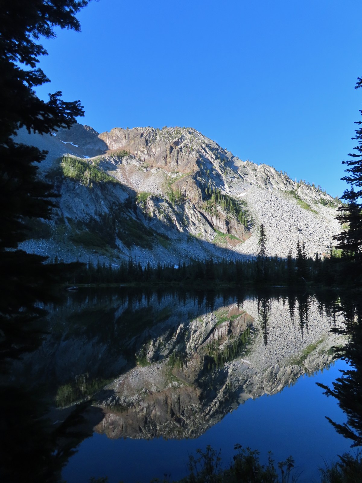
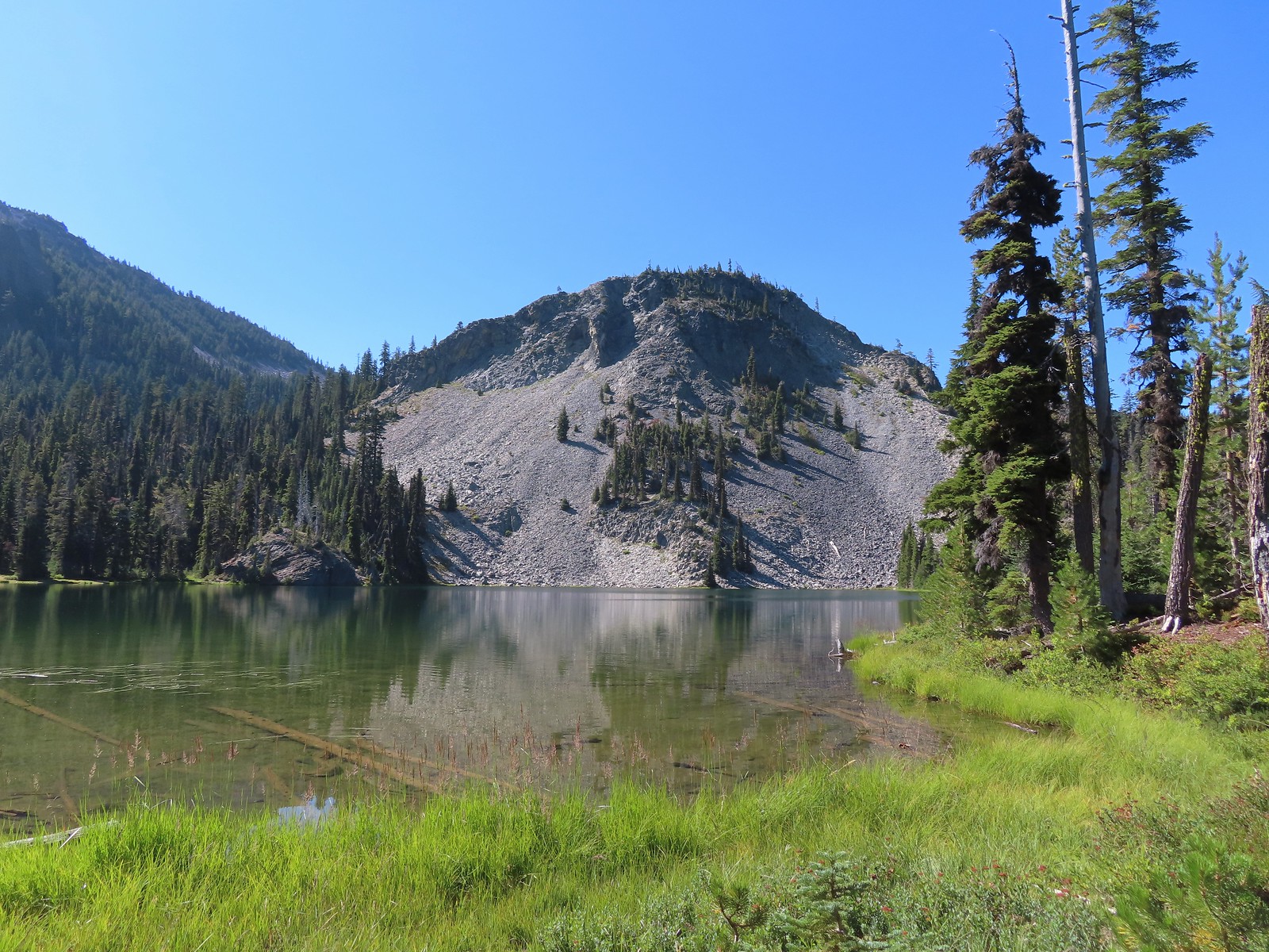 Cliff Lake
At Cliff Lake we turned onto a use trail following it around the eastern side of the lake in search of a suitable campsite. While there were numerous sites most of the sites we were seeing were large enough for multiple tents. We didn’t want to take up one of the large sites with our single tent and we also didn’t want to wind up with neighbors if we could avoid it. We wound up getting separated in the process and after walking back and forth for a bit we found each other and settled on a campsite.

 Arnica
 Aster
Aster

 Splash in Cliff Lake from one of many fish that were feeding on insects.
 Camp
Camp
After getting set up we grabbed our daypacks and headed back to the Seven Lakes Trail. We decided to hike the loop clockwise which meant backtracking along the Seven Lakes and Cliff Lake Trails to the PCT and then turning right to continue southward.
 Huckleberry bushes along the Cliff Lake Trail.
 Anywhere there was water nearby there were lots of tiny Cascade toads to watch out for.
 Back at the PCT.

 Larger frog
 Monkshood
 More grass-of-parnassus
 Not only were the toads tiny, they also were well camouflaged.
The PCT climbed steadily providing the first glimpses of the peaks around Crater Lake.
 Mount Scott (post) between the trees.
 Mount Scott
 The Watchman (post) and Hillman Peak (post)
 The Watchman and Hillman Peak
 Devil’s Peak
 Union Peak (post) in the distance.
 Cliff Lake with Violet Hill beyond.
 Black backed woodpecker
 Getting closer to Devil’s Peak.
 A much bigger Cascade toad.
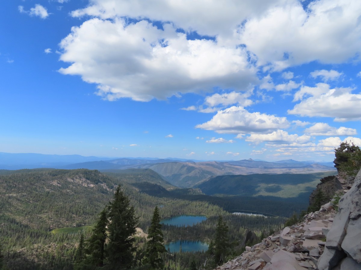
Near Devil’s Peak the PCT left the trees and switchbacked up a talus field resulting on great view to the north toward Crater Lake and beyond.


 Mt. Thielsen (post) in the center beyond the rim of Crater Lake.
 Union Peak with Mt. Bailey (post) behind to the right.
 Lots of neat rock formation on Devil’s Peak.
 Western pasque flower seed heads.

 Buckwheat
Two and a half miles from the Seven Lakes Trail junction the PCT arrived at a pass. The final climb was fairly steep even with switchbacks, so a brief rest was in order at the pass.

 Views to the South opened up at the pass including Klamath Lake and Pelican Butte.
 Klamath Lake
 Devil’s Peak and the PCT coming up to the pass from the North.
 Klamath Lake, Pelican Butte, Aspen Butte (post) over the right shoulder of Pelican, Brown Mountain (post) is the small cone on the right, and Mt. McLoughlin (post)
 Mt. McLoughlin
 A faint Mt. Shasta which, given the wildfires burning in NW California was a bit of a surprise to be able to see.
 The view North.
 Goose Egg and Ethel Mountain in the forefront with Llao Rock, Mt. Thielsen, and Garfield Peak (post) behind.
 Devil’s Peak
While we were resting at the pass we heard a helicopter approaching from the NW. It wound up hovering low above the lakes basin before heading back the way it came.
 We were a little concerned at first that it might be picking up water for a new fire but there wasn’t anything hanging from the helicopter so we have no idea what it was actually doing.
A path headed uphill from the pass toward Devil’s Peak while the PCT headed slightly downhill.
 The use path to Devil’s Peak on the right and the PCT on the left.
We headed up the use trail which was fairly easy to follow with just one slightly sketchy narrow spot.

 The rather ominously named Lucifer from the use trail.
 A second use trail coming up from the opposite side.
 Western pasque flowers on the hillside above the use trails.
 The summit of Devil’s Peak ahead.
The views were excellent from the summit so we took another nice break to soak them in before heading down.
 Looking North toward Crater Lake and Mt. Thielsen
 Lucifer, Jupiter, and Venus
 Lee Peak above the pass.
 Luther Mountain (post) in the foreground with Aspen Butte, Brown Mountain and Mt. McLoughlin.
 Remains of a former lookout.
 The PCT below Devil’s and Lee Peaks.

 Goose Egg, Llao Rock, and Mt. Thielsen
 Mt. Scott
 Mt. Shasta to South through a little smoke but again we felt fortunate to be able to see the mountain at all.
 Colorful grasshopper at the summit.
 American pipit
We headed down taking the other use trail which angled down along a ridge to the PCT approximately a third of a mile from where we had left it to climb Devil’s Peak.
 The Seven Lakes Basin from the use trail down.
 South, Middle, North, and Grass Lakes
 Heading down the use trail.
 Looking back up the use trail.
When we reached the PCT we turned right and headed toward Lucifer.

 Western snakeroot along the PCT.
 A comma butterfly on western snakeroot.
 Painted lady
At a ridge below Lucifer we arrived at a signed trail junction.

Here the PCT forked left toward Luther Mountain while the Devil’s Peak Trail forked right. We took the Devil’s Peak Trail and followed it 1.3-miles to the Seven Lakes Trail. Passing below Jupiter and Venus along the way.
 Venus from the Devil’s Peak Trail.
 Looking back at Devil’s Peak.
 Looking North across the Seven Lakes Basin.
 Lake Alta in a bowl below Violet Hill.

 Pond along the Devil’s Peak Trail.
 Coming up to the Seven Lakes Trail junction. A rock cairn was the only marker.
We turned right onto the Seven Lakes Trail and descended 0.2 miles to a signed junction with the Alta Lake Trail.


We turned left onto the Alta Lake Trail. We followed this trail for a fairly level half mile to the long lake.


Heather took another break at the South end of the lake while I hiked another quarter mile along the lake to get a better look at the northern end.
 I was still only about halfway along the lake after the quarter mile. There used to be a campground at the North end.
 Common merganser
 The southern end of Lake Alta.
On the way back to Heather I detoured to take in the view from the cliffs above the basin.
 Cliff Lake below Devil’s Peak and Middle Lake.
 Middle and Grass Lakes
 I could hear several pikas in the rocks below the cliffs but the only thing I spotted was a chipmunk.
 Chipmunk
After rejoining Heather we headed back to the Seven Lakes Trail and continued descending into the basin.
 Sulphur butterfly on aster.

 Gentian
 Fireweed
A mile from the Alta Lake Trail we arrived at South Lake.

 South Lake
Another quarter mile brought us to a view of Cliff Lake.

 Devil’s Peak from the trail. There were more pikas “meeping” from the rocks here but again we failed to spot any of them.
We followed the trail around to the North side of Cliff Lake and then turned on the use trail to return to our campsite.


Back at camp we refilled our water supply and had dinner then relaxed a bit before turning in for the night. For me this had been a 15.3-mile hike with 2000′ of elevation gain. One and a quarter of those miles was hiking from the Seven Lakes Trail to our camp, and initially wandering around looking for a site and Heather.
 Devil’s Peak in the evening.
 So many fish in the evening.
In the morning we packed up and headed back, this time sticking to the Seven Lakes Trail to visit Middle and Grass Lakes.

 Devil’s Peak in the morning.
 Seven Lakes and Cliff Lake Trail junction.
 We reached Middle Lake in 0.4-miles.

 We detoured left at the northern end of the lake following a pointer for Lake Ivern to find a view back across Middle Lake.
 Devil’s Peak from Middle Lake.
We returned to the Seven Lakes Trail and in another half mile we passed views of Grass Lake.
 Stream crossing.
 Monkshood and grass-of-parnassus
 Grass Lake
We didn’t follow any of the use trails down to Grass Lake and instead stuck to the Seven Lakes Trail as it climbed for 0.2 miles to the Pacific Crest Trail.

 Arriving at the PCT.
We turned left onto the PCT and returned to the Sevenmile Marsh Trailhead the way we’d come the day before. Of note were the ducks making use of the small pond along Honeymoon Creek.


 Golden-mantled ground squirrel
 Sevenmile Trail at the PCT to return to the Sevenmile Marsh Trailhead.
 Exiting the Sky Lakes Wilderness.
The hike out came to 6.1-miles with just 200′ of elevation gain.

This was a great trip. The temperatures were pleasant, the views great, lots of huckleberries and only a few mosquitos. We also only saw a total of eight other people all weekend. We are now down to a half dozen featured hikes from the Southern Oregon/Northern California book and if conditions cooperate we may well be finished by November. Happy Trails!
Flickr: Seven Lakes Basin

 The trailhead has numerous parking spots for cars as well as a large horse trailhead, outhouse, and picnic tables.
 The big signboards unfortunately did not have a map or other information about the trail system though.

 The North Sister behind us.

 Signpost for the canyon ahead.
 This sign was just like the ones we’d seen Saturday at the Dry River Canyon (post).


 The canyon is home to some impressive ponderosa pines.
 Another ponderosa
 Looking up from below the ponderosa.
 Lichens


 Townsend’s solitaire
 Owl
Owl
 West wall
 East wall
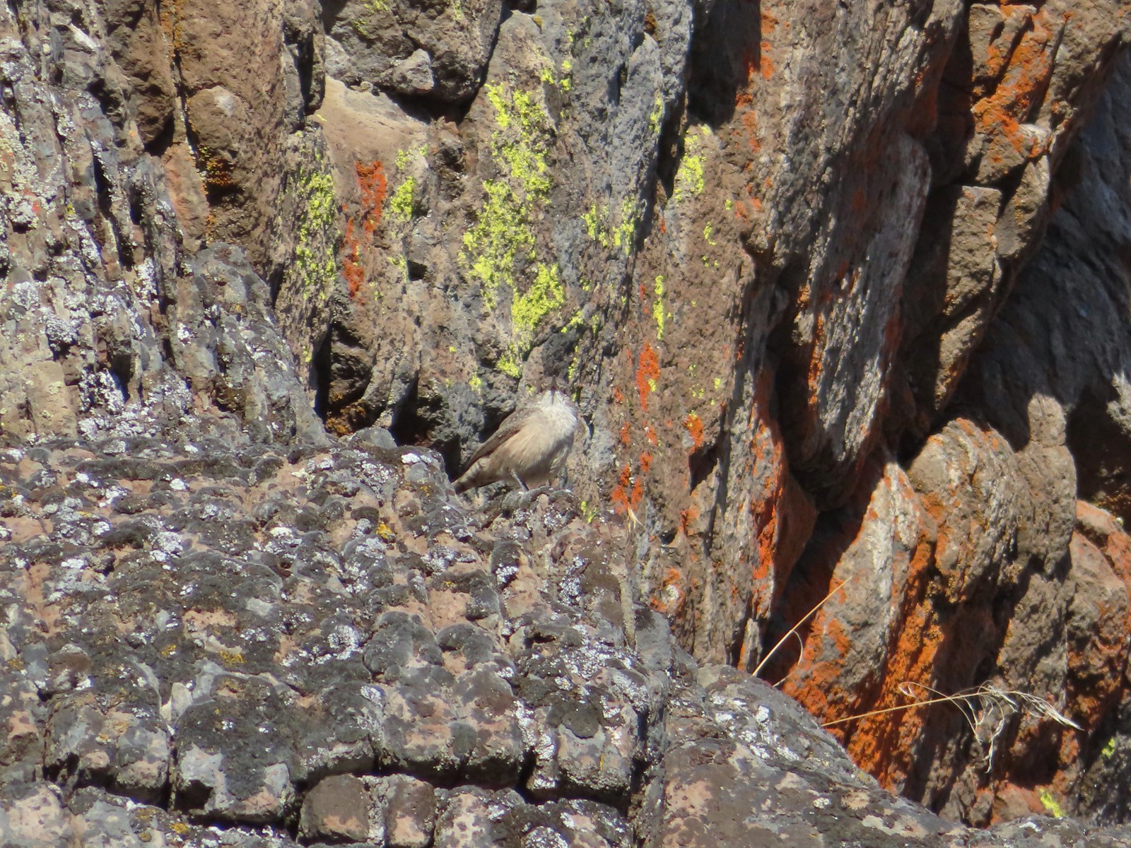 Wren
Wren Neat rock formation.
 Exiting Fryrear Canyon.
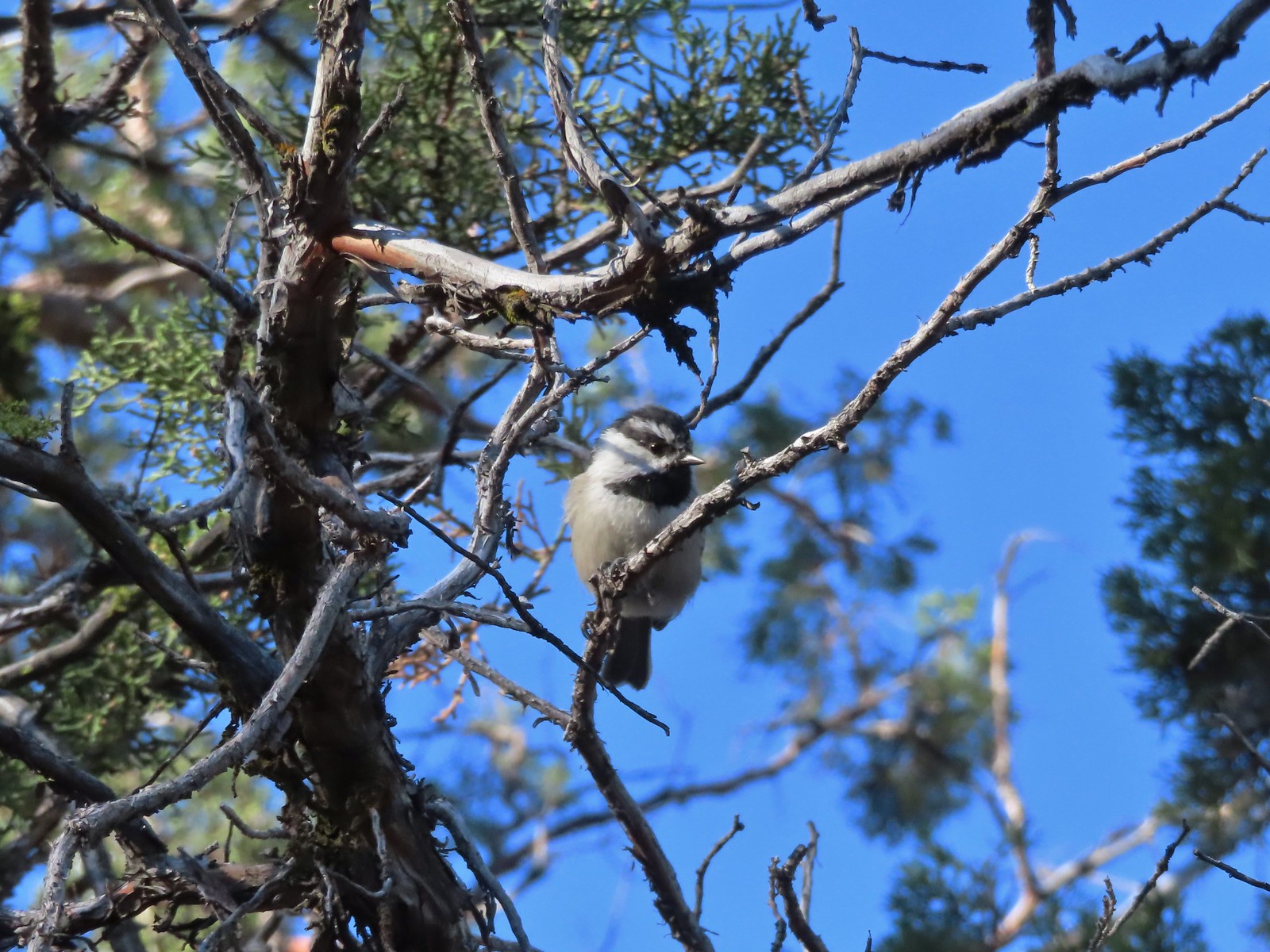 Several mountain chickadees came to investigate as we passed through the gate.

 Middle and North Sister
 Mountain bluebird
 South Sister
 Mt. Jefferson
 Broken Top and South Sister
 Broken Top behind some clouds.
 We turned right back onto the spur trail to the Fryrear Trailhead at the end of our loop.
 Stellars jay


 Beatys Butte to the SW.
 Rain to the SW as well.


 Threemile Creek could be heard but not seen through the thick brush.
 Lupine
 There was a post but no sign at the junction.
 Wickerstem buckwheat
 The Pueblo Mountains (
 Clouds and rain showers to the SW.
 Threemile Canyon
 The faint Huffman Trail.
 Alvord Peak in the center distance with Pueblo Mountain to the far right.
 Closer look at Alvord Peak in the center.
 Still a little blue sky to the NW.
 Not sure where the fog below came from but it was on a mission to beat us up to the plateau.
 Here comes the fog and some rain.
 Just moments later.
 And here is the fog.

 The final pitch to the plateau.
 Cairn at the end of the trail.
 Exploring is possible as long as you remember where you came up.
 Looking West.
 Looking toward Threemile Canyon.
 Beatys Butte at center with the long fault block of Hart Mountain (

 This frog seemed to enjoy the damp weather.
 Cliffs across Threemile Canyon
 Arriving back at the junction with the Threemile Creek Trail.

 Curlycup gumweed
 The trail crossed and at times used dry creek beds and also crossed Threemile Creek several times.
 The easiest crossing of Threemile Creek. Several of the others were not obvious until I pushed through the brush and then the footing was often tricky due to large, slick rocks needing to be navigated (at least in order to stay out of the creek).
 On the trail, I think.
 Elderberry
 Hard to tell by the photo but this puffball was a little bigger than a softball.
 I wouldn’t really describe the area as a meadow but I was 0.9 miles from the junction.
 Looking down at the meadow and post/snag (lower right) from the rocks.
 Sometimes the trail was really only identifiable by which junipers had had limbs cut.
 The drop to the creek here was approximately 2′ and the pool in Threemile Creek was fairly deep making this crossing a bit of a challenge not to slip and fall in.
 Aster
Aster

 Sullivan’s map showed a “Bart Simpson Rock” which we believe was this one.
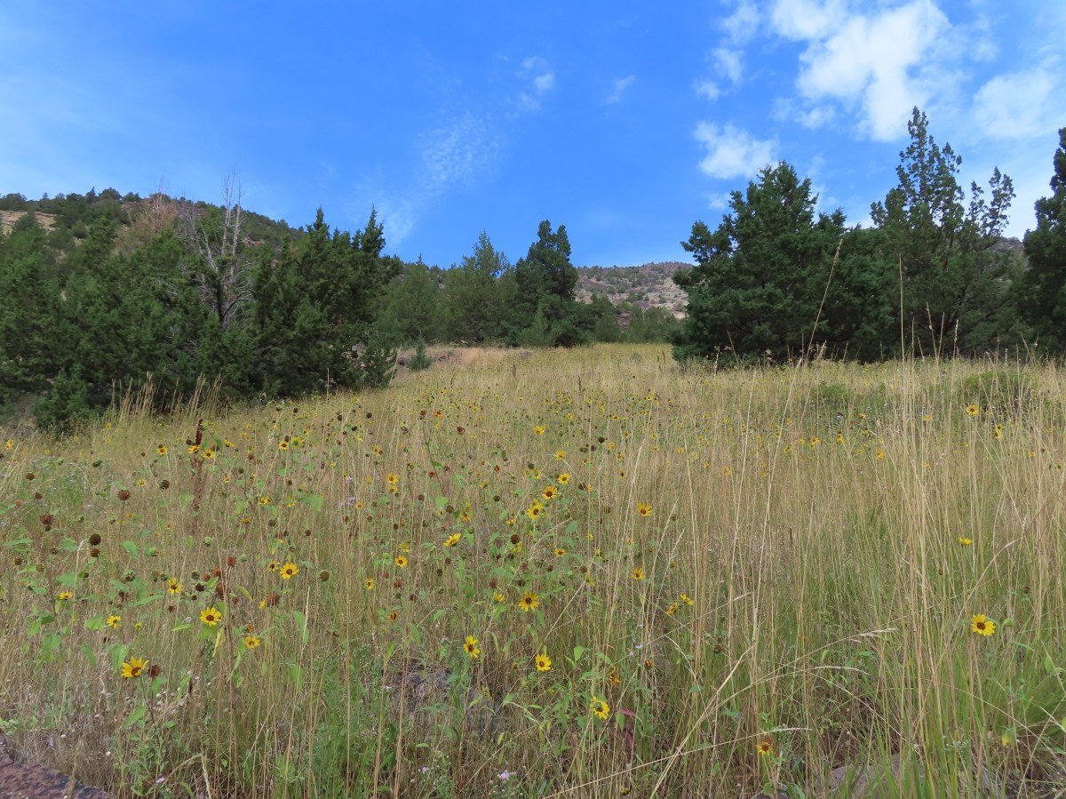
 Nearing the sunflower hillside and trail junction.
 Dragonfly
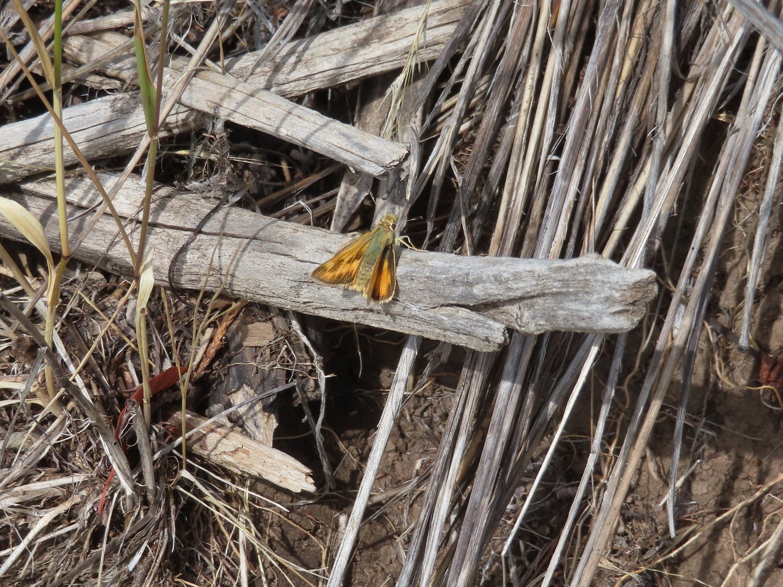 Skipper
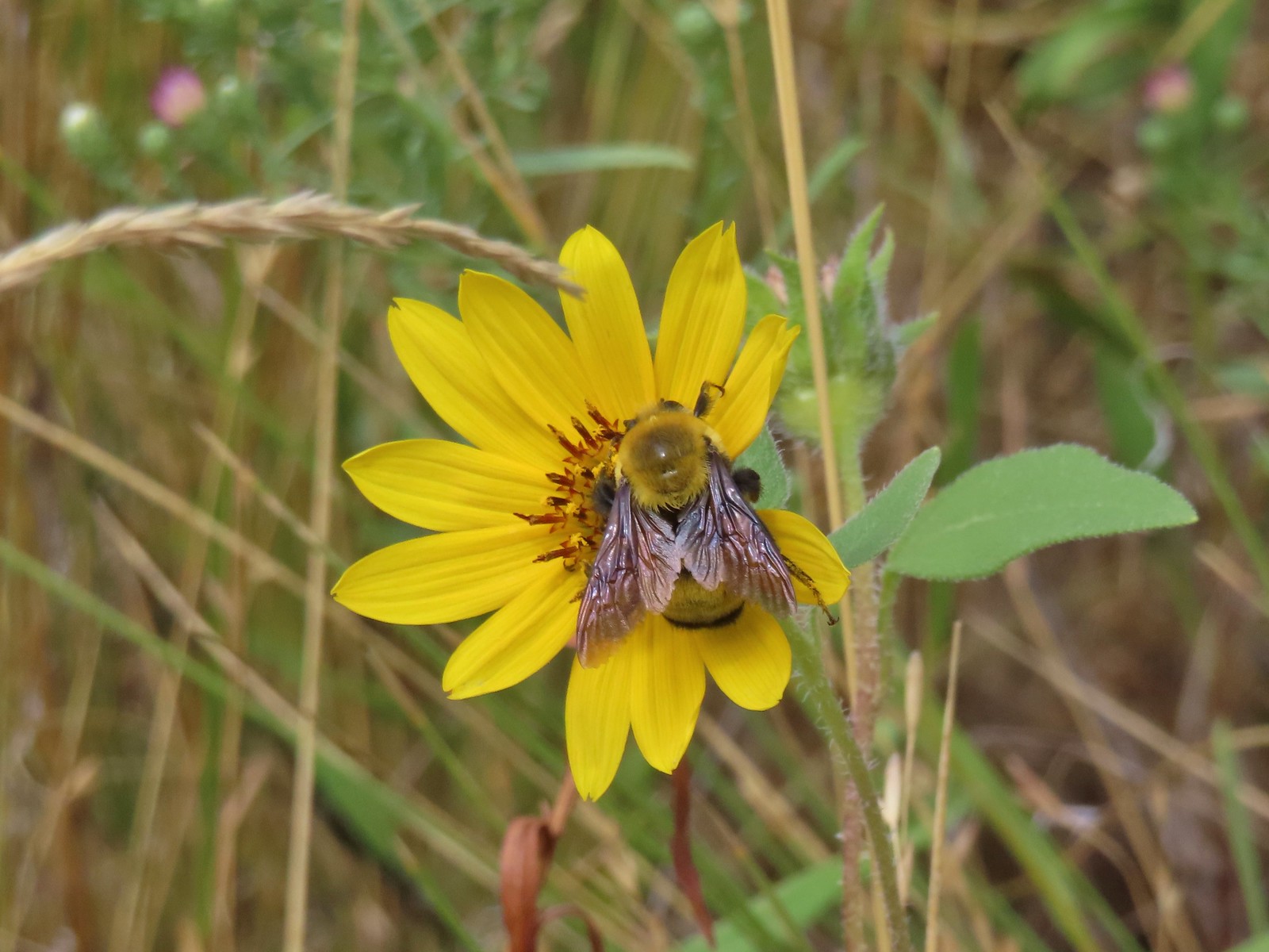 Big bumblebee


 Sign for the River Trail.
 The long barn where we’d be heading next.
 We turned around here where the tread became rougher.
 Interpretive signs were scattered along the trails at the P Ranch.
 Lorquin’s admiral and a grasshopper.
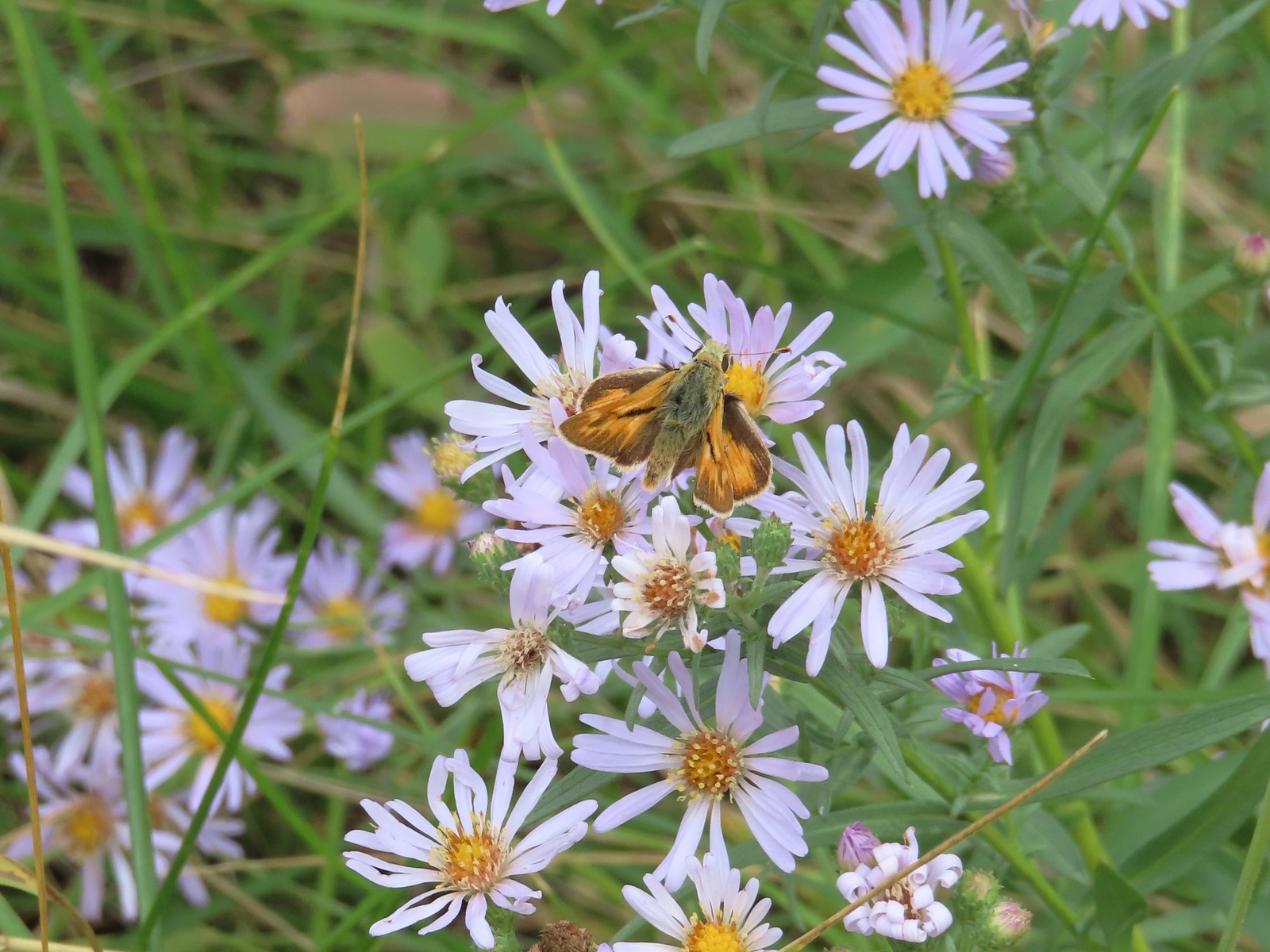 Skipper on aster.

 History of the P Ranch which at one time covered 140,000 acres.
 The owl inside the barn.
 Other structures from the ranch.
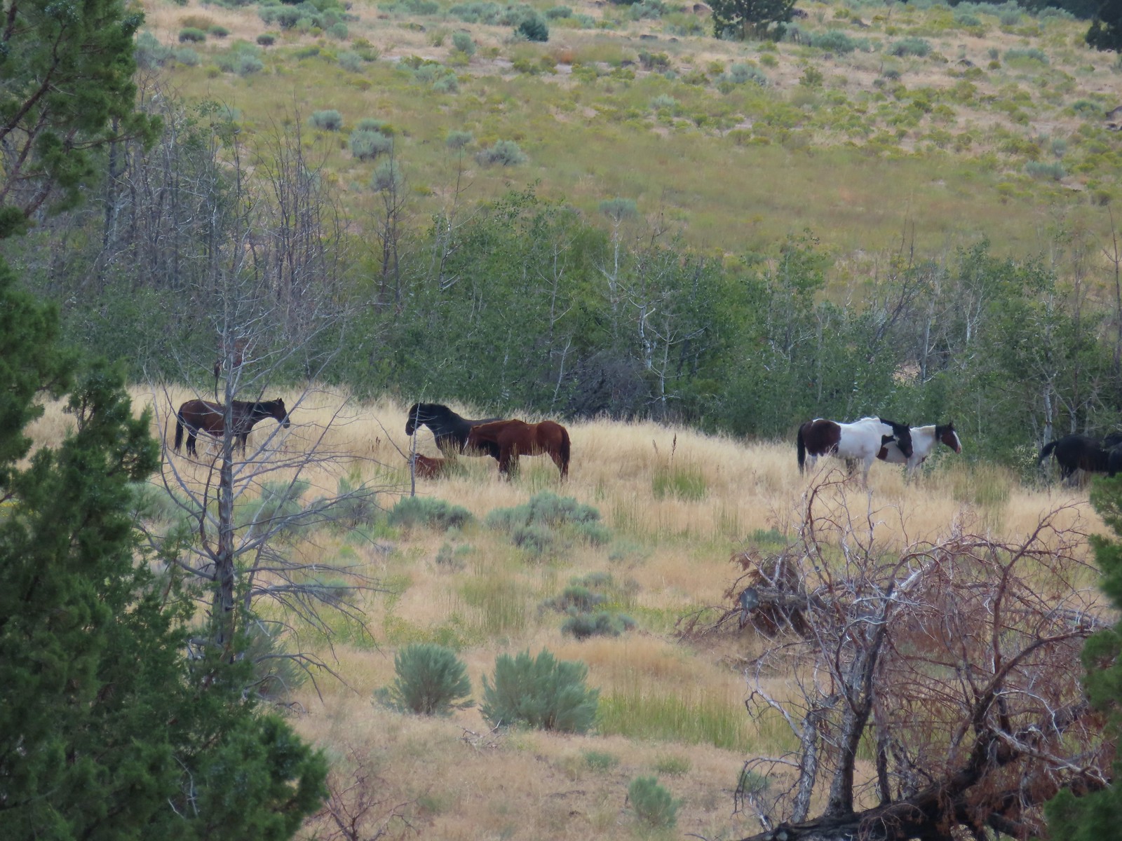
 The gravel road is in good shape but you don’t want to drive any faster than about 10mph so you don’t miss any wildlife.
 Fawns
Fawns Common nighthawk
 So many red-winged blackbirds.
 Hawk (northern harrier?) in a field.
 More fawns and birds.
 Finch?

 It disappeared in the grass moments later.
 Another hawk
 Sandhill cranes in the field.
 Sandhill cranes


 Crossing the dam.
 Kiger Gorge (
 Kiger Gorge
 Blurry due to distance but there were several deer at the far end of the reservoir.
 Another long shot, a western grebe.
 Not certain what this bird was but it dove into the water a couple of times.
 The deer, some ducks, the western grebe and a cormorant were all that direction.
 It also appeared that some rain was on the way.
 Recrossing the dam.
 Pheasant family
 There were at least 5 deer out there.
 Two
Two Three more
 White faced ibis
 California quail
 Pheasant
 A few of at least 10 turkey vultures in the trees above the Refuge Headquarters.
 Malheur Lake from the end of the auto tour.


 Open sign at the trailhead.
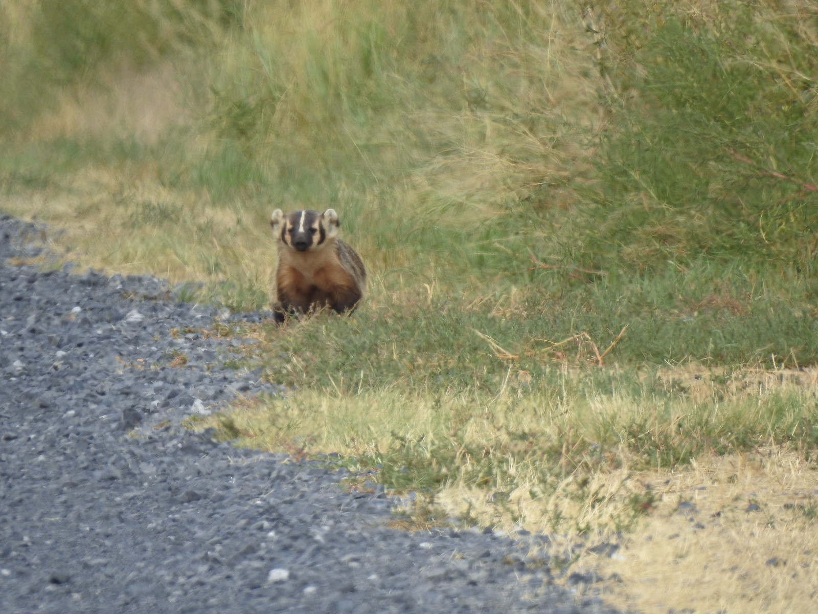
 Rabbit in the sagebrush.
 Some of the exposed rocks showed the work of the ancient river.
 Shaped by water.
 Colorful rock bands along the canyon wall.


 There is a huge nest up on the cliffs.
 The nest
 Wren
Wren American kestral
 Tall sagebrush in the canyon.
 The canyon reaches a depth of approximately 300′.


 Skipper
 I believe this is a ringlet of some sort.

 Heading toward the Evens Well Trailhead.
 Looking toward the Dry River Canyon from the plateau. It was impossible to tell that there was such a deep canyon out there.
 Pine Mountain (
 The rock steps were more obvious on the way down them.
 A sparrow behind the sticks the camera was intent on focusing on.
 Bee on buckwheat
 Arriving back at the official trailhead. Several SUVs were now parked here.
 They’re hard to make out but the Middle and North Sisters were visible from the road walk back to the gravel area.
 The trailhead at the campground.
 Neat map at the trailhead.
 Gold flagging on the sagebrush ahead marked the junction.
 The trail followed a fence line before turning right along Highway 395.
 Tiny frog
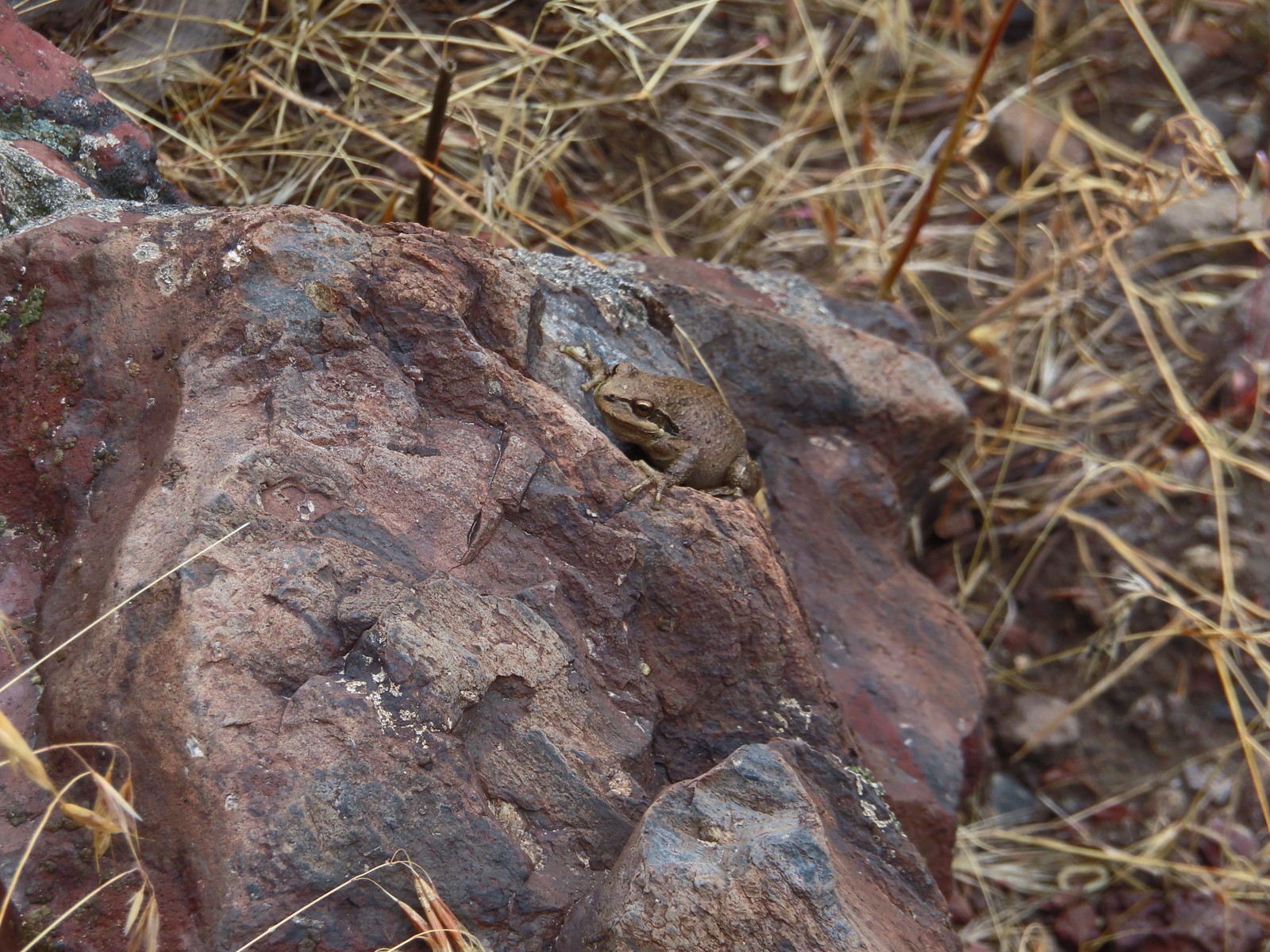
 The trail crossed this gated road near the highway. A blue diamond marked the trails continuation.
 One of several interpretive signs along the loop.
 Squirrel
 The highway was just out of sight to the left.
 Big ponderosa
 We crossed the campground road and quickly realized our mistake and backtracked.
 This time we spotted the correct trail and forked right here.
 There were lots of dragonflies in the area.


 Golden-mantled ground squirrel already sporting some of its winter weight.
 We turned right here onto the Devine Summit Trail.
 Deer in the forest.
 There was a bit of blowdown to navigate along the trail.
 Some maintenance had been done in the past. There were also a good number of benches along the trail, all of which were accompanied by a post with a number.
 Another bench near this fence.
 Ponderosa forest
 White breasted nuthatch
 Another post and bench.
 Arriving at the Idlewild Loop on the far side of the fence.

 Most of the buildings are gone but this relocated Officers Quarters is being restored.
 It was hard to tell at times if it was cloudy or smokey which would be a theme for most of the day.
 Flagpole behind an interpretive sign.
 Most of the trail is ADA accessible but not the entire loop.
 The forest was quite a contrast from the open hillside.


 Lots of fading flowers: yarrow, goldenrod and aster mostly.
 Some of the caterpillar tents on the hillside.


 The nature trail crossed the service road after half a mile.
 The continuation of the nature trail on the right.
 We were pleasantly surprised at how forested this entire trail was.
 There were lots of frogs hopping off the trail. Can you see this one?
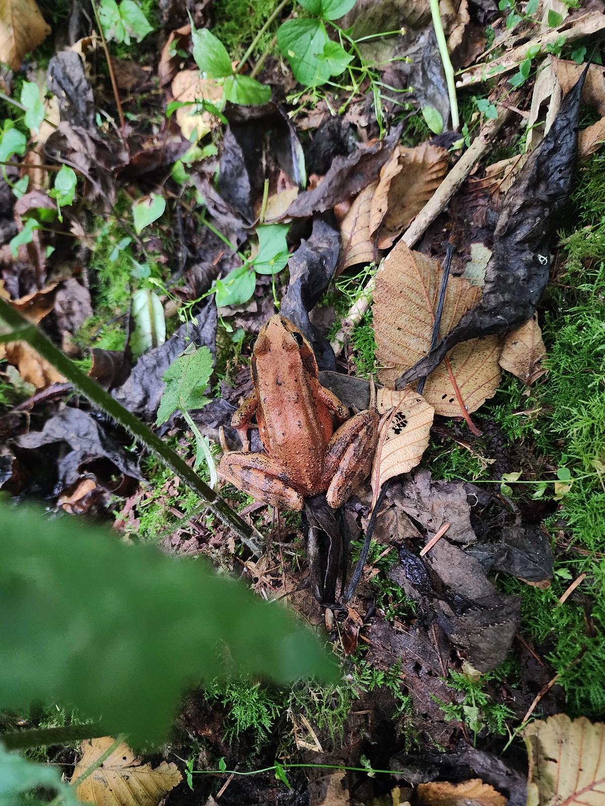 Norther red-legged frog?
 A little less than half a mile after crossing the road we passed a junction with a trail leading to the picnic area. We would visit the picnic area on our way back and pick up the service road there.

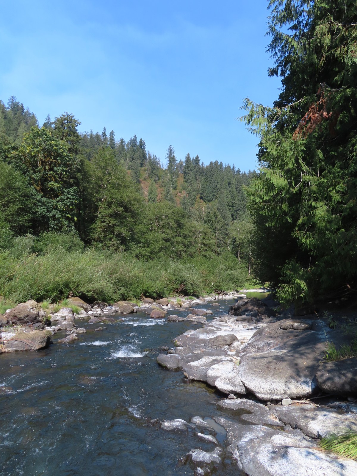
 The Little Nestucca is to the right with the Nestucca River straight ahead.
 Cormorants

 We disturbed a doe near the picnic area.
 The doe leaving the picnic area.
 A path here leads down to the bay to provide fishing access (we didn’t follow it).
 Ground squirrel
 Thistle
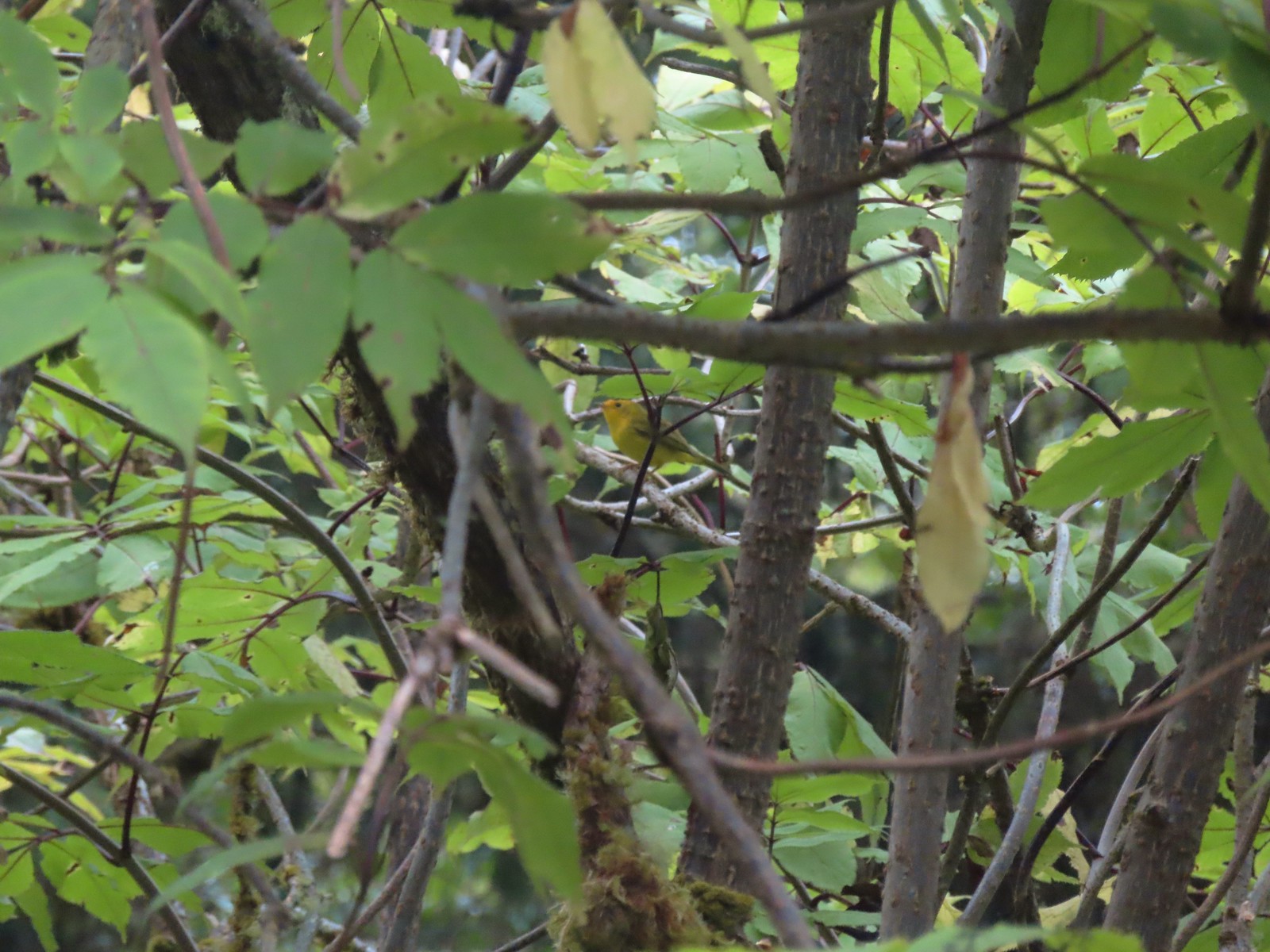 Wilson’s warbler
 The overlook on the far hillside.
 The trailhead from the service road.

 Haystack Rock and Cape Kiwanda (
 Haystack Rock
 Pearly everlasting, spirea, and aster.
 View from the overlook.
 Bench at the overlook.
 Little Nestucca River from the overlook.
 White-crowned sparrow
 Ladybug


 Trask River from the trailhead.
 Garter snake near the trailhead.
 We followed the pointer here and went right.
 Here we again followed the pointer and went left. We failed to notice the pointer on the lower sign not facing us. It was also hard to tell if the rocks were actually part of a trail or just a scramble route. Turns out they are “stone steps”.
 The inland clouds were breaking up giving us some nice blue sky.
 Ouzel
Ouzel

 Big tree along the trail.
 Arriving at the picnic area.


 The trail to the left.
 Huge nursery log.
 It’s hard to see here but this section was very steep.
 Steps along the ridge.
 The stone steps looked more like steps from this direction.
 Arriving back at the trailhead.


 Skunk cabbage
 Bindweed
 While there were quite a few people visiting the preserve there were still moments when we had the boardwalk to ourselves.


 Tree root along the cedar from another tree that is growing from it.
 Another big cedar, but not anywhere near as big as the other.
 We passed a “hiker trail” pointer which is a reportedly rough, muddy track that links up to the boardwalk near the big cedar. We had seen the other end near the smaller big cedar but there was a “trail closed” sign at that end so we hadn’t even considered taking it.
 Interpretive sign at the viewing platform. There were some benches here which were mostly occupied and not much of a view.
 Salal
Salal


 It was a little before 6am when I started up to the lakes.
 There was an interesting amount of sagebrush along the lower portion of this hike.
 There was still some smoke in the air, but it was quite a bit less than it had been the day before.
 The trail initially seemed like it is heading up this valley before it crosses over a ridge and heads for the Echo Lake basin.
 From this trail the route of the Tombstone Lake Trail was visible.
 Waterfall along Olive Lake’s outlet creek. One of the switchbacks along the Tombstone Lake Trail is just to the right.
 Tasselflower brickellbush
 There was a lot of paintbrush along the trail.
 Paintbrush and I believe fading false sunflowers.
 Penstemon and paintbrush
 Western snakeroot
 Pika!
Pika!
 View across the valley.
 The trail approaching the outlet of Echo Lake.
 Above Echo Lake Falls which wasn’t visible from this trail.
 Groundsel, lupine, and fireweed along the creek.
 Sunrise in the basin.


 The pond.
 Gray sagewort
 Looking back toward the valley and pond.


 The spur trail.
 Spotted sandpiper


 Spirea
 A no fires beyond this point sign. Several of the lakes in the Eagle Cap Wilderness are in no campfire zones.
 Fleabane or aster lining the trail.
 Two types of lousewort.
 Echo Lake hidden by the trees.
 Pearly everlasting along the trail.
 Looking down at that trail from above the blowdown.
 Bluebells
 Echo Lake from the ridge end.
 The Elkhorn Mountains (
 Arriving at Traverse Lake.

 Golden-mantled ground squirrel
 Yellow Wallowa Indian paintbrush
 Columbian ground squirrel
 Cusick’s speedwell
 Remember that no fires sign? (Sigh)


 Monkeyflower
 Globe penstemon
 Gentians along the lake.
 A lone paintbrush.
 The blowdown at the far end of the boulder field.
 White mariposa lily
 Arnica
 Swamp onions
 Echo Lake
 The pond below on the left.
 Passing through the meadow.
 Paintbrush and fireweed
 Above Echo Lake Falls.
 West Eagle Meadows in the valley in the distance.
 Zoom in on West Eagle Meadows.
 Looking down at the switchbacks.
 Heather had also warned me about this blowdown over one of the switchbacks. There was a steep reroute that bypassed the trees.
 There were some interesting cloud formations on the way back.
 There was also an increase in the smoke.
 Can you spot the pika?
 Pika (possible the same one from earlier given the location).
 Paintbrush and buckwheat
 Yellow columbine

 Another pika at the end of this switchback.
 The Tombstone Lake Trail junction ahead.

 Swallowtail photo bomb.
 West Eagle Creek Crossing.
 Sphinx moth
 Leaving the Eagle Cap Wilderness.
 Squirrel
 West Eagle Meadows
 It’s hard to see here but there is a trail post at this fork with a point to the left. This is for the horse camp and not the way back to the
  The trailhead in sight.
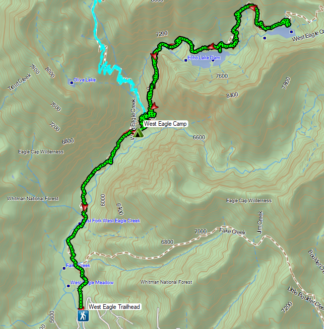
 Flax
Flax Jacob’s ladder
 The path from camp meeting the West Eagle Trail.
 It was a little before 6:30am when I started.
 Switchbacks would be a theme for these last two days.
 The trail junction on the ridge ahead.


 The West Eagle Creek crossing.
 There was a large waterfall on West Eagle Creek flowing from Echo Lake’s basin on the right.
 Echo Lake Falls
 There was a waterfall ahead at the end of the switchback here, but it was mostly obscured by vegitation.
 It was fairly smokey looking ESE in the morning.
 Wildflowers along the trail.
 Several switchbacks were along this tributary of West Eagle Creek. This particular spot would provide me with much needed water on my descent.
 It looked like there might be a bit of a waterfall along this stream as well.
 Looking up the stream at another cascade.
 The upper portion entered an old fire scar and sunlight which heated things up quickly.
 Northern flicker
 Every time I thought I was at the basin the trail would switchback to find more hillside.
 Mountain bluebird
 Surely that is the crest.
 It was not, up I go.
 Smoke to the South.
 Echo Lake across the valley.
 Finally done with the switchbacks I could see the next climb in the distance ahead, but for now I had a bit of a reprieve.
 Lousewort
 Columbian ground squirrel
 Gentians, one of my favorite wildflowers.
 The larger meadow ahead.
 Their camp was uphill to the left. The stream here was lined with wildflowers.
 Lewis monkeyflower, aster (or fleabane), and fringed grass of parnassus.
 The trail all but disappeared on the far side of the stream, but small cairns helped mark the way.
 Cairns along the trail through the meadow.
 Yellow Wallowa Indian paintbrush
 Heading up again.

 Larkspur
 White mariposa lily
 Looking back down into the basin.
 False hellebore
 Coiled lousewort
 View of the basin headwall.
 View back down the valley.
 Phlox
Phlox Chipmunk
 Golden-mantled ground squirrel
 Arriving at the pass.
 Smokey view from the pass.
 Tombstone Butte, Swabb Mountain, with Granite Butte behind in between, and China Cap to the right.
 The pass at nearly 8200′.
 Tombstone Lake below.
 Sturgill Peak

 Tombstone Lake is a series of connected bodies of water.
 A phacelia.
 Rosy paintbrush
 Finally at the lake.

 Gentian along the lakeshore.
 Swamp onion along the shore of one of the smaller bodies of water.
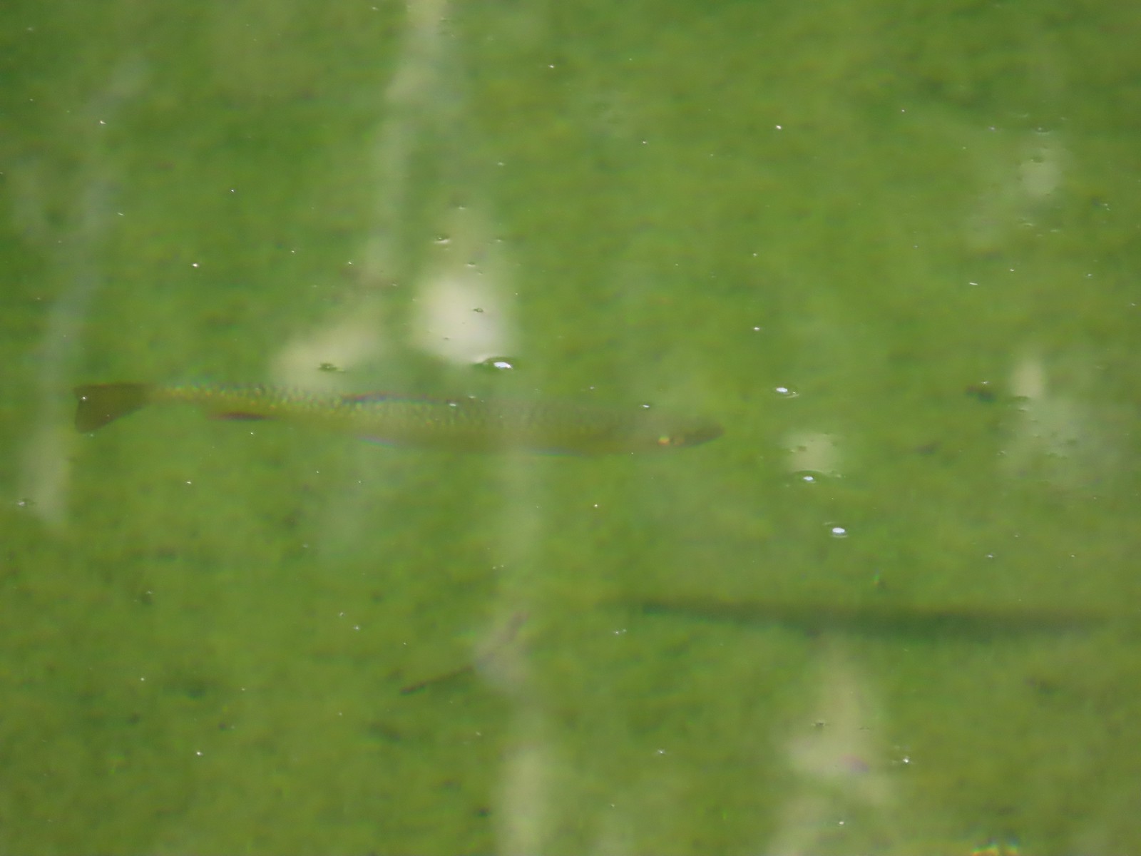 Trout
Trout

 Pika!
Pika! The Tombstone Lake Trail from the gap.
 Eagle Cap in the middle and Needle Point in the distance to the right.
 Eagle Cap (
 The East Fork Elk Creek valley below.

 Starting the switchbacks down.


 Hawk
Hawk Sphinx moth visiting some Lewis monkeyflower
 Some nice paintbrush
 Clumps of gentians
 Gentians
 Swamp onion
 Leaving the basins to start the giant set of switchbacks down.


 This little cascade was perfect for filling the bladder.

 Echo Lake Falls straight ahead.
 Recrossing West Eagle Creek.
 One last look up at where I’d come from.

 Small unnamed waterfall on an unnamed creek.
 Sphinx moth at camp.
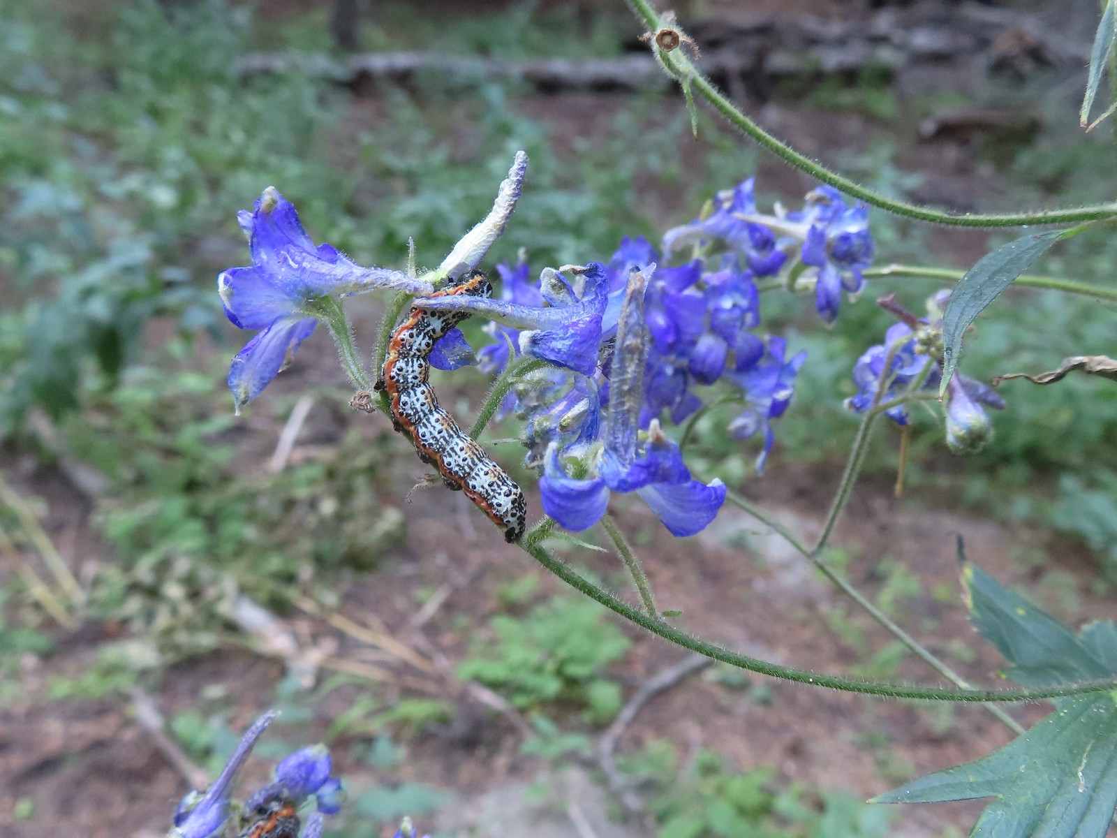 Not sure what type of caterpillar this is but it was pretty. It was on the same larkspur the sphinx moth was visiting.
 While we don’t intentionally feed the wildlife this green comma seemed to like the sweaty socks.

 Doe on the other side of Eagle Creek.
 I started out on the small logs shown here.
 Here comes the Sun.
 Shade for us for now though.
 The junction up ahead.
 We arrived at the junction roughly three quarters of a mile and 650′ up from camp.
 Not many mushrooms of fungi along the trails but we spotted a few along this trail.
 Globe penstemon

 Cairn marking the trail to Culver Lake.

 Snow patch along Culver Lake.

 Needle Point from the trail.
 Nuttall’s linanthus
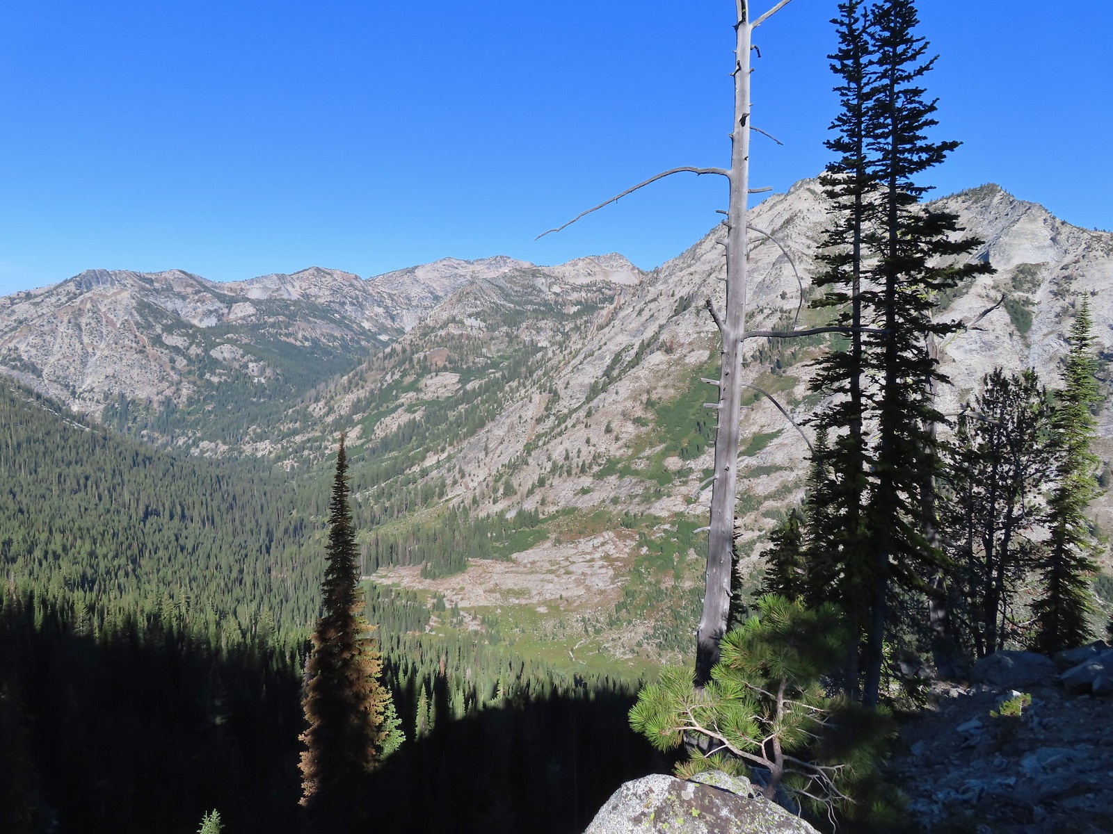 Arrow Lake is somewhere up in the mountains on the other side of the valley.
 View down the Eagle Creek Valley.
 Rock Creek Butte in the Elkhorns (
 Heading down.
 Bear Lake
 Mountain heather.
 Cusick’s speedwell
 Aster and swamp onion
 Arnica and possibly alpine leafybract aster.
 A bunch of globe penstemon.
 Meadow at the eastern end of Bear Lake.
 Needle Point from Bear Lake.
 Looking toward Eagle Lake in the basin behind and right of Needle Point.
 Eagle Creek is down there somewhere.
 Eagle Creek Meadow. The Main Eagle Trail can be seen crossing the granite slope at the far end of the meadow.
 Allum root
 White mariposa lily
 The Sun had reached the valley by the time we were nearing Eagle Creek.
 The Eagle Creek crossing going the other direction. I’m happy (and amazed) to report that I managed a fourth dry crossing.
 Lupin along Eagle Creek where we topped off our water.
 Hummingbird Mountain
 Mountain coyote mint
 Falls on the far side of the valley. Probably the outlet creek of Lookingglass Lake.
 Nearing the Bench Trail junction.
 Copper Creek Falls from the trail.
 Small cascade along the trail.
 Wallflower, this was the only one we spotted all trip.
 Damaged footbridge over Eagle Creek.
 Buck crossing the trail.
 Swallowtail on nettle-leaf giant hyssop.
 Bridge over Eagle Creek.

 Back at the Main Eagle Trailhead.
 West Eagle Trail
 One of the campsites.
 Mule Peak behind to the right and Wolf Point furthest back center.
 Nettle-leaf giant hyssop
 Painted lady on the hyssop.
 Frittilary butterfly
 Approaching the trees.
 The decommissioned Fake Creek Trail to the right at the 0.6-mile mark.
 Fake Creek crossing.
 Squirrel
 Unnamed creek crossing.
 Lewis monkeyflower
 Entering the
  West Eagle Creek Crossing. I almost made it across this one dry footed too but one of the rocks on the far side was unstable causing me to drag my right toe in the creek.
 Trail maintenance.
 Coneflower
 Reentering the trees after passing through a meadow.
 West Eagle Creek
 Another small meadow.
 West Eagle Creek near the second crossing.


 The trail briefly followed an old roadbed.
 Log bridge over Boulder Creek.


 Sierra larkspur
 Paintbrush lined trail
 We were in the shade for most of the morning.
 Entering the Eagle Cap Wilderness.
 We had to leave the trail to get a view of the falls which we could hear from the trail.

 Buckwheat and nettle-leaf giant hyssop
 At the 2.7-mile mark the trail again crossed Eagle Creek, this time on a damaged footbridge.
 Part of the falls were visible from the trail.
 Copper Creek Falls
 Penstemon
 Fringed grass of parnassus and some fading arnica.
 Flowers below the falls.
 The Bench Trail is ahead on the left of the Main Eagle Trail.
 View up the valley.
 Looking back at the hillside the Bench Trail climbs to Heart and Arrow Lakes.
 Looking across the valley.
 There was quite a bit of western snakeroot along the trail.
 Scarlet gilia
 Hummingbird Mountain
 Granite hillside and peaks above the trail.
 Trail signs at the Lookingglass Lake/Main Eagle Trail junction.
 Needle Point on the left from Eagle Creek Meadow.
 Hummingbird Mountain from the campsite.
 Eagle Creek near camp.
 Lewis monkeyflower

 Columbian ground squirrel
 Pearly everlasting and Scouler’s St. John’s wort.
 White mariposa lilies
 White mariposa lilies
 Orange agoseris
 Beetle on a white mariposa lily
 Hillside along the trail.
 Butterfly (Boisduval’s blue?) on pearly everlasting.
 Monkshood
 Heading toward Needle Point.
 One of the switchbacks.
 This junction was just under 2-miles from the Lookingglass Lake Trail junction.
 Wildflowers along the trail.
 Looking back down the valley.
 Hawk
Hawk Fireweed along the trail.
 Shrubby cinquefoil and paintbrush
 Wildfire smoke creating a slight haze of the valley.
 Granite near Eagle Lake.
 Eagle Lake
 Eagle Creek flowing below the dam at Eagle Lake.


 Paintbrush
 While sitting in the shade we spotted a herd of elk on the hillside across the valley.
 Blurry photos due to the distance but it was fun to watch them.

 Golden-mantled ground squirrel
 Shade!
 American saw-wort
 Fawns
Fawns Our campsite in the trees from the Main Eagle Trail.


 Hoary aster
 The interpretive center on Flagstaff Hill.


 Map near the wagon.


