
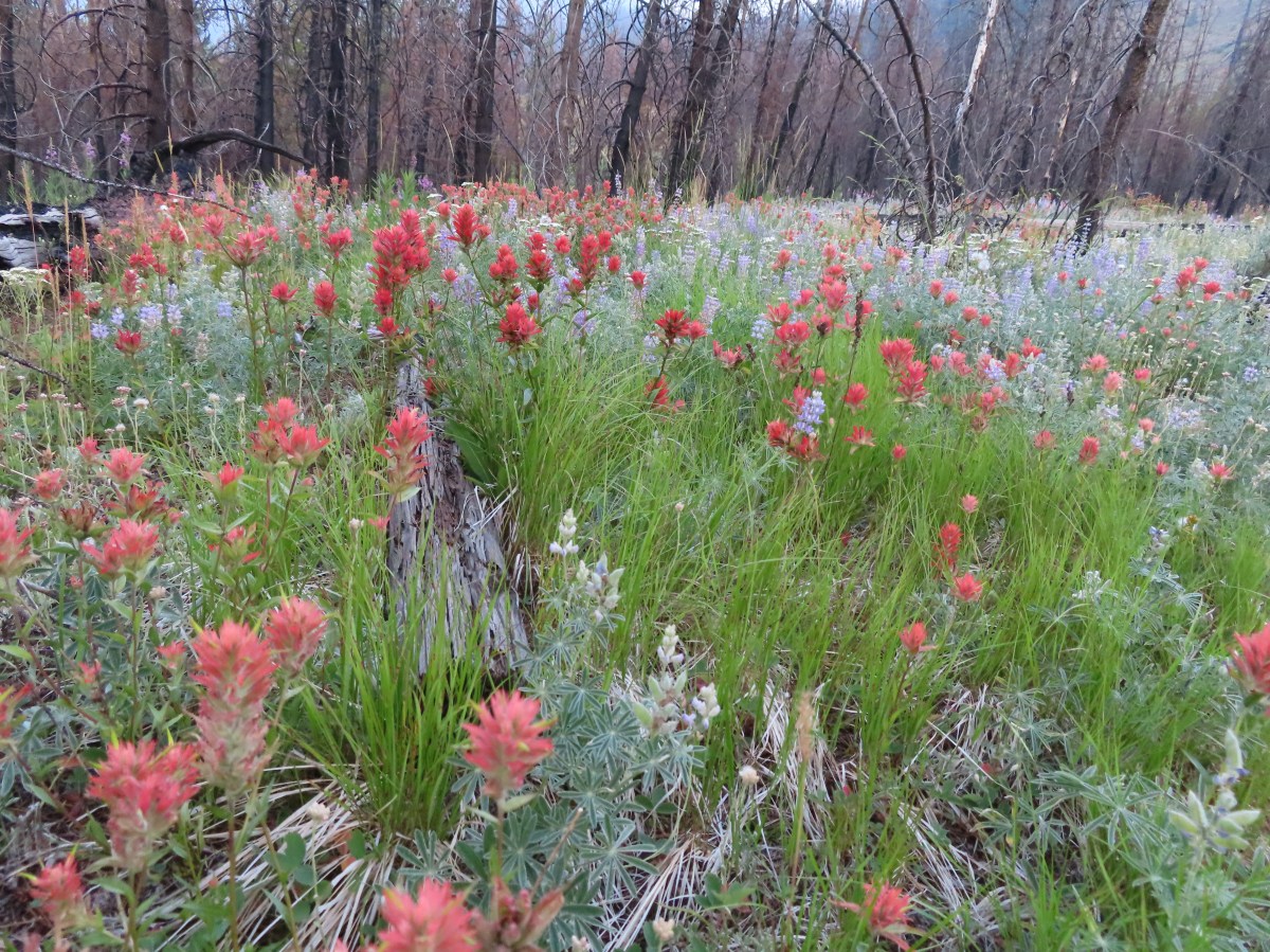
** Note the 2025 Burdoin Fire burned over much of the route described here. **
A combination of inclement weather and illnesses had kept us off the trails for a few weeks, so we were excited to get a chance to head out and check out some wildflowers. We decided to revisit a pair of hikes that we’d done back in 2016 as part of our 500 featured hikes quest. On our 2016 outing we made separate stops at Catherine Creek and Coyote Wall but this time our plan was to hike a loop between the two areas.
We based our route on a loop described in the Oregonhikers.org field guide which begins at the Catherine Creek Trailhead.


The Forest Service along with the Washington Trails Association have been working on restoring these areas including by improving, rerouting and decommissioning various user created trails. It is a work in process so knowing the current conditions and respecting any closed trails/areas is important before visiting.

For our loop today we began by following Atwood Road (right of the signboard).
 Atwood Road
The first 3.5 miles of our loop followed this old roadbed. The initial 1.5 miles climbed steadily before the road turned west to traverse the hillside toward Coyote Wall. There were a variety of wildflowers blooming along the lower portion of the road.
 Death camas
 Saxifrage and a yellow bells.
 Grass widows

 Gold stars, wood-land stars, and blue-eyed Mary.
 Catherine Creek from Atwood Road.
 Pungent desert parsley


Catherine Creek Arch from Atwood Road.
 Closer look at the arch.
 Buttercup
One of the highlights of the day was spotting a number of Dutchman’s breeches on a hillside below some cliffs.
 I believe this was just our second time coming across these flowers.
 Closer look at the Dutchman’s breeches.

The Columbia River from Atwood Road.
 Hairy bittercress (non-native)
 Entering the sunlight.
 Glacier lilies
 wood-land stars
 Toothwort

Nearing the forest.
 Columbia desert parsley
Shortly before Atwood Road turned we passed a roadbed on the right that led to an old stove.


 Heading through the forest.
The road exited the forest not long after turning west and passed through an open hillside with views of Mt. Hood.
 Looking east as the road emerged from the forest.
 Grassy hillside

This signed trail heading down Sunflower hill is the Bitterwood Trail aka Ca2. This is not yet an official trail, and the Forest Service plans to reroute and build out an official trail in 2025. (Assuming they have employees and funding.)
 Mt. Hood behind a few clouds.
 Mt. Hood
 Popcorn flower
The trail descending into another stand of trees to cross Rowland Creek and continued to alternate between open hillsides and stands of trees before arriving at a signed junction.

 Rowland Creek
 Another user trail on the left, referred to as the Shoestring Trail by the Oregonhikers Field Guide. This trail is not shown on the Forest Service map nor is it mentioned on their website.

 Coastal manroot

 Grass widows

 View of Mt. Hood’s summit.
 Robin hunting worms.
 Daffodils
 The Upper Labyrinth Trail (aka Co8) joining from below. This was the first junction with signs naming official trails.
We had come up the Upper Labyrinth Trail in 2016 making the next three quarters of a mile a repeat.

 Labyrinth Creek below Atwood Road.
 The Labyrinth Creek crossing.
 Wet trail climbing away from Labyrinth Creek.
 Red-tailed hawk
A half mile from the Upper Labyrinth Trail junction, and 3.5-miles along Atwood Road, we arrived at another signed junction at a boundary with some private land.


Here Atwood Road enters the private property, so we followed the pointer for the Old Ranch Trail #4426. We followed this trail downhill 0.3-miles to a signed junction with trail #4427 – Traverse to Coyote Wall where we turned right.

 Yellow bells

This was once again new trail for us and we followed it uphill just over three quarters of a mile to a confusing signed junction near the rim of Coyote Wall.

 We stayed left here.
 We ignored the singletrack leading right on the far side of this unnamed stream.
 Here we veered right on the single track. I believe the single track is the “official trail” although both paths led to the signed junction.
 A multitude of tracks near the junction.
It appears that the ultimate plan is to have one official route for the Coyote Wall Trail #4428 (aka Co1) and to decommission all others. At this point there was only one small sign identifying a closed trail and it was a path along the rim of Coyote Wall that was covered in a type of netting. We turned uphill at the junction to visit the meadow at the junction but were unsure which path to take. The field guide map has not been updated to identify the new official route and showed a narrow-elongated loop. There was no consistency watching other trail users, so we picked a hiker and followed his route up.

We eventually came to the conclusion that the new official trail was the one that used a series of switchbacks to reach the upper viewpoint.
 On one of the switchbacks.
 Turkey vulture
 The upper viewpoint.
After a short break at the viewpoint we headed back down to the signed junction where we continued down the Coyote Wall Trail.

 Balsamroot
 Looking east over the Columbia River.
 Gold stars
A mile beyond the junction the Old Ranch Road Trail joined from the left at a three way junction.

Here we stayed right on the Little Moab Trail (Co3) and continued downhill along Coyote Wall.

Coyote Wall
 The
The  Woolly-pod milk-vetch

 Miniture lupine, redstem storksbill and a popcorn flower.
 Fiddleneck

Poet’s shooting star
 We turned right at this junction with the Old Ranch Trail to continue downhill.

 Naked broomrape and redstem storksbill


We took another right at this junction with the Little Maui Trail to drop down even further to an old highway.
 Tomcat clover and redstem storksbill

The old highway below.
We turned left (east) on the highway and followed it for 0.3-miles to the Labyrinth Trail #4423 (Co7) where we turned left.


The Labyrinth Trail wound through rocky outcrops for 1.2-miles to an unsigned junction with the Upper Labyrinth Trail on an open hillside.
 We ignored the Little Maui Connector Trail on the left near the old highway.

 Larkspur

The trail to the right here is a spur to Labyrinth Falls.

Labyrinth Falls

 Crossing for Labyrinth Creek.

Labyrinth Trail


 First view of the Catherine Creek Trailhead on the plateau ahead.

At the junction we stayed right on the Labyrinth Trail. We were happy to not be climbing for a bit as the Labyrinth Trail traversed the hillside before dropping to an ancient rockslide where Native Americans built vision quest pits.

 Hound’s tongue
 Rowland Creek
 Rowland Basin


 Lupine and balsamroot
We’d done a pretty good job staying on course given the numerous trail junctions, a good number of which were unsigned, but that ended when we reached another unsigned junction with a rough trail on the left marked by a small rock cairn.


We should have turned left here but got confused reading the field guide entry and wound up staying straight. Apparently straight is the Raptor Trail (Ca1). We didn’t realize our mistake until we spotted the highway below.
At that point I turned around to go back to the junction. Heather was just behind me on her way down and when I informed her of the mistake she decided not to climb back up to the junction but to simply walk the highway a little over a third of a mile to the trailhead. (Apparently the Raptor Trail is closed seasonally from Feb 1 – July 15th, but we didn’t see any signs to that effect.)
I returned to the cairn and turned right up the rough path which led to basalt cliffs and up a scree slope to another unsigned junction after just 0.2-miles.

 The Rowland Pinnacle

I turned right at the junction and followed this trail just over half a mile back to the trailhead where Heather was waiting. (Eventually the Bitterroot Trail (Ca2) will replace this user created trail.)


One of several small vernal pools.

The GPS put this hike at 11.9 miles consisting of a little over 2900′ of elevation gain.

There was more climbing than we’d anticipated between Coyote Wall and the Upper Labyrinth Trail junction, but we should have expected it since we’d hike that section before. There was an extra 0.6-miles in that total from the Raptor Trail mistake (which also added 280′ of the elevation gain). It was a great hike though with a lot of variety both in flowers and scenery. Hopefully the Forest Service will be able to finish their projects at these areas and add signage to the official trail junctions to help keep people on the correct trails. These are busy areas (as can be seen from the trailhead photos) in later Winter/early Spring when the wildflowers are blooming. Starting early and doing the longer loop as we did helped to keep our hike from feeling overly busy, but if you can swing a weekday, it would be ideal. Happy Trails!
Flickr: Catherine Creek-Coyote Wall Loop

 The small blue sign on the left provides the pay by phone information. This was one of two such signs in the parking area.

 Little Joe Creek
 The pointer to the right was for the Sandy and Salmon Rivers (.25 miles) while continuing another .18 miles would bring us to the Sandy Ridge Trail System.


 Start of the Falls Looop.
 Primitive Trail number 2 with the Falls Loop continuing to the left.

 This was a nice little cascade this time of year. Later in the Summer the flow reportedly drops down to a trickle.
 The self-guided nature tour follows the Northern Loop Trail here as well.
 Passing stop #6 on the self-guided tour (Forested Headwaters).
 One of the creeks flowing from the forested headwaters.


 There are a few Eagle Creeks in Oregon, this is the Eagle Creek that originates in the Salmon-Huckleberry Wilderness (


 Snow queen
 One of several switchbacks.
 Rough-skinned newt and snow queen.
 Closer look at the newt.
 Blue sky
 Traversing the hillside.
 The trail below as we neared a switchback to begin descending.


 Viewpoint near the end of the loop.
 The start of Loop D from Kitzmiller Road.
 The remains of former signs can be seen at the split ahead.
 The trail made a steady climb to the junction with the supposed Lollipop Loop.
 The lower portion of the tree across the switchback.
 Left is the continuation of Loop D. We stayed right to attempt the Lollipop Loop.
 There were some cut trees along the trail mixed with more recent blowdown but nothing was particularly difficult to navigate.
 Wren
Wren There was a lot of snow queen.
 The footbridge with a large tree across it.
 Look back along the bridge.
 The older blowdown had all be cut.
 I made it through this muddy mess but couldn’t find any sign of tread on the opposite side.


 Swagger Creek
 Song sparrow (according to Merlin)

 The second unsigned junction.


 Swagger Creek (right) joining Clear Creek at the suspension bridge.
 The Nature Trail wasn’t signed other than some “No Motor Vehicles” signs.
 The old roadbed.
 Relative locations of the three stops plus Milo McIver from our previous outing.


 McIver Memorial Viewpoint
 Clackamas River from the viewpoint.
 The small trail sign on the left is labeled “Viewpoint Trail”.
 Map on the signboard. Oddly the Viewpoint Trail is not shown on this map even though the trail continues past the signboard.
 The Vortex Meadow through the trees.


 Former model airplane landing strip in the meadow.

 There were some limited views of the Clackamas River from this trail.
 While we were happy to see trail signs again it was a little confusing to see the Riverbend Trail pointer here. Here again the maps that we had did not show this junction. They did show a 4-way junction between the Riverbend Trail and Vortex Loop but only after crossing a road which we had not done.


 Viewpoint near the group camp.

 Had we not backtracked through the group camp we would have connected with the Riverbend Trail after crossing a road then turned right on the Riverbend Trail, recrossed the road, and arrived at this junction on that trail which was now on our left.


 Stellar’s jay

 We stumbled on a one-leg standing competition that the local geese were engaged in.
 The mallards seemed unimpressed with the geese’s balancing abilities.
 Common mergansers


 Common merganser drake
 We found this nice little bridge wandering around the disc golf course attempting to connect with the Maple Ridge Trail.


 The Cedar Knoll Trail connects the upper and lower segments of the Maple Ridge Trail. We stayed right on the Maple Ridge Trail.
 Colorful fungi
 Wood ducks on Wood Duck Pond. It’s pretty rare that the animal a feature is named after is actually present.


 Not sure if this is just the biggest rough-skinned newt we’ve ever seen or a different type of salamander.
 Great blue heron by a small pond. It was probably hunting the frogs that were croaking loudly here.
 The sign ahead is for the Cedar Knoll Trail joining from the left.
 Dropping down to the Riverbend Loop Trail junction.
 The Maple Ridge Trail makes another nearly 180 degree turn here and drops down to the parking area a short distance from its other end.
 We stayed right here again at a junction with a trail leading to the Maple Ridge Picnic Shelter.
 I believe these are sweet coltsfoot starts.
 There was a bench next to this nice little creek.
 Nearing the Riverbend Day Use Area entrance road.


 Song sparrow

 It’s hard to make out but there is a coyote in this photo.
 I have no idea what’s going on with this photo of the coyote as it was trotting away from us. Shortly after this it popped out from behind some brush and jumped into the air to pounce on something. That was the last we saw of it.
 Squirrel
 Left to right: Silver Star Mountain, Little Baldy, and Bluff Mountain (
 Mt. Hood making a partial appearance.


 1930 Caterpillar Model 30
 Bridge over Cedar Creek.
 Cedar Creek
 North Scappoose Creek
 Sun hitting the top a hill in the distance.
 There was a lot of
  Forest along the trail.
 One of several interpretive signboards along this segment.
 While the Sun was out the trail remained mostly shaded and therefore cold. We both would have benefited from some slightly warmer layers.
 Hair ice
 More hair ice
 Another interpretive sign ahead.
 MP 13
MP 13 The Nehalem Divide TH on the left and the Crown Z Trail continuing on the right.
 I believe that is Silver Star Mountain (

 North Scappoose Creek winding past a private home.
 The Ruley Trailhead ahead.


 We started with this hike in part due to it being the first day of the final king tides, abnormally high tides, for the season. High tide for Smelt Sands was going to be 9:45am so we were hoping to see some of the wave action.
 It was just before 8am as we hiked the 804 Trail.
 We made a mistake and turned right on the paved path here, but we should have continued beyond the large signboard to a second path marked by a wooden post. You can see the small white and black to the left of the green signboard. We may have been distracted by “Free Coffee” being printed on the bottom of the green sign.
 This post is similar to the one along the 804 Trail where we should have turned right.


 Boardwalk over Mitchell Creek.
 Grandmother Spruce
 The upper end of the preserve trail.

 Mushrooms
 Approaching Starr Creek.
 Starr Creek
 The upper gate at the junction.
 Ya’Xaik Trail
 The right hand fork here is the trail leading down to the fire station that dog owners can use to make a loop. A local had warned us that this trail can be pretty slick. We went left to remain on the Ya’Xaik Trail.
 There was a little climbing involved before the trail headed down to Diversity Drive.


 The Ya’Xaik Trail at Diversity Drive.


 The Woodland Trail continues to the left while the right connects up to a road.


 A footbridge over the Red River below with a disc golf hole on the opposite ridge. We were able to use the OregonHikers Field Guide map to identify this connector trail as one we did not want to take. That map had many of the connector trails identified in red which helped keep our position located as well as keep us on the correct route.


 The old roadbed at the bottom of the switchbacks.
 Woodland Trail on the left and our next stop, the Lint Slough Trail, on the right.


 Memorial plaque
 There was a bypass uphill for this short flooded section.
 There were a number of bufflehead ducks, a pair of geese, and one noisy great blue heron at the slough. All of the wildlife seemed to be positioned as far away from the trail as possible.
 The great blue heron in a tree across the slough.
 This little group of buffleheads was the exception.
 I turned around at this bench due to not seeing an obvious continuation of the trail here. I had also lost Heather who had stayed up to avoid the flooded section and instead of returning to the trail I was on, on the other side of the flooded bench, stayed up on the higher path. That path began leading up uphill away from the actual trail without another way to get back to the correct path. She wound up backtracking and we met shortly after I had started back.
 The slough from my turn around point.
 Yarrow
 Bull thistle (non-native)
 Rose (probably non-native)


 Looking north along the beach.
 The view south.
 The wet sand and debris from the high tide was up to the vegetation along much of the beach.
 We decided to turn back at the creek partly to avoid crossing it, but also because we had been walking into the wind. It wasn’t a particularly cold day, but the wind chill was almost making it uncomfortable.
 Seagull with a crab.
 Cape Perpetua (
 Buckley Creek
 We had to ford Buckley Creek which was only a couple of inches deep at most.
 Semipalmated plovers
 Western gull
 Heading back north.
 The path back up to the parking area at Driftwood Beach.

 Ocean spray – August 4th – Wizard Island (Crater Lake NP), OR
 Olympic onion – June 8th – Cedar Butte, OR
 One-sided wintergreen – July 25th – Minam River Trail, OR
 Tapertip onion – July 21st – Granny View Overlook (Hells Canyon), OR
 Ookow – June 1st – Cook Hill, WA
 Orange agoseris – June 29th – Grasshopper Mountain, OR
 Orange globe mallow- May 25th – Barnes Butte (Prineville), OR
 An orchid – July 22nd – Hurricane Creek Trail (Eagle Cap Wilderness), OR
 Oregon bluebells – June 29th – Grasshopper Mountain Trail, OR
 Oregon grape – March 30th – Mulkey Ridge Trail (Corvallis), OR
 Oregon sunshine – July 13th – Nasty Rock Trail, OR
 Pacific coralroot – July 13th – Joyce Lake Trail, OR
 Pacific hound’s tongue – March 30th – Mulkey Ridge Trail (Corvallis), OR
 Pacific waterleaf – May 12th – Cathedral Tree Trail, OR
 Indian paintbrush – May 25th – Willow Creek Canyon, OR
 Paintbrush – probably scarlet (Castilleja miniata) – August 18th – Cliff Creek Trail (Wallowa-Whitman National Forest), OR
 Parry’s arnica – July 21st – Hat Point, OR
 Patridge foot – September 13th – Pacific Crest Trail (Mt. Jefferson Wilderness), OR
 Gray sagewort – July 21st – Granny View Overlook (Hells Canyon), OR
 Pea-vine – May 26th – Madison Butte, OR
 Pearly everlasting – June 19th – Deception Butte Trail, OR
 Woolly head clover – July 24th – Tenderfoot Wagon Road Trail (Eagle Cap Wilderness), OR
 Pennycress – July 23rd – McCully Creek Trail (Eagle Cap Wilderness), OR
 Penstemon – May 25th – Barnes Butte (Prineville), OR
 Penstemon – June 1st – Cook Hill, WA
 Pestemon – July 13th – Nasty Rock Trail, OR
 Venus penstemon – July 21st – Granny View Overlook (Hells Canyon), OR
 Globe penstemon – July 24th – Tenderfoot Wagon Road Trail (Eagle Cap Wilderness), OR
 A phacelia – July 26th – East Peak (Eagle Cap Wilderness), OR
 Phantom orchid – June 1st – Cook Hill, WA
 Phlox – June 1st – Cook Hill, WA
 Pinedrops – August 3rd – The Pinnacles Trail (Crater Lake NP), OR
 Pink pyrola – June 19th – Deception Butte Trail, OR
 Pioneer violet – April 13th – Wind Mountain, WA
 Woolly goldenweed? (If so this was a first for us.) – May 26th – Madison Butte, OR
 Prairie smoke – May 26th – Bull Prairie Lake, OR
 Prince’s pine – July 22nd – Hurricane Creek Trail (Eagle Cap Wilderness), OR
 Purple dead-nettle – February 24th – Fernhill Wetlands, OR
 Purpleflower honeysuckle – June 29th – Grasshopper Mountain, OR
 Pussypaws – July 26th – Mount Howard, OR
 Pussytoes – July 13th – Nasty Rock Trail, OR
 Queen’s cup – June 22nd – Big Huckleberry Mountain, WA
 Raceme pussytoes – June 29th – Grasshopper Mountain, OR
 Rosy pussytoes – June 22nd – Big Huckleberry Mountain, WA
 Ragwort – May 26th – Madison Butte, OR
 Red clover – July 24th – Tenderfoot Wagon Road Trail (Eagle Cap Wilderness), OR
 Red flowering currant – April 13th – Wind Mountain, WA
 Rhododendron – June 15th – O’Leary Mountain Trail, OR
 Rockcress – May 26th – Madison Butte, OR
 Rose campion (non-native) – June 19th – Buckhead Nature Trail, OR
 Rosy bird’s-foot trefoil – June 8th – Kilchis Forest Road, OR
 Sagebrush mariposa lily – July 22nd – Hurricane Creek Trail (Eagle Cap Wilderness), OR
 Salal – June 8th – Kilchis Forest Road, OR
 Salmonberry – April 13th – St. Cloud Trail, WA
 Sandwort – July 24th – Bonny Lakes Trail (Eagle Cap Wilderness), OR
 Saxifrage – July 24th – Tenderfoot Wagon Road Trail (Eagle Cap Wilderness), OR
 Scarlet gilia – July 4th – Horsepasture Mountain, OR
 Scouler’s bluebell – June 19th – Deception Butte Trail, OR
 Scouler’s corydalis – April 13th – Lower Archer Falls, WA
 Scouler’s woollyweed – July 24th – Bonny Lakes Trail (Eagle Cap Wilderness), OR
 Seaside bittercress – May 11th – Ecola State Park, OR
 Self-heal – June 19th – Deception Butte Trail, OR
 Serviceberry – May 26th – Madison Butte, OR
 Shooting star – May 26th – Madison Butte, OR
 Silverleaf phacelia – May 25th – Willow Creek Canyon, OR
 Silvery raillardella (new to us) – August 4th – Crater Lake National Park, OR
 Sitka mist-maidens – April 27th – Wahkeena Trail, OR
 Skunk cabbage – May 11th – Ecola State Park, OR
 Slender phlox – May 26th – Madison Butte, OR
 mall-flowered woodland-star – May 26th – Madison Butte, OR
 Small bluebells – May 26th – Madison Butte, OR
 Snowberry – June 19th – Deception Butte Trail, OR
 Solomonseal – April 20th – Jackson Bottom Wetlands, OR
 Oregon oxalis – April 13th – Lower Archer Falls, WA
 Spirea betulifolia – June 22nd – Big Huckleberry Mountain, WA
 Spiraea douglasii – July 6th – Independence Riverfront Park, OR
 Spiraea splendens – July 25th – Minam River Trail, OR
 Spotted coralroot – June 1st – Cook Hill, WA
 Spreading dogbane – July 22nd – Hurricane Creek Trail (Eagle Cap Wilderness), OR
 Spreading stickseed? – June 1st – Cook Hill, WA
 Star-flowered false solomonseal – June 8th – Cedar Butte, OR
 Starflower – June 1st – Cook Hill, WA
 Stonecrop – June 1st – Cook Hill, WA
 Wormleaf stonecrop – July 13th – Nasty Rock, OR
 Strawberry – March 30th – Mulkey Ridge Trail (Corvallis), OR
 Streambank globe-mallow – July 24th – Tenderfoot Wagon Road Trail (Eagle Cap Wilderness), OR
 Sub-alpine mariposa lily – June 19th – Deception Butte Trail, OR
 Sugar sticks – July 4th – Olallie Trail, OR
 Swamp onion – July 24th – Bonny Lakes Trail (Eagle Cap Wilderness), OR
 Chicory (non-native) – August 18th – Cliff Creek Trail (Wallowa-Whitman National Forest), OR
 Sweet coltsfoot – April 27th – Wahkeena Trail, OR
 Tall bluebells – June 29th – Grasshopper Mountain Trail, OR
 Tansy ragwort (non-native) – July 6th – Independence Riverfront Park, OR
 Tasselflower brickellbrush – July 22nd – Hurricane Creek Trail (Eagle Cap Wilderness), OR
 Thimbleberry – April 20th – Jackson Bottom Wetlands, OR
 Thistle – June 8th – Kilchis Forest Road, OR
 Thistle (non-native) – July 6th – Independence Riverfront Park, OR
 Greene’s thistle (Cirsium inamoenum) – July 26th – Mount Howard, OR
 Threadleaf phacelia – May 25th – Barnes Butte (Prineville), OR
 Tiger lilies – June 19th – Deception Butte Trail, OR
 Dalmation toadflax (non-native) – May 25th – Willow Creek Trail (Madras), OR
 Tolmie’s mariposa lily – June 19th – Deception Butte Trail, OR
 Toothwort – March 30th – Mulkey Ridge Trail (Corvallis), OR
 Trillium – March 30th – Mulkey Ridge Trail (Corvallis), OR
 Twinberry – April 20th – Jackson Bottom Wetlands, OR
 Twin flower – July 4th – Olallie Trail, OR
 Valerian – June 8th – Kilchis Forest Road, OR
 Vanilla leaf – June 1st – Cook Hill, WA
 Variable-leaf collomia – June 8th – Cedar Butte Road, OR
 Vetch – May 28th – Baskett Slough National Wildlife Refuge, OR
 Vine maple – April 13th – Lower Archer Falls, WA
 Violet – March 6th – Dorris Ranch (Eugene), OR
 Violet – July 25th – Minam River Trail, OR
 Canary violet – May 26th – Madison Butte, OR
 Hookedspur violets – May 26th – Madison Butte, OR
 Wallflower – June 8th – Kilchis Forest Road, OR
 Wallowa paintbrush – July 25th – Minam River Trail, OR
 Washington lily – July 4th – Olallie Trail, OR
 Western buttercups – March 16th – Middle Fork Willamette Path (Eugene), OR
 Western clematis – August 19th – Pine Lakes Trail (Eagle Cap Wilderness), OR
 Western featherbells – July 13th – Nasty Rock Trail, OR
 Western Labrador tea – July 25th – Minam River Trail, OR
 Western meadowrue – April 27th – Angel’s Rest Trail, OR
 Western snakeroot – August 4th – Wizard Island (Crater Lake NP), OR
 White mariposa lily – July 24th – Bonny Lakes Trail (Eagle Cap Wilderness), OR
 Bushy blazing-star (Mentzelia dispersa) – July 24th – Tenderfoot Wagon Road Trail (Eagle Cap Wilderness), OR
 Tough-leaved iris – March 30th – Mulkey Ridge Trail (Corvallis), OR
 Wild onion (Tolmie’s?) – May 26th – Madison Butte, OR
 Wild roses – May 28th – Baskett Slough National Wildlife Refuge, OR
 Willowherb – July 24th – Tenderfoot Wagon Road Trail (Eagle Cap Wilderness), OR
 Wintergreen – July 13th – Nasty Rock Trail, OR
 Possibly woolly groundsel – July 24th – Tenderfoot Wagon Road Trail (Eagle Cap Wilderness), OR
 Yarrow – June 22nd – Big Huckleberry Mountain, WA
 Yellow bell – May 26th – Madison Butte, OR
 Yellow columbine – July 22nd – Hurricane Creek Trail (Eagle Cap Wilderness), OR
 Yellowleaf iris – June 15th – O’Leary Mountain Trail, OR
 Yellow sweet clover (non-native) – Hurricane Creek Trail (Eagle Cap Wilderness), OR
 Youth-on-age – June 8th – Kilchis Forest Road, OR
 Zigzag groundsmoke – August 3rd – The Pinnacles Trail (Crater Lake NP), OR
 Invasive Queen Anne’s Lace lower right corner.
 The trailhead.
 The caution sign was related to some pile burning that the Forest Service had been doing.
 McKenzie River

 Mushrooms
 National Recreation Trail symbol on a tree to the left.


 Private Road sign on Duffy Rd.
 There was quite a bit of witches’ butter fungus along the trail.
 There were a lot of other mushrooms too.
 Unnamed creek crossing.


 Ruby-crowned kinglet. We didn’t see much wildlife on this hike but there were several kinglets flitting among the trees here. This was the only photo of one I managed to get though.
 We had not expected any blue sky so this was a treat. It had rained for most of the drive and sprinkled for a minute shortly after we started hiking, but it had been dry otherwise.
 The trail switching back up a small hill.
 The most significant elevation change was this decent to a footbridge over Lost Creek.
 Coral fungus
 Lost Creek
 The footbridge over Lost Creek was a little over 4.5-miles from the Lower McKenzie Trailhead.
 Lost Creek
 Willamette National Forest Boundary
 Approximately 5.25-miles from the trailhead we crossed Belknap Hot Springs Road.
 Sign for the
 Unnamed seasonal stream.
 Footbridge over Scott Creek.
 Scott Creek
 Mushrooms
 Footbridge over Boulder Creek.
 Highway 126 bridge over Boulder Creek from the footbridge.
 Boulder Creek flowing into the McKenzie River.
 Forest Road 2650.
 Boat ramp at Forest Road 2650.
 The river from Forest Road 2650.

 This short section along the road is just east of Belknap Springs Road.
 Madrones
 A little sunlight on the forest floor.
 Rain shower falling over Lost Creek. It wasn’t raining hard enough to convince me to pull my rain gear back out.
 I spotted Heather with a little over three and a quarter mile left back to the trailhead. (Look for a little orange in the trees ahead and to the right of the trail.)


 Ours was the only car at the trailhead when we got back.
 Red – Clear Lake, June 2014 (


 The North Rim Trail heads left at a fork with the Twin Falls Trail a short distance from the parking lot.
 I stuck to the North Rim Trail here leaving another (short) trail to do next time.
 The Nature Play Area along the loop trail I didn’t take.
 One of two bridges along the North Rim Trail.
 Railing near the North Falls Viewpoint.
 North Falls from the viewpoint.
 North Falls
 Map located at the North Falls Trailhead.
 Upper North Falls from the Upper North Falls Trail.
 Upper North Falls.
 The split in the Trail of Ten Falls where the Canyon Trail heads down to North Falls.
 North Falls
 Trail behind North Falls.
 Behind North Falls.
 I will always take pictures of these large boulders in the creek.
 Trail marker at the Twin Falls Trail junction.
 Twin Falls
 Twin Falls is a tough one to get a good clear view of the full waterfall. Recent rainfall had provided good flow for this fall which helps with the visibility.
 This is Twin Falls on July 7, 2006.
 All the rain had the side creeks and falls flowing as well.
 Nearing the Winter Falls Trail and its bridge over the creek.
 The view from the bridge.
 Winter Falls from the Winter Falls Trail.
 Winter Falls

 The forecast had called for sunny skies, but we were also dealing with an air stagnation warning. For a brief moment I thought the fog might burn off, but that never materialized and by the time I arrived at South Falls more fog had rolled in.
 There are some nice big trees scattered throughout the park.


 Trail of Ten Falls/Canyon Trail above South Falls.
 South Falls
 Behind South Falls
 For a short loop just to South Falls you can cross the bridge and return to the rim.

 The trail below heading for Lower South Falls.
 From behind Lower South Falls. I scared a poor woman so badly as I neared the falls. She was setting her phone up on a tripod for a selfie and didn’t see me coming nor could she hear me with the roar of the falls until I was just a couple of feet away. When I said that I was just going to sneak behind her she let out the loudest scream I’ve heard in a while.
 Ankle deep pools behind the falls.
 Lower South Falls
 The mile long Maple Trail (right) allows for a shorter loop to both the falls on South Fork Silver Creek.
 This is now the North Fork Silver Creek.
 Unnamed falls on a side creek.
 The footbridge over the North Fork Silver Creek.
 Pool below the bridge.
 Lower North Falls
 Footbridge over Hult Creek and the spur trail to Double Falls.
 Double Falls
 Back on the Canyon Trail.
 More fog.
 Drake Falls
 Middle North Falls
 Spur trail (right) to Middle North Falls.
 Behind Middle North Falls.
 Splash pool
 The Winter Falls Trail footbridge spanning the creek ahead on the right.
 Chipmunk.
 Twin Falls again which meant I was nearly to the Twin Falls Trail.
 Twin Falls Trail junction.

 The Twin Falls Trail leveled out near its end.
 Arriving back at the junction with the North Rim Trail.
 I spotted several ruffed grouse as I was driving out of the trailhead.
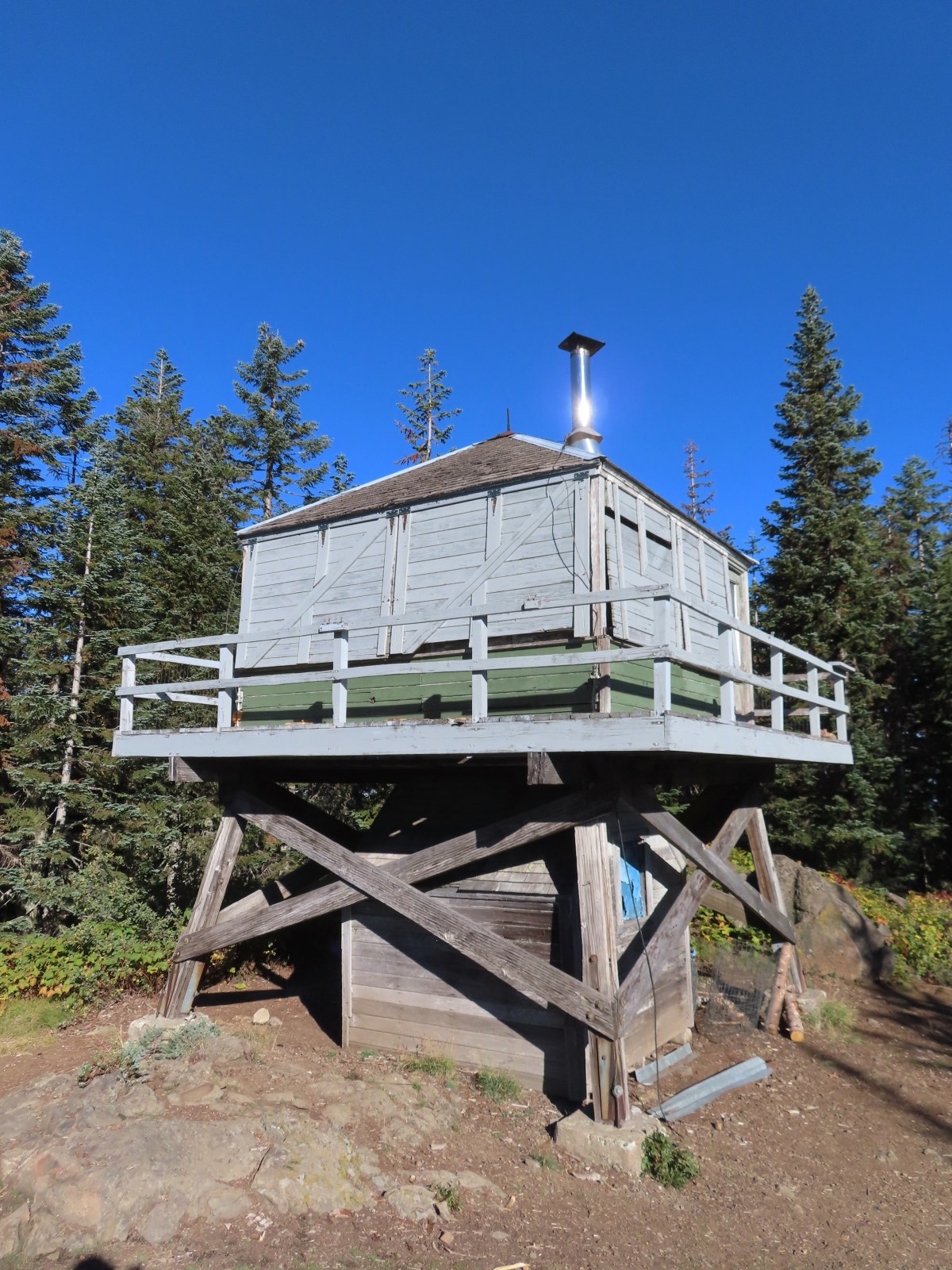
 Not having light until after 7am is rough for someone who likes to get an early start.
 The Salmon River Trail is located next to this interpretive sign near the trailhead.
 A flash was necessary as I set off.
 There was a very brief road walk along this section.
 There was also plenty of time along the Salmon River.
 I veered right at this picnic table to cross into the campground.
 The day use area at the campground.
 Water spigot at the day use area.
 It was hard to read the date for this cougar sighting, it appeared to be from June, but I couldn’t make out the year.
 Entering the Salmon-Huckleberry Wilderness
 One of the downed trees, this one covered both sides of a switchback.
 A rare viewpoint along the forested trail.
 A level stretch along a narrow ridge.
 A healthy looking paintbrush.
 The Sun rising above Hunchback Ridge.
 It was going to a be a bluebird day.
 Sign ahead marking the Hunchback Trail junction.

 One of the “downs”.
 This trail was also in good shape with just a few easy obstacles.
 I did not go investigate the source of the “water”, it could have been a trap (there is a spring shown on the map).
 Signs at the junction below Devil’s Peak.
 Mount Jefferson
 Olallie Butte (
 The lookout from the Mt. Jefferson viewpoint.
 Mt. Hood from the lookout.
 You can’t see Mt. Jefferson from the lookout due to trees.
 Trail signs at the Cool Creek Trail junction.
 Lookout Mountain(
 Mt. Hood from the Hunchback Trail.
 Arriving at the trailhead on FR 2613.
 It’s hard to make out in the photo but that is a giant pothole (crater) in the middle of the road seen from the trailhead.
 That is the trailhead at the end of the road on the right.


 There were some nice Fall colors along the Kinzel Lake Trail.
 There were also a few obstacles that were trickier than anything on the other trails involved in this loop.
 Salmon Butte (
 Nearing the Salmon River Trail.
 Trail sign at the Salmon River Trail junction.

 There wasn’t much water at all in any of the side creeks.
 There are several viewpoints just over 3.5-miles from the trailhead.
 The furtherst hump in the center is Huckleberry Mountain (
 Wilderness kiosk along the trail. There were self-issued permits here, but none at Green Canyon Way so I stopped and filled one out even though I was almost done with my hike (and out of the wilderness).

 Salmon River
 There were a couple of good-sized fish in the pool here.
 The trail arriving back at the trailhead.
 We had also parked here in 2021 for our Barlow Butte hike (


 The colors of Fall.
 Tom, Dick, and Harry Mountain (
 Mt. Hood teased an appearance a couple of times along the lower portion of the PCT. It was enough to see that there was a dusting of fresh snow on the mountain.
 The signed junction with the Yellowjacket Trail.
 The wet brush had me whishing I’d worn boots.
 The Yellowjacket Trail passing a small meadow.
 Makeshift footbridge along the trail.


 New snow on Mt. Hood.
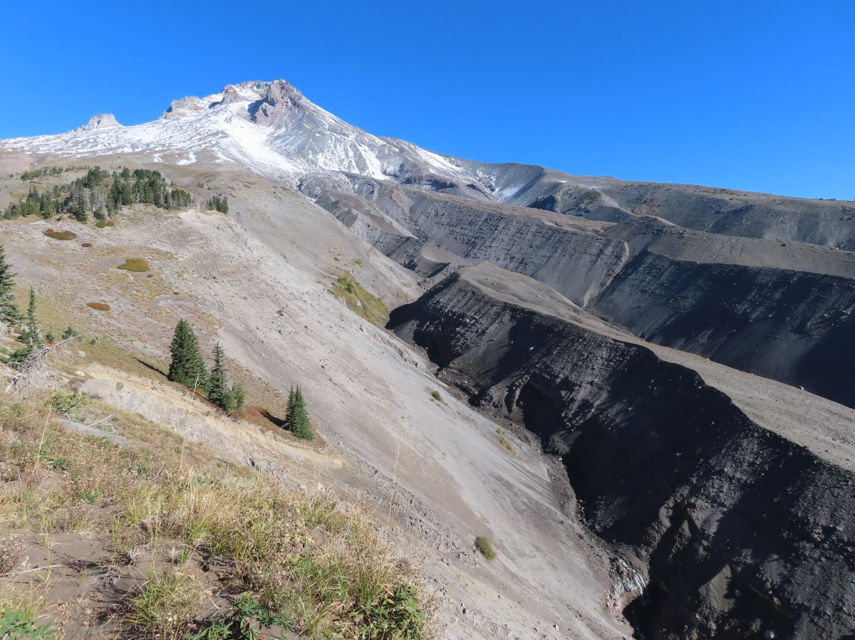
 The valley is the result of an eruption around 250 years ago.
 Pacific lupine
 At the end of the levee the route climbed a moraine then continued its gradual ascent to the Timberline Trail.
 Dark-eyed junco. There was a good variety of birds along the moraine, but this was the only one that sat still long enough to have its picture taken.
 Frost on a log. It was really nice to be hiking in the crisp cool air.
 Boy Scout Ridge from the moraine.
 The unsigned junction with the Timberline Trail.
 Mt. Hood from the junction.
 Sign for the PCT nearly absorbed by the tree.
 Lupine (broadleaf?)
 A few remaining blooms on the goldenrod.
 Signpost at the PCT junction ahead.


 The coyote with Mt. Hood looming behind.
 Mt. Jefferson to the south with the Three Sisters behind to the left.
 The Three Sisters and Mt. Jefferson
 The round peak along the far ridge is Gunsight Butte (
 We’d lost sight of the coyote until it ran across the trail not too far in front of us.
 More lupine
 A few remaining aster blossoms in the foreground.
 Timberline Lodge across the Salmon River Canyon.
 Looking back down the White River Valley. Barlow Ridge is the near hump on the right.
 Another look at Timberline Lodge.
 Despite all the cars at the lodge we would only encounter a half dozen other trail users until we were back at the Barlow Pass Trailhead.
 Small waterfall below the ridge.
 I turned around here where the Timberline Trail headed across the Salmon River drainage. The Silcox Hut is straight ahead on the side of the mountain.
 Looking back at the high point where Heather had stopped.
 Mt. Hood’s summit.
 The waterfall looking pretty small far below the mountain.
 It took us a moment to decide what the dark rounded peak straight ahead in the distance was. We eventually correctly identified it as Black Butte (
 Olallie Butte (
 Birds on mountain ash.
 The Timberline Trail junction.
 Beargrass meadow, there hadn’t been any blooms this year.
 Lousewort
 It was nearly 2-miles between the Timberline and Yellowjacket trail junctions.
 We were shocked to see a bunchberry that still had some petals, even if they were in sad shape.
 Mushrooms and fungi are not surprising this time of year.
 Highway 35
 Arriving at the Barlow Road.
 Our various hikes around the mountain. There are still a few areas where we could add a track or two. Happy Trails!