Part two of 2025 wildlife wrap-up is a collection of the non-bird critters that we were able to get a photo of during our 2025 outings. I checked one animal off the list of those that we hadn’t seen while hiking during our Tygh Creek hike in May when I spotted a skunk making its way up the trail ahead. Heather unfortunately missed out on that sighting. We also saw a sea otter during our visit to Olympic National Park in May however it was so far away that we weren’t sure what we were looking at until we were able to look at the couple of photos that I had taken. It was exciting to have seen one, but it would have been more exciting had we realized what we were seeing at the time. The other exciting (and scariest) sighting was just our second rattlesnake in the Criterion Tract along the Deschutes River, also in May. We didn’t see it until we heard the loud hiss and rattle letting us know that we were getting too close.

Bumble bee – Mt. Hood National Forest, 05/24/25.

Bee swarm – William L. Finley National Wildlife Refuge, 04/30/25.

Unknown bee species – Criterion Tract, 05/25/25.

Beetle – Criterion Tract, 05/25/25.

Beetle – Criterion Tract, 05/25/25.

Beetles – Mt. Jefferson Wilderness, 07/14/25.

Beetles – Mt. Hood National Forest, 06/14/25.

Isopod – Olympic National Park, 05/15/25.

Western sea slater (Ligia occidentalis) – Olympic National Park, 05/14/25.

Spider hiding in the camas – Thurston Hills, 04/19/25.

Crab spider – Clearwater River Trail, 06/21/25.

Slug – Thurston Hills, 04/19/25.

Slug – Fern Ridge Wildlife Area, 05/03/25.

Slug – Olympic National Park, 05/13/25.

Slug – Olympic National Park, 05/12/25.

Slug – Olympic National Park, 05/15/25.

Snail – Oswald West State Park, 04/05/25.

Snail – Loon Lake Recreation Area, 05/03/25.

Snail – Fern Ridge Wildlife Area, 05/03/25.

Snail – Umpqua National Forest, 05/31/25.

Dragon flies – Mt. Washington Wilderness, 07/19/25.

Caterpillar – Olympic National Park, 05/13/25.

Caterpillars – Mt. Jefferson Wilderness, 07/17/25.

Cinnabar moth – Mt. Jefferson Wilderness, Linn County Oregon, 07/17/25.

Plume moth – Mt. Jefferson Wilderness, Linn County Oregon, 07/17/25.

Moth – Mt. Jefferson Wilderness, Marion County Oregon, 07/14/25.

Moth – Mt. Washington Wilderness, Linn County Oregon, 07/19/25.

Moth – Mt. Hood National Forest, Wasco County Oregon, 06/14/25.

Brown elfin (and fly) – Mt. Hood National Forest, Wasco County Oregon, 05/24/25.

Ochre ringlet – Criterion Tract, Wasco County Oregon, 05/25/25.

Cabbage White – Tualatin River National Wildlife Refuge, Washington County Oregon, 05/01/25.

Margined white – Oswald West State Park, Tillamook County Oregon, 04/05/25.

Western white? – Mt. Hood National Forest, Hood River County Oregon, 07/12/25.

California tortoiseshell – Mt. Hood National Forest, Hood River County Oregon, 07/12/25.

Sagebrush checkerspot (f) – Criterion Tract, Wasco County Oregon, 05/25/25.

Sagebrush checkerspot? (m) – Criterion Tract, Wasco County Oregon, 05/25/25.

Checkerspot (Hoffman’s?) – Mt. Hood National Forest, Hood River County Oregon, 07/12/25.

Clodius Parnassian – Sourgrass Mountain, Lane County Oregon, 06/28/25.

Propertius duskywing – Mt. Hood National Forest, Wasco County Oregon, 06/14/25.

Possibly a Pacuvius Duskywing (Erynnis pacuvius) – Mt. Hood National Forest, Wasco County Oregon, 05/24/25.

A skipper – Criterion Tract, Wasco County Oregon, 05/25/25.

Field crescent – Mt. Washington Wilderness, Linn County Oregon, 07/19/25.

Meadow fritillary – Mt. Rainier National Park, Yakima County Washington, 08/08/25.

A fritillary but not sure which one. – Criterion Tract, Wasco County Oregon, 05/25/25.

Another of the fritillaries. – Mt. Jefferson Wilderness, Linn County Oregon, 07/17/25.

Wester sulphur – Mt. Hood National Forest, Wasco County Oregon, 06/14/25.

Indra swallowtail – Criterion Tract, Wasco County Oregon, 05/25/25.

Pale tiger swallowtail – Mt. Hood National Forest, Wasco County Oregon, 06/14/25.
When it comes to the Lycaenidae Family (Gossamer Wings) I am almost always out of my depth trying to identify them.
Mt. Jefferson Wilderness, Marion County Oregon, 07/14/25.

Mt. Hood National Forest, Wasco County Oregon, 05/24/25.

Mt. Washington Wilderness, Linn County Oregon, 07/19/25.

Criterion Tract, Wasco County Oregon, 05/25/25.

Olympic National Park, Clallam County Washington, 05/13/25.

These might be Echo Azures – Mt. Hood National Forest, Wasco County Oregon, 05/24/25.

Crab – Olympic National Park, Clallam County Wasing 05/14/25.

Hermit Crab – Olympic National Park, 05/14/25.

Velalla velella – Olympic National Park, 05/14/25.

Anemones – Olympic National Park, 05/14/25.

Starfish – Olympic National Park, 05/14/25.

Lions mane jellyfish – Rockaway Beach, 09/06/25.

Sealion – Olympic National Park, 05/14/25.

Seals – Olympic National Park, 05/15/25.

Sea otter, albeit a poor picture – Olympic National Park, 05/14/25.

Tree frog – Mt. Washington Wilderness, 07/19/25.

Frog – Mt. Jefferson Wilderness, 07/14/25.

Bullfrog (invasive) – Ankeny National Wildlife Refuge, 04/28/25.

Painted and western pond turtles – William L. Finley National Wildlife Refuge, 04/30/25.

Dunn’s salamander – Thurston Hills, 04/19/25.

Rough skinned newt – Driftwood Beach, 01/11/25.

Lizard – Mt. Hood National Forest, 05/24/25.

Snake – Ankeny National Wildlife Refuge, 04/28/25.

Snake – McDonald-Dunn Forest, 07/05/25.

Western racer – Mt. Hood National Forest, 05/24/25.

Western rattlesnake – Criterion Tract, 05/25/25.

Olympic chipmunk – Olympic National Park, 05/13/25.

Townsend’s? chipmunk – Silver Falls State Park, 10/13/25.

Yellow pine chipmunk – Mt. Rainier National Park, 08/04/25.

Golden-mantled ground squirrel – Mt. Rainier National Park, 08/04/25.

Douglas’ squirrel – Olympic National Park, 05/13/25.

Western gray squirrel – William L. Finely National Wildlife Refuge, 04/30/25.

California ground squirrel – E. E. Wilson Wildlife Area, 04/27/25.

Nutria (invasive) – Tualatin River National Wildlife Refuge, 05/01/25.

Yellow-bellied marmot – Three Sisters Wilderness, 07/15/25.

Hoary marmot – Mt. Rainier National Park, 08/05/25.

Pika – Mt. Jefferson Wilderness, 07/14/25.

Rabbit – Ankeny National Wildlife Refuge, 04/28/25.

Racoon – Olympic National Park, 05/14/25.

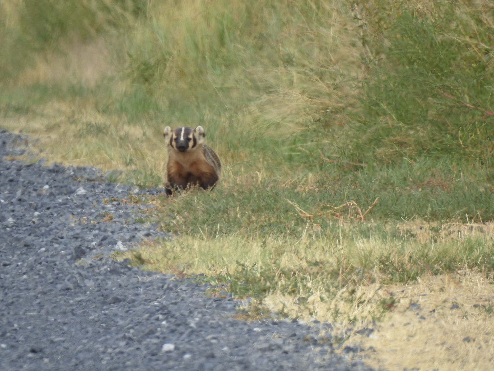
Skunk – Mt. Hood National Forest, 05/26/25.

Coyote – William L. Finley National Wildlife Refuge, 04/30/25.

Black-tailed deer – Mt. Rainier National Park, 08/04/25.

Mule deer – Criterion Tract, 05/25/25.

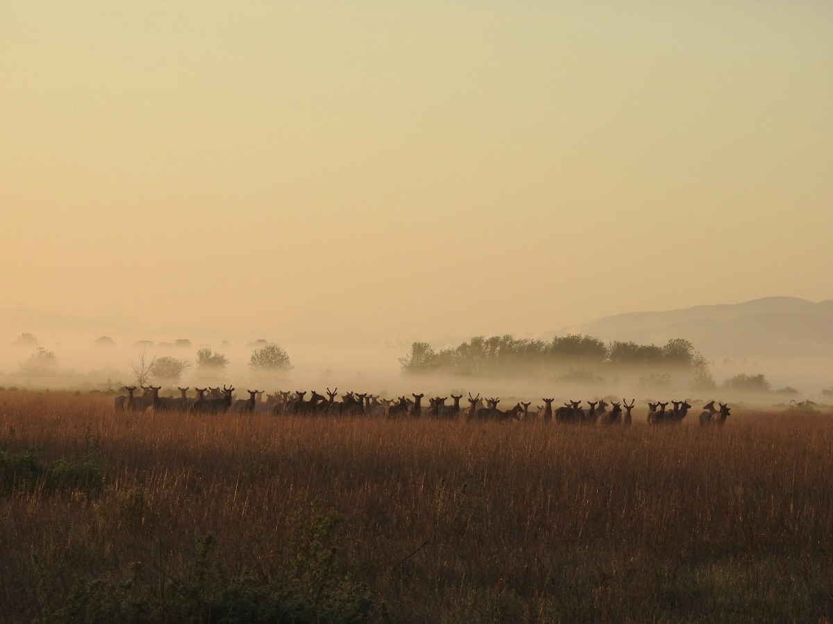
Elk – Elk Run Trail, 10/11/25.

Mountain goats – Mt. Rainier National Park, 08/05/25.
Being fortunate enough to witness animals in their natural habitat is one of the perks of hiking and we hope to see many more this coming year. We’re still on the lookout for several species that are possibilities. Most notable and likely of these are porcupines, giant pacific salamanders, and cougars. Much less likely but possible are wolves, wolverines, and moose among others. Happy Trails!


 Trail signs for the Benson-Ruckle Trail.


 \
\


 Map at the trailhead signboard and wilderness permit station.
 Trail sign at the split of the East and West Fork trails.

 Trail sign for the East Fork Wallowa Trail at a junction with a gravel road.
 Ghost pipe
 Entering into the Wallowa-Whitman National Forest.

 Chief Joseph Mountain and Wallowa Lake
 I never saw any but I heard a number of pikas in the rock fields.
 Switchback
 Rock clematis seed heads.
 Bridge at the upper end of the access road that I had passed earlier.
 The lower section of the waterfall from the bridge.

 The access road bridge from the switchback.
 East Fork Wallowa River Forebay
 Interpretive sign at the forebay.
 Aster
Aster The trail entering the

 Elderberry and baneberry
 Zoomed in photo.
 Small meadow along the trail.
 Aneroid Mountain in the distance.
 Mountain larkspur
 Pika underneath some raspberries.
 Pika
Pika A few lupine were still blooming along the trail.
 Doe in a small meadow along the trail.
 Tall mountain bluebells
 The damaged footbridge.


 East Fork Wallowa River
 The inbound and outbound forks rejoining.
 East Fork Wallowa River flowing through a meadow along the trail.
 Goldenrod
 Unnamed creek crossing.
 American sawort
 Another doe in a meadow.
 A hazy view of Aneroid Mountain.
 Pearly everlasting along the trail.
 East Peak (
 A closer look at East Peak.


 The benches.
 Groundsel along the trail.
 A boat docked on the lakeshore in the distance.
 An inlet creek to the lake near the boat dock.
 East Peak from Aneroid Lake.


 Signs for Camp Halton at the actual junction with the East Fork Wallowa Trail.


 Hammond’s flycatcher
 East Peak
 Lewis monkeyflower
 Aneroid Mountain
 Pollinator on a flower.
 The split trail.
 The outbound trail dropped quite steeply before meeting back up with the inbound trail.
 The damaged bridge from the other side.
 Fritillary butterfly
 A comma butterfly
 Golden-mantled ground squirrel
 Mount Howard
 Coneflower
 Wallowa Lake
 Quaking aspen
 Arriving back at the trailhead.


 The trail passes through the Shady Campground.
 Lostine River
 Unnamed creek crossing.

 Thimbleberry
 One of the switchbacks.
 Climbing into the sunlight.
 Possibly a Cassin’s vireo.
 Another switchback.
 Fireweed
 Monkshood
 Twisted stalk
 Eagle Cap (
 Looking down from the trail.
 Paintbrush
 Chipmunk
 The trail turning uphill ahead to start the steep climb.
 Meadow along a brief section of reasonably graded trail.
 Nuttal’s linanthus


 The pass in view.
 Twin Peaks to the left over the shoulder of the ridge.
 The trail down to Maxwell Lake.
 Ground squirrel on alert.
 Maxwell Lake

 Aster along the outlet creek.
 Gentians
 Island in Maxwell Lake.
 The view from the granite outcrop.
 Looking back at the pass from the outcrop.
 Last of the snow at Maxwell Lake.
 Trail along Maxwell Lake.
 Trail to Jackson Lake.
 Jackson Lake
 False hellebore
 Pika raising a warning call. Interestingly the pikas in the Wallowas make a sound that we don’t recall hearing from pikas in other areas. It was almost as if they had their own regional dialect.
 Passing back over the granite outcrop.
 Maxwell Lake’s outlet creek.
 Trout in the outlet stream.
 One last look at Maxwell Lake.
 The view from the pass on the way back.
 Heading down the steep section.
 The afternoon lighting on the ridge across the Lostine River really brought out the colors.
 Eagle Cap way up the valley.
 Heather counted at least seven significant drops on a creek cascading down the far hillside.
 Fritillary
 Canada jay
 Police car moth
 Back at the bridge over the Lostine River.
 Lostine River
 The Maxwell Lake Trailhead in the afternoon.


 This pointer refers to trail 1880 as “Pine Creek” but other signs and the Forest Service website refer to it as “Pine Lakes”.
 This one says Pine Lakes.
 Sign for the Packstation.
 Squirrel with breakfast at the packstation.
 Old footbridge over a dry creek bed. It didn’t look particularly safe so I stuck to the road.
 The dry creek bed crossing.
 Black cows on the trail ahead.
 Coneflower
 Snowberry
 West Fork Pine Creek
 Formation on the hillside.
 Western clematis
 Paintbrush
 Fireweed
 The bridge felt stable despite being slanted at a 45-degree angle.
 View from the trail.

 The second bridge.
 West Fork Pine Creek
 Heather caught this cool cloud from her currently cow free hike. (She would run into them later where they’d ducked off the trail in front of me.)
 Looking back down at the campsite.
 The use trail straight ahead at the switchback.

 The base of Chute Falls.


 Looking back down the valley.
 View up the valley.
 Wilderness sign on the tree marking the boundary.
 The Pine Lakes are back up there somewhere.
 Somewhere on the other side of the peaks on the left is the Schneider Cabin where we’d hiked the day before.
 Cliffs above the trail.
 I spy mountain goats!
 A zoomed in photo of the mountain goats.


 I believe that is Cornucopia Peak on the left.
 Going up.
 Fireweed above the trail.
 Paintbrush along the trail.
 The forest on the other side of the pass.
 West Fork Pine Creek
 There was a large waterfall flowing down from the outlet of the Pine Lakes. (Not West Fork Pine Creek whose headwaters were beyond the meadowed basin.
 West Fork Pine Creek begins somewhere above the basin at the far end.
 Rock formations along the cliffs.
 Arnica and pearly everlasting
 I tried to get a clearer look at the large waterfall but couldn’t find a clear line of sight.

 Gentians along the trail.
 Evidence of an avalanche at the far end of this meadow. It took a lot of trail maintenance to clear the snapped trees from the trail.
 Wildflowers lining the trail.
 A doe that turned out to be on the trail above me. There was a switchback just ahead of where I was.


 The forest in the basin.
 The Pine Lakes are in the basin ahead.
 Arnica and aster?
 Monkshood
 Seep along the trail.
 Grass of parnassus
 American sawort
 Something had been bedded down in this little bowl below the trail.
 Goldenrod
 The valley I’d come up to the right.
 Nearly 5-miles from Chute Falls I arrived at the dam at the outlet of Lower Pine Lake. A number of lakes in the Wallows were dammed to control water flow to the surrounding communities.
 Lower Pine Lake

 Lower Pine Lake
 Lower Pine Lake from between the two lakes.
 Upper Pine Lake from the same spot.
 Upper Pine Lake.


 The view from my break spot.
 Shrubby cinquefoil
 White mariposa lily, the only one I spotted, and I’d missed it on the way up.
 Yellow columbine, I also missed this on the first pass.
 Dusky flycacther
 A meadow and the forest in the lower basin.
 Fritillary on pearly everlasting
 Trail maintenance in the avalanche section.
 Loved the rock colors in the area.
 I’m guessing some sort of wren.
 Caterpillers
 Herding the cattle back past the damaged bridge.
 West Fork Pine Creek.
 The footbridge across the East Fork Pine Creek ahead. We’d left the cows behind here and made our way back to the trailhead.

 Harvester ants – 5/29/23, Riley Ranch Preserve, Bend
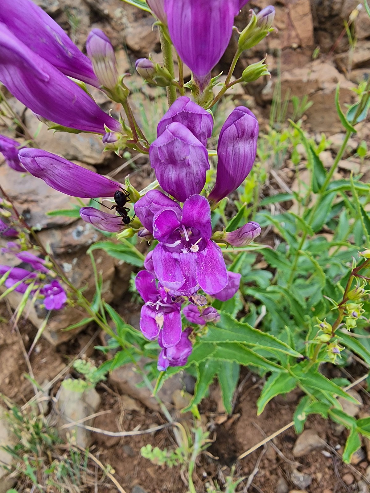 Ant on penstemon – 6/15/23, Hells Canyon National Recreation Area, Wallowa-Whitman National Forest
 Crab spider on a California harebell – 6/25/23, North Umpqua Trail, BLM Roseburg District
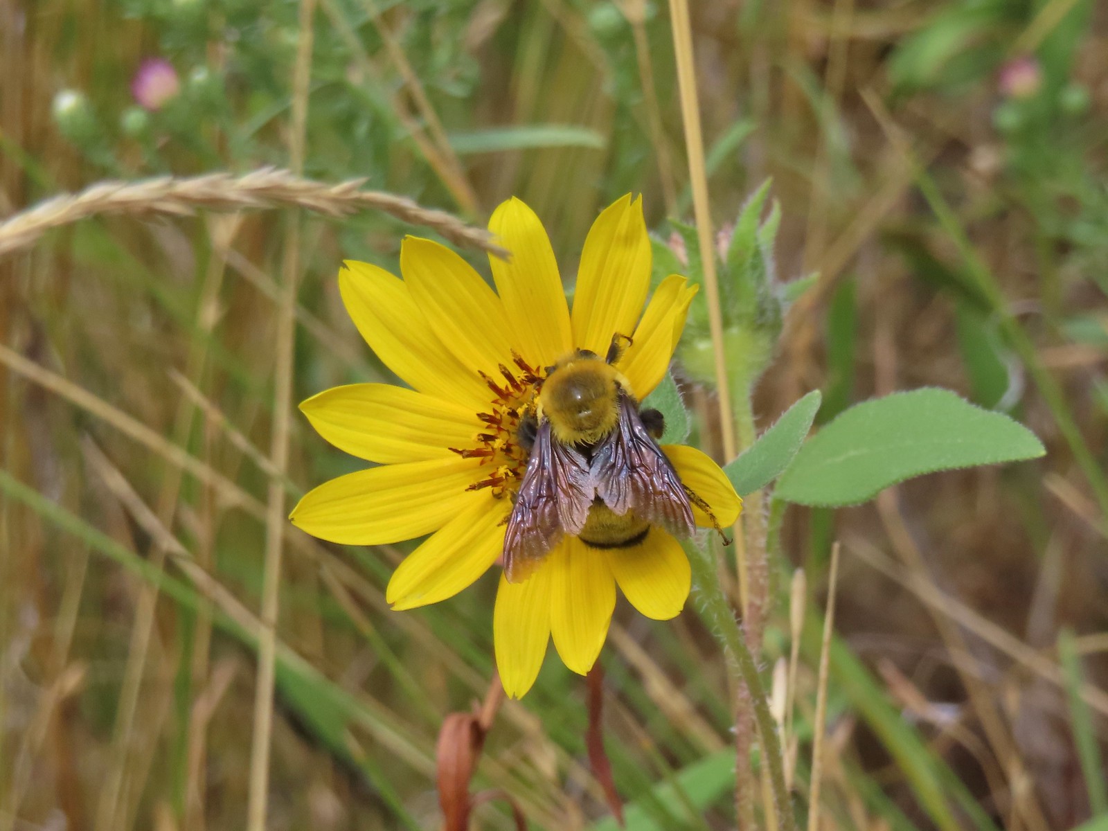 Bee – 9/3/23, Threemile Canyon, BLM Burns District
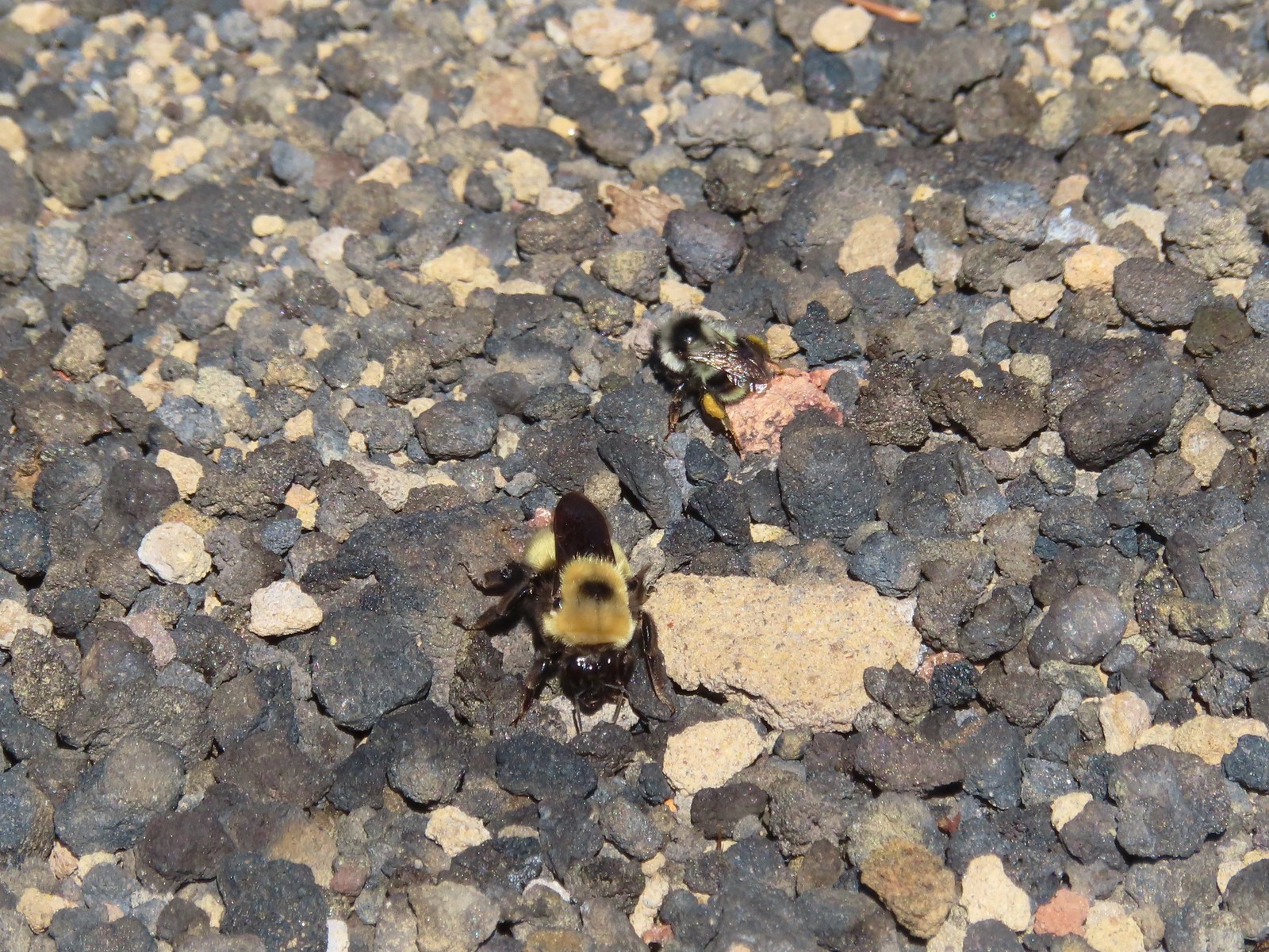 Bees – 7/8/23, Sand Mountain, Willamette National Forest
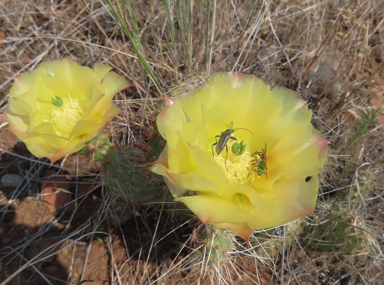 Sweat bee? and a beetle on a prickly pear cactus – 6/15/23, Hells Canyon National Recreation Area, Wallowa-Whitman National Forest
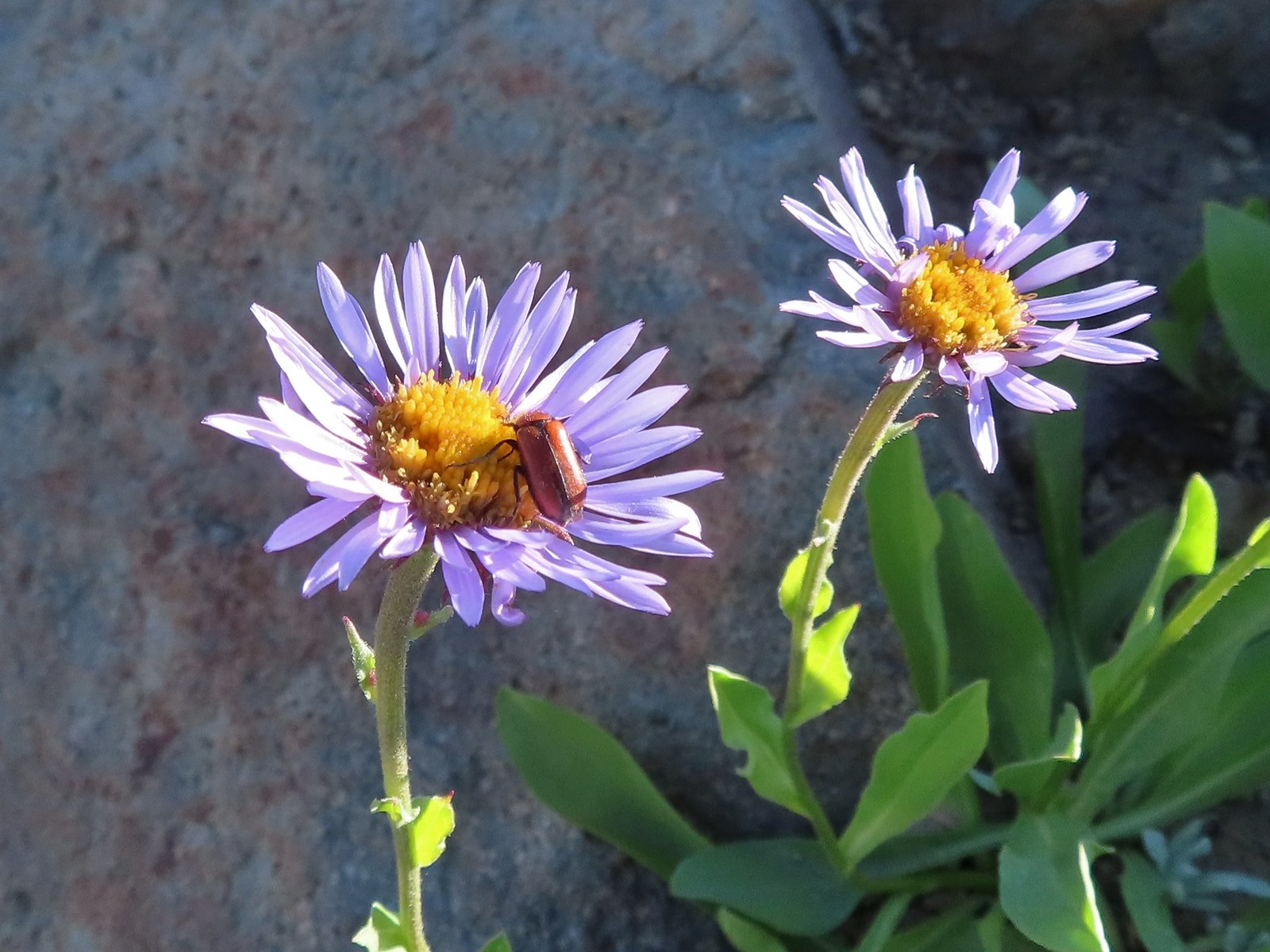 Beetle – 7/31/23, Garfield Peak Trail, Crater Lake National Park
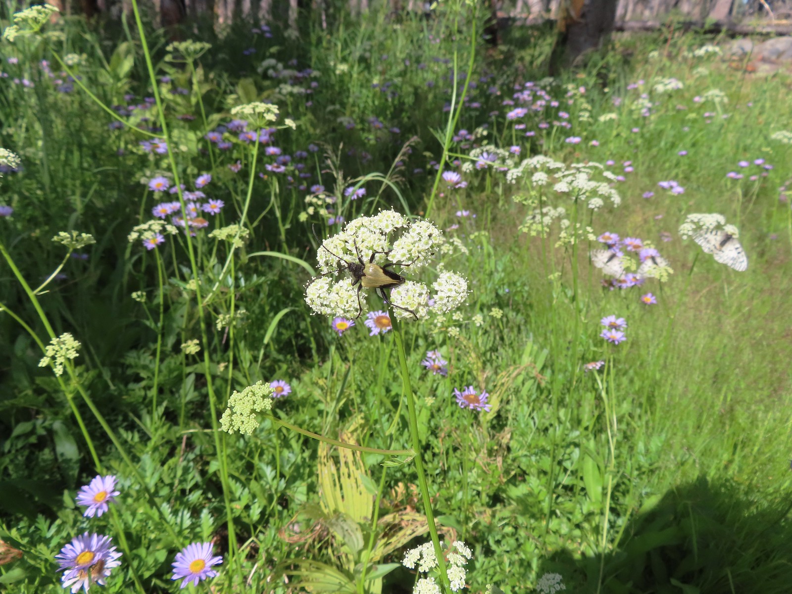 Beetle – 7/29/23, Stuart Falls Trail, Crater Lake National Park
 Beetle on a white mariposa lily – 8/14/23, Main Eagle Creek Trail, Eagle Cap Wilderness
 Beetle and another bug on spirea – 7/4/23, Rocky Top Trail, Santiam State Forest
 Beetles on thistle – 6/15/23, Hells Canyon National Recreation Area, Wallowa-Whitman National Forest
 Ladybug on a daisy – 7/4/23, Natural Arch Trail, Santiam State Forest
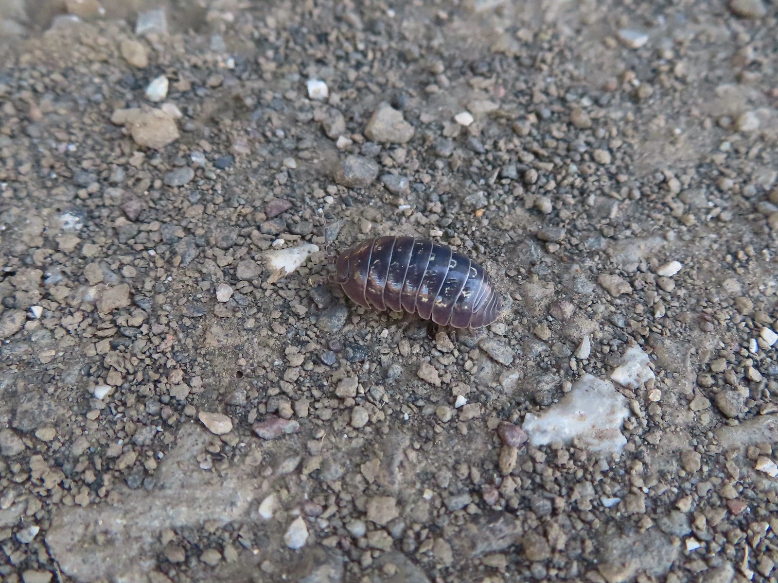 Common pill-bug – 6/25/23, North Bank Habitat, BLM Roseburg District
 Beetle – 5/28/23, Criterion Tract, BLM Prineville District
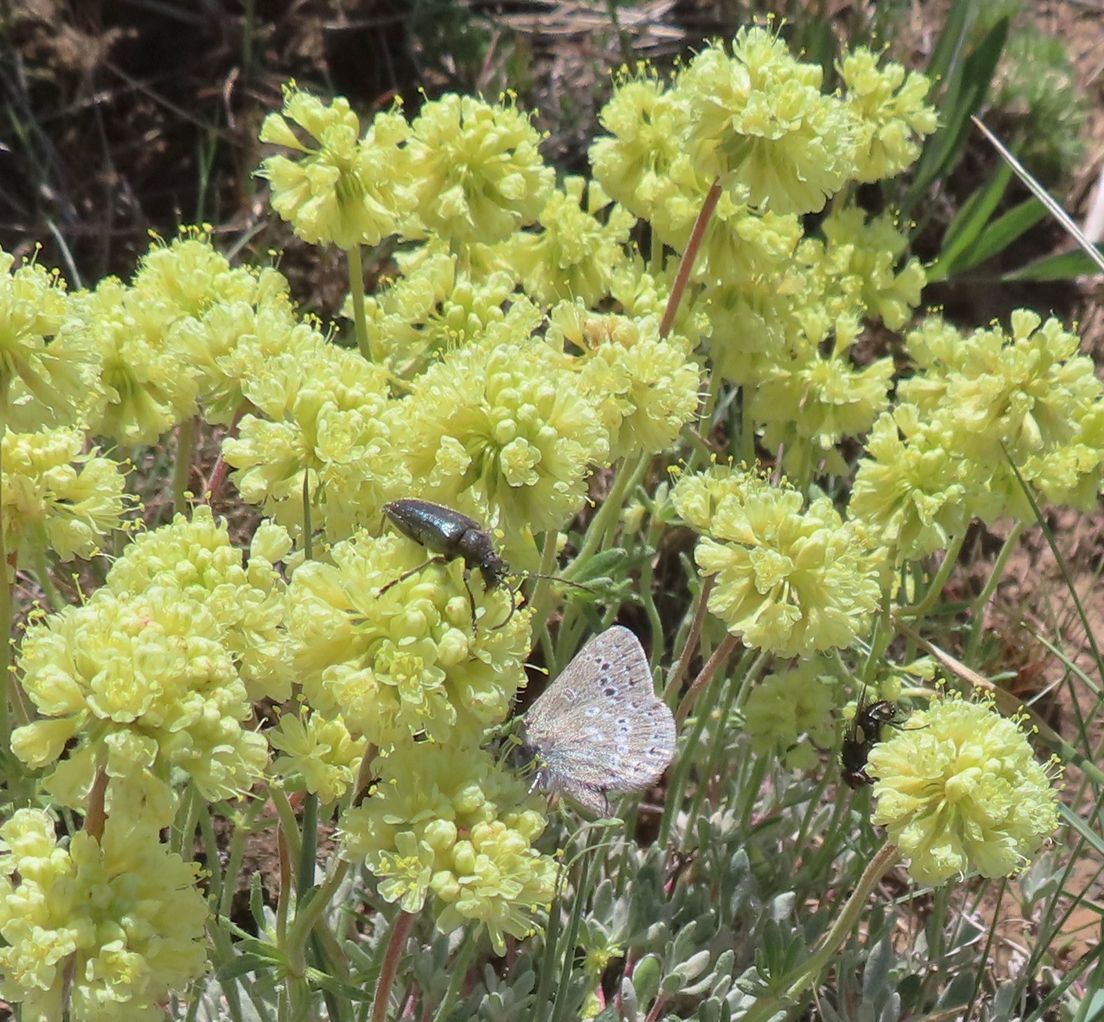 Beetle and a butterfly on buckwheat – 5/28/23, Criterion Tract, BLM Prineville District
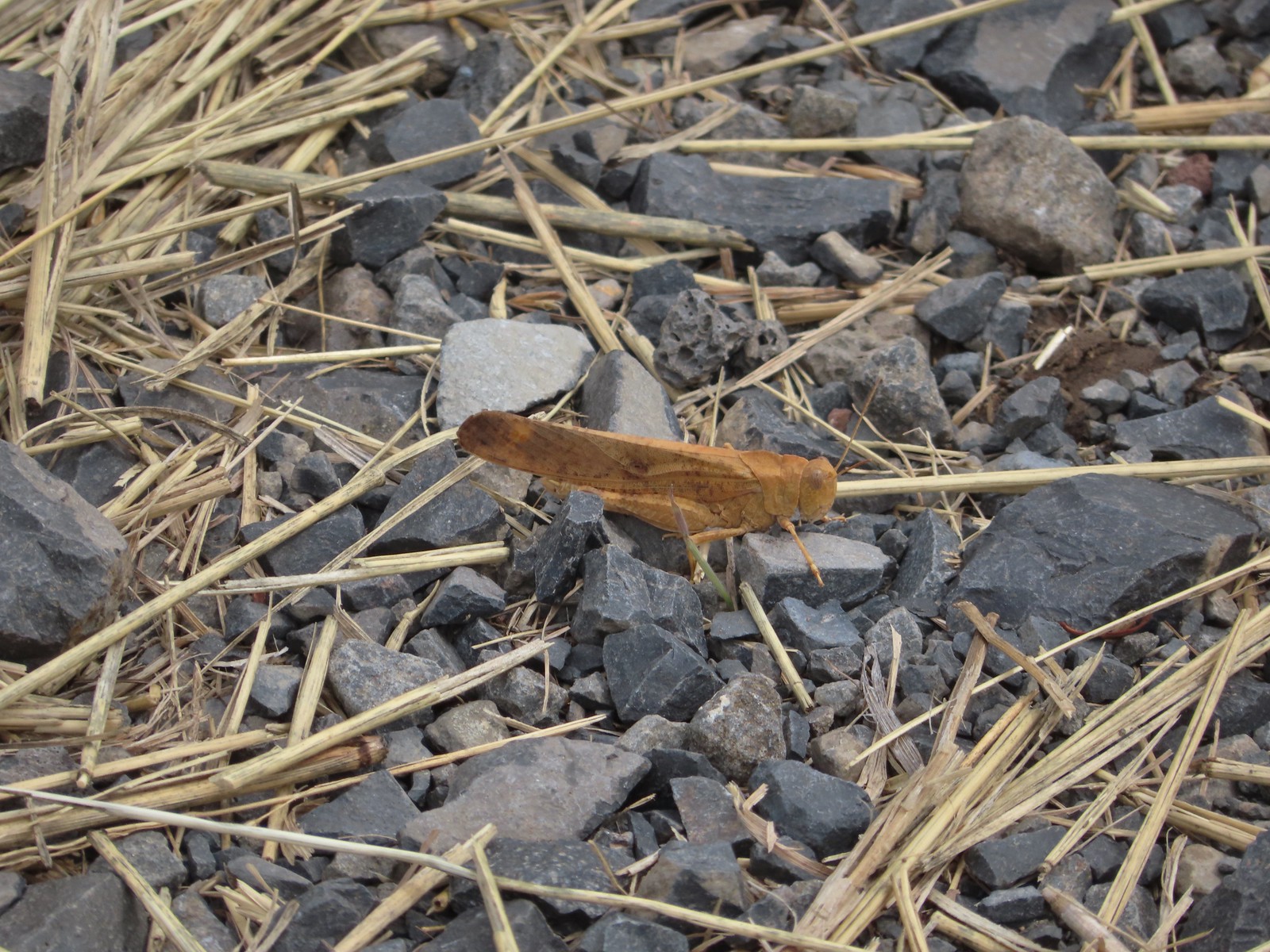 Grasshopper – 9/3/23, P Ranch, Malheur National Wildlife Refuge
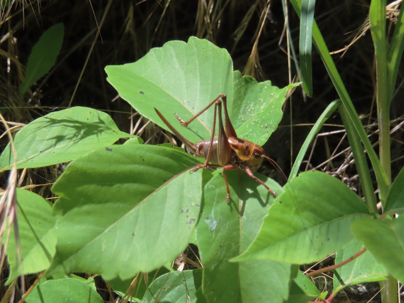 Cricket – 6/14/23, Imnaha Trail, Hells Canyon National Recreation Area
 Caterpillar – 5/28/23, Criterion Tract, BLM Prineville District
 Caterpillar – 7/1/23, Hummocks Trail, Mt. St. Helens National Volcanic Monument, WA
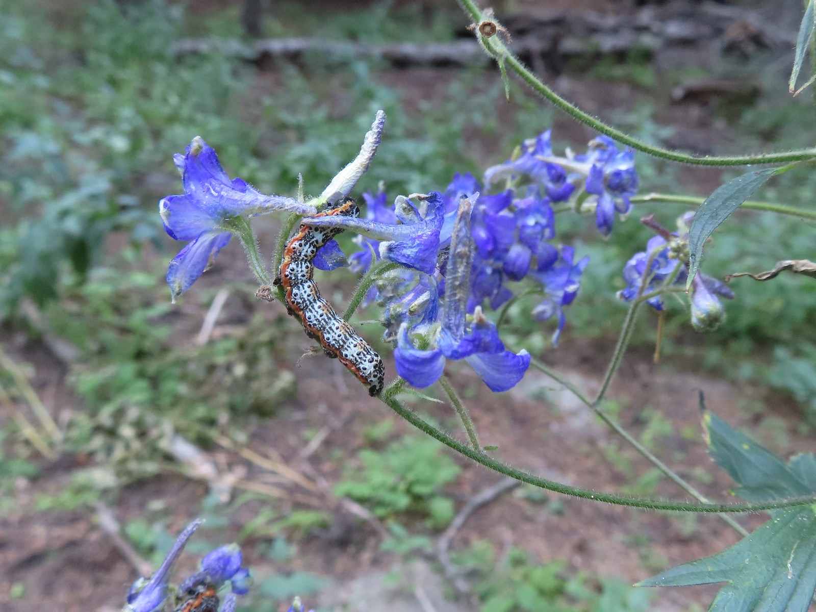 Caterpillar – 8/16/23, West Eagle Trail, Eagle Cap Wilderness
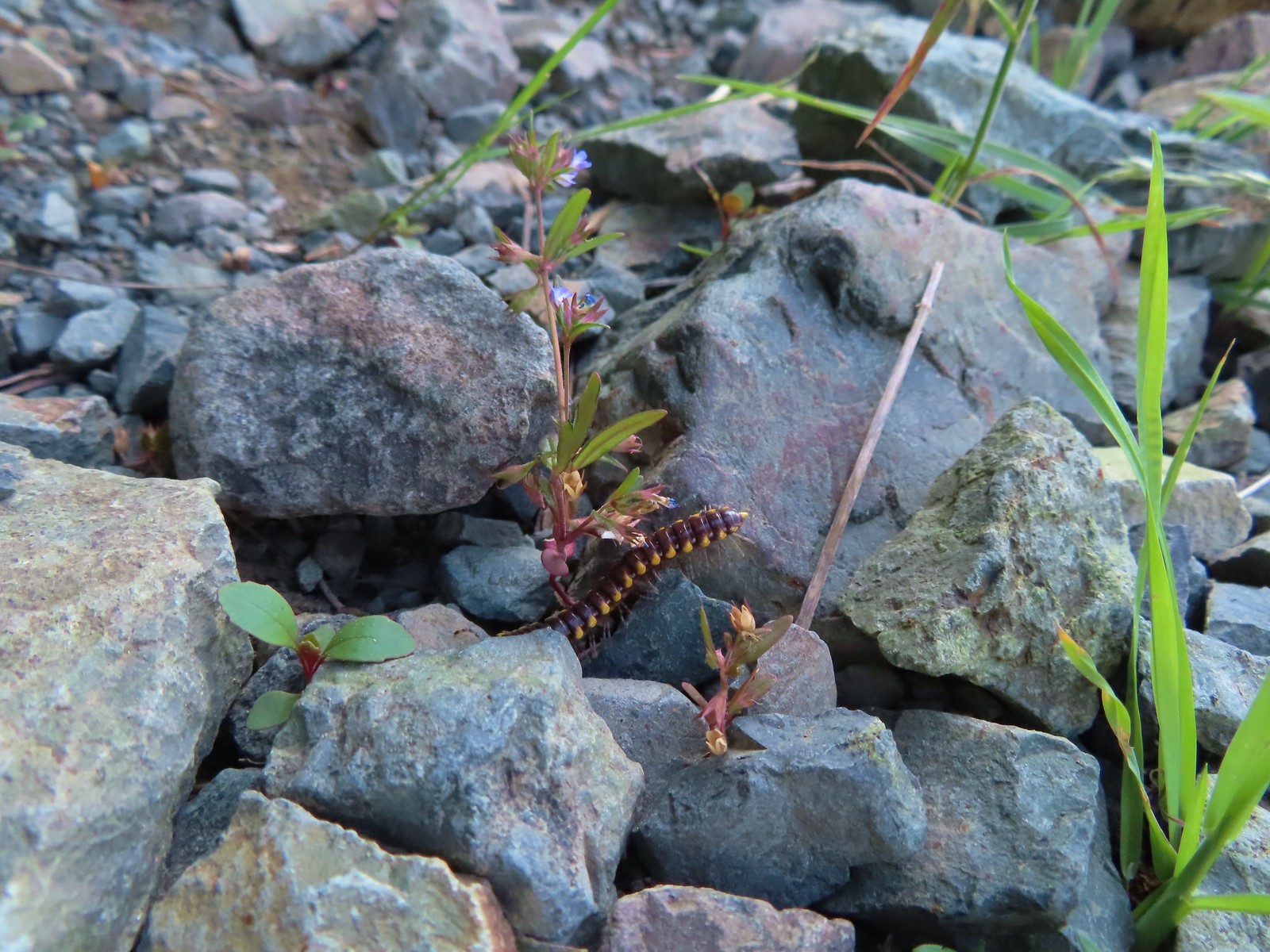 Millipede – 6/12/23, Imnaha River Trail, Eagle Cap Wilderness
 Millipedes – 6/12/23, Imnaha River Trail, Eagle Cap Wilderness
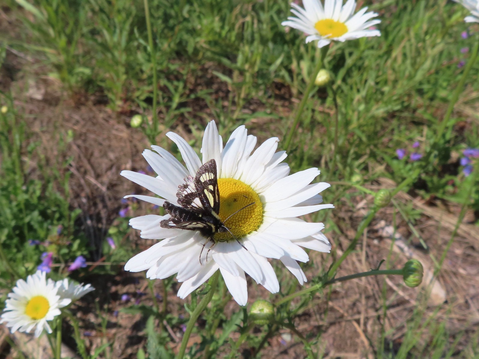 Eight-spotted Forester-Alypia octomaculata – 7/4/23, Niagra Heights Road, Santiam State Forest
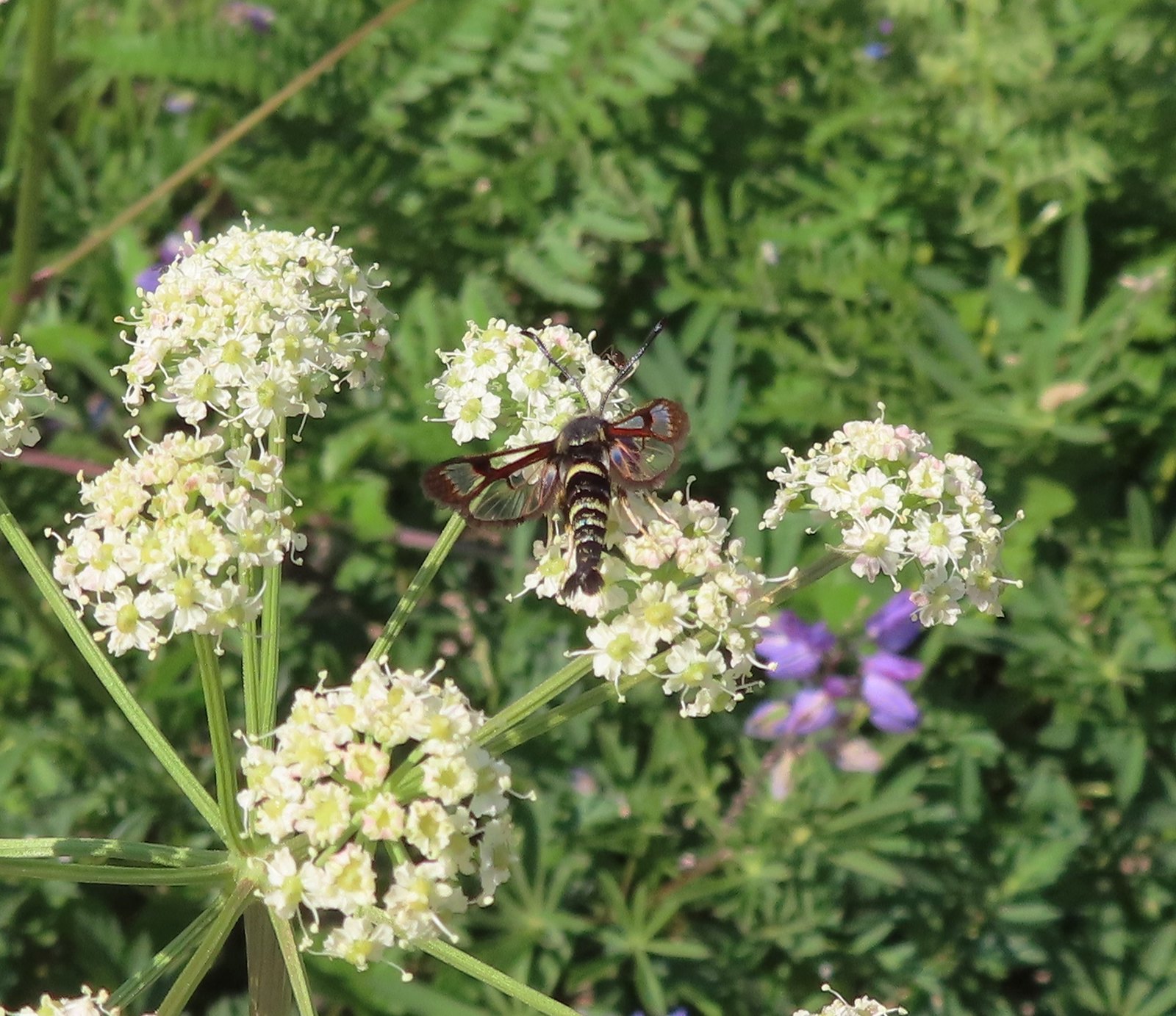 Fireweed Clearwing Moth (Albuna pyramidalis) – 7/4/23, Niagra Heights Road, Santiam State Forest
 Moth – 7/4/23, Niagra Heights Road, Santiam State Forest
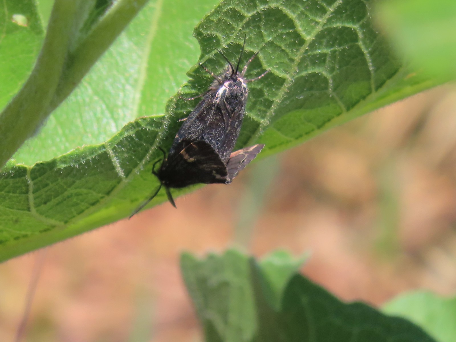 Moths – 6/3/23, Buck Creek Trail, Husum, WA
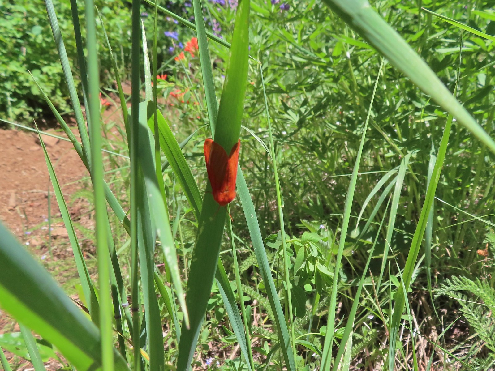 Moth – 6/3/23, Buck Creek Trail, Husum, WA
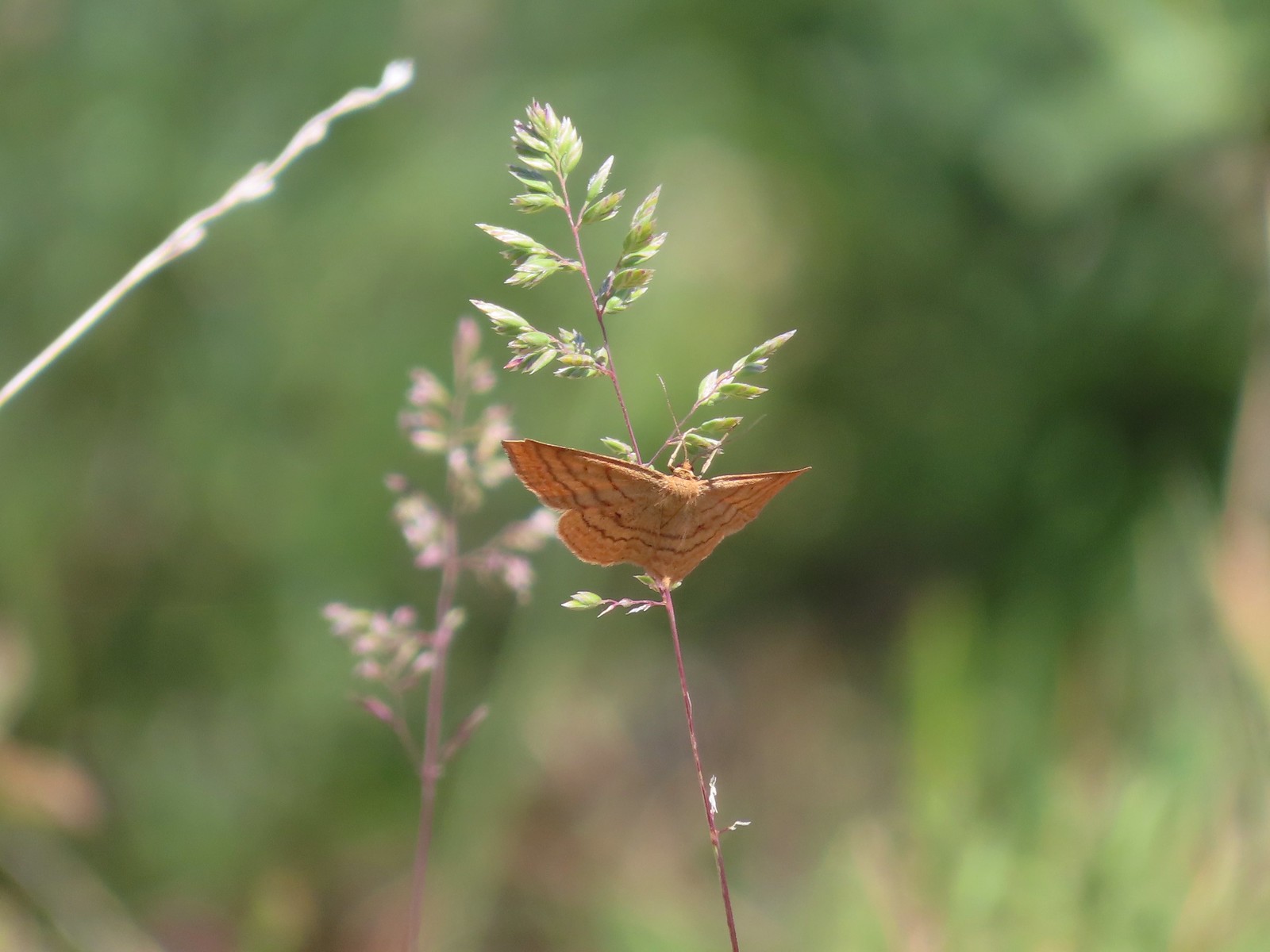 Moth – 6/3/23, Buck Creek Trail, Husum, WA
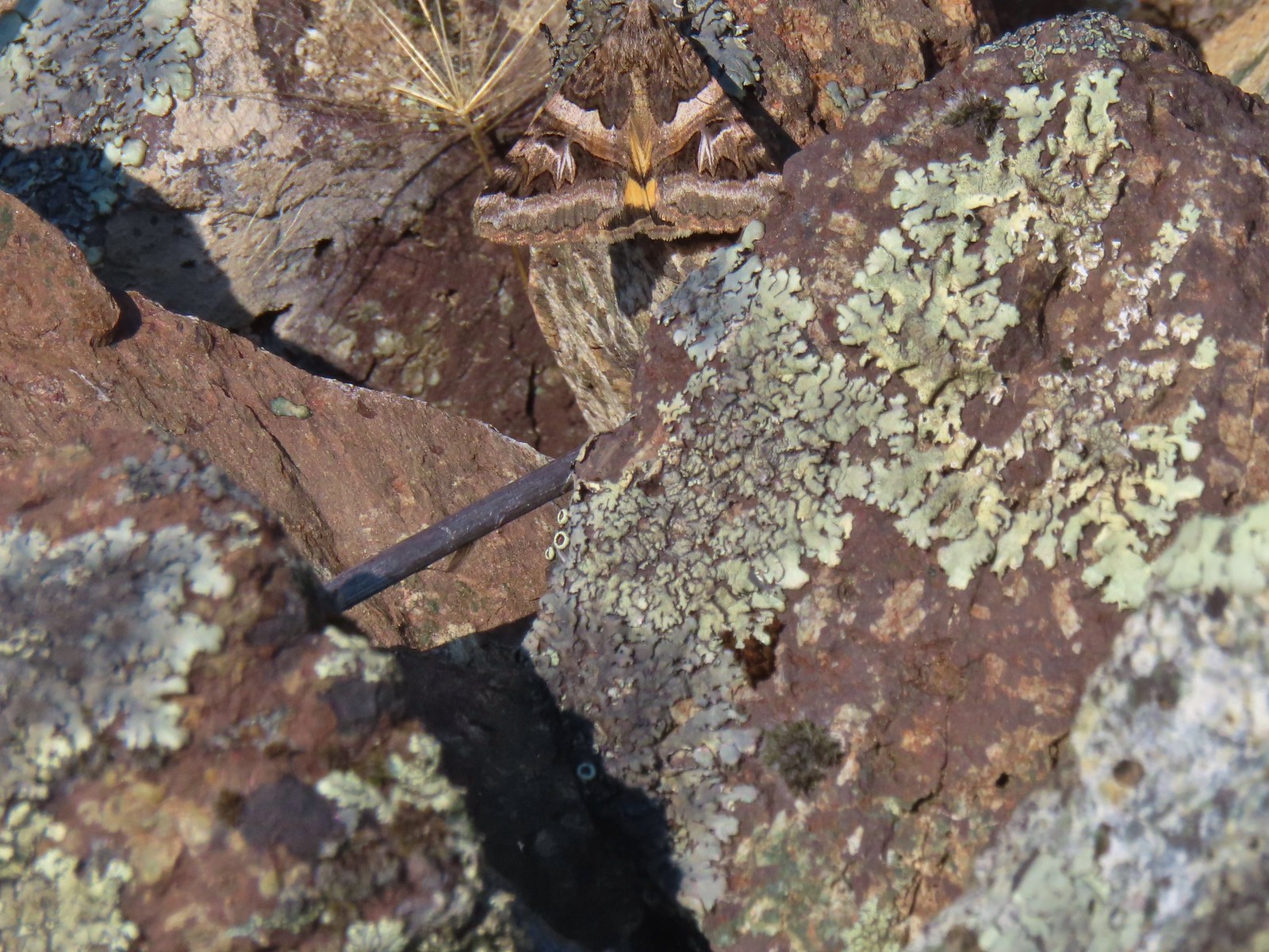 Moth – 6/16/23, Trail 1890, Hells Canyon National Recreation Area
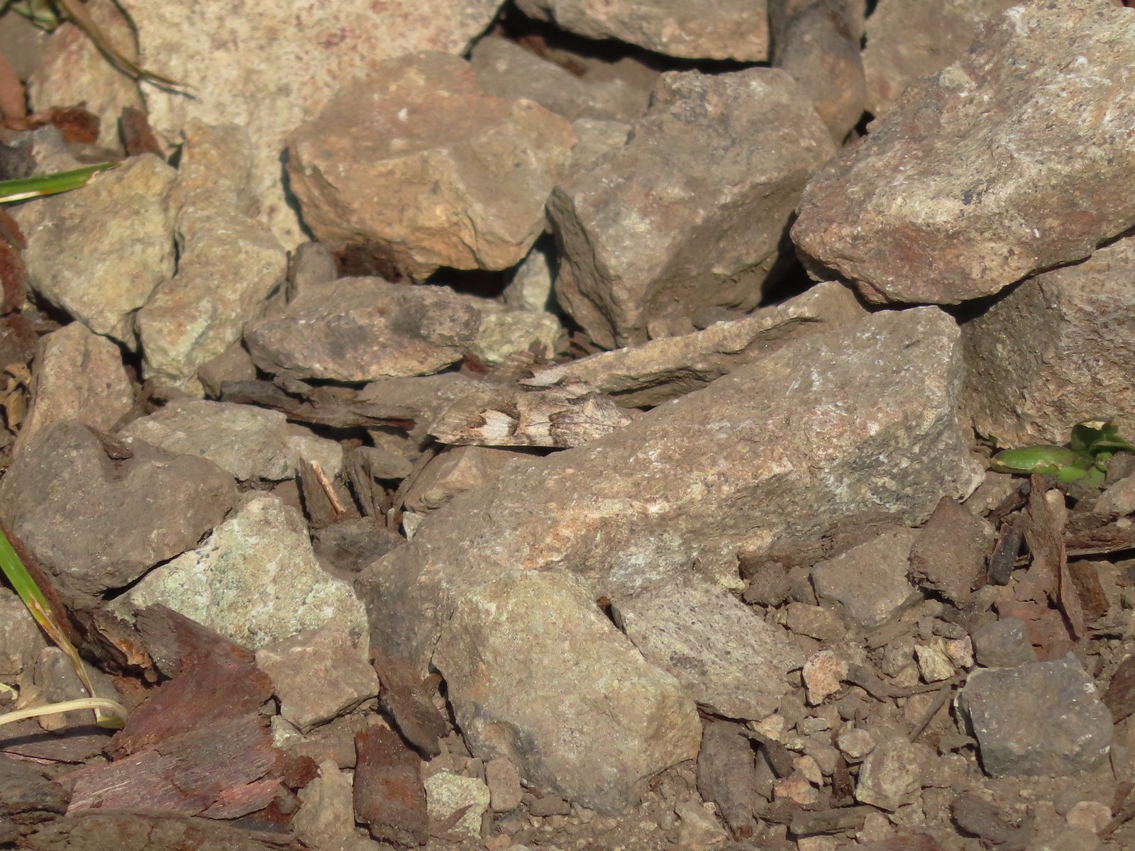 Moth – 7/4/23, Rocky Top Trail, North Santiam State Park
 Moth – 6/25/23, North Umpqua Trail, BLM Roseburg District
 Moth – 6/12/23, Imnaha River Trail, Eagle Cap Wilderness
 Moth – 6/24/23, Rogue River National Recreation Trail, Wild Rogue Wilderness
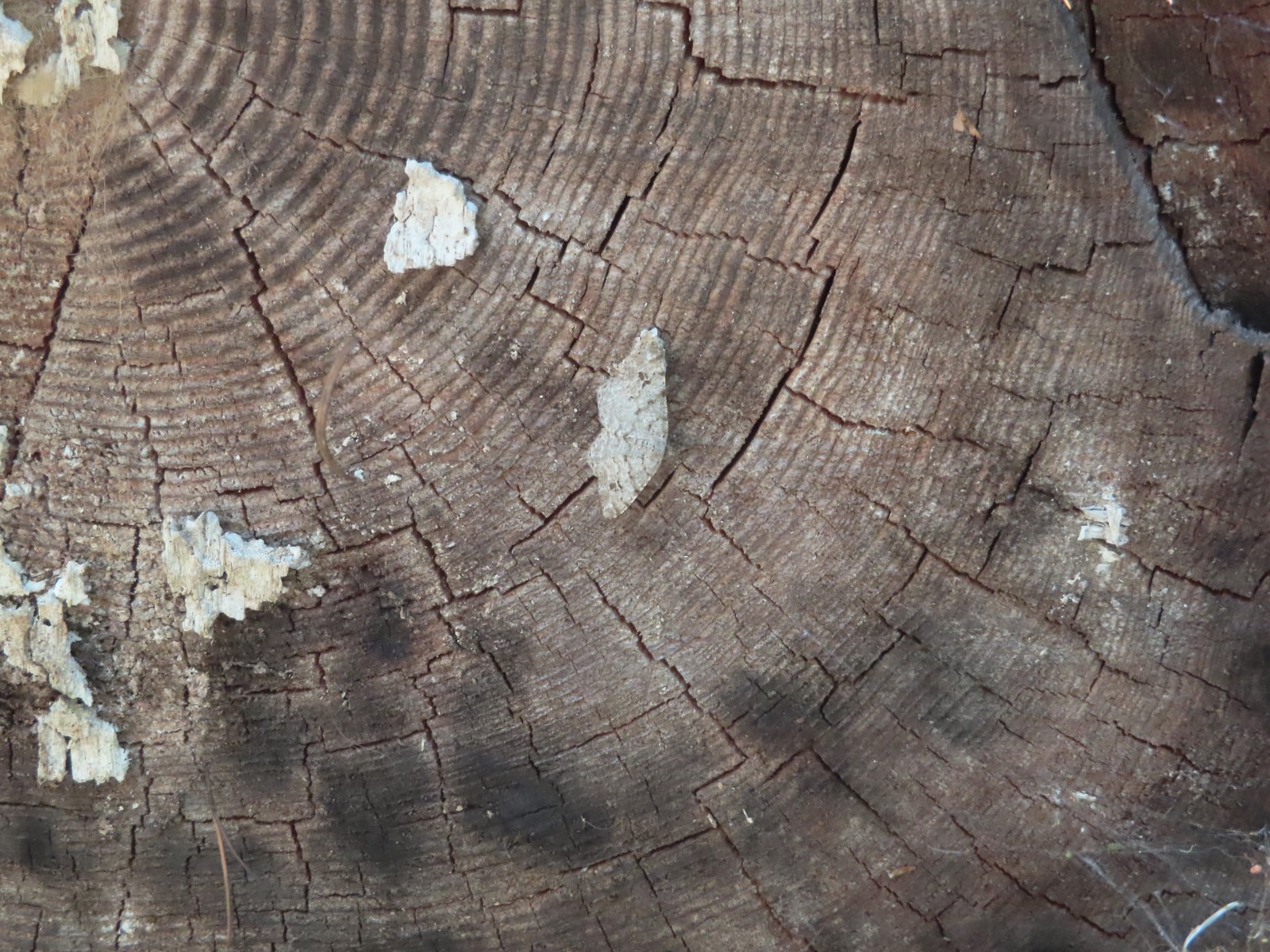 Moth – 7/8/23, Santiam Wagon Road, Willamette National Forest
 Sphinx moth – 8/17/23, West Eagle Trail, Eagle Cap Wilderness
 Fly and butterfly – 5/28/23, Criterion Tract, BLM Prineville District
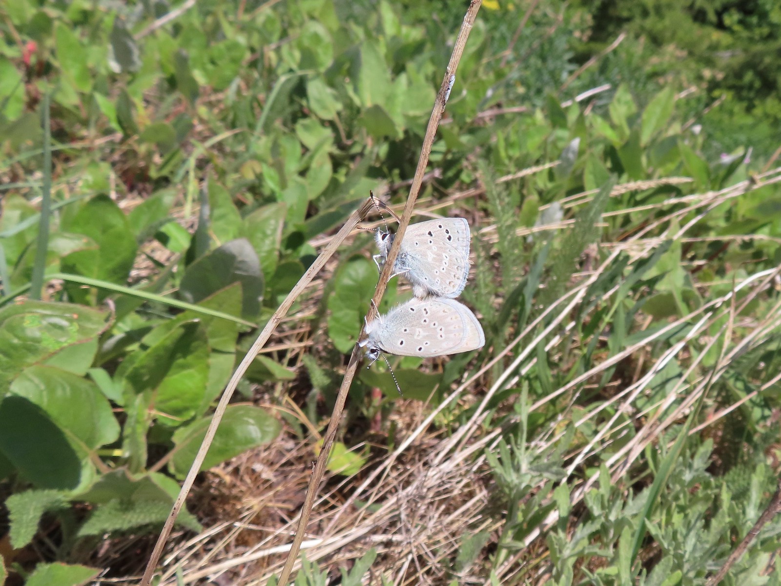 Boisduval’s blues? – 6/3/23, Buck Creek Trail, Husum, WA
 Acmon blue? – 5/28/23, Criterion Tract, BLM Prineville District
 Eastern tailed blue? – 5/13/23, Graham Oaks Nature Park, Wilsonville
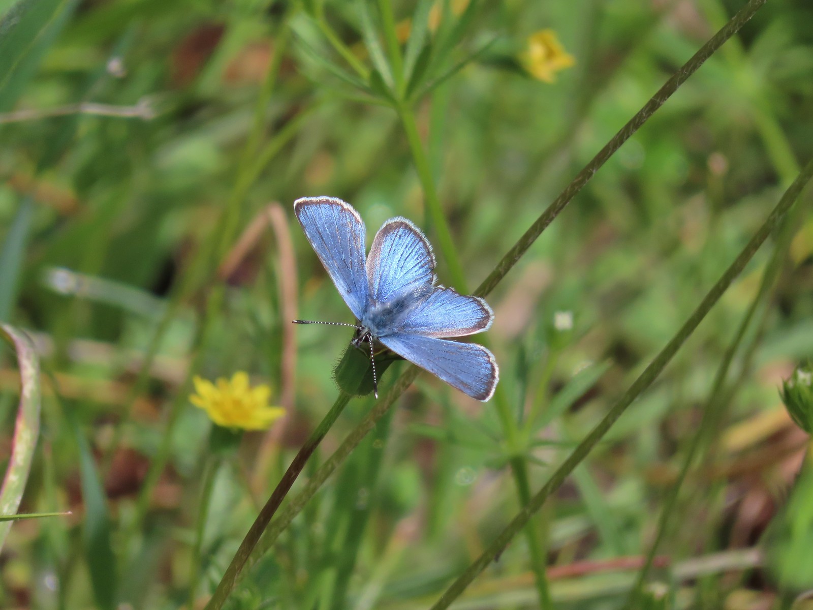 Butterfly in the Lycaenidae family – 5/2/23, Sterling Mind Ditch Trail System, BLM Medford District
 Butterfly in the Lycaenidae family – 5/28/23, Criterion Tract, BLM Prineville District
 Butterfly in the Lycaenidae family – 6/15/23, Hells Canyon National Recreation Area, Wallowa-Whitman National Forest
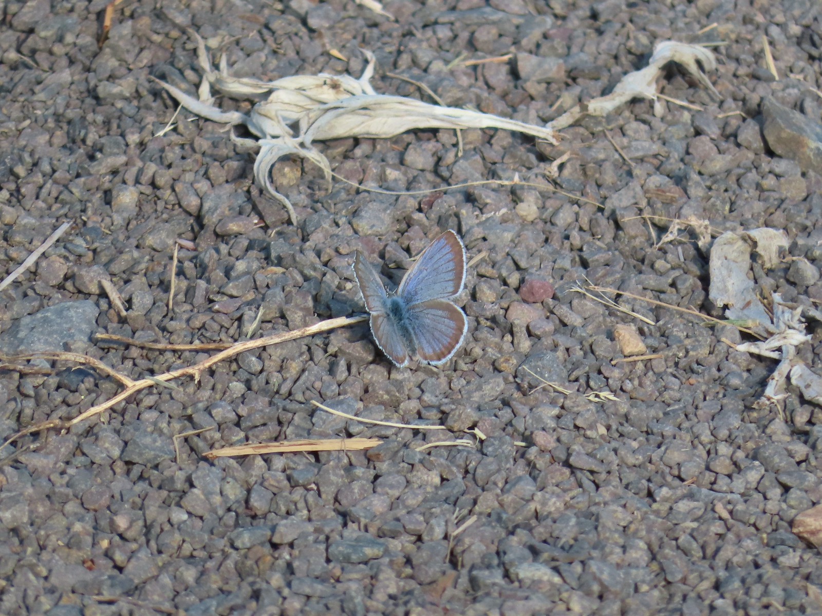 Butterfly in the Lycaenidae family – 6/13/23, Iwetemlaykin State Heritage Site, Joseph
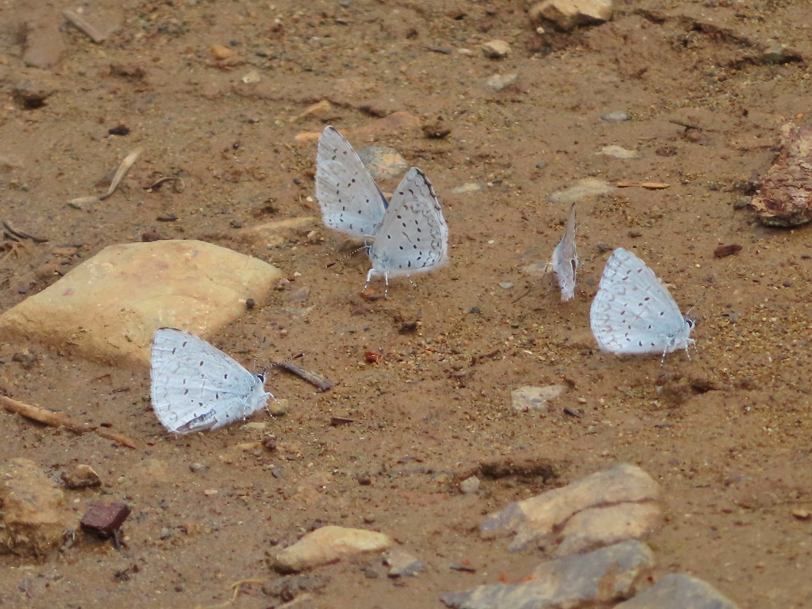 Echo azures? – 5/4/23, Forest Road 011, Rogue-River Siskiyou National Forest
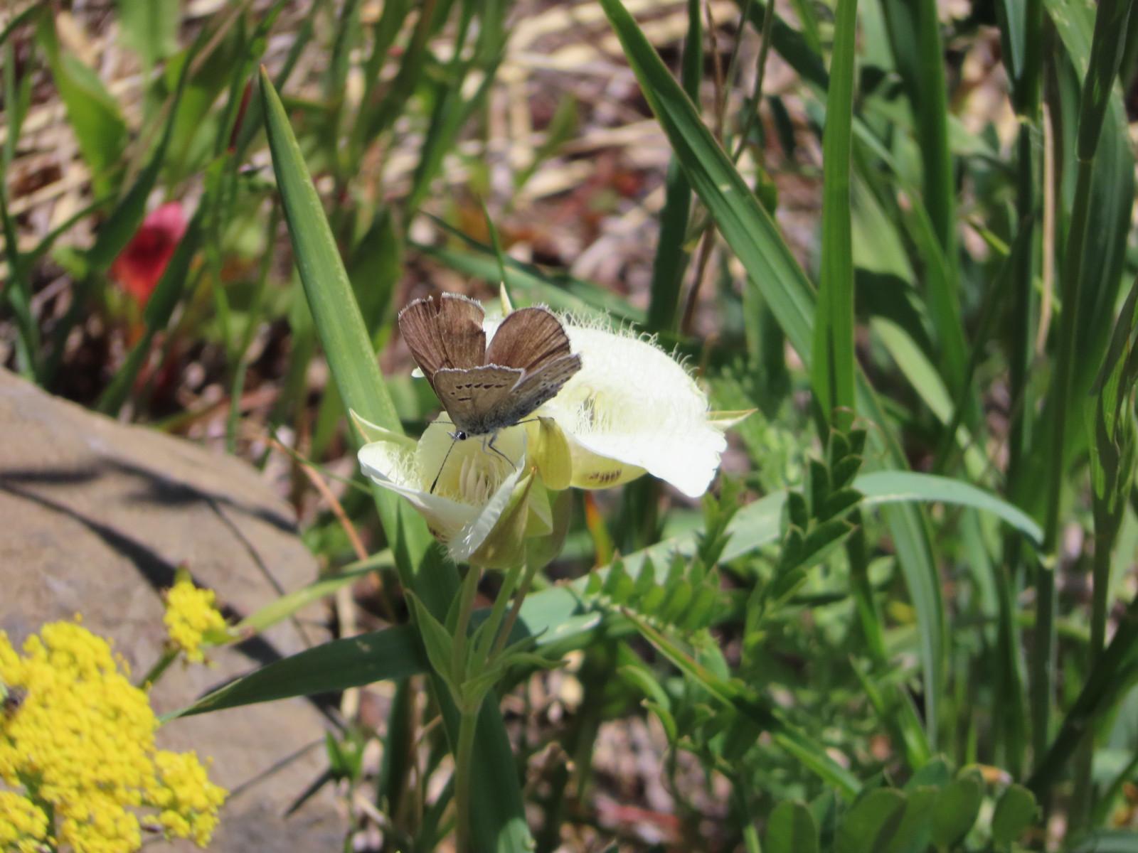 Butterfly in the Lycaenidae family – 6/3/23, Buck Creek Trail, Husum, WA
 Butterflies in the Lycaenidae family – 7/4/23, Niagra Heights Road, Santiam State Forest
 Gray hairstreak – 6/11/23, Lewis & Clark Trail, Hermiston
 Thicket hairstreak? – 7/8/23, Sand Mountain, Willamette National Forest
 A hairstreak – 6/3/23, Buck Creek Trail, Husum, WA
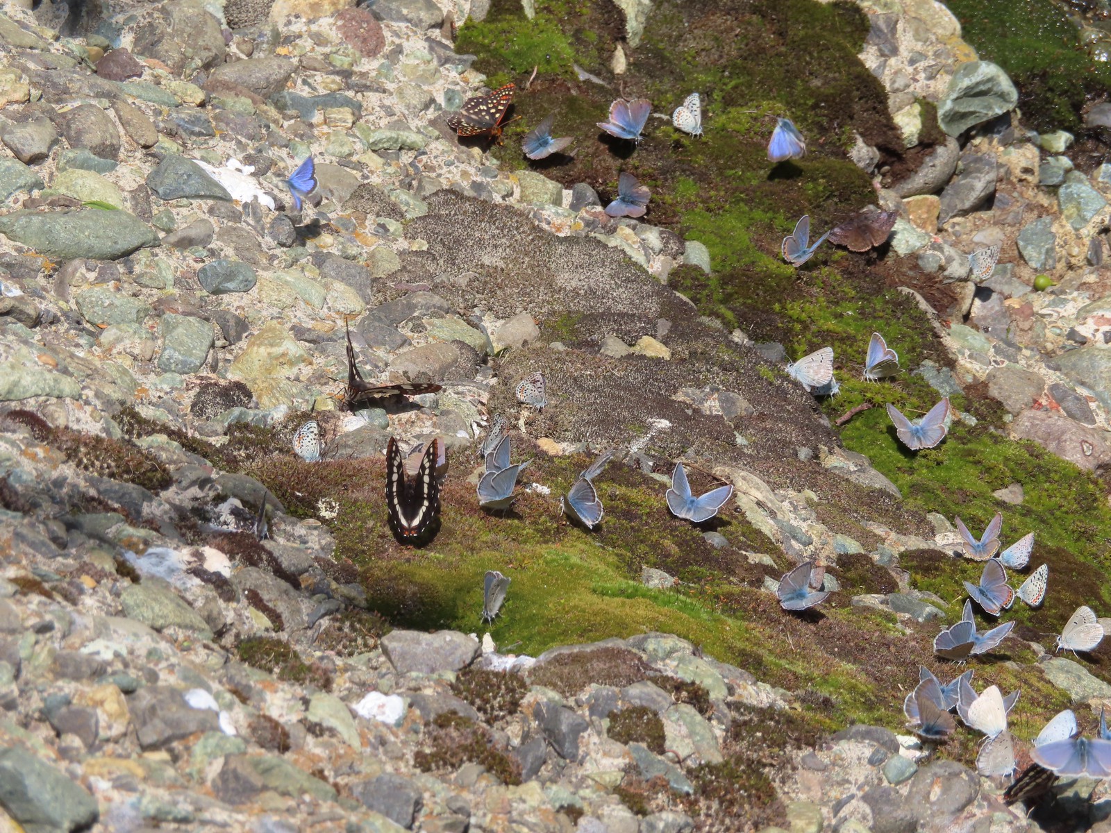 Various butterflies – 6/16/23, Deep Creek Stairway Trail, Payette National Forest, ID
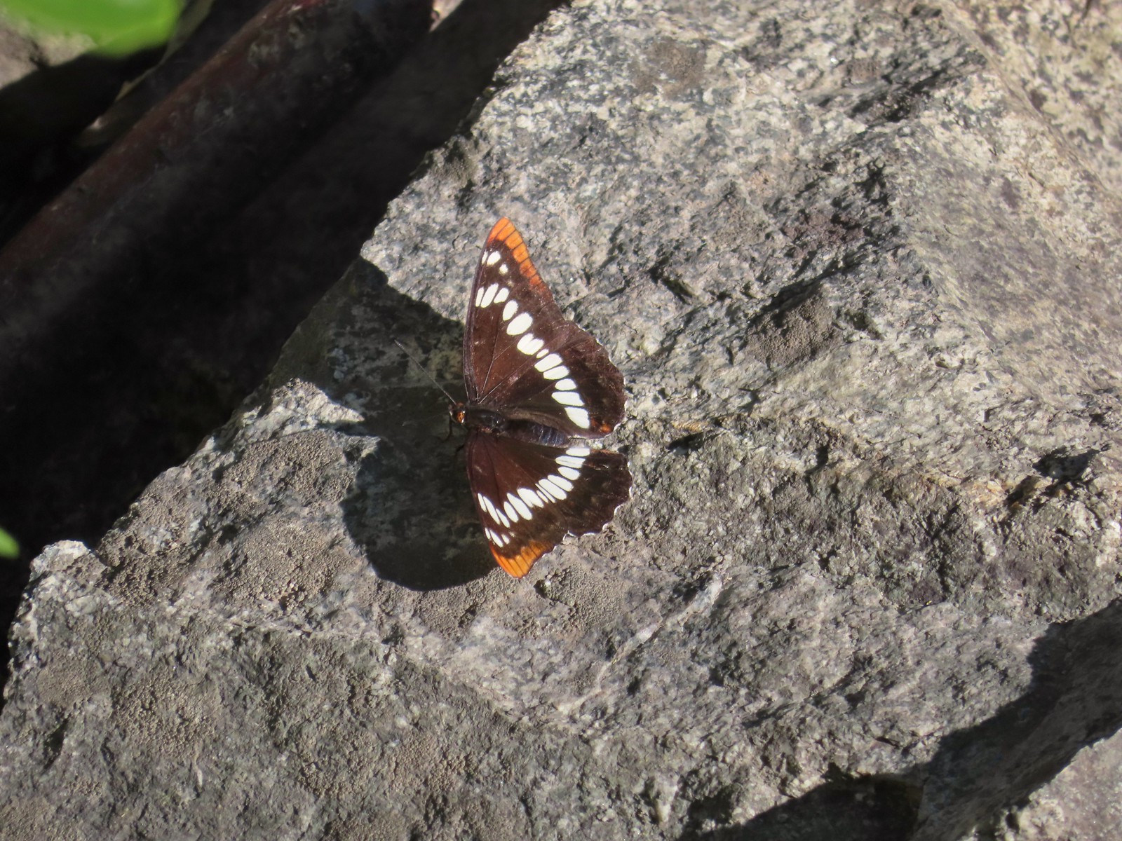 Lorquin’s admiral – 6/14/23, Imnaha Trail, Hells Canyon National Recreation Area
 Red admiral – 7/23/23, Metolius River Trail, Deschutes National Forest
 California sister – 10/8/23, Forest Road 041, Rogue River-Siskiyou National Forest
 Painted lady – 6/12/23, Imnaha River Trail, Eagle Cap Wilderness
 California tortoiseshell – 9/16/23, Fish Lake Trail, Mt. Hood National Forest
 Milbert’s tortoiseshell – 8/14/23, Main Eagle Creek Trail, Eagle Cap Wilderness
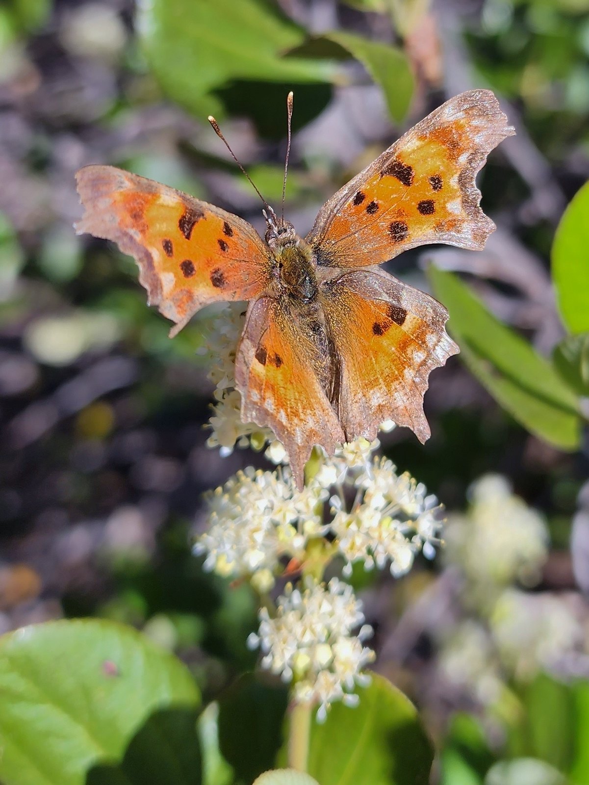 Hoary comma – 7/8/23, Sand Mountain, Willamette National Forest
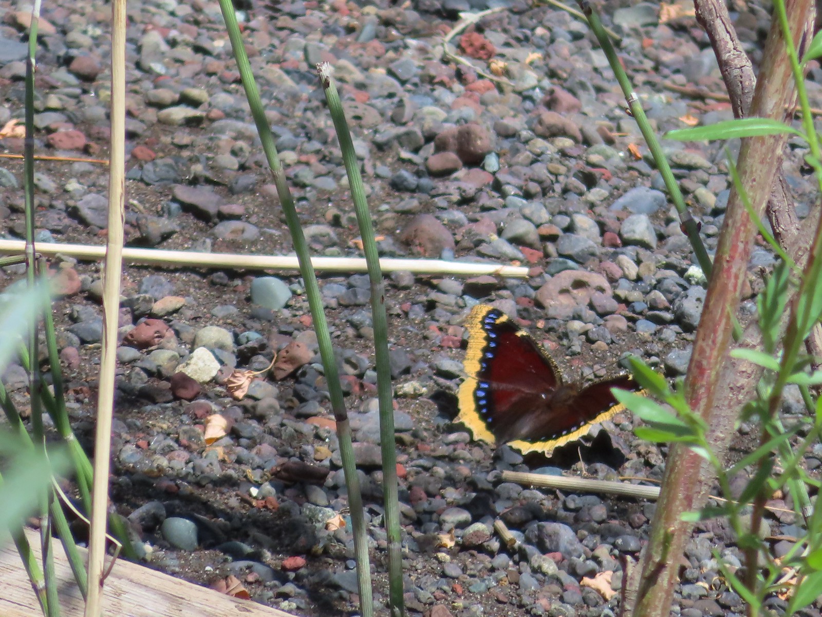 Mourning cloak – 6/14/23, Imnaha Trail, Hells Canyon National Recreation Area
 Common wood nymph – 6/15/23, Hells Canyon National Recreation Area, Wallowa-Whitman National Forest
 Ochre ringlet – 5/28/23, Criterion Tract, BLM Prineville District
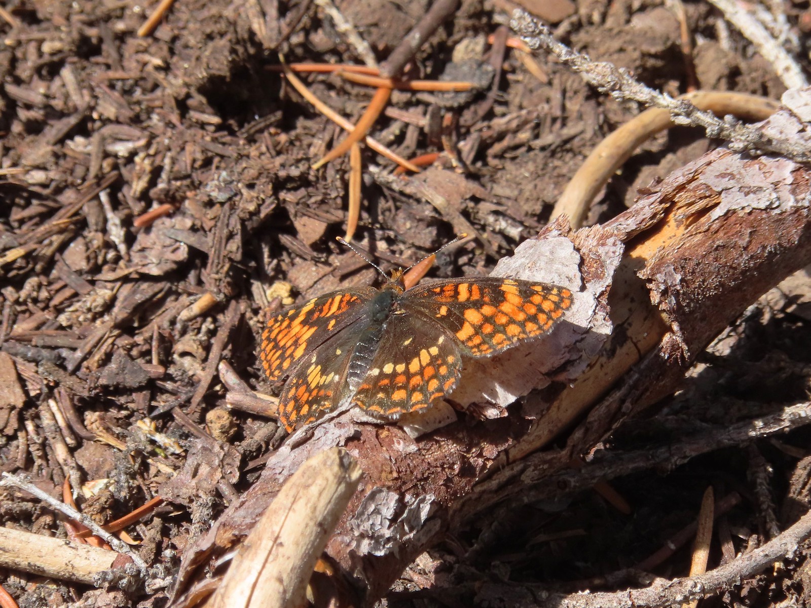 Checkerspot – 7/29/23, Stuart Falls Trail, Crater Lake National Park
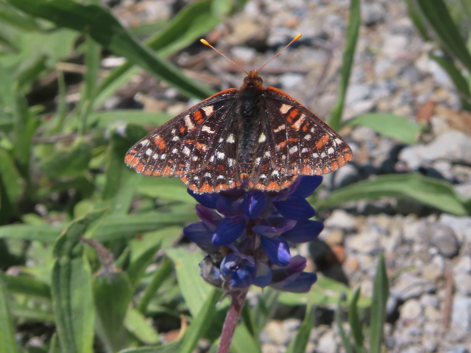 Checkerspot – 7/1/23, Boundary Trail, Mt. St. Helens National Volcanic Monument, WA
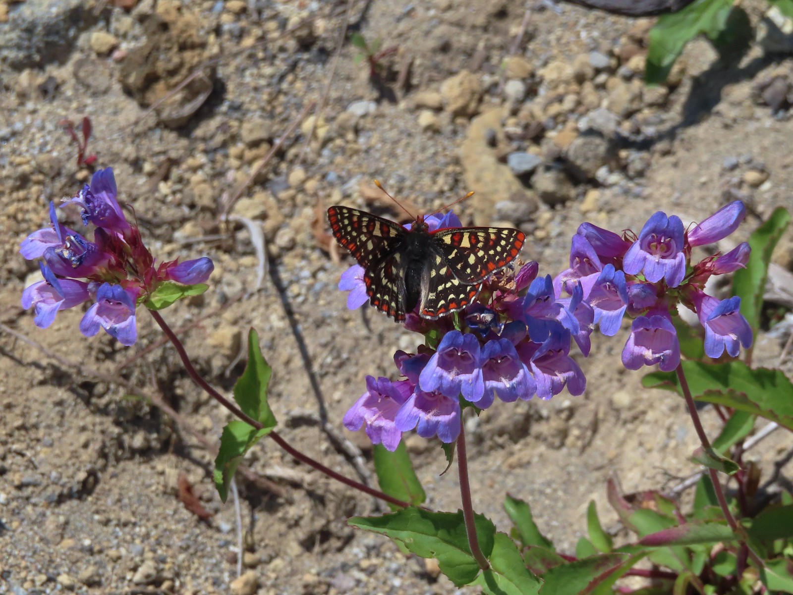 Snowberry checkerspot – 7/1/23, Boundary Trail, Mt. St. Helens National Volcanic Monument, WA
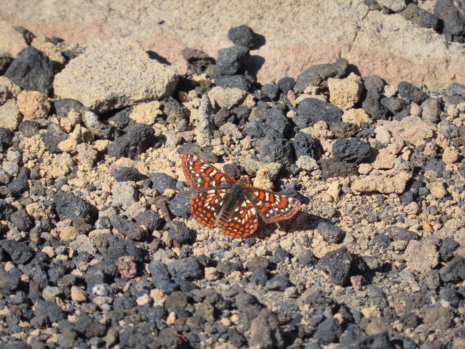 Edith’s checkerspot – 7/8/23, Sand Mountain, Willamette National Forest
 Mylitta crescent – 6/15/23, Hells Canyon National Recreation Area, Wallowa-Whitman National Forest
 A crescent? – 5/13/23, Graham Oaks Nature Park, Wilsonville
 Fritillary butterflies – 5/28/23, Criterion Tract, BLM Prineville District
 A fritillary – 7/4/23, Rocky Top Trail, Santiam State Forest
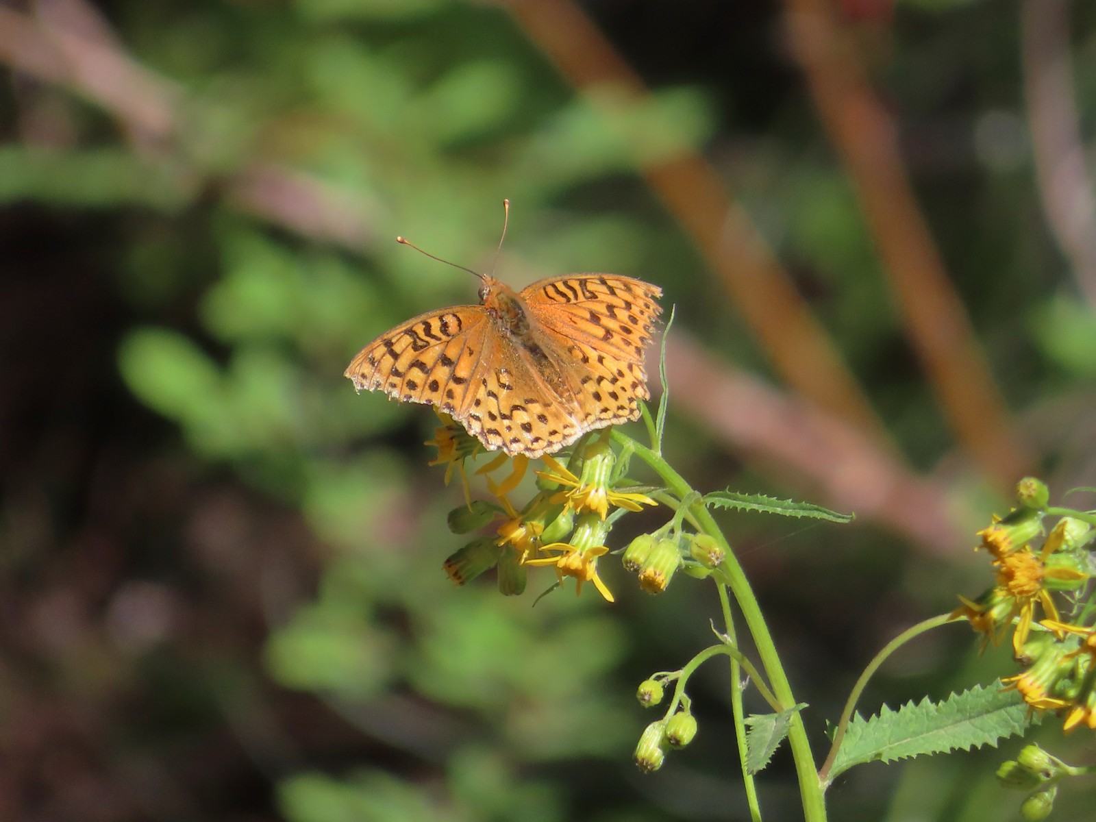 A fritillary – 7/15/23, Forest Road 4610, Mt. Hood National Forest
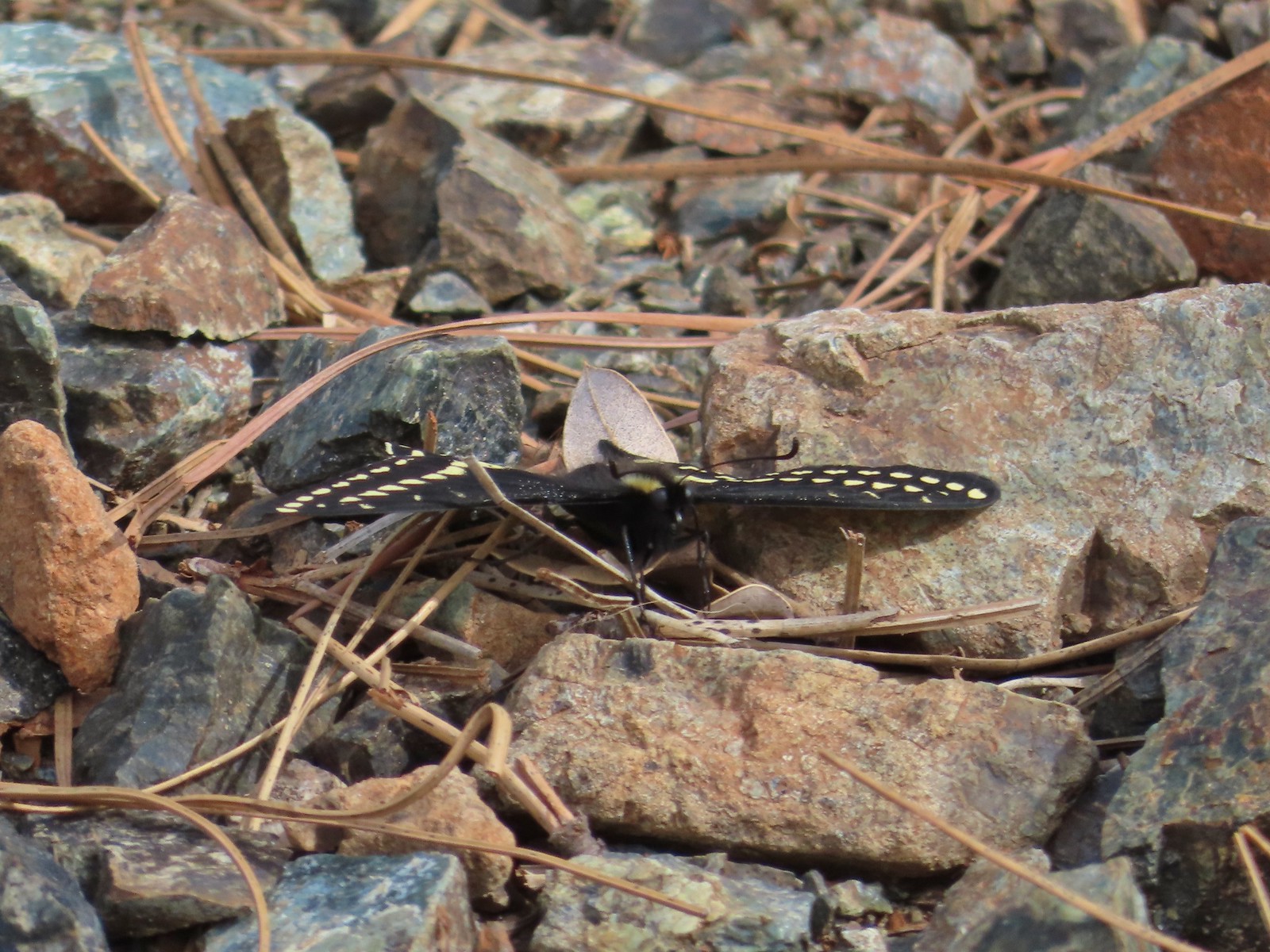 Indra swallowtail – 5/4/23, Kerby Flat Trail, Rogue River-Siskiyou National Forest
 Oregon swallowtail? with ladybug – 5/28/23, Criterion Tract, BLM Prineville District
 Swallowtail – 6/3/23, Conboy Lake National Wildlife Refuge, Trout Lake, WA
 Western swallowtails – 6/12/23, Imnaha River Trail, Eagle Cap Wilderness
 Swallowtail – 6/12/23, Imnaha River Trail, Eagle Cap Wilderness
 A sulphur – 9/9/23, Alta Lake Trail, Sky Lakes Wilderness
 Large marble – 5/28/23, Criterion Tract, BLM Prineville District
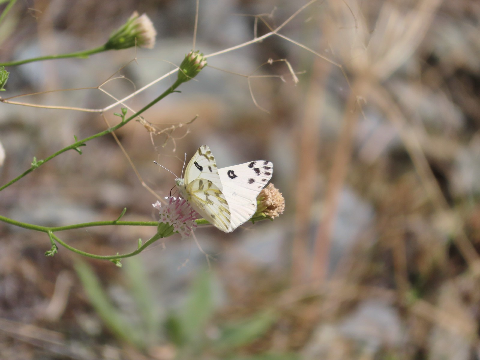 Becker’s white – 6/14/23, Imnaha Trail, Hells Canyon National Recreation Area
 Male margined white? – 8/29/23, Newell Creek Canyon Nature Park, Oregon City
 Mountain parnassian – 6/15/23, Hells Canyon National Recreation Area, Wallowa-Whitman National Forest
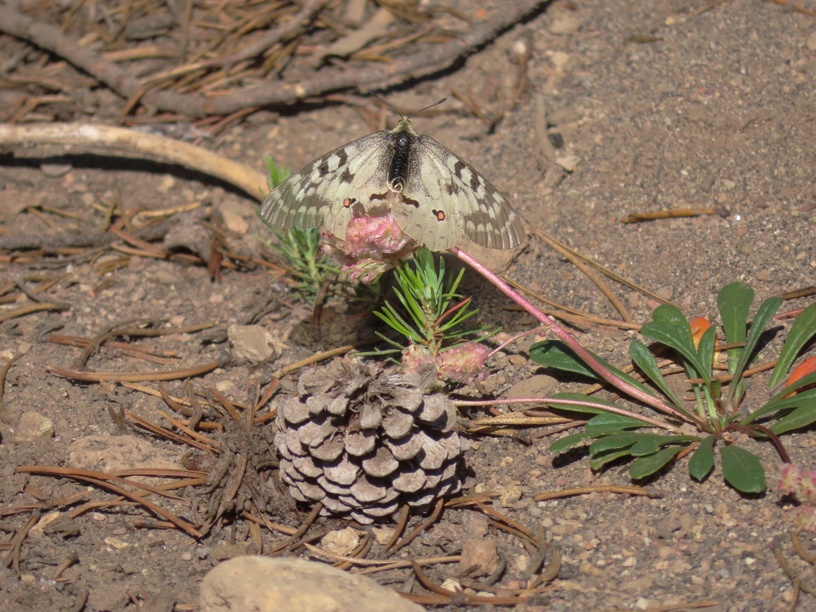 Clodius parnassian – 7/29/23, Pumice Flat Trail, Crater Lake National Park
 Silver-spotted Skipper – 6/14/23, Eureka Bar, Hells Canyon National Recreation Area
 A skipper – 5/28/23, Criterion Tract, BLM Prineville District
 A skipper – 6/12/23, Imnaha River Trail, Eagle Cap Wilderness
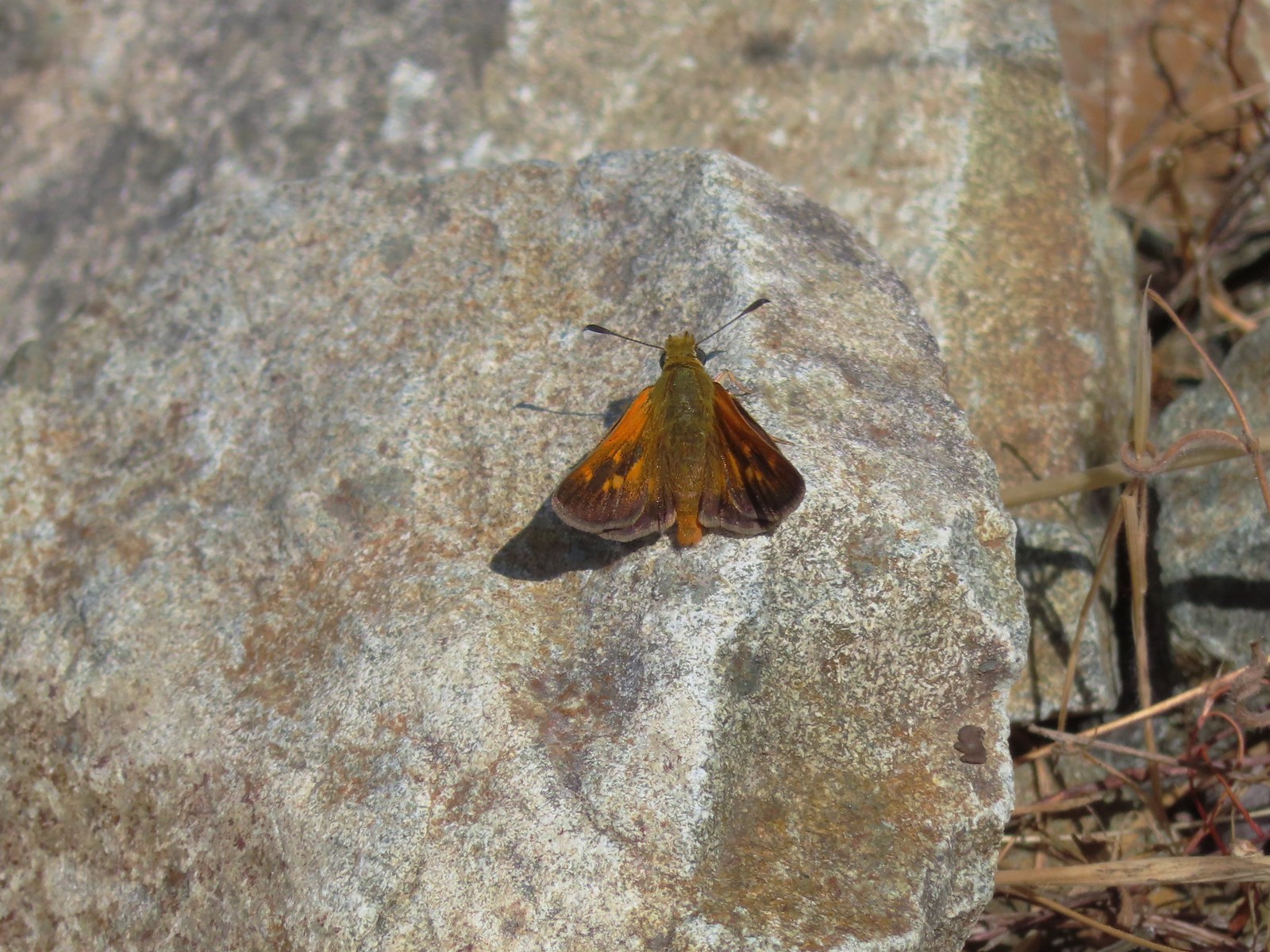 A skipper – 6/24/23, Rogue River National Recreation Trail, Wild Rogue Wilderness
 A skipper – 9/3/23, Threemile Canyon, BLM Burns District
 Skipper on a sagebrush mariposa lily – 7/23/23, Metolius River Trail, Deschutes National Forest
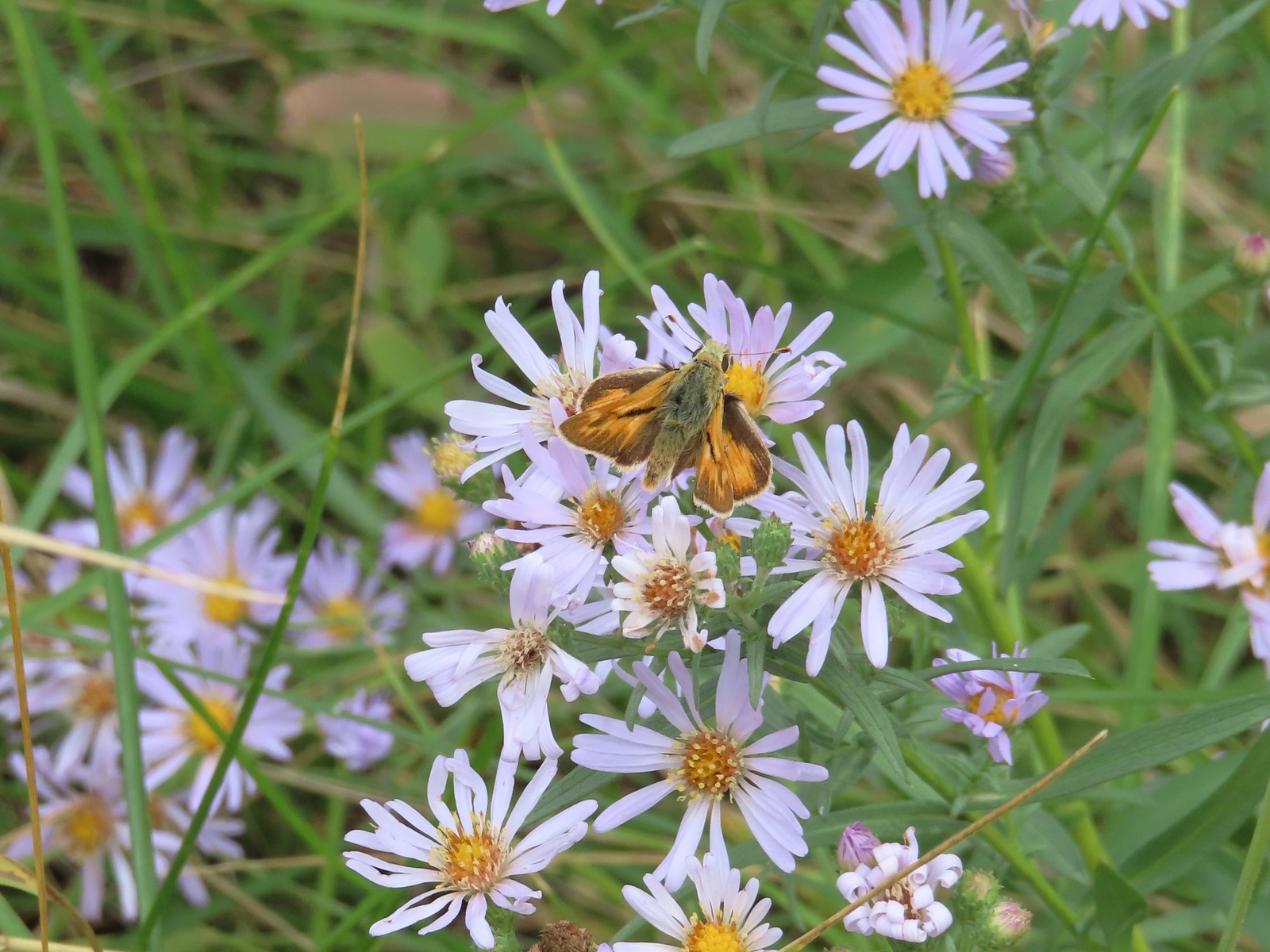 A skipper – 9/3/23, P Ranch, Malheur National Wildlife Refuge
 Duskywing? – 6/24/23, Rogue River National Recreation Trail, Wild Rogue Wilderness
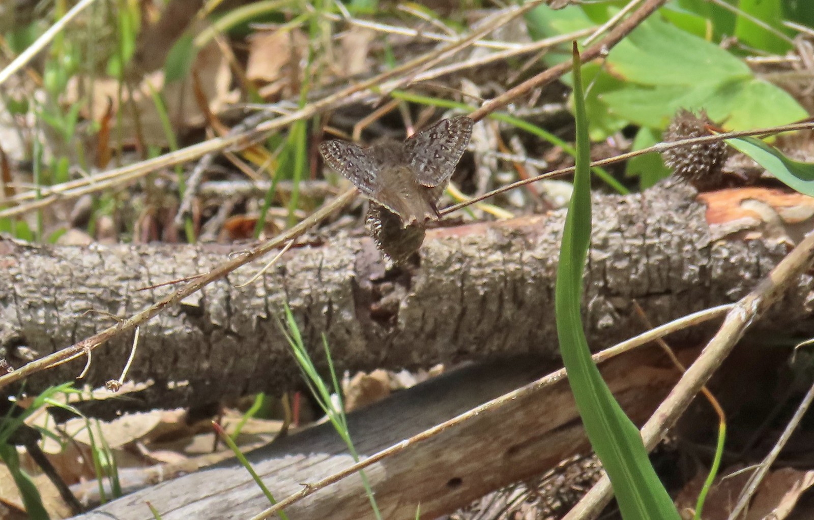 Duskywing – 5/3/23, Waters Creek Interpretive Trail, Rogue River-Siskiyou National Forest
 Dreamy duskywing – 6/12/23, Imnaha River Trail, Eagle Cap Wilderness
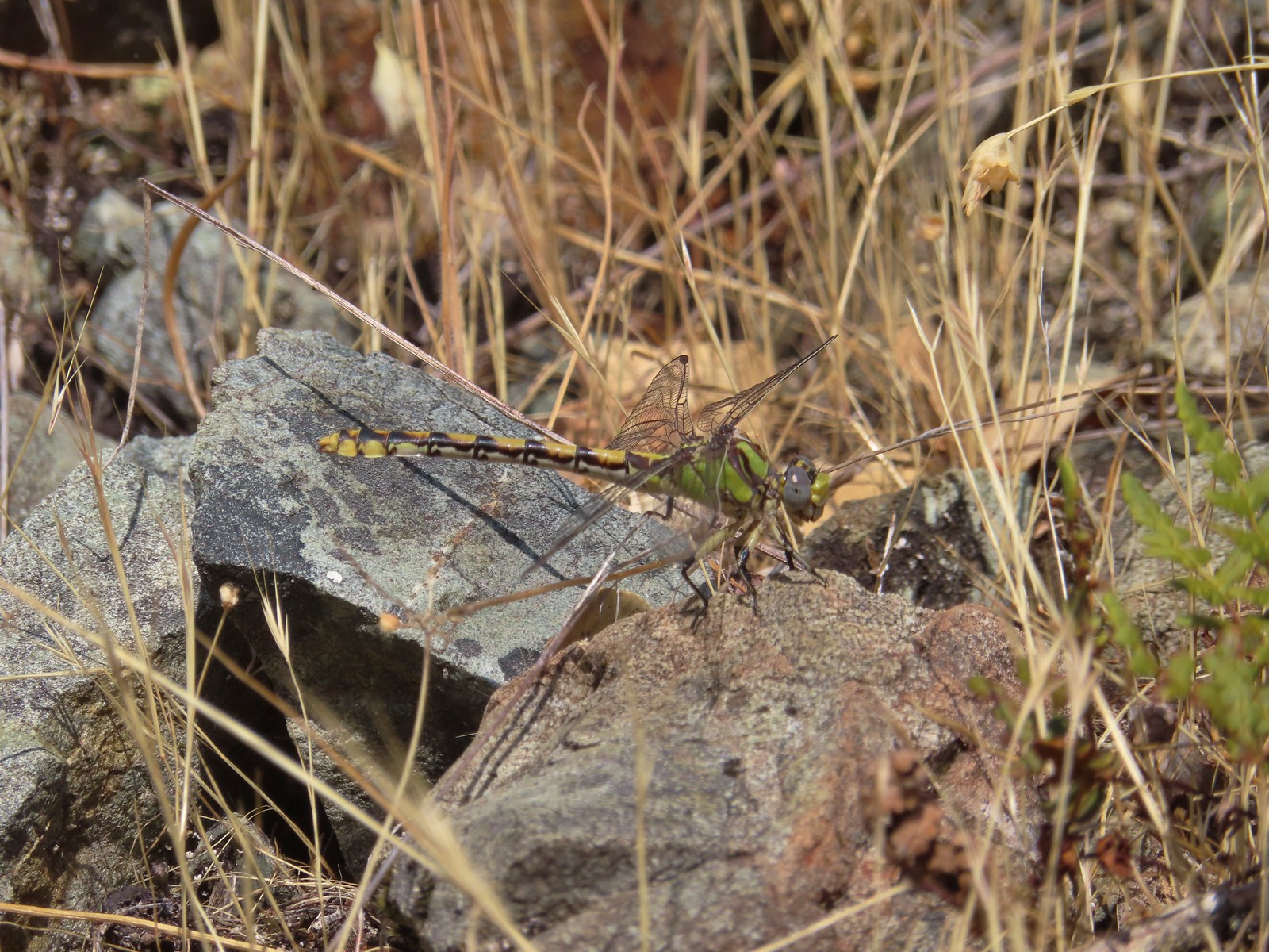 Dragonfly – 6/24/23, Rogue River National Recreation Trail, Wild Rogue Wilderness
 Dragonfly – 7/1/23, Hummocks Trail, Mt. St. Helens National Volcanic Monument, WA
 Dragonfly – 7/15/23, Plaza Lake, Salmon-Huckleberry Wilderness
 Dragonfly – 7/31/23, Godfrey Glen Trail, Crater Lake National Park
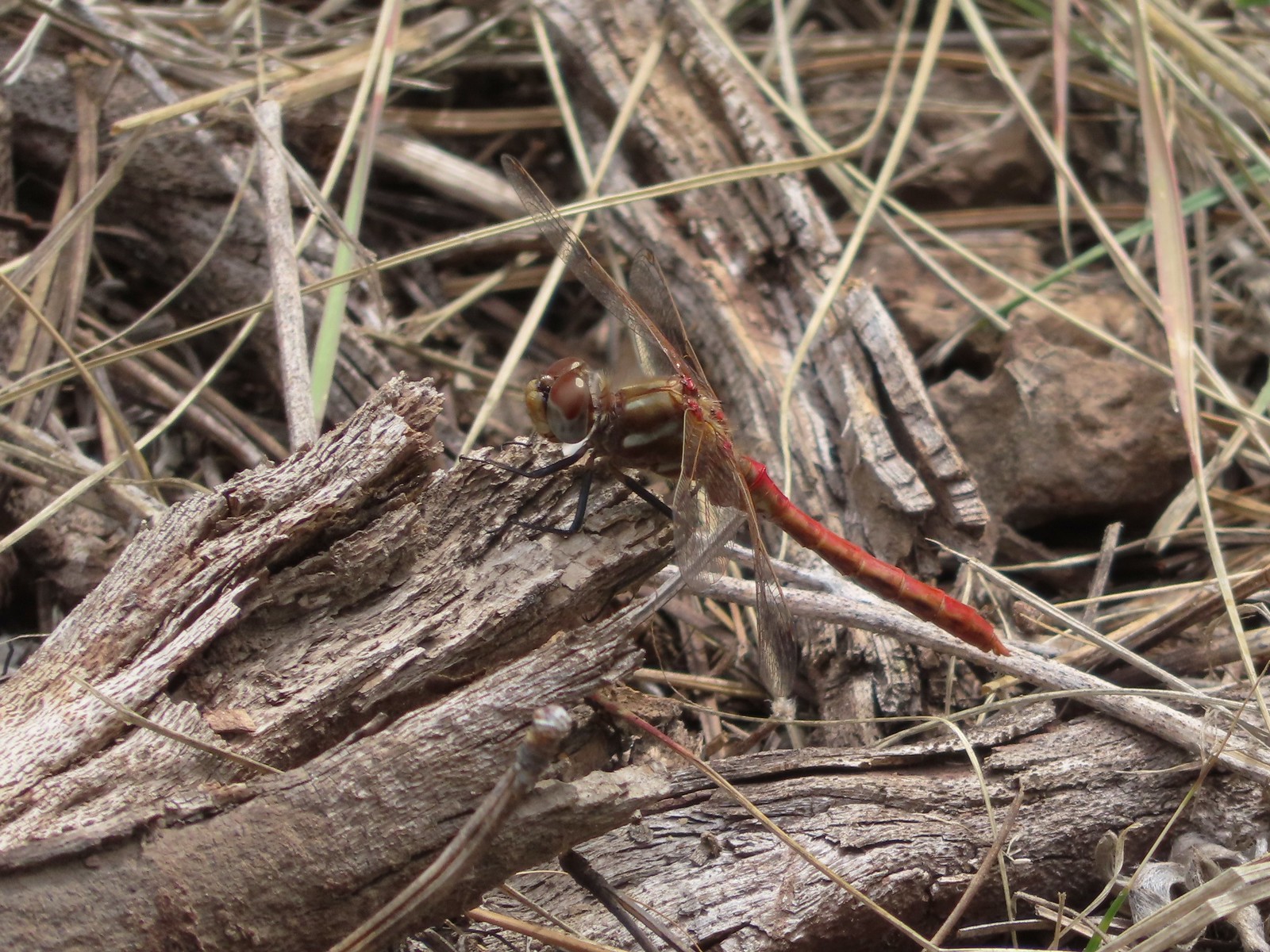 Dragonfly – 9/2/23, Idlewild Loop Trail, Malheur National Forest
 Slug – 4/29/23, Canemah Bluff Nature Park, Oregon City
 Snail – 4/15/23, Enchanted Valley Trail, Siuslaw National Forest
 Rough skinned newt – 4/15/23, Cape Mountain, Siuslaw National Forest
 Tadpoles – 9/9/23, Pacific Crest Trail, Sky Lakes Wilderness
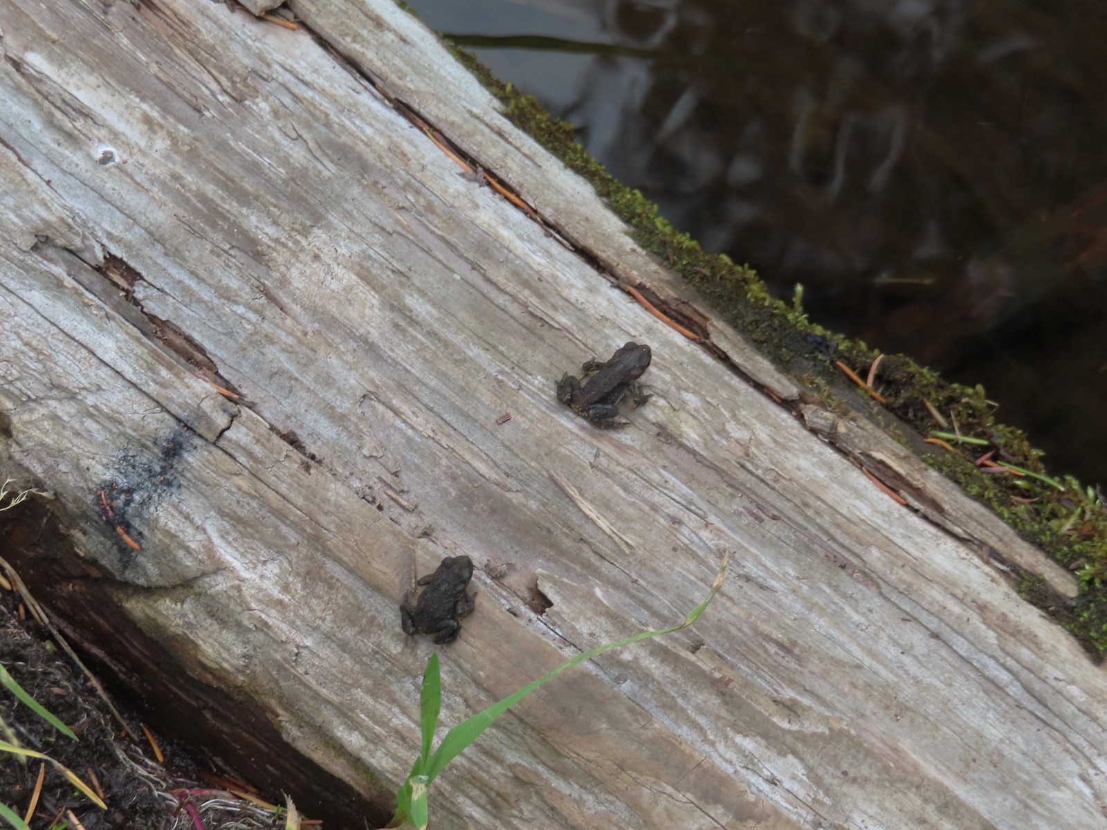 Western toads – 9/9/23, Pacific Crest Trail, Sky Lakes Wilderness
 Full grown western toad – 9/9/23, Pacific Crest Trail, Sky Lakes Wilderness
 Cascade frog – 9/9/23, Pacific Crest Trail, Sky Lakes Wilderness
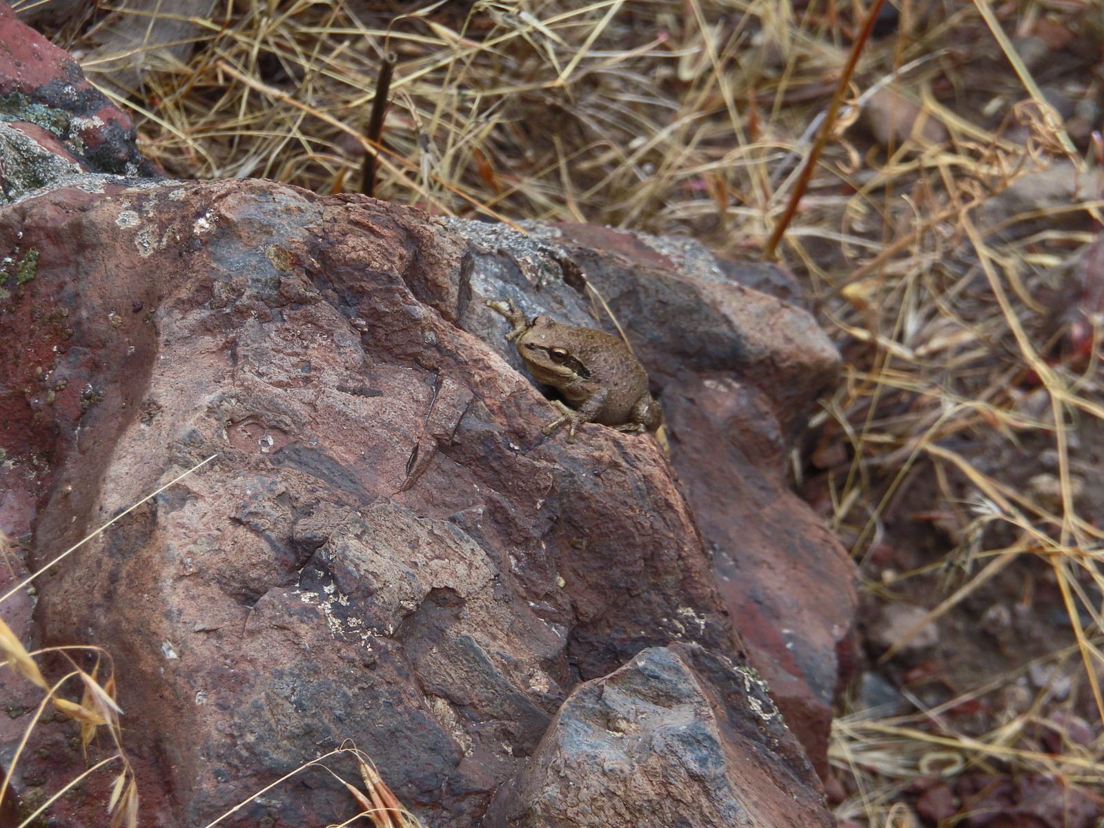 Pacific treefrog – 9/3/23, Threemile Canyon, BLM Burns District
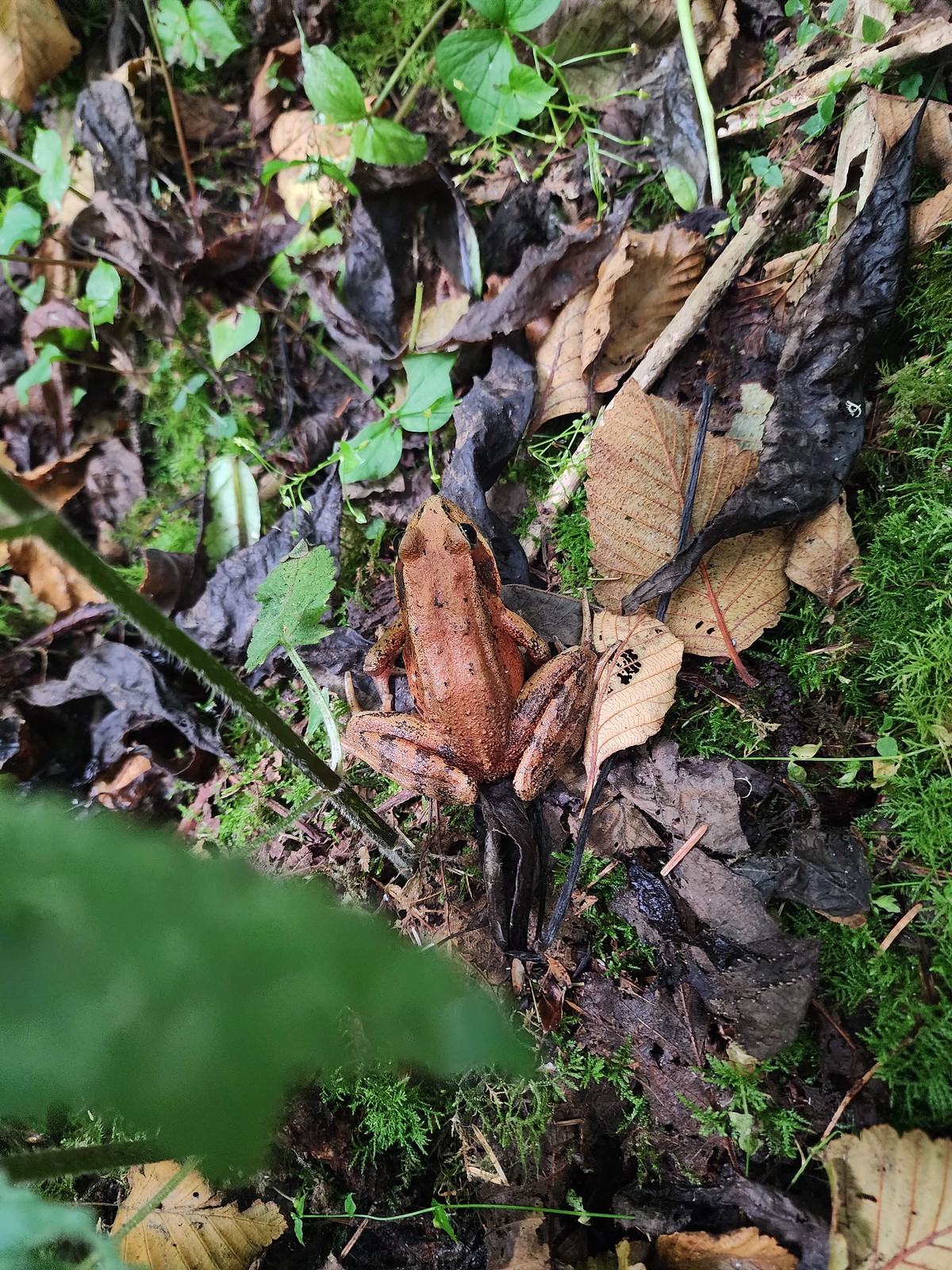 Northern red-legged frog – 8/26/23, Nestucca Bay National Wildlife Refuge, Cloverdale
 Bullfrog (invasive) – 4/22/23, Talking Water Gardens, Albany
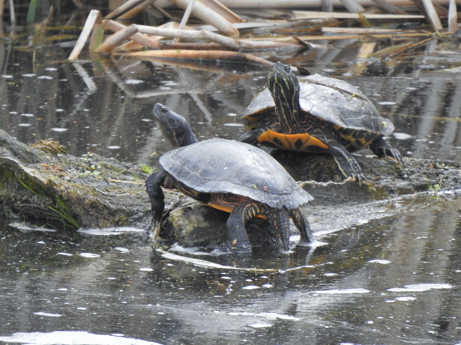 Western pond turtles – 4/22/23, Talking Water Gardens, Albany
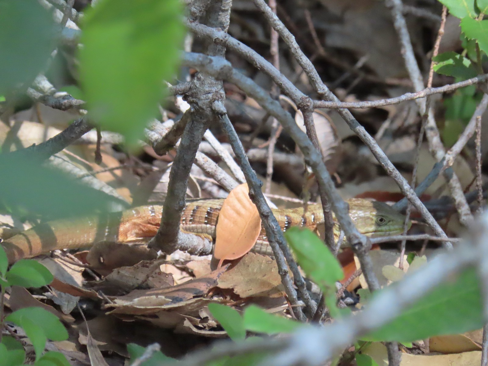 Southern alligator lizard – 6/24/23, Rogue River National Recreation Trail, Wild Rogue Wilderness
 Western fence lizard – 5/3/23, Waters Creek Interpretive Trail, Rogue River-Siskiyou National Forest
 Sagebrush lizard – 7/22/23, Shut-In Trail, Deschutes National Forest
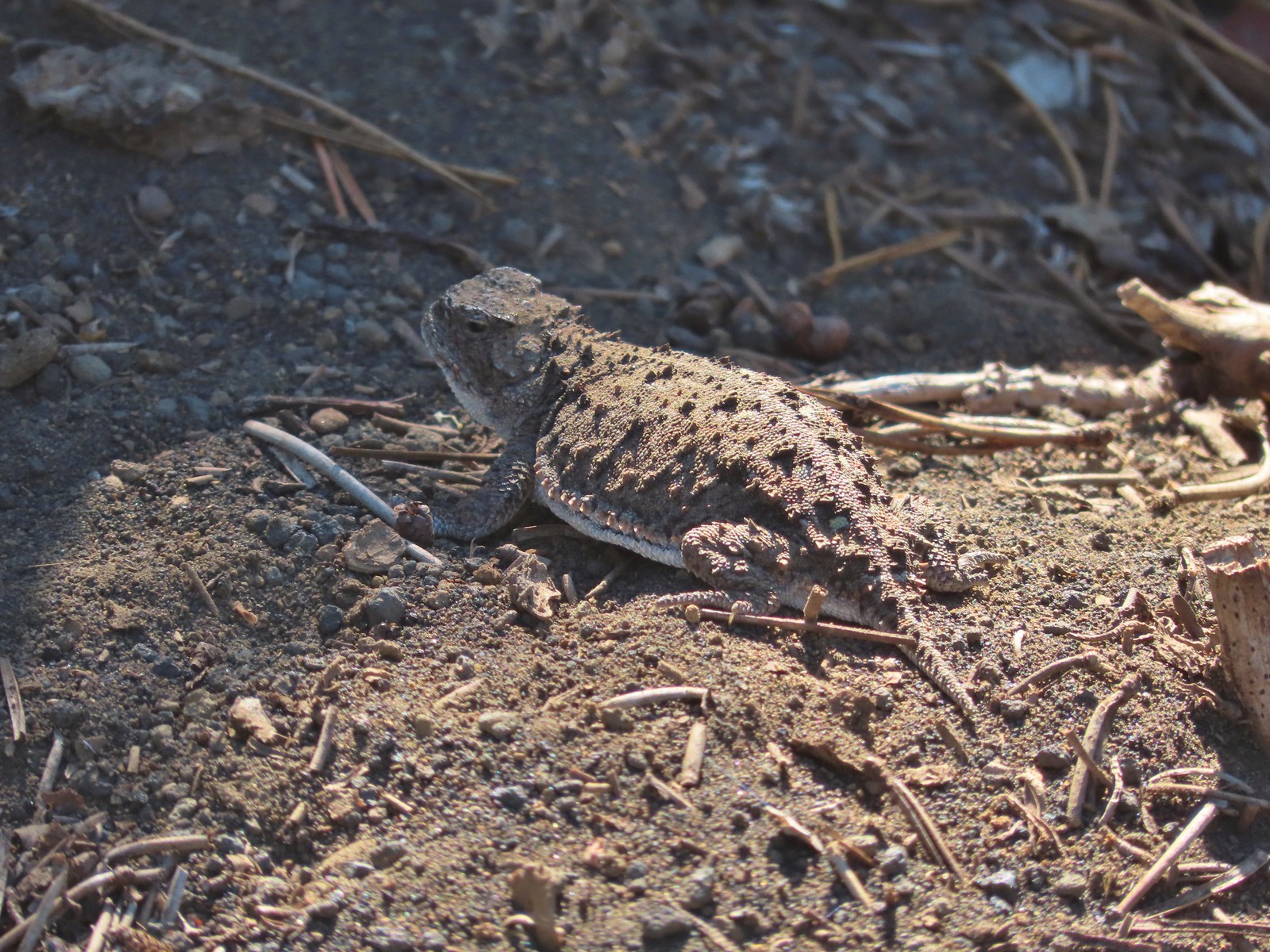 Pygmy short-horned lizard – 7/8/23, Santiam Wagon Road, Willamette National Forest
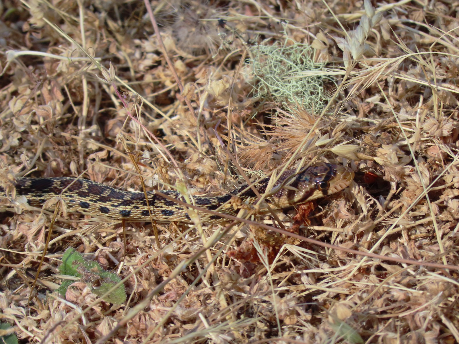 Gopher snake – 6/25/23, North Bank Habitat, BLM Roseburg District
 Garter snake – 4/22/23, Dave Clark Riverfront Path, Albany
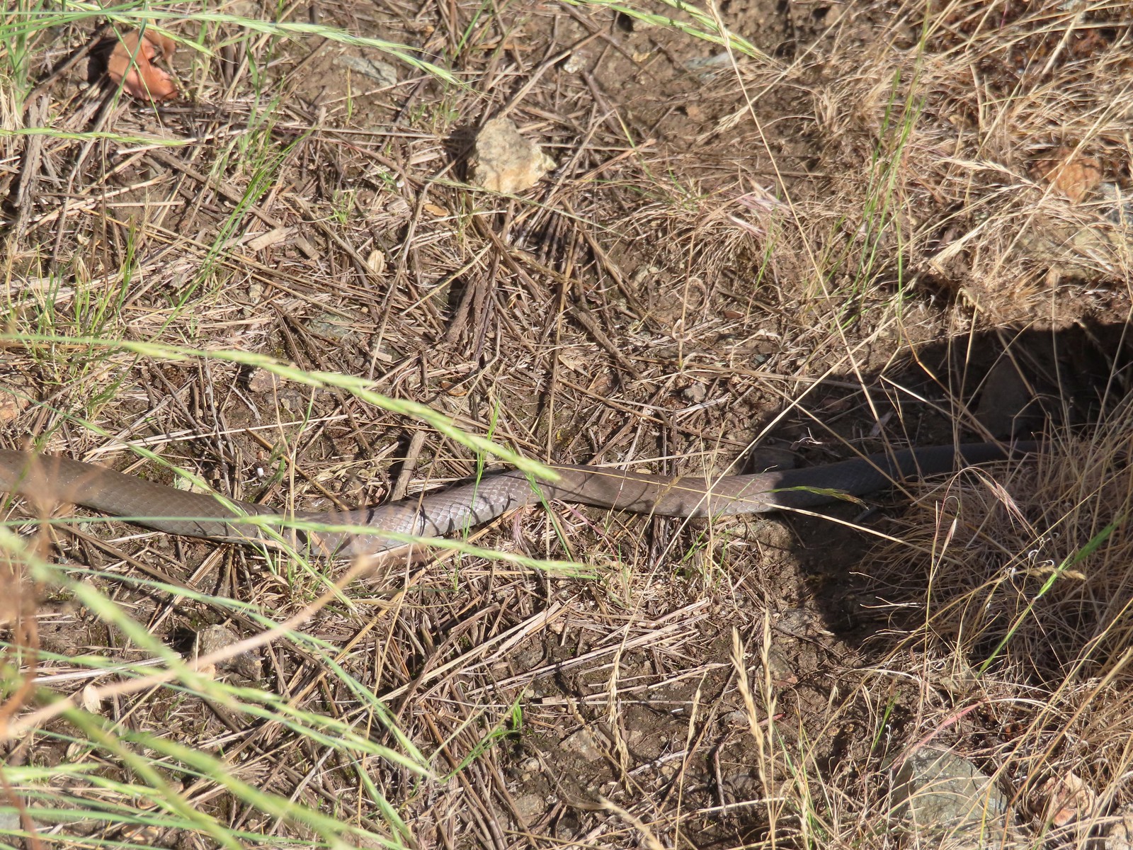 Rubber boa? – 6/14/23, Imnaha Trail, Hells Canyon National Recreation Area
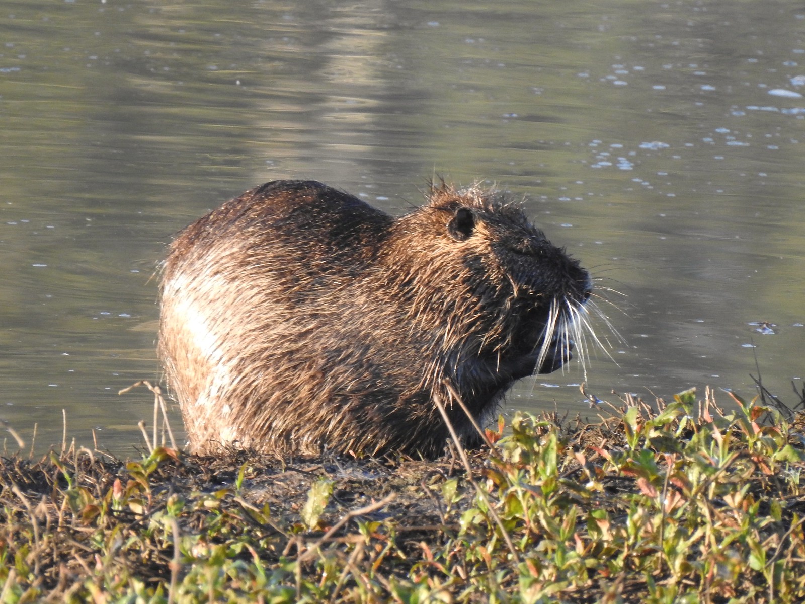 Nutria (invasive) – 5/13/23, Tualatin River National Wildlife Refuge, Sherwood
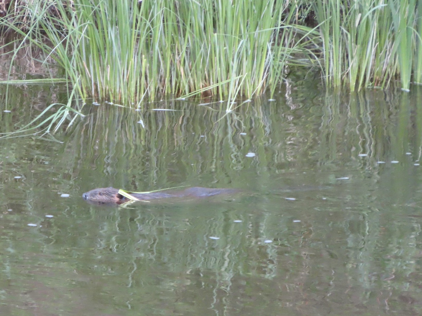 Beaver – 5/29/23, Riley Ranch Preserve, Bend
 Yellow-bellied marmot – 7/31/23, Garfield Peak Trail, Crater Lake National Park
 Gray squirrel – 4/22/23, Dave Clark Riverfront Path, Albany
 Douglas’ squirrel – 4/22/23, Dave Clark Riverfront Path, Albany
 Eastern fox squirrel? – 4/29/23, Newell Creek Canyon Nature Park, Oregon City
 Columbian ground squirrel – 8/16/23, Tombstone Lake Trail, Eagle Cap Wilderness
 Golden-mantled ground squirrel – 7/31/23, Garfield Peak Trail, Crater Lake National Park
 Chipmunk – 8/5/23, McNeil Point scramble trail, Mt. Hood Wilderness
 Pika – 8/5/23, McNeil Point Trail, Mt. Hood Wilderness
 Rabbit – 5/13/23, Tualatin River National Wildlife Refuge, Sherwood
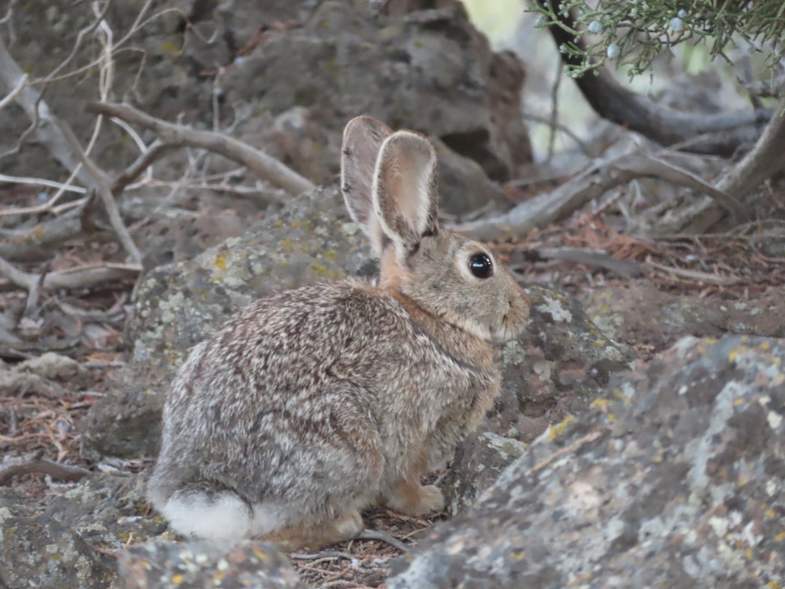 Mountain cottontail – 5/29/23, Riley Ranch Preserve, Bend
 Fawns – 7/31/23, Garfield Peak Trail, Crater Lake National Park
 Doe – 5/20/23, Steigerwald Lake National Wildlife Refuge, Washougal, WA
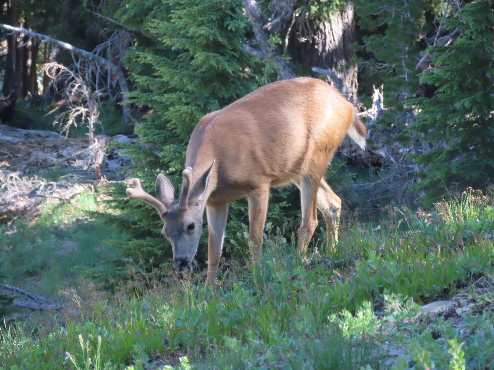 Buck – 7/31/23, Rim Trail, Crater Lake National Park
 Elk – 6/15/23, Buckhorn Road (FR 46), Wallowa-Whitman National Forest
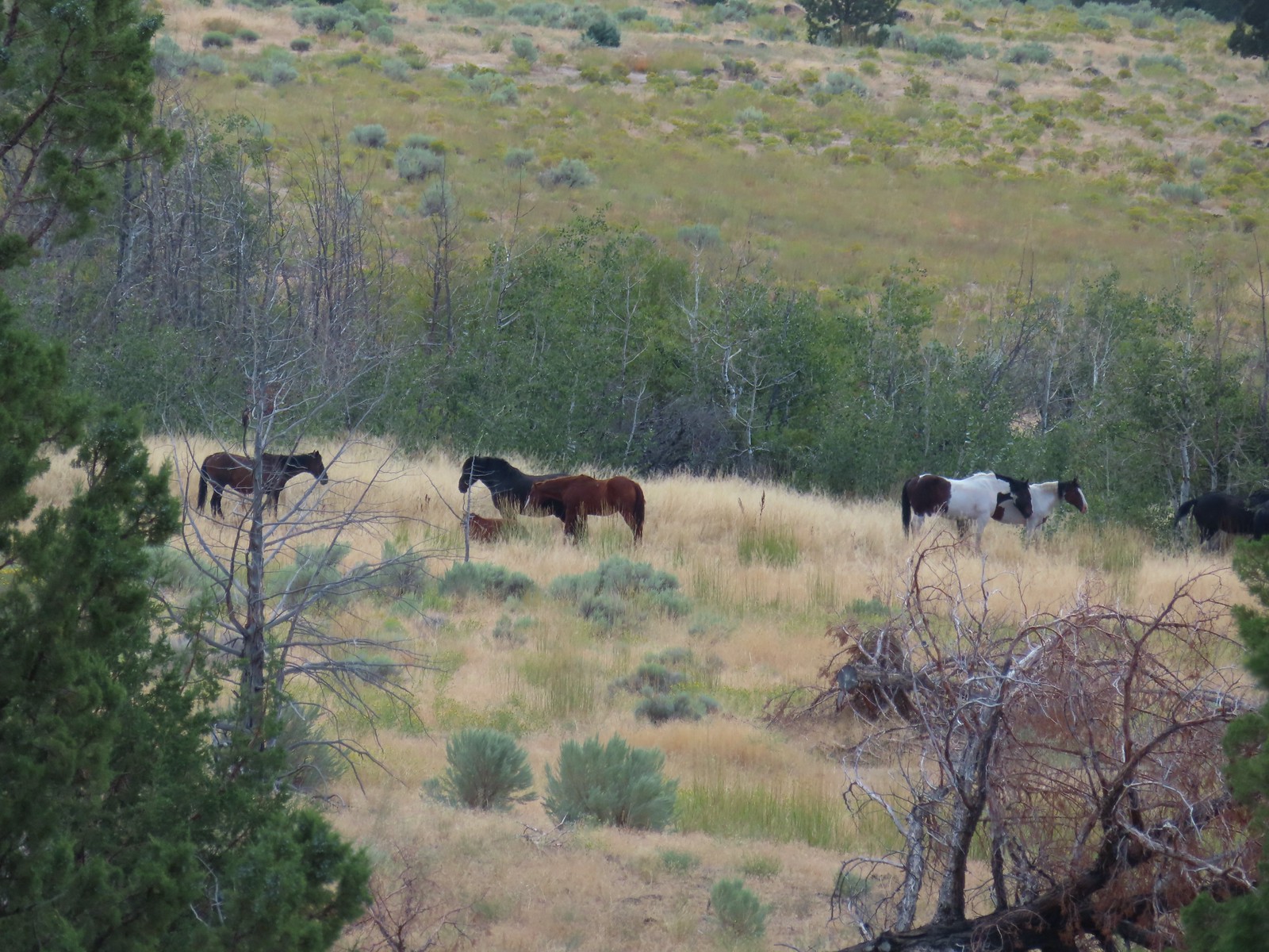 Horses – 9/3/23, Threemile Canyon, BLM Burns District
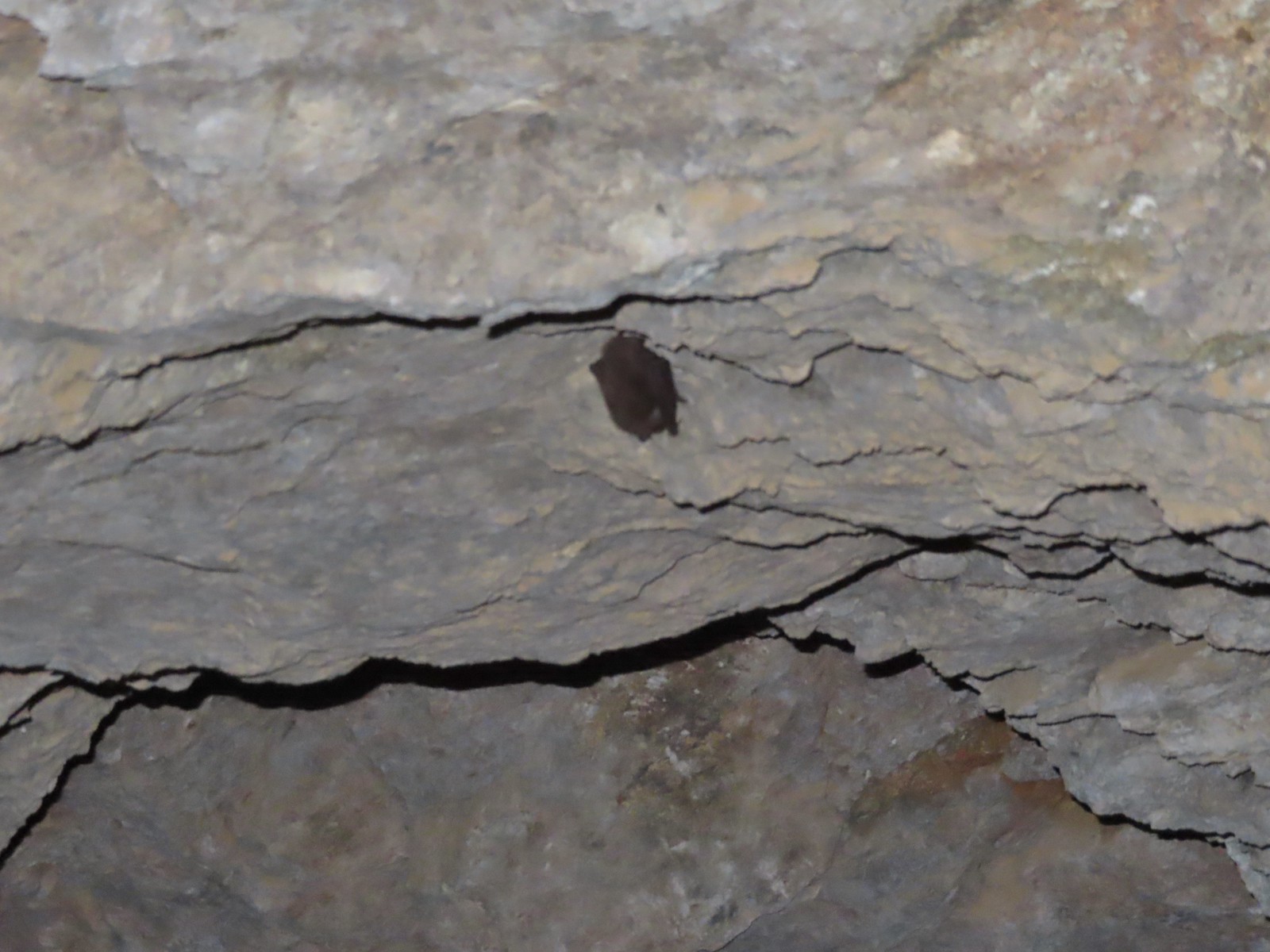 Bat -5/2/23, Sterling Mine Ditch Tunnel, BLM Medford District
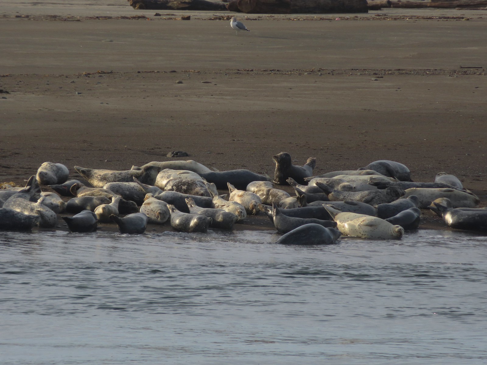 Seals – 11/18/23, Siletz Bay, Lincoln City
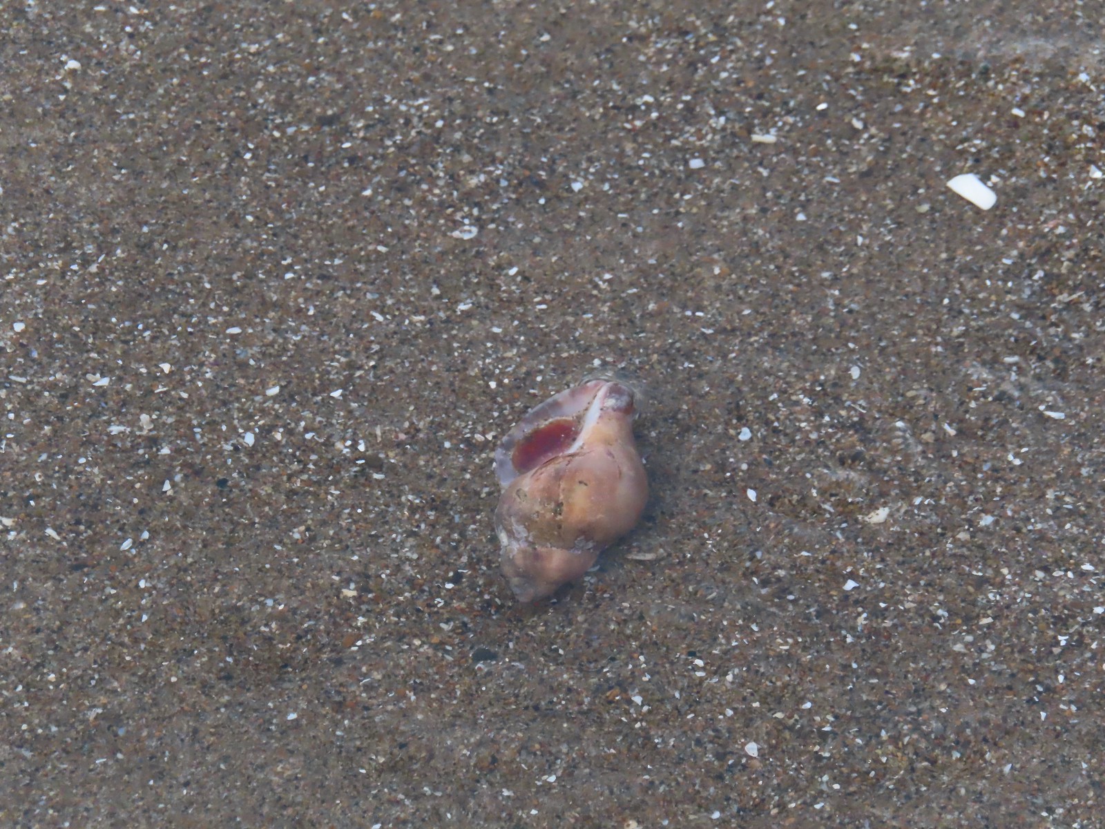 Shell with inhabitant – 11/18/23, Nelscott Beach, Lincoln City
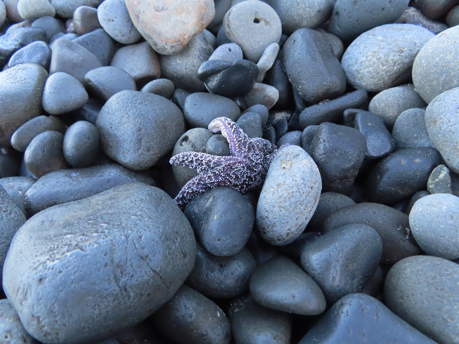 Starfish – 10/28/23, Short Beach, Oceanside
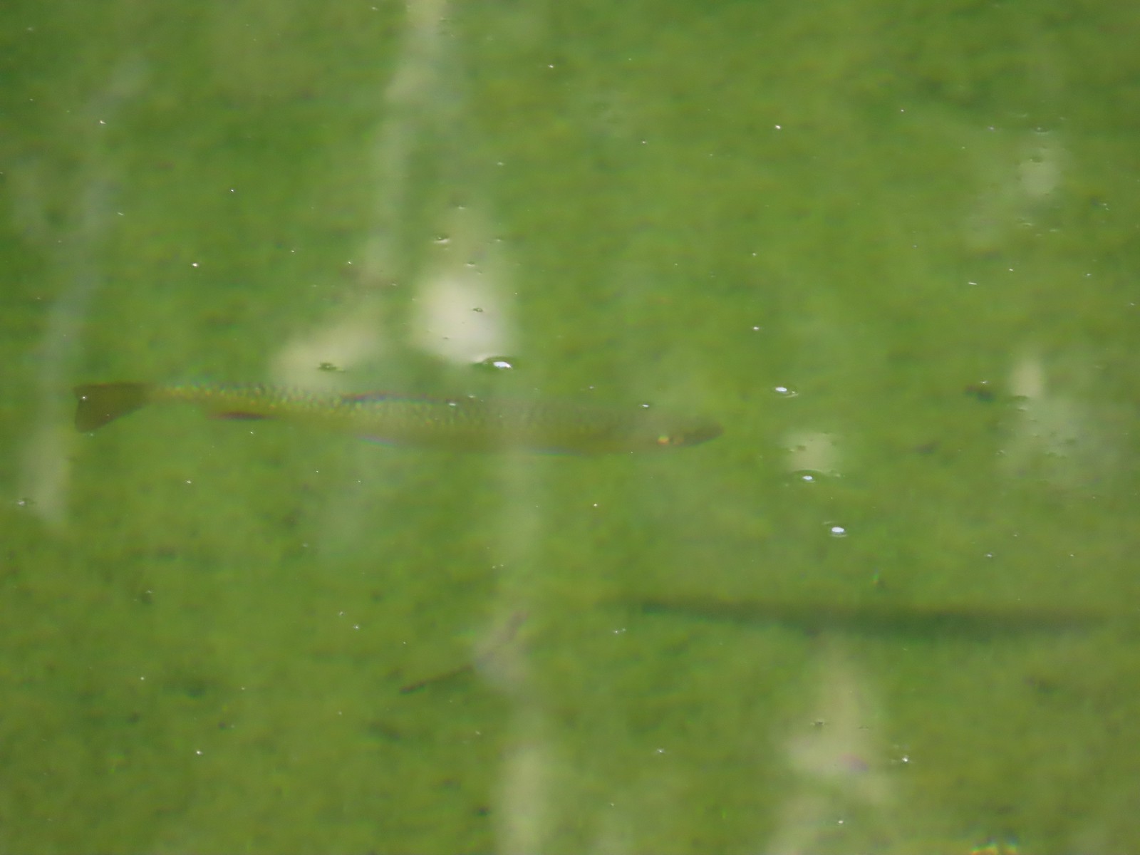 Trout – 8/16/23, Tombstone Lake, Eagle Cap Wilderness
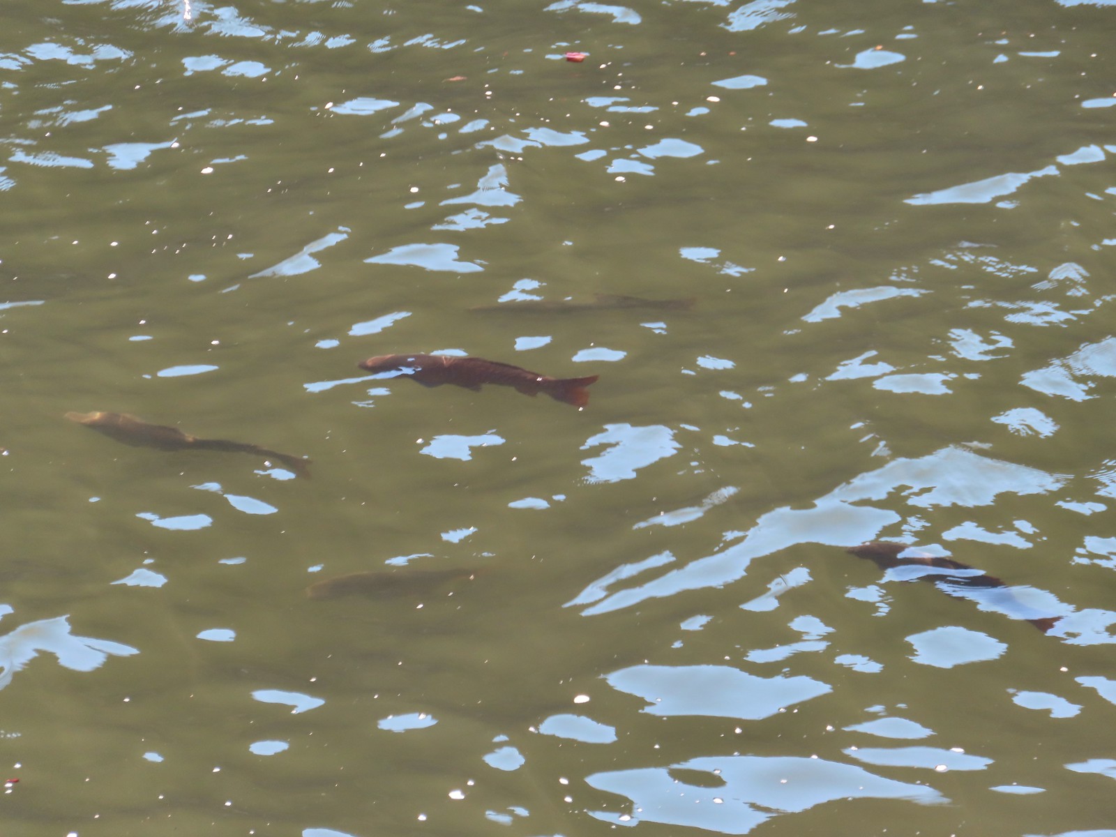 Fish – 6/16/23, Hells Canyon Reservoir, Hells Canyon National Recreation Area
 The path from camp meeting the West Eagle Trail.
 It was a little before 6:30am when I started.
 Switchbacks would be a theme for these last two days.
 The trail junction on the ridge ahead.


 The West Eagle Creek crossing.
 There was a large waterfall on West Eagle Creek flowing from Echo Lake’s basin on the right.
 Echo Lake Falls
 There was a waterfall ahead at the end of the switchback here, but it was mostly obscured by vegitation.
 It was fairly smokey looking ESE in the morning.
 Wildflowers along the trail.
 Several switchbacks were along this tributary of West Eagle Creek. This particular spot would provide me with much needed water on my descent.
 It looked like there might be a bit of a waterfall along this stream as well.
 Looking up the stream at another cascade.
 The upper portion entered an old fire scar and sunlight which heated things up quickly.
 Northern flicker
 Every time I thought I was at the basin the trail would switchback to find more hillside.
 Mountain bluebird
 Surely that is the crest.
 It was not, up I go.
 Smoke to the South.
 Echo Lake across the valley.
 Finally done with the switchbacks I could see the next climb in the distance ahead, but for now I had a bit of a reprieve.
 Lousewort
 Gentians, one of my favorite wildflowers.
 The larger meadow ahead.
 Their camp was uphill to the left. The stream here was lined with wildflowers.
 Lewis monkeyflower, aster (or fleabane), and fringed grass of parnassus.
 The trail all but disappeared on the far side of the stream, but small cairns helped mark the way.
 Cairns along the trail through the meadow.
 Yellow Wallowa Indian paintbrush
 Heading up again.

 Larkspur
 White mariposa lily
 Looking back down into the basin.
 False hellebore
 Coiled lousewort
 View of the basin headwall.
 View back down the valley.
 Phlox
Phlox Chipmunk
 Golden-mantled ground squirrel
 Arriving at the pass.
 Smokey view from the pass.
 Tombstone Butte, Swabb Mountain, with Granite Butte behind in between, and China Cap to the right.
 The pass at nearly 8200′.
 Tombstone Lake below.
 Sturgill Peak

 Tombstone Lake is a series of connected bodies of water.
 A phacelia.
 Rosy paintbrush
 Finally at the lake.

 Gentian along the lakeshore.
 Swamp onion along the shore of one of the smaller bodies of water.

 Pika!
Pika! The Tombstone Lake Trail from the gap.
 Eagle Cap in the middle and Needle Point in the distance to the right.
 Eagle Cap (
 The East Fork Elk Creek valley below.

 Starting the switchbacks down.


 Hawk
Hawk Sphinx moth visiting some Lewis monkeyflower
 Some nice paintbrush
 Clumps of gentians
 Gentians
 Swamp onion
 Leaving the basins to start the giant set of switchbacks down.


 This little cascade was perfect for filling the bladder.

 Echo Lake Falls straight ahead.
 Recrossing West Eagle Creek.
 One last look up at where I’d come from.

 Small unnamed waterfall on an unnamed creek.
 Sphinx moth at camp.
 While we don’t intentionally feed the wildlife this green comma seemed to like the sweaty socks.


 Registration box and signboard at the Mt. Hood Wilderness boundary.
 There were a few downed trees but nothing too difficult to navigate.
 The brush was mostly huckleberry bushes.
 Trail side snacks.
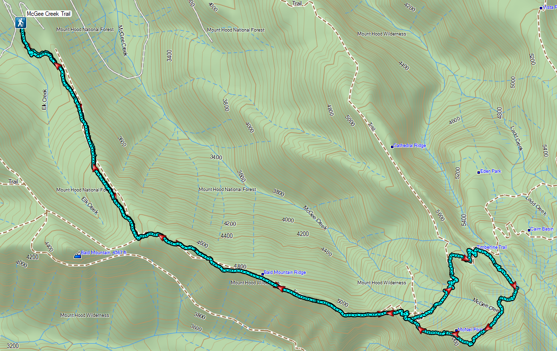
 McGee Creek Trail junction with the Timberline Trail.
 Blowdown from the September 2020 storms that also flamed the destructive wildfires across the state. For more information on the storms impact on Mt. Hood check out this Wy’East Blog
  Looking through the trees at one of the areas that suffered severe blowdown.
 It was a cloudy day. We got sprinkled on briefly a couple of times.
 Fireweed
 Pinedrop
 Avalanche lilies
 Paintbrush
 Valerian, spirea, and paintbrush
 Gentians
 Yellow monkeyflower
 A tributary of McGee Creek.
 Spirea along the Timberline Trail.
 Shooting star
 Pink monkeyflower
 Fleabane
 Beargrass
 False hellebore
 Partridge foot
 Lupine
 Lewis monkeyflower along a tributary of McGee Creek.
 Beardstongue
 Lousewort
 Dry pond surrounded by beargrass.
 The idiots camped in the meadow. There is even an arrow on the “Do not camp in meadow” sign pointing at the meadow. Please DON’T be these people.
 The second pond still had some water in it.
 Junction with the Mazama Trail (
 The butterflies weren’t out today but the bees were.
 The clouds just wouldn’t quite raise enough.
 Mountain heather
 Lupine and paintbrush
 Beargrass along the Timberline Trail.
 Paintbrush, partridge foot and lupine
 Signpost for the McNeil Point Trail.

 We’d never seen a paint colored like this before.


 Western pasque flower
 Lupine and two types of monkeyflower


 Pikas spend the Summer gathering greens for the rest of the year when they remain in their homes under the snows.

 Mountain heather and paintbrush.
 Saxifrage
 A variety of flowers.
 Avalanche lilies
 Sub-alpine fleabane
 Western pasque flowers
 Doe that was as surprised as we were when we spotted each other.

 Lewis monkeyflower
 The righthand fork.
 View from the plateau.
 Some low clouds to the East.
 Dwarf lupine
 A hiker on the righthand fork headed for the McNeil Point Shelter.

 Caves below the Sandy Glacier.
 Bluebells of Scotland
 The shelter below to the right.
 Muddy Fork
 Goldenrod
 With the clouds the view wouldn’t have been great from the ridge on this day.


 Patches of blowdown along Bald Mountain Ridge.

 Columbine
 Valerian
 Paintbrush and bistort
 Aster
Aster Meadow near the Timberline Trail.
 Arriving back at the Timberline Trail.
 Every once in awhile the trail was clear of other users.
 We’re always drawn to this rock fin above the Muddy Fork.
 Canada jay
 McGee Creek Trail junction.
 Bunchberry
 Is that sunlight?
 While the clouds never lifted from Mt. Hood we did experience a window of blue sky near the end of our hike.