Categories
High Cascades Hiking Oregon Three Sisters Area Trip report

Three Sisters Wilderness Day 2 – Linton Creek Exploration

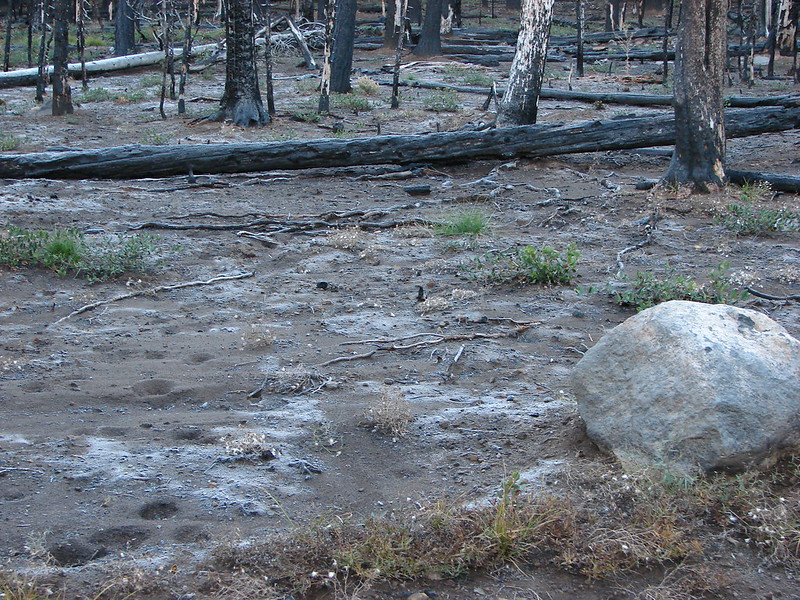
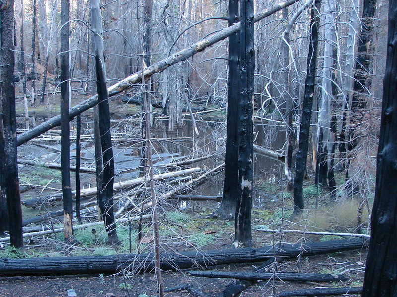
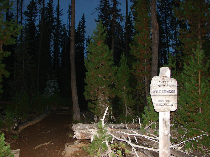
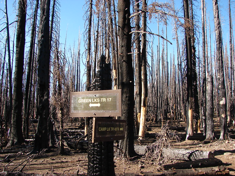
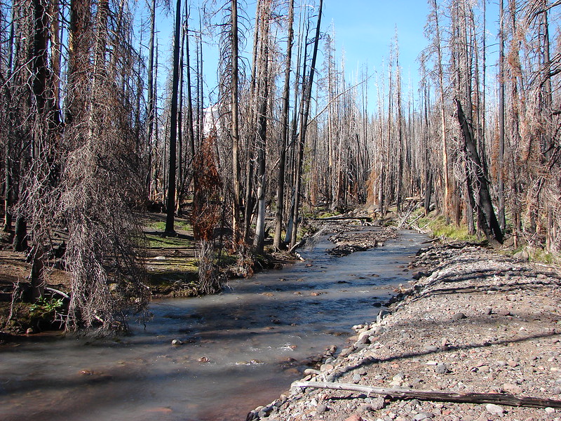
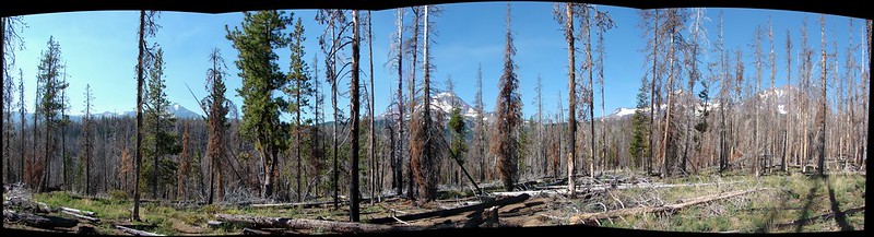
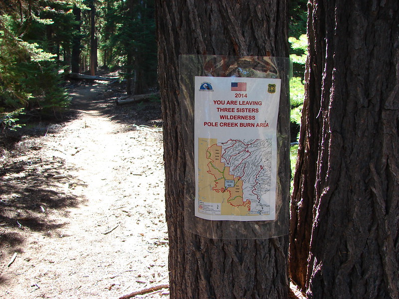
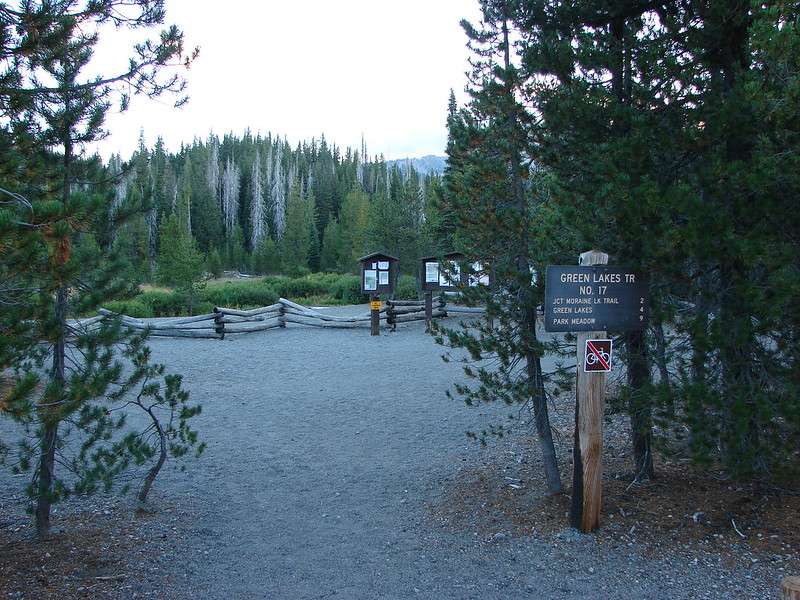
**Note the 2017 Separation and 2024 Linton Creek Fires burned portions of this hike.**

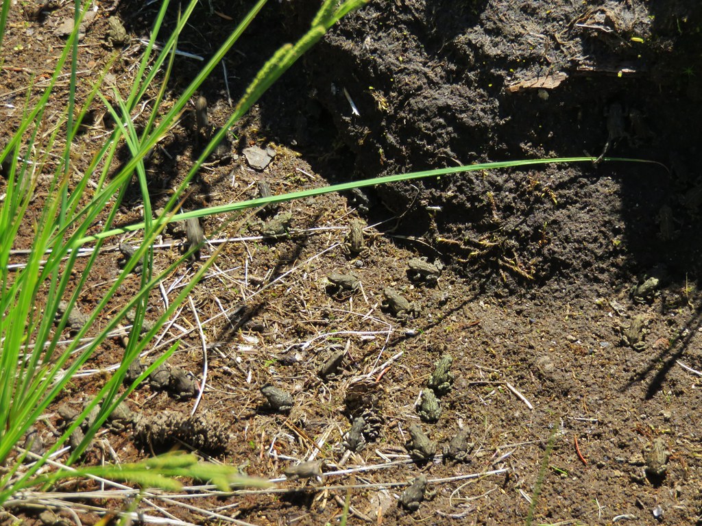
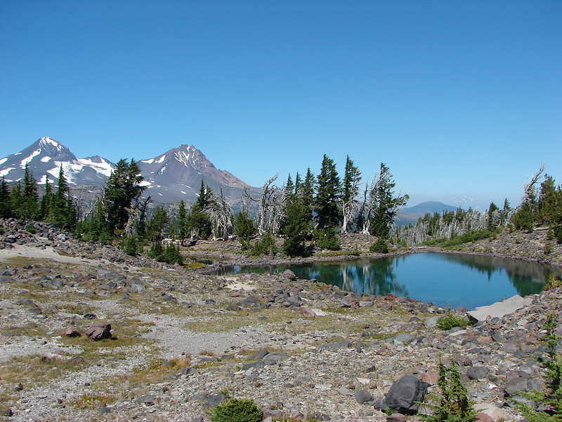
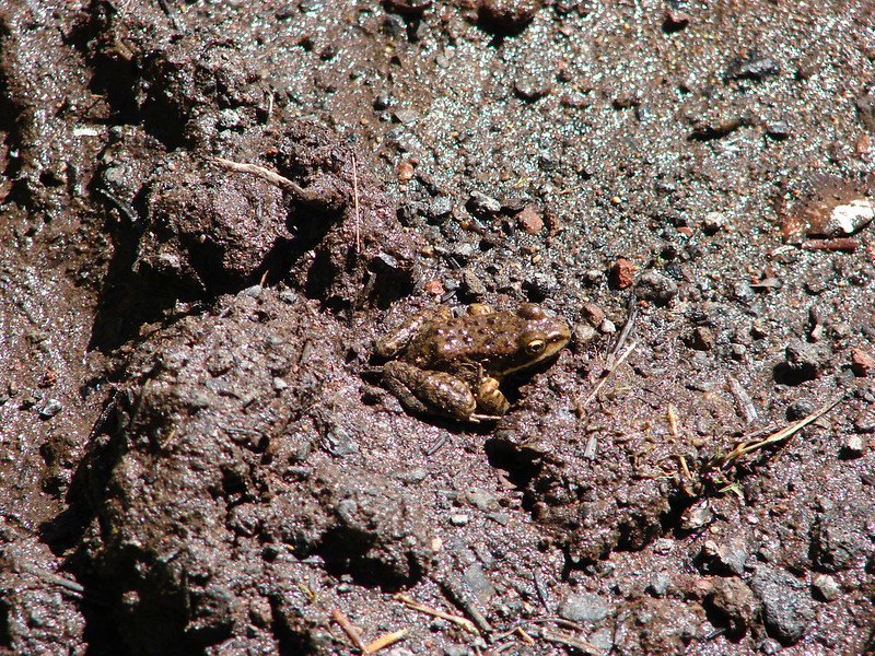
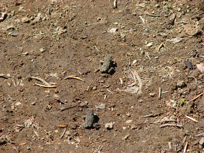
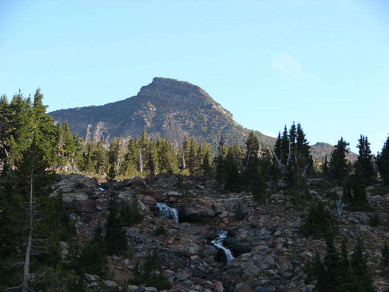
The second day of our four day backpacking trip was set to be an adventure. Our plan was to spend the day “off-trail” exploring Linton Creek which is home to several rarely visited waterfalls. We had camped at Eileen Lake on the NE side of The Husband and originally planned on hiking down the official trail to Linton Creek where we had eaten our dinner the night before, but during our evening exploration of the area behind our campsite we realized we should be able to follow a dry creek bed we’d seen and reach Linton Creek by a more direct route. It would also allow us to avoid another trip through all the frogs along Eileen Lake.

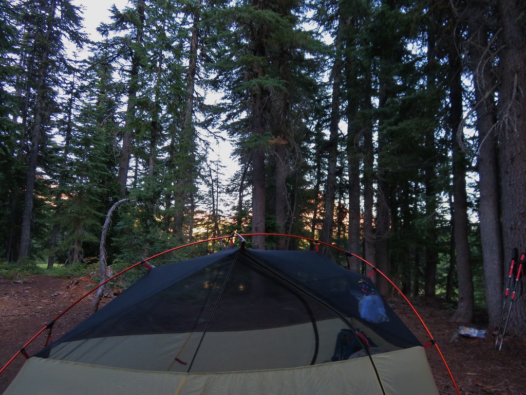
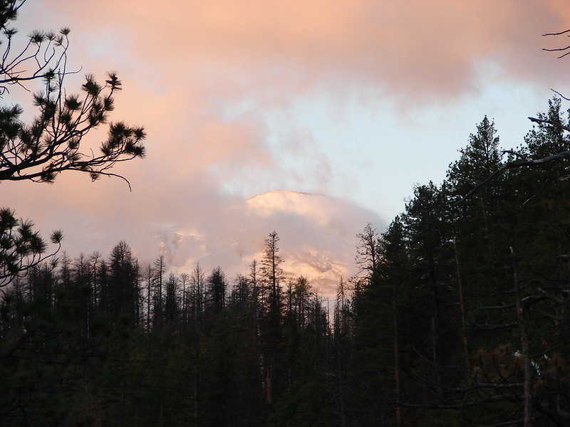
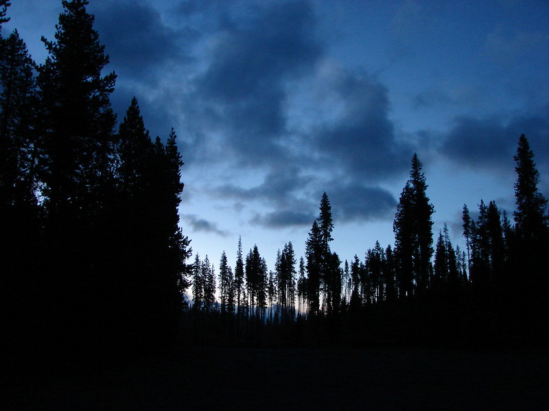
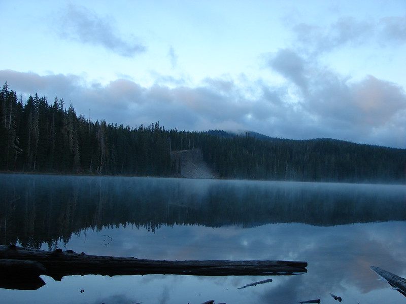
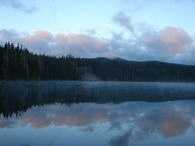
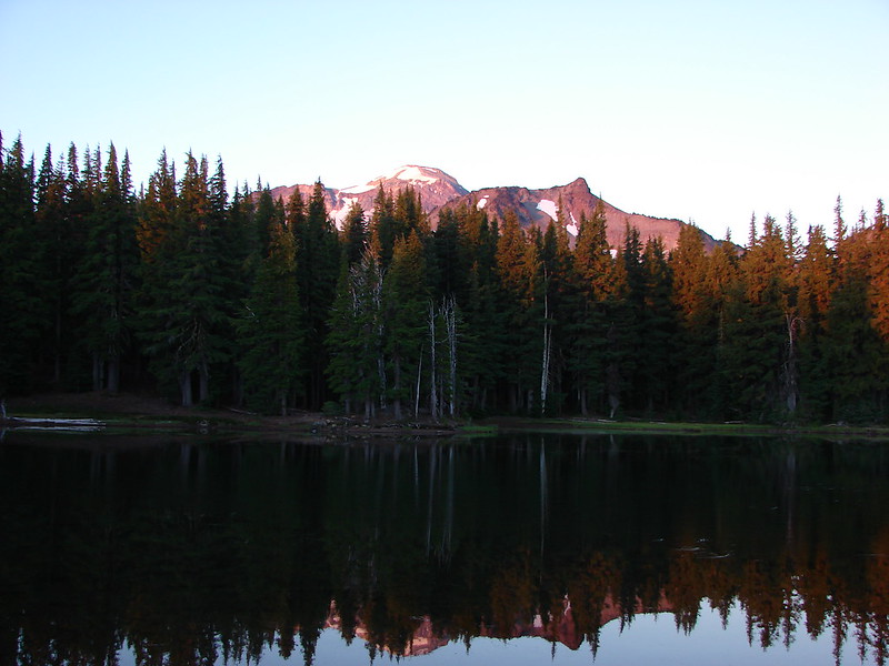
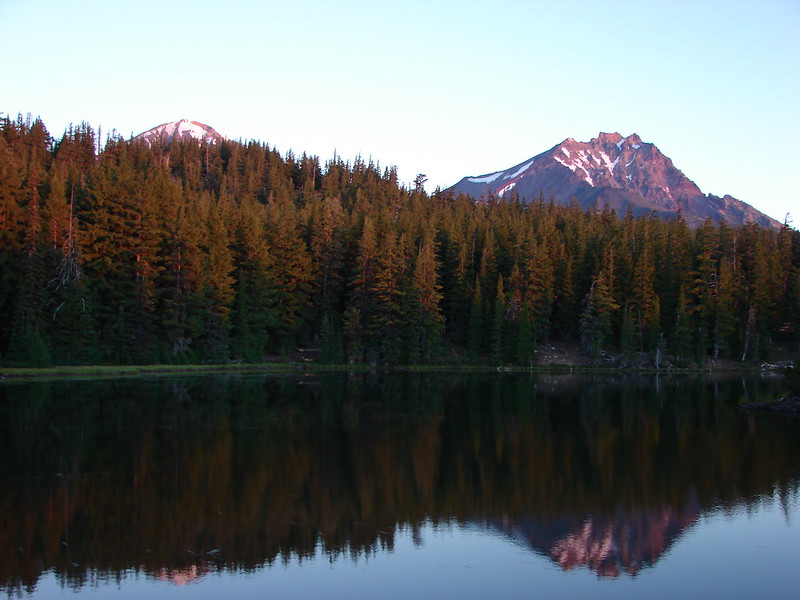
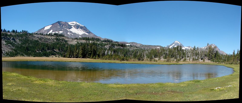
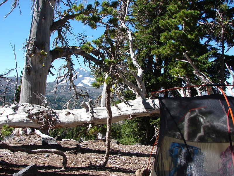
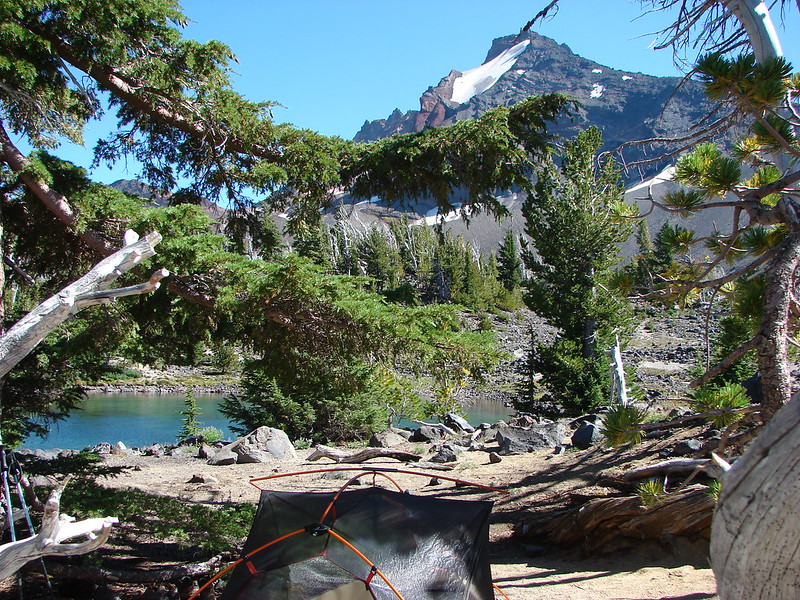
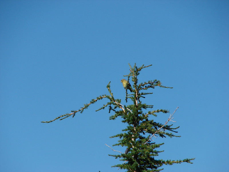
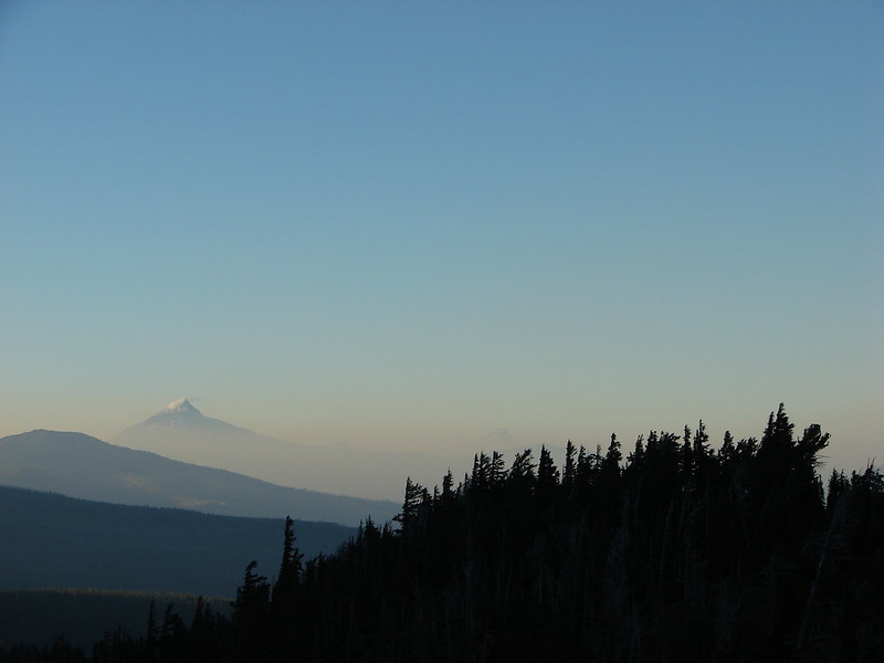
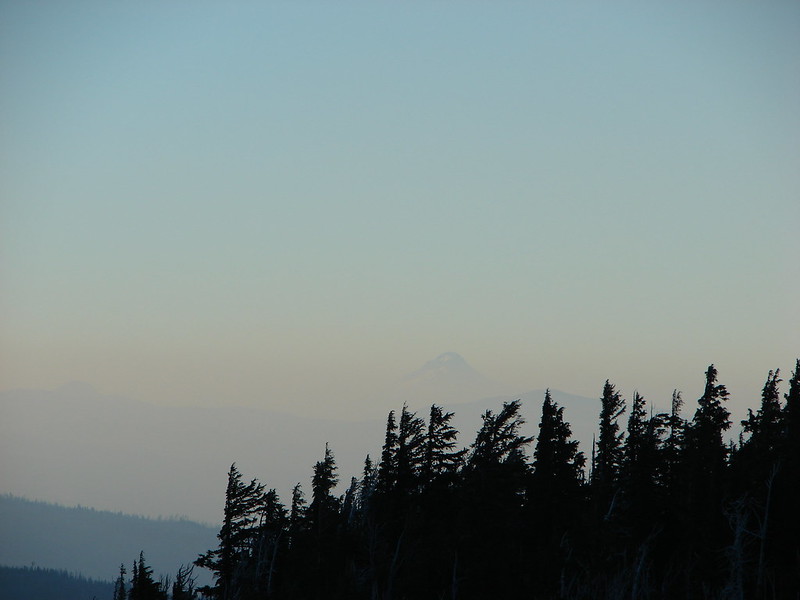
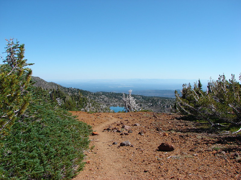
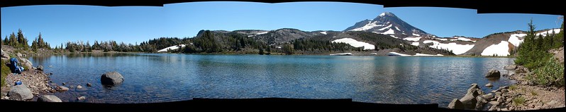
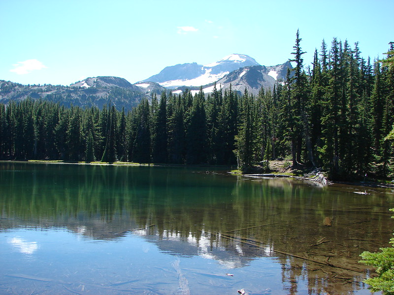
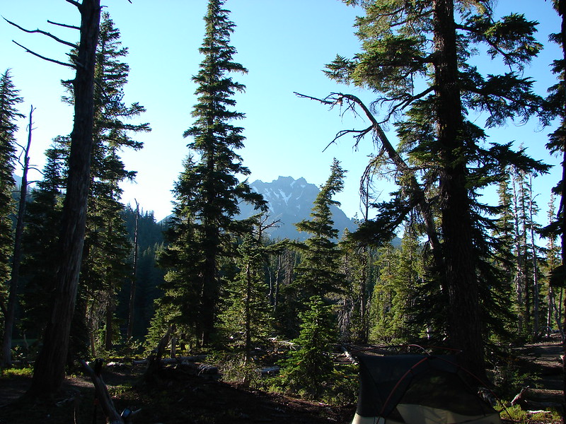
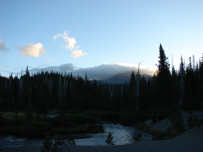
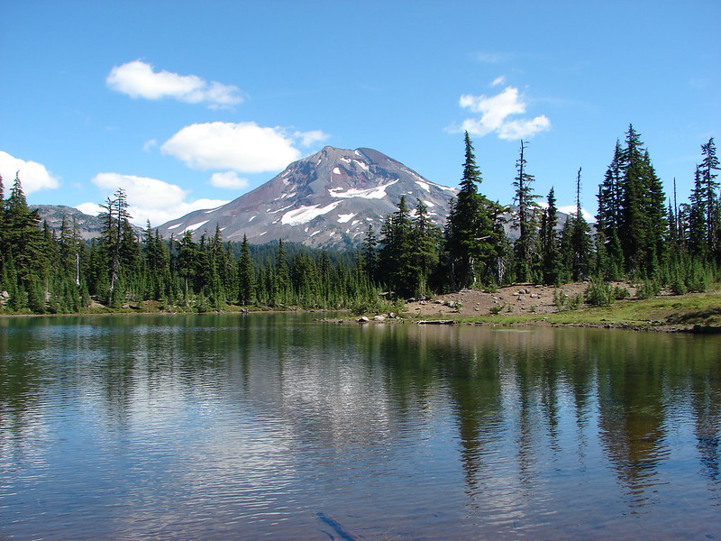
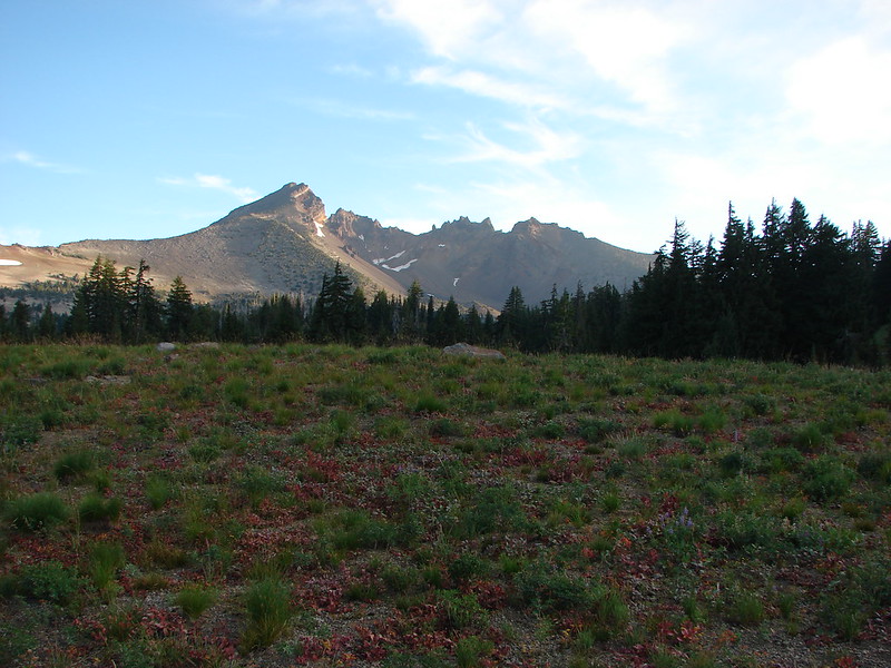
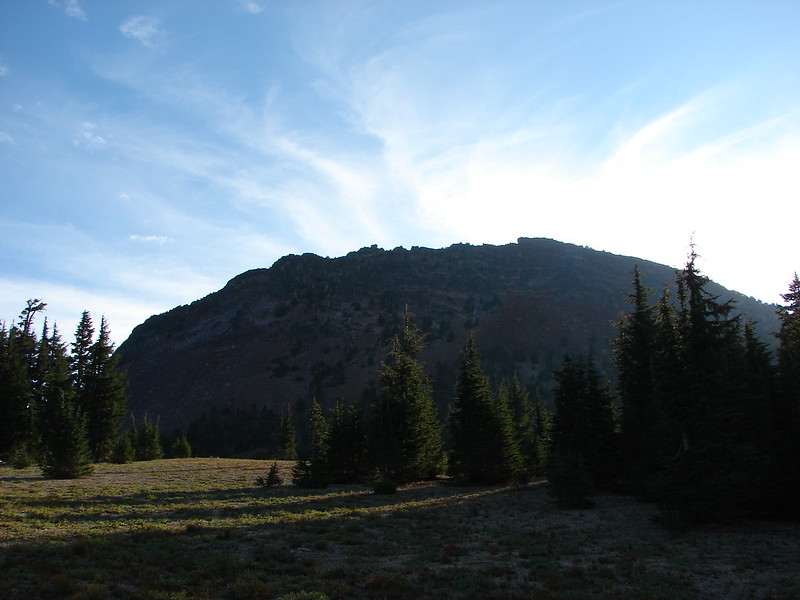
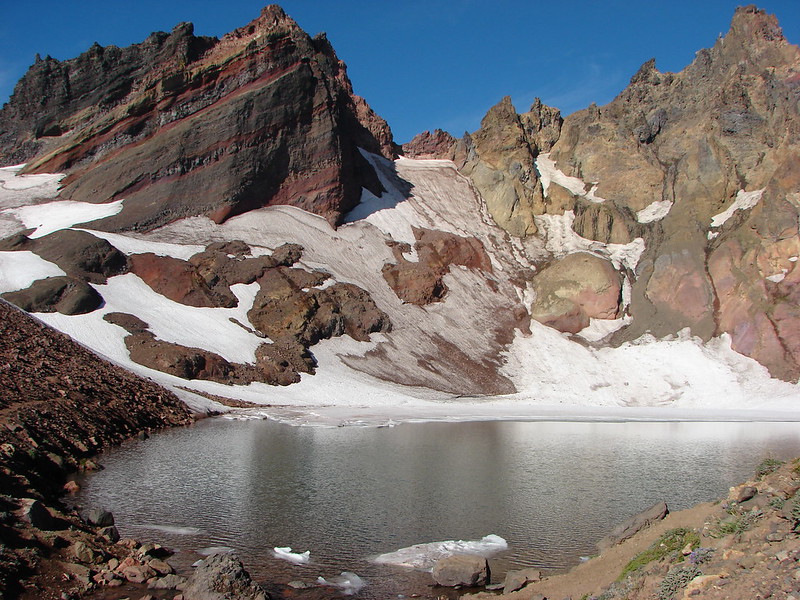
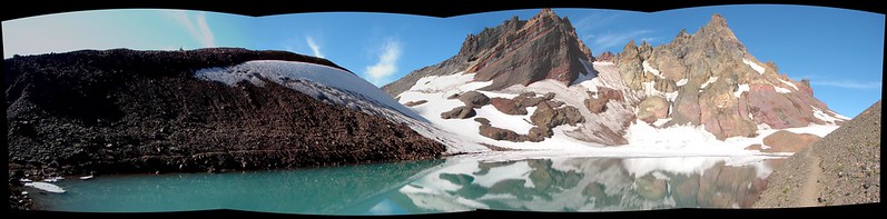
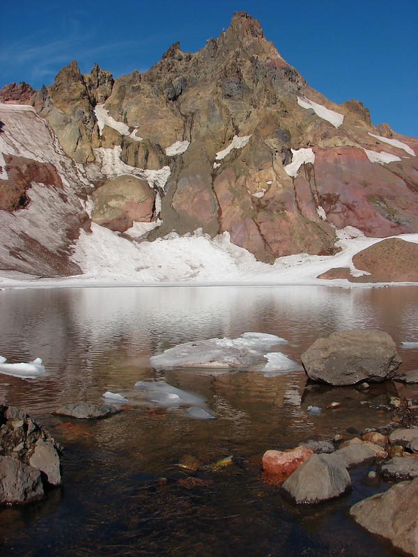
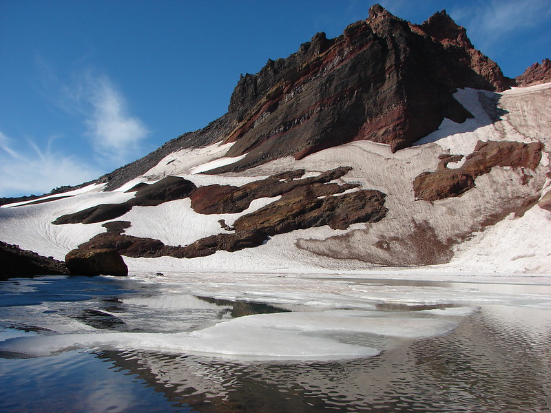
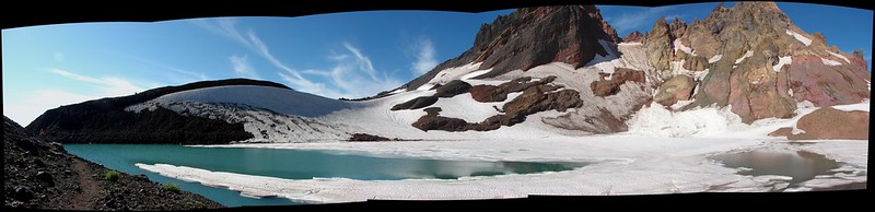
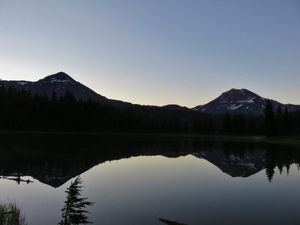
I woke up a little before 5 and went down to the lake for a bit to look at the mountains.
IMG_6484

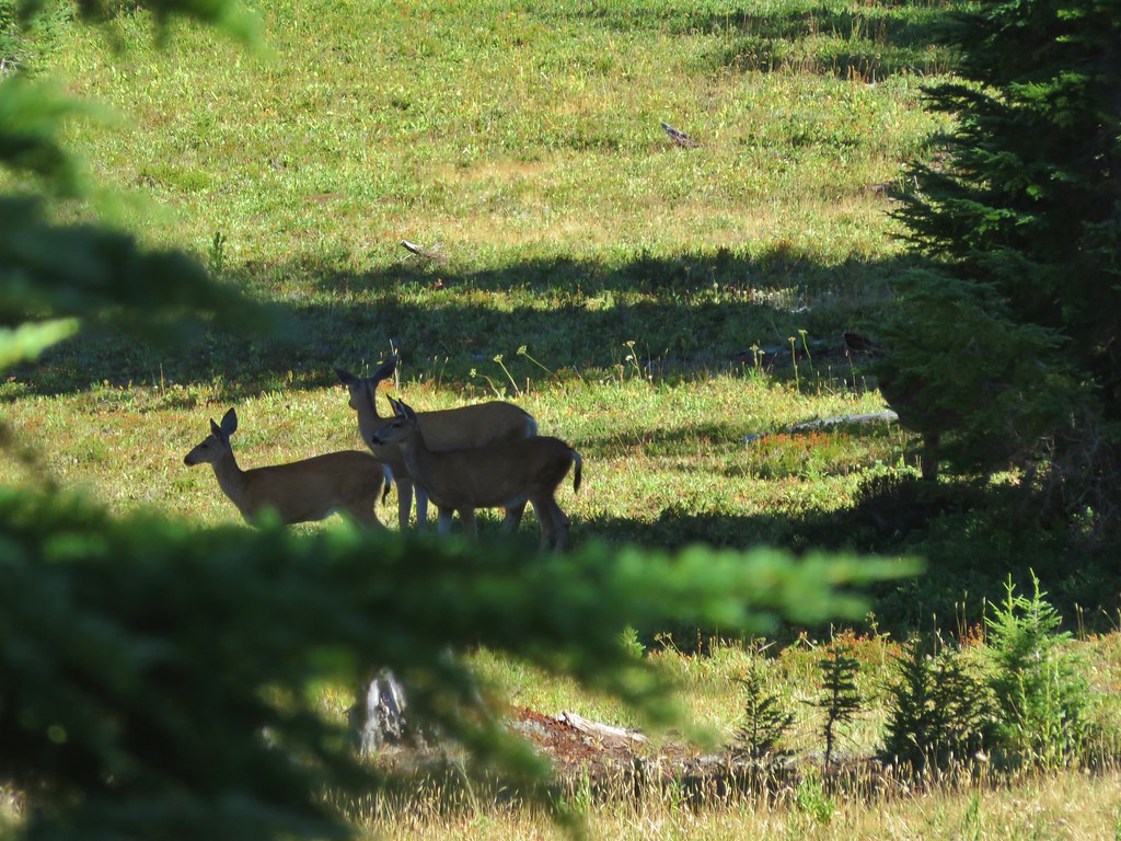
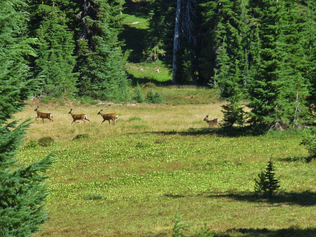
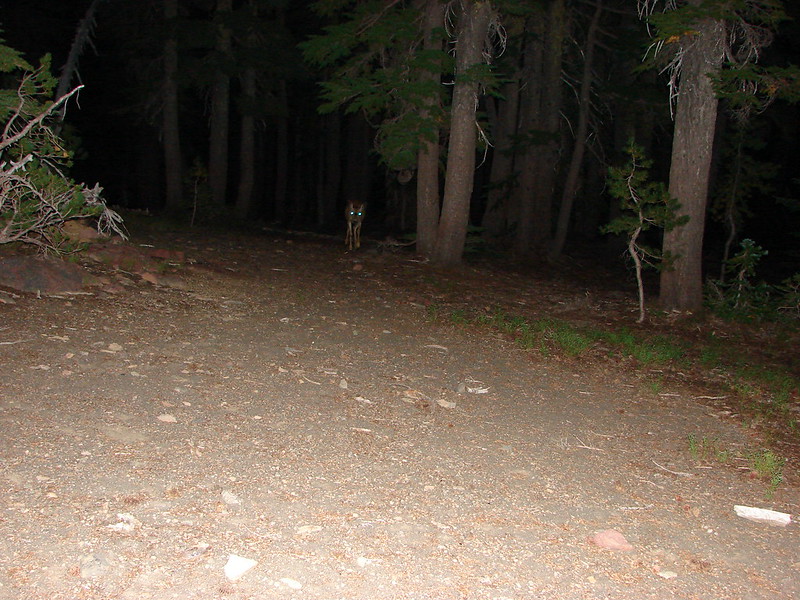
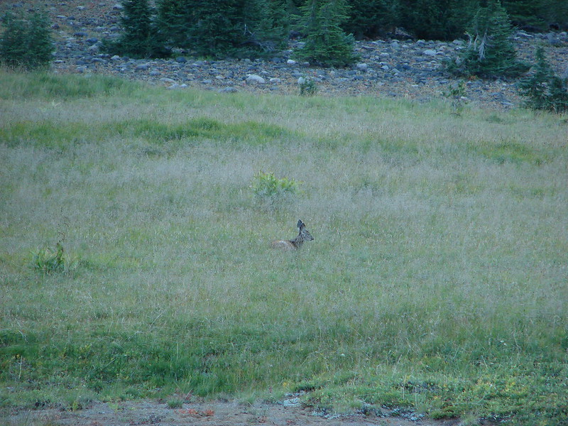
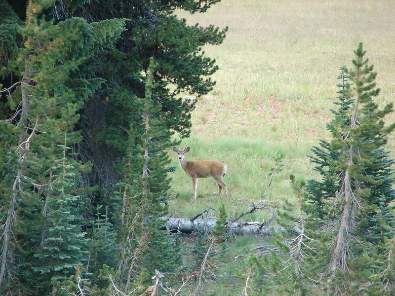
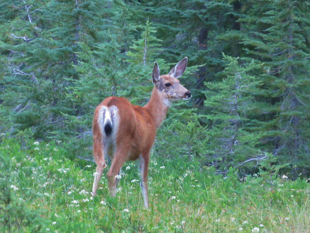
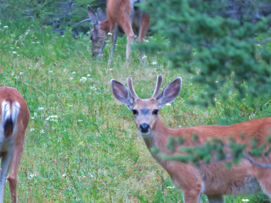
Heather woke up and I was busy getting ready for our breakfast and the days hike when I looked up and noticed there were deer about 50 feet from our tent. Heather was still inside putting her hair into braids and hadn’t noticed them yet.
IMG_6486

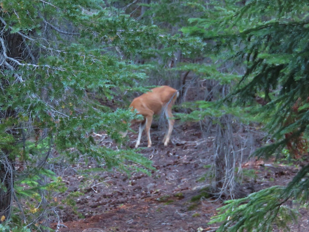
I got her attention and we watched as they nibbled on some plants then entered the little meadow by our site and had their own breakfast.
IMG_6501

IMG_6493

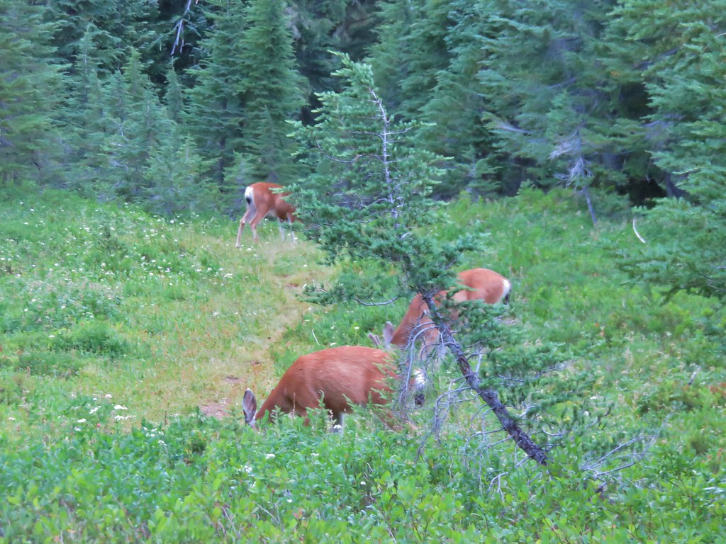
They looked up at us occasionally but didn’t seem to be the least bit concerned with our presence then left the same way they’d come slowly disappearing into the forest.
IMG_6491

IMG_6500

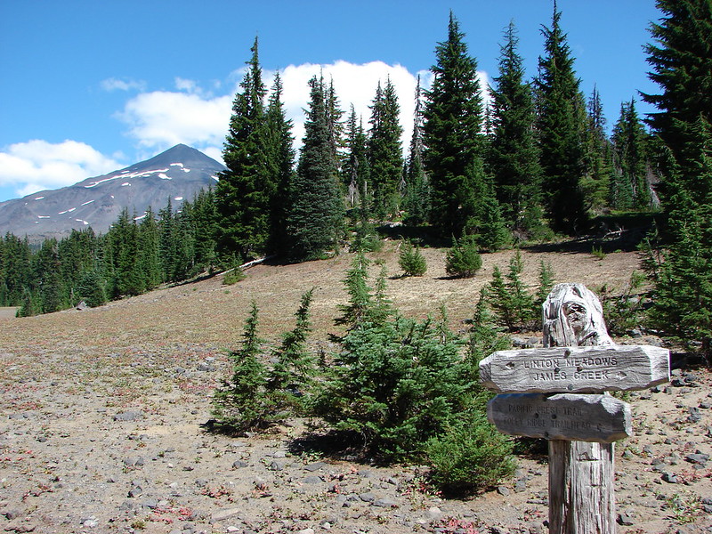
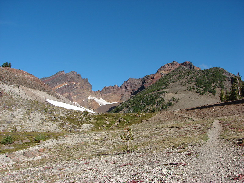
After our breakfast we threw on our daypacks and got ready for our adventure. We had our compass and three different maps including the map loaded on the Garmin and I had studied the area using Google Earth. That research along with information from a few trip reports and the Northwest Waterfall Survey had us feeling pretty confident that we would at least be able to reach Duncan Falls and possibly Upper Linton Falls if time allowed. I also established a turn around time in order to make sure we had enough time to climb back up from wherever we ended up.

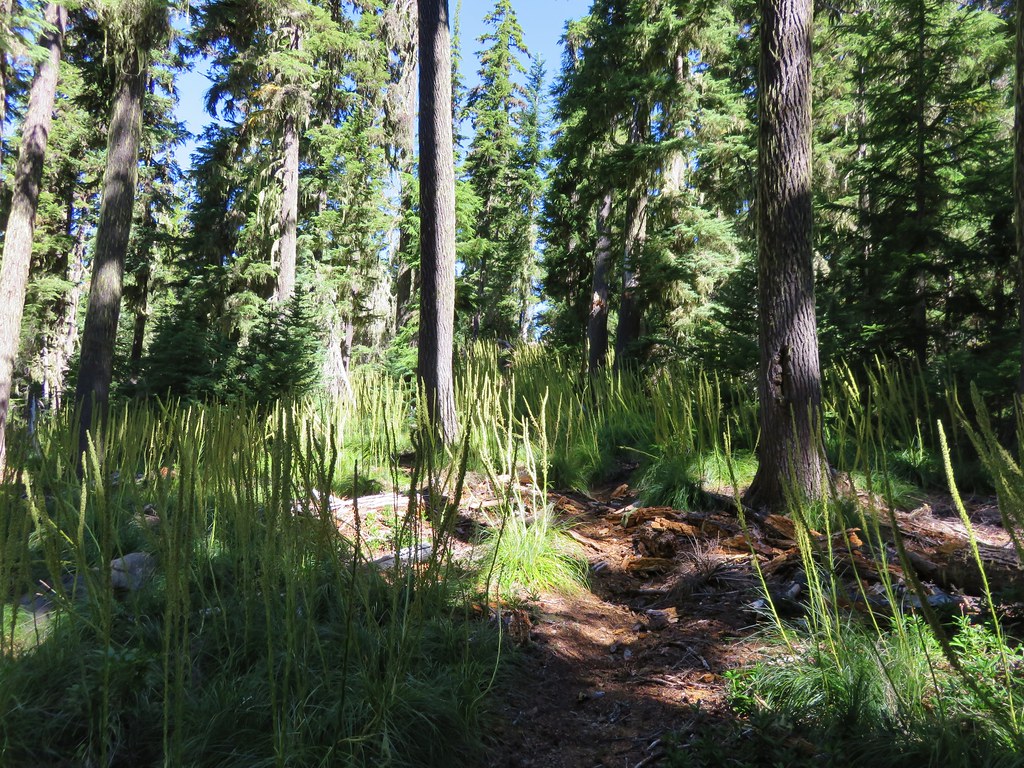
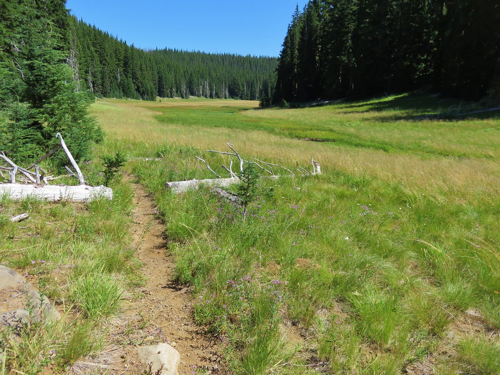
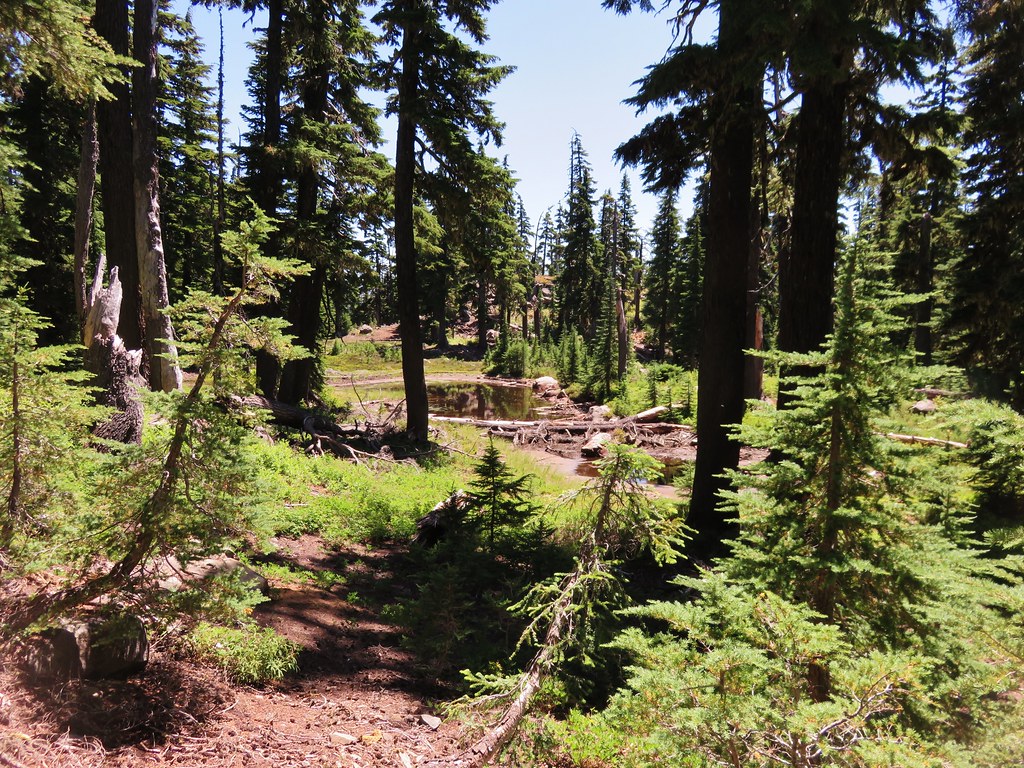
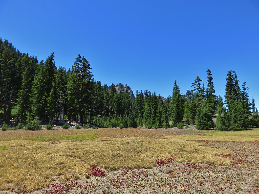
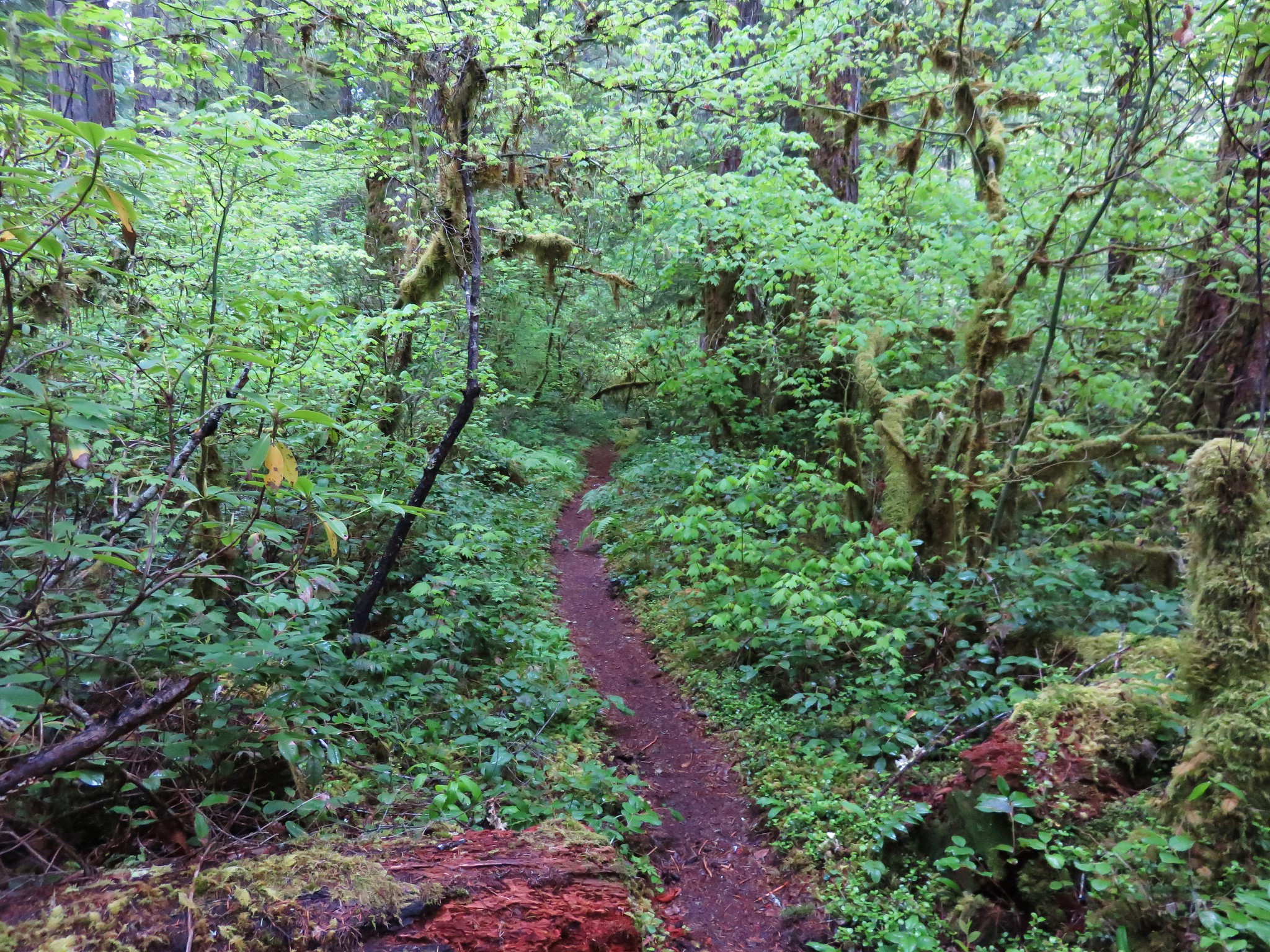
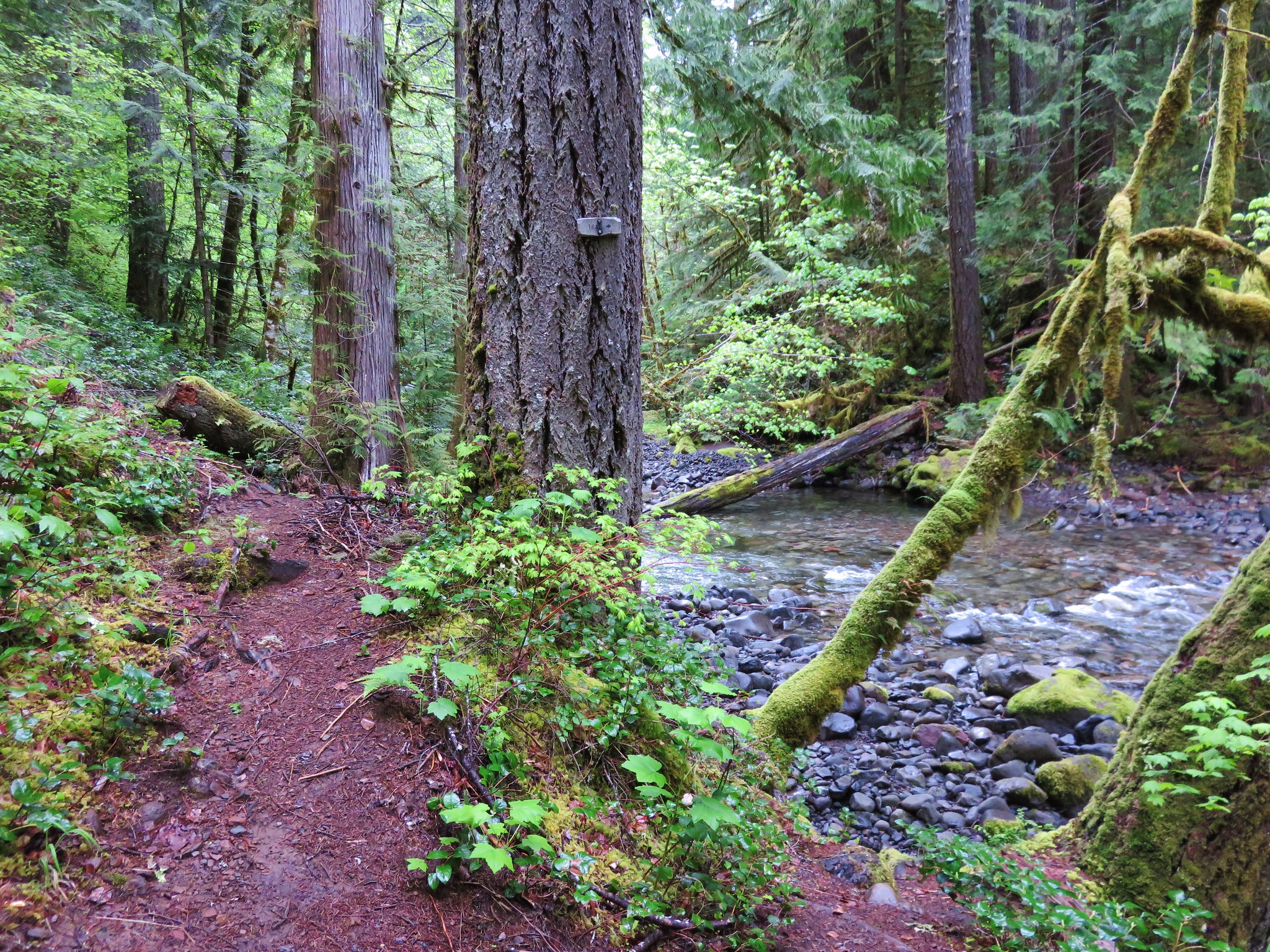
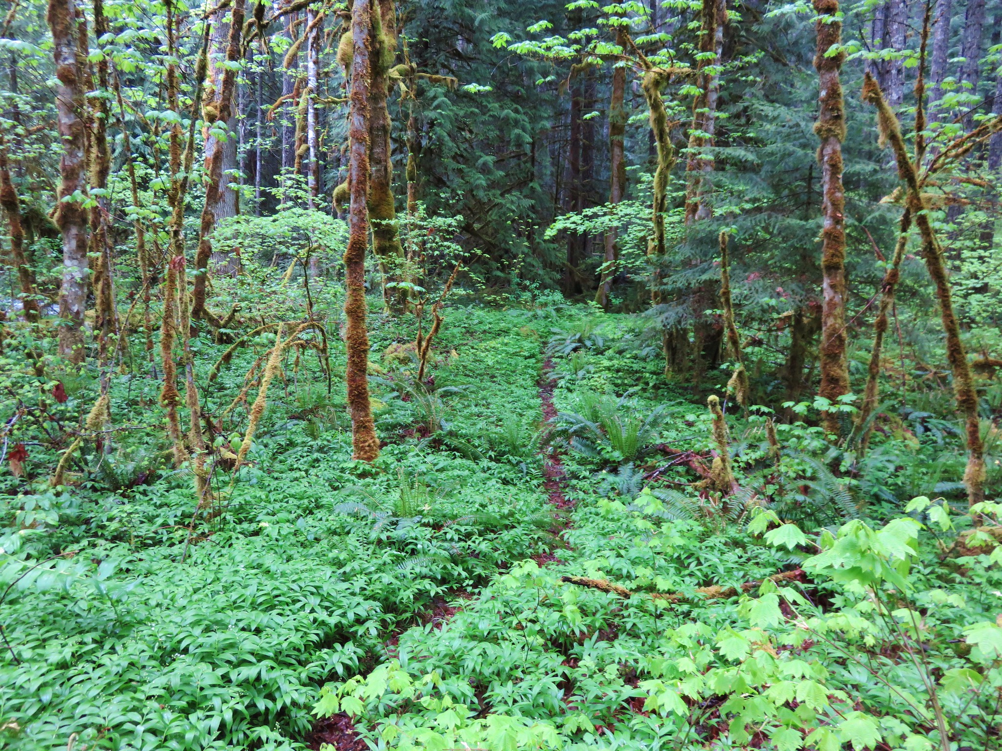
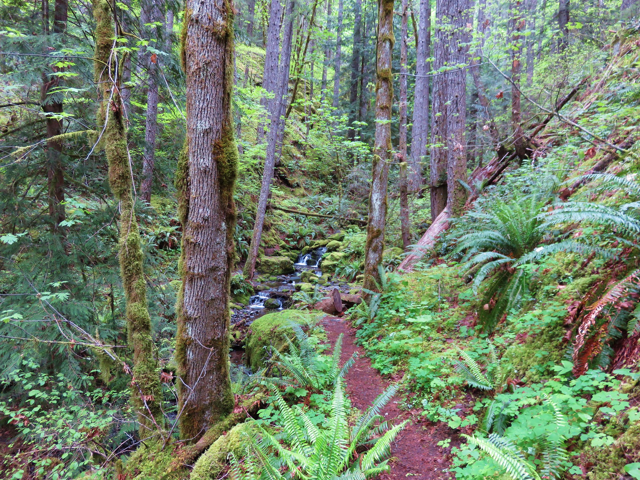
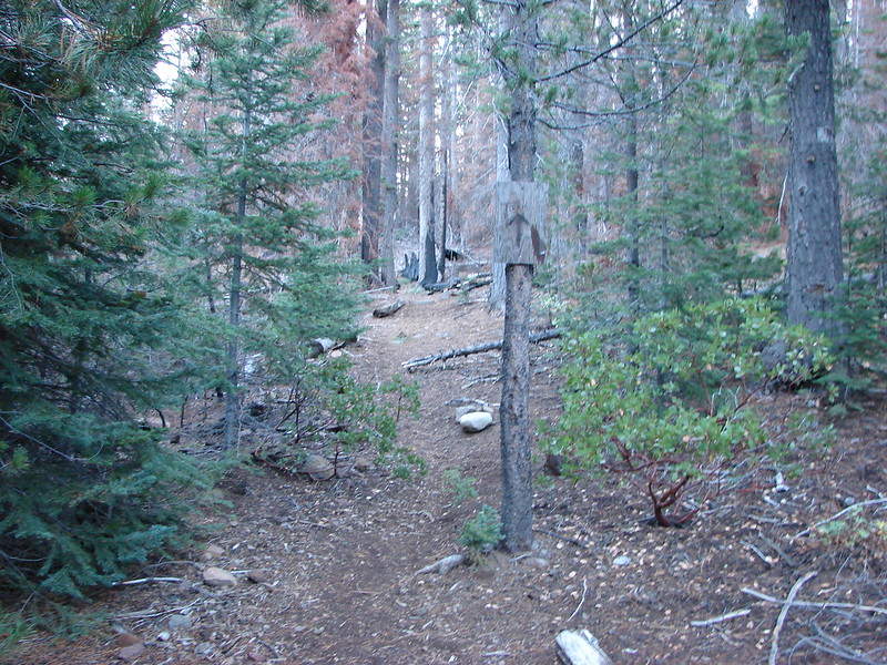
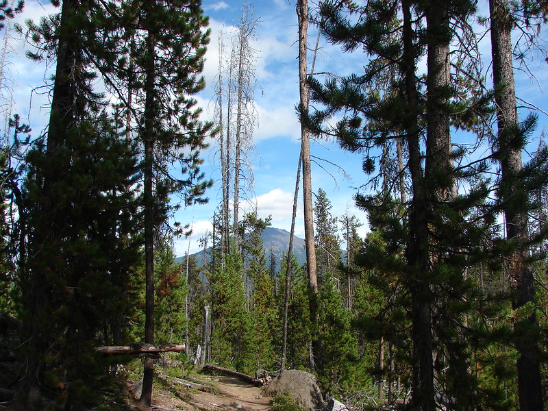
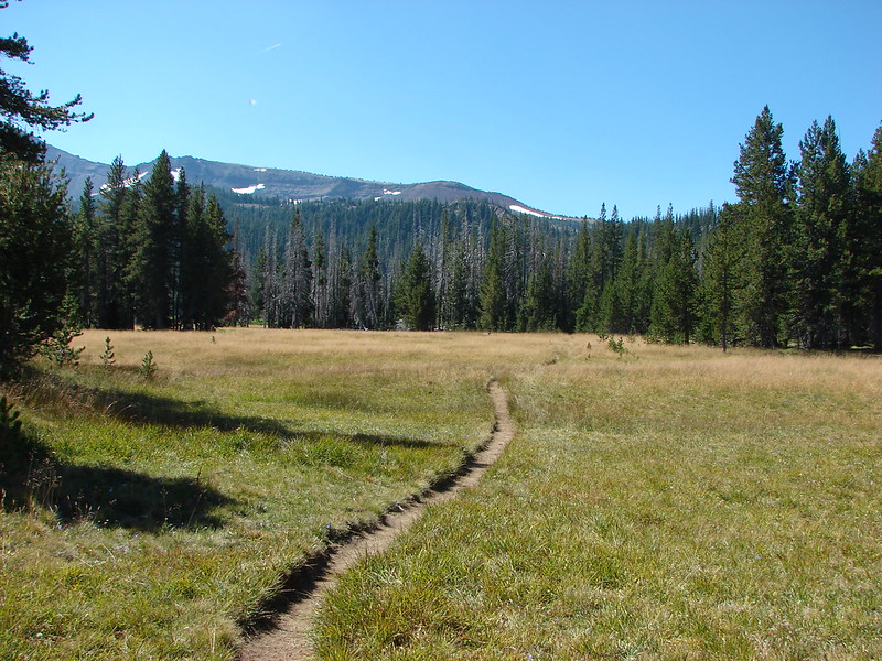
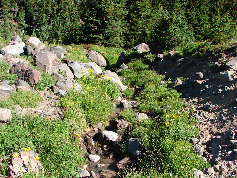
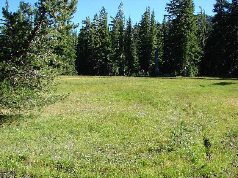
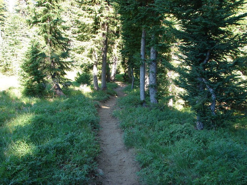
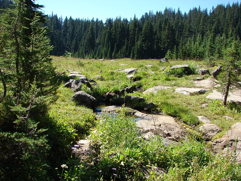
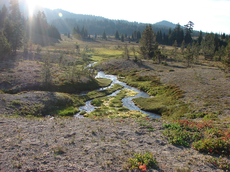
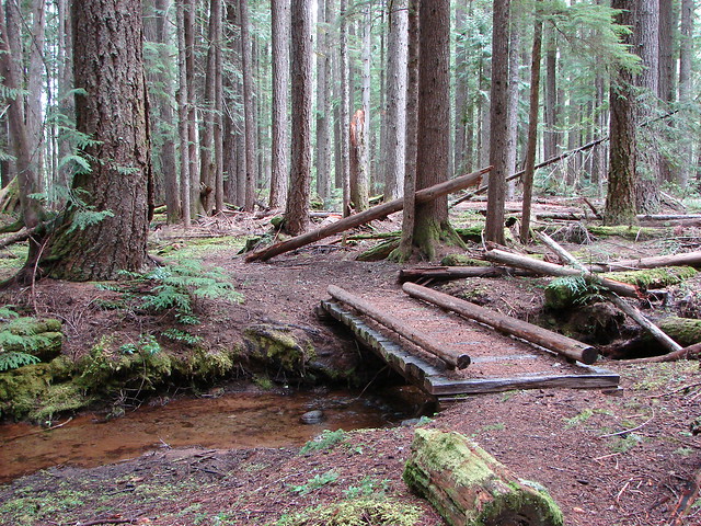
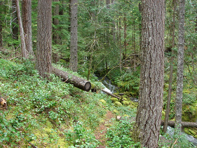
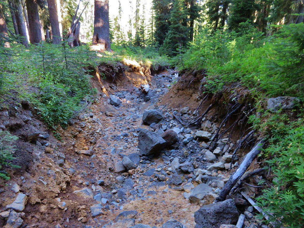
We followed a use path from our campsite through the little meadow along the dry creek into a larger meadow. The use path ended at the larger meadow so we hopped into the dry creek bed planning on following it as far as possible.
IMG_6504

IMG_6505

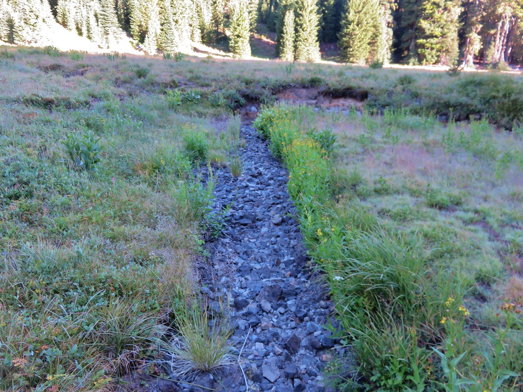
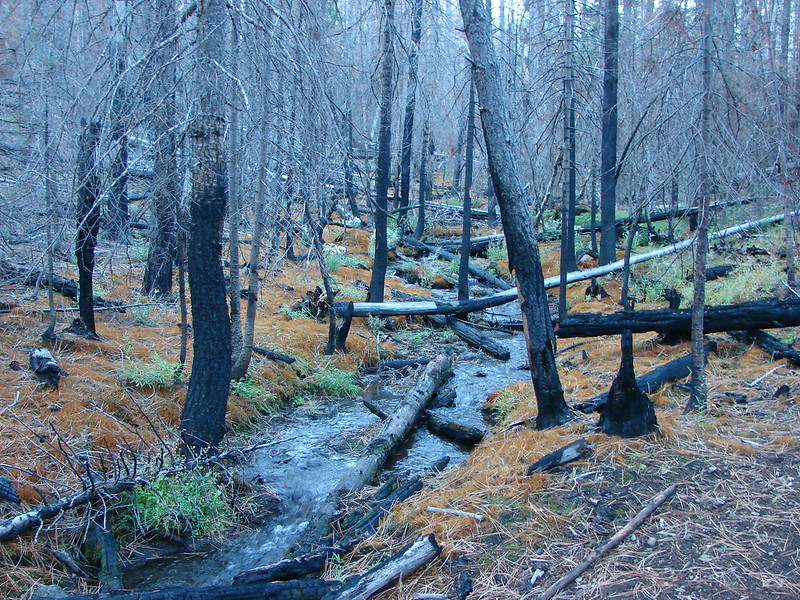
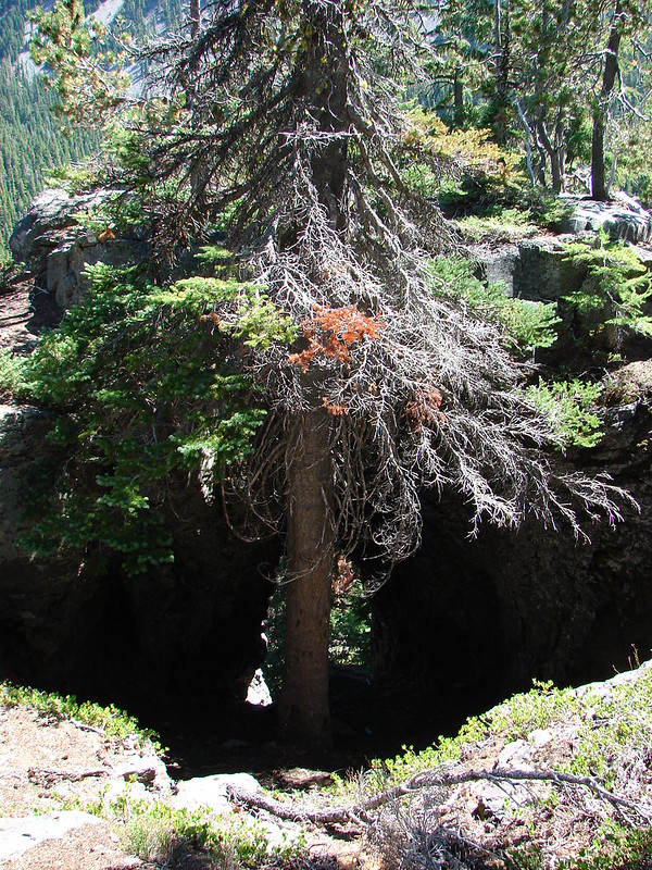
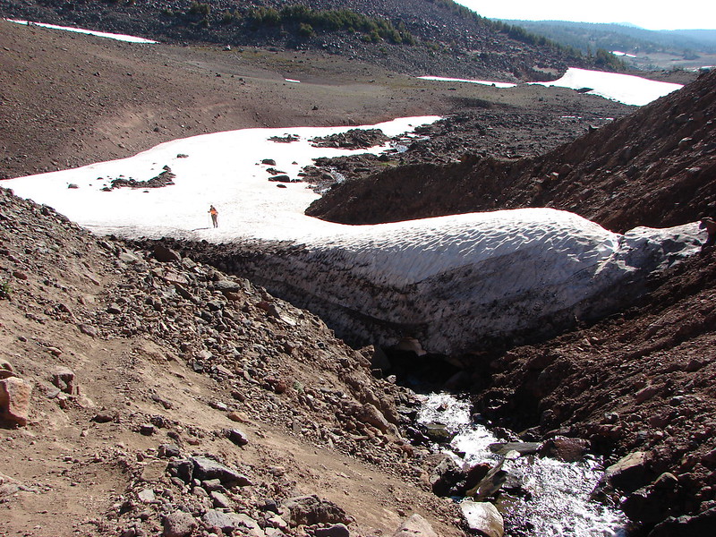
We had to leave the creek bed in the meadow for a bit when we started running into small pools of water. We got back in shortly after leaving the meadow but that also didn’t last long because the creek bed was getting deeper and we spotted downed trees blocking it further downhill. We didn’t want to get stuck in the bed and be forced to backtrack so we got out and started bushwacking through the forest.
IMG_6508

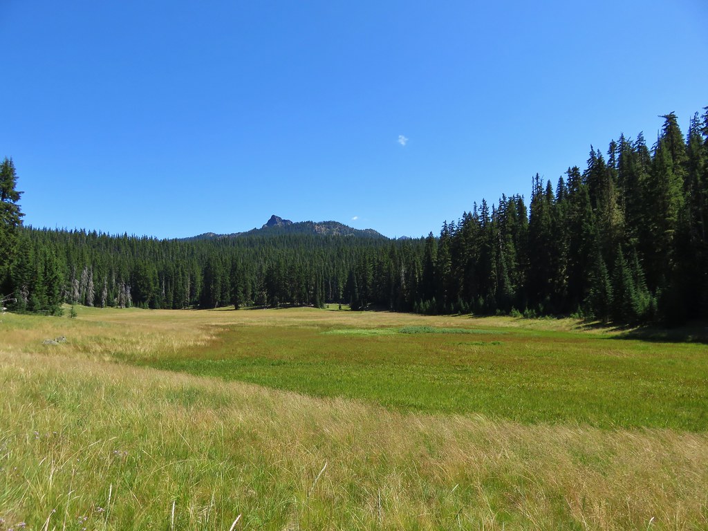
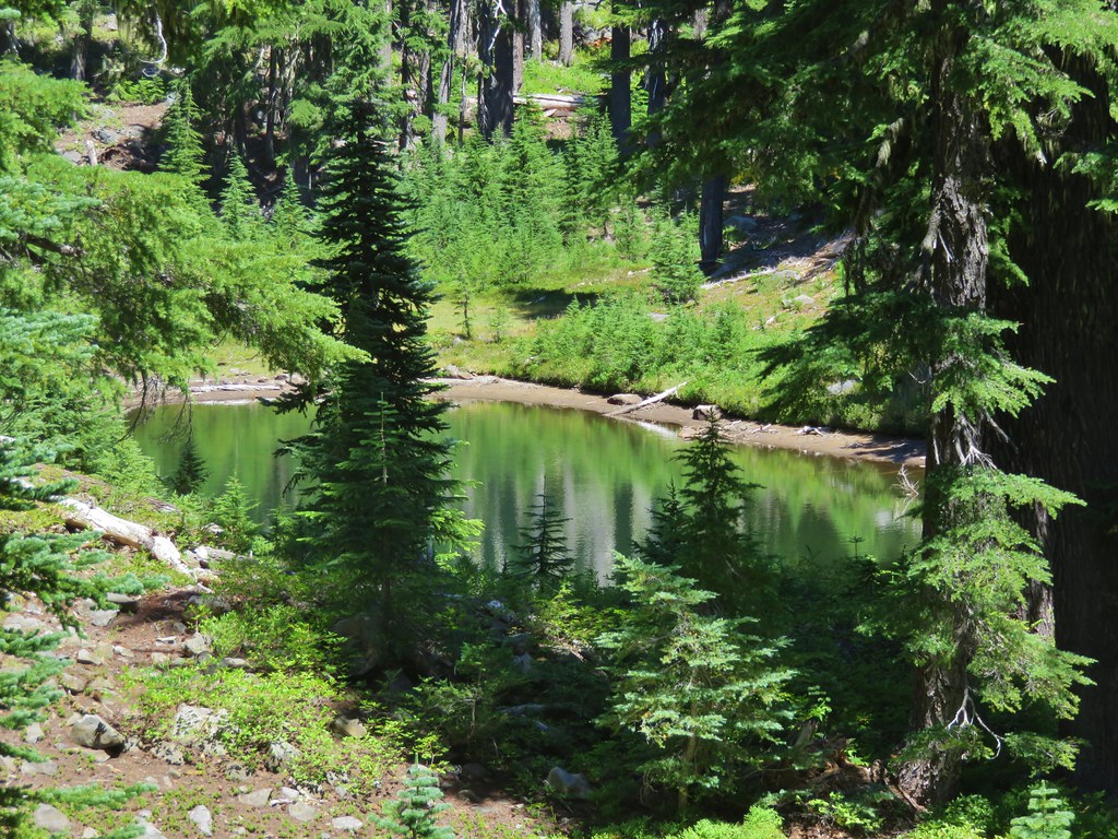
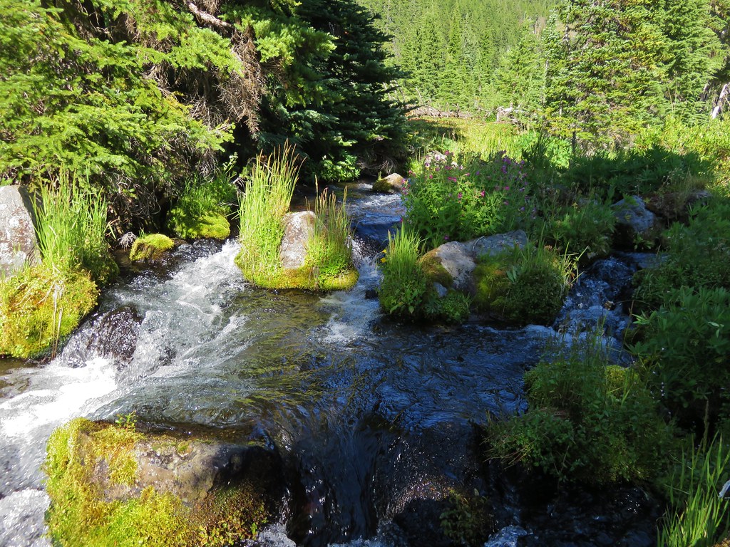
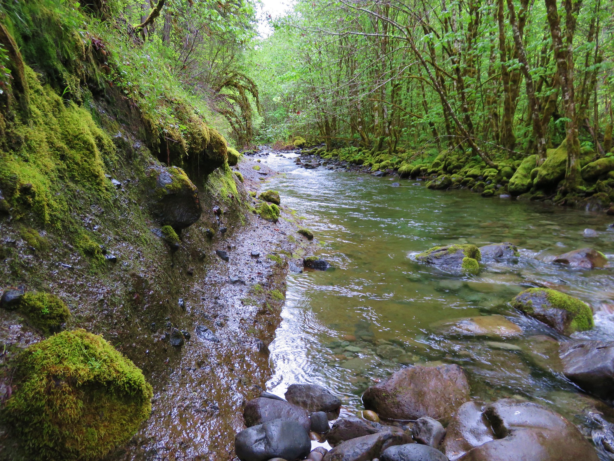
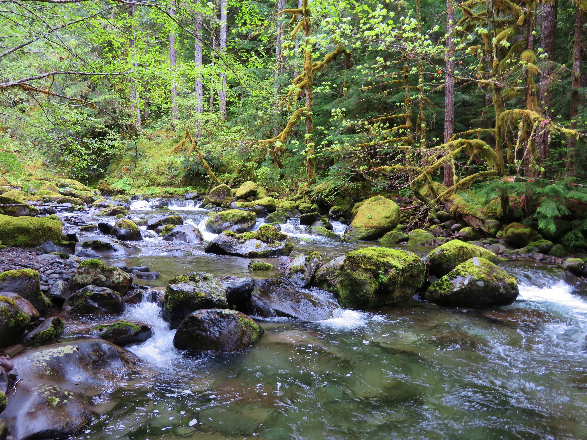
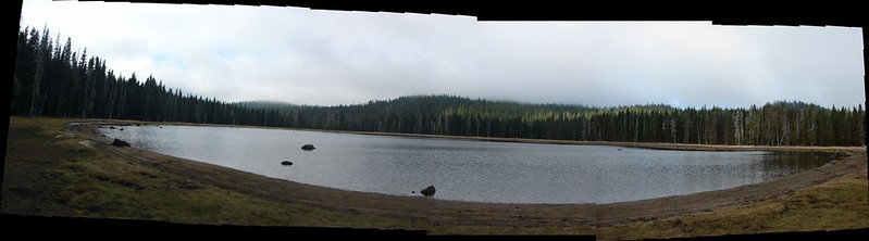
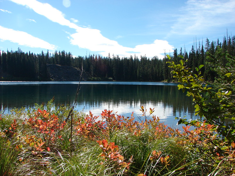
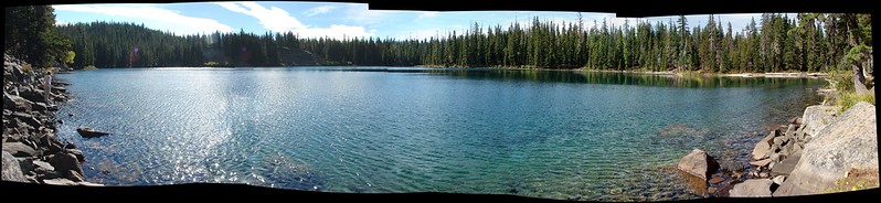
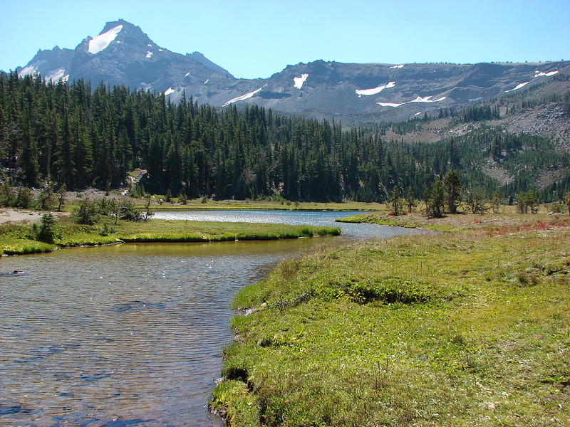
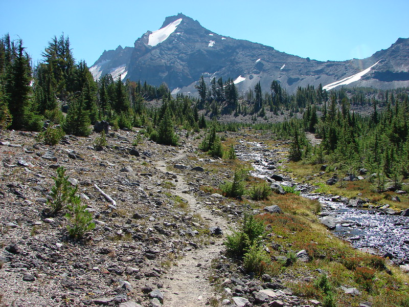
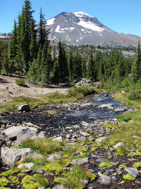
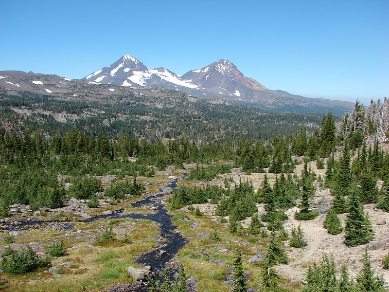
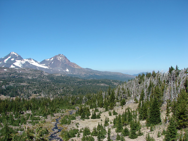
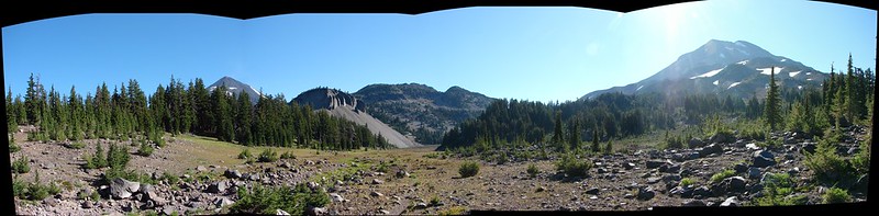
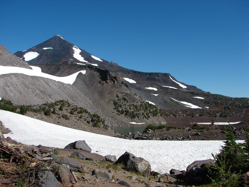
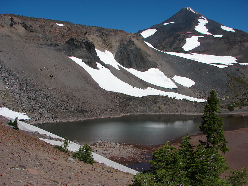
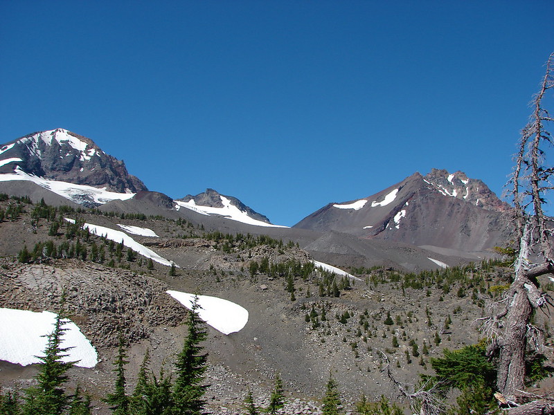
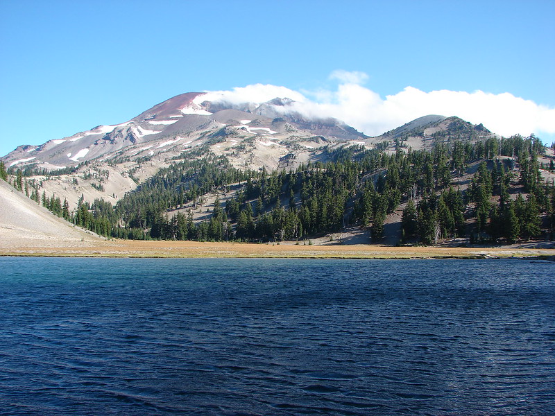
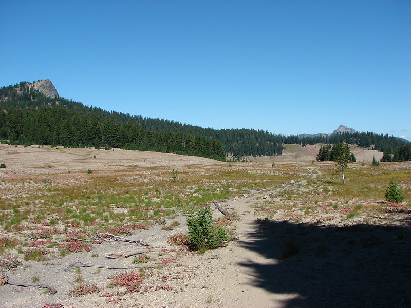
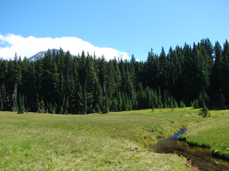
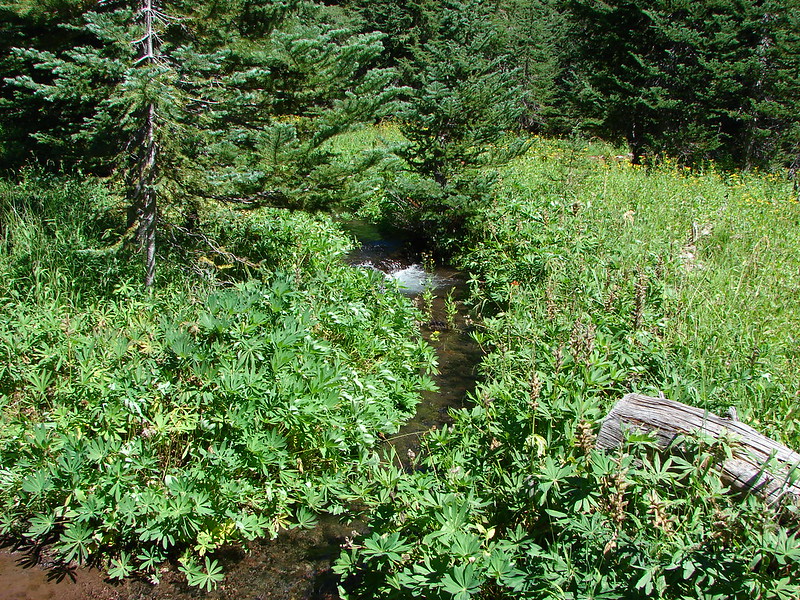
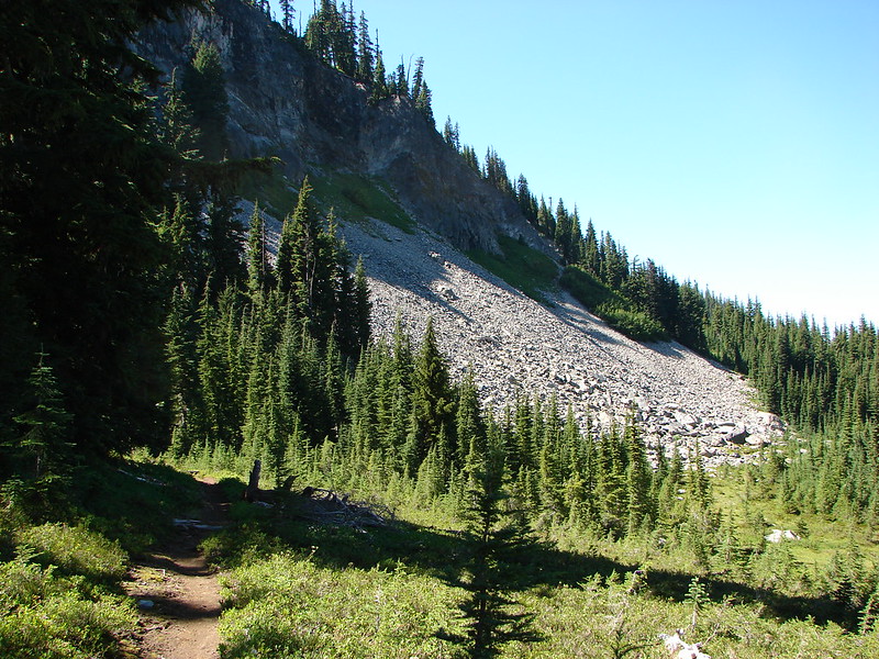
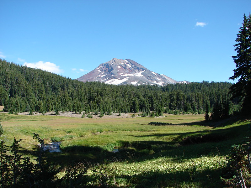
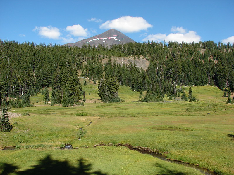
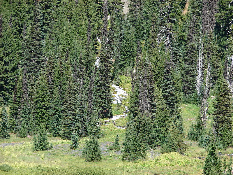
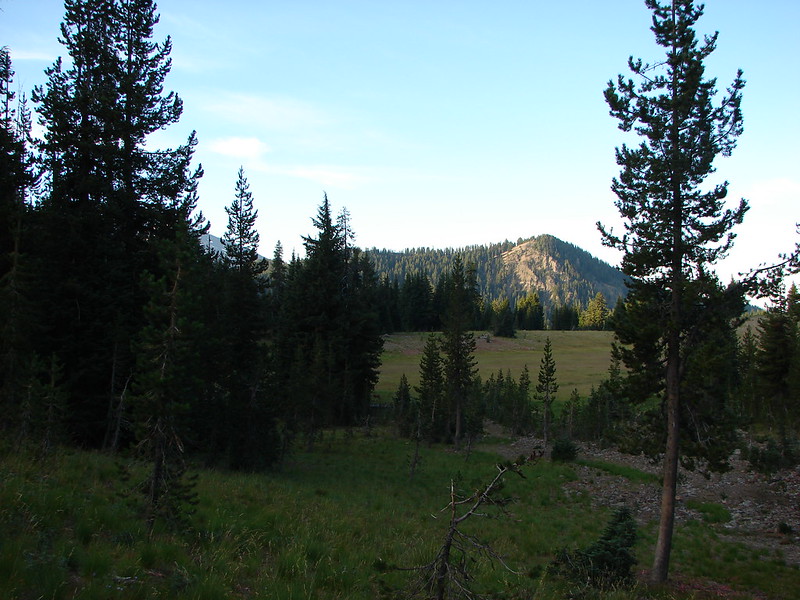
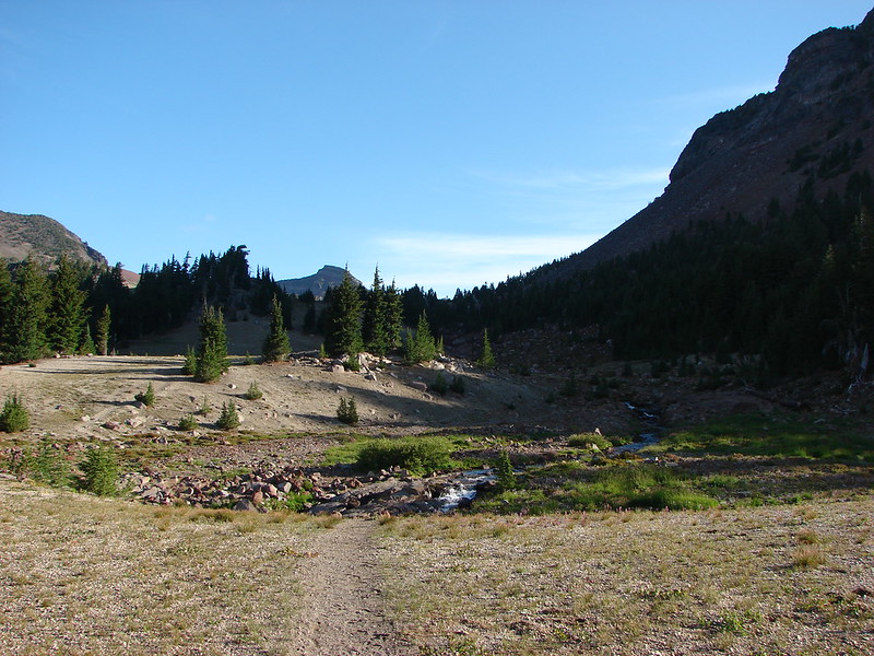
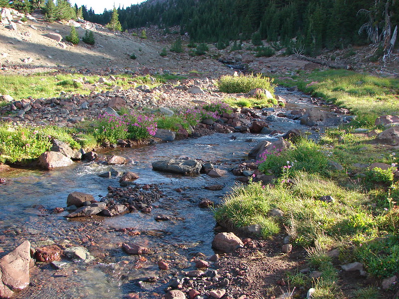
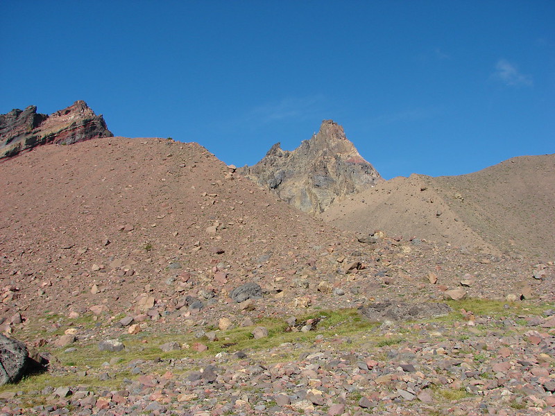
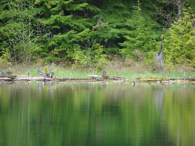
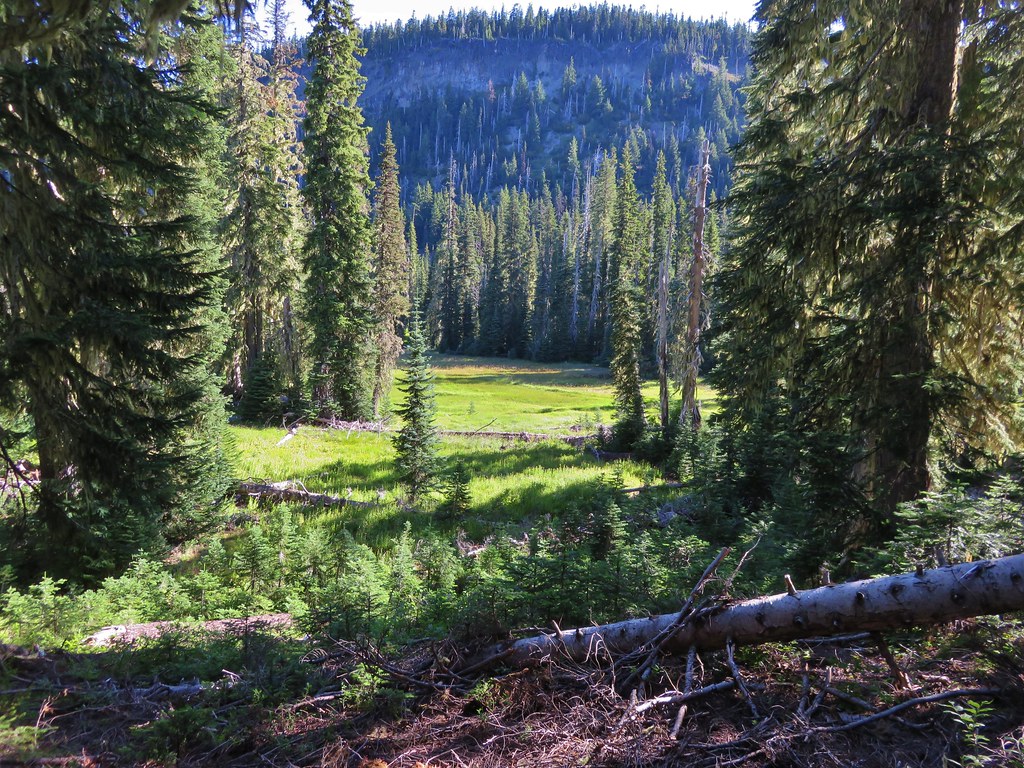
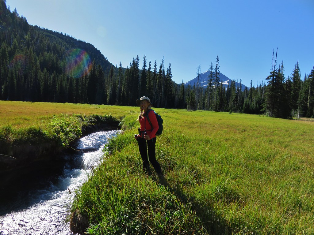
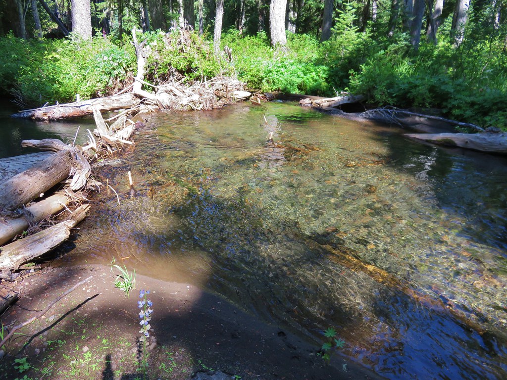
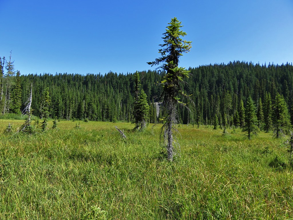
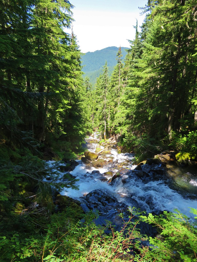
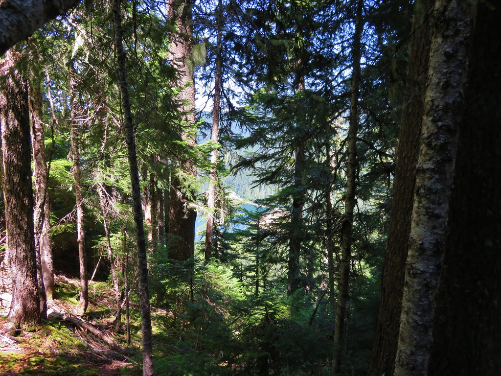
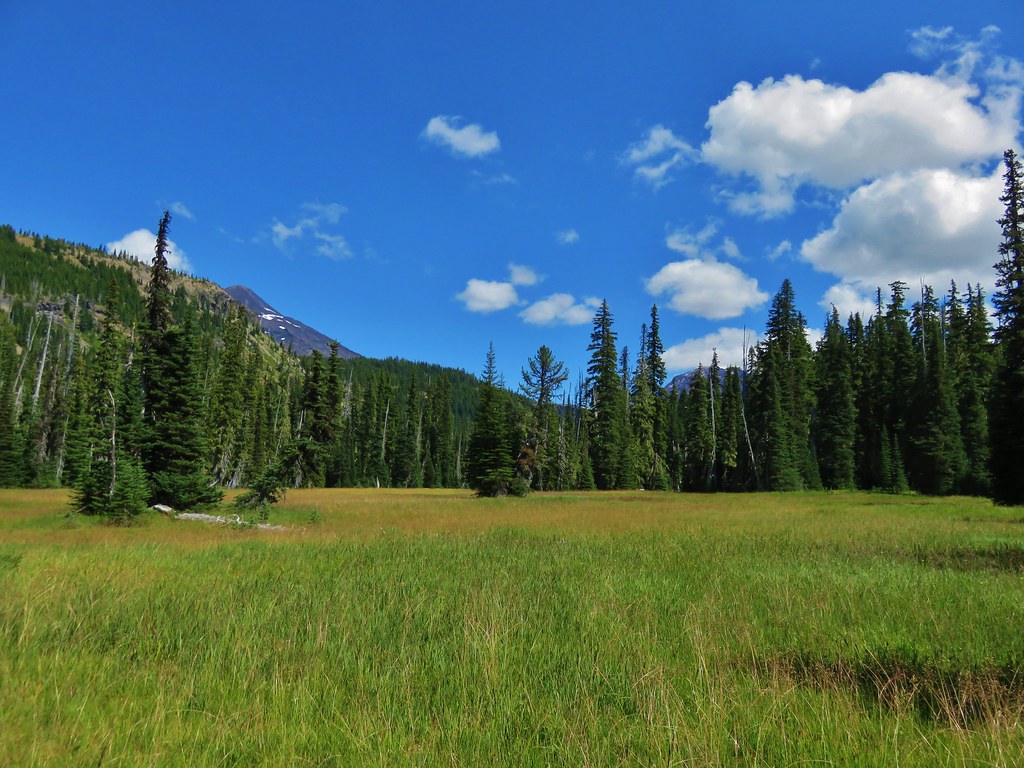
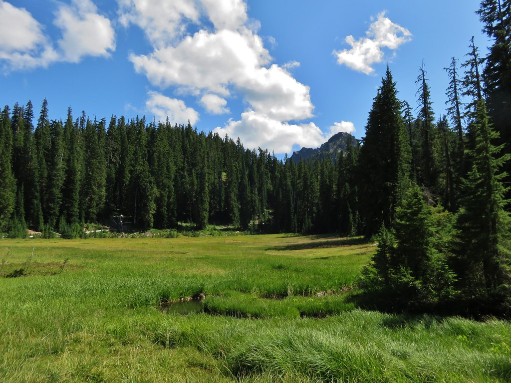
We gradually made our way downhill toward the meadows surrounding Linton Creek. There was some blowdown in the forest but it wasn’t ever too bad and the vegetation was sparse enough not to cause any problems. We used the Garmin and our maps to keep us heading in the direction we wanted. We were aiming for the northwestern end of the meadows where Linton Creek enters the forest near a series of whitewater. We managed to reach the meadows fairly close to that area and made our way to the glassy creek.
IMG_6509

IMG_6523

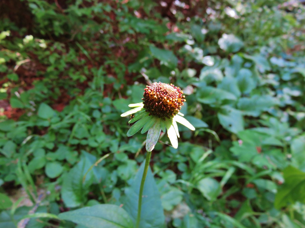
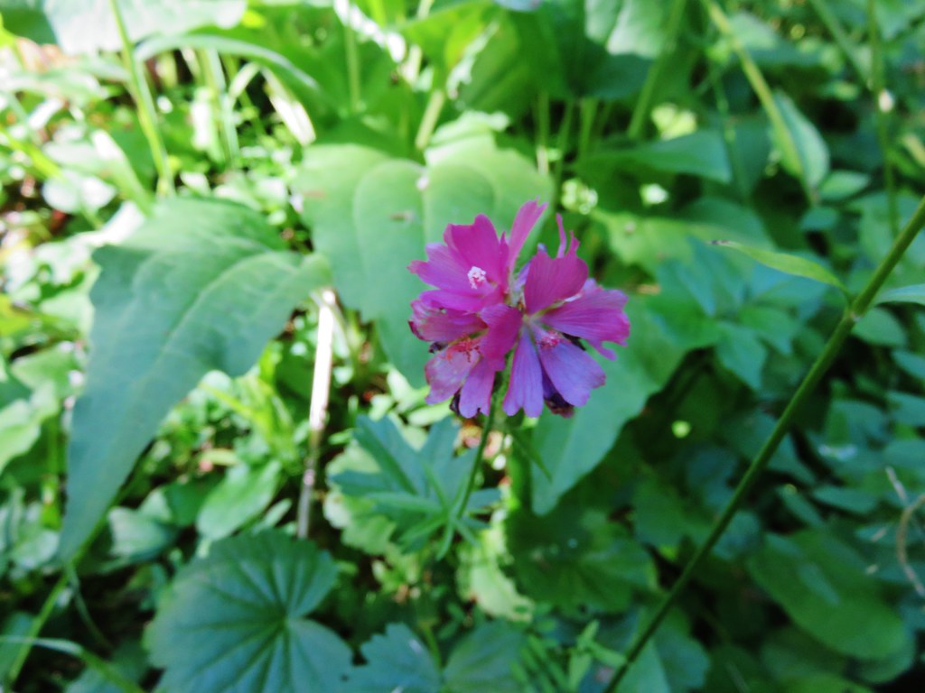
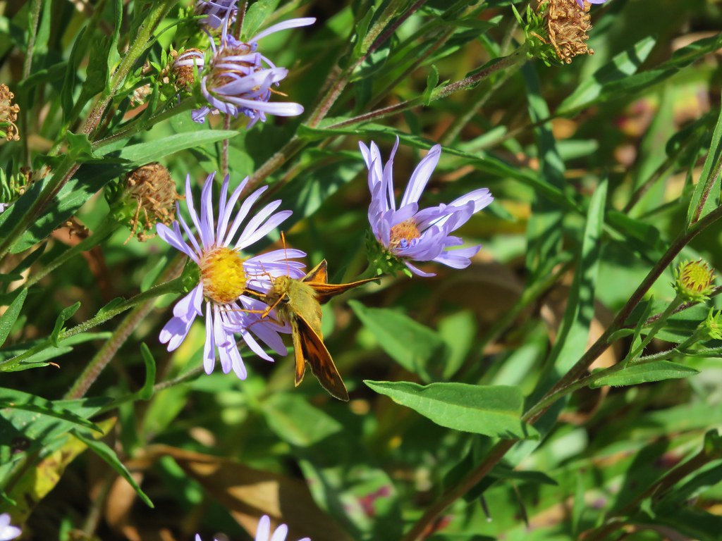
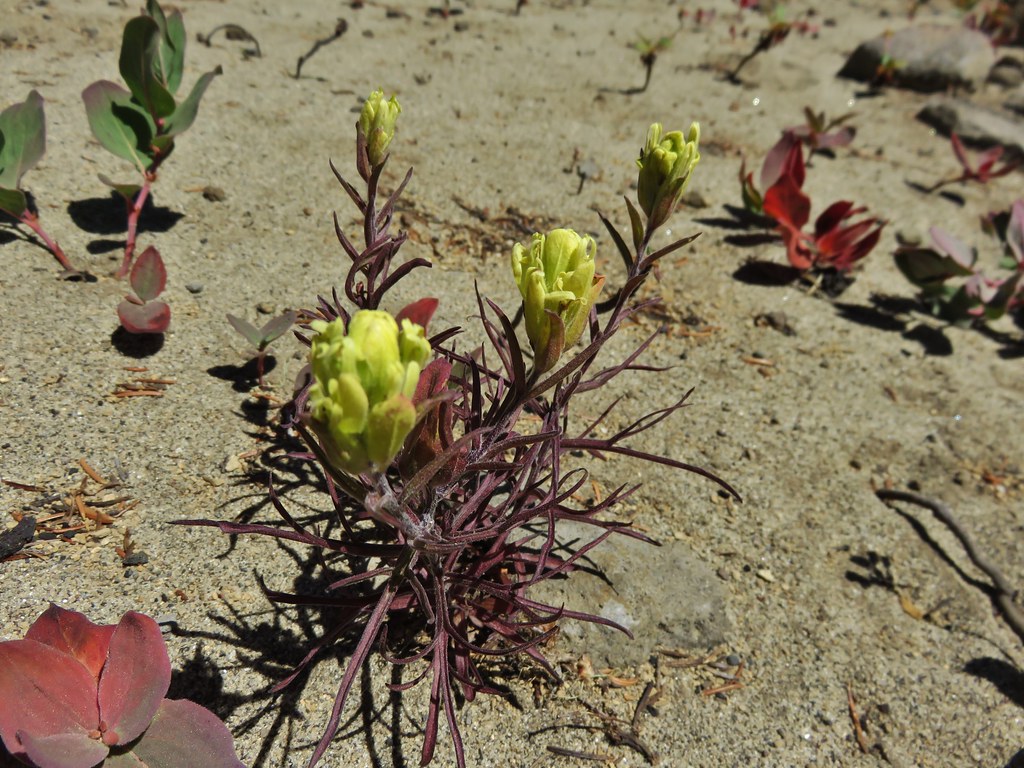
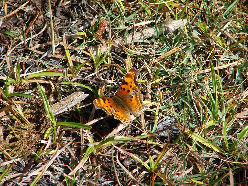
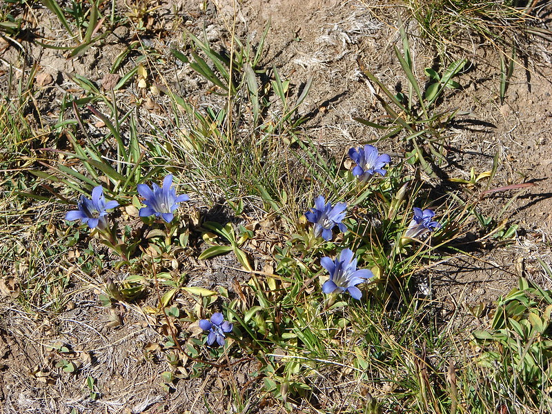
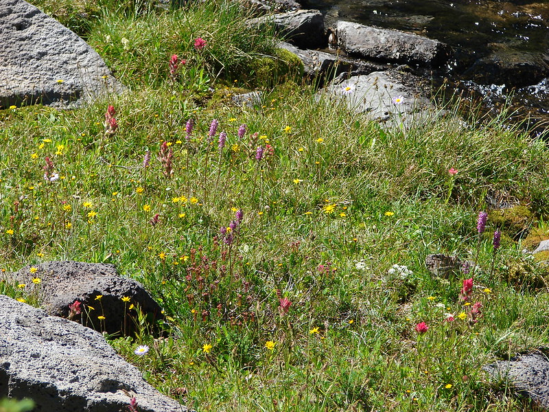
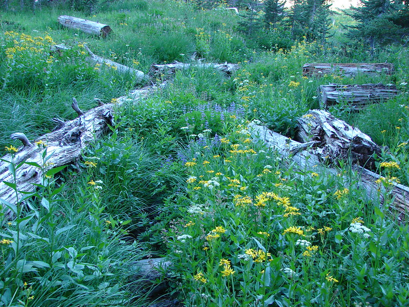
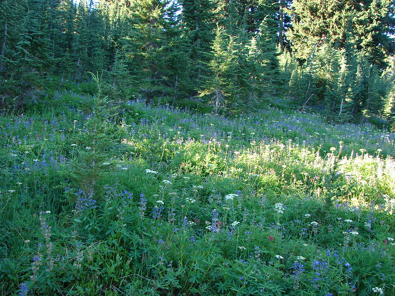
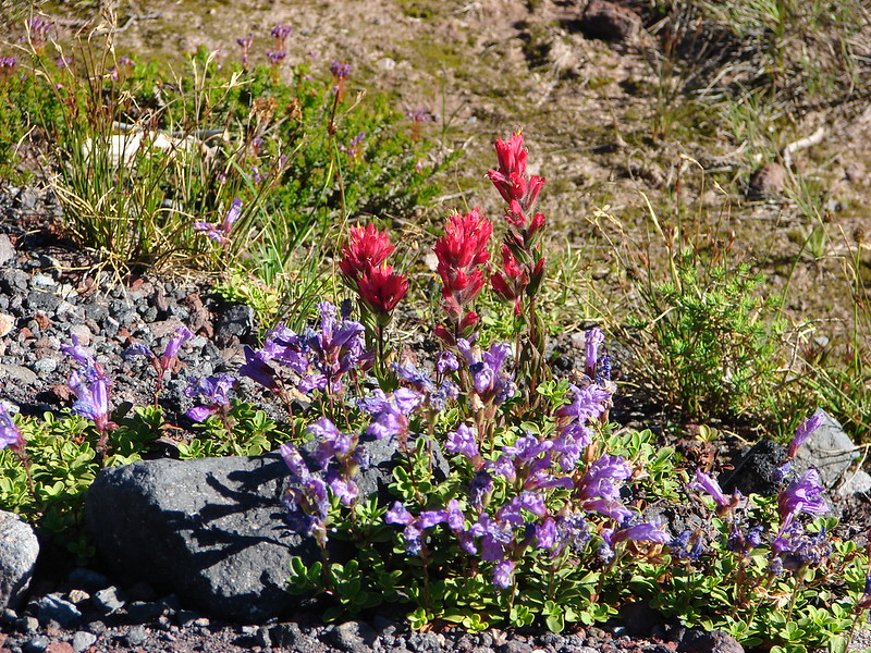
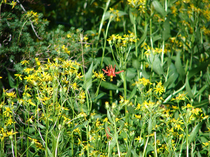
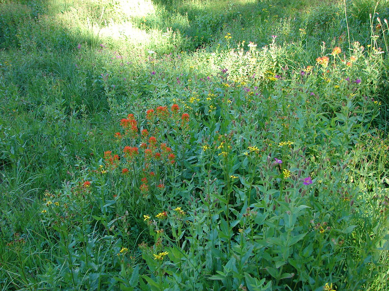
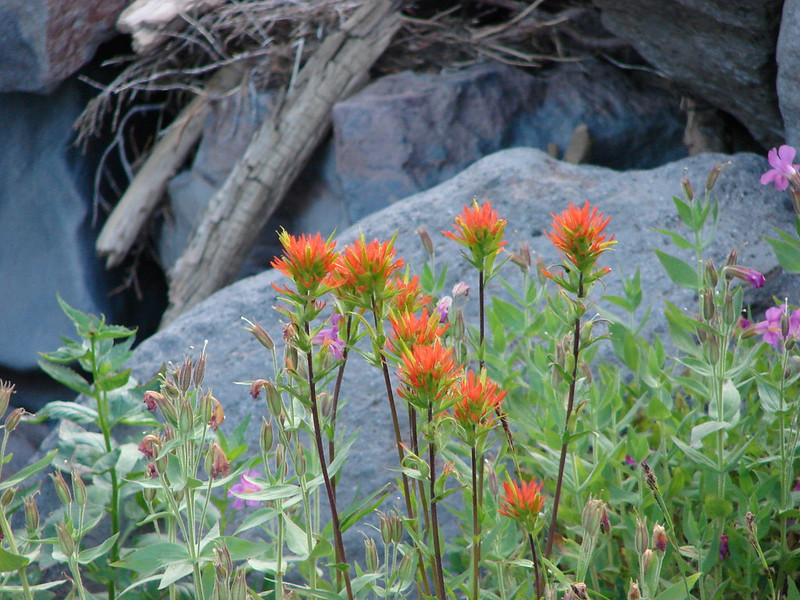
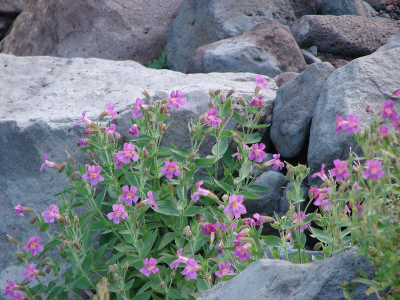
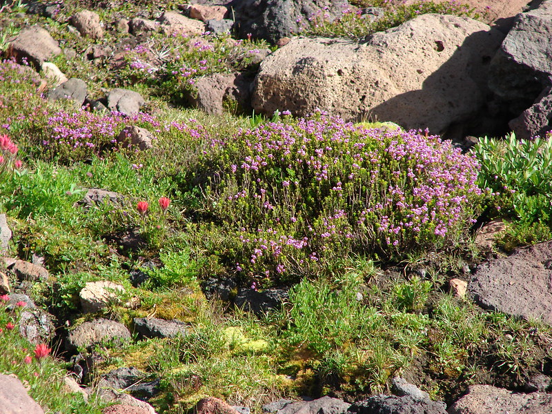
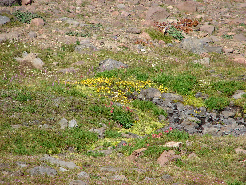
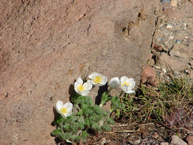
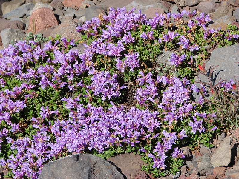
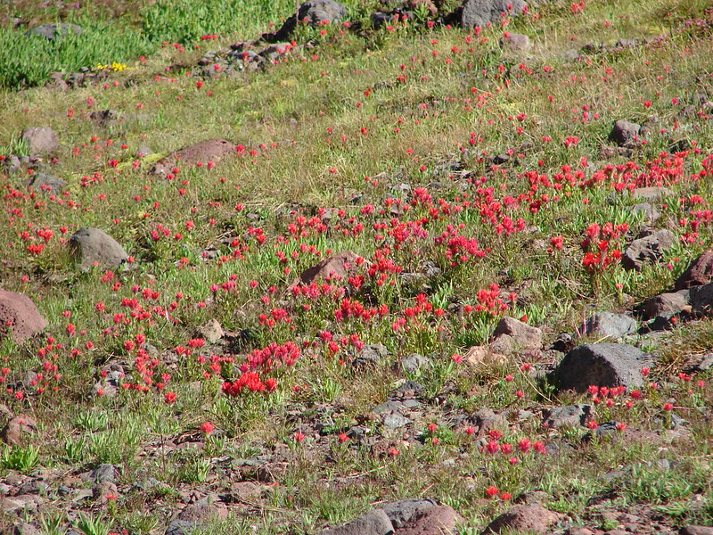
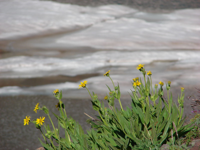
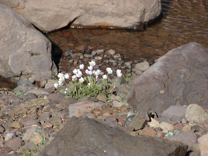
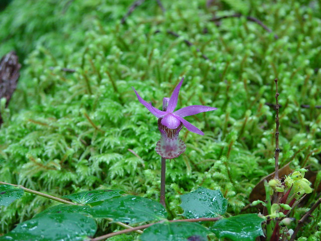
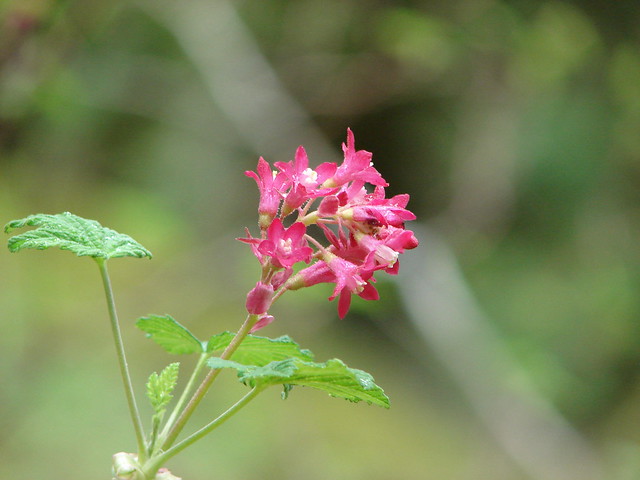
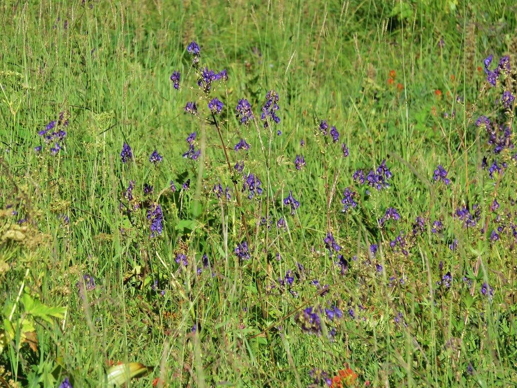
There were a few flowers still blooming including some very tall monkshood.
IMG_6511

IMG_6514

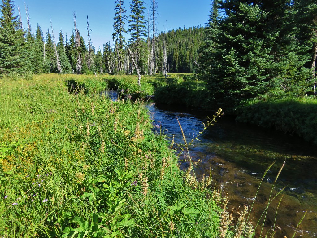
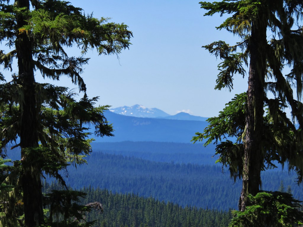
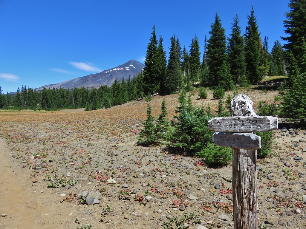
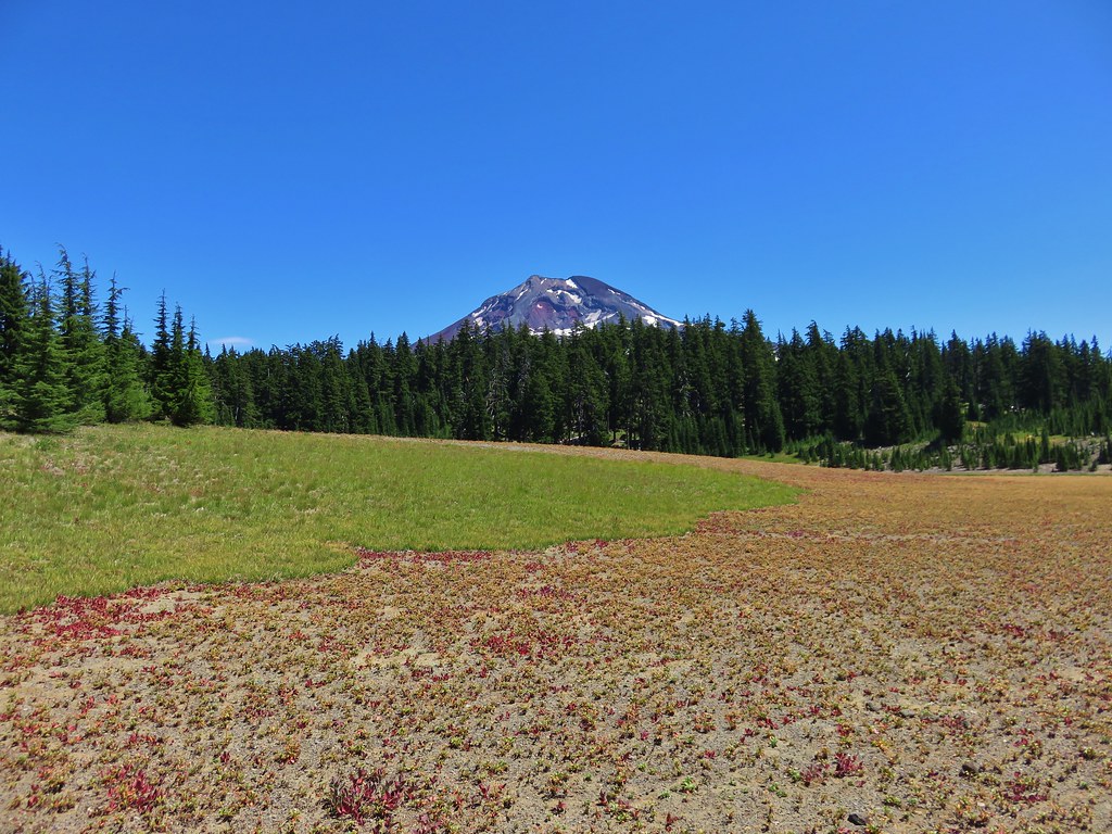
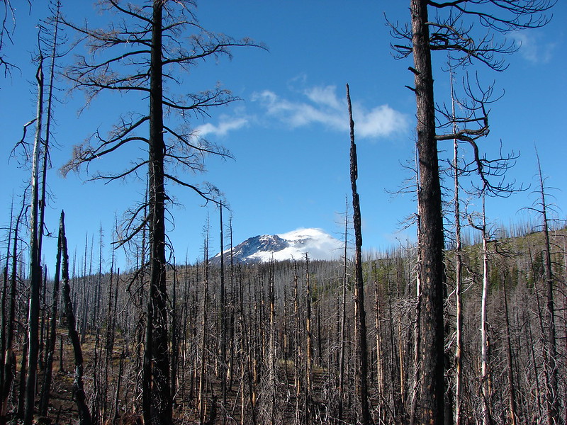
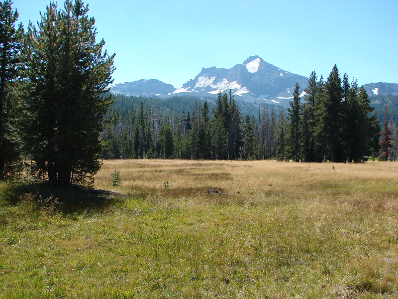
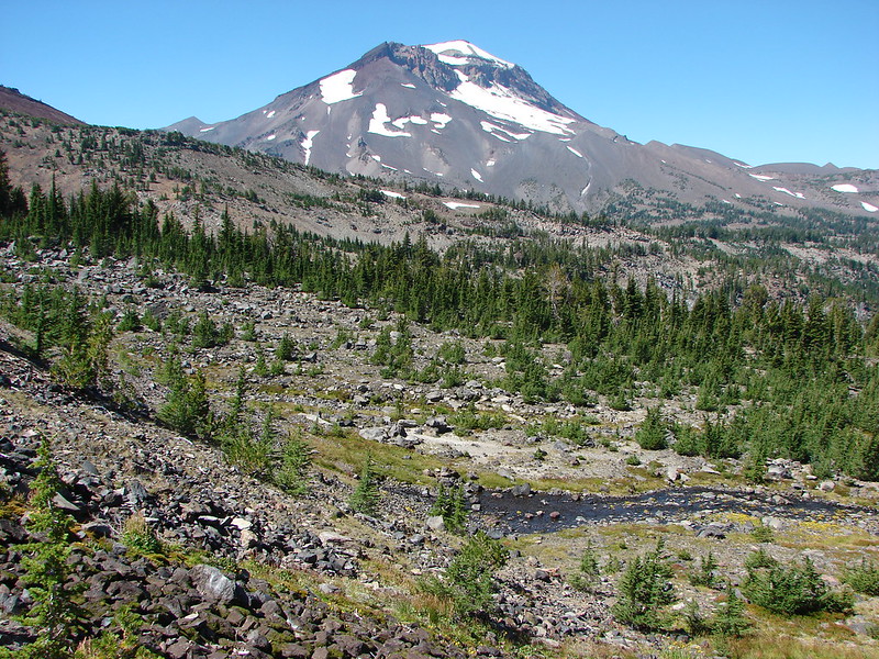
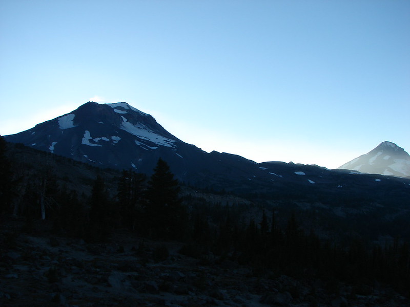
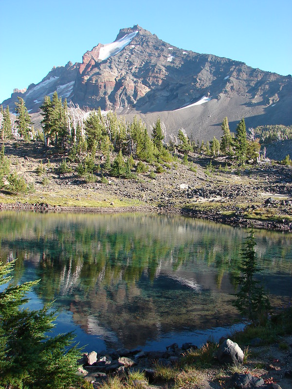
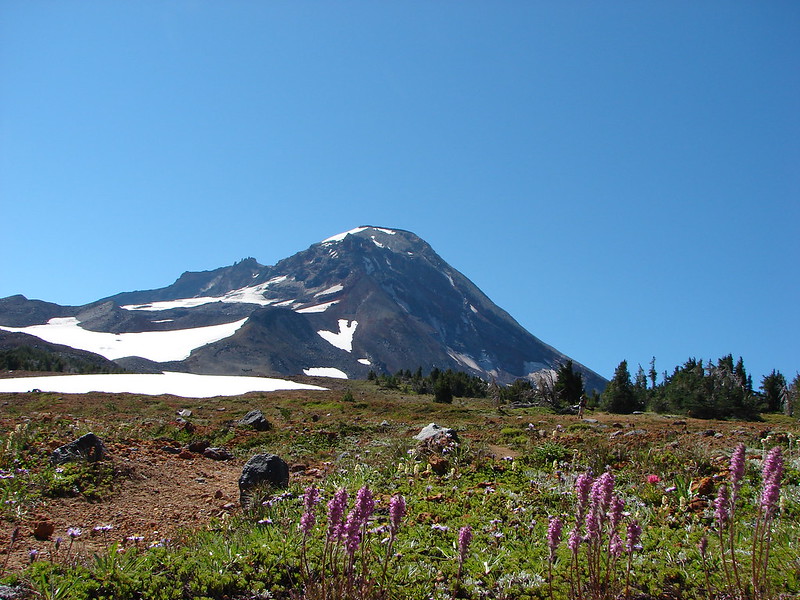
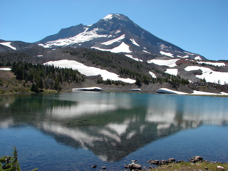
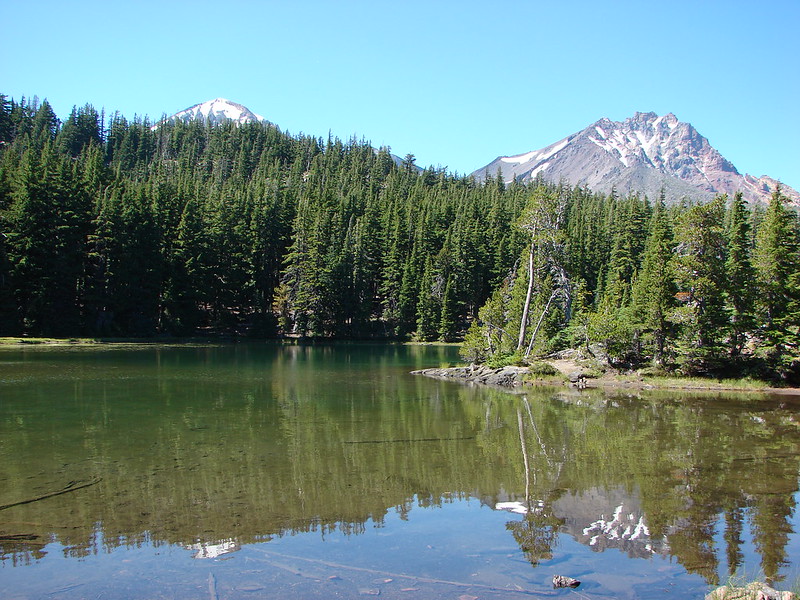
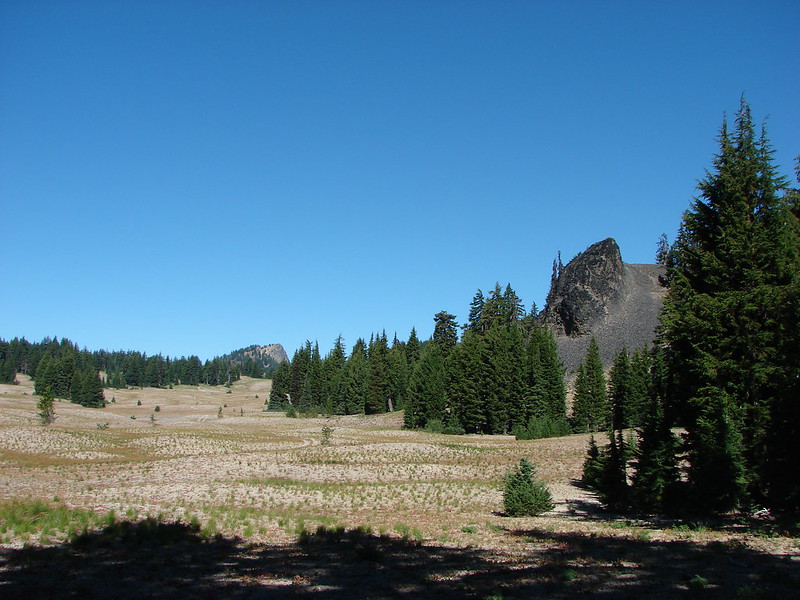
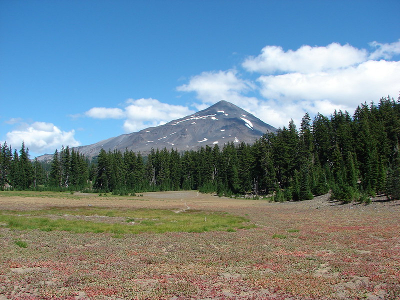
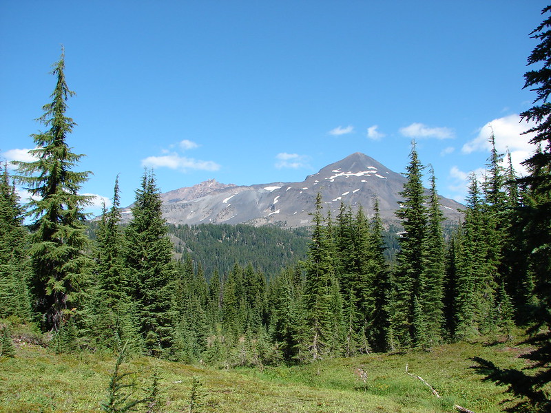
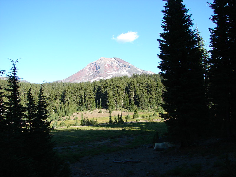
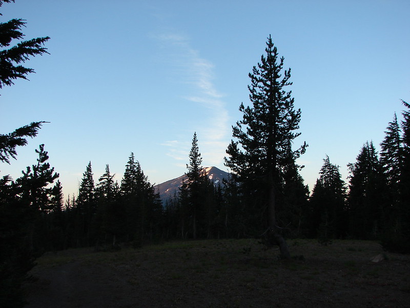
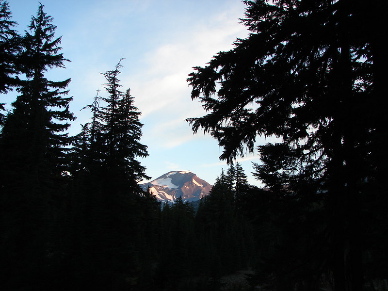
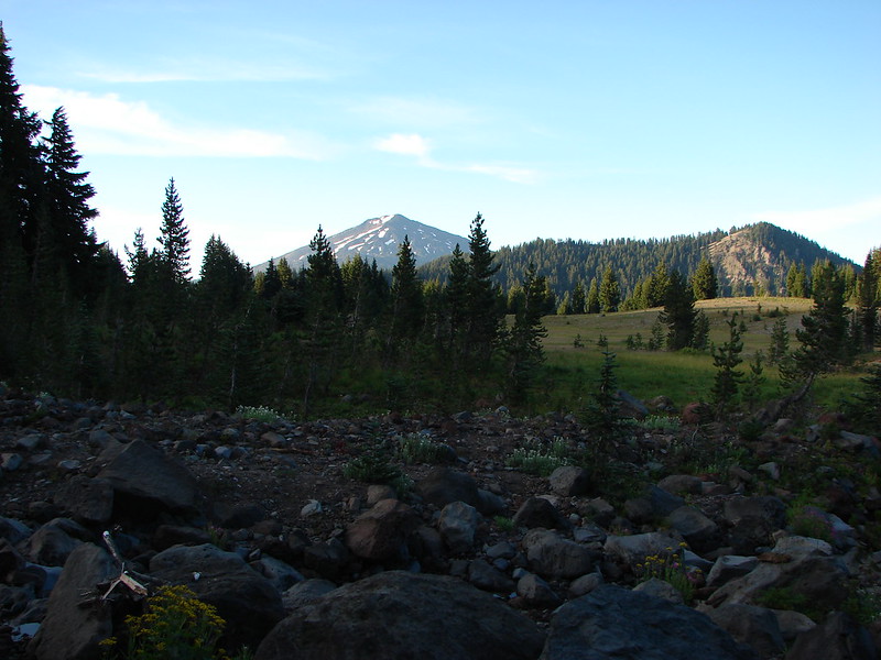
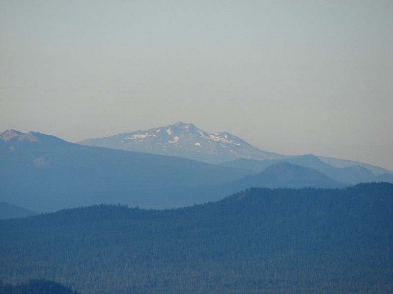
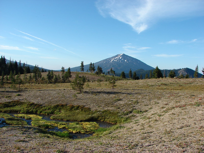
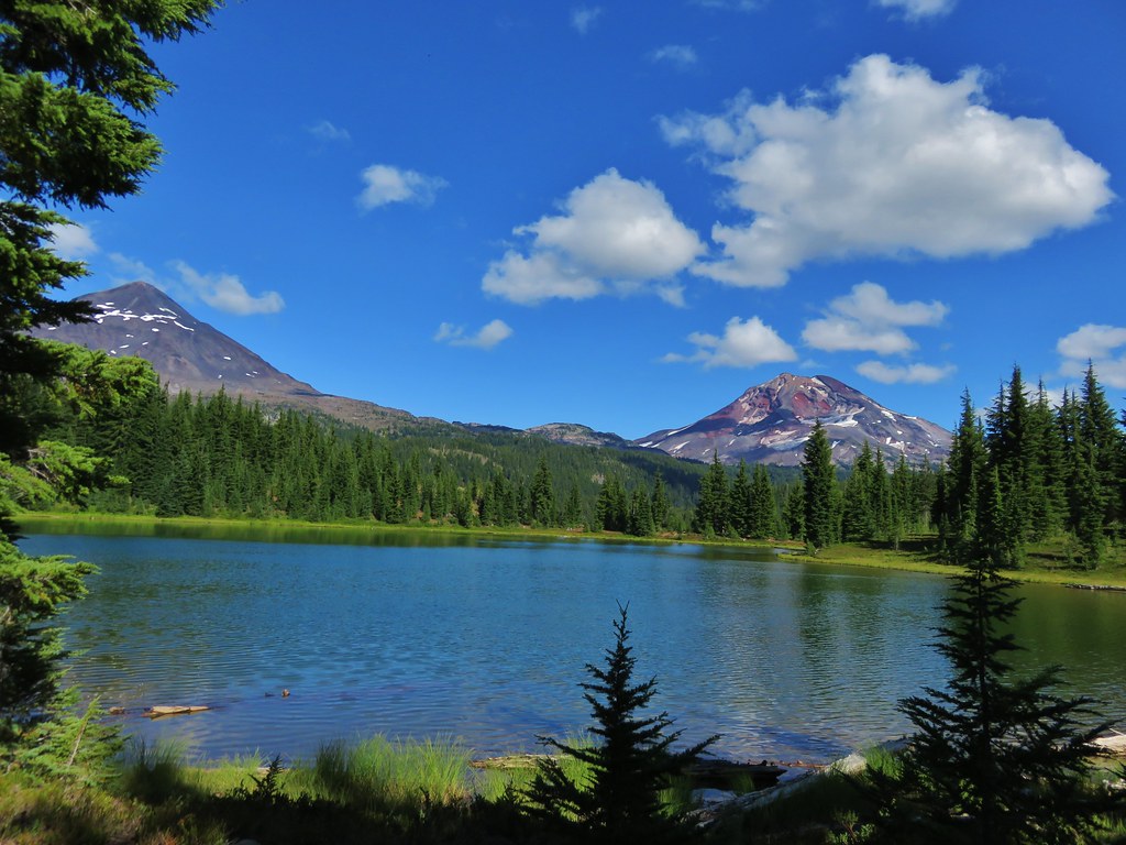
The South Sister loomed behind us over the creek and meadows.
IMG_6522

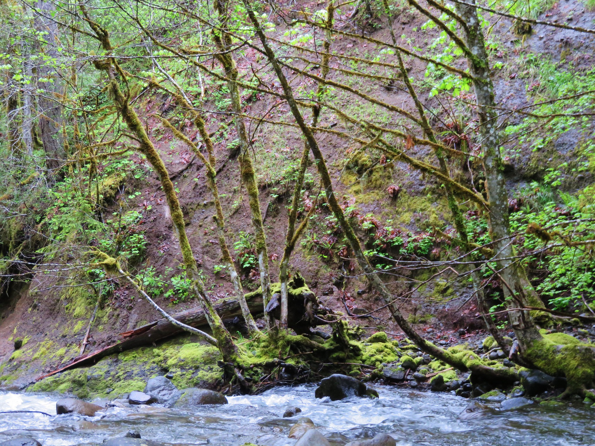
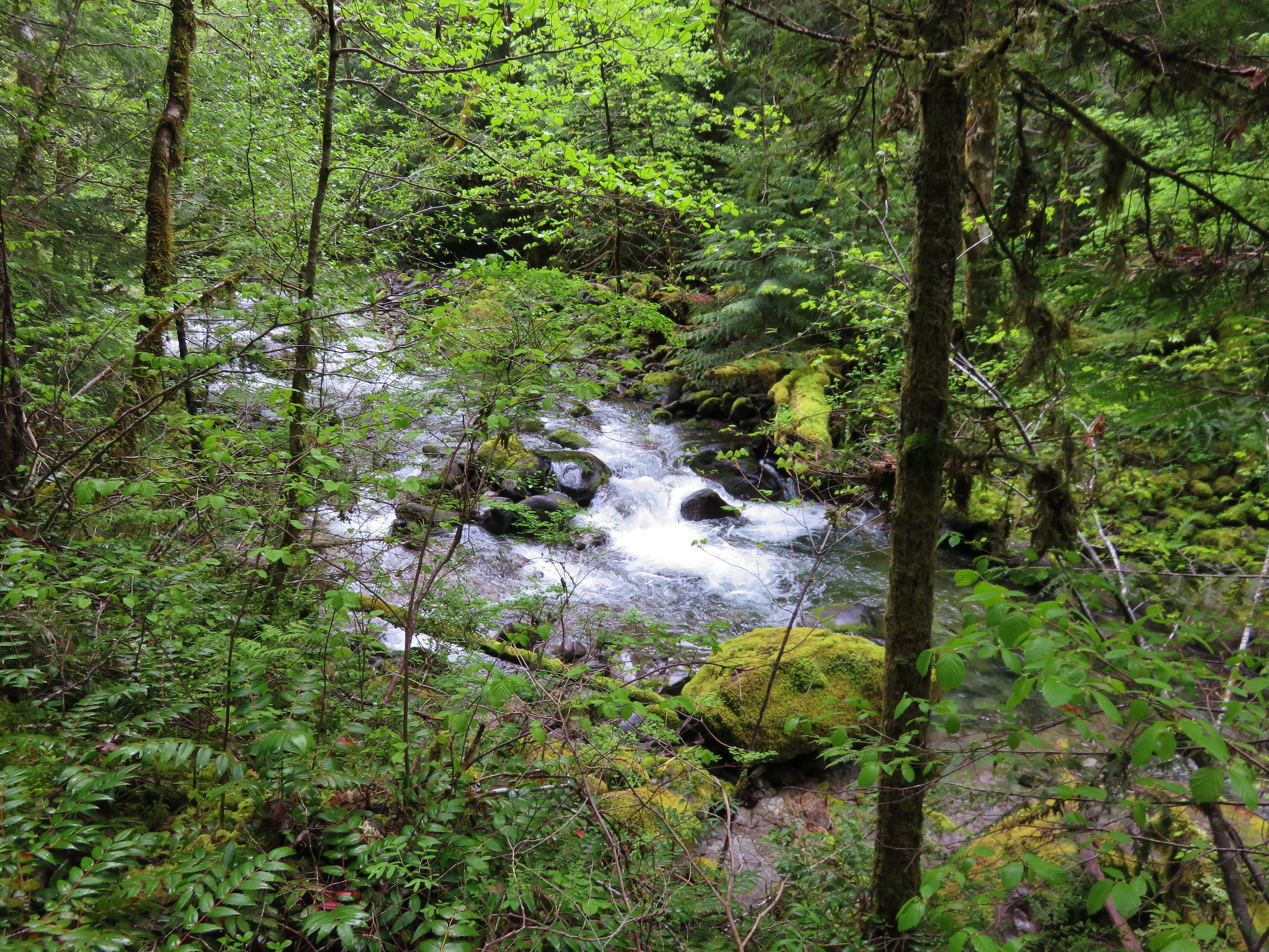
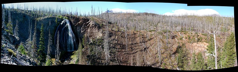
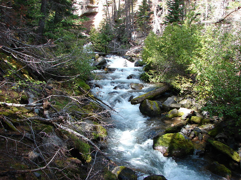
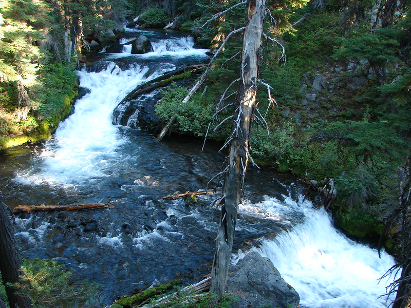
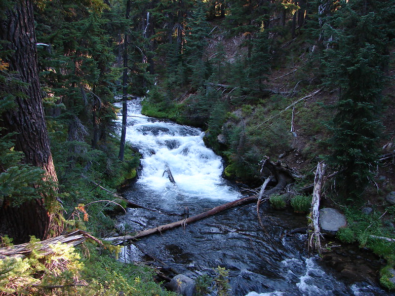
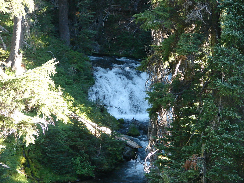
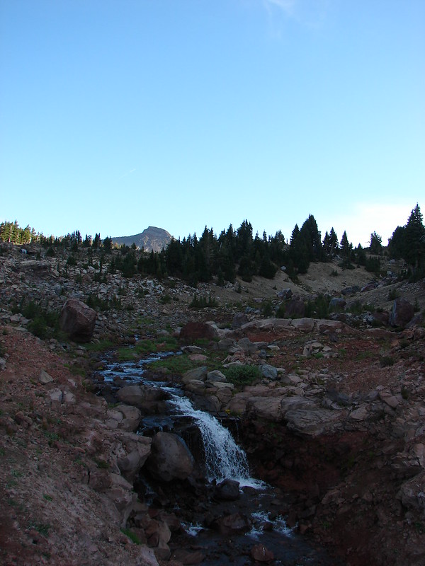
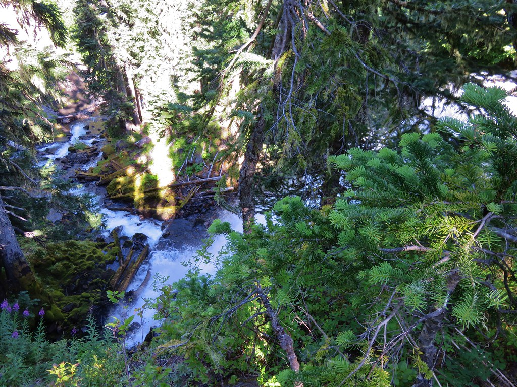
Shortly after Linton Creek enters the trees it takes a horseshoe bend through a rocky chasm where it puts on its first whitewater show. We were on the south side of the creek and able to side-hill along and around the ridge that the creek bent around which allowed us some good views of the now raging creek.
IMG_6531

IMG_6536

IMG_6540

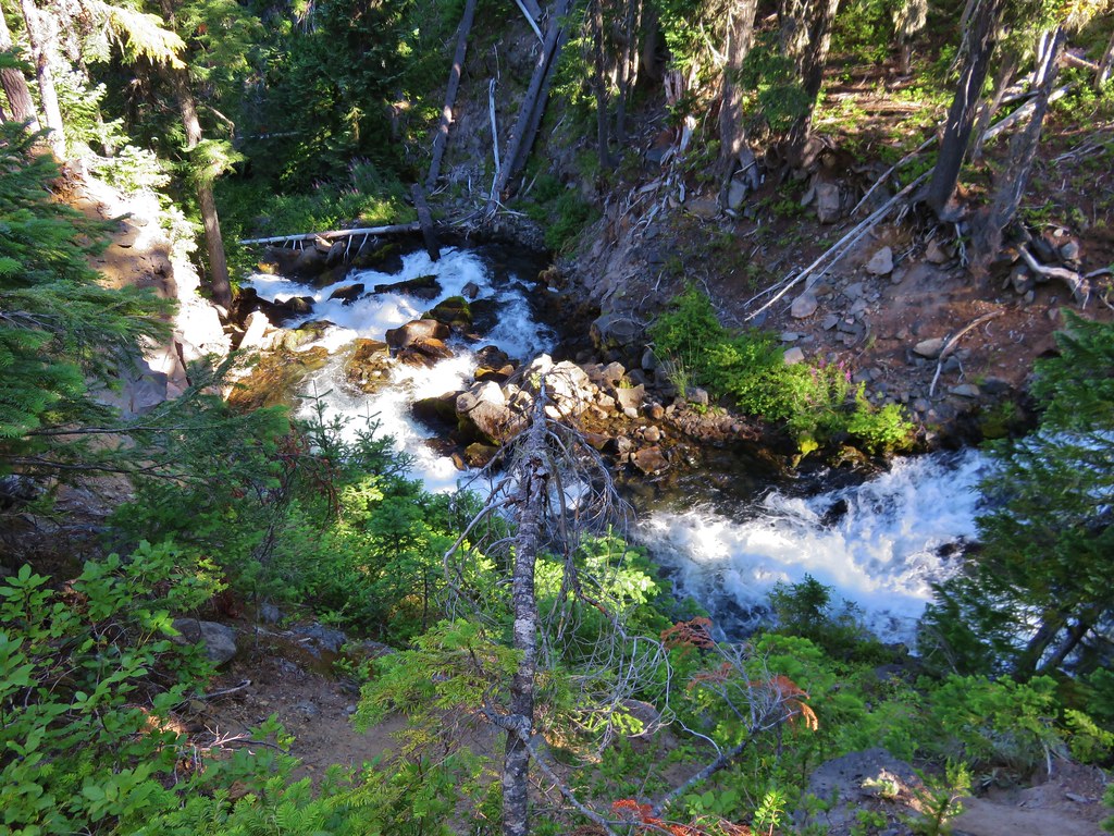
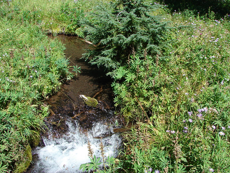
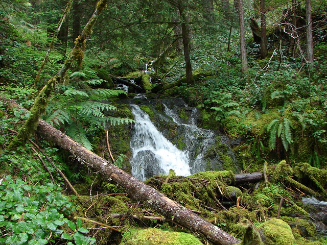
After rounding the ridge we came to the first small unnamed waterfalls. A pair of short drops were visible through the trees.
IMG_6545

IMG_6548

A little further was another whitewater slide.
IMG_6551

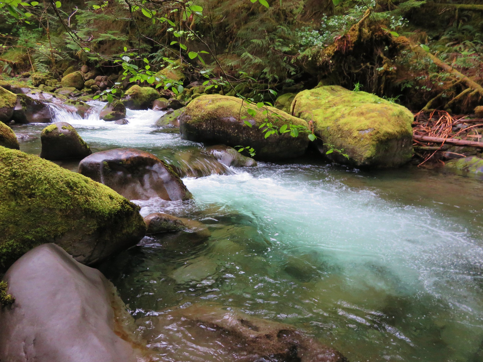
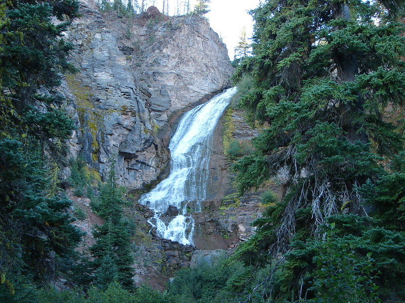
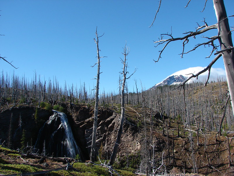
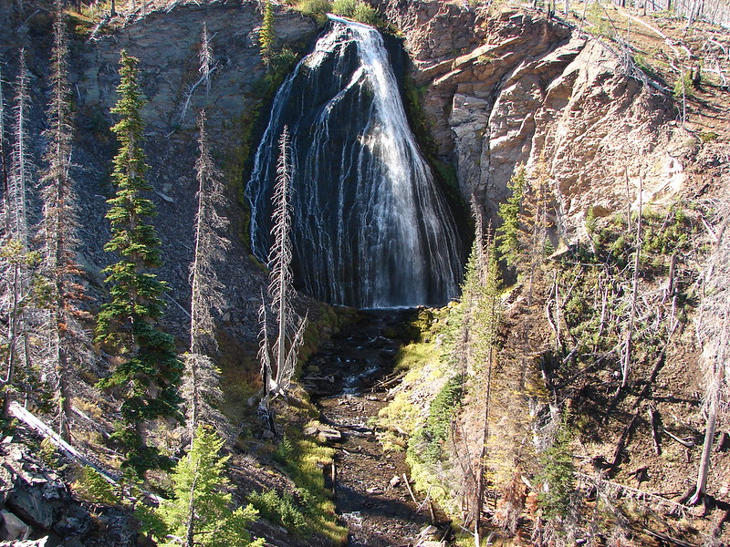
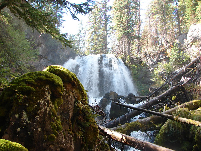
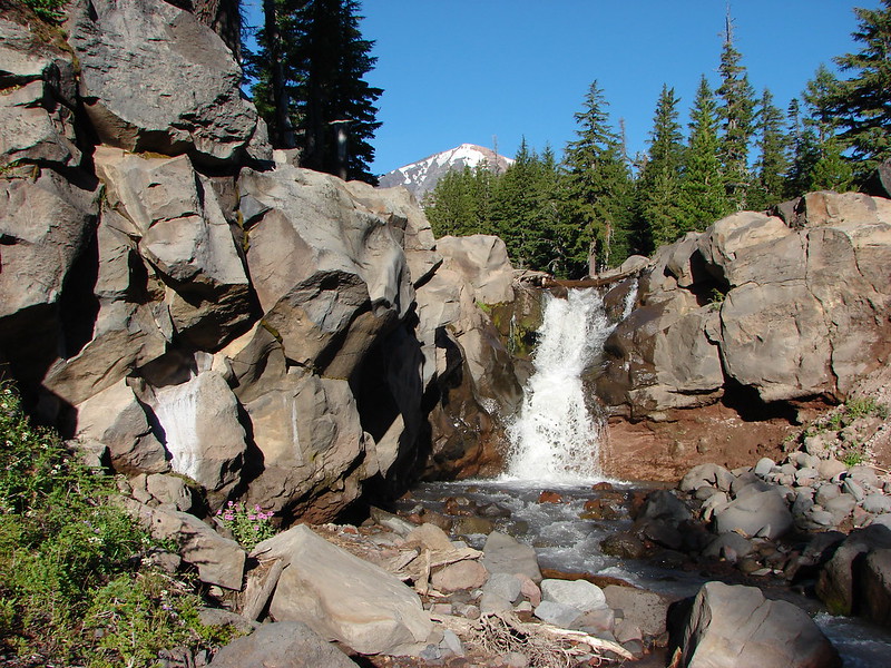
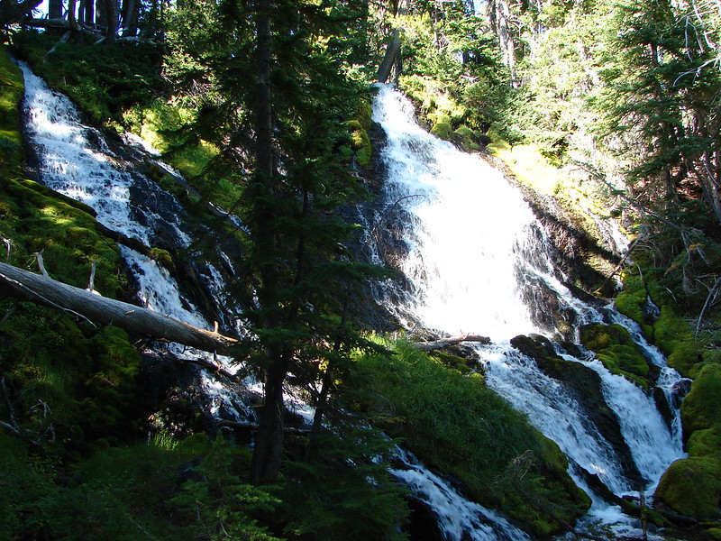
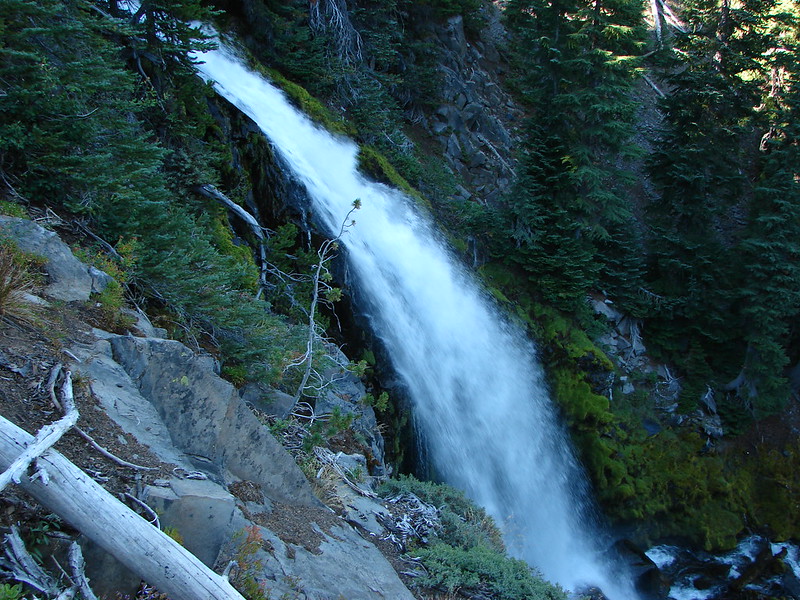
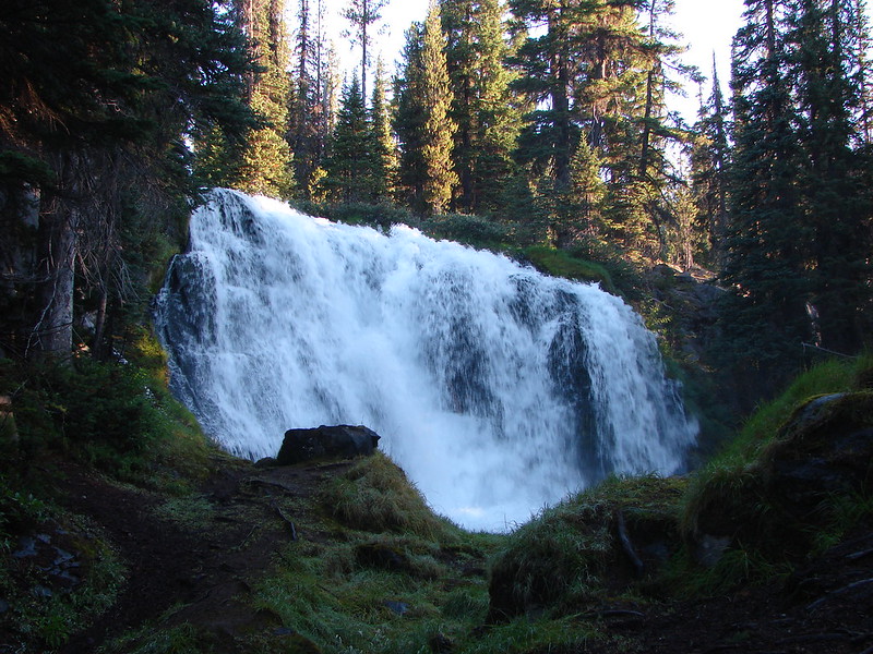
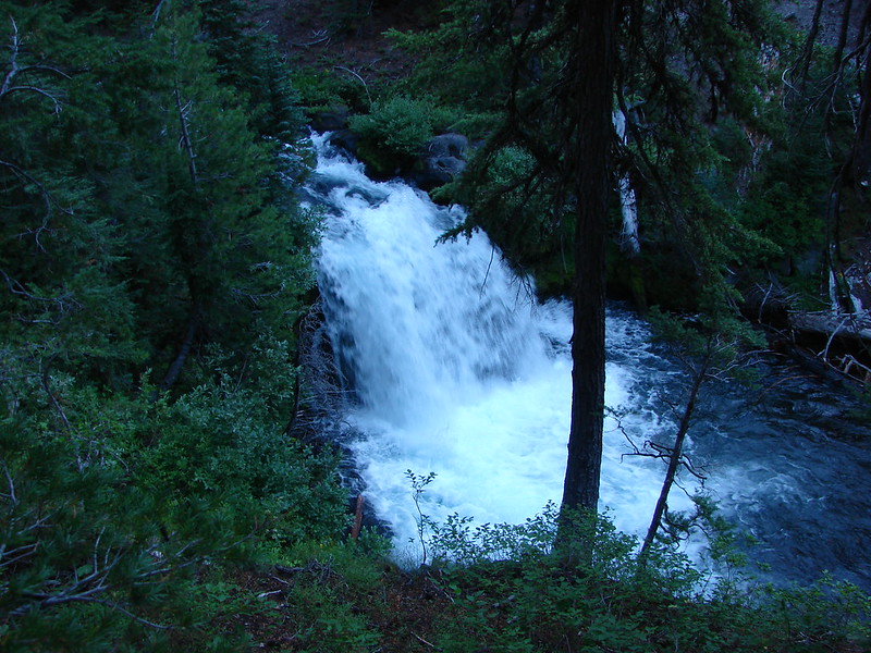
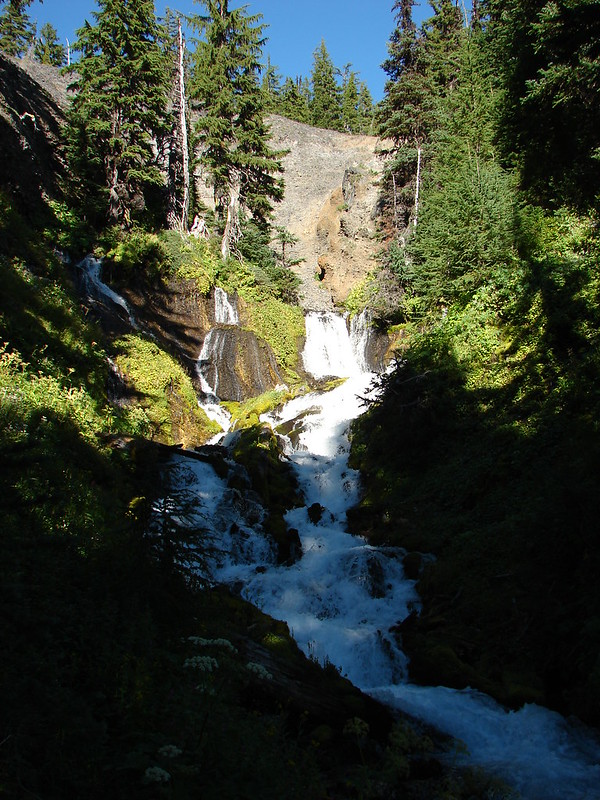
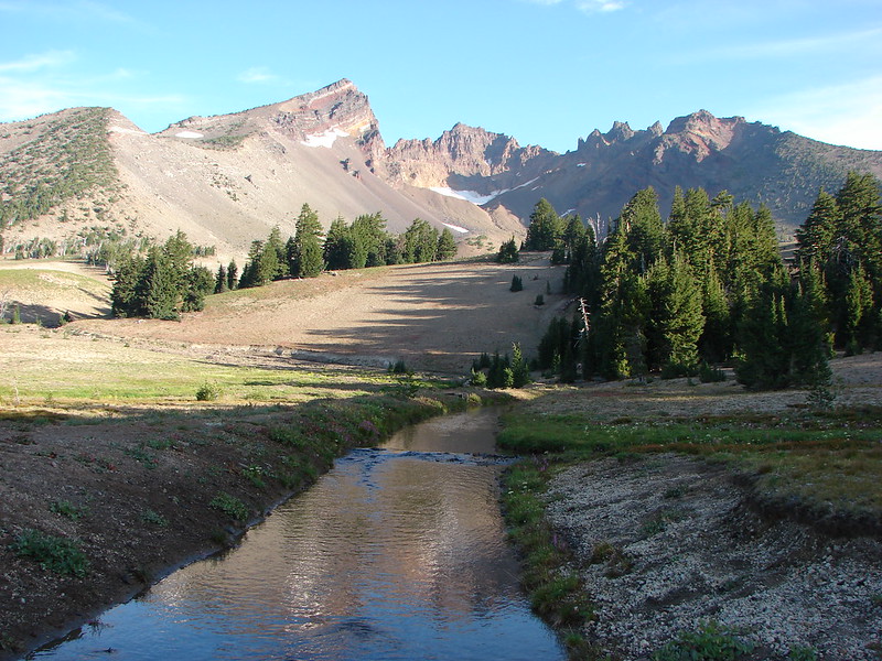
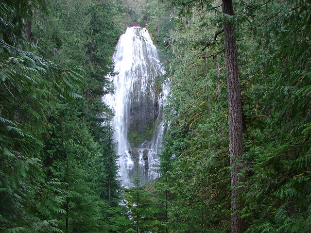
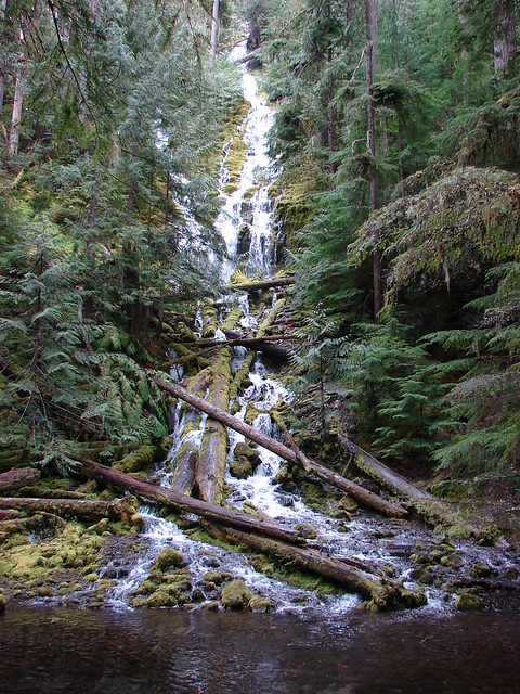
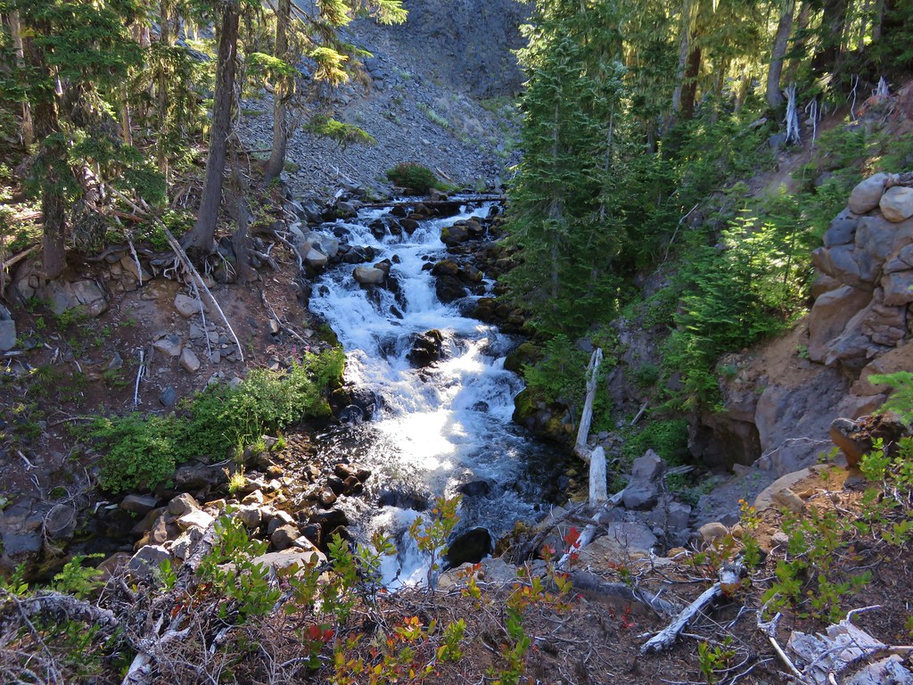
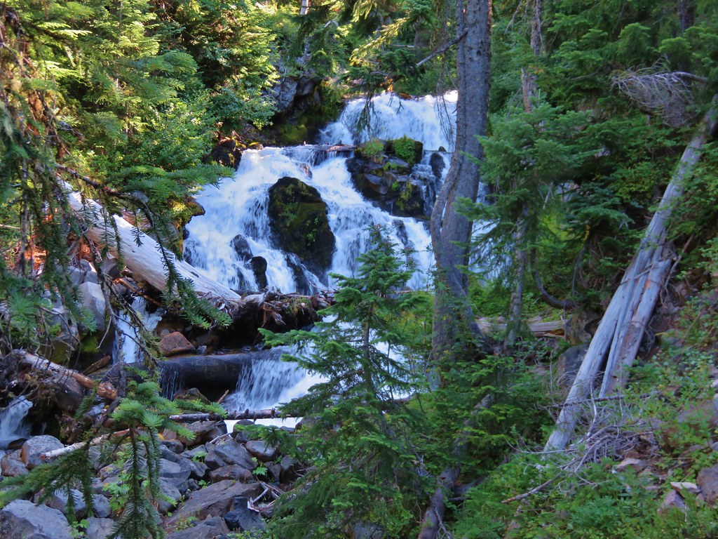
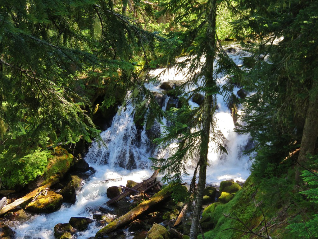
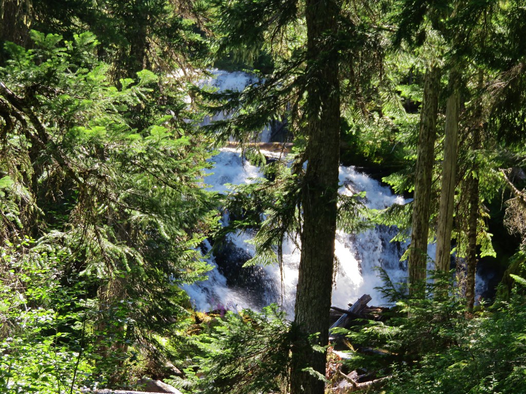
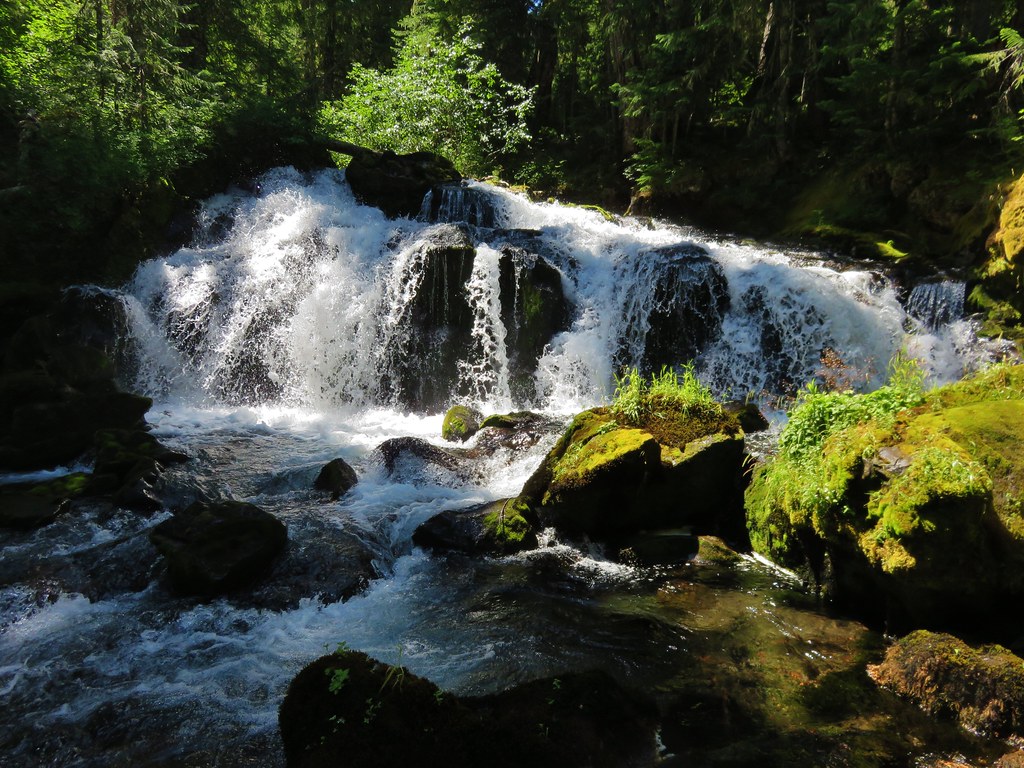
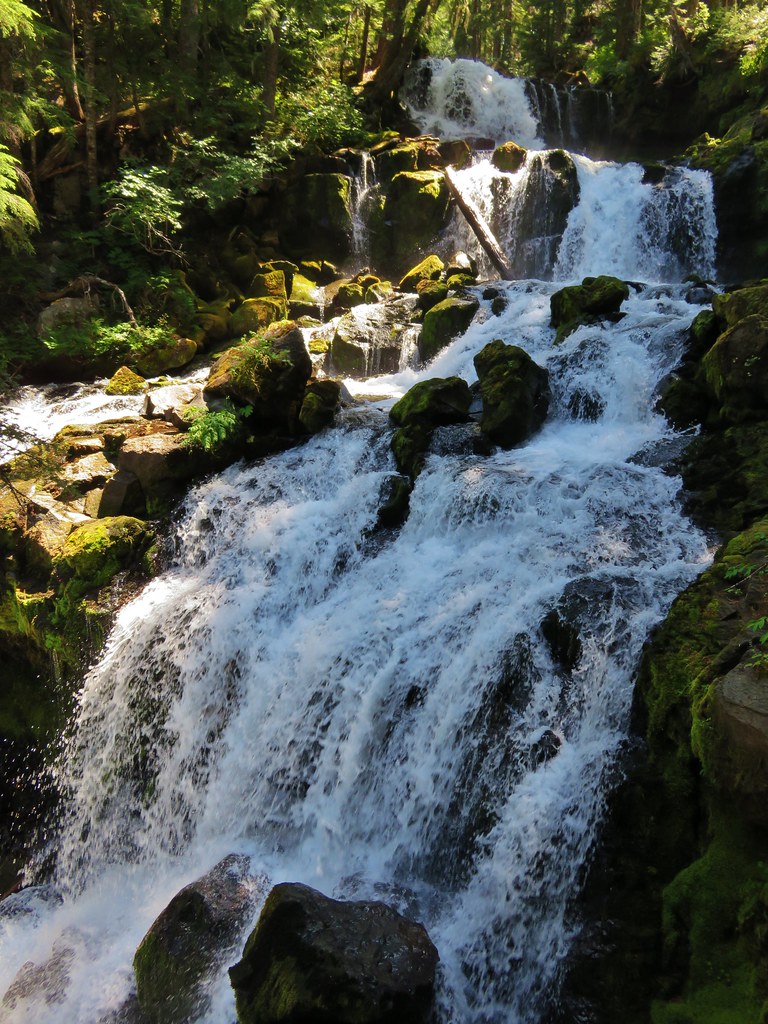
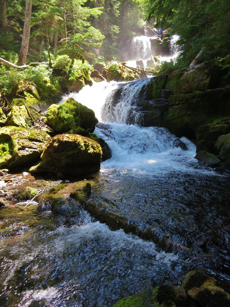
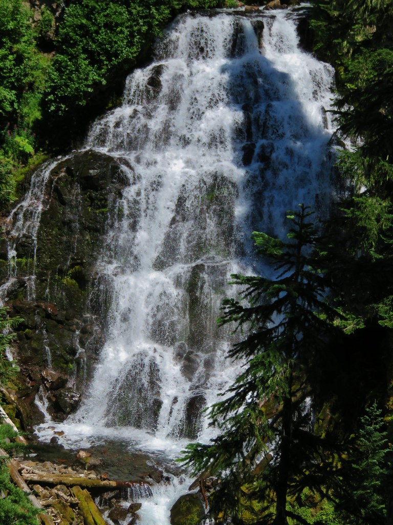
The creek was putting on a good show and we were trying to stick as close as possible to it given the terrain. When we couldn’t see the creek we listened intently for any indication of another fall. The creek then began a second horseshoe bend turning back toward the NW. Somewhere in the middle of the bend was where we would find Duncan Falls. It was one the two main targets for our hike and we heard it well before reaching it. We arrived at the top of the falls and could tell we were not going to be disappointed.
IMG_6560

IMG_6562

The ridge stayed and made a wide swing around the falls. We were finally able to get a good view though.
IMG_6565

IMG_6567

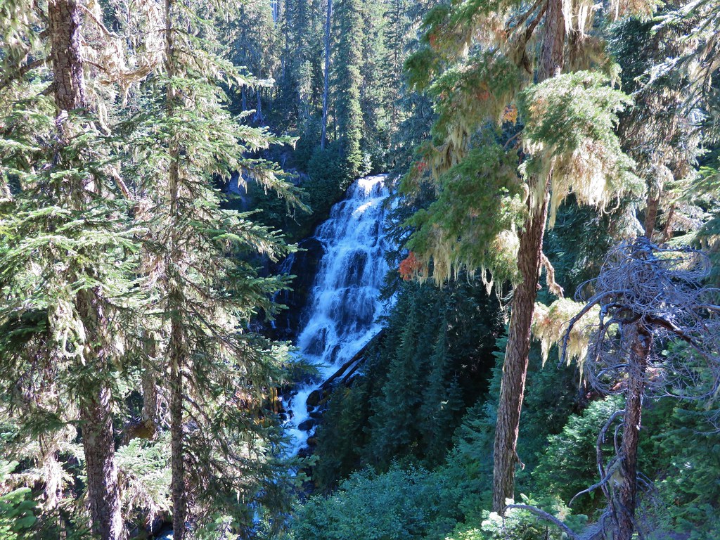
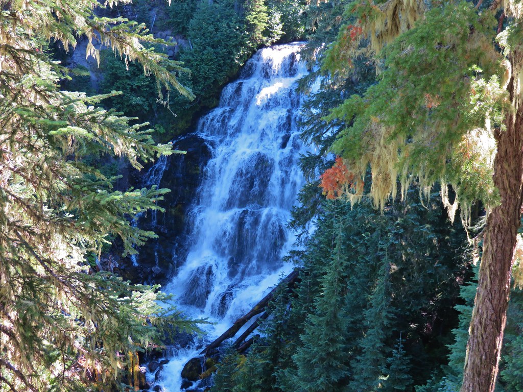
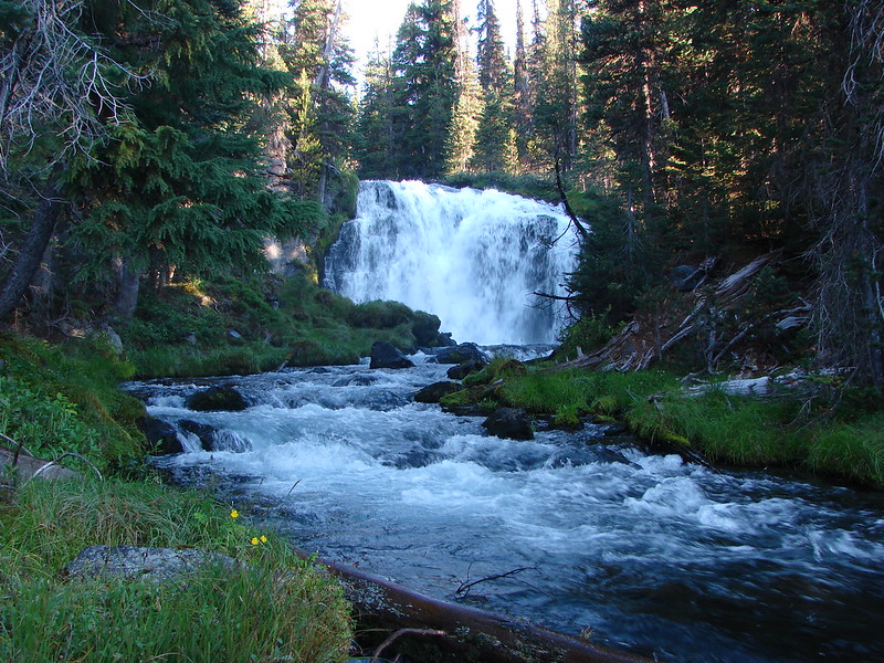
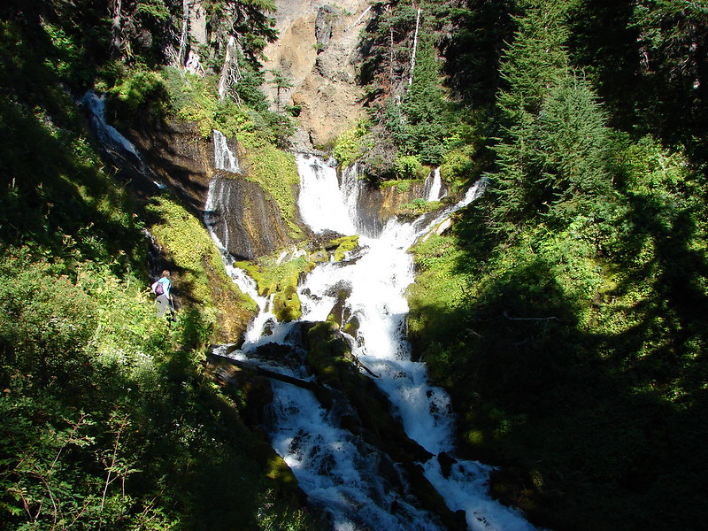
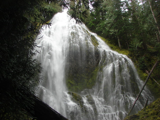
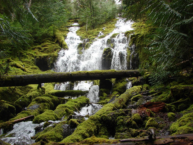
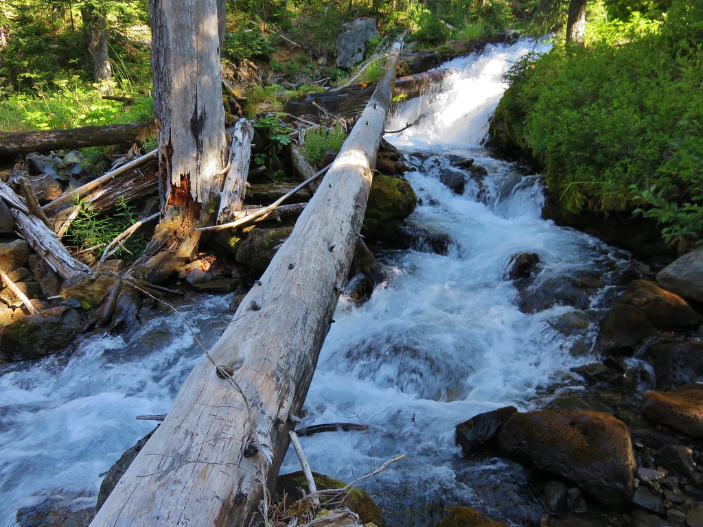
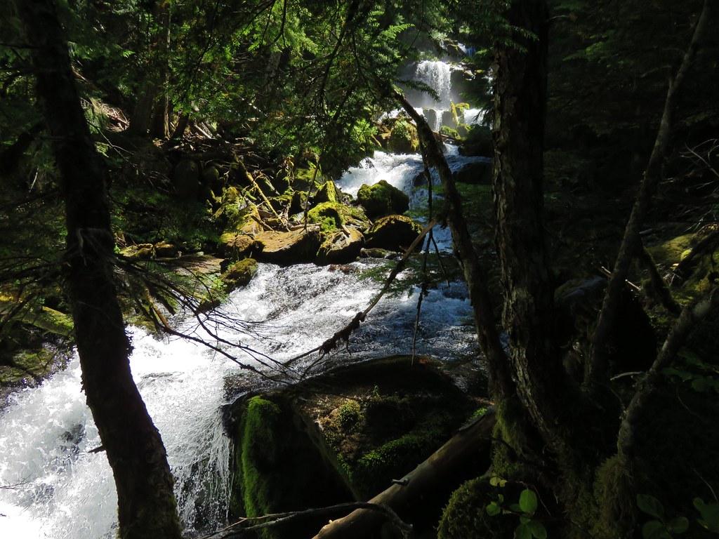
It was a spectacular waterfall. After standing in awe of this hidden gem we worked our way down a steep hillside to the creek a little ways below Duncan Falls. We could just see the bottom of the falls through some trees and briefly considered hiking up the creek to reach the base but decided against that in the end. We still had a lot of bushwacking ahead of us and the thought of wet shoes and socks was not appealing plus I was fairly certain that I’d fall in and ruin the camera.
IMG_6575

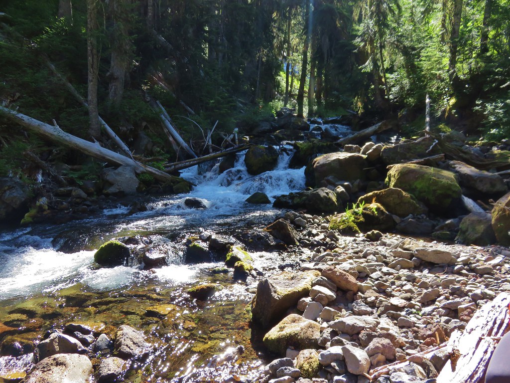
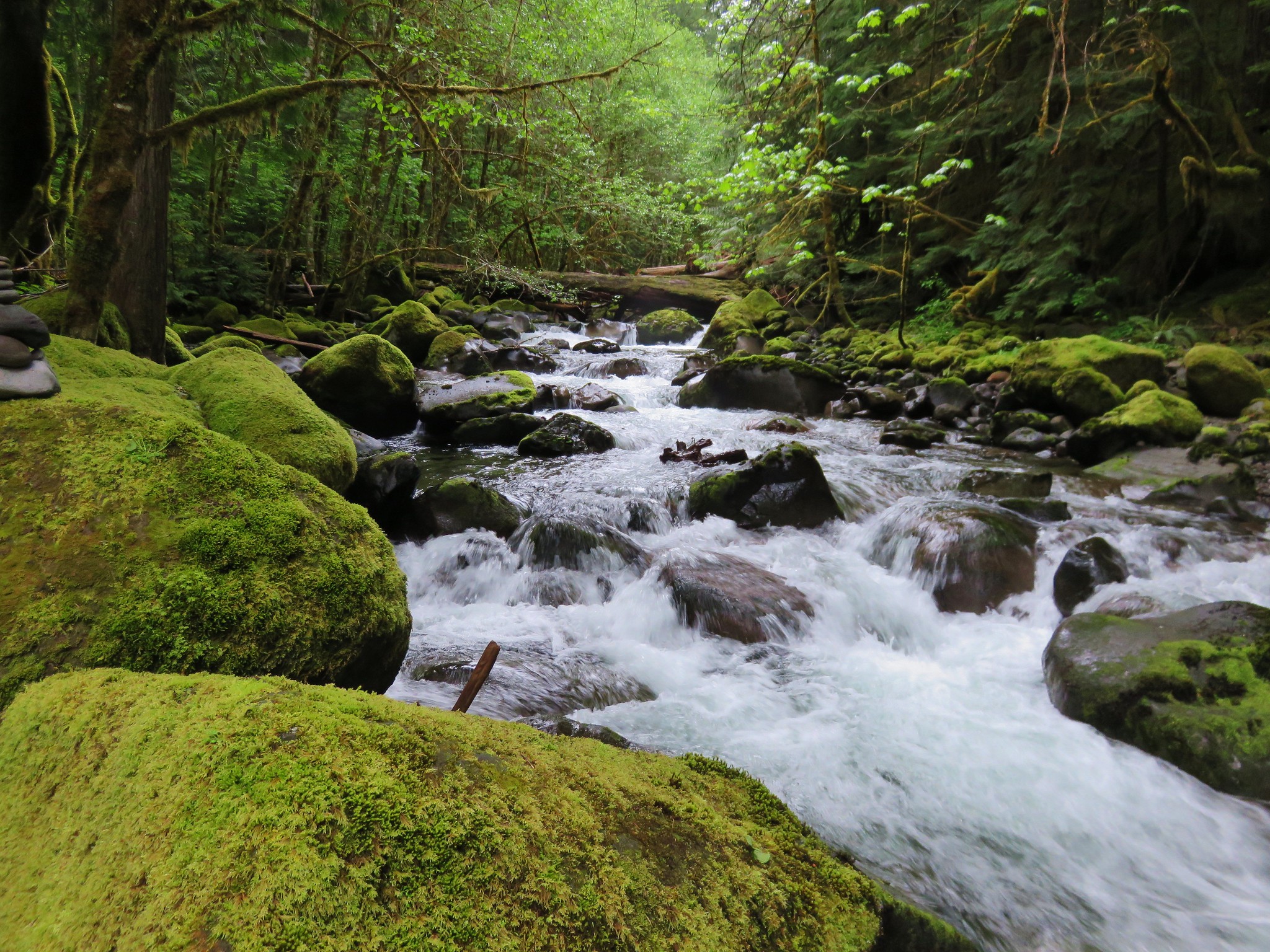
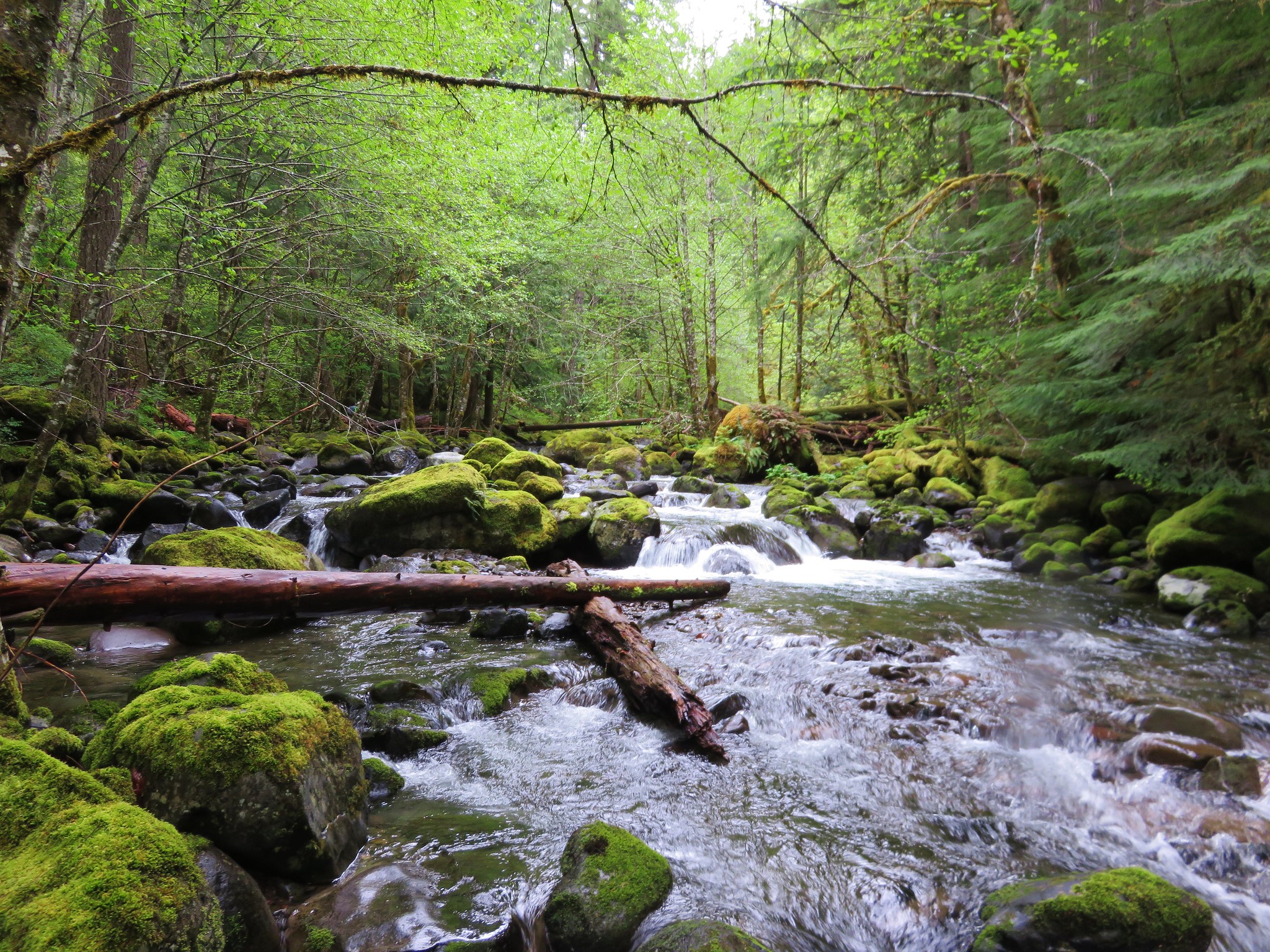
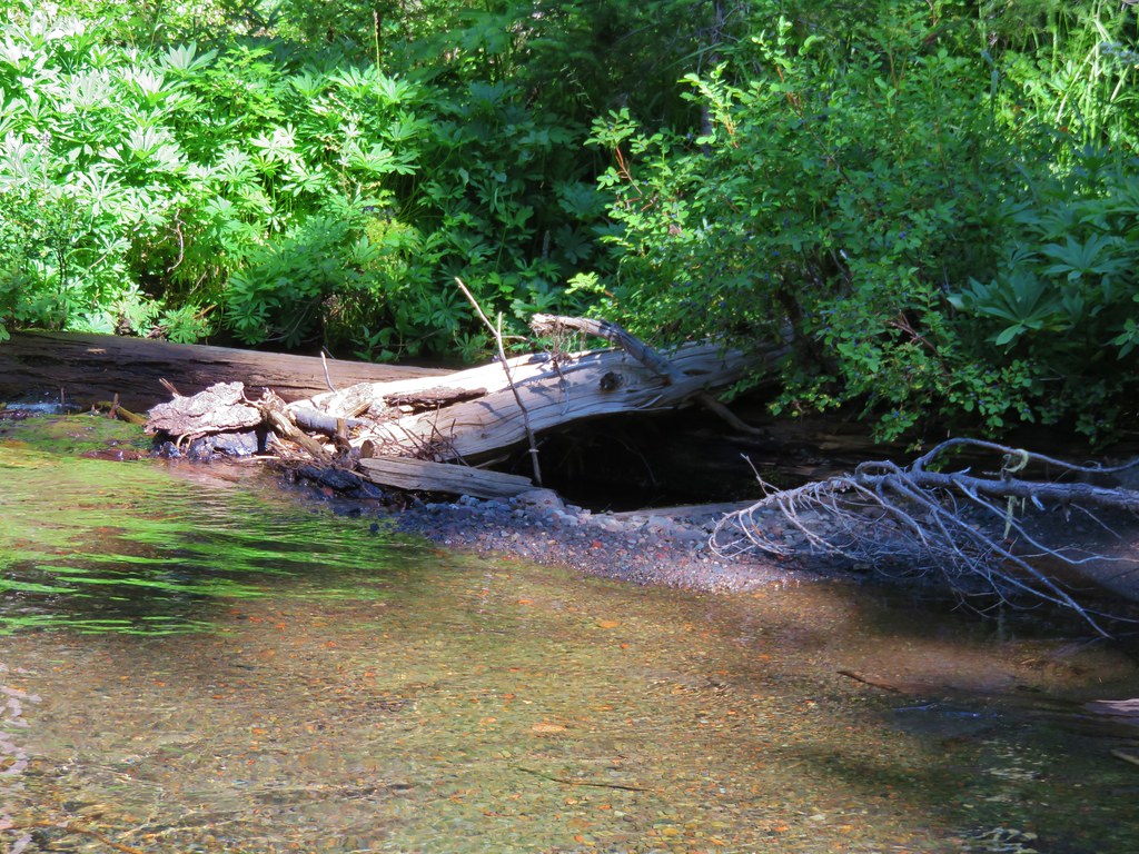
Below Duncan Falls the creek settled down some as the terrain became a little more level.
IMG_6576

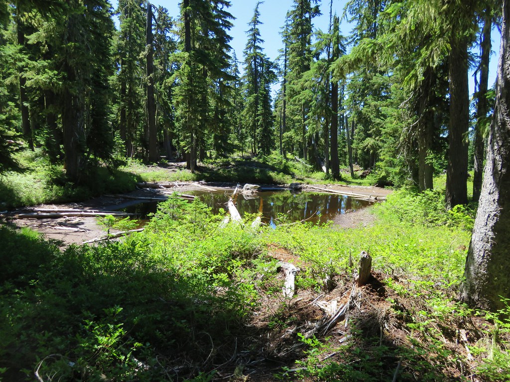
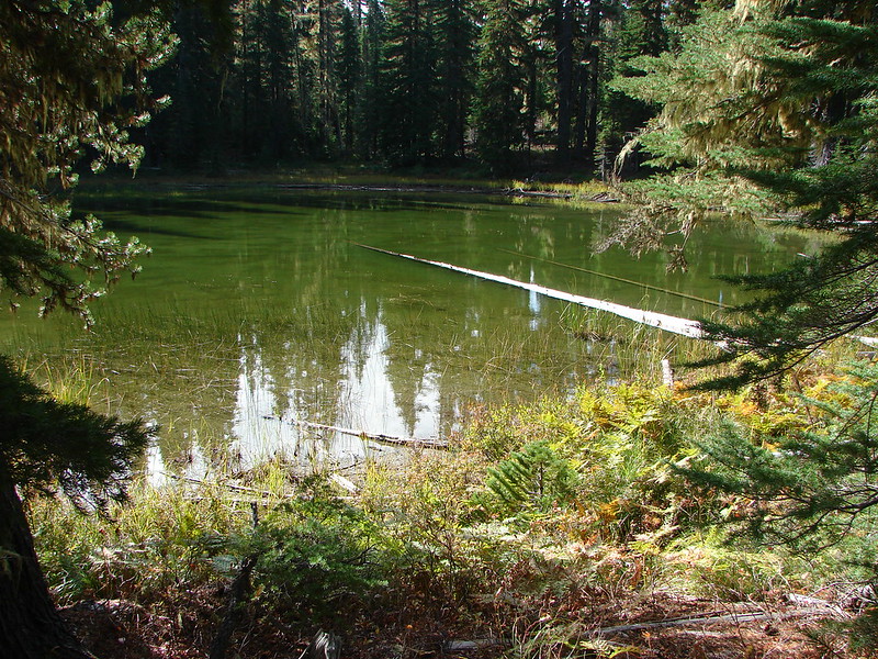
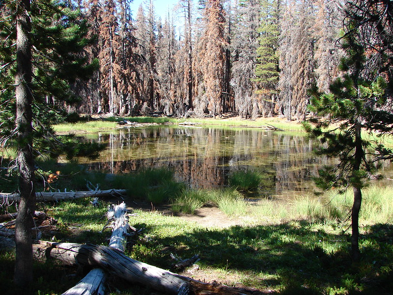
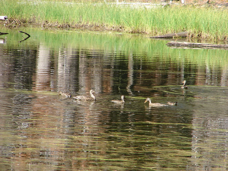
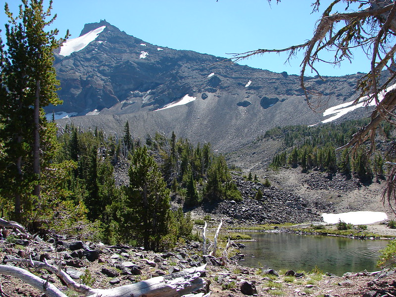
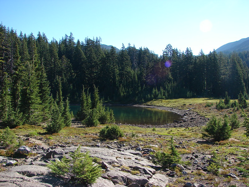
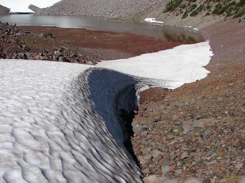
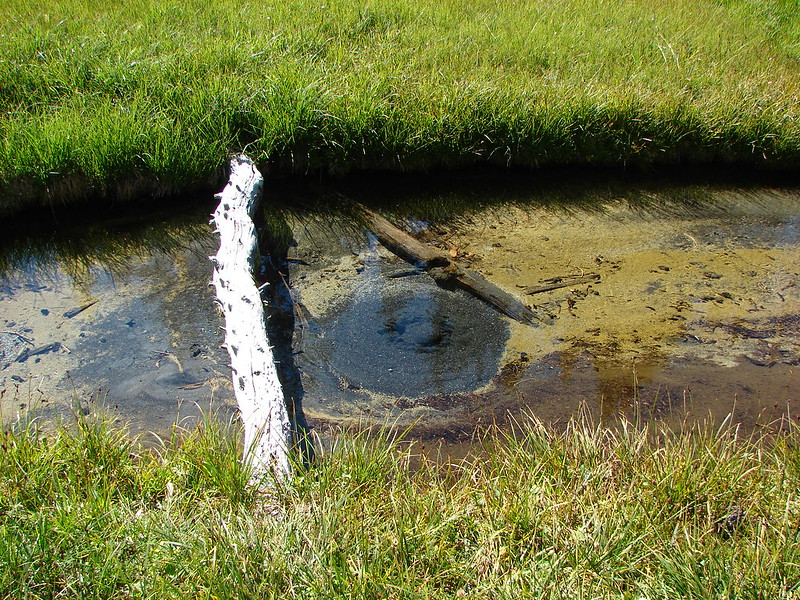
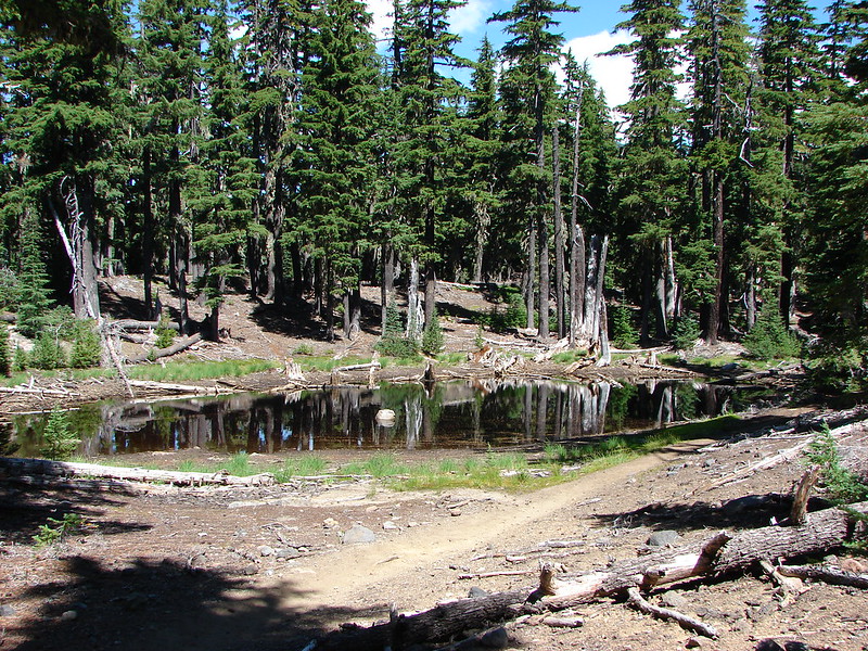
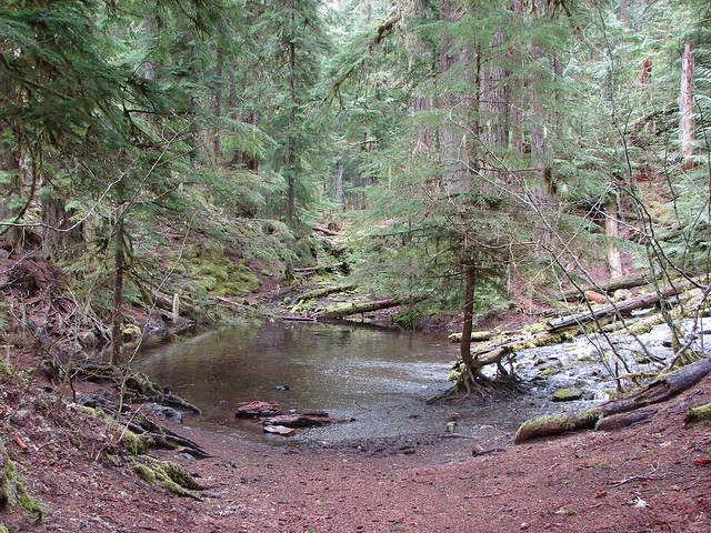
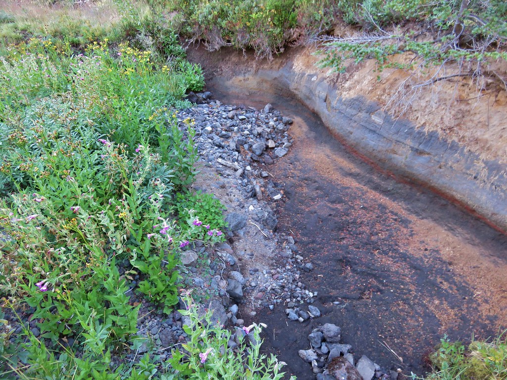
At one point we found what looked like it could possibly be a beaver pond.
IMG_6579

IMG_6580

IMG_6581

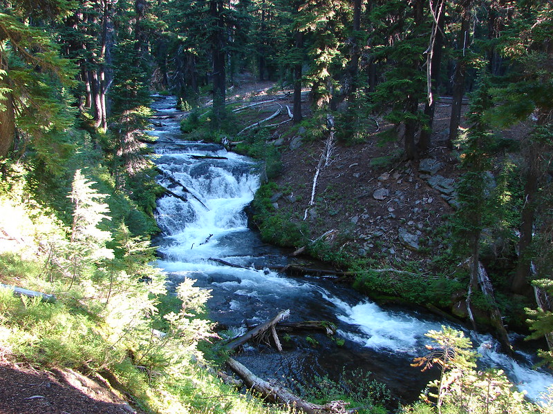
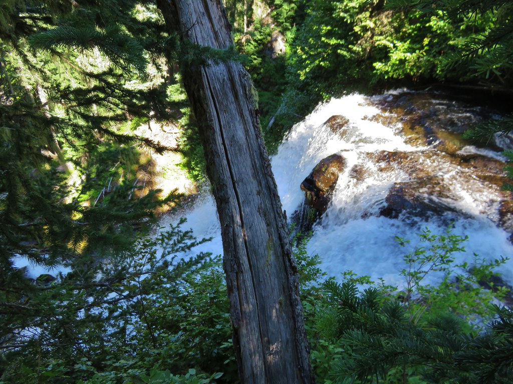
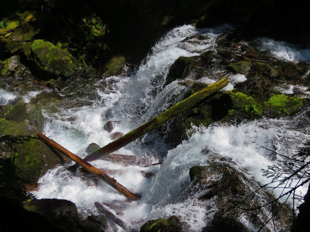
We then came upon another pair of small waterfalls.
IMG_6582

IMG_6589

IMG_6594

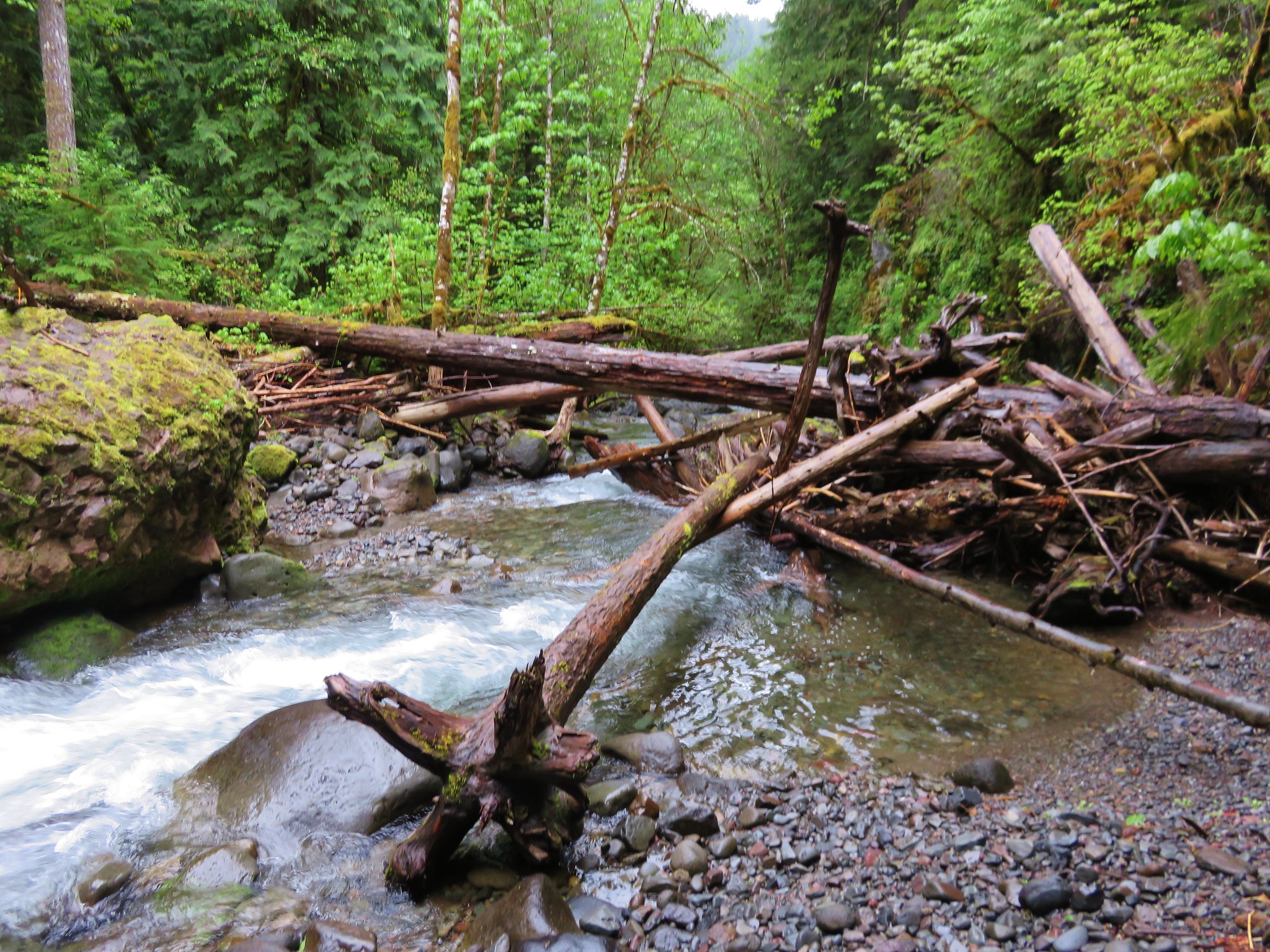
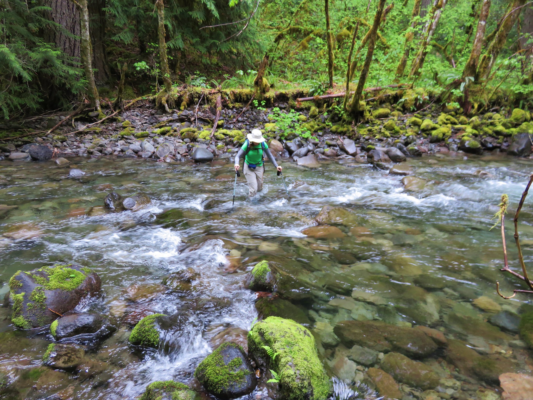
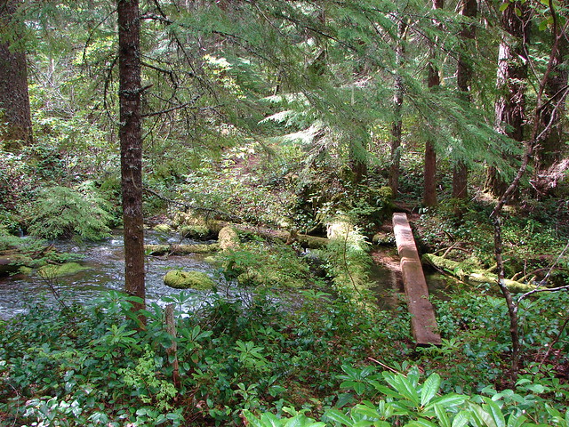
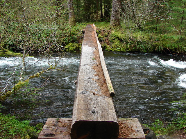
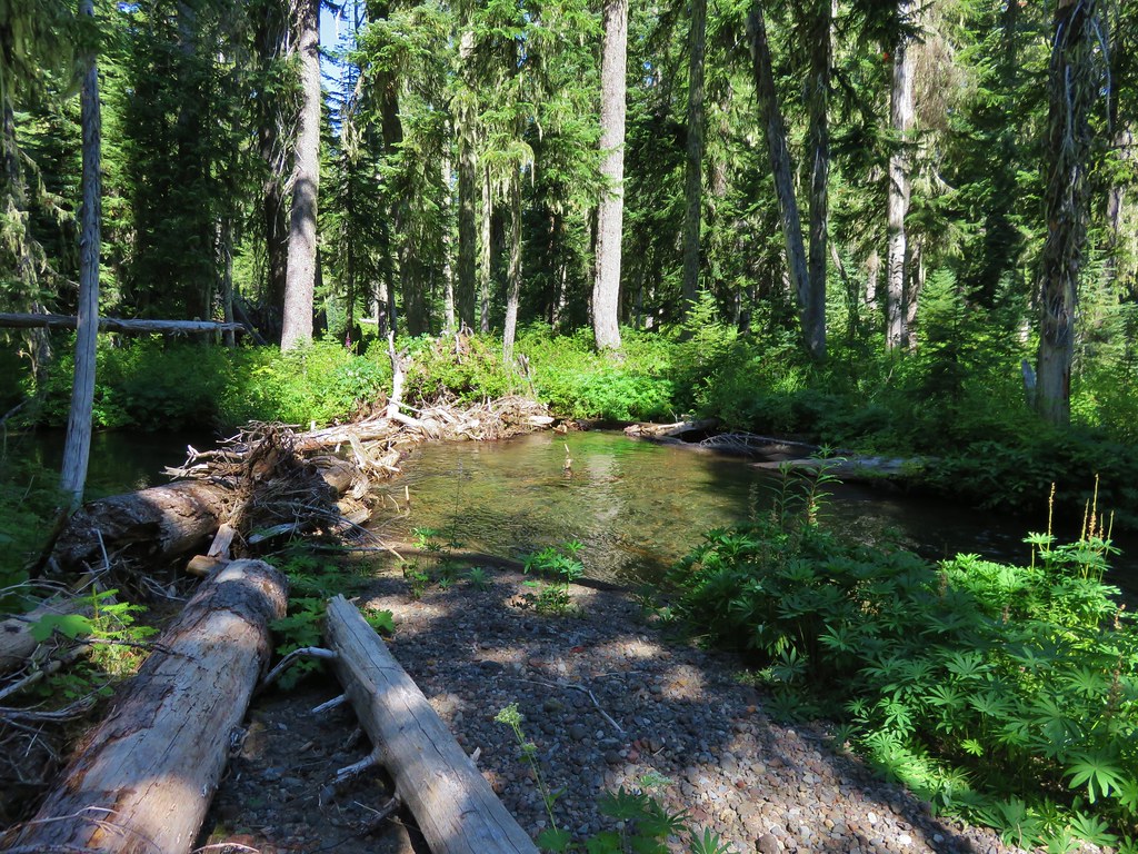
In the other trip reports that I had seen the hikers had been on the north side of the creek from Linton Lake until somewhere below Duncan Falls. We had originally planned on staying on the south side of the creek the entire time, partly to be different, and partly because the top tiers of Upper Linton Falls were said to not be visible from the north side of the creek. That changed when we could see that we had arrived at point directly across from the start of a large meadow on the other side of the creek. It looked so much easier than picking our way over and around logs and brush and there was a perfect log to cross the creek on near us. We gave in and walked across the log and entered the meadow. I had read about the meadow and the reports called it marshy but I was hopping the dry year we were having would lessen that, but there was still plenty of wet spongy ground and both of us had soaked shoes in no time.
IMG_6601

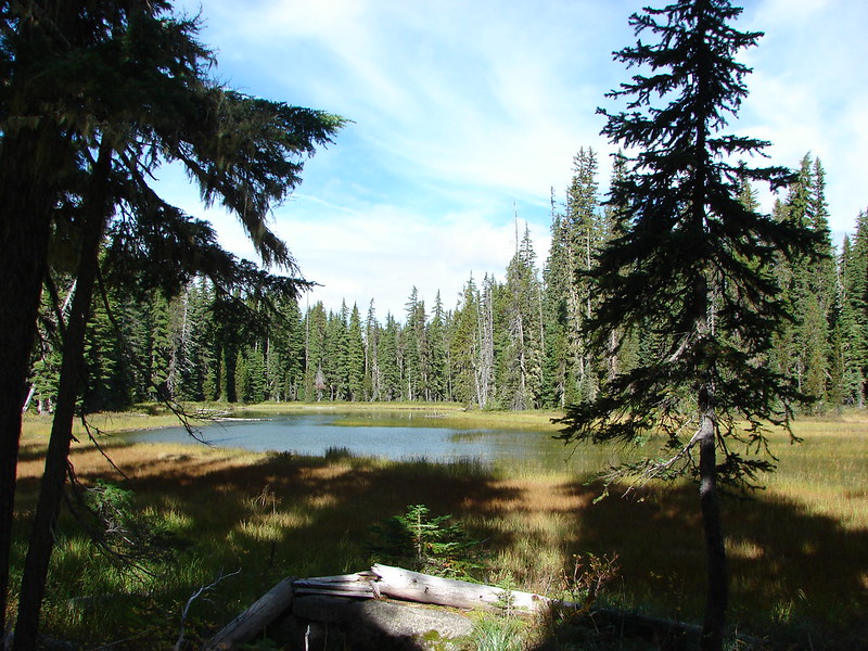
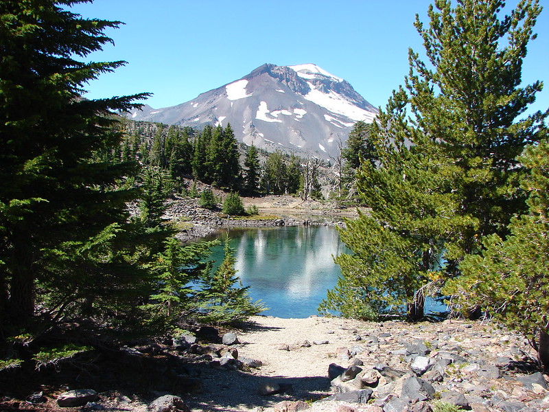
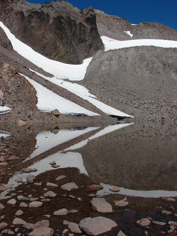
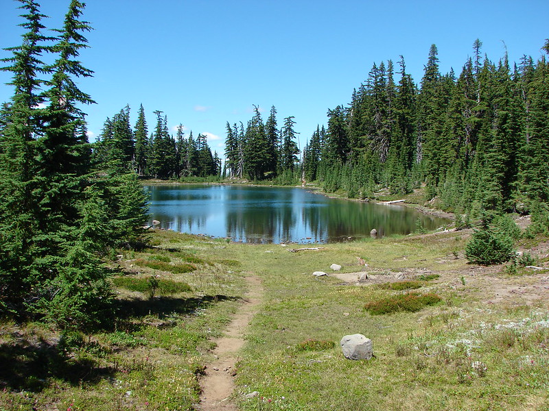
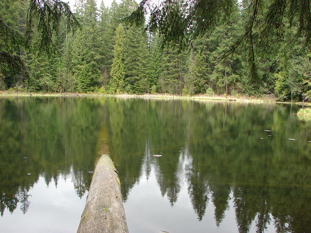
We aimed for the closest stand of trees and exited the meadow. We took a short side trip to check out one of two small lakes/ponds that the maps had shown toward the back of the meadow.
IMG_6602

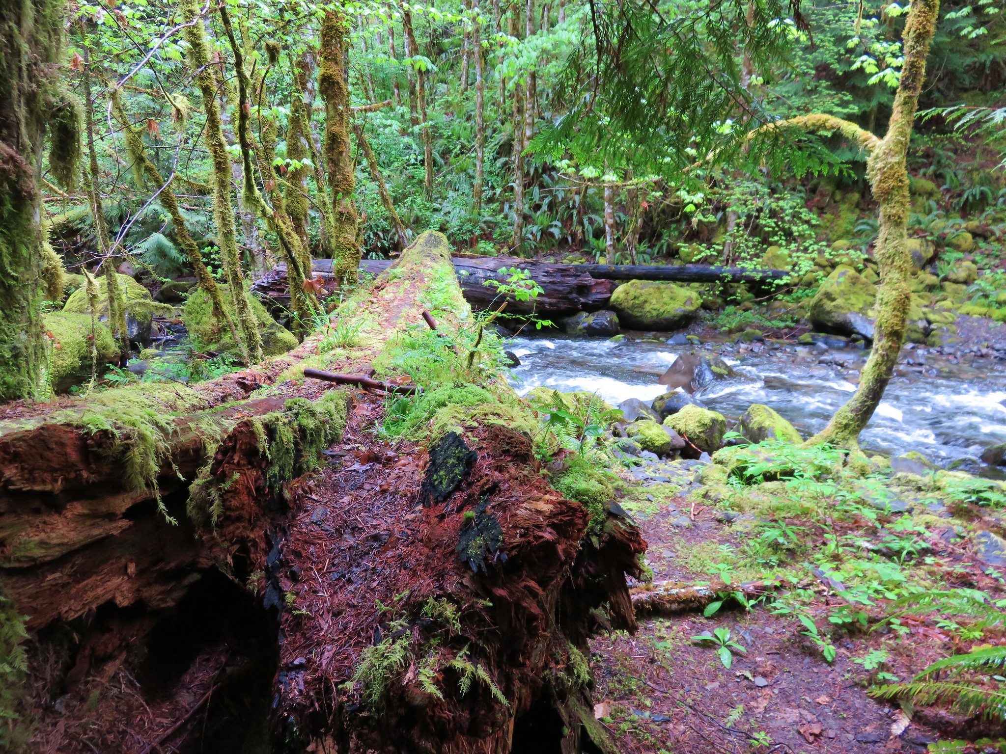
After checking out the pond we began making our way back toward the creek. Shortly after rejoining the creek we found another log we could cross on and got back to our original plan of being on the south side of the creek for Upper Linton Falls.

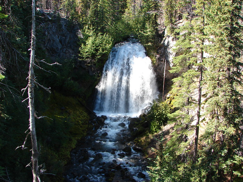
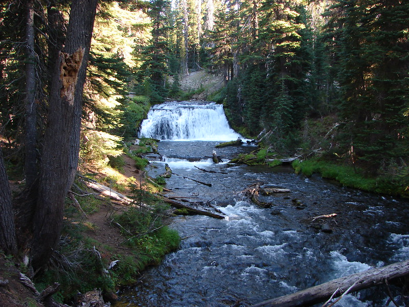
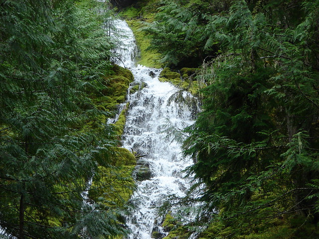
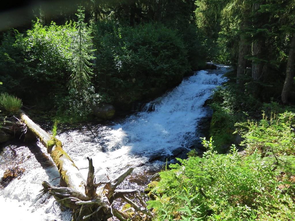
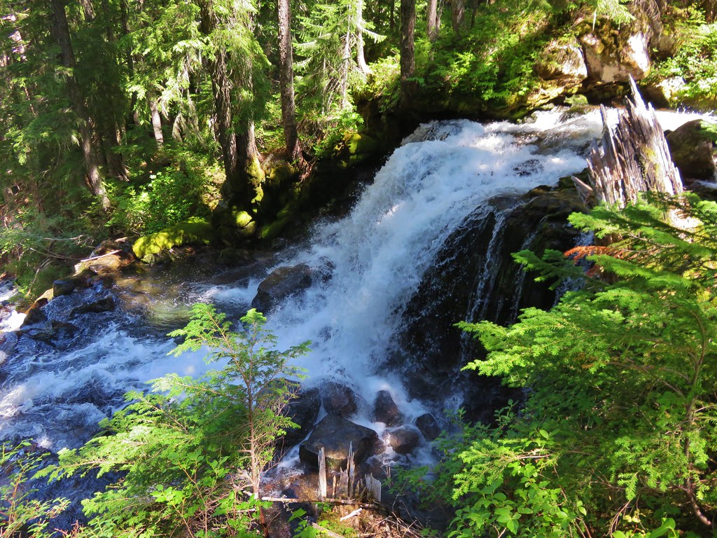
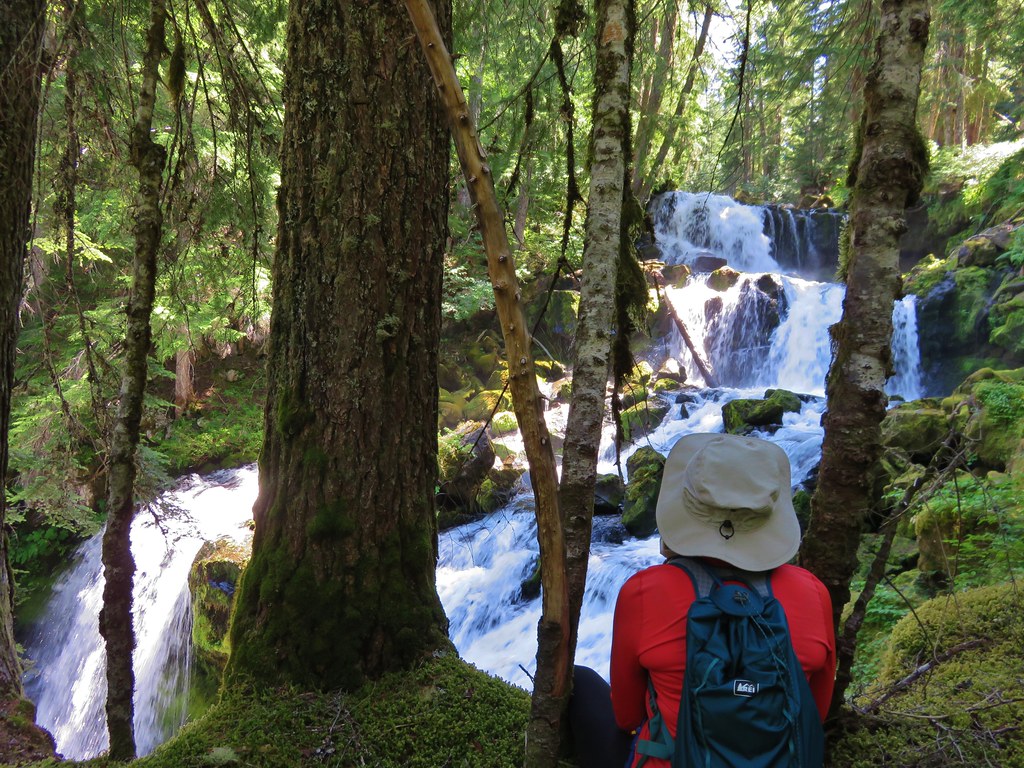
We knew we were getting close to our goal but before we got to Upper Linton Falls there was another nice little fall with a great viewpoint.
IMG_6620

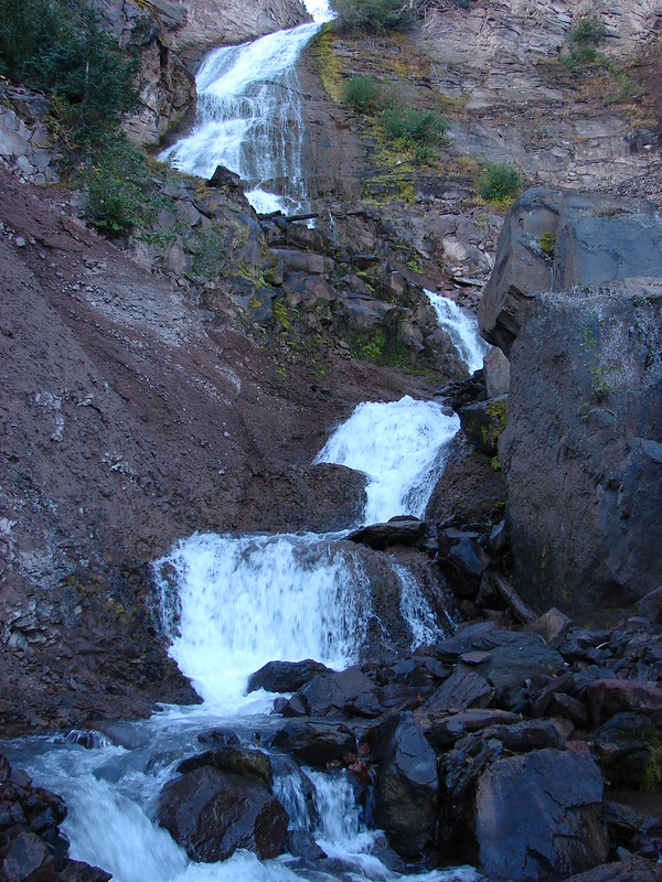
The next fall we came to was the top tier of Upper Linton Falls.
IMG_6623

The roar from the creek was amazing as it thundered steeply down toward Linton Lake.
IMG_6625

We found our way down to the third tier where there was a nice viewpoint.
IMG_6633

IMG_6634

The fourth tier was visible below.
IMG_6640

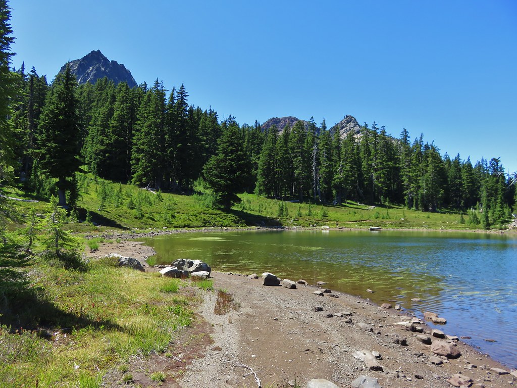
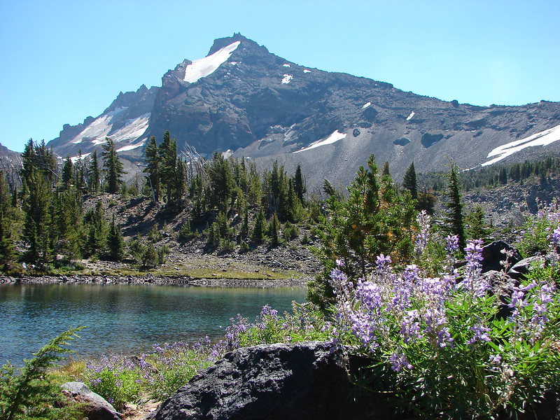
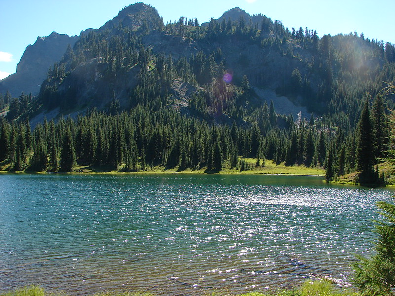
The ridge we were on began to swing away from the creek though. We could see Linton Lake far below and went in search of a decent view but there were too many trees to ever get a good clear look.
IMG_6641

IMG_6646

We found one final viewpoint of Upper Linton Falls. We appeared to be somewhere between the 5th and 6th tiers.
IMG_6655

There was a big drop below us but no way to get a look at the lower tiers from the south side. We decided that just gave us an excuse to come back some day and hike up from Linton Lake to see Lower Linton Falls and get a look at the lower tiers from the north side. In the meantime we sat at the edge of the enormous fall recharging in the cool breeze it generated.
IMG_6660

We had made it to our goal just before the established turnaround time and now it was time to climb back up to Eileen Lake. This time we did stick to the south side of the creek avoiding the marshy trap of the meadow. By doing so we located a couple more small falls we’d missed on the way down.
IMG_6678

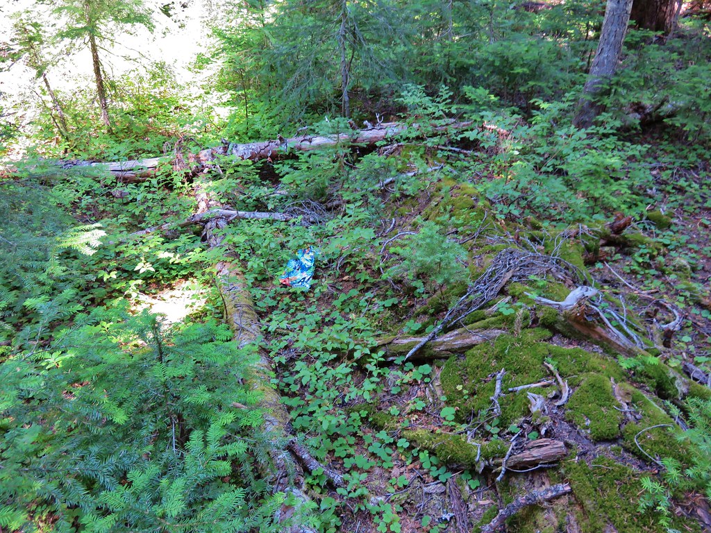
We also managed to find a balloon which happens more often than you’d think (and we’d like) in the forest. We retrieved the garbage and packed it out with us.
IMG_6691

IMG_6692

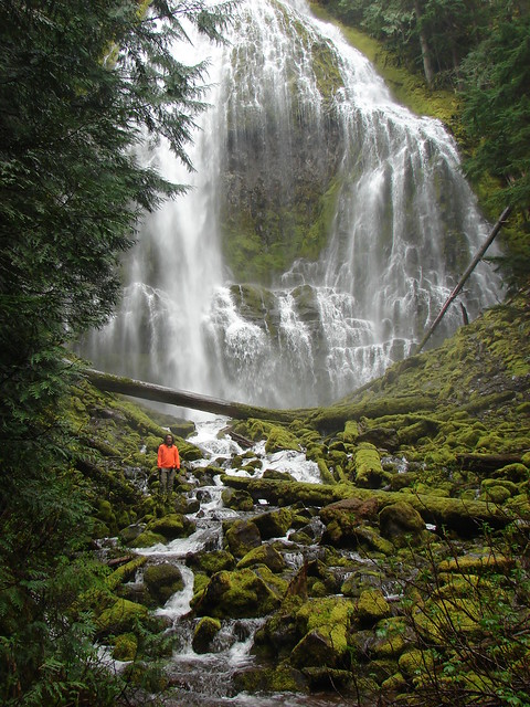
We arrived back at Duncan Falls to find it was just as impressive the second time around.
IMG_6700

IMG_6697

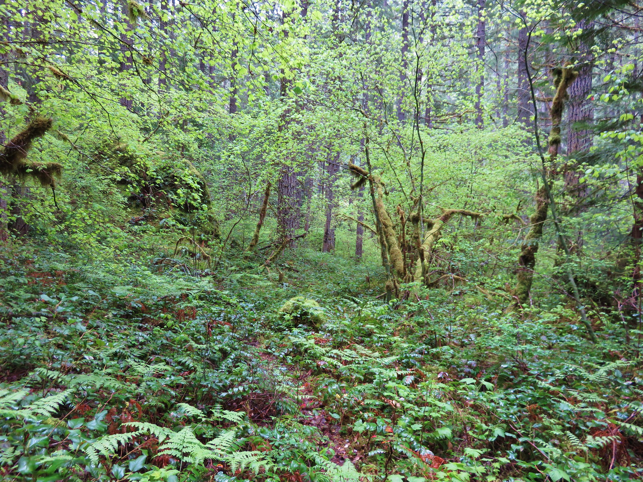
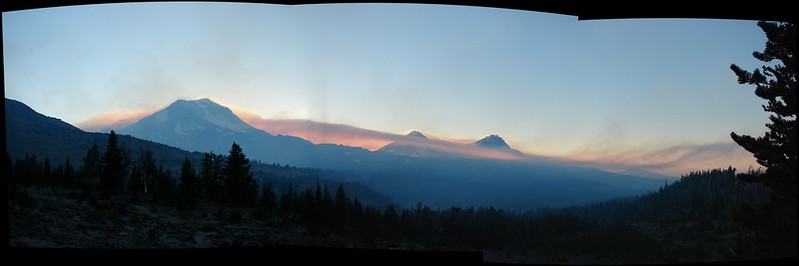
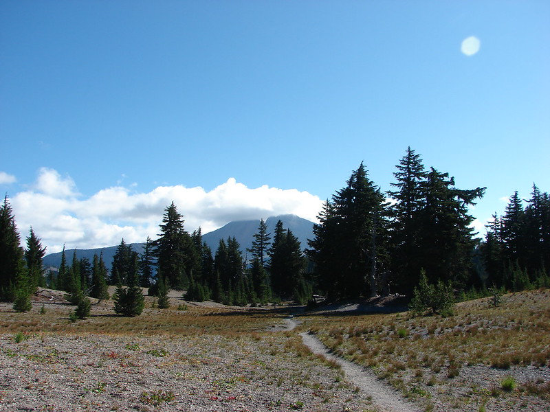
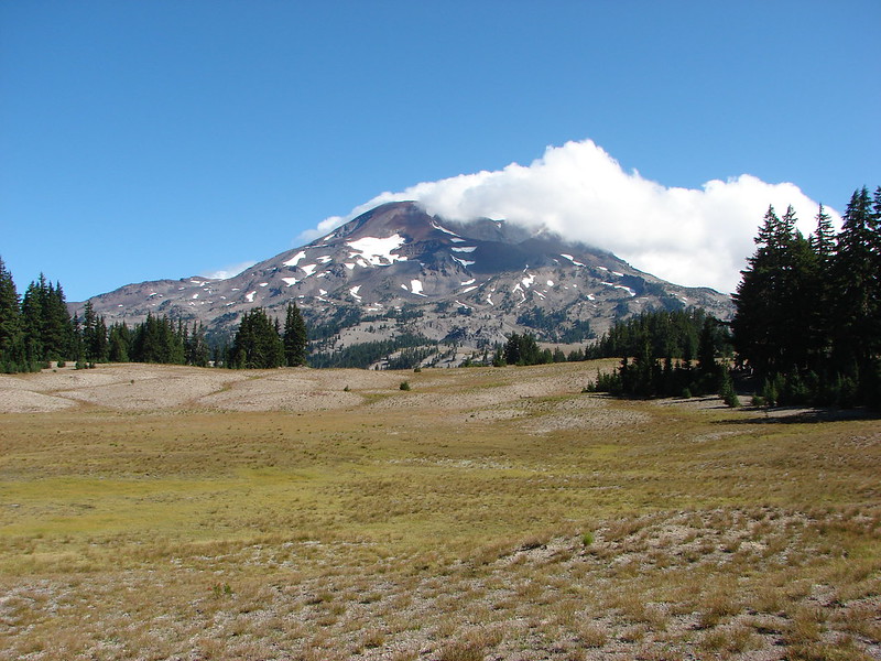
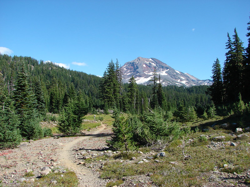
After Duncan Falls we left the creek and took a more direct route toward Linton Meadows which avoided the steep ridge above the whitewater of the first horseshoe bend. White fluffy clouds hung over the mountains when we finally reentered the meadows.
IMG_6707

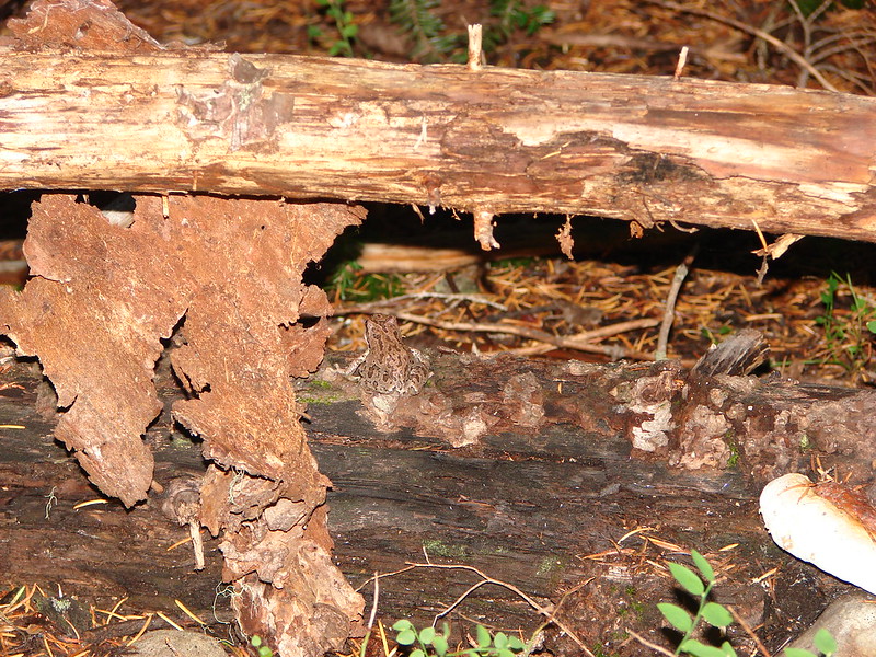
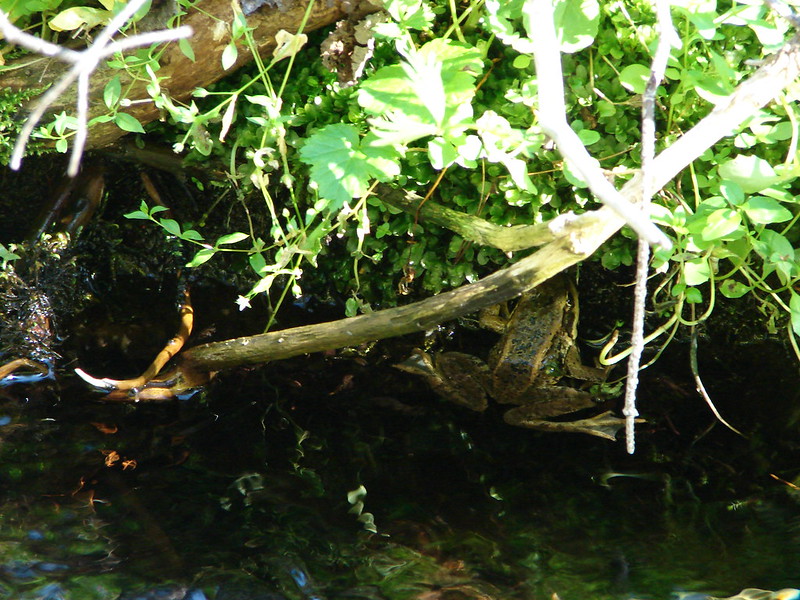
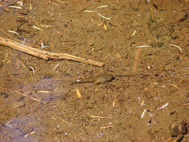
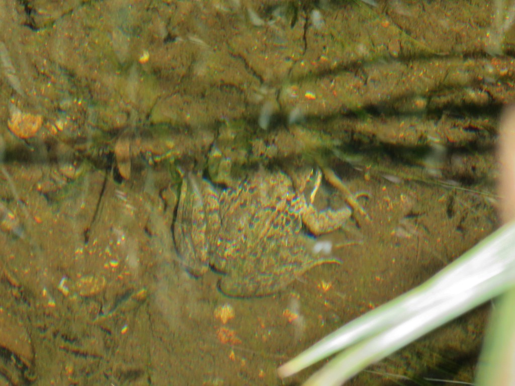
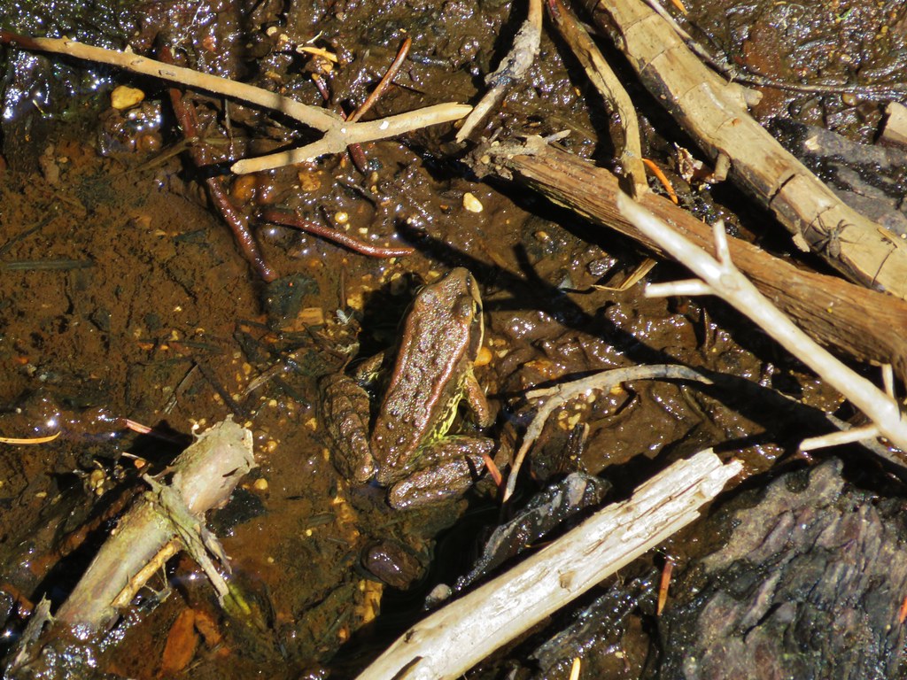
We were paying more attention to the views than to where we were going and wound up passing the spot where we had entered the meadows in the morning. We turned up a different creek bed instead. It looked similar enough that we both thought we remembered certain details as we passed them but as the drainage got steeper and we started noticing more blowdown than we’d remembered we knew we had made a wrong turn. Using the GPS and our maps we could see that we were just on the other side of the ridge we’d come down but we had found a different little meadow here and it’s creek had a little more water which was home to some larger frogs and fish.
IMG_6720

IMG_6715

IMG_6717

IMG_6719

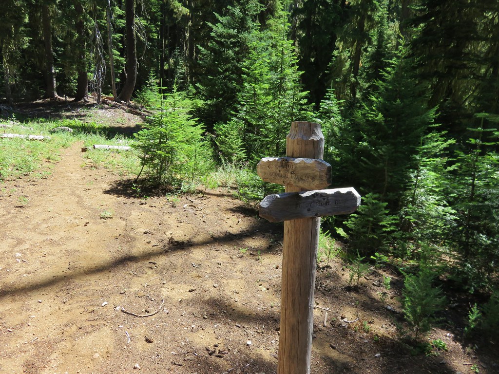
We were able to make our way over the ridge at the far end of the meadow and picked up our earlier path just about where we had entered the dry creek bed near the start of our hike.

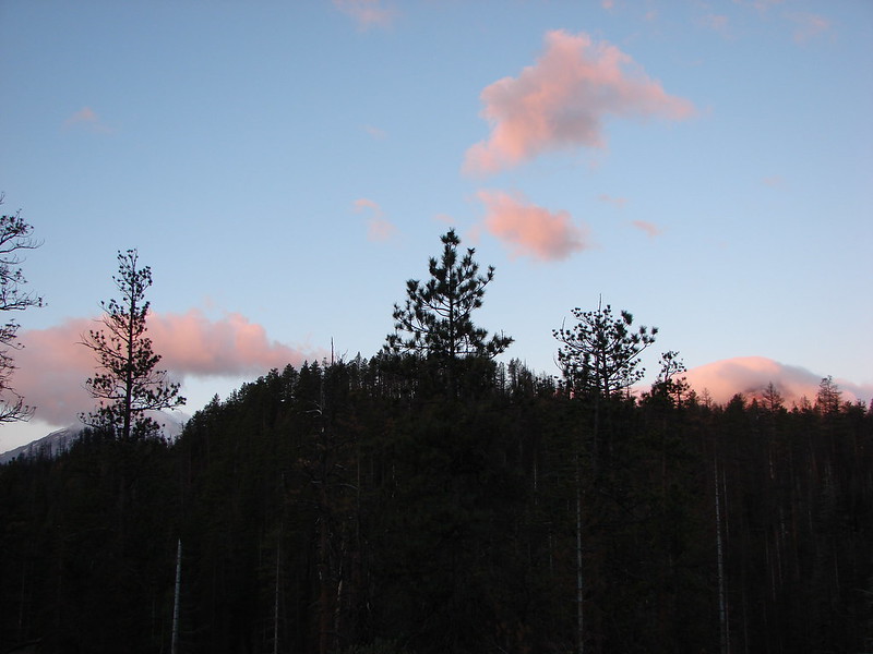
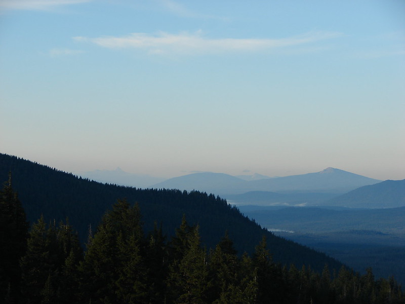
According to the Garmin we had covered 9.3 miles. We both had a few scrapes and bruises as well as some mosquito bites and Heather had been stung in the shin by a yellow jacket but it had all been worth it. We spent the evening at Eileen Lake watching clouds float by and then disappear over the Three Sisters.
IMG_6724

Happy Trails!

Flickr: https://www.flickr.com/photos/9319235@N02/sets/72157656375371832

Categories
High Cascades Hiking Oregon Three Sisters Area Trip report

Three Sisters Wilderness Day 1 – Separation Lake Trailhead to Eileen Lake

**Note the 2017 Separation Fire burned a portion of this hike.**

We just started backpacking last year and we really enjoyed it so we were looking forward to our first outing of the year which we recently completed. I plan on covering our trip over three entries starting with this post featuring our first day.

We had originally planned on spending a long weekend in the Opal Creek and Bull of the Woods Wilderness areas, but with the early snow melt in the mountains we changed our destination to the Three Sisters Wilderness. I had been wanting to check out the waterfalls along Linton Creek since seeing a trip report that was posted on Portlandhikers.org in 2013. There is no official trail to any of the falls along the creek and in most places there is no trail at all. The few reports I found on the area all began their hike at Linton Lake along Highway 126 and climbed up toward Linton Meadows. In the report on Portlandhikers they had hiked up the creek then over to Eileen Lake for the night then returned to Linton Lake the next day. I wasn’t too keen on the idea of carrying our full packs while bushwacking uphill so I came up with a different plan.

The solution was to start the exploration of Linton Creek from Eileen Lake where we would already have established our campsite. This would allow us to explore down stream as far as Upper Linton Falls using daypacks. I began studying our maps trying to plan the trip. The three closest trailheads to Eileen Lake are the Obsidian Trailhead, the Foley Ridge Trailhead, and the Separation Lake Trailhead. I quickly settled on the Separation Lake TH since it was the closest to us, didn’t require a limited entry permit, and offered a couple possible return loops.

We had been to the Separation Lake Trailhead in May 2014 when we hiked to Separation Lake so we were familiar with the trail when we slung our packs on and set off into the Three Sisters Wilderness.
IMG_6216

This time we took the Louise Creek Trail when we reached the junction just under a mile from the trailhead.
IMG_6217

Our plan was to follow the Louise Creek Trial for 7.2 miles to another trail junction at Buck Meadows then continue up to the Foley Ridge Trail which would take us to yet another junction. From there we would take the Linton Meadows Trail to a final junction where we would head for Husband Lake and our ultimate destination of Eileen Lake.

As we climbed up the Louise Creek Trail we met a couple that were hiking out after having camped at Sisters Mirror Lake. They had come down a portion of the Separation Creek Trail from the James Creek Shelter to Indian Hole Falls and reported that the trail did indeed have many downed trees across it. This confirmed what the information on the Forest Service website which called the trail “impassible due to heavy blowdown”. We had planned on visiting Indian Hole Falls then taking that trail down to Separation Lake where we would camp on our third night but had nixed those plans after seeing the information on the website. The other couple said the falls were beautiful and we still planned on visiting them but by using the Separation Creek Meadows Trail instead.

They also reported that there were a couple of people doing trail maintenance just up the trail and that they had not seen any water along the trail for quite some time. We had plenty of water for the day but it was good information to have for our return trip so we didn’t short ourselves hiking out.

The Louise Creek Trail was indeed dry and most of the flowers had long since passed although a few stragglers could be found here and there. There was also the remains of what must have been an impressive beargrass display lining much of the trail.
IMG_6226

IMG_6229

IMG_6242

The meadows of Buck Meadows were also dry as far as we could tell. There were some patches of green but no visible water. Purple aster dotted the dry grasses and were popular with the butterflies.
IMG_6265

IMG_6263

We got our first look at The Husband from the meadows. We knew Eileen Lake was on the far side of the rocky mountain.
IMG_6273

The final meadow was surprisingly long and we wound up losing track of the trail near the far end and just headed cross county to a small knoll with trees. We were now planning on staying somewhere in the area of the meadows on our final night and this seemed to be a viable spot. We picked up the trail again near the signed trail junction.
IMG_6279

The pointer to the left was for the Foley Ridge Trail and the right was for Honey Lake. Oddly none of our maps or the Forest Service website showed a trail going to Honey Lake, instead the trail passed by on its way to the Separation Creek Meadows Trail. It was also unclear if either or both forks were still considered the Louise Creek Trail. Our two maps indicated the right hand fork was the Louise Creek Trail but the Forest Service showed it as the left fork. Either way we needed to get to the Foley Ridge Trail so we headed left. The trail switchbacked uphill offering a brief view of Diamond Peak to the south before arriving at the Foley Ridge Trail junction.
IMG_6282

IMG_6287

It had been a tough climb up for us not being used to carrying full packs so we rested a bit at the junction where we were joined by a hummingbird.
IMG_6291

Shortly after setting off again we passed the first water we’d seen all day, a few small ponds that still held some water.
IMG_6292

IMG_6296

IMG_6305

We followed the Foley Ridge Trail for almost two and a half miles to the next trail junction.
IMG_6316

Four trails met at this junction. The Foley Ridge Trail we had come up and on its right was the trail to the James Creek Shelter. To the left were two trails one to the Pacific Crest Trail and to the immediate left the trail to Linton Meadows. We had expected to see a fifth trail at the junction, the Separation Creek Meadows Trail, which appeared to also meet here according to the maps. We thought it was odd but it was a question for another day and headed toward Linton Meadows.
IMG_6317

We had been on this portion of trail during our backpacking loop around the South Sister the previous year. The trail passes through a pumice plain which manages to support a good amount of colorful vegetation.
IMG_6321

IMG_6322

IMG_6333

Just .3 miles from the big junction the Linton Meadows Trail split again. The right fork headed down to Linton Meadows while the left fork pointed to Husband Lake. The left fork then passes Eileen Lake before rejoining the right hand fork at Linton Creek.
IMG_6324

We stopped at Husband Lake for a moment to take in the views before continuing on our way.
IMG_6338

IMG_6342

IMG_6352

We finally came upon a creek with flowing water between the lakes coming down from The Husband.
IMG_6366

On our previous visit there had been tons of frogs along the shore of Eileen Lake and we had been wondering if we would find the same thing this time. That question was answered upon arriving at the lake.
IMG_6382

IMG_6386

There were more this time than before and we slowly made our way around the lake being careful not to step on any of them. We were planning on setting up camp on the far side of the lake where we would be able to set up at least 100 feet away from the water and the trail per wilderness regulations. We found our spot on a small rise with a small meadow behind us and no frogs to have to watch out for.
IMG_6479

After setting up camp we decided to hike down to Linton Creek to have dinner in the same location we had eaten at the year before and to fill up on water from the creek. We tried going around the lake on the other side hoping the frogs would be less but it proved just as challenging and slow. On our way down to the creek we spotted 4 deer also making their way down the meadows.
IMG_6407

IMG_6419

We arrived at Linton Creek to find it flowing strongly. It is primarily fed by Linton Springs so the dry year apparently hadn’t effected it as much as the other creeks. The springs also mean the water is cold and we had forgotten just how cold until we tried to soak our feet. The water was too cold to keep them in for more than 10 or 15 seconds.
IMG_6425

After having dinner and filling up on the wonderfully cold water we returned to Eileen Lake where we explored the area behind our campsite then sat by the water watching the frogs along the shore and small fish occasionally jumping from the water disrupting the reflection of the mountains.
IMG_6471

It had been a great start to our trip and the adventure had just begun. Happy Trails!

Flickr: https://www.flickr.com/photos/9319235@N02/sets/72157656374056692

Categories
High Cascades Hiking Oregon Three Sisters Area Trip report

French Pete Creek

**Note the 2018 Terwilliger Fire burned a portion of this hike.**

This is the third straight year we’ve had French Pete Creek on our schedule. Each of the previous years it has wound up getting bumped for one reason or another. This year was different although it had been pushed back several weeks due to the early wildflower bloom in the Columbia Gorge. A cloudy forecast made for a good day to take a hike through an old growth forest along a wilderness stream. With that in mind we headed to the French Pete trail 3311 in the Three Sisters Wilderness. Our goal was a 5 mile marker mentioned in William L. Sullivans “100 Hikes in the Central Oregon Cascades”. The trail starts at the French Pete Trailhead which is located across from the French Pete Campground a mile beyond Cougar Reservoir on Road 19. Road 19 or Aufderheide Rd runs between the McKenzie Hwy 126 and Hwy 58 near Oakridge.
French Pete Creek Trailhead

The trail promptly enters the Three Sisters Wilderness passing through nice old growth and several access points to the creek.
Entering the Three Sisters Wilderness

IMG_2038

IMG_2046

Pool along French Pete Creek

IMG_2053

After 1.8 miles of some up and down trail we arrived at the first of two creek crossings. There had been a bridge here years ago but now if you want to continue on you either ford the creek or attempt to cross on a log jam just downstream. We inspected the log jam but given the wet weather the logs were rather slick and we decided that it wasn’t going to be the best option on this day.
IMG_2068

There was a possible third option to the ford or log jam, a rough 1.2 mile scramble trail along the north side of the creek. Where the trail turned down toward the creek there was a faint trail leading further along the creek so we decided to try that option versus the ford.
IMG_2067

This path is not mentioned in the most recent edition of Sullivans book and we soon discovered why. We do not recommend attempting this route. The tread was very narrow with some blowdown and a few sketchy spots then after about .4 miles we came to the spot of a slide about 15′ above the creek. The path (and I use that term lightly) dove down the slide to the creek bank. I made it down but when I turned around I could tell Heather was not going to be able to do the same. I managed to get back up to where she had gotten stuck and helped her do a controlled slide in the dirt/mud down to a log where she was able to brace her self and continue on down to the bank. We knew we wouldn’t be going back that way so we sallied forth to the next big obstacle – a slanted rock shelf traverse.
Bedrock along French Pete Creek

The rock was wet and slick, but we managed to find enough footholds to not slip into the creek which was quite deep in sections. A bit further along the creek we were stymied again by another big slide. While I was attempting to find a way around this new obstacle Heather realized that she had lost her phone. We backtracked recrossing the rock shelf to the spot of her slide where I found the phone wedged against the log covered in dirt. Luckily it was inside its case and undamaged. When we turned back to find the phone we had only covered about half the distance needed to rejoin the official trail and neither of us wanted to tempt fate with a third go at the rock shelf. From where we were we could tell by the GPS that the trail was just on the other side of the creek so we decided it was time to ford the creek.
IMG_2078

From the far side we had a pretty good look at the slide area that had started all the trouble.
IMG_2075

IMG_2076

We came up from the creek and only had to walk about 10′ to find the trail. The trail in this section was a bit overgrown but in pretty good shape given most hikers turn back at the first crossing.
IMG_2079

We made it to the second creek crossing where a nice cedar log serves as a suitable bridge.
Cedar log crossing of French Pete Creek

We had another 1.8 miles to go after the second crossing to reach the 5 mile marker. This section of trail was also fairly overgrown and narrow but there were no major obstacles along the way. The trail climbed up above the creek at times passing through a grassy meadow and past some nice rock formations.
IMG_2094

IMG_2103

IMG_2098

IMG_2147

It also provided some of the best views of French Pete Creek.
IMG_2110

IMG_2120

After reaching the marker we stuck to the official trail on the way back.
IMG_2129

One of many little creeks flowing into French Pete Creek

We only ran into three other groups of hikers, all on the way back between the trailhead and first crossing making for a nice quiet hike. Happy Trails!

flickr: https://www.flickr.com/photos/9319235@N02/sets/72157652543084568

Categories
High Cascades Hiking Oregon Three Sisters Area Trip report

Chush Falls and Beyond

Our third hike while in Bend took us back to the Three Sisters Wilderness for a mostly off trail waterfall loop that had been reported on by a member of Portland Hikers in November 2013. The plan was to start at the Chush Falls Trailhead and continue past the falls up Wychus Creek passing two more waterfalls then crossing that creek and Park Creek visiting six more waterfalls on three different creeks before recrossing Wychus Creek and returning to the trail.

We were greeted at the trailhead by some chilly air. We could see parts of the tops of the Three Sisters which were mostly engulfed in clouds. What we could see though showed that a little fresh snow had fallen sometime in the previous couple of days.
DSC06970

South Sister
DSC06972

Frosty ground
DSC06979

The beginning of the trail is on an abandoned road which we followed for about a mile and a half before reaching the former trailhead which was now only marked by a homemade sign.
DSC06985

The 2012 Pole Creek Fire burned through the forest here creating interesting color contrasts where water was present.
DSC06987

DSC06988

DSC06990

A mile from the old trailhead we came to a wide flat area with a Trail Ends Here sign. Beyond the sign the top of Chush Falls was visible.
DSC06991

To the right was a clear path down a steep slope to the base of Chush Falls.
Chush Falls

After returning to the trail ends here sign we picked up another clear trail continuing up Wychus Creek. The second waterfall was just .3 miles up this use trail.

Middle Chush Falls
Middle Chush Falls

We found Upper Chush Falls another .3 miles from the middle falls. This was by far the most interesting of the falls on Wychus Creek. It was also the most difficult to get a good view of because of its location in a rocky bowl and 230′ height.
Upper Chush Falls

Upper Chush Falls

Upper Chush Falls

Upper Chush Falls

My parents, who had started the hike at the same time we had, caught up with us here. They had not spotted the trail down to the base of Chush Falls so we were able to give them that information before we set off cross-country in search of the next fall – Phoenix Falls.

In order to reach Phoenix Falls we needed to be up above Upper Chush Falls and over to the next creek which was East Fork Park Creek. We had unfortunately neglected to bring the maps we had planned on having with us, but we still had our Garmin (and tons of batteries). I had also spent a lot of time pouring over the maps and Google imagery of the area and making notes so we felt fairly confident in the resources we did have. We crossed Wychus Creek below the upper falls and began to skirt around a ridge end in search of a draw that I hopped would be the easiest way up to the plateau above the ridge. We picked our way around the ridge following game trails as best we could until we could see the draw below in between two ridge ends. The draw did indeed look like it would have been a good option but we had crossed the creek and headed around the ridge way above the draw so continued up and around the ridge finally reaching the draw near the edge of the plateau. Travel became much easier once we emerged from the draw. We continued SW toward the location on the creek where we expected to find Phoenix Falls. The South Sister loomed ahead on our right as we went.
DSC07013

We reached the edge of the canyon in which the East Fork Park Creek was flowing and began following it up toward the sound of a waterfall. Soon we could see the falls we were in search of with the added bonus of Broken Top rising over the shoulder of Phoenix Falls.
Phoenix Falls

To the right of Phoenix Falls were the Three Sisters. The 110′ falls roared down into the canyon creating a good amount of wind up on the rim.
Phoenix Falls

Phoenix Falls

Phoenix Falls

From Phoenix Falls we headed back downstream below the confluence of the East & West Forks of Park Creek and crossed what had become Park Creek. We then made our way along the West side of Park Creek to Middle Park Creek Falls. This was the most difficult to get a clear view of due to the angles of the canyon and a couple of downed trees laying between the canyon walls.
Middle Park Creek Falls

Just down the creek was the next fall – Howlaak Falls.
Howlaak Falls

We left Park Creek at Howlaak Falls and headed cross-country again toward yet another creek – South Fork Wychus Creek. The final three falls we hopped to visit were on this creek. We had to traverse along another ridge end to find the creek and this time Heather took the lead picking up a good game trail which wound up leading us almost directly to Columnar Canyon Falls, the first of the three falls we were looking for. A short steep trail led down to a rocky overhang which allowed for a good view of the falls. Not a spot I’d recommend for anyone nervous around heights.
Columnar Canyon Falls

We then began following the creek down a ridge listening for the next fall. We heard Mosaic Falls before we spotted it. In fact getting a decent view of this fall proved to be as frustrating as I had read it was in the earlier trip report. It wasn’t too difficult getting down to the creek below the falls but there was no view of the falls from where you were able to get to the creek.
DSC07062

In order to see the falls I made my way along the edge of the creek shown above. It was slick and full of thorny gooseberry bushes and complicated by a large boulder that was in the way once the falls came into view.
Mosaic Falls

I managed to get around the boulder just enough to get a fairly clear view of the falls but even then the spray from the falls made getting a picture difficult.
Mosaic Falls

I rejoined Heather who had smartly stayed behind and then we headed for our final fall – Shelter Falls. We had to hop back over the ridge away from the creek in order to continue downhill. The ridge at this point was quite narrow though so we were never far from the creek. When we could we angled back toward the creek and were able to find the site of an old shelter.
DSC07064

Just a little further on we found Shelter Falls.
Shelter Falls

Having successfully found all the falls we were looking for (there are others out there) it was time to make our way back to the trail. This proved to be the most difficult part of the hike in terms of route finding. Wychus Creek was close by and the confluence with the South Fork was nearby. We crossed over to Wychus Creek to look for a decent crossing but the opposite side looked too steep to climb. Not wanting to hike back up the creek we headed down stream. Near the South Fork the ground on the opposite side of Wychus Creek leveled out giving us our best option for reaching the trail on the other side. We had managed to stay dry up to this point but now there was no getting around the need to wade across the creek. We found a good crossing where the water was only mid-calf deep and crossed the creek. From there it was a short climb up out of the canyon. We re-found the trail about 10′ from where we popped up over the hillside. It had been a successful hike despite the forgotten maps. We relied on the GPS, my notes, and the research done beforehand which was a good reminder to always be prepared. Happy Trails!

flickr: https://www.flickr.com/photos/9319235@N02/sets/72157648214455552/
facebook: https://www.facebook.com/media/set/?set=a.10205149155155671.1073741912.1448521051&type=1

Categories
High Cascades Hiking Oregon Three Sisters Area Trip report

Six Lake Trail – Three Sisters Wilderness

Following our attempt at catching the sunrise from Tumalo Peak we took a day off then headed back out to the trails. The weather was still a bit cloudy but it was okay this time because our goal was a series of lakes and not mountain views. We arrived at the trail just as it was becoming light.
Six Lakes Trailhead

DSC06847

Shortly after setting off we entered the Three Sisters Wilderness.
DSC06849

The trail climbed gradually to the first lake which was Blow Lake which we arrived at just as the clouds began turning colors with the rising Sun.
DSC06859
DSC06860
BLow Lake Sunrise

We left Blow Lake and followed the trail another mile and a half to Doris Lake. Along the way we met a couple of the locals and spotted an interesting group of mushrooms.

Frog on a log.
DSC06873

Chipmunk (On a different log.)
DSC06884

Mushrooms
Mushrooms along the trail

Doris Lake
Doris Lake

From Doris Lake we followed the Six Lakes Trail for close to another mile to a trail junction where we then took a short .6 mile side trip to see Senoj Lake.
DSC06894

Senoj Lake

We returned to the Six Lake Trail and continued two more miles to the Pacific Crest Trail. We then took the PCT south for 1.6 miles past several small bodies of water to an unmarked side trail on the left at a small rock pile. We took the side trail which led us to the Cliff Lake Shelter and Cliff Lake, our turnaround point.

Ponds along the trail
DSC06911
DSC06918

Cliff Lake Shelter
DSC06925

DSC06928

Cliff Lake

DSC06945

We left our gear at the shelter and spent some time exploring a rocky bank and enjoying the lake. When we got back to the shelter we noticed that a squirrel, chipmunk, and a golden-mantled squirrel had all taken an interest in our packs. They scurried off when we approached but soon several grey jays came in to check us out.
Grey Jay at the Cliff Lake Shelter

There were also lots of dragon flies and a butterfly flitting about.
DSC06951

We left the shelter and headed back the way we’d come (minus the side trip to Senoj Lake). There had been a slight chance of showers forecast but the weather had been great and the skies increasingly blue. When we arrived back at Doris Lake we went back down to the shore and followed a trail along it for awhile.
DSC06961

Near the end of the hike we even got a mountain view.

Mt. Bachelor
DSC06963

It turned out to be a very pleasant hike. Each lake was unique and trails were were well maintained and never very steep. Our Garmin showed a total distance of 16.7 miles which was a bit more than we’d expected but the ease of the trail made it seem like less. Happy Trails!

flickr: https://www.flickr.com/photos/9319235@N02/sets/72157647774074649/
facebook: https://www.facebook.com/media/set/?set=a.10205149078033743.1073741911.1448521051&type=1

Categories
High Cascades Hiking Oregon Three Sisters Area Trip report

South Sister Loop – Day 3

After not being able to fall asleep in the wake of an amazing second day the third day of our backpacking loop started way to early. I woke up just after 5am needing to empty my bladder. Looking out our tent to the East I could see an orange glow through the trees indicating that the Sun was coming, but not for awhile. I threw my headlamp on, grabbed my camera hoping to get a shot of the horizon, and started to walk toward the edge of the plateau that Demaris Lake sits on. I was scanning the forest with my light when I noticed a pair of glowing eyes about 50yds to the left of our tent. They were fairly low to the ground and I couldn’t tell what it was. Since I didn’t know what kind of animal was staring at me I wasn’t sure if I should get big or slowly back away. Not being fully awake my solution was to take a picture using the flash to see if I could figure out what it was. That may not have been the best idea, but when the flash went off I could see that it was a deer that was bedded down.
DSC05771

She got up after I took the picture and began walking along the ridge in front of me so I stopped heading that way and thought I would loop around behind to get my horizon picture. Apparently she didn’t like that because when I looked back in the direction she had been headed she had turned around and was now walking toward me with her head down.
DSC05773

She stopped when she realized I’d spotted her and I backtracked down to the lake shore and tried taking a wider loop around a rocky outcropping to get my picture. I got to good viewpoint and after scanning for the deer I set about trying to get a decent picture.
DSC05777

After taking a few pictures I suddenly had a strange feeling. Glancing to my right there was that crazy deer again staring at me with those glowing eyes. I headed back down to the lake and hurried back to the tent site to grab my poles and wake Heather up thinking that maybe the presence of a second person would deter the stalker deer. It must have because we didn’t see her again and were able to watch the sunrise light up the mountains and trees above the lake.
DSC05791
DSC05789

After a deer free breakfast we returned to the Camp Lake Trail at the North Fork Wychus Creek. A nice little waterfall lay just downstream from the creek crossing.
DSC05801

Soon we entered the area burned during the 2012 Pole Creek Fire.
DSC05806

The forest is only starting to recover from the fire so there wasn’t much to see as we made our way to the Green Lakes Trail and Soda Creek.
DSC05819
DSC05822

We turned right on the Green Lakes Trail and headed south toward Park Meadow. The first section of trail remained in the burn area but we were now headed back toward the mountains so we at least had a view.
DSC05824 Stitch

After recrossing the North Fork Wychus Creek and then crossing the South Fork Wychus Creek the trail passed between a pair of ponds at the edge of the burn. The large pond on the left was empty while the much smaller pond on the right was filled with ducks.
DSC05844
DSC05853
DSC05851
DSC05857

After leaving the burn area our next marker was the West Fork Park Creek in Red Meadow.
DSC05861
DSC05863

There weren’t many flowers in the meadow but a hawk provided some entertainment as it watched us from a nearby tree.
DSC05867

From there it was just under a mile to our next trail junction located in Park Meadow.
DSC05871

After taking a quick look at Park Creek we continued on the Green Lakes Trail passing through Park Meadow. The meadow was quite large with a good view of both Broken Top and the South Sister. Although it was fairly dry many gentian flowers dotted the ground along with the occasional aster.
DSC05877
DSC05878
DSC05876
DSC05884

We were looking for a side trail about a mile from Park Meadow that would take us to Golden Lake. There was no sign marking the .7 mile trail to the lake but as we made our way toward the lake we did see signs announcing the areas restrictions.
DSC05891

It was easy to see why this was a popular spot.
DSC05893
DSC05900
Golden Lake2

We hiked around to the far end of the lake and decided to follow the inlet creek up looking for a place to set up our tent far enough from the lake to fit the 250′ restriction. We knew that there were a pair of tarns about a mile up from Golden Lake which we had originally planned on visiting after we had found our camp site and dropped off our gear. We weren’t having much luck finding a site, but the scenery was once again spectacular. Wildflowers lined the creek and the water was as clear as glass. We were headed straight at Broken Top and the South Sister loomed across the creek to our right.
DSC05917
DSC05915
DSC05923
DSC05921

We eventually reached the beginning of the creek as it flowed out from the bottom of a rocky hillside.
DSC05927

We began climbing the hill expecting to find the first tarn at the top.
DSC05926
DSC05928

We were not disappointed.
DSC05931

The water in the tarn was crystal clear and the views extended to Mt. Jefferson to the North.
DSC05947
DSC05936
DSC05953

A path led up another hill to the second tarn. It was quite a bit smaller and there was a hiker with a dog splashing around in it so we headed back down to the first tarn and went about setting up camp. We had found our spot for the night.
Second tarn
DSC05943
South Sister over the first tarn
DSC05939
Our campsite back in the trees on the far side of the tarn.
DSC05945

We had views all around from the site.
DSC05962
DSC05964
DSC05965

The nice part was we had arrived just after 1pm so we had plenty of time to soak our feet (the water was way too cold for anything else) and watch the wildlife that would occasionally stop by the tarn.
DSC05958
DSC05990
DSC05986

We decided to try and turn in early (or at least take a nap) since we didn’t get much sleep the night before so we laid down in the tent around 6pm. Heather fell asleep but I wasn’t having any luck so I got back up shortly after 7pm and took a few more pictures. It had been hazy to north all weekend but I could now make out Mt. Hood in that direction, and rays of sunlight shot through the gap between the South and Middle Sister.
The Three Sisters, Three Fingered Jack, Mt. Jefferson, and Mt. Hood at 7:04pm
DSC06009
DSC06008
DSC06006
DSC06002
DSC06003

Broken Top at 7:07pm
DSC05997

I went back to the tent and laid back down after taking the picture of Broken Top hoping to finally get some sleep. About 20 minutes later I smelled smoke. Thinking it was a campfire I lay there for a minute wondering if someone wasn’t able to follow the restriction on campfires. The smell kept getting strong so I sat up and looked around. Smoke was filling the basin below Broken Top and when I turned around I could see a line of smoke passing between the Sisters. The whole valley below us was full of smoke and it looked like it was rising up from somewhere on the other side of the South Sister.
Smoke

I woke Heather up and we began discussing what to do. Another hiker came up to the tarn and she was wondering what was going on as well. She had a satellite phone and had managed to talk to a friend in Bend but they didn’t have any knowledge of a fire near the Sisters. There were some fires near Oakridge, OR 40 miles to the South but it didn’t seem possible that this smoke was coming from there. Looking at the smoke column we weren’t sure if we would be able to hike out via Green Lakes since it appeared to be rising from somewhere in that direction so we considered our Plan B evacuation route back through Park Meadow to the Three Creeks Campground. We were also debating on if we should try and stick it out through the night of if we should just pack up and try and get out before it got any worse. We quickly agreed that neither of us would be able to get any sleep under these conditions and if the smoke got any worse it would certainly be unhealthy even if we did manage to fall asleep.

We loaded everything up grabbed our headlamps and started back down toward Golden Lake just after 8:15pm. We were watching the smoke column still unable to decide exactly where it was emanating from when arrived back at Golden Lake. No one had any new news at the lake so we decided to attempt to hike out as originally planned past the Green Lakes as it looked like the smoke was coming from the far side of the South Sister.

This was our first experience with night hiking so we didn’t know exactly what to expect. Our adrenaline was pumping as we began climbing the Green Lakes Trail to its high point above the Green Lakes. To our surprise and relief the smoke lessened as we went. By the time we arrived at the Green Lakes area the sky was full of stars and the smell of smoke had all but vanished.
DSC06021

I managed one picture of the elusive Green Lakes having once again missed seeing them in the light of day.
DSC06022

We were now committed to leaving though so we kept hiking. It turned out to be quite a bit of fun. We missed out on seeing a lot but the sky was beautiful and we spotted some things we would not have seen during the day like toads and the glowing eyes of many deer.
DSC06029
DSC06039
DSC06045

We were fortunate that the Green Lakes Trail is well used and easy to follow. By 11:40pm we had reached the trailhead and our waiting car. There was no sign of fire anywhere around and as it turned out the smoke had come from the Deception Creek Complex of fires near Oakridge. The wind had apparently shifted just right flooding the area with smoke. Although it would have been nice to have spent the night by the tarn and been able to wake up to that view we felt like we made the right choice. Experiencing our first night hike was something to remember and it brought our day 3 total to a nice round 21 miles. It truly was a trip to remember.

Happy (and smoke free) Trails!

Flickr: https://www.flickr.com/photos/9319235@N02/sets/72157646556478610/
Facebook: https://www.facebook.com/media/set/?set=a.10204873722630030.1073741905.1448521051&type=1

Categories
High Cascades Hiking Oregon Three Sisters Area Trip report

South Sister Loop – Day 2

We woke up early on day 2 anxious to see what surprises awaited us. It didn’t take long for the first one. We had seemingly been the only ones camped around Linton Meadows but when we awoke we found we were not alone.
DSC05451

The sun was just starting to rise as we packed up and headed to Linton Creek to replenish our water supply before heading back to the Pacific Crest Trail.
DSC05458

After getting water we headed South on the James Creek trail returning to the 5 way trail junction we had passed the day before. At the junction we turned left on the Foley Ridge Trail and climbed a mile to the PCT.
DSC05474

We turned right on the PCT and headed toward Reese Lake where we hoped to pick up a climbers trail that would lead us between the Middle and South Sister. There were still some pretty good flowers lining the PCT.
DSC05476
DSC05478

We turned off the PCT at little Reese Lake. The small lake had crystal clear water and a nice view of the South Sister.
DSC05486
DSC05488

Working our way around the North side of the lake we picked up a trail leading East which we hopped would lead us to Separation Creek and the climbers trail. We chose wisely and arrived at Separation Creek on a clear path. We had seen Separation Creek back in May when we hiked to Separation Lake https://wanderingyuncks.wordpress.com/2014/05/04/proxy-falls-separation-lake/. Crossing the creek was very different this close to its source.
DSC05496

Separation Creek below Separation Lake in May.
DSC03721

There was a well worn trail following the creek up toward the saddle between the two mountains.
DSC05500 Stitch

It was an interesting landscape. There were numerous types of rocks, wildflowers, and volcanic formations all around.
DSC05509
DSC05525
DSC05515
DSC05514
DSC05522
DSC05537

After a stiff climb through over a forested ridge we came to the Frazier Upland and the first of the Chambers Lakes.
DSC05549
DSC05559
DSC05566
DSC05568

We passed by the first lake, crossed a snowfield, and climbed another ridge to find the second Chambers Lake.
DSC05584

There are a number of lakes that make up the Chambers Lakes each tucked in a depression surrounded by moraines but these were the only two our route would take us past. There was a good sized snowfield near the second lake which we would either need to cross or drop below. Not wanting to climb any more than we absolutely had to we opted to try crossing the snowfield. It was warm enough that the snow was soft and we easily made it across without needing to break out our Yaktrax.
DSC05594 Stitch

We had one last ridge to climb before dropping down to Camp Lake and an “official” trail. The final ridge was covered in wind bent whitebark pines. They seemed to be making a gateway to Central Oregon and the East side of the mountains.
DSC05599
DSC05609

The scenery at the pass was some of the best we’d seen. The contrast in colors of the various rocks, snow, trees, and even some flowers was otherworldly.
DSC05612
DSC05616
DSC05618

We passed a group of backpackers that had just come up from Camp Lake. They were happy to be finished with the climb and we quickly understood why after seeing what they had come up.
DSC05624

It was a steep descent but we were happy to be going the direction we were instead of having to go up it. The view at the bottom was gorgeous.
DSC05632 Stitch

We arrived at the breathtaking Camp Lake and took our packs off. It was time to soak our feet and give our shoulders a rest.
Camp Lake

While we were resting a couple from Coos Bay, that we had seen earlier going the other direction at the second Chambers Lake, returned and we had a nice conversation before continuing on. Camp Lake offered one last photo op when the wind calmed enough to get a nice reflection of the South Sister.
DSC05657

We were now on the Camp Lake Trail and headed to the Demaris Lake Trail junction on the bank of the North Fork Wychus Creek. As we continued to descend to the East, the Middle and South Sister were joined by the North Sister and Broken Top.
DSC05672
DSC05675

When we reached the Demaris Lake junction we turned right and took the .8 mile trail to the lake. We had chosen Demaris Lake simply because it would mean a slightly shorter hike on day 3 and we like to visit as many places as possible if we are in the area. As it turned out Demaris Lake was much nicer than we had anticipated. It had many camp sites, mountain views, and lot of big dragon flies zooming about.
DSC05697
DSC05702

We were really surprised that there was no one else at this lake. We had seen several groups of people going the other direction on the climbers trail and the couple at Camp Lake, but no one was here except for some wildlife.
DSC05717
DSC05719

We picked out our camp site and then set about exploring the area.
DSC05764

Our afternoon explorations led to some totally unexpected discoveries.
DSC05704
DSC05733
DSC05734
DSC05737
DSC05744
DSC05749
DSC05752
DSC05758

We returned to Demaris Lake re-energized by the discoveries which turned out to be an issue. Neither one of us could fall asleep despite having been awake by 5:30 and hiking 34 miles in two days. Sometime after midnight we finally dozed off but it wouldn’t be for long, Day 3 was coming and it would be full of even more surprises.

Happy Trails!

Flickr: https://www.flickr.com/photos/9319235@N02/sets/72157646908180516/
Facebook: https://www.facebook.com/media/set/?set=a.10204870070898739.1073741904.1448521051&type=1

Categories
High Cascades Hiking Oregon Three Sisters Area Trip report

South Sister Loop – Day 1

**Note the 2017 Separation and Nash Fires burned a portion of this hike.**

After kicking off our vacation with a visit to Broken Tops no name lake we took a day off and got ready for what we originally planned to be a 4 day backpacking trip around the South Sister in the Three Sisters Wilderness. We wound up finishing the loop in 3 days instead of 4 hiking two 20+ mile days, our first ever over that number. Given the mileage and the amount of places we visited we are going to break this report up into three entries instead of trying to fit it all into one.

The route we were going to take would start and end at the Green Lakes/Soda Creek Trailhead. http://www.fs.usda.gov/recarea/deschutes/recreation/hiking/recarea/?recid=38870&actid=50
We decided to take a less direct route around the mountain in order to visit some of the places we had yet to see in the wilderness. Below is our GPS track from the trip (The hike to the no name lake is also on the map to the right).

South Sister Loop

We were excited for this hike for a number of reasons. We had tried to visit the Green Lakes on four previous occasions including our first attempted hike together over 20 years earlier. Snow had turned us back that day and again in 2011, in 2012 it was a forest fire, and in 2013 thunderstorms stymied our plans. The forecast was good this time around and there were no fires in the immediate area as we set off from the trailhead. The sky was blue except for above each of the mountains which were each covered in white clouds.
DSC05072
DSC05073
DSC05074

In 1994 we managed to hike up Fall Creek a little over a mile before being turned back. We both remembered being impressed with the creek and the scenery but couldn’t remember exactly what we had seen. We were quickly reminded of why Fall Creek left such an impression on us. In the first two miles Fall Creek lived up to its name with over a half dozen cascades of varying sizes.
DSC05083
DSC05088
DSC05091
DSC05097
DSC05099
DSC05101
DSC05110
DSC05116

At the two mile mark we took the Moraine Lake Trail to the left and veered away from the creek. After crossing a lava flow and climbing over a ridge we arrived at Moraine Lake. We had been at the lake the year before after climbing the South Sister. It was just as pretty this time around nestled beneath a moraine with a front row view of the South Sister.
Moraine Lake
DSC05142

After leaving Moraine Lake we headed toward the Wickiup Plains on our way to the Pacific Crest Trail. The clouds were starting to burn off of the mountains as we passed through the plains. Broken Top was behind us with the South Sister on our right and the Wife ahead.
DSC05152
DSC05160
DSC05163

The plains offered an interesting landscape with open views all around.
DSC05166
DSC05175 Stitch

As we headed North toward the PCT on the Le Conte Trail we were able to see a couple of peaks that are often overlooked due to their proximity to the larger Three Sisters, The Wife at 7054′ and The Husband at 7524′.
DSC05182

We met the PCT and turned right passing the Rock Mesa lava flow and views of the South Sister.
DSC05190

The PCT eventually left the plains and entered more forested terrain crossing several branches of Mesa Creek amid meadows and wildflowers.
DSC05201
DSC05203
DSC05217
DSC05232

We left the PCT when we reached the James Creek Trail. We had planned on camping at Linton Meadows the first night and this trail would eventually lead us there and take us past some other interesting sights. The first of these was the James Creek Shelter which sat at the edge of a meadow made green by James Creek.
DSC05247
DSC05249

Next we passed a small pond where Heather spotted a tadpole.
DSC05255
DSC05260

Flower lined Hinton Creek was next.
DSC05264

Followed by Separation Creek. We may have found some of the tadpoles relatives there.
DSC05267
DSC05270
DSC05271

At a five way trail junction we stayed straight continuing on toward Linton Meadows. The clouds had finally lifted from the mountain tops and here we got our first good look at the Middle Sister.
DSC05279
DSC05280

Another junction awaited just .3 miles later. We had originally planned on staying straight and going directly to Linton Meadows but we were enjoying the scenery so much we decided to take a longer route to the meadows and go past Husband and Eileen Lakes first. The 2.4 mile trail would lead us beneath The Husband, past the two lakes, and back to the far end of Linton Meadows. It was interesting to see The Husband up close. The shape reminded us a lot of Broken Top.
DSC05295

The first lake we reached was Husband Lake. It was a nice lake with views of both the Middle and South Sister.
DSC05297
DSC05299
DSC05311

After a nice break at Husband Lake we continued on toward Eileen Lake. The trail passed a rock slide at the base of The Husband where we were surprised to see some Columbine in bloom.
DSC05328
DSC05331

There was also the cutest little tree attempting to grow out of the side of a boulder.
DSC05336

The North Sister made its first appearance of the day as we continued North.
DSC05337

Eileen Lake was a gem with green shores and great views. There had been several people camped near Husband Lake but for some reason no one was at Eileen Lake. As we made our way around the lake we encountered a large number of tiny frogs. We had to walk very carefully so we didn’t step on any since they were all over on the trail.
DSC05345

We eventually made our way around to the best views from the lake.
Eileen Lake
DSC05358

We left the lake and the frogs behind and in another .8 miles reached the junction with the James Creek Trail at the edge of Linton Meadows.
DSC05376
DSC05377

Several branches of Linton Creek flow through the meadows creating a large swath of green with the Middle & South Sister providing the backdrop. There were not many flowers left but a couple of patches remained and the sound of the streams roaring down hillside on the far side of the meadows completed the experience.
DSC05379
DSC05381
DSC05382
DSC05388

We headed back South here and found a campsite at the edge of the meadows. We seemed to be the only ones camped in the area which suited us just fine.
DSC05435
DSC05436

After getting camp set up we had one more thing to visit – Linton Springs. There is no official trail to the springs but I had a feeling there might be a way up to them so we set off looking for any signs of a trail that might lead us to them. We managed to find some faint trails and picked our way up the main stream being careful to avoid damaging the plants. As we neared the springs we found a more established path and followed it up to an amazing view.
DSC05411

The springs were truly impressive cascading down from all around the rim of a small bowl.
DSC05417

It was a perfect way to cap off our first day. We had already visited so many diverse and beautiful places we couldn’t wait to see what day 2 had in store when we would return to the PCT and head to the Chambers Lakes between the Middle and South Sister and finally past Camp Lake to Demaris Lake for our second night.

Happy Trails!

Flickr: https://www.flickr.com/photos/9319235@N02/sets/72157646955382382/
Facebook: https://www.facebook.com/media/set/?set=a.10204860263453559.1073741903.1448521051&type=1

Categories
High Cascades Hiking Oregon Three Sisters Area Trip report

Broken Top – No Name Lake

We’re a little behind on our trip reports due to spending too much time hiking 🙂 (If that is possible). After being in Washington for our last couple of trips we headed over to Central Oregon to spend some time in the Three Sisters area. We started off with a day hike to a lake we had really been wanting to visit, a lake with no name but a spectacular view located at 8000′ on the east side of Broken Top.

We set off from Todd Lake as the Sun was rising hoping to beat the crowds up to this increasingly popular spot.
DSC04655

The trail from Todd Lake entered the Three Sisters Wilderness shortly after leaving the lake.
DSC04666

Then Broken Top made an appearance.
DSC04667

It wasn’t the only Cascade Peak visible from the trail.
Mt. Bachelor:
DSC04669
South Sister:
DSC04673

The trail climbed gently as it left the forest and gained better and better views as it passed by and through open meadows.
DSC04690
DSC04695
DSC04694

And across wildflower lined streams.
DSC04710
DSC04707
DSC04701
DSC04702

We spotted several deer grazing in the meadows near the junction with the Green Lakes Trail.
DSC04722
DSC04727
DSC04735

As we gained elevation the views to the south opened up and we could see Diamond Peak, Mt. Thielsen, and Mt. Bailey beyond Mt. Bachelor.
DSC04744
DSC04743
DSC04746

As we worked our way around Broken Top we passed several springs which were the sources of many of the green meadows we’d passed.
DSC04758
DSC04759

It was interesting to note a small section of land that was not included in the Three Sisters Wilderness surrounding Crater Ditch. The ditch channels water from glacial melt-off down into Central Oregon for irrigation purposes and predates the wilderness designation thus remaining outside of the boundary.
DSC04764
DSC04776

After crossing Crater Ditch the trail headed toward Ball Butte and the end of the Green Lakes Trail at road 380.
DSC04779

Shortly after crossing a creek an unofficial trail forked to the left heading between Ball Butte and Broken Top with Broken Hand dead ahead.
DSC04784

We then recrossed the monkeyflower lined creek and followed it up toward the no name lake passing several small but scenic falls.
DSC04786
DSC04797
DSC04803

The trail turned toward Broken Top and continued to climb toward the east side of the mountain. An increasing variety of wildflowers could be seen as we got closer to the lake and many birds were flying about chirping happily.
DSC04809
DSC04820
DSC04825
DSC04834
DSC04835

Finally the path reached a snowfield between two moraines. We climbed the snowfield to find no name lake waiting at the base of Broken Top.
DSC04851
DSC04854
DSC04853
DSC04856

The lake was as beautiful as advertised. The colors of the water and of Broken Top were spectacular.
DSC04880 Stitch
DSC04869
DSC04912
DSC04902 Stitch

We were surprised by several things. The lake was larger than we had expected and there was a surprising number of flowers growing on the moraines surrounding the lake.
DSC04940
DSC04926
DSC04898
DSC04908

A path around the right side of the lake led to yet more amazing views. Climbing to a viewpoint revealed mountains from Broken Top to a faint Mt. Hood on the horizon with the lake below behind us.
DSC04961 Stitch
DSC04944

There was a single tent high up on the rim overlooking the lake but we didn’t see the owner and had had the lake all to ourselves for awhile before another pair of hikers arrived. On our hike out we passed a number of people heading up the trail and were once again glad we chose to get an early start. There is a shorter route to the lake but it involves what has been described as a terrible access road and it would have meant missing out on some great scenery. When we got back to Todd Lake the parking lot was full but the lake and Broken Top remained a peaceful sight and a great way to kick off a vacation.
DSC05068

Happy Trails!

Flickr: https://www.flickr.com/photos/9319235@N02/sets/72157646779105332/
Facebook: https://www.facebook.com/media/set/?set=a.10204792879248996.1073741902.1448521051&type=1

Categories
High Cascades Hiking Oregon Three Sisters Area Trip report

Proxy Falls & Separation Lake

They say timing is everything. I don’t know if I’d go that far, but it certainly can make a difference in hiking. The time of day, of week, and of year can greatly impact the experience on any given trail. That was certainly the case on our recent visit to the Three Sister Wilderness. The plan was to hike to Separation Lake and back, a 13.7 mile trek. While I was planning the hike though I got to thinking that the trailhead was awfully close to the Proxy Falls trailhead on the Old McKenzie Highway (Hwy 242). Proxy Falls was a hike that we had been wanting to do at some point, but at only 1.7 miles it didn’t warrant the 2:45 minute drive. It was only about 11 miles from our turnoff on Foley Ridge Road for the Separation Lake Trail though so we decided we’d do the loop there as a warm up for the longer hike.

Proxy Falls is a very popular hike. The trailhead is located along the highway, the distance is manageable for hikers of all ages and types, and most importantly the falls are quite impressive. During the summer months the parking spots fill quickly, but on this day we were by ourselves when we arrived at 8am. The old highway is closed during the winter months and doesn’t reopen until June, but just a couple of weeks ago the first snow gate had been opened on the west end allowing access to the trailhead. The Proxy Falls trail loops over a lava field and past the two falls before returning to the highway. The falls are the stars of the show, and being the only ones there we were able to explore and enjoy them all to ourselves.

The lava flow
DSC03469

The first fall that you reach is Lower Proxy Falls
Proxy Falls
DSC03487
DSC03491

Next up is Upper Proxy Falls. The pool of water at the bottom of the falls flows underground reappearing a few miles away.

Pool beneath Upper Proxy Falls
DSC03515

Upper Proxy Falls
Upper Proxy Falls
DSC03525
Upper Proxy Falls

Our timing was great in this case. The falls were flowing very strongly due to the time of year and we had had a very popular trail all to ourselves :). We hopped back into the car and headed back toward the Separation Lake trail for part two of the days hikes.

Unlike the Proxy Falls trail the trail to Separation Lake is lightly used. We weren’t sure what we would find for conditions as it was unlikely the Forest Service had done any trail maintenance since last year. We were once again the only car at the trailhead which suited us just fine. The trail quickly entered the Three Sisters Wilderness as it headed down toward Separation Creek.
DSC03556

The trail crossed several creeks all of which were easy to manage either on bridges or by rock hopping.
Bridge over Louise Creek
DSC03561

Another creek crossing
DSC03579

One more
DSC03584

At one point we passed a tree stump littered with pieces of pine and fir cones. We’d never seen such a large pile and kept expecting to see the fattest chipmunk ever nearby.
DSC03591

The path was very brushy in places and our feet and lower legs were soaked as we passed through the damp leaves.
Separation Lake Trail

A number of early flowers were out and many of the bushes and trees were beginning to leaf out.

Vanilla Leaf
DSC03625

Fairyslipper
DSC03618

Red Currant
DSC03664

Trillium
DSC03707

Oregon Grape
Oregon Grape

George Creek is the final small creek that the trail crosses before reaching the much larger Separation Creek. This was the most scenic of the smaller creeks at it had a small waterfall at the crossing.
George Creek
DSC03629

After 3.5 miles the trail finally gains a view of Separation Creek. It looked like a river compared to the other creeks we had crossed.
DSC03695
Separation Creek

After following along the creek for 2 miles the trail splits. The Separation Lake Trail crosses Separation Creek on a log bridge while the Separation Creek Trail continues on deeper into the Three Sisters Wilderness. That trail is apparently no longer maintained and closed due to excessive downed trees. We crossed over the creek and continued on toward the lake. Not long after crossing the creek we were greeted by the smell of skunk. It wasn’t actually a skunk but rather a marshy area filled with skunk cabbage.
Separation Creek crossing
DSC03721
Skunk Cabbage
Skunk Cabbage

A little over a mile after crossing the creek the trail reaches Separation Lake. It was a nice little lake with a couple of campsites. We were greeted by the usual birds and chipmunks (and a mosquito or two). We took a break here and had a snack at which point a couple of sets of ducks appeared on the far side of the lake followed by an Osprey who was scoping out the small fish that had been jumping in the lake.
DSC03753
The ducks
DSC03764
The osprey
DSC03770

After the food break we strapped our packs back on and made the return trip back to the car. On our way back we finally ran into the first and only other people we would see – a couple and their dog were headed in to camp. We were pretty tired when we reached the trailhead but it had been a great day of solitude in the wilderness. Happy Trails!

Photos on flickr:https://www.flickr.com/photos/9319235@N02/sets/72157644490517611/
Facebook:https://www.facebook.com/deryl.yunck/media_set?set=a.10203913310380324.1073741872.1448521051&type=3