We’re continually looking for hikes that are new to us which led us to a pair of such hikes in the Tillamook State Forest. William L. Sullivan includes the 1.6-mile round trip to a former lookout site in Cedar Butte as an additional, non-featured hike in his “100 Hikes Oregon Coast” guidebook. A hike that short didn’t warrant the 2hr drive from Salem, so I took a look at the Oregonhikers.org field guide for other nearby hikes. That research revealed the Triangulation Point Loop. The field guide entry mentioned that the loop could be started from a saddle on the north side of Cedar Butte which was just over a mile from the Cedar Butte Trailhead.
We decided to start with the long loop first. We drove up the steep, narrow Cedar Butte Road past the Cedar Butte Trailhead and parked at the saddle overlooking a clearcut.
 From the saddle South Triangulation Point, the highpoint of the loop, is to the right.
We would be doing the loop clockwise to avoid ending the loop with a climb back up to up to the saddle. We headed down Kilchis Forest Road which wound down through the clearcut before entering the forest.

The roadside was lined with wildflowers which we focused on over the missing trees.
 Bleeding heart
 Fairy lanterns
 Solomonseal
 Inside-out flower
 Paintbrush
 Lupine
 Starflower
 Salmonberry
 Cardwell’s penstemon
 Beargrass
 Wallflower
 Little-leaf montia
 Fringecup
 Salal
Salal
 Rosy bird’s-foot trefoil
 Band-tailed pigeons
 Looking back at the saddle before heading into the trees.
 Vetch
Vetch
 Leaving the clearcut.
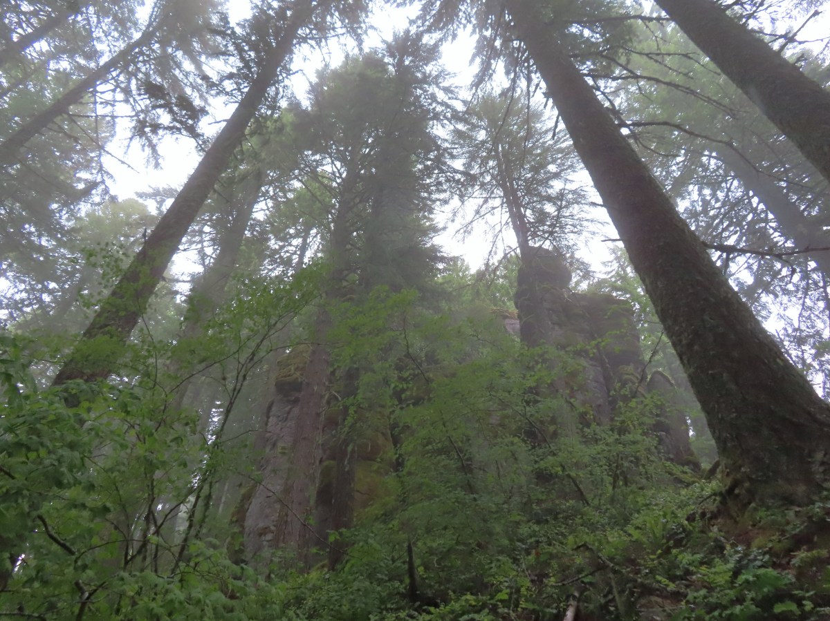
The road leveled out in the forest making for a pleasant walk. Two miles from the saddle we arrived at 100′ Kilchis Falls.

 Rock cliffs marking the location of Kilchis Falls.
 Located on a tributary of the North Fork Kilchis River the falls reportedly seldom have much flow, but there was enough water today to make for a pretty sight.
 The small pool below the falls.
 Avens
Avens
 Spider hiding on a columbine.
 Scouler’s corydalis
 Youth-on-age
 Valerian
After a relaxing break at the falls, we continued along Kilchis Forest Road which approached the North Fork Kichis River and then followed it NW.


 Hedgenettle
 Waterfall on an unnamed creek. It was quite a way back in thick vegetation.
 The above waterfall sans zoom.
 Buttercup
 Fick Creek joining the river.

 Potholes on the North Fork Kilchis River.
 Triangulation Creek flowing into the river.
Approximately two miles from Kilchis Falls we crossed the river on a bridge.


We continued to follow the river for another 0.6-miles where Middle Road joined steeply from the right.

 Snail shadow on a iris.

 Middle Road coming downhill on the right. This is the Middle Road Trailhead mentioned in the Oregonhikers.org field guide.
We made a sharp right turn here and began the difficult climb to South Triangulation Point.

Middle Road isn’t really a road anymore and is only suitable for high clearance 4wd vehicles or OHVs. We huffed and puffed up this track passing a road on the left after 1.3 miles and arriving at a saddle in another 0.3 miles.

 A very blurry picture of a doe that was way down the hillside in the forest.
 Large rock and log in the middle of Middle Road.
 Monkeyflower surrounded by candyflower

 Paintbrush on some cliffs above Middle Road.

 Thistle
 The road at the 1.3-mile mark along Middle Road.
 The saddle at the 1.6-mile mark.
 Memorial at the saddle.
We took a break at the saddle before continuing the climb. We passed another road on the left approximately half a mile from the saddle then came to 4-way junction 0.6 miles later.
 Middle Road continuing on from the saddle.
 Beargrass
 The road on the left at the 2.1-mile mark.
 Iris
Iris
 Stream flowing down the road.
 Coming up to the 4-way junction.
From the junction we took the righthand fork signed “FB3”.
 Middle Road from the 4-way junction.
 The two lefthand forks at the 4-way junction.
 FB3
FB3

The elevation at the 4-way junction is about 2600′ and the Middle Road Trailhead is just over 800′ so we’d gained over 1800′ on Middle Road. South Triangulation Point tops out at 3255′ meaning we were still over 650′ below its summit so neither of us were pleased when FB3 proceeded to lose approximately 100′ of elevation in the first 0.6 miles.


 Monkeyflower
 Beargrass, paintbrush and penstemon
 More flowers on a rocky outcrop along FB3.
 A bunch of monkeyflowers.
When the road finally started climbing again it was more gradual than Middle Road had been. In 3/4 of a mile, we gained 350′ before coming to a fork.
 Springs along the road.
 Snake cooling off in the mud.
 The snake didn’t budge as we passed around it.

 This fork is approximately 4.2 miles from the Middle Road Trailhead.
At the fork we veered uphill to the left. This road gained nearly another 300′ in half a mile where it arrived at a saddle between Triangulation Point and South Triangulation Point.
 Snake number two on the day.
 This one didn’t budge either.
 Switchback below the saddle.
 Approaching the saddle.
 Gated road up Triangulation Point.
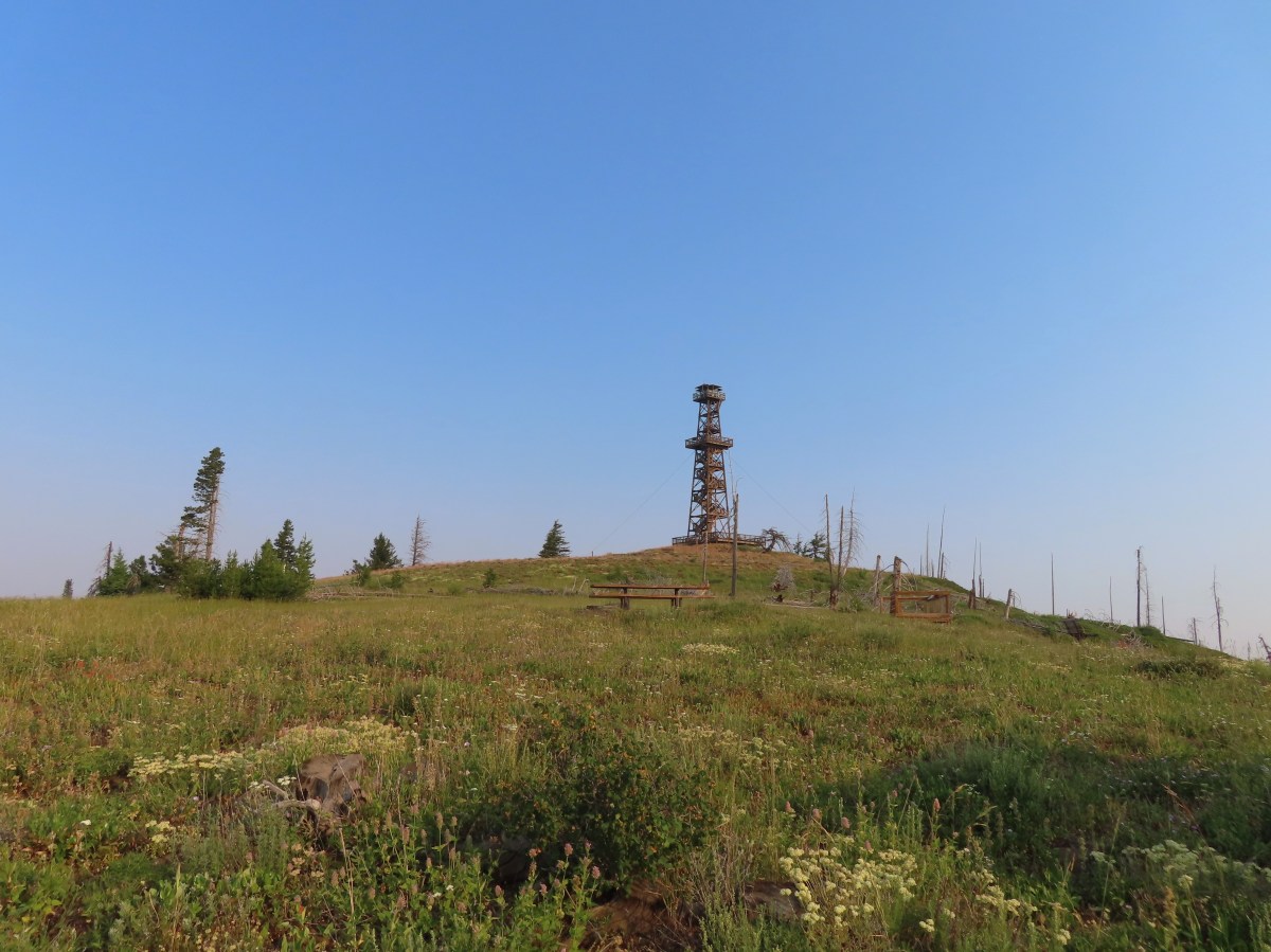
 South Triangulation Point
The wildflower display at the saddle was impressive and we spent some time admiring the blooms.
 Serviceberry, paintbrush, yarrow, and iris.
 Paintbrush and Cardwell’s penstemon
 Iris
Iris
 Broadleaf arnica, paintbrush and penstemon

 Columbine among others.
 Broadleaf arnica
Aside from a vehicle that was just leaving the saddle below Cedar Butte when we’d arrived that morning we hadn’t seen anyone all day. That changed at South Triangulation Point as a group of dirt bikes had arrived while we were taking a break at the switchback below the saddle. We took a left fork in the road and made our way to the summit where we briefly spoke with them.
 Final pitch to the summit.
 We could see our car parked at the saddle below Cedar Butte from South Triangulation Point.
 Motorcycle track heading down from the summit with Triangulation Point on the other side of the saddle.
 Looking to the NW you can see out to the Pacific Ocean. The line of peaks furtherst back staring from left to right consists of Neahkahnie Mountain (post), Angora Peak (post), West Onion & Onion Peaks, Sugarloaf Mountain, and Kidders Butte.
 Closer look at Surgarloaf Mountain and Kidder Butte.
 Wildflowers on South Triangulation Point.
After a break we headed down the road to the fork where we turned left and quickly began a steep half mile descent to a 5-way junction.


 Another nice clump of wild iris.
 Lupine
 Flowers lining the road.
 More motorcycles at the 5-way junction.
We stayed straight at this junction and continued downhill sticking to the main road at all junctions.


 Variable-leaf collomia
 The road briefly followed a narrow ridge.
 Anemones
 Moth
Moth

 Heather spotted this little one. Not sure if it’s a vole, pocket gopher, or something else.
A little over a mile from our car we passed a series of wet cliffs that were putting on a spectacular flower display.

 Silverleaf phacelia and chickweed
 A lomatium


 Larkspur and monkeyflower
 This pink larkspur really stood out on the cliffs.
 Littleleaf miner’s-lettuce
 Several types of yellow wildflowers.
The cliffs helped explain why the road had dipped so far below Kilchis Saddle where our car was. Shortly after passing them the road began a final climb to the saddle gaining close to 200′ in the final three quarters of a mile.
 Still dropping a little after the cliffs.
 Bleeding heart and candyflower
 Climbing the road at the edge of the clearcut.
 The saddle where our car was parked across the clearcut.
 South Triangulation Point from Cedar Butte Road.
 South Triangulation Point
 Looking down the North Fork Kilchis River valley from the saddle.
For us this loop came in at 12.7 miles a little over 2700′ of elevation gain. Despite being on roads some of the elevation change was quite steep adding to the difficulty. That being said this was a good hike with a nice waterfall and lots of wildflowers. We encountered about a dozen motorbikes, all between South Triangulation Point and end of the hike and we didn’t hear them all that often either.
It had been a long hard loop, so Heather chose not to add another 780′ climb when we arrived at the Cedar Butte Trailhead.

I on the other hand am a glutton for punishment so I threw my pack back on and walked 250′ up a gravel road to a signboard marking the start of the Cedar Butte Trail.
 The trail information lists the hike as “difficult” due to the amount of elevation gained over just three quarters of a mile to the summit.
 The start of the Cedar Butte Trail.
The trail began fairly level passing through some heavy brush before breaking into a second growth forest.

 Star-flowered false solomonseal
 Black-headed grosbeak
 False lily of the valley

The trail didn’t really begin to climb until the 0.3-mile mark where it made a series of short switchbacks then alternated between steep straightaways and more switchbacks.
 The trail was in good shape with just one small tree down over it.
 Blue-eyed Mary
 Small saddle below the summit.
 Beargrass
 Phlox
Phlox
 Final pitch to the summit.
 Wild onion
 Benches at the former lookout site.
 View from the summit.
 Wildflowers at the summit.
On the way back down I took a short, steep spur trail to a viewpoint where I could see Kings Mountain (post) to the NE.
 Kings Mountain is the high point to the right along the ridge.
After checking out the viewpoint I continued my descent and rejoined Heather at the trailhead.

 Fairy bells and vanilla leaf
 Almost back
This hike had been 1.6 miles and one heck of a climb. My legs were feeling all 3500′ on the day. Late Spring seems like a good time to visit this area as the wildflowers were the highlight. Kilchis Falls was nice but at different times of the year the flow would likely diminish the appeal quite a bit. Happy Trails!

Flickr: Kilchis Falls, South Triangulation Point, and Cedar Butte


 Canadian milk-vetch
 The Falls Creek Trail on the right.


 Mock orange
 The Falls Creek crossing.
 Twin Peaks from Falls Creek.
 Geranium
 Paintbrush

 A paintbrush hiding in fleabane.
 Robin
Robin The trail crossed a rocky area caused by an avalanche.
 Doe with one of her two fawns that were down at the creek at the avalanche area.
 Mountain death-camas
 The Hurwal Divide to the left of Sacajawea Peak.
 Rosy pussytoes
 Hurricane Divide (south)

 Deadman Creek
 Western tanager
 Hurricane Creek


 Slick Rock Creek flowing down from the right in the distance.


 The creek crossing.
 Harebells and stonecrop
 Paintbrush below the falls.
 Arnica
 Wallowa paintbrush, yellow columbine, milk-vetch, and northern sweetvetch.
 Faint rainbow in the falls.
 Butterfly on Rocky Mountain goldenrod.
 Yellow fleabane
 This may be common butterwort, but I’m not positive.
 Yellow columbine
 Spider hunting a moth. There was a brief scuffle, but the moth escaped unharmed.
 Penstemon

 Sagebrush mariposa lily

 Despite all the wildfires the views were pretty good as long as the Sun was at our backs.


 Nuttal’s linathus
 Wood nymph
 There was haze to our backs though.
 Rose along the trail.
 A Sulphur butterfly.
 A pale crescent on fleabane.
 It was warm and smokey at the viewpoint.

 Yarrow
 White mariposa lily
 Aster
Aster Sulphur buckwheat
 Scarlet gilia
 Bee visiting some penstemon
 Imnaha River canyon
 A small section of the loop was lost in a 2022 wildfire.
 The other end of the missing trail.
 One of several interpretive signs along the loop.
 Nettle-leaf giant hyssop
 This appeared to be the last of the elkhorn clarkia in bloom.
 Looking down wasn’t bad, but we couldn’t really make out any of the mountain peaks in the distance.
 Taper-tip onions
 A smokey Sun was heating things up fast.
 Grouse
 One of a pair of hawks.
 The Hat Point Lookout from the parking area.
 Paintbrush
 The start of the loop.
 Fireweed
 The lookout staffer?
 Sunlight reflecting off of the Snake River in Hells Canyon.
 Hidden in the haze are the Seven Devils mountains in Idaho.
 Penstemon
 The tower was closed to the public due to safety concerns.

 Hells Canyon is deeper than the Grand Canyon from its highest point, 9,393′ He Devil in Idaho at 8,043′ from the river. The depth from Hat Point to the river is 5,632′.
 Mountain coyote mint
 Lewis flax


 The tread was faint in spots amid the patches of wildflowers.
 There was a small rock outcrop at the ridge end.
 This is where we turned around not wanting to lose anymore elevation and have to climb back up on what was already an uncomfortably warm day. As it turns out we were just about at the boundary of the
  The lookout from our turn around point.


 Hat Point Trail sign near the quarters.
 This trailhead sign was in a large parking area near the quarters, but there were “No Parking” signs along the road here.
 Lupine

 Imnaha River canyon
 Imnaha from the Five Mile Overlook.
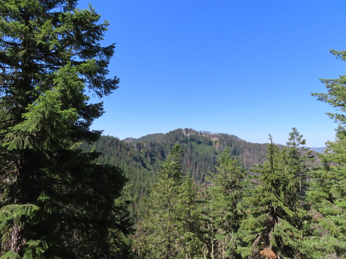
 The unsigned trail enters the forest across from a small pullout.
 Bunchberry


 Fish
Fish Rough skinned newt


 Flagging and some old trail maintenance along the Baty Butte Trail.
 We could see the tread continuing on the other side of the thicket.
 Vegetation covering the trail.
 The trailhead is located at a turnaround at the end of BLM road 7-4E-11.1.
 Oregon sunshine, lupine and paintbrush.
 Larkspur, paintbrush, and Oregon sunshine.
 Penstemon, paintbrush, and valerian.

 Westen featherbells
 Bistort
 Arnica

 Bear sign on the trail.
 Paintbrush and lousewort
 Nasty Rock from the trail.
 Entering the fire scar.
 The trail was especially overgrown in the fire scar.
 Penstemon
 Columbine along the trail.
 Valerian
 Exiting the fire scar after less than 100 yards.
 While none of the several downed trees posed much of an issue the condition of the trail made for slow going.

 Nasty Rock sticking up ahead.
 Not Nasty Rock further along the ridge and in the Beachie Creek fire scar.
 Wildflowers were blooming in the openings along the ridge.
 Arrowleaf buckwheat
 Checkerspot on Oregon sunshine
 Oregon sunshine
 Table Rock (
 Mt. Hood peecking up from behind a ridge.
 Scarlet gilia
 Nasty Rock from the trail.
 Flowers below the trail.
 Flowers above the trail.
 Buckwheat


 There were a lot of nice Washington lilies below Nasty Rock with more to come over the next week or two.
 Wintergreen
 Nasty Rock from the trail.
 The trail below Nasty Rock.
 Nasty Rock from the end of the “trail”. Prior to the 2020 fire a rougher use trail continued on to Not Nasty Rock, but we didn’t see any obvious tread. (We weren’t really looking though either.) We made the fairly easy scramble to the top of Nasty Rock and took a short break.
 Mt. Jefferson from Nasty Rock.
 Mt. Jefferson with the flat-topped Battle Ax (
 Mt. Hood in the distance.

 Looking out across the Molalla River drainage to the Table Rock Wilderness.
 Rooster Rock is the rock outcrop to the left with Table Rock the tall feature to the right. Pechuck Lookout can be seen on the lower hilltop in the center foreground.
 Not Nasty Rock from Nasty Rock. The highest peak diagonally left of Not Nasty Rock is Rocky Top (
 We were joined at the summit by a swarm of flying ants obsessed with this fir tree.
 Checkerspot on Oregon sunshine
 Swallowtail resting on serviceberry.
 Blue bells of Scotland
 Fritillaries on mountain coyote mint
 Clodius parnassian on mountain coyote mint.
 Fleabane
 Buckwheats, paintbrush, Oregon sunshine and at least one butterfly.
 Scarlet gilia
 Larkspur
 Washington lily
 Inside-out flower
 Fritillary
 Beardtongue
 Pink pyrola
 Bead lily a.k.a. Queen’s cup
 Bunchberry
 Cat’s ear mariposa lily
 Approaching the road.
 Larkspur and yarrow
 Checkerspots on Oregon sunshine


 Ash Creek


 In addition to the single doe we spotted a variety of birds along our route.
 Passing the dog park.
 Sign at the start of the sports park.
 Bird in a nest.
 Interpretive sign along the trail.

 Stellar’s jay
 Flowers along the path.
 Eventually the field on the left will be developed into sports fields.
 Vetch
Vetch Morning sunlight showing why it’s a robin “red breast”.
 Sparrow
 Going around the open field brought is into the sunlight, but it still hadn’t warmed up too much.
 Swallows
 Spotted towhee with breakfast.
 Amphitheater at Riverview Park.
 Willamette River
 Killdeer


 Pointers on South Main Street.


 Trail map at the trailhead.
 Rhododendron

 Twinflower and fringed pinesap
 Sugar sticks


 North and Middle Sister followed next.
 The trail spent some time on top of the ridge as well as each side as it gradually climbed.

 Washington lilies
 Paintbrush
 Northern phlox
 Penstemon
 Garter snake
 Mt. Jefferson and Three Fingered Jack
 Entering trees that survived the 2017 fire.
 The hillsides that the trail traverses are pretty steep.
 Common whipplea
 Better view of Mt. Jefferson and Three Fingered Jack with Maxwell Butte (
 Bunchberry, queen’s cup, and foam flower.
 We had hiked to MacDuff Mountain on the O’Leary Trail just a few weeks earlier (

 Columbine
 Mt. Hood, Mt. Jefferson, Three Fingered Jack, Mt. Washington, and Scott Mountain (
 Trillium
 Valerian
 Wallflower and buckwheat
 Purple larkspur, yellow cinquefoil, and white sub-alpine mariposa lilies
 Paintbrush and lupine
 North and Middle Sister with Horsepasture Mountain on the right.
 Oregon bluebells
 Penstemon
 Butterfly on bistort
 Musk monkeyflower
 A stalk of beargrass along the trail.
 Jacob’s-ladder
 Bane berry and solomonseal
 Vanilla leaf
 The Saddle Trail arriving from the right.
 Downhill to the left is the Horsepasture Trailhead, uphill to the left is Horsepasture Mountain and the Olallie Trail continues along the righthand fork.
 Arnica, bunchberry and vanilla leaf
 Fleabane
 It was not a big year for beargrass but if you pick the right year there is an impressive amount along this trail.
 Second snake of the day. I wound up seeing three on the day which was two more than other trail users, excluding Heather.


 Pollinator photobomb in the upper left.

 The Three Sisters and Mt. Bachelor on the horizon.
 Lupine, bluehead gilia, paintbrush, and pussytoes?
 The former lookout site with Mt. Hood and Mt. Jefferson behind.
 The summit
 Survey marker
 Diamond Peak from the summit.
 The Three Sisters
 Mt. Washington, Scott Mountain, Belknap Crater (
 Mt. Hood, Mt. Jefferson, and Three Fingered Jack
 Scarlet gilia
 Buckwheat and bluehead gilia
 An aster or fleabane
 Paintbrush with penstemon in the background.
 Butterfly on bluehead gilia
 Butterfly and bees
 I believe this is a persius duskywing (Erynnis persius)
 Vetch?
 This outcrop is just slightly lower than the summit.
 Cliff beardtongue on the rocks with the Three Sisters and Mt. Bachelor behind.


 Phlox
Phlox Bastard toadflax

 Passing the Saddle Trail on the way back.
 Eight-spotted forester
 Blue-eyed Mary
 Horsepasture Mountain
 Waterleaf
 Mt. Hood, Mt. Jefferson, Three Fingered Jack, and Mt. Washington
 North and Middle Sister
 Larkspur
 Pink pyrola
 Clodius parnassian on a tiger lily.
 Fireweed
 It was right around 90 degrees at the trailhead when we got back at 2:30pm.

 Valerian along the trail.
 Vanilla leaf and anemones carpeting the forest floor.
 Star-flowered false solomonseal.
 Coneflower with lupine behind.
 Penstemon


 Monkeyflower
 Lupine
 Sub-alpine mariposa lily
 Moth on fleabane.
 Waterleaf
 Tiger lily
 Pussytoes
 From left to right the peaks with snow are: The Twins (
 Diamond Peak
 Grasshopper Mountain above the meadow.
 The post in the rocky area.
 When we visited in 2017 it had been mid-July, and the larkspur show was over.
 A cairn marks the Grasshopper Mountain Trail.

 Looking out over the meadow.
 Fuji Mountain and Diamond Peak
 The saddle below Grasshopper Mountain.
 The Three Sisters and Broken Top
 Mt. Bachelor
 The last of the snow, at least it is all we saw.
 Glacier lilies near the tiny snow patch.
 It was evident that the trail does get maintained on occasion, but none of it appeared recent near Grasshopper Mountain.
 Anemone
 Violets
 Bleeding heart
 Oregon bluebells
 The Three Sisters and Broken Top were visible from this area.
 Back on the slightly overgrown trail.
 Mt. Jefferson and Three Fingered Jack
 Bears appear to use the trail more than hikers. This was the largest of three piles we’d pass on the day.
 Arnica
 This is both the trail and a front (back) door.
 Valerian and tall bluebells
 Fairy bells
 Meadowrue
 Moth on valerian.
 Jacob’s-ladder
 While the trail was overgrown in places it was passable and the tread was in pretty good shape.
 Fringecup
 Possibly a speedwell but unsure and it was the only one we saw.
 More blowdown to maneuver around.
 Edith’s checkerspot
 Trail passing through an area full of monkeyflower and larkspur.
 Cinquefoil, larkspur, and buckwheat
 Scarlet gilia
 Paintbrush
 Bluehead gilia and silverleaf phacelia
 The rocky area from the trail as it crossed the ridge.
 Columbine crowding the trail.
 The wildflower covered rocks on the way back.
 Arrowleaf buckwheat and Oregon sunshine
 The Three Sisters and Broken Top with some clouds moving in.

 Paintbrush surrounded by buckwheat, bluehead gilia, and stonecrop.
 Scarlet gilia
 Wallflower
 Wild rose
 Beargrass near the outcrop.
 The outcrop from the trail.
 Blowdown
 More blowdown
 Western meadow fritillary
 Bunchberry
 Recent trail maintenance! There were a couple of cut trees in the final mile, but there were also still many to step over.
 The trail dropped low enough that there were several rhododendron blooming.
 Queen’s cup.
 South Sister (

 Had I not just come down the trail I might not have even noticed it was there.
 Cardwell’s penstemon
 Starflower
 Ginger
 Mt. Bachelor through the trees.
 Musk monkeyflower
 Grasshopper Mountain from the outcrop.
 Cliff beardtongue
 Blue-eyed Mary
 Cicada, not a pollinator but interesting to see.
 Solomonseal
 Variable-leaf collomia
 Honeysuckle
 Oregon grape
 Pollinator 1
 Pollinator 2
 Pollinator 3 (Clodius parnassian)
 Bees on bastard toadflax
 Checkerspot on groundsel
 Naked broomrape (Aphyllon purpureum)
 Penstemon
 Our guess is this is mile three from Grasshopper Saddle. We didn’t notice any other numbers and missed this one on our first pass.
 Dwarf bramble
 Strawberry
 Cinquefoil
 It started clouding up in the afternoon.
 Back at the saddle below Grasshopper Mountain.
 Great artic butterfly. There were a lot of these flying about. Their dorsum is a bright orange, but they rarely would open their wings when they landed.
 The checkerspots on the other hand are happy to open their wings.
 False hellebore
 It clouded up over Diamond Peak as well.
 Lewis flax
 Orange agoseris
 A Lycaendae on a lupine leaf.
 Moth on a mariposa lily.
 Butterflies gathering at the spring.
 The Prius at the TH. We parked on the shoulder in a pullout.
 Looking down at the pullout from the PCT on the way back.


 Phantom orchid
 Spotted coralroot
 Finetooth beardtongue
 Mt. Hood through a window in the trees.
 Finetooth beardtongue along the trail.
 White spiraea
 Bluehead gilia
 Paintbrush
 Some yellow balsamroot along the trail.
 Columbine
 Inside-out flower
 Queen’s cup
 Bunchberry
 Vanilla leaf
 Arnica
 Approaching the landslide area.
 Starting at the green up to the left is Augspurger Mountain (
 Mt. Hood from the viewpoint.
 Lomatium, bluehead gilia, and arrowleaf buckwheat in the bowl.
 Honeysuckle


 Wild onion mixed in with bluehead gilia.
 Bluehead gilia
 Lupine
 Catchfly
 Arnica and beargrass in the forest.
 Nearing one of the little meadows.

 Sub-alpine mariposa lilies
 Bluehead gilia
 Sub-alpine mariposa lilies
 A closer look shows why these are also known as cat’s ear lilies.
 Buckwheat
 Onion
Onion
 Bastard toadflax behind a cat’s ear lily.
 Rosy pussytoes
 Yarrow
 Looking back from the meadow.
 I believe these are some type of microseris.
 Boundary sign for the
  Broadleaf arnica
 Star-flowered false solomonseal
 The Cedar Creek Trail coming up from the right.
 Anemones
 Wallflower
 White groundsel
 Cliff beardtongue
 Cliff beardtongue
 Wild rose
 Larkspur
 Mt. Hood from the viewpoint.
 Spotted coralroot
 Oregon sunshine and wild onions
 Chickweed
 Arriving at another small clearing with flowers.
 Phlox, penstemon, lomatium, onion, and mariposa lilies.
 Another little meadow.
 Larkspur and balsamroot
 This was the only time we spotted Mt. St. Helens on the hike.


 Mt. Adams from the former lookout site.
 There was a lot of phlox in bloom.
 Table Mountain (
 Mt. Hood
 Mt. Hood with Mt. Jefferson behind to the right.
 Balsamroot and groundsel
 Mt. Adams
 Phlox
Phlox
 Paintbrush and cliff beardtongue
 Another view of Mt. Hood.

 Sandwort
 Chickweed
 Balsamroot
 Some of the smaller flowers present on the summit.
 Finetooth beardtongue
 Wallflower
 Wild onion
 The end of the ridge is about three quarters of a mile from the lookout site.
 Heather on the outcrop.
 Painted lady
 Larkspur
 Swallowtail
 Chickweed in some phlox.

 Wallflower
 Colubmine
 Bluehead gilia
 Beargrass along the PCT.
 Heading down to the trailhead.


 Signboard about a tenth of a mile from the trailhead.
 The loop began on the far side of the footbridge.
 As far as we could remember we’d never seen a bench on the other side of a fence before.
 Middle Fork Willamette River through the vegetation.
 Tiger lily
 Self-heal
 Snail
Snail Mock orange

 Anemone
 There are a few junctions prior to reaching the footbridge. The first was the only one with any signage. We stayed on the correct trail by ignoring side trails to the left that headed uphill and on the right that led down to Deception Creek.
 We turned left at the signed junction following half a sign for the Deception Butte Trail.

 At the last unsigned junction there was a signboard, but with nothing on it. (We went straight.)
 Warning sign for the burned area ahead.
 The footbridge over Deception Creek.
 Deception Creek

 The amount of trail work needed to clear the trail was evident by the sheer number of cut trees along the length of the trail.
 This was from 2017 near the same stretch of trail.
 View up the canyon from the trail.
 Clodius parnassian
 There was a lot of vegetation along the trail, so we had to keep an eye out for poison oak which was present at times on the lower two-thirds of the trail. It was never much of a problem, but there were a couple of plants crowding the trail that we had to maneuver around.
 Moth
Moth Starflower
 Rhododendron
 Northern cloudywing
 Big deervetch
 Hummingbird
 Groundsel
 One of the damaged sections of trail.
 There was some forest that survived the fire starting near the 3.5-mile mark where the fire burned less intensely.
 Townsend’s solitaire
 Canada jay
 There were a few views of the Three Sisters through the remaining trees. (Middle & South Sister here)
 Inside-out flower
 Looking up as the trail neared the summit.
 Woodpecker
 Common whipplea
 Anemone
 The Deception Butte Trail arriving at Deception Butte.
 Beargrass


 Looking down at the saddle and wondering if it was really worth having to climb back up.
 Northern flicker
 Lizard
 Rock outcrop on the other side of the saddle.
 Tolmie’s mariposa lilies
 Bluehead gilia
 Squirrel
 Oakridge in the valley below with Diamond Peak (
 Diamond Peak
 Oakridge
 Leafy fleabane
 Oregon sunshine on the hillside looking up Deception Butte from the saddle.
 Wild onion
 One of the fritillary butterflies.
 Fly inside a Tolmie’s mariposa lily.
 There is a very steep trail just below the summit that leads to an upper trailhead. The Forest Service does not recommend using these though as the trail is said to be slippery and steep. We can vouch for the steep just by having looked down from the Deception Butte Trail.
 Plectris and stonecrop
 Coralroot
 The best view of the Three Sisters that we got all day.
 Butterflies enjoying some vetch. There were at least a half dozen butterflies visiting this patch.
 Brown creeper
 Pink pyrola

 Pearly everlasting
 Turkey vulture
 Fireweed
 Entering the trees near the footbridge over Deception Creek.
 Columbine
 Tiger lilies


 There were some nice rhododendron blooms along the trail.
 Spotted coralroot
 The first of three crossings of FR 411, this is at the 0.4-mile mark.
 Inside-out flower
 Starflower
 Yellowleaf iris
 The trail is narrow at times but well maintiained.
 Forest filled with rhododendron.
 A closer look at the rhodies.
 There were several madrones in the forest.
 Little prince’s pine
 Sugar sticks
 There were a few places where we might have had a view if not for the clouds.
 Stonecrop
 Passing below some of the rock formations.


 Anemones
 Bleeding heart

 The first small meadow that the trail passed through was full of blue-eyed Mary.

 Northern phlox
 Coming up on another small meadow.
 Subalpine mariposa lily
 Beargrass
 The fog didn’t help with our trying to find the trail. There was enough room along this section of road that parking and starting the hike from here would be possible.
 Back on trail.
 Honeysuckle
 More northern phlox
 This meadow was full of bluehead gilia.


 The trail dropped steeply as it rejoined FR 411.
 There was no parking room that we could see near this area.
 Vanilla leaf along the trail.

 Bunchberry
 Trillium
 We stopped when we spotted something in the trail ahead that looked like it might be an animal. Using the camera to zoom we realized it was a grouse hen with her little chicks.
 The hen got up and then the chicks headed into the underbrush. We felt bad having disturbed them, but once they’d moved, we calmly passed by while momma came back to gather her little ones.
 This was all beargrass, but none of the plants in this area appeared to be planning on blooming this year.
 Hermit thrush
 The rocky summit of MacDuff Mountain.
 A lot of larkspur.
 Subalpine mariposa lilies
 Paintbrush and buckwheat
 Cinquefoil
 A penstemon


 The view from the top.
 No blue sky that way.
 No sign of clearing this way either.
 Cliff beardtongue
 Woodland-stars
 Paintbrush
 Hey look, there is another ridge over there.
 Ookow just starting to open up.
 Steep climb or road walk? We chose the trail again on the way back.
 A wetter road now thanks to the rain shower.
 Blue sky, it does exist.
 The clouds got a late start but eventually started lifting.
 From this angle it looks like a statue.
 Looking down from some of the switchbacks.
 Cougar Reservoir
 Pyrola
 Sunlight!
 I’ve never seen a track this far off.
 The track after manually editing it.
