Memorial Day marked the end of our trip to the Medford area but before we headed home we had one final hike planned at Roxy Ann Peak. Located within Prescott Park the 3670′ Roxy Ann Peak offers multiple trails and great views (on clear days) of the surrounding area. The park has two gates that according to the park brochure are “typically” open from 8 to 8 in Spring and Summer (closed at 5pm in Fall/Winter). We wanted to get an early start to our drive back to Salem so we opted to park at the 1st gate and road walk to the start of the trail that Sullivan features in his guidebook. Setting off at 5:20am from the 1st gate.
This was another hike that became a featured hike in his 4.2 edition “100 Hikes/Travel Guide Southern Oregon & Northern California” due to fire damage to several of the previously featured hikes. He suggests a 3.4 mile loop started by parking at the second gate. Like most of our other hikes this trip we’d originally planned on a longer hike utilizing more of the Park’s trails but had pulled back after the first day of our trip (post) but parking at the first, lower trailhead did add a little over 2 miles round trip. While the forecast was for a mostly sunny day the clouds from the weekend hadn’t moved on as we hiked up the road. Roxy Ann Peak from the road.
We spotted three deer and a jack rabbit during the road walk but the low light conditions made for poor picture taking opportunities. Fortunately deer were the theme for the first half of the hike and we had several more photo ops with them. Jack rabbit
Coming up on the 2nd gate.
Sunlight hitting the hillsides on the far side of Medford.
Our planned lollipop loop was to take the Madrone Trail to the Oak Trail then onto the Ponderosa Trail which would take us up to the Park Tower Road where we could visit the summit. Then we would descend via the Manzanita Trail back to the Madrone Trail to return to Roxy Ann Road and eventually our car.
It was 0.2 miles along the road from the 2nd gate to the start of the Madrone Trail where we turned right and began climbing in earnest. Roxy Ann’s shadow being cast over Medford.
For the most part the trails in the park were nice and wide giving us the feeling of plenty of space from the abundant poison oak in the area. (We’re not sure how long it takes to get used to hiking in its presence but we haven’t gotten there yet.) There was a nice variety of wildflowers along the way and, as I already mentioned, a good deal of wildlife. We also appreciated the fact that most junctions were well marked with posts identifying the various trails. Lots of purple vetch along the trails.
One of the posts used to identify trails.
Madrones along the Madrone Trail.
We turned left following the pointer for the Oak Trail.
Juvenile great horned owl along the Oak Trail. We didn’t get a good look at the second owl to the left but it looked to be an adult.
This segment of the Madrone Trail (MD3) ended at Roxy Ann Road with the Oak Trail picking up on the far side.
The Oak Trail
Lupine amid the vetch
Camas in front of poison oak.
Carrotleaf horkelia
ookow
Death camas
Blue-eyed grass
Oak along the Oak Trail.
Roxy Ann Peak
Blow wives
The Oak Trail appeared to be the least used of all the trails we would hike on this day.
Trail junction near the Challenge Course with the Oak and Ponderosa Trails.
Dove
Hopping onto the Ponderosa Trail.
Mariposa lily
Lazuli bunting. We saw quite a few of these during our trip but they proved to be very difficult to photograph.
Medford from the Ponderosa Trail.
Paintbrush
Madia
Lower Table Rock again.
A bench and Ponderosa pines along the Ponderosa Trail.
Plectritis
Two more deer above the trail.
Deer and balsamroot.
Young deer
Momma deer
Larkspur
Nearing Park Tower Road.
When we hit the road we headed uphill then took a short rocky trail to a picnic table on the summit. Unfortunately the low clouds hadn’t burned off nearly enough yet for us to get the big views of either the Cascade Mountains or the Sisikyous but it was a nice view none the less.
Serenading lazuli bunting.
A lot darker clouds toward the Cascades.
With no real views today we took a brief break then headed over to the tower on the other side of the peak just for the heck of it before heading down the road to pick up the Manzanita Trail.
Sign for the Manzanita Trail
We followed this trail back down to Roxy Ann Road and the Madrone Trail.
The lower flank of Grizzly Peak (post) to the left. Mt. Ashland (post) is hiding behind the clouds almost straight ahead.
Looking NE from the trail, still a lot of clouds.
Another bunting, we were on a roll.
The clouds were really starting to break up as we descended.
Arrow-leaf buckwheat on the hillside.
Roxy Ann Road
Back on the Madrone Trail.
Back on the road walk. The trail post here is for the Greenhorn Trail.
Spotted towhee.
The lower gate was still closed when we got back to our car around 8:20am but we’d passed a steady stream of hikers and trail runners heading up the road regardless. In the end our hike came to 5.4 miles with approximately 1475′ of elevation gain.
It had been a nice short hike to end the trip on. It was only about 15 minutes from our room so we had left our things there instead of having to leave it in the car and now had time to go back to the room, shower and then drive home. We stopped in Eugene to have lunch with our son Dominique and his friend Russell and then continued home to unpack and start getting ready for our next adventure. Happy Trails!
Having escaped the rainy weather thus far Sunday of Memorial Day weekend was yet another foretasted “chance of rain/showers” but also contained the words partly sunny. Today’s hike was another piece of one of Sullivan’s featured hikes that we had done a different portion of on a previous trip. For Applegate Lake Sullivan gives two options – a 6.4 mile peninsula loop starting at French Gulch and the 17.8 mile loop around the entire shore of the man made lake. Going around the lake requires a good amount of road walking mixed in with trails and given the distance never sounded too appealing so in 2017 when we hiked Collings Mountain (post) we made a loop incorporating Da-Ku-Be-Te Trail on the west side of the lake. That trail was not part of Sullivan’s 6.4 mile option which is located on the east side of the lake so today that hike was our goal. We had tentatively planned on lengthening his hike by following the Payette Trail beyond the Osprey Trail as an out-and-back extension. That idea was scrapped after our first hike of the trip at Mule Mountain (post) turned out to be a lot more challenging that expected leaving us a little depleted.
Here the Payette Trail headed downhill into the forest.
We followed this trail as it wound around the lake for a mile to a 5-way junction.
Walk in campsite at French Gulch.
French Gulch
Hooker’s Indian Pink
White lupine
Violet
Iris
Pretty face
Starflower
Columbine
Osprey
Ground cone
Madrones near the the 5-way junction.
We stayed straight at the junction ignoring two trails to the right the led onto a smaller peninsula and the Calsh Trail on the left which would be our return route on the loop.
After another half mile we took a short trail downhill to the lake. The side trail to the right.
Collings Mountain
After checking out the view from the lake we returned to the Payette Trail and in a quarter of a mile passed a junction with the Sins Bar Trail.
Just beyond the junction the Payette Trail became an old road bed.
Penstemon
Stricklin Butte in the distance.
Two tenths of a mile along the road we came to a fork where a pointer indicated the trail left the road to the right. We could see from the maps we had that the trail would rejoin the road in a little over half a mile so we had the option of following either.
We decided to split up here with me taking the trail while Heather stuck to the road where there was much less chance of encountering poison oak.
We didn’t see many mushrooms on the trip but this one was good sized.
Collings Mountain on the left.
Deer brush and manzanita along the trail.
Marble
Rejoining the roadbed.
In another mile the trail split off from the road again, this time to the left while the road headed down into the lake. Oregon sunshine
Kellog’s monkeyflower
heart-leaf milkweed
Blue gilia
Ookow
Silverleaf phacelia
Blow wives?
Lupine
Payette Trail to the left.
We decided to stick to the road to see how much of it was above water. We made it a quarter mile before the road vanished but we were able to follow a use path uphill along the hillside to rejoin the Payette Trail. The road vanishing into the lake.
Back on the Payette Trail.
At a signed junction with the Osprey Trail we turned uphill leaving the Payette Trail.
Mallards
Heading up the Osprey Trail.
Approximately 0.2 miles up this trail we came to a fork. A small pointer on a tree seemed to indicate that the Osprey Trail was to the right which was another old roadbed.
The paper map we had did not show both a trail and a road so we weren’t certain which was correct, but based on the arrow pointing right and not straight up we turned onto the road and followed it uphill. As it turns out this was the wrong choice and if we’d have stopped to look out our GPS we would have known that.
Clarkia
Looking back down the road.
Mariposa lily
The roadbed grew fainter the more we climbed and we eventually began to suspect we’d gone the wrong way which was confirmed when we finally did consult our GPS maps. The good news was that this road, appearing as a trail on the GPS, hooked up with Forest Road 1075 which the Osprey Trail also did. The bad news was that the two trails veered in opposite directions leaving us with a quarter mile road walk to reach the Dagelma Trailhead where the Osprey Trail terminated.
This obvious trail split off from the road to the left. We’re not sure if it would have led us to the Osprey Trail possibly by old cabin ruins that are in the area or if it would have gotten us nowhere so we stuck to the road.
The roadbed petered out a short distance from FR 1075 leaving a short cross-country scramble up to a pullout along the road where a section of barbed wire fence had been broken by what appeared to be an off-road vehicle of some sort based on tire tracks down the slope.
Signboard at the pullout.
Unintended road walk.
The Dagelma Trailhead
These chutes prevent equestrian and motorized users from passing through but also tend to attract poison oak.
The Osprey, Sinns Bar, and Calsh Trails all begin/end here with the Osprey being the left most, Sinns Bar center and the Calsh on the right. We took the Calsh Trail and headed downhill through the forest 0.7 miles to the 5-way junction at the Payette Trail.
Northern phlox
The 5-way junction.
We turned right onto the Payette Trail and followed it back to the French Gulch Trailhead. Junco
Canada geese in French Gulch.
It was another day without any significant precipitation despite the forecast and while there were a number of folks fishing near French Gulch and we’d heard others along the lake shore we didn’t encounter anyone else on the trails. We ended the day with a 6.4 mile hike, the same distance as Sullivan’s described hike despite a couple of deviations from it. My guess is we saved some distance following sticking to the road instead of turning inland on the Payette Trail then added about the same back by splitting off of the Osprey Trail.
This was a nice hike with a surprising variation in habitat and some nice views. We were however glad that we’d decided to shorten it though since we were both dealing with blisters we’d picked up 4 days (and hikes) earlier. Happy Trails!
Rain was forecast for the Saturday of Memorial Day weekend so we decided to visit the Kenneth Denman Wildlife Area. While Sullivan mentions the 0.7 Denman Nature Loop in the “more hikes” section of his “100 Hikes/Travel Guide Southern Oregon & Norther California” we were basing our hike on various postings by Boots on the Trail. Permits are required to park at the trailheads accessing the area and take two forms. To park at the wildlife area trailheads a $10 ODFW Wildlife Area parking permit is required. A cheaper (and easier to purchase) option is available by parking at TouVille Recreation Area managed by Oregon State Parks. The one drawback to this option is that TouVille opens at 7am while the wildlife area opens at 4am. Typically we try and get started as early as possible but we had been taking it easy (for us anyway) following our Wednesday hike at Mule Mountain (post) so a 7am start sounded just fine.
We purchased a permit from the self-service kiosk and parked at the end of park near the start of the quarter mile interpretive nature trail.
A large tree trunk between the parking lot and outhouse is filled with holes made by acron woodpeckers who then jam acorns inside to save for later.
Acorns in some of the holes.
On the nature trail.
The trail crossed a small stream on a footbridge which would be the way to go if you want to do the loop clockwise but we chose to go counterclockwise so it would hopefully be easier to follow the route described by VanMarmot from April this year (post). The bridge
We turned right at the bridge and after passing through a grassy area we picked up a clearer trail.
We followed this path to a “Y” at a fence marking the boundary of the Denman Wildlife Area. Camas
Ash-throated flycatcher
Srub jay
Passed through the fence and onto the Denman Interpretive Trail.
Acorn woodpecker
Death camas and vetch
One a several ponds along the trail fed by Military Slough.
A second pond with Upper Table Rock (post) behind.
One thing we quickly picked up on was that the grass and under story had gone through quite a bit of growth between the April 6th trip report and now. This included plenty of poison oak which now often crowded the trail in brushier sections.
The trail left the trees and climbed a hill where views opened up.
Mt. McLoughlin
We got a little confused on the hillside where several paths went NE and one SW to a bench which we wandered over to before choosing one of the NE paths. Common madia with Lower Table Rock (post) in the background.
Wildflowers near the bench.
Upper Table Rock
The viewpoint bench.
I think we chose a different one than VanMarmot had but the end result was the same as we wound up on duck boards passing another pond along Military Slough which we recognized from a photo.
Wood duck
Not far from this pond the trail climbed to TouVille Road.
Denman Trail at TouVille Road.
Following VanMarmot’s April hike we turned right along the road looking for a “very faded road” that headed north across the Agate Desert. Mt. McLoughlin
Upper Table Rock from TouVille Road.
A swallow on a fence post with Mt. McLoughlin behind.
Swallow
Yet another pond along Military Slough.
A kingbird, most likely western.
A pair of hawks near the pond.
We found a faint road which we assumed was the one we were looking for and turned left onto it.
In the pictures we’d seen from early April the old road was faint but visible passing through the short grass but that grass had grown since then making the road even harder to pick out.
I I believe this is a paintbrush, possibly Castilleja tenuis – hairy Indian paintbrush.
Mourning doves
We wound up losing track of the roadbed as we neared a small depression where a seasonal creek supported more brush and trees. We could see from VanMarmot’s track that they had turned SE following along this seasonal creek before crossing it and turning back to the NW. While it hadn’t rained on us yet walking through the tall wet grass here provided enough water to soak our lower halves and we both had run ins with turkeys that startled us when they burst out of the grass near us. Looking back at Upper Table Rock with the stream bed in the trees/brush to the right.
We eventually reached the end of the thick brush and made our loop near a couple of old fence posts.
Now that we were on the other side of the stream bed we picked up a much clearer trail.
Mt. Ashland (post) peaking through a hole in the clouds.
Mt. Ashland
Ookow
We veered left sticking as close to the stream bed as possible passing through a fence with an orange “Safety Zone” sign.
We wound up on an old gravel road that passed by a dozen old bunkers left over from when the area had been a WWII training camp. VanMarmot had followed a horse trail out to TouVille Road and then doubled back along this gravel road but it wasn’t entirely clear if they had been on this road briefly before picking up the horse trail or if we had missed it. We did see a trail leading uphill near where we had arrived at the road but that trail had quite a bit of poison oak hanging over it and not being used to hiking with it so prevalent and also not knowing for sure if it was the right trail we decided to stick to the gravel road and follow it to TouVille Road.
Bunker 6
Jack rabbit
Unsure what type of bird this is.
Trailhead just off TouVille Road.
We couldn’t tell where exactly the horse trail was here either so we simply back-tracked along the road only this time taking a fork to the left to visit a few more bunkers. The fork where we went left.
Passing another bunker.
Lupine
We passed a small trail leaving the road but didn’t realize that it was the trail we were looking for and wound up completing a small loop before realizing our mistake. We back-tracked again and left the road on the trial we’d seen.
White tritellia
This trail quickly forked and it took us a few minutes of map consulting to decide we should take the left hand forked vs climbing up the small slope on the right.
This was the path we wanted as it passed through a row of old oak trees.
We popped onto another gravel roadbed and followed it to the right looking for a trail heading north (left) that would take us toward Little Butte Creek. We completely missed that turn and wound up at a parking area off Agate Road.
We considered our options and decided to walk north along Agate Road to another pullout next to the creek.
Things got interesting here. Trails led west along the creek here, presumably used mostly by fishermen but not too often from the looks of it. They were very overgrown causing us to make some contorted movements in an attempt to avoid contacting any of the poison oak in the area. Occasional open areas were followed by thick brush with poison oak hidden among the other vegetation.
This section at least had hoof prints.
We popped out onto the gravel road that we had followed to Agate Road and were given a brief respite from dodging poison oak.
We turned right and in 100 yards, when the road veered left stayed straight to follow a path to Little Butte Creek. More ookow
Headed down to the creek.
Little Butte Creek
Bachelor button near the creek.
Another bachelor button
We returned to the road and continued west which soon ended. There were two trails to choose from the furthest from the creek having a sign naming it the Butte Creek Trail.
Given this trail was at least named we chose it and followed it for a mile to TouVille Road. There was plenty of poison oak to avoid along this stretch as well but we also spotted a great horned owl that kept an eye on us while we took some pictures.
Nookta rose surrounded by poison oak.
Don’t touch!
Maiden fly
Sign for a Paddle Wheel Trail which we couldn’t really see in the grass.
TouVille Road
We crossed the road back onto the Denman Nature Trail and followed it a quarter mile to the TouVille Recreation Area Interpretive Nature Trail.
Bench near the confluence of Little Butte Creek and the Rogue River.
Rogue River on the left and Little Butte Creek on the right.
Pale flax
Exiting the Denman Wildlife Area.
The Rogue River along the TouVille Interpretive Nature Trial.
Back to the bridge near the parking area.
The route that we had tried to follow would have been a 6 mile irregularly shaped loop. With several mistakes requiring extra hiking we managed to turn it into a 7.2 mile hike that only resembled our original plan.
Despite the missteps (and dodging poison oak) this was a fun hike with a lot of wildlife sightings including one deer. The rain that had been forecast didn’t materialize until later in the day and we only dealt with a couple of brief periods of sprinkles. Surprisingly we saw no ticks despite all the hiking through tall grass so that was a big plus. We wound up trying the Thai Bistro that evening for dinner which we enjoyed and provided another night of leftovers for the next day after our planned hike at Applegate Lake. Happy Trails!
With the snow level forecast to drop as low as 4500′ over the weekend we shifted the order of our planned Memorial Day weekend hikes so that we could do the highest elevation hike on Friday before the big snow level drop. It was already going to be a much cooler day than the previous two had been and there was a slight chance of showers which didn’t sound all that bad at this point. Sullivan added the Jack-Ash Trail as a featured hike in his 4.2 edition of “100 Hikes/Travel Guide Southern Oregon & Norther California” guidebook after the 2020 wildfire season wreaked havoc on some of the previous featured hikes. We have switched our goal to completing the 100 featured hikes in this most recent version for the same reason and this would be the first hike on this trip that would check another of the 100 off. (While our hike at Upper Table Rock (post) the day before had been one of Sullivan’s featured hikes we had previously done Lower Table Rock which is the other option Sullivan gives for the featured hike and so we had been counting it as done.) Sullivan’s described hike is a short 3 mile loop visiting the site of a former lookout tower on Anderson Butte. We had originally planned on hiking a longer portion of the trail which the BLM is in the process of developing. When completed the trail will connect the cities of Jacksonville and Ashland, OR thus the name. There are several different trailheads that can be used for access and we chose to start at the Griffin Gap Trailhead and planned on hiking to the Anderson Ridge Trailhead which is where Sullivan’s described loop begins. (Directions to the trailheads can be found on the BLM page for the trail here.)
We’ve seen all kinds of trailheads over the last dozen years and this one was up there on the list of odd ones. Located on a saddle where pavement ends on Anderson Butte Road there was no visible signage at first glance and the area was clearly popular with the target shooting crowd (a subset of which tends to leave quite a mess). An ATV/Motorcycle trail was visible diving steeply down a ridge to the north and then up the ridge on the other side of the saddle where the now gravel Anderson Butte Road forked to the left of the ridge and BLM Road 39-2-8 forked to the right side. The Jack-Ash Trail follows this road 0.9 miles to the Greenstone Trailhead. We didn’t attempt driving to that trailhead because why drive a potholed gravel road if you don’t have to. After deciding on a parking spot that we felt would be the most out of the line of fire we got out of the car and spotted the trailhead sign several feet downhill where the Jack-Ash Trail came up to the saddle from the Grub Gulch Trailhead. The target shooting area and the OHV track coming down the ridge.
The track going up the ridge between the two roads. We briefly wondered if this had been the BLM’s work to bypass the road walk in between this trailhead and the Greenstone Trailhead but decided it likely wasn’t (good call).
The “hidden” trailhead sign.
We set off on the road which indeed had a few potholes.
We gained about 200′ getting to the Greenstone Trailhead passing another graffiti filled shooting area at an old quarry and finding yet more evidence of target practice at the Greenstone Trailhead. Despite the empty shell casings and garbage left by the shooters there were some nice flowers along the road.
Valerian
Bleeding heart
The Greenstone Trailhead
People suck
The Jack-Ash Trail turned uphill over a dirt berm and continued on a old road bed for another half mile or so. Nicer signs on the other side of the berm.
There were quite a few Henderson’s fawn lilies blooming along this stretch which was a flower we had not encountered in bloom until this trip so we took a lot of pictures.
Can you spot the insect?
Trillium
The old road bed became fainter the further we went and eventually at a post the Jack-Ash Trail veered uphill to the right.
The trail climbed up through an open forest that showed signs of a previous fire. We made three switchbacks gaining approximately 400′ in the process. The under story here was full of milk-vetch and wild iris and was also hosting a number of ticks.
Milkvetch
Iris
Pacific houndstongue
We managed to spot a few of the bloodsuckers before they grabbed my pants but we also had to flick 6-8 of the little buggers off.
Charred tree trunks along the trail.
After climbing near to the top of the ridge the trail leveled off and straightened out as it headed south following the ridge.
Snow queen
No signs of fire here.
Approximately two miles from the Greenstone Trailhead we left the forest at a small saddle below Anderson Butte.
Had we been doing Sullivan’s described hike we would have been coming from the other direction and at the edge of the forest where he says to “..turn uphill on a smaller, unmarked trail that leads to an old roadbed..”. We got a bit turned around here because we only saw two trails, the continuation of the Jack-Ash Trail and a faint trail passing an unmarked post heading west. The Jack-Ash Trail continuing south.
The trail heading west.
The problem was Anderson Butte was to the SE not to the west but we wandered out on that trail just to make sure we were reading the map right. The path led a short distance to a knoll confirming this wasn’t the trail to Anderson Butte. Balsamroot
Phlox
We walked back to the saddle and then walked back into the forest a few steps to a faint trail heading slightly uphill toward the butte and turned onto it.
This trail soon joined an old roadbed.
Four tenths of a mile after leaving the Jack-Ash Trail we arrived at another road where we made a sharp right turn and climbed a quarter mile to the former lookout site.
Scarlet fritillary – Fritillaria recurva
There were an number of wildflowers around the summit and despite the cloudy day the views were good.
Parsley, larkspur, prairie stars and blue-eyed Mary.
After a nice break at the summit we followed a trail down the southern ridge of the butte.
Paintbrush, blue-eyed Mary, and redstem storksbill
A stonecrop
After 0.2 miles this trail joined a roadbed which we followed for roughly 450 feet. We were looking for a short connector trail described by Sullivan that would take us down to the Jack-Ash Trail. If we couldn’t find the connector Sullivan mentioned a steep OHV Trail that could be used.
We weren’t really seeing anything that looked like a connector but we thought we saw what might be a very faint path leading downhill through a more open section of forest at a point where the GPS showed the Jack-Ash Trail less than 100 yards away. Whether or not this was the right spot it seemed preferable to a steep OHV trail so we set off downhill and soon found ourselves back on the Jack-Ash. Where we left the roadbed.
Back on the Jack-Ash.
Before heading back toward the car we continued south on the trail a little over three quarters of a mile to the Anderson Ridge Trailhead. This stretch of trail was relatively level with more views and wildflowers. As we neared the Anderson Ridge Trailhead we did hear some shooting along the road on the other side of the ridge but we never saw anyone and they weren’t at the actual trailhead. Giant white wakerobbin
Paintbrush and waterleaf
Grayback Mountain to the left with snow.
The OHV trail crossing the Jack-Ash Trail.
The OHV trail coming down from the road.
Lupine
Larkspur
Always appreciate a good mountain locator.
Mariposa lily
Paintbrush
Silverleaf phacelia
Some sort of big thistle on the hillside.
Some pink lupine.
Rough eyelash-weed
Western wallflower with a crab spider.
Clustered broomrape
Buckwheat, paintbrush, and lupine
Plectritis
Nearing the Anderson Ridge Trailhead.
This trailhead had a sign-in log so we filled that out and then headed back sticking to the Jack-Ash Trail and passing below Anderson Butte.
Miniture lupine
A ringlet on fiddleneck.
Post at the OHV trail crossing.
Salsify
Yarrow
The Jack-Ash Trail nearing the saddle where we had turned off to go up Anderson Butte.
Wild onion (possibly Siskiyou)
Meadowfoam
Royal Jacobs-ladder
Royal Jacobs-ladder
The berm at the Greenstone Trailhead.
We were happy to find that there was no one using the Griffin Gap Trailhead when we got back and aside from the gunfire near Anderson Butte we hadn’t seen or heard any other people all day. The hike came in just a bit over 9 miles with approximately 1650′ of elevation gain. The incoming wet weather held off aside from a couple of sprinkles but the cloud cover kept the temperature very comfortable which was welcome after the previous two days.
This hike was a needed break from both the heat and poison oak. We only spotted the latter a couple of times on open hillsides but never had to worry about it. Long pants were still useful though due to the occasional ticks that we had to stop and flick off my pants (we never saw any on Heather this time). We were starting to feel like we were back on track now that we were halfway through our trip. Saturday looked to be a rainy one so we were going to stick close to the motel and check out the Denman Wildlife Refuge. For now though we headed back to Medford looking forward to our leftover pizza from Kaleidoscope. Happy Trails!
After the debacle at Mule Mountain (post) we made some adjustments to our planned set of hikes by removing a hike up Stein Butte and a stop at Lower Table Rock which we had visited on a previous trip (post) and shortening our other planned outings. Removing Stein Butte left open the option to not hike on Thursday if we needed a full day of rest which as we went to bed Wednesday night seemed likely. We got up Thursday and hobbled down to the motel’s continental breakfast to finalize our plans for the day which included a trip to the store for food and medical supplies and doing a load of laundry to hopefully wash off any lingering poison oak that we’d picked up on the Mule Creek Trail. It was going to be another warm day but then the forecast showed a dramatic shift with precipitation possible Friday through Sunday including snow as low as 4500′. While we ate we decided that it was going to be too nice to not get out at all and waiting for the afternoon/evening would result in a warmer hike than we’d like so we decided to head to Upper Table Rock as soon as we were done with breakfast.
The Table Rocks are a pair of horseshoe shaped mesas north of Medford and host a variety of Spring wildflowers. Pre Mule Mountain our plan had been to hike both Upper and Lower Table Rocks along with a visit to the Denman Wildlife Area. The plan now was to skip Lower Table Rock this time and split the two other hikes up with the shorter, Upper Table Rock today, and a little longer loop at Denman on Saturday which was forecast to be the rainiest day of the weekend. When we arrived at the Upper Table Rock Trailhead a little before 8am it was already fairly warm out.
We stopped at the signboards and reviewed the map determining to do the yellow “recommended loop” once we had climbed the 1.25 miles to the top of the mesa.
There were a good number of flowers still blooming and although poison oak is profuse in the area the wide trail made it easy to avoid. We were definitely feeling the effects of the prior days hike though as we gained the 700’+ of elevation to the start of the loop. Acorn woodpecker
Siskiyou Mountains including Mt. Ashland (post), Wagner Butte (post), and Dutchman Peak.
Another type of clarkia
Possibly bastard toadflax
Mariposa lilies
Balsamroot along the trail.
Bell catchfly
Plumed solomonseal
Approaching the start of the loop.
We did the 0.9 mile loop counter-clockwise trying to stick to the most worn trails where the official trail wasn’t obvious. Looking toward the Siskiyous.
Not sure what these yellow flowers are. Yellow flowers are by far the hardest to figure out.
Rock wren
Turkey vulture in flight with Mt. McLoughlin in the background.
Lower Table Rock beyond the other bench of Upper Table Rock.
An American kestral atop a tree.
Lizard
A butterfly and a beetle on arrowleaf buckwheat
Yarrow
Chaparral false bindweed
White tritelia
After completing the loop, along with taking a couple of breaks to enjoy the scenery, we headed back down to the trailhead. Along the way we spotted a few more species of wildlife and passed a couple of elementary school classes heading up the trail.
Rufous sided hummingbird
Lizard
Brown headed cowbird
Mt. McLoughlin on the way down.
This hike was just what we needed after the previous days outing. The 3.5 miles and 720′ of elevation gain kept our muscles moving and helped us not stiffen up too much but it was easy enough that we didn’t feel we overexerted ourselves.
After the hike we stopped at Fred Meyer for supplies and lunch from their deli then returned to the motel to do a load of laundry. Later we headed out to Kaleidoscope Pizza having seen it mentioned in a post by Boots on the Trail. It was a good choice and we wound up with leftovers for the next nights dinner as well. Happy Trails!
We took a few days of vacation prior to Memorial Day weekend and headed to Medford, OR for six days of hiking. Our original plan had been to make 8 different stops over those 6 days hiking around 70 miles. Seven of the stops would be new to us with two of the hikes being featured hikes in Sullivan’s “100 Hikes/Travel Guide Southern Oregon & Northern California” (4.2 edition) that we were hoping to cross of our list. Two others involved featured hikes that we had done part of previously and were now looking to complete another portion. The other three hikes that we hadn’t done were listed in the “More Hikes” section in the back of his book. I said our original plan because after the first hike our plans were blown up. For the first hike we picked Mule Mountain which had been a featured hike in Sullivan’s 3rd edition but lost that status after the Mule Mountain Trailhead was closed in 2016. From that previous trailhead the first 0.3 miles of the Mule Mountain Trail pass across private land and the Forest Service has so far been unable to obtain an easement. The Forest Service shows two alternate trailheads that can be used to access the loop that Sullivan describes – the Charlie Buck/Baldy Peak Trailhead and the Mule Creek/Baldy Peak Trailhead. Sullivan and Oregon Hikers suggest starting at the Charlie Buck/Baldy Peak Trailhead which is what we chose to do.
Our planned hike here looked to be about 12 miles with approximately 4000′ of cumulative elevation gain. Those numbers were quite similar to our hike at Elk & Kings Mountain (post) the previous Saturday. That had been a hard hike but not anything that we couldn’t manage and we had forgotten to bring our Endurolytes on that hike. These have seemed to really help on warmer/more difficult hikes when we work up a good sweat. It was supposed to be a little warmer for this hike with highs forecast to be in the mid to upper 70s but we had hydrated ahead of time, were carrying full water bladders and a filter to get additional water from Mule Creek if the opportunity arose. Despite the similarities in overall statistics there were a couple of key differences between the two hikes that we failed to take fully into account. The biggest difference was that it had been a brisk 37 degrees at 6:50am when we set off on the steep climb at Elk Mountain while here due to the long drive time from Salem it was 9:20am when we started and already in the mid 60s. Another key difference was that the majority of the elevation gain on the previous hike had been during the first half of the hike meaning we were done earlier in the day with the most strenuous portions. Here the climbs were broken up with a steep initial 1200′ climb in the first mile and a longer 3.5 mile 2000′ climb later near the end prior to the final downhill mile. The other differences were the amount of direct Sun exposure involved in this hike and that the one long downhill section on the Mule Creek Trail would involve a lightly maintained trail requiring extra effort.
The hike started off nice enough despite the steep initial climb. We spotted a number of wildflowers and a couple of alligator lizards as we huffed our way upwards.
Mariposa lilies
Alligator lizard
Henderson’s stars
Hooker’s Indian pink
Fern leaf biscuitroot
Blue dicks
Larkspur
Paintbrush
Mariposa lily
Another alligator lizard. They eat ticks but in this case it appears a couple ticks got the jump on him (or her).
Red bells, these were on a short wish list of wildflowers that we’d yet to see on trail.
After the mile climb the trail gained a ridge on the west shoulder of Baldy Peak and began a 0.4 mile traverse below the peak through an open grassy hillside. Sullivan showed a 0.3 mile use trail leading up this ridge to the summit of Baldy Peak but while Heather noticed the trail neither of us at the time remembered it was on Sullivan’s map (I thought it was at the other end of the 0.4 mile traverse.) which was probably a good thing.
Poppy
Scraggy Mountain behind Little Grayback Mountain
Red Buttes behind Little Grayback Mountain
Butterfly on scat.
When we arrived at the ridge at the end of the 0.4 mile segment we spotted a faint trail heading up Baldy Peak.
After giving it some thought and consulting Sullivan’s map we realized that this wasn’t the trail he showed and so we decided to skip Baldy Peak for now and then see if it was something we wanted to attempt on our way back by later. In addition to the use trail heading up Baldy Peak the Mule Mountain Trail joined the Baldy Peak Trail on the ridge. For now though we headed out along the ridge on what was now a much more level trail.
Mule Mountain is the lower peak along the ridge with the brown left side.
Lupine
Prairie stars
Balsamroot
Blue-eyed Mary
A collection of various small wildflowers.
Rough eyelashweed
Bee on silverleaf phacelia
Poppies
Butterfly on grass
Blue gilia
Grayback Mountain behind Mule Mountain
Yet another lizard
A colorful moth.
Little Grayback Mountain
The trail descended to a forested saddle before joining an old road bed that led to the Mule Creek/Baldy Creek Trailhead approximately 1.5 miles from the Mule Mountain Trail junction.
Iris
Approaching the trailhead.
A very short road walk brought us to the Mule Creek Trail on our right. Looking back at the trailhead from the road.
It was just a bit after noon now and it was getting pretty warm out so we were looking forward to the long downhill section in the forest. Unfortunately, as mentioned earlier, the Mule Creek Trail was in need of maintenance so there was some blowdown to navigate. Possibly worse, at least for those of us that aren’t used to a lot of poison oak, the trail was rather overgrown in places so we found ourselves twisting and turning in vain to try and avoid making any contact. Eventually we realized that wasn’t possible so we did our best to minimize contact and keep it to our clothing (we were wearing long pants/sleeves and sun gloves so we were pretty well covered).
Henderson’s fawn lily, another one we could check off our wish list.
A typical obstacle.
Overgrown trail.
Giant white wakerobbin
Some flagging on the left and bleeding heart on the right.
Star flower
Striped coralroot
The trail crossed Mule Creek several times, sometimes there was water and other times it was dry. We were so busy trying to dodge poison oak though that we didn’t think to check our water supply and refill if necessary. There was a good pool at this crossing where we could have gotten water.
California ground cones.
A folded up mushroom.
A butterfly
After almost three and a half miles following the creek the trail turned north and gradually climbed 250′ over the next three quarters of a mile to a junction with the Mule Mountain Trail.
Apparently lady bugs and butterflies don’t care about poison oak.
The trail got pretty faint at times.
We eventually popped out of the forest into an oak grassland on a hillside overlooking Upper Applegate Road.
The heat blasted us with the Sun beating down and Heather realized that despite the water and electrolyte tablets she wasn’t going to be able to make the climb back up to the shoulder of Baldy Peak. She decided that when we reached the Mule Mountain Trail she would head to the decommissioned trailhead and plead mercy if anyone questioned why she was trespassing. Arriving at the Mule Mountain Trail.
While I too was warm I felt pretty good when we reached the junction so we decided to split up and I would retrieve the car and drive down to pick her up. It was about 0.8 miles downhill to Upper Applegate Road and I was a little concerned that Heather might pass out on her way down but said she would take it real slow. I was facing the 3.5 mile 2000′ climb back up and after we split the electrolyte tablets between us we went our separate ways. I set off at a slow but steady pace gradually climbing what was a forested hillside.
White lupine
Grand collomia
As I neared Mule Mountain I lost what little cover the trees were providing though.
Penstemon
A brief section of shade.
Dwarf purple monkeyflower
Approximately 2.5 miles into the climb I hit a wall. I still had water that I was sipping on and the electrolytes but between the climb and all the sweat I had already lost I really began to struggle. I managed to make it another quarter of a mile or so to a small tree that was providing a bit of shade on a section of trail that was free from poison oak. I sat down in the shade in the middle of trail thinking that this might be where I waited for SAR. I had been praying for Heather to make it out safely and now I added my own safety to the list. I knew I was close to running out of water but I had plenty of food, extra clothing and a small pad that I could sit/sleep on if needed. I didn’t have cell service or an SOS beacon though so I sat, waited and prayed. While I waited for my hands and feet to stop tingling I flicked a lone tick off my pant leg, fought of a cramp behind my left knee, and worried about passing out and rolling down the hillside. I didn’t want that to happen and I knew I couldn’t sleep there if it came to that due to the same risk so after what felt like at least an hour (it was actually just over 20 minutes) I stood up and decided to make an attempt at the ridge where I knew I could spend the night. I was a little under three quarters of a mile from the ridge and a little over 400′ below it. My body had noticeably cooled down so I proceeded out of my shady spot and slowly climbed toward the ridge. I needed to get just below the lone tree on the ridge in the distance.
I pretty much had given up on pictures at that point and could only laugh at the thought of trying to climb Baldy Peak. Once I had gained the ridge I considered my next plan of action. It as a fairly level 0.4 traverse below Blady Peak to the other ridge where there were better spots to spend the night and I was feeling okay so I kept going. Miraculously my water held out until I had made the ridge even though I was sure every sip was going to be the last of it. It wasn’t until I was traversing below Baldy Peak that it was gone. Once I was on the western ridge I was only a mile from the car where I knew there was a cold powerade and some gatorades waiting. I wasn’t sure if my legs were strong enough though to handle the steep descent but I wanted to know if Heather had made it so after eating a little something I started downhill relying heavily on my poles. I made it back to the car half expecting to either find Heather there (if she had managed to find a ride) or SAR or both. It was just our car though so I grabbed a cold drink and started the drive down FR 940 to Beaver Creek Road (FR 20). When I got to Beaver Creek Road I promptly turned the wrong way, chalk that up to a deteriorated mental state, but almost immediately questioned myself so I pulled over and reread Sullivan’s driving direction and discovered my mistake. I drove back past FR 940 hoping I didn’t miss Heather or anyone heading up to the trailhead. Not long after passing FR 940 though I spotted Heather hiking up the road. She appeared to be doing a lot better than I was. As it turns out she had made it to the closed trailhead without incident and then made here way toward FR 940 stopping a few times to rest against fences. A little way up Beaver Creek Road she came to the Twin Pear Farm which had a small stand/store where she was able to buy some rations including a Popsicle which she ate while sitting in a chair there. A random Minion in a field.
Deer along the road.
The Twin Pear Farm on the way back by.
My track at Mule Mountain
Heather wisely took over the driving duties and got us to our motel in Medford then ran out for some food from the DQ across the street. It was after 8pm and we were exhausted. We decided that we would plan on taking it easy the next day and probably skip the hike in lieu of recovery. It was an unnerving experience and a good reminder of how easily things can go wrong no matter how prepared you try to be. We did some things right including listening to our bodies and stopping/bailing when needed and had almost everything we needed aside from a rescue beacon. On the other hand we should have taken the opportunity to replenish our water at Mule Creek when we had a chance. That wouldn’t have helped Heather but it might have helped me a bit and definitely would have if I’d have had to spend the night out there. We also should be carrying a rescue beacon/satellite communicator but every year we talk about getting something then fail to be able to choose and wind up with nothing so any recommendations you have please leave in the comments. The good news was neither of us did get hit by poison oak so that was a big positive. Happy and safe Trails!
The weather finally cooperated enough for us to get back to our originally planned 2022 hikes. For this outing we were heading back to one of our earliest hikes, Elk & Kings Mountains (post) to see how much we remembered from that first visit. When we made the conscious choice to take up hiking in 2010 the loop over Elk and Kings Mountains was our eighth hike. One of only a handful of hikes rated “Very Difficult” in all five of Sullivan’s “100 Hikes” guidebooks, and the only one in the Oregon Coast book, this had been quite the challenge for us. We were curious how nearly 12 years of additional hikes, and age, might change our experience this time around. We were also hiking the trail at a better time of the year having tackled it in the heat of mid-August the first time around. Our hope was that the earlier visit would provide a different experience with wildflowers and with the streams and creeks along the route.
Before we started the difficult loop though we stopped at Killin Wetlands Nature Park just outside of Banks, OR for a short warmup hike on the 0.7 mile loop. An unintended result of having altered the plan for our two previous outings was that this stop would mark our third straight outing visiting an Oregon Metro managed park. (Orenco Woods)(Chehalem Ridge)
We set off on a clockwise loop on the Peat Swamp Trail then stayed left at its junction with the Waterfowl Way Trail.
Peat Swamp Trail.
Our 6am start time paid off as we were not only the only ones at the park but we spotted a deer (too quick for a photo), two otters, several families of Canada geese, and a gadwall and a mallard.
One of the two otters that were swimming in the wetlands.
Mallard
The gadwall amid a family of Canada geese. When we got home and looked closer at the picture we realized that one of the round shapes we took for a clump of mud was actually an animal. We can’t make out the tail to know for sure whether it was a beaver or a nutria but we’d like to think it was another beaver.
The beaver? turned a bit in this photo but we still couldn’t make out the tail. It does appear relatively large when compared to the adult goose though.
Waterfowl Way made a 180 turn and headed uphill through some small trees to return to the Peat Swamp Trail.
We stayed left again and completed the short but eventful loop.
From Killin Wetlands we headed west on Highway 6 to Elk Creek Campground and the Elk Mountain Trailhead.
We set off on the Wilson River Trail which began a 0.2 mile climb to a junction with the Elk Mountain Trail.
Fairy bells and bleeding heart.
Elk Creek below the trail.
Junction with the Elk Mountain Trail
While it had been sunny at the wetlands we had dropped under some clouds as we descended to the Wilson River Valley and found ourselves hiking steeply up into fog.
Paintbrush
Parsley
Blue-eyed Mary
Viewpoint along the Elk Mountain Trail.
The blue sky is up there.
Snow queen
The trail was as steep and rough as we’d remembered.
We did climb out of the cloud to find that blue sky again.
White service berry blossoms and a huckleberry plant.
The trail made a series of ups and downs along a ridge crossing four saddles before climbing to the 2788′ summit of Elk Mountain.
Violet
Red-flowering currant
Trillium
Anemone
Monkeyflower
One of the saddles.
Chocolate lily
Elk Mountain summit.
We spent a little time resting at the summit where we found a lone blooming beargrass with more to come. Kings Mountain from Elk Mountain.
Wilson River
Pacific Ocean
The blooming beargrass below some red-flowering currant.
Beargrass
While the 1.5 mile climb to this summit had been hard the next mile of trail beyond the summit took it up a notch. The trail dropped nearly straight down the rocky west face of Elk Mountain requiring us to use our hands as we climbed down the damp rocks. Looking down the trail.
Heather on her way down.
After navigating the rocky descent the trail passed along some cliffs then climbed atop a narrow rocky ridge which it followed to an old roadbed where the hiking became temporarily much easier.
On the ridge.
Dropping down to a saddle along the ridge.
Near the start of the road bed we spotted a hermit warbler eating something off of some huckleberry bushes.
This was the first time we’d seen one of these pretty little birds, at least that we are aware of. Who knows how many we’ve seen fly by and not been able to identify them.
Mercifully on the old roadbed.
We followed the old roadbed for about a mile as it climbed to a junction at a saddle.
A clump of trillium.
Little moth.
Getting closer to Kings Mountain.
Paintbrush
Coming up to the junction.
We turned left onto the Kings Mountain Trail which according to the pointer was 1.3 miles away.
The trail continued to follow an old road bed for a little over half a mile before dropping steeply to a ridge and switchbacking around an outcrop and finally crossing over a saddle.
Phlox, paintbrush, and chickweed.
Still on the old road.
At the ridge end above the saddle, the trail dropped down to the left then through the saddle.
Below the outcrop headed to the saddle.
Probably the most memorable part of our first hike here was needing to use a rope that had been affixed to a stump to descend a steep chute. While we both remembered that we had forgotten at what point we’d encountered the rope and after the steep drop off of Elk Mountain we convinced ourselves that the rope had been there. As we passed over the saddle we realized our mistake as the stump and rope were here and the 12 years had not been kind to the trail here.
Heather getting ready to start down.
The chute in 2010.
The rope was quite a bit longer this time, out of necessity, but we made it down and continued on. From here the trail passed below some sheer cliffs which had been a very nerve wracking experience in 2010. Apparently somewhere during the 549 outings that we’d done between visits I’d gotten much more comfortable with narrow trails with steep drop offs because this time there were no nerves but there were a couple of spots that required the use of hands to get up.
The trail is down there somewhere.
Trillium
Bleeding heart
Fringed kitten-tails
Glacier lily
The trail then climbed to a high point along the ridge which Heather initially mistook for the summit of Kings Mountain. She was less than thrilled when I pointed out the actual summit a short distance, and one saddle, away. Coming up to the high point.
Kings Mountain
View SE from the high point.
We dropped down to the saddle then made the final climb to Kings Mountain. We had seen a small number of other hikers up to this point but found several others here having come up from the Kings Mountain Trailhead. Dropping to the last saddle.
Summit register at Kings Mountain.
Pacific Ocean in the distance.
View north.
Other hikers at the summit.
Valerian
Saxifrage, possibly Saddle Mountain saxifrage.
Phlox, paintbrush, parsley, blue-eyed Mary, and chickweed.
From Kings Mountain the Kings Mountain Trail dropped steeply downhill for 2.5 miles to a 4-way junction with the Wilson River Trail. While the trail is steep and rough in a couple of spots it’s nowhere near as gnarly as the Elk Mountain Trail. We had remembered the descent as having given us trouble but in those days we hadn’t used hiking poles. Armed with proper poles this time the descent went much smoother.
One of the rougher sections.
Wood sorrel
Woodland buttercup and candy flower.
The 4-way junction.
We turned left on the Wilson River Trail to make the 3.5 mile hike back to the Elk Mountain Trailhead. While the hike had been challenging we’d been doing pretty well but we’d forgotten to bring any electrolytes with us and while we had plenty of water we both started feeling a bit off. We paused at Dog Creek which is right near the junction for a bit of a break before continuing on the final stretch.
Dog Creek
The Wilson River Trail passed a wetland fed by several small streams before making a long gradual climb up to the junction with the Elk Mountain Trail.
The wetlands
One of the smaller streams.
Monkey flower
Lily that will bloom in a few weeks.
Fringecup
Coming up on a footbridge across Big Creek.
Big Creek
Pacific waterleaf
Steadily climbing.
A pea or vetch.
Unnamed stream crossing.
Miterwort
Rosy Birdsfoot Trefoil
The third type of monkey flower we saw on the day.
The junction is on the saddle ahead.
From the junction we dropped down to the trailhead where we thankfully had some meat sticks waiting that provided some much need salt and protein. Cars to the left through the trees, we made it.
So what did we learn revisiting this challenging hike after 12 years? One is that we are more comfortable with sketchy trails and exposure after having experienced both many times since then. Secondly our bodies are 12 years older and they reminded us of that toward the end of the hike. Finally we were reminded that as much as we have learned about hiking such as the advantage that trekking poles can provide we are still prone to making mistakes and underestimating what we might need such as the electrolytes. It will likely be quite a while before you find us on a hike without some handy.
Aside from both stops being loops our two hikes for the day couldn’t have been much different from one another. The 0.7 mile loop at Killin Wetlands was short with a well graded trail that gained a total of 60′ of elevation while the Elk and Kings Mountain Loop and been over 11 miles (It’s just under 11 if you don’t wander around with over 4000′ of elevation gain. The gains were often steep, as were the losses, requiring the use of hands at times and included steep exposed drop offs. It was obvious from the number of other trail users that we encountered that most people stick to the out and back up to Kings Mountain but if you’re an experience hiker looking for a challenge or an early season training hike this is a great option. Happy Trails!
May continues to be wet this year despite being in the midst of a drought. Hopefully these rainy days will help with that to some extent but in the meantime for the second week in a row we found ourselves looking for a “Plan B” hike that was more inclement weather friendly. We decided on the recently opened (December 2021) Chehalem Ridge Nature Park. Located in the Chehalem Mountains this 1260 acre park is managed by Metro which also manages Orenco Woods where we had started last week’s hike (post). Chehalem Ridge offers a network of hiking, biking, and equestrian trails but does not allow pets/dogs. The park website states that the park is open from sunrise to sunset which I mention because Google seemed to think it opened at 6:30am and entries in the Oregon Hikers Field Guide (Iowa Hill & Chehalem Ridge) give the hours as 8am to 7pm. With sunrise being a little before 6am this time of year we gambled on the Metro website hours and arrived at the large Chehalem Ridge Trailhead at 6am to find that the gate to the trailhead was indeed open.
We had spent most of the hour drive passing through rain showers but there was no precipitation falling as we prepared to set off. We stopped at the signboard to read up on the park and to study the map to confirm out plan for the hike.
Simply put the plan was to stay right at all junctions. This meant taking the Timber Road to the Ammefu (mountain in Atfalti (Northern Kalapuya)) Trail back to the Timber Road then to the Ayeekwa (bobcat in Atfalti) Trail to Witches Butter to the Chehalem (outside place in Atfalati) Ridge Trail. We would then follow the Chehalem Ridge Trail (detouring on a small partial loop) to the Madrona Trail and follow it to it’s end at a loop near some madrone trees. Our return would be back along the Madrona Trail to the Chehalem Ridge Trail (skipping the partial loop this time) to the Mampaꞎ (lake in Atfalati) Trail then right on the Zorzal (Spanish for thrush) Trail back to the Mampaꞎ Trail to Iowa Hill where the Mampaꞎ Trail ends in a loop around the hill. From Iowa Hill we would return to the Timber Road via the Mampaꞎ Trail and follow the road downhill to the Woodland Trail which we would follow back to the trailhead. The route could have been confusing but Metro has done an excellent job with not only placing posts identifying the trails at all of the junctions but also including maps on top of the posts.
The other nice touch is that the maps on these posts were oriented differently to align with the direction of the trail with north identified in the legend which made them quicker to read.
We set off down the Timber Road past the first of three figures located throughout the park representing the traditional storytelling of the Atfalti.
The Castor (Spanish for beaver) Trail on the left, this was the only trail in the park that we didn’t hike on during our visit. It was always a left turn.
Fawn lilies
Our first right turn (left was a short connector to the Woodland Trail).
Again the posts and accompanying maps were some of the best trail identifiers we’ve run across.
Bench at the viewpoint along the Ammefu Trail.
We had to imagine the view today.
The second figure.
Back at the Timber Road and another short connector to the Woodland Trail.
Fog on Timber Road
Passing the Woodland Trail on the left which would be our right turn on the way back.
Christensen Creek
Right turn for the Ayeekwa and Witches Butter Trails.
Witchs Butter on the left and Ayeekwa on the right.
Trillium
Some of the trails were gravel which helped keep mud from being an issue given the damp conditions. In fact there was only one spot (along the Madrona Trail) where mud was an issue at all.
Another bench, this one overlooked Christensen Creek.
Common blue violet
Pioneer violets and a strawberry blossom.
Mushrooms under a fern.
Popping out on the Witches Butter Trail.
Witches Butter Trail
Witches Butter Trail winding through Douglas firs.
Turning right onto the Chehalem Ridge Trail.
There was a little more mud on the Chehalem Ridge Trail.
Spring green carpet.
A good example of the differently oriented maps, on this one north is down.
Another fir plantation. The land had been owned by a timber company prior to being purchased by Metro in 2010.
Start of the Chehalem Ridge Loop. We went right which simply swung out along the hillside before dropping down to the Madrona Trail in 0.4 miles.
The loop continued to the left but we turned right onto the Madrona Trail.
The one thing that was hard to distinguish on the maps was the topography so we were a little surprised when the Madrona Trail continued to descend the hillside. (Had we read the Oregon Hikers Field Guide more closely we would have been prepared.) The trail switchbacked a total of 11 times before arriving at an old roadbed which it continued along to the right. Still cloudy and gray but we’d experience very little if any precipitation yet.
Lots of tough-leaved iris along this trail.
One of several blooming dogwood trees.
View on the way down.
Madrone trees began to be a common sight as we descended.
One of the 11 switchbacks.
We hadn’t seen a lot of mushrooms recently but this hike had plenty.
Following the roadbed.
The trail left the roadbed at a post and dropped down to the 0.1 mile loop at the end of the Madrona Trail. Aside from one other very small (3 in diameter) tree this was the only obstacle we encountered all day.
The start of the loop along with several madrones.
As we started back from the loop Heather mentioned that there should be a deer in the brush nearby and I jokingly said that there probably was and pointed out a game trail heading down to a small stream. As soon as I had finished my remark Heather spotted a doe that emerged from the bushes along the game trail. The doe made her way to the far hillside before we could get a good look at her.
After watching the deer for a while we began the climb back up to the Chehalem Ridge Loop. It had felt like we’d come a long ways down but the climb back wasn’t any where near as bad as we expected it to be (In reality we’d only lost about 400′). It was as we were hiking back up that the first vestiges of blue sky appeared.
The Tualatin Valley and Coast Range.
We stayed right at the Chehalem Ridge Loop to finish that loop and then retraced our steps on the Chehalem Ridge Trail back to Witches Butter Trail junction where we stayed right on the Chehalem Ridge Trail to its end at a three way junction. We had only seen 3 other people all morning, a trail runner on our way to the Madrona Trail and two hikers as we were coming back. We did however need to keep our eyes out for other trail users. Either these worms were racing or it was a bird buffet. The rain had brought a lot of earthworms onto the trails.
Another trail user a rough skinned newt.
A closer look at the rough skinned newt.
We also spotted a pileated woodpecker at the top of a dead tree. Between the distance and other trees in between I couldn’t get a good picture.
It had been so foggy when we had come up the Witches Butter Trail that we hadn’t realized that there was a giant green field nearby.
The end of the Chehalem Ridge Trail with the Mampaꞎ Trail to the right and a very short connector to the Timber Road to the left.
We briefly followed the Mampaꞎ Trail then turned right onto the Zorzal Trail. Sunlight hitting the Mampaꞎ Trail.
Fairy slippers
Squirrel
The Zorzal Trail to the right.
Toothwort along the Zorzal Trail.
Stripped coralroot
The Zorzal Trail swung out and then rejoined the Mampaꞎ Trail near the Timber Road. We yet again turned right, crossed the Timber Road near a gate and continued on the Mampaꞎ Trail.
The Mampaꞎ Trail passed along Iowa Hill before turning uphill and entering a wildflower meadow on the hilltop where a loop began.
There was a large amount of lupine in the meadow but we were several weeks early and only a few plants had any blossoms. There were a few other flowers blooming and many more to come over the next few weeks. An assortment of smaller flowers.
One of the few lupines with blossoms.
Camas buds
Oak tree on Iowa Hill. Most of the larger green clumps are lupine.
On the western side of the loop was a horse hitch, bike rack and stone circle where we sat and took a break.
The third and final figure was also located near the stone circle.
As we sat and enjoyed the sun breaks and views we began spotting a few other wildflowers hiding in the lupine. Yarrow
More lupine starting to blossom.
Tualatin Valley
Plectritis
Believe this is a checker mallow.
Parsley
Camas
Iris
White crowned sparrow
Buttercups in the lupine.
After a nice rest we finished the loop and headed back to the Timber Road which we followed downhill for six tenths of a mile to the Woodland Trail. Turning down the Timber Road.
I’m not good with these little yellowish birds. It could be an orange-crowned warbler.
Black capped chickadee
Approaching the Woodland Trail on the right.
Woodland Trail
We followed this trail for 1.4 winding miles back to the trailhead. Candyflower
Coming to a switchback.
We ignored a couple of shortcuts that would have led back to the Timber Road.
We also skipped the Castor Trail which would have slightly lengthened the hike.
Lupine along the Woodland Trail as we neared the trailhead.
Much nicer conditions than we’d had that morning and way nicer than anything we had expected.
Our hike came to 12.1 miles with approximately 1200′ of elevation gain utilizing portions of all but one of the parks trails.
Again we had been fortunate enough to avoid any significant precipitation. The weather forecast had kept the crowds away though and we only encountered about 15 other hikers all day, the majority of which had been during the final hour of our hike. We were very impressed by the park and have put it on our list of nearby go to destinations when weather or other factors keep us from going someplace new. The number of different trails provide for hikes of various lengths with none of the trails being too challenging. There was also a decent variety of scenery in the park and it looks like the wildflower display on Iowa Hill toward the end of May will be amazing. Happy Trails!
A wet weather system along with a small chance of thunderstorms led us to look for a plan “B” for our second outing in May. Looking ahead to the hikes on our 2023 list for April/May gave us a suitable alternative so we moved a 2022 hike to next year and moved up an outing to visit four parks, two in Hillsboro and two SE of McMinville. These hikes were all located within an hour of Salem allowing to stay relatively close to home and we figured that the less than ideal weather might make for less crowded trails. We decided to start at the northern most trailhead and work our way south.
We arrived at the Orenco Woods Trailhead (open dawn to dusk) just before 6am and headed past the restrooms to an interpretive sign in front of the McDonald House.
Beyond the house the path forked with the right hand fork leading to the Rock Creek Trail while the left fork led to the Habitat Trail which is the way we went.
Camas
Lupine
Habitat Trail
After a third of a mile we arrived at the Rock Creek Trail near NW Cornelius Pass Road where we made our first wrong turn of the morning. We initially turned right which would have led us back into Orenco Woods. We’ll blame our inability to read this sign on it still being early in the morning. We started down the path ahead before quickly questioning the direction and correcting course.
He probably knew which way he was going.
Heading the right way now.
From Orenco Woods the Rock Creek Trail follows the sidewalk along NW Cornelius Pass Road north 150 yards to a crosswalk where it crosses the road and follows NW Wilkins Street west another third of a mile. NW Wilkins
The trail crosses NW Wilkins St below some power lines at a crosswalk and resumes as a paved path.
While there are no more sidewalk stretches of the trail until the Rock Creek Trailhead at NE Rock Creek Boulevard there are three other road crossing; NE Walker, NE Cornell, and NE Evergreen Parkway. Fortunately all of these road crossings are at signaled crosswalks.
A little over a half mile from Wilkins Street we arrived at the start of a loop in Orchard Park
We stayed left planning on completing the loop on our return.
Another trail user
Two tenths of a mile from the start of the loop the trail split. We didn’t see a sign/map here and didn’t consult the maps we had on our phones and mistook the left hand fork as simply a spur trail to a parking lot in the park and we stayed right. This was our second wrong turn of the morning.
This path led downhill and crossed crossed Rock Creek without realizing that we had curved a full 180 degrees.
Fringecup
The trail split again two tenths of a mile later and here we veered left thinking it was the continuation of the Rock Creek Trail.
After a short distance the pavement ended at a circle of stone benches.
A well worn dirt path picked up here along a fence line behind some apartements
Spotted towhee
Stellar’s Jay
This dirt path ended after a tenth of a mile at what turned out to be NW John Olson Avenue but we didn’t figure that our right away. We didn’t see any signs for the trail here so we finally consulted the maps we had in our phones but even then didn’t realize our mistake. On the map there was a slight jog right coming out of Orchard Park before crossing NE Walker so we headed right to the next street corner where we read the street sign realized this was NE Walker. The full extent of our mistake still wasn’t clear though as we followed the dirt path back past the stone benches to the fork where we’d veered left. It was here that we made our third and final wrong turn of the morning. We were actually on the Orchard Park Loop and not on the Rock Creek Trail which had veered left up to the parking lot while we had gone downhill to the right. Not realizing this we took the right hand fork which recrossed Rock Creek and then climbed back up to the Rock Creek Trail at the start of the loop
We almost made our fourth mistake here as we didn’t initially realize that we had made the full loop. It wasn’t until we spotted some familiar looking camas nearby that the light bulb went off. Second time staring at this sign.
Having finally figured it out we headed north through Orchard Park again but this time hiked uphill through the parking lot to NE Walker.
Not sure exactly how to interpret this scene – mourning, a murder, or breakfast?
The slight jog right along NE Walker.
We crossed NE Walker and a tenth of a mile later crossed NE Cornelius Pass.
The next three quarters of a mile proved to be the most active for wildlife even though portions of it were between the creek and residences.
Bridge of Rock Creek
Look a pointer for John Olsen Avenue (just a lot further north).
Mallards (A pair of wood ducks flew off at the same time the mallards headed downstream.)
We had stopped while I attempted to get a photo of a small yellow bird that was bouncing around in a tree when we heard a branch/tree crack nearby. While I continued to try and get a picture Heather went over to the creek to investigate. It turned out to be a beaver which had been one of the animals left on our list that we hadn’t yet seen on a hike (or drive to one). Before she could get my attention (or a photo) it disappeared underwater so I still haven’t seen one in the wild. Here is the only photo that I could even get with the little yellow bird visible at all.
NE Evergreen Parkway
Two tenths of a mile beyond NE Evergreen the trail passed under Highway 26 and in another 400′ arrived at the Rock Creek Trailhead.
This was our turn around point so we headed back the way we’d come. We checked again for the beaver but it was no where to be found. Since we had inadvertently completed the Orchard Park Loop earlier we went straight back through the park and made our way back to Orenco Woods. At the entrance to the park we forked left staying on the Rock Creek Trail. (Retracing the short distance that we had hiked in the morning when we had made our first wrong turn.)
Two tenths of a mile into the park we came to a footbridge over Rock Creek.
After crossing the bridge we forked left and then took another left back on the Habitat Trail.
Checkermallow
The trail looped around and downhill to pass under the footbridge before arriving at small pond with a viewing platform.
Beyond the pond the trail climbed back uphill near the McDonald House. We turned left here and made our way back to the trailhead.
While it had remained cloudy all morning there had not been any noticeable precipitation during our 7.5 mile hike here.
The orange portion is the wrong turn on the Orchard Park Loop
Our plan here was to make a counterclockwise loop using the outer most trails.
From the trailhead we headed downhill to the right behind the rest rooms.
Even though we were less than a mile from Orenco Woods we spotted a few flowers that we hadn’t seen during that hike. Trillium
Solmonseal
Fawnlilies
The trail leveled out to cross Rock Creek.
Aven
A short spur trail on the other side of the creek theoretically led to Rock Creek but the recent rains had swollen it enough that the trail ended before the actual creek.
We continued on the loop climbing toward Borwick Road Trailhead but before reaching the grassy park at that trailhead we turned right leaving the paved path for a compacted gravel/dirt trail
This trail swung to the west before making a 180 degree turn and leading to the Borwick Road Trailhead. Near a viewpoint and bench Heather spotted a barred owl being harassed by a robin.
Rock Creek from the viewpoint.
The back of the owl (middle tree 2/3 of the way up)
The viewpoint was near the turn of the trail so we got some more glimpses of the owl through the trees after the turn. A second owl began hooting and this one wound up flying off to have a conversation. We hiked past the parking area at the Borwick Road Trailhead and hopped on a the trail the map called a “wood-chip” trail. In truth it was mostly mud at this point.
Violets
We stuck to the outer trail when this trail forked.
We arrived back at the paved loop near Rock Creek. We turned right onto it, crossed Rock Creek, and then climbed back up to the Baseline Road Trailhead. Swollen creek
Fairy bells
Cinquefoil
Nearing the trailhead.
The loop here was just over a mile.
We had once again been sparred any precipitation and as we drove to our next stop at Miller Woods found ourselves under blue skies and bright sunshine. Miller Woods however was under cloud cover but we were feeling pretty confident and put all our rain gear into our packs before setting off from the trailhead. While it had been our first visit to Orenco and Noble Woods we had hiked here in March, 2020 (post).
On our previous visit we had taken the yellow Outer Loop and had considered taking one of the other trails this time but a portion of the Discovery Loop was closed due to hazardous conditions (appeared to be a slide/washout) and the Oak Summit Trail didn’t look as interesting as the Outer Loop so we followed our route from 2020 except for a short section that had been rerouted.
From the kiosk we followed the yellow pointers downhill through the grass passing camas and birds along the way down.
A wren and a white-crowned sparrow
American goldfinches
Tree swallows
As we neared the tree line the precipitation finally arrived and a light rain began to fall.
We stopped in the trees to put our rain jackets on and then began descending through the forest to an unnamed stream.
Bleeding heart near the stream.
The trail then turned NNW leveling out a bit above Berry Creek as it traversed the hillside. Berry Creek down to the right.
There was a lot of wild ginger on the hillside.
Not long after donning our rain jackets the rain stopped and sunlight began to break through again.
The trail climbed as it came around the hill and we spotted a deer in the distance.
It was a young one that was munching on plants along a service road. As we made our way by on the trail Heather noticed the mother bedded down on the road.
After leaving the deer the trail soon began to descend and leave the trees.
It was here that the trail had been rerouted since our 2020 visit. In 2020 the trail veered left to a service road and made a right turn along the road back to the tree line before reaching a bridge across a creek. Now the trail simply headed downhill sticking to the treeline.
Iris
Buttercups
One of the neat features at Miller Woods is the wildlife survey covers which are liftable metal covers that could house wildlife. We had yet to lift one and see anything more than ants though until the cover near the creek. Lifting this cover revealed a small snake.
Small garter snake
We gently replaced the cover and continued on the loop which reentered the trees after crossing the creek. Approaching the bridge and creek.
Striped coralroot
It was shortly after crossing the bridge that we discovered the trail closure which ended the question of whether we would do the different, shorter loop this time or repeat our previous hike.
Doing the longer 4.5 mile loop turned out to be great as the weather stayed dry and we spotted several more deer and some birds along the way.
Sparrow
Doe just hanging out in a patch of poison oak. (It doesn’t bother deer.)
Nearing the high point of the trail at K.T. Summit
Spotted coralroot
K.T. Summit
A very cool madrone tree.
Two more deer with a third off camera.
Another neat feature that was new for us this visit were a number of signs along the trail identifying different evergreen trees in the Miller Woods Diversity Area. There was at least one identifier for each tree listed on this sign. The signs were particularly nice because many were next to younger trees which made it easier to see the needles and bark instead of just look at a trunk and having to look up to try and see other details of the trees.
A couple of examples. Western white pine
Western larch
Vanilla leaf
Fairy slippers
The trail passes above the entrance road and swings out before dropping down to what you expect to be the parking area (there is a signed short cut to it along the way) but the Outer Loop actually loops back behind the parking area and pops out of the trees near a the pond that the Discovery Loop goes around.
Frog near the pond.
Another new feature was a platform over the pond.
Red-winged blackbird
After taking a break on the platform we hiked uphill to the parking area and headed for our last stop.
2022 track in orange
The Erratic Rock State Natural Site is located just off Highway 18 between McMinville and Sheridan. There are no amenities at the site, just a quarter mile paved trail uphill to the rock from a small pullout along Oldsville Road. While it is less than 30 miles from our house that is a stretch of highway that we never find ourselves on. I realized when I was planning this outing that it would only add about 10 minutes to our drive home from Miller Woods to detour to the site so I added it to the plans.
We missed the little pullout but found a wide section of shoulder to pull off on and walk back to the signed trail.
The Erratic Rock is a 90 ton rock from the Northern Rocky Mountains that wound up over 500 hundred miles away on a hill in Oregon after being deposited here after one of Lake Missoula’s floods. Interpretive sign at the start of the trail.
We were in a pocket of mostly blue sky as we headed up the trail. Vineyard along the trail.
Although short the trail gains over 100′ in the quarter mile to the rock and we had already hiked over 13 miles, we were relieved when we saw the trail begin to crest.
Seeing the rock there and knowing how far it had to travel to wind up there made it an impressive sight. The views from the hill were also quite nice making it a worthwhile detour.
Our total for the day came to 13.8 miles with only 920′ of cumulative elevation gain. Individually each of these hikes are worth a stop and they all have things to offer young hikers. It turned out to be a fun combination with a unexpected amount of wildlife sightings and aside from the 10-15 minutes of light rain had been a surprisingly dry day. Happy Trails!
We welcomed the month of May by kicking off our official hiking season. We took advantage of a one day window of dry weather and headed toward the eastern end of the Columbia River for a pair of short wildflower hikes near Mosier, OR followed by a third short stroll in Hood River along an old pipeline. During wildflower season sunny weekend days mean crowds so we got an extra early start and headed out the door a little before 5am hoping for a little solitude at least to start with.
We chose to start our morning at Memaloose Hills, the furthest east of our three stops and the most popular. We had visited the area in April of 2018 (post) when you could park at a rest area along Interstate 84. That is no longer allowed so we parked at the Memaloose Overlook along Highway 30 which is now the de-facto trailhead for the unofficial trails here.
Looking west down the Columbia River from the overlook.
After a brief visit to the overlook we crossed the highway to pick up the well defined trail.
From the highway it was just under three quarters of a mile to a junction where the trail splits with the left hand fork climbing to the top of Marsh Hill and the right fork to Chatfield Hill. There are a few ups and downs along this stretch as the trail passes through oak woodlands before crossing a small creek just before the junction. We took our time admiring the wildflowers and to watch a pair of deer. Naked broomrape and poison oak
Woodland stars
Lupine
Paintbrush
Larkspur and parsley
Balsamroot
Chocolate lilies
Giant blue-eyed Mary
Coming up on the creek crossing.
On our previous hike we had only taken the left-hand fork to Marsh Hill so today we went right first and headed for Chatfield Hill.
This section of trail passes through a grassland as it wraps around a small pond then passes a fence before turning up Chatfield Hill after a third of a mile.
Ground squirrel on the other side of the fence.
Looking back at the pond surrounded by trees.
Heading up Chatfield Hill.
The trail gained a little over 250′ in 0.3 miles as it climbed through wildflowers to the top of the hill. The cooperative weather provided us with some great views of Mt. Hood.
Fiddleneck and other wildflowers in front of Mt. Hood.
Near the top of the hill Mt. Adams came into view to the north.
The Hood River Bridge spanning the Columbia River.
Lupine, balsamroot, and paintbrush
Balsamroot
Large-head clover
Large-flower Triteleia
We took a short break before heading back down and then made our way back to the junction and turned right to head up Marsh Hill. Hummingbird
Balsamroot on Marsh Hill
The climb up Marsh Hill was more gradual and in a third of a mile we found ourselves at the top looking at Mt. Hood and Chatfield Hill.
Lupine and balsamroot
I think this is longhorn plectritis
After another short break we returned the way we’d come and at the junction began finally running into other hikers. Our early start had paid off again having had both hill tops to ourselves. Once we got back to the car we drove west on Highway 30 into Mosier for our next hike on the Mosier Plateau Trail. We parked in a signed parking area along the highway just west of a one lane bridge spanning Mosier Creek. Sign for the parking area (If this small lot is full there are other options nearby.)
To reach the trail we had to walk across the bridge then turned uphill at a bench.
The trail climbed a tenth of a mile to a viewpoint bench just beyond the historic Mosier Cemetery.
A better viewpoint was just 150 yards further along at a railing overlooking Mosier Creek Falls.
We continued on detouring to visit the rocks above the falls.
Shortly beyond the falls the trail began a steep climb via a series of switchbacks and stairs to reach the plateau. Looking up the hillside.
Red-stem storksbill
Vetch and balsamroot
Silver-leaf phacelia
We followed the trail as it wound along the plateau gradually descending to the start of a signed loop.
We went clockwise around the loop which brought us to the edge of the plateau above I-84 and Highway 30.
Gold star
Fiddleneck
Balsamroot
View east.
Mosier to the west.
It was warming up nicely on our way back and the pollinators were starting to come out. Gray hairstreak
Busy bumblebee
A duskywing (propertius?) on vetch.
Propertius duskywing
Poppies opening up to the Sun.
Bachelor button
We passed quite a few groups heading to the plateau on our way down and more were on there way as we loaded back into the car. From Mosier we returned to I-84 and drove west to Hood River where we took exit 64 and made our way to the Powerdale Powerhouse Trailhead. The hike starting here is described in Matt Reeder’s “PDX Hiking 365”. (The Mosier Plateau hike is also featured in that book.) While we have been focused on completing William L. Sullivan’s series of hiking guidebooks (post) we have been working in Reeder’s hikes more and more. While many of the hikes show up in each author’s books Matt throws some unique and more obscure hikes into his books which we appreciate. The old powerhouse.
The hike here may not exactly be well known to hikers. The many access points to Hood River attract fishermen and in the Summer folks looking to escape the heat. The trail starts on a gated road then quickly crosses ACTIVE railroad tracks.
Stellar’s jay near the tracks.
We crossed the tracks and turned left walking along them for about a tenth of mile before the trail jogged slightly to the right to follow the route of the former penstock which led from the decommissioned 1923 Powerdale Dam on the Hood River to the powerhouse. The trail ahead to the right.
We followed this dirt path for a little over half a mile before arriving at the pipeline bridge spanning the Hood River where we crossed on the catwalk atop the pipe.
For the next 0.6 miles we followed the catwalk along the pipeline which ends abruptly at a 2006 washout that also led to the removal of the dam up river.
Monkeyflower
Looking back from the turnaround point.
We headed back passing a few hikers along the way. We were also under the watchful eye of the area wildlife. Lizard
Mallard
Scrub jay
Starlings
Osprey
The three hikes came in at 3.3, 3.2 and 3 miles respectively for a 9.5 mile day with a little over 1400′ of cumulative elevation gain. The short distances and convenient locations make any of these hikes nice for a quick stop and we saw several younger kids at both Mosier Plateau and the Hood River Pipeline (watch for poison oak). The combo of hikes made for a nice variety of scenery with waterfalls, snowy mountains, wildflowers, and wildlife along with the unique experience of hiking along the pipeline. (FYI – The grate on the catwalk might be hard on puppy paws.)
While we aren’t quite finished with all of our home improvement projects it was great to get our hiking season off to a good start. Happy Trails!

 Setting off at 5:20am from the 1st gate.
 Roxy Ann Peak from the road.
 Jack rabbit
 Coming up on the 2nd gate.
 Sunlight hitting the hillsides on the far side of Medford.
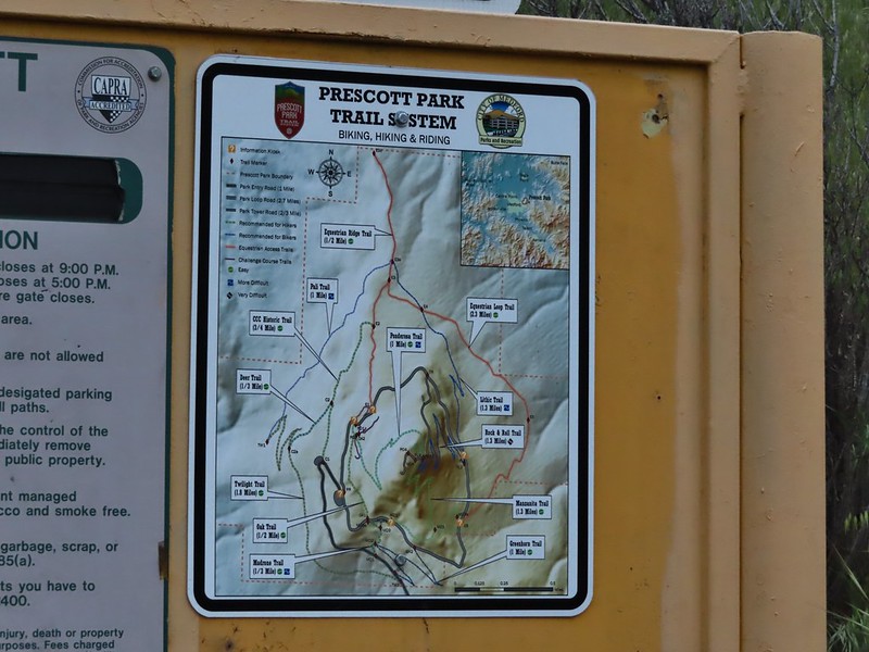
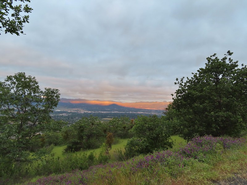 Roxy Ann’s shadow being cast over Medford.
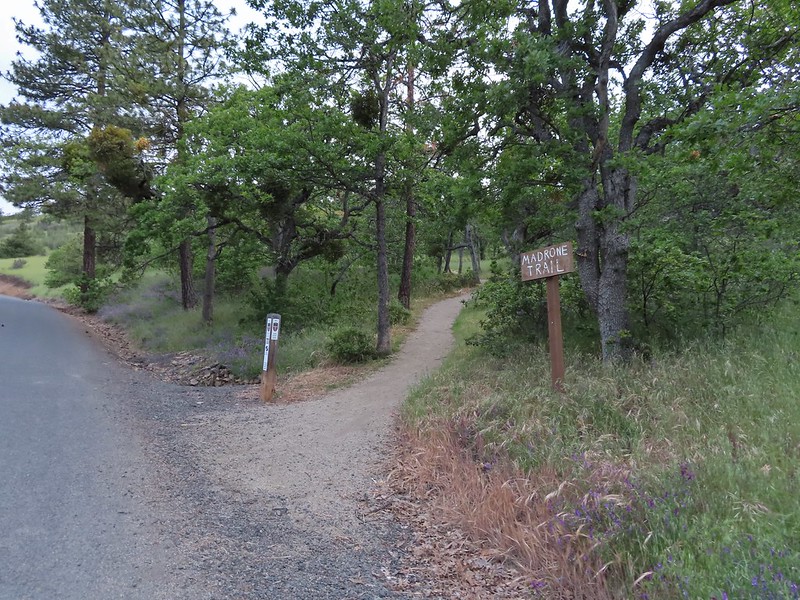
 Lots of purple vetch along the trails.
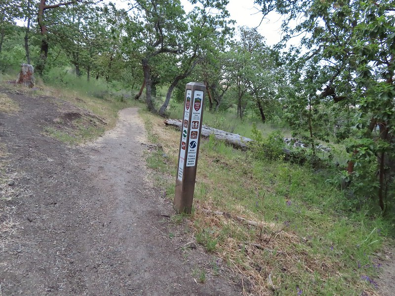 One of the posts used to identify trails.
 Madrones along the Madrone Trail.
 We turned left following the pointer for the Oak Trail.
 Juvenile great horned owl along the Oak Trail. We didn’t get a good look at the second owl to the left but it looked to be an adult.
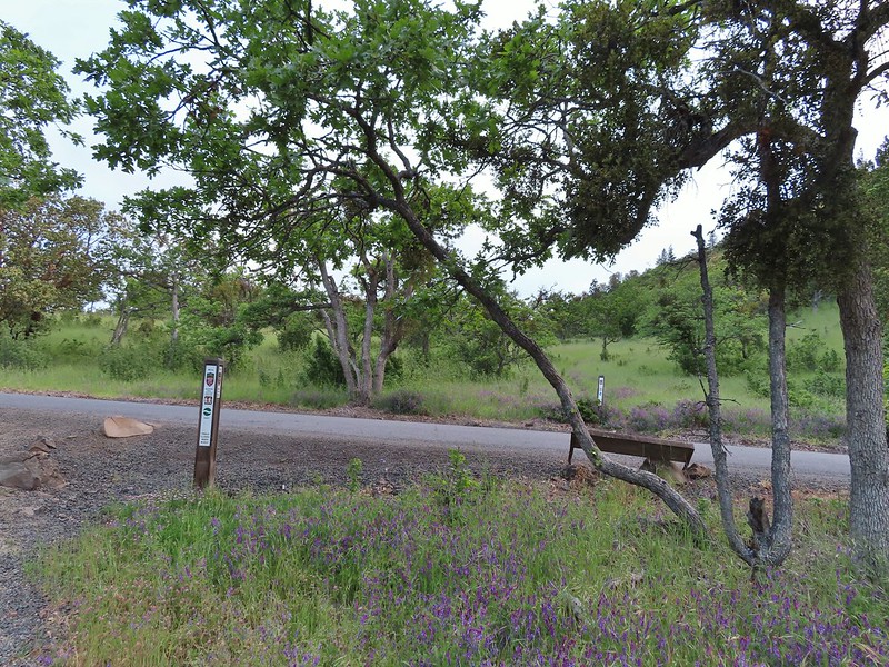 This segment of the Madrone Trail (MD3) ended at Roxy Ann Road with the Oak Trail picking up on the far side.
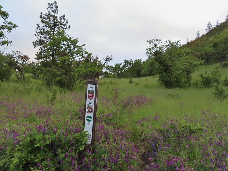 The Oak Trail
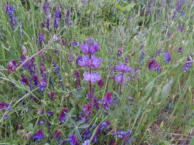 Lupine amid the vetch
 Camas in front of poison oak.
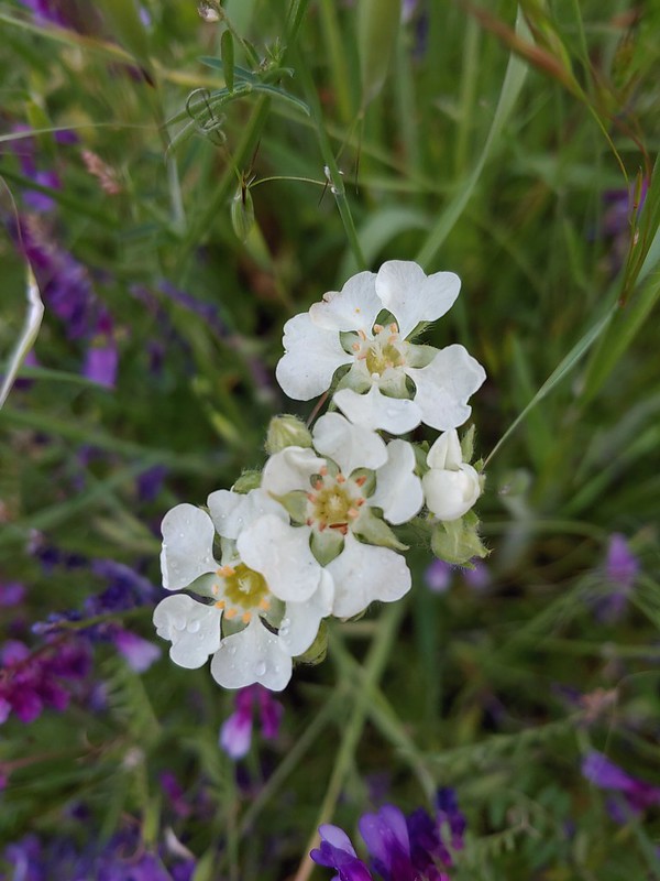 Carrotleaf horkelia
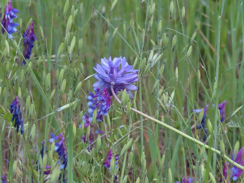 ookow
ookow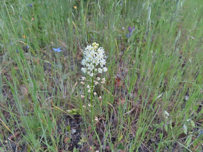 Death camas
 Blue-eyed grass
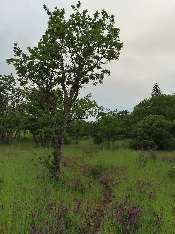 Oak along the Oak Trail.
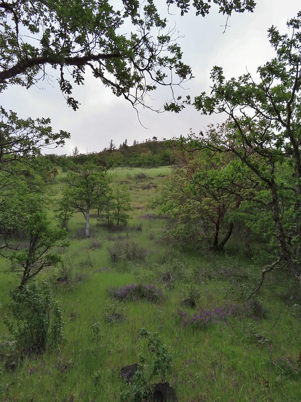 Roxy Ann Peak
 Blow wives
 The Oak Trail appeared to be the least used of all the trails we would hike on this day.
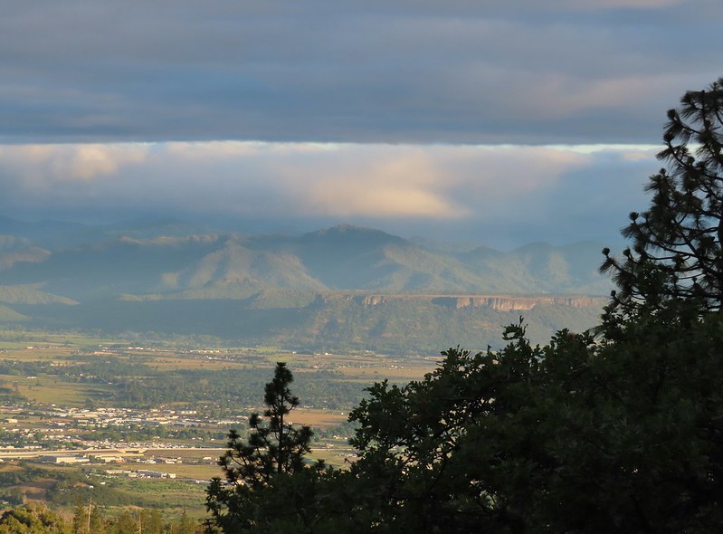 Lower Table Rock (post)
 The only post we saw that wasn’t helpful.
 Challenge Course just off the Oak Trail.
 Parts of the Challenge Course
 Trail junction near the Challenge Course with the Oak and Ponderosa Trails.
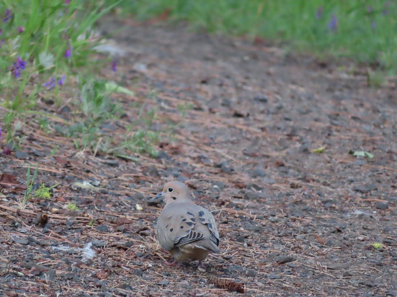 Dove
Dove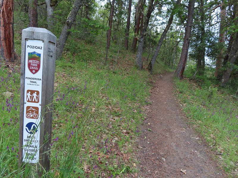 Hopping onto the Ponderosa Trail.
 Mariposa lily
 Lazuli bunting. We saw quite a few of these during our trip but they proved to be very difficult to photograph.
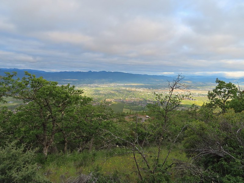 Medford from the Ponderosa Trail.
 Paintbrush
 Madia
Madia Lower Table Rock again.
 A bench and Ponderosa pines along the Ponderosa Trail.
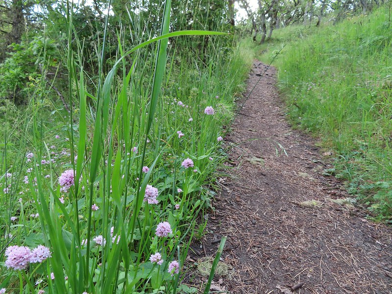 Plectritis
 Two more deer above the trail.
 Deer and balsamroot.
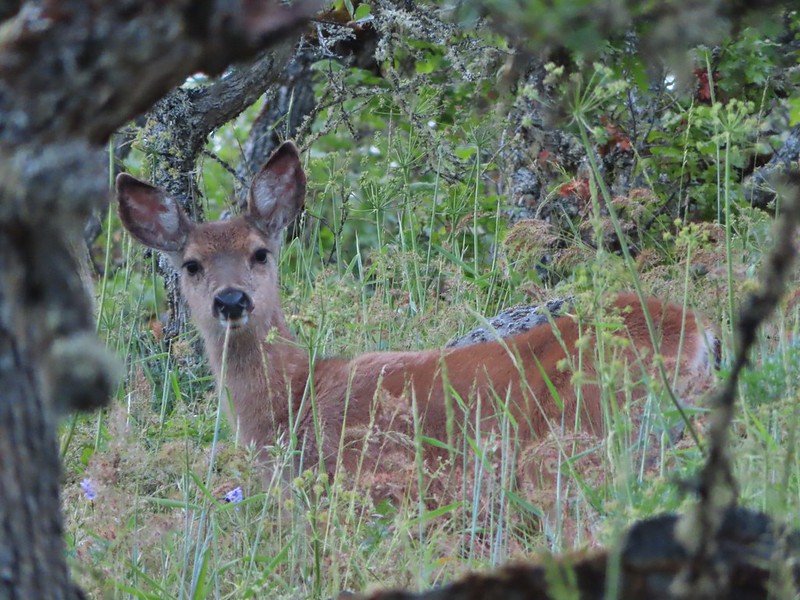 Young deer
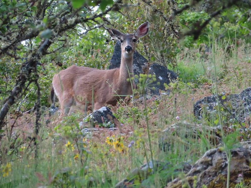 Momma deer
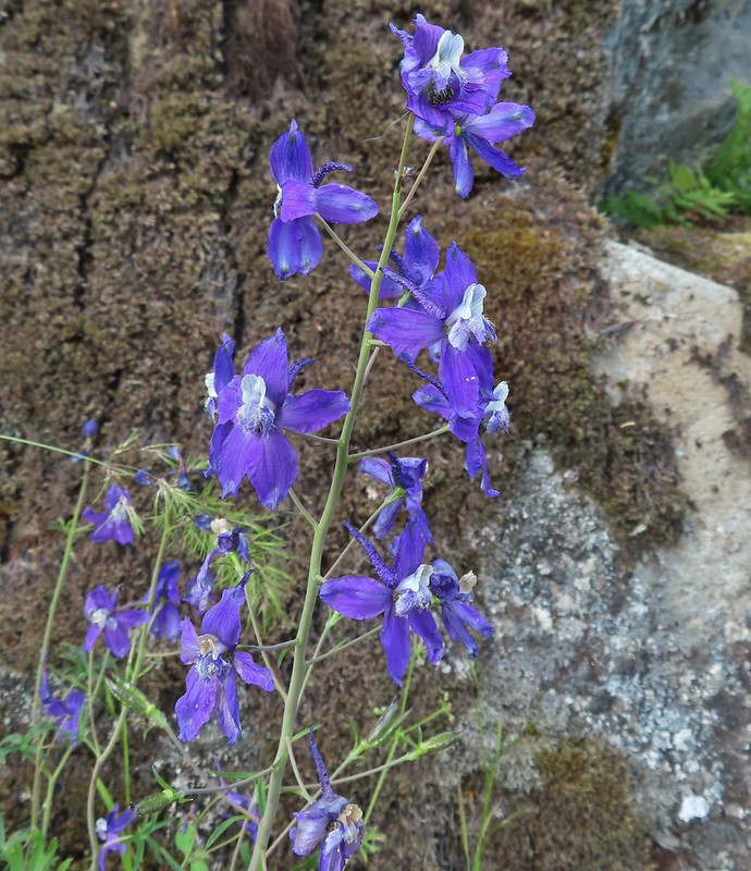 Larkspur
 Nearing Park Tower Road.
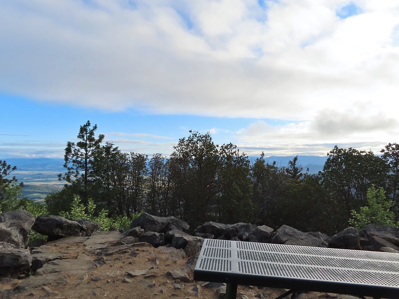

 Serenading lazuli bunting.
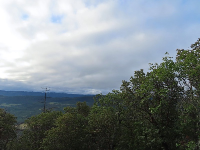 A lot darker clouds toward the Cascades.
 Sign for the Manzanita Trail
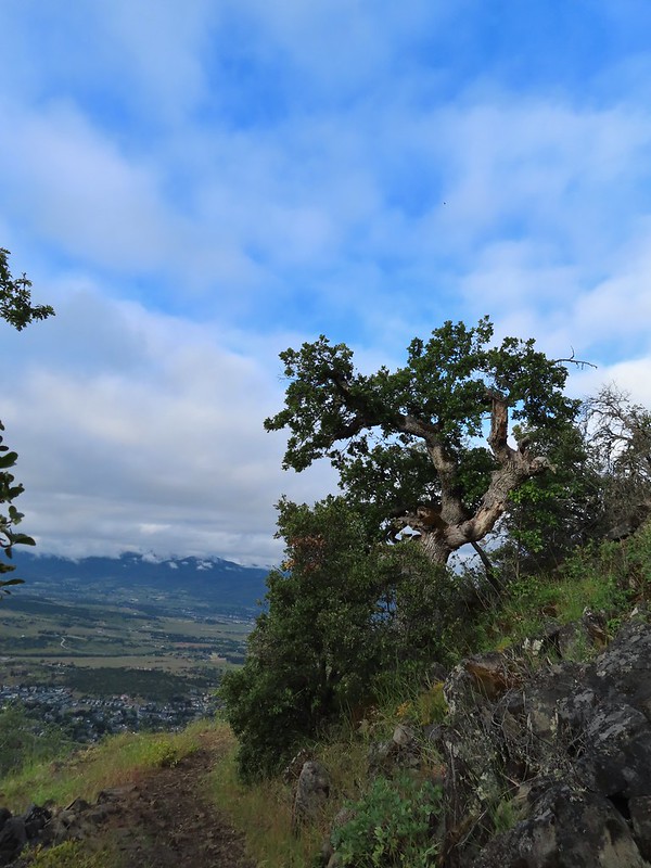
 The lower flank of Grizzly Peak (post) to the left. Mt. Ashland (post) is hiding behind the clouds almost straight ahead.
 Looking NE from the trail, still a lot of clouds.
 Another bunting, we were on a roll.
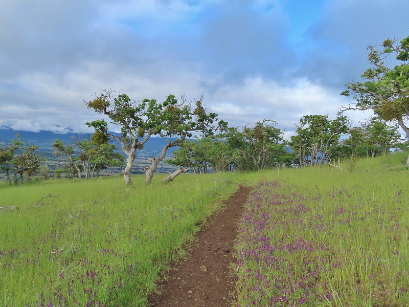
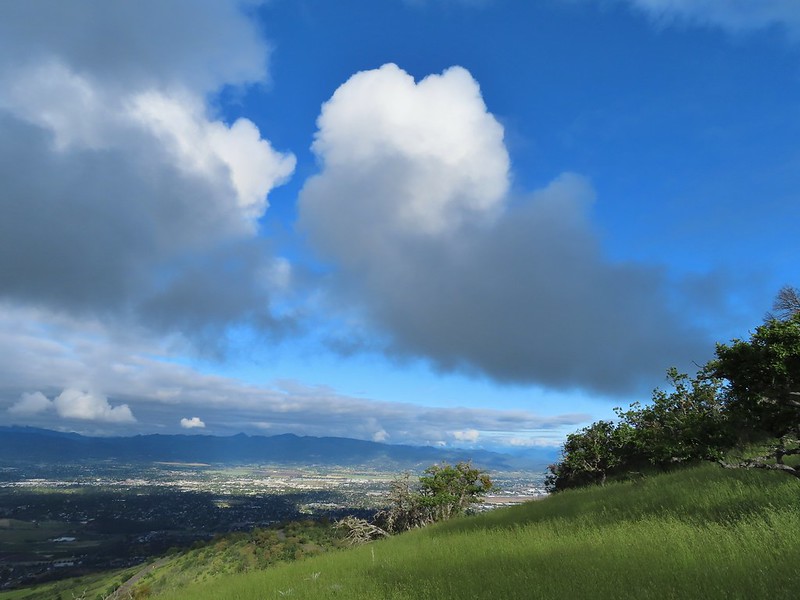 The clouds were really starting to break up as we descended.
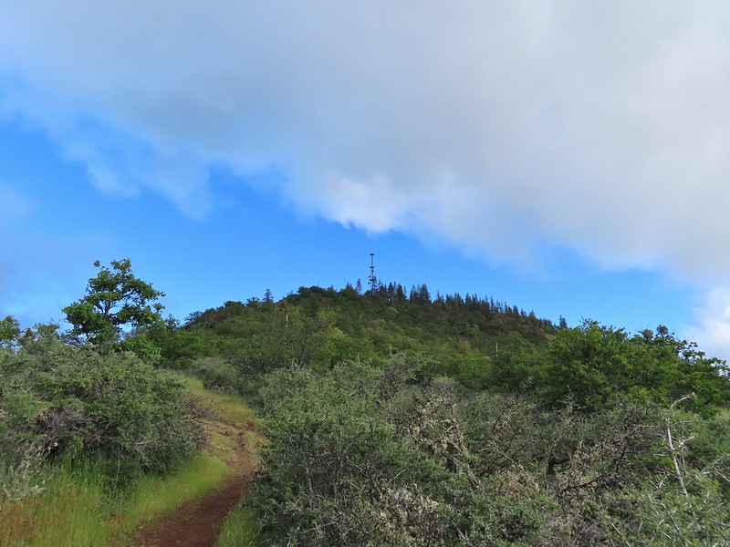
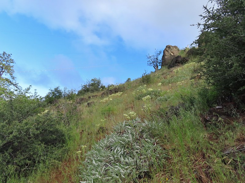 Arrow-leaf buckwheat on the hillside.
 Roxy Ann Road
 Back on the Madrone Trail.
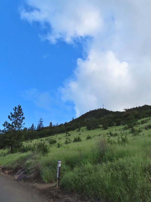 Back on the road walk. The trail post here is for the Greenhorn Trail.
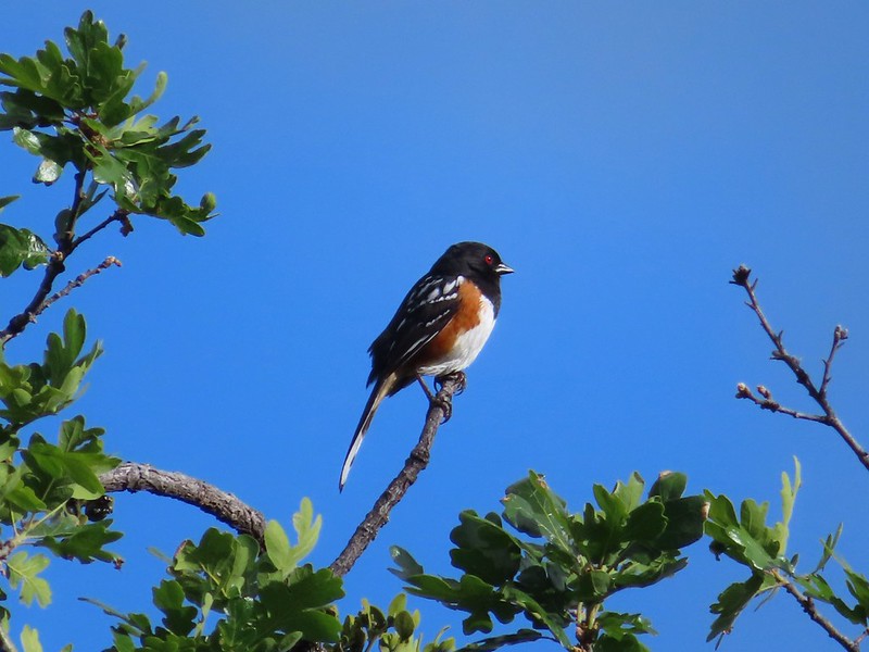 Spotted towhee.
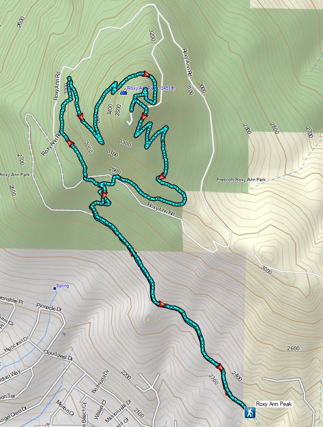


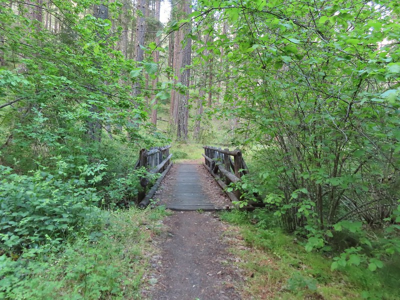
 Walk in campsite at French Gulch.
 French Gulch
 Hooker’s Indian Pink
 White lupine
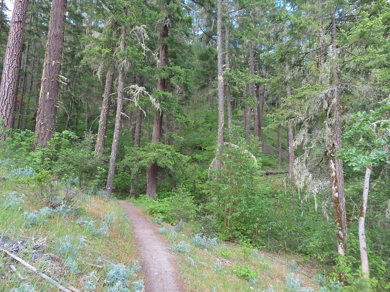
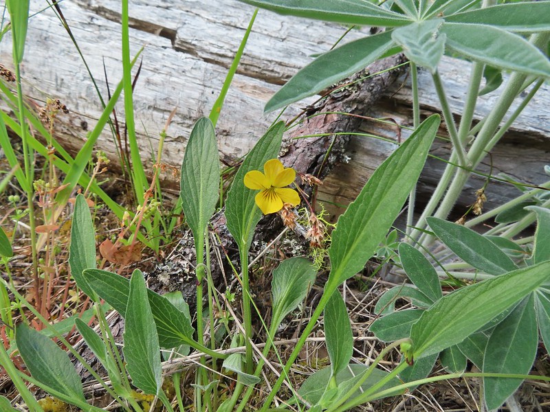 Violet
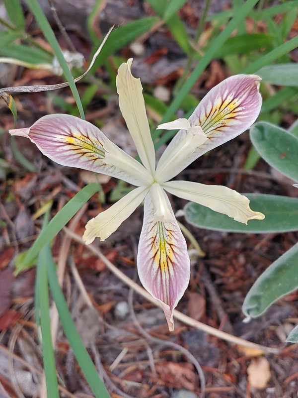 Iris
Iris Pretty face
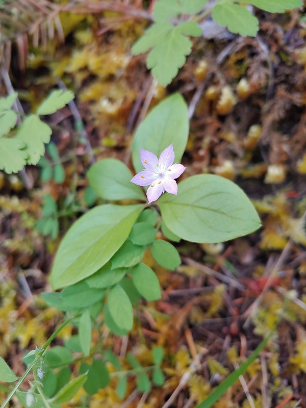 Starflower
 Columbine
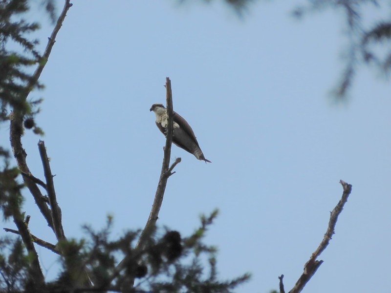 Osprey
 Ground cone
 Madrones near the the 5-way junction.
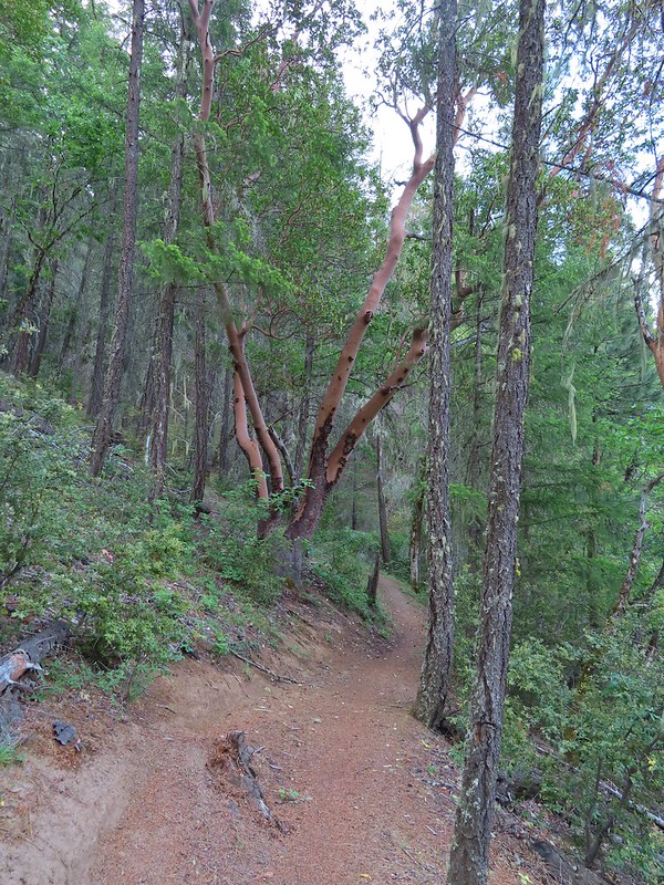
 The side trail to the right.

 Collings Mountain

 Penstemon
 Stricklin Butte in the distance.


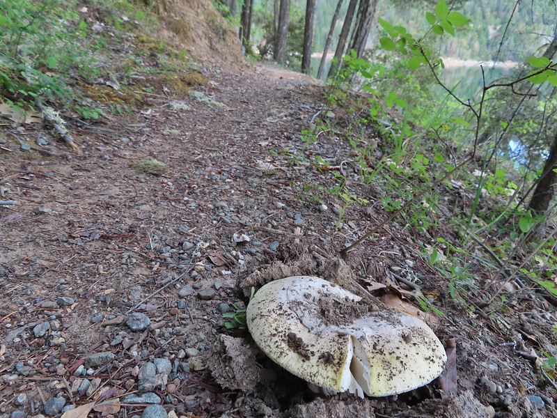 We didn’t see many mushrooms on the trip but this one was good sized.
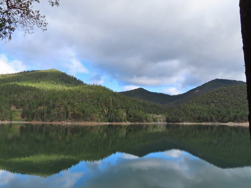 Collings Mountain on the left.
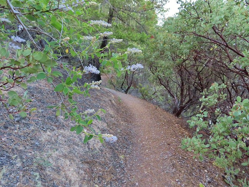 Deer brush and manzanita along the trail.
 Marble
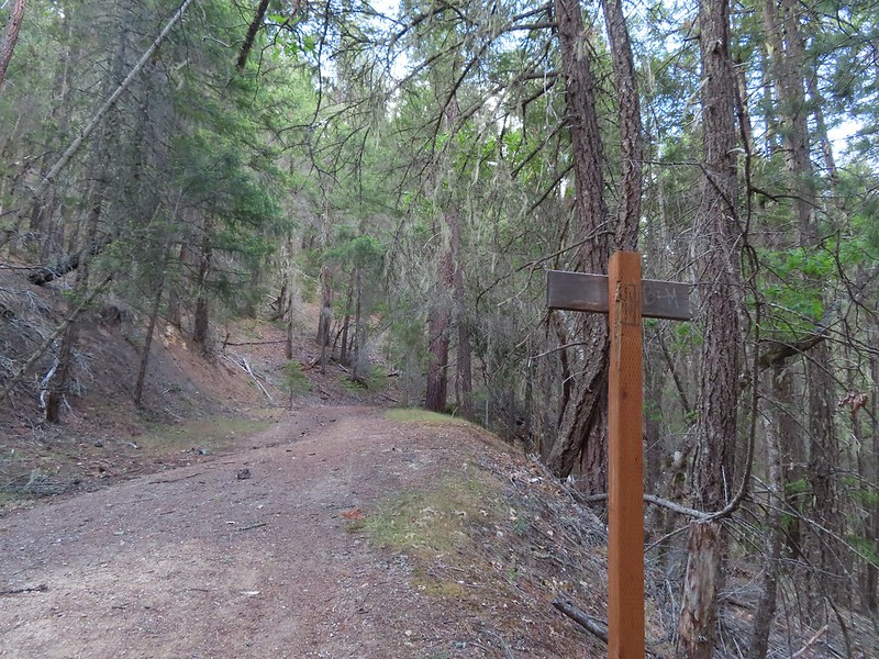 Rejoining the roadbed.
 Oregon sunshine
 Kellog’s monkeyflower
 heart-leaf milkweed
 Blue gilia
 Ookow
Ookow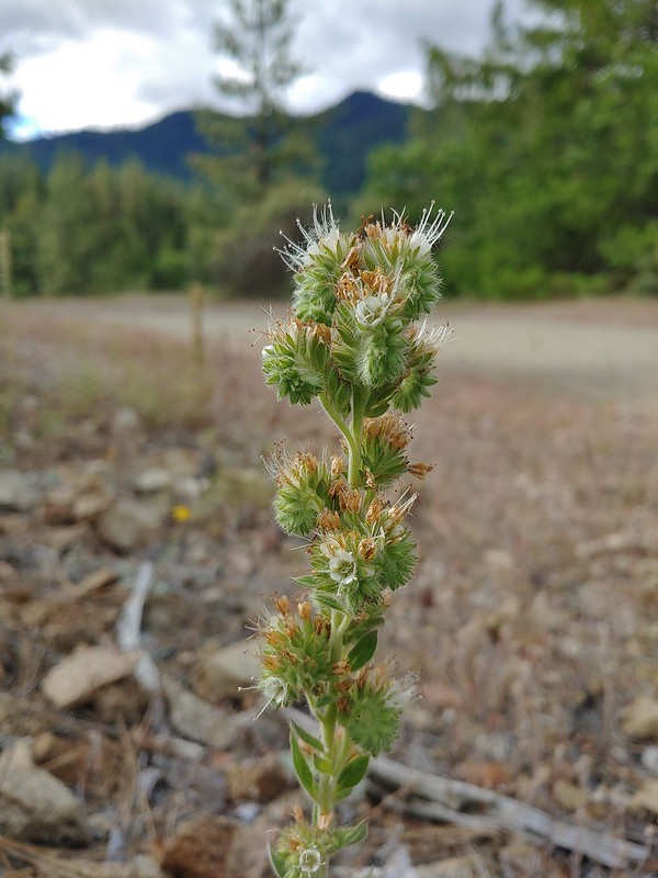 Silverleaf phacelia
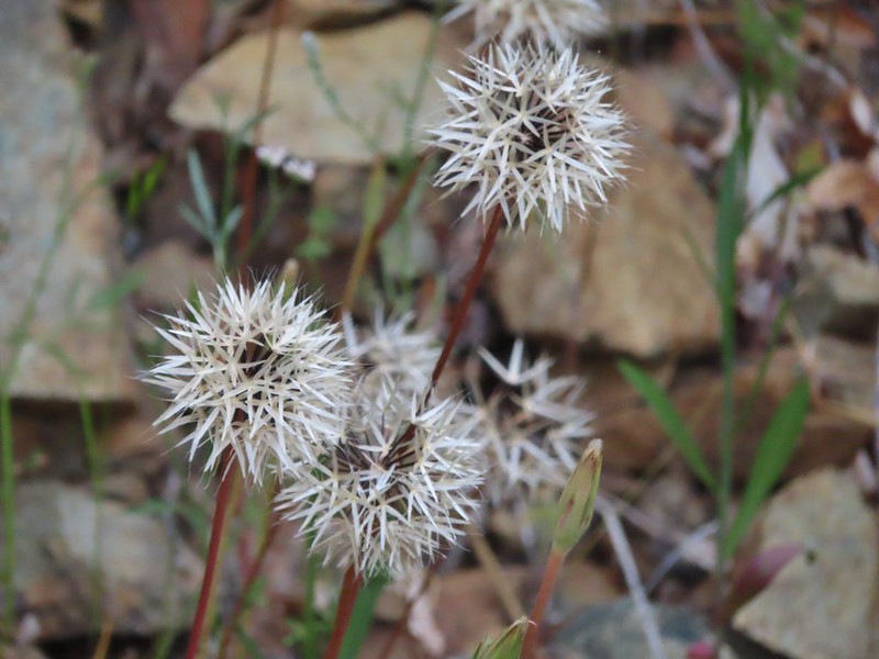 Blow wives?
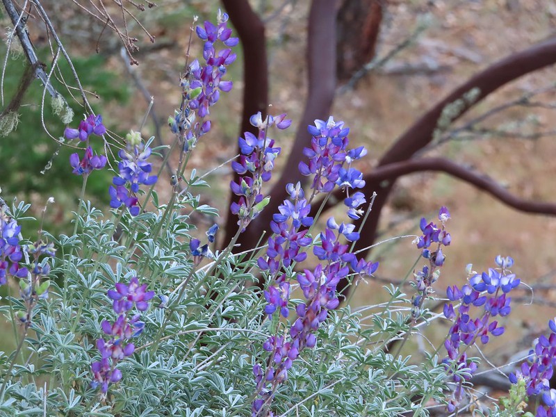 Lupine
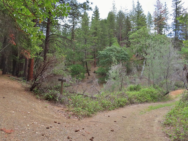 Payette Trail to the left.
 The road vanishing into the lake.
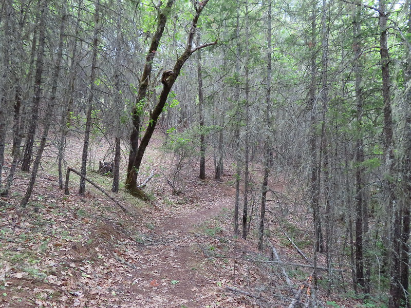 Back on the Payette Trail.
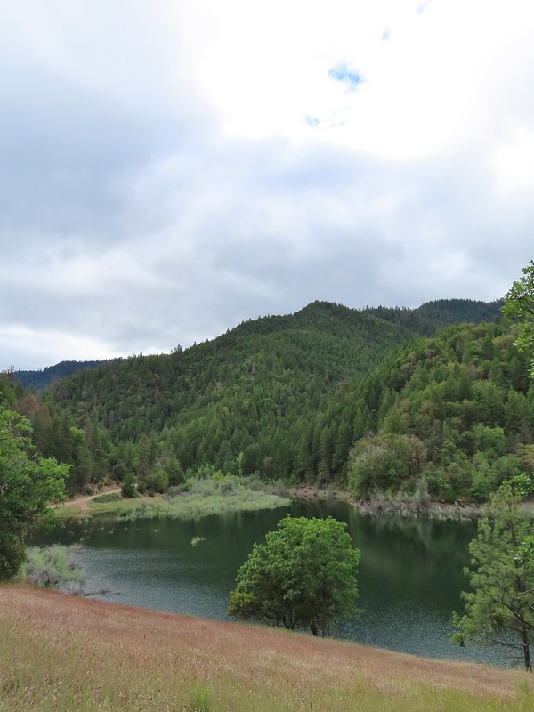
 Mallards
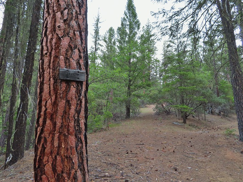
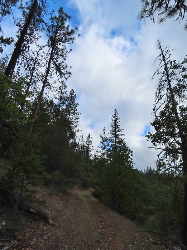
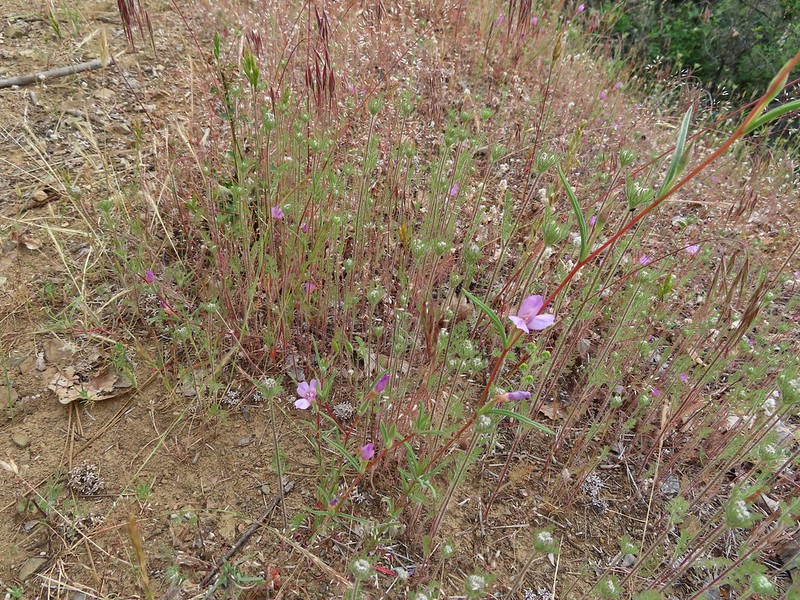 Clarkia
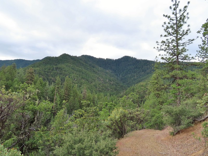 Looking back down the road.
 Mariposa lily
 This obvious trail split off from the road to the left. We’re not sure if it would have led us to the Osprey Trail possibly by old cabin ruins that are in the area or if it would have gotten us nowhere so we stuck to the road.
 The roadbed petered out a short distance from FR 1075 leaving a short cross-country scramble up to a pullout along the road where a section of barbed wire fence had been broken by what appeared to be an off-road vehicle of some sort based on tire tracks down the slope.
 Signboard at the pullout.
 Unintended road walk.
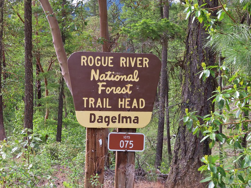
 The Dagelma Trailhead
 These chutes prevent equestrian and motorized users from passing through but also tend to attract poison oak.
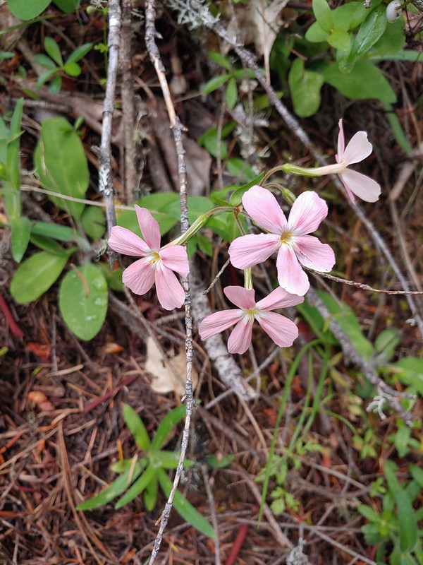 Northern phlox
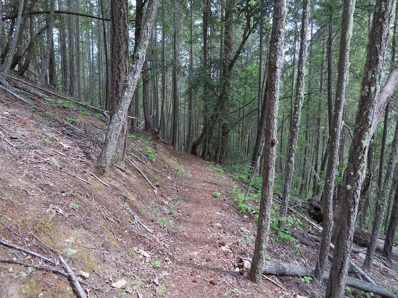
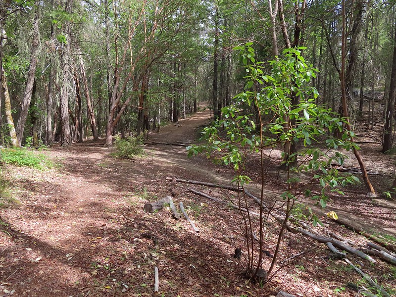 The 5-way junction.
 Junco
Junco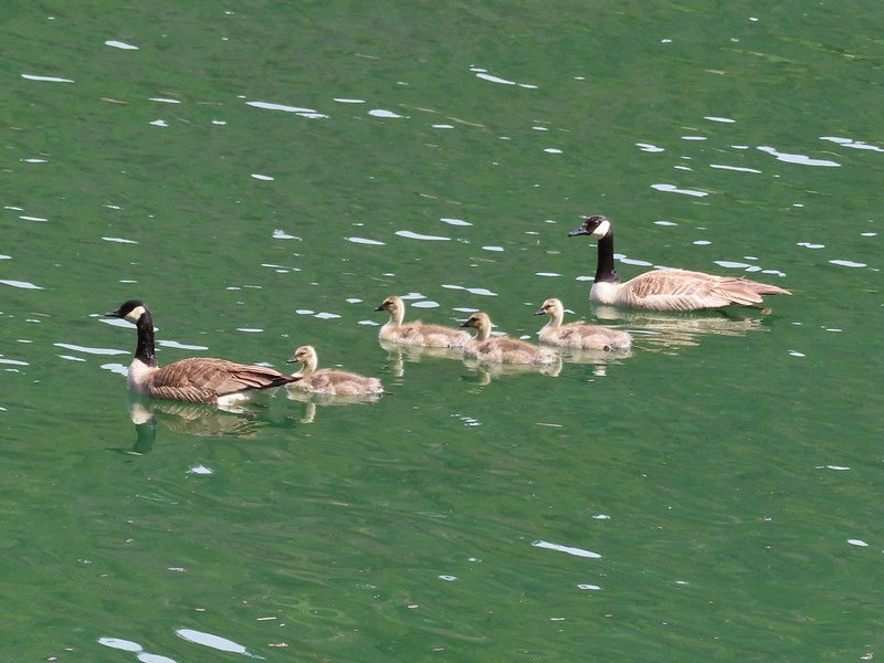 Canada geese in French Gulch.
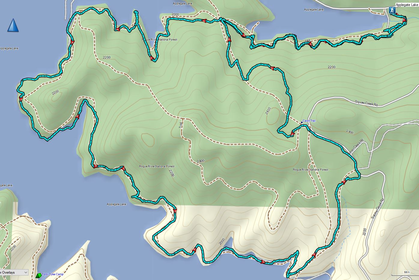


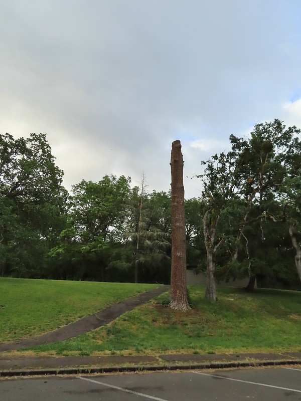
 Acorns in some of the holes.
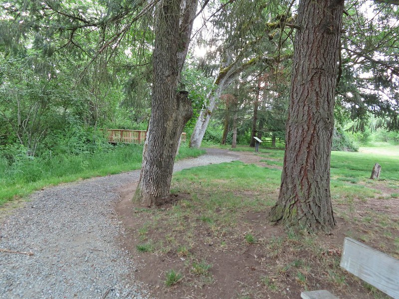 On the nature trail.
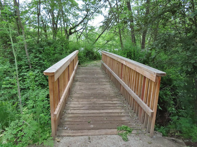 The bridge
 Camas
Camas Ash-throated flycatcher
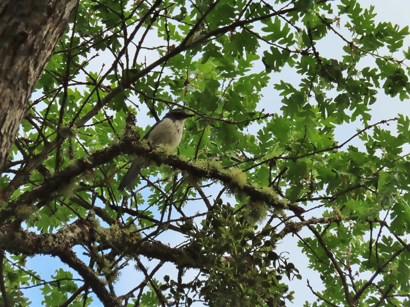 Srub jay
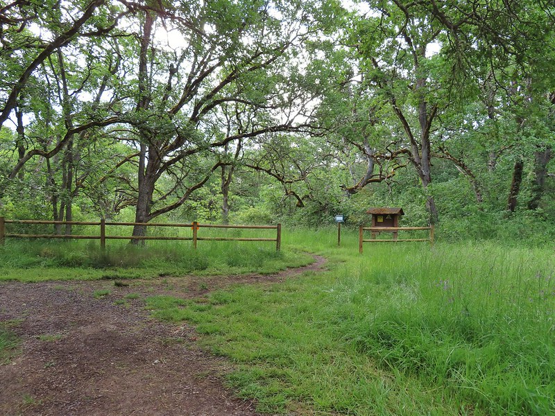
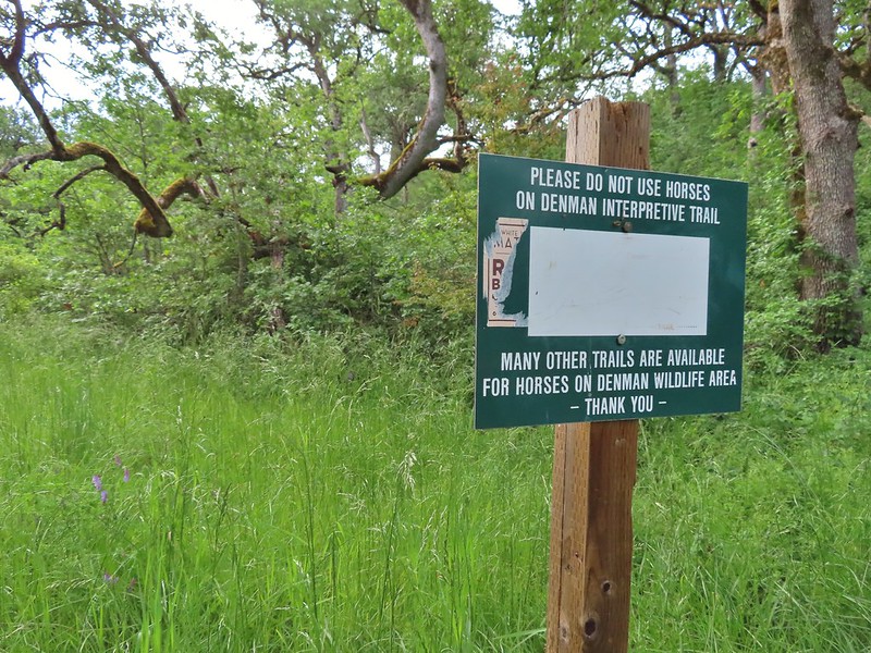
 Acorn woodpecker
 Death camas and vetch
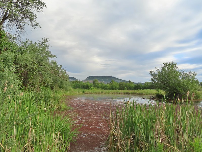 A second pond with Upper Table Rock (post) behind.
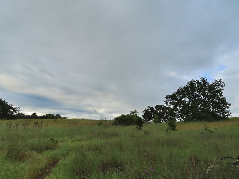
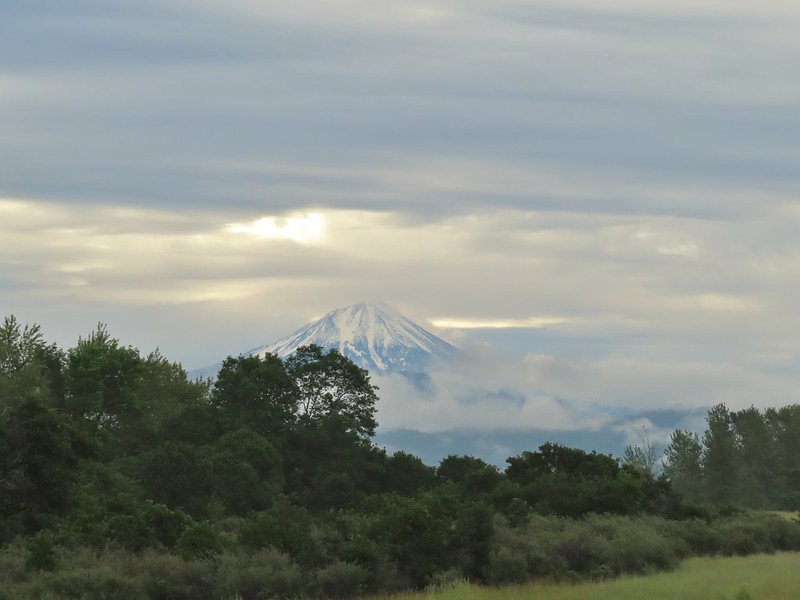 Mt. McLoughlin
 Common madia with Lower Table Rock (
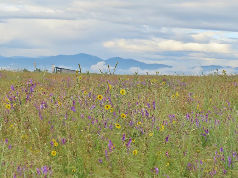 Wildflowers near the bench.
 Upper Table Rock
 The viewpoint bench.
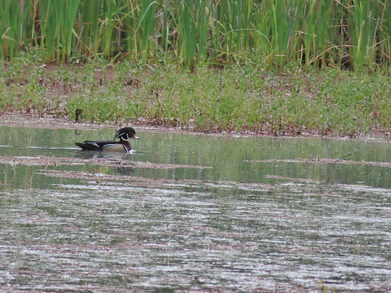 Wood duck
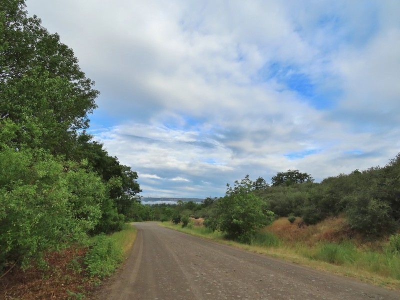
 Denman Trail at TouVille Road.
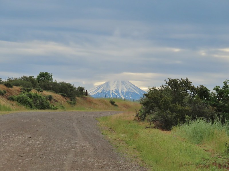 Mt. McLoughlin
 Upper Table Rock from TouVille Road.
 A swallow on a fence post with Mt. McLoughlin behind.
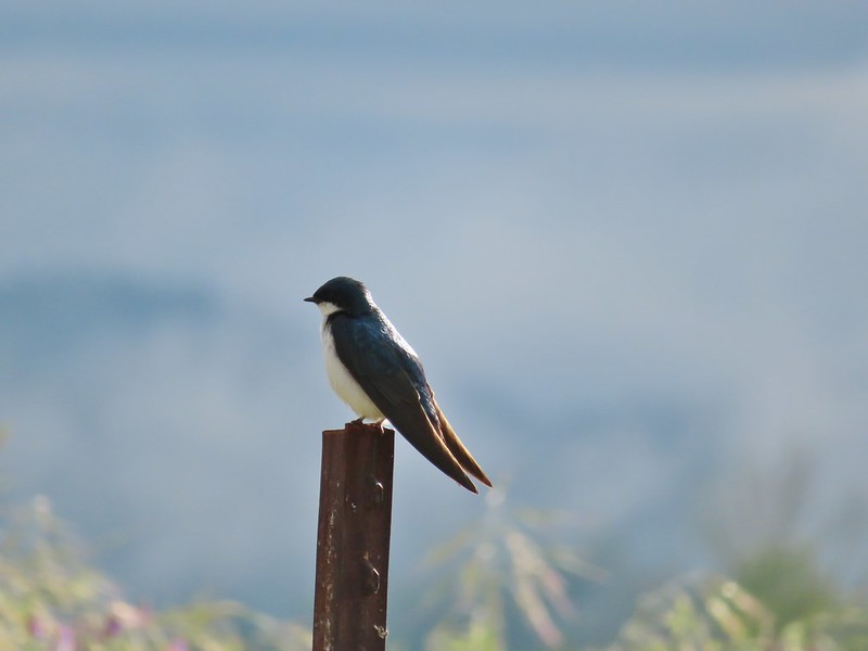 Swallow
 Yet another pond along Military Slough.
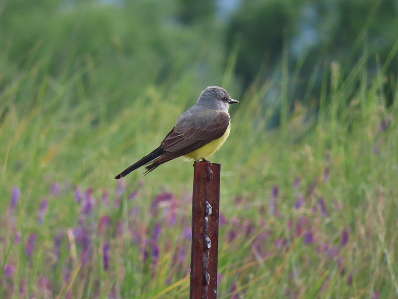 A kingbird, most likely western.
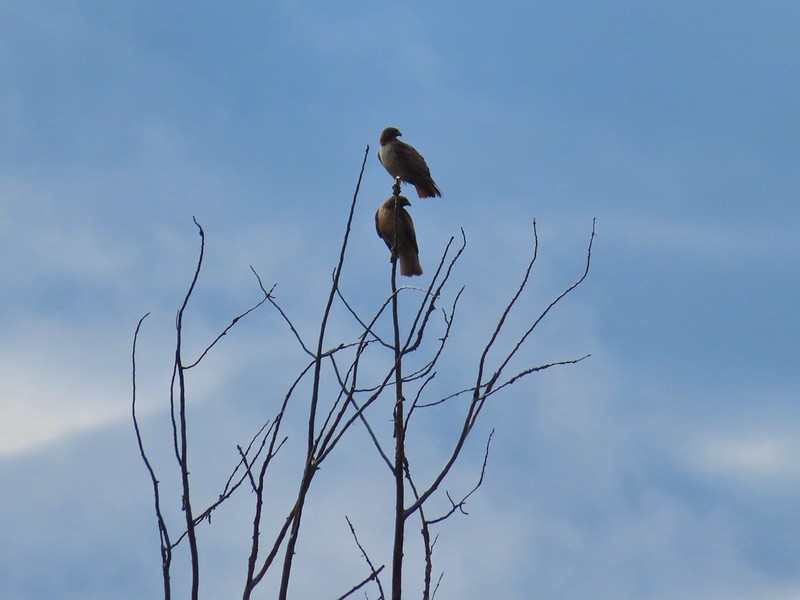 A pair of hawks near the pond.

 I I believe this is a paintbrush, possibly Castilleja tenuis – hairy Indian paintbrush.
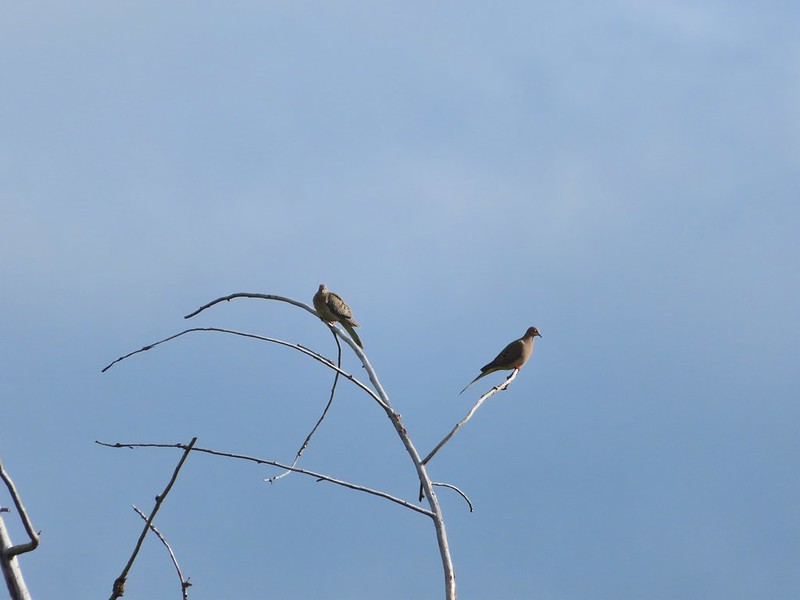 Mourning doves
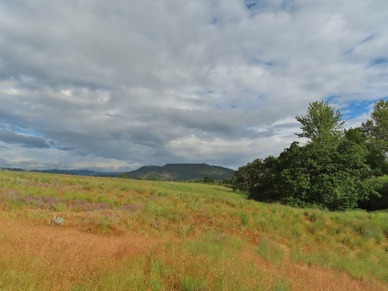 Looking back at Upper Table Rock with the stream bed in the trees/brush to the right.
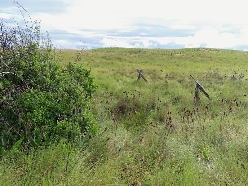
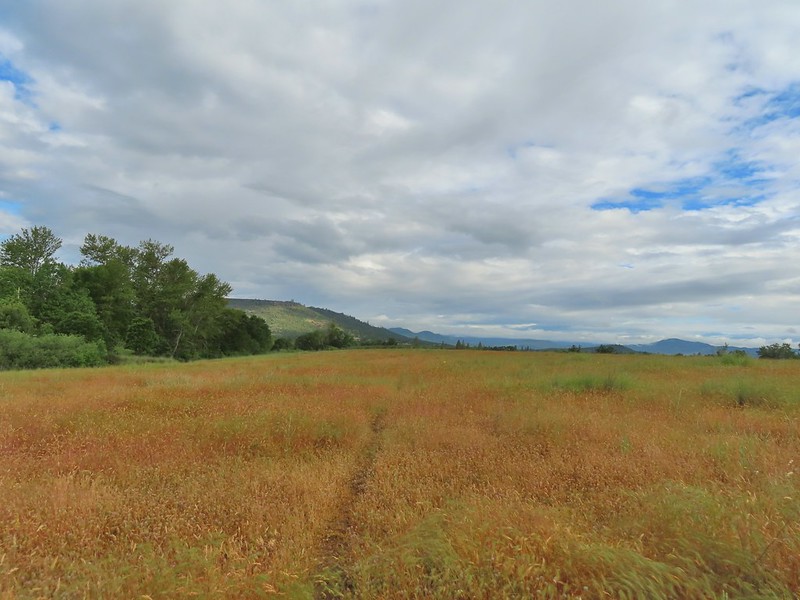
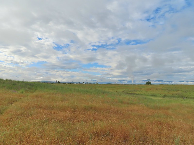 Mt. Ashland (
 Mt. Ashland
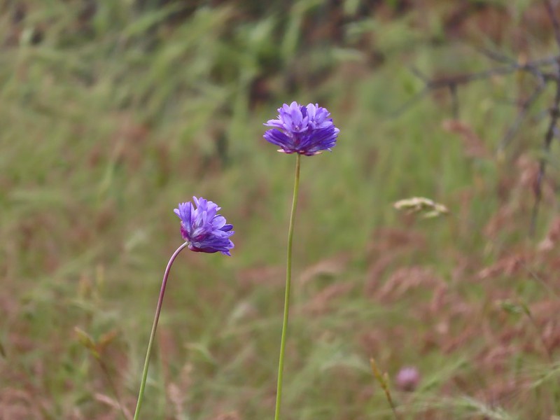 Ookow
Ookow
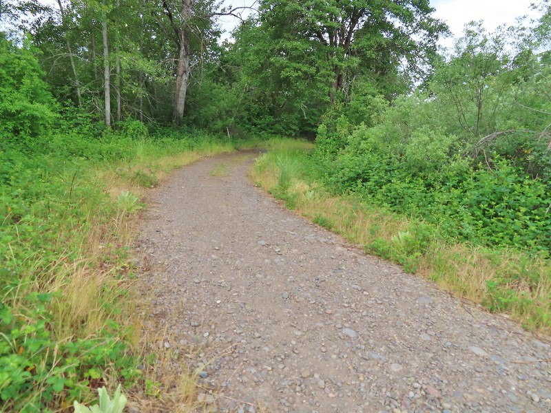
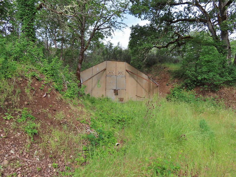 Bunker 6
 Jack rabbit
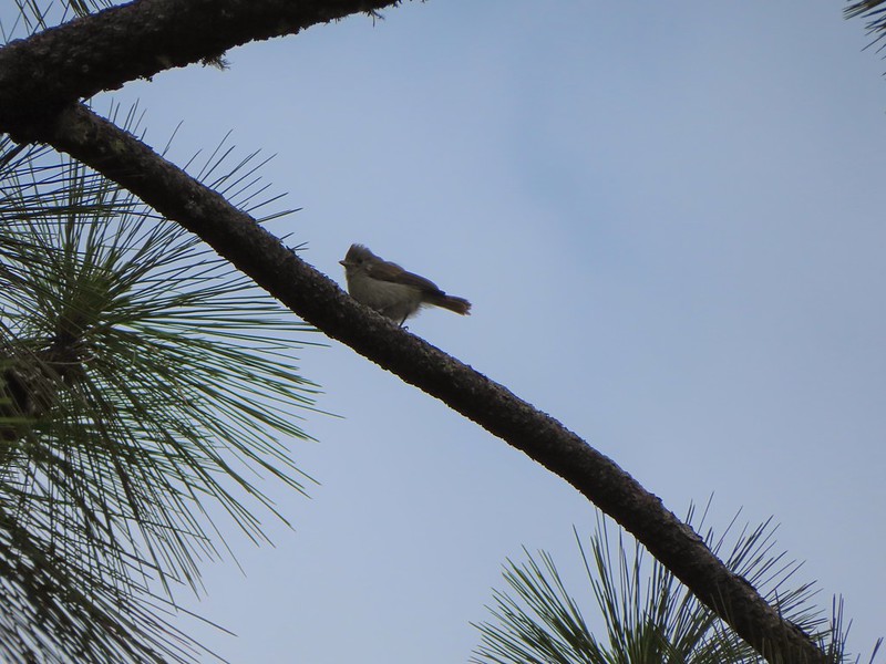 Unsure what type of bird this is.
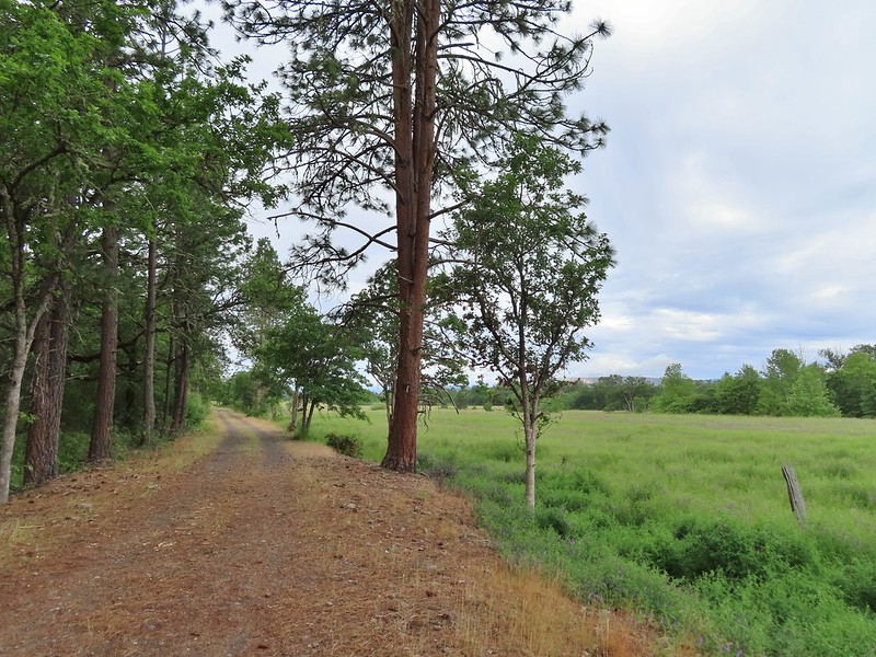
 Trailhead just off TouVille Road.
 The fork where we went left.
 Passing another bunker.
 Lupine
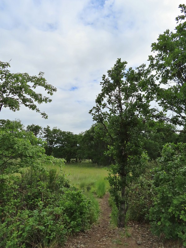
 White tritellia
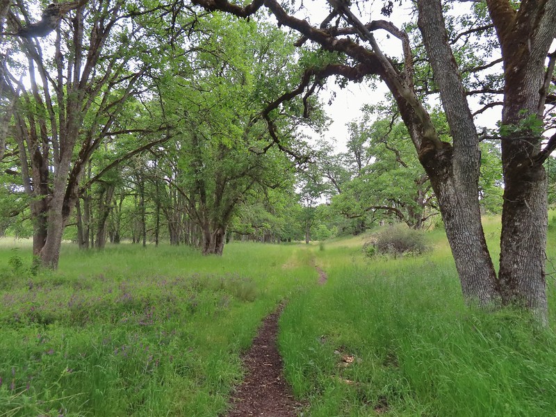
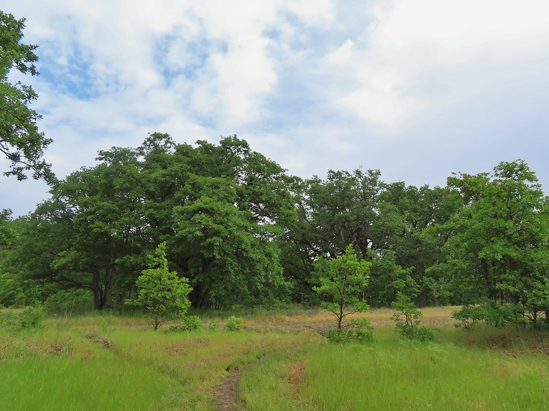

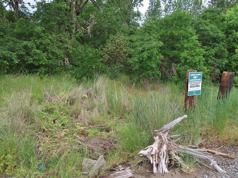
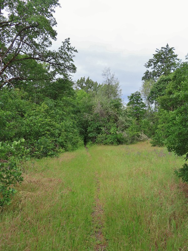 Occasional open areas were followed by thick brush with poison oak hidden among the other vegetation.
 This section at least had hoof prints.
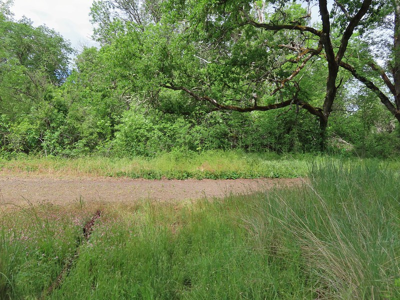
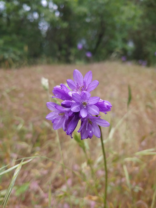 More ookow
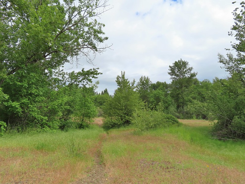 Headed down to the creek.
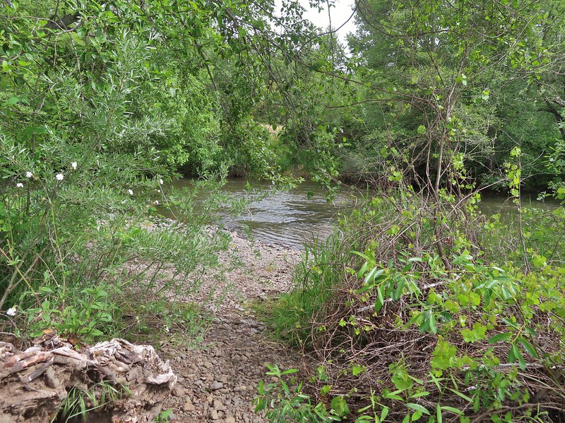
 Little Butte Creek
 Bachelor button near the creek.
 Another bachelor button

 Nookta rose surrounded by poison oak.
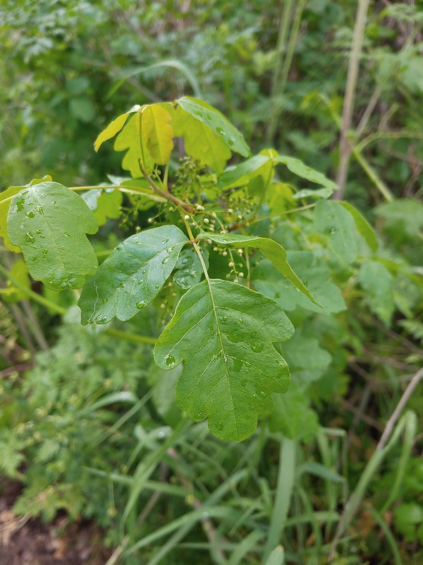 Don’t touch!
 Maiden fly
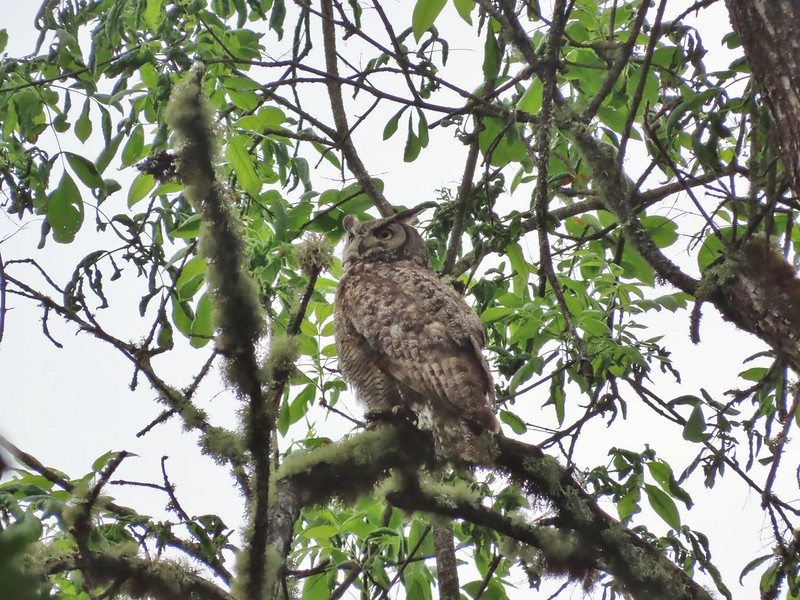
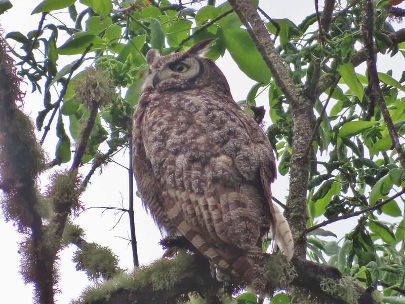
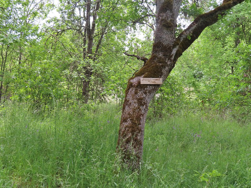 Sign for a Paddle Wheel Trail which we couldn’t really see in the grass.
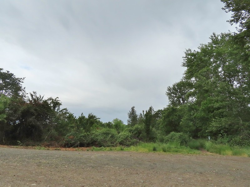 TouVille Road
 Bench near the confluence of Little Butte Creek and the Rogue River.
 Rogue River on the left and Little Butte Creek on the right.
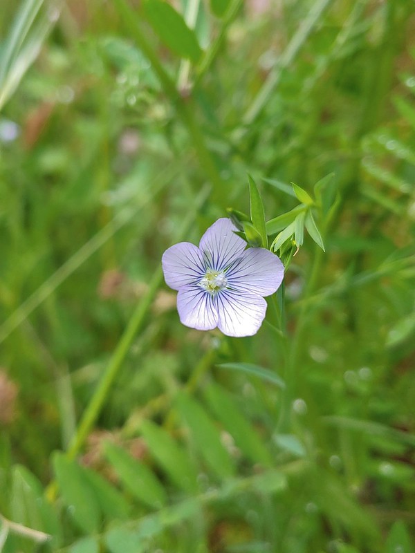 Pale flax
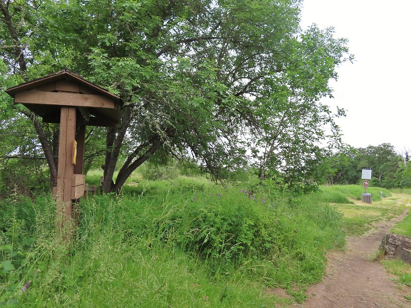 Exiting the Denman Wildlife Area.
 The Rogue River along the TouVille Interpretive Nature Trial.
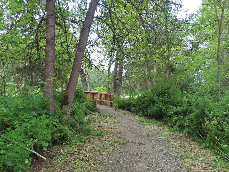 Back to the bridge near the parking area.

 The target shooting area and the OHV track coming down the ridge.
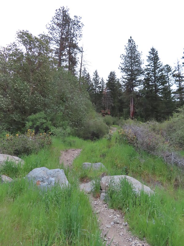 The track going up the ridge between the two roads. We briefly wondered if this had been the BLM’s work to bypass the road walk in between this trailhead and the Greenstone Trailhead but decided it likely wasn’t (good call).
 The “hidden” trailhead sign.
 Despite the empty shell casings and garbage left by the shooters there were some nice flowers along the road.
 Valerian
 Bleeding heart
 The Greenstone Trailhead
 People suck
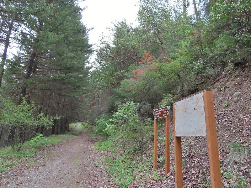 Nicer signs on the other side of the berm.

 Can you spot the insect?
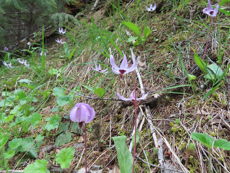
 Trillium
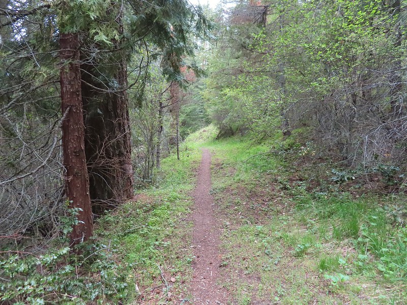

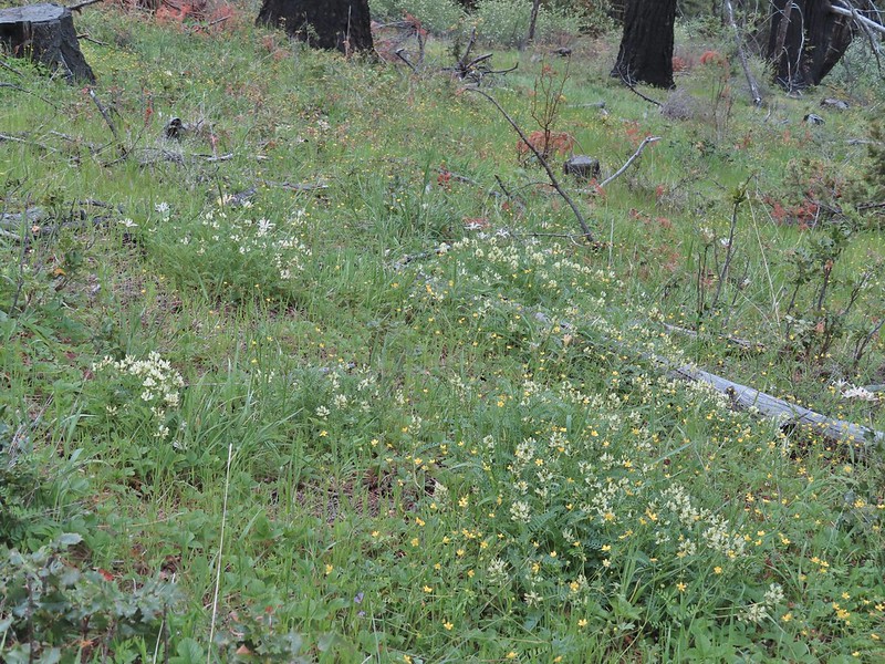
 Milkvetch
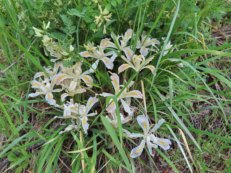 Iris
Iris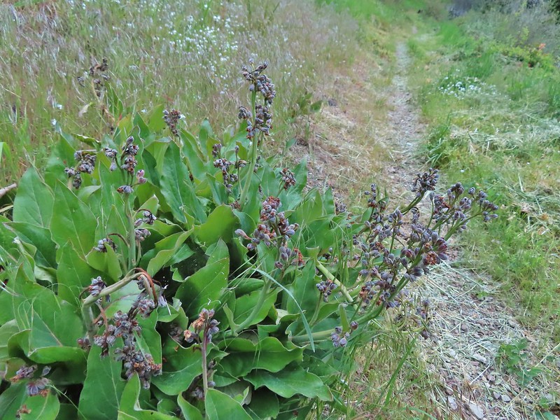 Pacific houndstongue
 We managed to spot a few of the bloodsuckers before they grabbed my pants but we also had to flick 6-8 of the little buggers off.
 Charred tree trunks along the trail.
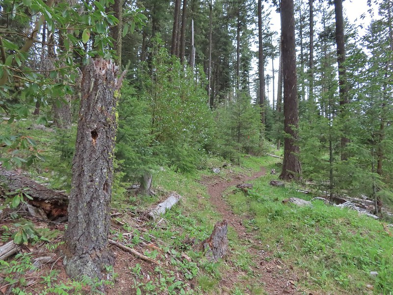
 Snow queen
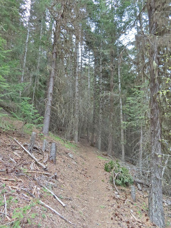 No signs of fire here.

 The Jack-Ash Trail continuing south.
 The trail heading west.
 Balsamroot
 Phlox
Phlox


 Scarlet fritillary – Fritillaria recurva
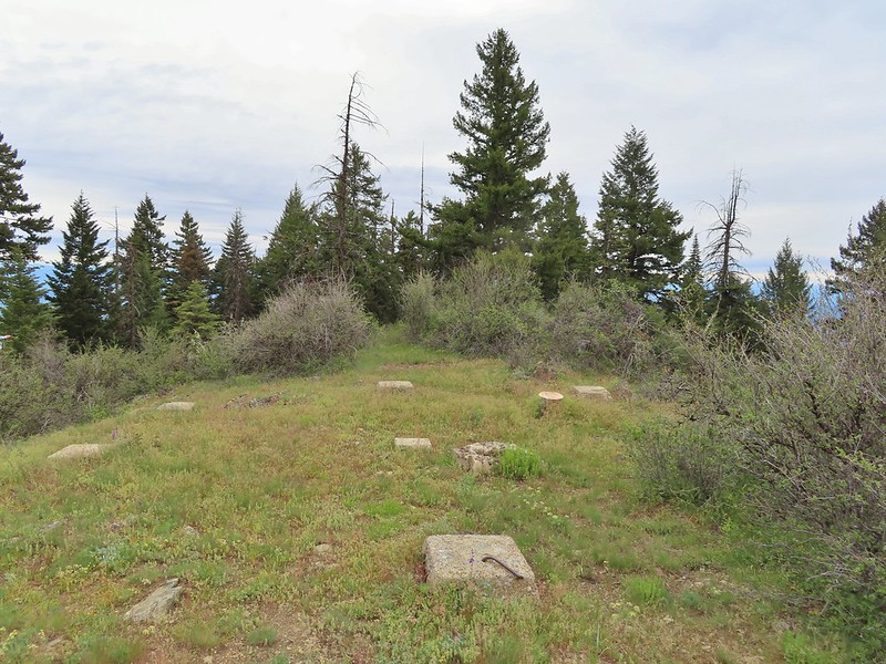

 Parsley, larkspur, prairie stars and blue-eyed Mary.
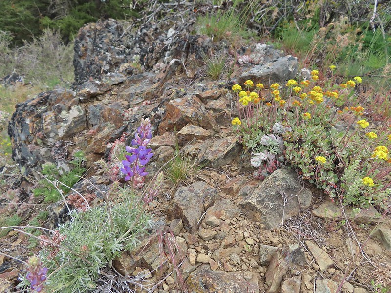 Lupine and buckwheat
 Mt. McLoughlin (
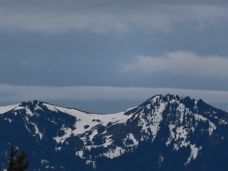 Zoomed shot of Dutchman Peak
 Zoomed shot of Red Buttes
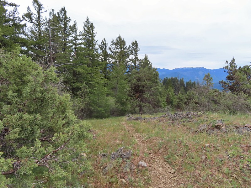
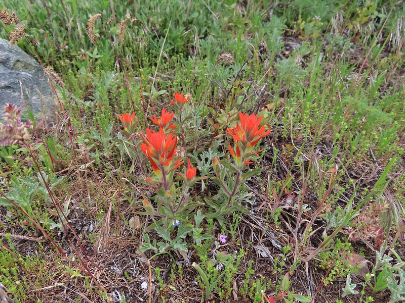 Paintbrush, blue-eyed Mary, and redstem storksbill
 A stonecrop
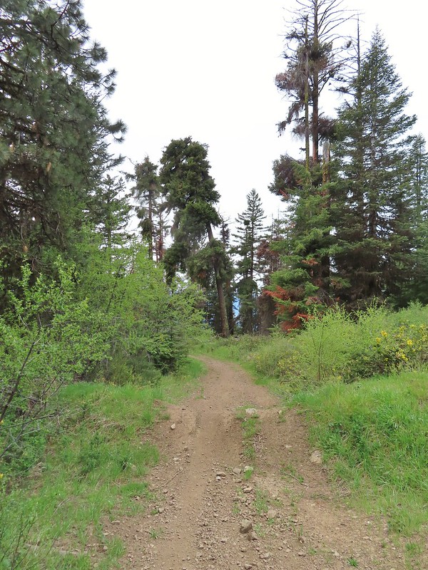
 Where we left the roadbed.
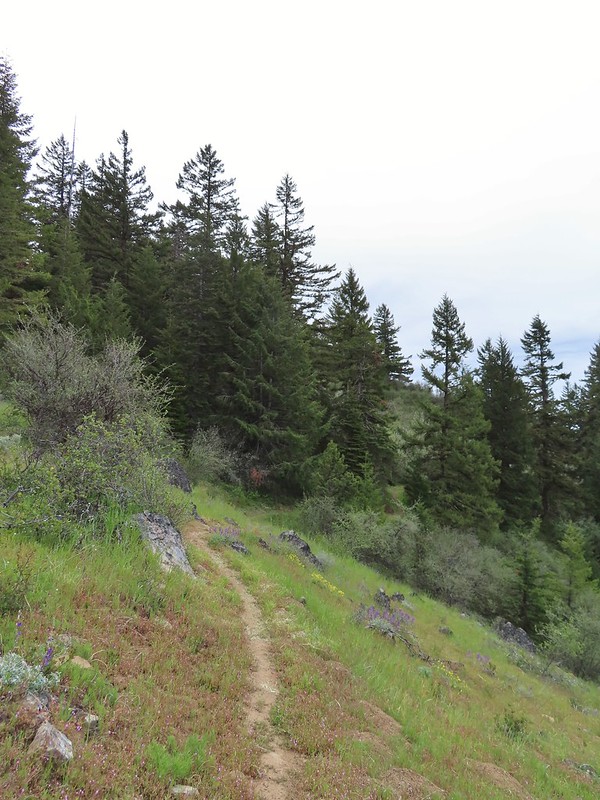 Back on the Jack-Ash.
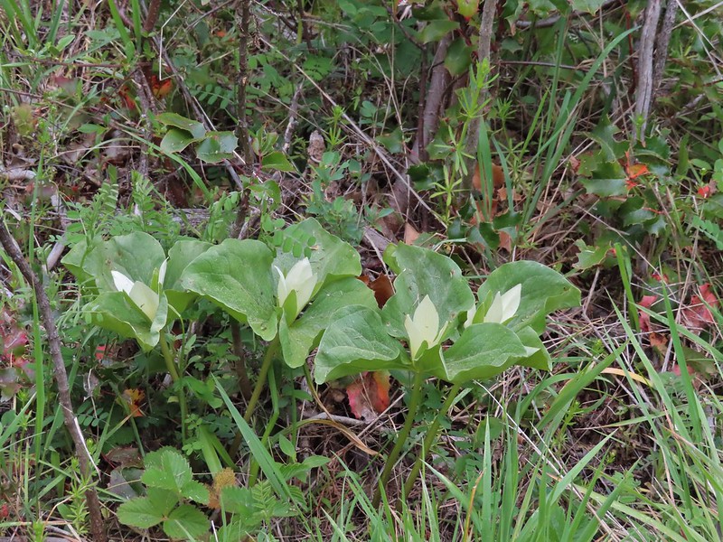 Giant white wakerobbin
 Paintbrush and waterleaf
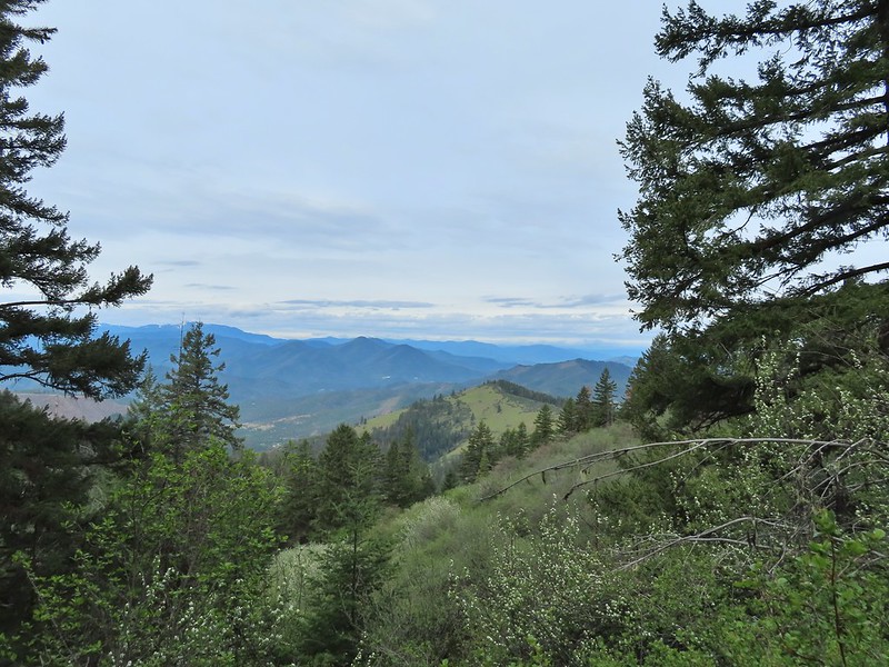 Grayback Mountain to the left with snow.
 The OHV trail crossing the Jack-Ash Trail.
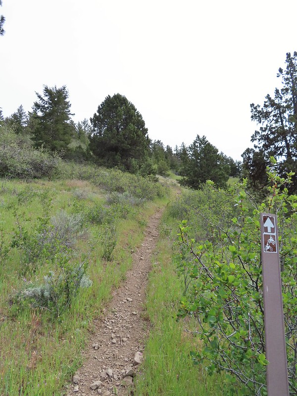 The OHV trail coming down from the road.
 Lupine
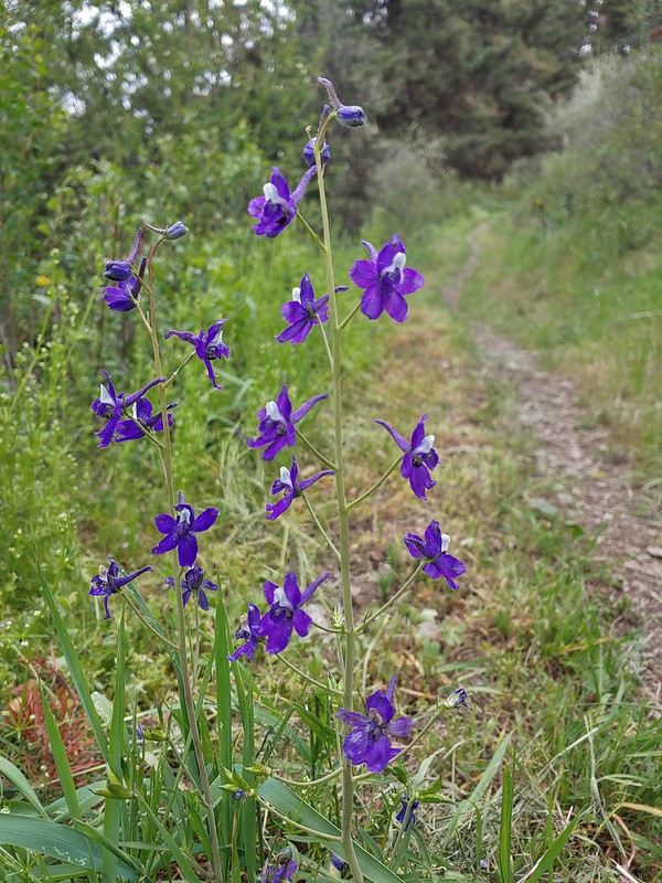 Larkspur
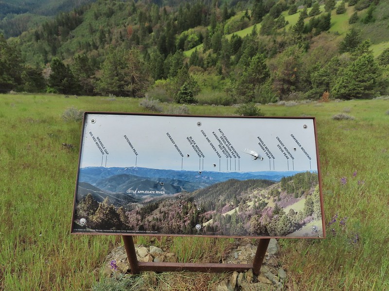 Always appreciate a good mountain locator.
 Mariposa lily
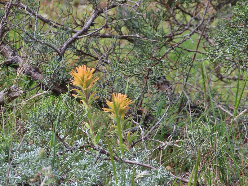 Paintbrush
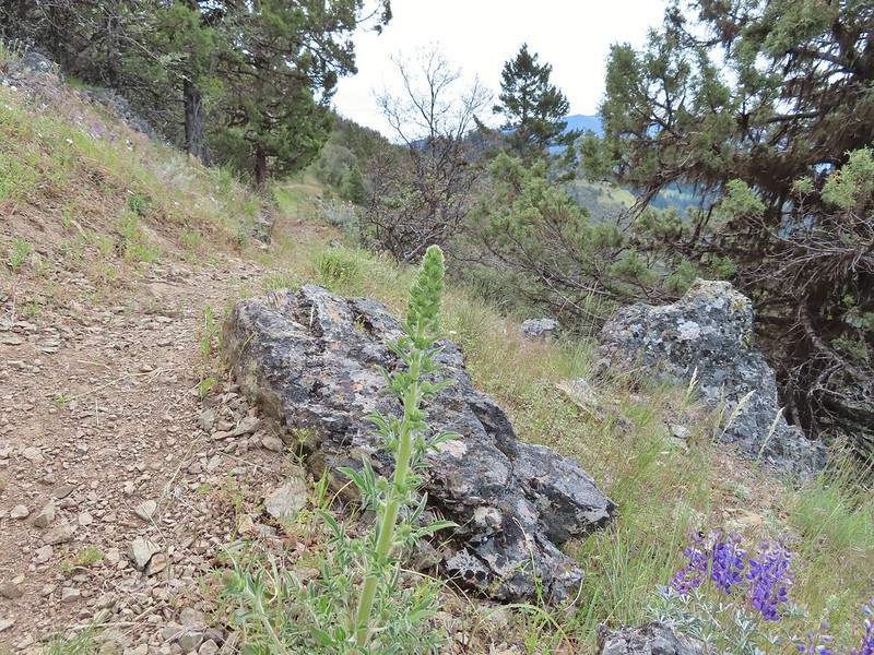 Silverleaf phacelia
 Some sort of big thistle on the hillside.
 Some pink lupine.
 Rough eyelash-weed
 Western wallflower with a crab spider.
 Clustered broomrape
 Buckwheat, paintbrush, and lupine
 Plectritis
 Nearing the Anderson Ridge Trailhead.
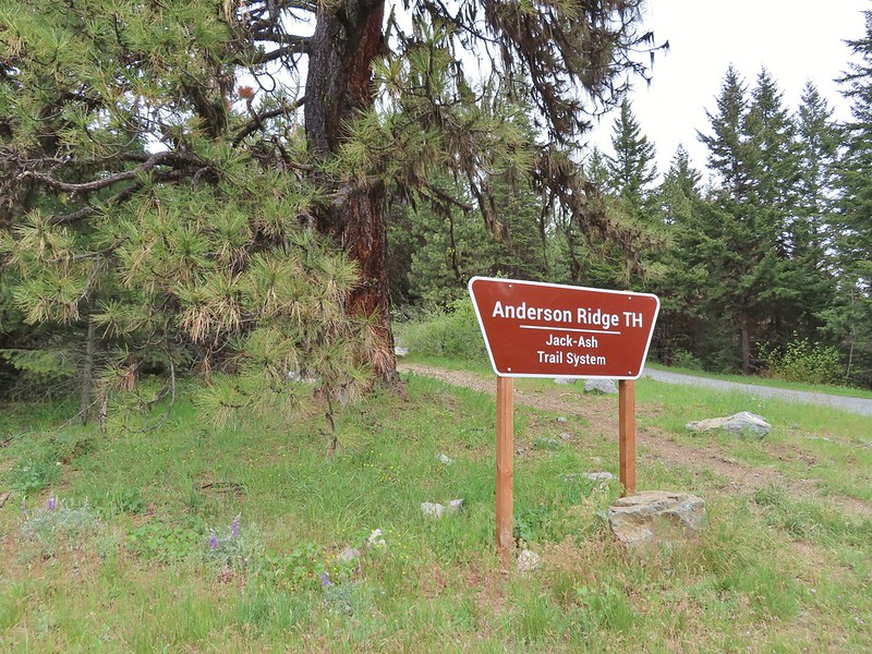


 Miniture lupine
 A ringlet on fiddleneck.
 Post at the OHV trail crossing.
 Salsify
 Yarrow
 The Jack-Ash Trail nearing the saddle where we had turned off to go up Anderson Butte.
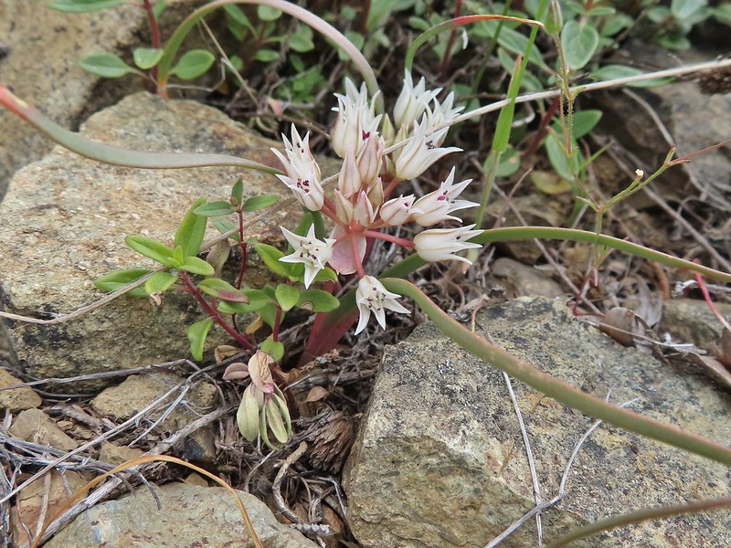 Wild onion (possibly Siskiyou)
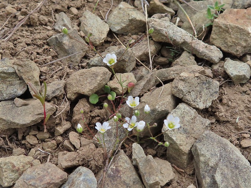 Meadowfoam
 Royal Jacobs-ladder
 Royal Jacobs-ladder
 The berm at the Greenstone Trailhead.


 Acorn woodpecker
 Death camas and vetch
 Carrotleaf horkelia
 Lazuli bunting
 Finch
Finch
 Lupine
 Oregon sunshine
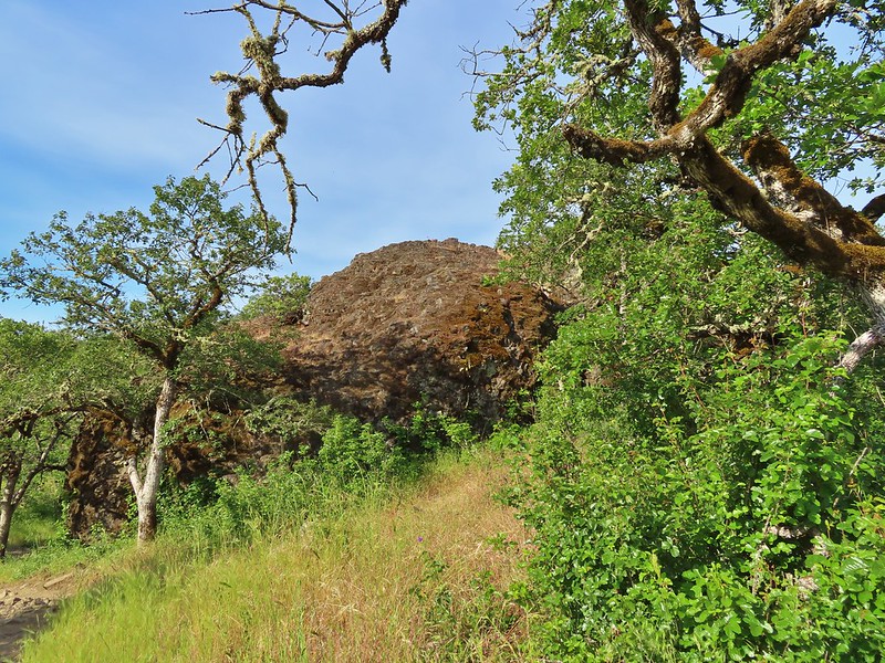 Andestite boulder
 Mt. McLoughlin (
 Ground squirrel having breakfast
 Blow wives
 A clarkia
 Blue dicks
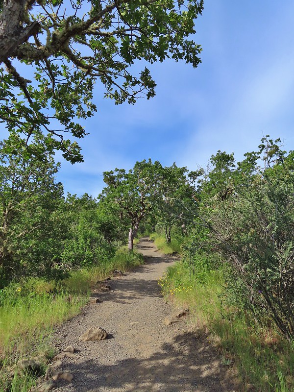
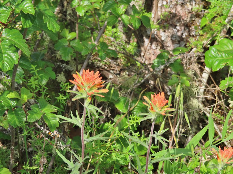 Paintbrush (and poison oak)
 Could be a cutleaf silverpuff or a hawksbeard
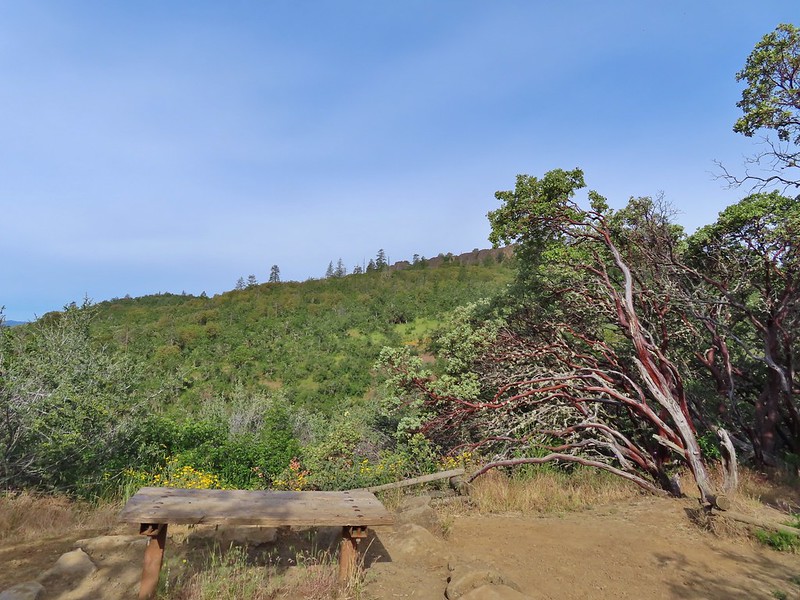 Viewpoint bench at the half mile point.
 Clustered broomrape
 Siskiyou Mountains including Mt. Ashland (
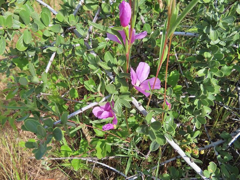 Another type of clarkia
 Possibly bastard toadflax
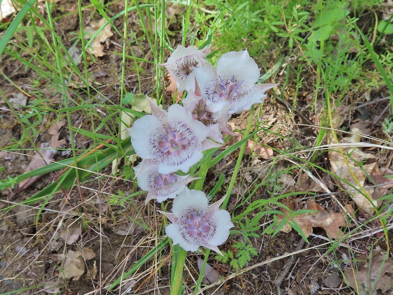 Mariposa lilies
 Balsamroot along the trail.
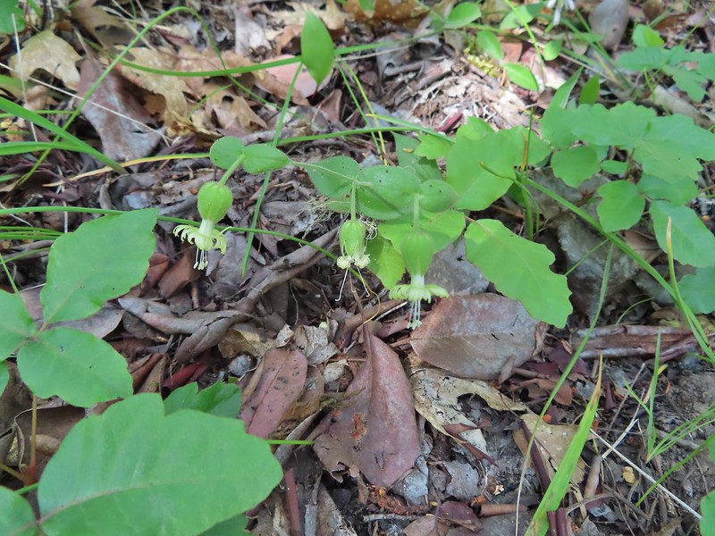 Bell catchfly
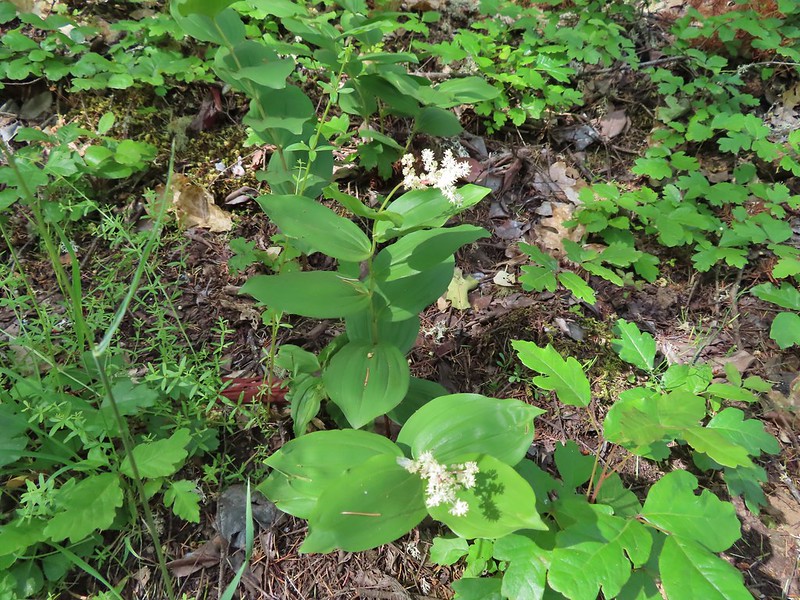 Plumed solomonseal
 Approaching the start of the loop.
 Looking toward the Siskiyous.
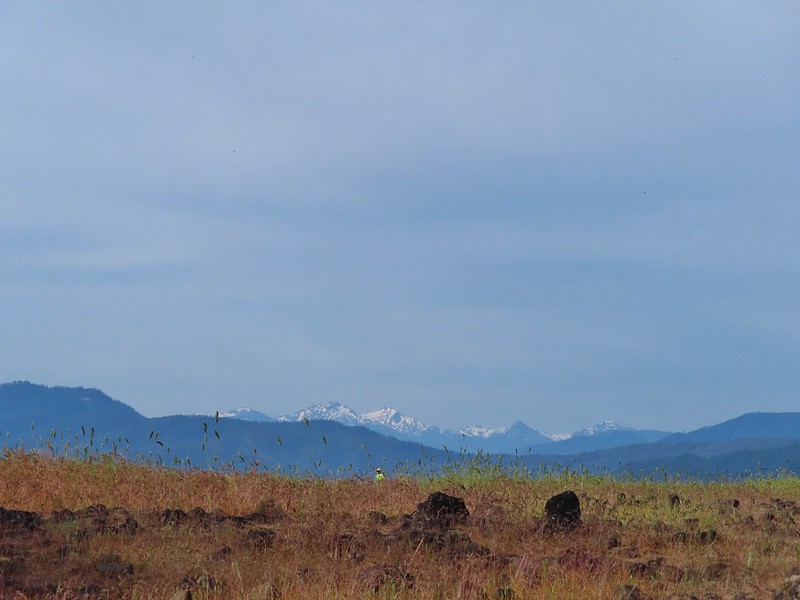 The Red Buttes (
 Pilot Rock (
 Mt. Ashland (w/snow) and Wagner Butte
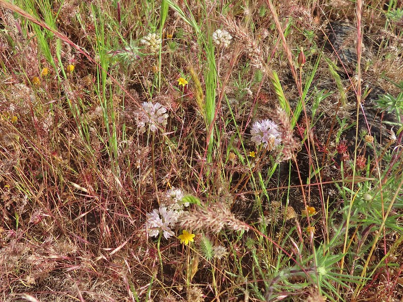 A couple of different wildflowers.
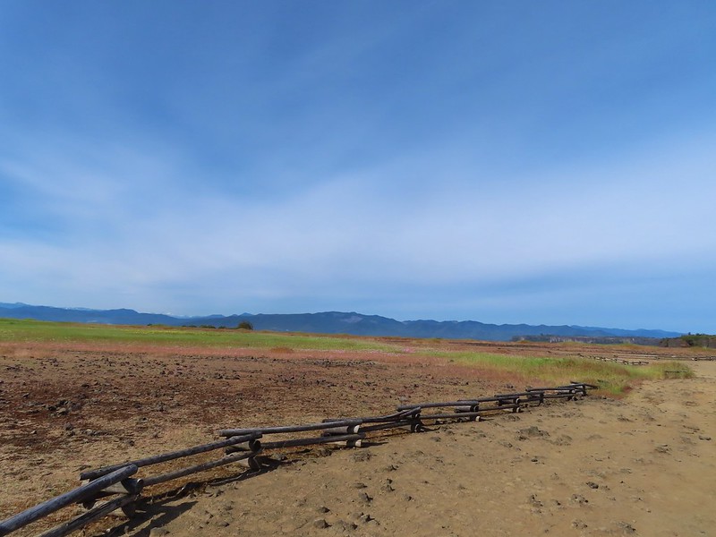 Narrowleaf onion?
 Pincushion plant
 Meadowfoam
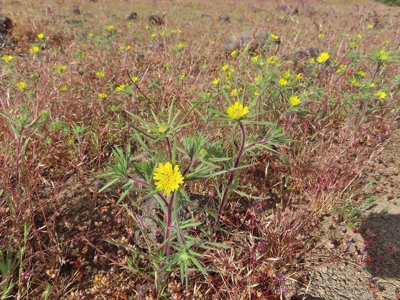 Not sure what these yellow flowers are. Yellow flowers are by far the hardest to figure out.
 Rock wren
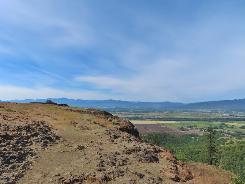
 Turkey vulture in flight with Mt. McLoughlin in the background.
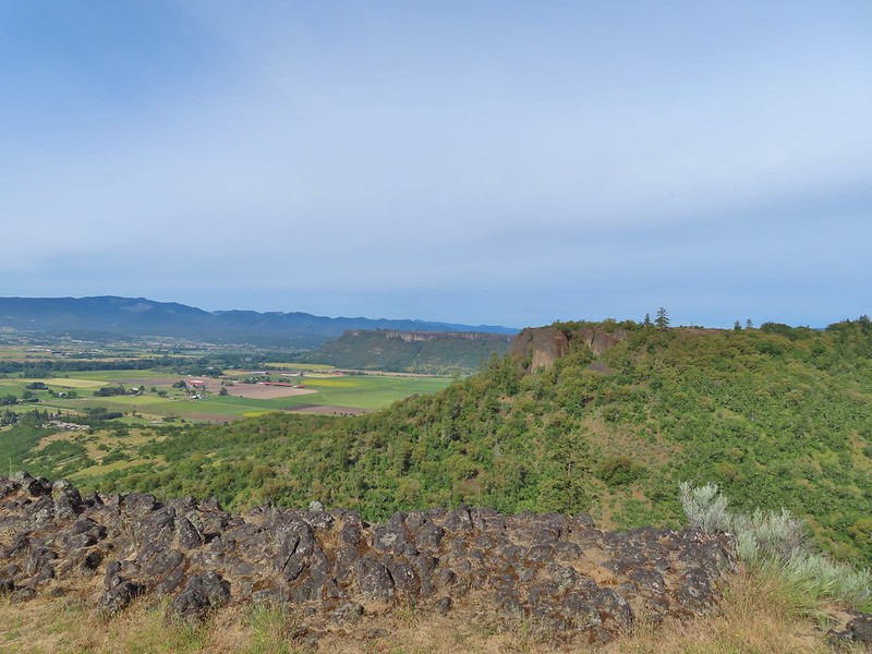 Lower Table Rock beyond the other bench of Upper Table Rock.
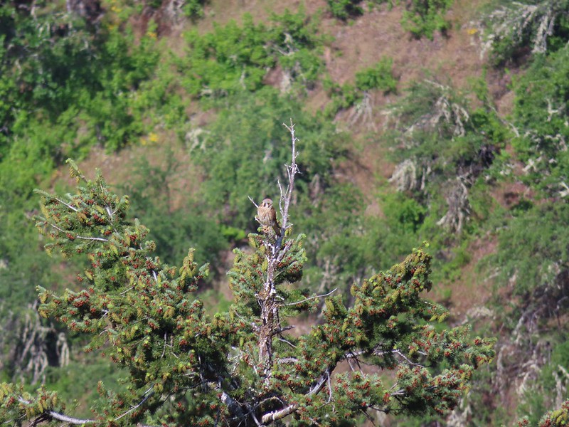 An American kestral atop a tree.
 Lizard
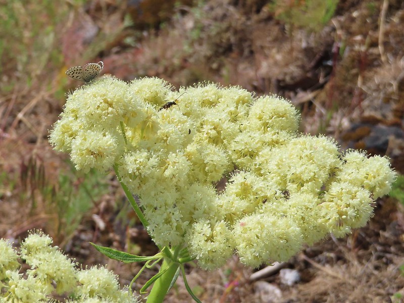 A butterfly and a beetle on arrowleaf buckwheat
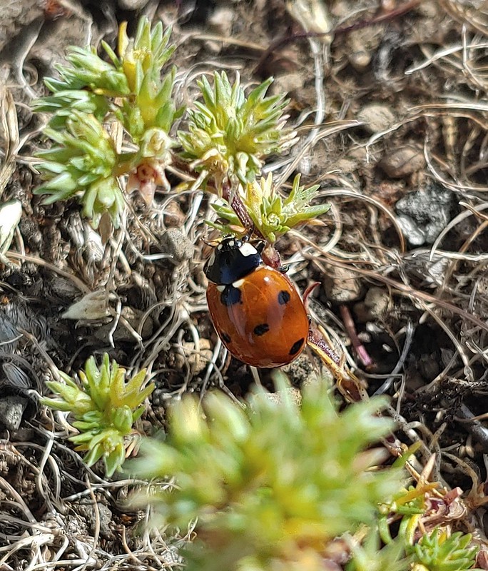
 Yarrow
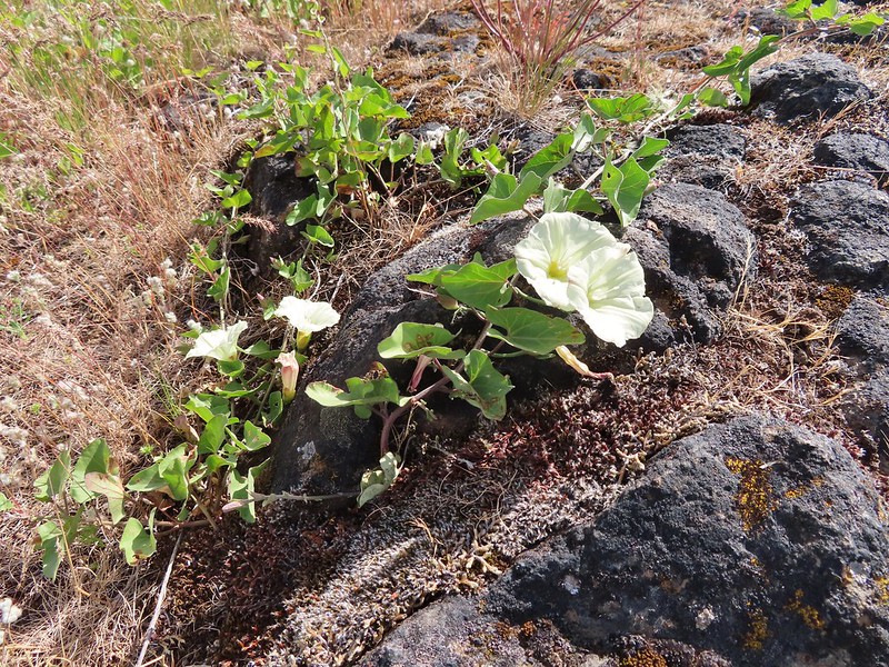 Chaparral false bindweed
 White tritelia
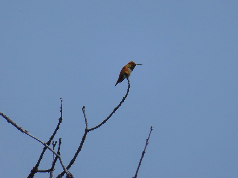 Rufous sided hummingbird
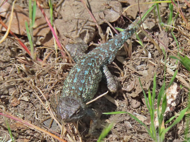 Lizard
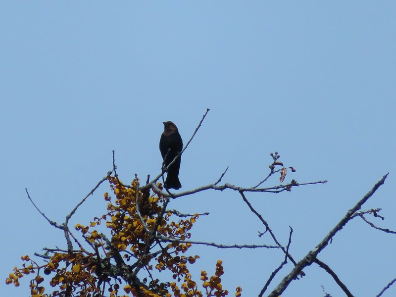 Brown headed cowbird
 Mt. McLoughlin on the way down.


 Mariposa lilies
 Alligator lizard
 Henderson’s stars
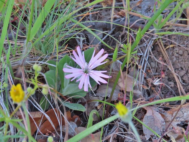 Hooker’s Indian pink
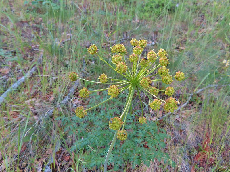 Fern leaf biscuitroot
 Blue dicks
 Larkspur
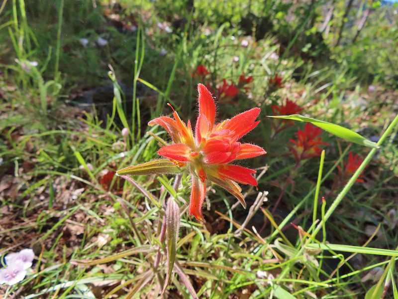 Paintbrush
 Mariposa lily
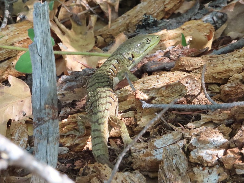 Another alligator lizard. They eat ticks but in this case it appears a couple ticks got the jump on him (or her).
 Lupine
 View from the trail.
 Grayback Mountain to the right in the distance.
 Fiddleneck
 Miniture lupine
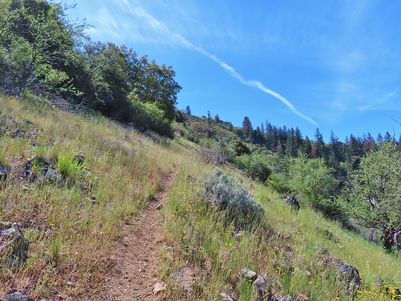
 A lupine, clarkia and madia?
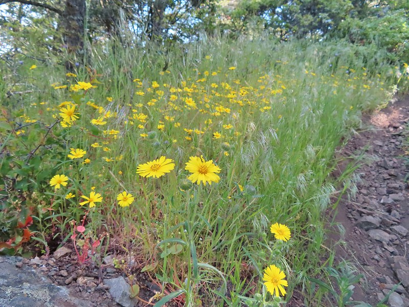 Madia
Madia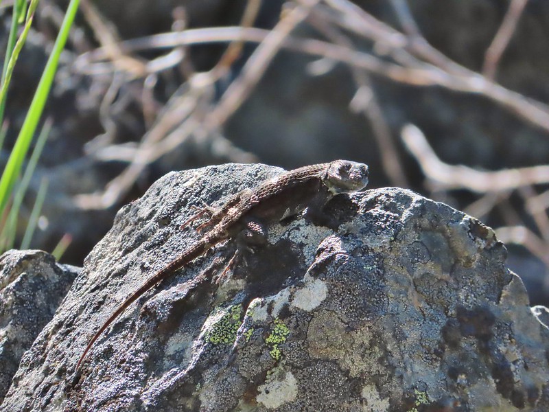 A molting lizard.
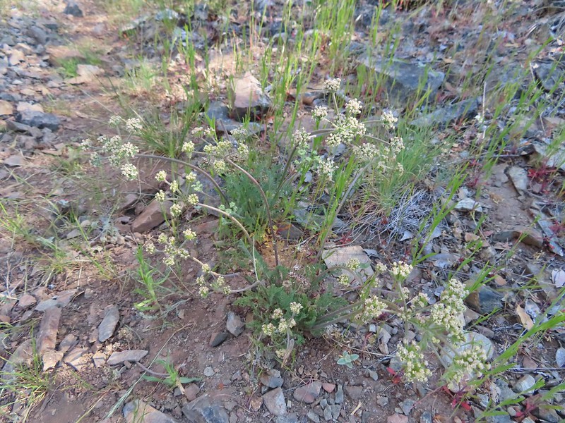 A lomatium
 Believe this is a female black-headed grosbeak
 The Red Buttes (
 Red bells, these were on a short wish list of wildflowers that we’d yet to see on trail.
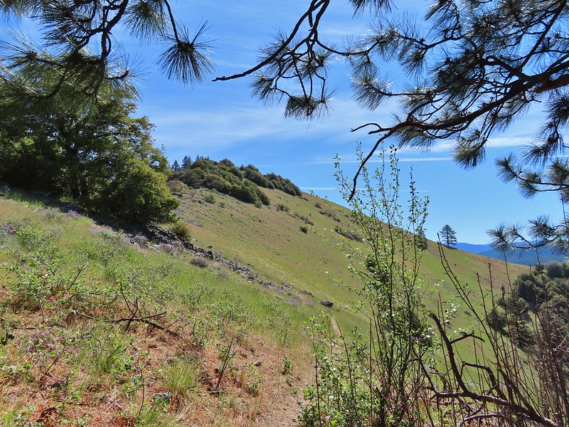
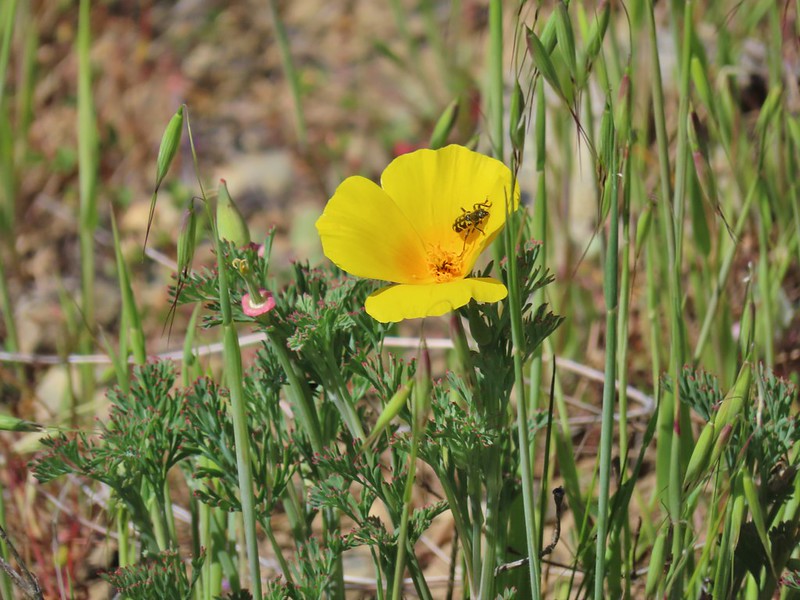 Poppy
Poppy Scraggy Mountain behind Little Grayback Mountain
 Red Buttes behind Little Grayback Mountain
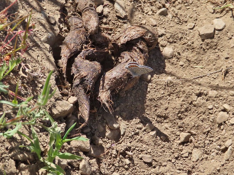 Butterfly on scat.
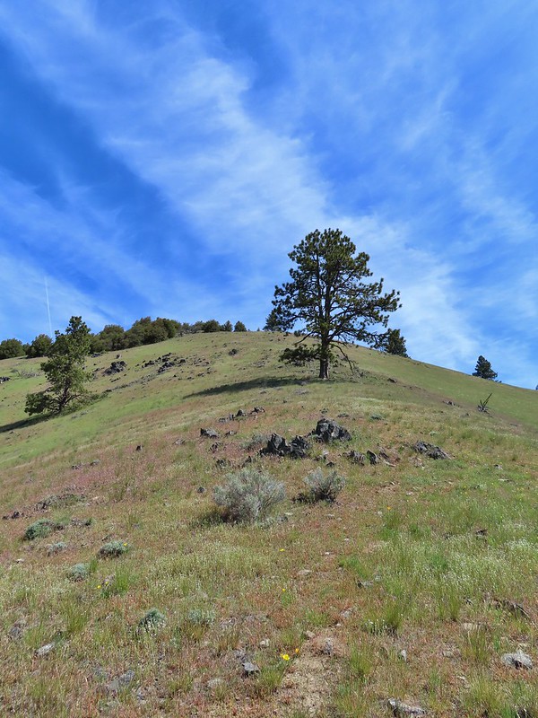

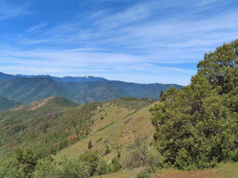 Mule Mountain is the lower peak along the ridge with the brown left side.
 Lupine
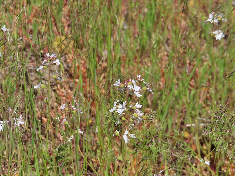 Prairie stars
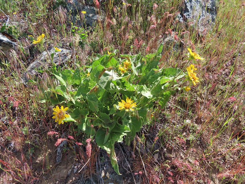 Balsamroot
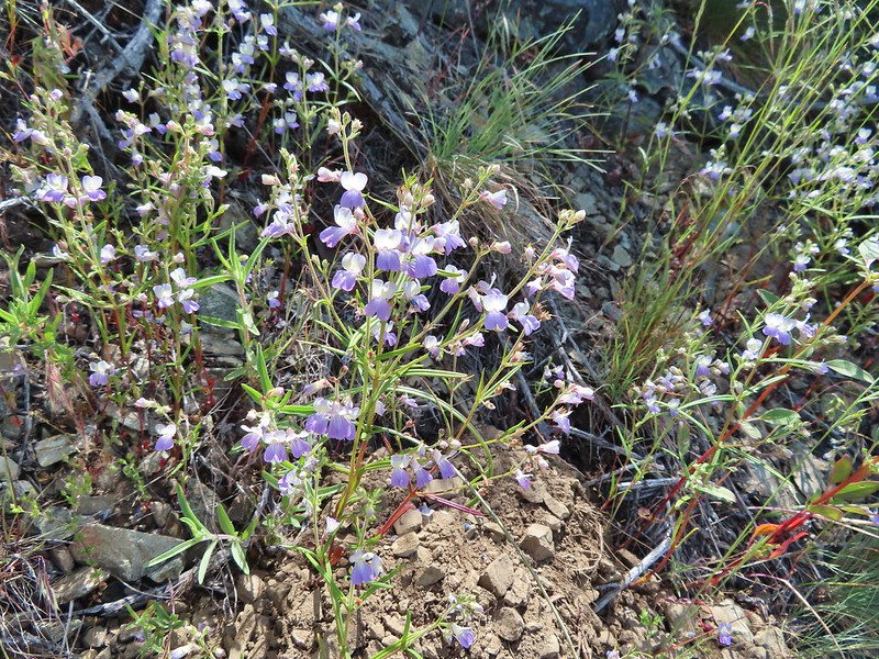 Blue-eyed Mary
 A collection of various small wildflowers.
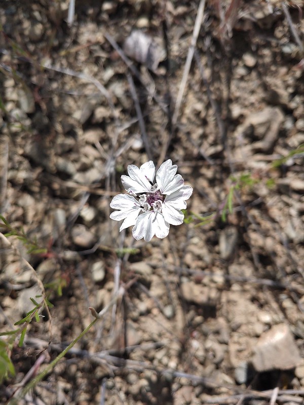 Rough eyelashweed
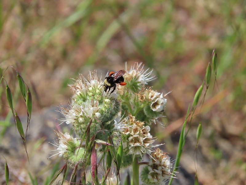 Bee on silverleaf phacelia
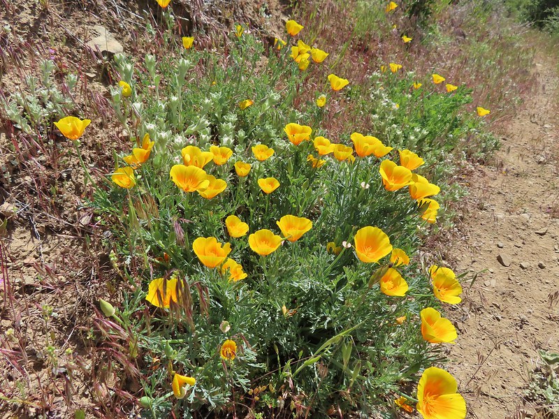 Poppies
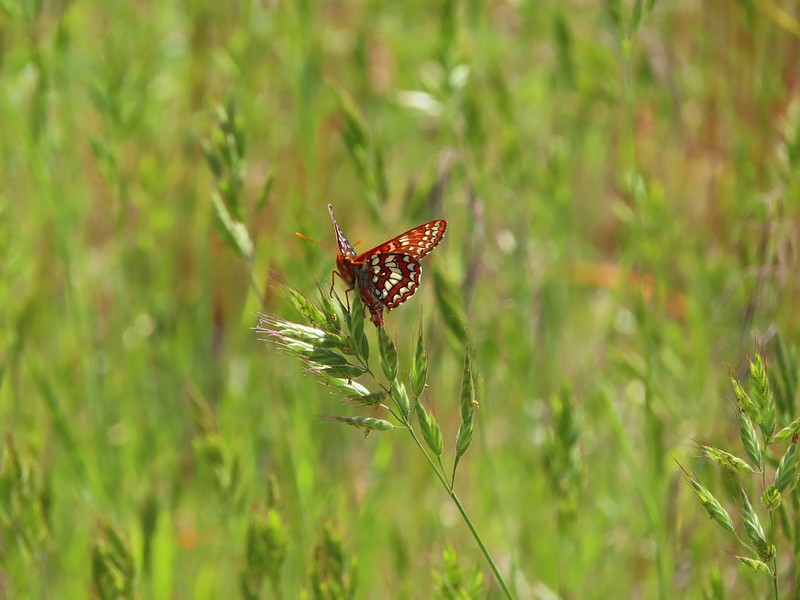 Butterfly on grass
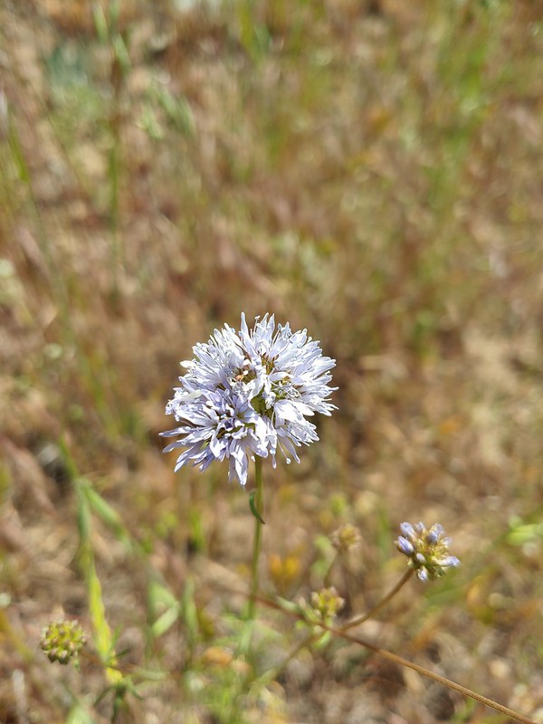 Blue gilia
 Grayback Mountain behind Mule Mountain
 Yet another lizard
 A colorful moth.
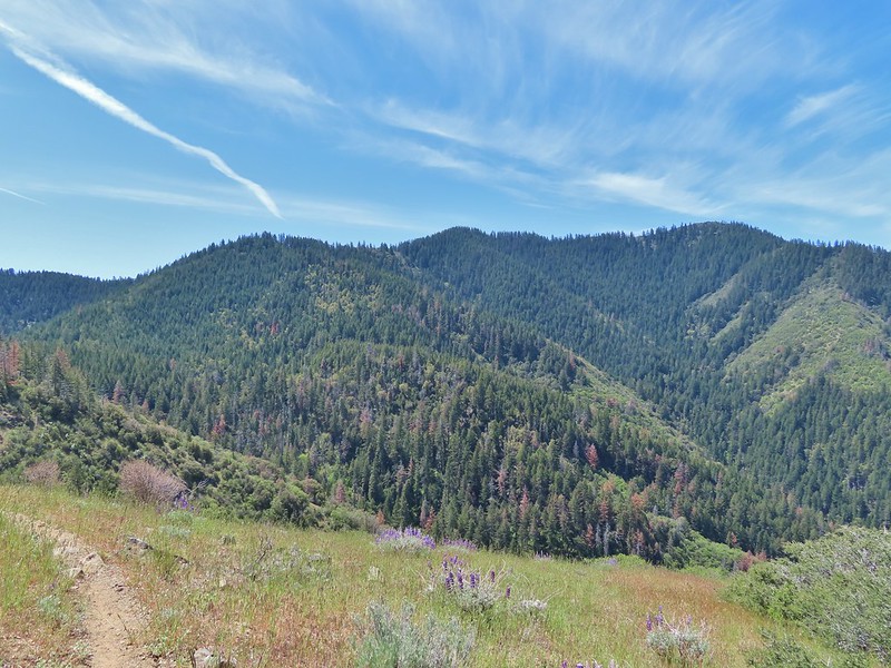 Little Grayback Mountain


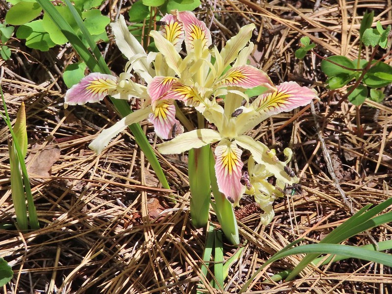 Iris
Iris Approaching the trailhead.
 Looking back at the trailhead from the road.
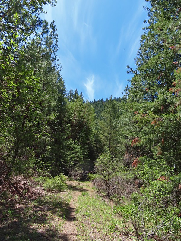
 Henderson’s fawn lily, another one we could check off our wish list.
 A typical obstacle.
 Overgrown trail.
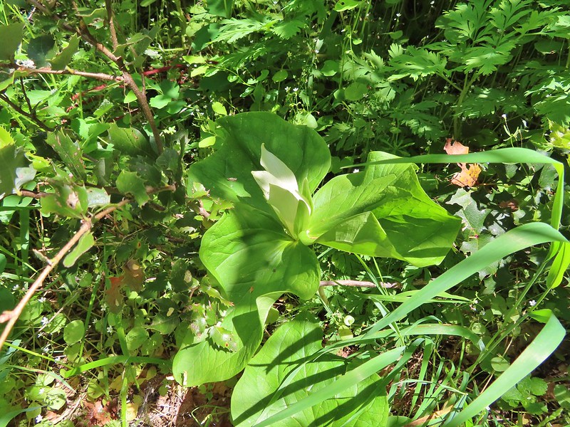 Giant white wakerobbin
 Some flagging on the left and bleeding heart on the right.
 Star flower
 Striped coralroot
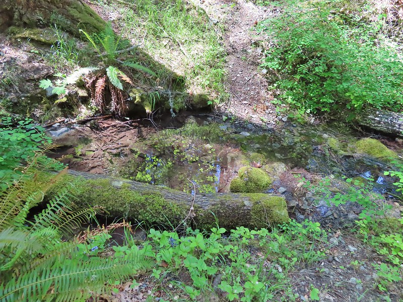 There was a good pool at this crossing where we could have gotten water.
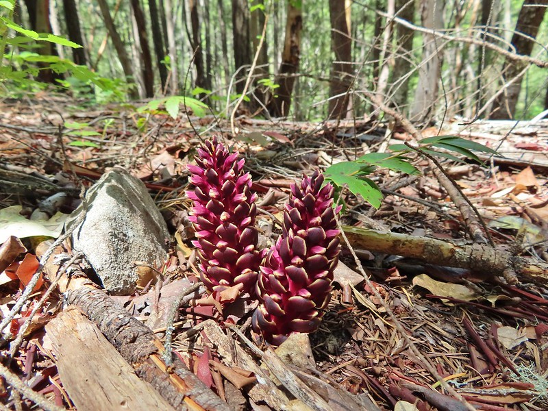 California ground cones.
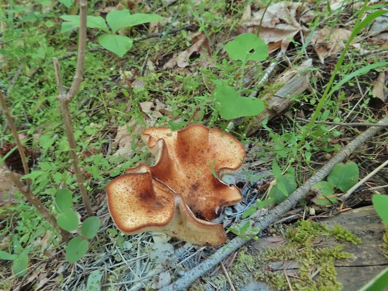 A folded up mushroom.
 A butterfly
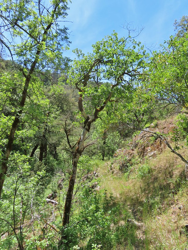
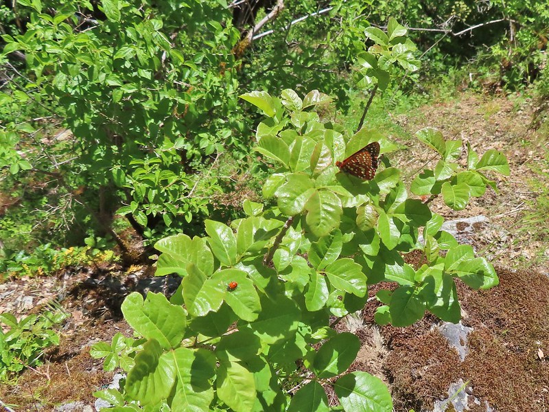 Apparently lady bugs and butterflies don’t care about poison oak.
 The trail got pretty faint at times.
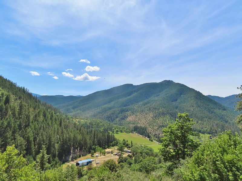
 Arriving at the Mule Mountain Trail.
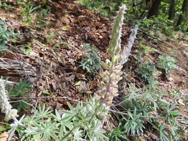 White lupine
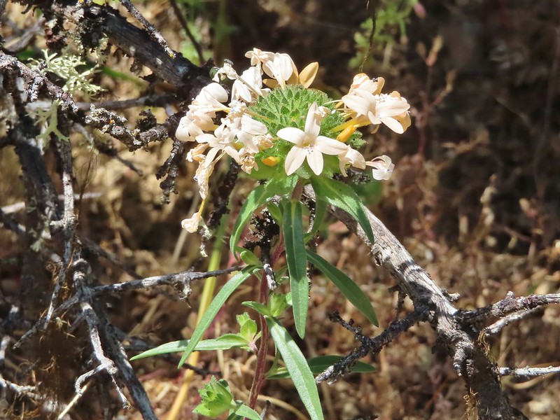 Grand collomia
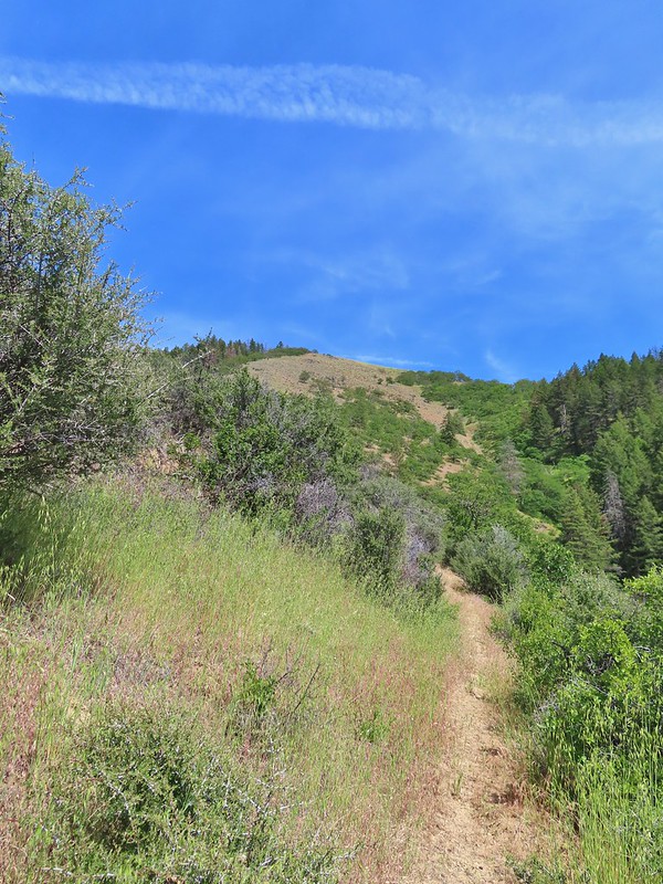
 Penstemon
 A brief section of shade.
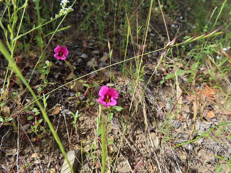 Dwarf purple monkeyflower
 I needed to get just below the lone tree on the ridge in the distance.
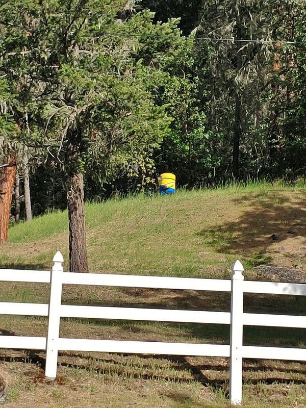 A random Minion in a field.
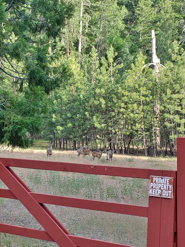 Deer along the road.
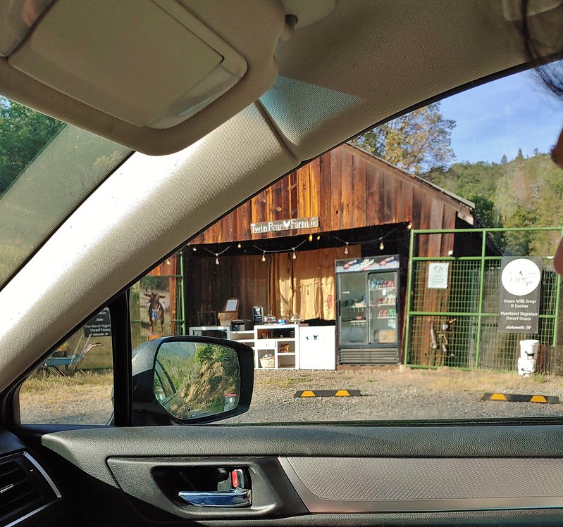 The Twin Pear Farm on the way back by.
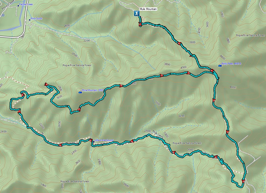
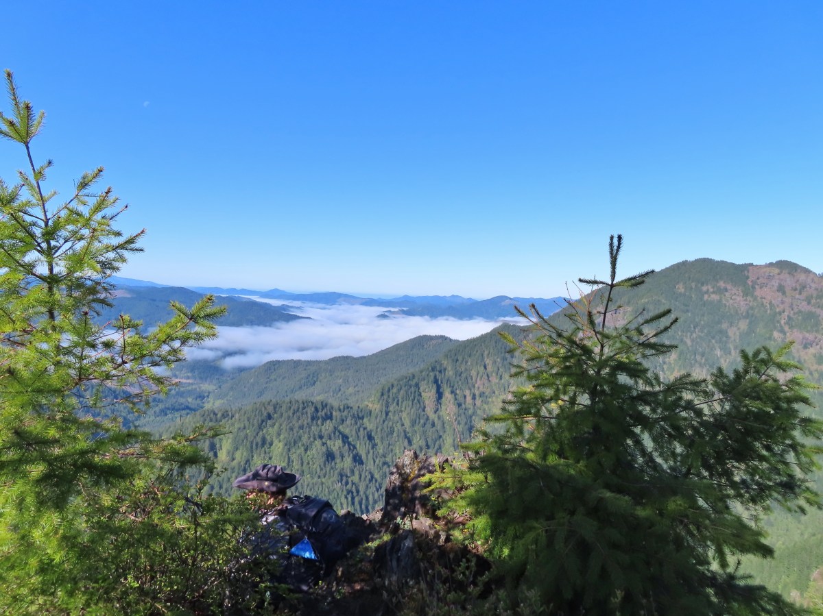


 Peat Swamp Trail.

 One of the two otters that were swimming in the wetlands.
 Mallard
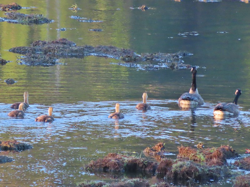
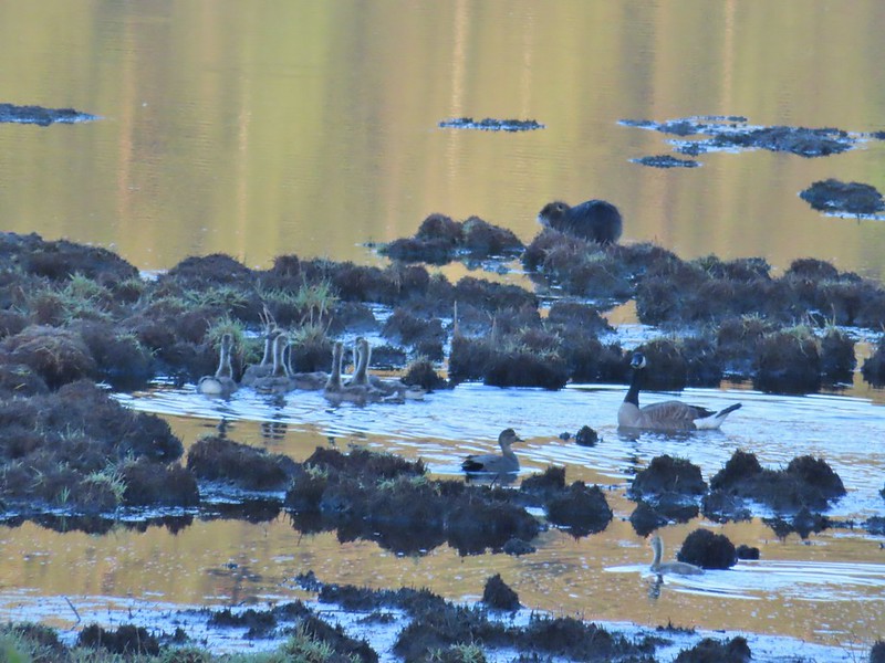 The gadwall amid a family of Canada geese. When we got home and looked closer at the picture we realized that one of the round shapes we took for a clump of mud was actually an animal. We can’t make out the tail to know for sure whether it was a beaver or a nutria but we’d like to think it was another beaver.
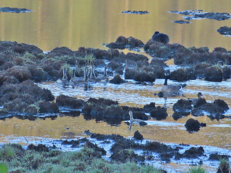 The beaver? turned a bit in this photo but we still couldn’t make out the tail. It does appear relatively large when compared to the adult goose though.
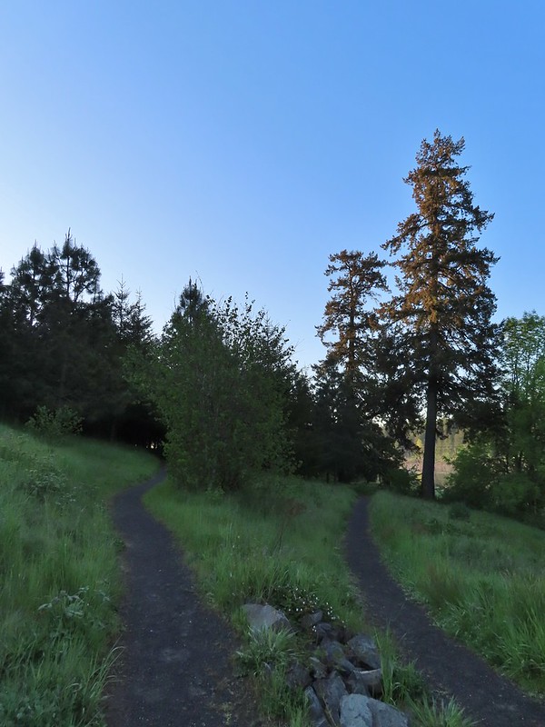

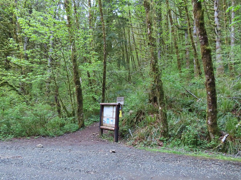

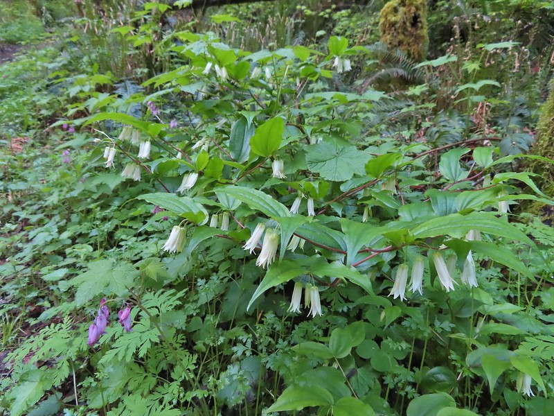 Fairy bells and bleeding heart.
 Elk Creek below the trail.
 Junction with the Elk Mountain Trail


 Paintbrush
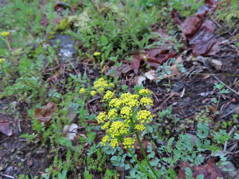 Parsley
 Blue-eyed Mary
 Viewpoint along the Elk Mountain Trail.
 The blue sky is up there.
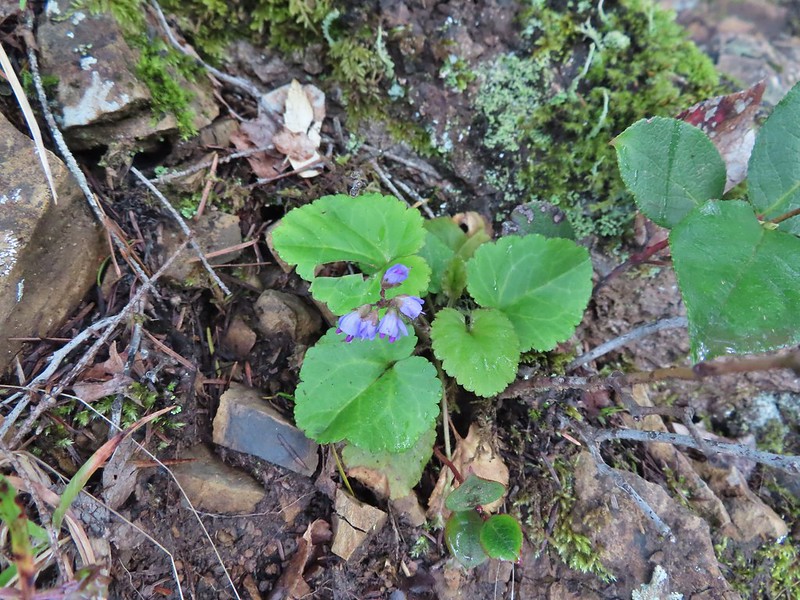 Snow queen
 The trail was as steep and rough as we’d remembered.

 White service berry blossoms and a huckleberry plant.
 Violet
 Red-flowering currant
 Trillium
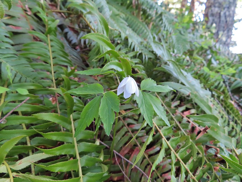 Anemone
 Monkeyflower
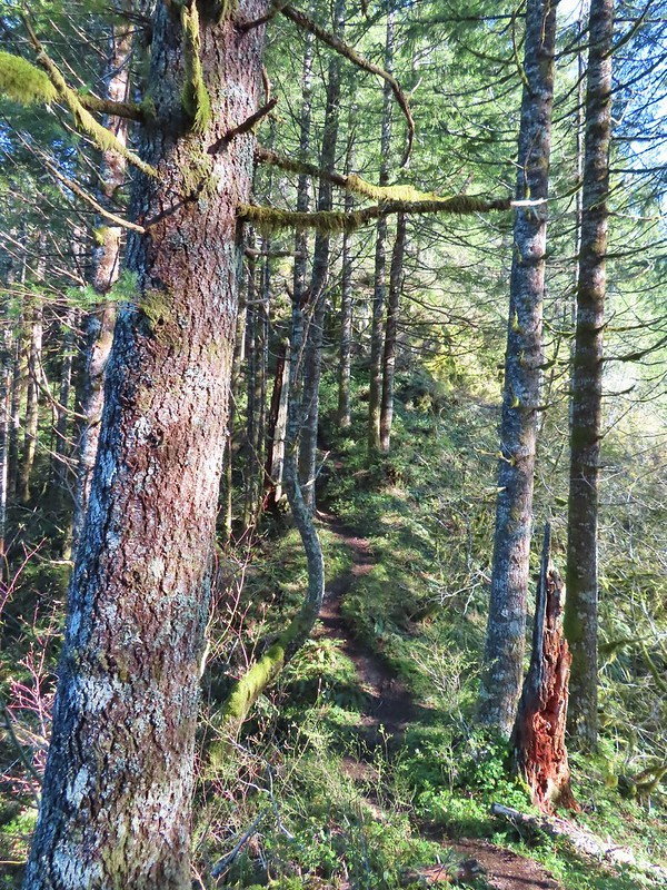 One of the saddles.
 Chocolate lily
 Elk Mountain summit.
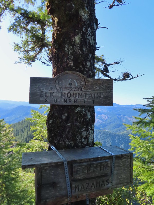
 Kings Mountain from Elk Mountain.
 Wilson River
 Pacific Ocean
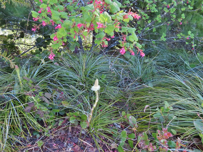 The blooming beargrass below some red-flowering currant.
 Beargrass
 Looking down the trail.
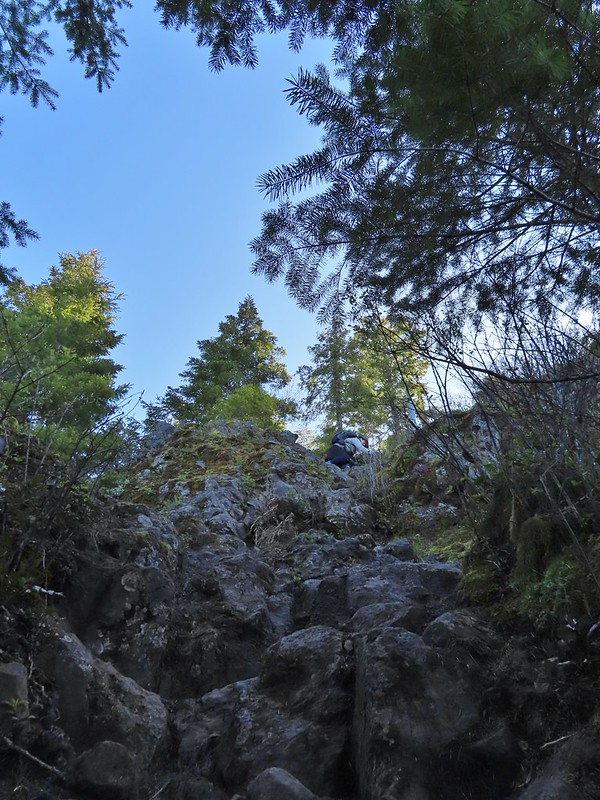 Heather on her way down.
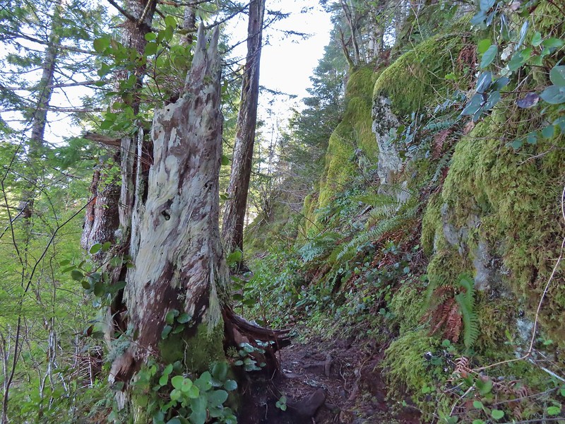
 On the ridge.
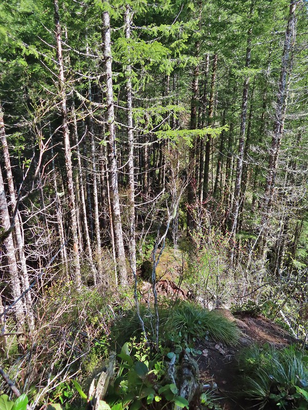 Dropping down to a saddle along the ridge.
 Mercifully on the old roadbed.
 A clump of trillium.
 Little moth.
 Getting closer to Kings Mountain.
 Paintbrush
 Coming up to the junction.
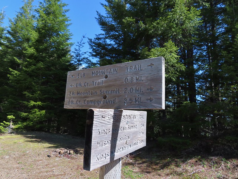
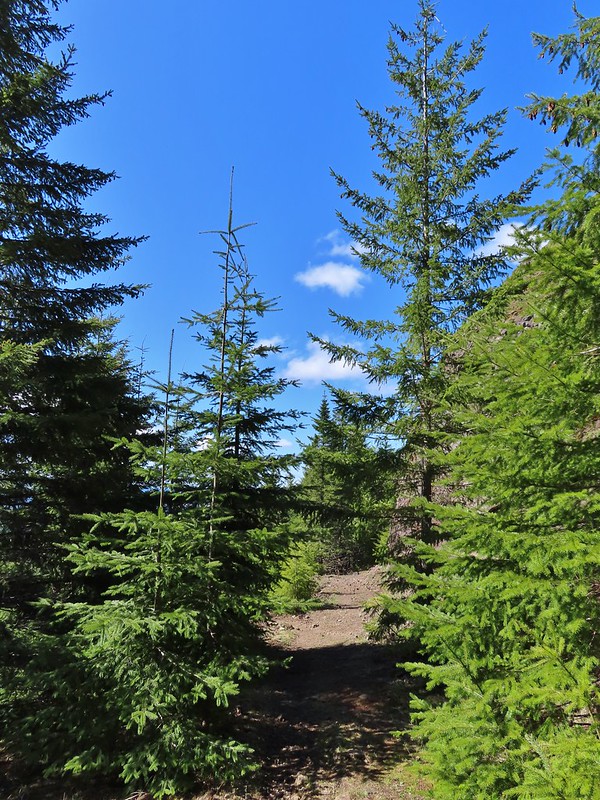
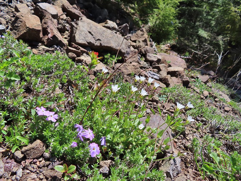 Phlox, paintbrush, and chickweed.
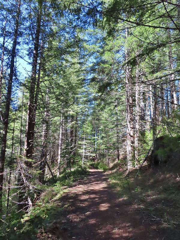 Still on the old road.
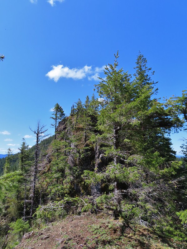 At the ridge end above the saddle, the trail dropped down to the left then through the saddle.
 Below the outcrop headed to the saddle.
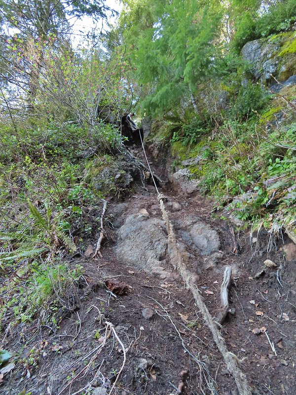 Heather getting ready to start down.
 The chute in 2010.
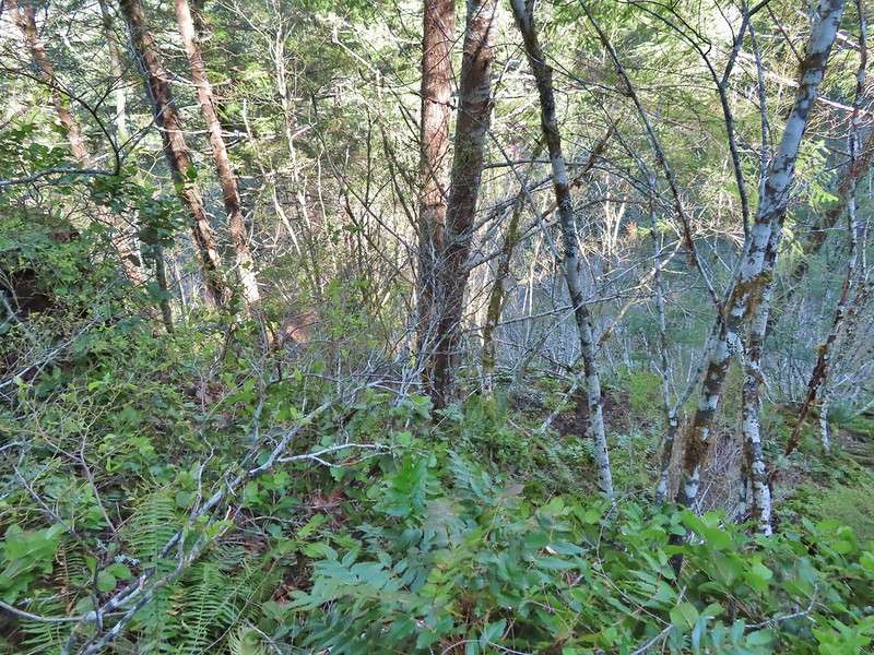 The trail is down there somewhere.
 Trillium
 Bleeding heart
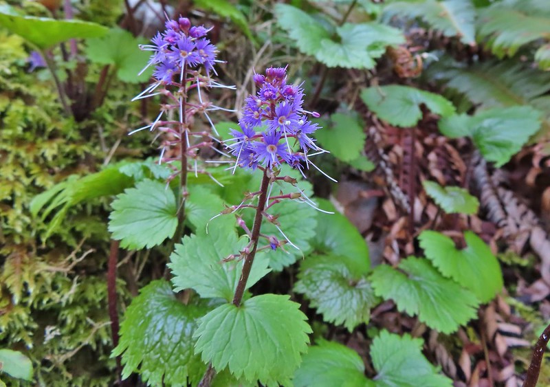 Fringed kitten-tails
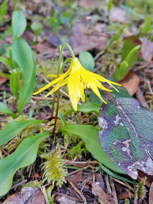 Glacier lily
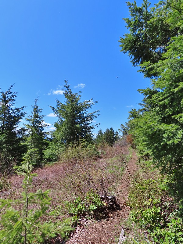 Coming up to the high point.
 Kings Mountain
 View SE from the high point.
 Dropping to the last saddle.
 Summit register at Kings Mountain.
 Pacific Ocean in the distance.
 View north.
 Other hikers at the summit.
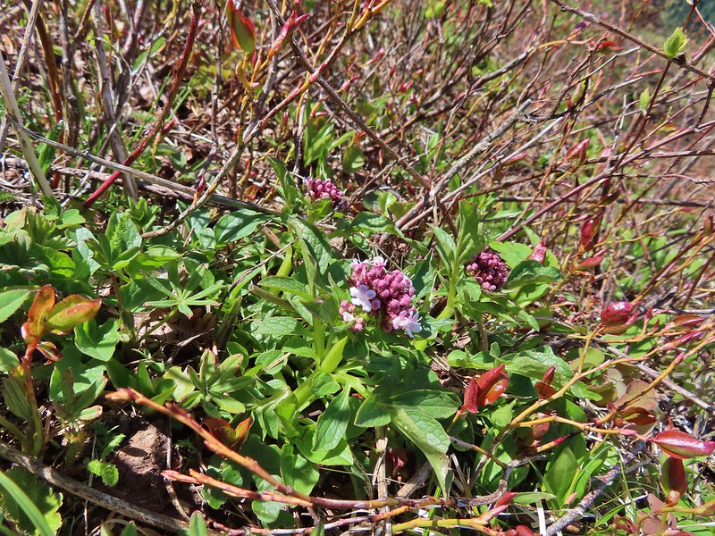 Valerian
 Saxifrage, possibly Saddle Mountain saxifrage.
 Phlox, paintbrush, parsley, blue-eyed Mary, and chickweed.
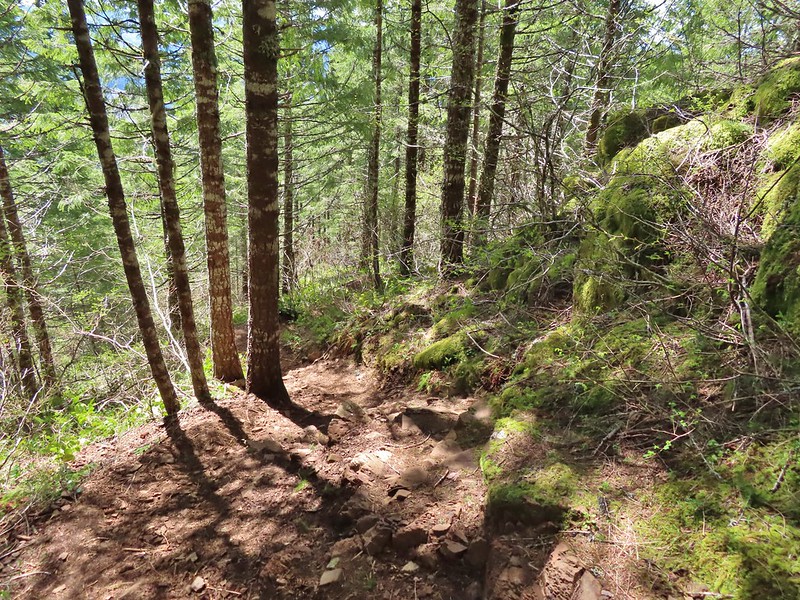 One of the rougher sections.
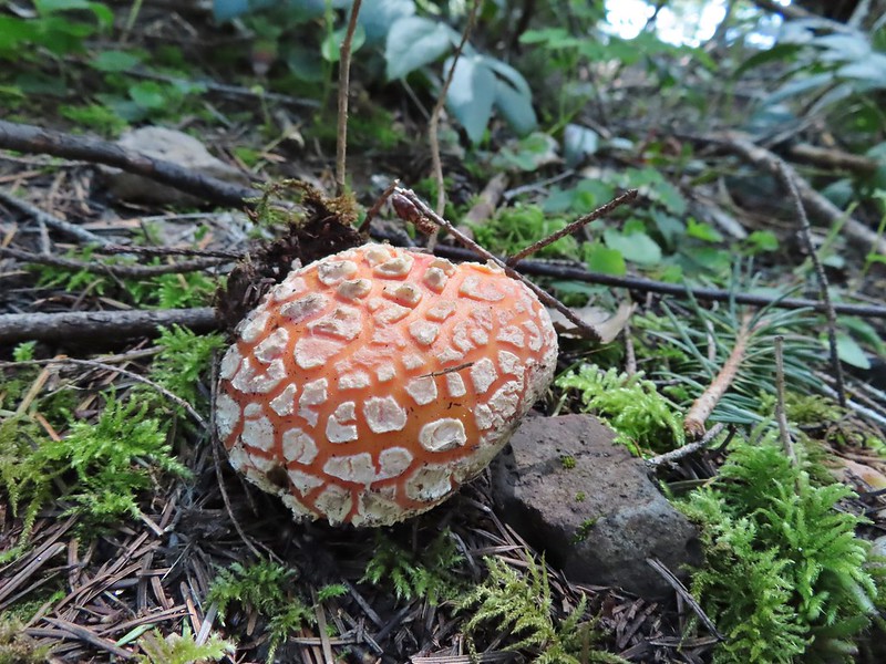

 Wood sorrel
 Woodland buttercup and candy flower.
 The 4-way junction.
 Dog Creek
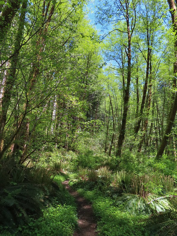


 One of the smaller streams.
 Monkey flower
 Lily that will bloom in a few weeks.
 Fringecup
 Coming up on a footbridge across Big Creek.
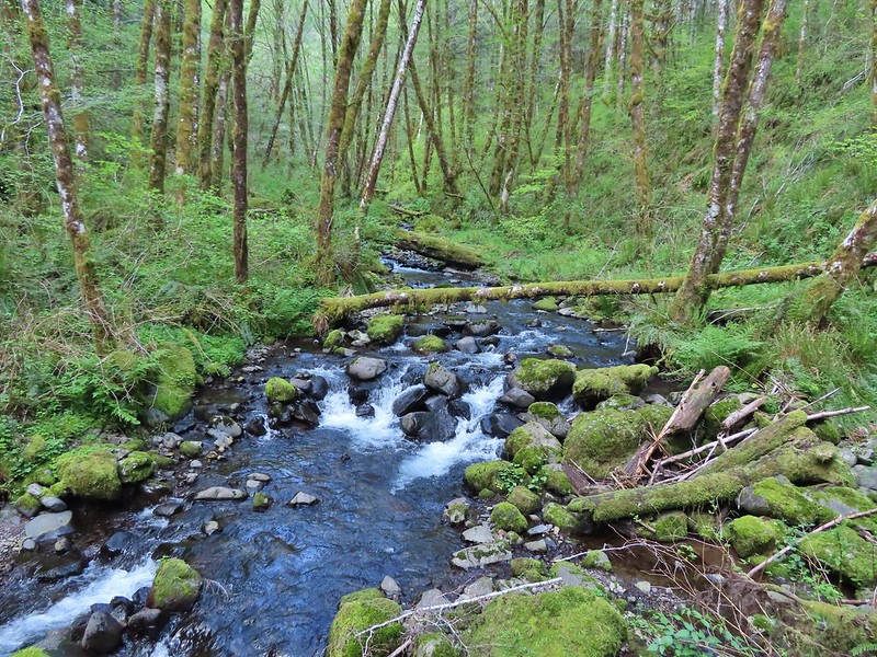 Big Creek
 Pacific waterleaf
 Steadily climbing.
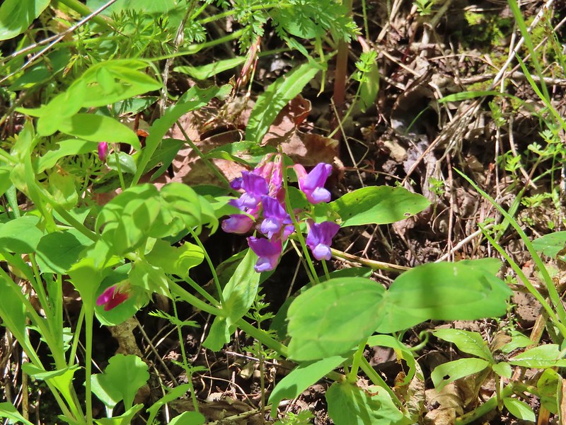 A pea or vetch.
 Unnamed stream crossing.
 Miterwort
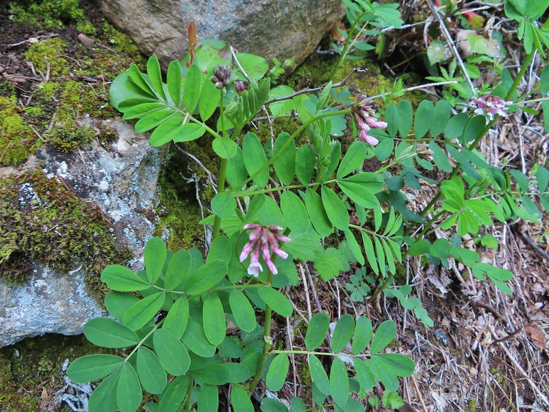 Rosy Birdsfoot Trefoil
 The third type of monkey flower we saw on the day.
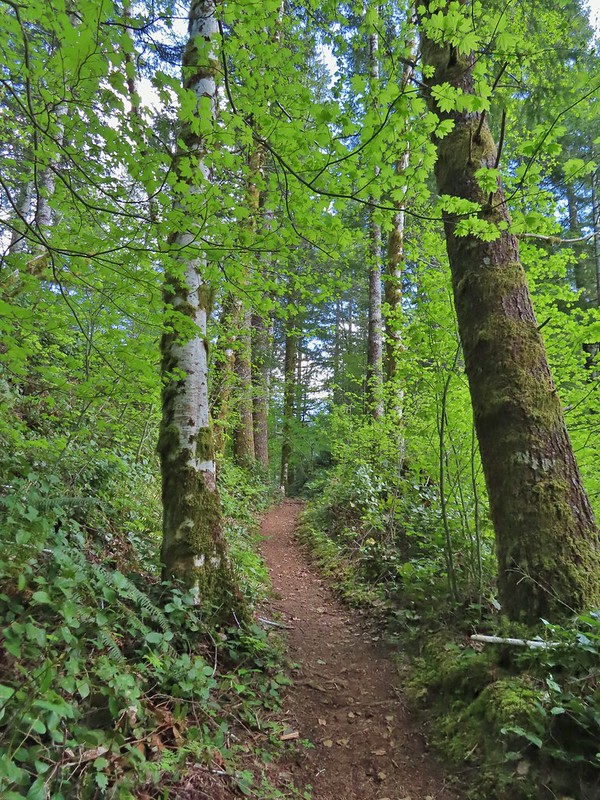 The junction is on the saddle ahead.
 Cars to the left through the trees, we made it.
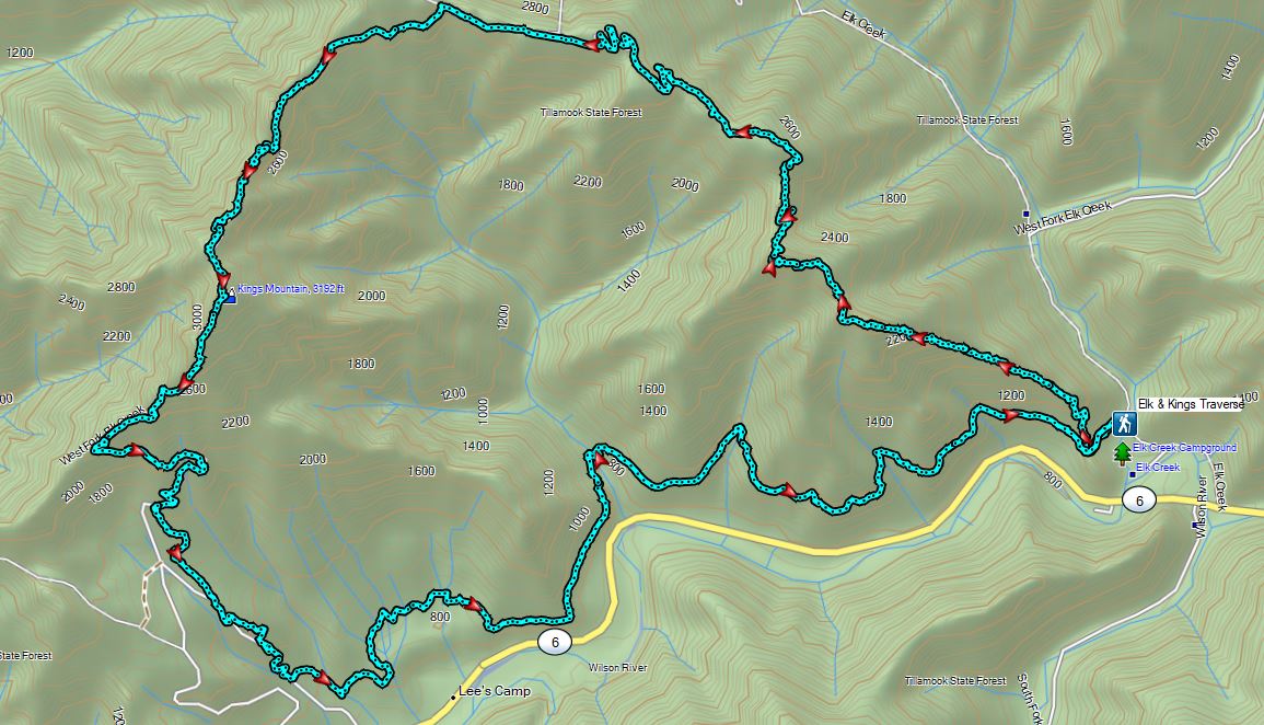
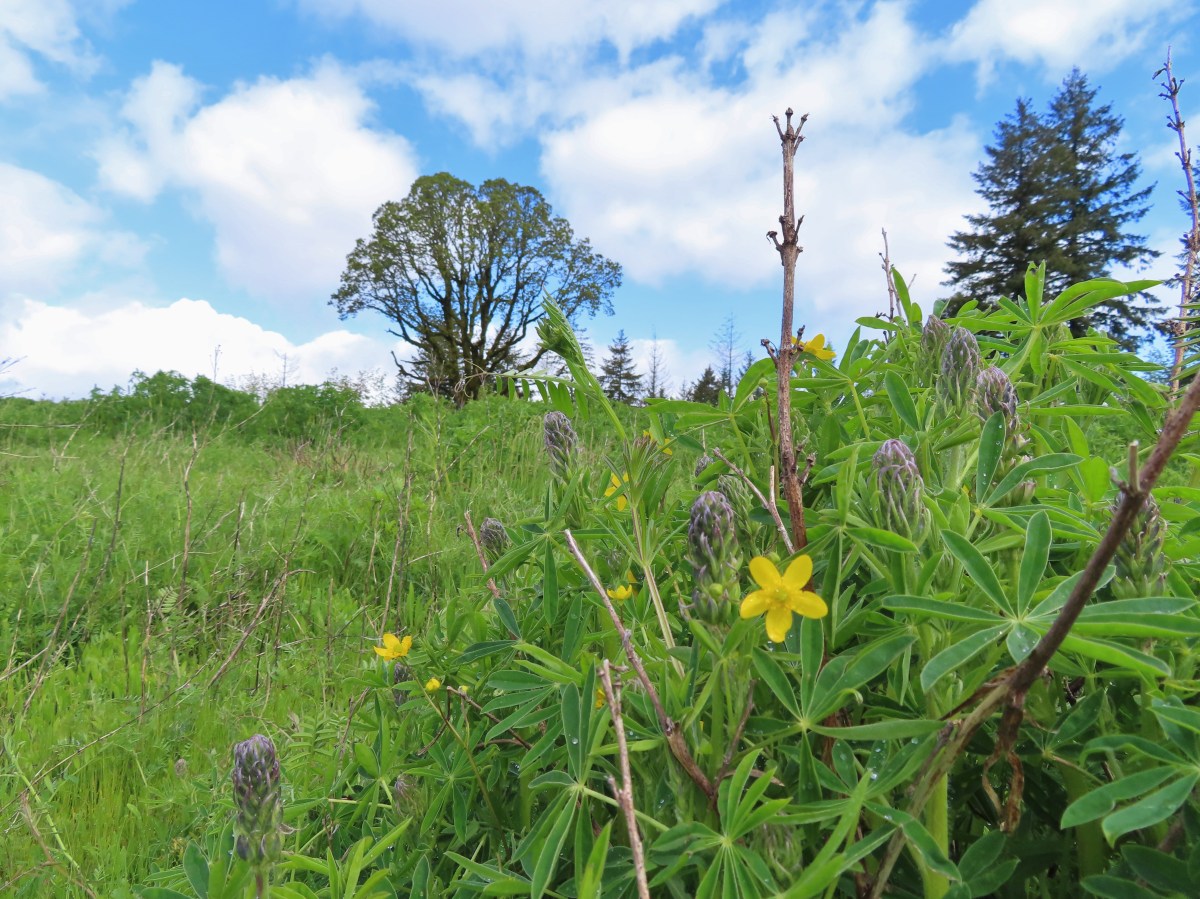


 The Castor (Spanish for beaver) Trail on the left, this was the only trail in the park that we didn’t hike on during our visit. It was always a left turn.
 Fawn lilies
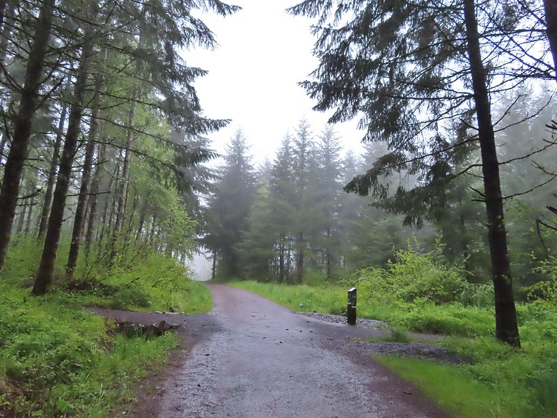 Our first right turn (left was a short connector to the Woodland Trail).
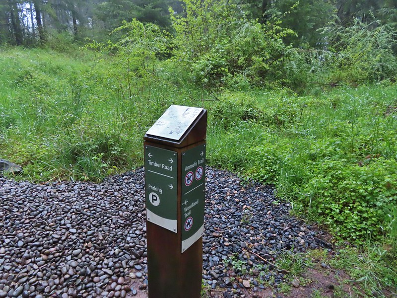 Again the posts and accompanying maps were some of the best trail identifiers we’ve run across.
 Bench at the viewpoint along the Ammefu Trail.
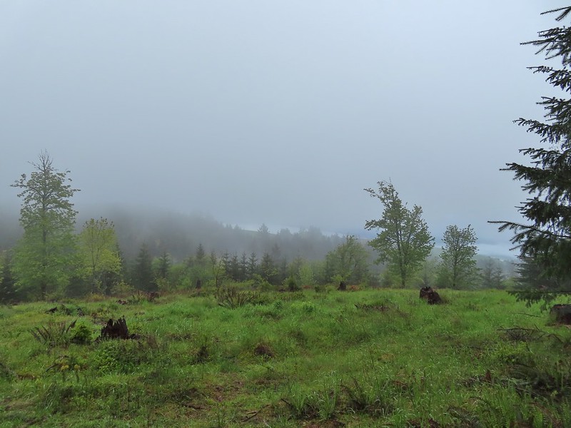 We had to imagine the view today.
 The second figure.
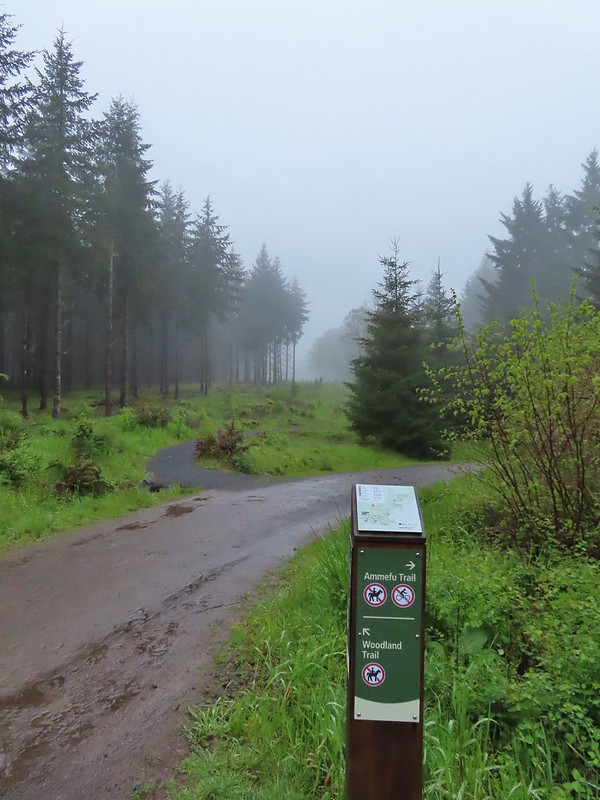 Back at the Timber Road and another short connector to the Woodland Trail.
 Fog on Timber Road
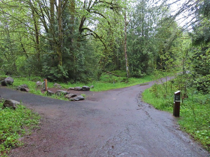 Passing the Woodland Trail on the left which would be our right turn on the way back.
 Christensen Creek
 Right turn for the Ayeekwa and Witches Butter Trails.
 Witchs Butter on the left and Ayeekwa on the right.
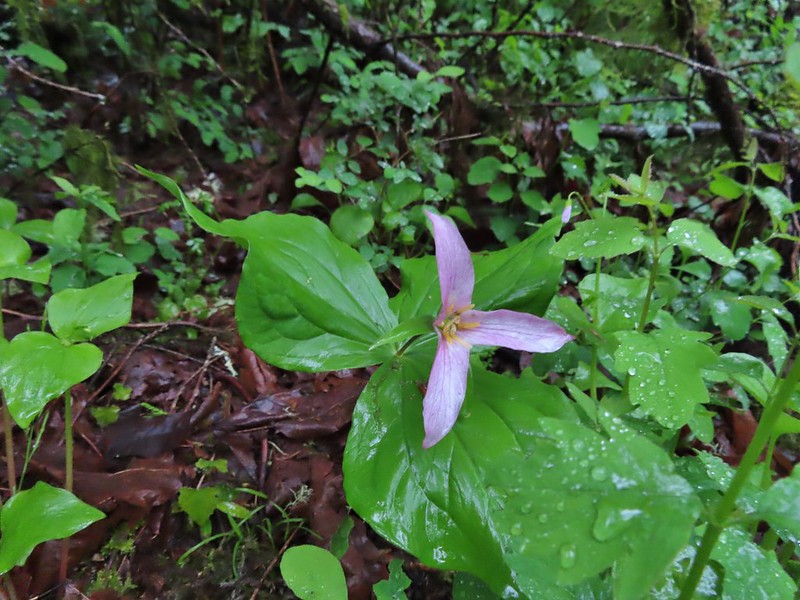 Trillium
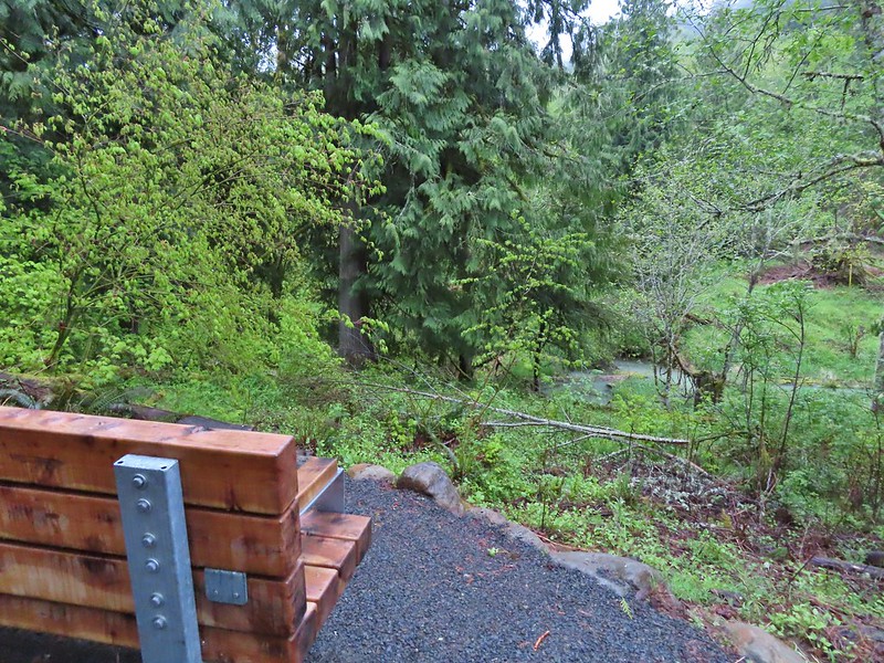 Another bench, this one overlooked Christensen Creek.
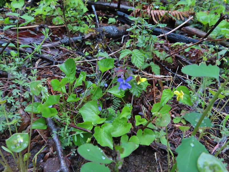 Common blue violet
 Pioneer violets and a strawberry blossom.
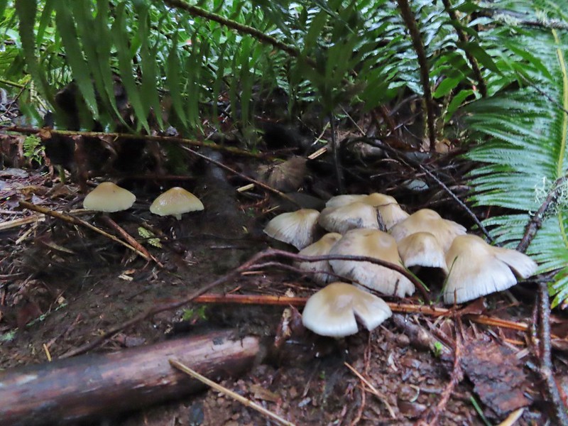 Mushrooms under a fern.
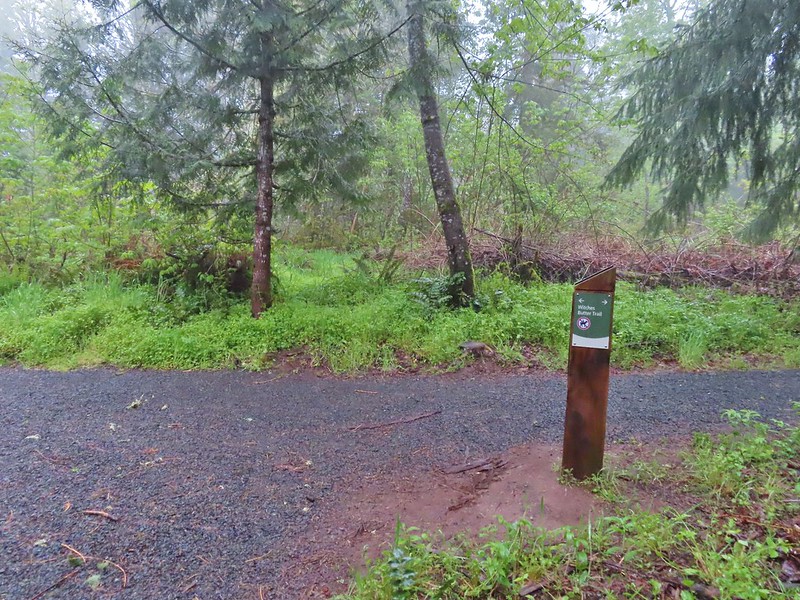 Popping out on the Witches Butter Trail.
 Witches Butter Trail
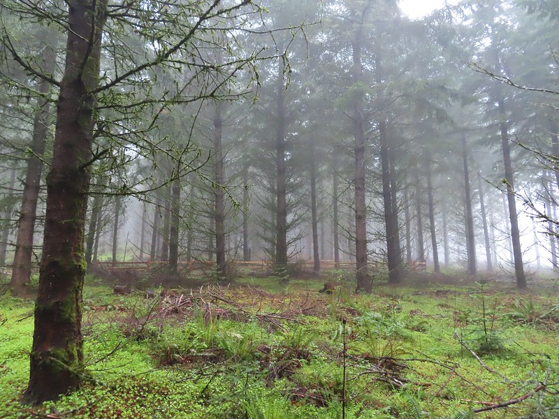 Witches Butter Trail winding through Douglas firs.
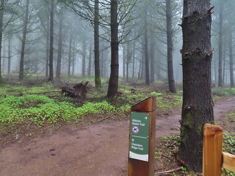 Turning right onto the Chehalem Ridge Trail.
 There was a little more mud on the Chehalem Ridge Trail.
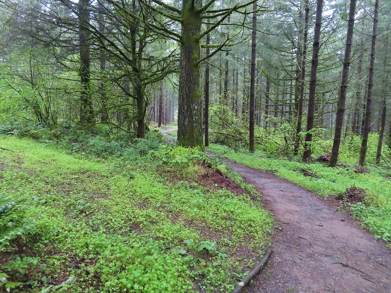 Spring green carpet.
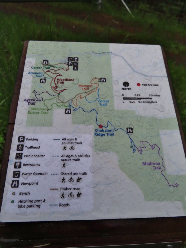 A good example of the differently oriented maps, on this one north is down.
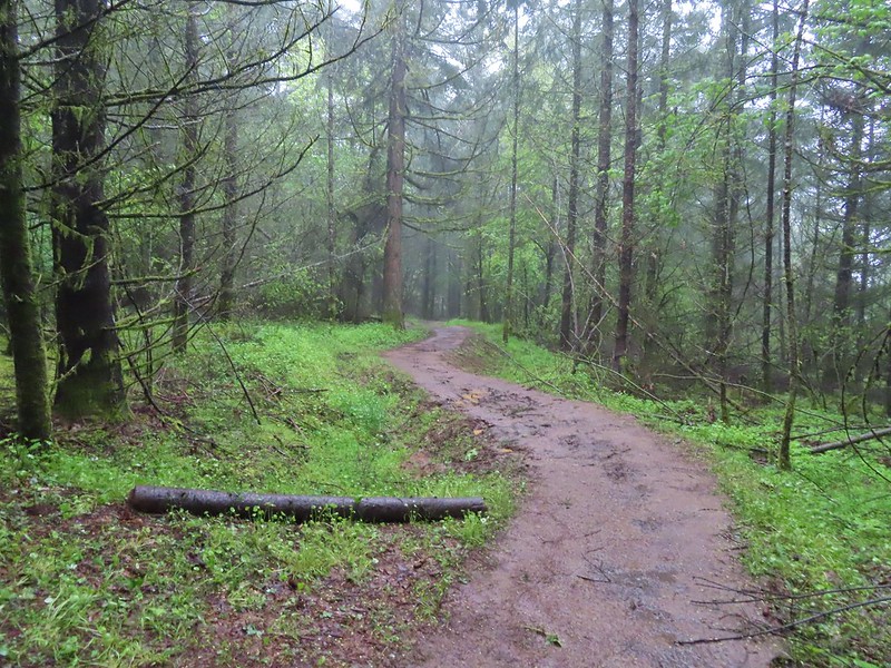
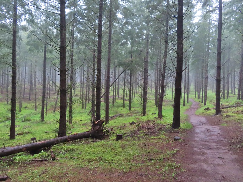 Another fir plantation. The land had been owned by a timber company prior to being purchased by Metro in 2010.
 Start of the Chehalem Ridge Loop. We went right which simply swung out along the hillside before dropping down to the Madrona Trail in 0.4 miles.

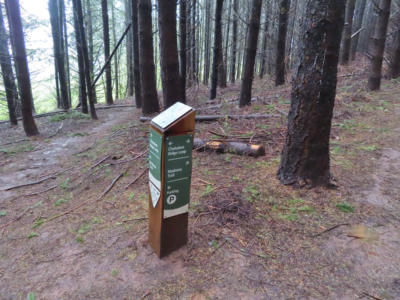 The loop continued to the left but we turned right onto the Madrona Trail.
 Still cloudy and gray but we’d experience very little if any precipitation yet.
 Lots of tough-leaved iris along this trail.
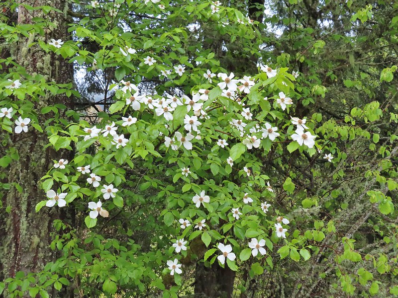 One of several blooming dogwood trees.
 View on the way down.
 Madrone trees began to be a common sight as we descended.
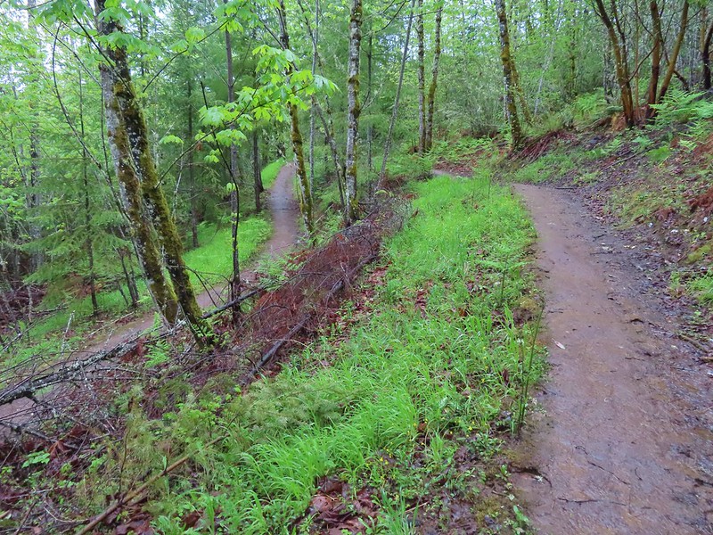 One of the 11 switchbacks.
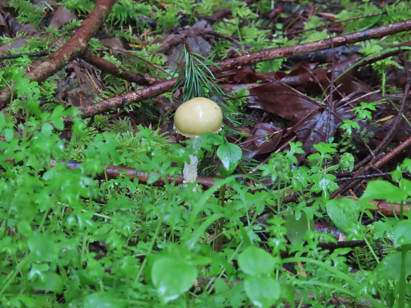 We hadn’t seen a lot of mushrooms recently but this hike had plenty.
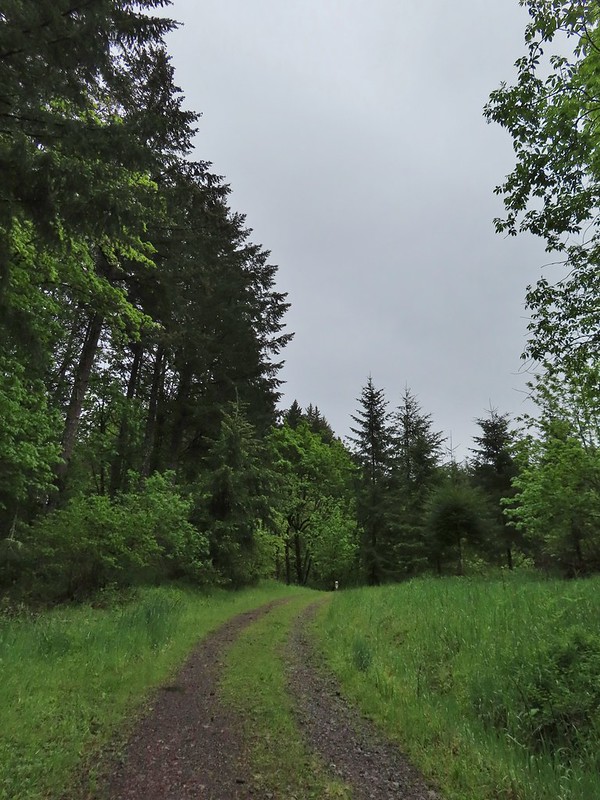 Following the roadbed.
 Aside from one other very small (3 in diameter) tree this was the only obstacle we encountered all day.
 The start of the loop along with several madrones.
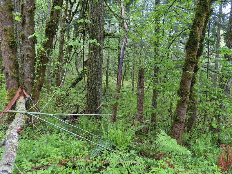


 The Tualatin Valley and Coast Range.
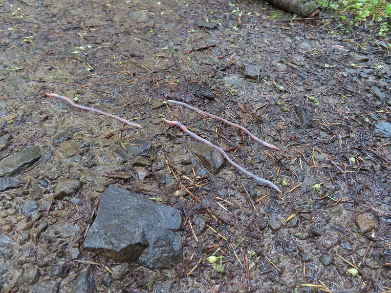 Either these worms were racing or it was a bird buffet. The rain had brought a lot of earthworms onto the trails.
 Another trail user a rough skinned newt.
 A closer look at the rough skinned newt.
 It had been so foggy when we had come up the Witches Butter Trail that we hadn’t realized that there was a giant green field nearby.
 The end of the Chehalem Ridge Trail with the Mampaꞎ Trail to the right and a very short connector to the Timber Road to the left.
 Sunlight hitting the Mampaꞎ Trail.
 Fairy slippers
 Squirrel
 The Zorzal Trail to the right.
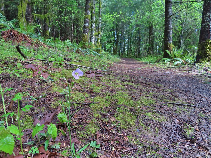 Toothwort along the Zorzal Trail.
 Stripped coralroot
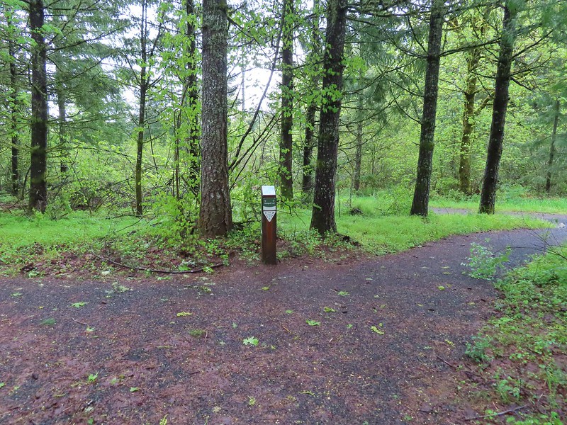
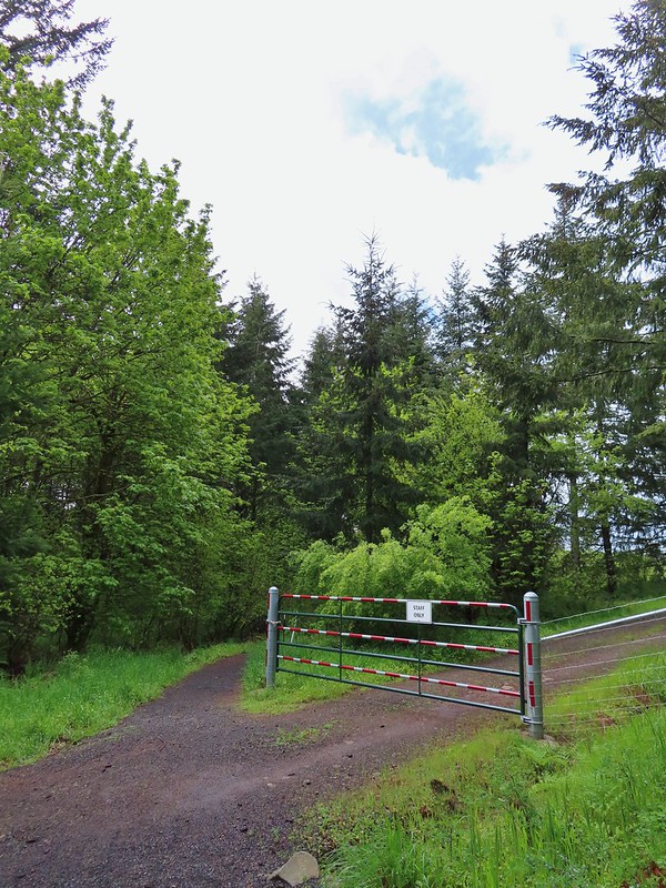


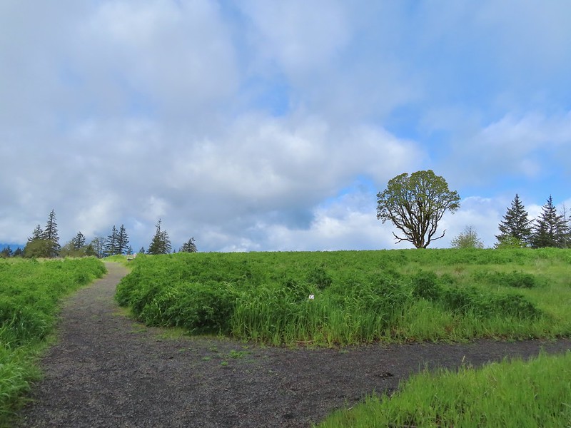
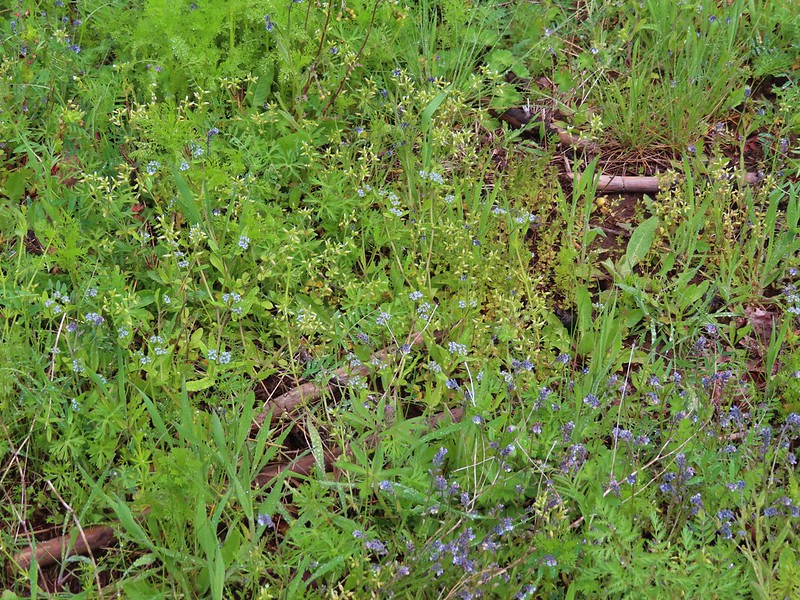 An assortment of smaller flowers.
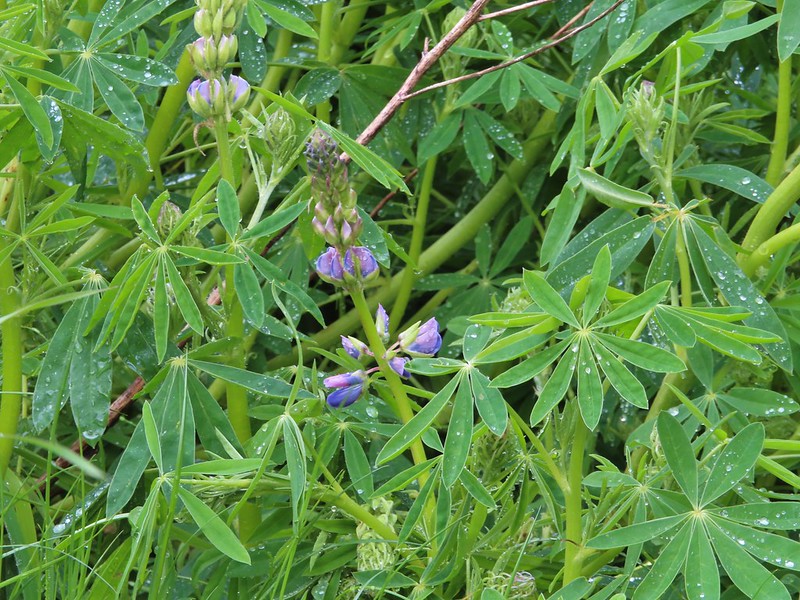 One of the few lupines with blossoms.
 Camas buds
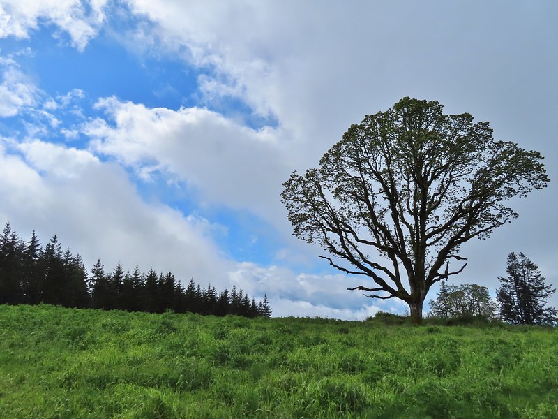 Oak tree on Iowa Hill. Most of the larger green clumps are lupine.
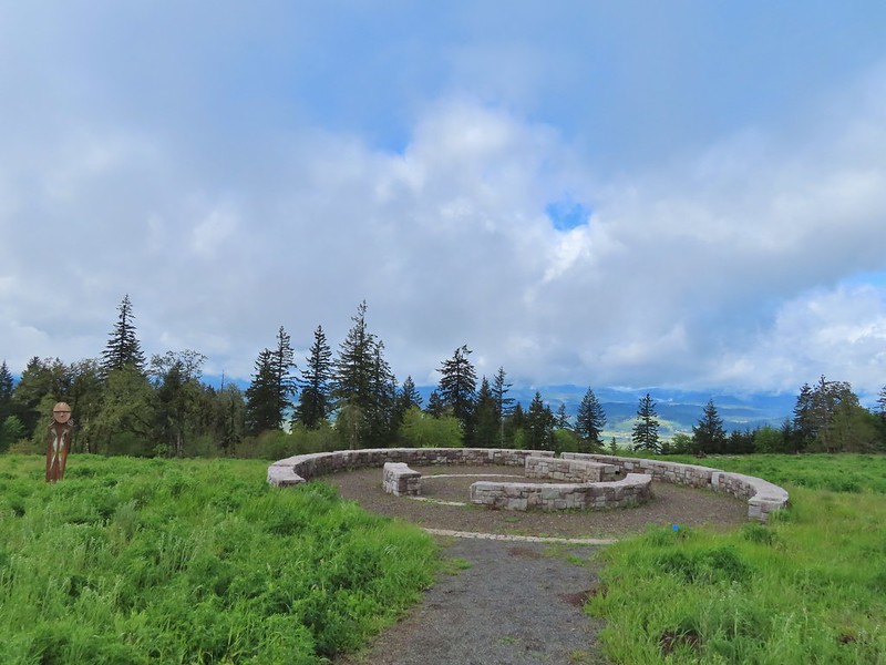 The third and final figure was also located near the stone circle.
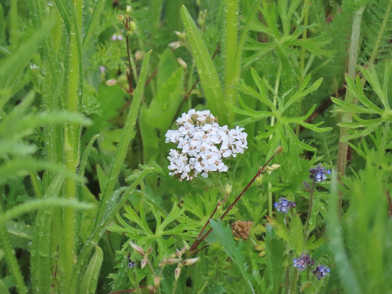 Yarrow
 More lupine starting to blossom.
 Tualatin Valley
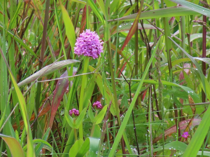 Plectritis
 Believe this is a checker mallow.
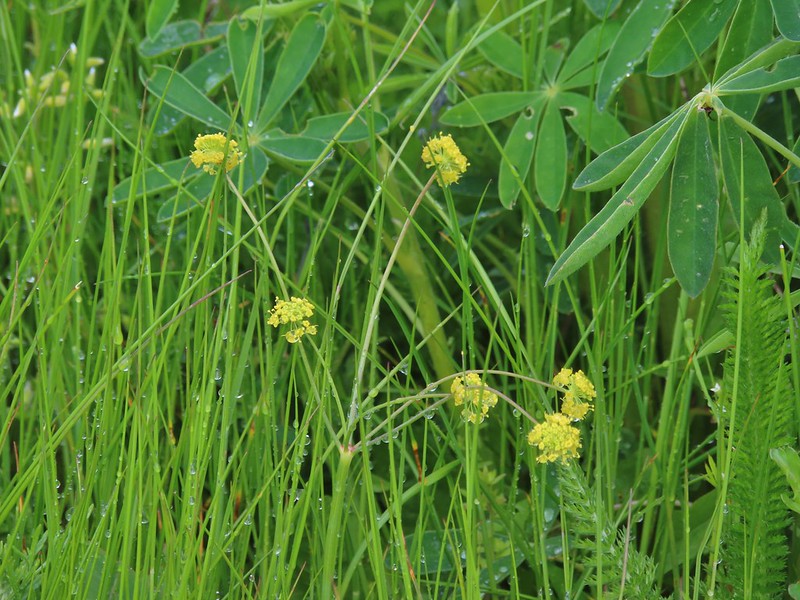 Parsley
 Camas
Camas Iris
Iris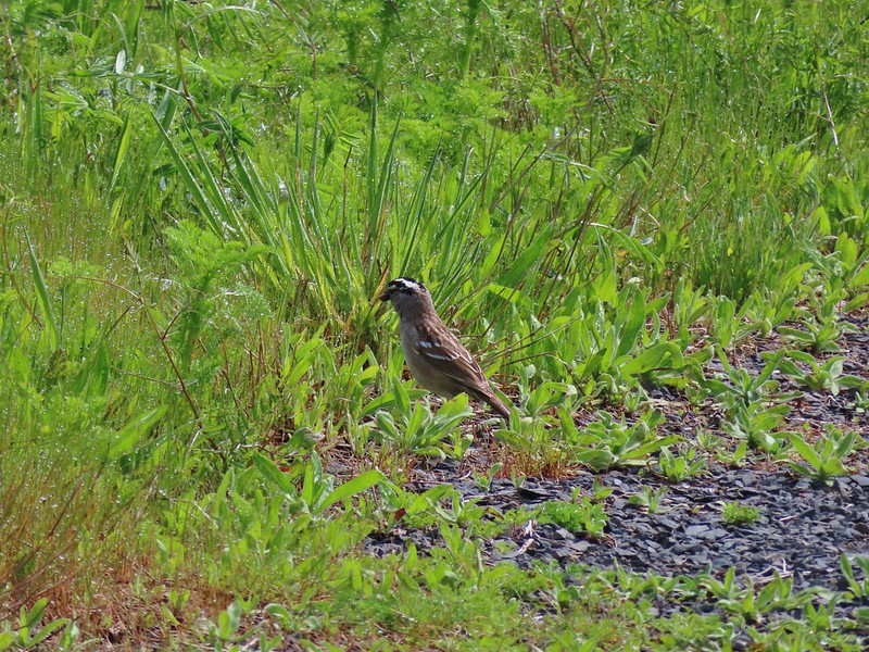 White crowned sparrow
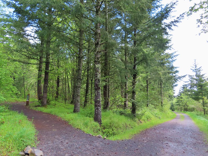 Turning down the Timber Road.
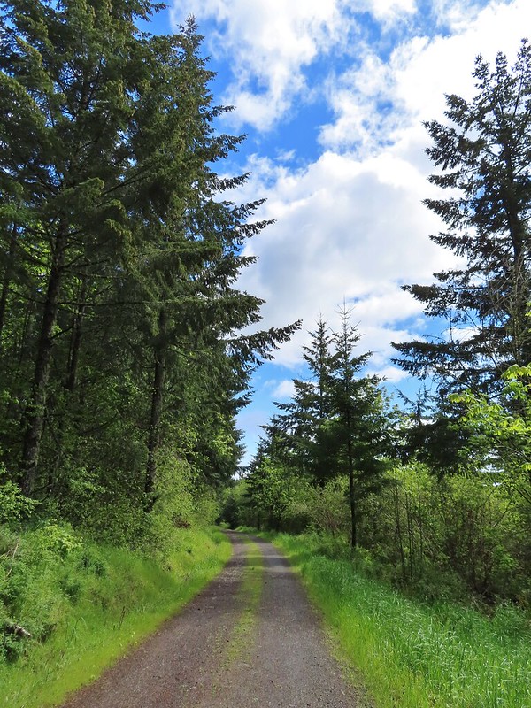
 I’m not good with these little yellowish birds. It could be an orange-crowned warbler.
 Black capped chickadee
 Approaching the Woodland Trail on the right.
 Woodland Trail
 Candyflower
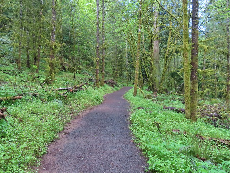 Coming to a switchback.
 We ignored a couple of shortcuts that would have led back to the Timber Road.
 We also skipped the Castor Trail which would have slightly lengthened the hike.
 Lupine along the Woodland Trail as we neared the trailhead.
 Much nicer conditions than we’d had that morning and way nicer than anything we had expected.

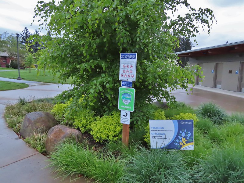

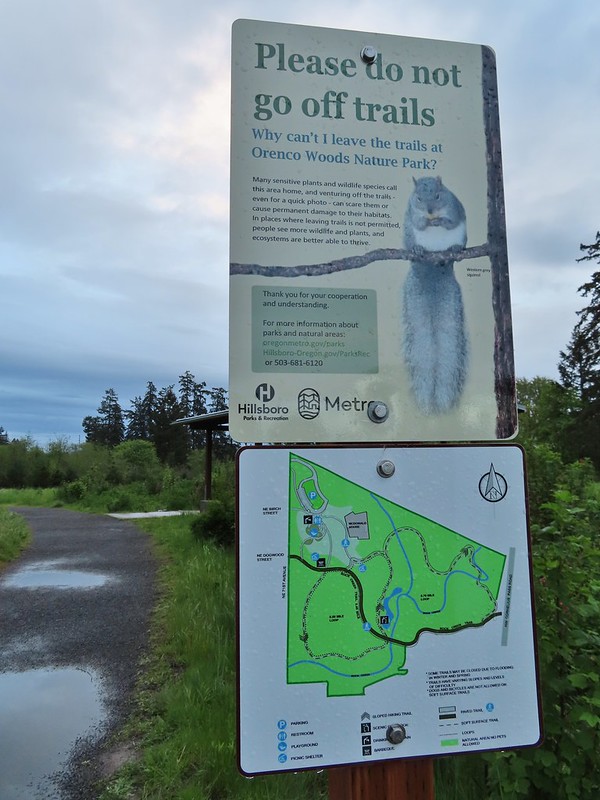
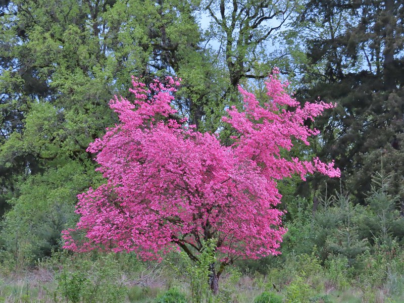
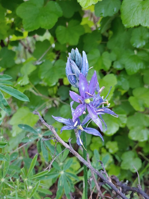 Camas
Camas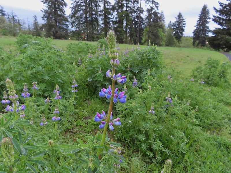 Lupine
 Habitat Trail
 We’ll blame our inability to read this sign on it still being early in the morning. We started down the path ahead before quickly questioning the direction and correcting course.
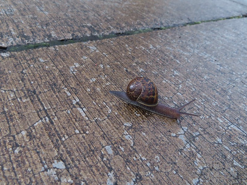 He probably knew which way he was going.
 Heading the right way now.
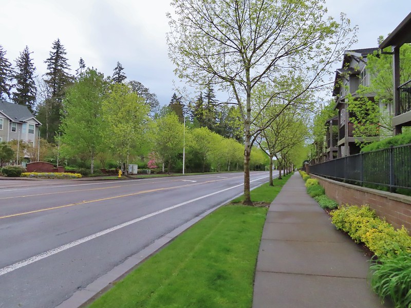 NW Wilkins


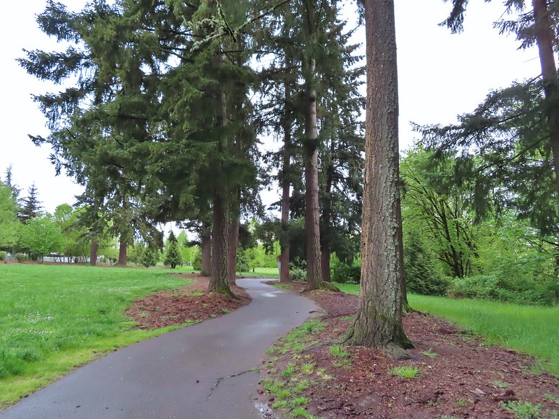
 Another trail user


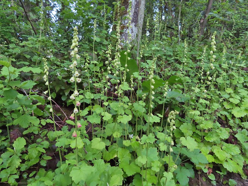 Fringecup
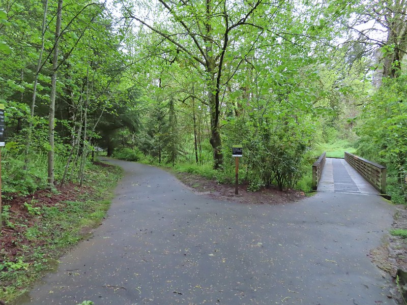
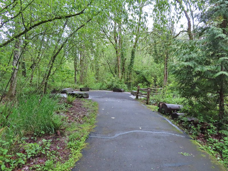

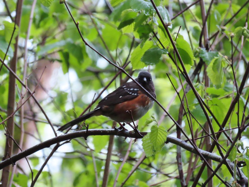 Spotted towhee
 Stellar’s Jay
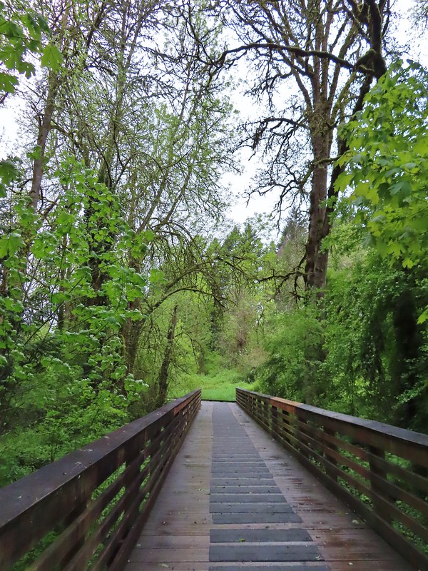
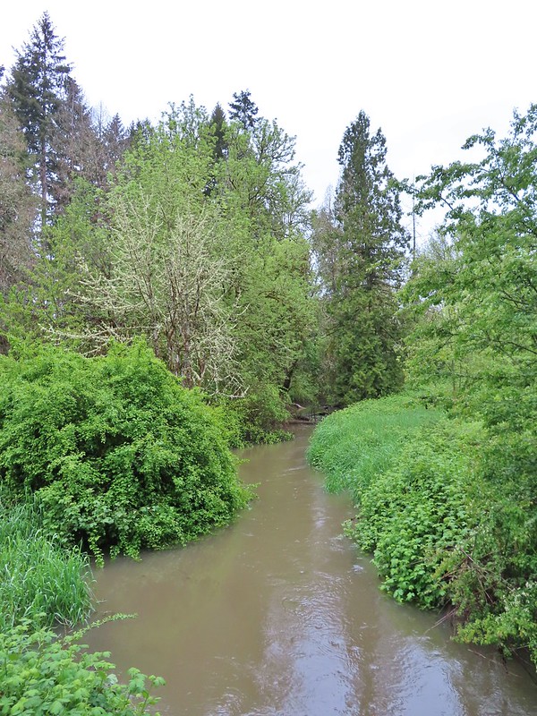
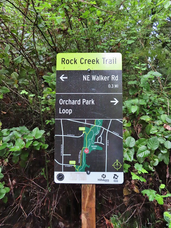 Second time staring at this sign.

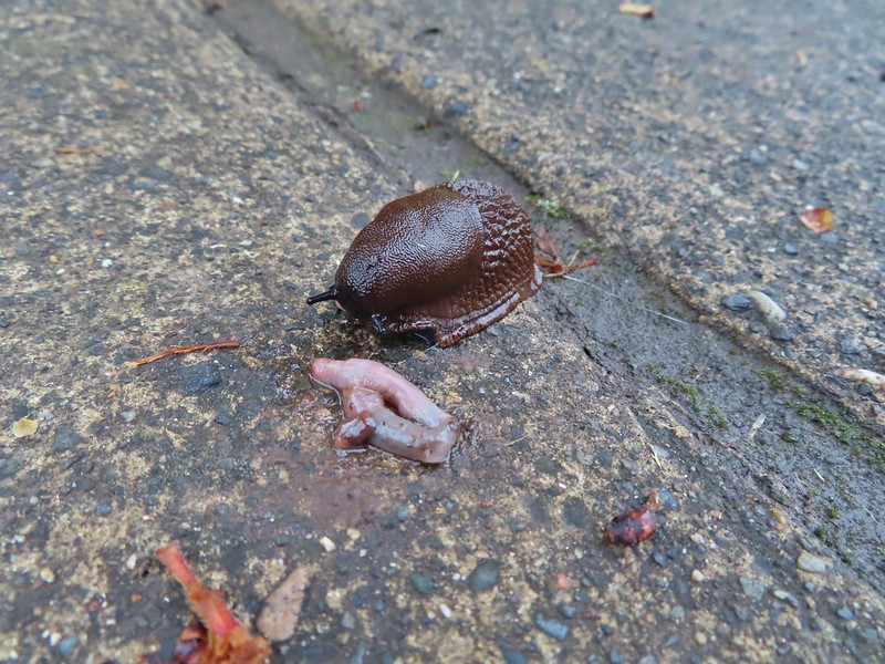 Not sure exactly how to interpret this scene – mourning, a murder, or breakfast?
 The slight jog right along NE Walker.


 Bridge of Rock Creek
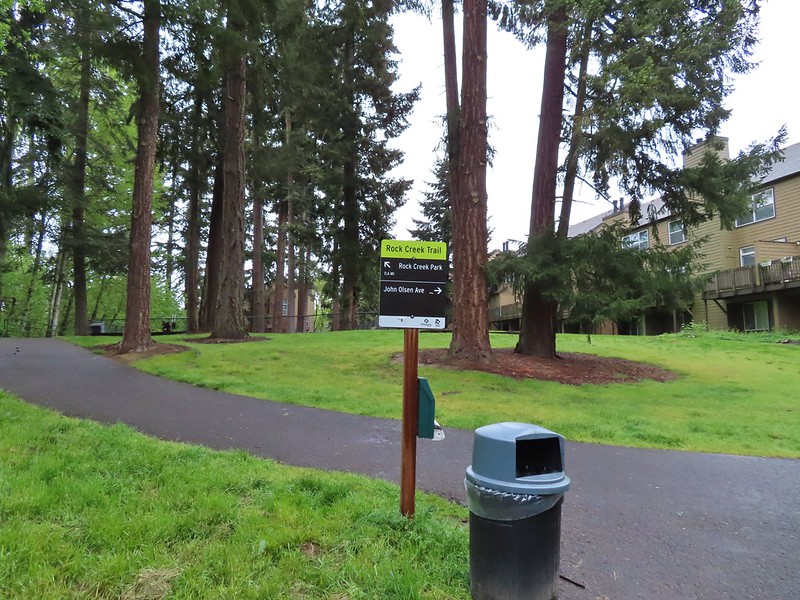 Look a pointer for John Olsen Avenue (just a lot further north).
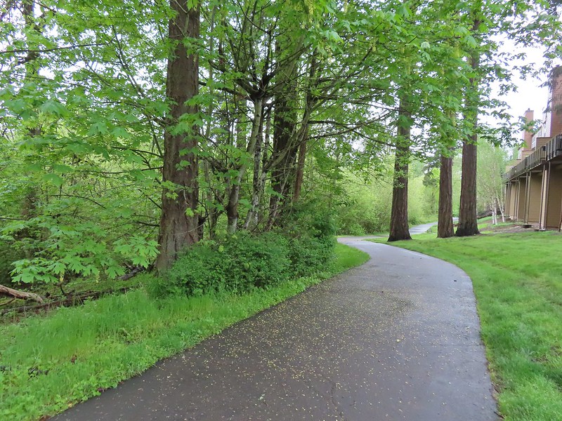
 Mallards (A pair of wood ducks flew off at the same time the mallards headed downstream.)
 Here is the only photo that I could even get with the little yellow bird visible at all.
 NE Evergreen Parkway
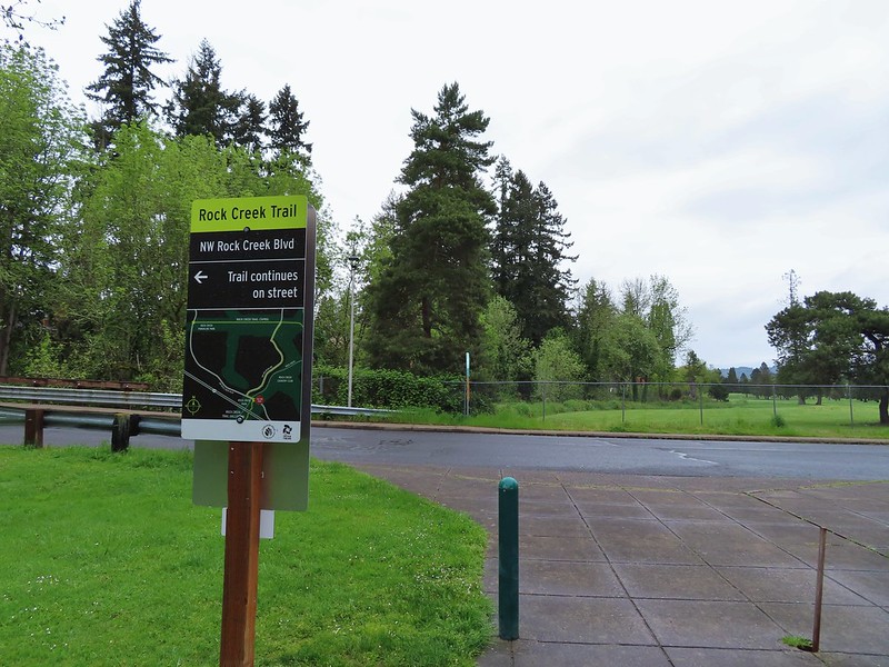
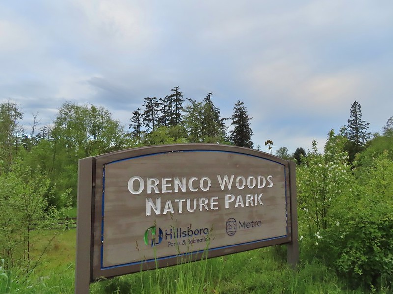
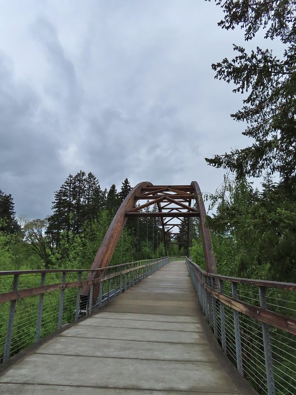

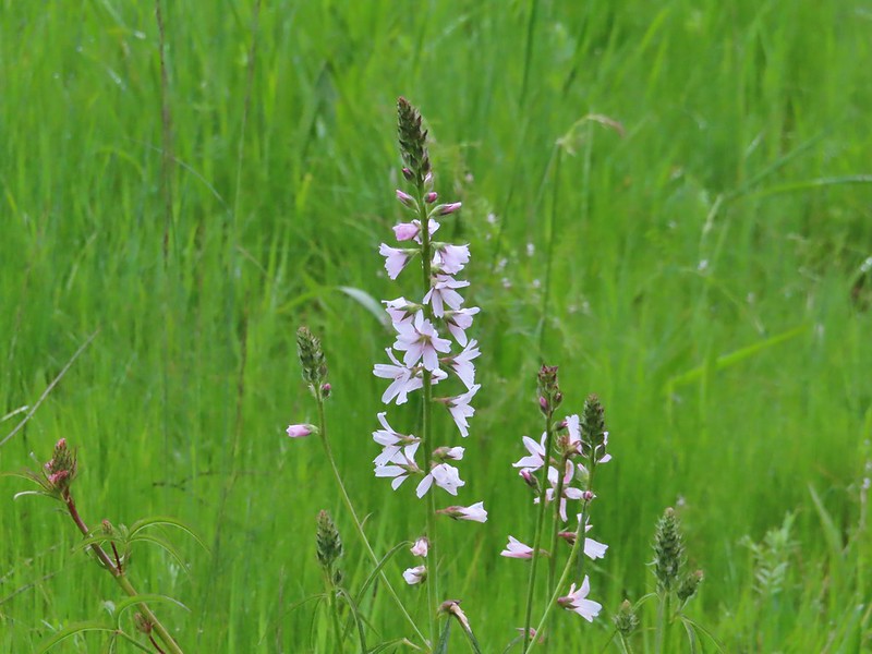 Checkermallow
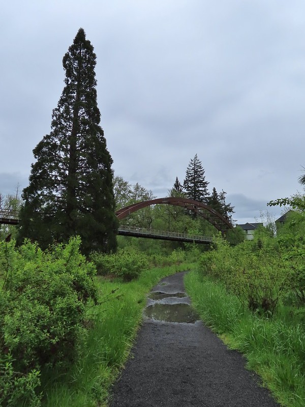
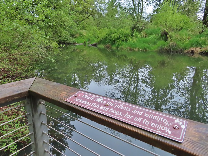


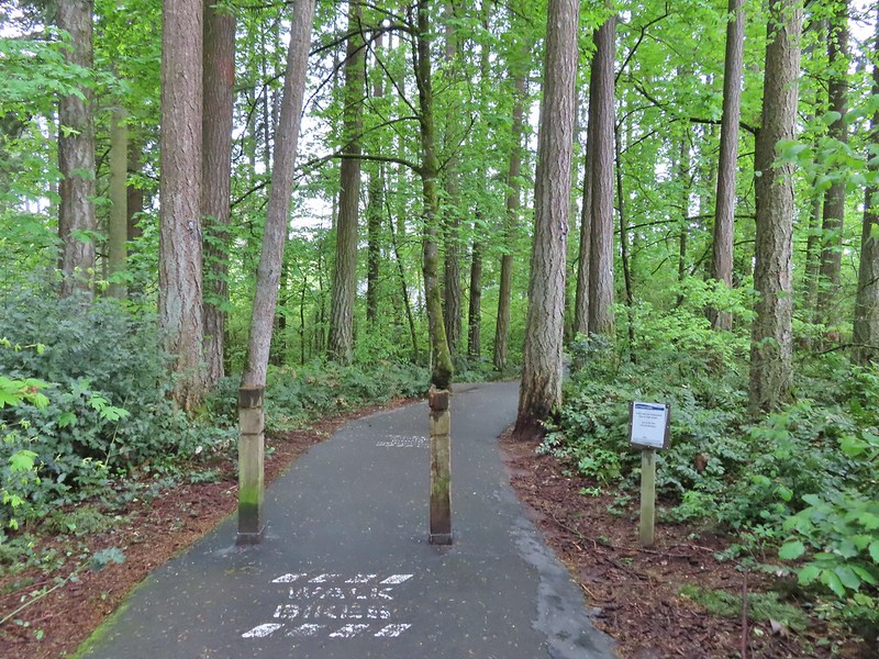
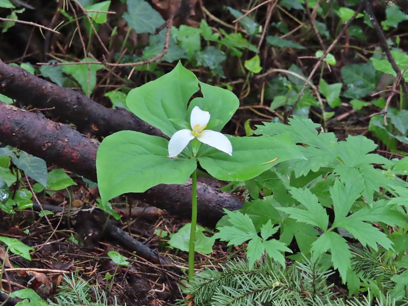 Trillium
 Solmonseal
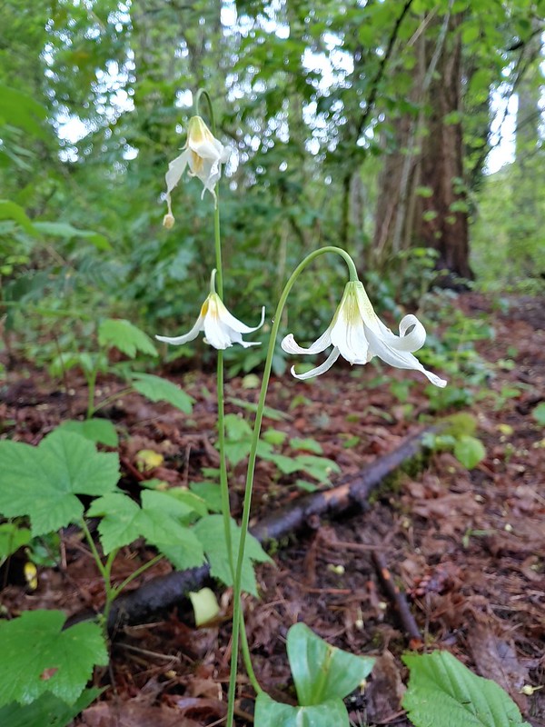 Fawnlilies
 Aven
Aven

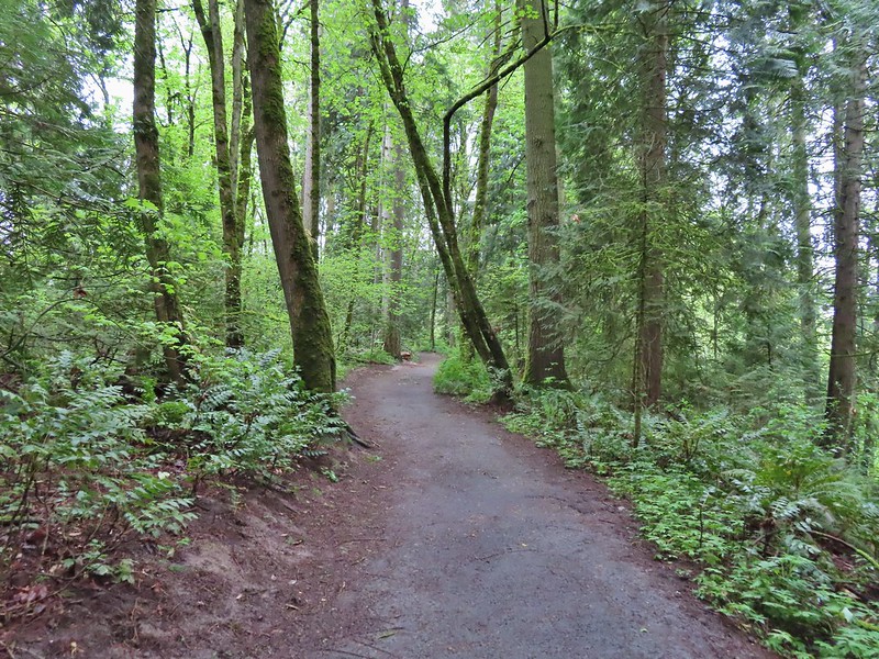


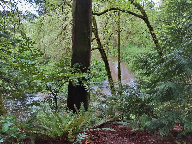 Rock Creek from the viewpoint.
 The back of the owl (middle tree 2/3 of the way up)

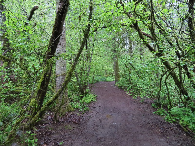
 Violets
 Swollen creek
 Fairy bells
 Cinquefoil
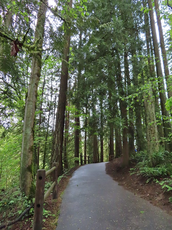 Nearing the trailhead.


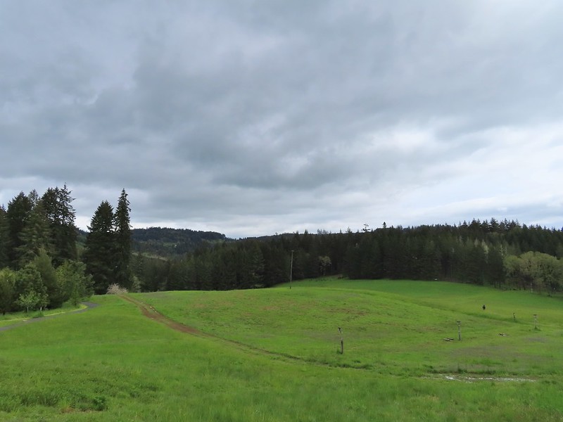
 A wren and a white-crowned sparrow
 American goldfinches
 Tree swallows
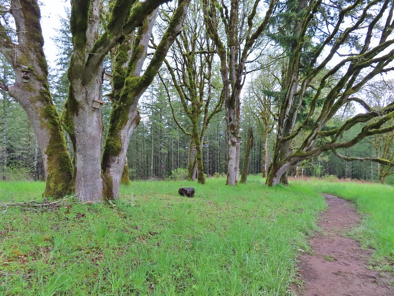

 Bleeding heart near the stream.
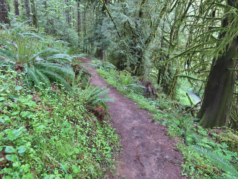 Berry Creek down to the right.
 There was a lot of wild ginger on the hillside.
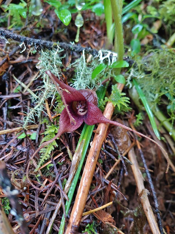
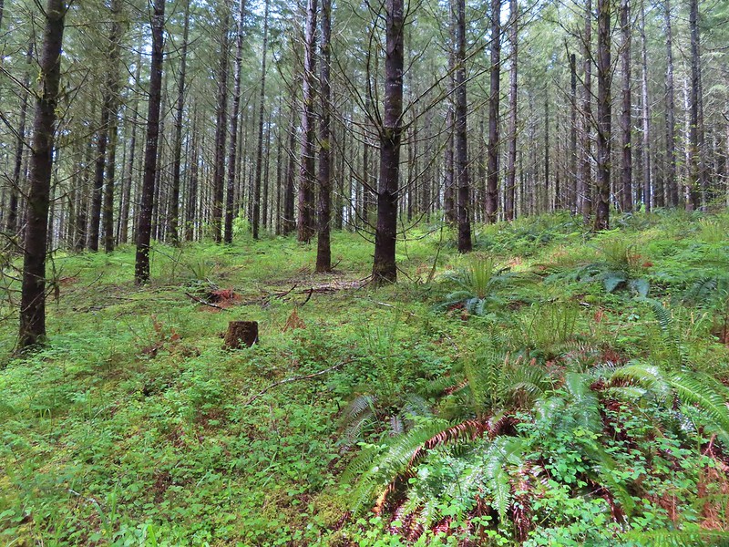
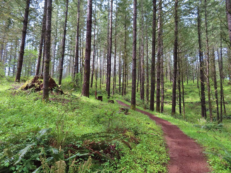


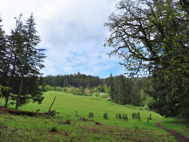
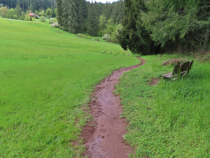
 Iris
Iris Buttercups
 Small garter snake
 Approaching the bridge and creek.
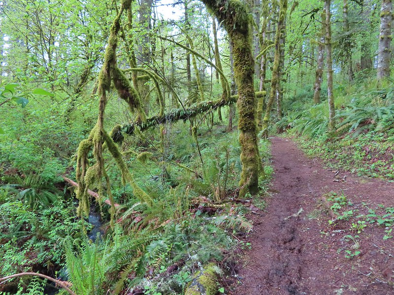
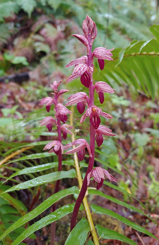

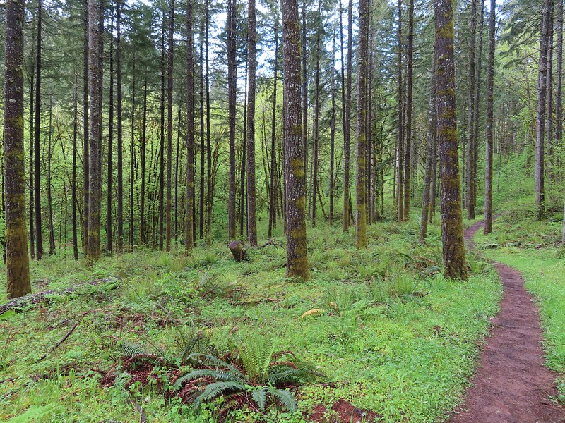
 Sparrow
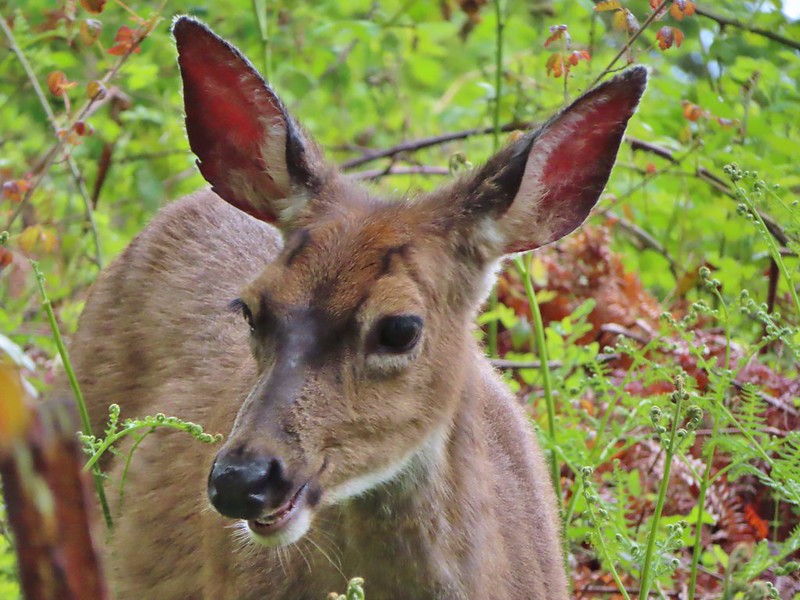 Doe just hanging out in a patch of poison oak. (It doesn’t bother deer.)
 Nearing the high point of the trail at K.T. Summit
 Spotted coralroot
 K.T. Summit
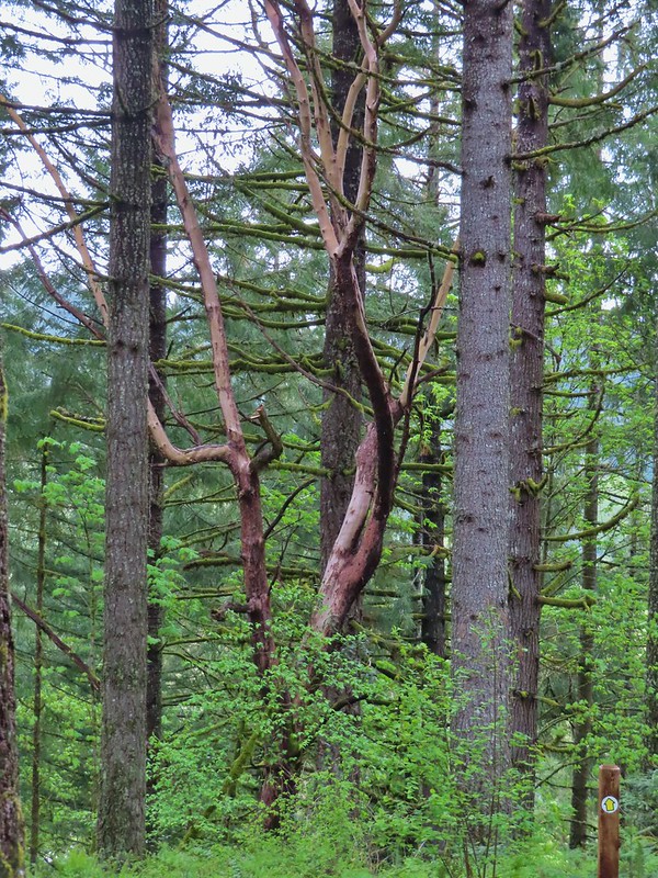 A very cool madrone tree.
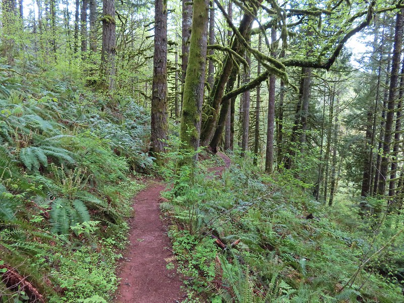
 Two more deer with a third off camera.
 There was at least one identifier for each tree listed on this sign. The signs were particularly nice because many were next to younger trees which made it easier to see the needles and bark instead of just look at a trunk and having to look up to try and see other details of the trees.
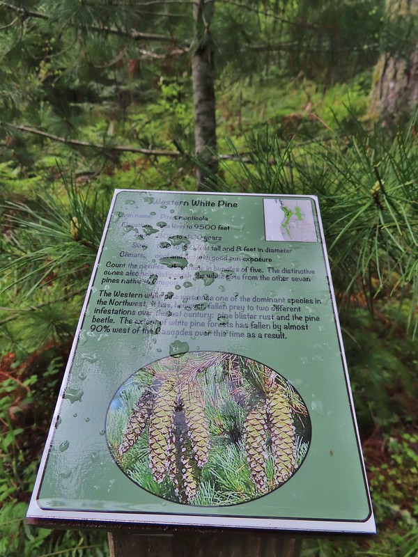 Western white pine
 Western larch
 Vanilla leaf
 Fairy slippers
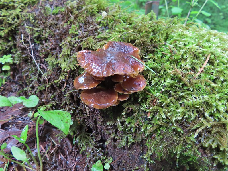


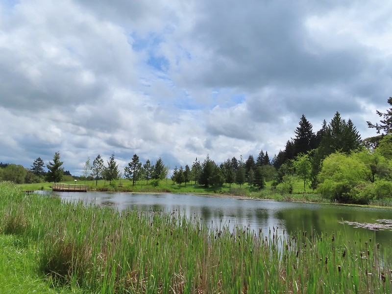
 Frog near the pond.
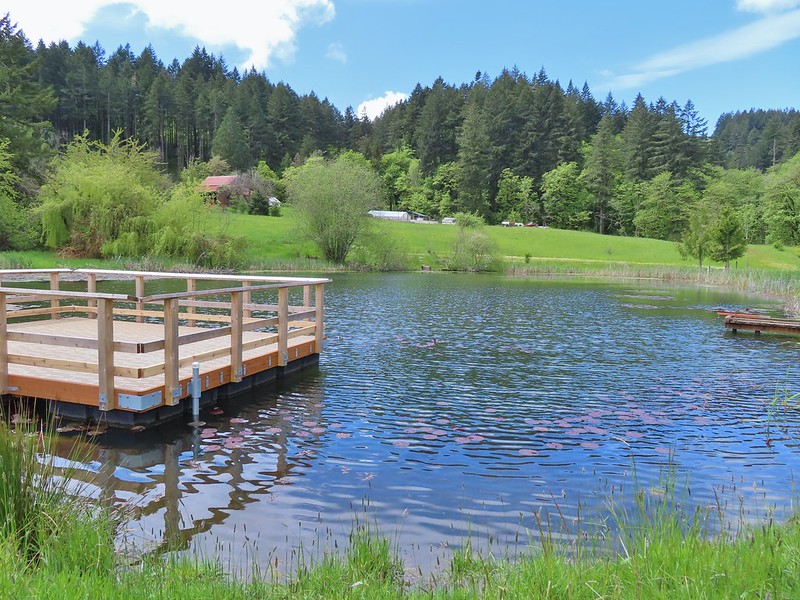
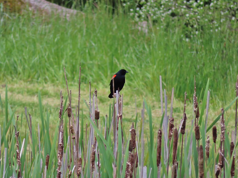 Red-winged blackbird

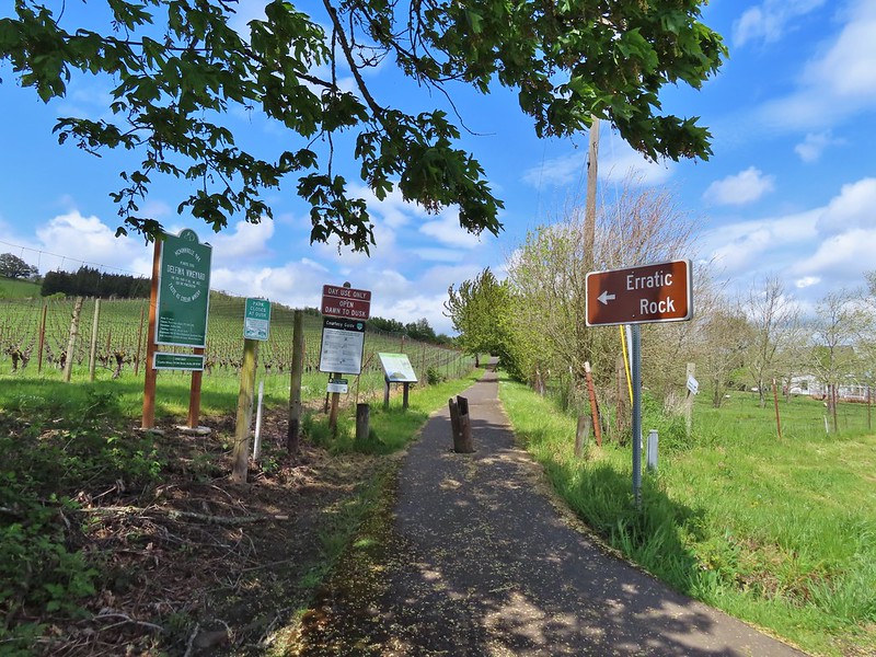
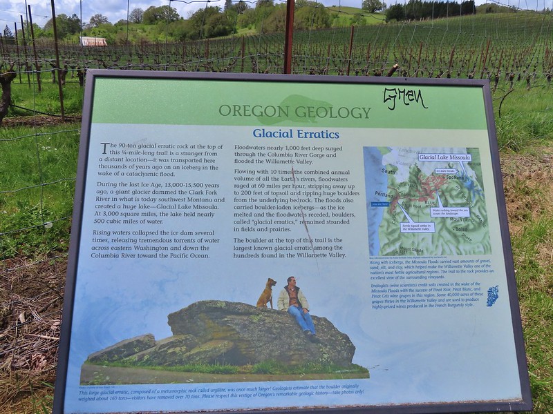 Interpretive sign at the start of the trail.
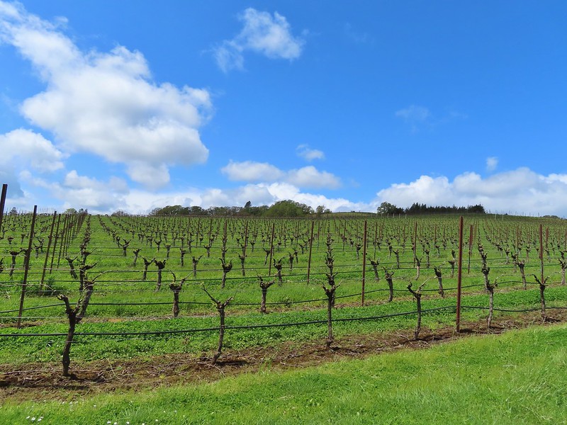 Vineyard along the trail.
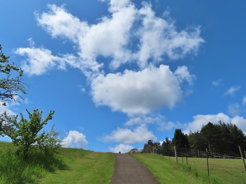
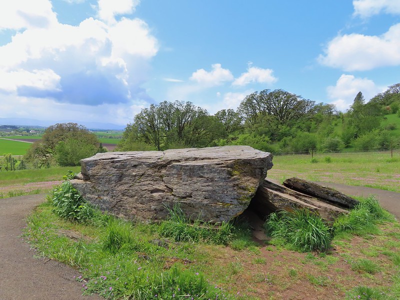
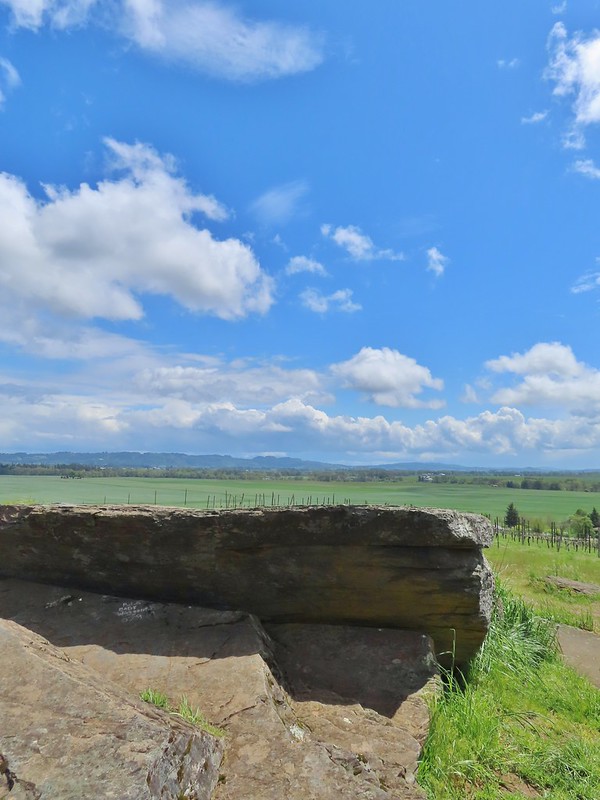

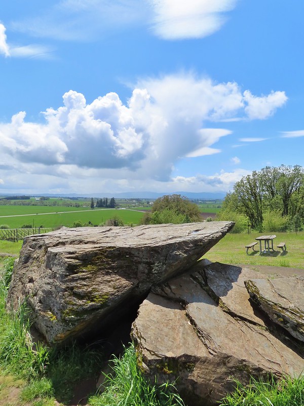
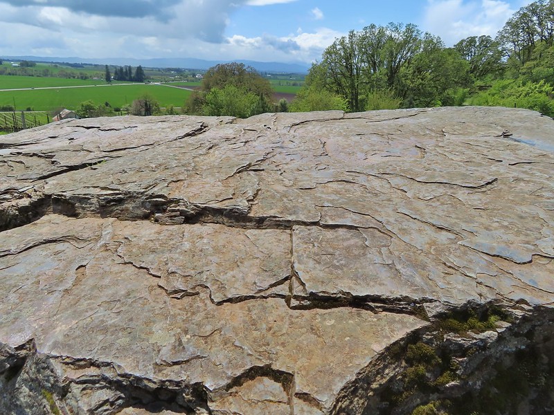


 Looking west down the Columbia River from the overlook.
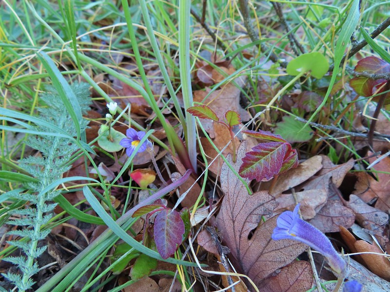 Naked broomrape and poison oak
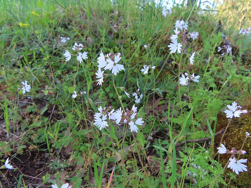 Woodland stars
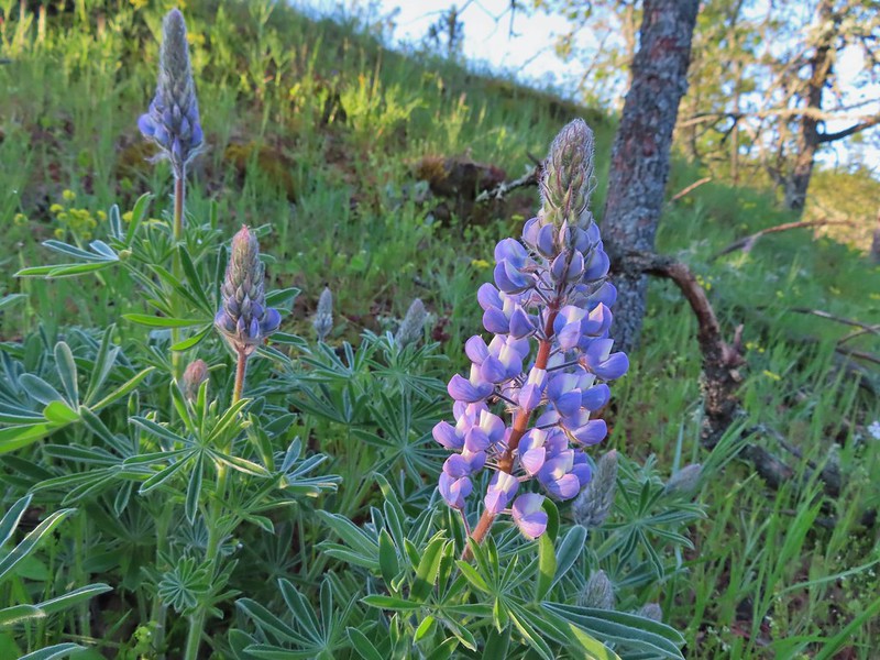 Lupine
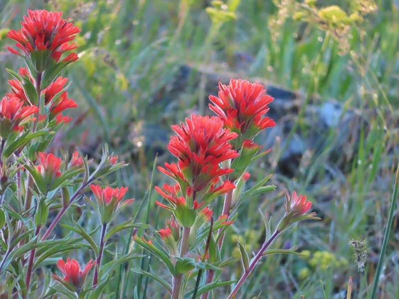 Paintbrush
 Larkspur and parsley
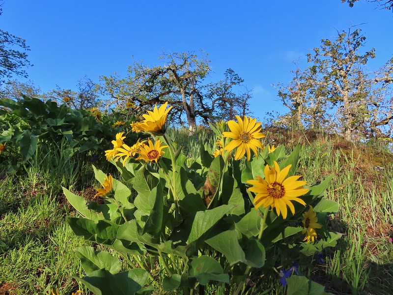 Balsamroot

 Chocolate lilies
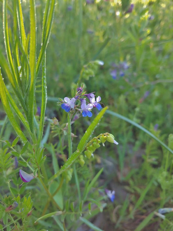 Giant blue-eyed Mary
 Coming up on the creek crossing.
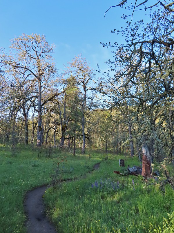

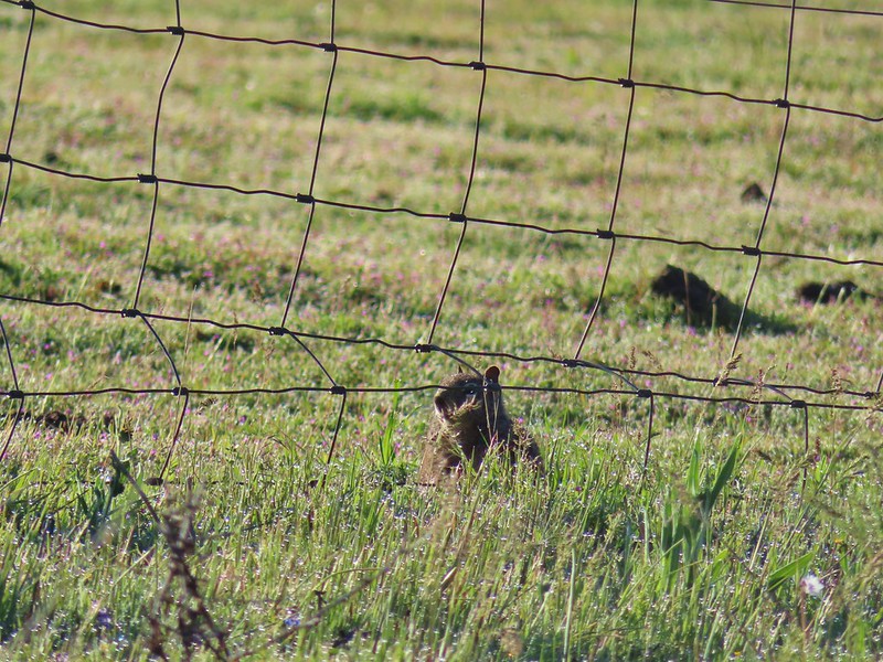 Ground squirrel on the other side of the fence.
 Looking back at the pond surrounded by trees.
 Heading up Chatfield Hill.
 Fiddleneck and other wildflowers in front of Mt. Hood.
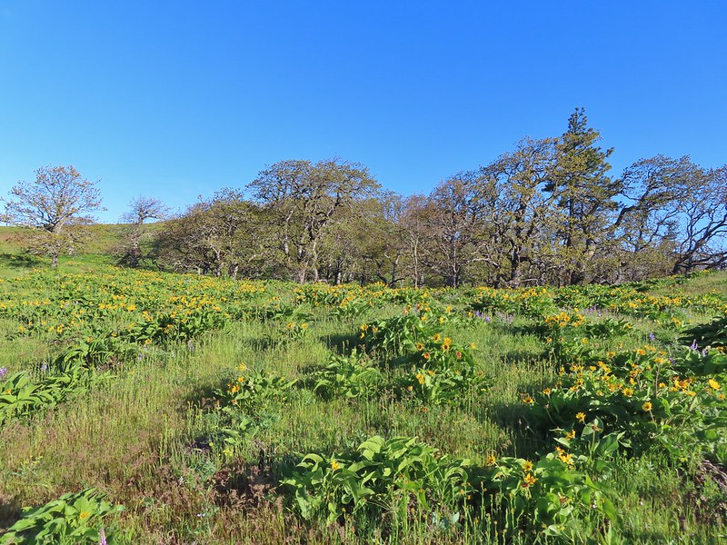


 The Hood River Bridge spanning the Columbia River.
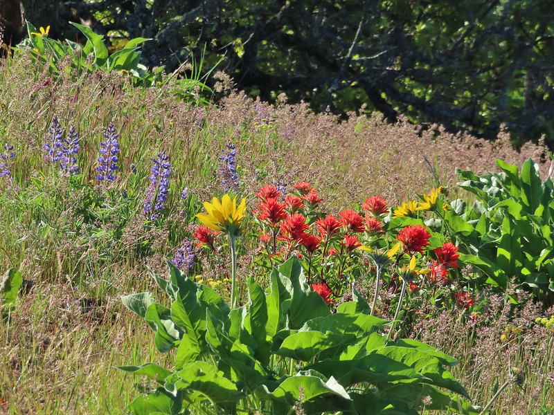 Lupine, balsamroot, and paintbrush
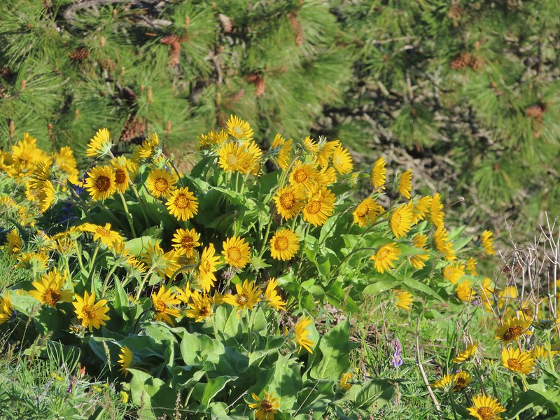 Balsamroot
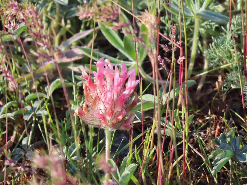 Large-head clover
 Large-flower Triteleia
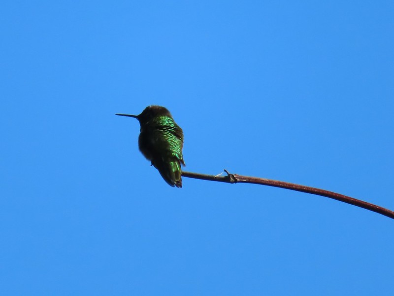 Hummingbird
 Balsamroot on Marsh Hill
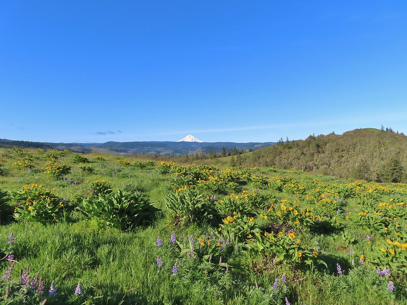
 Lupine and balsamroot
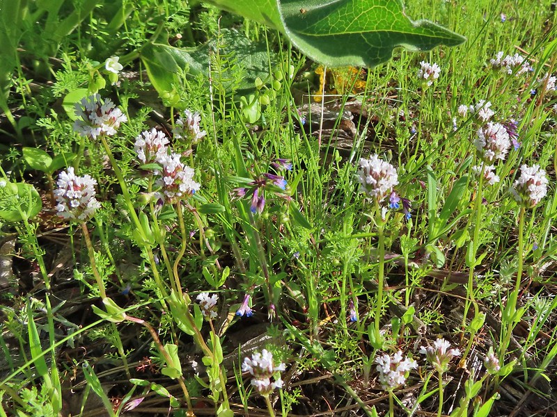 I think this is longhorn plectritis
 Sign for the parking area (If this small lot is full there are other


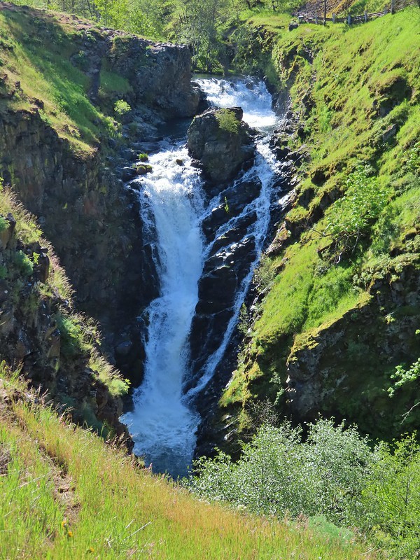


 Looking up the hillside.
 Red-stem storksbill
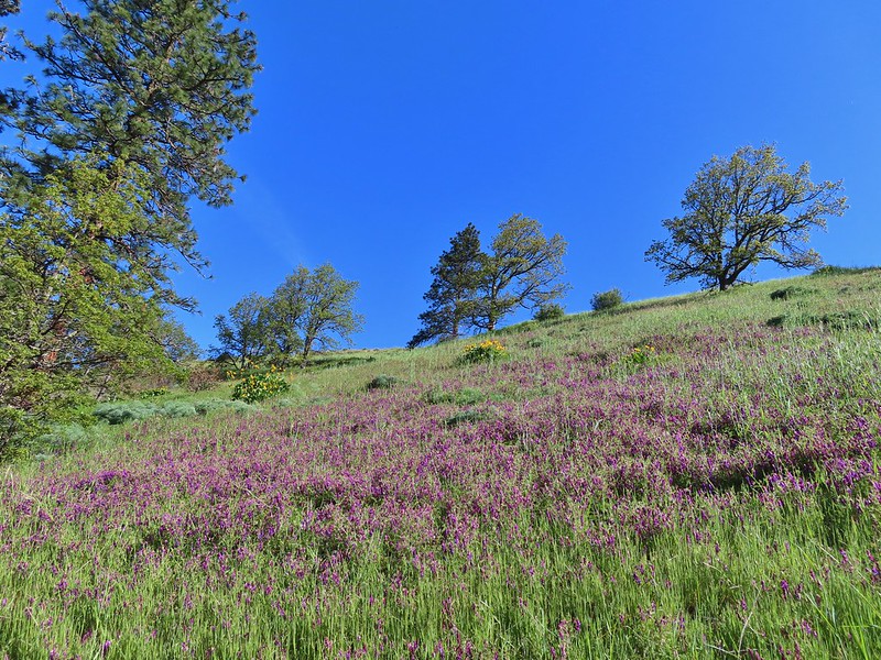 Vetch and balsamroot
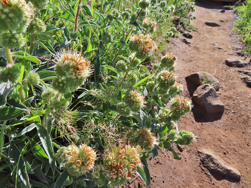 Silver-leaf phacelia
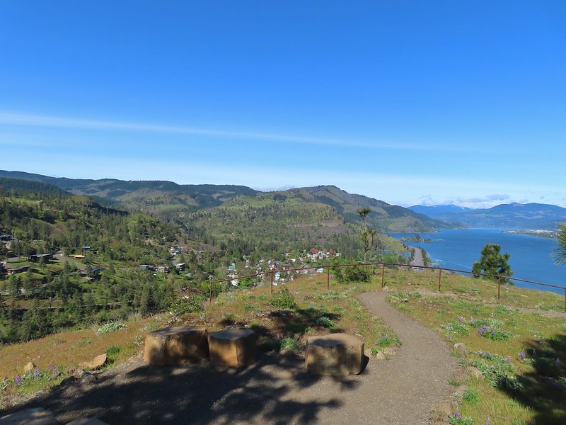
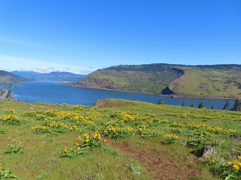 Coyote Wall (
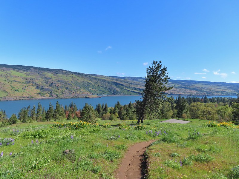


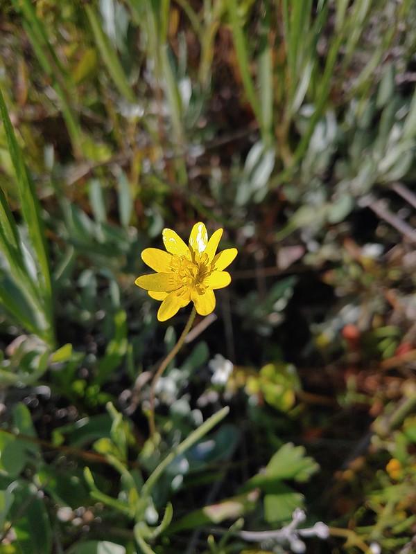 Gold star
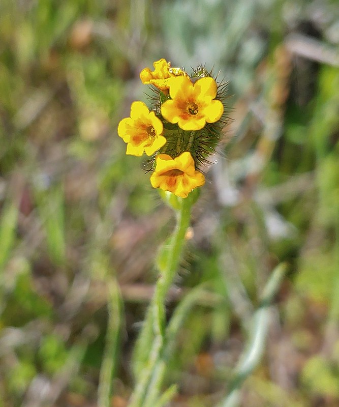 Fiddleneck
 Balsamroot
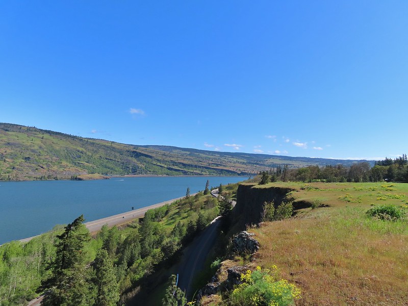 View east.
 Mosier to the west.
 Gray hairstreak
 Busy bumblebee
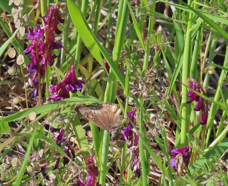 A duskywing (propertius?) on vetch.
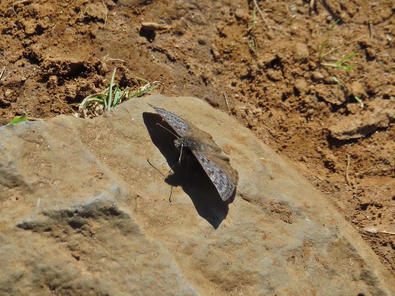 Propertius duskywing
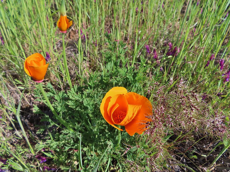 Poppies opening up to the Sun.
 Bachelor button
 The old powerhouse.

 Stellar’s jay near the tracks.
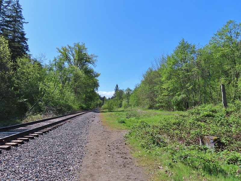 The trail ahead to the right.
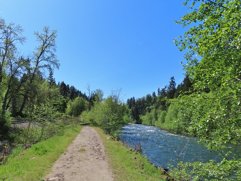


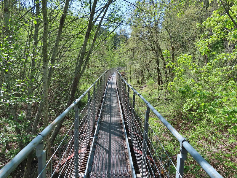
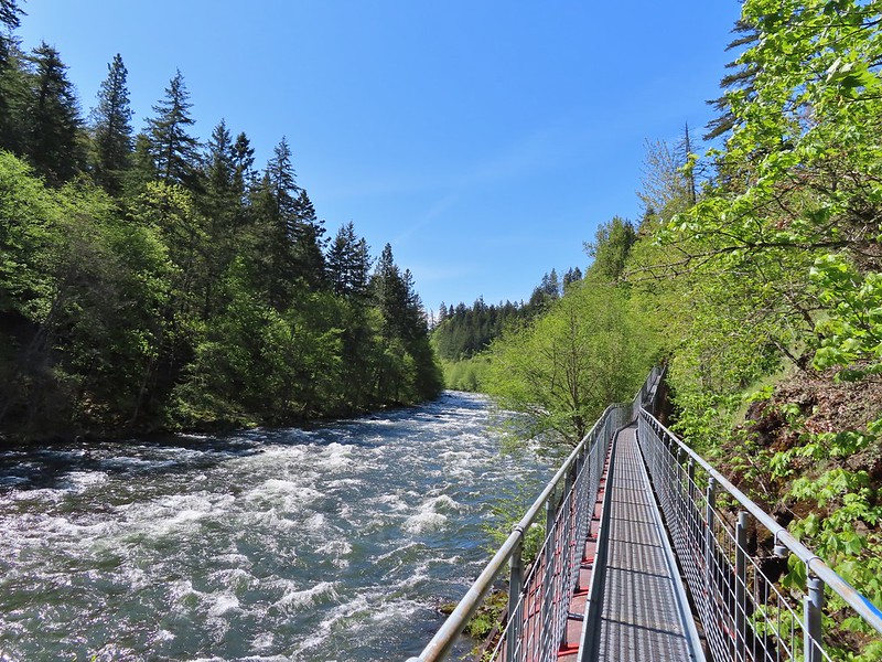
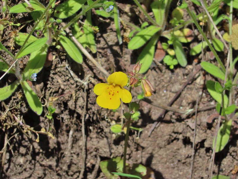 Monkeyflower
 Looking back from the turnaround point.
 Lizard
 Mallard
 Scrub jay
 Starlings
 Osprey