Categories
Central Coast Coastal Range Hiking Oregon Oregon Coast Trip report

Niagara Falls and Neskowin

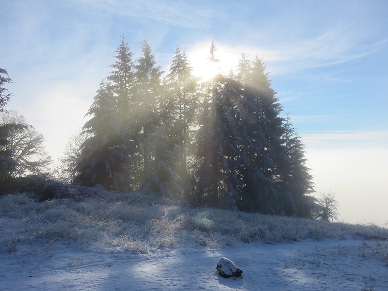
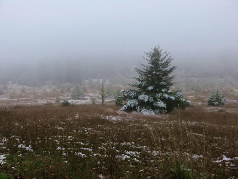
We took advantage of a favorable forecast and headed out for our February hike to visit a pair of coastal waterfalls and then the beach near Neskowin.  We’ve had a lot of snow and rain this winter making it a good time to catch the waterfalls assuming you can reach them.  The storms have left their mark on some of the trails and roads so we weren’t sure what to expect as we prepared to head out, but a quick check of the Forest Service website listed the Niagara Falls Trailhead as open so we were optimistic.

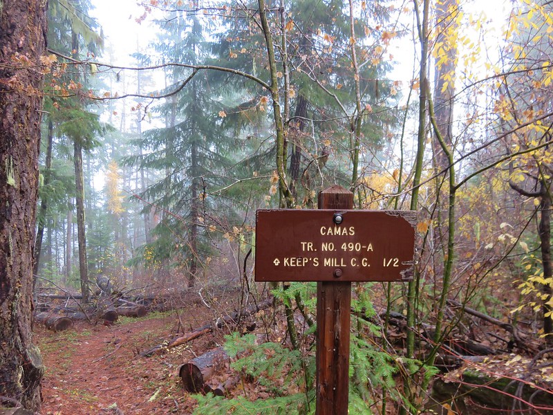
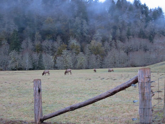
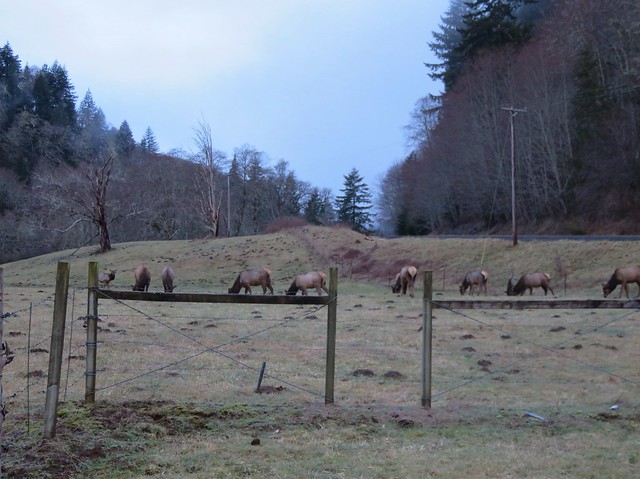
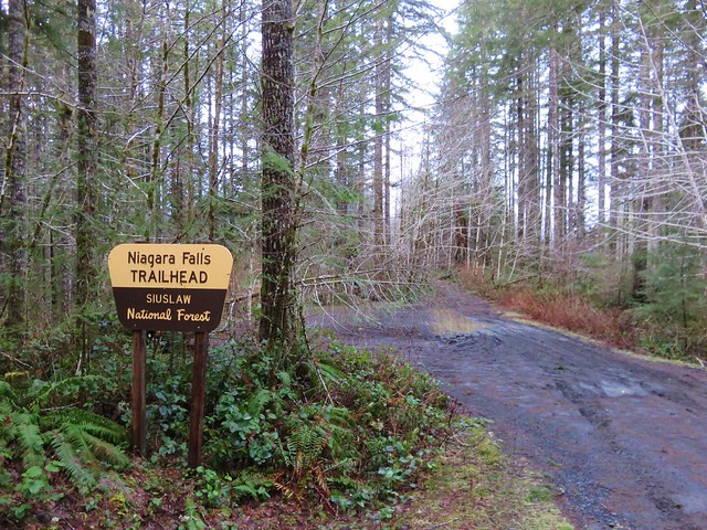
The Niagara Falls Trailhead is located east of Mt. Hebo in the Siuslaw National Forest. There was good signage along the route which took us  5 miles east of Blaine, OR on Upper Nestucca Road (Forest  Road 85) where we turned right onto Niagara Road (Forest Road 8533). A small herd of elk were grazing in the field at this turn.
IMG_8536

IMG_8538

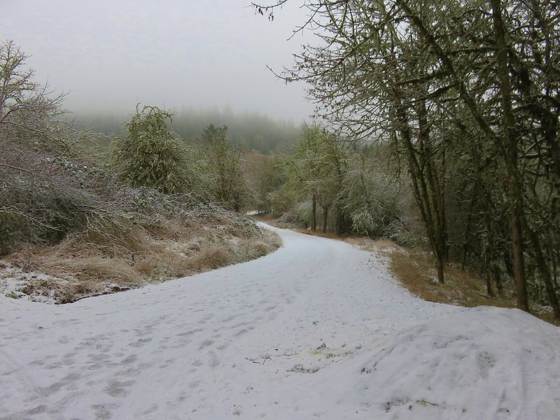
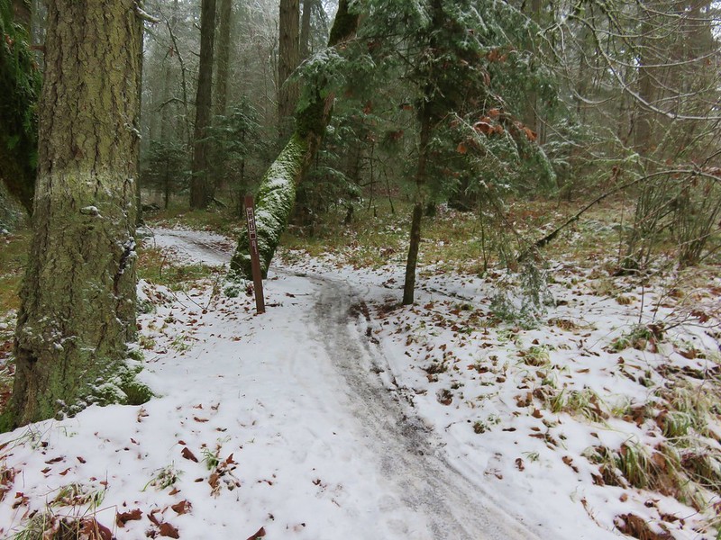
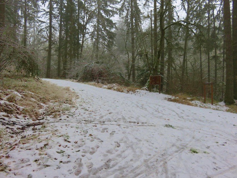
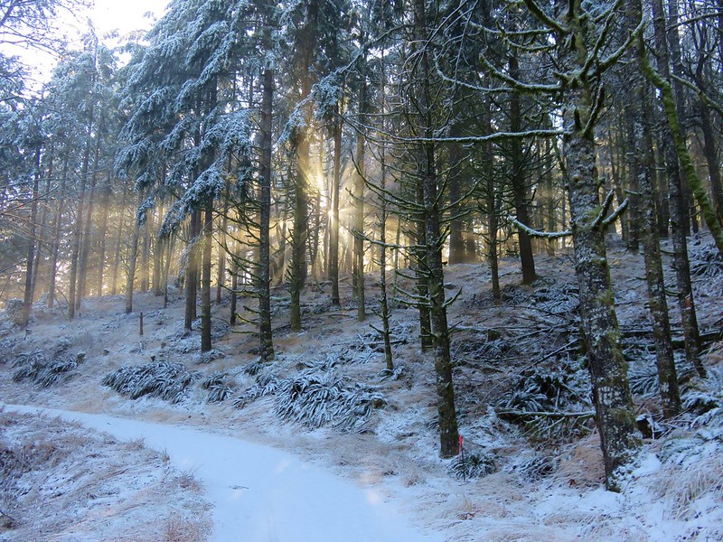
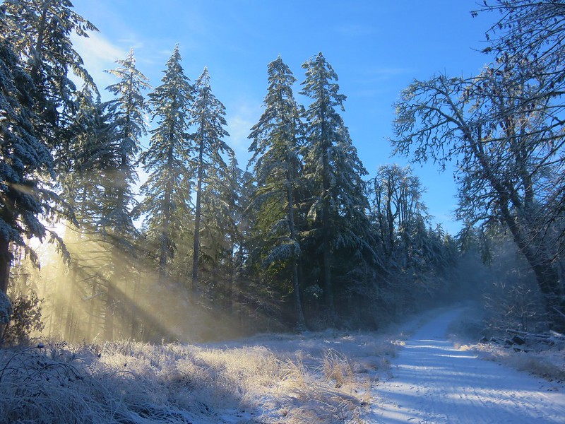
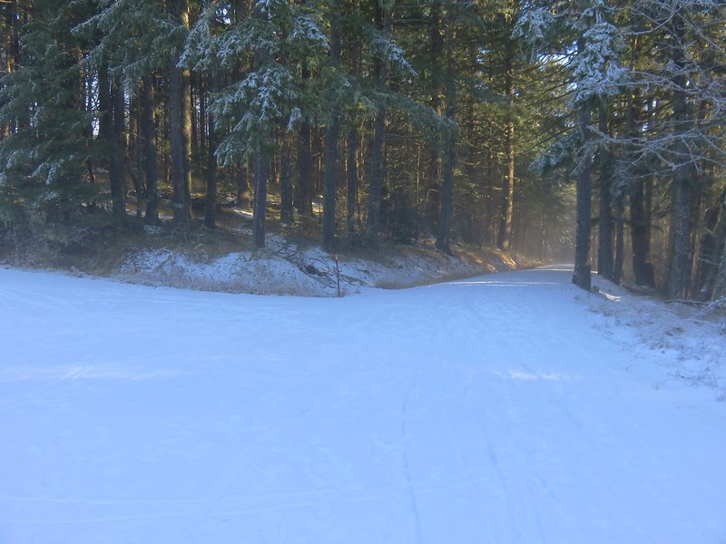
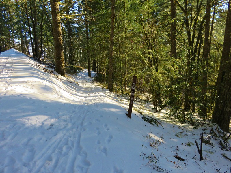
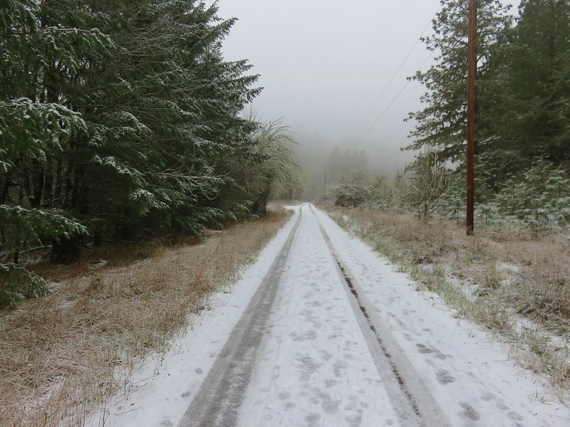
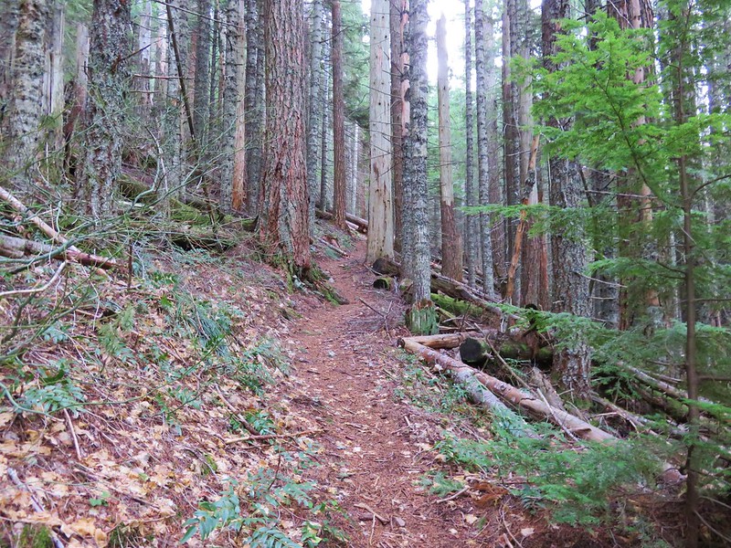
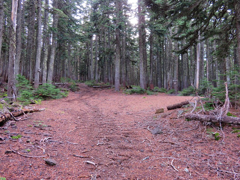
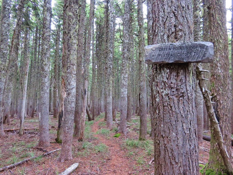
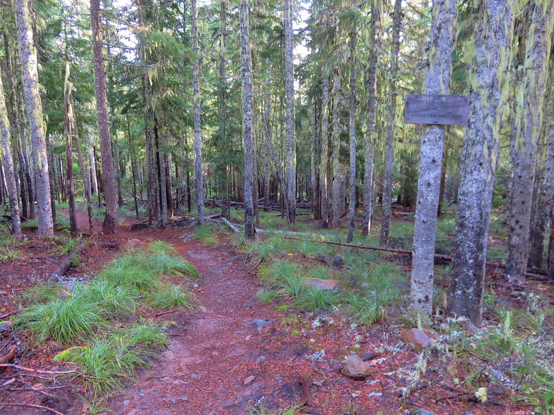
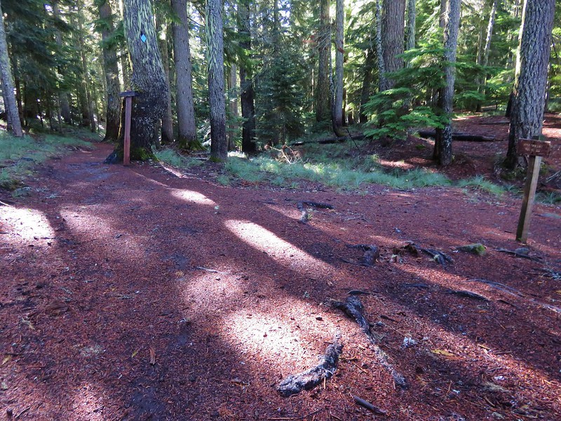
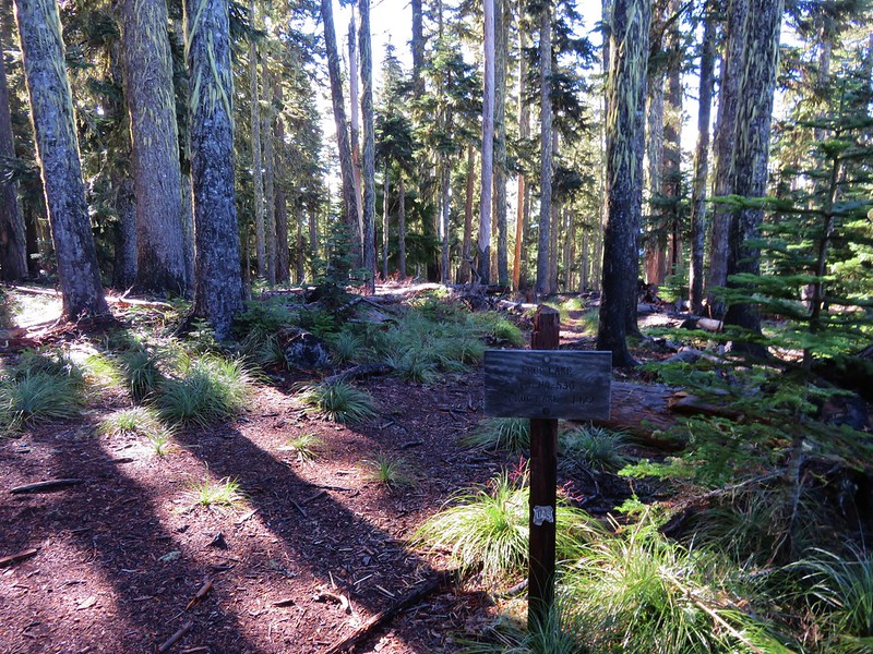
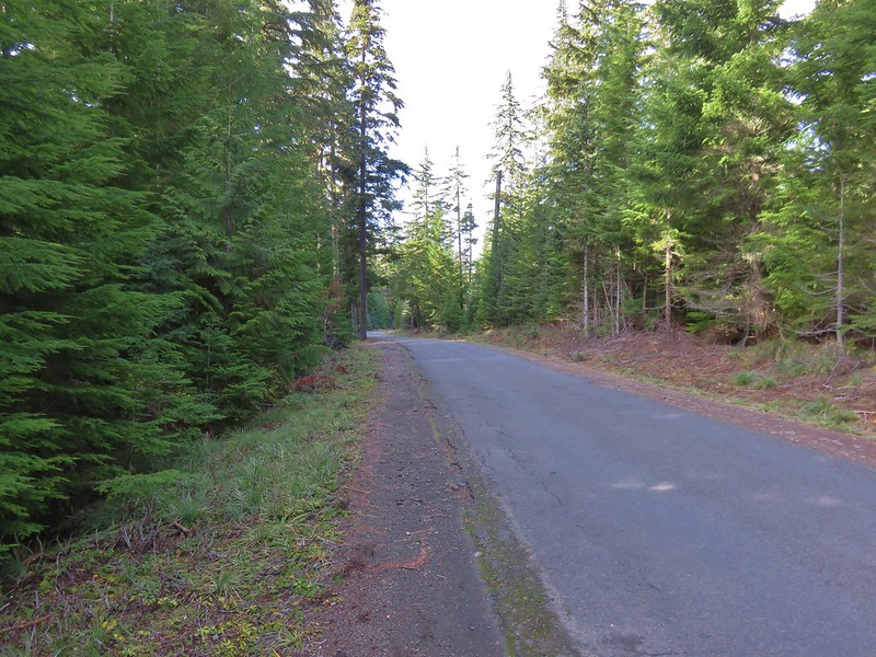
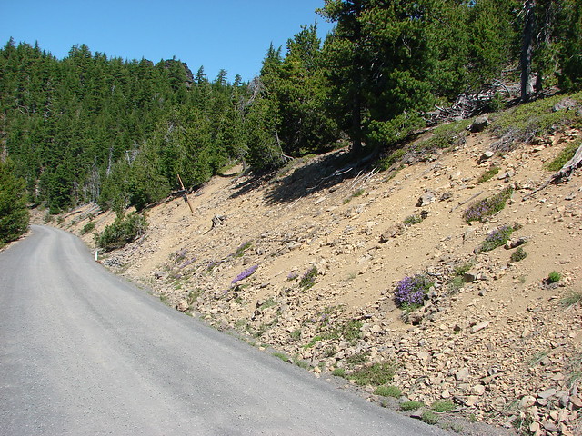
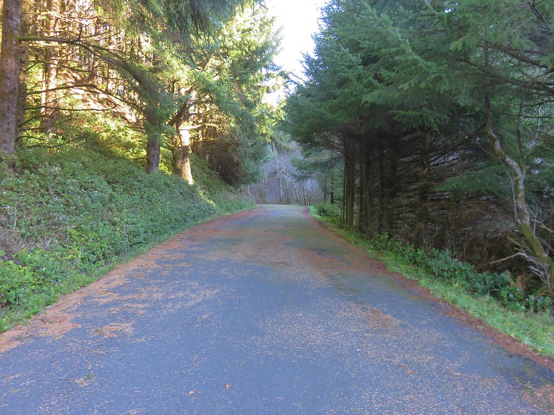
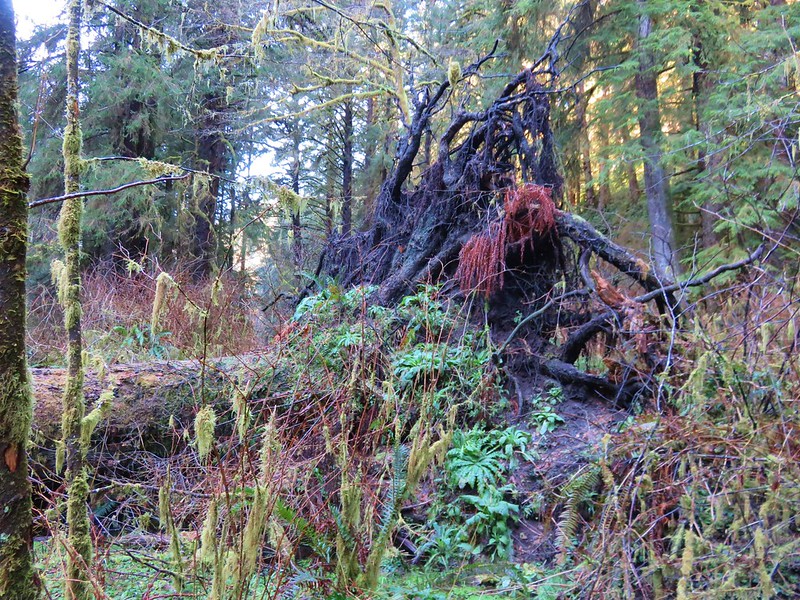
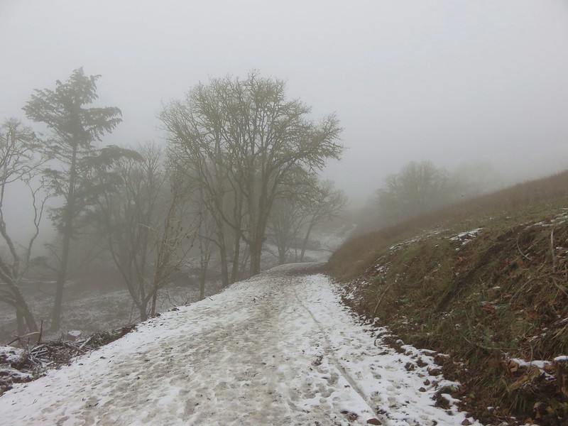
We followed this gravel road for 4.3 miles. The road was in pretty good shape and had obviously been cleared recently. At the 4.3 mile mark we forked right following signs for the trail for another .7 miles to the trailhead.
IMG_8543

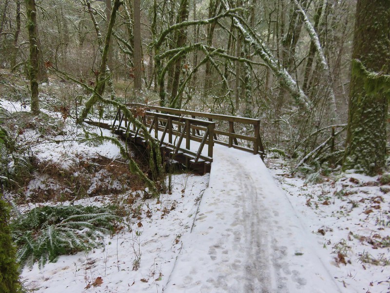
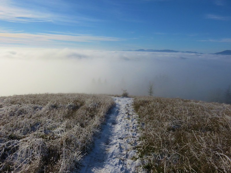
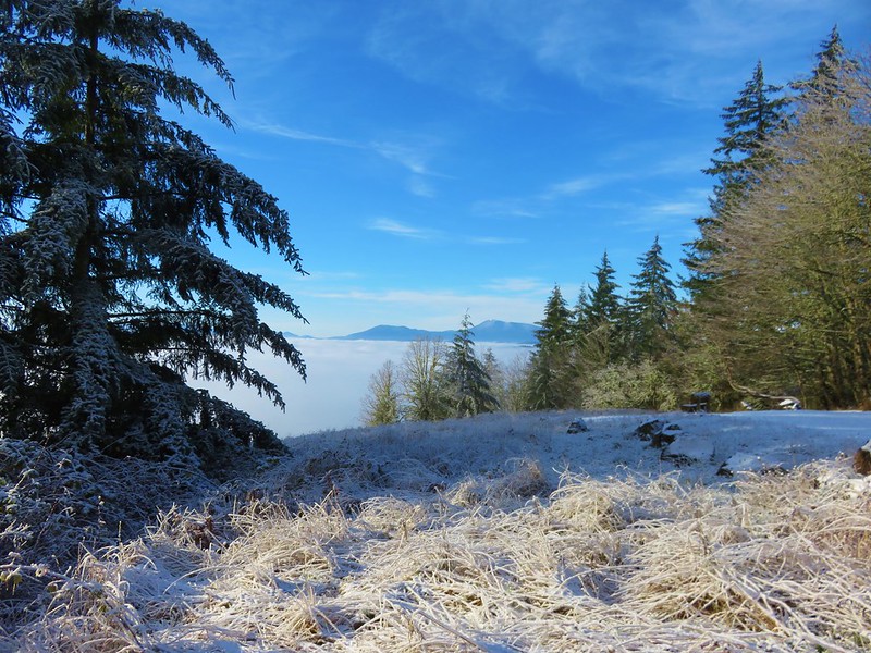
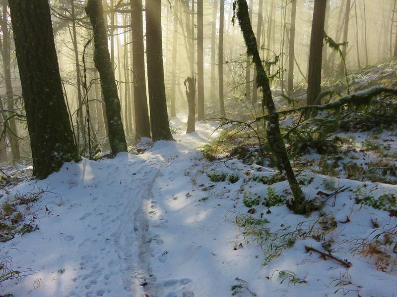
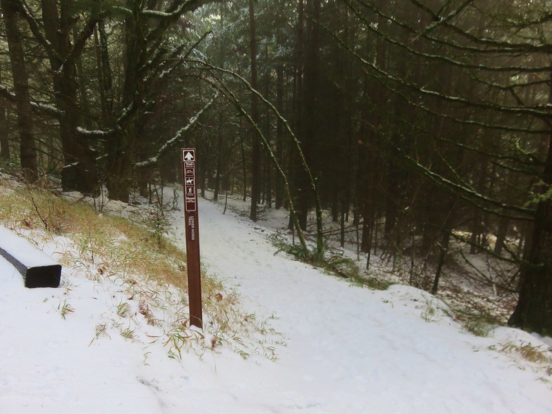
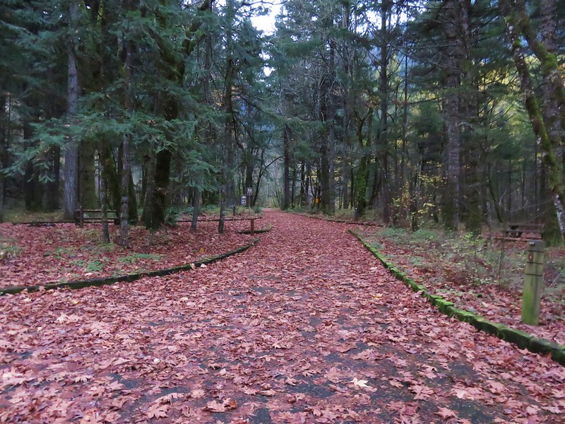
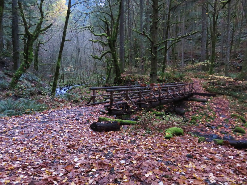
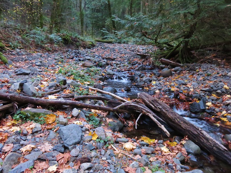
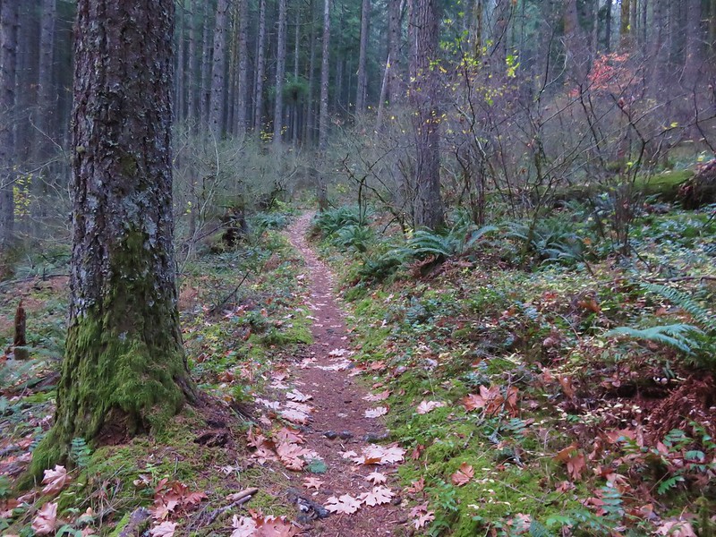
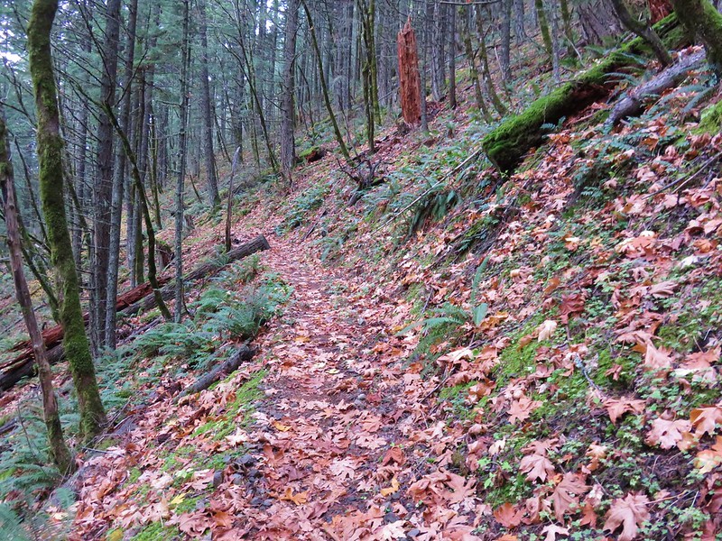
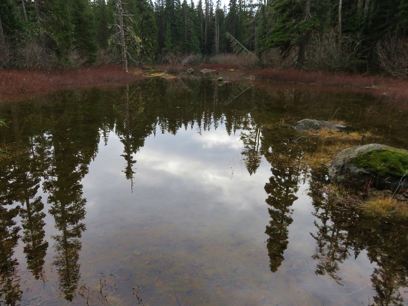
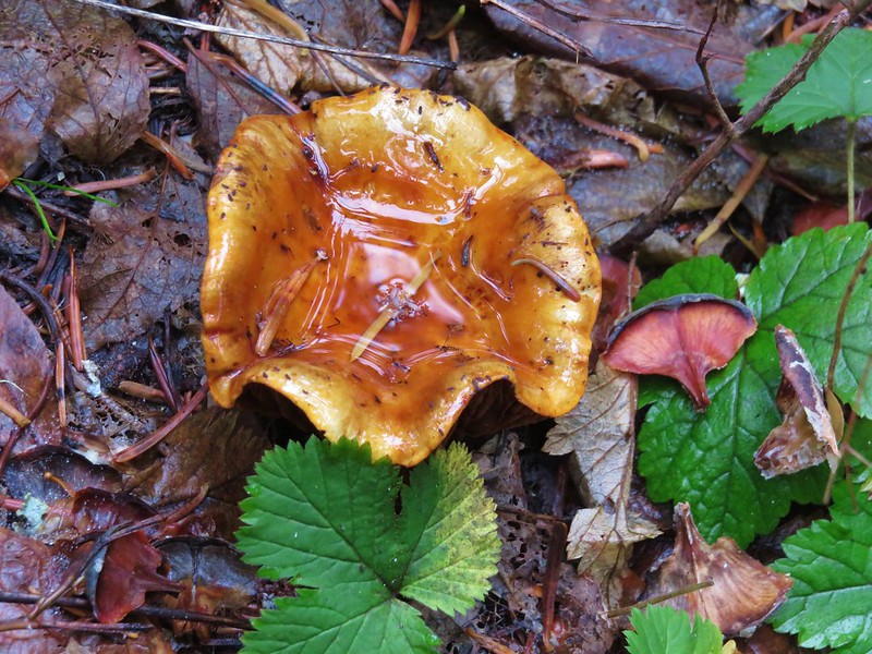
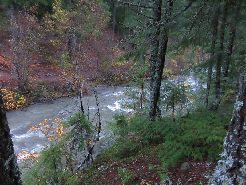
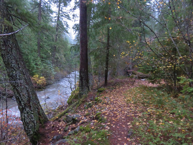
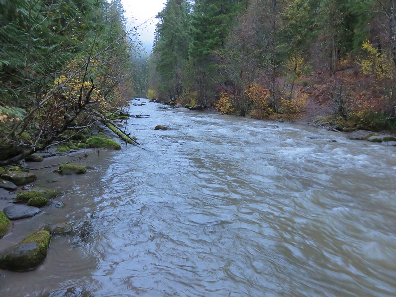
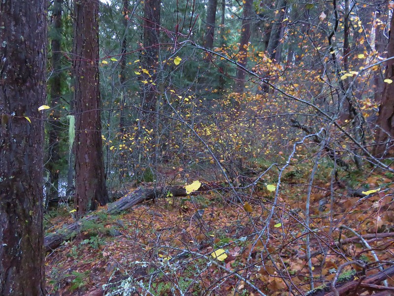
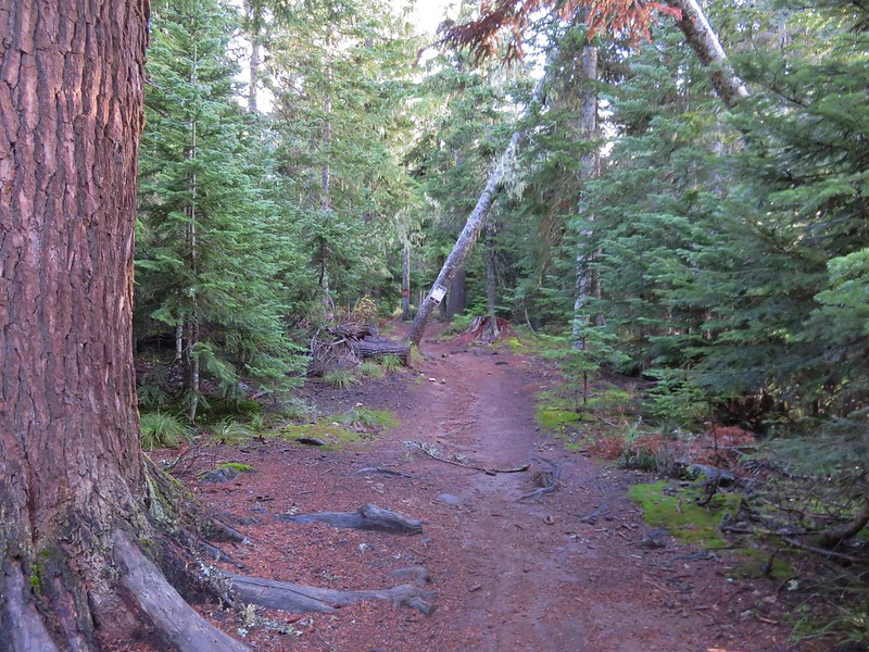
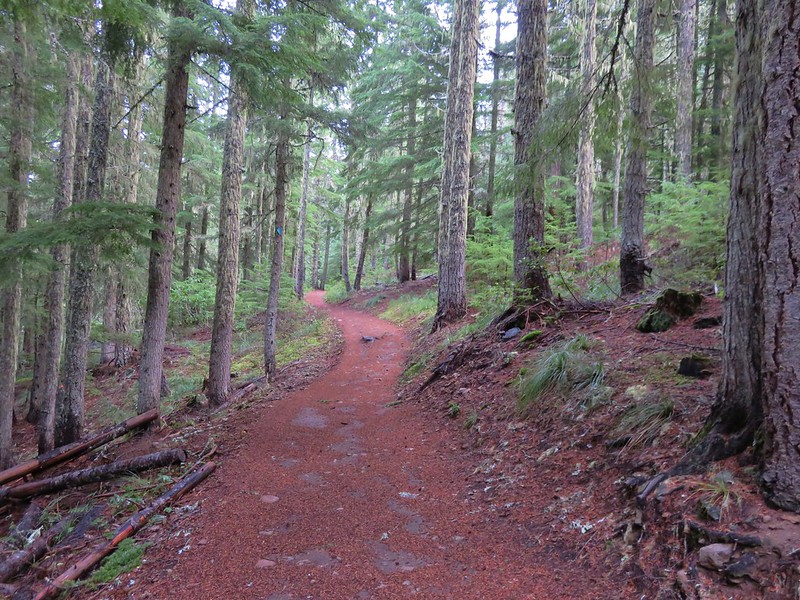
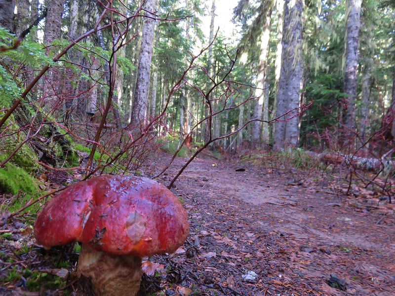
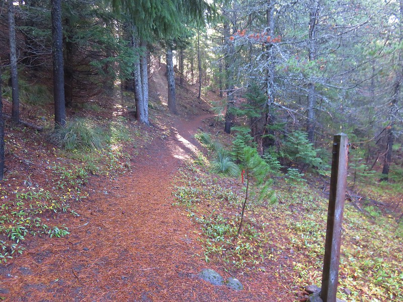
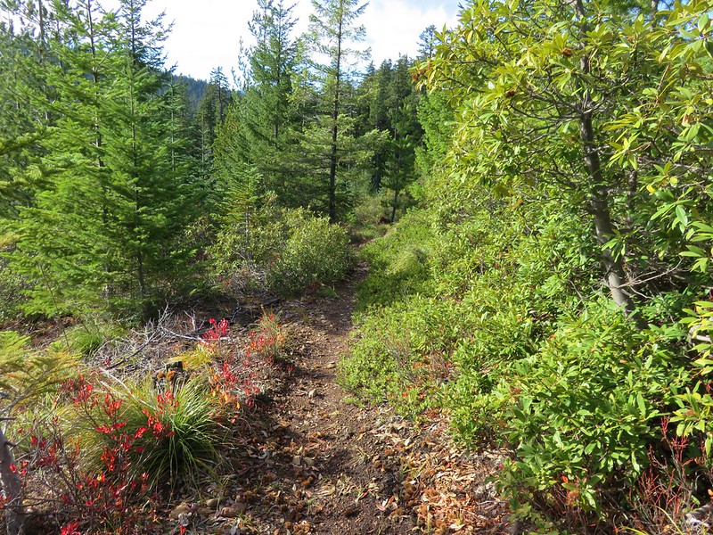
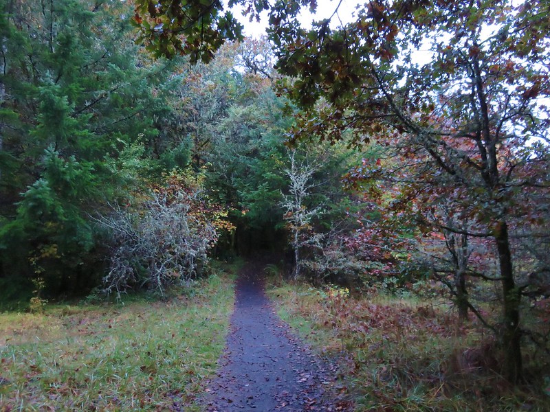
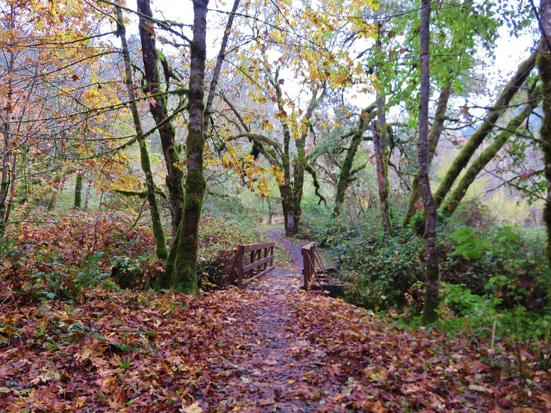
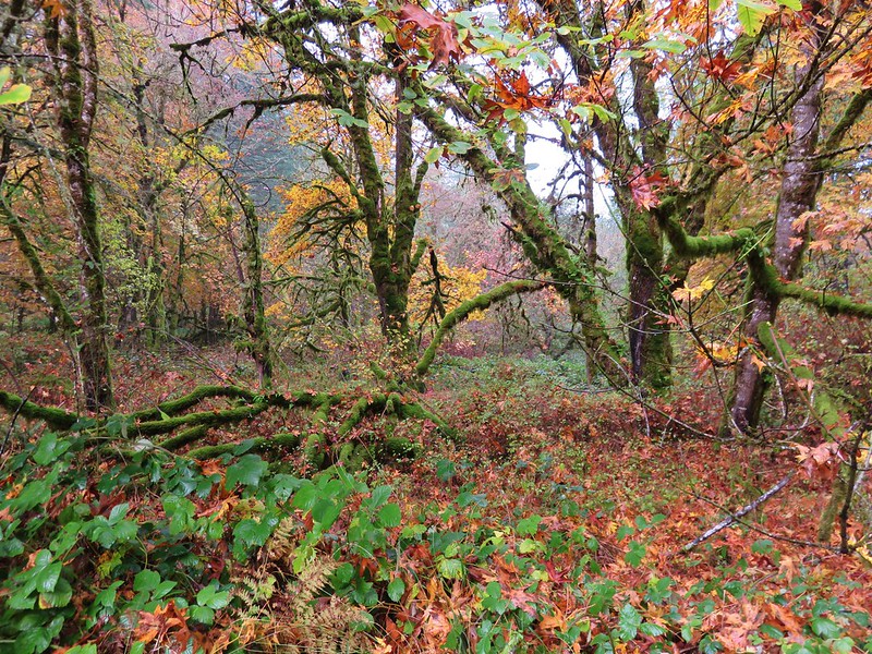
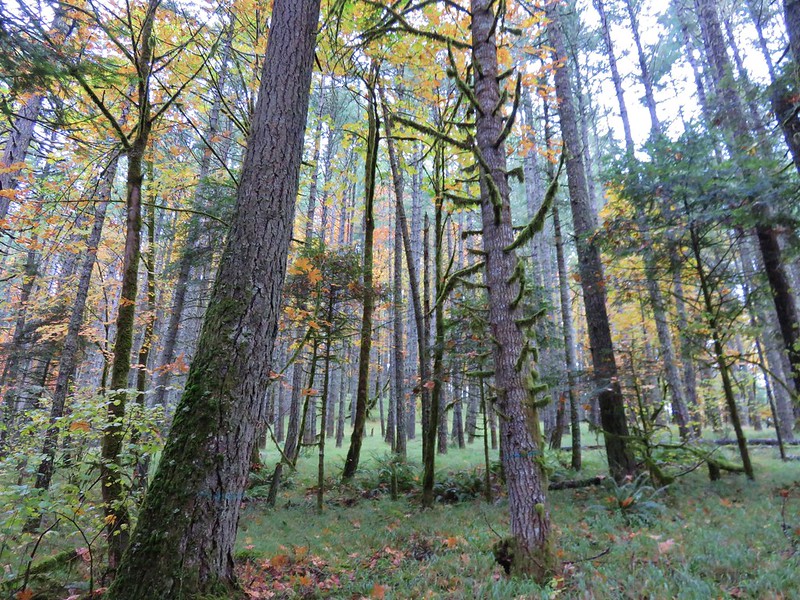
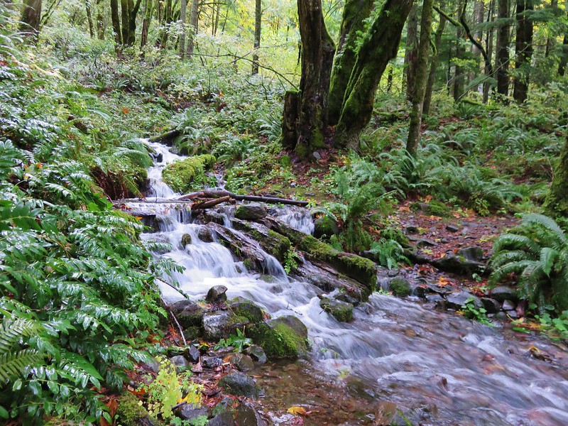
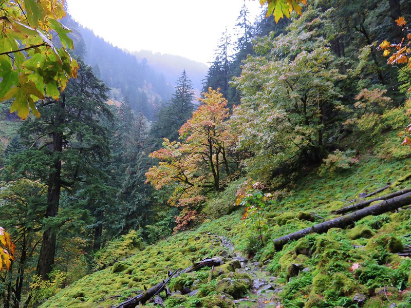
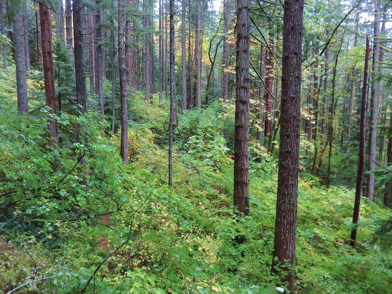
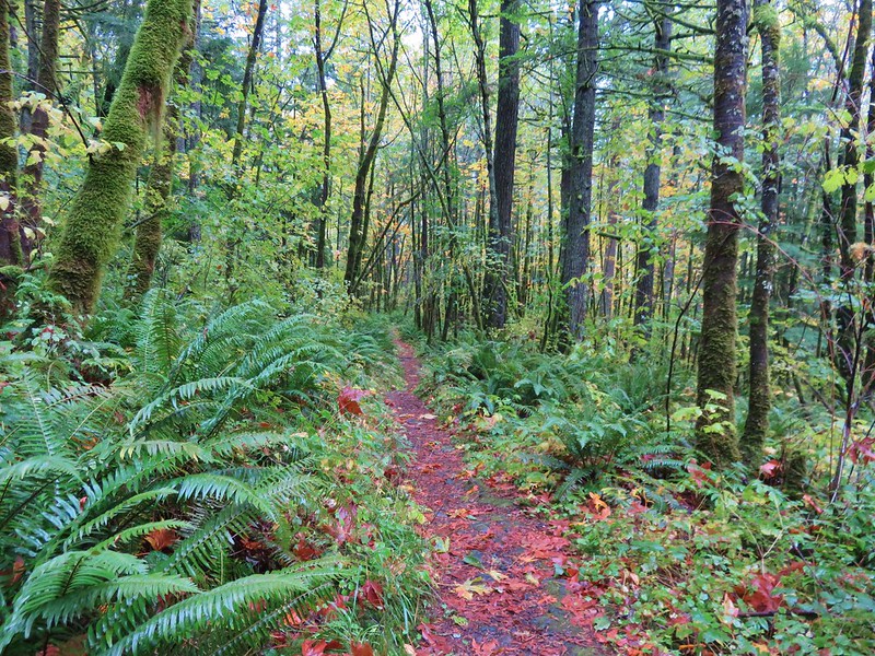
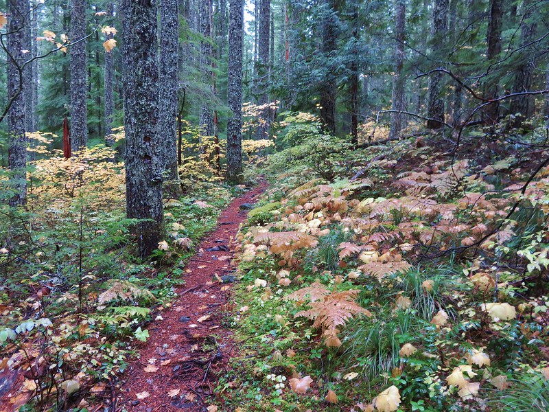
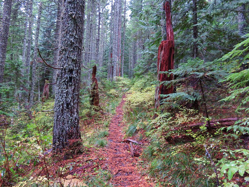
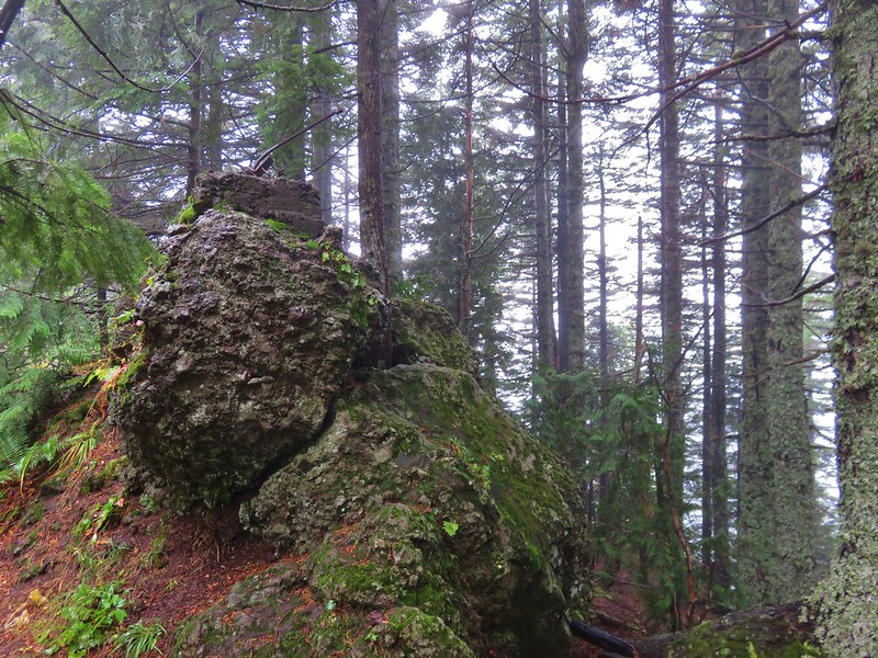
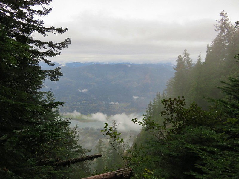
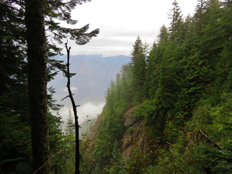
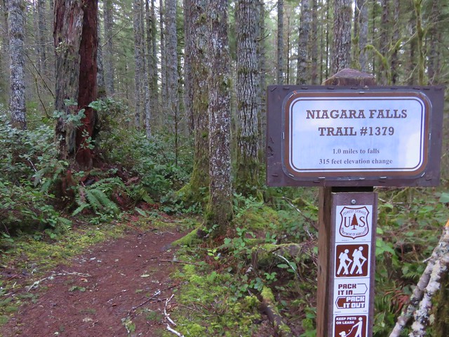
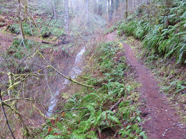
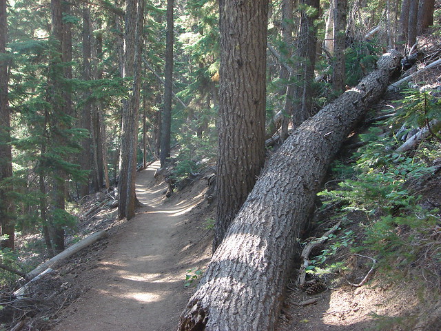
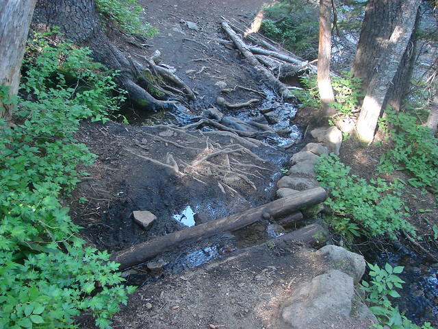
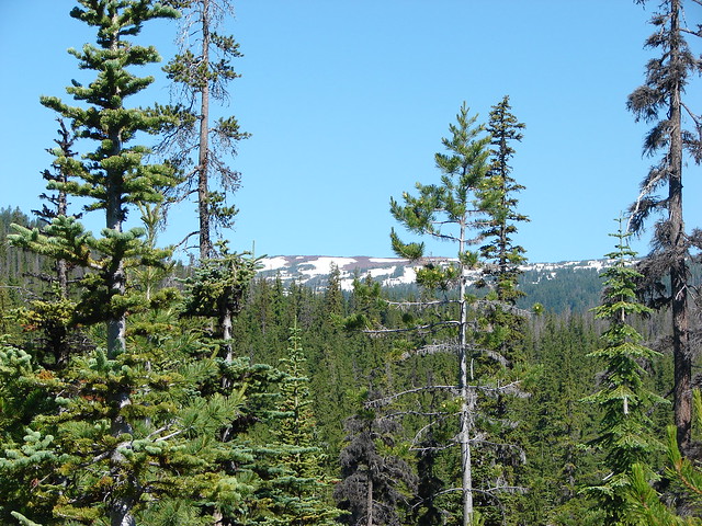
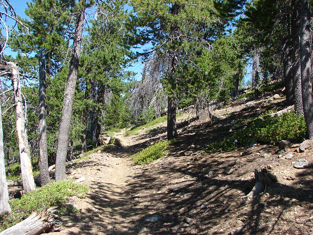
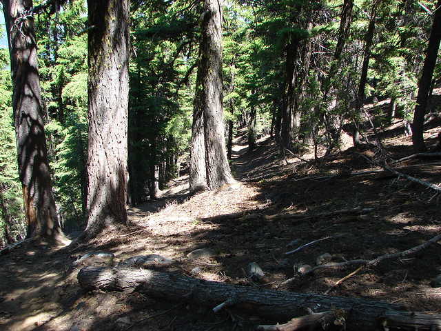
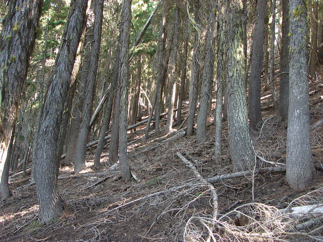
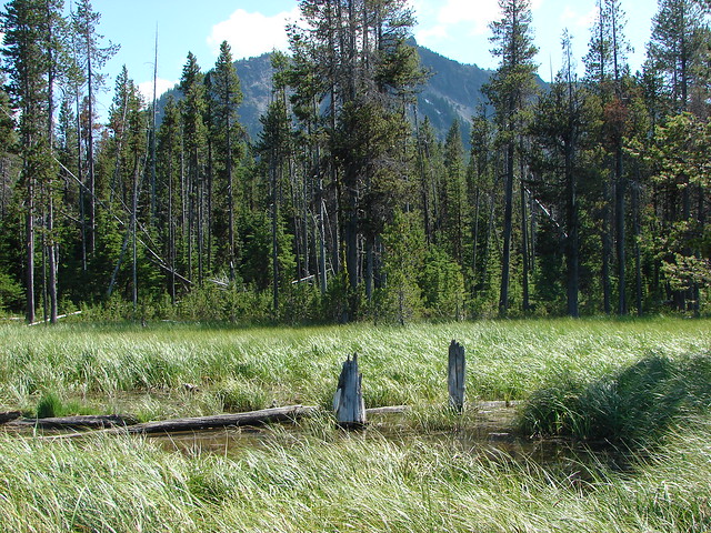
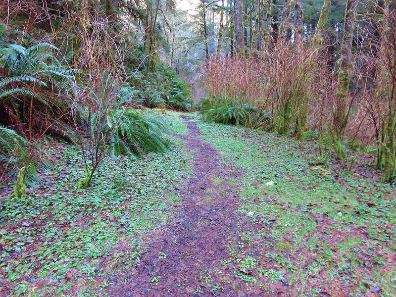
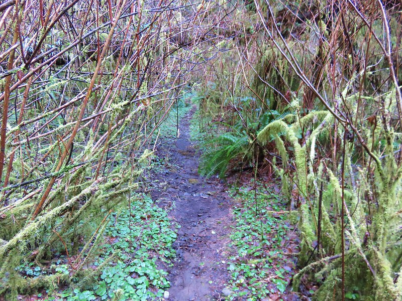
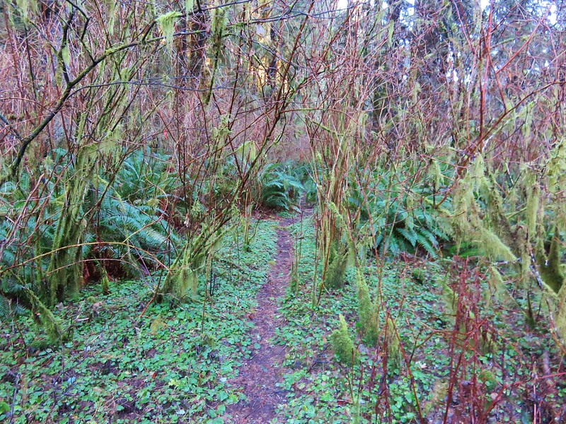
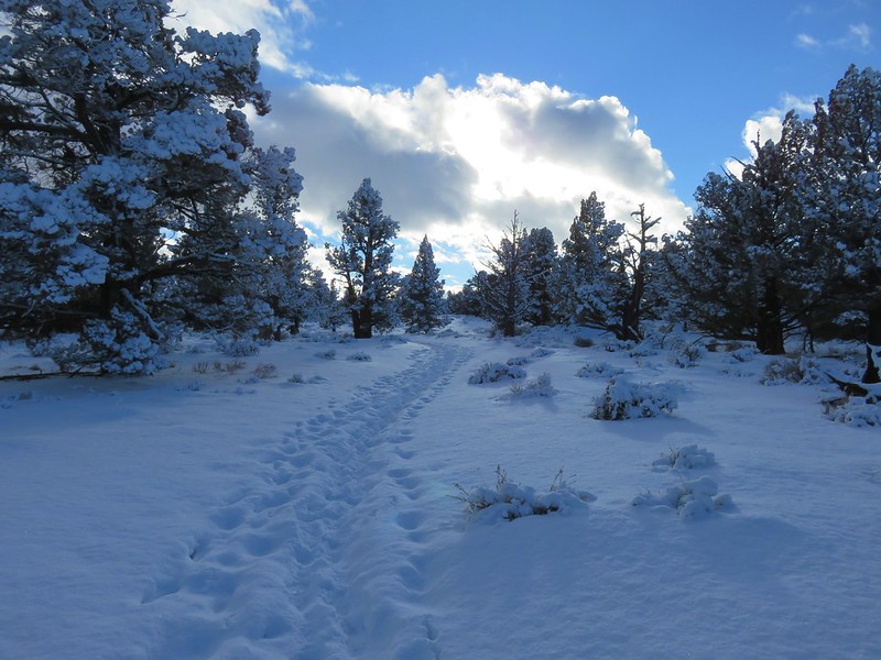
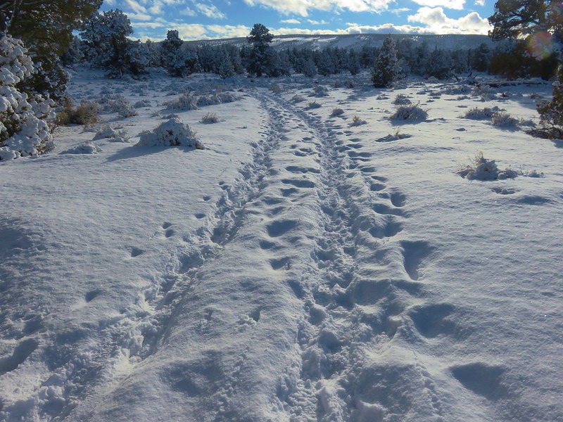
The mile long Niagara Falls Trail led downhill through a fern filled forest crossing a small creek three times on footbridges.
IMG_8545

IMG_8551

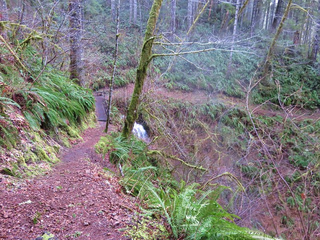
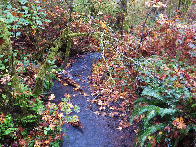
This small creek was flowing well enough to create its own decent, albeit hard to see little fall.
IMG_8553

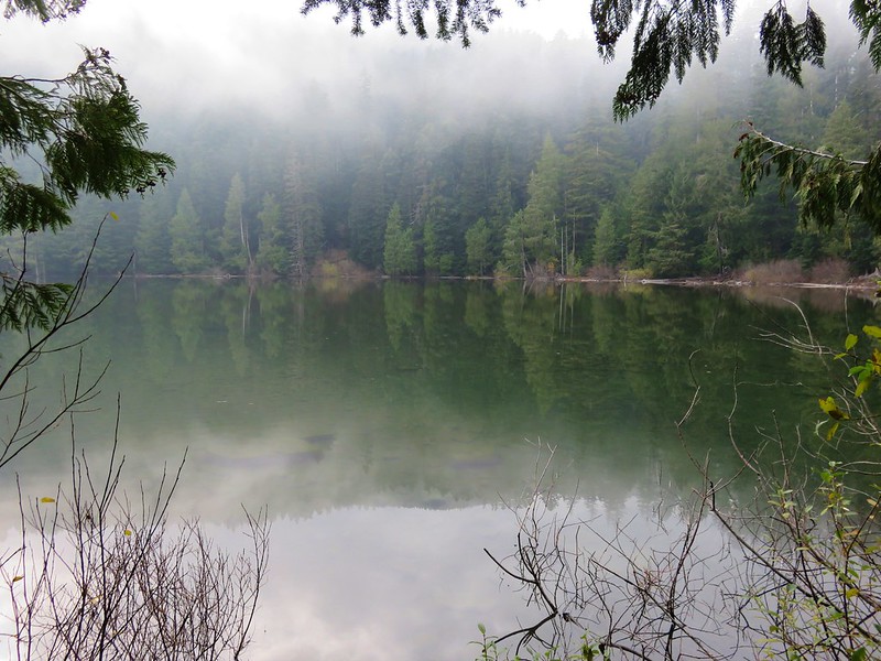
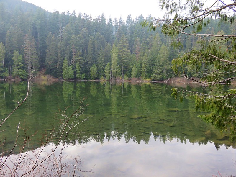
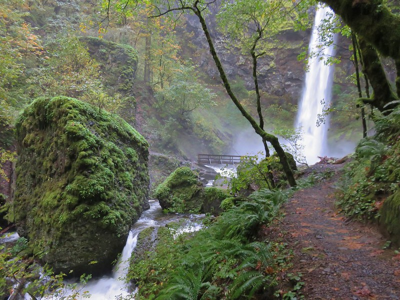
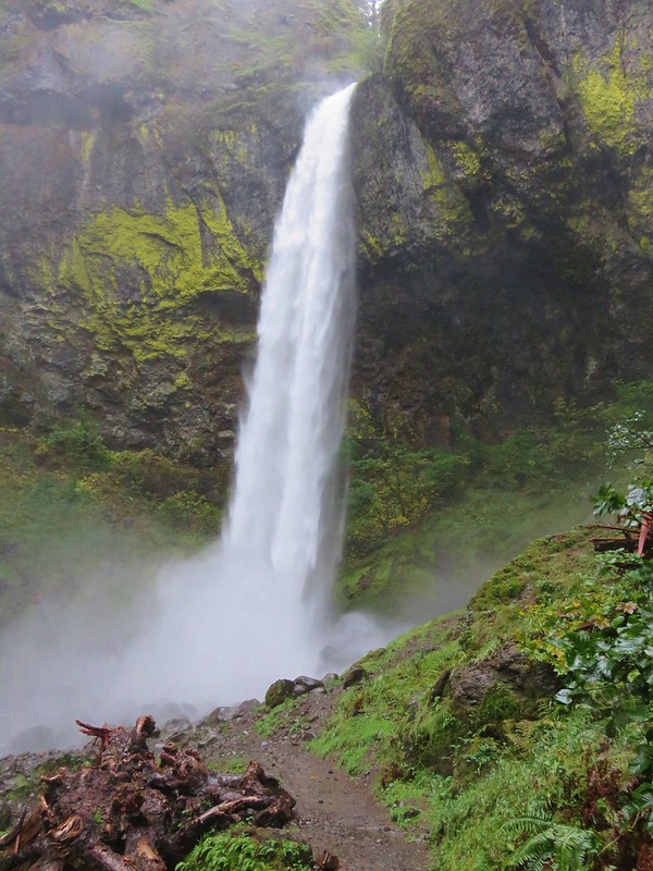
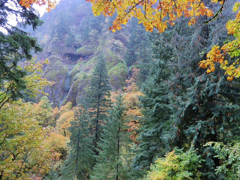
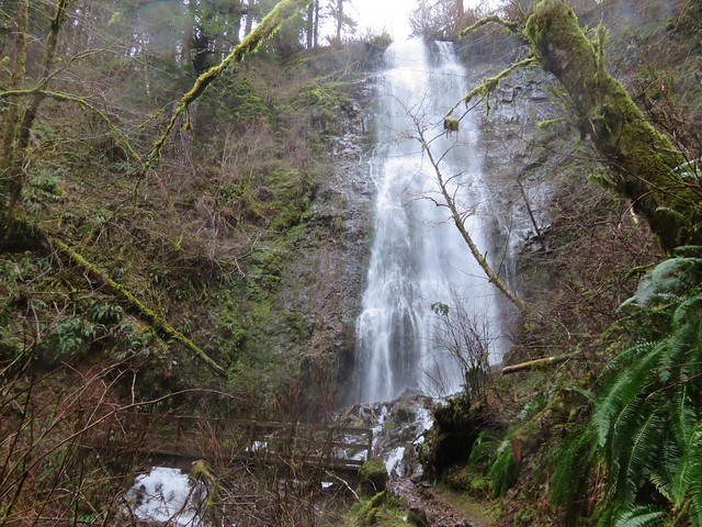
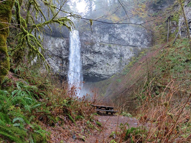
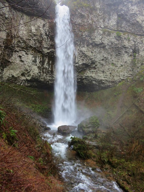
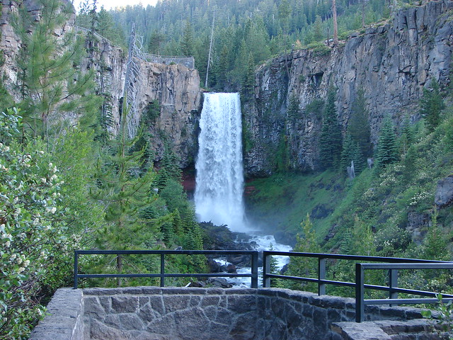
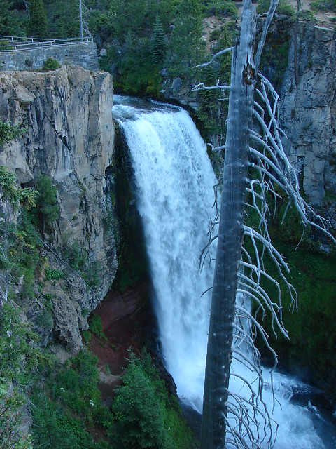
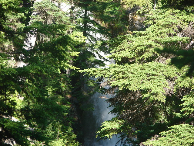
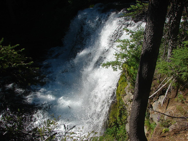
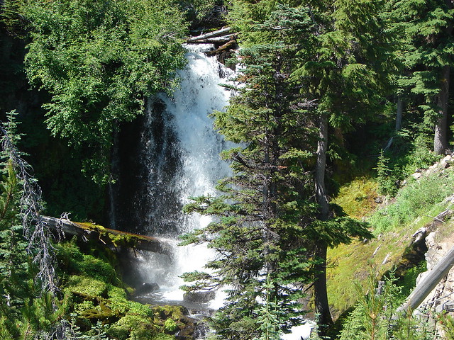
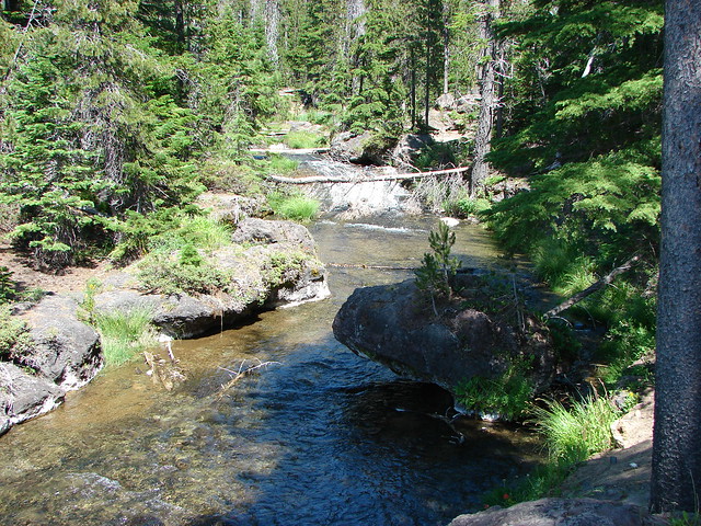
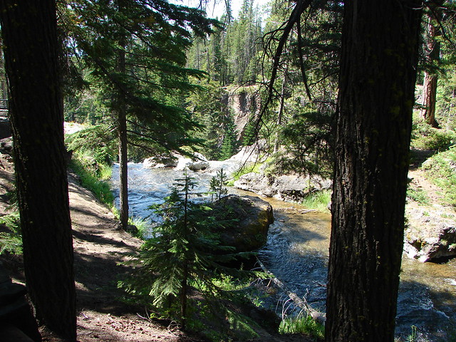
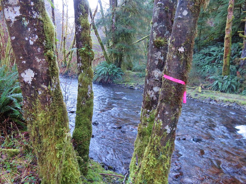
As the trail leveled out along Pheasant Creek the first fall to come into view was Niagara Falls.
IMG_8556

IMG_8563

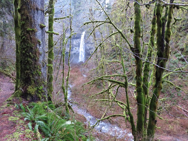
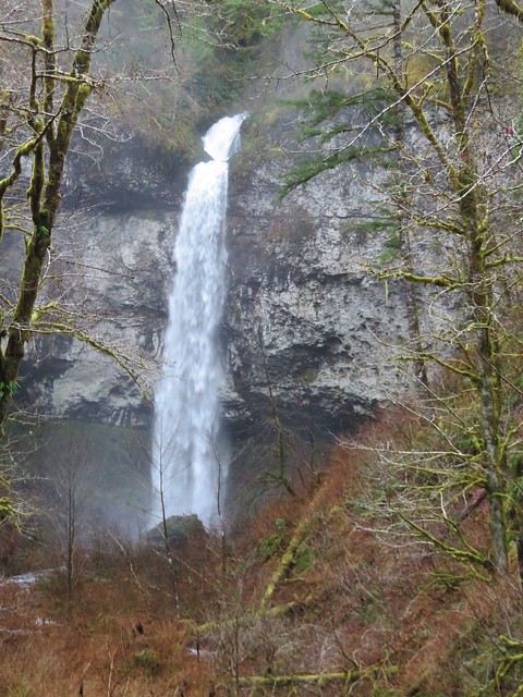
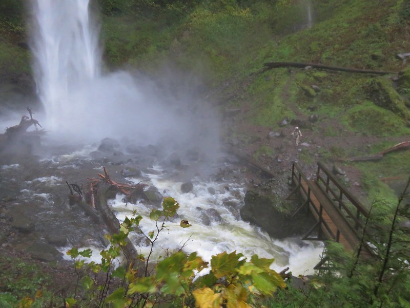
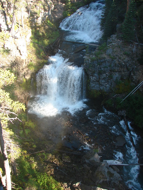
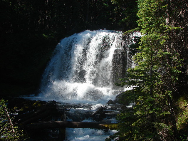
As the trail neared Niagara Falls an opening to the left revealed Pheasant Falls.
IMG_8576

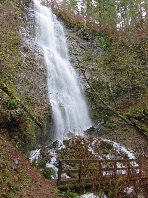
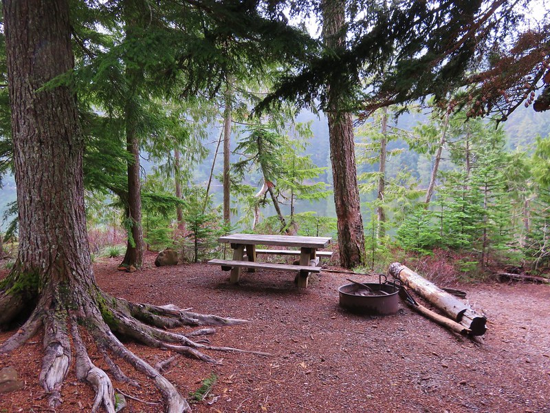
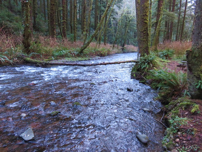
A footbridge below Pheasant Falls brought us to a picnic table at the end of the Niagara Falls Trail.
IMG_8579

IMG_8582

IMG_8590

We returned the way we’d come. The 2 mile hike had been a nice warm up and now we were headed back to Highway 101 and then south to Neskowin.

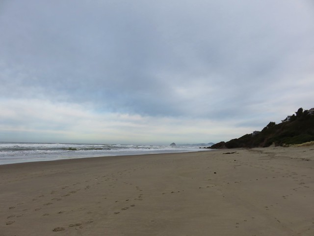
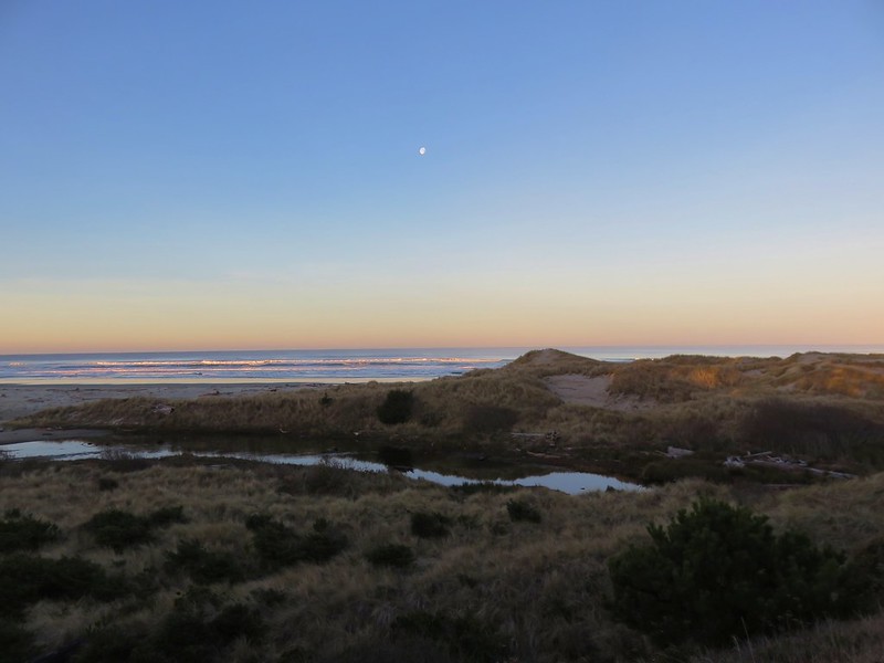
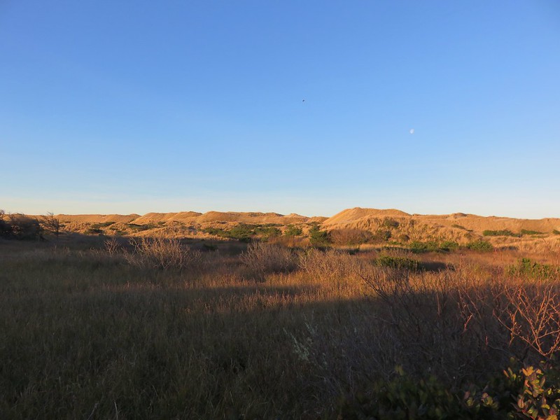
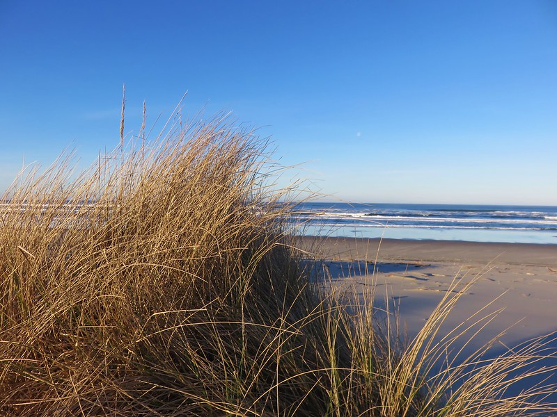
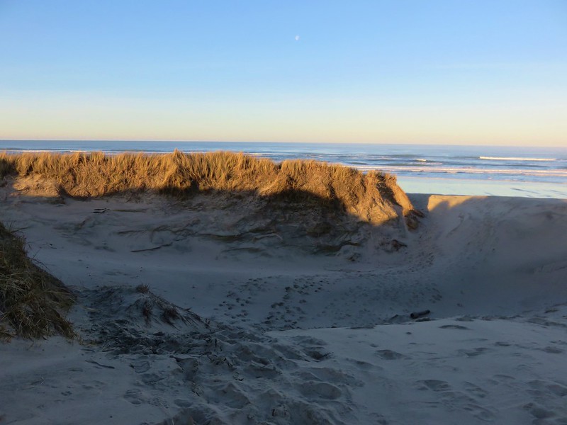
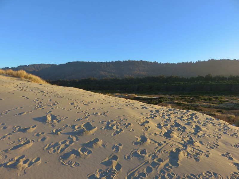
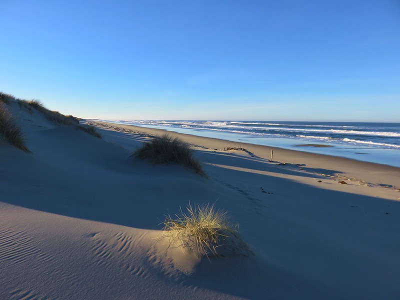
We stared our second hike of the day at the Winema Road Beach Access which is located near the Wi-Ne-Ma Christian Camp. The beach access can be reached by driving .6 miles on Winema Road which is 4 miles north of Neskowin along Highway 101.
IMG_8604

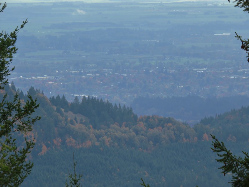
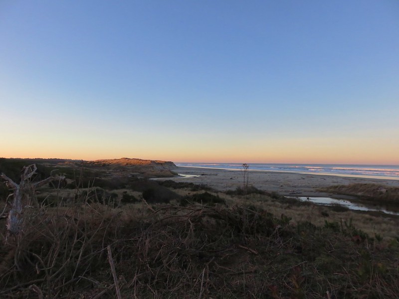
From the beach the view south extended to Cascade Head and to the north to Cape Lookout beyond Haystack Rock.
IMG_8614

IMG_8615

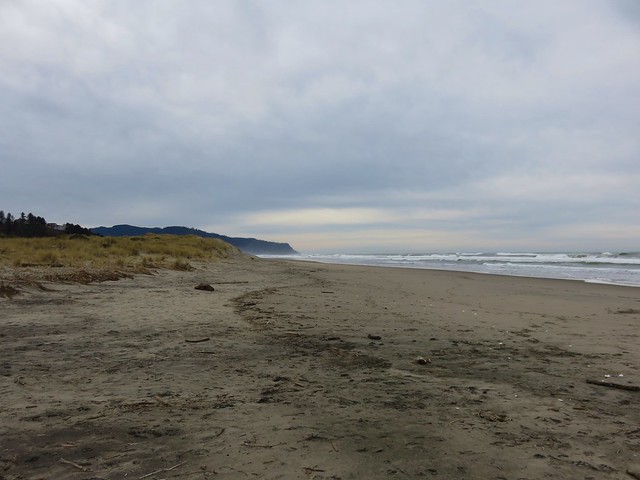
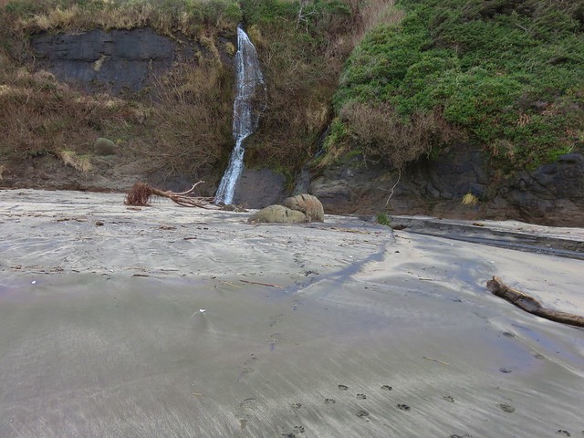
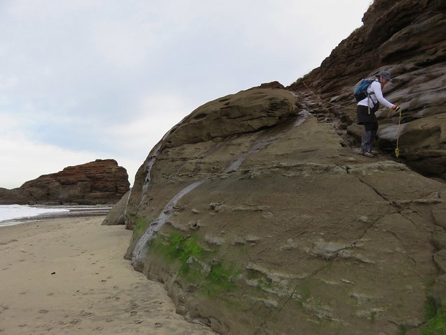
Our timing wasn’t great as it was a little before 10am when we started and high tide would be just after 12:30 so it was already coming in. This meant we would not be getting to a couple of places that would have been accessible at lower tide. We headed north first for .4 miles to some rocks jutting out onto the beach. Along the way we passed a small waterfall that we had not been expecting.
IMG_8618

IMG_8619

At low tide it is possible to continue .6 miles to the mouth of the Nestucca River across from Bob Straub State Park but the waves were already reaching the rocks and we knew if we continued we’d be stuck until the tide went back out so after playing around on the rocks for a minute we turned around and headed south.
IMG_8621

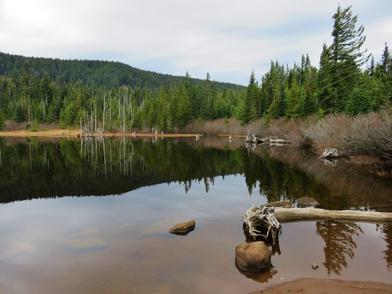
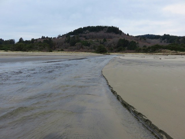
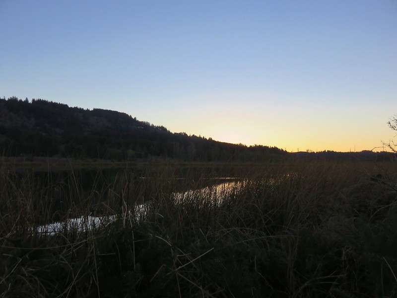
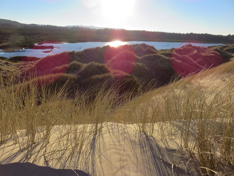
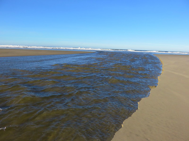
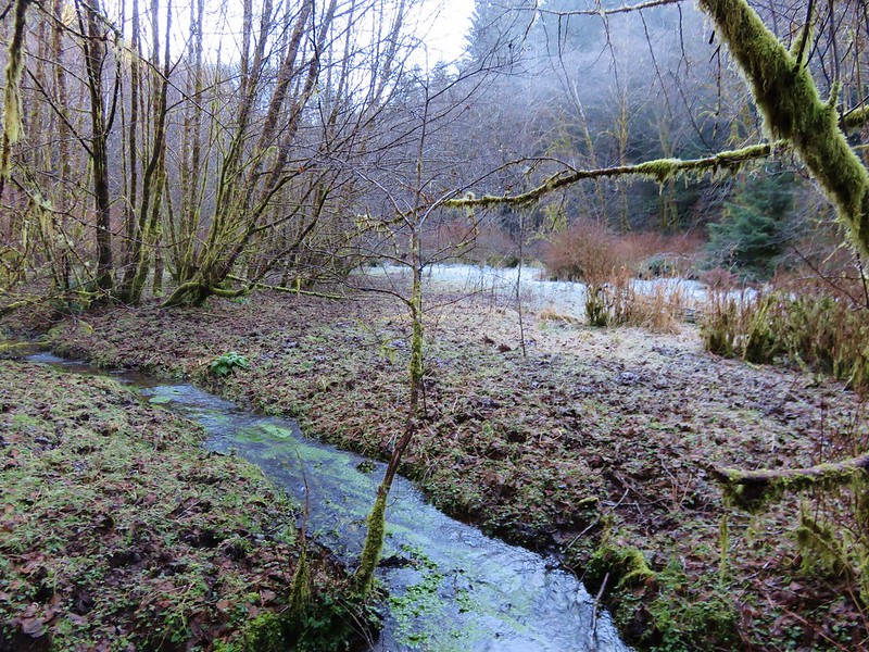
We hadn’t gone too far to the south when we reached the outlet creek of Daley Lake which wasn’t mentioned in our guidebook. The only way across was to ford the creek, but luckily it was only ankle deep and not too cold.
IMG_8627

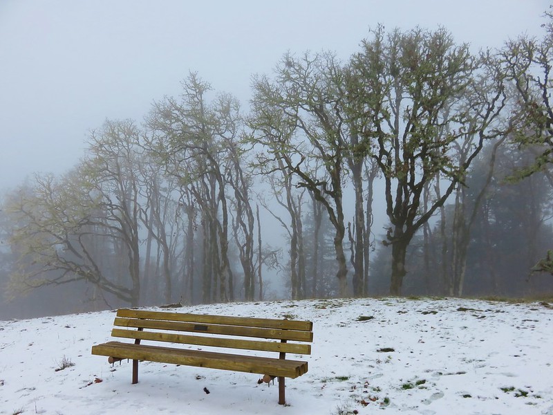
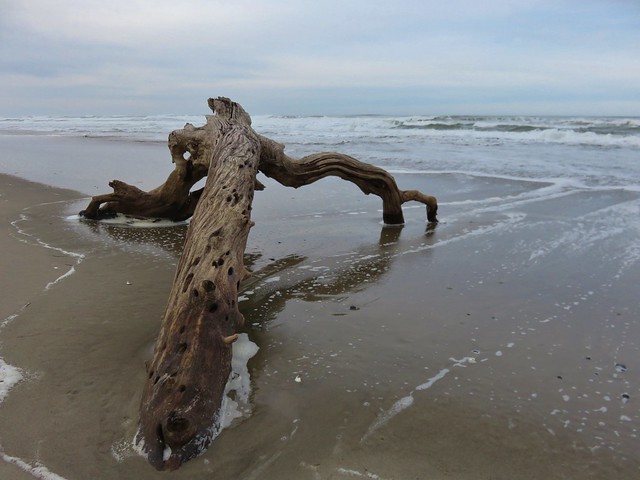
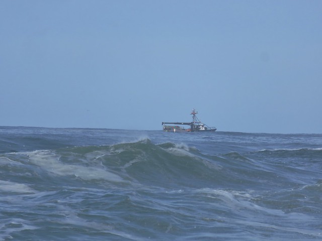
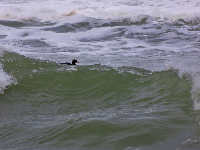
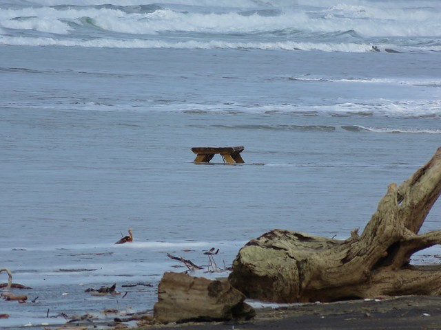
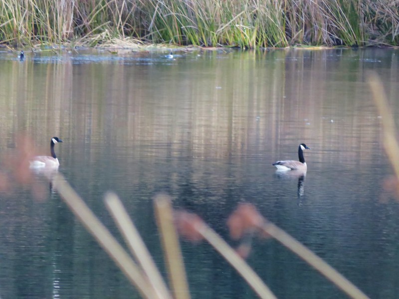
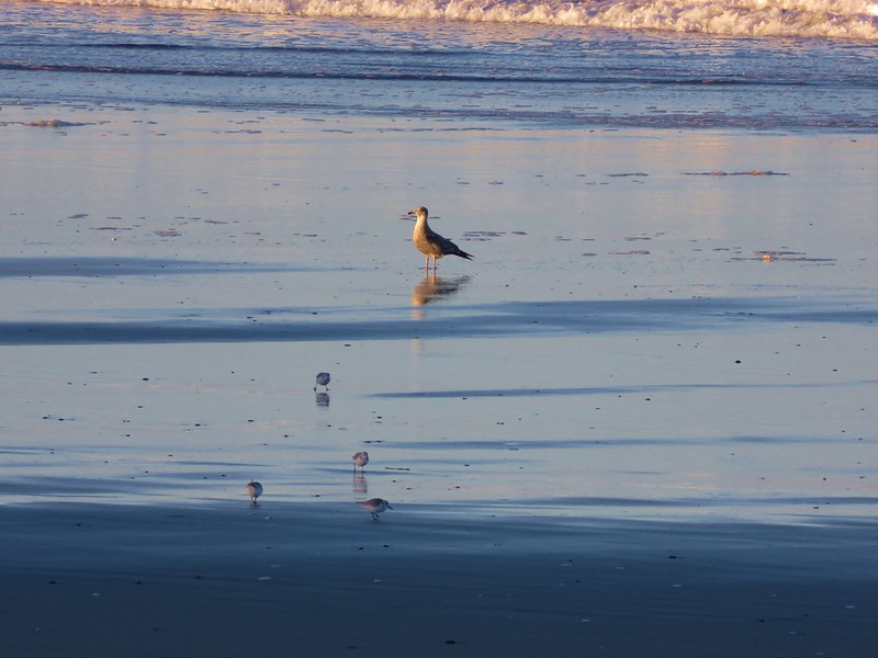
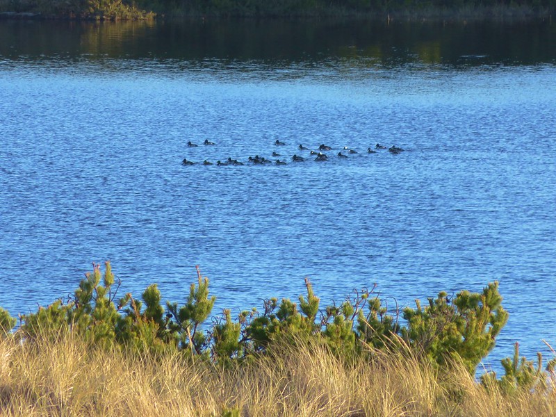
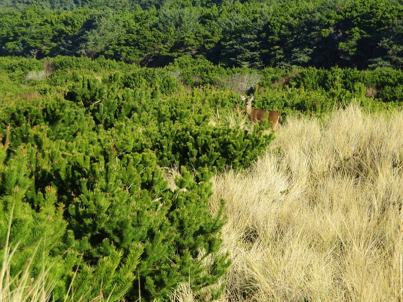
On the other side of creek was a picnic table that seemed really out of place. Heather noted that it appeared to be close enough that the ocean would reach it, although it wasn’t very close at that time. The rest of the sights were pretty typical of a beach walk. Driftwood, rocks, pieces of shells, seaweed, boats, sea birds, and lots of washed up garbage.
IMG_8628

IMG_8633

IMG_8624

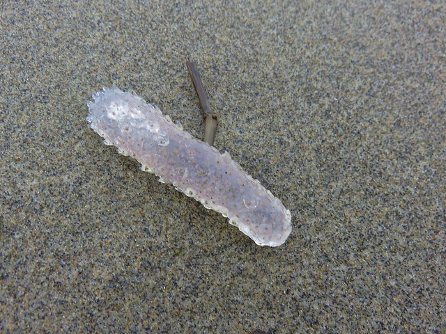
There was something we couldn’t recall seeing before though. Large numbers of pickle shaped jelly fish looking things of various sizes.
IMG_8622

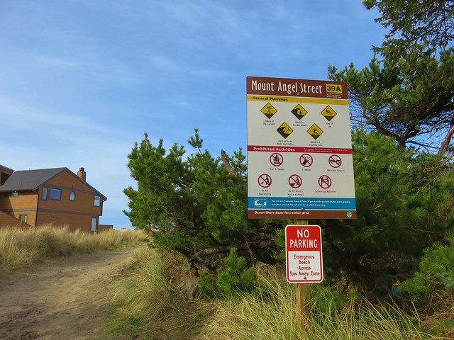
A little under 2.5 miles from the Winema Beach Access the beach became impassable due to the tide reaching the rock wall protecting the houses at Neskowin. Luckily the Mt. Angel St. access was located at the north end of the rock wall so we left the beach and walked inland to Breakers Blvd.
IMG_8634

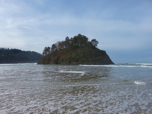
We turned right on the paved street and walked for .7 miles to Carlton Ave. where we turned left toward the Proposal Rock Inn which was on the far side of Neskowin Creek. At the creek we turned right and followed it to Proposal Rock.
IMG_8638

IMG_8639

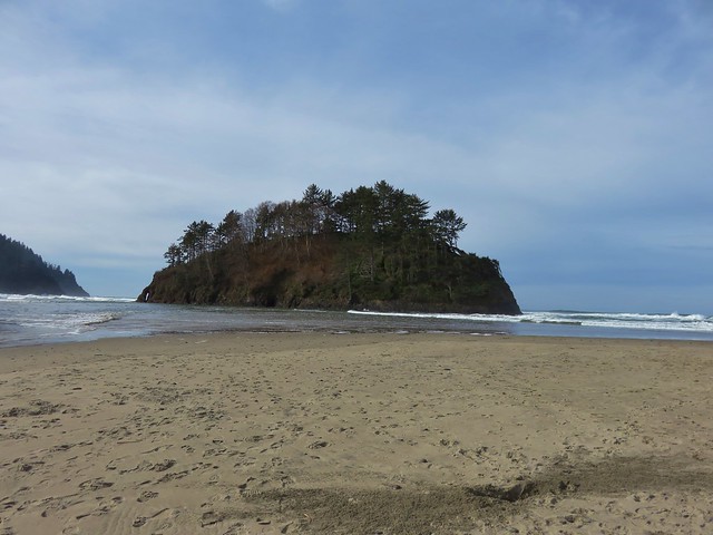
Our guidebook indicated it was possible to continue another .6 miles south to Cascade Head but the creek was far too swollen for us to ford it. Likewise we were unable to reach Proposal Rock due to it’s being surrounded by water.
IMG_8644

With the tide in we couldn’t walk back along the beach from there so we took the paved streets of Neskowin once again back to the Mt. Angle St. access. We then hiked back along the beach where we discovered that Heather had been right about the ocean reaching that odd picnic table.
IMG_8653

IMG_8654

IMG_8651

You just never know what you’re going to see along the Oregon Coast. Happy Trails!

Flickr: Niagara Falls & Neskowin

Categories
Bend/Redmond Central Oregon Hiking Oregon Throwback Thursday Trip report

Throwback Thursday – Tumalo Falls

On 8/2/2011 during a week of vacation in Central Oregon we did a 6.8 mile loop hike visiting several waterfalls, most notably Tumalo Falls.

We began at an interpretive sign at the end of Tumalo Falls Road (Road 4603) on the North Fork Trail.
Tumalo Falls trailhead

North Fork Trail sign

We kept right at junctions passing the lower viewpoint with its straight ahead look at the falls and continued to the upper viewpoint beside the falls which is less than a quarter mile from the trailhead.
Tumalo Falls

Tumalo Falls

Tumalo Falls

Tumalo Falls

The beauty of the falls and the easy access make it a very popular destination but we were there early and had the view to ourselves. Most people turn back after reaching the upper viewpoint but we continued on the North Fork Trail further into the forest.
North Fork Trail

The trail stuck close to Tumalo Creek passing Double Falls after .8 miles followed by Middle Tumalo Falls .9 miles later.
Double Falls

Middle Tumalo Falls

After passing a spring the trail crossed the Middle Fork Tumalo Creek on a footbridge.
North Fork Trail

Smaller fork of Tumalo Creek

Beyond the footbridge we took a brief detour toward the North Fork Tumalo Creek to see Lower North Fork Tumalo Falls.
Lower North Fork Tumalo Falls

After returning to the North Fork Trail we continued to follow the Middle Fork Tumalo Creek passing several more nice waterfalls. The names of some of which we are not certain of.
Small waterfall on Tumalo Creek

Middle Fork Tumalo Falls

Lower Middle Fork Tumalo Falls

Middle Fork Tumalo Falls

Shortly beyond Middle Fork Tumalo Falls we arrived at a junction with the Swampy Lakes Trail which we turned left on and promptly crossed the creek on a log.
Tumalo Creek Crossing

From this trail we could see part of snowy Tam McArthur Rim where the headwaters of Tumalo Creek originate.
Tam McArthur Rim

We followed the Swampy Lakes Trail just over 2 miles from the creek crossing to a junction with the Bridge Creek Trail where we turned left along Bridge Creek to complete the loop. One final waterfall awaited along this final 1.3 mile section – Bridge Creek Falls.
Bridge Creek Falls

A moderate to easy hike the loop is a great option for waterfall lovers spending time in the Bend area. Happy Trails!

Flickr: Tumalo Falls

Categories
Central Oregon Hiking Newberry Crater Oregon Throwback Thursday Trip report

Throwback Thursday – Paulina Peak

With the frequency of our hikes down during our off-season we’ve decided to go back and write up some of our outings from before we started this blog. We’re hoping to have Throwback Thursday posts during those weeks that we don’t have a new trip report to write. We’ll start with hikes that we haven’t repeated since starting the blog and, at least to begin with, are not in our plans to be hiked again in the foreseeable future. That is not to say that they are not worthwhile hikes, they all are. In our attempt to take as many different trails as possible we rarely repeat hikes, and when we do it has typically been because we missed something the first time such as a view or blooming wildflowers.

Please keep in mind that we completed all of the throwback hikes at least 4 years ago so before visiting any of the trails be sure to check with the managing agency on their current condition and availability.

With that disclaimer we’d like to start off with one of the most diverse hikes in terms of scenery that we’ve taken – Paulina Peak in the Newberry National Volcanic Monument. This hike was done on 8/6/2011 during a week long vacation in Central Oregon.

There are a number of hiking options in the monument and our visit consisted of a loop using several different trails allowing us to visit several different worthwhile goals. We began our hike by parking at the Big Obsidian Flow Trailhead.
Big Obsidian Flow

Big Obsidian Flow Amphitheater sign at the trailhead

We started with the .8 mile interpretive Big Obsidian Trail which took us into the obsidian flow passing numerous information signs along the way.
Interpretive sign at the Big Obsidian Flow

Obsidian

Big Obsidian Flow

In addition to the interpretive signs and cool rock formations the trail offers views of Paulina Peak, Paulina Lake, and Lost Lake.
Paulina Peak from the Big Obsidian Flow Trail

Paulina Lake
Paulina Lake with Mt. Bachelor and the South Sister beyond.

Lost Lake

A great option for kids this proved to be perfect warm up for the longer loop we had planned. After returning to the parking area we followed the Silica Trail for 100 yards to a junction with the Newberry Crater Trail where we turned right.
Newberry Crater Trail sign

We followed this trail for another half mile to the Lost Lake Trail where we once again turned right following a pointer for the Crater Rim Trail.
Lost Lake Trail sign

The Lost Lake Trail passed near Lost Lake but not close enough to get a look although occasional hints of sulfur in the air gave it’s presence away. After passing Lost Lake the trail began switching back uphill alongside the Big Obsidian Flow. The open forest sported a number of blooming lupine plants.
Forest along the Lost Lake Trail

Lupine

Snow along the Lost Lake Trail

As we climbed we gained views of both of the large lakes in the Newberry Caldera.
Paulina Lake
Paulina Lake

East Lake
East Lake

After nearly 3 miles on the Lost Lake Trail the trail leveled out after cresting a knoll. Here the trail forked. The left fork led a quarter mile to the Pumice Flat and then on to the Crater Rim in another 3/4 of a mile while the right hand fork reached the Crater Rim Trail in only a half mile (and at a much closer point to Paulina Peak).
Trail signs along the Lost Lake Trail

Before taking the right hand fork we visited the Pumice Flat which was dotted with purple dwarf lupine blossoms.
Lupine near the Pumice Flat

Pumice Flat

Pumice Flat

From the junction near the Pumice Flat the trail climbed almost 350′ to the rim of the caldera and the Crater Rim Trail. This section of trail offered a nice view of our goal, Paulina Peak, as well as a look down on the Pumice Flat from above.
Paulina Peak

Pumice Flat near the Crater Rim Trail junction

Junction with the Crater Rim Trail

We turned right on the Crater Rim Trail and headed toward Paulina Peak. Although it was a little hazy out due to smoke form a couple of forest fires the views along this section extended from Mt. Jefferson in the north to Mt. Thielsen in the South.
Mt. Jefferson
Mt. Jefferson

Mt. Thielsen
Mt. Thielsen

The views back down into the caldera where less affected by the haze.
Pumice Flat and the Big Obsidian Flow from the Crater Rim Trail
Pumice Flat

East Lake and the Big Obsidian Flow
East Lake

Paulina Lake
Paulina Lake

The trail traversed around the south side of Paulina Peak meeting up with Road 500 two and a half miles from where we had turned onto the Crater Rim Trail.
Crater Rim Trail

Crater Rim Trail

Road 500 allows people to drive up to the 7984′ summit of Paulina Peak which makes it accessible to anyone. The Crater Rim Trail picked up on the far side of Road 500 at a trail sign after a 100′ jog to the left.
Crater Rim Trail

Crater Rim Trail

We followed the Crater Rim Trail for an additional .9 miles where we arrived at a junction with the Paulina Peak Trail.
Paulina Peak Trail

We followed this trail to the parking area atop Paulina Peak at the end of Road 500.
Paulina Peak summit sign

Despite the haze the 360 degree view was spectacular.
Diamond Peak
Diamond Peak to the SW

View from Paulina Peak
Mt. Bachelor, Broken Top, and The Three Sisters to the NW

Mt. Bachelor, Broken Top and the Three Sisters
Closer look at the mountains

Paulina Lake
Paulina Lake to the north.

East Lake
East Lake and the Big Obsidian Flow to the NE

Big Obsidian Flow and the Pumice Flat from Paulina Peak
Pumice Flat to the East

After a nice break at the summit we returned to the Crater Rim Trail and continued on our loop. The trail headed down into the forest passing a view back to Paulina Peaks cliffy north face before recrossing Road 500 after 1.8 miles.
Crater Rim Trail

Paulina Peak

After another mile we reached a junction near Road 21 and the Paulina Visitor Center. Here we faced a choice. We could have turned right on a horse path for 3 miles back to the Big Obsidian Trailhead or we could cross Road 21 and take a slightly longer route along the shore of Paulina Lake. Of course we chose option C which was to take the lake shore trail but only after detouring to visit Paulina Falls.
Trail sign along the Crater Rim Trail

We followed the Crater Rim Trail across Road 21 and briefly along the entrance road to the Paulina Lake Lodge then turned left on the Paulina Falls Trail which followed Pualina Creek .3 miles to a picnic area at the falls viewpoint.
Paulina Creek

Paulina Creek

The twin falls were beautiful and quite a change from the other scenery we had encountered so far during the hike.
Paulina Falls

After a taking advantage of the cooler air by the falls to recharge we set off on the final leg our our hike. We crossed the lodge entrance road where we picked up the Paulina Lake Shore Loop Trail.
Trail sign for the Paulina Lake Shore Loop Trail

This 7.5 mile trail loops around Paulina Lake and is on our schedule for this year along with the upper portion of the Peter Skene Ogden Trail.  To complete our loop for this trip we would follow the lake shore for roughly 2.5 miles to the Silica Trail.

The scenery along this section of the lake shore varied quite a bit changing from grassy marsh to forest to rocky shore line and back.
Paulina Lake

Forest along the Paulina Lake Shore Loop Trail

Paulina Lake

Paulina Lake

Paulina Peak

BIg Obsidian Flow from Paulina Lake

After all the different views and scenery the hiked had provided up to the point when we arrived at the Silica Trail the final half mile paled in comparison.
Trial sign for the Silica Trail

The Silica Trail led away from Paulina Lake through a mostly viewless, dusty lodgepole pine forest before crossing Road 21 and bringing us back to the Big Obsidian Flow Trailhead.
Big Obsidian Flow sign

Our hike was somewhere around 15 miles (pre GPS) with approx 2500′ of elevation gain so it’s not for everyone, but everyone of the highlights of this hike are accessible via shorter options. This and the availability of numerous other recreational activities make the Newberry National Volcanic Monument a great place to visit. Happy Trails!

Flickr: https://www.flickr.com/photos/9319235@N02/albums/72157632954961759

Categories
Central Coast Hiking Oregon Oregon Coast Trip report

Baker Beach and Rock Creek Wilderness

Since 2013 our first hike of the year has been somewhere along the Oregon Coast.  Often the weather at the coast during January is nicer than other parts of the State making it a great time to visit.  This was certainly the case this year as the first part of January saw near record snows and freezing temperatures over much of the State.  The coast had not escaped the weather entirely but by the time we headed out for our first hike of the year, things were much nicer there than at home in the Willamette Valley.

Our destination was Baker Beach Camp just north of Florence, OR. This was a change (already) to our plans for 2017 but the forecast for the area was just too good to pass up. Mostly sunny skies and a high of 48 degrees was what was being called for so we left 23 degree Salem early in the morning and headed down to Eugene then west to Florence on Highway 126.

Baker Beach Camp is located at the end of Baker Beach Road, 7 miles north of Florence along Highway 101.  The only signage along the highway was a small green street sign which I noticed just as we passed by it. After quickly turning around we turned onto the gravel road and followed it .5 miles to the camps parking area.

Baker Beach Camp

Baker Beach Camp sign

To start our hike we walked a short distance back along the road and turned left at a trail sign for the Lily Lake Loop.

Start of the Lily Lake Loop

A short sandy climb brought us to a trail junction at the top of a sandy ridge.

Pacific Ocean from the Lily Lake Loop Trail in the morning

The Pacific Ocean was visible beyond Baker Beach and the sand dunes.

Trail signs along the Lily Lake Loop

The Berry Creek Loop would have kept us up on the sandy ridge while the Lily Lake Loop dropped down and passed near Lily Lake before climbing back up to the ridge top and rejoining the Berry Creek Loop Trail. We wanted to see the lake so we followed the Lily Lake pointer passing through a salal filled forest before things opened up along the lake.

Lily Lake Loop Trail

Trail along Lily Lake

We stayed on the paths closest to the lake thinking that one would bring us right to it but instead the lake remained mostly hidden behind first a row of trees then by a reed filled marsh near it’s outlet.

Lily Lake

We could see that there was quite a bit of activity on the lake with several types of ducks and some Canada geese floating on the water, but it was hard to get any clear photos with the vegetation in the way.

Canada geese on Lily Lake

Bufflehead

Bufflehead on Lily Lake

From the lake we climbed back up to the top of the Sandy Ridge which overlooked a small pond and Berry Creek flowing out toward the Pacific.

Moon over the Pacific Ocean

Berry Creek flowing toward the Pacific

There was no sign here and we could have followed the sandy ridge back to the junction we’d been at earlier, but instead we followed a path down to the base of the ridge which led us back to the start of the Baker Beach Trail at Baker Beach Camp. This little loop was just under 1.5 miles.

Baker Beach Trail

Here we turned right following the pointer for Baker Beach. (The Lily Lake/Berry Creek Loop continued from this junction creating an additional 1.7 mile loop to the north of the camp.)

The trail passes through a deflation plain behind the beaches foredune for .4 miles.

Foredune at Baker Beach

Looking north along the Baker Beach Trail

The deflation plain is the result of the dunes no longer expanding due to the loss of additional sand being blown from the beach. European bunchgrass which was introduced in the early 1900’s to help stabilize jetties but spread along the beaches and began stopping the blowing sand from leaving the beach which created the foredunes denying the dunes further inland any additional sand.

Baker Beach

Pacific Ocean from the foredune at Baker Beach

Cape Mountain from the foredune at Baker Beach

When we reached the beach we turned south heading toward Sutton Creek which was 3 miles away. Aside from a few birds we had the beach to ourselves.

Sanderlings on Baker Beach

Seagull and sanderlings

After about 3/4 of a mile along the beach we climbed back up the foredune to get a look at Sutton Creek which we had visited the previous February.

Sutton Creek behind the foredune

Ducks on Sutton Creek

We traveled along the foredune for a bit before dropping back down to the beach.

Patterns in the sand

Baker Beach

We had been considering crossing Sutton Creek and continuing south along Heceta Beach another 2.5 miles to the Siuslaw River but the creek was wide and it wasn’t that warm out.

Sutton Creek

Sutton Creek

After watching several large chunks of sand fall into the creek we headed back with the Heceta Head Lighthouse blinking in the distance to the north.

Heceta Head Lighthouse from Baker Beach

As we were recrossing the deflation plain we spotted a doe amid the grass and pines.

Heading back toward Baker Beach Camp

Doe

Doe

Since we’d cut our hike short (8.2 miles instead of the 13.2 planned) we had time to do another. We could have hiked Heceta Beach like we had planned by driving back to Florence and parking at the end of South Jetty Road, but we had noticed that that beach was already busy when we were at Sutton Creek earlier. We preferred something a little less crowded which led us to the Rock Creek Wilderness.

This was one of the wilderness areas that we had yet to visit and it was just another 8 miles north on Highway 101 from Baker Beach Road. We hopped in our car and drove to the gated entrance to the Rock Creek Campground.

Rock Creek Campground sign along Highway 101

The campground was closed for the season so we had to walk along the paved entrance road for approximately .4 miles.

Road to Rock Creek Campground

There had been one other vehicle parked at the gate and we passed it’s owner on his way back up from the campground area. The little campground was located right along Rock Creek.

Rock Creek

Rock Creek

The 7,486 Rock Creek Wilderness was designated as such in 1984 and has no Forest Service developed or maintained trials. That being said there is a use trail leading from the end of the Rock Creek Campground that can be followed into the wilderness.

Use trail leading from the Campground into the Rock Creek Wilderness

The path was brushy and narrow but passable as it followed along the creek.

Use trail in the Rock Creek Wilderness

Rock Creek Wilderness

Rock Creek

Occasional flagging was present but really unnecessary as the brush was so thick that we had to follow the path in order to keep moving forward. The only real obstacle to speak of was a large downed tree that had fallen over the best path, but game trails led around the root ball.

BIg tree down in the Rock Creek Wilderness

Without an official trail there were no signs to mark the beginning of the wilderness area so we just followed the path as long as we could. After awhile the path led into a frosty meadow where the canyon widened.

Frosty meadow in the Rock Creek Wilderness

It was a muddy in spots but enough of the ground was still frozen to make it passable. Elk and deer sign were everywhere. It was a beautiful spot with the white frost contrasted against the green of a coastal forest while rays of sunlight attempted to penetrate the canopy.

Frosty meadow in the Rock Creek Wilderness

Sunlight through the trees in the Rock Creek Wilderness

The sound of water flowing on every side only added to the ambiance. There was more flagging at the far end of the meadow and some on the far side of Rock Creek but again this wasn’t a day for fording creeks so we declared victory here and turned around.

Our turn around point (too cold to ford the creek today)

When we got home I wanted to make sure we’d actually made it into the wilderness so I pulled up the interactive map on Wilderness.net. The actual wilderness boundary bows away from the Rock Creek Campground making it further up along the creek than I had thought, but comparing our GPS track to that map showed we had managed to get about .4 miles into the Rock Creek Wilderness.

The Wilderness.net map

Rock Creek Wilderness

Our GPS track

Rock Creek Wilderness Track

On a warmer day when you don’t mind spending some time in the creek it’s possible to get further into the wilderness as this trip report indicates.a href=”http://www.cascadiahiking.com/2012/08/rock-creek-wilderness-no-trail-no.html” target=”_blank”>Cascadia Hiking

Our adventure was only 2.2 miles round trip including the road walk to and from the campground but the solitude and remote feeling of the Rock Creek Wilderness made it seem much more removed from civilization.

With that our 2017 hiking year is officially under way. We checked off our 27th Oregon Wilderness Area and still have 18 to go, 4 more of which are planned this year. Happy Trails!

Flickr: https://www.flickr.com/photos/9319235@N02/albums/72157679106715756

Categories
Bend/Redmond Central Oregon Hiking Oregon Trip report

Flatiron Rock – Oregon Badlands Wilderness

We thought our hikes were done for the year after visiting Chip Ross Park and Dimple Hill earlier this month, but a rare opportunity to hike with our Son on Christmas Eve couldn’t be passed up.  We were heading to Bend to celebrate Christmas with our families and after driving over Santiam Pass  we met up with Dominique and drove to the Flatiron Rock Trailhead on Highway 20 east of town.

Flatiron Rock Trailhead

Our plan was to repeat part of a 22.6 mile hike we had done this past May. This time around we were shooting for a 7 mile hike out to Flatiron Rock and back.

We followed the same course as on our previous visit starting out on the 1.9 mile Ancient Juniper Trail. Unlike last time there was a few inches of snow on the trail and more along side it.
Trail sign in the Oregon Badlands Wilderness

Ancient Juniper Trail - Oregon Badlands Wilderness

It was a beautiful day with temperatures just below freezing. The sagebrush and junipers were covered in snow and robins sang as they gobbled up juniper berries.
Ancient Juniper Trail - Oregon Badlands Wilderness

Snow covered sagebrush

Robin catching snow?

When we arrived at the Ancient Juniper Trail junction with the Flatiron Rock Trail things were a litter whiter than last time.
Trail junction in the Oregon Badlands Wilderness

Trail junction in the Oregon Badlands Wilderness

At the junction we turned left onto the Flatiron Rock Trail and followed it 1.6 more miles to Flatiron Rock at a junction with the Castle Trail.
Flatiron Rock from the Flatiron Rock Trail

Flatiron Rock from the Flatiron Rock Trail

Flatiron Rock Trail junction with the Castle Trail

The number of hikers who had been through the snow before us had been dwindling and at Flatiron Rock it appeared that no one had ventured up into the rock itself since the last snow.
Flatiron Rock

I reached the rock first and headed inside its passageways to get a birds eye view of Heather and Dominique coming up the trail.
View from Flatiron Rock

View from Flatiron Rock

Flatiron Rock Trail

Although a few clouds limited the views from Flatiron Rock they were better than they had been on the cloudy day in May as both the Middle and North Sister appeared on the horizon.
Middle and North Sister from Flatiron Rock

Middle and North Sister from Flatiron Rock

In addition to those 10,000′ peaks Black Butte, Gray Butte, and Powell Butte rose above the high desert.
Black Butte

Gray Butte

Powell Butte

Several passages on Flatiron Rock allow for a nearly half mile loop past colorful lichen and interesting rock formations including a couple of arches.
Inside Flatiron Rock

Lichen on the rocks

Rock arch in Flatiron Rock

Rock arch in Flatiron Rock

Various animal tracks could be seen in the snow but the only ones we saw were the robins which seemed to particularly like the rock.
Robins (at least 14) at Flatiron Rock

After completing the loop we retraced our steps to the junction with the Ancient Juniper Trail where we remained on the Flatiron Trail for 1.2 miles to the trailhead. Between the passing clouds and the lowering of the Sun the light began to soften along this final stretch sometimes leaving the snow with a beautiful blueish color.
Flatiron Rock Trail

Flatiron Rock Trail

Flatiron Rock Trail

After finishing the hike we drove to my parents house and relaxed waiting for them to return with my brother and his family. It was the perfect way to kick of Christmas weekend and to cap off our 2016 hiking year all in one. Happy Trails (and Holidays)!

Flickr: https://www.flickr.com/photos/9319235@N02/albums/72157674546328223

Categories
Corvallis Hiking Oregon Trip report Willamette Valley

Chip Ross Park and Dimple Hill

A week of snow and icy conditions had kept us indoors much of the week so when the forecast for Sunday looked promising we decided to cash in our December hike and make the short drive down to Chip Ross Park in Corvallis.  The park offers a 1.5 mile loop trail as well as access to the more extensive trail network in Oregon State University’s McDonald-Dunn Research Forest.

It was a foggy morning when we arrived at the parking area at the end of Lester Rd.
Chip Ross Park Trailhead

Chip Ross Park had been closed part of the year as the City of Corvallis attempts to restore the area to it’s natural oak habitat. Many trees have been removed and some of the trails closed or rerouted. A small section of the loop remains closed but should be reopened in early 2017.
Chip Ross Park

We headed left along a wide tract passing many piles of debris left over from the tree removal.
Chip Ross Park<

After a quick half mile climb we arrived at a signboard and trail map for the McDonald-Dunn Research Forest.
Infromational signboard for McDonald-Dunn Research Forest

McDonald-Dunn Research Forest Trail Map

We had visited the forest in October when we hiked to the summit of McCulloch Peak and really enjoyed that hike so we were looking forward to checking out some of the other trails.

We set off on Lower Dan’s Trail following it through the forest just under a mile to a road crossing.
Lower Dan's Trail

Lower Dan's Trail

Road crossing of Lower Dan's Trail

We then took Upper Dan’s Trail which began on the far side of the road.
Upper Dan's Trail

This trail crossed Jackson Creek on a footbridge before climbing up toward the summit of Dimple Hill.
Upper Dan's Trail

Upper Dan's Trail

Junctions along the way were well signed making it fairly easy to stay on track.
Upper Dan's Trail

Trail map in the McDonald-Dunn Research Forest

As we followed Upper Dan’s Trail to the 1493′ summit of Dimple Hill we began to catch some glimpses of blue sky above the fog.
Blue sky above the trees

McDonald-Dunn Research Forest

Approximately 2.5 miles from the road crossing we arrived at the summit of Dimple Hill.
Dimple Hill summit

The summit was above the clouds and we had a great view of Mary’s Peak to the south.
Clouds below Dimple Hill

Mary's Peak from Dimple Hill

Mary's Peak from Dimple Hill

Mary's Peak from Dimple Hill

We took a short rest on the summit bench soaking in the sunshine before continuing on.
Bench on Dimple Hill

Trees on Dimple Hill

Frozen grass on Dimple Hill

We took Road 650 down and around the NE side of Dimple Hill where we found quite a bit more snow than there had been at the summit.
Looking west from Dimple Hill

Snowy trees on Dimple Hill

The combination of snow, fog, and sunlight created some beautiful scenery.
Sunlight in the McDonald-Dunn Research Forest

McDonald-Dunn Research Forest

At a fork in the road we headed right on Road 600 a.k.a. Patterson Road.
Road junction in McDonald-Dunn Research Forest

After about three quarters of a mile on Patterson Road we turned downhill on the Upper Horse Trail
Upper Horse Trail

This trail switchbacked downhill eventually reentering the fog.
Upper Horse Trail

At another junction we followed a pointer for the Lower Horse Trail.
Lower Horse Trail

We continued to follow pointers for the Lower Horse Trail passing a private residence in a meadow before turning right briefly on the road to that house.
Lower Horse Trail

Meadow along the Lower Horse Trail

Short road walk along the Lower Horse Trail

We forked left on this road which crossed Jackson Creek before leading us back to Lower Dan’s Trail at the road crossing. We then headed back to Chip Ross Park where we checked out it’s summit benches which were still in heavy fog.
Bench in Chip Ross Park

Bench in Chip Ross Park

The total hike was 9.1 miles with approximately 1650′ elevation gain. The view on Dimple Hill was wonderful and just what the doctor had ordered after the spell of bad weather we’d had. For what was possibly our final hike of 2016 it was a great way to end the year. Happy Trails!

Flickr: https://www.flickr.com/photos/9319235@N02/albums/72157678011347405

Categories
Columbia River Gorge South Hiking Oregon Trip report

Wyeth Trail To North, Rainy, and Black Lakes

**Note the 2017 Eagle Creek and 2024 Whiskey Creek fires burned portions of this hike.**

This past Veterans Day we celebrated our 21st wedding anniversary with a hike. Heather had spent the first part of the week in Las Vegas attending a convention for her work so we were looking to spend some quality time together and what better way than out on the trail away from distractions.

Our hike on the schedule for this month was to be a lollipop loop starting at Wyeth Campground in the Columbia Gorge and passing North, Rainy, and Black Lakes before returning via Green Point Ridge. I had originally estimated this hike to be a little over 16 miles with around 4000′ of elevation gain. Both of these figures turned out to be low. The total elevation gain was closer to 5000′ and the GPS read 21.5 miles when all was said and done.

The Wyeth Trail begins at Wyeth Campground which was gated closed for the season so we parked near the gate on the side of the Wyeth Road (Exit 51 off of I-84) and walked through the empty campground.
Sunrise from Wyeth Campground

Wyeth Campground

The campground is the eastern terminus for the Gorge Trail #400 which we followed briefly to a signed junction near a footbridge over Gorton Creek.
Footbridge over Gorton Creek

Wyeth Trail junction with the Gorge Trail

We turned left following the pointer for the Wyeth Trail passing under a set of power lines before the bridge-less crossing of Harphan Creek.
Creek crossing

Not long after crossing Harphan Creek the Wyeth Trail began its climb. The trail gained approximately 3500 over the next 4.8 miles. This mostly forested section used numerous switchbacks to keep from ever being too steep.
Wyeth Trail

Wyeth Trail

Wyeth Trail

Wyeth Trail

There were a couple of open areas which offered small views across the Columbia River toward Mt. St. Helens. Although the mountain was free of clouds the gray skies above and behind it provided a good camouflage from the camera.
Columbia River from the Wyeth Trail

The trail leveled off at a saddle where it began following the ridge south to the Green Point Ridge Trail junction.
Wyeth Trail juntion with the Green Point Ridge Trail

Green Point Ridge Trail

The Green Point Ridge Trail was our return route so we stayed left and continued 1.4 miles to North Lake. Along the way there was a nice view of Mt. Defiance from a rock field.
Mt. Defiance from the Wyeth Trail

To see North Lake we followed an unsigned trail to the right at a junction where signs pointed back to the Wyeth Campground and ahead to the Mt. Defiance Trail.
Wyeth Trail

Wyeth Trail sign for the Mt. Defiance Trail

North Lake
North Lake

After sitting for a bit on some rocks along North Lake we continued along it’s shore back to the the Wyeth Trail at a junction with the North Lake Trail.
North Lake Trail

We took the North Lake Trail following it for a mile past a small pond to another trail junction.
Pond along the North Lake Trail

North Lake Trail junction with the Rainy Lake Trail

We headed to the left onto the Rainy Lake Trail.
Rainy Lake Trail

A quick .4 miles brought us to Rainy Lake with a view of Green Point Mountain on the far side.
Rainy Lake

Green Point Mountain from Rainy Lake

Green Point Mountain

A tenth of a mile beyond the lake the trail left the Mark O. Hatfield Wilderness and ended at the Rainy Lake Campground, which can be driven to. Directions

Mark O. Hatfiled Wilderness boundary near the Rainy Lake Campground

We walked through the campground passing the unique outhouse to the Rainy-Wahtum Trail.
Outhouse at the Rainy Lake Campground

Rainy Lake Trail

The Rainy-Wahtum Trail would lead us up to a junction with the Gorton Creek Trail where we would begin our return to the Wyeth Campground but before we did that we had wanted to visit nearby Black Lake. Both the North Lake Trail map available on the Mt. Hood Forest Service website and Google showed a trail descending to Black Lake from the Rainy-Wahtum Trail. We were keeping our eyes out for this trail and just when we began to think we had missed it we spotted a path near a small cairn.
We thought this was marking the trail to Black Lake

We turned left onto this faint path passing the remnants of an old sign that could no longer be read. All traces of the path soon disappeared and we looked around for old blazes or any other sign of the correct route. With nothing to be seen we pulled out the Forest Service map and compared it the map shown on the Garmin. The GPS didn’t show the trail but we could compare the topography of the two maps to get a good idea of where the trail should be. We bushwacked downhill using the topographic maps in an attempt to pick up some sort of trail but weren’t having any luck so we finally decided to follow a decommissioned logging road down to its junction with Dead Point Road which went by Black Lake after passing the Rainy Lake Campground.
Road to Black Lake

We found a few flowers along the road before arriving at the Black Lake Campground.
Thistle

Black Lake Campground

Black Lake

Black Lake

We took a break at one of the picnic tables which we shared with a caterpillar.
Caterpillar

We followed the road back to the Rainy Lake Campground and set off once again on the Rainy-Wahtum Trail. We watched again for any signs of a different trail to Black Lake both before and after the one we’d turned down but never saw anything.

The Rainy-Wahtum Trail followed what was once Wahtum Road up to a 4-way trail junction.
Rainy-Wahtum Trail

The junction is the meeting point of the Rainy-Wahtum, Gorton Creek, and Herman Creek Cutoff Trails.
Rainy-Wahtum Trail junction with the Gorton Creek, and Herman Creek Cutoff Trails

Gorton Creek Trail

WWII signal Hut

Our route was to follow the Gorton Creek Trail but first we took a very short detour on the Herman Creek Cutoff Trail to check out a WWII signal hut which seemed fitting on Veterans Day.
WWII signal Hut

We started down the Gorton Creek Trail reentering the Mark O. Hatfield Wilderness and gradually climbing Green Point Ridge.
Wilderness sign along the Gorton Creek Trail

As we approached Green Point Mountain, which is really just the highest point on the ridge, the first view to open up was of Rainy Lake and Mt. Defiance beyond.
Mt. Defiance and Rainy Lake

Rainy Lake

The Oregon Hikers Field Guide entry for  Green Point Mountain mentions views of Mt. Defiance, Rainy Lake, and Mt. Adams but we quickly found that there were more views than that. Before we were able to see Mt. Adams to the north a glance behind us to the south revealed Mt. Hood rising above the tress.
Mt. Hood

A viewpoint near the summit offered the Mt. Adams, Mt. Defiance, and Rainy Lake view.
Mt. Adams, Mt. Defiance and Rainy Lake

Mt. Adams
Mt. Adams

The view of Mt. Hood was especially nice with a layer of clouds in the valley below it and an opening of blue sky in the clouds above.
Mt. Hood from Green Point Mountain

When we reached the summit we were a bit surprised to see Mt. Rainier join the view to the north and Mt. Jefferson to the south.
Mt. Rainier from Green Point Mountain

Mt. Jefferson and Olallie Butte
Olallie Butte and Mt. Jefferson from Green Point Mountain

Mt. Hood & Mt. Jefferson
Mt. Hood and Mt. Jefferson from Green Point Mountain

In addition the Goat Rocks were also visible between Mt. Rainier and Mt. Adams.
Goat Rocks from Green Point Mountain

After enjoying the surprisingly good view we began our descent. It was nearly 2pm and we’d been hiking for almost 7 hours already. I was beginning to suspect that the hike was going to be longer than what I had estimated. We tend to average right around 2mph so a 16 mile hike should take us 8 hours. We hadn’t taken any extended breaks and it didn’t feel like we’d been going particularly slowly on the climb up so extra distance was the only explanation for the time. We picked up the pace on the way down not wanting to have to rely on using lights to finish the hike in the dark.

A quarter mile from the summit we left the Gorton Creek Trail at a three-way junction. The Gorton Creek Trail headed downhill to the left and on the right the North Lake Trail came up from the lake. We stayed straight on the Green Point Ridge Trail.
Green Point Ridge Trail

We followed the wooded ridge another 2.5 miles ignoring the Plateau Cutoff Trail to the left after 1.5 miles.
Green Point Ridge Trail

The steepest section of trail we’d been on all day was the final descent down to the Wyeth Trail.
Green Point Ridge Trail descending to the Wyeth Trail junction

Once we were back on the Wyeth Trail we retraced our steps down to the power lines. Mt. St. Helens was a little more visible on our way down in the afternoon light.
Mt. St. Helens in the distance

Mt. St. Helens from the Wyeth Trail

That morning we had noticed a trail coming up from the Wyeth Campground at the power lines which appeared to be a shorter route than what we had done so when we spotted it on the way down we followed it into the campground arriving back at our car ten minutes before 5pm.

We had hiked from dawn to dusk (nearly 10 hours) without seeing anyone else on the trails. The views had been much better than expected and the lakes were all nice. One of the things that held our interest was the amazing variety of mushrooms along the way. The various colors, shapes, and sizes were impressive. Here is a small sample of that variety.
Mushrooms along the Wyeth Trail

Mushrooms

Mushroom

Mushrooms

Mushroom

Green mushrooms

Mushroom

Red mushroom

Another mushroom

Orange mushroom

Yellow mushrooms

Mushroom on a log

Mushroom groud near Black Lake

Mushrooms along the Wyeth Trail

Despite the hike turning out to be a lot longer than planned it was a great way to spend our anniversary. Happy Trails!

Categories
High Cascades Hiking Mt. Hood Area Oregon Trip report

Lower White River Wilderness and Twin Lakes Loop

We took advantage of a favorable weather forecast and ended our “hiking season” with a pair of hikes south of Mt. Hood in two separate wilderness areas. Our first hike was in the Lower White River Wilderness.

Designated a wilderness area in 2009, the 4 square mile Lower White River Wilderness has no official trails. The narrow wilderness SE of Mt. Hood covers a portion of the White River and it’s canyon on either side from Keeps Mill Forest Camp for approximately 7.5 miles. A use trail from the forest camp follows the river a short distance and this was our planned route into the wilderness.
Lower White River Wilderness Sign

Keeps Mill Forest Camp is located at the end of Road 2120 which is accessed from Highway 216. The narrow dirt road is poorly maintained along the final mile and a half making it suitable only for high clearance vehicles. Instead of driving all the way down to the camp we parked at a pullout near the Camas Trail which crosses Road 2120 on it’s way from Camas Prairie to Keeps Mill Forest Camp.
Camas Trail sign along Road 2010

We followed the Camas Trail down to the campground. It was still pretty dark and also fairly foggy when we arrived back on Road 2120 near the entrance of Keeps Mill Forest Camp.
Keep's Mill Forest Camp

The campground is located near the confluence of Clear Creek and the White River.
Clear Creek
Clear Creek

White River
White River

We found the use trail along the river and followed it for about half a mile where it appeared to become fairly brushy.

Lower White River Wilderness

White River

Lower White River Wilderness

The trail had been traveling between the river and a talus slope where the remains of an old flume could be seen amid the rocks.
Talus slope with the remains of an old flume

Old flume remains in the Lower White River Wilderness

We turned around here having accomplished our goal of hiking into the wilderness and seeing some of the flume remains and headed back to the campground and up the Camas Trail.
Camas Trail

Fog and a little blue sky over the talus slope along the Camas Trail

When we got back to where we’d parked Heather spotted a doe that quickly fled into the forest. The hike had been just under 2 miles with approximately 250′ of elevation gain climbing up the Camas Trail.

We hopped back into the car and headed toward Mt. Hood turning off Highway 26 at the Frog Lake Sno-Park for our next hike.
Frog Lake Sno-Park sign

Our planned hike here was a loop visiting Palmateer Point, the Twin Lakes, Frog Lake Butte, and Frog Lake. We began by heading north from the large parking lot on a short connector trail that brought us to the Pacific Crest Trail.
Pacific Crest Trail near the Frog Lake Sno-Park

We turned right on the PCT at a sign for Barlow Pass.
Trail sign for Barlow Pass

Pacific Crest Trail

After 1.4 miles we arrived a trail junction with the Twin Lakes Trail.
Pacific Crest Trail near the Mt. Hood Wilderness boundary

Turning right on the Twin Lakes Trail would have led past Lower then Upper Twin Lake before returning to the PCT 1.4 miles to the north after traveling a total of 3.1 miles. We had a longer loop planned so we stuck to the PCT and entered the Mt. Hood Wilderness.
Pacific Crest Trail entering the Mt. Hood Wilderness

There were no views along this section of the PCT but it was a pleasant forest walk and we kept busy spotting all the different mushrooms along the trail.
Mushroom

Mushrooms

Mushrooms

Mushrooms

Mushrooms

Mushroom along the Pacific Crest Trail

We passed the other end of the Twin Lakes Trail sticking to the PCT for another 3/4 miles to the Palmateer Trail.
Twin Lakes Trail

Palmeteer Trail

We turned onto the Palmateer Trail and followed it for nearly a mile passing a junction with the Devil’s Half Acre Trail along the way.
Palmateer Trail

Trail sign along the Palmateer Trail

We forked left at a post after .9 miles.
Spur trail to Palmateer Point

This .3 mile spur trail led up to Palmateer Point.
Heading to Palmateer Point

View along the spur trail to Palmateer Point

We were hoping for a close up view of Mt. Hood but found that a jumble of clouds were preventing that.
Mt. Hood behind clouds from Palamteer Point

We took a break on the point watching a pair of hawks soaring nearby and admiring the golden larches in the valley below.
One of two hawks flying around Palmateer Point

Hawk on Palmateer Point

Larches

Larches

This was our first good look at the larches, the only deciduous conifers, sporting their fall colors.

After getting a brief glimpse of Mt. Hood’s summit we headed back down to continue our loop.
Mt. Hood hiding behind clouds from Palmateer Point

We passed in and out of small patches of fog for the next .6 miles to a junction with a .2 mile tie-trail that would have led to the Twin Lakes Trail.
Sunrays in the Mt. Hood Wilderness

Trail sign along the Palmateer Trail

This was the route equestrians would need to take, but we stuck to the Palmateer Trail heading for another viewpoint.
Palmateer Trail

Mt. Hood was still mostly hidden when we arrived at the small rocky viewpoint so it was once again the larches that were the highlight.
Mt. Hood from the Palmateer Trail

Larches in the valley below the Palmateer Trail

Larches

We followed the Palmateer Trail to it’s end at the Twin Lakes Trail along Upper Twin Lake.
Upper Twin Lake

Mt. Hood was starting to reveal more of itself as the day went on.
Mt. Hood from Upper Twin Lake

We followed trails counter-clockwise around the lake getting an even better view of the mountain’s snowy summit from the lake’s southern end.
Upper Twin Lake

Mt. Hood from Upper Twin Lake

Mt. Hood from Upper Twin Lake

When we arrived back at the Twin Lakes Trail we headed south down to Lower Twin Lake which was .7 miles away.
Trail junction near Upper Twin Lake

The lower lake is just off the Twin Lakes Trail and is accessed from the direction we were coming from by the Frog Lake Butte Trail.
Frog Lake Butte Trail sign near Lower Twin Lake

Lower Twin Lake

Again we did a counter-clockwise loop around the lake.
Lower Twin Lake

The quickest way back to the sno-park would have been to return to the Twin Lakes Trail and follow it back to the Pacific Crest Trail for a 9.1 mile loop (not counting the loops around the lakes). By being willing to do an extra 4 miles though we could visit one more viewpoint and another lake by taking the Frog Lake Butte Trail.
Frog Lake Butte Trail

This trail led 1.3 miles to a junction on a saddle with the Frog Lake Trail.
Frog Lake Butte Trail

At the junction we turned uphill toward Frog Lake Butte climbing steeply for .7 miles to the summit.
Cell tower on Frog Lake Butte

The final portion of the trail followed Frog Lake Butte Road past a communications tower to a viewpoint where Mt. Hood was now mostly visible.
Mt. Hood from Frog Lake Butte

Mt. Hood from Frog Lake Butte

We stayed at the viewpoint for awhile watching as the clouds slowly passed by.
Mt. Hood from Frog Lake Butte

When we were satisfied that we’d gotten about as good a view as we were going to get we headed back down to the Frog Lake Trail and continued downhill on it.
Frog Lake Butte Trail

This trail crossed Frog Lake Butte Road before entering what appeared to be an old clear cut where we had a nice view of Mt. Jefferson to the south.
Frog Lake Butte Trail

Mt. Jefferson from the Frog Lake Butte Trail

Mt. Jefferson from the Frog Lake Butte Trail

After 1.3 miles we arrived at the Frog Lake Campground where we detoured briefly to get a look at Frog Lake.
Frog Lake

Frog Lake

A .7 mile walk along Frog Lake Butte Road brought us back to the sno-park and our waiting car.
Frog Lake Butte Road

The loop came to 14.1 miles which was nicely broken up into shorter sections by the various sights and trail junctions. It was a very enjoyable hike on a great weather day and a perfect end to our 2016 hiking season. We’ll try and get out on a trail at least once a month until next year’s season starts. For now – Happy Trails!

Flickr: https://www.flickr.com/photos/9319235@N02/albums/72157672250482753

Categories
Corvallis Hiking Oregon Trip report Willamette Valley

Bald Hill & McCulloch Peak

Our latest outing took us to the Bald Hill Natural area and the McDonald Dunn Forest. (Hike #48 in William L. Sullivan’s “100 Hikes/Travel Guide Oregon Coast & Coast Range” 4th edition.) This pair of hikes near Corvallis, OR was a recent substitution in our hiking schedule. We were looking for a hike closer to home for the day after attending the homecoming game at my alma mater – Western Oregon University (It was Western Oregon State College back in my day) with my college roommate and his family. My roommate Tim and his wife Erin had already been dating when Heather and I began seeing each other so the four of us had spent quite a bit of time together in those days. We spent all day Saturday reminiscing starting with an alumni breakfast and ending with dinner at Mendi’s Pizza.

We were able to sleep in a little on the day of the hike since the drive was just under an hour and it hadn’t been getting light out until almost 7:30am. We took Highway 99W to Corvallis then turned right (west) onto NW Walnut Blvd for 4.3 miles to NW Oak Creek Drive where we once again turned right. Both of the days trailheads were located along this road and we hadn’t yet decided which we were going to start with. We had been waiting to see what the weather was like. It had been extremely foggy the prior morning and we didn’t want to head up Bald Hill (the shorter of the two hikes) if there was no visibility because the guidebook indicated that it had the better views. The forecast for the day called for patchy morning fog and a 20% chance of showers before 11am, but as we neared the Bald Hill Natural Area .8 miles along NW Oak Creek Dr. there was no fog just some higher clouds so we pulled into the already busy parking lot.

The majority of cars seemed to belong to runners and the rest dog owners. The area offers numerous trails, some paved and some not, as well as an off leash dog area. It reminded us a bit of Minto-Brown Island Park in Salem except there were hills instead of a river.

We set off from the parking area crossing Oak Creek on a footbridge and heading straight out a wide paved path.
IMG_7537

IMG_7539

As the path began to curve through the wetlands Bald Hill came into view.
IMG_7541

The route suggested by Sullivan turns right off the paved path after a half mile passing an old barn on the right. We wound up turning right one path too soon though and found ourselves passing through a field with the barn up on a hill to our left.
IMG_7542

IMG_7546

We followed a faint path up through the field to the barn where we picked up the correct trail.
IMG_7547

IMG_7548

IMG_7549

With the aid of trail maps at junctions we were able to stay on Sullivan’s route climbing .8 miles to the summit of Bald Hill.
IMG_7551

IMG_7552

IMG_7557

For a cloudy day the view was very nice. The first of two benches on the hill overlooked the southern end of Corvallis where trees blazed with fall colors amid the houses.
IMG_7561

IMG_7558

Various fruit trees lined the trail at the summit drawing birds to the area.
IMG_7553

IMG_7564

IMG_7567

The second bench looked to the SW towards Mary’s Peak which was mostly hidden by clouds.
IMG_7566

IMG_7568

After passing the second bench we continued on our loop 1.9 miles passing farmland and more birds on the way back to the parking lot.
IMG_7582

Northern Flicker
IMG_7575

IMG_7579

IMG_7585

IMG_7583

IMG_7586

The loop was 3.3 miles which was a nice warm up for our next stop which was to be a 9.5 mile loop in the McDonald Dunn Forest with a stop atop 2154′ McCulloch Peak. From the Bald Hill parking lot we continued west on NW Oak Creek Drive following it to the right at a fork after 1.1 miles and continuing to a parking area at the roads


gated end. The McDonald-Dunn Research Forest consists of approximately 11,250 acres largely used by Oregon State University for instruction and research. Various trails and roads are open to hikers, bikers, and equestrians although occasional closures do occur due to forestry activities. Despite having checked the forest website the night before we noticed a sign at the trailhead stating that our planned return route (Road 770) was currently closed due to a timber harvest. The route up to McCulloch Peak was open though and there appeared to be a couple of other ways to return using different roads and/or trails so we sallied forth.
IMG_7587

IMG_7590

We followed Patterson Road from the gate just over half a mile to a junction with road 6020.
IMG_7593

Near the junction was the beginning of the Extendo Trail.
IMG_7595

The Extendo Trail is open to Bikes, horses, and hikers from April through October and then to hikers only from November through March. We followed this trail across Oak Creek and then uphill for almost 1.5 miles. Fall was on full display in the forest along the trial with colorful leaves and plenty of mushrooms to be seen.
IMG_7597

IMG_7600

IMG_7601

IMG_7602

IMG_7603

IMG_7606

IMG_7610

Some of that fall color was attributable to poison oak which we were keeping a close eye out for.
IMG_7615

IMG_7616

The Extendo Trail ended at a 4-way junction. To the left was the Uproute Trail which headed back downhill to Road 6020. An unofficial (illegal) path continued straight uphill and to the right was gravel Road 680 and a pointer for McCulloch Peak.
IMG_7619

We followed road 680 uphill to a clearcut saddle with an interpretive sign and a bit of a view to the NW.
IMG_7620

IMG_7621

IMG_7623

IMG_7626

Beyond the saddle Road 680 came to an end at Road 700 where we followed another pointer for McCulloch Peak.
IMG_7629

Just before reaching the junction with Road 770 we got a clear look at our destination, McCulloch Peak.
IMG_7630

We passed closed road 770 1.1 miles from the Extendo Trail.
IMG_7631

IMG_7632

We passed several roads sticking to Road 700 until we reached Road 790 which was also signed Marvin L. Rowley Road (named after the former Forest Manager).
IMG_7639

We reached the summit a little over a mile from Road 770 where a small bench awaited.
IMG_7645

Although it wasn’t wide, the view was nice enough.
IMG_7646

IMG_7648

IMG_7649

After a brief break we headed back downhill. Since our planned return route was closed we decided to look at the map and see what other options we had. First we turned left when we got back to Road 700 following it for a quarter mile to Road 740 which looped around a small knoll before rejoining Road 700 after another quarter mile. Near the end of Road 740 we passed a stump covered with Chicken of the Woods mushrooms.
IMG_7658

IMG_7660

IMG_7664

We then retraced our path down Road 700 to Road 680. At the clearcut viewpoint on Road 680 we spotted a faint Mt. Jefferson against the clouds.
IMG_7665

IMG_7668

We had a choice when we reached the junction with the Extendo and Uproute Trails. We could return on either of those trails or stay on Road 680 and follow it down to Patterson Road. We decided on following the road which swung out to the west for .6 miles to Patterson Road just over a mile from where we had turned off it earlier to take to Extendo Trail uphill. It was a pleasant walk through the woods back to the trailhead.
IMG_7675

The hike wound up being a little over 9 miles giving us a total of 12.4 miles for the day. The trails (and roads) in both of the areas were in excellent shape and the number of options and year round accessibility makes them nice options anytime of the year. They will be on our list of nearby alternatives when we want to get outside but don’t want (or can’t get) too far from home.

Happy Trails!

Flickr: https://www.flickr.com/photos/9319235@N02/albums/72157674433573180

Categories
Columbia River Gorge South Hiking Oregon Trip report

Nesmith Point

**Note the 2017 Eagle Creek Fire burned a portion of this hike.**

With the remnants of Typhoon Songda sending a series of storms over the Pacific Northwest we were wondering what kind of conditions we’d be hiking in as we headed out to the Columbia Gorge for our 56th hike of 2016. The storms had not lived up to the dire predictions we had been hearing but there had been a good amount of rain and some stronger than normal winds over the previous couple of days.

Our goal for this hike was Nesmith Point, a 3800′ climb from John B. Yeon State Park.
Nesmith Point Trailhead

We had started at this same trailhead in March 2015 when we visited Elowah and Wahclella Falls. The trail set off uphill from the parking area where it promptly forks.
Trail sign for Nesmith Point

We hadn’t originally been planning on revisiting any of the waterfalls from our previous visit, but the recent rainfall piqued our interest enough that we decided to hike the .7 miles to Elowah Falls before heading up to Nesmith Point. There was definitely a lot more water pouring over the basalt now.
Elowah Falls

Elowah Falls

One of the great things about Elowah Falls is that the Gorge Trail crosses McCord Creek on a footbridge very close to the waterfall’s splash pool. Crossing it was literally a blast as wind and water sprayed out from the thundering waterfall.
Elowah Falls

After crossing the bridge we turned right back around and headed back across. We were sufficiently wet at that point and ready to begin the day’s big climb. When we got back to the fork in the trail near the trailhead we stayed on the Gorge Trail following the pointer for Nesmith Point. The Gorge Trail led uphill at a reasonable grade crossing an unnamed creek that was also swollen with rain water.
Creek crossing

Our maps showed the Nesmith Trail splitting off from the Gorge Trail after approximately .9 miles at a swtichback along another creek. We passed the switchback without realizing it because there was no sign of the Gorge Trail continuing from it across the creek. It turns out a 2.4 mile section of that trail is missing from the creek to Ainsworth Campground. We were now climbing in earnest and wondering when the .9 mile section was going to end. I eventually took a peak at the Garmin which is when I discovered that we had already passed the switchback where we should have split from the Gorge Trail. Heather was quite relieved when I informed her that we were now well into the 2.4 mile climb from the phantom trail split to a ridge top saddle. This portion of the Nesmith Trail was forced to climb steeply due to the narrowness of the valley we were heading up. Several sets of switchbacks alternated sides of the valley allowing views from different angles.
Nesmith Point Trail

Fall colors and seasonal waterfalls along the Nesmith Point Trail

Fall colors along the Nesmith Point Trail

View from the Nesmith Point Trail

Occasional views across the Columbia River included Beacon Rock along with Hamilton and Table Mountains.
Beacon Rock from the Nesmith Point Trail

Hamilton and Table Mountains from the Nesmith Point Trail

The trail showed little sign of damage from the storms as we slowly made our way up to the saddle where a trail sign awaiting announcing it was only 1.6 more miles to Nesmith Point.
Nesmith Point Trail

At the saddle we could see across the McCord Creek valley to the next ridge but not beyond.
View from the Nesmith Point Trail

From the saddle the trail wrapped around the SE side of a ridge extending to the NE from Nesmith Point. One of the rewards of climbing up out of the Gorge is getting to experience the change in the forests. At the lower elevations along the Gorge the forest typically looks something like this:
Forest along the Gorge Trail

Gorge Trail

On top of the basalt plateau the forest is noticeably different.
Nesmith Point Trail

Nesmith Point Trail

The stark contrast makes it hard to believe that these ecosystems are so close to one another as they feel like different worlds. We were now climbing at a much more reasonable grade. Approximately 1 1/4 mile from the saddle the trail curved sharply to the right at a pointer for Nesmith Point.
Nesmith Point Trail

Trail sign for Nesmith Point

Less than a quarter mile from the sharp turn we arrived at the now closed road that led to the former lookout tower on Nesmith Point.
Trail junction near Nesmith Point

Nesmith Point Trail

We followed the old road uphill .3 miles to the now overgrown site of the old fire lookout.
Anchor for the former lookout tower on the rocks

Just before reaching the lookout site there was a break in the trees that offered a bit of a view across the Columbia River Gorge.
View from Nesmith Point

Columbia River from Nesmith Point

Columbia River from Nesmith Point

To get a better view (and on a clear day a view of Mt. St. Helens and Mt. Adams) we continued on the trail past the old lookout site. This path led downhill before splitting. We took the right had fork to begin with which led us down to a cliff top viewpoint that was a little sketchy on such a damp day. The cloudy conditions weren’t allowing for any better view than what we’d seen at the viewpoint before the lookout site either, so we backtracked to the split and took the left hand fork. This fork led to a viewpoint across from where we had just been. Again the clouds effectively canceled the views but it was fun to watch them as they swirled below.
View from Nesmith Point

View form Nesmith Point

We decided to take a break there and eat some food. It was very peaceful being that far above the noise of the cars on I-84 and the trains chugging through the gorge. I found myself thinking I could spend quite a while just watching everything pass by below. Just a couple of minutes later our hands were becoming numb and we were ready to get moving again. Between the damp conditions and the breeze on the plateau our core temperatures had fallen and now we were cold. So much for the peaceful bliss 🙂 We retraced our steps making our way back downhill past several hikers and a number of beetles.
Beatle on the Gorge Trail

At the switchback where we had expected the Gorge Trail to split off we looked for any signs of the other trail. The only thing we could see was a wooden post surrounded by rocks at the switchback but there was nothing on the other side of the creek to even hint at where the Gorge Trail had been. We felt better about having missed that spot now that we knew there was really nothing there that we should have seen. We returned to the now full trailhead having finished our 56th hike of the year equaling our total from last year. Only 4 hikes remained on our 2016 schedule and we wondered what would be in store for us on those. Happy Trails!

Flickr: https://www.flickr.com/photos/9319235@N02/albums/72157675210106016