
It had been nearly 14 years since we visited Shellburg Falls (post). Since that time a lot has changed there, most notably the area was burned in the 2020 Beachie Creek Fire. The area remained closed until May 2024, when it was reopened thanks in large part to volunteer work done by the Trail Keepers of Oregon (TKO). I had MLK Day off from work and while the polar vortex was keeping people from outdoor activities in some parts of the country the low at Shellburg Falls was forecast to be a crisp but reasonable 25F with nothing but blue skies.
I couldn’t pass up hiking weather like that so while Heather was getting ready for work I headed out to the Shellburg Falls Trailhead. Please note that access roads for the trailhead changed post fire and that some information online and certain navigation apps (I’m looking at you Google Maps) still show the pre-fire route. The directions in Oregon Hikers Field Guide (linked above) are correct as of this writing.
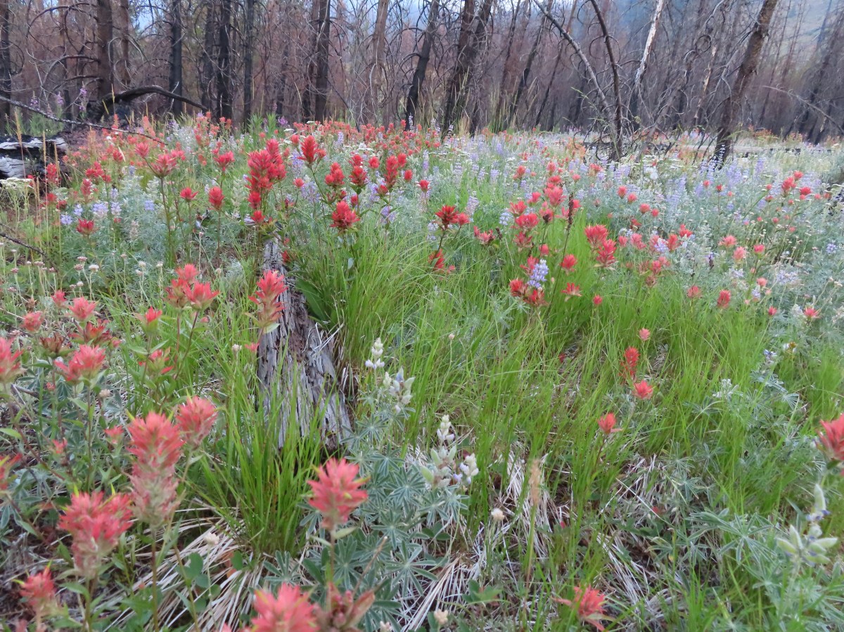
One of the other changes post fire is that the loop we did back in 2011 is no longer possible due to the closure of the section of trail that passed behind Shellburg Falls. You can still reach Shellburg Falls on either the west side or east side, you just can’t make a loop out of it. There are several other loops that are possible in the area on the east side of the creek and my plan was to check out three of those and also take a detour to the Silver Falls State Park Backcountry.

Prior to doing any of that though I headed down the Shellburg Falls Trail to do the roughly 1.5-mile out-and-back on the west side of the falls.

The trail parallels Shellburg Road and briefly joins it after passing a gate to cross Shellburg Creek and then returns to a single track recrossing Shellburg Creek on a new footbridge installed by TKO volunteers.

 Shellburg Creek
 Trail sign ahead on the right marking the resumption of the Shellburg Falls Trail.

The trail soon passes the top of the falls before descending via new switchbacks and turning back up the creek for a view of the full waterfall.

 May 2011 view.

 First sunlight hitting the rocks above the trail.
 Barricade and sign marking the closed section of trail.

2011 view

After admiring the falls I headed back up toward the trailhead but stayed on Shellburg Road and turned right across the parking area to head toward the shelter and day use area.
 Some survivors on the far hillside.
 I heard a number of woodpeckers throughout the day, but this was the only one I was able to spot.
 Outhouse at the day use area up ahead.
 Parking spots at the day use area along with the shelter. The trails on the left and right are the Vine Maple Trail, the shortest loop option at about 1-mile.
While my plan was to do the Vine Maple Loop it would not be all at once. Instead, my plan was to take the left (northern) section to the Shellburg Creek Trail where I would turn left onto that loop which would eventually lead me back to the trailhead where I would then take the southern section of the Vine Maple Loop to the August Mountain Trail.

 The only tree I had to step over on a trail all morning.
 Arriving at the 4-way trail junction with the Shellburg Creek, August Mountain, and southern portion of the Vine Maple Trail.
At the junction I made a hard left onto the Shellburg Creek Trail.

We had not been on this trail in 2011, so it was brand new to me. The trail climbed gradually along Shellburg Creek (no views) for a third of a mile before turning away from the creek and climbing more steeply.

 I saw a good number of varied thrushes including 4 or 5 in this spot, but once again I failed at getting a clear picture.
 The forest along the creek held up pretty well in the fire.
I was keeping an eye out for the Lost Creek Trail which would be heading uphill to the right (or left if you’re going the other way) of the Shellburg Creek Trail. I first spotted a faint trail signed as a horse route.

I had seen this trail on at least one map and knew it wasn’t the trail I was looking for. (It theoretically rejoins the Shellburg Creek Trail a short distance later, but I did not notice the other end.)


 Frosty leaves
A short distance later the trail crossed a roadbed that was not on any of the maps that I had available to me. (This road is shown on several other maps that I did not happen to be using.)


Referring to the maps I had, and my GPS track this old roadbed looked like it might be what I was looking for. There was no sign for the Lost Creek Trail but the other tail signs at the junction increased my confidence that this could be the trail. I turned uphill on the roadbed and climbed 150′ in a quarter of a mile to the end of the road.

 End of the line. I briefly searched for old tread before deciding that this was not in fact the Lost Creek Trail.
I returned to the Shellburg Creek Trail and continued on that loop. A tenth of a mile later I passed an abandoned trail that had been covered with debris. A few feet beyond the abandoned trail I came to an unsigned T-junction at the edge of a clearcut.

 The T-junction
The trail leading uphill here was in good shape and I was confident that I had finally found the correct trail, so I turned right.
 Heading uphill from the Shellburg Creek Trail.
After climbing for a bit I passed the upper end of the closed trail and a trail marker for the Snag Loop Trail.

 As near as I can tell the decommissioned section of trail was the Lost Creek Trail as some maps show both the Lost Creek and Snag Loop Trails.
I continued uphill crossing a roadbed at the half a mile mark and arriving at Shellburg/Ayers Creek Road at the three-quarter mile mark.

 Arriving at the road crossing.

 Shellburg/Ayers Creek Road (depending on the map)
I turned right on the road for a tenth of a mile to an intersection where I proceeded straight into a wide muddy area.

 On the other side of the intersection.
The Lost Creek Trail followed the muddy roadbed for another 0.2-miles before splitting off to the left at a trail pointer.


The trail continued uphill to Lookout Mountain Road at the edge of Silver Falls State Park.
 Some of the forest up higher had survived the fire as well.

 Arriving at Lookout Mountain Road.
 Gate at the border of Silver Falls State Park.
I had been on the other side of that gate in 2022 during my 21.5-mile perimeter loop of that park(post).
 The unmistakable flat top of Coffin Mountain (post) in the distance.
After tagging the gate, and shedding a layer, I headed back down to the Shellburg Creek Trail.

Shortly after starting back down I spotted a couple of early wildflowers.
 Evergreen violets – Viola sempervirens
 Snow queen

Back at the Shellburg Creek Trail.
From the junction the Shellburg Creek Trail descended at a good pace through a recently replanted clearcut before ending at Shellburg Road after two thirds of a mile.

 While the Sun was out and it had warmed up a bit the shady areas were still frosty.


The trail crossed this road at the 0.3-mile mark. It turns out this roadbed is the one I turned up earlier in error.


Shellburg Road
I turned left onto the road and followed it approximately 500′ to the trailhead where I again headed for the day use area (left this time) and picked up the southern section of the Vine Maple Trail.


I followed the Vine Maple Trail back to the 4-way trail junction and turned right onto the August Mountain Trail.

The back of the shelter.


The August Mountain Trail crossed Shellburg Creek on another nice new bridge then climbed August Mountain to a signboard at a roadbed.


Following a pointer for the Shellburg Falls Trail I headed downhill into a creek drainage where I spotted a few deer on the opposite hillside.
 While not unobstructed, the fire had opened up partial views of Mt. Jefferson.
 Mt. Jefferson through the trees.

 Two of the deer.
The trail dropped to Shellburg Road (again) and continued on the far side.

I however turned left onto the road in order to make another little loop, and to see if the fire had opened up any views of Stassel Falls. While the waterfall is on private property the Santiam State Forest Boundary extends far enough that it is possible to get glimpses of the 125′ waterfall. There is no official trail but I picked up a use trail which I followed, keeping an eye out for private property or no trespassing signs.

While the fire had burned away much of the trees the angle looking toward the falls from this side of Stout Creek still doesn’t provide a great view.
 Stassel Falls
Given the rough terrain, dangerous hillside, and lack of a view I don’t recommend this side trip. I returned to the road and followed it down to a picnic table next to Lower Shellburg Falls. Along the way I was passed by a bike, the first person I’d seen on trail all morning.

The picnic table in the distance.
 Lower Shellburg Falls
 2011
2011
I saw a second trail user, an equestrian, just before I headed up toward Shellburg Falls from the road.

I had the waterfall to myself and as a bonus there was a nice rainbow at its base.


 Rainbow and ice below Shellburg Falls.
 Icicles on the rocks above Shellburg Creek.
After admiring the falls again I headed back by taking the August Mountain Trail through the burned forest to the road crossing.
 August Mountain Trail on the left.

At Shellburg Road I turned left and followed it above the falls and back to the bridge over Shellburg Creek.


At the gate I hopped back onto the Shellburg Falls Trail and took it back to the trailhead.

My convoluted route came to 10.8-miles with a little over 1700′ of elevation gain and consisted of five loops.

Given the numerous options and proximity to Salem (about an hour) it’s an area we need to make more use of. There is also a network of mountain bike only trails in the area making it a popular destination at times but on a day like to today it provided a lot of solitude.
One interesting prospect that I found myself thinking about was the possibility of shuttling from Shellburg Falls over to Silver Falls State Park. It would make for a long outing but could include at least a dozen waterfalls with the right planning. Happy Trails!
Flickr: Shellburg Falls


 We started with this hike in part due to it being the first day of the final king tides, abnormally high tides, for the season. High tide for Smelt Sands was going to be 9:45am so we were hoping to see some of the wave action.
 It was just before 8am as we hiked the 804 Trail.
 We made a mistake and turned right on the paved path here, but we should have continued beyond the large signboard to a second path marked by a wooden post. You can see the small white and black to the left of the green signboard. We may have been distracted by “Free Coffee” being printed on the bottom of the green sign.
 This post is similar to the one along the 804 Trail where we should have turned right.


 Boardwalk over Mitchell Creek.
 Grandmother Spruce
 The upper end of the preserve trail.

 Mushrooms
 Approaching Starr Creek.
 Starr Creek
 The upper gate at the junction.
 Ya’Xaik Trail
 The right hand fork here is the trail leading down to the fire station that dog owners can use to make a loop. A local had warned us that this trail can be pretty slick. We went left to remain on the Ya’Xaik Trail.
 There was a little climbing involved before the trail headed down to Diversity Drive.


 The Ya’Xaik Trail at Diversity Drive.


 The Woodland Trail continues to the left while the right connects up to a road.


 A footbridge over the Red River below with a disc golf hole on the opposite ridge. We were able to use the OregonHikers Field Guide map to identify this connector trail as one we did not want to take. That map had many of the connector trails identified in red which helped keep our position located as well as keep us on the correct route.


 The old roadbed at the bottom of the switchbacks.
 Woodland Trail on the left and our next stop, the Lint Slough Trail, on the right.


 Memorial plaque
 There was a bypass uphill for this short flooded section.
 There were a number of bufflehead ducks, a pair of geese, and one noisy great blue heron at the slough. All of the wildlife seemed to be positioned as far away from the trail as possible.
 The great blue heron in a tree across the slough.
 This little group of buffleheads was the exception.
 I turned around at this bench due to not seeing an obvious continuation of the trail here. I had also lost Heather who had stayed up to avoid the flooded section and instead of returning to the trail I was on, on the other side of the flooded bench, stayed up on the higher path. That path began leading up uphill away from the actual trail without another way to get back to the correct path. She wound up backtracking and we met shortly after I had started back.
 The slough from my turn around point.
 Yarrow
 Bull thistle (non-native)
 Rose (probably non-native)


 Looking north along the beach.
 The view south.
 The wet sand and debris from the high tide was up to the vegetation along much of the beach.
 We decided to turn back at the creek partly to avoid crossing it, but also because we had been walking into the wind. It wasn’t a particularly cold day, but the wind chill was almost making it uncomfortable.
 Seagull with a crab.
 Cape Perpetua (
 Buckley Creek
 We had to ford Buckley Creek which was only a couple of inches deep at most.
 Semipalmated plovers
 Western gull
 Heading back north.
 The path back up to the parking area at Driftwood Beach.

 Ocean spray – August 4th – Wizard Island (Crater Lake NP), OR
 Olympic onion – June 8th – Cedar Butte, OR
 One-sided wintergreen – July 25th – Minam River Trail, OR
 Tapertip onion – July 21st – Granny View Overlook (Hells Canyon), OR
 Ookow – June 1st – Cook Hill, WA
 Orange agoseris – June 29th – Grasshopper Mountain, OR
 Orange globe mallow- May 25th – Barnes Butte (Prineville), OR
 An orchid – July 22nd – Hurricane Creek Trail (Eagle Cap Wilderness), OR
 Oregon bluebells – June 29th – Grasshopper Mountain Trail, OR
 Oregon grape – March 30th – Mulkey Ridge Trail (Corvallis), OR
 Oregon sunshine – July 13th – Nasty Rock Trail, OR
 Pacific coralroot – July 13th – Joyce Lake Trail, OR
 Pacific hound’s tongue – March 30th – Mulkey Ridge Trail (Corvallis), OR
 Pacific waterleaf – May 12th – Cathedral Tree Trail, OR
 Indian paintbrush – May 25th – Willow Creek Canyon, OR
 Paintbrush – probably scarlet (Castilleja miniata) – August 18th – Cliff Creek Trail (Wallowa-Whitman National Forest), OR
 Parry’s arnica – July 21st – Hat Point, OR
 Patridge foot – September 13th – Pacific Crest Trail (Mt. Jefferson Wilderness), OR
 Gray sagewort – July 21st – Granny View Overlook (Hells Canyon), OR
 Pea-vine – May 26th – Madison Butte, OR
 Pearly everlasting – June 19th – Deception Butte Trail, OR
 Woolly head clover – July 24th – Tenderfoot Wagon Road Trail (Eagle Cap Wilderness), OR
 Pennycress – July 23rd – McCully Creek Trail (Eagle Cap Wilderness), OR
 Penstemon – May 25th – Barnes Butte (Prineville), OR
 Penstemon – June 1st – Cook Hill, WA
 Pestemon – July 13th – Nasty Rock Trail, OR
 Venus penstemon – July 21st – Granny View Overlook (Hells Canyon), OR
 Globe penstemon – July 24th – Tenderfoot Wagon Road Trail (Eagle Cap Wilderness), OR
 A phacelia – July 26th – East Peak (Eagle Cap Wilderness), OR
 Phantom orchid – June 1st – Cook Hill, WA
 Phlox – June 1st – Cook Hill, WA
 Pinedrops – August 3rd – The Pinnacles Trail (Crater Lake NP), OR
 Pink pyrola – June 19th – Deception Butte Trail, OR
 Pioneer violet – April 13th – Wind Mountain, WA
 Woolly goldenweed? (If so this was a first for us.) – May 26th – Madison Butte, OR
 Prairie smoke – May 26th – Bull Prairie Lake, OR
 Prince’s pine – July 22nd – Hurricane Creek Trail (Eagle Cap Wilderness), OR
 Purple dead-nettle – February 24th – Fernhill Wetlands, OR
 Purpleflower honeysuckle – June 29th – Grasshopper Mountain, OR
 Pussypaws – July 26th – Mount Howard, OR
 Pussytoes – July 13th – Nasty Rock Trail, OR
 Queen’s cup – June 22nd – Big Huckleberry Mountain, WA
 Raceme pussytoes – June 29th – Grasshopper Mountain, OR
 Rosy pussytoes – June 22nd – Big Huckleberry Mountain, WA
 Ragwort – May 26th – Madison Butte, OR
 Red clover – July 24th – Tenderfoot Wagon Road Trail (Eagle Cap Wilderness), OR
 Red flowering currant – April 13th – Wind Mountain, WA
 Rhododendron – June 15th – O’Leary Mountain Trail, OR
 Rockcress – May 26th – Madison Butte, OR
 Rose campion (non-native) – June 19th – Buckhead Nature Trail, OR
 Rosy bird’s-foot trefoil – June 8th – Kilchis Forest Road, OR
 Sagebrush mariposa lily – July 22nd – Hurricane Creek Trail (Eagle Cap Wilderness), OR
 Salal – June 8th – Kilchis Forest Road, OR
 Salmonberry – April 13th – St. Cloud Trail, WA
 Sandwort – July 24th – Bonny Lakes Trail (Eagle Cap Wilderness), OR
 Saxifrage – July 24th – Tenderfoot Wagon Road Trail (Eagle Cap Wilderness), OR
 Scarlet gilia – July 4th – Horsepasture Mountain, OR
 Scouler’s bluebell – June 19th – Deception Butte Trail, OR
 Scouler’s corydalis – April 13th – Lower Archer Falls, WA
 Scouler’s woollyweed – July 24th – Bonny Lakes Trail (Eagle Cap Wilderness), OR
 Seaside bittercress – May 11th – Ecola State Park, OR
 Self-heal – June 19th – Deception Butte Trail, OR
 Serviceberry – May 26th – Madison Butte, OR
 Shooting star – May 26th – Madison Butte, OR
 Silverleaf phacelia – May 25th – Willow Creek Canyon, OR
 Silvery raillardella (new to us) – August 4th – Crater Lake National Park, OR
 Sitka mist-maidens – April 27th – Wahkeena Trail, OR
 Skunk cabbage – May 11th – Ecola State Park, OR
 Slender phlox – May 26th – Madison Butte, OR
 mall-flowered woodland-star – May 26th – Madison Butte, OR
 Small bluebells – May 26th – Madison Butte, OR
 Snowberry – June 19th – Deception Butte Trail, OR
 Solomonseal – April 20th – Jackson Bottom Wetlands, OR
 Oregon oxalis – April 13th – Lower Archer Falls, WA
 Spirea betulifolia – June 22nd – Big Huckleberry Mountain, WA
 Spiraea douglasii – July 6th – Independence Riverfront Park, OR
 Spiraea splendens – July 25th – Minam River Trail, OR
 Spotted coralroot – June 1st – Cook Hill, WA
 Spreading dogbane – July 22nd – Hurricane Creek Trail (Eagle Cap Wilderness), OR
 Spreading stickseed? – June 1st – Cook Hill, WA
 Star-flowered false solomonseal – June 8th – Cedar Butte, OR
 Starflower – June 1st – Cook Hill, WA
 Stonecrop – June 1st – Cook Hill, WA
 Wormleaf stonecrop – July 13th – Nasty Rock, OR
 Strawberry – March 30th – Mulkey Ridge Trail (Corvallis), OR
 Streambank globe-mallow – July 24th – Tenderfoot Wagon Road Trail (Eagle Cap Wilderness), OR
 Sub-alpine mariposa lily – June 19th – Deception Butte Trail, OR
 Sugar sticks – July 4th – Olallie Trail, OR
 Swamp onion – July 24th – Bonny Lakes Trail (Eagle Cap Wilderness), OR
 Chicory (non-native) – August 18th – Cliff Creek Trail (Wallowa-Whitman National Forest), OR
 Sweet coltsfoot – April 27th – Wahkeena Trail, OR
 Tall bluebells – June 29th – Grasshopper Mountain Trail, OR
 Tansy ragwort (non-native) – July 6th – Independence Riverfront Park, OR
 Tasselflower brickellbrush – July 22nd – Hurricane Creek Trail (Eagle Cap Wilderness), OR
 Thimbleberry – April 20th – Jackson Bottom Wetlands, OR
 Thistle – June 8th – Kilchis Forest Road, OR
 Thistle (non-native) – July 6th – Independence Riverfront Park, OR
 Greene’s thistle (Cirsium inamoenum) – July 26th – Mount Howard, OR
 Threadleaf phacelia – May 25th – Barnes Butte (Prineville), OR
 Tiger lilies – June 19th – Deception Butte Trail, OR
 Dalmation toadflax (non-native) – May 25th – Willow Creek Trail (Madras), OR
 Tolmie’s mariposa lily – June 19th – Deception Butte Trail, OR
 Toothwort – March 30th – Mulkey Ridge Trail (Corvallis), OR
 Trillium – March 30th – Mulkey Ridge Trail (Corvallis), OR
 Twinberry – April 20th – Jackson Bottom Wetlands, OR
 Twin flower – July 4th – Olallie Trail, OR
 Valerian – June 8th – Kilchis Forest Road, OR
 Vanilla leaf – June 1st – Cook Hill, WA
 Variable-leaf collomia – June 8th – Cedar Butte Road, OR
 Vetch – May 28th – Baskett Slough National Wildlife Refuge, OR
 Vine maple – April 13th – Lower Archer Falls, WA
 Violet – March 6th – Dorris Ranch (Eugene), OR
 Violet – July 25th – Minam River Trail, OR
 Canary violet – May 26th – Madison Butte, OR
 Hookedspur violets – May 26th – Madison Butte, OR
 Wallflower – June 8th – Kilchis Forest Road, OR
 Wallowa paintbrush – July 25th – Minam River Trail, OR
 Washington lily – July 4th – Olallie Trail, OR
 Western buttercups – March 16th – Middle Fork Willamette Path (Eugene), OR
 Western clematis – August 19th – Pine Lakes Trail (Eagle Cap Wilderness), OR
 Western featherbells – July 13th – Nasty Rock Trail, OR
 Western Labrador tea – July 25th – Minam River Trail, OR
 Western meadowrue – April 27th – Angel’s Rest Trail, OR
 Western snakeroot – August 4th – Wizard Island (Crater Lake NP), OR
 White mariposa lily – July 24th – Bonny Lakes Trail (Eagle Cap Wilderness), OR
 Bushy blazing-star (Mentzelia dispersa) – July 24th – Tenderfoot Wagon Road Trail (Eagle Cap Wilderness), OR
 Tough-leaved iris – March 30th – Mulkey Ridge Trail (Corvallis), OR
 Wild onion (Tolmie’s?) – May 26th – Madison Butte, OR
 Wild roses – May 28th – Baskett Slough National Wildlife Refuge, OR
 Willowherb – July 24th – Tenderfoot Wagon Road Trail (Eagle Cap Wilderness), OR
 Wintergreen – July 13th – Nasty Rock Trail, OR
 Possibly woolly groundsel – July 24th – Tenderfoot Wagon Road Trail (Eagle Cap Wilderness), OR
 Yarrow – June 22nd – Big Huckleberry Mountain, WA
 Yellow bell – May 26th – Madison Butte, OR
 Yellow columbine – July 22nd – Hurricane Creek Trail (Eagle Cap Wilderness), OR
 Yellowleaf iris – June 15th – O’Leary Mountain Trail, OR
 Yellow sweet clover (non-native) – Hurricane Creek Trail (Eagle Cap Wilderness), OR
 Youth-on-age – June 8th – Kilchis Forest Road, OR
 Zigzag groundsmoke – August 3rd – The Pinnacles Trail (Crater Lake NP), OR
 Invasive Queen Anne’s Lace lower right corner.

 Agoseris – July 26th – Mount Howard, OR
 Allumroot – July 26th – Mount Howard, OR
 Alpine pennycress – June 1st – Cook Hill, WA
 American Sawwort (Saussurea americana) – July 24th – Bonny Lakes Trail (Eagle Cap Wilderness), OR
 Arnica – July 24th – Tenderfoot Wagon Road Trail (Eagle Cap Wilderness), OR
 Drummond’s anemone seedhead – August 4th – Crater Lake National Park, OR
 Columbia windflower (Anemone deltoidea) – June 1st – Cook Hill, WA
 Apple blossoms – April 13th – St. Cloud Trail, WA
 Heartleaf arnica – May 26th – Bull Prairie Lake, OR
 Broadleaf arnica – June 22nd – Big Huckleberry Mountain, WA
 Arrowleaf buckwheat – July 13th – Nasty Rock, OR
 Western mountain aster – July 13th – Nasty Rock, OR
 Showy? aster – August 22nd – East Fork Wallowa River Trail (Eagle Cap Wilderness), OR
 Thick-stemmed aster and buckwheat – July 21st – Granny View Overlook (Hells Canyon), OR
 Another aster (or fleabane) – August 20th – Bowman Trail (Eagle Cap Wilderness), OR
 Largeleaf avens – June 8th – Kilchis Forest Road, OR
 Bachelor buttons (non-native) – June 1st – Cook Hill, WA
 Ballhead sandwort – July 24th – Bonny Lakes Trail (Eagle Cap Wilderness), OR
 Ballhead waterleaf – May 26th – Madison Butte, OR
 Carey’s balsamroot – May 25th – Willow Creek Canyon, OR
 Arrowleaf balsamroot – May 26th – Madison Butte, OR
 Baneberry – May 18th – Wilson River Trail, OR
 Bastard toadflax – June 29th – Grasshopper Mountain, OR
 Woodland beardtongue – July 13th – Nasty Rock, OR
 Beargrass – June 8th – Cedar Butte, OR
 Bigleaf maple – March 30th – Mulkey Ridge Trail (Corvallis), OR
 Bindweed – August 18th – Cliff Creek Trail (Wallowa-Whitman National Forest), OR
 Barestem biscuitroot – May 26th – Madison Butte, OR
 Trailing blackberry – June 19th – Deception Butte Trail, OR
 Bleeding heart – April 27th – Devil’s Rest Trail, OR
 Blue-eyed Mary – April 13th – Wind Mountain, WA
 Bluebell-of-Scotland – July 13th – Nasty Rock, OR
 Bluehead gilia – June 22nd – Big Huckleberry Mountain, WA
 Bog Orchid – July 23rd – McCully Creek Trail (Eagle Cap Wilderness), OR
 Bolander’s Ragwort – June 22nd – Big Huckleberry Mountain, WA
 Daisies (non-native) – June 19th – Buckhead Nature Trail, OR
 Sulphur-flower wild buckwheat (Eriogonum umbellatum) – July 13th – Nasty Rock, OR
 Barestem wild buckwheat (Eriogonum nudum) – July 13th – Nasty Rock, OR
 Cushion wild buckwheat – July 26th – Mount Howard, OR
 Alpine wild buckwheat – August 4th – Crater Lake National Park, OR
 Buek’s groundsel – July 26th – Mount Howard, OR
 Carolina bugbane – July 24th – Tenderfoot Wagon Road Trail (Eagle Cap Wilderness), OR
 Bunchberry – July 13th – Joyce Lake Trail, OR
 Buttercup – June 8th – Kilchis Forest Road, OR
 Bistort – July 4th – Olallie Trail, OR
 California-tea – June 19th – Deception Butte Trail, OR
 California cornlily – July 24th – Tenderfoot Wagon Road Trail (Eagle Cap Wilderness), OR
 Camas – April 20th – Jackson Bottom Wetlands, OR
 Canadian milk-vetch – July 24th – Tenderfoot Wagon Road Trail (Eagle Cap Wilderness), OR
 Candy flower – April 13th – Sams-Walker Day Use Area, WA
 Cardwell’s penstemon – June 8th – Tillamook State Forest (Road FB3), OR
 Catchfly – June 22nd – Big Huckleberry Mountain, WA
 Ceanothus – June 15th – O’Leary Mountain Trail, OR
 Chocolate lily – April 13th – Doetsch Ranch, WA
 Meadow checker-mallow – May 28th – Baskett Slough National Wildlife Refuge, OR
 Rose checker-mallow – May 28th – Baskett Slough National Wildlife Refuge, OR
 Oregon checker-mallow – July 24th – Tenderfoot Wagon Road Trail (Eagle Cap Wilderness), OR
 Chickweed – June 1st – Cook Hill, WA
 Cinquefoil – June 29th – Hiyu Ridge, OR
 Shrubby cinquefoil – July 21st – Hat Point, OR
 Farewell to spring (Clarkia amoena) – June 1st – Cook Hill, WA
 Cliff beardtongue – June 22nd – Big Huckleberry Mountain, WA
 Coyote mountain mint – July 13th – Nasty Rock, OR
 Clover – August 22nd – East Fork Wallowa River Trail (Eagle Cap Wilderness), OR
 Coastal manroot – May 11th – Crescent Beach Trail, OR
 Columbian larkspur – March 16th – Middle Fork Willamette Path (Eugene), OR
 Columbine – June 29th – Hiyu Ridge, OR
 Common butterwort? – July 22nd – Hurricane Creek Trail (Eagle Cap Wilderness), OR
 Common madia – May 28th – Baskett Slough National Wildlife Refuge, OR
 Common whipplea – June 19th – Deception Butte Trail, OR
 Coneflower – August 17th – Emigrant Springs State Heritage Area, OR
 Cusick’s speedwell – July 23rd – McCully Creek Trail (Eagle Cap Wilderness), OR
 Cut-leaf thelypody – May 25th – Willow Creek Trail, OR
 Cutleaf anemone – July 24th – Bonny Lakes Trail (Eagle Cap Wilderness), OR
 Death camas – May 26th – Madison Butte, OR
 Desert yellow fleabane – May 25th – Willow Creek Trail, OR
 Devil’s club – June 8th – Kilchis Forest Road, OR
 Dogwood – April 20th – Rood Bridge Park, OR
 Dusty maidens – July 26th – East Peak (Eagle Cap Wilderness), OR
 Dwarf alpinegold – August 4th – Crater Lake National Park, OR
 Dwarf lupine – August 4th – Crater Lake National Park, OR
 Elderberry – June 29th – Grasshopper Mountain, OR
 Elephants head – July 25th – Minam River Trail, OR
 Elkhorn clarkia – July 21st – Granny View Overlook (Hells Canyon), OR
 Engilish plantain (non-native) – May 11th – Fort Stevens State Park, OR
 Explorer’s gentian – September 21st – Black Wolf Meadows, OR
 Fairy bells – April 27th – Wahkeena Trail, OR
 Fairy lanterns – June 8th – Kilchis Forest Road, OR
 Fairy slipper – April 13th – Wind Mountain, WA
 Fawn lilies – March 30th – Mulkey Ridge Trail (Corvallis), OR
 Felt-leaf everlasting – August 4th – Crater Lake National Park, OR
 Finetooth beardtongue – June 22nd – Big Huckleberry Mountain, WA
 Fireweed – July 24th – Tenderfoot Wagon Road Trail (Eagle Cap Wilderness), OR
 False hellebore – July 24th – Bonny Lakes Trail (Eagle Cap Wilderness), OR
 A fleabane? – June 29th – Grasshopper Mountain, OR
 Showy? fleabane – July 22nd – Hurricane Creek Trail (Eagle Cap Wilderness), OR
 Flett’s ragwort – June 8th – Kilchis Forest Road, OR
 Ground-ivy (non-native) – April 13th – Sams-Walker Day Use Area, WA
 Foam flower – June 1st – Cook Hill, WA
 Fringecup – April 13th – Lower Archer Falls, WA
 Fringed pinesap – July 4th – Olallie Trail, OR
 Gentian – August 19th – Pine Lakes Trail (Eagle Cap Wilderness), OR
 Geranium – July 22nd – Hurricane Creek Trail (Eagle Cap Wilderness), OR
 Ghost pipe – August 22nd – East Fork Wallowa River Trail, OR
 Giant purple wakerobin (Trillium kurabayashii) – April 20th – Jackson Bottom Wetlands, OR
 Giant white wakerobin (Trillium albidum) – April 20th – Jackson Bottom Wetlands, OR
 Wild ginger – June 1st – Cook Hill, WA
 Glacier lilies- May 26th – Madison Butte, OR
 Rocky Mountain goldenrod – July 22nd – Hurricane Creek Trail (Eagle Cap Wilderness), OR
 Gold stars – April 27th – Wahkeena Trail, OR
 Grass-of-parnassus – July 24th – Tenderfoot Wagon Road Trail (Eagle Cap Wilderness), OR
 Grass widows – May 26th – Madison Butte, OR
 Gray’s licorice-root – August 3rd – Castle Crest Wildflower Trail (Crater Lake NP), OR
 Greene’s goldenbush – August 3rd – The Pinnacles Trail (Crater Lake NP), OR
 Groundsel – June 1st – Cook Hill, WA
 Harebells – July 22nd – Hurricane Creek Trail (Eagle Cap Wilderness), OR
 Hedgenettle – June 8th – Kilchis Forest Road, OR
 Hoary Cress (non-native) – May 25th – Barnes Butte (Prineville), OR
 Honeysuckle – June 29th – Hiyu Ridge Trail, OR
 Hooded ladies tresses – August 20th – Chimney Lake Trail (Eagle Cap Wilderness), OR
 Idaho licorice-root – July 24th – Tenderfoot Wagon Road Trail (Eagle Cap Wilderness), OR
 Inside-out-flower – June 8th – Kilchis Forest Road, OR
 Royal Jacob’s ladder – July 4th – Olallie Trail, OR
 Jacob’s ladder – July 24th – Bonny Lakes Trail (Eagle Cap Wilderness), OR
 Jessica’s stickseed – July 4th – Olallie Trail, OR
 Lance-leaf spring beauty – May 26th – Madison Butte, OR
 Large-flower triteleia – June 1st – Cook Hill, WA
 Largeleaf sandwort – June 29th – Grasshopper Mountain Trail, OR
 Menzies’ Larkspur (Delphinium menziesii) – July 4th – Olallie Trail, OR
 Possibly rockslide larkspur (Delphinium glareosum) – July 13th – Nasty Rock, OR
 Sierra larkspur (Delphinium glaucum) – July 24th – Bonny Lakes Trail (Eagle Cap Wilderness), OR
 Leafy fleabane – June 19th – Deception Butte Trail, OR
 Leafy miterwort – May 18th – Wilson River Trail, OR
 Lemon-scented madia – May 25th – Willow Creek Canyon, OR
 Lewis flax – June 29th – Grasshopper Mountain, OR
 Lewis monkeyflower – August 3rd – Castle Crest Wildflower Trail (Crater Lake NP), OR
 False lily of the valley – April 20th – Rood Bridge Park, OR
 Littleleaf montia – June 8th – Kilchis Forest Road, OR
 Little prince’s pine – June 15th – O’Leary Mountain Trail, OR
 Longhorn plectritis – May 26th – Madison Butte, OR
 Sickletop louswort – July 4th – Olallie Trail, OR
 Coiled lousewort – July 23rd – McCully Creek Trail (Eagle Cap Wilderness), OR
 Lupine – May 18th – Wilson River Trail, OR
 Lupine – July 24th – Tenderfoot Wagon Road Trail (Eagle Cap Wilderness), OR
 Lyall’s goldenweed – July 26th – Mount Howard, OR
 Microseris – June 22nd – Big Huckleberry Mountain, WA
 Basalt? milk-vetch – May 25th – Barnes Butte (Prineville), OR
 Mock orange – July 22nd – Hurricane Creek Trail (Eagle Cap Wilderness), OR
 Common monkey-flower (Erythranthe guttata) – June 1st – Cook Hill, WA
 Chickweed monkey-flower (Erythranthe alsinoides) – June 8th – Cedar Butte Road, OR
 Coastal monkey-flower (Erythranthe dentata) – June 8th – Kilchis Forest Road, OR
 Monkshood – July 24th – Tenderfoot Wagon Road Trail (Eagle Cap Wilderness), OR
 Mountain ash – July 22nd – Hurricane Creek Trail (Eagle Cap Wilderness), OR
 Mountain death camas – July 22nd – Hurricane Creek Trail (Eagle Cap Wilderness), OR
 Mountain heather – July 24th – Bonny Lakes Trail (Eagle Cap Wilderness), OR
 Musk monkey-flower (Erythranthe moschata) – July 4th – Olallie Trail, OR
 Naked broomrape – June 29th – Grasshopper Mountain, OR
 Nettle-leaf giant hyssop – July 21st – Granny View Overlook (Hells Canyon), OR
 Northern phlox – June 15th – O’Leary Mountain Trail, OR
 Northwestern rabbit-tabbaco – September 13th – Pacific Crest Trail (Mt. Jefferson Wilderness), OR
 Northwestern twayblade – July 13th – Nasty Rock Trail, OR
 Nuttall’s linanthus – July 25th – Minam River Trail, OR


 In July we took the Wallowa Lake Tramway up Mount Howard (
 In August we traveled by boat to Wizard Island in Crater Lake National Park (
 The Town Gulch Fire near Carson, OR was dangerously close to blocking our access to one of the featured hikes we needed to do to finish our goal (
 January – Corvallis to Sea Trail
 February – Sunrise from Maple Creek Road
 March – Mary’s Peak from Fitton Green
 April – Bridal Veil Falls
 May – Fishhawk Falls
 May – Willow Creek Trail
 May – Juniper Hills Preserve (The trails here were/are closed so we simply parked along the road and took pictures.)
 May – Madison Butte
 June – Cook Hill
 June – Deception Butte Trail
 June – Mt. Adams from Big Huckleberry Mountain
 June – Grasshopper Meadow (Unfortunately this area burned by the Young Grasshopper Fire in September.)
 July – Horsepasture Mountain
 July – Nasty Rock Trail
 July – Lower Bonny Lake
 July – Minam Lake
 July – Mount Howard
 August – The Pinnacles
 August – Downing Creek Falls
 August – Schneider Cabin
 August – Pine Lakes Trail
 August – Laverty Lake
 August – Aneroid Lake
 September – Hidden Lake
 September – Mt. Jefferson from Sprague Lake
 September – Black Wolf Meadows
 October – White River Canyon
 October – Kinzel Lake
 October – Sawtooth Trail
 October – William L. Finely National Wildlife Refuge
 October – Gold Lake Shelter
 November – Silver Falls State Park
 December – McKenzie River Trail
 The trailhead.
 The caution sign was related to some pile burning that the Forest Service had been doing.
 McKenzie River
 Mushrooms
 National Recreation Trail symbol on a tree to the left.


 Private Road sign on Duffy Rd.
 There was quite a bit of witches’ butter fungus along the trail.
 There were a lot of other mushrooms too.
 Unnamed creek crossing.


 Ruby-crowned kinglet. We didn’t see much wildlife on this hike but there were several kinglets flitting among the trees here. This was the only photo of one I managed to get though.
 We had not expected any blue sky so this was a treat. It had rained for most of the drive and sprinkled for a minute shortly after we started hiking, but it had been dry otherwise.
 The trail switching back up a small hill.
 The most significant elevation change was this decent to a footbridge over Lost Creek.
 Coral fungus
 Lost Creek
 The footbridge over Lost Creek was a little over 4.5-miles from the Lower McKenzie Trailhead.
 Lost Creek
 Willamette National Forest Boundary
 Approximately 5.25-miles from the trailhead we crossed Belknap Hot Springs Road.
 Sign for the
 Unnamed seasonal stream.
 Footbridge over Scott Creek.
 Scott Creek
 Mushrooms
 Footbridge over Boulder Creek.
 Highway 126 bridge over Boulder Creek from the footbridge.
 Boulder Creek flowing into the McKenzie River.
 Forest Road 2650.
 Boat ramp at Forest Road 2650.
 The river from Forest Road 2650.

 This short section along the road is just east of Belknap Springs Road.
 Madrones
 A little sunlight on the forest floor.
 Rain shower falling over Lost Creek. It wasn’t raining hard enough to convince me to pull my rain gear back out.
 I spotted Heather with a little over three and a quarter mile left back to the trailhead. (Look for a little orange in the trees ahead and to the right of the trail.)


 Ours was the only car at the trailhead when we got back.
 Red – Clear Lake, June 2014 (


 The North Rim Trail heads left at a fork with the Twin Falls Trail a short distance from the parking lot.
 I stuck to the North Rim Trail here leaving another (short) trail to do next time.
 The Nature Play Area along the loop trail I didn’t take.
 One of two bridges along the North Rim Trail.
 Railing near the North Falls Viewpoint.
 North Falls from the viewpoint.
 North Falls
 Map located at the North Falls Trailhead.
 Upper North Falls from the Upper North Falls Trail.
 Upper North Falls.
 The split in the Trail of Ten Falls where the Canyon Trail heads down to North Falls.
 North Falls
 Trail behind North Falls.
 Behind North Falls.
 I will always take pictures of these large boulders in the creek.
 Trail marker at the Twin Falls Trail junction.
 Twin Falls
 Twin Falls is a tough one to get a good clear view of the full waterfall. Recent rainfall had provided good flow for this fall which helps with the visibility.
 This is Twin Falls on July 7, 2006.
 All the rain had the side creeks and falls flowing as well.
 Nearing the Winter Falls Trail and its bridge over the creek.
 The view from the bridge.
 Winter Falls from the Winter Falls Trail.
 Winter Falls

 The forecast had called for sunny skies, but we were also dealing with an air stagnation warning. For a brief moment I thought the fog might burn off, but that never materialized and by the time I arrived at South Falls more fog had rolled in.
 There are some nice big trees scattered throughout the park.


 Trail of Ten Falls/Canyon Trail above South Falls.
 South Falls
 Behind South Falls
 For a short loop just to South Falls you can cross the bridge and return to the rim.

 The trail below heading for Lower South Falls.
 From behind Lower South Falls. I scared a poor woman so badly as I neared the falls. She was setting her phone up on a tripod for a selfie and didn’t see me coming nor could she hear me with the roar of the falls until I was just a couple of feet away. When I said that I was just going to sneak behind her she let out the loudest scream I’ve heard in a while.
 Ankle deep pools behind the falls.
 Lower South Falls
 The mile long Maple Trail (right) allows for a shorter loop to both the falls on South Fork Silver Creek.
 This is now the North Fork Silver Creek.
 Unnamed falls on a side creek.
 The footbridge over the North Fork Silver Creek.
 Pool below the bridge.
 Lower North Falls
 Footbridge over Hult Creek and the spur trail to Double Falls.
 Double Falls
 Back on the Canyon Trail.
 More fog.
 Drake Falls
 Middle North Falls
 Spur trail (right) to Middle North Falls.
 Behind Middle North Falls.
 Splash pool
 The Winter Falls Trail footbridge spanning the creek ahead on the right.
 Chipmunk.
 Twin Falls again which meant I was nearly to the Twin Falls Trail.
 Twin Falls Trail junction.

 The Twin Falls Trail leveled out near its end.
 Arriving back at the junction with the North Rim Trail.
 I spotted several ruffed grouse as I was driving out of the trailhead.
 The Star Wars Trading post was a must stop for us.
 I had to get a picture of this butterfly to help it feel more like a hike.
 A couple of the areas in the park were closing early in preparation for the reopening of the former Splash Mountain ride as Tiana’s Bayou Adventure on Friday.
  Some of the Christmas decorations were already up.
 Rise of the Resistance entrance.
 First Order troops.
  The Millennium Falcon
 Big Thunder Mountain
 Rivers of America
 Jungle Cruise
 Construction of what looked like it will be an amazing Fast and the Furious roller coaster was ongoing (expected to open in 2026).
  The Wizarding World of Harry Potter
 We were the first ones on Harry Potter and the Forbidden Journey.
 View from Universal Studios.
 WaterWorld

 The Incredicoaster
 Overcast sky over Cars Land. The clouds broke up and gave way to blue sky.
  There were some really cool cacti and other plants around the Radiator Springs Racers ride (the ride was really fun too).
 Grizzly Peak
 I am Groot
 Another highlight was a holiday story from Deadpool.
 We hadn’t expected to see a unicorn on this trip.
 Our first Wolverine sighting.
 The Guardians tower and Avengers Headquarters all lit up.


 The Redwood Creek Challenge Trail was a good proxy for a hike.
 Waterfall along the challenge trail.


 It’s a Small World was really lit up.
 The back side of Cinderella’s Castle.
 Walking through the queue for Tiana’s Bayou Adventure.
 View of the final drop from the ride.
  One of the rides was It’s a Small World which was impressively decorated inside for the holidays.


 Santa!
 The Matterhorn from the Alice in Wonderland ride.
 The first snow fall over Main Street after the lighting of Cinderella’s Castle.
 Part of the fireworks show.
 The pointer is for Gold Lake & Highway 58.
 The pullout along FR 5897.
 We were pleased to find that there was more snow left than we’d expected.
 Coming up on the Gold Lake Trail.
 Trail signs at this well marked junction.
 Campsites on the right at the Gold Lake Campground.
 Looking back up the Gold Lake Trail.
 Downstream several miles Salt Creek flows over Salt Creek Falls (
 Signs ahead for the Marilyn Lakes Trail.


 The left-hand fork led up to FR 500. We took this fork on our way back.
 Heading toward the lakes.
 The right-hand fork is the start of the Lower Marilyn Lakes Trail.


 Lower Marilyn Lake
 A lot of downed trees had been logged out.
 We lost the trail briefly in this area and simply headed for the diamond in the distance.
 Upper Marilyn Lake

 Canada jay
 The cold air and moisture started fogging up my camera lens.
 The trail got very overgrown just before reaching the road. We were pretty damp after passing through this mass of huckleberries.


 Not sure what is going on with this mushroom.
 A bald eagle was circling over the lake hoping to catch a fish for breakfast.


 Common mergansers
 Diamond Peak (
 Diamond Peak and Mt. Yoran with a few of the mergansers flying overhead.

 The eagle was now watching us.


 We went straight here this time and followed this trail 0.4-miles to FR 500.


 Gold Lake
 More fogging on the lens.
 The dry creek bed ahead.

 Bear tracks. We weren’t the only visitors to the shoreline.
 Mount Ray


 Howkum Lake on our left was the first lake we passed by.
 Reflection in Howkum Lake.
 Nearing the second lake on the left, Horsefly Lake.
 Horsefly Lake
 Tiny Lake

 The junction with the Jim Weaver Loop was next to a small unnamed lake.

 A different bear had been wandering around this area.
 We could tell it was a different bear because the prints were noticeably larger. (11 1/2 shoe size for reference.)
 Signs at the junction.
 View from the junction.
 I dropped down to the shore on the other side of this footbridge.
 The longer hump to the right in the distance is Waldo Mountain (
 Fuji Mountain (
 Tree reflecting in snowmelt.
 Betty Lake had some nice coloration.
 Mount Ray from Betty Lake again.
 A look at the two hikes proximity to each other.
 Featured hike starting locations. Blue = OR Coast, Red = NW, Black = Central Cascades, Purple = Southern OR, Yellow = Eastern OR