Following a great visit to Jefferson Park on Monday (post) I continued my solo vacation by revisiting a hike that we refer to as “The hike that shall not be named.” On October 14th, 2012, we (including our Son) had set off from the Obsidian Trail for what I thought was going to be 15-mile loop with epic views. A combination of me misunderstanding the route described in the guidebook and cloudy conditions it wound up being a largely viewless 18.6-mile trudge (post). Heather and I revisited a portion of that hike by visiting Four-in-One Cone in 2019 (post), but we had not been back to the Obsidian Trail.
I had my Central Cascades Wilderness Permit for the Obsidian Trailhead and set off ridiculously early (3am) to make the 2:30 hour drive.

The trailhead at 5:30am.

In addition to the Central Cascades Wilderness Permit a NW Forest Pass is required to park at the trailhead.
I set off on the trail which began in the trees before briefly passing through the 2017 Separation Fire scar.

A connector trail joins from the left shortly after leaving the hiker trailhead. This trail connects to the equestrian trailhead, and it theoretically connects to the Scott Trail. We had used this connecter for the hike that shall not be named, and I was planning on using it again today but more on that later.

Most of the beargrass was past but there were a few still in bloom.

Entering the Three Sisters Wilderness.

The initial section of the trail climbs gradually.

Entering the fire scar.

Sims Butte

The Middle Sister on the left and South Sister (post) to the right.

There had been some recent trail work done on the Obsidian Trail.

Just under 3.5-miles from the trailhead I arrived at a lava flow which the Obsidian Trail climbs over providing the loop’s first set of great views.


Partridgefoot

North and Middle Sister

Scott Mountain (post) on the left.

Belknap Crater (post), Mt. Washington, and Mt. Jefferson

Belknap Crater, Mt. Washington, Mt. Jefferson, and Little Belknap Crater

Buckwheat

North and Middle Sister as the trail began to descend to the White Branch.

White Branch crossing. I was able to rock hop and keep my feet dry.
On the far side of the White Branch is a junction with the Glacier Way Trail.

Lupine and a patch of snow on the far side of the White Branch.

Both of the trails lead to the Pacific Crest Trail 1.4-miles apart The Glacier Way meets the PCT near Sunshine, a large meadow, in 0.7-miles and the Obsidian Trail meets the PCT near Obsidian Falls in 1.7-miles. This allows for a nearly 12-mile lollipop loop. It is also where the hike that shall not be named went awry. Sullivan described a 15-mile loop using the PCT and Scott Trails, but I failed to pick up on needing to use the Glacier Way Trail in order to keep the milage to fifteen. Just as we’d done in 2012, I stuck to the Obsidian Trail only this time I knew what I was signing up for. The only thing I wasn’t sure of was how much snow might still be lingering in the area. I was carrying micro spikes and prepared to either turn back or bail on the Glacier Way Trail if need be.
Beyond the junction the Obsidian Trail climbed more steeply before reaching a series of meadows along the South Fork White Branch.

There was a lot of lupine in bloom along the trail.

There were quite a few patches of snow starting at 5800′ but most were easy to cross without needing the spikes.

More trail work.

I did put the spikes on to cross this patch since it was on a fairly steep hillside.


When the trail leveled out near the meadows start looking for obsidian in and along the trail.

Middle Sister from one of the meadows.

The same meadow in 2012.


Alpine false dandelion

Sub-alpine mariposa lily

Alpine wild buckwheat

Cobwebby paintbrush

South Fork White Branch

More patchy snow.

Second crossing of the South Fork White Branch in the meadows.

Western pasque flowers going to seed.

Western pasque flower still in bloom.

Heading back to the trees near Obsidian Creek.
The trail descended to a crossing of Obsidian Creek below Obsidian Falls then climbed to a junction with the Pacific Crest Trail.


Obsidian Creek

The top of The Husband sticking up above the trees.

Jacob’s ladder

Junction with the PCT.
I turned left onto the PCT which switchbacked up above Obsidian Falls. I made the short detour down to the viewpoint below the waterfall.


Spur to the base of the falls on the left.

Obsidian Falls

Obsidian Falls from the PCT.
Above the waterfall the PCT levels out on a wide plateau with a view of the Middle Sister.


Looking back down Obsidian Creek.

The headwaters of Obsidian Creek.

Spring feeding the creek.
There were two large snowfields still covering the PCT along this section but given the terrain was flat and there were well established footprints they were fairly easy to cross.

The first snowfield passed one of several ponds on the plateau, this one being frozen.

Frozen Pond.

The same pond in October 2012.

The second snowfield crossing.

Roughly the same spot in 2012, note the small pond ahead.

The small pond today.

Obsidian

Little Brother ahead.

North Sister
At the northern end of the plateau the trail begins a descent into Sunshine, a large meadow along Glacier Creek.

User trail leading down to Glacier Creek. I did see one person down at the creek gathering water.

View from the junction with the user trail. If you look closely, you can see the person who was getting water near the trail crossing of the creek below.
There were more patches of snow to navigate as I made my way down to Sunshine on the PCT but nothing had been too bad, so I decided not to bail when I passed the Glacier Way Trail junction and continued down to Glacier Creek.


Belknap Crater and Mt. Washington were once again visible.

I ended up going around this one.

Sign at the junction.

A closed user trail that has been replaced by the one up above.

The PCT crossing Glacier Creek.

Paintbrush
Beyond Glacier Creek the Pacific Crest Trail did some ups and downs before arriving at Sawyer Bar, a crossing of the White Branch at a lava flow.


Leaving the Obsidian area.

I’d also left the maintained trail area. This was probably the worst obstacle of the day but there were a number of downed trees along this section of the PCT and later on the Scott Trail.

Lots of lupine again.

The PCT made a hard right turn to the east at the lava flow.


Belknap Crater, Mt. Washington, Three Fingered Jack and Mt. Jefferson
It had been a little hazy to the north all morning, and I had started getting a faint whiff of smoke every once in a while, after crossing Glacier Creek. Looking at the sky as I neared Sawyer Bar it was obvious that smoke from the Cram Fire over 60 miles away just NE of Madras was being blown into the area by the NE winds.

North Sister and Little Brother

Dropping down to Sawyer Bar. There was still a snowfield over the White Branch.
My arrival at Sawyer Bar was loudly announced by a resident yellow-bellied marmot.

After a brief stint in some sparse trees the trail entered the lava flow and headed for a narrow chute where it switched back relentlessly in the loose volcanic rock.


Collier Cone poking up ahead.

Paintbrush

Heading into the chute with the Sun above.

Penstemon

Sorrel

Looking back down from near the top.

Goldenrod
I wasn’t sure if I was going to be able to climb up onto the rim of Collier Cone as we had in 2012 due to the presence of snow, but after reaching the top of the chute and seeing the use trail into the cone I could tell that it would be possible.

The high point of Collier Cone from the PCT.

Catchfly

North and Middle Sister from inside the cone. I was following use trails toward the low point along the rim to save myself some effort.

Looking back at the smoke from the Cram Fire flowing through Santiam Pass.

The opposite side of the cone.

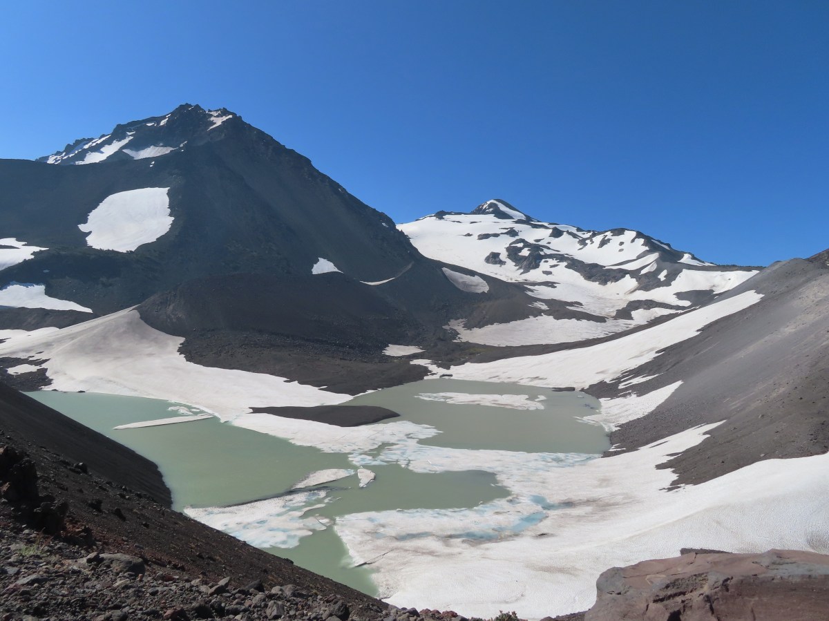
North and Middle Sister from the rim. The glacial lake at the bottom is from melting snow and the shrinking Collier Glacier.

Middle Sister and Little Brother

The view was a little different in 2012.
The wind was whipping pretty strongly but I took advantage of a couple of large cinder rocks to take a seat, have some food, and change my socks before continuing.


Silvery raillardella

Dwarf alpinegold

Heading down to the PCT.

On last look back from the PCT.
I continued north on the PCT rounding Collier Cone’s ridge and then descending for almost a mile and a half to Scott Meadow.


I passed a hiker and her dog just before rounding the ridge here, the first I’d seen other than the person getting water from Glacier Creek.
After rounding the ridge I spotted the sketchiest snowfield of the entire hike, but having just seen the hiker and dog coming from that direction helped boost my confidence.

I put my micro spikes on for the second time today and carefully made my way across the soft melting snowfield. That was the last time the spikes felt necessary, but not the end of the snow patches.

Collier Cone, North Sister and Little Brother from the far side of another snow patch.

There was evidence of some glissading down this patch to the PCT below. I was able to avoid most of the snow by looping around it.

I just had to cross this short section in order to loop around the rest.

The creek along the trail here is not named on maps and is shown as seasonal.

The final snow patch along the PCT before Scott Meadow.

Almost to the meadow.
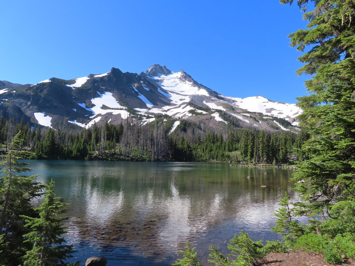
This would mark my fourth visit to this meadow. The first was of course in October 2012 and the third was in August 2019 on our Four-in-One Cone hike. In between those two hikes was a July 29th visit during our Matthieu Lakes hike (post). The 2013 hike had been the only one where there were any flowers to speak of blooming in the meadow. At that time it was primarily lupine with some scattered paintbrush, and a host of mosquitos. I had been expecting mosquitos all day, but whether it was timing, the breeze, or the DEET I had applied before setting off there had been almost no sign of them all morning and it was the same at the meadow.

I’m not sure my timing could have been much better for the flowers this year. It took me a bit to cover the 0.2-miles between the start of the meadow and the Scott Trail junction.


Paintbrush and cinquefoil

Western pasque flowers

Alpine speedwell

Lupine


Alpine false dandelions, speedwell, cinquefoil and possibly some pussytoes.

California tortoiseshell

Bog laurel
The meadow through the years.

October 14,2012

July 29, 2013

August 14, 2019

Today

The junction with the Scott Trail.
I turned left onto the Scott Trail and followed it up an open hillside.


Yapoah Crater to the left.
After making the climb the trail gradually descended to a cinder field near Four-in-One Cone.


Pussy paws

Four-in-One Cone
A user trail leads up the cone and despite the lack of views we had made the 0.4-mile detour along the top. That detour had been the last straw for our son who didn’t realize that it wasn’t part of the loop needed to get back to the car. When he got to the top and found out it was just an out-and-back side trail he was not at all happy with me. I didn’t make the side trip this time given the increasing smoke on the horizon and the fact that Heather and I had gotten to enjoy the view in 2019.

Looking back at the side trail after passing it.

The view from the trail below Four-in-One Cone isn’t too bad.
Beyond Four-in-One Cone the Scott Trail briefly continues through the cinder field before skirting the tree line next to a lava flow.


North Sister and an increasingly hazy sky.
The Scott Trail eventually crosses over the lava flow then enters the forest as it descends toward the McKenzie Highway.


Sign reminding visitors there are no campfires allowed above 5700′.

There were more snow patches in the forest but nothing much on the trail itself. A bigger issue was the amount of blowdown along the trail; however, I did pass a trail crew working their way up the trail.

Fritillary on valerian

Queen’s cup

Lousewort

Rosy spirea

Fading Washington lilies.

Strawberry blossoms

Larkspur
I had been watching for the connector trail and keeping my eye on the GPS, but somehow I completely missed it. I did pass a decommissioned trail with a closed for rehabilitation sign. In 2012 there had been a sign at the junction but by 2019 the sign was missing but the trail was obvious.

The connector trail on the right coming from the opposite direction that I was headed.
The Forest Service page for the Obsidian Trailhead still lists the Obsidian Tie Trail and as providing access to the Scott Trail which leads me to believe I just didn’t notice it, but it’s also possible that it has been decommissioned and the trail that I had passed after just setting off is now just a connector to the Obsidian Equestrian Trailhead.
Missing the connector wasn’t the end of the world as the Scott Trail crosses the McKenzie Highway a little over a quarter mile from the tie trail (or former tie trail).

It was when I reached this meadow that I knew I’d missed the turn.

Looking across the meadow.

Shooting stars

The highway from the wilderness sign.
I popped out onto the highway and turned left for a 0.6-mile road walk to the Obsidian Trailhead.


Historical marker for the 1862 Scott Road.

It was another third of a mile to my car along the gravel road to the trailhead.
I saved myself a little over a mile by not retracing our side trip across Four-in-One Cone, but missing the connector trail added almost a third of a mile so instead of an 18.6-mile loop like 2012 my GPS came in at 17.8-miles. Skipping Four-in-One-Cone also shaved off a little over 100′ of elevation gain leaving today just under 3400′ of cumulative gain.

Not sure why the Garmin map shows the PCT going along the rim of Collier Cone. It looks as though there is a use trail around the rim, but it certainly is not the PCT.
This was an excellent hike with spectacular views and some nice wildflowers. I was pushing the timing as far as snow goes, but this year has been warm and dry enough that it was passable (with micro spikes) this early. The lack of mosquitos was a huge blessing.
The only bummer was the arrival of the smoke from what has become a very serious fire. As of my writing this on July 16, 2025, the fire is over 64,000 acres with zero containment. Many people have had to evacuate, and many others are on standby to do so. Our prayers go out to them and to the responders doing everything they can to get the blaze under control.
Flickr: Obsidian Loop


 Not having light until after 7am is rough for someone who likes to get an early start.
 The Salmon River Trail is located next to this interpretive sign near the trailhead.
 A flash was necessary as I set off.
 There was a very brief road walk along this section.
 There was also plenty of time along the Salmon River.
 I veered right at this picnic table to cross into the campground.
 The day use area at the campground.
 Water spigot at the day use area.
 It was hard to read the date for this cougar sighting, it appeared to be from June, but I couldn’t make out the year.
 Entering the Salmon-Huckleberry Wilderness
 One of the downed trees, this one covered both sides of a switchback.
 A rare viewpoint along the forested trail.
 A level stretch along a narrow ridge.
 A healthy looking paintbrush.
 The Sun rising above Hunchback Ridge.
 It was going to a be a bluebird day.
 Sign ahead marking the Hunchback Trail junction.

 One of the “downs”.
 This trail was also in good shape with just a few easy obstacles.
 I did not go investigate the source of the “water”, it could have been a trap (there is a spring shown on the map).
 Signs at the junction below Devil’s Peak.
 Mount Jefferson
 Olallie Butte (
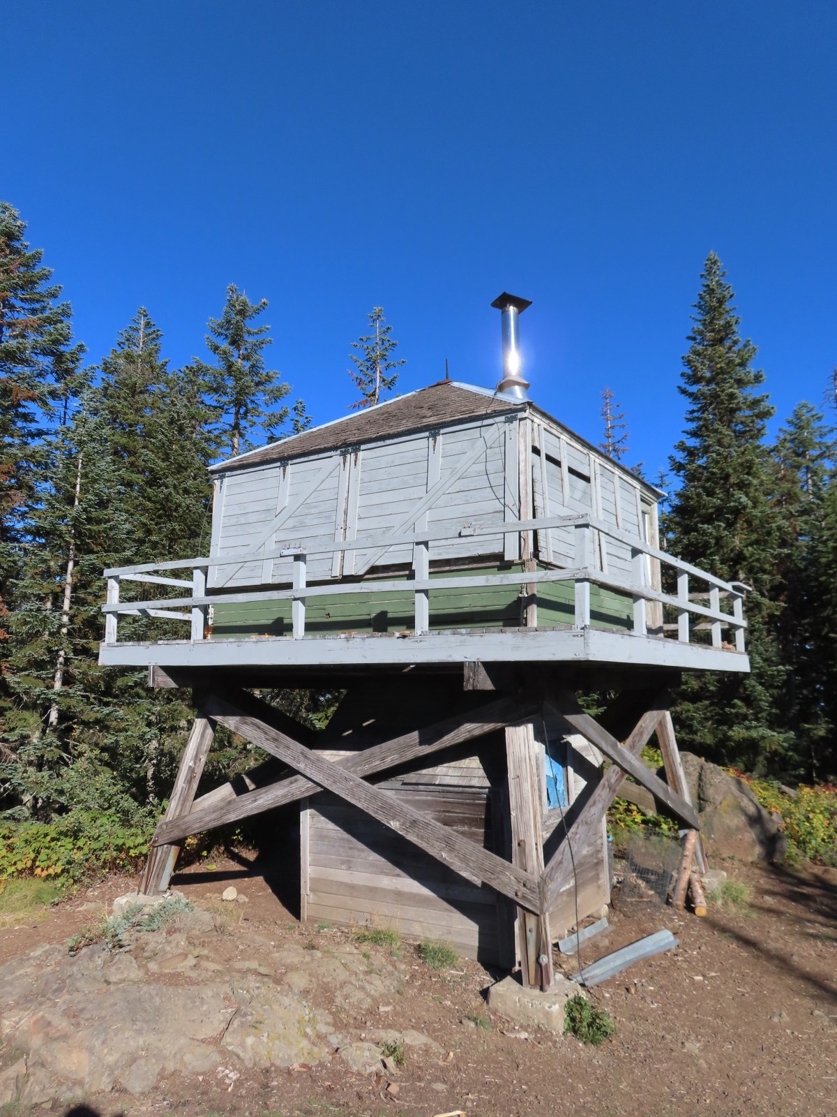
 The lookout from the Mt. Jefferson viewpoint.
 Mt. Hood from the lookout.
 You can’t see Mt. Jefferson from the lookout due to trees.
 Trail signs at the Cool Creek Trail junction.
 Lookout Mountain(
 Mt. Hood from the Hunchback Trail.
 Arriving at the trailhead on FR 2613.
 It’s hard to make out in the photo but that is a giant pothole (crater) in the middle of the road seen from the trailhead.
 That is the trailhead at the end of the road on the right.


 There were some nice Fall colors along the Kinzel Lake Trail.
 There were also a few obstacles that were trickier than anything on the other trails involved in this loop.
 Salmon Butte (
 Nearing the Salmon River Trail.
 Trail sign at the Salmon River Trail junction.

 There wasn’t much water at all in any of the side creeks.
 There are several viewpoints just over 3.5-miles from the trailhead.
 The furtherst hump in the center is Huckleberry Mountain (
 Wilderness kiosk along the trail. There were self-issued permits here, but none at Green Canyon Way so I stopped and filled one out even though I was almost done with my hike (and out of the wilderness).

 Salmon River
 There were a couple of good-sized fish in the pool here.
 The trail arriving back at the trailhead.
 We had also parked here in 2021 for our Barlow Butte hike (


 The colors of Fall.
 Tom, Dick, and Harry Mountain (
 Mt. Hood teased an appearance a couple of times along the lower portion of the PCT. It was enough to see that there was a dusting of fresh snow on the mountain.
 The signed junction with the Yellowjacket Trail.
 The wet brush had me whishing I’d worn boots.
 The Yellowjacket Trail passing a small meadow.
 Makeshift footbridge along the trail.


 New snow on Mt. Hood.
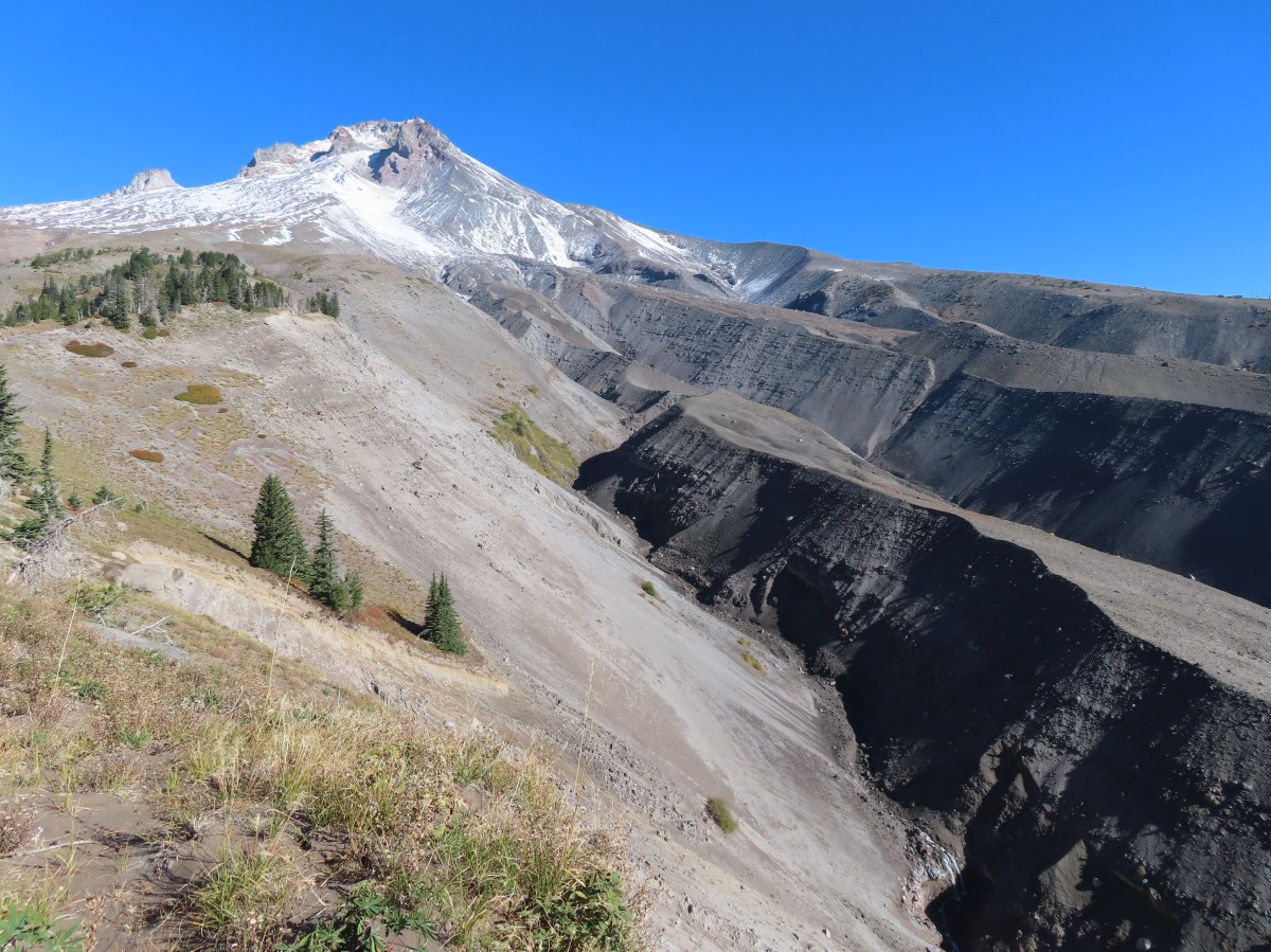
 The valley is the result of an eruption around 250 years ago.
 Pacific lupine
 At the end of the levee the route climbed a moraine then continued its gradual ascent to the Timberline Trail.
 Dark-eyed junco. There was a good variety of birds along the moraine, but this was the only one that sat still long enough to have its picture taken.
 Frost on a log. It was really nice to be hiking in the crisp cool air.
 Boy Scout Ridge from the moraine.
 The unsigned junction with the Timberline Trail.
 Mt. Hood from the junction.
 Sign for the PCT nearly absorbed by the tree.
 Lupine (broadleaf?)
 A few remaining blooms on the goldenrod.
 Signpost at the PCT junction ahead.


 The coyote with Mt. Hood looming behind.
 Mt. Jefferson to the south with the Three Sisters behind to the left.
 The Three Sisters and Mt. Jefferson
 The round peak along the far ridge is Gunsight Butte (
 We’d lost sight of the coyote until it ran across the trail not too far in front of us.
 More lupine
 A few remaining aster blossoms in the foreground.
 Timberline Lodge across the Salmon River Canyon.
 Looking back down the White River Valley. Barlow Ridge is the near hump on the right.
 Another look at Timberline Lodge.
 Despite all the cars at the lodge we would only encounter a half dozen other trail users until we were back at the Barlow Pass Trailhead.
 Small waterfall below the ridge.
 I turned around here where the Timberline Trail headed across the Salmon River drainage. The Silcox Hut is straight ahead on the side of the mountain.
 Looking back at the high point where Heather had stopped.
 Mt. Hood’s summit.
 The waterfall looking pretty small far below the mountain.
 It took us a moment to decide what the dark rounded peak straight ahead in the distance was. We eventually correctly identified it as Black Butte (
 Olallie Butte (
 Birds on mountain ash.
 The Timberline Trail junction.
 Beargrass meadow, there hadn’t been any blooms this year.
 Lousewort
 It was nearly 2-miles between the Timberline and Yellowjacket trail junctions.
 We were shocked to see a bunchberry that still had some petals, even if they were in sad shape.
 Mushrooms and fungi are not surprising this time of year.
 Highway 35
 Arriving at the Barlow Road.
 Our various hikes around the mountain. There are still a few areas where we could add a track or two. Happy Trails!
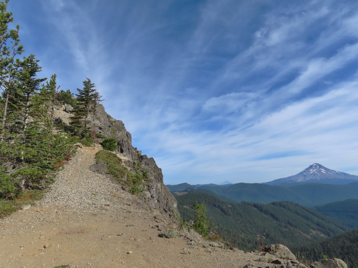
 We parked on the shoulder here and road walked three quarters of a mile to the official
  This is a good example of why we parked where we did.
 The official trailhead.


 A pair of Barrow’s goldeneye ducks enjoying a morning swim on the far side of the lake.
 The use trail
 Mushroom along the road walk back to the car.
 The somewhat obscured sign for the Anvil Lake Trail along spur road 5800-160.
 The pullout where we parked.


 The edge of Black Wolf Meadows.
 Sign in Black Wolf Meadows.


 The trail leaving the meadows.
 More mushrooms
 Rough-skinned newt

 Old sign near Anvil Creek.
 The dry bed of Anvil Creek.
 Coral fungus
 The sign for the spur trail ahead on the left.
 Pointer for Anvil Lake. According to the Oregon Hikers Field Guide this sign is likely over 50 years old based on the reference to S-502 which is currently known as FR 5820 which is another potential
 Anvil Lake


 Mt. Hood from the pullout.


 The road continuing to the left.
 Olallie Butte (
 Mt. Hood with Mt. Adams behind to the left.
 The view south toward Mt. Jefferson.
 Heather is the orange dot climbing up the side of the outcrop.
 Mt. Hood from the saddle.
 Signal Buttes is the pointy peak on the left and Salmon Butte (
 Salmon Butte now in the middle with Linney Butte the hump on the right of the double humps in the foreground and Devil’s Peak (
 Linney Butte, Devil’s Peak, Mt. Adams in the distance, and Mt. Hood.
 Wolf Peak in the foreground which is above Black Wolf Meadows.
 Mt. Jefferson from the former lookout site.
 Peaks in the Bull-of-the-Woods and Opal Creek Wilderness areas in the distance to the left and Fish Creek Mountain (
 The remains of the lookout on High Rock.
 A zoomed in shot of Mt. Adams.
 Mt. Rainier rising behind Devil’s Peak.

 The ground squirrel watching us as we passed below.
 Skipper along the road on the way down.
 Aster
Aster


 Another reminder that overnight permits are required in the wilderness.
 Low clouds in the valley.
 Mt. Jefferson through some of the snags with a few surviving trees on the right.
 Mt. Jefferson from the junction, note the rock cairn on the left marking the PCT.
 The cairn at the junction.
 Triangulation Peak (
 Whitewater Lake
 Triangulation Point and Bocca Cave (Trailheads still closed.)
 Tarn 0.3-miles from the junction.
 Mt. Jefferson reflecting in the tarn.
 Ducks on the tarn.
 The Sentinel Hills with Park Butte behind to the right. The Whitewater Trail (
 The fires did open up fairly consistent views of the mountain.
 A few remaining penstemon blossoms.
 Heading down to the Russell Creek crossing.
 This can be a tricky crossing at times, but there was a makeshift bridge which made it fairly easy this time.
 Aster and pearly everlasting near the creek.
 We started seeing more trees that had survived the fire as we got closer to Jefferson Park.
 Gentians and aster
 Grass-of-parnassus
 There were patches of burned forest along this stretch.
 Approximately 0.4-miles from the junction the trail crosses Whitewater Creek.
 From the other side of Whitewater Creek the views of Mt. Jefferson are amazing.
 Based on the barred sides I believe this is a black-backed woodpecker.
 Unofficial use trails are an issue in Jefferson Park which has prompted the Forest Service to install a number of “Closed for Rehabilitation” sign such as the one on the left side of the trail.
 They’ve also added quite a few signs to indicated sanctioned trails. Typically in wilderness areas the Forest Service tries to keep signage to a minimum, but overuse has led them to add additional signs.
 Another sign with Park Butte in background.
 The last of the pointers for Scout Lake.
 PCT heading for Park Butte and Park Ridge.
 Russell Lake pointer.
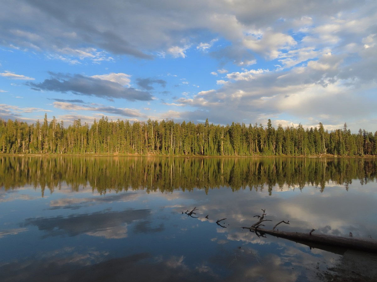


 There were hundreds of dragonflies along the trails which were much more welcome than the mosquitos that are a problem here in July and early August.
 The trail entering the wilderness.
 To the left through the trees is Mt. McLoughlin (
 The currently dry outlet creek of South Puck Lake.
 South Puck Lake from the Nannie Creek Trail.
 Someone had taken it upon themselves to craft their own sort of sign for the Puck Lakes Trail.

 The southern end of the lake was closed to camping for site restoration.
 South Puck Lake
 Use trail around the lake. The alignment of the former Puck Lakes Trail is further back from the lake.
 Two of three common mergansers that seemed to be calling the lake home for now.
 Our campsite for the night.
 Just after the trail began its descent it crossed a talus field.
 Mt. McLoughlin behind Luther Mountain.
 Shale Butte and Lucifer Peak (double hump is Lucifer).
 Pelican Butte straight ahead with peaks in the Mountain Lakes Wilderness (
 A faint Mt. Shasta through the haze.
 Agency Lake

 A good representation of the trail conditions between the talus slope and the Snow Lakes Trail. Nothing was overly problematic, but it did mean more effort on our part which in turn made it feel even warmer.
 Rock cairn marking the junction with the Snow Lake Trail.
 Looking back at the hillside we’d descended.
 One of several grouse that crossed the trail in front of us.
 Entering the fire scar from the 2014 “790 Fire”.
 Northwestern Rabbit-tobacco
 Martin Lake
 Pair of Lewis’s woodpeckers.
 One of the Snow Lakes below Luther Mountain.
 One of the Snow Lakes.
 After 1.4-miles we came to a junction with the Donna Lake Trail on the left. (Deep Lake is the lake visible below through the trees.) We’d turned down that trail on our previous visit, so we stayed right this time.
 One of several small, unnamed, bodies of water between the Donna Lake Trail junction and Margurette Lake.
 Blue beetle
 Hardhack
 Margurette Lake
 Margurette Lake
 Coming up on the junction.
 The Sky Lakes Trail.
 Trapper Lake
 The Donna Lake Trail to the right.
 Donna Lake

 Luther Mountain from Deep Lake.
 Tiny western toad
 Signs of Fall.
 Lousewort
 Young grouse

 Martin Lake
 Back at the Nannie Creek Trail junction.
 It was increasingly looking like a shower or two might happen.
 A deep zoom in at Mt. Shasta.

 Pine white
 Spotted sandpiper
 The three resident mergansers.
 The abandoned Puck Lakes Trail.
 A dark cloud passing over the Puck Lakes (no rain).
 North Puck Lake
 North Puck Lake


 Heather in the tent packing up.
 A sliver of the Moon reflecting in the lake at 5:48am.
 6:06am
 North Puck Lake at 6:22am as we set off.
 Luther Mountain from the Nannie Creek Trail in the morning.
 Dark blue = day one, magenta = day two, light blue = previous visit.


 Gooch Falls
 The road widened briefly near the pullout that acts as the trailhead.
 Delicious red huckleberries provided morning snacks along much of the road and trail.

 We forked right when the ancient roadbed headed uphill.


 Not Downing Creek Falls, just one of many streams along the mossy hillside flowing into the creek.
 Downing Creek Falls


 The flat top of Coffin Mountain to the left of the tall trees at center and Bachelor Mountain to the right.
 Coffin Mountain
 It took us a bit to realize that this was indeed a really old roadbed.

 There was sporadic flagging along the creek.
 Another flag ahead.
 The faint trail running along Downing Creek.
 When I lost the path a couple times I just looked for signs like this old log cut for where the tread might be.
 I wasn’t expecting to see caution tape. Maybe that’s all the person had because I couldn’t identify any hazard here.
 A forested island in Downing Creek.
 It was a short climb back up to the road.