Categories
High Cascades Hiking Mt. Jefferson Area Oregon Trip report

Red Lake Trail

**Note the 2020 Lionshead Fire burned the area covered by this hike.**

I am a bit behind on our trip reports but that’s because we were busy getting a few more hikes in on our final week of vacation. After our hike on the coast at Pacific City we headed back toward the mountains on Thursday. We had been debating on whether or not to attempt the hike we had planned due to the early snow that had been falling in the Cascades. The planned hike had us starting on the west end of the Red Lake Trail, climbing Potato Butte, continuing on to Top Lake, and then making a small loop past Cigar Lake where we would attempt to climb Double Peaks before returning to the Red Lake Trail and our car.

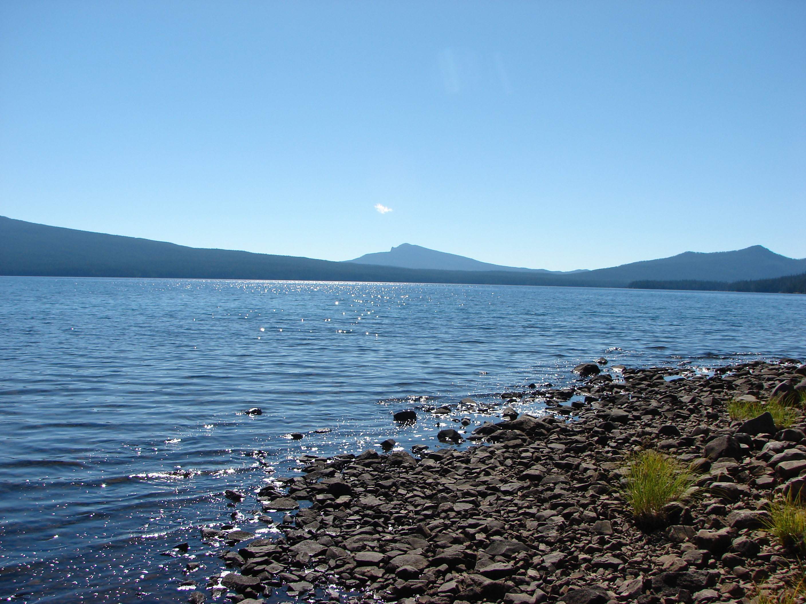
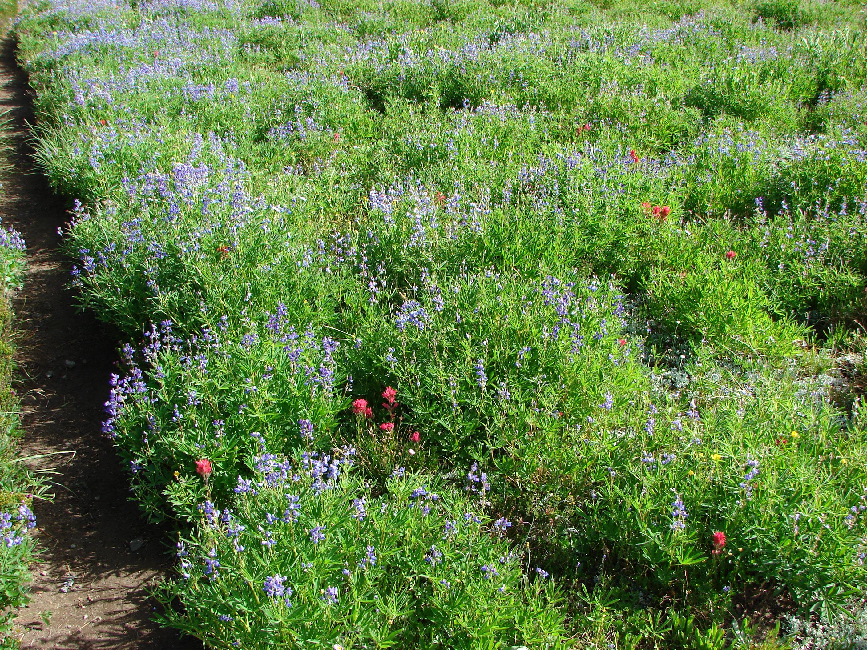
It was a nice morning as we set off and there were some good Fall colors on display. We climbed for a mile and a half before reaching the trails namesake – Red Lake.
017

Water on the Red Lake Trail
Red Lake
Red Lake

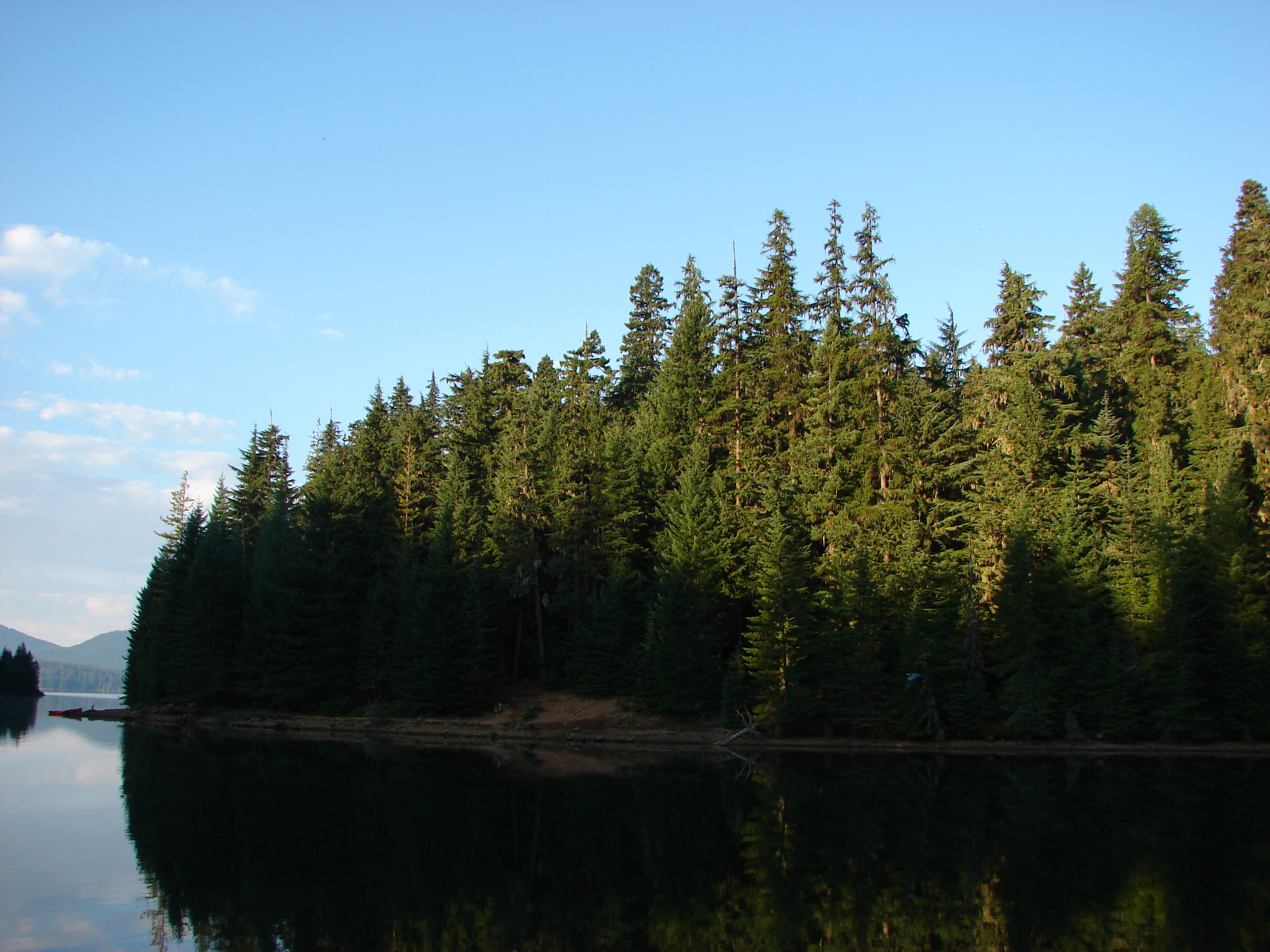
After passing Red Lake the trail then visits three more lakes in the next 1.3 miles. Avrill Lake was up first with a great reflection of Olallie Butte and Twin Peaks.
059

Next up was Wall Lake where we got our first good glimpse of Potato Butte.
072

Finally we came to Sheep Lake where a pair of ducks paddled beneath the reflection of Double Peaks.
086

We took a trail on the eastern end of Sheep Lake that led up to Potato Butte. There were several swollen ponds along this trail and in places standing water obscured the path. We wound up losing the trail at the base of the butte and decided to scramble to the top and hope to pick up the correct trail at the summit.

One of the many swollen ponds along the Potato Butte Trail

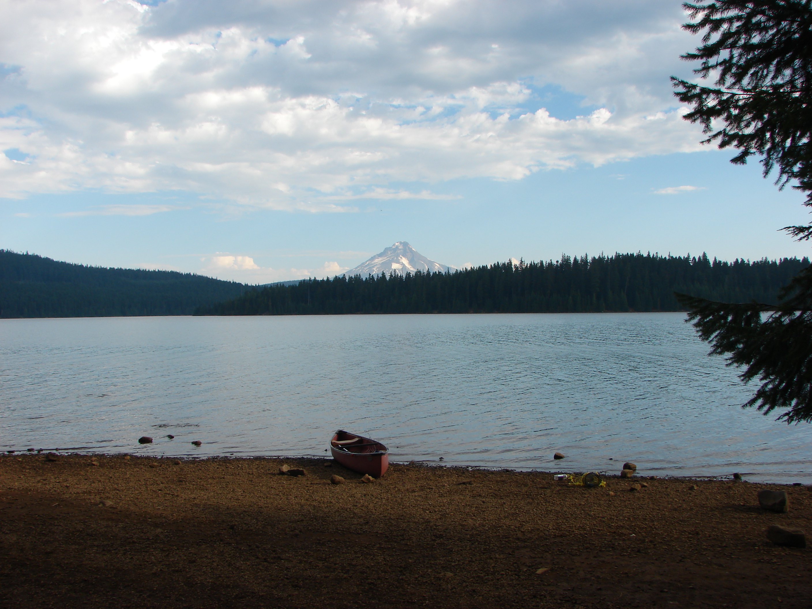
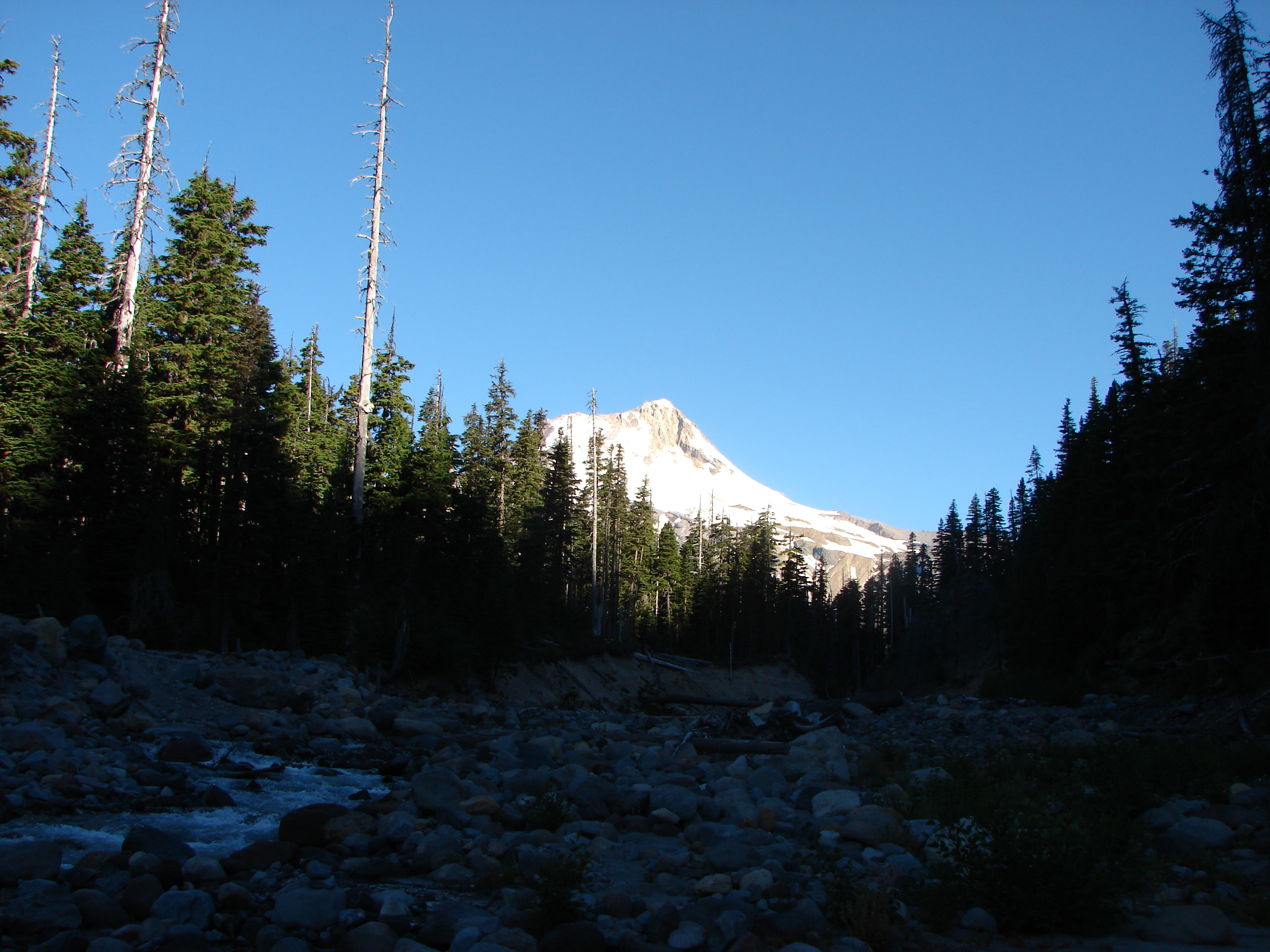
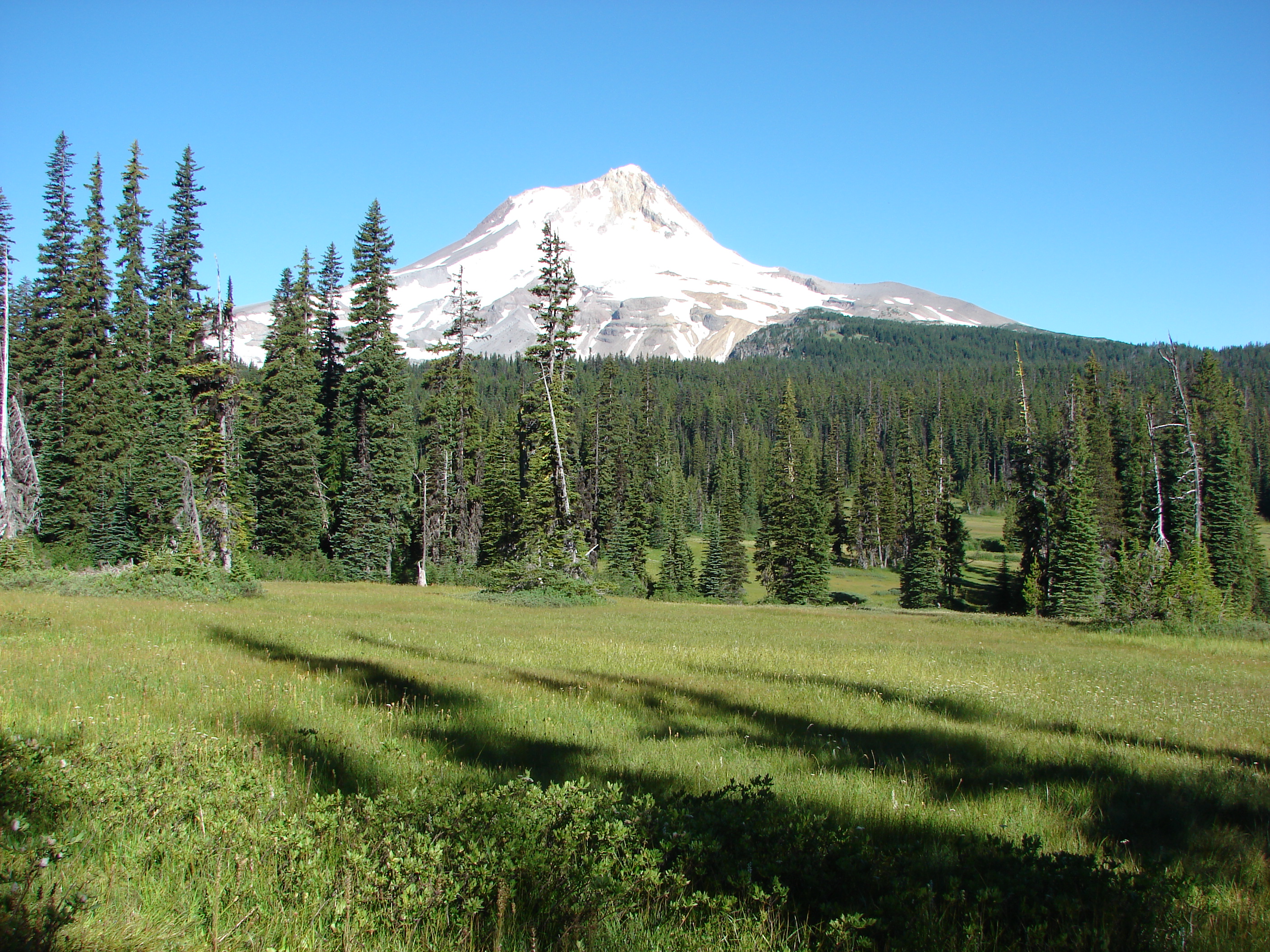
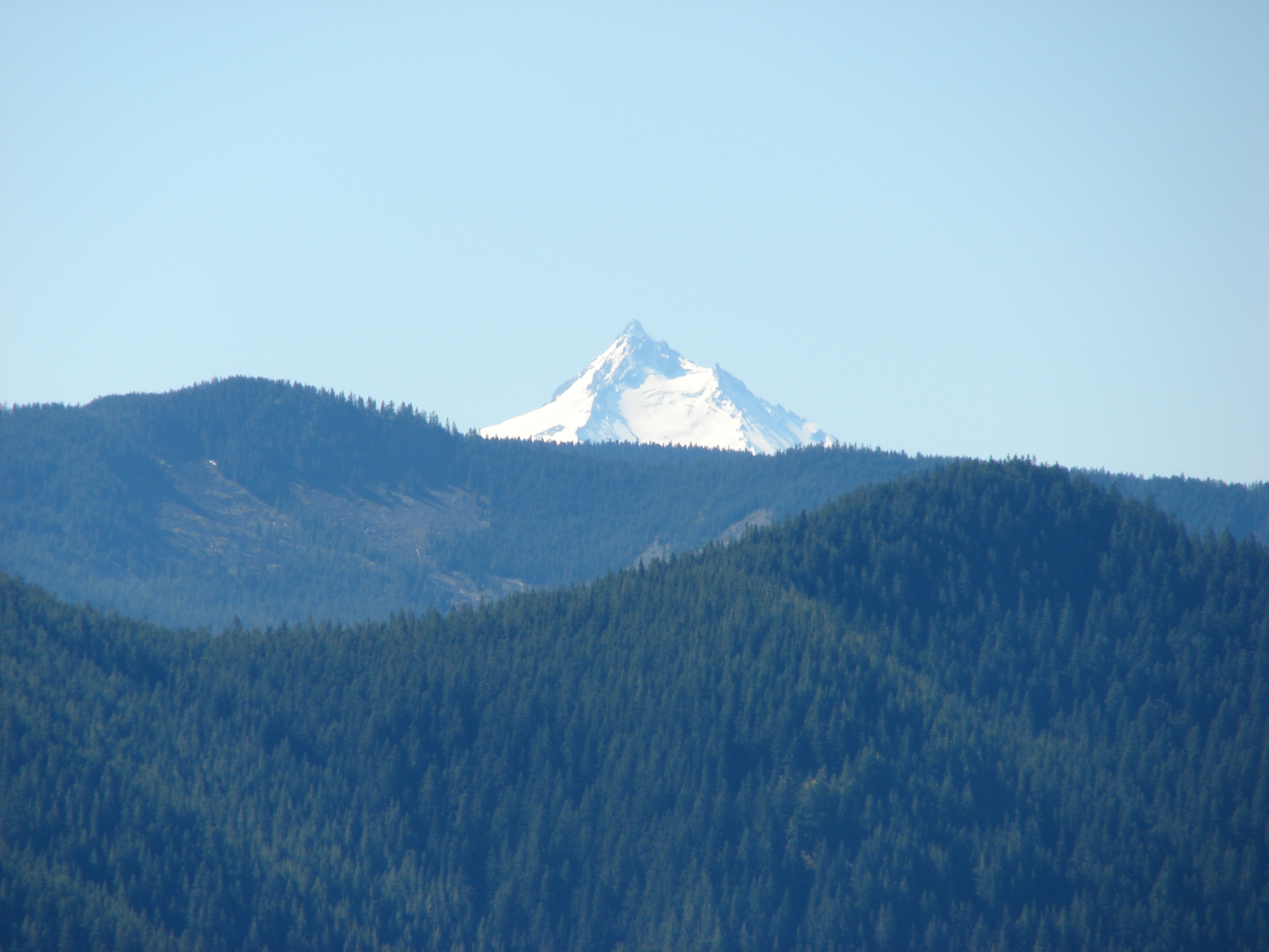
We arrived at the summit and easily picked up the official trail. We had a fairly good view of Mt. Hood despite the presence of some clouds and a great view of Olallie Butte.

Mt. Hood from Potato Butte
Olallie Butte from Potato Butte

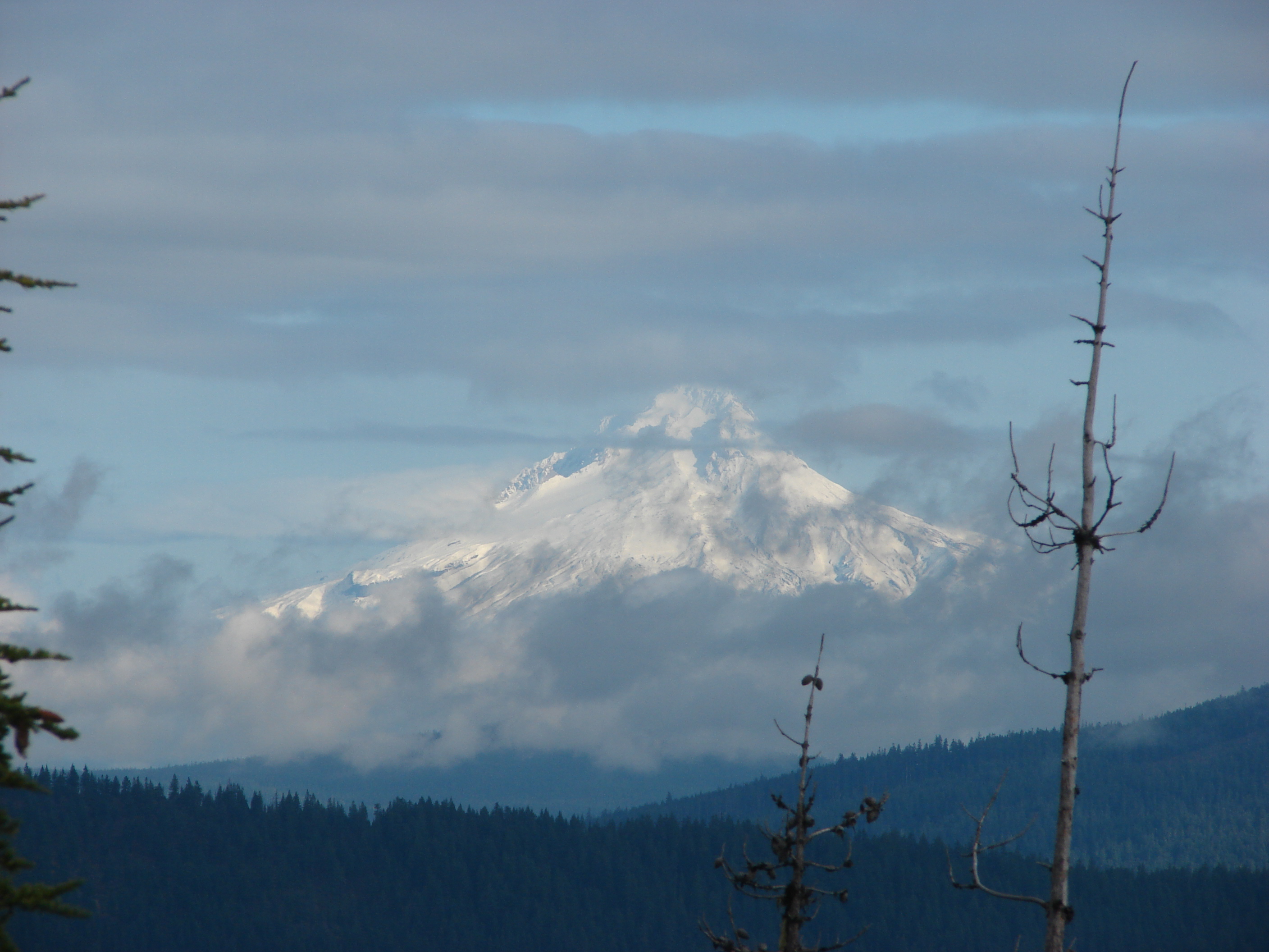
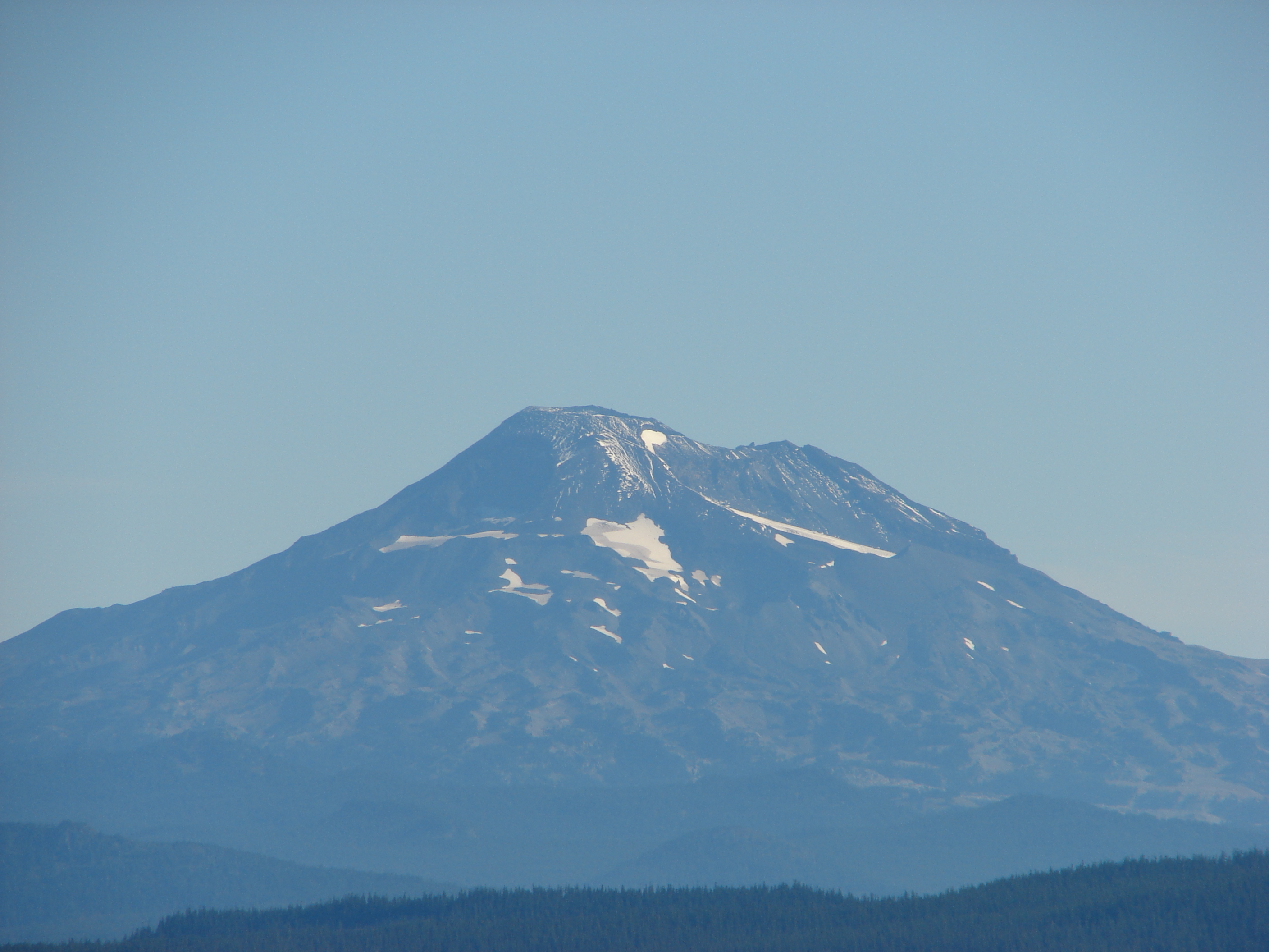
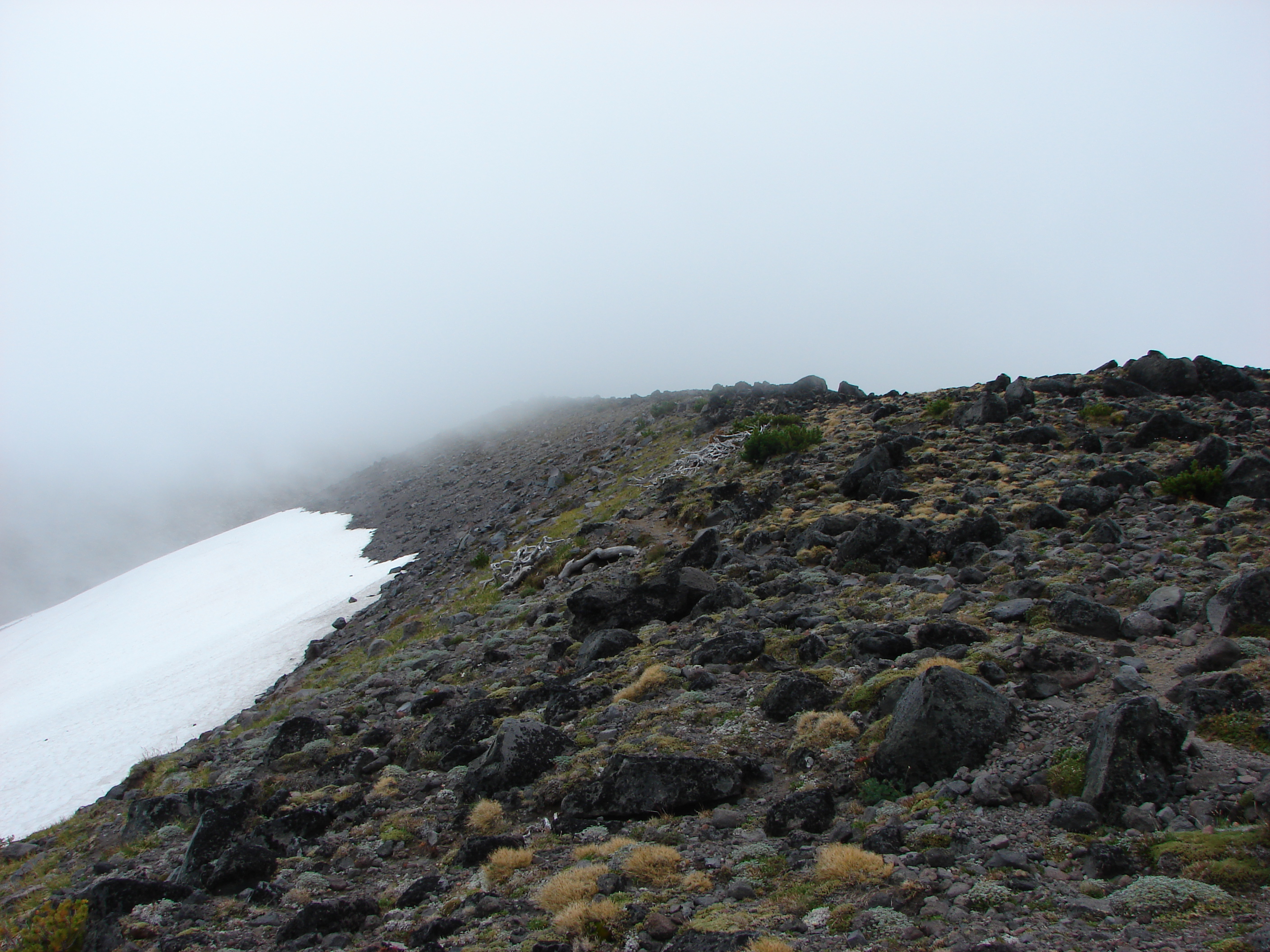
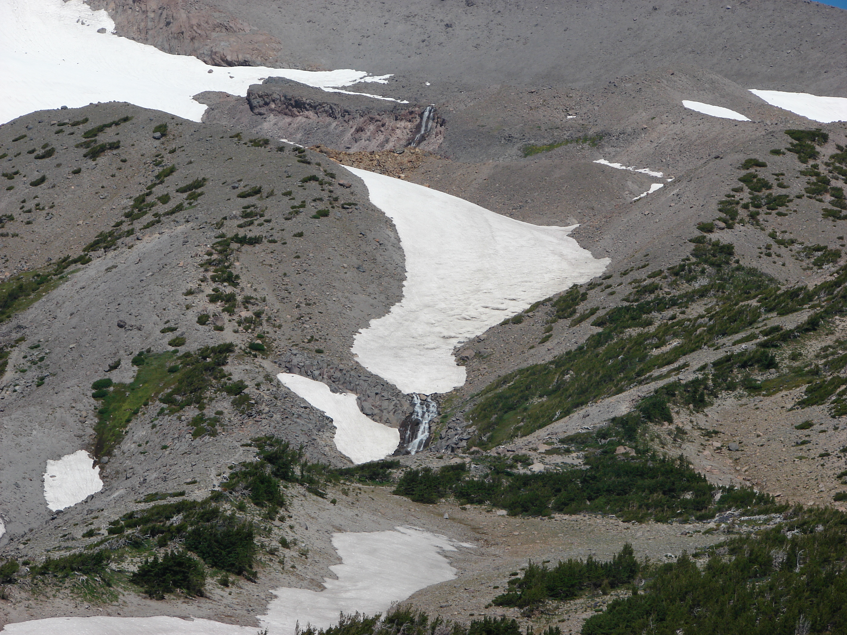
On the way down on the real trail we got a good look toward Mt. Jefferson which was hiding in the clouds and at Double Peaks. At 5280′ Potato Butte had only small amounts of scattered snow but Double Peaks was clearly snow-covered at its height of 5998′.

Looking toward Mt. Jefferson from Potato Butte
Twin Peaks on the left and Double Peaks on the right from Potato Butte

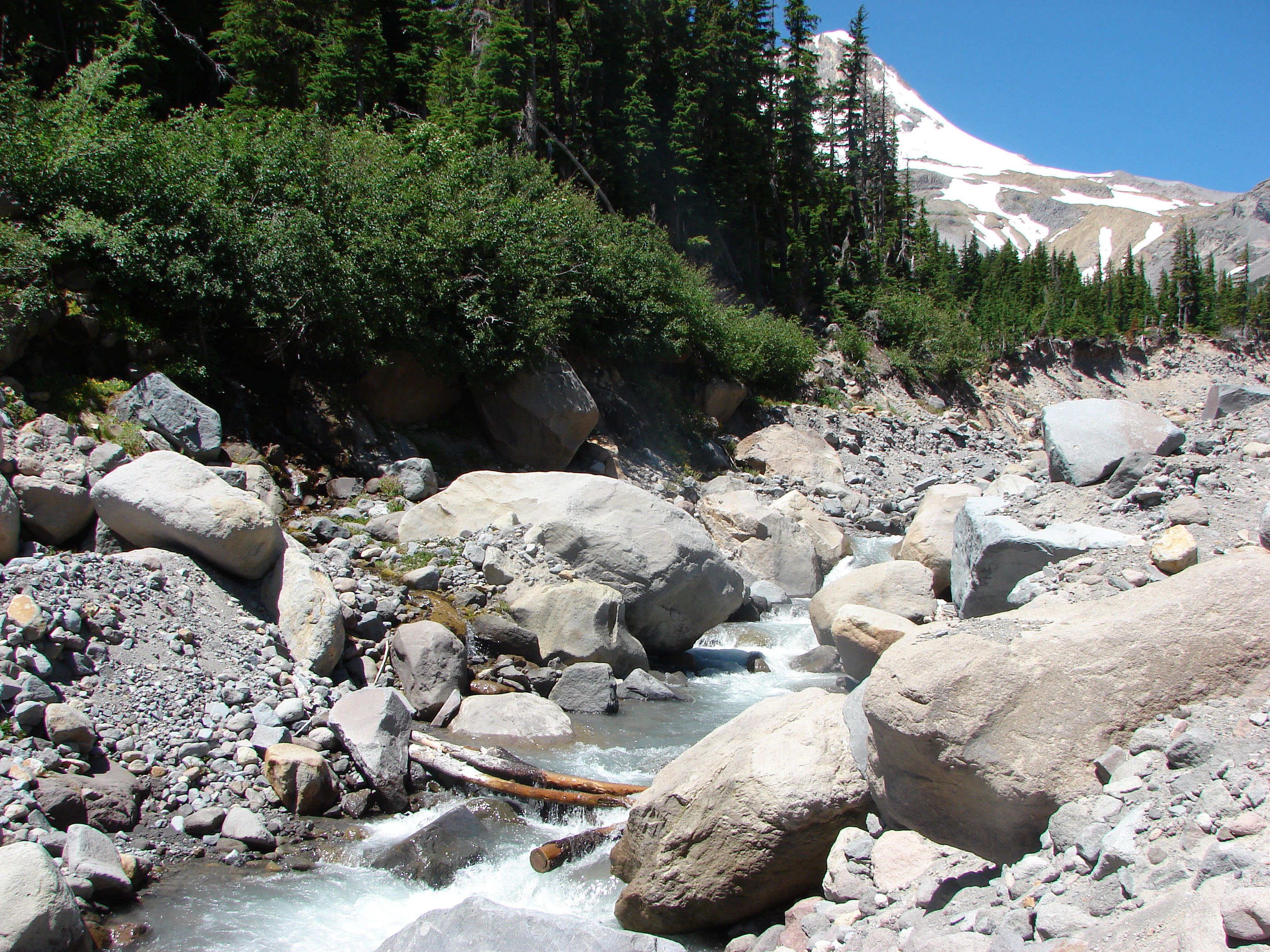
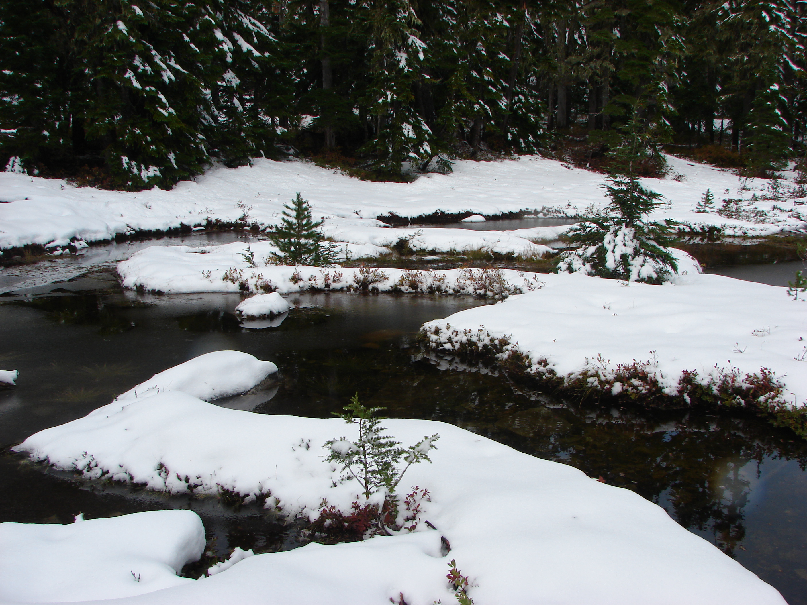
When we got to the base of the butte we saw the reason for our having lost the trail on the way up. One of the ponds had enveloped the actual trail making it impossible to see. We made our way around the edge of the pond and back to the Red Lake Trail and continued east toward the Pacific Crest Trail which we would use for part of our small loop to Cigar Lake.

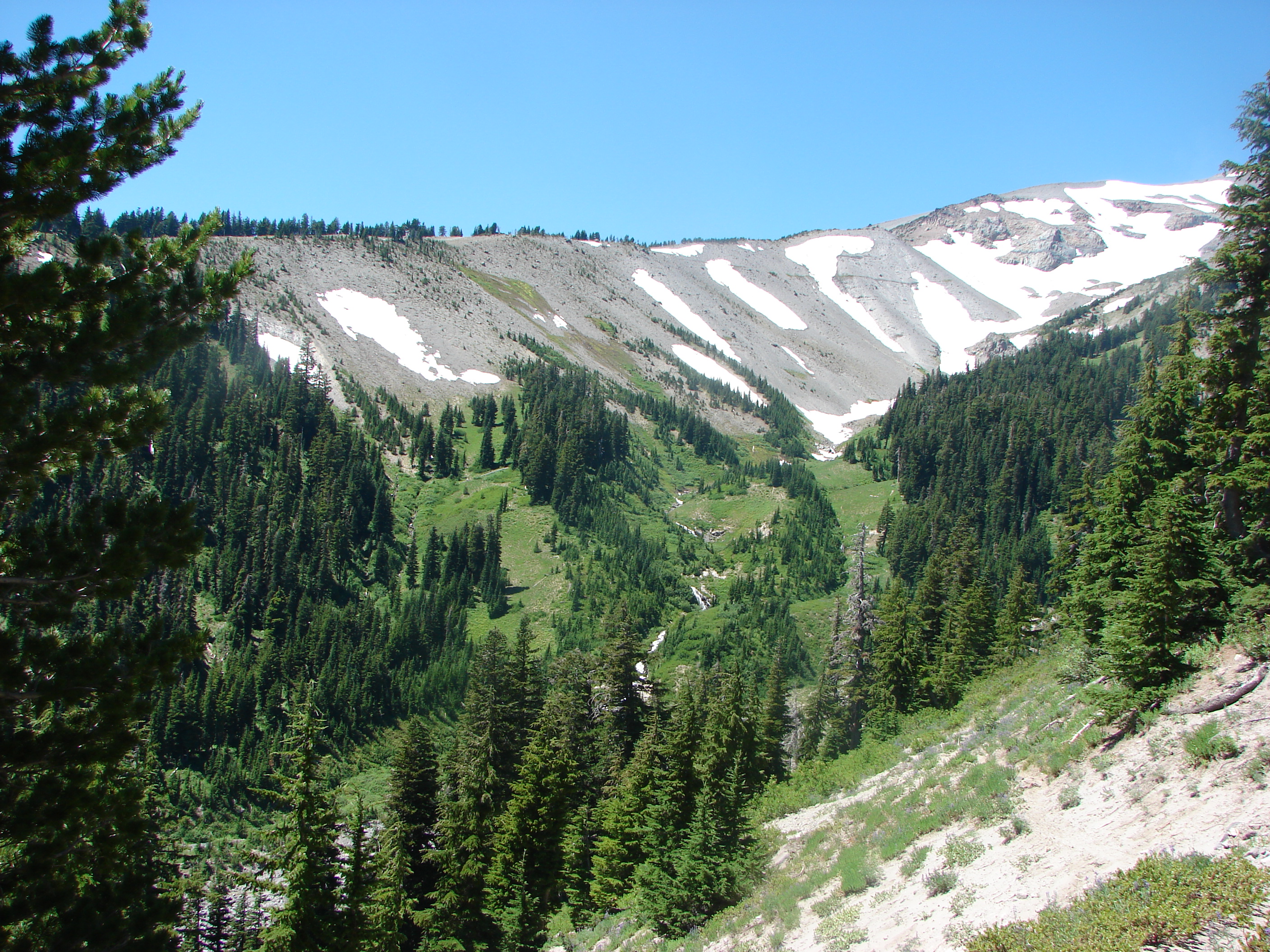
The trail passed Fork Lake and several other unnamed ponds/lakes as it slowly climbed toward the PCT. We also began encountering more and more snow as we went.

Pond below Twin Peaks
Increasing amounts of snow

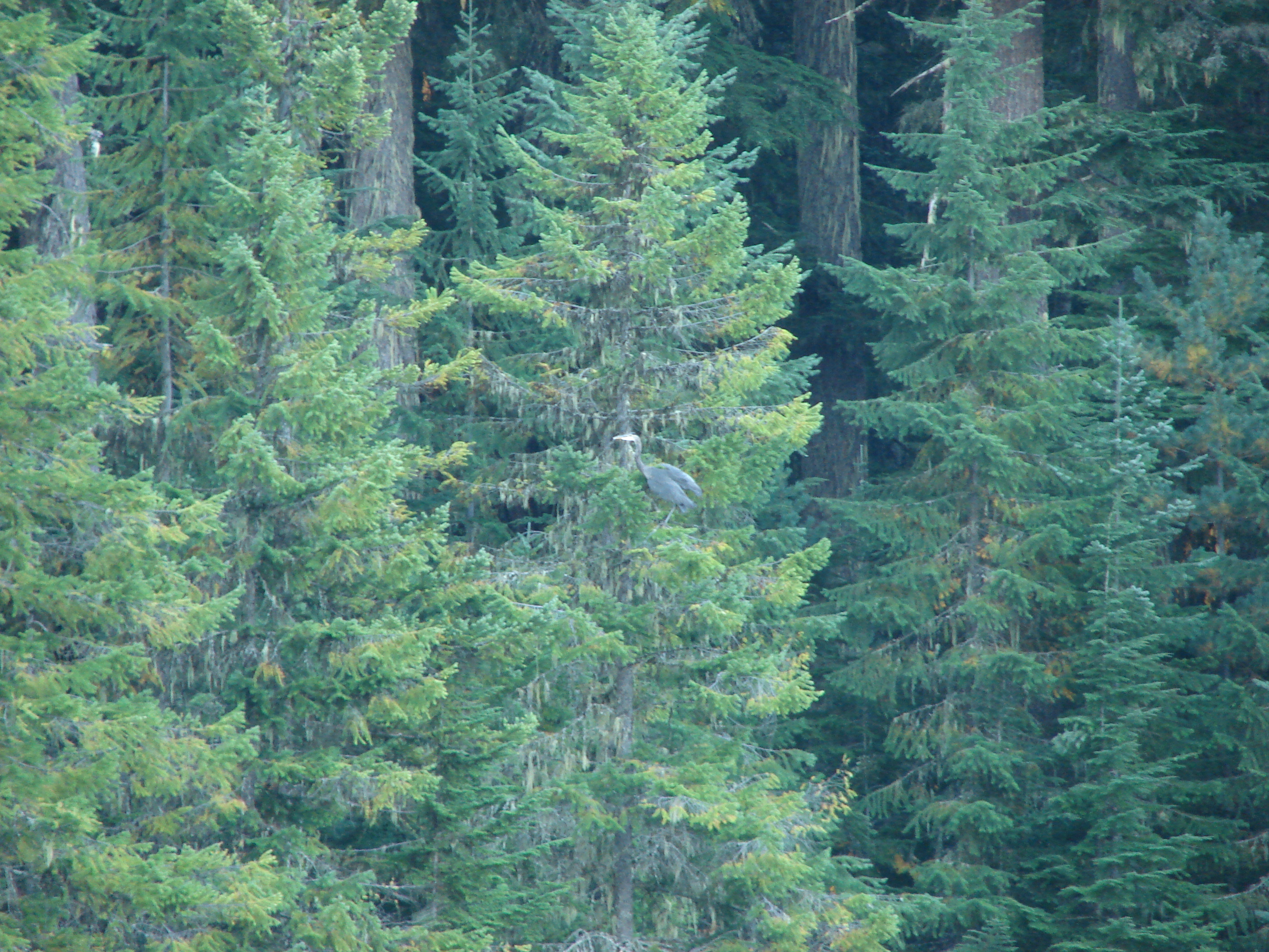
The snow made it possible to see a variety of animal tracks showing us just how many different species that we never see walk these same trails. At the PCT junction we continued on the Red Lake Trail heading down now to Top Lake.

Some of the tracks in the snow
Top Lake
Top Lake
Fall on the shore of Top Lake

At Top Lake we left the Red Lake Trail and skirted the overflowing lake to its south end and climbed back up to the PCT near Cigar Lake.

Double Peaks from Cigar Lake

There was a good amount of snow at Cigar Lake but we decided to see how far up Double Peaks we could make it. We found the marker for the trail easily enough, but between the snow and the extra water around Cigar Lake we were having a hard time determining just where the trail actually was. Luckily for us a deer had left us a set of tracks that we were able to follow that led us across and around the edge of Cigar Lake and to the continuation of the Double Peaks Trail which was just barely identifiable by a slight indentation in the snow.

Snow and water near Cigar Lake
Double Peaks Trail
Double Peaks Trail

Once we found the trail it was like walking through a winter wonderland. The snow was anywhere from a half-inch deep to mid-shin. The snow-covered trees looked ready for Christmas making this one of the most enjoyable stretches of hikes we’d had.

Heather on the Double Peaks Trail
Christmas Trees in October

The trail was fairly steep and we almost lost it near the top when it veered up between some boulders but we managed to follow it all the way to the summit.

The base of Mt. Jefferson from Double Peaks
Evidence of wind and ice
Potato Butte from Double Peaks
Olallie Butte
Olallie Butte
Timber, Olallie, Long, and Monon Lake from Double Peaks

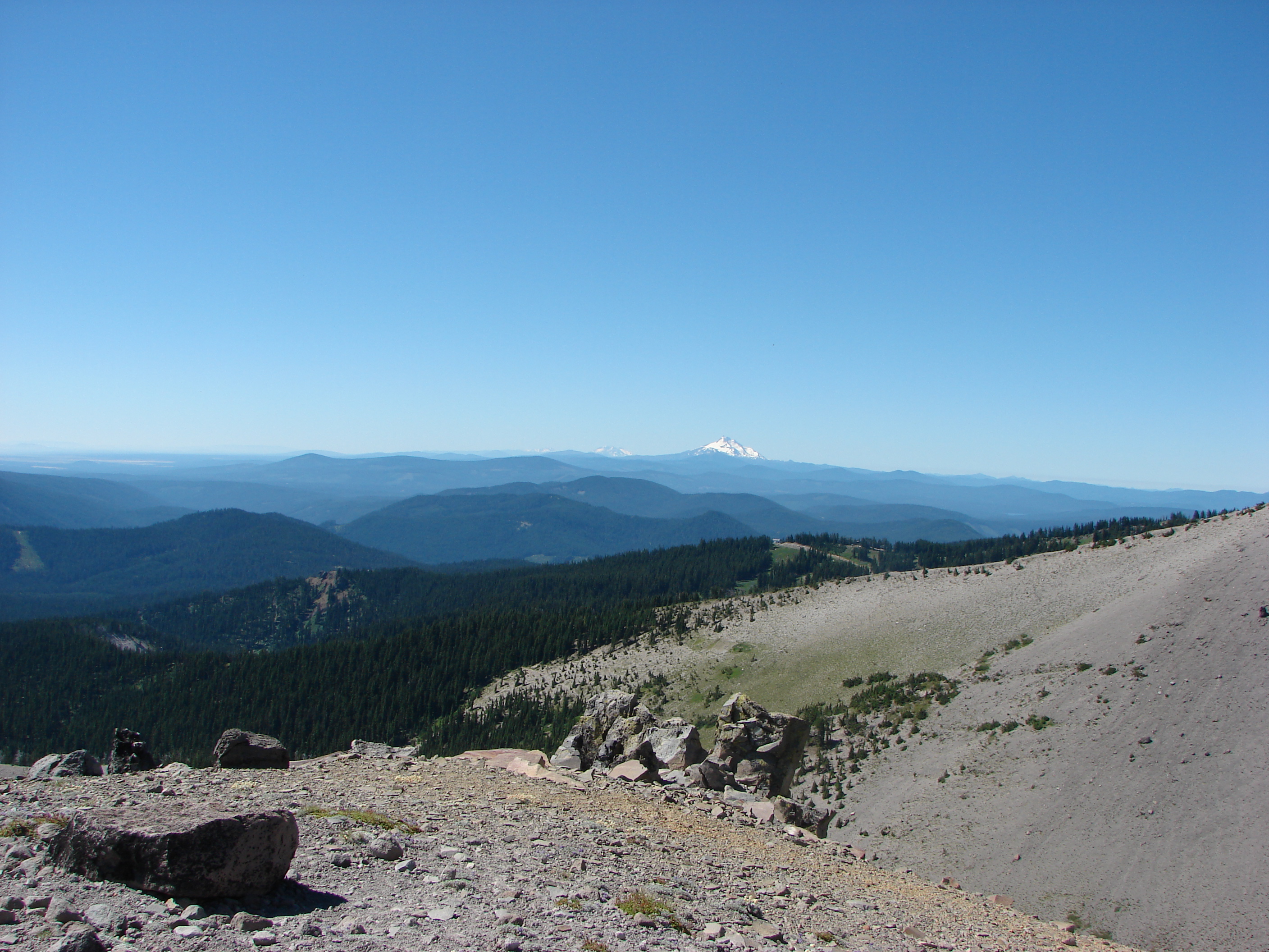
We didn’t get the view of Mt. Jefferson we’d hoped for but the snow more than made up for that. As we started down Double Peaks the day began to warm up and the snow was melting quickly. We did a lot of sliding down the slushy trail before reaching the PCT again and heading back to the Red Lake Trail. We returned the way we’d come only now we had some blue skies and sunlight as we passed the lakes and arrived back at our car. Happy Trails!

Sunlight mushroom
Sunlight mushroom
Twin Peaks from Sheep Lake in the afternoon

Facebook photos: https://www.facebook.com/deryl.yunck/media_set?set=a.10202367670300288.1073741861.1448521051&type=3
Flickr: http://www.flickr.com/photos/9319235@N02/sets/72157636413874236/

Categories
Clackamas Hiking Old Cascades Oregon Trip report

Timothy Lake

We reached into our bag of backup hikes this past weekend and grabbed what wound up being a decent little hike. We were needing something in the Portland, OR area because after the hike we were set to celebrate the upcoming birthdays of my Grandmother Zana (89) and our Son Dominique (18) at Gustav’s http://gustavs.net/. Our original plan was to hike up Cooper Spur on Mt. Hood but the forecast called for thunder storms so we decided to save that one for another time and went to plan B which was a loop around Timothy Lake.

I am a bit hesitant when it comes to hiking around a lake because loops like that can sometimes lack a scenic diversity, but Timothy Lake was in the right area and had an appealing distance and elevation gain (14.2mi & <1000'). We started our hike at Little Crater Lake Campground in order to visit Little Crater Lake before starting the loop. Little Crater Lake is the result of a cold spring that has removed soft soils over time leaving a clear blue pool of water.
Reflection in Little Crater Lake Reflection in Little Crater Lake
A pair of ducks floated on the small lake while the surrounding meadows were draped in a low layer of fog. Shortly after leaving the lake we arrived at a junction with the Pacific Crest Trail where we turned left for .3 miles to the start of the official loop.

We remained on the PCT heading south, crossing Crater Creek, and passing several small springs before reaching our first good view of Timothy Lake. A great blue heron flew by and landed in a tree a little further down the lake shore from where we stood.

Timothy Lake
Timothy Lake
Great blue heron
Great blue heron

For the next 2 miles the PCT stayed in the forest away from the lake shore. Numerous paths led from the trail toward the lake but we stuck to the PCT as I was on a mission to find a view of Mt. Hood.

We knew Hood was visible from the lake, but we didn’t know from which part of the trail, and we’d managed to forget both the guide book and a map. When we reached the Oak Grove Fork Clackamas River the trail split from the PCT and continued along the lake shore toward the first of several busy campgrounds. It was at the second of these campgrounds that Mt. Hood was finally visible.
057
The campgrounds reminded me of another reason I am leery of lake loops. Crowded, noisy, and often disappointingly dirty (Is it really that hard to throw your garbage away?) these types of campgrounds are diametrically opposed to the tranquil beauty of nature. I think it’s great that people want to go out and enjoy God’s creation, but it would be nice if more of them respected it enough to be good stewards as I believe God intended when he gave man dominion over it. End of rant and back to the trail ;).

We hurried our way through the first 3 campgrounds and then were faced with a fork in the trail. To the right a path led along the lake but the sign indicated the only allowed use was for bikes. The left fork showed open to horses, hikers, and bikes and since we had already commented on the bike tire marks on a hiker only portion earlier we went left. This fork crossed paved road 57 and continued through the forest parallel to the road until reaching the dam that created Timothy Lake.

Oak Grove Fork Clackamas River continuing on from the Timothy Lake dam.

After passing through yet another campground the trail once again became peaceful as it continued on to Meditation Point. Meditation Point is a peninsula with a small tent campground. We took the short .3 mile trial to the end of the peninsula which had a nice view despite no longer having a view of Mt. Hood.

Timothy Lake from Meditation Point

Continuing on the loop after Meditation Point we worked our way around the lake to the NW side where the top of Mt. Jefferson was now visible.
103
Just a short while later we spotted a line of ducks floating on the lake. We headed down to the shore to get a closer look and as we were doing so an osprey had the same idea.

Osprey flying of ducks on TImothy Lake

It was interesting to watch as the ducks began to huddle together while the osprey flew overhead. After a couple of passes the osprey flew off leaving the ducks in peace.
127

After that interesting encounter the hike was fairly uneventful. We went around one final campground before veering away from the lake for good and returning to the PCT. We stopped again to marvel at Little Crater Lake before returning to our car and completing the trip.

Reflections on Little Crater Lake

Happy Trails!

Facebook photos:https://www.facebook.com/deryl.yunck/media_set?set=a.10202157025074289.1073741856.1448521051&type=3
Flickr: http://www.flickr.com/photos/9319235@N02/sets/72157635562348915/

Categories
High Cascades Hiking Oregon Trip report Waldo Lake Area

Waldo Mountain Lookout

**Note a portion of this hike burned in the 2022 Cedar Creek Fire.**

There are still several designated wilderness areas close enough for a day hike that we have not yet visited. Wilderness areas by definition are areas “where the earth and its community of life are untrammeled by man, where man himself is a visitor who does not remain.” In his book Listening for Coyote William Sullivan says of wilderness; “We need a place where we do not belong, just as children delight in sneaking into forbidden rooms and attics, for a glimpse of the unknown.” My hope is to eventually visit as many of Oregon’s 46 wilderness areas as possible and our latest hike checked one more off our list.

Our destination was the Waldo Lake Wilderness near Willamette Pass in the central Cascades. Waldo Lake is the second largest natural lake in Oregon and oddly enough is not actually inside the Waldo Lake Wilderness boundary. There are a number of hiking trails to choose from in the area but for our trip we decided on a loop up and over Waldo Mountain with stops at Waldo Lake and the Salmon Lakes. This route would give us a good sample of what this wilderness had to offer.

The trail head parking area was empty when we arrived as it would be when we left. While we were preparing to set off a State Police Truck pulled up asking if we’d seen any other vehicles and what our planned route was. It was the first day of buck season but the trooper didn’t think we’d likely see anyone out on the trails. He was close, on the trail near Waldo Lake we passed a group of three hikers and a little later a single mountain biker and that was it. He wished us a good hike then drove off and as he passed by we noticed the decoy in the bed of the truck presumably to catch illegal road hunters.

The trail quickly entered the wilderness and climbed up Waldo Mountain through a quiet forest. After 3 miles of climbing we suddenly were at the top of the mountain right at the former lookout tower.
022
The forest had limited views to a couple of brief glimpses of Diamond Peak which made the view at the lookout even more satisfying. Mountains and lakes lined the horizon from the NE to the SE starting with Mt. Hood and ending with the summit spire of Mt. Thielsen. Waldo Lake stretched below us to the east with many smaller lakes dotting the forest around it.

The Cascades from Mt. Hood to Mt. Bachelor and Lower Eddeeleo Lake
Waldo Lake
Waldo Lake
Diamond Peak
Diamond Peak

It looked as though some of the higher peaks to the north had received some recent snow including the South Sister which we had climbed about a week before.
Dusting of snow at the top of the South Sister

From the lookout tower we headed down the SE side of Waldo Mountain toward Waldo Lake. More peaceful forest hiking ensued. We spotted dozens of frogs sharing the trail and also ran into some less welcome mosquitoes. After 1.4 downhill miles we came to a junction with the Waldo Meadows trail which we would take to complete the loop, but first we had a lake to visit. We took a right on the Waldo Meadows trail and after 300yds turned left on a trail with a sign pointing toward Waldo Lake. This trail passed by several small ponds and lakes on its way to the Waldo Lake trail, the prettiest being Elbow Lake.

Elbow Lake
Elbow Lake

The Waldo Lake trail circles the 10 square mile lake, but at the junction the water was nowhere to be seen. We turned left and continued around Elbow Lake until we spotted a fairly well-worn side trail heading down toward the lake. This path led down to a secluded cove and nice campsite. We sat on the rocky shore of the lake and had lunch while enjoying the gentle lapping sound of the lake.

Waldo Lake and Maiden Peak

After lunch we returned to the Waldo Meadows trail and continued our loop. Waldo Meadows was full of tall plants but most of the flowers time had come and gone. There were a few coneflowers and a handful of paint and aster on its last legs but it gave us an idea of what it might have looked like earlier in the year.

Some of the few remaining flowers in the meadows.

In the middle of the meadow was another trail junction. To the left just .5 miles away was Upper Salmon Lake and nearby Salmon Creek Falls. True to form we turned left and headed in that direction. 🙂

Upper Salmon Lake turned out to be a gem. A half-dozen tortoise-shell butterflies greeted us at a lakeside campsite while several ducks patrolled the green lake.

Butterfly greeters.
Butterfly greeters.
Ducks on Upper Salmon Lake

Heather and I headed to the grassy shore where she spotted a good-sized toad that just wouldn’t come into the open for a good picture.

We then headed to the lake’s outlet, Salmon Creek, and followed it down to Salmon Creek Falls.

Salmon Creek Falls
Salmon Creek Falls

From the falls we knew we were close to Lower Salmon Lake but hadn’t seen a trail for it so we decided to test our “off trail” skills. Let’s just say they are a work in process, but after some unnecessary travel we managed to find the lake but not much of a view.

We returned to Upper Salmon Lake and collected Dominique who had chosen to stay with the butterflies and headed back to the meadow junction. The return loop passed through several more sections of the meadows before returning to the forest on the side of Waldo Mountain. This nearly 2 mile section had once burned and was now home to thimbleberry patches and deciduous trees. For the first time it really felt like Fall on the trail to me. Leaves slowly drifted down around us and the trail rustled as we walked on the leaves that already covered the path.
171

It was a bittersweet ending for me as I began to come to terms with the realization that the seasons were changing. It had been a beautiful day and a peaceful hike but we were now entering the home stretch of our hiking season. We’ve had a great year so far and hope to end it the same way. Until next time – Happy Trails!

Categories
High Cascades Hiking Mt. Hood Area Oregon Trip report

Barrett Spur via the Mazama Trail

After a short break following our vacation in Central Oregon we were back on the trails exploring the north side of Mt. Hood. Our scheduled hike was the Mazama Trail which climbs to the Timberline Trail along Cathedral Ridge. From the Timberline Trail we would head clockwise around the mountain passing through Cairn and Wy’East Basins to a viewpoint overlooking Elk Cove. Then the plan was to head up to Dollar Lake then on to the 7300′ knoll on Barrett Spur and go cross-country back down to Wy’East Basin and back to our car, possibly visiting Eden Park on the way back. If that sounds like a lot it’s because it was. 🙂

The forecast called for isolated thunderstorms beginning at 1pm so we made sure we got our usual early start. There had been a nice storm that came through the previous night and clouds lingered near the mountain as we drove toward the trail head.

Mt. Hood from Lolo Pass Rd.

When we arrived at the parking area a group from the Mazamas was camped there. We found out they had been doing trail maintenance for 4 days. One of the group informed us that Search and Rescue had come down the trail the day before looking for a hiker that was missing from the Ramona Falls area and that we should keep on the lookout (We found out later that he was found after the S&R team had spoken with the Mazama group). From the trail head we had a great view of Mt. Hood with Barrett Spur just below and to the left and Cathedral Ridge to our right.
009

The Mazama Trail was reconstructed by the Portland Mazama Club and they also maintain the trail. The group that had been doing the recent trail work had done an excellent job and the trail was in great shape. The trail sets off in a forest of Rhododendron but quickly comes to a rock slide which it switchbacks up through. After reentering the forest a second series of switchbacks ensue. This may have been the most switchbacks we’ve encountered in such a short distance but they made the climb a bit easier than it would have been otherwise. Near the bottom of the switchbacks we met a snowshoe hare on the trail.
017
Once we had completed the switchbacks the trail climbed more gradually sometimes through burnt forest and others in the green trees. The previous days rain kept the dust and ash from being an annoyance in the burnt sections and the 4.2 miles of the trail went by surprisingly quickly.

When we reached the Timberline Trail we took a left and headed for Cairn Basin. We had been on this section of the trial the previous year when we had hiked up the Top Spur Trail to McNeil Point. It was interesting to find that even though we were visiting almost two weeks earlier in the year the flowers were already at a later stage due to the low snow pack and early Spring. Still the displays were impressive.
073

We crossed Ladd Creek, passed through Cairn Basin, crossed another branch of Ladd Creek, and made our way to Wy’East Basin.

Aster field in Wy'East Basin
Aster field in Wy’East Basin

It would have been possible to head up to Barrett Spur from here, but we were unsure of the path so we decided to go on to the Elk Cove viewpoint and then up past Dollar Lake and try and come down to this point instead so I marked it on the Garmin for later reference.

The “unofficial” trail to Dollar Lake is approximately .7mi from Wy’East Basin, but we wanted to check out the Elk Cove viewpoint which was just an additional .2mi according to William Sullivan’s description. I didn’t do a very good job of reading his description though so we walked past the viewpoint and continued down the Timberline Trail toward Elk Cove a ways before I realized we had dropped further than we had intended. We consulted our topo maps, the garmin, and Sullivan’s book and climbed back to the correct viewpoint then walked back to find the path to Dollar Lake just as it was described in the guide book. The saving grace of the extra descent and subsequent climb was a nice field of western pasque flowers and paintbrush with a mountain view.
181

We took the path up to Dollar Lake and easily spotted the trail heading up Barrett Spur on the opposite side. We took the sometimes faint path up along the edge of Elk Cove’s Canyon. Flowers dotted the ridge adding color to the climb and below in Elk Cove a vibrant display of flowers surrounded a patch of melting snow.
215
At one point we heard an odd noise that we couldn’t place at first. We paused looking back down toward Elk Cove where the sound had come from when we heard it again. This time it was clear as a bell as it rose up the canyon walls, it was a Bull Elk bugling. 🙂

As we neared the knoll, clouds began to cover Mt. Hood and by the time we had reached the wind break atop it we were in the clouds and Mt. Hood was hidden.
228
We settled in at the wind break to have lunch and hopefully have the clouds pass which they quickly began to do. As they lifted we were gifted with some spectacular views of the mountain.
268

When it was time to head back down we could see the Timberline Trail below and after once again consulting our maps we decided on the correct ridge to follow down to Wy’East Basin. On the way up we’d spotted a small cairn that seemed to mark a possible path we could follow so when we reached it we veered left. A series of cairns led us along the ridge past several snow fields. Clumps of lupine and paint managed to grow amid the rocks in the gully.
323
We followed the path down through the gully and wound up right where we had hoped in Wy’East Basin.

Back on the Timberline Trail I threw out the idea of taking a slightly longer return route by dropping down into Eden Park. We decided a different path was worth the extra .7 miles and took the Vista Ridge Trail for .3 miles and then turned right on an unmarked trail toward Eden Park. More floral displays greeted us along the way and Eden Park did not disappoint.
407

From Eden Park we climbed back up to the Timberline Trail at Cairn Basin and hung a right to get back to the Mazama Trail. This time the trail felt all of the 4.2 miles despite the fact we were going downhill. When it was all said and done we had covered 16.2 miles and climbed a cumulative 5089′. The weather had remained nice despite the forecast and we still had a good view of the mountain as we prepared to drive home.
463
Happy Trails.

Facebook photos: https://www.facebook.com/media/set/?set=a.10201808005669022.1073741849.1448521051&type=1
Flickr: http://www.flickr.com/photos/9319235@N02/sets/72157635036745114/

Categories
High Cascades Hiking Oregon Three Sisters Area Trip report

Matthieu Lakes

**Note the 2017 Mili Fire burned a portion of this hike.**

After finally successfully hiking Canyon Creek Meadows the next day we headed to McKeznie Pass to visit the Matthieu Lakes. We had been in this part of the Three Sisters Wilderness the previous October on a dreary day that left us without any views of the mountains and too late in the year for flowers. We arrived at the trail head at about 6:30am and were quickly reminded of how cold it is in the Cascades early in the morning. Looking behind us from the parking area we could see the spire of Mt. Washington as the morning sunlight reflected off the volcanic rock. We had already seen one more mountain than we had the previous year and we hadn’t even started hiking yet.

A short path led to the Pacific Crest Trail which we turned left on and started a gradual climb up to the start of the Matthieu Lakes loop. At the loop junction we kept on the PCT and headed toward South Matthieu Lake. As we climbed the tress began thinning out giving us glimpses to the north and west. The further we went the more we could see and soon a string of volcanoes was lined up on the horizon.

Belknap Crater, Little Belknap Crater, Mt. Washington, Three Fingered Jack, Mt. Jefferson, and Mt. Hood from L to R

When we reached South Matthieu Lake North and Middle Sister had joined the visible volcanoes to the south. They rose above the small lake making for a pretty scene.
071

At the north end of the lake was a trail junction for the return loop, but first we continued on the PCT heading for the meadow at the Scott Trail junction. In October we had come from the other direction on the PCT and then taken the Scott Trail back to our car and we could see the potential for the meadow to be a beaut at the right time.
This section of the PCT started along side a lava flow where we spotted a Pika who seemed to be as interested in us as we in it.
081
The trail then passed over the lava flow and headed for Yapoah Crater, one of many cinder cones that helped create the volcanic landscape. The Sisters got larger as we neared and to the north the view became even better as we gained elevation. As we contoured around Yapoah Crater we could even see the top of Mt. Adams in Washington join the volcanic line beyond Mt. Hood. Here the crater hid the Sisters, but as we came around they came into view joined by The Little Brother.
144

A short while later we reached a ridge looking down into the meadow. The purple patches of lupine were visible from above and as we descended other flowers became evident. Pink heather, red paintbrush and several different yellow flowers were joined by a single western pasque flower at the meadows edge. Here we also ran into our first mosquitoes of the day but they were not too bad. The meadow itself was filled with flowers and a view ahead to the Sisters.
158
Here is the same meadow from our visit last October:
23916_4744965989267_997769053_n
We crossed through the meadow on the PCT enjoying the display of wildflowers. Had the mosquitoes been less it would have been a perfect lunch spot, but as it was we just turned around and passed back through.
181

When we reached South Matthieu Lake we took the North Matthieu Lake trail to visit that lake and complete our loop. North Matthieu Lake was much larger than South Matthieu, but being lower in elevation meant almost no view of The Sisters save at the very north end and then only just the tip of the North Sister was visible. What it lacked in mountain view it made up for in color. The water went from blue to green depending on where you looked.
220

Past North Matthieu Lake we encountered a number of small ponds. The last of which was teeming with birds. We spotted a variety of birds in the trees around the pond and sometimes in it.
238
Finally we passed through a small meadow beside a lava flow that was home to a number of butterflies. Here we saw our first California Tortoiseshell.
254

It was a great hike and really nice to be able to visit a place we had been before at a different time. It’s amazing how much timing can change the experience. It was a good reminder that it can be worth going back to a previous hike at a different time of year to see how things have changed. Happy Trails.

Facebook photos: https://www.facebook.com/deryl.yunck/media_set?set=a.10201705197258876.1073741845.1448521051&type=3
Flickr: http://www.flickr.com/photos/9319235@N02/sets/72157634853318672/

Categories
High Cascades Hiking Mt. Hood Area Oregon Trip report

Elk Meadows

Greetings, we recently made our first visit of the year to Mt. Hood. We had taken a handful of trips to the west side of the mountain last year and had fallen in love with it. So for this hike we decided to check out the east flank of Oregon’s tallest mountain. The plan was to travel a big loop around the area to hit as many sights as possible. Starting at the Elk Meadows trail head just off highway 35 near the Mt. Hood Meadows ski area the plan was to hike around the far end of the meadow, head up Gnarl Ridge for an up close view, then take the Timberline Trail through Mt. Hood Meadows, and return to the car via the Umbrella Falls trail to visit two waterfalls along the East Fork Hood River. Total planned distance was 15.2 miles (which I verified using two different maps).

We set off on the Elk Meadows and soon reached the boundary of the Mt. Hood Wilderness at Clark Creek. After crossing the creek (and into the wilderness) another .6 miles brought us to Newton Creek and a nice view of Mt. Hood.
040
We crossed the creek on a makeshift bridge and began climbing up towards Elk Meadows. Purple lupine began lining the trail as we approached the meadows and soon we could see the open green expanse through the trees ahead. Our arrival was ill timed as it was early on a weekend morning so many backpackers were camped around the perimeter. We did our best to avoid disturbing the campers and skipped a visit to the old shelter, but we still managed to get some good views.

Mt. Hood from Elk Meadows

We veered off the perimeter trail and took the Gnarl Ridge trail up toward the mountain. After a mile or so we reached the junction with the Timberline Trail on its way around Mt. Hood. We continued on the Timberline Trail through ever better wildflower meadows as we gained elevation. This portion of the trail winds around Lamberson Butte which kept Mt. Hood hidden for awhile. As we worked our way around the butte we spotted Mt. Adams and the very top of Mt. Rainier away to the north. Eventually forest began to give way to sand and rocks as we approached the Gnarl Ridge viewpoint. Dwarf lupine and buckwheat dotted the drier ground able to survive in the exposed dry climate. Mt. Hood now loomed before us while the Newton Creek Canyon replaced Lamberson Butte on our left. Behind us to the south snowy Mt. Jefferson was joined by the Three Sisters and Broken Top in Central Oregon. To the SE there appeared to be a fire which it turned out was in fact a forest fire on the Warm Springs Indian Reservation.
171

We had been informed by a fellow hiker we’d run into earlier that there were a couple of waterfalls coming off of snow melting higher up on the mountain, but we couldn’t see them from where we’d stopped. We decided to split up and see if we could get a view so Heather headed further up the ridge while I turned around and scrambled up Lamberson Butte. From the butte I was able to see the falls, the higher of the two seemed to be flowing straight out of the rocks and sand.
193
I could barely make out Heather up on the ridge and decided to go see if she had a closer view from where she was. She didn’t, but she did find a great overlook of Newton Creek as it flowed down through the canyon.

Having found the waterfalls we headed back down the Timberline Trail and headed down into the Newton Creek Canyon. On the way down we ran into Ken, the hiker who had told us about the waterfalls, on his way back up the trail. He had been down to the creek but was uncertain of the correct place to cross and hadn’t been able to spot the continuation of the trail on the opposite side of the creek. I had seen trail reports on Portlandhikers.org from hikers that had made the crossing in the previous couple of weeks so I knew there was one, and between my maps and GPS unit felt confident we could find it. Ken decided to join us and followed us back down to the creek. We wound up using the map, GPS, and binoculars but in the end found two good crossings and Ken quickly spotted the flagging marking the continuation of the trail.

One of the “bridges” across Newton Creek

At the top of the canyon Ken turned down the Newton Creek Trail to complete his planned loop and we continued clockwise around the mountain on the Timberline Trail.

When we reached the Clark Creek canyon the gray sandy ground began to give way to more plants and flowers. We could see down to Heather Creek as it flowed through the canyon on its way to join Clark Creek. The lush valley below was a stark contrast to the bare ridges beyond as Heather Creek flowed down the middle in a series of picturesque waterfalls.
311
We crossed the creek just above a nice waterfall surrounded by beautiful wildflowers. It was certainly one of the prettiest places we’ve been.

When we gained the canyon ridge we came to the Mt. Hood Meadows. The ski lifts sat idle and the ski runs were replaced with green slopes decorated with wildflowers. As we passed through the meadows we noticed that each one seemed to have a slightly different mix of flowers often with Mt. Hood towering above. One would be cat’s ear lilies and lupine, another beargrass and paintbrush, and yet another of western pasque flowers and paintbrush. This was a treat for Dominique since his favorite flower is the paintbrush but he also enjoys the “Hippies on a stick”.

Paintbrush & Western Pasque Flowers (Hippies on a Stick)

After a little over three miles since saying goodbye to Ken we reached the Umbrella Falls Trail. In 3.5 miles we would be back at our car but first we had some waterfalls to visit. Up first was Umbrella Falls, the trails namesake. We crossed the East Fork Hood River just below this fall which was rather scenic.
545
Normally we would have stuck around for awhile and enjoyed a snack while taking in the falls, but after the unplanned scramble up Lamberson Butte and extra climb up the Timberline Trail it was getting late and we were all pretty tired. We continued on to a sign for Sahalie Falls which was down in a narrow canyon. The trail down was steep and after surveying it I went down alone. This was another nice waterfall and the breeze created by it felt wonderful. After climbing back out of the canyon we completed the final .5mi leg of our loop and arrived at the trail head.

Once again Mt. Hood had delivered a spectacular hike. In addition to the mountain views, wildflowers, and waterfalls we saw dozens of butterflies and a pair of Western Tanagers. We have three more hikes planned around Mt. Hood this year and can’t wait to see what else the mountain has to offer. Happy Trails.

Facebook photos:https://www.facebook.com/media/set/?set=a.10201658556452885.1073741843.1448521051&type=1
Flickr:http://www.flickr.com/photos/9319235@N02/sets/72157634743927448/

Categories
Hiking Mt. St. Helens Trip report Washington Washington Cascades

Sheep Canyon

So after a couple of months of taking pictures of the major Cascade peaks it was finally time to visit one. Our most recent hike brought us to the volcanic landscape of Mt. St. Helens. Our plan was to hike a loop on the SW side of the mountain starting at the Blue Lake trail head.

For the second week in a row we spotted elk from the car on the way to the trail, but were skunked while actually hiking. We arrived at the current Blue Lake trail head (washouts occasionally relocate it) and headed across a rocky washout to the Toutle Trail. The washout provided a view ahead to the mountain while forest lined each side. At the Toutle Trail we turned left and headed toward Blue Lake. Coldspring Creek flowed along the edge of the washout creating a dividing line between the grey rocks and old growth forest on the other side. Shortly after crossing the creek and entering the forest we came within sight of Blue Lake. The forest here survived the 1980 eruption leaving old growth trees, but a mudflow dammed the creek creating the lake. The forest was peaceful and carpets of white flowers covered much of the ground.

After 2.5 miles in the forest we began to descend into Sheep Canyon. Here the Toutle Trail intersects the Sheep Canyon trail which climbs the mountain on the south side of Sheep Canyon up to the Loowit Trail which circles the entire mountain. We continued on the Toutle and crossed Sheep Canyon on a scenic footbridge and continued on toward the South Fork Toutle River.
056

This section of trail was not very well maintained so we had to do a lot of stepping over and under along the way. After 1.5 miles we made it to the Toutle Trail’s own jct with the Loowit Trail at the edge of the S. Fork Toutle River’s canyon. This wide canyon was affected by the eruption when snow from Mt. St. Helens’ glaciers rapidly melted sending a huge mudslide down the valley. The river now is a small ribbon of water in the wide canyon. Here we turned right on the Loowit and started to climb the side of the mountain.
096

As we climbed we left the forest and entered the blast zone where the trees did not survive the eruption. Here increasingly better views opened up of the mountains rim and to the north the top of Mt. Rainier. Wildflowers surrounded the trail taking advantage of the clearings created by the blast. We passed through some excellent bear grass stands and large numbers of orange tiger lilies, purple penstemon, red columbine & paintbrush, and various colors of phlox. Some small patches of snow lingered in gullies along the way.
170

The trail eventually leveled out and began traversing along the mountains flank to the south. We dipped in and out of the tree line passing a number of different landscapes. We passed the Sheep Canyon Trail choosing instead to continue to the Butte Camp Trail. As we traveled on we crossed several rocky outwash gullies and eventually worked our way far enough around to the south to see Mt. Hood and Mt. Jefferson in the distance. Pink mountain-heather and dwarf lupine bloomed along this portion of the trail.
277

When we reached the Butte Camp Trail we turned right and started our descent back to the Toutle Trail. This trail passed through a dry lodgepole pine forest before reaching the meadow at Butte Camp. Recent snow melt had left the meadow flooded. The trail got us down fairly quickly without being steep and soon we were back on the Toutle Trail ready for the last leg of our hike.

The Toutle Trail was mostly level as it passed through the forest which was nice because we were all starting to feel tired. We pressed on and eventually reached the washout and the junction with the Blue Lake Trail and hustled the final 3/4 miles back to the car. I had chalked our fatigue up to the 10k we had all run the day before, as we seemed to have been much slower than normal. I got a possible answer to why when we got home and I checked the GPS which had us going a total of 16.1 miles :). I’m still not quite sure where the extra 2.6 miles came in but the track from the gps looks right so all I know to say is “Happy Trails”.

Photos -Facebook: https://www.facebook.com/media/set/?set=a.10201590209464253.1073741842.1448521051&type=1
Flickr: http://www.flickr.com/photos/9319235@N02/sets/72157634653720111/

Categories
Hiking Trapper Creek Trip report Washington Washington Cascades

Observation Peak

**Note the 2020 Big Hollow Fire burned a portion of this hike.**

Unexpected is as fitting a description as I can think of for our visit to the Trapper Creek Wilderness in Washington. The first unexpected event happened before we even arrived at the trail head. I have mentioned before that we seem to see more large wildlife from our car than we do on the trail. As we were turning off the highway I noticed a large brown animal just a bit further up along the shoulder. I quickly turned around and got out the camera. It was an Elk just grazing on the side of the road. This was the closest we’ve been to seeing an elk on one of our hikes.
278

We created the next unexpected event when we parked near Bubbling Mike Spring at an empty sign board. This turned out to be the wrong parking area, but the road ahead was gated closed and we failed to notice the small sign around the corner to our left that pointed toward the campground. We set off on a clear trail toward Trapper Creek which we knew we needed to cross at some point. That path quickly ended at the creek with no dry way to cross so we backtracked and headed up the gated road. We spotted one footbridge that had a do not use, danger sign posted on it as we passed several cabins that sat along the creek. The road veered away from the creek and just after crossing a small stream we decided to head back and work our way up the creek bank to see if we could find a crossing that way. No sooner had I recrossed the stream when I heard quite a commotion behind me. I expected to see Dominique on the ground since he is the most prone to losing his balance but instead it was Heather sitting in the middle of the stream. She banged her hand up pretty good but was fortunate not to have hit her head or hurt her legs. Her pinky though was already swelling and slightly discolored. We hadn’t even found the official trail yet and we had a “man down”. She decided she wanted to try and continue the hike so back we went to searching for a dry way across.

After wandering up and down we settled on trying a downed tree that appeared to be flattened on top for crossing. It led to the back of a couple of cabins on the far side of the creek so we quickly ducked past them onto the access road that led to them. Our map showed that this road would lead to the trail we had been seeking so we headed left and soon had found it.

We entered the Trapper Creek Wilderness and paralleled Trapper Creek through a dense forest. If you love old forests and the sound of flowing water this would be a great hike for you. If you are after views and wildflower meadows skip this trail and take the Observation Peak Trail from road 5800 as described in Sullivan’s 100 Hikes book. The trail went up and down occasionally offering glimpses of the creek below. After 2.5 miles the path crossed Hidden Creek and shortly after a pair of signs pointed to Hidden Falls. We decided we needed to check this out so we struck off on the faint trail up a ridge to a nice camping spot. Hidden Falls was below down a steep hillside which Heather and I picked our way down. We were able to make our way to the base of the secluded falls and then had to climb back out of the canyon.
343

From Hidden Falls the Trapper Creek trail began to climb a long series of fairly steep switchbacks. We crossed the creek again after the first set of switchbacks and then launched upward again. A nice viewpoint along the way overlooked Trapper Creek Falls across the valley backed by Observation Peak. The trail eventually leveled out, recrossed Trapper Creek, and then came to a junction with a trail labeled “Shortcut Tr. 129B”. Dominique was all for taking any trail that had the word shortcut in it’s name so we turned up it. I don’t know how much of a shortcut it was, but we were soon at another junction, this time with the Observation Peak Trail.

We headed up toward the summit through a forest with large bear grass plumes and many other smaller white flowers. After about a half mile of climbing we reached the lower viewpoint. This first viewpoint was on a rocky outcropping dotted with white cats ear blossoms. It had been a nice day, with blue sunny skies and a occassional breeze that kept it from being too warm but we found that clouds were hanging around the Washington peaks covering each of them to some degree. Never the less the view was impressive and the view from the actual summit promised to be even better. We returned to the trail and continued up another .2 miles to the summit passing bear grass blooms and other various wild flowers. As we approached the summit, Mt. Hood appeared over the right shoulder of Observation Peak with a faint Mt. Jefferson nearly hidden by haze further to the south.

Mt. Adams and the Trapper Creek Wilderness from Observation Peak

After a short rest we headed back down from the summit and turned right at the trail junction to begin our descent down Howe Ridge. We had a little over 5 miles down this pleasant trail to get back to the car. It gradually descended through the forest crossing numerous small streams and we were able to make good time. We spotted a small snake and later I came around a corner to find myself staring straight at an owl about 10 yards away. When I reached for my camera it flew to a nearby tree but I was able to get
a couple of decent pictures.
474

Our feet were sore and legs tired when we finally reached Trapper Creek and we didn’t care about finding a dry crossing. Our car was almost directly across from us so we just walked into the water and crossed. What was supposed to have been a 13.3 mile hike turned into a 15.8 adventure. Despite a few mosquitoes (much less than our last hike) and Heather’s bruised hand it had been a pretty good day. There was only one way to end a day like this – with pizza 🙂 Happy Trails.

Photos – Facebook https://www.facebook.com/media/set/?set=a.10201538005439185.1073741841.1448521051&type=3
Flickr http://www.flickr.com/photos/9319235@N02/sets/72157634535134225/

Categories
Hiking Silver Star Mountain SW Washington Trip report Washington

Silver Star Mountain

HOT! That certainly describes our recent visit to Silver Star Mountain, but that would be doing this hike a great disservice. Despite the 90 degree temperatures better descriptions would be amazing flowers, great views, and beautiful scenery. Silver Star Mountain is located in Washington State’s Gifford-Pinchot National Forest between Mt. St. Helens and Portland, OR.

I’d been wanting to visit Silver Star for a long time, but the timing hadn’t been right until now. I had seen a number of trip reports which indicated now was a good time to catch many of the wildflowers that fill the meadows and the weather called for clear skies, the perfect combo. There are a number of possible approaches to the 4390′ summit but for our hike we chose to approach from the north via Ed’s Trail.

The drive to the trail head was tedious with the last 9 miles taking a good 45 minutes due to poor road conditions. Our plan was to hike a big loop sampling as much of the area as we could so we knew we had a long day ahead of us. It was already over 60 when we arrived at the parking area at 7:15. The sky was clear and the birds were out in force as we headed up the north flank towards the junction with Ed’s Trail. Mt. St. Helens loomed behind us and as we climbed Mt. Rainier and later Mt. Adams joined the horizon. As we approached the junction with Ed’s Trail Mt. Hood appeared through a gap ahead surrounding us in Cascade peaks.

Mt. St. Helens & Mt. Rainier from the jct with Ed's Trail
Mt. St. Helens & Mt. Rainier from the jct with Ed’s Trail

Already the flower display had been amazing. The variety of flowers was one of the best we’d seen. There was red paintbrush and columbine, pink nootka rose, purple lupine and iris, orange tiger lilies, white beargrass and thimbleberry, and (new to us) yellow lupine. The meadows here are due in large part to the 1902 Yacolt fire which swept over Silver Star Mountain removing the trees and clearing the way for the flowers. I could easily fill this whole trip report attempting to describe the flowers we saw on this day but the hike had other things to offer as well so I will have to let our photos do much of the flower reporting.
056

Ed’s trail was truly scenic as it traversed the NE side of the ridge through wildflower meadows with views of the 4 snowy Cascade peaks. Soon the path passed some rocky areas and passed through a natural rock doorway. Not long after passing through the doorway we scrambled up a short, steep section of the trail as it passed through a rocky slot up to a great viewpoint. A small patch of snow remained surrounded by avalanche lilies.

When Ed’s trail met an old road we took it up to the twin summits of Silver Star mountain. The view from the north summit was a true 360 degree panorama. Mt. St. Helens, Mt. Rainier, and Mt. Adams were joined by snow covered Goat Rocks to the north while Mt. Hood, Mt. Jefferson, and the faint Three Sisters rose to the south. The Columbia River and Portland, OR lay to the SW while the ridges and meadows of Silver Star Mountain surrounded us in every direction.

Washington Cascades form the summit

After leaving the summit we continued on to the Indian Pits trail to visit a series of rock pits used as vision quest sights at one time. More wildflower meadows awaited on this trail which ended at a rocky ridge endge with yet another set of wonderful views. As an added bonus we were serenaded by a resident swallow who appeared to be enjoying the view from the top of the rocks as much as we were. It was really starting to warm up as we left the pits and continued on our loop down an abandoned road past sturgeon rock. The old road was actually lined with trees but it was wide enough to remain in the sunlight.

We made our way down the road to the Tarbell Trail which we then turned right (north) on and momentarily entered the forest. The trees didn’t extend far to our left and we could see that much of the hillside below had been clearcut. It is a sight that I don’t particularly enjoy seeing. The stark contrast of the stumps and piles of slash next to the still standing forest always leaves me imagining what it must have once looked like. We were on a collision course with the cut though and soon emerged to the treeless hillside. One of the first things we noticed were the butterflies. They were everywhere and flitting above a vast array of wildflowers. Even the clearcut couldn’t spoil the areas scenery 🙂
604

The lack of trees did mean we were once again exposed to the sun and for about 2 miles we switchbacked down and across the hillside before again reaching the forest on the other side. We were greeted by the first sound of water on the hike. The source was Coyote Creek and that was where we would find our next destination, Hidden Falls. What a welcome change to the heat Hidden Falls was. A bench near the 92′ cascade gave us a place to rest while we cooled off courtesy of the breeze created by the falls.
653

After another mile and a half on the Tarbell Trail we arrived at the Chinook Trail which would take us up Kloochman Ridge and back to the road we had been on early in the morning. The Chinook trail spent a short time climbing in the forest before emerging in some of the hikes best wildflower meadows. The number and variety of flowers on this ridge trumped all the others we had been through on this day.
747
This was also the steepest trail we’d been on and with the temperatures hitting the 90s we needed all the distraction the flowers could provide.

We eventually made it up Kloochman Ridge and then headed back down the road to our car and the extra water that was stashed in our cooler. This was one of the rare occasion when I actually finished off all the water in my Camelbak (1/4mi from the car). Silver Star Mountain had lived up to all the hype I’d seen in the trip reports. With a little something for everyone it’s an amazing area and I highly recommend exploring any of the areas trails. If you’re a fan of beargrass skip next year since it only blooms every 2nd or 3rd year and this year it was on, or better yet go both years and see the difference. Happy Trails and have a safe 4th of July.

Facebook album https://www.facebook.com/media/set/?set=a.10201492927112255.1073741839.1448521051&type=1
Flickr photos -http://www.flickr.com/photos/9319235@N02/sets/72157634416726411/

Categories
High Cascades Hiking Mt. Hood Area Oregon Trip report

Wildcat Mountain

Greetings, I’m back again with another trip report from the Salmon-Huckleberry Wilderness. We were making a second attempt at Wildcat Mountain; which we had tried to do in May but had run into fresh snow on the road to the trail head. I’d seen a trip report on portlandhikers.org from 6/09/13 saying that the trail head was open and that in a couple of weeks the flower show should be going strong.

We were aware that there have been issues in this area with illegal shooting & off highway vehicle operation but the forest service and volunteers have been attempting to limit access and discourage the bad behavior. Evidence of this battle was everywhere on the drive to the trail head. Numerous “No Shooting” signs lined the road and almost every spur road was barricaded to block access. Unfortunately litter (mostly beer cans and empty shell casings) was visible in many areas as well. When we reached the new McIntyer Ridge trail head the parking area was covered in more of the same. It was a shame because the surrounding forest was beautiful.

We had a little difficulty finding the correct path due to our not noticing the small temporary trail sign at first. The OHV use was obvious given the width and condition of the trail. We followed this wide path for a mile to an opening which provided the first view of Mt. Hood. Shortly after the opening the tail narrowed leaving the OHV damage behind.

Rhododendrons bloomed in mass along the trail and we spotted several patches of avalanche lilies proving that snow had melted not too long before.

Avalanche lilies
Avalanche lilies

Next the trail entered a meadow of beargrass which was still, for the most part, not in bloom. I hoped that this would not be the case when we reached the next viewpoint in a meadow with a memorial bench.

The bench meadow did not disappoint. A good number of beargrass plumes rose up while paintbrush and penstemon added red and purple to the ground. The view of Mt. Hood was great and a pair of hummingbirds zoomed about visiting the flowers. One of them even landed long enough for me to get a couple of pictures.

Mt. Hood from the bench meadow

Continuing along the path we reached a junction with the Douglas Trail and turned SE along it toward Wildcat Mountain. A short side trail led up to the summit where an old lookout tower once stood. In order to get a decent view we had to follow a very faint trail through rhododendrons toward Mt. Hood. When we reached an opening not only did we have a view of Mt. Hood but Mt. Adams and Mt. Rainier now appeared to the NW. After returning to the Douglas trail we continued SE to another viewpoint on a rocky section of the ridge. More wildflowers covered this area and Mt. St. Helens and the top of Mt. Jefferson now joined the views.

Mt. Jefferson from the rock garden

We continued on the Douglas trail to it’s end at the Plaza trail and turned around. Clouds had begun forming around the mountains changing the views on the way back. We stopped again at the bench (I don’t think you could not stop here) where I took a few more pictures.
288
We heard a few gunshots on the way back which sounded like they may have been coming from the Douglas trail head, and learned from a couple of hikers that they had run into a pair of OHVs (illegally) on the trail. We hadn’t heard them, but the presence was easy to see. The trail had been torn up and fresh damage done to several trees and plants along the path.

It’s hard to understand why some people just can’t follow the rules or how they could possibly leave such a mess without regard to anyone or anything else. If you were able to bring it in you can certainly pack it back out. That’s enough of a rant from me 🙂 Despite the depressing state of the trail head and OHV damage it was a great hike with wonderful views. The best thing that could happen to this area is to have more responsible/legal users. Maybe that would discourage the bad seeds and give the area a chance to recover from their damage. Happy (clean) Trails