Categories
Hiking Mt. Rainier Trip report Washington Washington Cascades

Mt. Rainier National Park – Northern Loop Day 1

At the beginning of the year Mt. Rainier National Park was near the top of our list of places we still needed to visit. On our initial hiking schedule I put down four days at Mt. Rainier and began researching possible hikes. The Northern Loop Trail looked to be the perfect choice coming in at close to 40 miles. We decided to submit a request for the necessary wilderness permits in hopes that we would be lucky enough to acquire them. In order to camp in the parks wilderness we needed to have permits and the number of permits are limited due to the limited number of designated camp sites available. The park began accepting permit applications on March 15th and ours was in the mail that day. All requests submitted between 3/15 and 3/31 were collected and on April 1st they began to process them. We found out on May 1st that our application had been accepted and our planned itinerary approved. We had requested Thursday 8/13/15 thru Sunday 8/17/15 with our camp sites being Mystic Camp, Yellowstone Cliffs Camp, and Fire Creek Camp.

We had been excited about the possibility of this trip even before finding out that we got our permits and that excitement only grew when we got the good news. As the date of our trip approached we kept a close eye on wildfire and weather information. Although it has been a bad year for fires none were affecting the park which was good news. The weather news was a little less exciting. The forecast called for a chance of showers or thunderstorms Thursday afternoon and evening and rain on Friday, possibly up to half an inch. There was also a slight chance of showers Saturday morning before becoming sunny for the rest of the weekend. We had our reservations though so we made sure we had plenty of waterproof gear before heading to the park.

The weather was beautiful when we arrived at the Sunrise Visitors Center on Thursday morning. Mt. Rainier was as massive as we’d been led to believe and we couldn’t wait to get started.
IMG_7598

We took the Sourdough Ridge Trail up toward the Wonderland Trail (the 93 mile trail that loops the entire mountain) marveling at the views along the way.
IMG_7625

IMG_7636

IMG_7604

IMG_7605

IMG_7608

In a typical year the flower displays would have been near their peak but just like the rest of the Pacific Northwest they had bloomed at least a month earlier than normal. It didn’t matter though because the scenery and views were spectacular and the few flowers that remained gave us an idea of what it might look like in full bloom.
IMG_7611

IMG_7615

IMG_7616

IMG_7623

IMG_7629

IMG_7638

We met the Wonderland Trail near Frozen Lake. This lake acts as a domestic water supply and was roped off.
IMG_7639

IMG_7645

Two other trails met at the junction, the Mt. Freemont Trail and the Burroughs Mountain Trail. Both of these looked interesting but would have to wait for another day.
IMG_7646

We took the Wonderland Trail which passed below Burroughs Mountain where we spotted over two dozen mountain goats lounging in the shade of the cliffs.
IMG_7657

IMG_7660

IMG_7665

IMG_7675

We continued down to another junction, this one with the Northern Loop Trail. This would be our return route to complete the loop on Sunday.
IMG_7678

IMG_7679

From the Wonderland Trail we had a good view of the climb that awaited us on that final day.
IMG_7684

The Wonderland Trail then climbed to a pass on a ridge below Skyscraper Mountain where we took our first snack break where we were joined by a marmot.
IMG_7702

IMG_7710

IMG_7712

From the pass the trail then headed downhill into a forest passing Granite Creek Camp.
IMG_7718

IMG_7730

IMG_7738

IMG_7745

We were on our way down to the Winthrop Glacier and to a crossing of Winthrop Creek. The sky had become rather hazy by the time we made it down to the glacier making it difficult to see the mountain. The glacier was much larger than any we’d been around on other mountains in the Cascades.
IMG_7768

IMG_7769

We passed under Garda Falls which was hidden from the trail, but after crossing Winthrop Creek on a foot bridge and climbing a bit we could look back and see the falls in the forest.
IMG_7781

IMG_7790

IMG_7800

We climbed out of the glacial outwash plain and back into the forest.
IMG_7794

IMG_7803

IMG_7805

Shortly after reentering the forest we arrived at a sign announcing Mystic Camp where we picked out a site and set up camp.
IMG_7817

IMG_7818

The camp was below Old Desolate and near Mystic Lake. The rocks on Old Desolate were very interesting.
IMG_7820

IMG_7824

After setting up camp we headed up the trail to Mystic Lake. It was a pretty alpine lake nestled between Mineral Mountain and Old Desolate. The lake shore was dotted with gentians.
IMG_7835

IMG_7842

IMG_7841

IMG_7839

We decided to have our dinner at the lake but hadn’t brought it with us so Heather headed back to camp to get our stove and food. When she got back she told me she met a doe and her two fawns along the trail. After dinner we headed back to camp and discovered the deer were still in the small meadow where she had seen them earlier.
IMG_7863

IMG_7869

Back at camp we found another deer. This one was a buck who was leisurely passing through camp eating as he went.
IMG_7877

IMG_7880

The showers had never materialized as we turned in for the night. We did hear a couple of rumbles of thunder during the night but never saw any lightning and it never did rain. It had been a great start to the trip and we were looking for to the rest of it. Happy Trails!

Flickr: https://www.flickr.com/photos/9319235@N02/albums/72157657389155121

Categories
Hiking Mt. St. Helens Trip report Washington Washington Cascades

Ape Cave and Ape Canyon

We are in the midst of revisiting several trails that we first hiked in 2012. Next up after our return trip to the Table Rock Wilderness we headed to the Mt. St. Helens National Volcanic Monument for a second hike on the Ape Canyon Trail. In 2012 we had done a second short hike along Lava Canyon after finishing the Ape Canyon Trail and this time we decided to add a visit to Ape Cave to the agenda.

At 12,810 feet long Ape Cave is the longest known Lava Tube in North America. It is also one of the more popular places to visit in the monument so we decided to tackle this trail first in an attempt to beat the crowds. A staffed information booth awaits at the trailhead, but we had arrived before it opened for the day.
IMG_5518

A short paved trail leads to an kiosk with signboards and the lower cave entrance.
IMG_5521

IMG_5593

IMG_5594

IMG_5595

IMG_5523

An above ground trail leads past the lower entrance to an upper entrance (or exit).
IMG_5525

We decided to hike up to the upper entrance and then descend down the lava tube to it’s end 3/4miles past the lower cave entrance. The trail to the upper entrance passed through the forest before skirting a lava flow and passing some smaller lava tubes that were not part of the cave.
IMG_5526

IMG_5527

IMG_5528

IMG_5529

The trail actually did pass over the cave three times before arriving at the site of the upper entrance. We walked passed the entrance initially following a well used path about 50 yards too far before realizing our mistake. There was no sign marking the upper entrance and the hole was much smaller than the lower entrance. It took a moment for us to spot the metal ladder barely sticking up from out of the dark hole.
IMG_5531

IMG_5533

Climbing down the ladder was interesting as the first 17 steps angled downward before the ladder suddenly dropped straight down for the final 10 or 12 rungs.
IMG_5536

The cave extends another .1 miles or so beyond the upper entrance so we turned north and walked to the end before turning around and heading for the lower entrance.
IMG_5537

The cave was really neat. The rock surrounding the tube was full of colors and different textures. White portions of rock reflected our headlamps imitating rays of sunlight along the walls and ceiling.
IMG_5541

IMG_5544

IMG_5547

A third of a mile from the upper entrance the trail past under a skylight where green ferns and mosses grew on the rocks.
IMG_5553

The lower entrance was another 1.1 miles beyond the skylight. This section of the lava tube was a workout. Ten different rock falls required scrambling over and around piles of lava rock and a pair of lava falls, drops of around 8 feet, proved a challenge to descend. The second lava fall was particularly difficult requiring us to slowly lower ourselves down using small nubs on the cave floor as handholds. The scenery of the cave was worth the effort and we wondered if climbing up would have been easier than coming down as we had.
IMG_5557

IMG_5563

IMG_5565

IMG_5577

It was fairly slow going but we eventually made it to the base of the staircase leading down from the lower entrance.
IMG_5582

IMG_5579

We headed down the lower end of the cave which was, as the sign said, a relatively easy walk. We turned around when the cave had become small enough that we would have had to crawl to continue any further.
IMG_5584

IMG_5586

IMG_5588

We had started to run into a few more people near the end of the lower cave and on the way back to the lower entrance the number of people increased dramatically. We exited up through the lower entrance and headed for the car.
IMG_5590

In hindsight we should have descended through the lower entrance as it seemed like it would have been easier to ascend up through the cave and it would likely have avoided the crowds that had formed later in the morning in the lower cave.

We drove from the Ape Cave parking area to the Ape Canyon Trailhead for our second hike of the day. On our previous visit we had taken the Ape Canyon Trail to the Loowit Trail and then followed that trail to a junction with the Abraham Trail which covered a total of 12.7 miles. Our second hike that day at Lava Canyon was only 1.3 miles for a 14 mile total. This time around we had already done nearly 5 miles at Ape Cave so the plan was to stop at a spring along the Loowit Trail in the Plains of Abraham. The small parking lot at the Ape Canyon Trailhead was full so we parked along road 83 and walked to the start of the trail.
IMG_5596

IMG_5598

We were on high alert as we started the trail due to warnings about local wildlife.
IMG_5601

The Ape Canyon Trail starts in the forest next to a lahar created by the Muddy River when the mountains 1980 eruption sent a large portion of the Shoestring Glacier down the valley. Our previous visit had been on a clear day in Mid-September where the views across the lahar to Mt. St. Helens were spectacular.
021

We were not to be so lucky on this day with our Mt. St. Helens views but the temperature was pleasant and we hoped to see more flowers this time than we had previously.
IMG_5602

IMG_5606

We did see more flowers along the lower section but we were a little late due to the weather we’d been having this year.
IMG_5614

IMG_5619

IMG_5620

IMG_5635

The trail passes through an old growth forest starting at the 1.4 mile mark then climbs a series of switchbacks as it heads up a ridge toward the Loowit Trail. We passed a few viewpoints that had provided impressive views on our first visit but today we had to rely on those memories to picture the mountain.
157

IMG_5633

After 4 miles the trail enters the blast zone from the 1980 eruption. The trail spends winds a half mile through the blast zone above forested Ape Canyon.
IMG_5712

A narrow slot at the top of the Canyon frames the creek below and apparently Mt. Adams in the distance. I say apparently because we have not been able to confirm this on either of our visits. In 2012 the Cascade Creek Fire was burning on the slopes of Mt. Adams filling the sky with smoke and clouds were now playing the same role on this day.
087

IMG_5645

IMG_5647

The trail ends after 4.5 miles at the Loowit Trail which circles the entire mountain.
IMG_5650

IMG_5651

We turned right here heading for the Spring .8 miles away. This section of the Loowit Trail passes through the Plains of Abraham, a pumice plain with a barren looking landscape which is really fascinating. Heading NE Mt. St. Helens looms on the left across the broad plain while hills on the right reveal the force of mountains eruption. Trees lay blown down on the hillsides facing the mountain while other sides are striped away exposing various layers of rock. Other areas green with trees and other vegetation.
IMG_5657

Flowers are sparse but some still manage to bloom in what looks like the most improbably conditions.
IMG_5653

IMG_5654

IMG_5656

IMG_5659

IMG_5679

One thing that didn’t change from our previous visit was being greeted by a marmot as we crossed this section. We couldn’t help but wonder if it was the same furry little guy.
IMG_5661

IMG_5664

When I had added this hike to the schedule I had hoped to find flowers near the spring where we would turn around, but with the timing being so far off this year due to the weather I wasn’t sure what we’d find. It wound up working out even though things were beginning to dry out. We spoted several different types of flowers including a nice clump of bluebell-of-Scotland.
IMG_5694

IMG_5690

IMG_5706

IMG_5693

IMG_5700

IMG_5688

IMG_5685

It was no apline wildflower meadow but considering the area it was an impressive display. What surprised us was the lack of water from the spring. Despite it being September on our previous visit a small steady stream of water was flowing down the rocks and into Ape Canyon, but this time the only water was a small pool left filling a depression in the rock.

2012
Spring fed stream

119

2015
IMG_5705

After resting a bit, and starting to get chilly due to a nice breeze and cooling our sweat, we headed back down. The clouds had only lifted a little as we passed the lower viewpoints and small pockets of blue sky teased us from above the mountain.
IMG_5730

It had been a long but interesting day of hiking. It was also our first visit of the year to one of the major Cascade mountains and it had been a good reminder of just how much we enjoyed our hikes on them. Happy Trails!

Flickr: https://www.flickr.com/photos/9319235@N02/sets/72157655789278375

Categories
Hiking Silver Star Mountain SW Washington Trip report Washington

Bluff Mountain Trail to Silver Star Mountain

Late June is typically a good time to catch the wildflower displays on Silver Star Mountain in the Gifford-Pinchot National Forest. Located in Washington between the Columbia Gorge and the snowy peaks of Mt. St. Helens and Mt. Adams the Silver Star Scenic Area offers several trails. Many of the trails pass through areas that were part of the 1902 Yacolt Burn, the largest fire in Washington State’s history. The series of September fires left exposed ridges and hillsides which are now wildflower filled meadows. The two most popular routes to Silver Star Mountain are via the Silver Star Trail/Ed’s Trail, a 5.2 mile loop, and an 8.2 mile loop via the Grouse Vista Trailhead. Each of these starting points come with their own drawbacks. Road 4109 which leads to the Silver Star Trail is an awful drive full of rocks, ruts, and potholes. The Grouse Vista Trailhead is on Washington Department of Natural Resource land and thus a Discovery Pass is required to park a car there. Passes are currently $10/day or $30/annually. We had done an expanded loop starting on the Silver Star Trail in 2013 https://wanderingyuncks.wordpress.com/2013/07/04/silver-star-mountain/ and didn’t feel like shelling out another $10 for a discovery pass so for this visit we chose a third option – the Bluff Mountain Trail.

The Bluff Mountain Trailhead has its drawbacks too, mostly a slow drive on a rock and pothole filled Forest Service road. I don’t think it is as bad as road 4109, you do pass this road on the way to the trailhead, but it is longer and took us a little over 45min to cover the 9.4 miles. It is also the longest route to Silver Star at 6.5 miles one way. The trailhead is at a poorly marked junction where the road bends around a ridge at a large swath of dirt. Only a small wooden stake marks the start of the trail which follows an old roadbed for the first 2 miles.
IMG_4862

Both Mt. Hood and Mt. Adams were visible from the trailhead parking area. It was going to be another hot day here with the highs near 90 degrees, but it was also fairly cloudy so the air was humid and the horizon hazy. We had prepared for the heat by filling the bladders for our packs the night before and leaving them in the refrigerator, bringing a couple of additional Hydro Flasks full of water, and packing some extra salty items such as potato chips and some after hike pickles.
IMG_4867

IMG_4869

IMG_4870

The old road traveled along ridges past a couple of small hills where a few trees were present. After passing the first of these hills Silver Star Mountain was visible in the distance.

Silver Star Mountain on the far right.
IMG_4874

There were still quite a few flowers along the ridge despite the hot and dry conditions, and there seemed to be butterflies everywhere we looked.
IMG_4875

IMG_4876

IMG_4886

IMG_4896

IMG_4893

There were even some huckleberries beginning to ripen.
IMG_4879

One sight that was not welcome was a fire pit filled with garbage where someone had obviously been shooting a shotgun.
IMG_4884

This is something we see far too often and it’s really disappointing that people bother to head out into nature just to make it their personal garbage can.

We continued along the road toward Bluff Mountain amid the wildflowers and butterflies. The views kept shifting as the old road made its way around the small hills along the ridge.
IMG_4902

IMG_4898

IMG_4910

IMG_4915

Little Baldy
IMG_4897

Silver Star Mountain and Little Baldy
IMG_4900

At the two mile mark the trail left the road and diped along the right hand side of a small knoll. At the split the view included all three of the peaks we would be passing – Bluff Mountain, Little Blady, and Silver Star Mountain.
IMG_4918

It was interesting to be able to see so much of our route due to the open views. Often times we could see the trail in the distance giving us a glimpse of what lay ahead.
IMG_4921

The section of trail between the road and Bluff Mountain was full of flowers. Some had seen better days a week or two before but many were still blooming strong and crowding the trail.
IMG_4924

IMG_4933

IMG_4925

IMG_4928

IMG_4939

In addition to the numerous butterflies we were seeing we also spotted several snakes during the hike. This one was spotted as we were passing below Bluff Mountain.
IMG_4947

New flowers and more butterflies joined the views as we passed under the cliffs of Bluff Mountain.
IMG_4953

IMG_4952

IMG_4956

There were also lots of thimble and salmon berry bushes. The thimbleberries were not ripe yet but we found plenty of red and orange salmonberries ready to be eaten.
IMG_4962

IMG_4968

IMG_4966

Looking back from where we’d come we could see three Cascade mountains. (Some better than others)
IMG_4963

Mt. St. Helens
IMG_4972

Mt. Rainier
IMG_4970

Mt. Adams
IMG_4974

After passing through the thick berry bushes the trail crossed a rock field then entered an forest of trees on a wide ridge between Bluff Mountain and Little Baldy.
IMG_4973

IMG_4975

We spotted a small rock cairn and what looked like a possible trail leading off to the right but didn’t have time to investigate.
IMG_4978

When we emerged from the trees we were in a small meadow with a view of Mt. Hood.
IMG_4979

IMG_4985

The meadow was full of yellow flowers.
IMG_4980

We also spotted some of my favorite flowers – gentians.IMG_4981

We were now on the opposite side of Little Baldy from what we’d been seeing all morning. Silver Star Mountain spread out ahead of us across a deep valley.
IMG_4987

IMG_4990

Little Baldy looked like a giant rock pile with a few patches of vegetation growing on its flanks.
IMG_4995

Gentians dotted the trail wherever plants were able to grow.
IMG_4992

As were were walking we started to hear a loud noise in the distance. At first I thought it might be thunder since the forecast had called for some storms later in the afternoon, but the noise kept growing and getting closer. Heather was the first to identify it as helicopters and then we spotted three of them crossing the sky above Silver Star.
IMG_5003

IMG_5005

IMG_5007

At the 5 mile mark we reached the junction with the Starway Trail. This trail starts on the same Forest Service Road as the Bluff Mountain Trail but at an elevation almost 2000′ lower and is reportedly difficult to follow due to light usage and maintenance. We had watched for the trailhead during the tedious drive along road 41 but were unable to spot it on the way up or back down in the afternoon.
IMG_5033

We were now on the final half mile section of the Bluff Mountain Trail before its end at the Silver Star Summit Trail. The trail skirted along the ridge amid wildflower covered slopes and mountain views.
IMG_5047

IMG_5042

IMG_5053

IMG_5054

IMG_5058

IMG_5076

I had been trying to get one of the many lighter colored butterflies to land long enough for a picture and finally a pink-edged sulpher landed long enough for one.
IMG_5050

As we neared the end of the trail it suddenly forked with the left hand path heading up the hillside while the right hand side turned and began a traverse along a ridge away from the summit. We initially went right due to that fork looking more like an official trail than the left hand fork but we were getting further from the summit and starting to lose some elevation. I checked the map then the GPS unit and decided we should have taken the narrower left hand fork up so we hiked back and took the other path up to a camp site next to an old road that serves as the Silver Star Summit Trail. The only sign in the area was a small metal plate attached to a tree at the campsite.
IMG_5079

We turned up the old road and headed for Silver Stars dual summits.
IMG_5081

IMG_5083

The views are great all along the long summit of the mountain. Our route was laid out below us all the way to the large dirt parking area where we’d left our car that morning.
IMG_5085

IMG_5087

On our previous visit we had visited the southern summit first so this time we headed for the northern rocky summit where a lookout tower once stood.
IMG_5097

IMG_5099

We took a seat on the rocks and ate the potato chips we’d brought along for their extra salt. They really hit the spot after all the hot climb we’d just finished. While we were relaxing and enjoying the view another pair of hikers arrived. I noticed a yellow button hanging from one of their packs and thought it might be a “I’m A Portland Hiker!!” button that some of the members of Oregonhikers.org (formerly Portlandhikers.org) had. It turned out to be miah66 from the forum and a friend who had come up the Silver Star Trail and was planning to return via Ed’s Trail. This was the second time that we’d crossed paths with another member of the forum but the first time we realized it at the time. The first time it wasn’t until we saw a trip report posted on the website that we realized we had passed another forum member.

After a nice conversation we headed to the southern summit then started back down the road. As we were starting to turn into the campsite and the start of the Bluff Mountain Trail miah66 caught up to us. He had realized that he had an extra button which he was nice enough to gift us. After a group photo it went straight on my pack.
1509012_857108270991212_1645144033841294853_n

It was a warm hike back to the car but the views and the butterflies helped keep our minds off the heat. We arrived back at the car with a little water to spare and a shiny new button. 🙂 Happy Trails!

flickr: https://www.flickr.com/photos/9319235@N02/sets/72157655183073161

Categories
Columbia Gorge North Hiking Trip report Washington

Beacon Rock State Park – The Return to Hamilton Mountain

Almost two years ago we traveled to Beacon Rock State Park to hike the Hamilton Mountain Trail. https://wanderingyuncks.wordpress.com/2013/05/ It was and still is the worst weather that we have ever encountered during a hike. Well enough time had passed and it was time for us to give this hike a second chance. We double checked the weather forecast before heading out which showed some morning clouds clearing up by mid-morning with little to no chance of rain and calm winds. That was good enough for us to give it a go so we got in the car and headed up to the Columbia Gorge once more. For most of the drive we were under a solid mass of clouds but as we headed east along Highway 14 toward Beacon Rock State Park rays of sunlight were shining down on the Columbia River in the distance. The edge of the clouds was just a bit further east than Hamilton Mountain so we decided to warm up on another trail in park, the .8mi Beacon Rock Trail, hoping to give the clouds more time to lift.

Parking for this trail is right along the highway and requires a Discovery Pass which can be purchased at the trailhead (currently $10/a day per vehicle). The trail begins almost directly below Beacon Rock itself.
Beacon Rock Trailhead

After a very short walk through woods the trail begins to switchback up Beacon Rock.
IMG_1584

IMG_1586

In fact the trail switchbacks 52 times on its way up to the top of the rock. (I lost count but that is the number that was on one of the signs at the trailhead.)
Beacon Rock Trail

IMG_1590

When we reached the summit the edge of the clouds was still to the east above Bonneville Dam.
IMG_1593

IMG_1599

We could also see that Hamilton Mountain still had a cloudy top making us wonder what the conditions would be by the time we got up there.
IMG_1600

On the way back down we watched a number of Turkey Vultures circling above the river as well as a lone Bald Eagle.
IMG_1605

IMG_1609

After completing our warm-up we hopped back in the car and crossed the Highway following a campground sign to the trailhead parking area. The trail sets off at a signboard behind the restrooms.
Hamilton Mountian Trailhead

After a gradual .5 mile climb through forest the trail emerges to views of Hamilton Mountain from under some power lines.
IMG_1623

The summit was still in the clouds but they did seem to be breaking up and we still had over 2.5 more miles to climb before reaching the top. After another half-mile a sign announces a viewpoint for Hardy Falls. A narrow path leads down a ridge to a platform that has no view of Hardy Falls at all. The only views are along the ridge prior to reaching the platform, and they are not great.
IMG_1632

The disappointing viewpoint of Hardy Falls is quickly forgotten after just another tenth of a mile on the trail. Here another sign points up to Pool of the Winds.
IMG_1636

This short path leads to another railed viewpoint, but this time there is really something to see. The upper portion of Rodney Falls splashes into a rock enclosed splash pool. The force of the water falling into the pool combined with the narrow opening in the rocks causes wind to funnel out giving the pool its name.
Pool of the Winds

IMG_1655

The view down is also nice as the trail crosses the creek on a footbridge below Rodney Falls.
IMG_1650

After spending some time enjoying the pool we continued on the trail passing below the falls. Rodney Falls is one of the more complicated falls we have seen. With the Pool of the Winds at the top followed by several smaller sections and then fanning out at the bottom it just has a lot going on. It also changes directions a couple of times which makes it difficult to capture it all well in a photo.
IMG_1665

Just over a quarter mile from Rodney Falls the trail splits allowing for a loop over Hamilton Mountain.
IMG_1680

We headed right which is the shorter but steeper way to the summit. We tend to prefer to go up rather than down steeper trails because it’s easier on our knees. Heading up the right fork the trail passes an increasing number of meadows where we were met with views and wildflowers. In 2013 the views consisted almost entirely of clouds so much of this we were seeing for the first time.

Beacon Rock from the trail.
IMG_1684

Larkspur
IMG_1683

Chocolate Lily
IMG_1686

Indian Paintbrush
IMG_1687

Phlox
IMG_1690

A side trail to the right leads to a rocky outcrop with even more views.
IMG_1702

Then the trail passes behind a knoll where more trees await.
IMG_1710

Larkspur along the Hamilton Mountain Trail

After making its way around the knoll the trail crosses a ridge between the knoll and Hamilton Mountains summit which looms ahead.
Hamilton Mountain

The view of the Columbia River along this ridge is very nice.
IMG_1718

The trail then begins its final ascent switchbacking up through open meadows of flowers. Larkspur and Chocolate Lilies were the predominate flowers blooming at this time of the year.
Chocolate Lilies

IMG_1723

IMG_1727

As we continued to climb the clouds continued to burn off and Mt. Hood suddenly appeared across the river.
IMG_1735

IMG_1738

To reach the actual summit take a side path to the right near the top of the mountain. Here the view was vastly different from our previous visit.

2013
151

2015
Mt. Hood from the summit of Hamilton Mountain

There were only a few bands of clouds left when we arrived at the summit and in addition to the view of Mt. Hood to the south Table Mountain and some of Mt. Adams were visible to the east.
Table Mountain and Mt. Adams from the summit of Hamilton Mountain

Mt. Adams

We took a short break and watched the clouds as they passed by. A few hikers and some other critters kept us company.
IMG_1785

We continued on the loop looking forward to reaching an exposed ridge that was the site of my infamous poncho battle in 2013. Wind and rain were whipping up and over the ridge on that visit but this time it was just sunshine and flowers.
IMG_1798

IMG_1799

At the far end of the ridge we looked back to soak in the view that we missed the first time.

2013
158

2015
Hamilton Mountain trail

Several paths lead off from the far end of the ridge, but we simply took a sharp left and headed down an old road toward Hardy Creek.
IMG_1809

The road leads downhill for a mile to Hardy Creek.
IMG_1810

IMG_1811

Signs at Hardy Creek point to the 1.1 mile hiker-only trail that completes the loop .3 miles from Rodney Falls. By the time we arrived back at the falls a steady stream of people were coming up from the trailhead. We were once again glad we’d gotten an early start and made our way past a traffic jam at the footbridge. With the number of hikers and dogs coming up the trail we were surprised when Heather spotted a garter snake on the path. It took cover in a stump but then came out to take a closer look at us.
IMG_1817

IMG_1821

We were really happy with the way this hike turned out. We had gotten the views we’d missed out on during our previous visit and the Beacon Rock warm-up was entirely new. Another great day in the Pacific Northwest. Happy Trails!

Flickr: https://www.flickr.com/photos/9319235@N02/sets/72157652309236702/

Categories
Columbia Gorge North Hiking Trip report Washington

Lacamas Park

We officially kicked off our hiking season this past week, a week earlier than we had originally planned. We got things started by attending a slide presentation by Adam Sawyer author of “Hiking Waterfalls in Oregon”. He covered several waterfalls some we’d been to and others that we have yet to visit. We wound up adding one of the falls to this years schedule after realizing one of our planned hikes would have us driving right past the short path to Panther Creek Falls. The presentation got us excited about getting back out on the trails, and when we saw that the weekend forecast was for sunny skies and 70 degree temperatures coupled with reports of the camas blooms hitting their peak we decided to move our Lacamas Park hike up a week.

Lacamas Park is located in Camas, WA and is a much more urban setting than we are used to on our hikes, but it offers plenty of trails with very minimal elevation gain which we were looking for due to Heather having just run a half-marathon the previous week. In addition, a series of lily fields bloom in the park in April and early May (most years) and there are several visitable waterfalls. We began our hike at the Lacamas Heritage Trail located at the north end of Lacamas Lake.
IMG_0982

This 3.5 mile path squeezes between Lacamas Creek then Lake and a golf club and private homes. The gravel path also passed several benches and interpretive signs listing some of the plants and animals that might be spotted in the area.
IMG_1008

The area was full of birds, some we saw and others we just heard singing away in the crisp morning air.
IMG_0993

IMG_0999

IMG_1031

IMG_1035

There were also plenty of flowers along the trail.
IMG_1012

IMG_1014

IMG_1019

IMG_1027

IMG_1029

IMG_1001

The lake began to widen as we traveled along and would have offered a pretty nice view of Mt. Hood but the sky was oddly hazy so we could only make out the mountains silhouette beyond the far end of the water.
IMG_1036

It turns out the haze was likely caused by massive fires in Siberia and possibly a dust storm in China when the jet stream picked up the smoke and dust particles and delivered them across the ocean to the Pacific North West.

As the lake widened we spotted several ducks and geese.
IMG_1048

IMG_1055

IMG_1060

The Lacamas Heritage Trail ends at Camas Hertiage Park at the southern end of the lake but just across Highway 500 lay Round Lake and Lacamas Park. We crossed the road at a stoplight and entered the park.
IMG_1065

A series of signboards in the park gave all kinds of information on the area as well as a trail map of the park.
IMG_1072

IMG_1073

We looked over the map which agreed fairly well with the one in our guidebook and headed off on the Round Lake Loop
IMG_1076

We crossed over the Round Lake dam and immediately realized that this was going to be a more confusing hike than what the maps had shown. There were several different trails heading off in various directions, all looking fairly well used. This wound up being the case throughout the park and even though there were a good number of signs the profusion of trails sometimes made it difficult to tell which trails the signs were referring to. We knew that we wanted to follow Lacamas Creek down to The Potholes so we picked the trail which seemed to be heading in the right direction and followed the creek. We found The Potholes easily enough and the water was really flowing.
IMG_1081

IMG_1088

A short distance from The Potholes we entered a field of flowers.
IMG_1092

Mostly camas and plectritis, the meadow offered a nice view back to The Potholes.
IMG_1101

IMG_1110

We continued on toward Lower Falls. The trail left the creek for a bit and passed through a forested section where we were serenaded by a little wren.
IMG_1125

IMG_1130

IMG_1134

At Lower Falls a footbridge crosses the creek, another possible starting point lays beyond, but to complete the loop we needed to stay on the east side of the creek. We did cross the bridge hopping for a better view of the falls but couldn’t find one.
IMG_1153

It appears we may have found one if we had stayed on the east side and explored further downstream, but when we returned to that side we just continued the loop which now lead away from the creek. We managed to find the correct trails and passed through a forested section of the park on a .4 mile path to an old gravel road. We turned left on the road and quickly spotted a sign announcing the lily field loop on the right.
IMG_1170

Before we took that loop we wanted to visit Woodburn Falls which was located off a left hand spur trial just a bit further up the road. This trail too was identified by a sign.
IMG_1154

The short trail led down to a pretty 20 foot waterfall that usually dries up after June each year. For our visit the water was flowing nicely making it a scenic little spot.
IMG_1157

IMG_1165

After visiting the falls we returned to the gravel road and backtracked to the start of the lily field loop. The first lilies we saw were white fawn lilies along the trail.
IMG_1172

Then we came to the first lily field. It had both fawn and camas lilies but not in the numbers I had been expecting to see.
IMG_1183

IMG_1187

We passed through a couple of these small meadows and I was beginning to think I had been mislead about the flowers when the path entered a larger field. Camas lilies carpeted the hillsides on either side of the path.
IMG_1197

IMG_1200

IMG_1203

The trail passed through a number of these meadows each full of camas flowers.
IMG_1222

IMG_1228

After the final field the trail dropped back down to the Round Lake Loop Trail just a short distance from Round Lake. We completed the loop and recrossed the highway to get back to the Lacamas Heritage Trail for the final 3.5 miles of our hike. It was a little before 11am when we started back on the Heritage Trail and the day had warmed up nicely. We had given ourselves a mission on the final leg – to keep a lookout for turtles. We had yet to see a turtle on any of our hikes, or at any point in the wild for that matter, and had just read an article about their presence in the park we often take our runs in. The interpretive signs along the lake mentioned turtles so we knew we had a chance of seeing one so we set off watching for anyplace that looked like a good spot for a turtle. We were keyed in on the logs in the water which were playing host to some animals at least.
IMG_1236

IMG_1246

We’d gotten almost to the end of the lake where it looked more shallow and was full of lily pads when Heather spotted it – our first turtle.
IMG_1249

We were staring at it for awhile before we realized that not far away on another log were more turtles. In fact there were turtles on a bunch of logs.
IMG_1253

IMG_1267

IMG_1266

Seeing the animals is one of the things we like about hiking and the first time you see one is extra special, especially when it’s one you’ve been looking for for awhile. We pulled ourselves away from the turtle bonanza and continued on the trail. Before we were finished we saw one more animal for the first time. A greater yellowlegs searching for food in the water.
IMG_1276

We probably saw more people on this hike than any of the others we’ve done save maybe at Multnomah Falls but we didn’t mind as it had a lot to offer. We managed to get 12.4 miles of hiking in, saw 3 waterfalls, some great wildflowers, and lots of wildlife. With all the options and access points Lacamas Park is a handy place for anyone to get outside and enjoy some scenery. Happy Trails!

flickr: https://www.flickr.com/photos/9319235@N02/sets/72157651646192359/

Categories
Columbia Gorge North Hiking Trip report Washington

Columbia Hills State Park

Spring came early to the Pacific Northwest and many of the flowers are running a week or two ahead of schedule so I’d been keeping my eye on the wildflower situation in the Columbia Gorge. Recent trip reports from the east end of the gorge showing the flowers out in force, a promising forecast, and a free day at Washington State Parks made for a combination that I just couldn’t pass up. Due to Heather training for the upcoming Corvallis half-marathon she was unable to accompany me this time, but my parents were able to join me for three short hikes in Columbia Hills State Park.

The park is located in Washington just across the Columbia River from The Dalles, OR and encompasses 3,338 acres offering rock climbing, fishing, sailboarding, and many other activities in addition to the hiking trails. We started our day off at Horsethief Butte, a rocky outcrop left over from an ancient basalt flow popular with rock climbers.

Basalt cliffs on the opposite side of Highway 14 from the trailhead.
IMG_0561_stitch

The trail starts off with a nice view of Mt. Hood over The Dalles.
IMG_0554

IMG_0580

The trail crosses a short section of flat grassland before splitting with the left fork heading up into a canyon of Horsethief Butte and the right fork leading around the mesa to rejoin the left fork on the far end of the canyon. There were a variety of flowers to be seen along this portion of the trail.

Manroot
IMG_0616

Bugloss fiddleneck
IMG_0617

Death camas
IMG_0623

Prarie star
IMG_0631

Large-flower triteleia
IMG_0578

Western stoneseed
IMG_0581

Larkspur
IMG_0584

Desert parsley
IMG_0619

When the trail split we took the left hand fork and headed for the canyon. At Horsethief Butte the dirt trail gave way to a short rock scramble up to the canyon entrance. At the top of the scramble the canyon opened up to reveal a good sized slot dotted with yellow balsamroot flowers.
IMG_0586

IMG_0589

Members of the Mazamas, an outdoor group based out of Portland, were busy setting up and climbing among the rocks.
IMG_0597

At the far end of the canyon the view opened to the Columbia River and Mt. Hood.
IMG_0596

IMG_0598

Here the trail dropped out of the canyon (without a rock scramble) to rejoin the right-hand fork. Before heading back we turned left and continued another quarter mile behind the butte to a viewpoint where poison oak patches were growing.

Poison Oak
IMG_0615

We headed back and completed the loop with Mt. Hood looming to our left.
IMG_0626

Next we headed to the Dalles Mountain Ranch, a short 4.5 mile drive away. To get there we drove 1.8 miles west on Hwy 14 and turned right on Dalles Mountain Road for another 2.5 miles to a fork. The trailhead for the ranch was to the right about .2 miles. Here an abandoned farmhouse and other buildings sat amid fields of balsamroot and lupine.
IMG_0634

We explored the area around the farmhouse first where several pieces of old equipment were on display along with the flowers and views of Mt. Hood and distant Mt. Jefferson.
IMG_0635

IMG_0653

IMG_0665

IMG_0666

There were also a couple of trail options. I wandered down to Eight Mile Creek through a spectacular field of balsamroot and lupine.
IMG_0668

IMG_0684

IMG_0681

IMG_0688

Our final stop was another short 1.4 mile drive up Dalles Mountain Road where a gate marked the end of the drive and the start of the Columbia Natural Area Preserve.
IMG_0693

We set off on the 2.5 mile hike up the closed road that would led us to the summit of Stacker Butte. Entire hillsides were covered in yellow from the balsamroot with a smattering of other flowers thrown in.
IMG_0713

IMG_0704

IMG_0716

IMG_0718

The total climb was a little over 1100′ but it was never too steep and the sweeping views drew attention away from the climb.
IMG_0720

IMG_0719

It was interesting to note the change in the mix of flowers as we climbed. Along the lower portion balsamroot and lupine dominated with a few prairie stars mixed in. A little higher up we ran into paintbrush and phlox.
IMG_0751

IMG_0767

IMG_0776

Next came larkspur and big-head clover.
IMG_0778

IMG_0797

Flowers weren’t the only things we spotted. There were numerous birds and a few deer in the area.
IMG_0783

IMG_0855

IMG_0844

We had lost our views of Mt. Jefferson and Mt. Hood to the clouds, but when we reached the summit of Stacker Butte new views opened up. To the NW Mt. Adams was mostly obscured by a line of clouds, but Mt. Rainier and Goat Rocks were virtually cloud free.
IMG_0879

IMG_0885

IMG_0865

Almost directly below us lay Stacker Canyon where the Klickitat Rail Trail follows Swale Creek toward the Klickitat River, a hike we had done last April. https://wanderingyuncks.wordpress.com/2014/04/27/klickitat-rail-trail-swale-canyon-from-harms-rd/

IMG_0875

IMG_0876

It was a little too windy (and chilly) to spend much time at the summit so after a quick snack break near an air control wigwam we headed back down the road.
IMG_0860

On our way down I got my first butterfly pictures of the year.

Sheridan’s Hairstreak
IMG_0899

Blue Copper
IMG_0936

With all of the options Columbia Hills State Park has to offer it makes a great place to spend a day outdoors, especially during the spring flower bloom. There are ticks and rattlesnakes in the area in addition to the poison oak so you’ll want to pay attention if you visit, but don’t let that stop you from checking this park out. Happy Trails!

flickr: https://www.flickr.com/photos/9319235@N02/sets/72157649434751593/

Categories
Year-end wrap up

The Hikes of 2014 – A Look Back

It’s hard to believe that it is time for our year end entry, but the calendar doesn’t lie. It was a busy year for us in which Dominique graduated from high school, we trained for and ran several races including the Vernonia Marathon, and of course we did some hiking.

We were able to get 52 days’ worth of hiking in this year. We stared off slow while we trained for the marathon having completed only 5 hikes before the end of April. We did however take a map reading and route finding class through the Chemeketans, a local hiking/climbing club which was extremely helpful and a lot of fun. We cranked up the hiking in May and only slowed down at the end of October when the weather began to turn ugly. We managed to expand the area we’ve hiked in by taking hikes further to the North (Goat Rocks Wilderness, WA), South (Mt. Scott), and East (Lookout Mountain in the Ochoco Mountains) than we had before. Below is a map showing all the locations for the trailheads we visited as well as a link to an interactive version.
2014 Trailheads

http://www.mapquest.com/embed?icid=mqdist_mb_tools&c=wfXA&maptype=hyb&zm=7&cr=44.53663017410884,-120.11096309346236&projection=sm&showScale=false

Here is a quick look at some of the statistics for the year:
Total Miles – 617.8
Shortest Hike – 2.2 miles (tie McDowell Creek Falls & Ankeny Wildlife Refuge)
Longest Hike – 21.4 miles (Fall Creek trailhead to Linton Meadows with a lot of extra exploring)
Average Moving Speed – 2.171 mph
Lowest Elevation – Sea level (Short Sand Beach, Neahkahnie Mt. Hike)
DSC02629
Highest Elevation – 8926′ (Mt. Scott summit)
DSC07291 Stitch

My favorite statistic though has to be that 65% of our hikes (15 out of 23) during summer involved us either walking on or next to snow. The rest of the year only 10% (3 out of 29) of our hikes involved a close encounter with snow.

As much as I am a numbers junkie they are just quantitative data without a story, and the story is the reason we head out. We tried really hard this year to time our hikes to maximize the sights each area had to offer. Having learned from our past experiences and keeping an eye on trip reports from other hikers (A big thank you to the folks at Portlandhikers.org) we were better able to plan when to go where. We visited a wildlife refuge, 2 county parks, 3 state parks, 1 memorial forest, 1 state forest, and 11 different national forests. In the national forests were 14 different designated wilderness areas, a national volcanic monument, a national scenic area, and a national park.

We started and ended our year at the Oregon Coast as has become our tradition. Rivers, creeks, and waterfalls dominated the early part of the year followed by wildflowers and mountains and finally lakes. The variety of vegetation, terrain and natural features we were lucky enough to visit was amazing.
We passed over rock fields
Bench Lake

pumice plains
DSC05189

lava flows
DSC01774

and snowfields
Pacific Crest Trail

We hiked through high desert sagebrush
DSC08996

alpine meadows filled with wildflowers
Goat Rocks Wilderness

and a variety of forest types

Whetstone Mountain Trail
DSC07851
Forest on Mary's Peak East Ridge Trail
DSC09951
DSC08171
Balsamroot in the Freemont National Forest
DSC07953
DSC04873

We visited waterfalls

Marion & Gatch Falls
Chush Falls
Phoenix Falls

caves
DSC06470
DSC06524

springs
Springs
Linton Springs

frozen lakes

Goat Lake
DSC04902 Stitch
DSC04527

and a steaming volcano
DSC06346

One of the new things we did this year was backpacking. We took five overnight trips. The first few were single night excursions to get used to our packs and equipment followed by two longer trips. The first of which was a 4 day/3 night stay in the Goat Rocks Wilderness. It quickly became the favorite place that we have visited.
DSC02575
Mt. Adams from the PCT
DSC02754
Camp site for the first night
Mt. Adams at sunrise
Wildflowers along the PCT
Old Snowy
DSC03829
DSC04021
DSC03671_stitch

The second extended trip was a 3 day/2 night loop around the South Sister. We had originally planned on an extra day/night but wound up cutting it short when smoke suddenly filled the area. It turned out to be from a fire over 40 miles away but not knowing that at the time we packed up camp and experienced our first night hike.
DSC05147
Eileen Lake
South Sister and the climbers trail
South Sister from Camp Lake
South Fork Wychus Creek
Central Oregon before sunrise
Small fall on the North Fork Wychus Creek
Golden Lake and the Three Sisters
DSC05926 Stitch
Broken Top and the tarn
Smoke

Hands down the most exciting thing that happened this year was our first bear encounter on our way down the Zig Zag Mountain trail. It sure got the adrenaline pumping even though it didn’t threaten us at all and in fact turned and ran as fast as it could in the other direction. I failed to get a picture of it but here are some of the other critters I did manage to get photos of.
Woolly Bear Caterpillar
DSC03153
Rabbit near Swale Creek
DSC03252
Deer coming up from Swale Creek
DSC03831
DSC05578
Harlequin Duck
DSC06371
DSC06302
Woodpeckers
Barrow's Goldeneye
Newt in Donaca Lake
DSC01683
Grouse
Sentinel standing guard
Grey Jay
DSC05270
Hawk
DSC06849
DSC01516
Hummingird in the meadow near Harts Cove
DSC02706
DSC06198
Sagebrush lizard

Looking ahead to next year we hope to continue to add to the areas we’ve visited. There are still a number of destinations we have yet to make it to including the Wallowas, Mt. Rainier, the Olympic Peninsula, Steens Mountain and the Indian Heaven Wilderness. Someday we’ll also get down to northern California. One thing is for sure, we won’t run out of new options any time soon. Happy Trails!

Categories
Hiking Mt. St. Helens Trip report Washington Washington Cascades

Mt. St. Helens Rim

We kicked off our September hiking with the steep rocky climb to the rim of Mt. St. Helens. After missing out on climbing permits last year (The passes are limited to 100 per day from April 1st through October.) we had scooped up this years permits as soon as they went on sale in February. We were fortunate to have wound up picking a day with a forecast for clear skies and mild temperatures.

After picking up our permits and signing the climbers register at the Lone Fir Resort in Cougar, WA we drove up to the Climbers Bivouac and got ready to climb. The first 2 miles of trail climbed gradually through a forest. There were just a few flowers and a couple of berries left here and there. We had blue skies above us but the sky was hazy to the East and South hiding Mt. Hood and Mt. Adams from view.
DSC06250
DSC06253
DSC06254
DSC06263

At the 2 mile mark we crossed over the Loowit Trail and continued up the mountain.
DSC06255
Going up

The trail quickly emerged from the trees and headed for the lava flow on Monitor Ridge.
DSC06261
DSC06262

Posts indicated the general path to follow up the lava, but it was nearly impossible to tell where the optimal route was. It seemed like no matter where we were a better looking route was just to the left or right.
Following the posts up Monitor Ridge
DSC06269
DSC06272

We picked our way up and over the rocks as best as we could passing the first monitor (yes there are actually monitors on monitor ridge) and gaining ever better views of Goat Mountain just to the SE of Mt. St. Helens.
DSC06266
DSC06275

Just under 2 miles from the Loowit Trail we found the second monitor. Used for monitoring any swelling of the mountain we used it as proof that we were actually getting somewhere.
The 2nd of the two monitors
DSC06289
DSC06292

From the second monitor there was one final pile of lava rocks before a final stretch of loose rock and ash.
DSC06295
Final stretch up to the rim of Mt. St. Helens

The sky above the rim was a clear blue and we had hopes that maybe the view North would be clearer than the rest of the horizon, but from the rim the view in that direction looked like the others.
Mt. St. Helens Rim 2

There was one big difference, the view down into the crater was unobstructed and Spirit Lake lay beyond with its flotilla of logs.
Lava dome in the crater of Mt. St. Helens
DSC06319
More of the crater
DSC06351

We sat on the rim for awhile catching our breath and resting our legs. The steam rising from the lava dome coupled with the nearly constant sound of rocks falling down into the crater gave us plenty of entertainment.
Somewhere out there is Mt. Rainier
DSC06364
DSC06371

Once we had sufficiently recovered we began our descent.
DSC06372

Going down was just as difficult as climbing up. We slowly made our way back down though and wound up back in the trees. The final 2 miles seemed to fly by compared to how long it took to come down the lava flow and we were soon leaving the volcanic monument.
DSC06404

Back at the car we had one final look at the rim we had been on just a few hours earlier. It had been an interesting hike, arguably the most difficult we’ve done, but worth the effort.
Mt. St. Helens from the parking lot

Happy Trail!

Flickr:https://www.flickr.com/photos/9319235@N02/sets/72157647296074376/
Facebook:https://www.facebook.com/media/set/?set=a.10204963823042484.1073741907.1448521051&type=1

Categories
Hiking Mt. Adams Trip report Washington Washington Cascades

Mt. Adams – Bird Creek Meadows

**Note That Portions of this hike were burned in the 2015 Cougar Creek Fire**

After staring at Mt. Adams for the better part of four days during our Goat Rocks trip we were off to that very mountain for the very first time. Our plans included visits to Crooked Creek Falls, Bird Creek Meadows, and Iceberg Lake on the SE flank of Mt. Adams. We had a couple of possible starting points but based on the description given of the access roads we chose to begin on the South Climb Trail. http://www.fs.usda.gov/recarea/giffordpinchot/recarea/?recid=31934
DSC04207

Although the parking lot was crowded we didn’t see anyone on the trail as we climbed up toward the Round-the-Mountain Trail which we would follow to Bird Creek Meadows. The South Climb Trail passes through a forest burned in 2008. We had occasional views of Mt. Adams ahead and Mt. St. Helens to the west.
DSC04210
DSC04215

When we reached the junction with the Round-the-Mountain Trail we turned right and began seeing more green trees.
DSC04221

This section of the trail was fairly dry with scattered flowers here and there before crossing the Aiken Lava Flow.
DSC04244
DSC04237
DSC04643

The wildflowers started to increase as we approached the wilderness boundary with the Yakima Indian Reservation. Green meadows also replaced the sandy dirt that had covered much of the ground on the earlier section.
DSC04257
DSC04266

Things got really colorful as soon as we were on the Reservation.
DSC04272
DSC04281
DSC04277
DSC04278

In the next half mile the trail crossed several streams including Crooked Creek and through a number of widflower meadows before reaching a trail junction.
DSC04290
DSC04307
DSC04318
DSC04322
DSC04323
DSC04334
DSC04616
DSC04620

At the trail junction was the Bird Lake Trail and a pointer for Crooked Creek Falls.
DSC04341

We followed the trail down a short distance to find the falls. The falls were very pretty with paintbrush filled meadows on either side as they spilled over a rocky shelf.
DSC04345
DSC04346
DSC04347

After viewing the falls we returned to the Round-the-Mountain Trail and continued another scenic .8 miles to the beginning of the Bird Creek Meadows Loop.
DSC04362
DSC04368
DSC04370
DSC04372

We turned up the Trail of Flowers and began to climb. There were some flowers along the trail but it was wildlife that stole the show as we spotted a variety of creatures including several grouse which made us jump when they took flight from the undergrowth.

Two of the grouse flying low along the trail ahead.
DSC04386

DSC04389
DSC04381
DSC04376
DSC04388

At the crest of the loop was a sign for the Hellroaring Viewpoint. We turned off the loop here and headed uphill toward the viewpoint. Clouds had begun to gather over the mountain but we could still see most of it.
DSC04395

Wildflowers grew along the trail before giving way to the viewpoint.
DSC04399
DSC04404

The Hellroaring Viewpoint looks out across a valley where Hellroaring Creek comes crashing down from the Mazama Glacier to the Ridge of Wonders.
DSC04407
DSC04409

To reach Iceberg Lake we continued on a path leading up the ridge from the viewpoint. Sometimes it was easy to see while at other times we followed rock cairns and orange paint across rock and snowfields.
DSC04423
DSC04446
DSC04476

The path eventually climbed up the moraine that held back Iceberg Lake.
DSC04482
DSC04524

The scenery at the lake was vastly different than that of the meadows below. The color of the water was beautiful and we could hear the ice cracking above on the mountain as we rested from the climb.
DSC04528
DSC04529
DSC04544

After a brief break we headed back down to the Trail of Flowers and continued on the loop. This section of loop had better wildflowers than the earlier one.
DSC04577
DSC04578
DSC04588

Once we had completed the loop we retraced our steps along the Round-the-Mountain Trail back to the South Climb Trail. Several groups of climbers were now descending that trail. One final look at Mt. Adams showed the clouds had remained mostly on the SE side of the mountain.
DSC04647

It had been a long day but well worth the time to visit a new wilderness. It is now another place we will need to explore more in the future. Happy Trails.

Flickr: https://www.flickr.com/photos/9319235@N02/sets/72157646167148139/
Facebook: https://www.facebook.com/media/set/?set=a.10204732405377187.1073741901.1448521051&type=1

Categories
Goat Rocks Hiking Trip report Washington Washington Cascades

Goat Rocks Wilderness

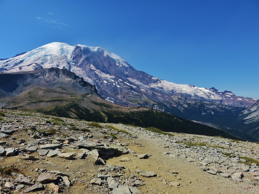
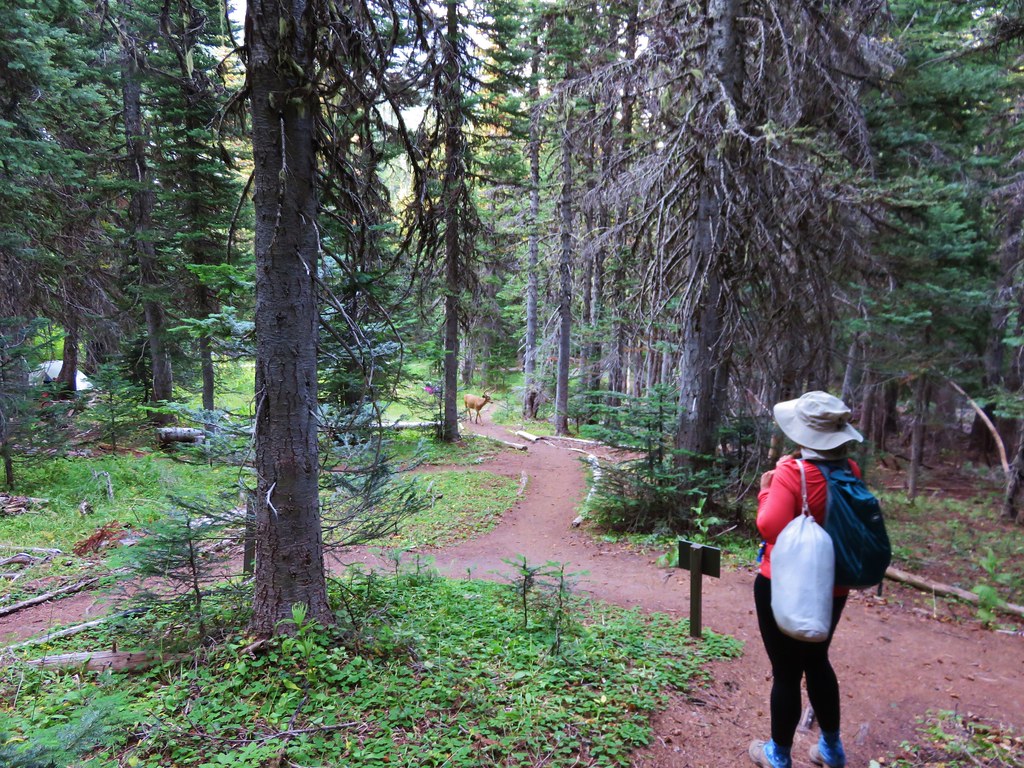
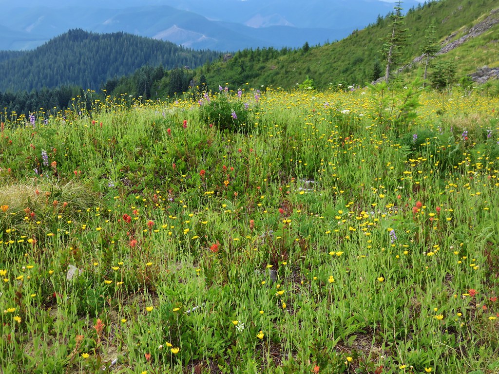
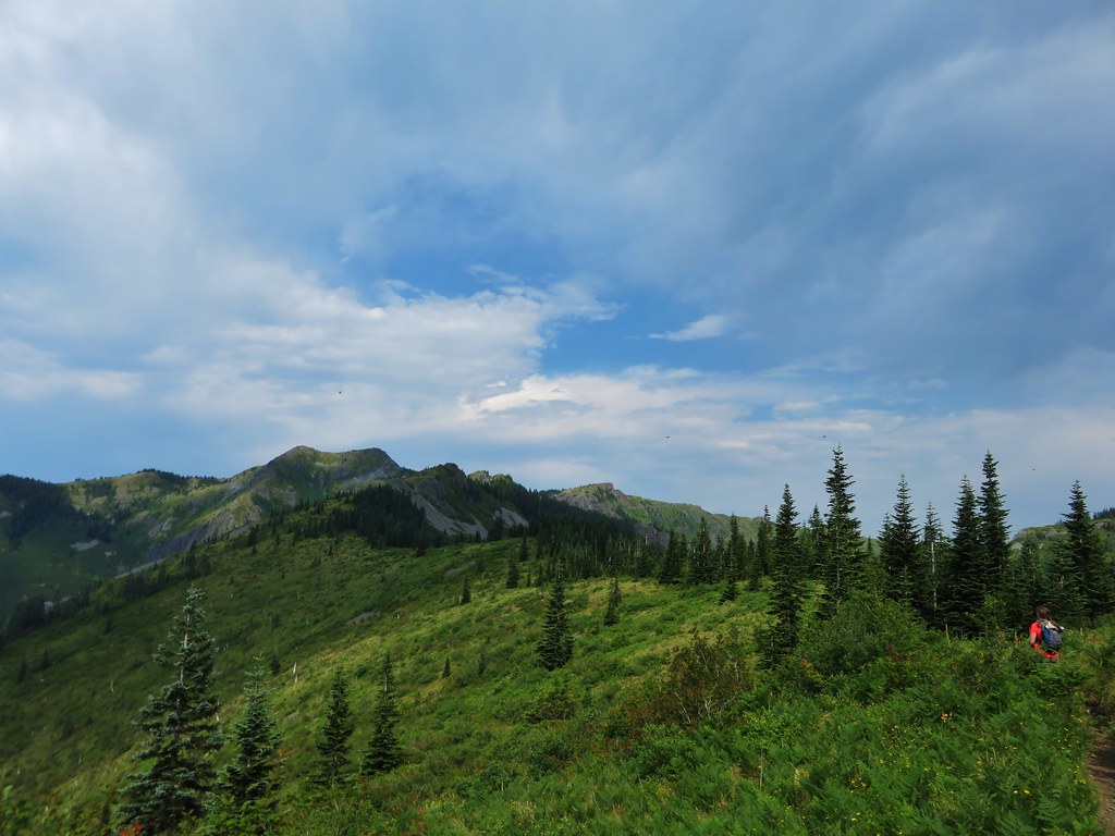
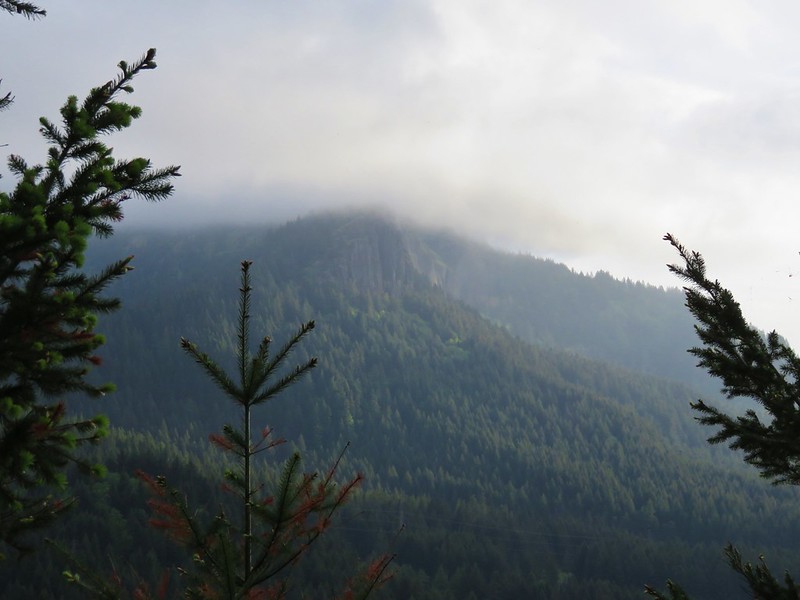
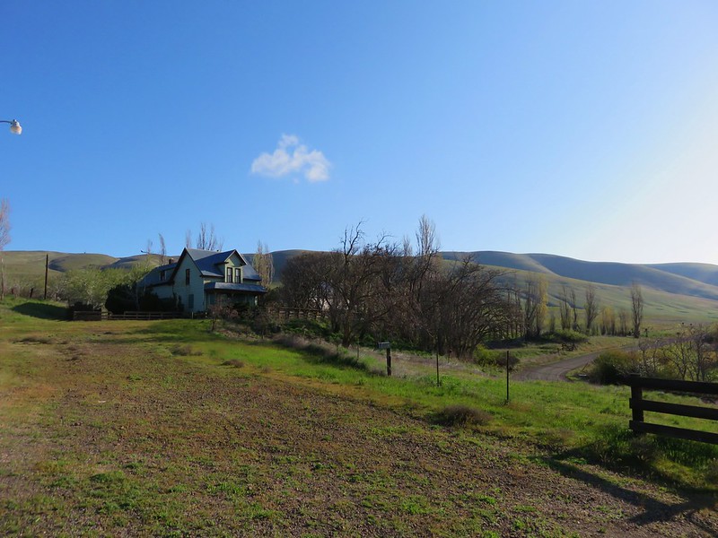
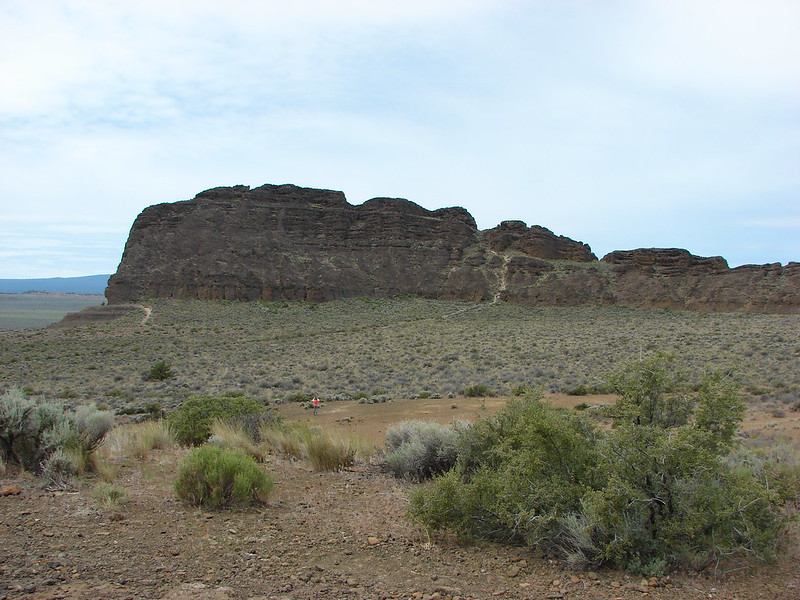
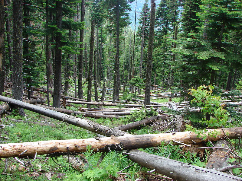
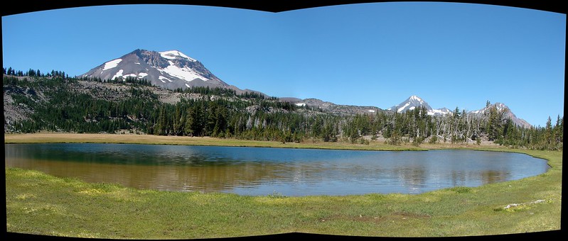
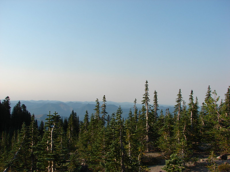
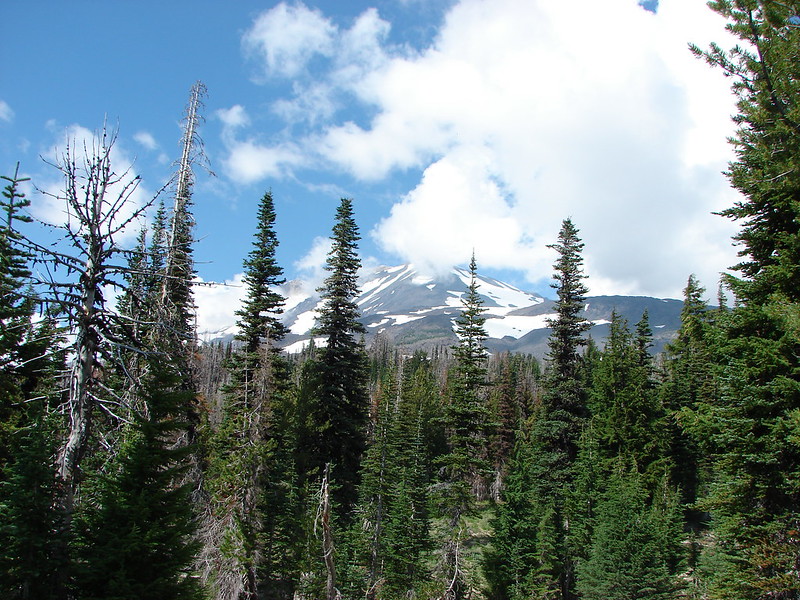
We just returned from our longest backpacking trip to date, a three night, four day stay in the Goat Rocks Wilderness in Washington. What an amazing place. Located between Mt. Adams and Mt. Rainier the Goat Rocks Wilderness sports spectacular views, vast meadows of wildflowers, and plenty of wildlife. A number of trails including the Pacific Crest Trail provide 120 miles of hiking opportunities to explore this special place. Our plan was to establish a base camp at Alpine and then explore in all directions from there.

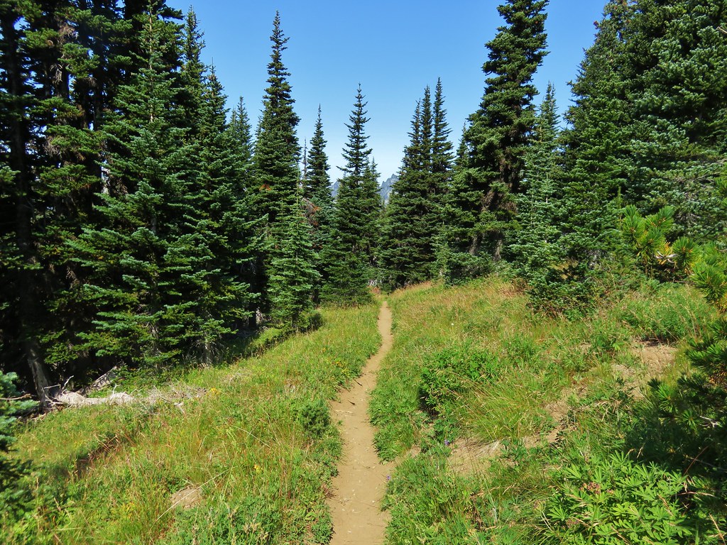
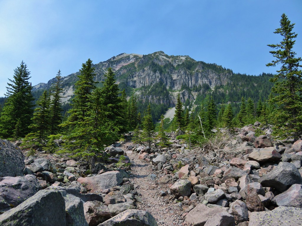
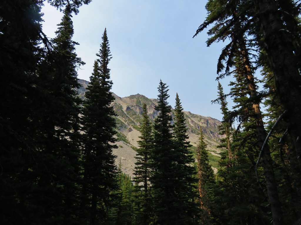
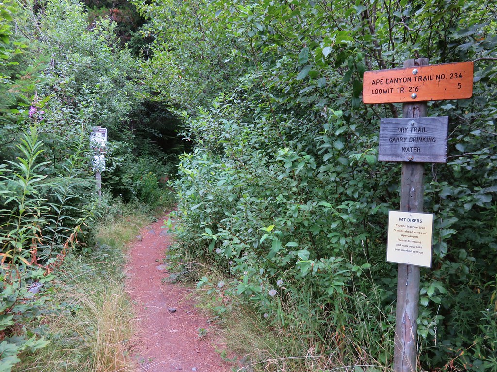
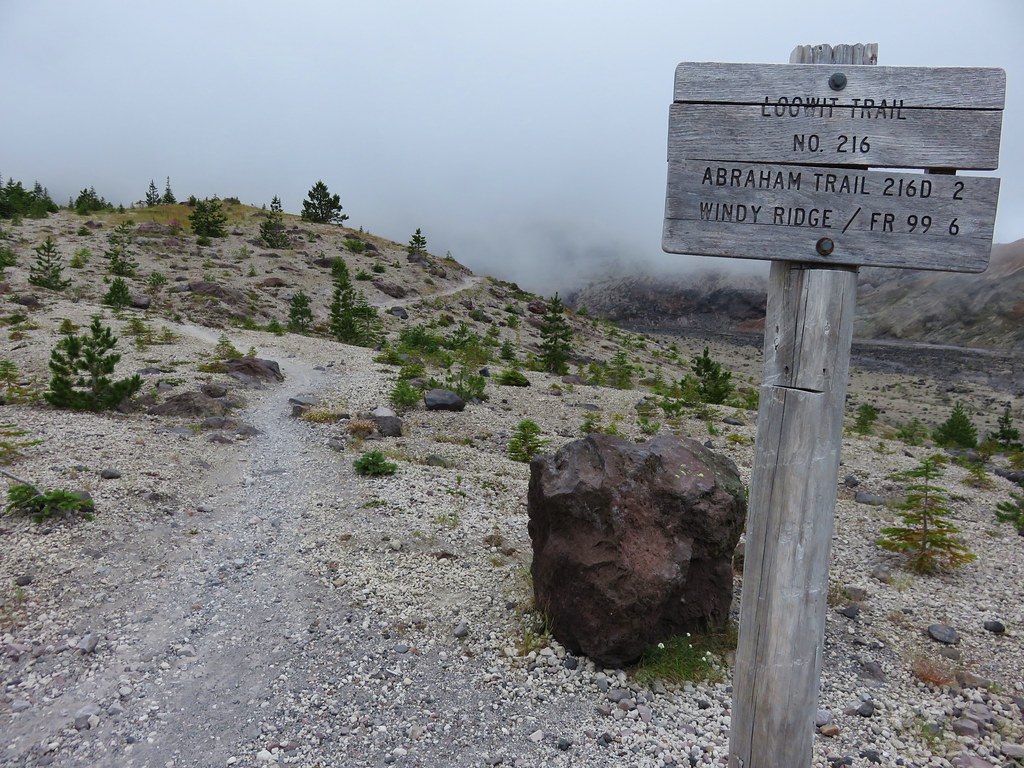
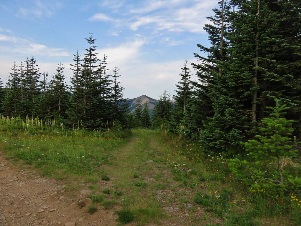
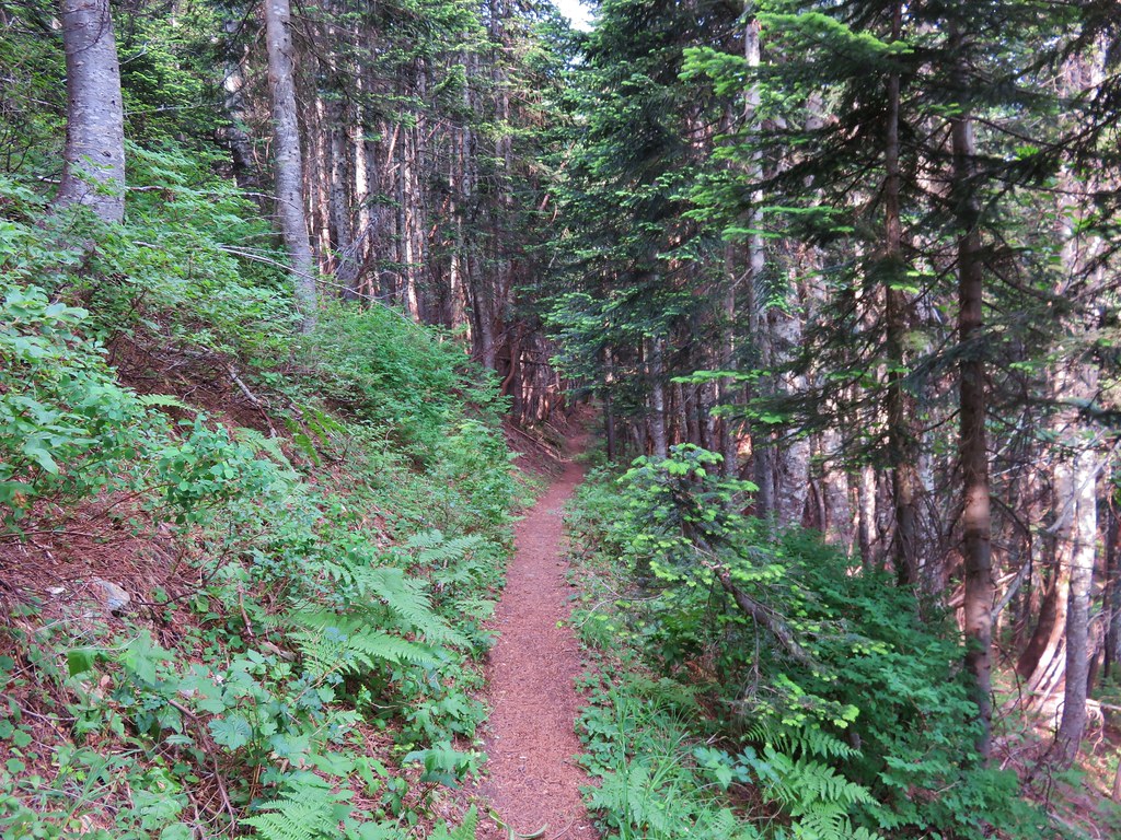
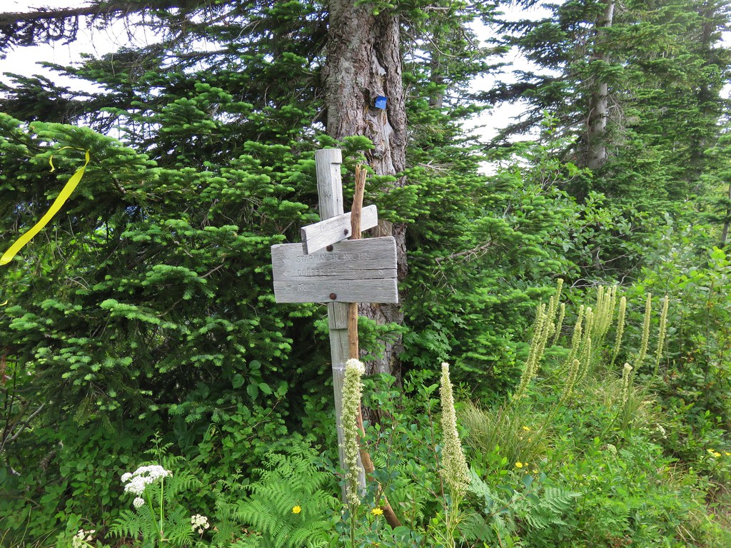
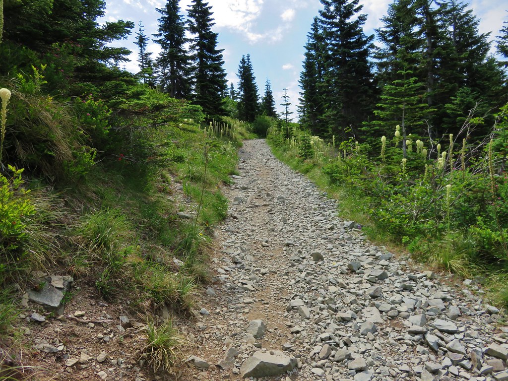
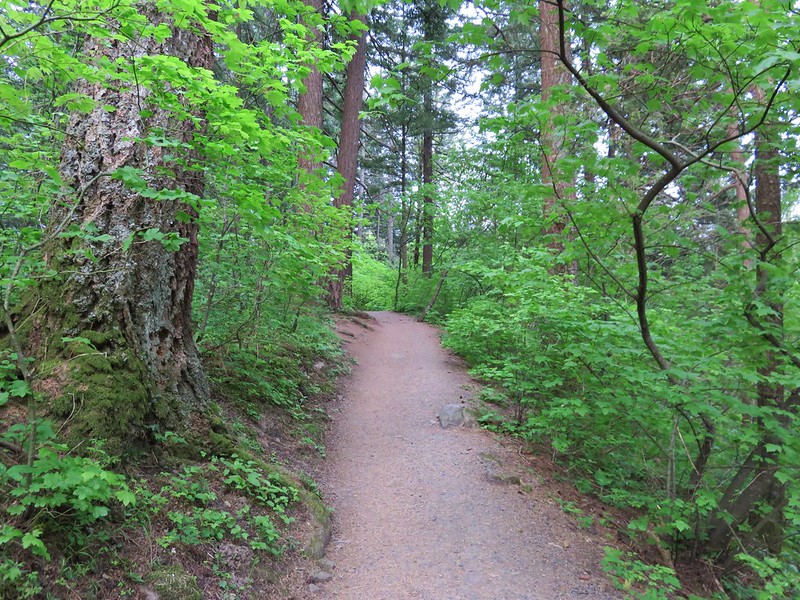
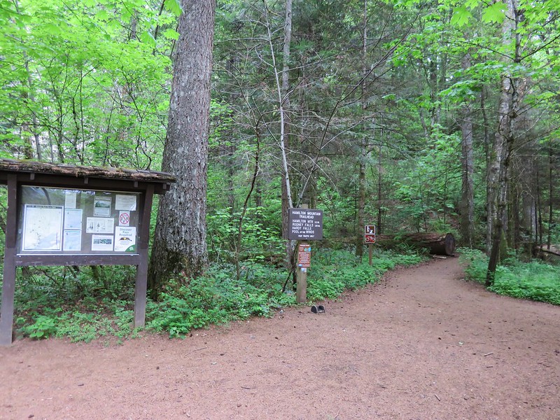
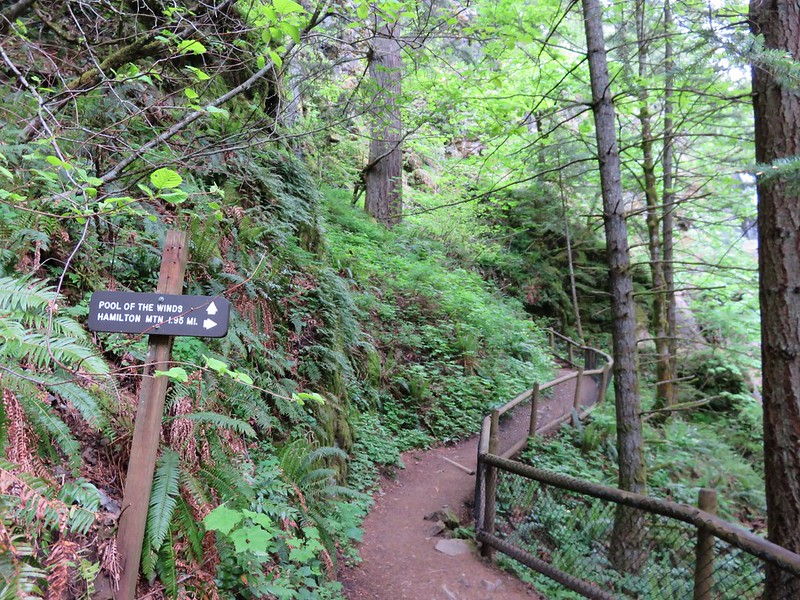
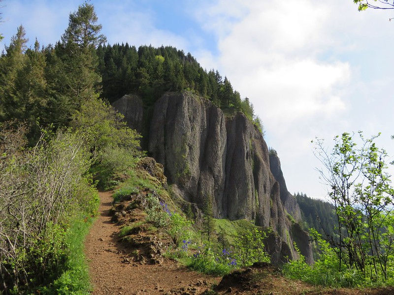
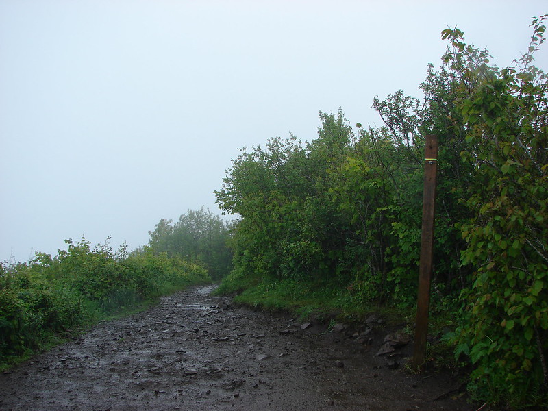
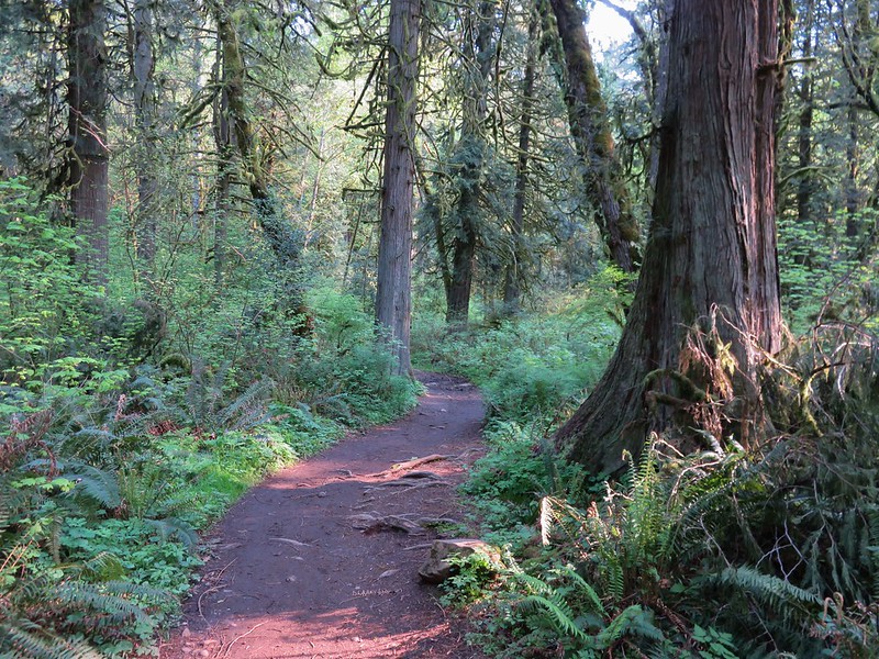
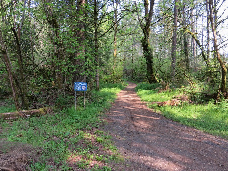
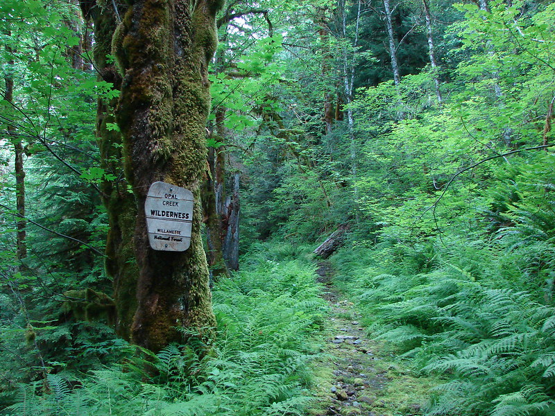
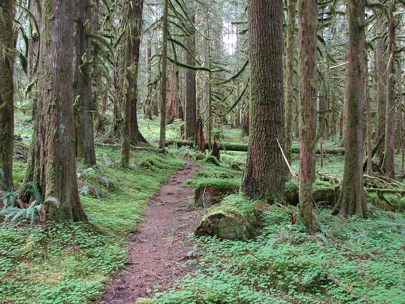
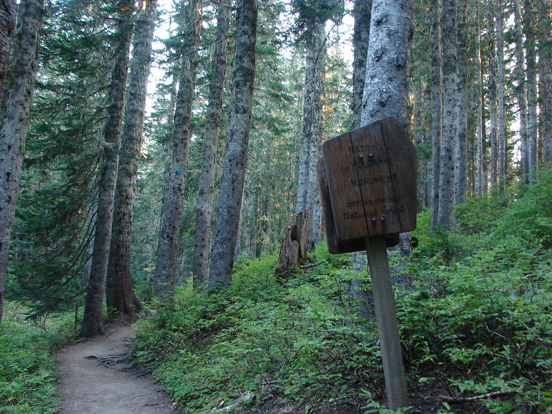
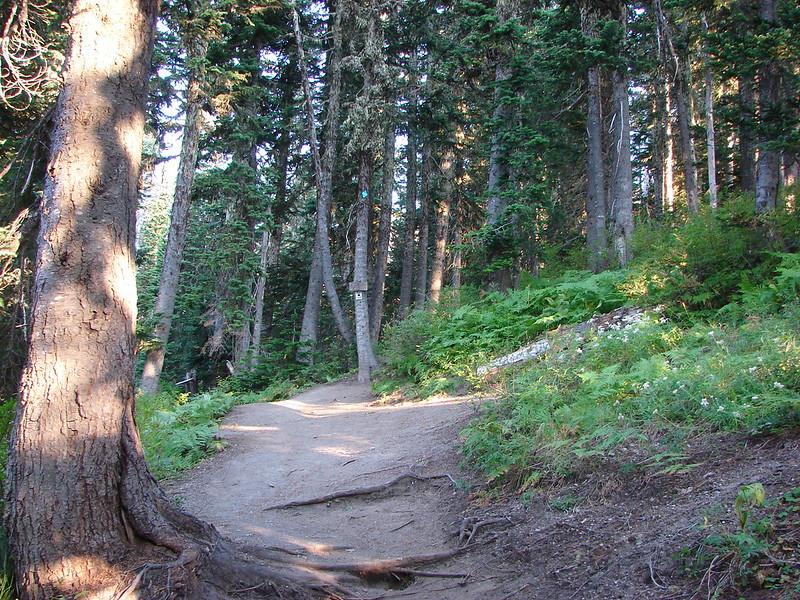
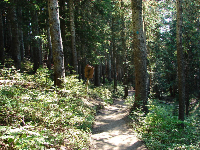
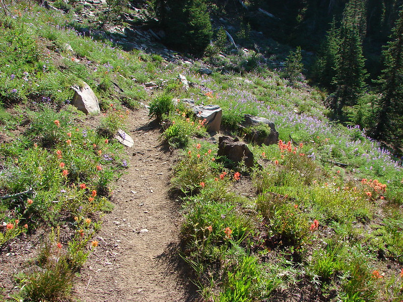
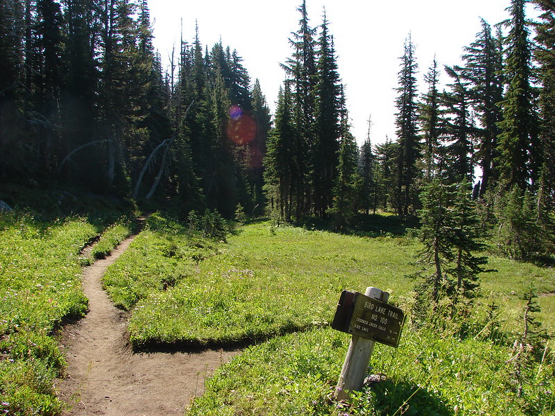
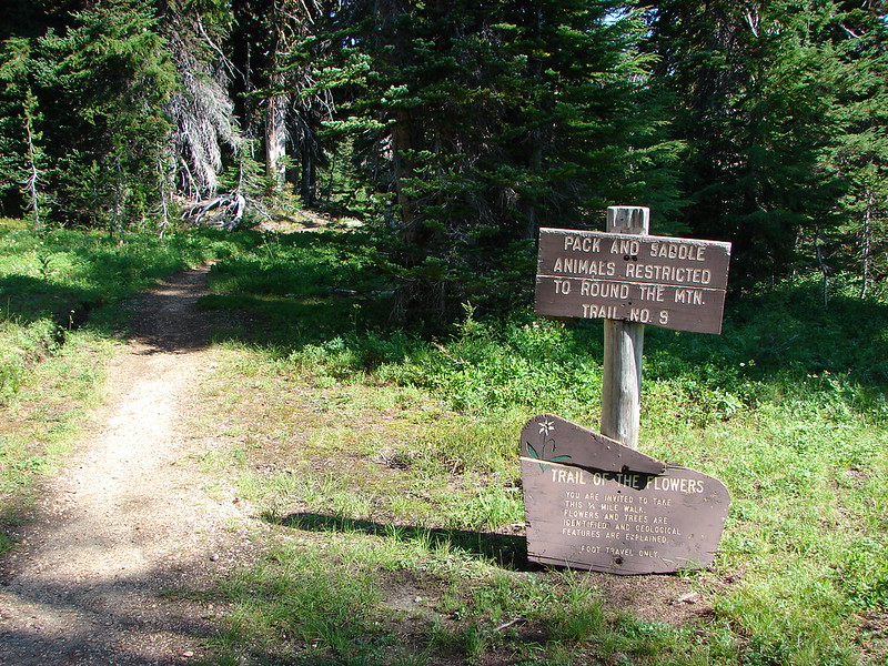
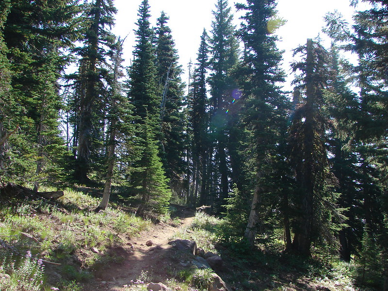
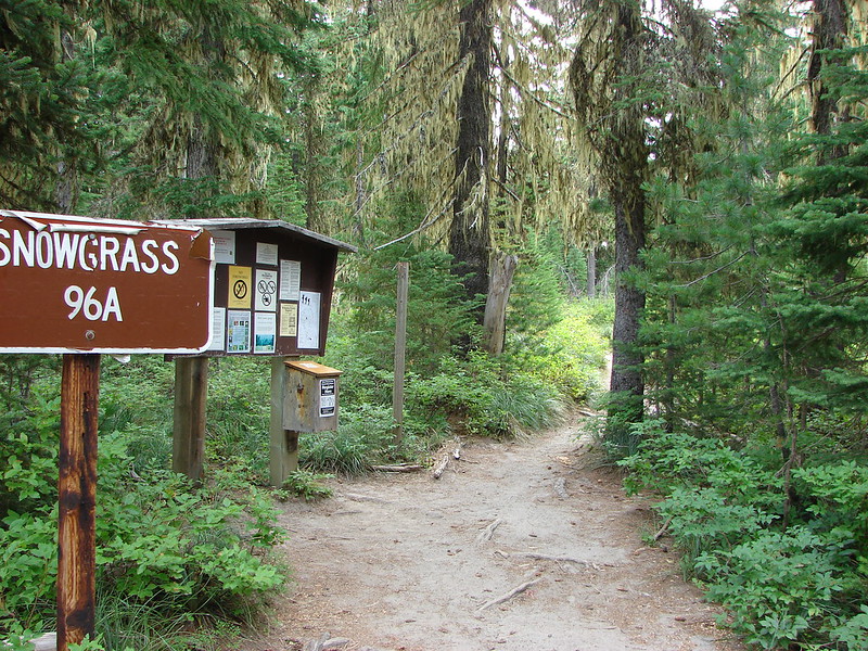
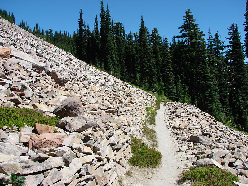
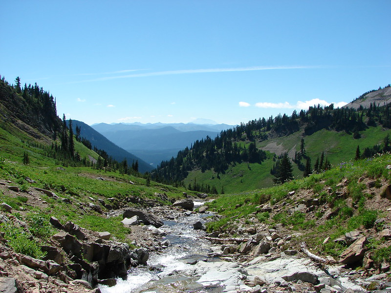
We started our trip at the popular Snowgrass Trailhead and quickly entered the wilderness.

DSC02449

DSC02450

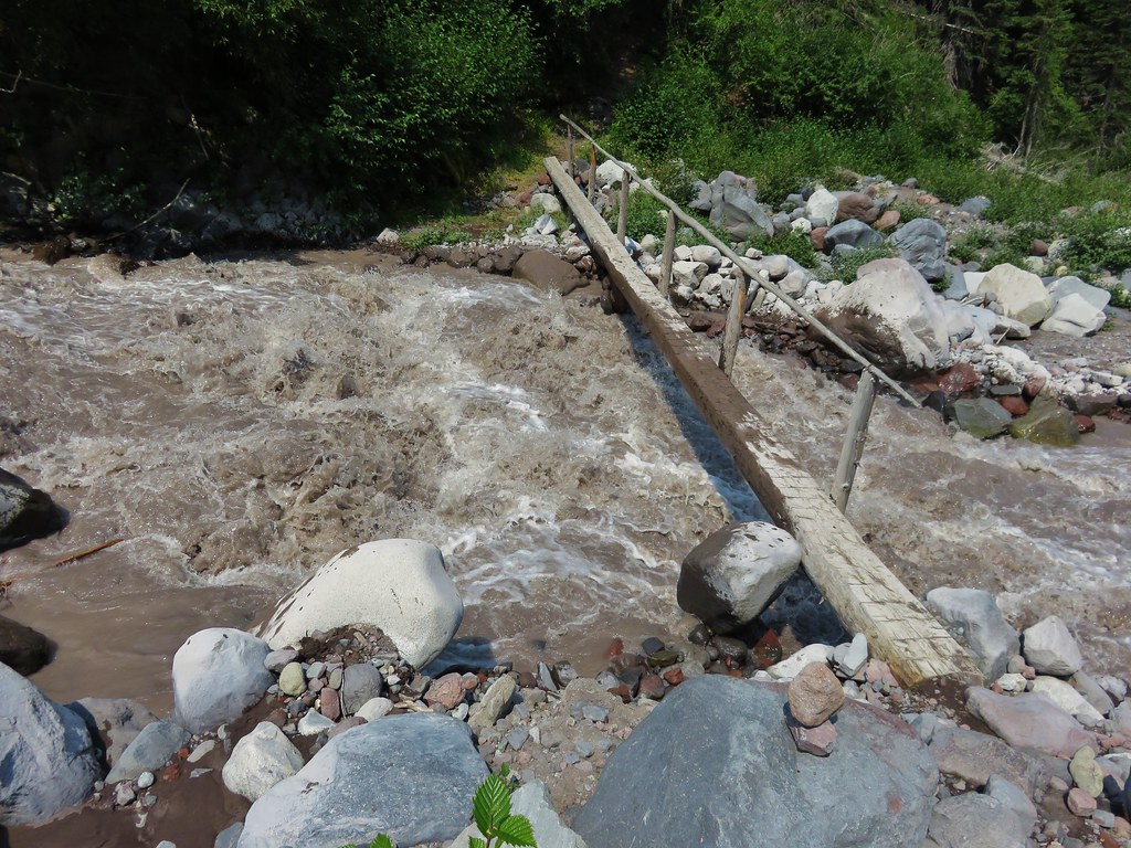
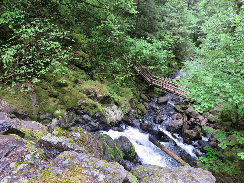
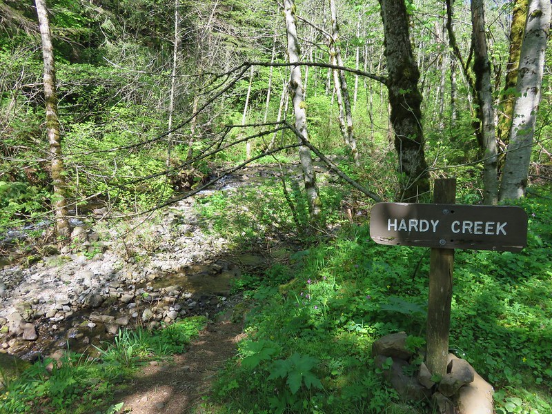
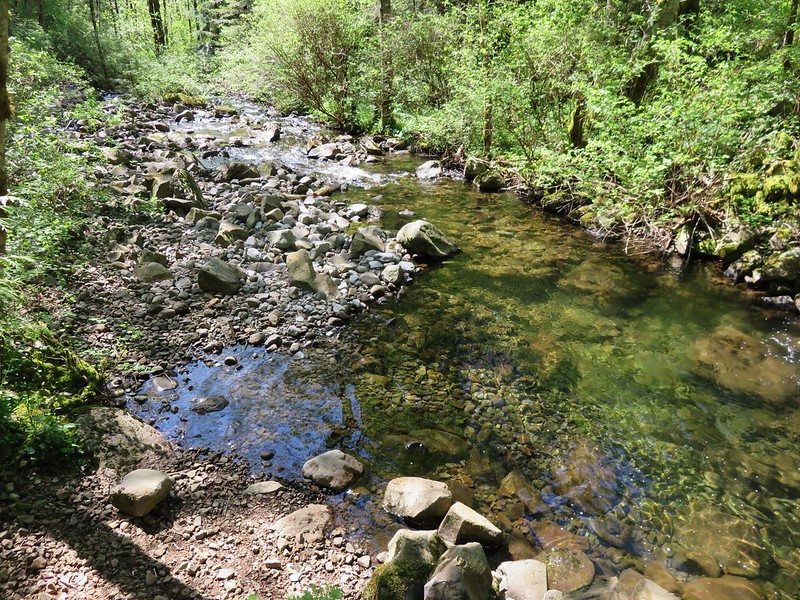
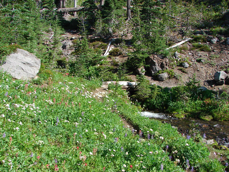
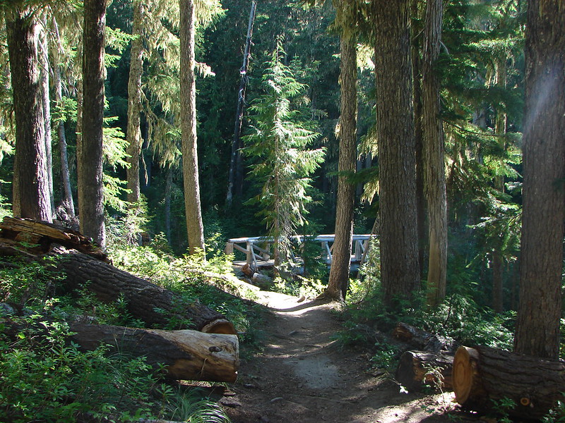
A little over 1.5 miles we crossed Goat Creek on a footbridge.

DSC02466

DSC02469

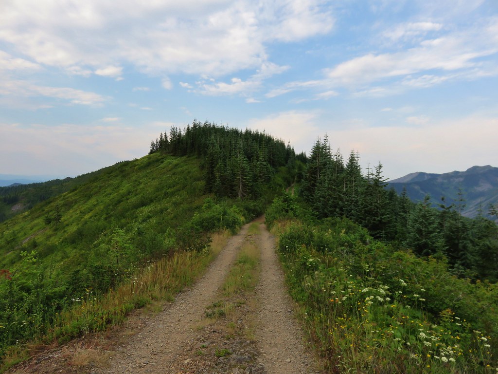
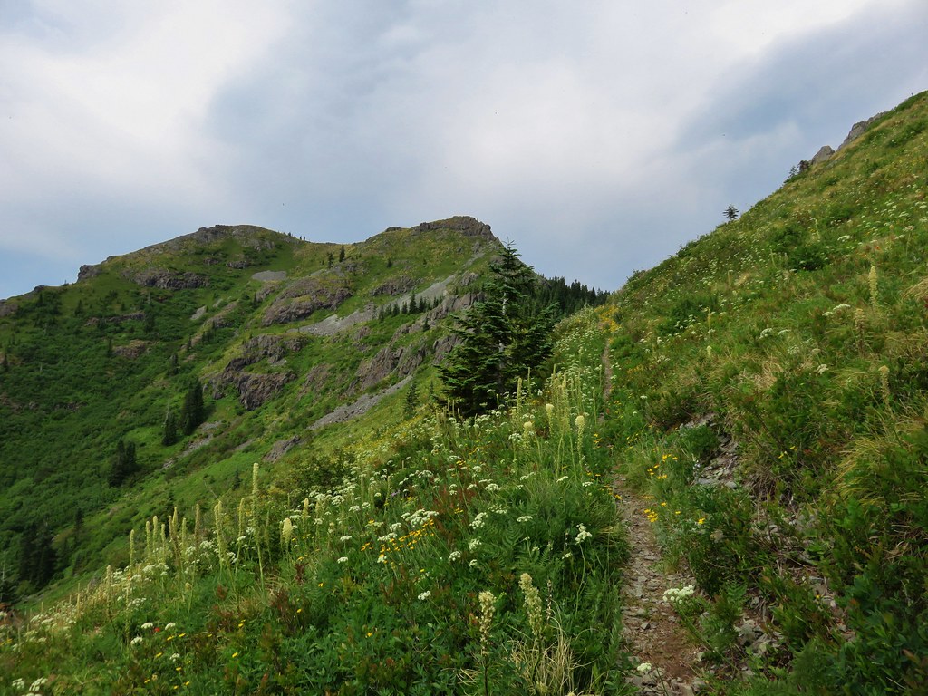
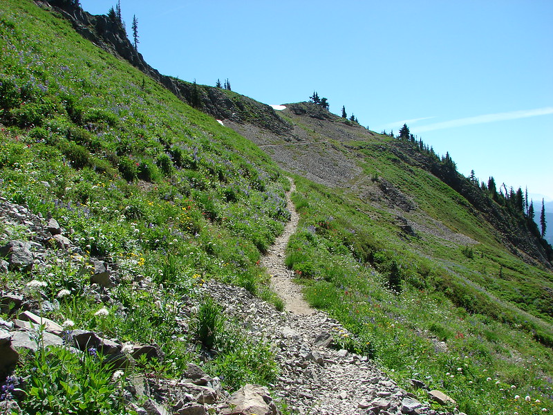
In another 2 miles we came to a trail junction where Bypass Trail 97 split off on its way up to the Pacific Crest Trail. Staying left on the Snowgrass Trail we climbed .7 miles to a trail junction.

DSC02534

DSC02535

DSC02550

DSC02557

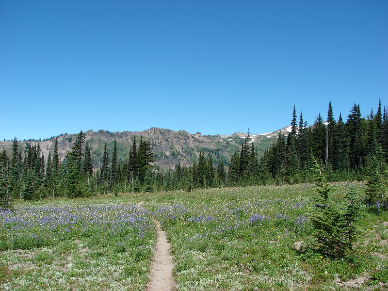
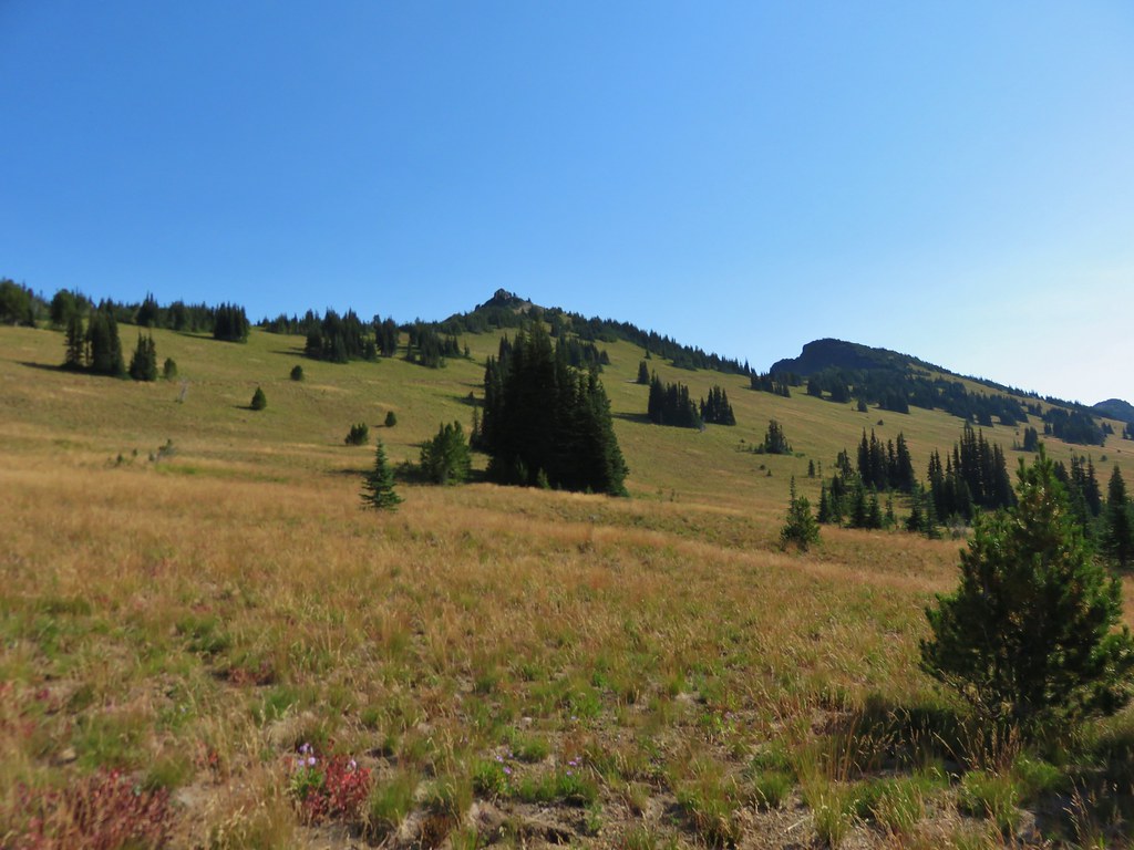
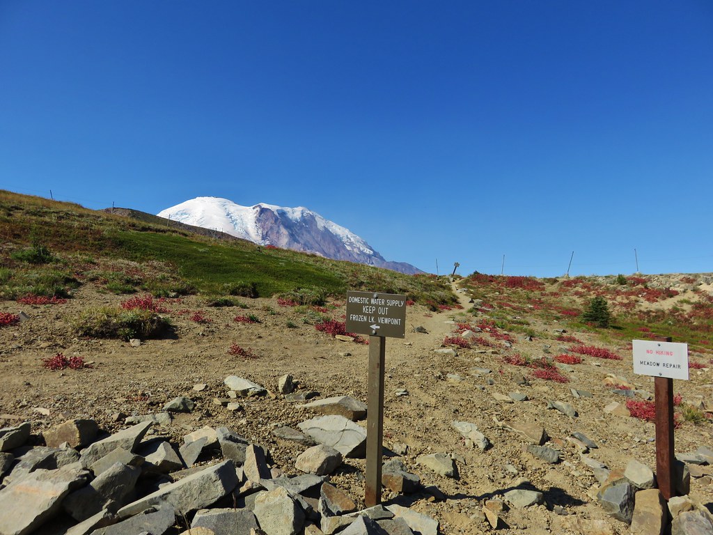
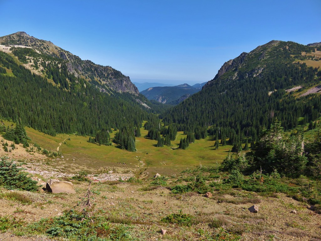
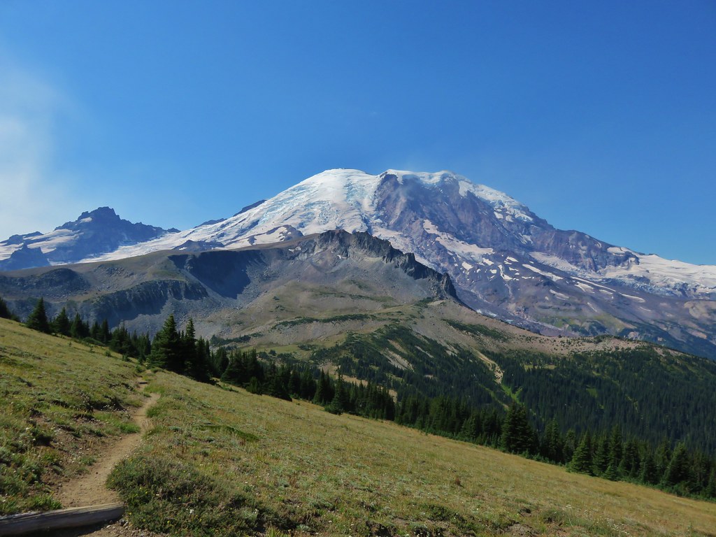
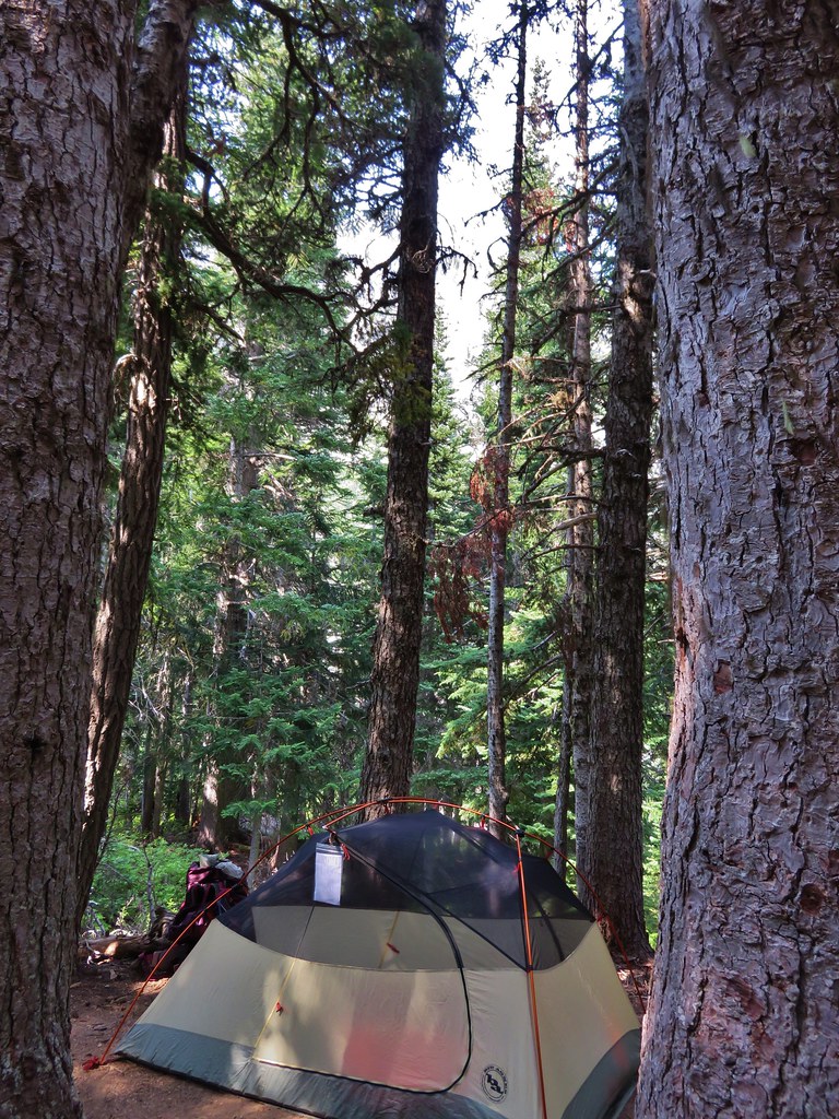
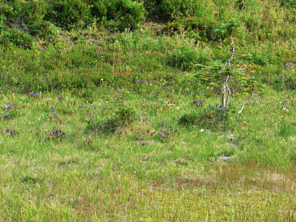
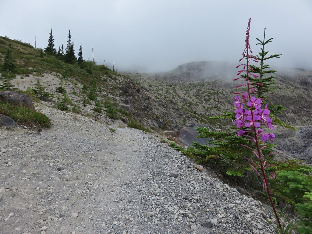
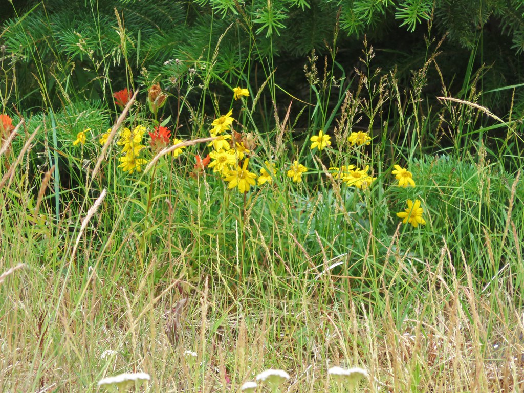
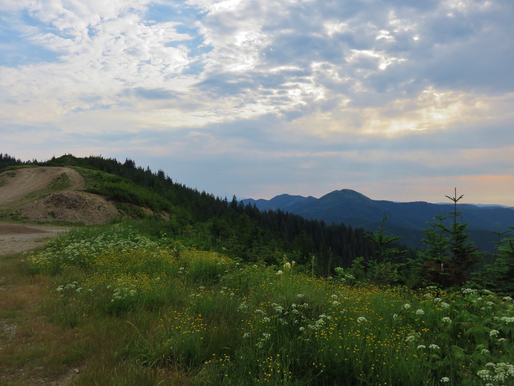
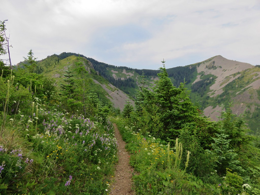
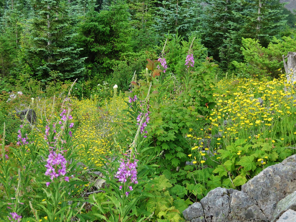
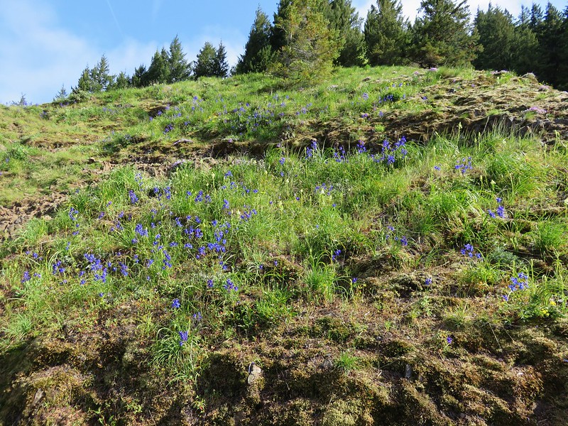
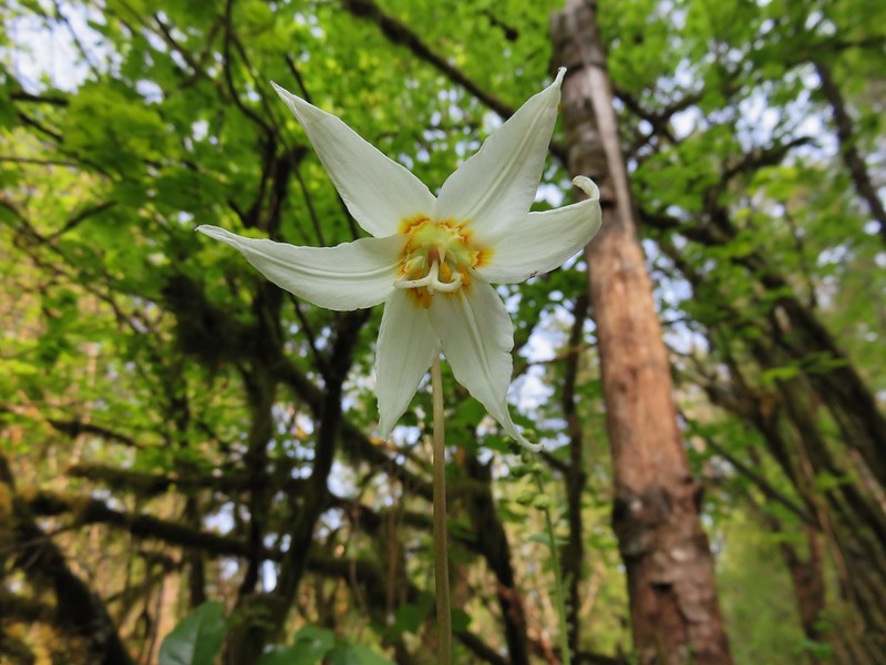
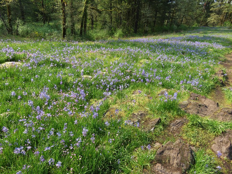
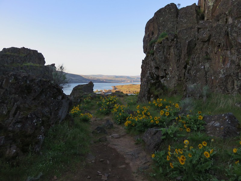
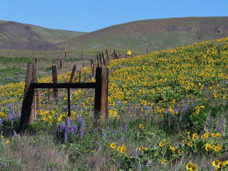
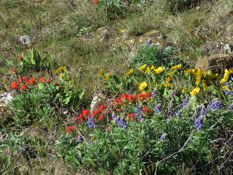
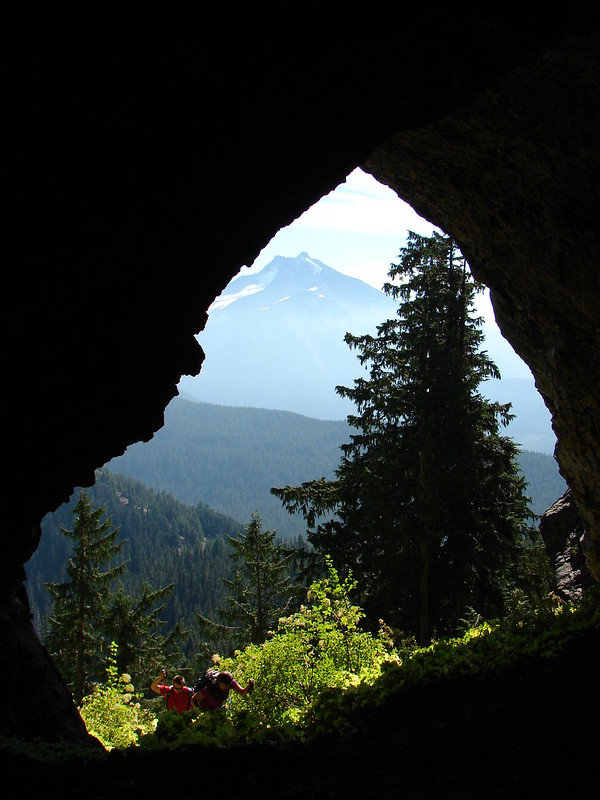
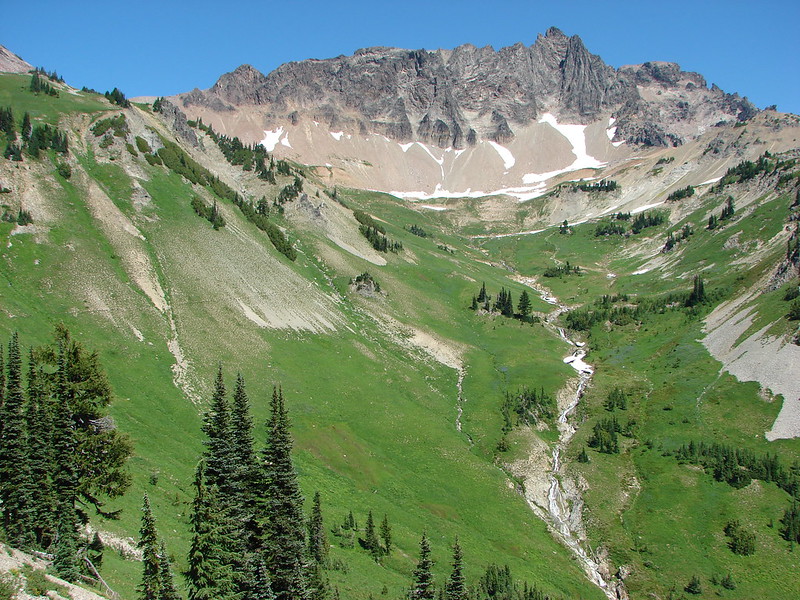
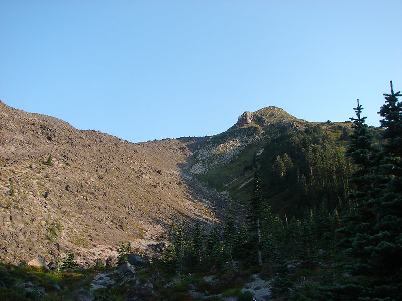
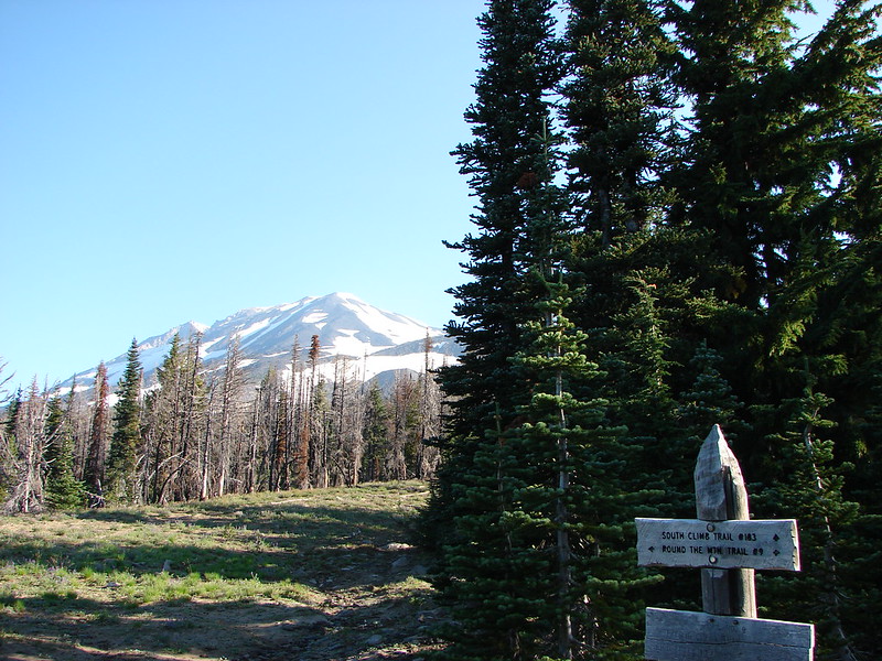
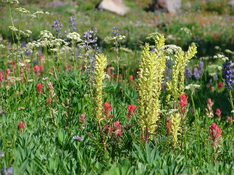
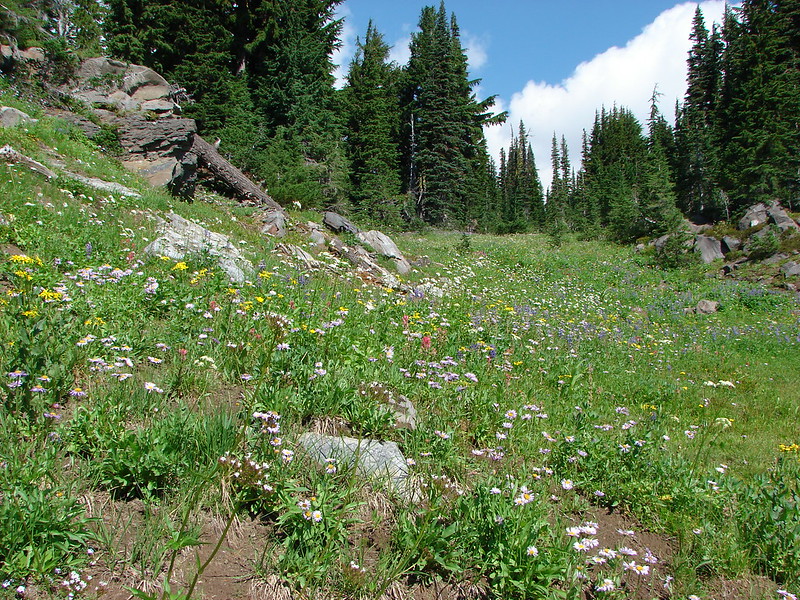
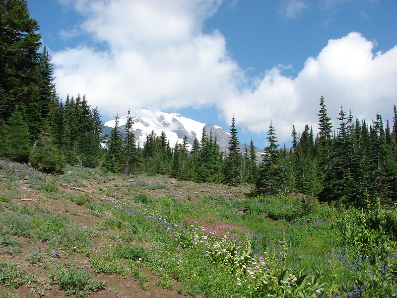
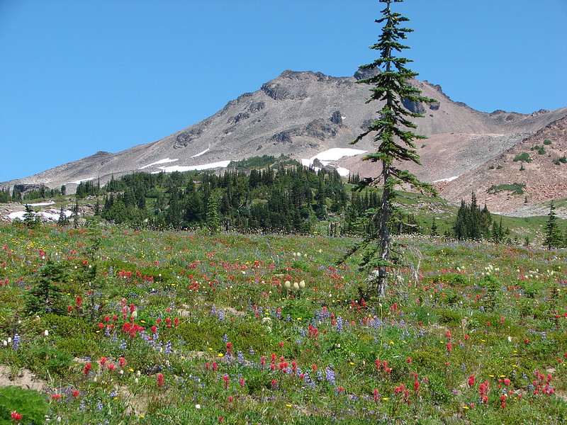
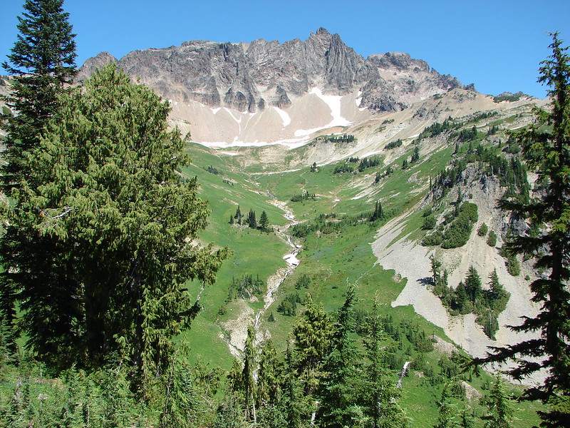
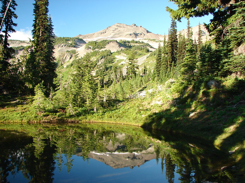
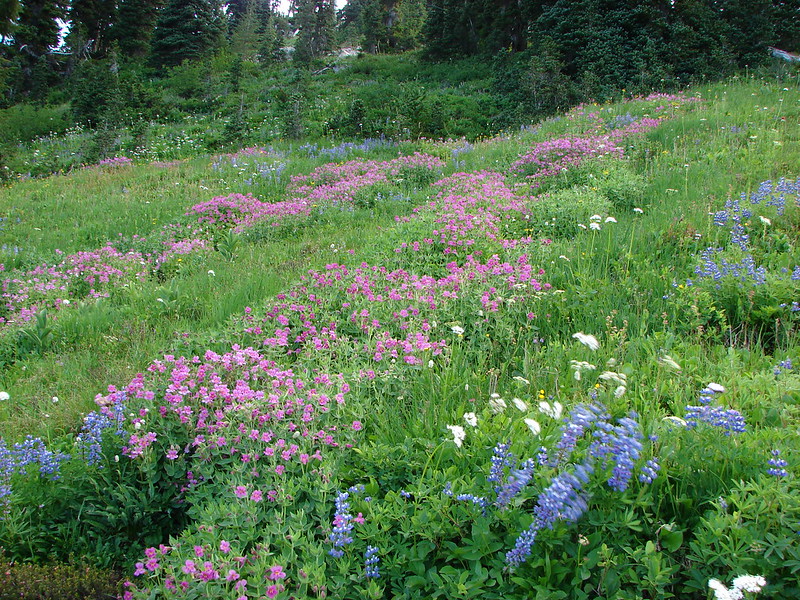
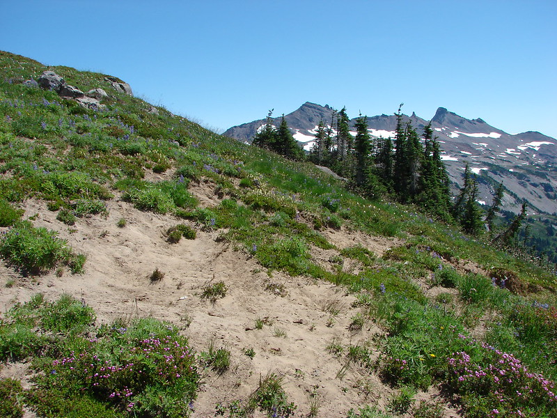
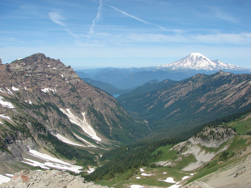
The Lily Basin Trail meets the Snowgrass Trail at this junction amid a wildflower meadow. Just a short distance away was Alpine where we began searching for a tent site. The views and wildflowers at Alpine were simply amazing. We ended up deciding on a small site with a view of Old Snowy Mountain.

DSC02582

DSC02575

DSC02578

DSC02928

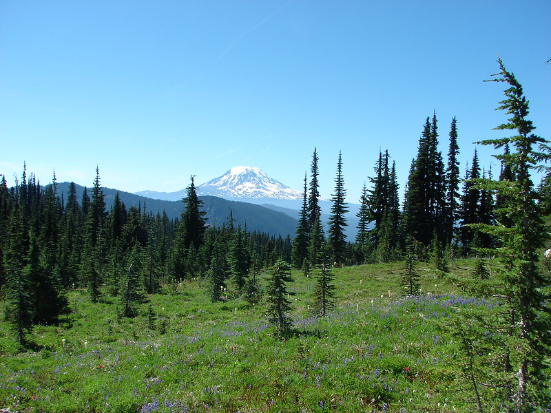
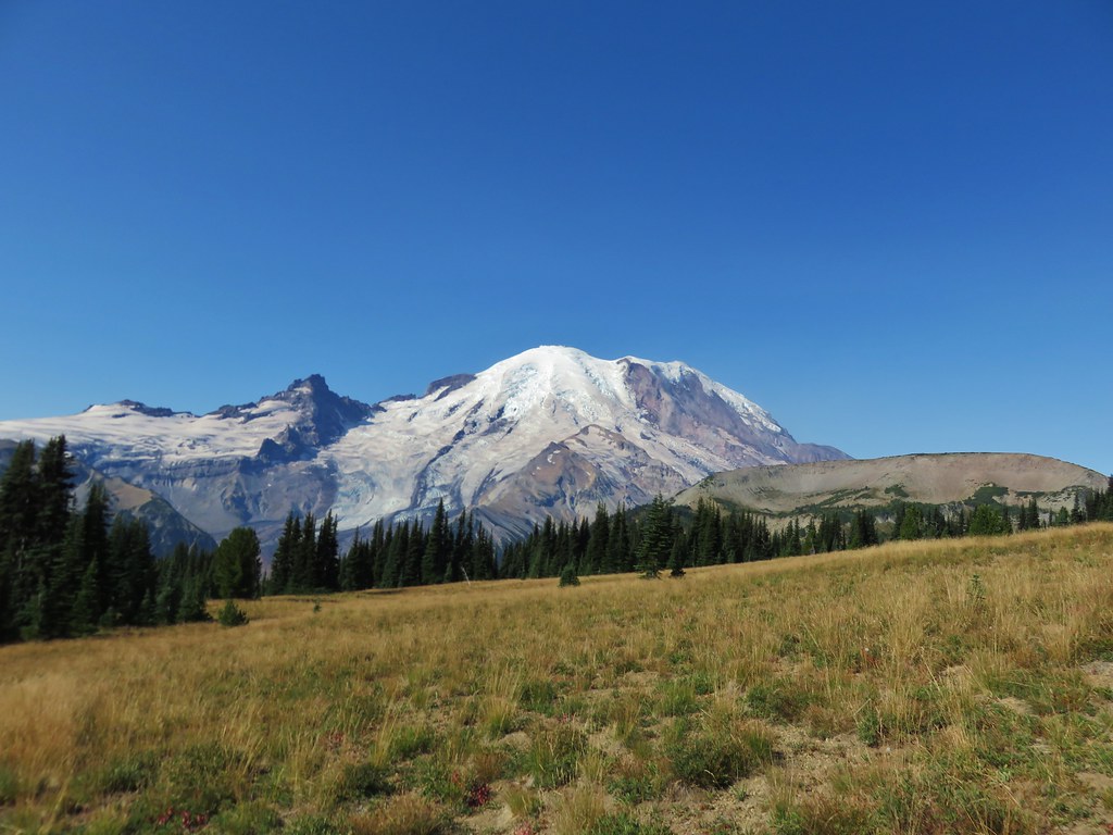
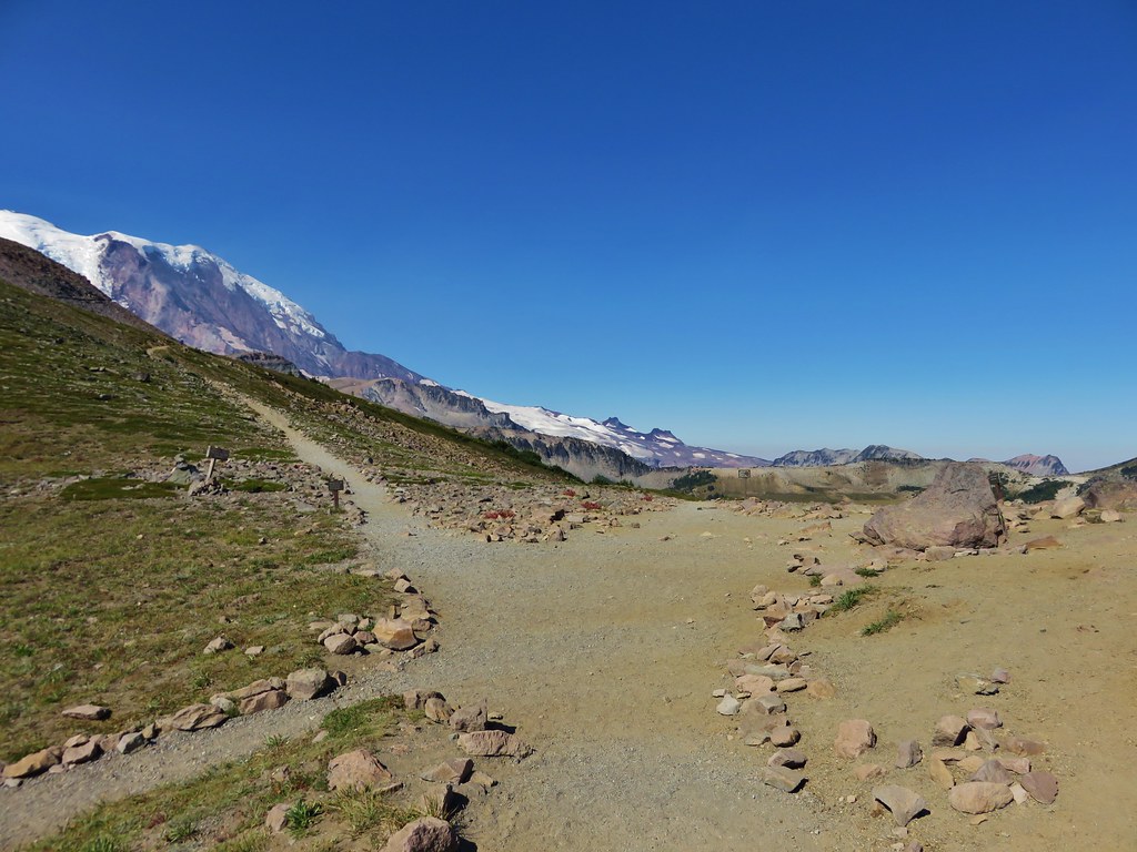
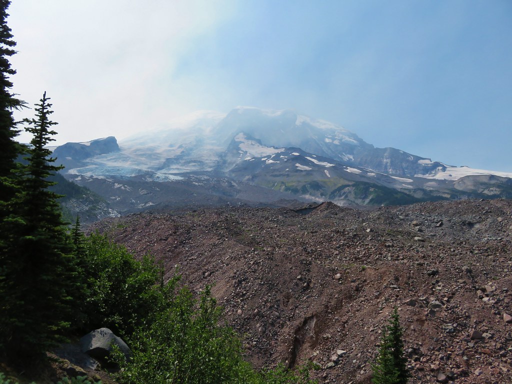
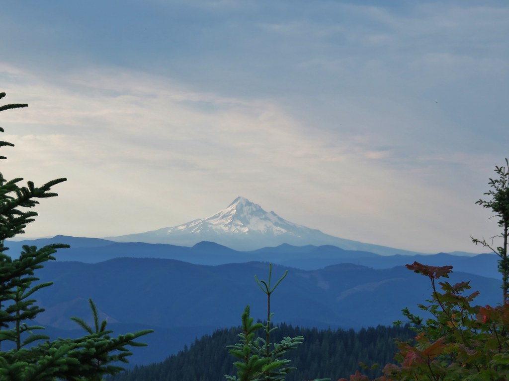
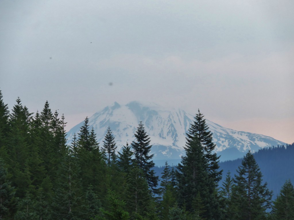
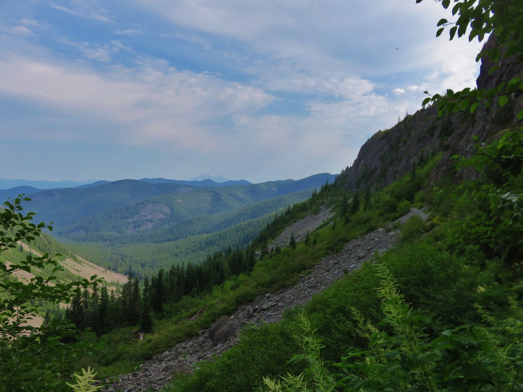
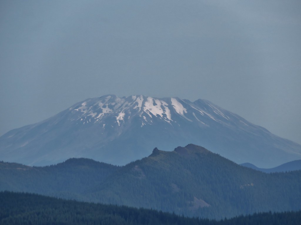
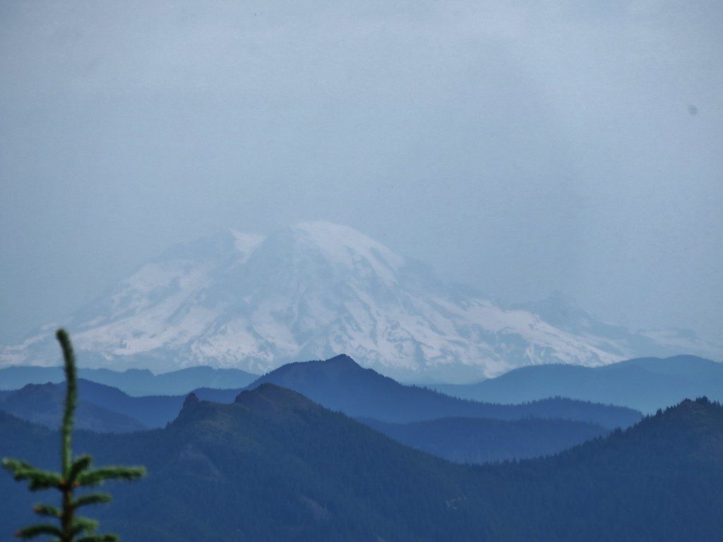
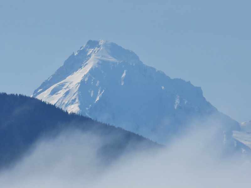
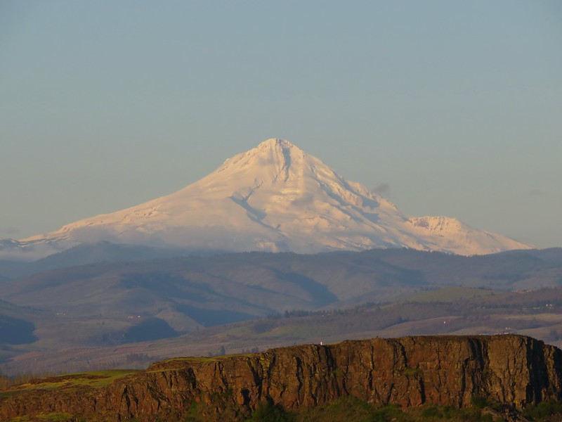
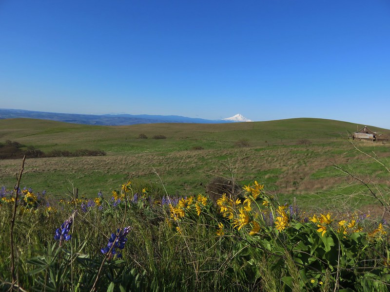
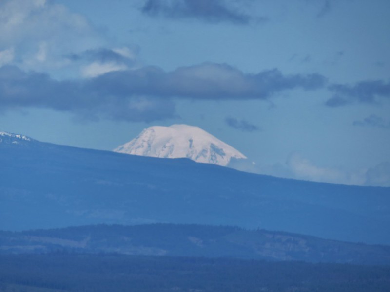
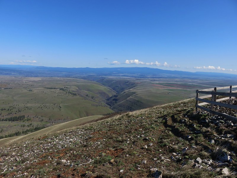
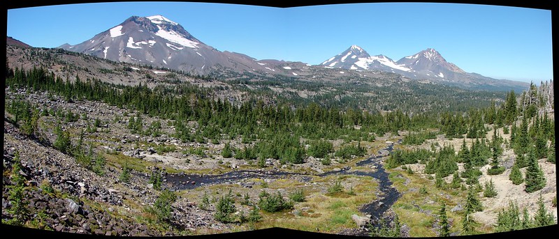
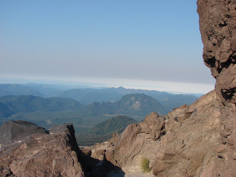
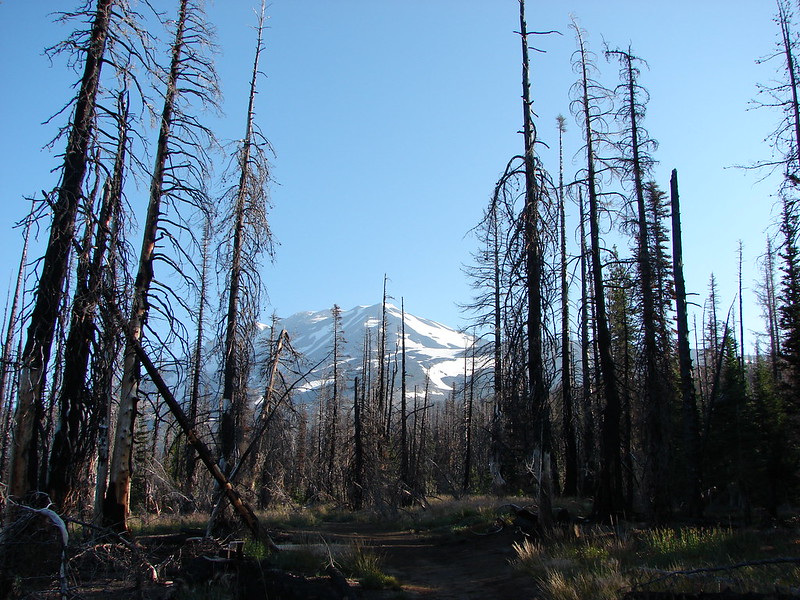
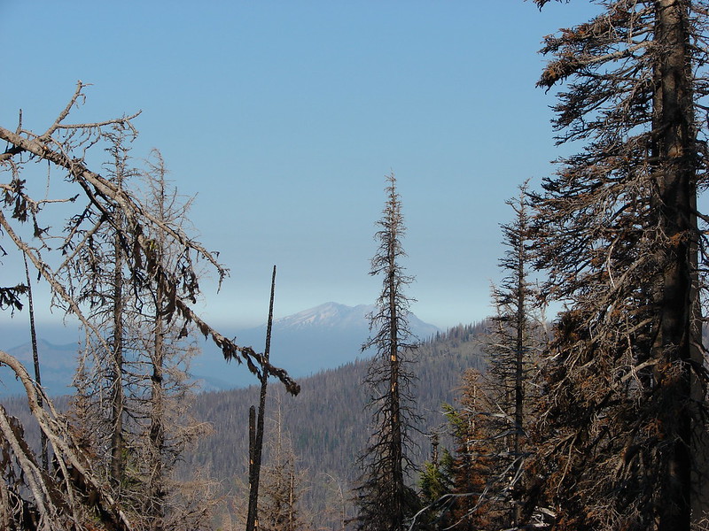
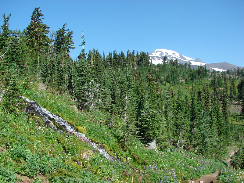
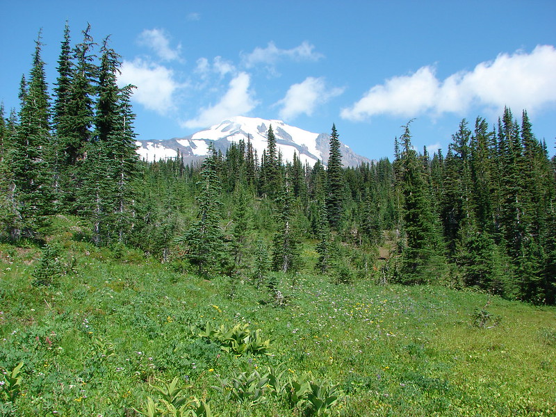
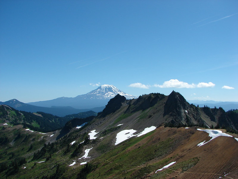
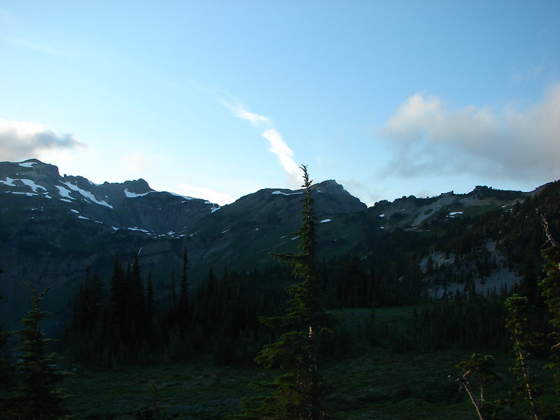
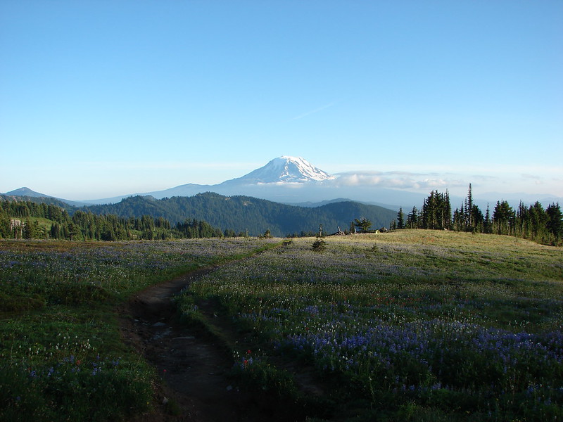
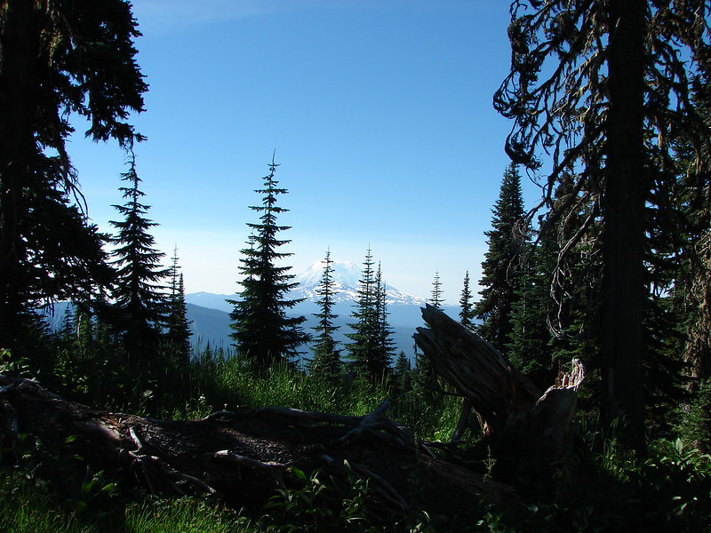
After setting up camp we loaded up our daypacks and headed back to the Snowgrass Trail and climbed to the Pacific Crest Trail. The scenery just kept getting better as we approached the PCT. Mt. Adams was standing tall to the SE, Mt. St. Helens sat in the distance to the SW and Old Snowy Mountain & Ives Peak lay dead ahead.

DSC02641

DSC02664

DSC02642

DSC02647

DSC02668

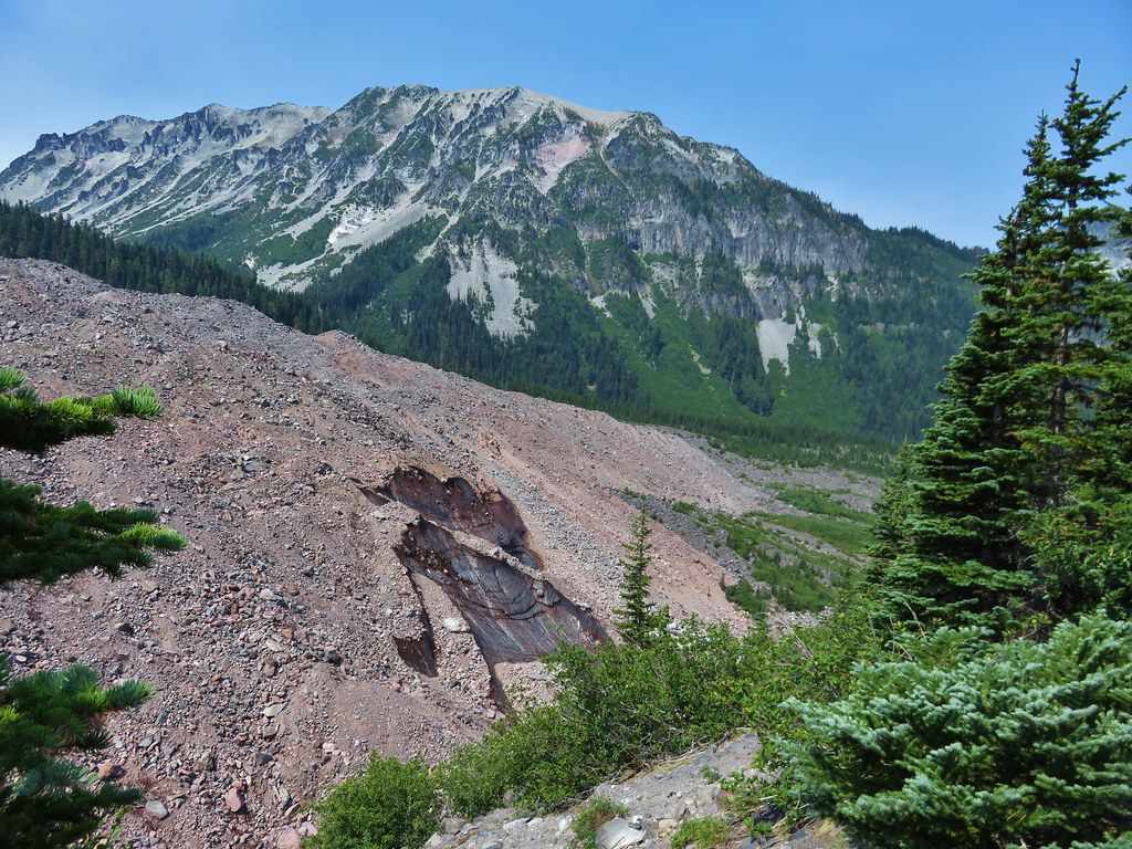
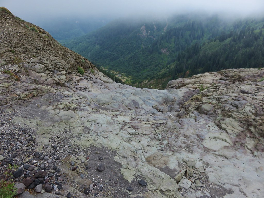
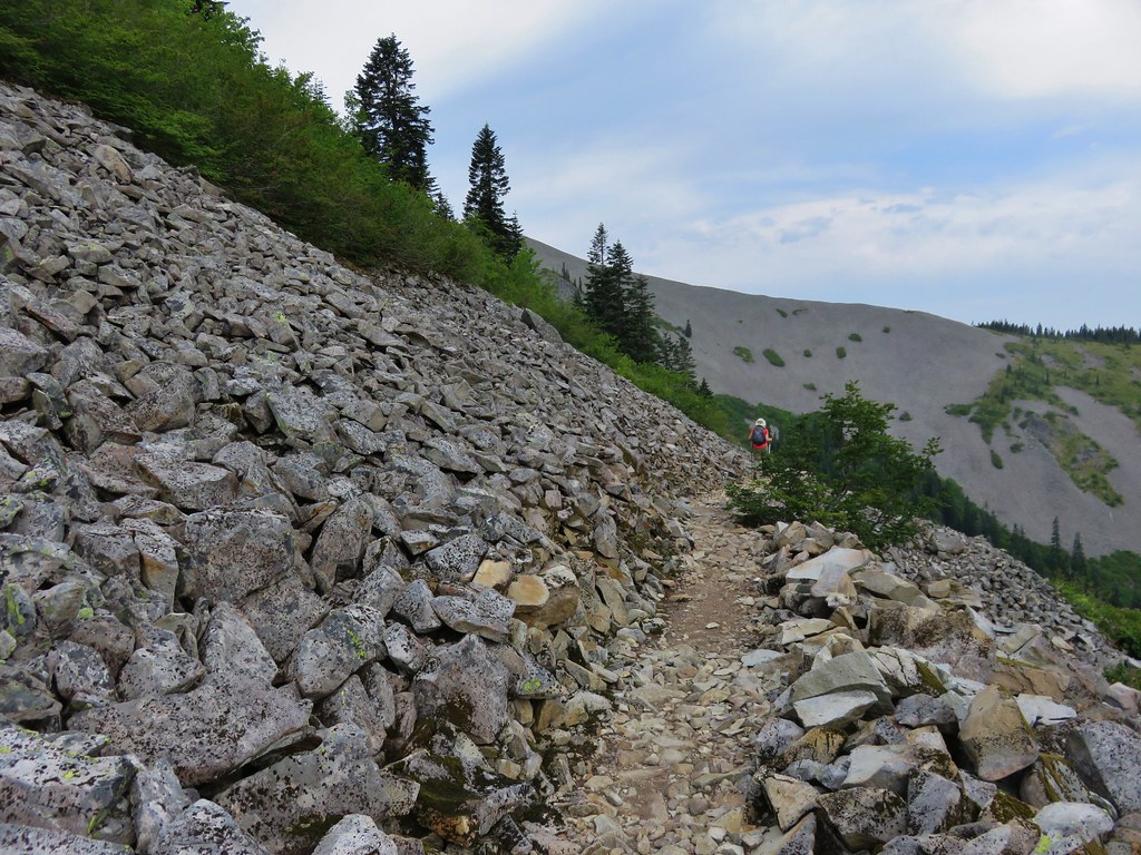
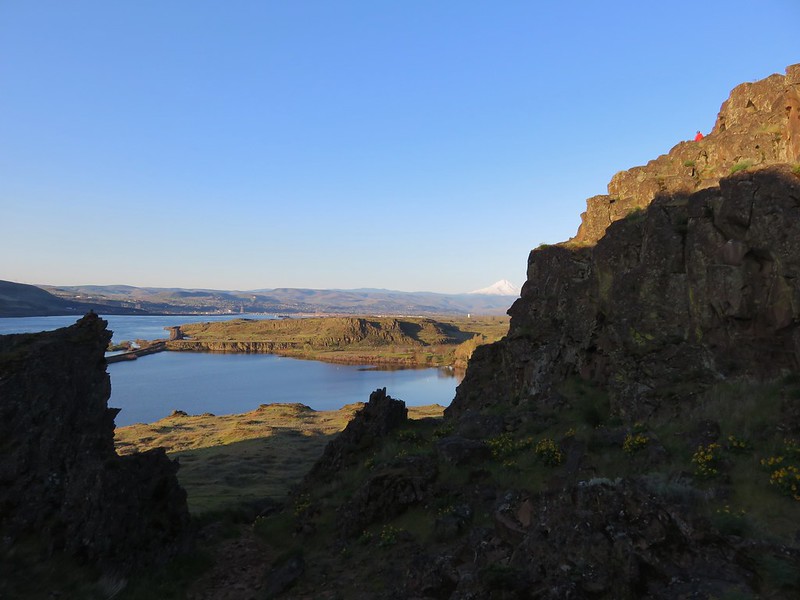
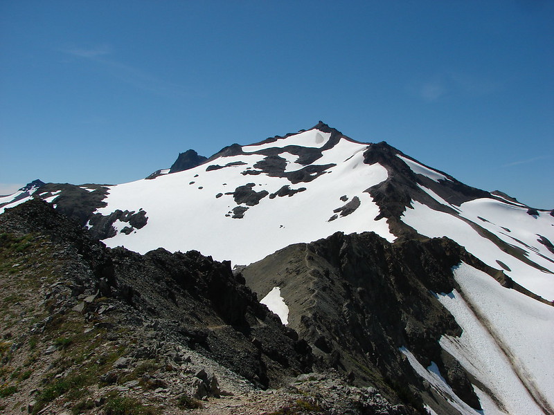
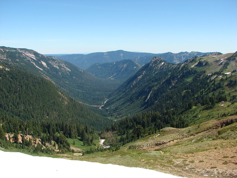
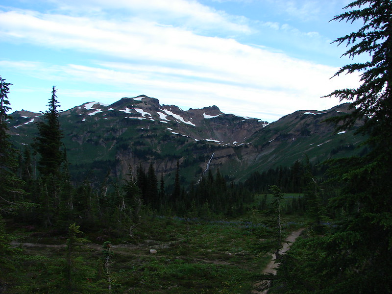
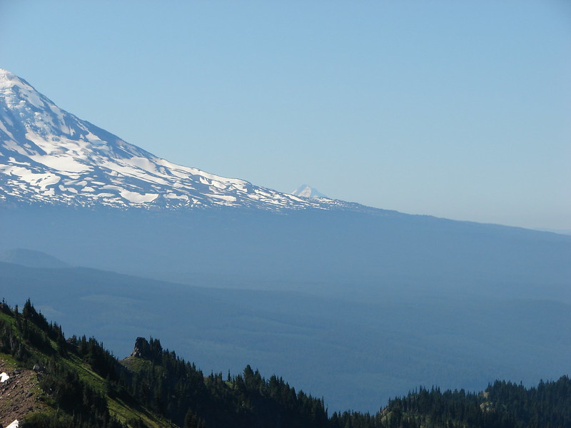
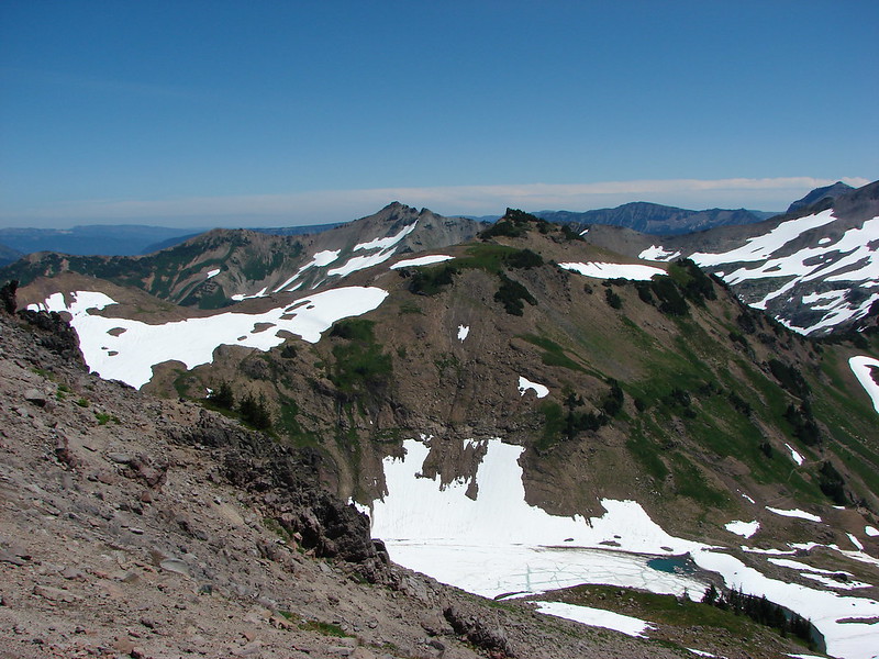
We turned right (south) on the PCT and headed toward the Cispus Basin planning to go as far as Cispus Pass before turning around. After a mile the Bypass Trail 97 joined the PCT which we would take on the way back. After crossing a large rock slide we got our first view across the Cispus Basin to Mt. Adams peaking over the far ridge.

DSC02722

DSC02729

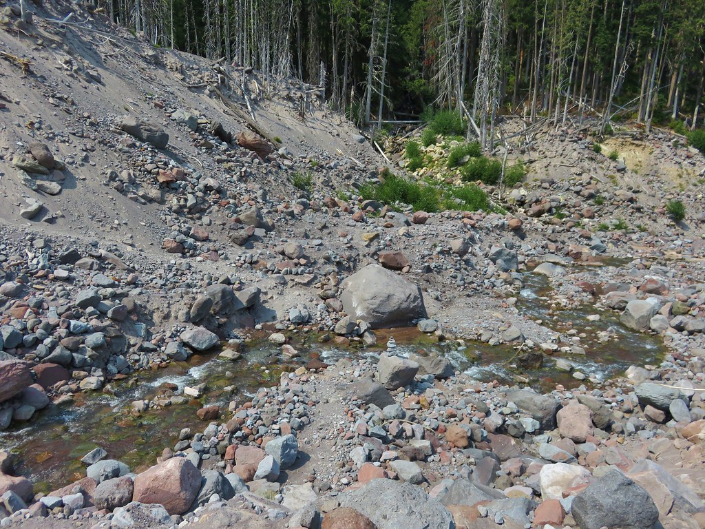
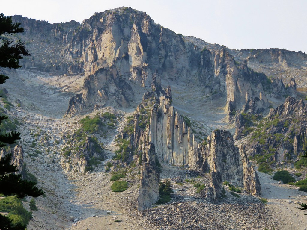
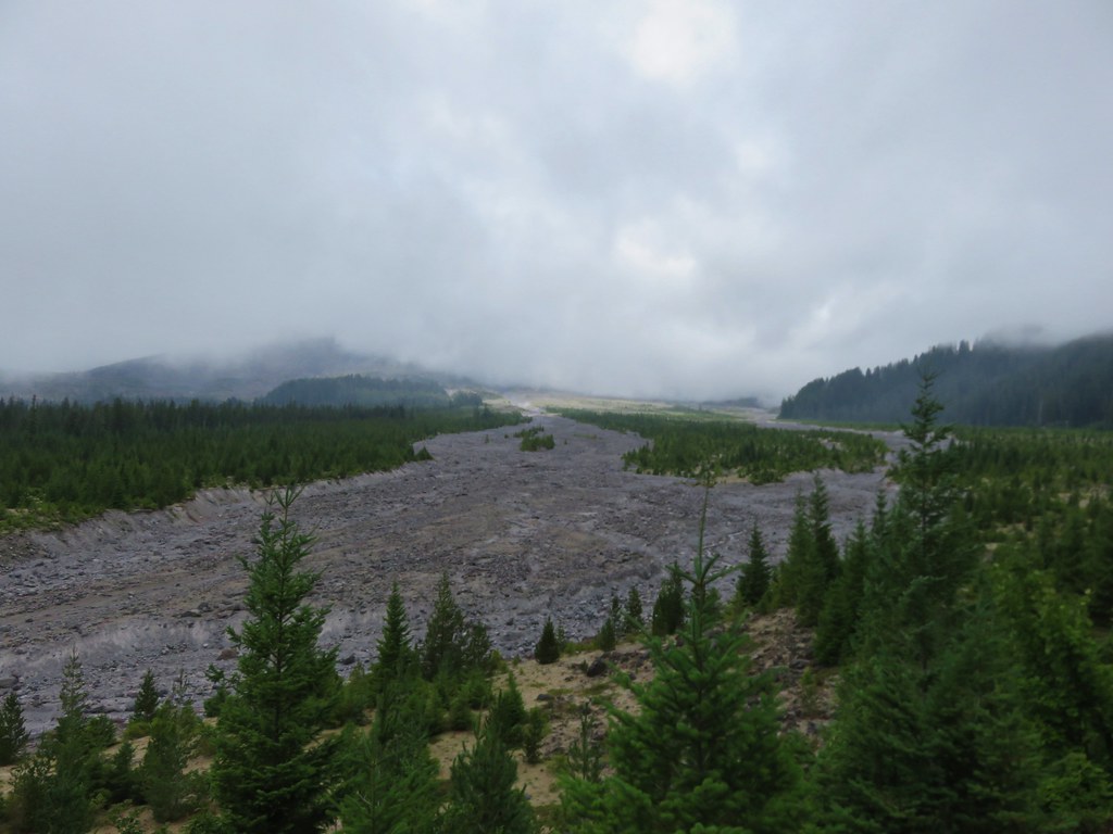
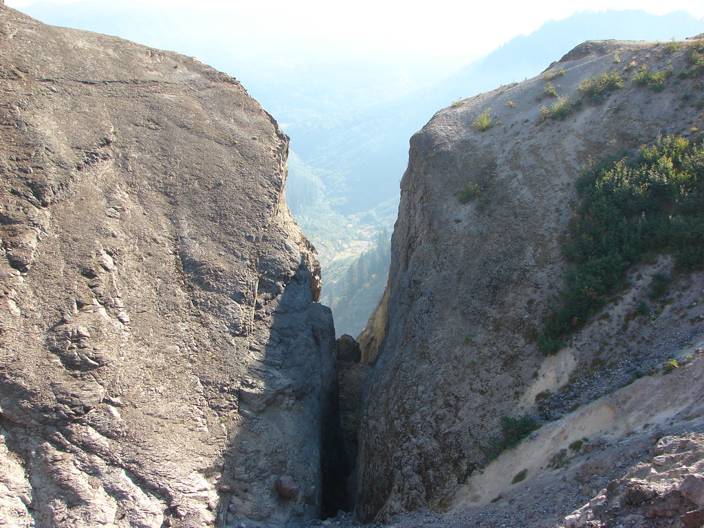
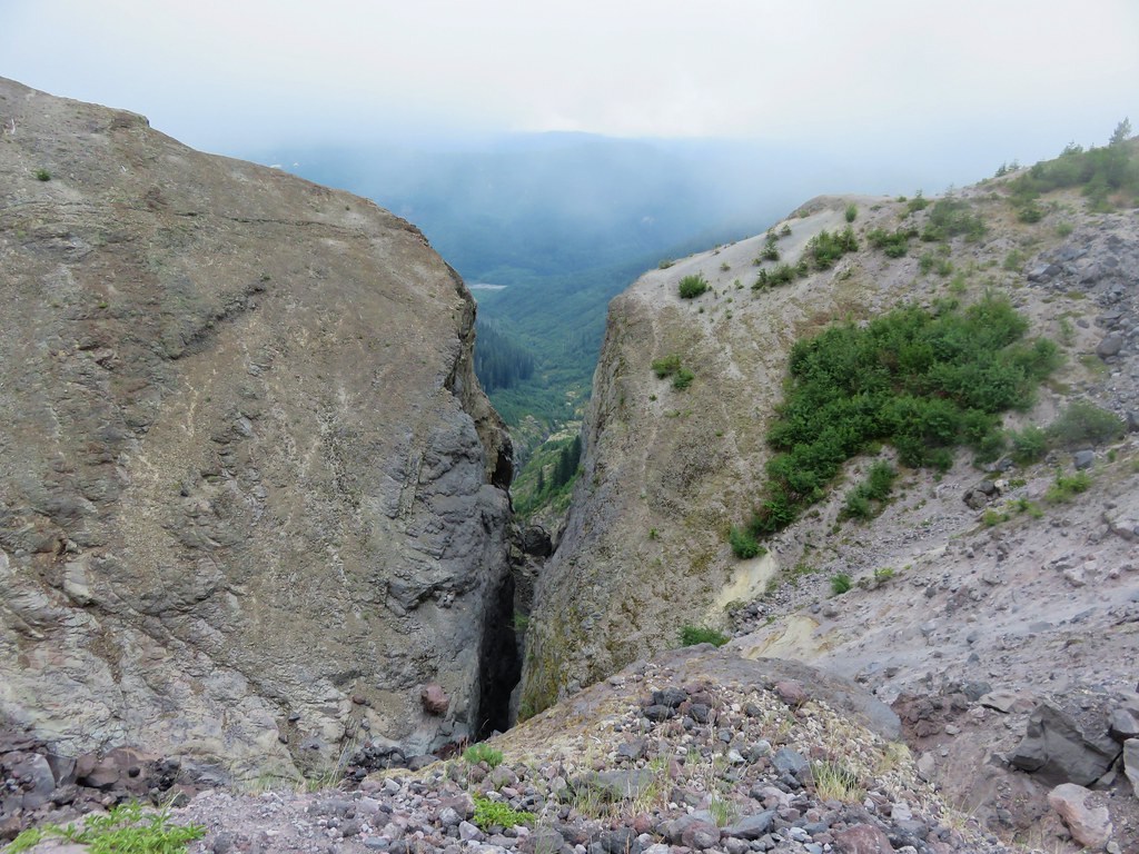
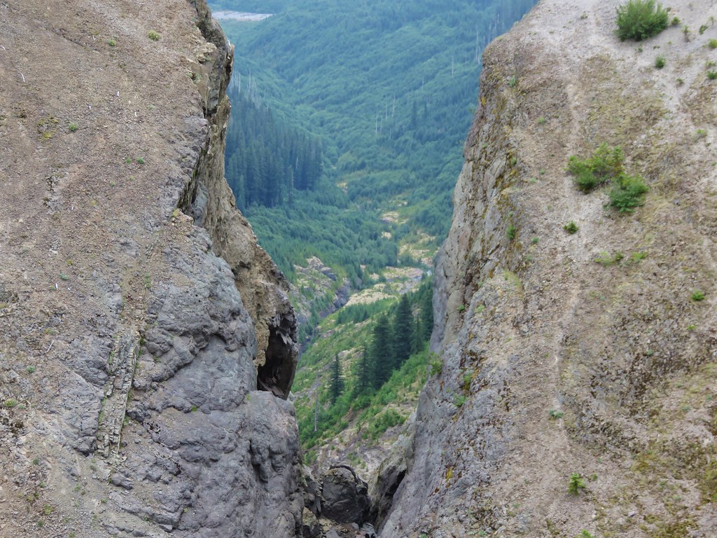
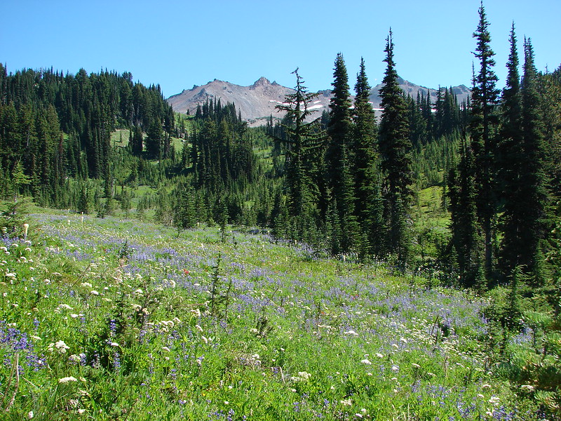
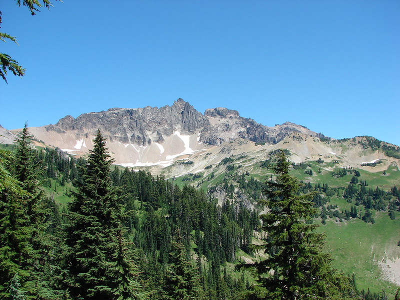
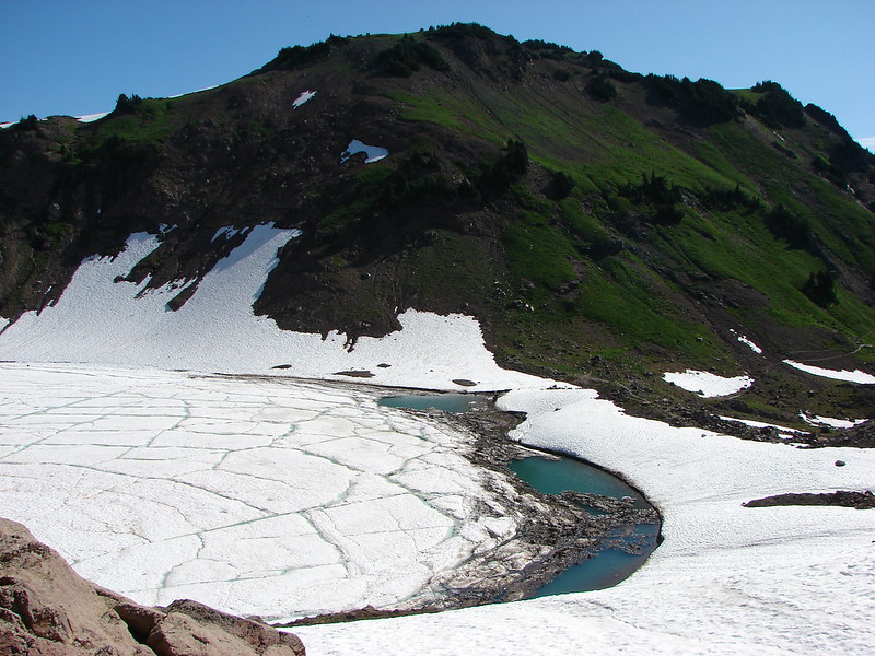
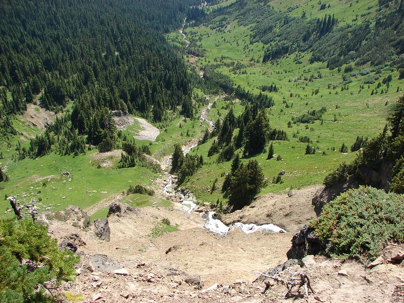
The Cispus River begins at the top of the basin underneath more jagged peaks of the Goat Rocks.

DSC02728

DSC02750

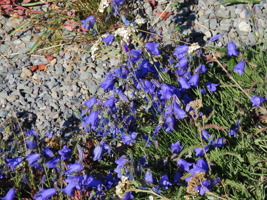
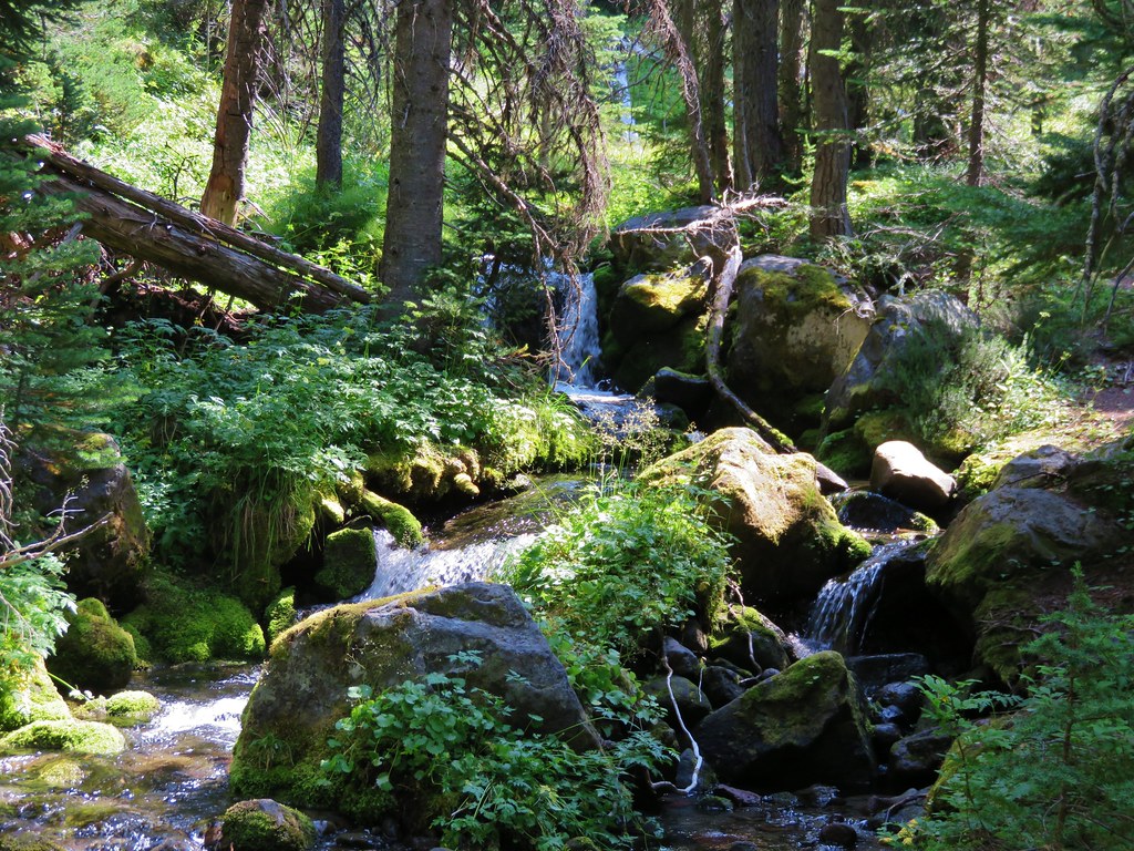
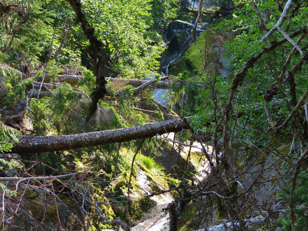
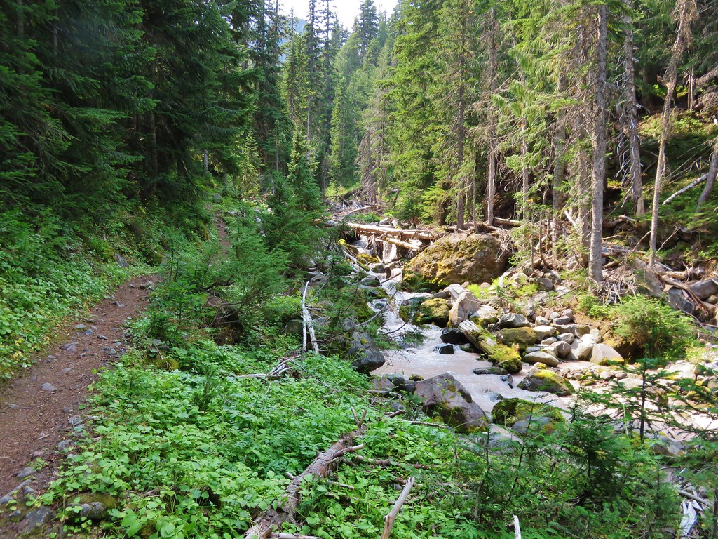
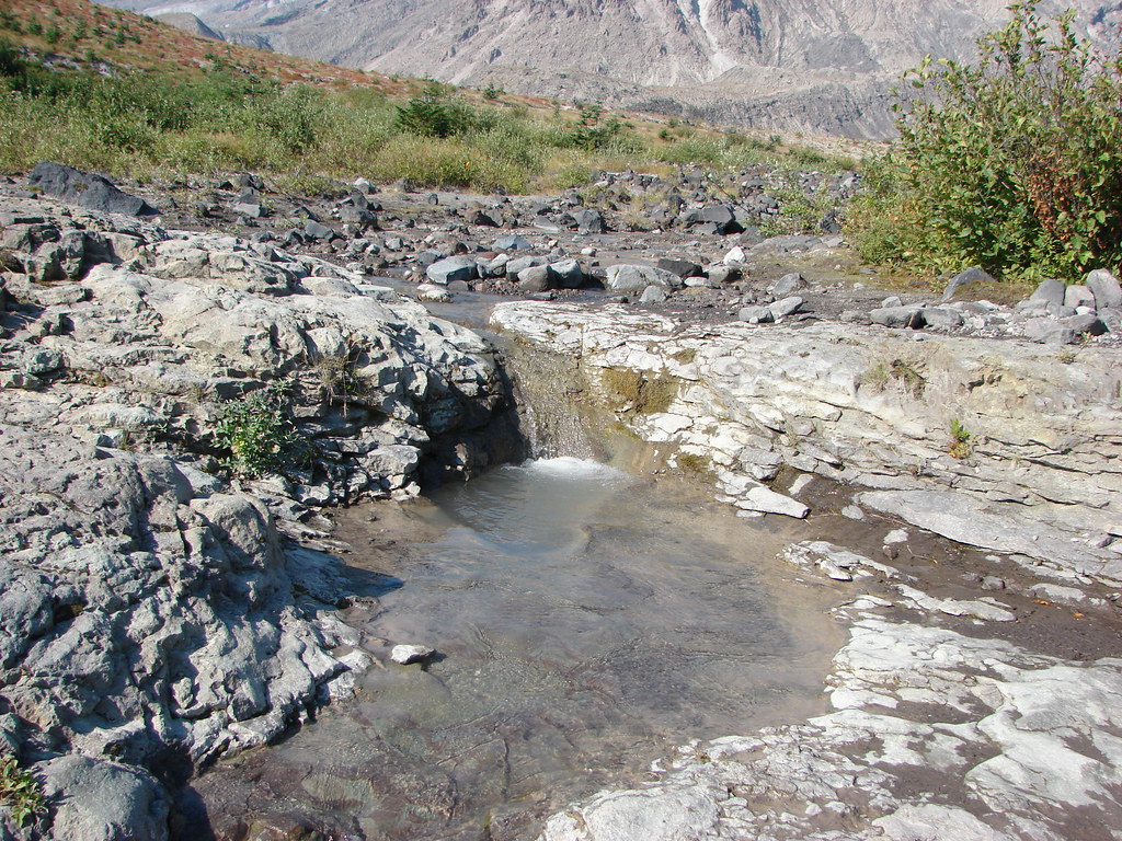
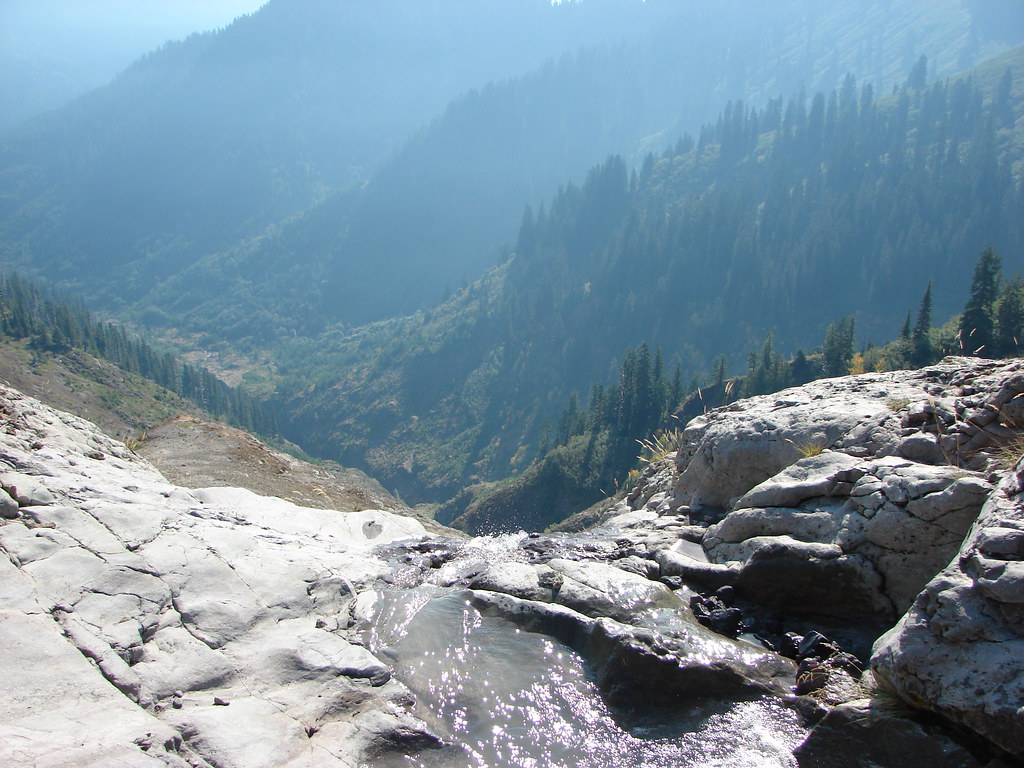
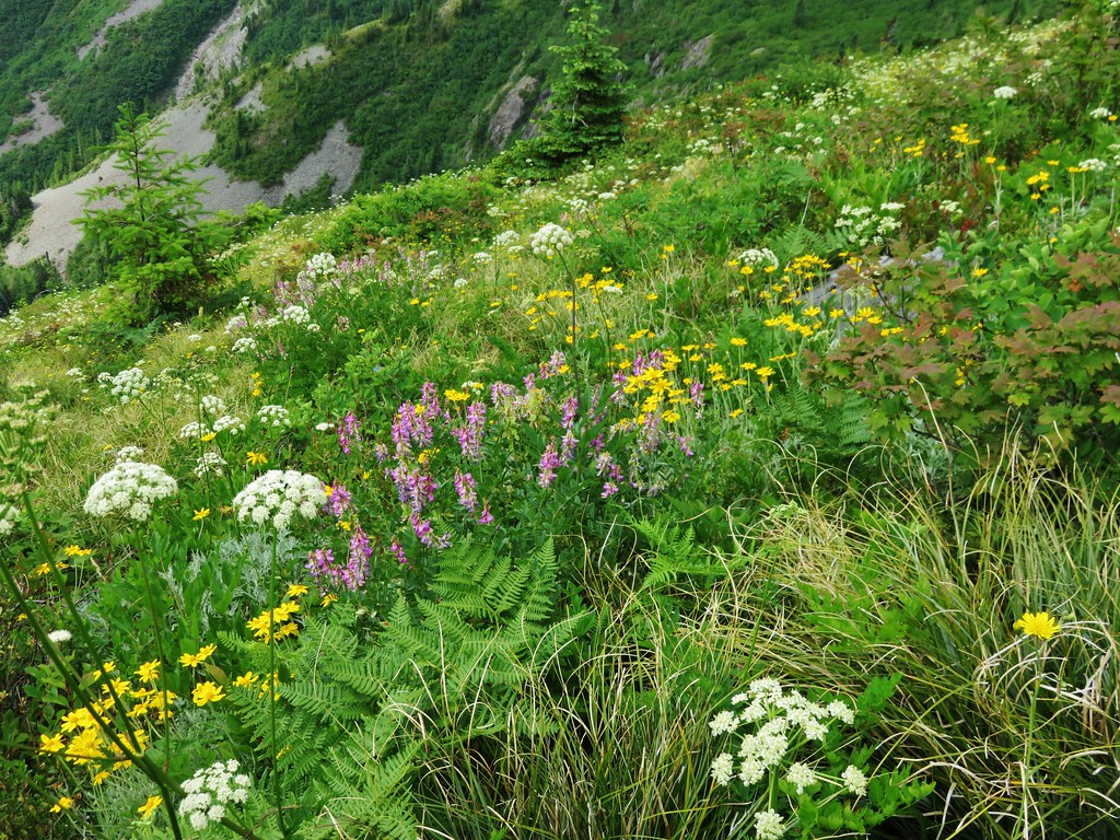
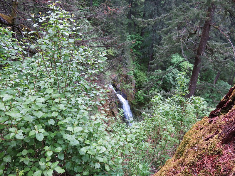
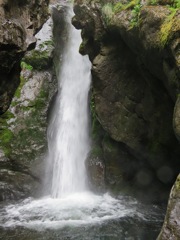
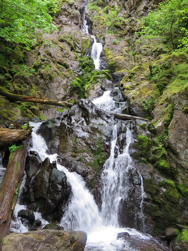
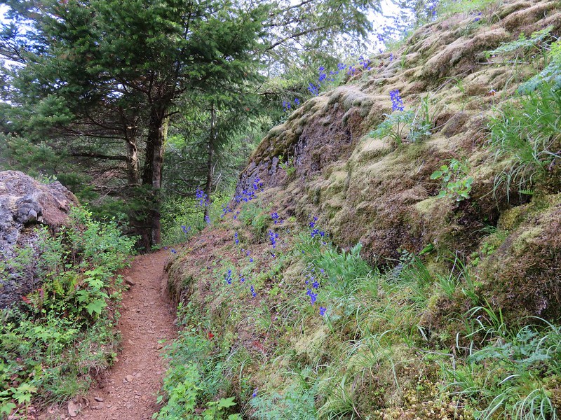
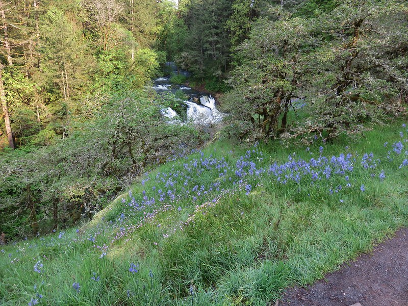
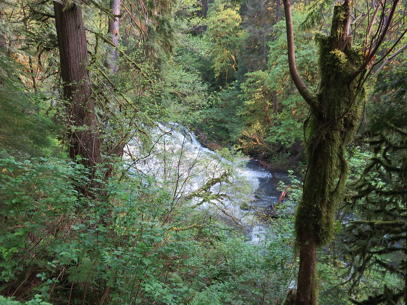
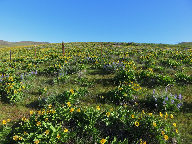
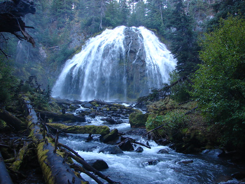
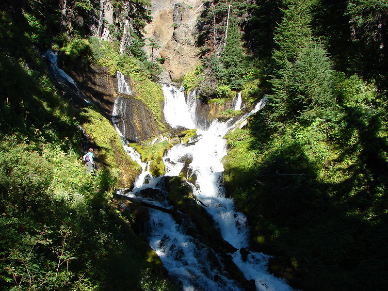
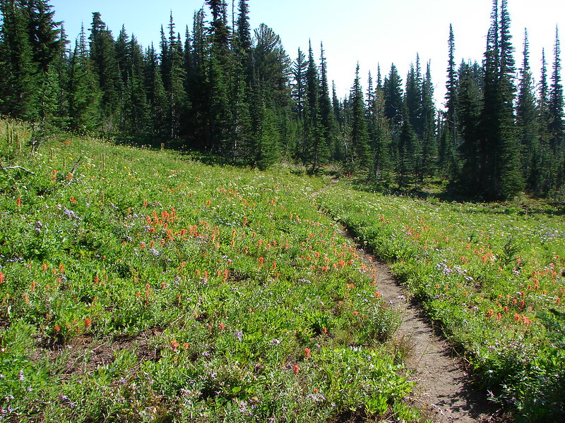
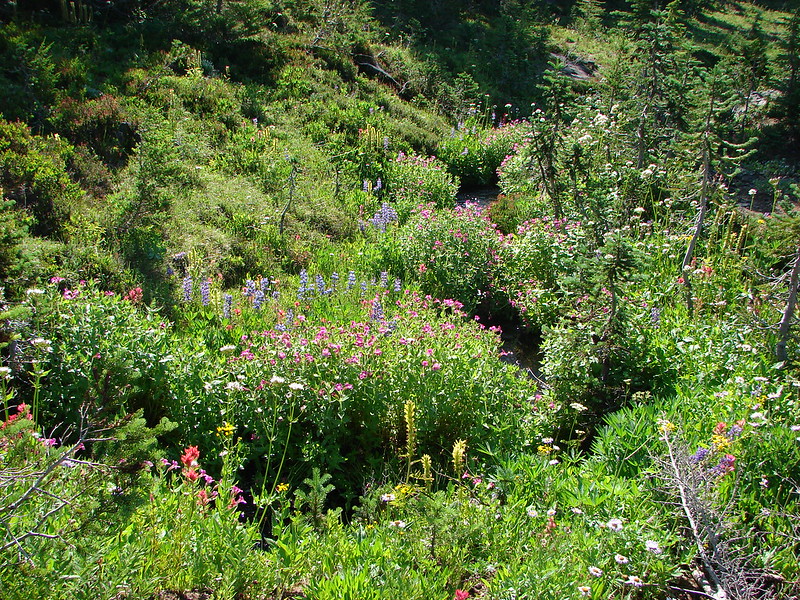
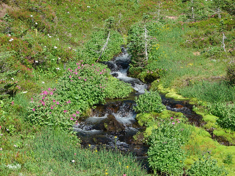
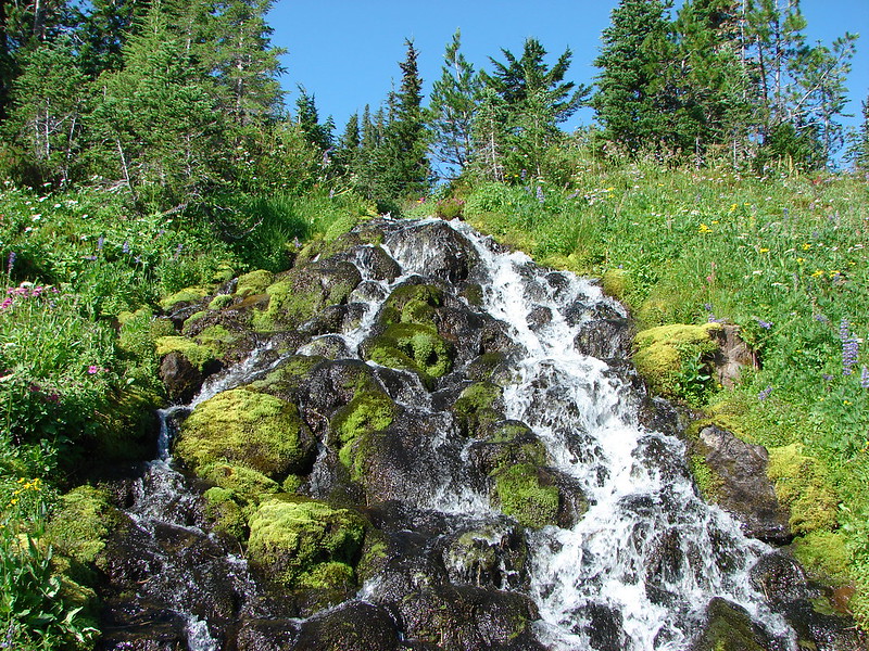
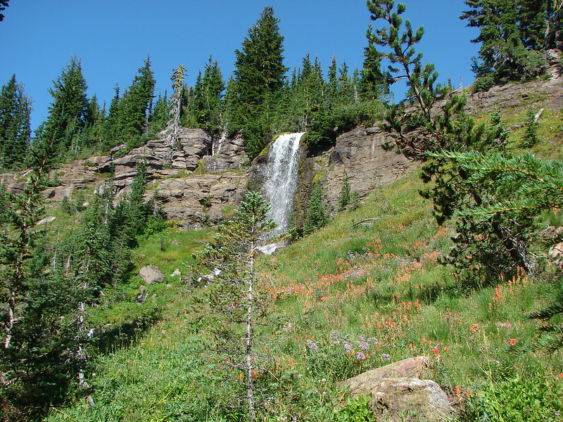
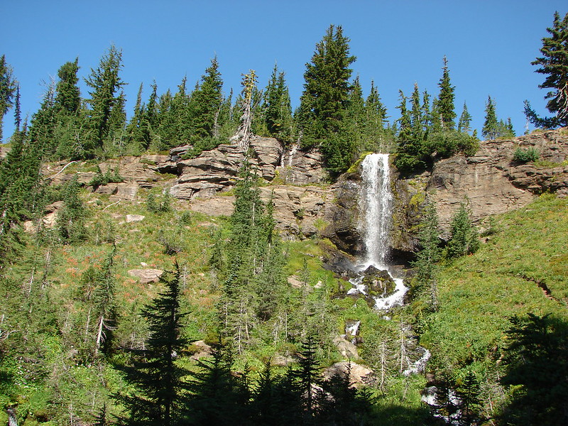
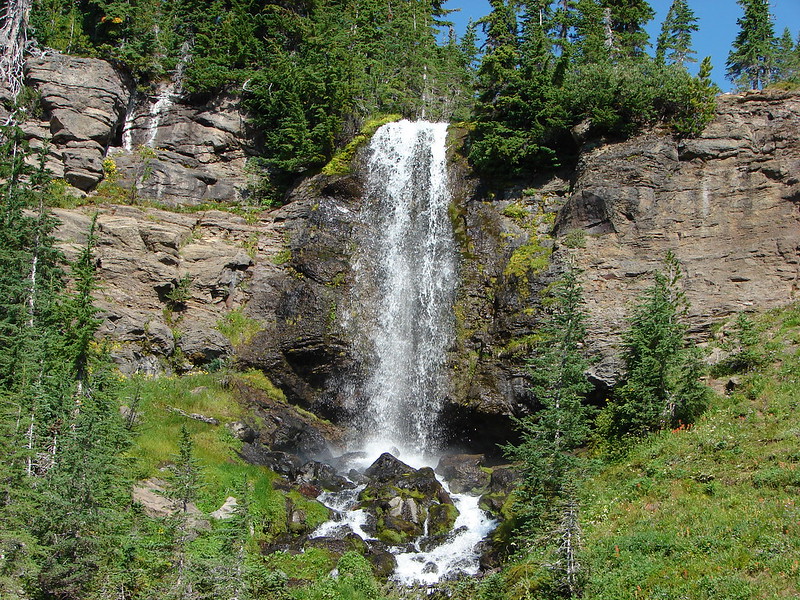
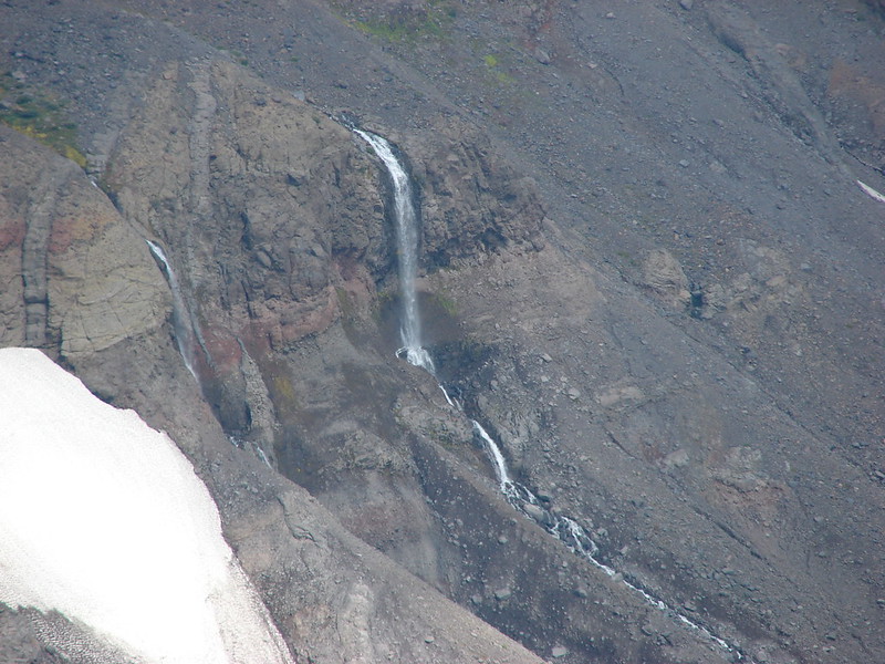
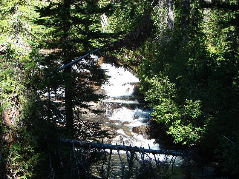
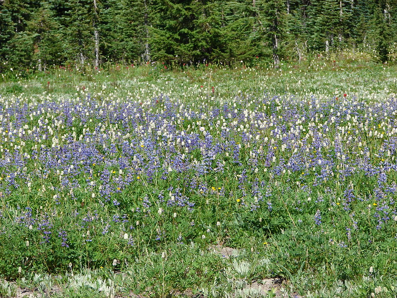
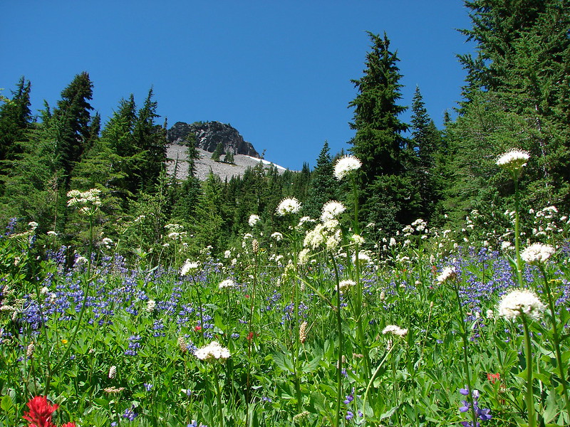
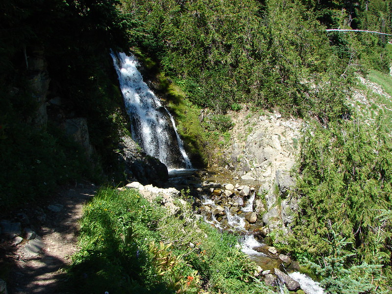
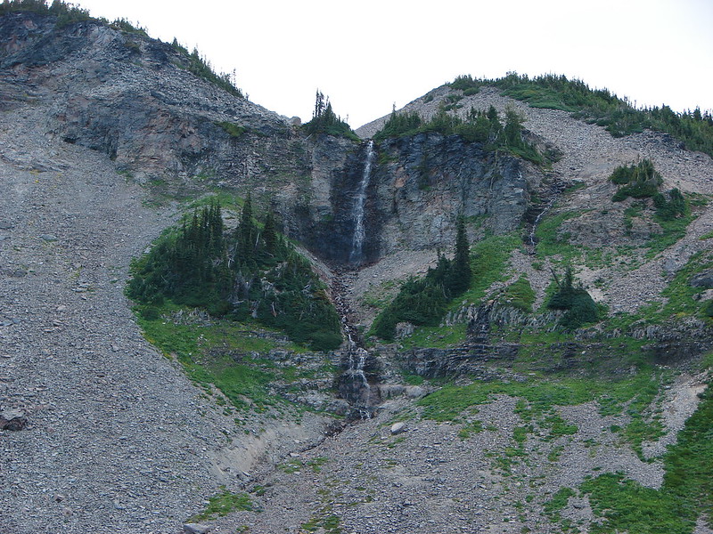
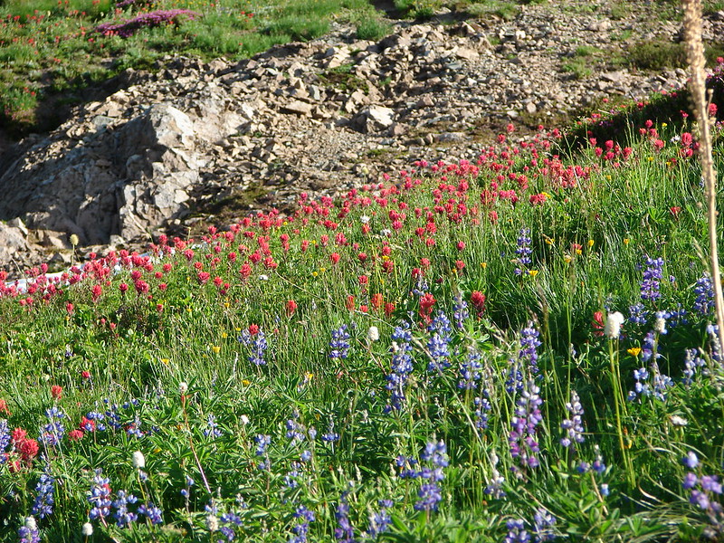
There had been wildflowers all along the trail but as we entered the basin they increased. Adding to the scenery was a waterfall that the PCT passed below.

DSC02740

DSC02757

DSC02786

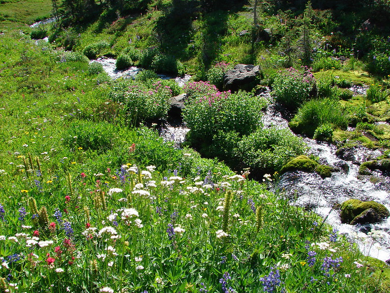
The trail continued around the basin crossing the Cispus River and then heading up the eastern side of the basin.

DSC02789

DSC02804

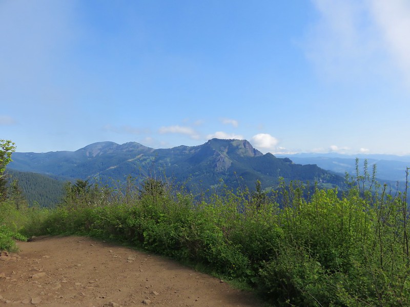
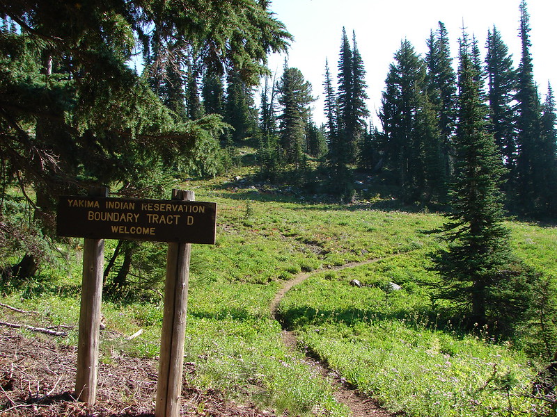
At the top of the ridge was Cispus Pass and the border of the Yakima Indian Reservation. The Klickitat River flowed below and Mt. Adams was again visible to the SE.

DSC02825

DSC02828

DSC02835

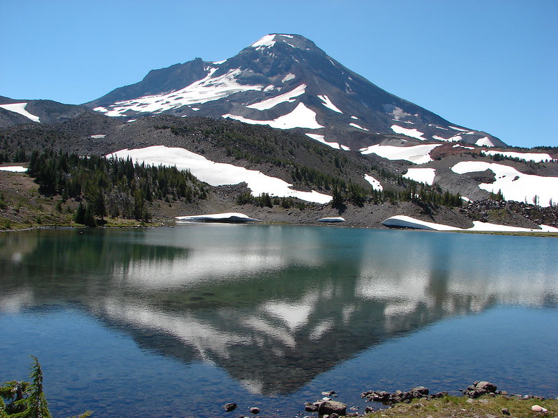
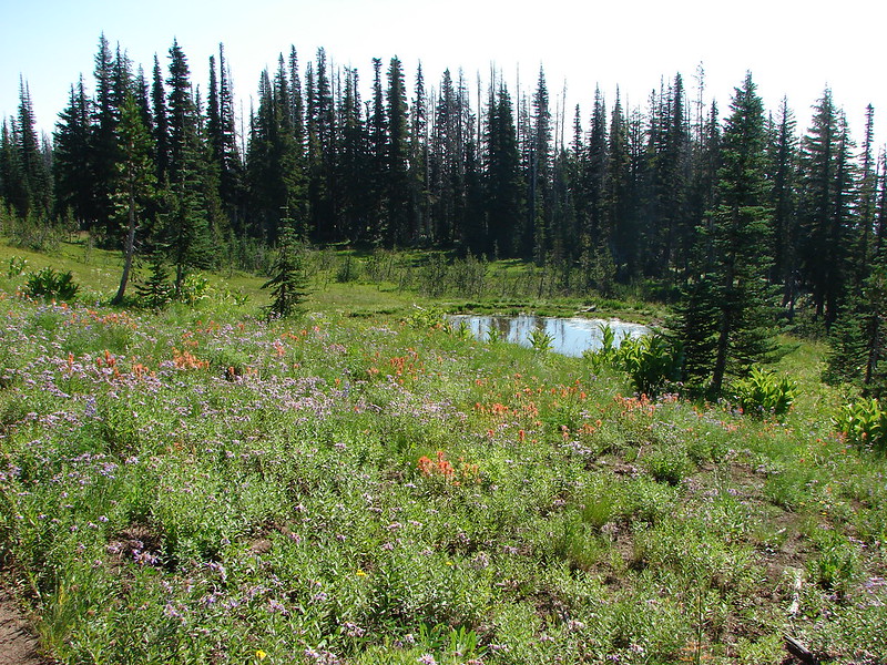
We returned to Alpine via the Bypass Trail 97 and took a short rest before heading back out to catch the sunset. We decided to try heading further out on the Lily Basin Trail since the Sun would be setting over the ridges in that direction. We passed a small pond with a big reflection before finding an unoccupied camp site where we settled in.

DSC02935

DSC02968

DSC02964

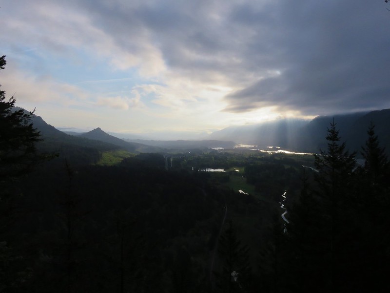
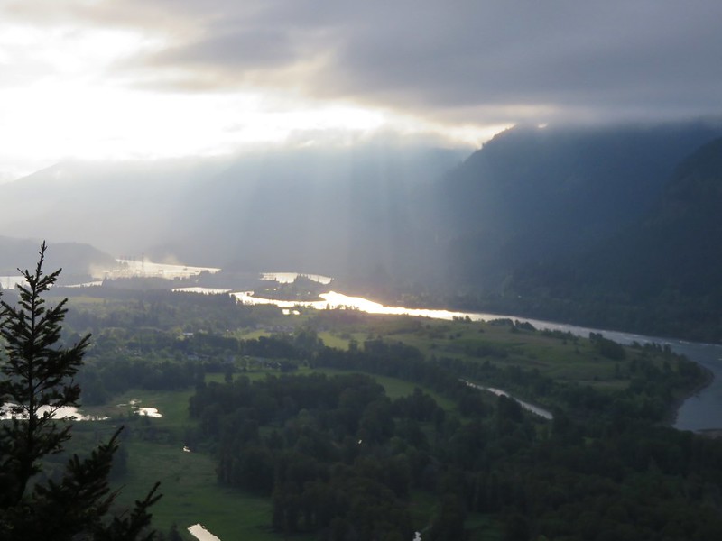
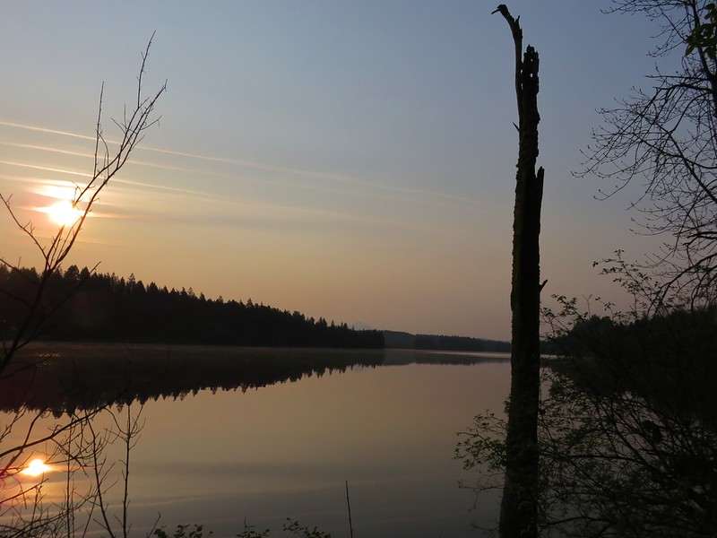
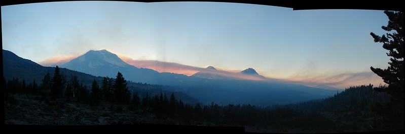
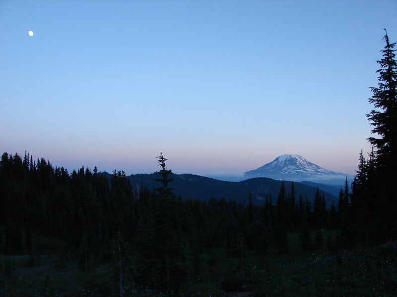
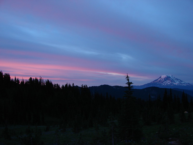
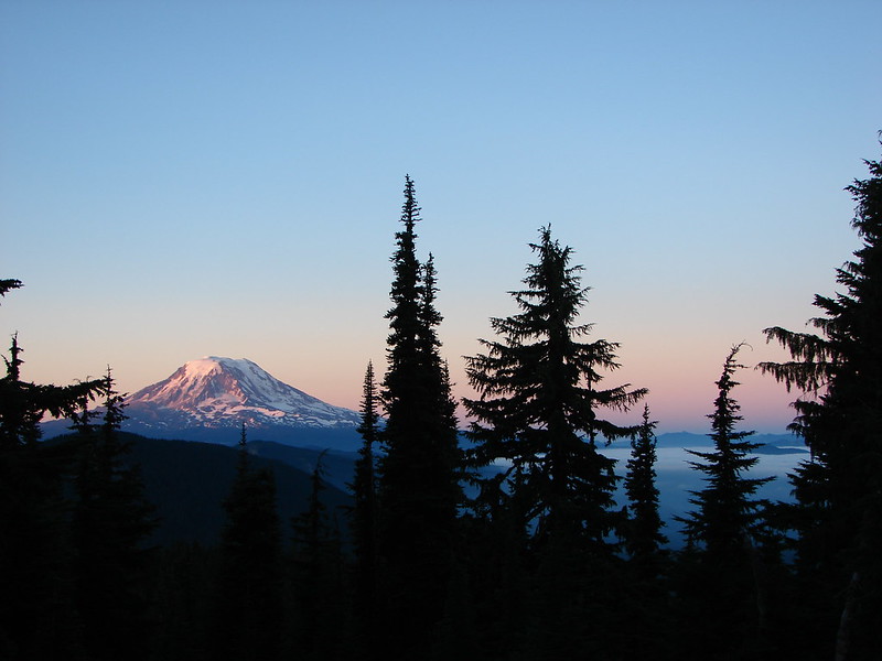
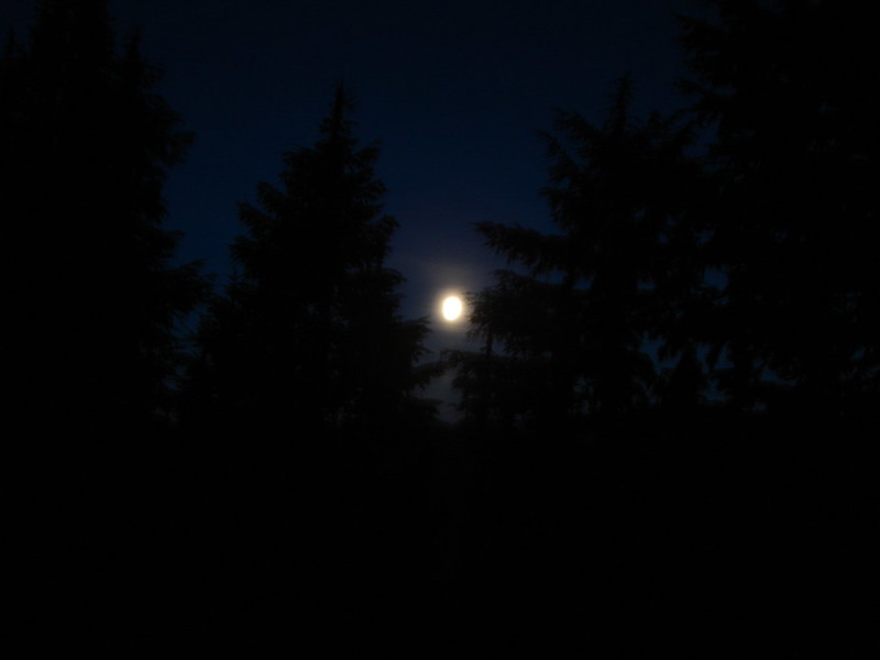
Clouds started to move in and cover some of the higher points though so we headed back toward Alpine to check on Mt. Adams. The Moon had risen over the ridges to the North of Mt. Adams making for a perfect ending to our first day.

DSC03004

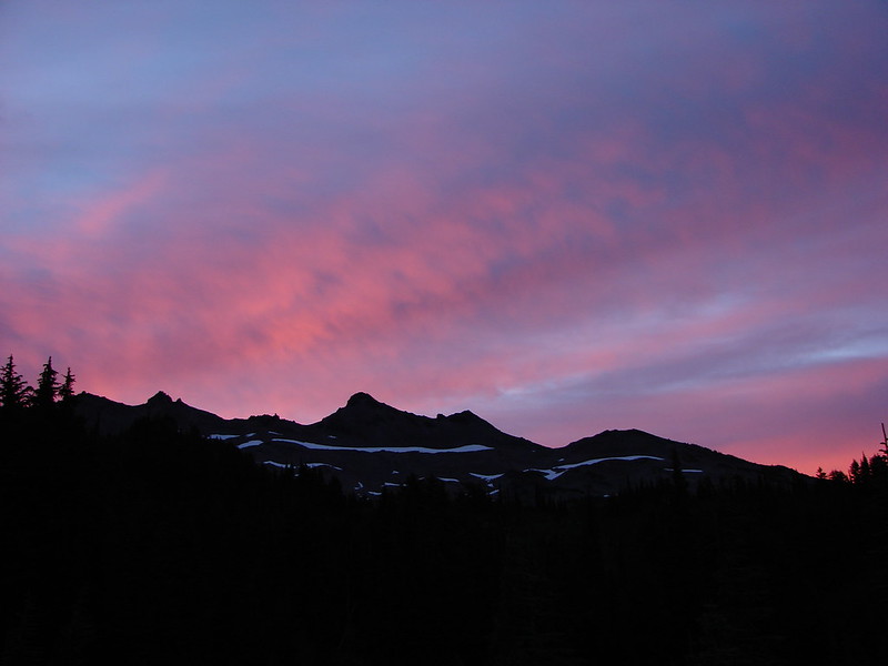
I was up early on day 2 and was able to catch the sunrise which lit up the clouds over Ives Peak and Mt. Adams.

DSC03037

DSC03029

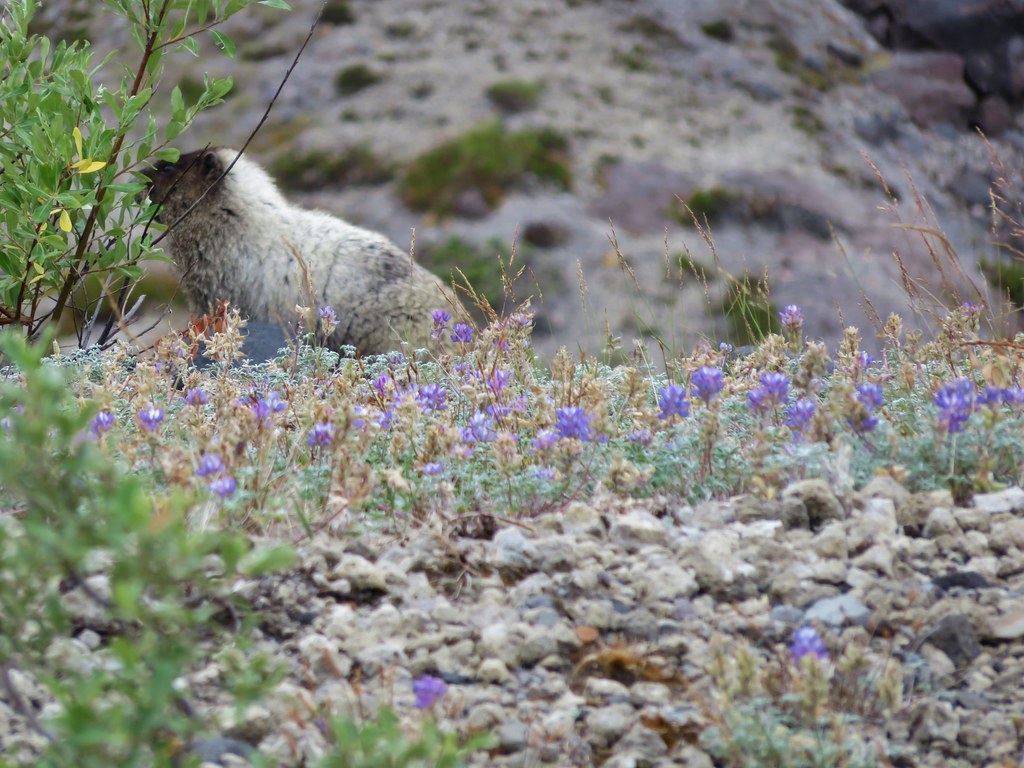
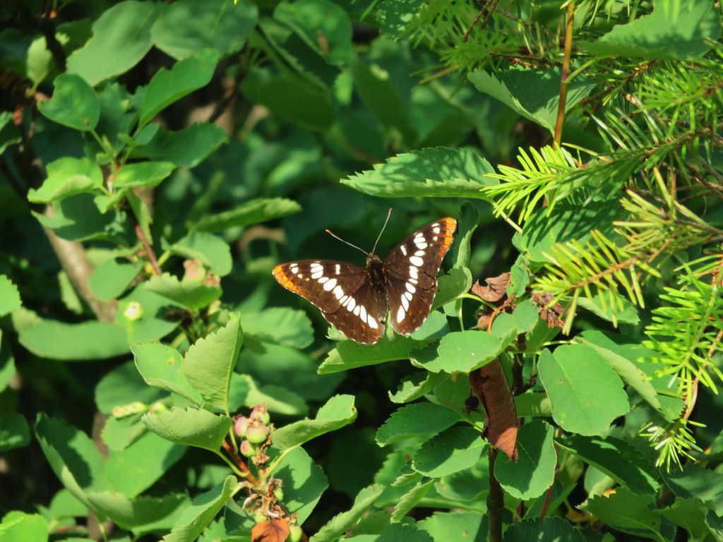
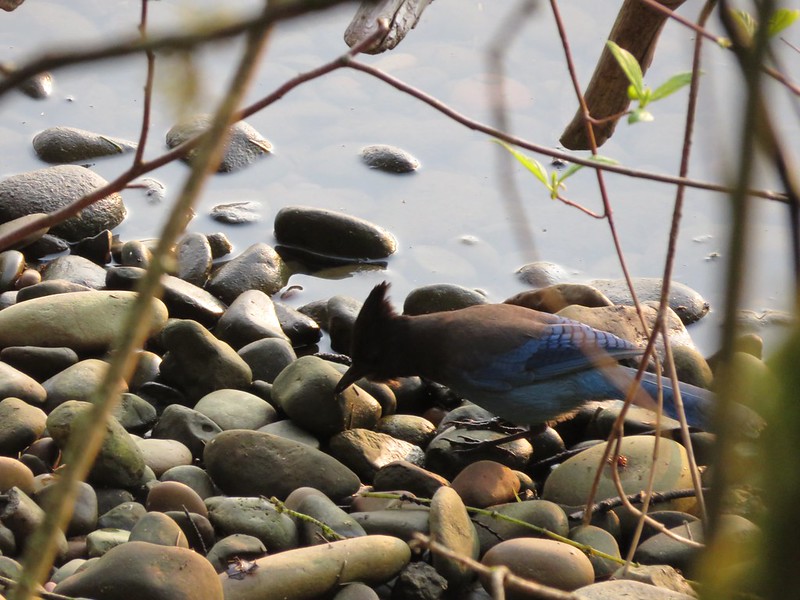
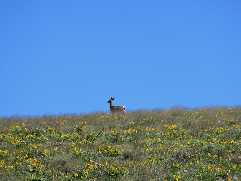
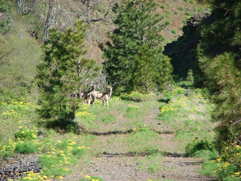
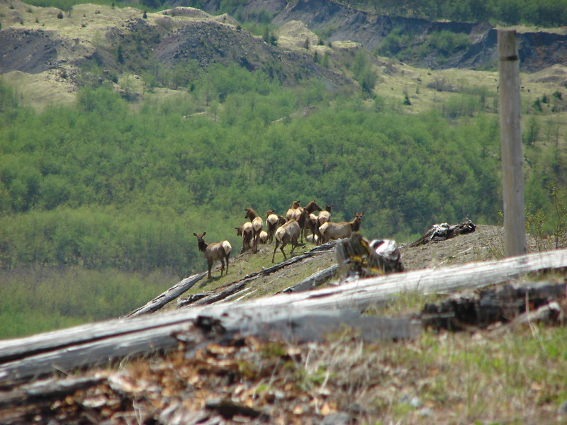
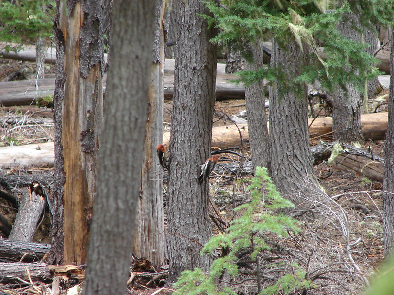
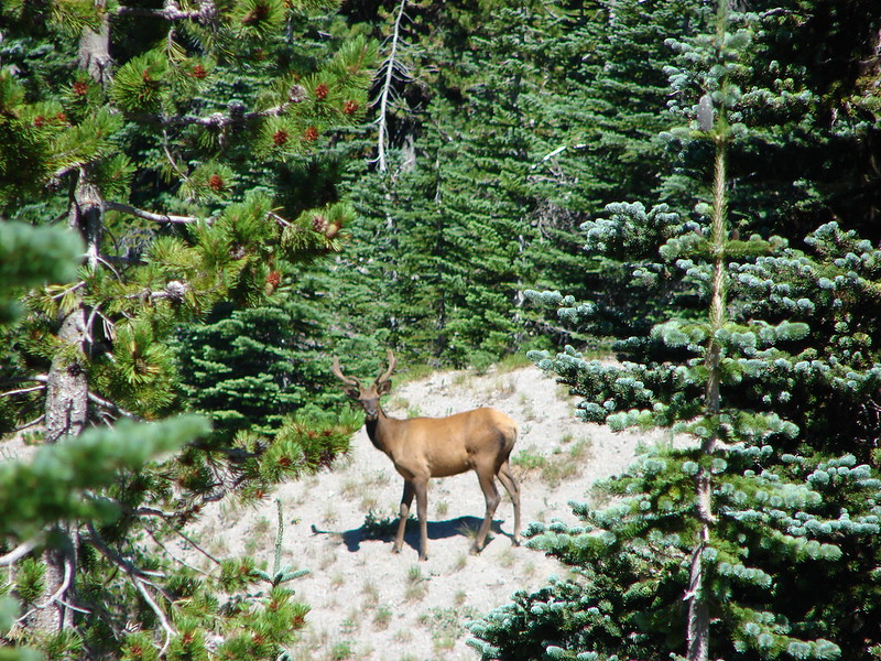
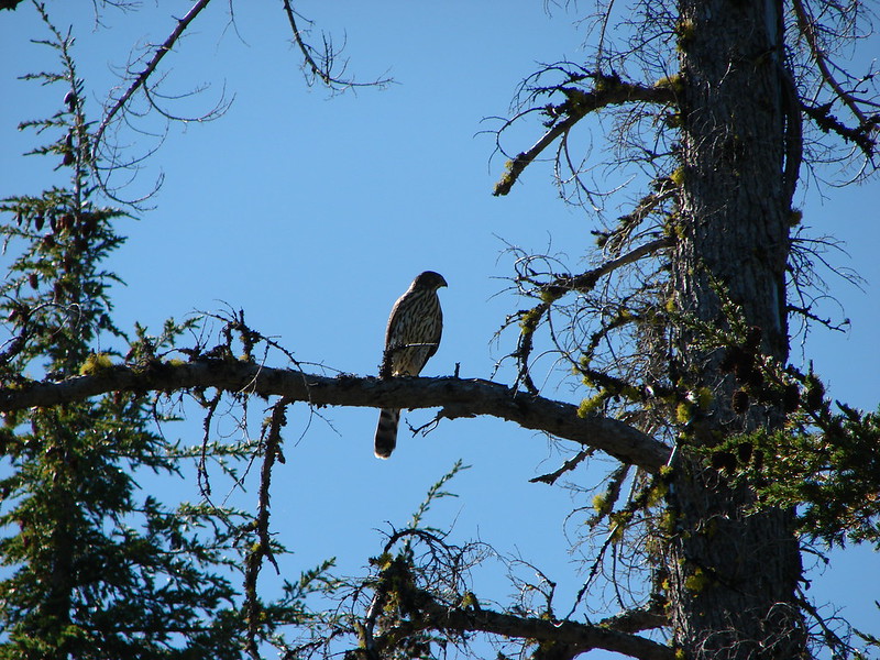
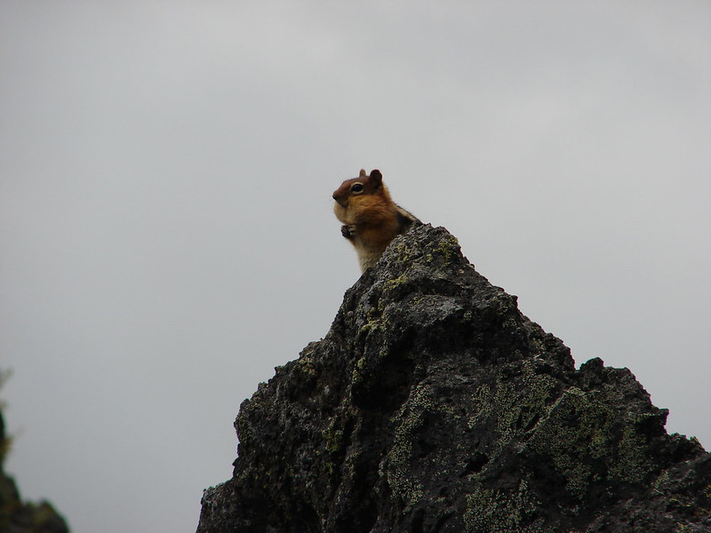
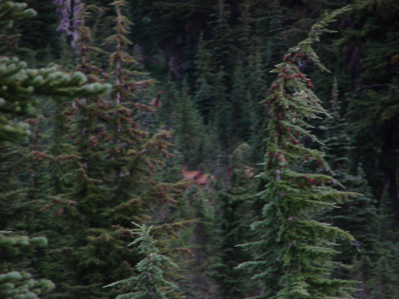
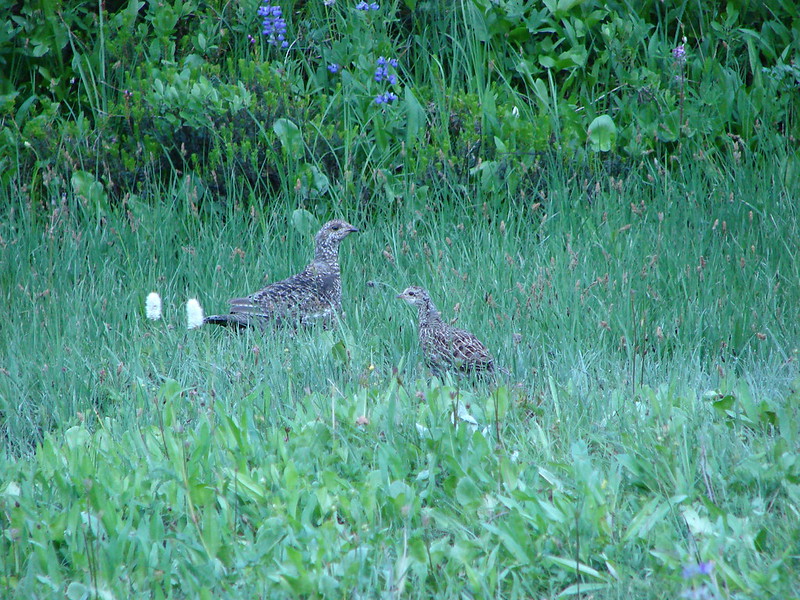
Several elk were passing through the trees on the far side of Alpine but the low amount of light left me with a single picture worthy of a bigfoot sighting. 🙂

DSC03068

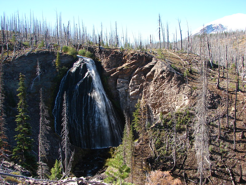
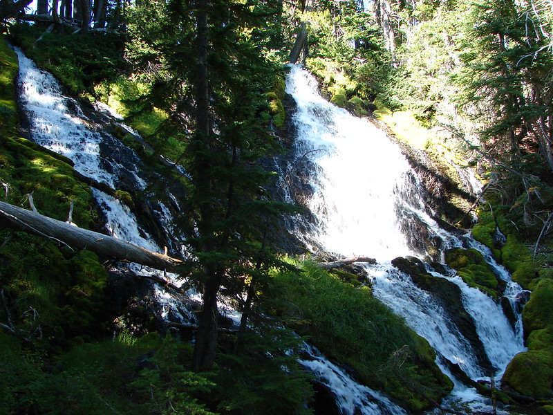
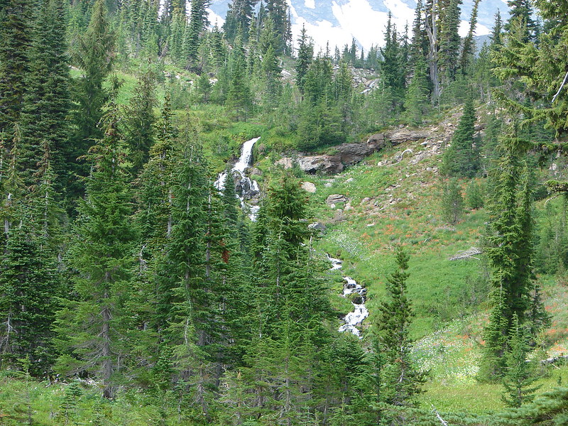
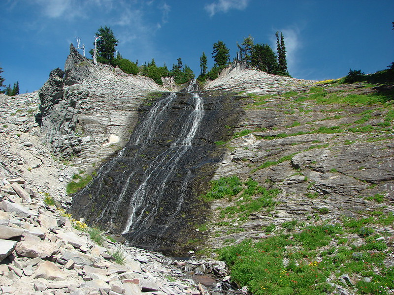
We set off early on the Lily Basin Trail planning on passing Goat Lake then continuing on the trail to Heart Lake with a possible side trip up Hawkeye Point. As we headed in that direction the view of Hawkeye Point and Goat Creek falling from the rocky ledge below Goat Lake was another stunner.

DSC03075

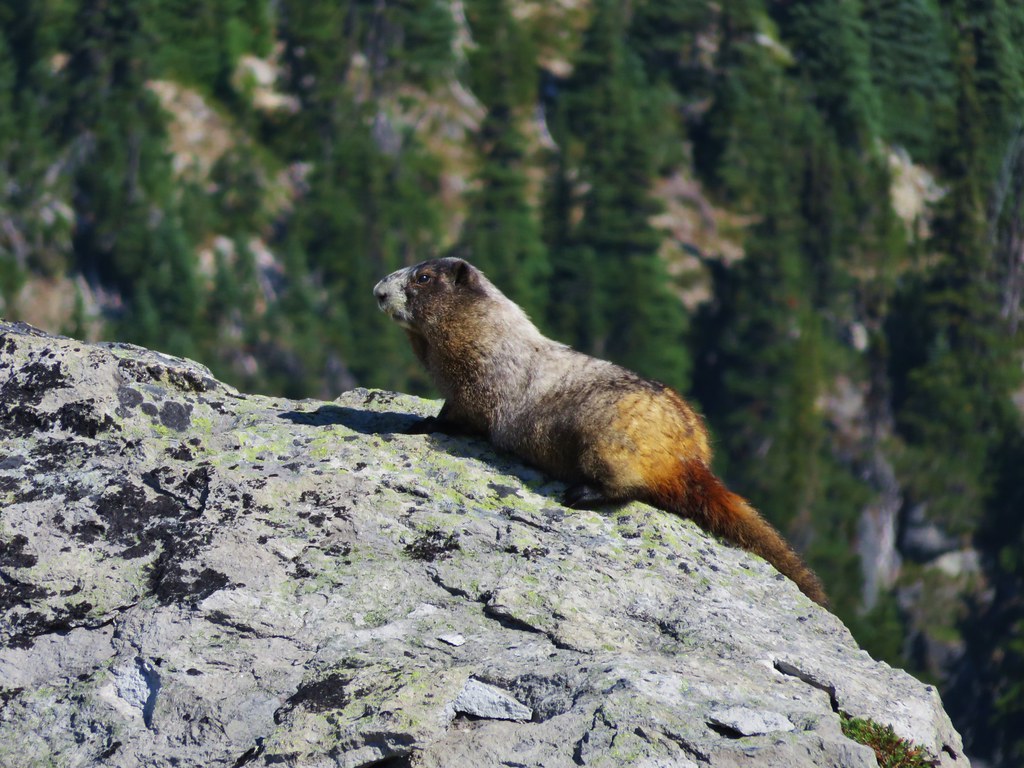
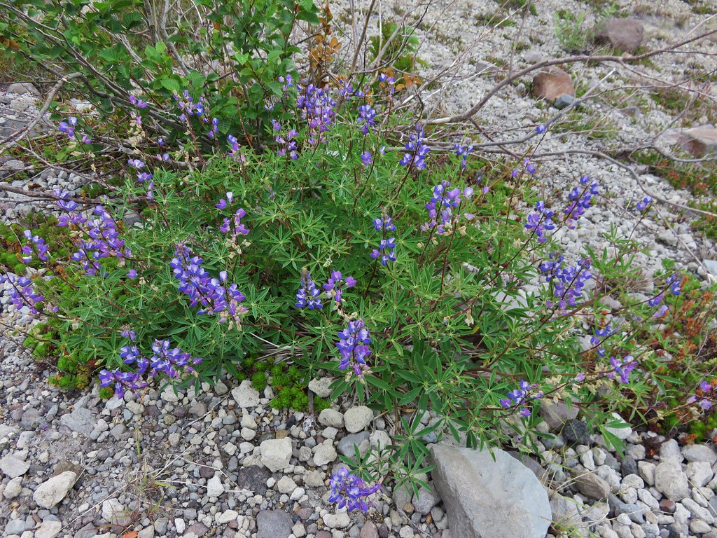
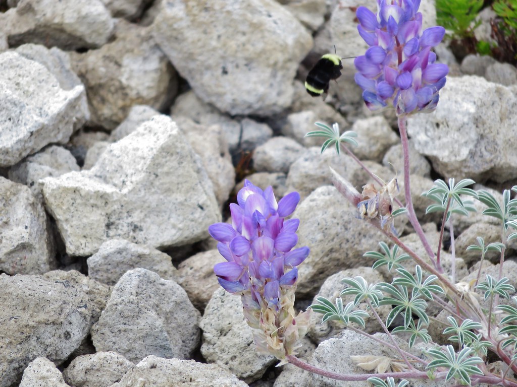
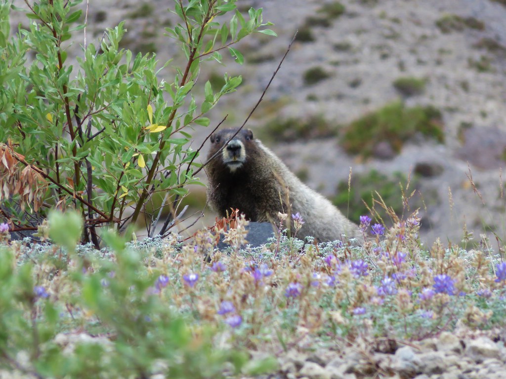
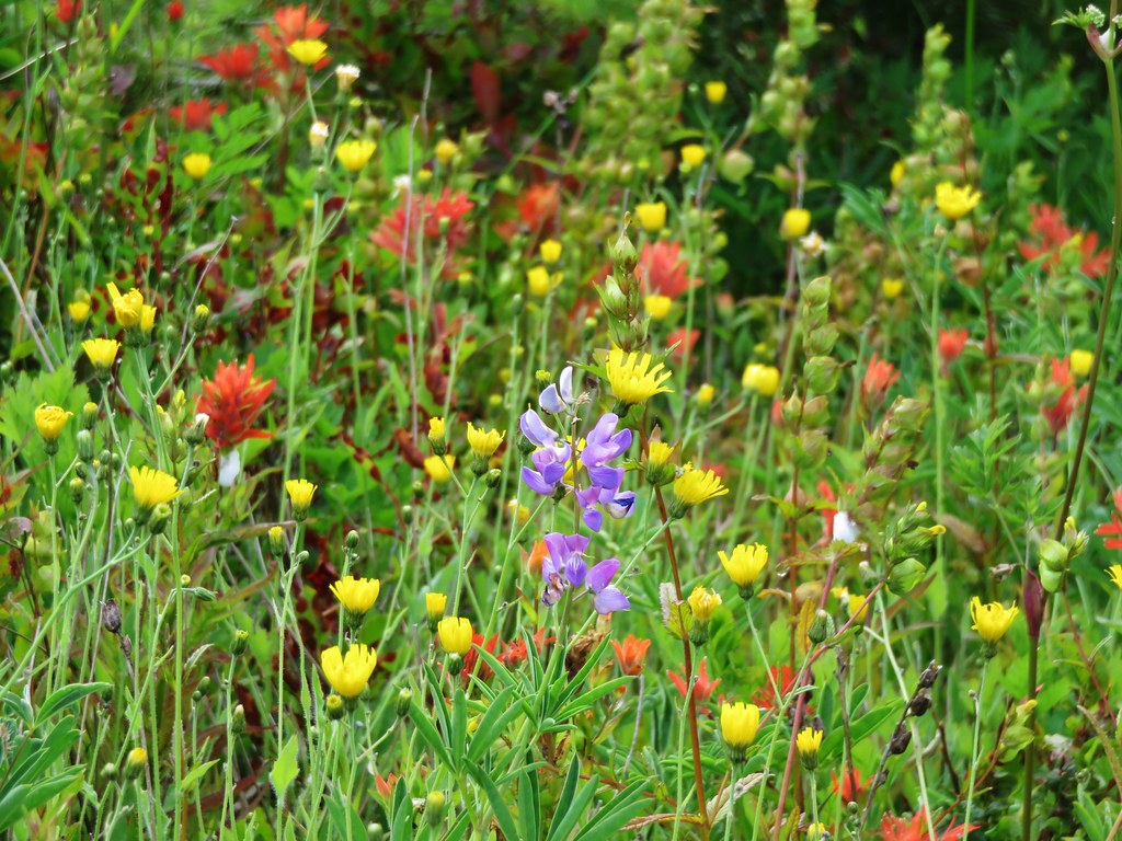
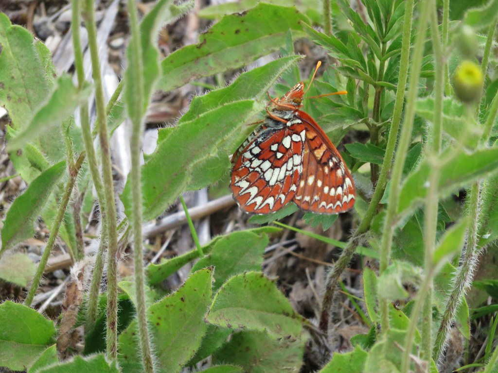
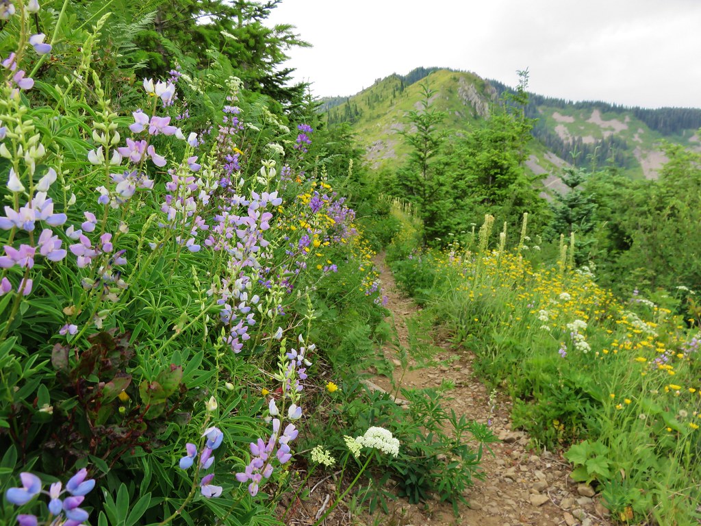
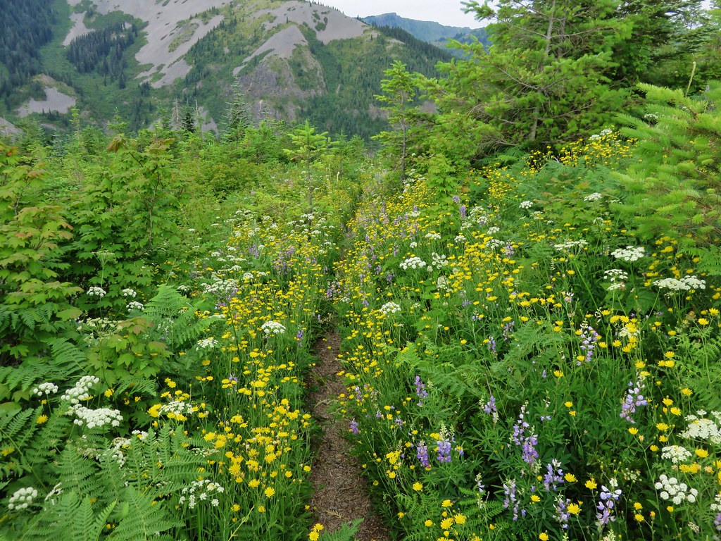
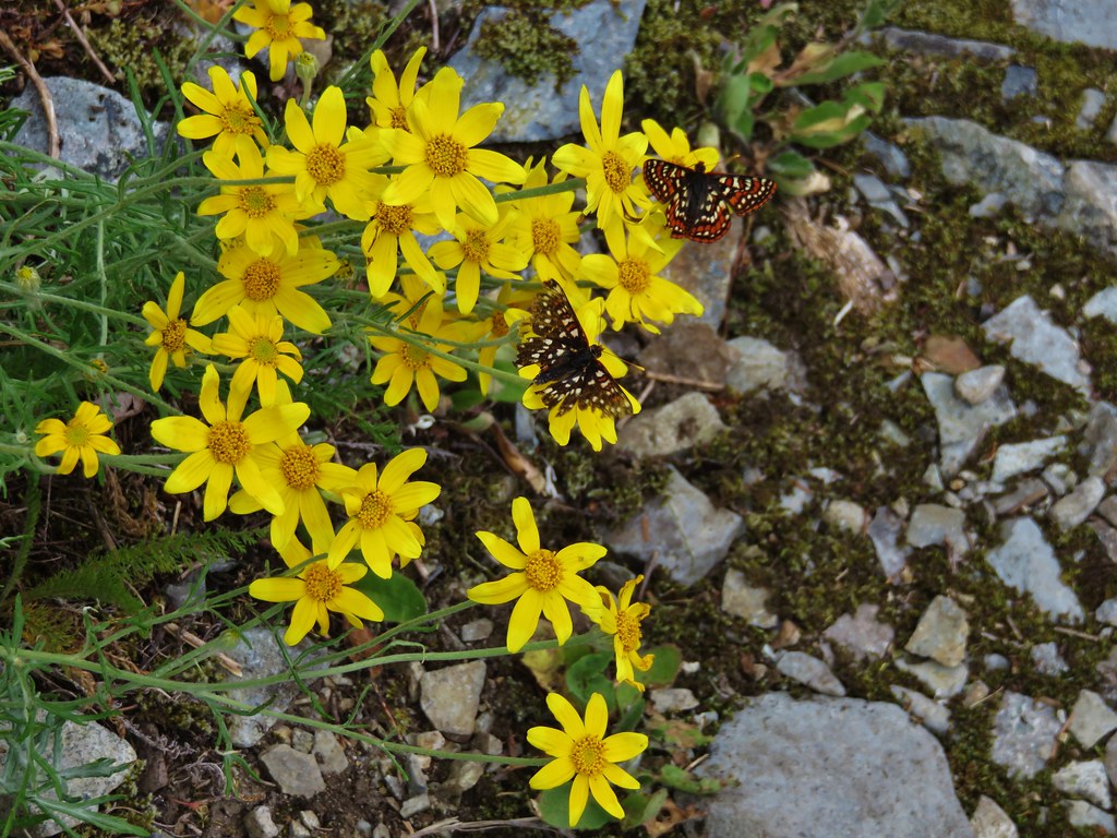
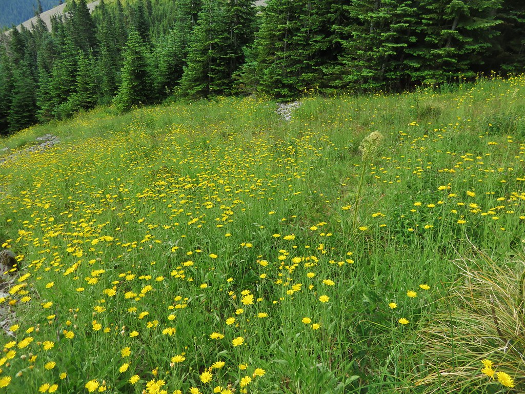
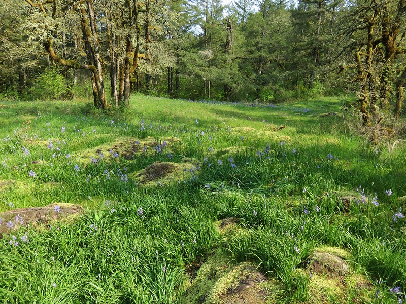
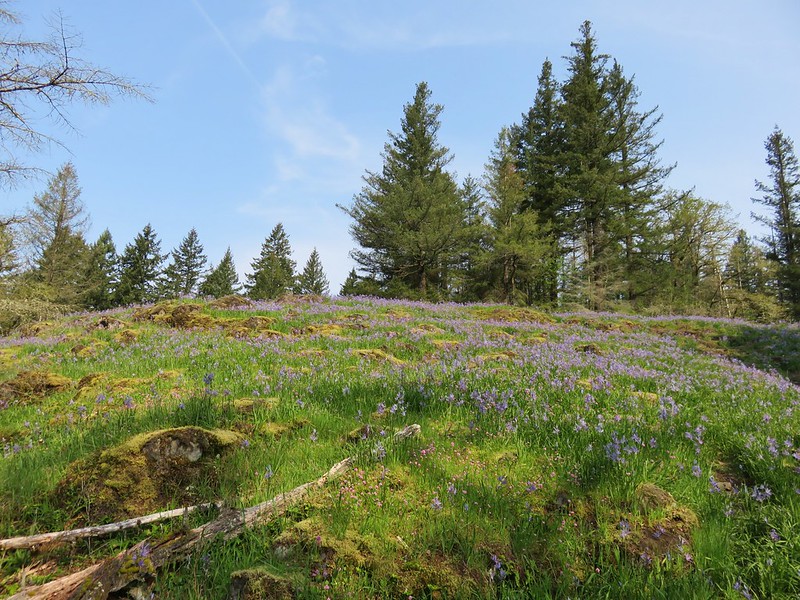
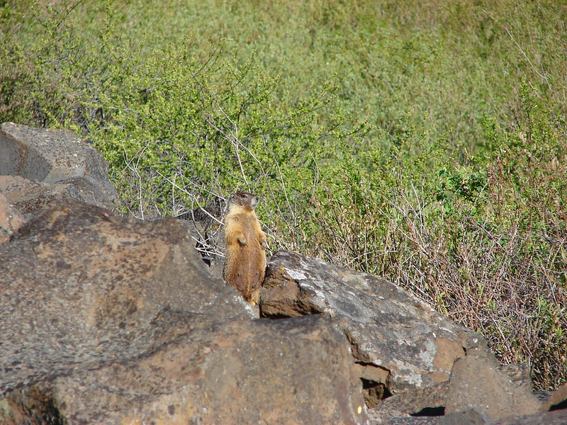
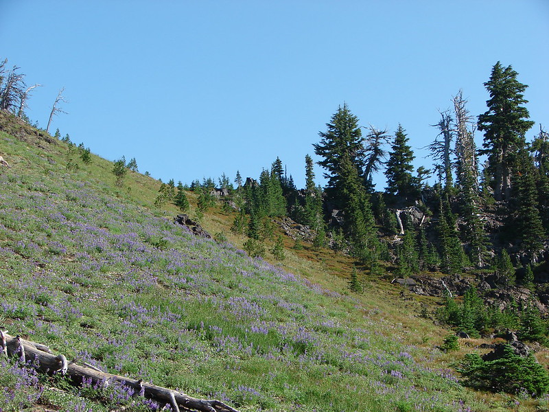
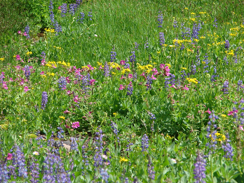
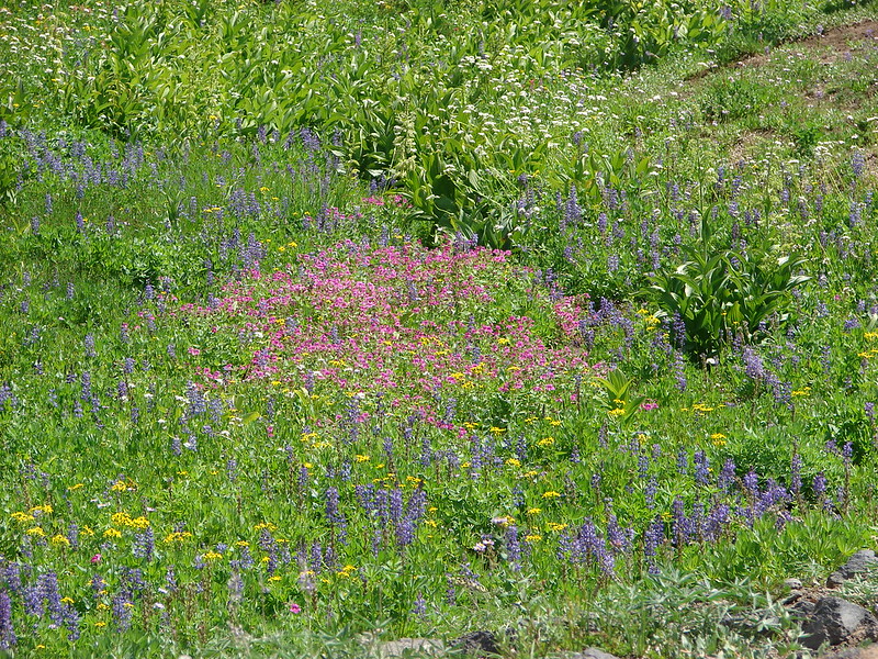
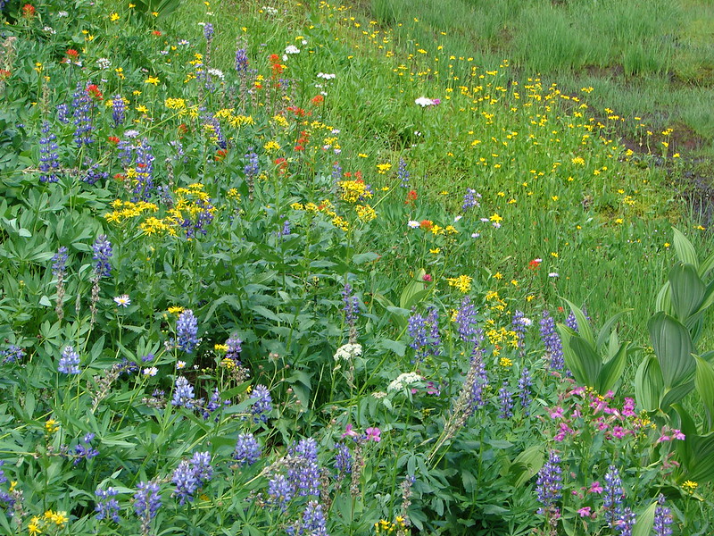
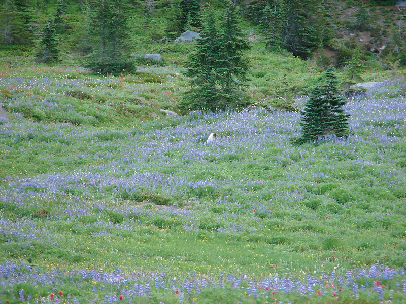
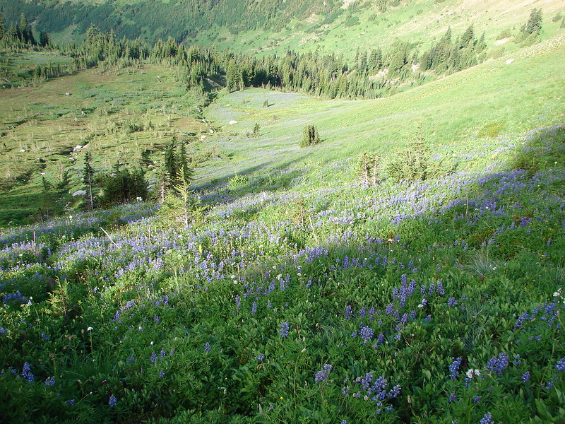
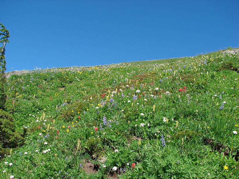
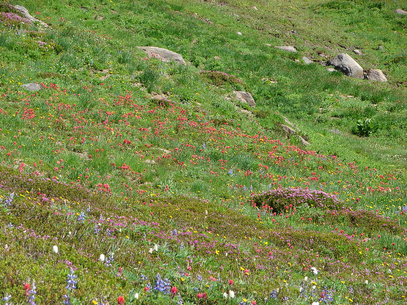
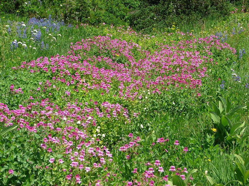
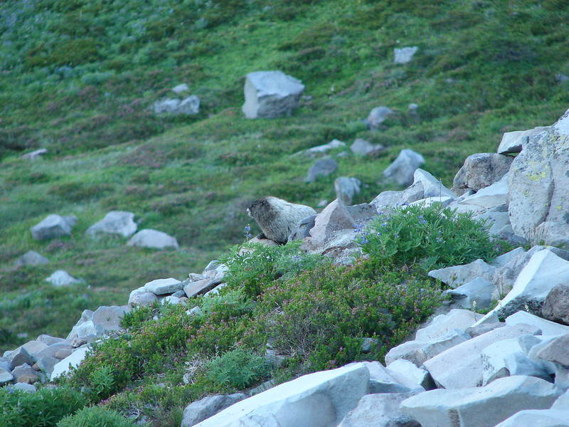
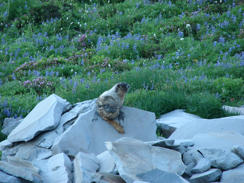
The trail passed through some large wildflower meadows where marmots could be seen scurrying about in the lupine.

DSC03080

DSC03085

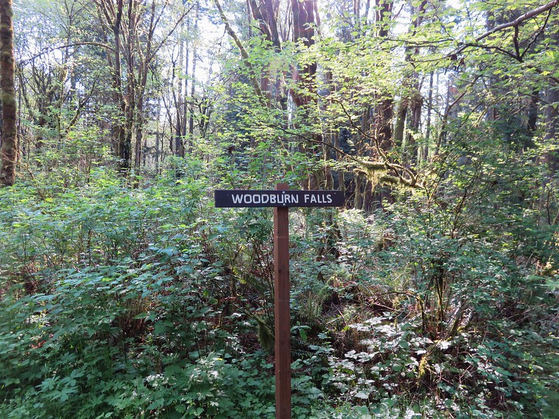
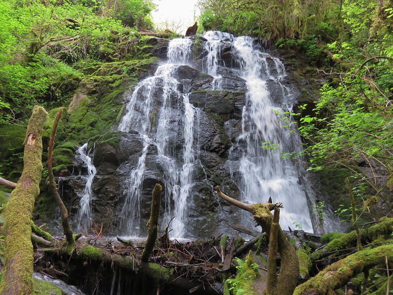
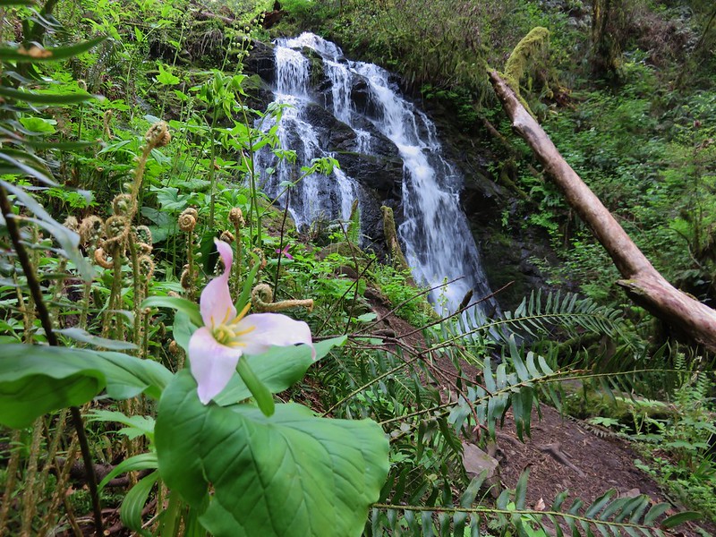
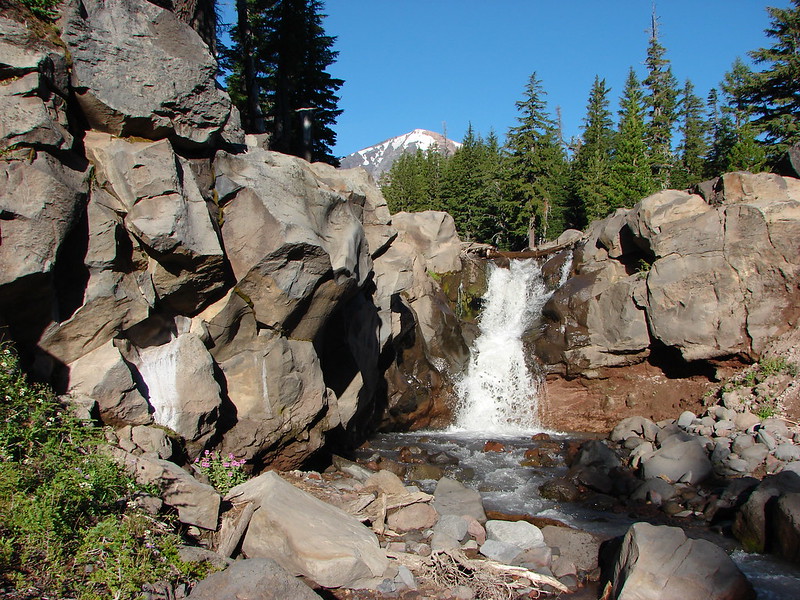
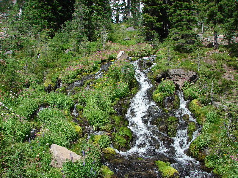
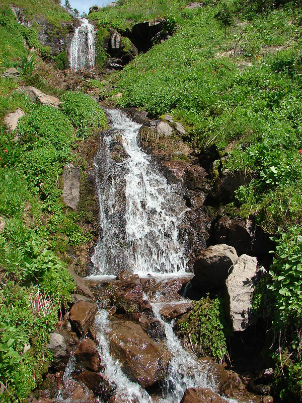
We also passed several waterfalls. The first just disappeared into a rock slide while the second slid down the rocks.

DSC03090

DSC03514

DSC03490

DSC03493

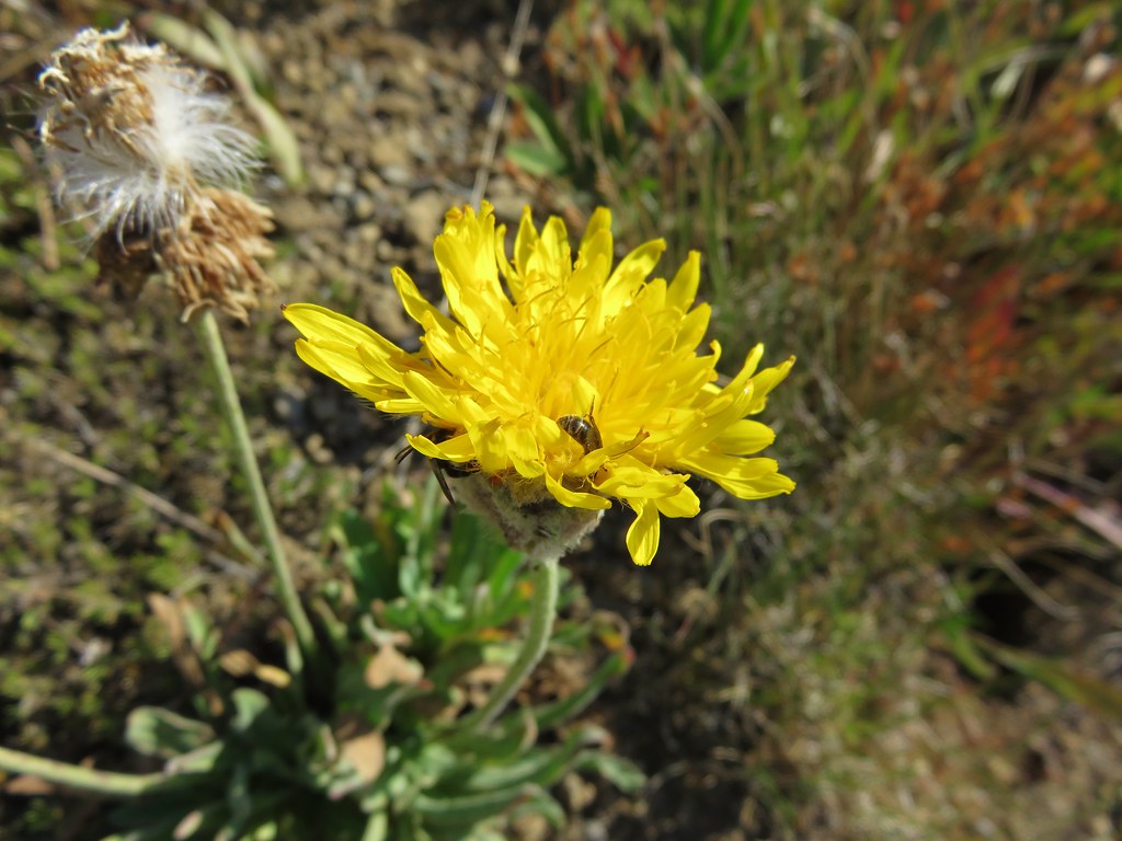
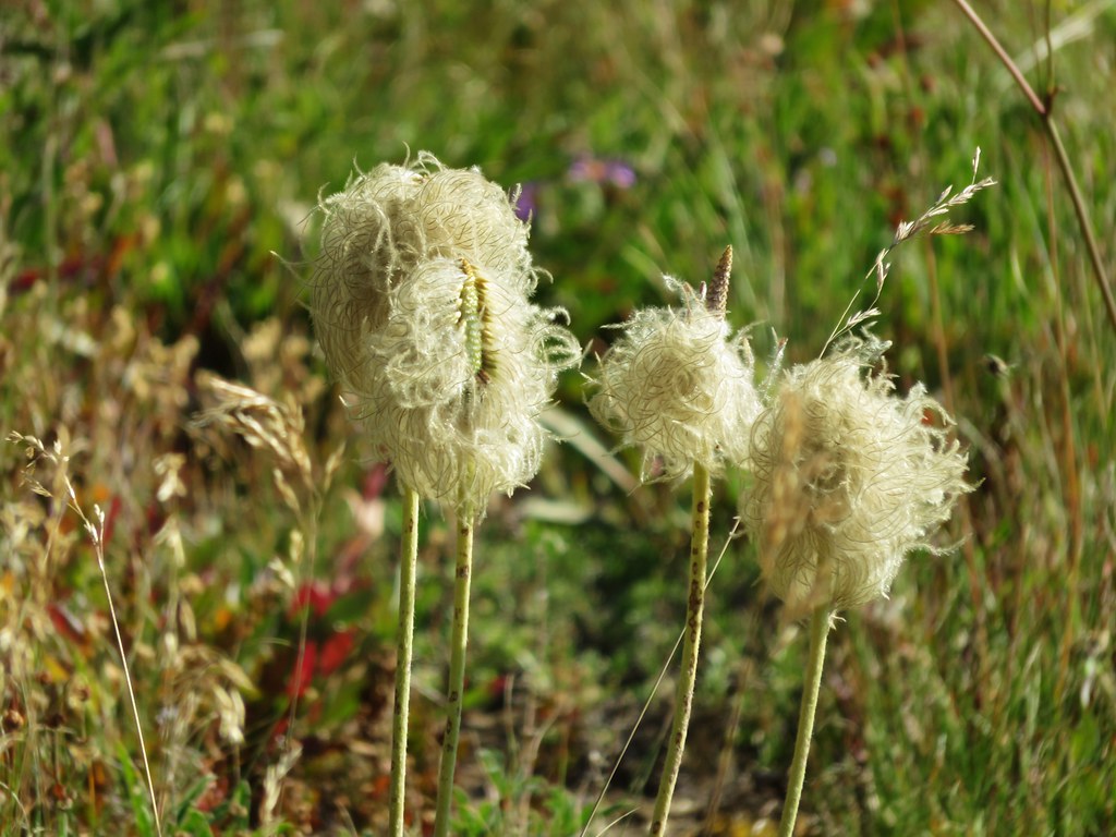
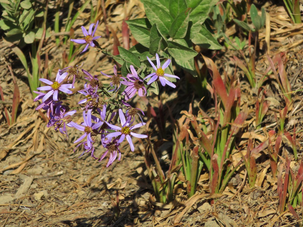
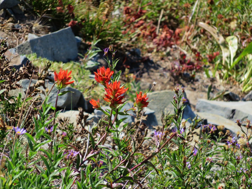
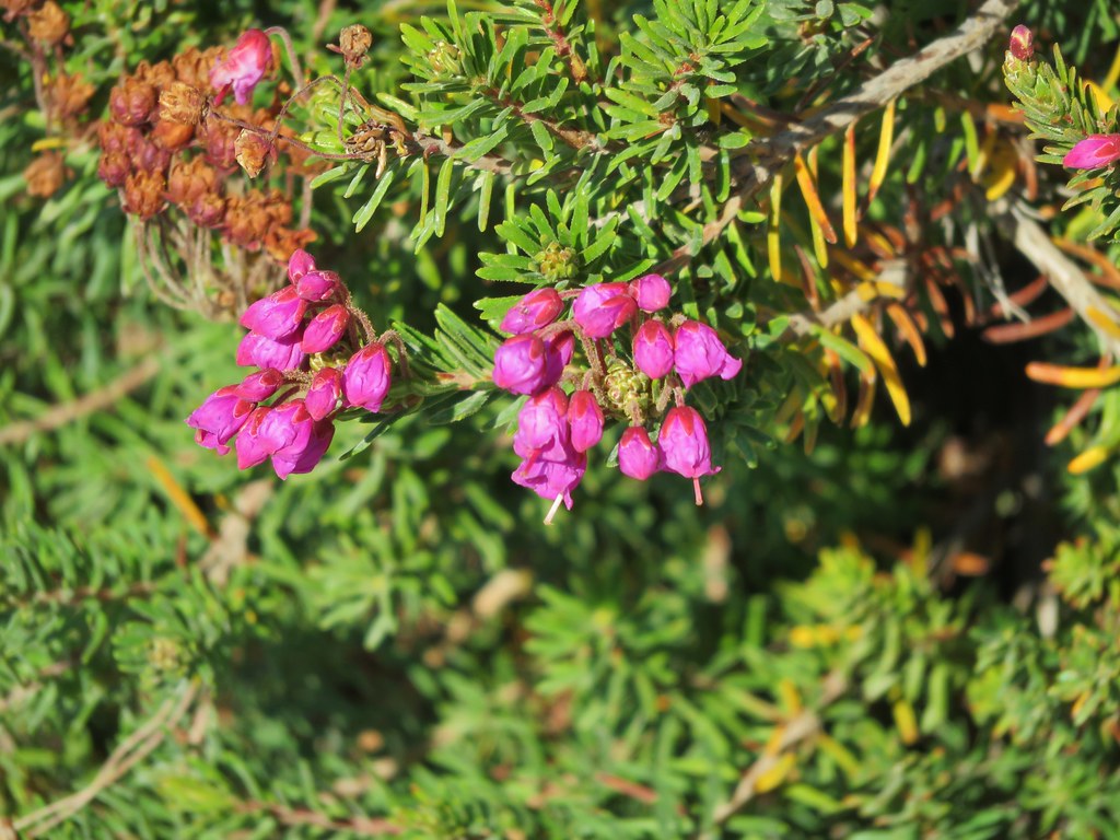
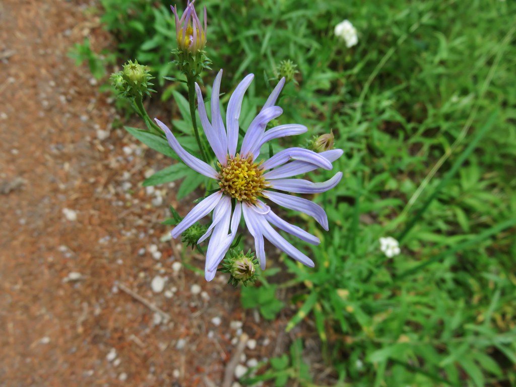
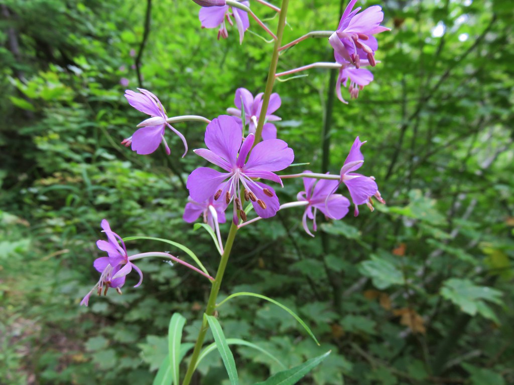
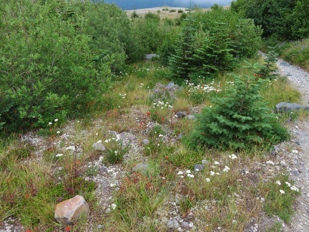
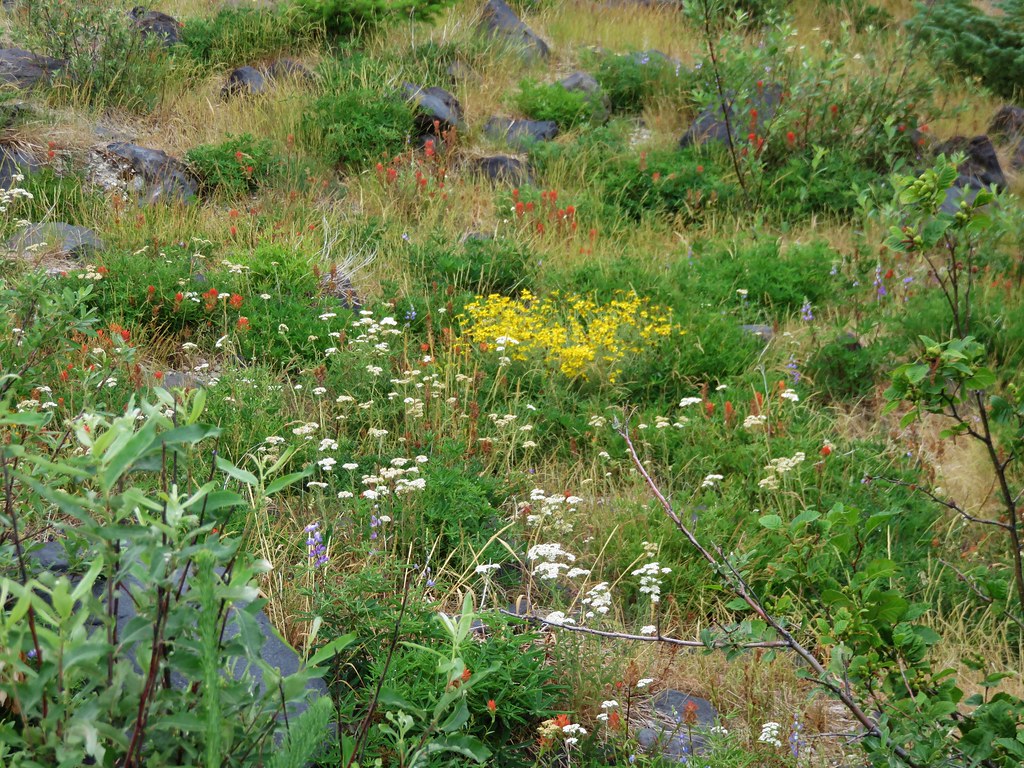
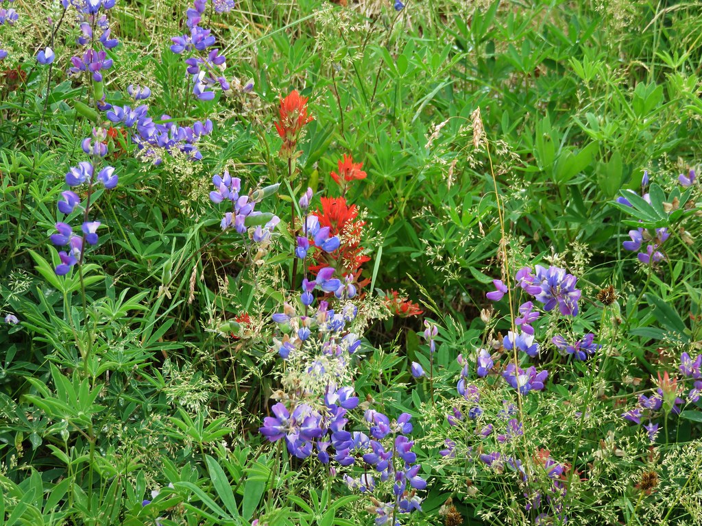
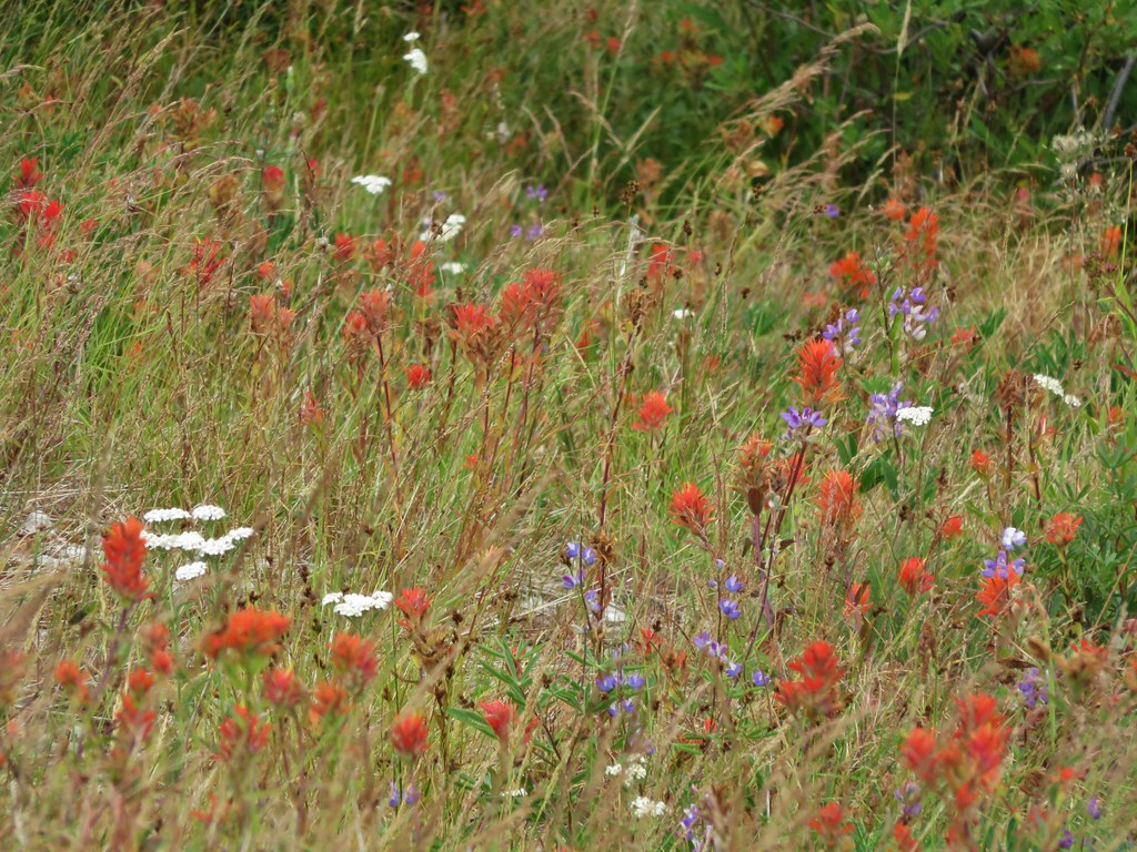
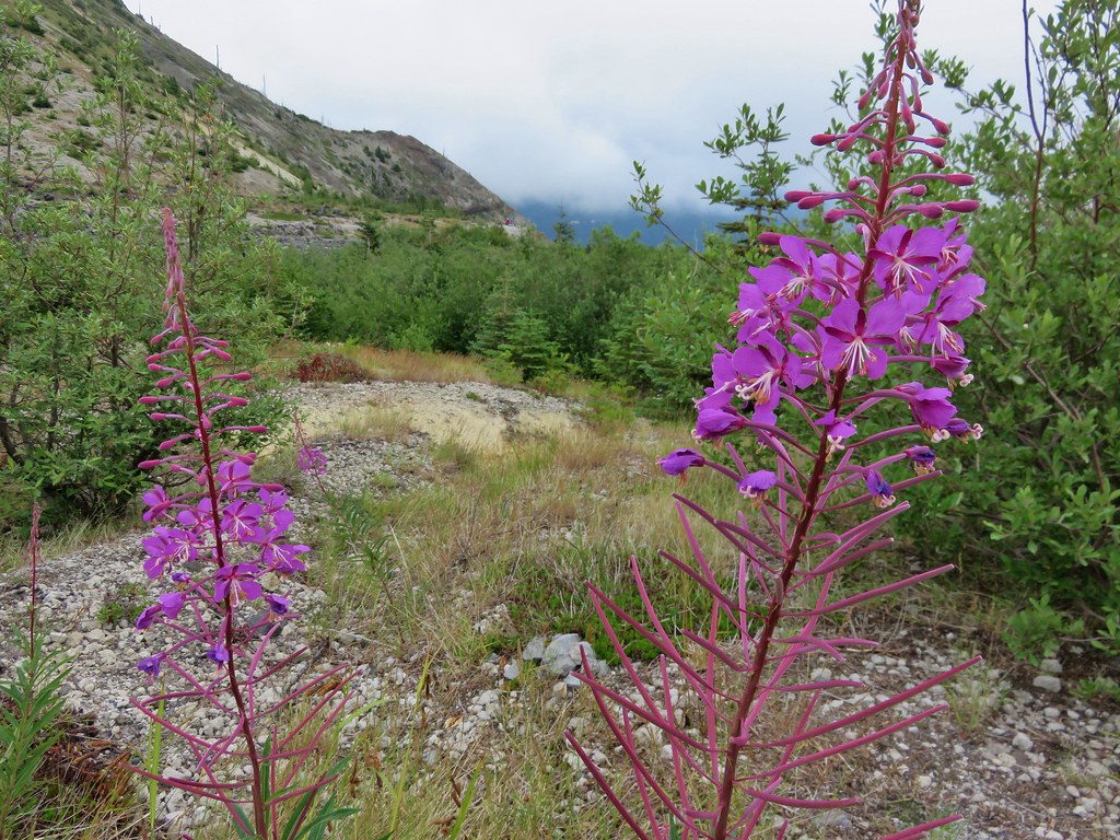
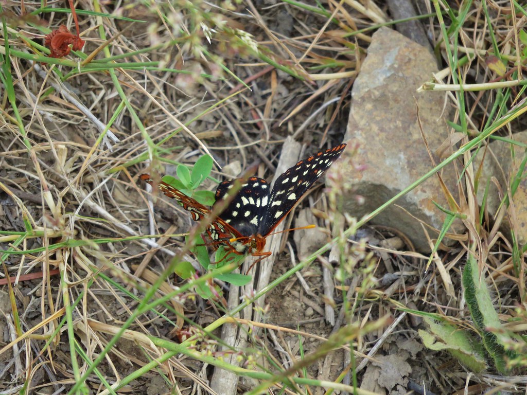
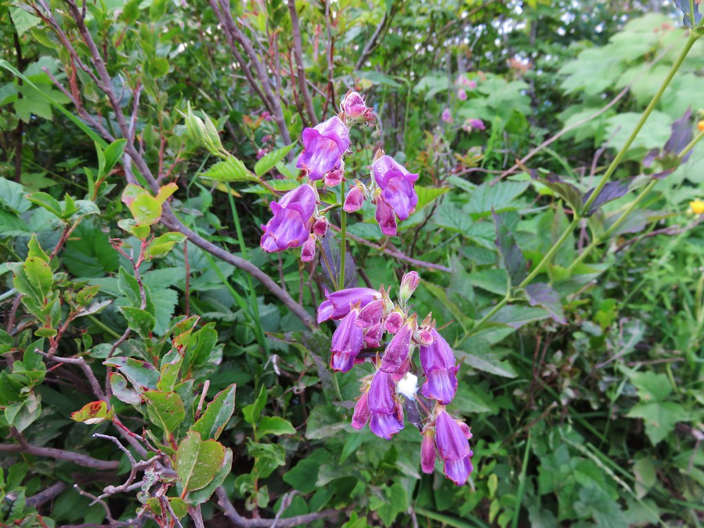
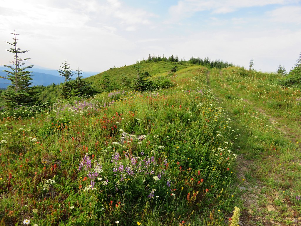
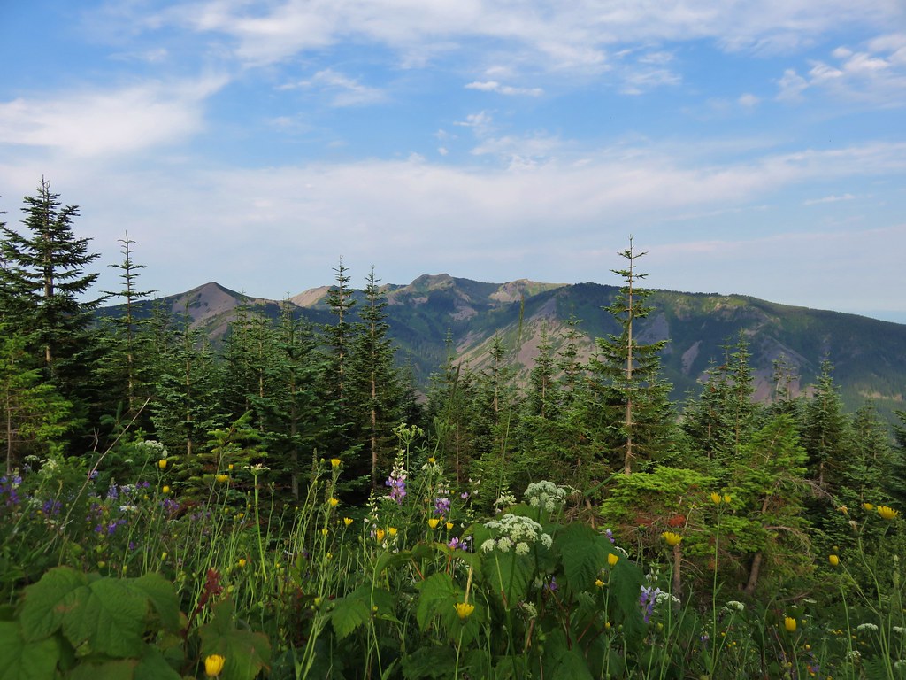
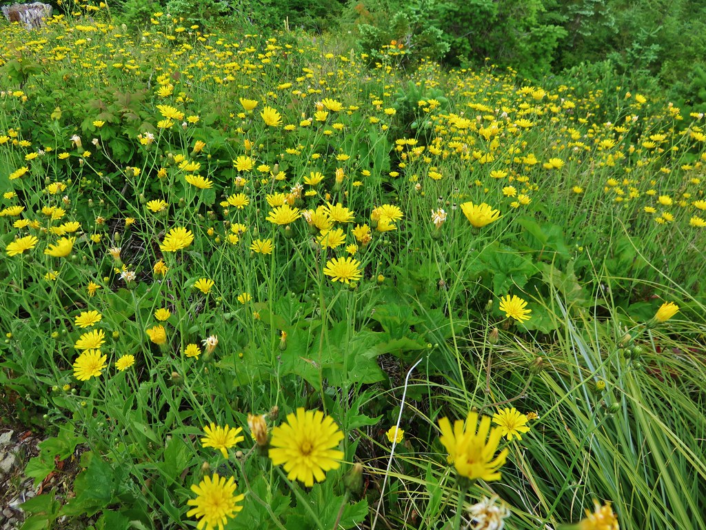
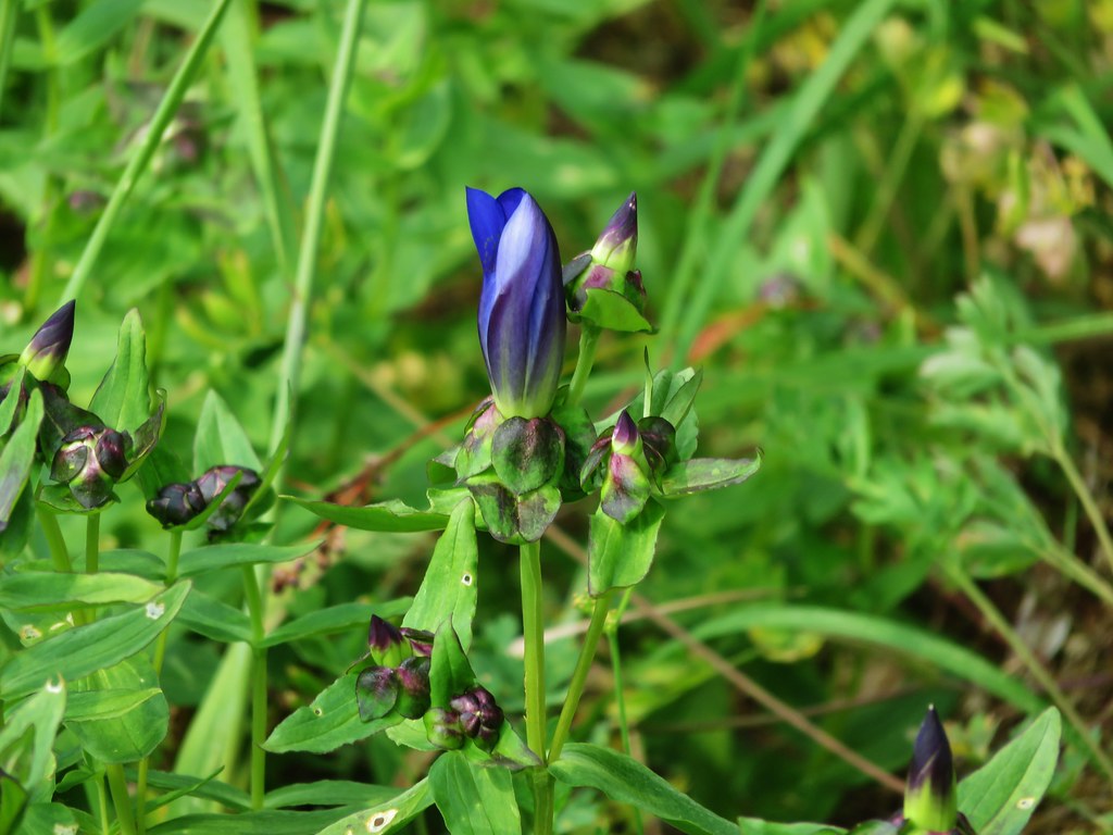
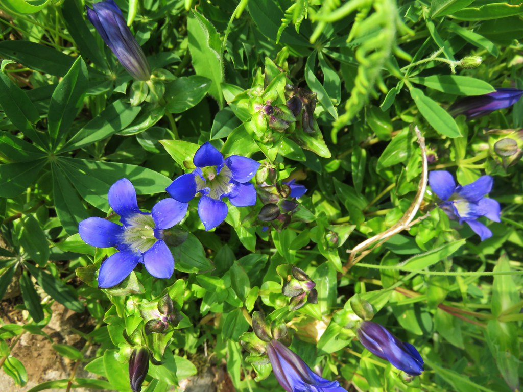
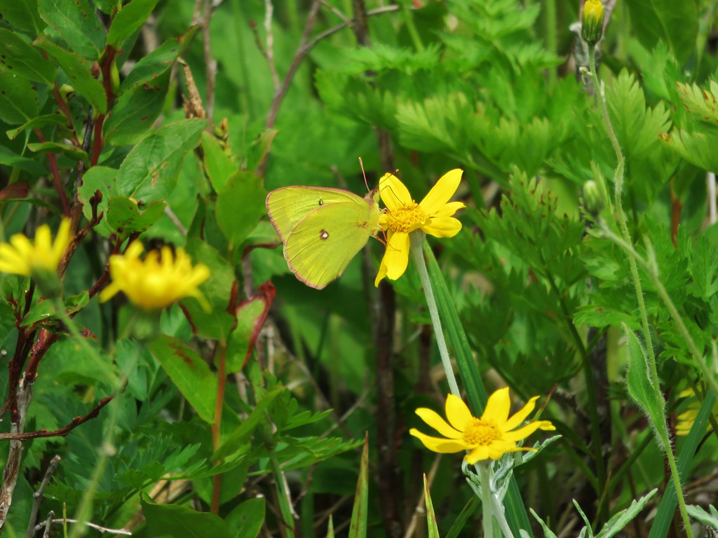
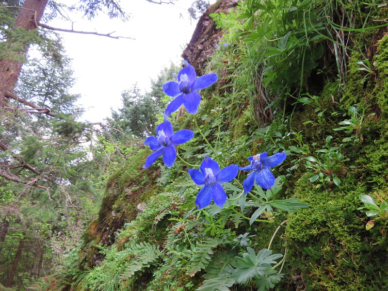
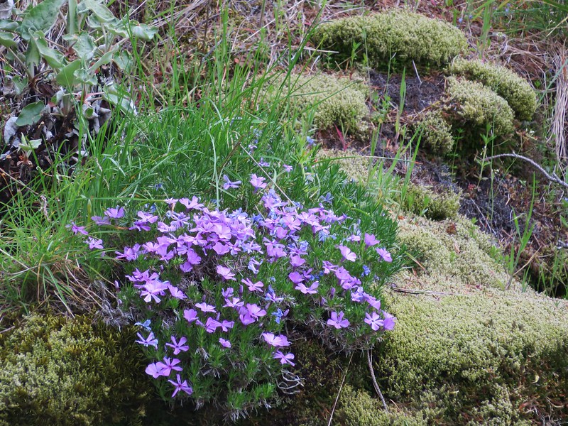
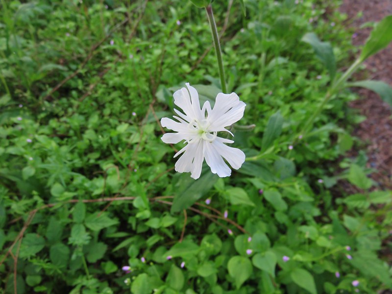
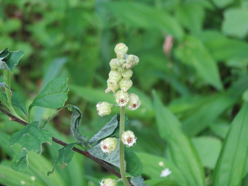
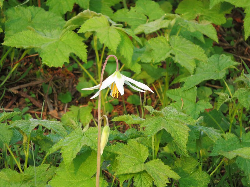
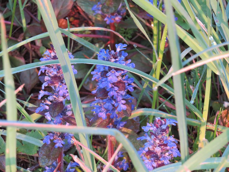
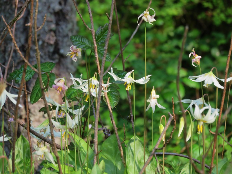
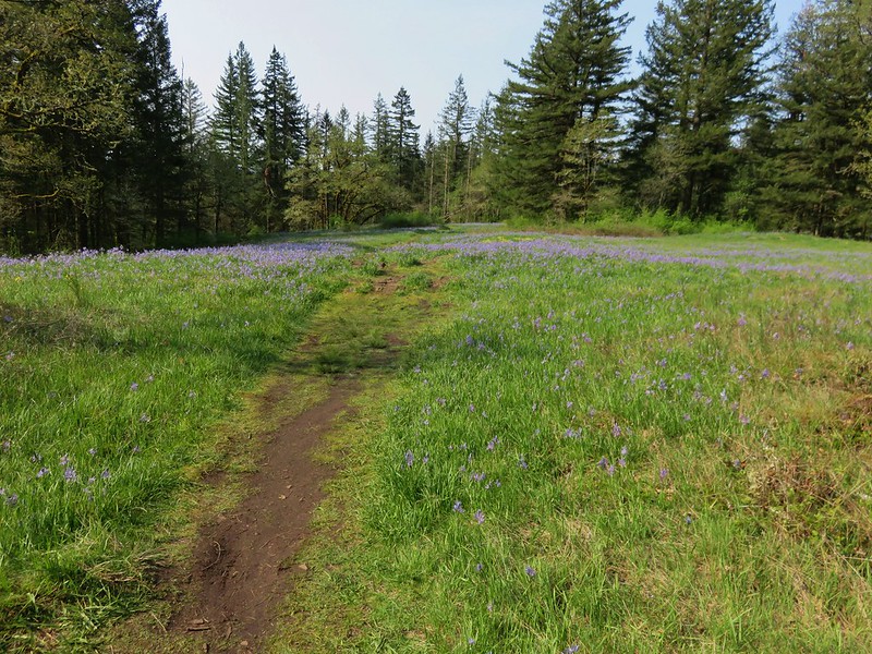
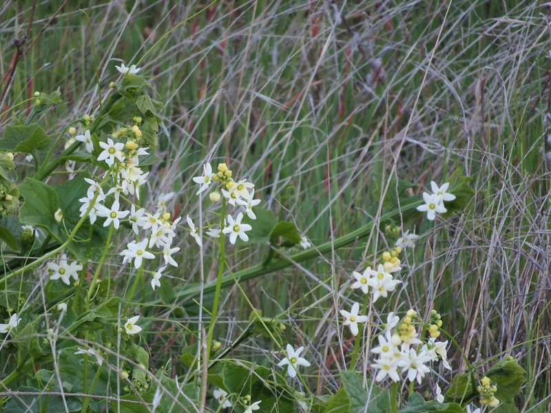
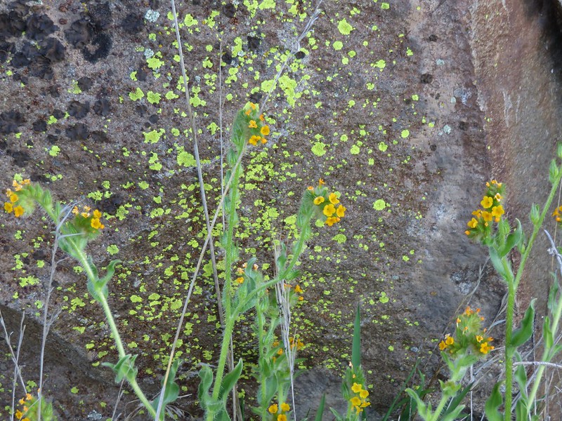
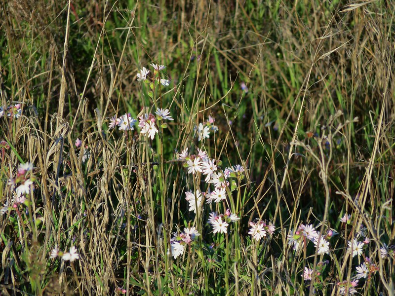
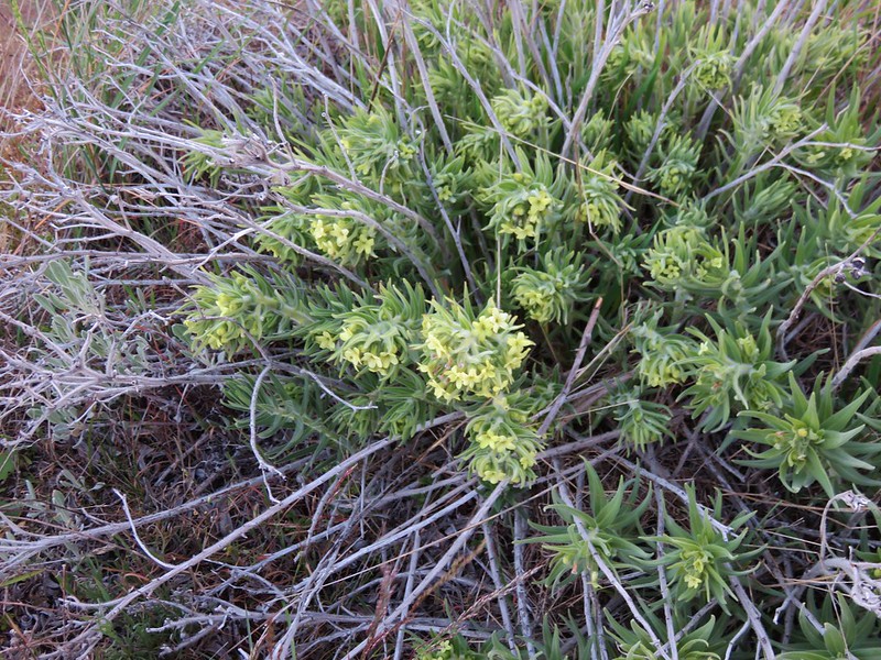
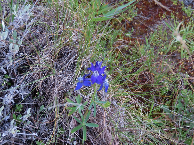
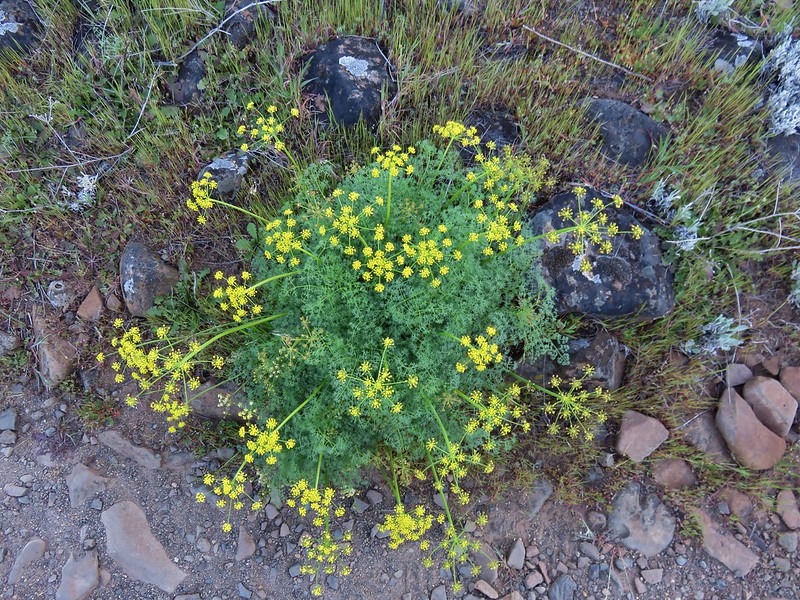
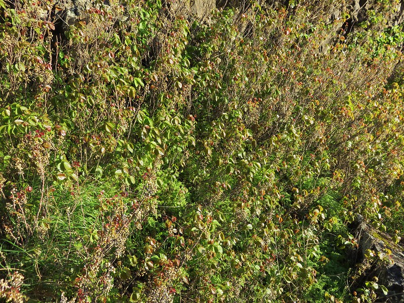
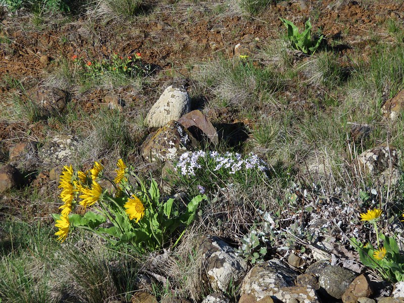
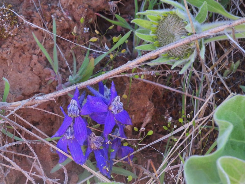
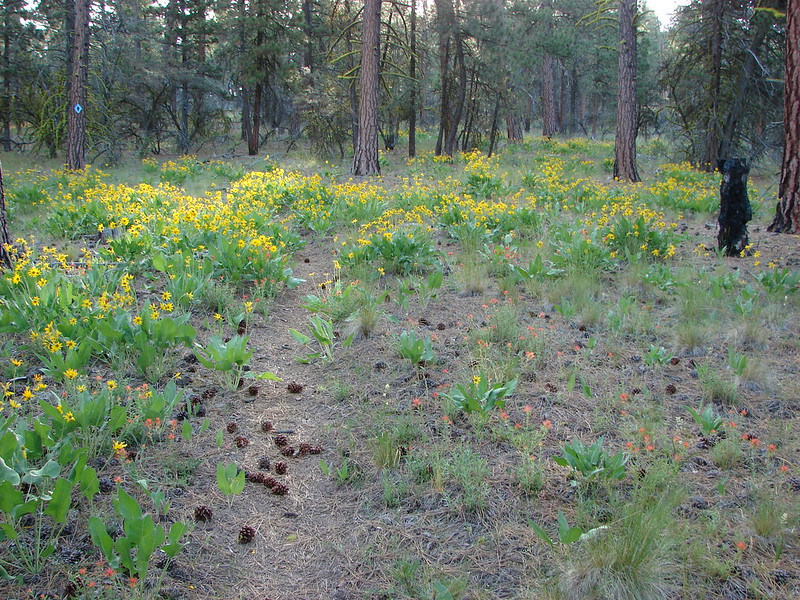
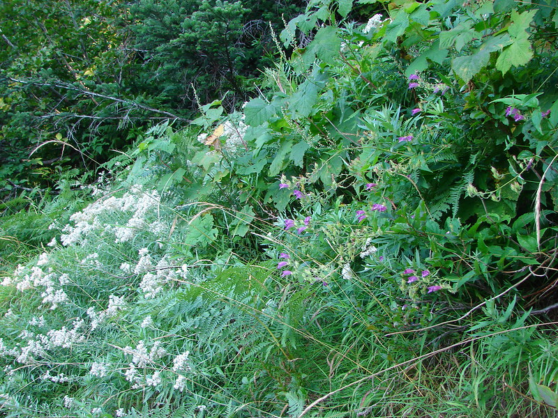
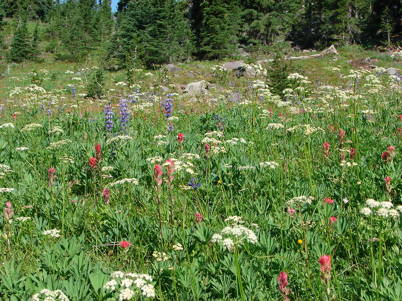
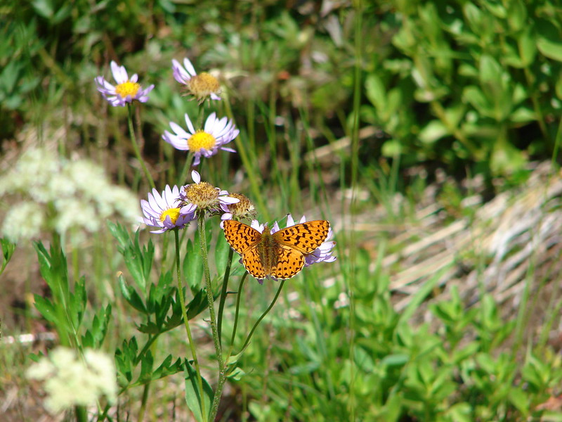
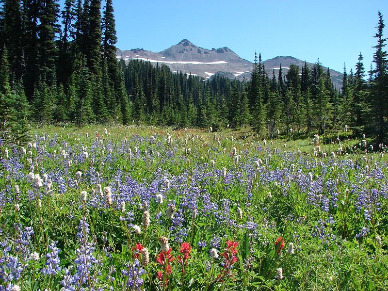
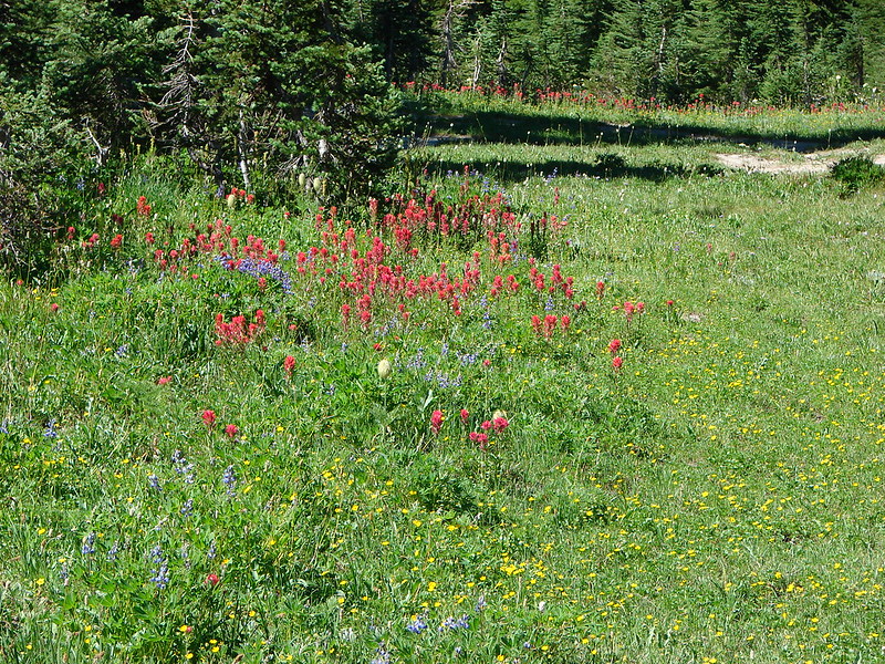
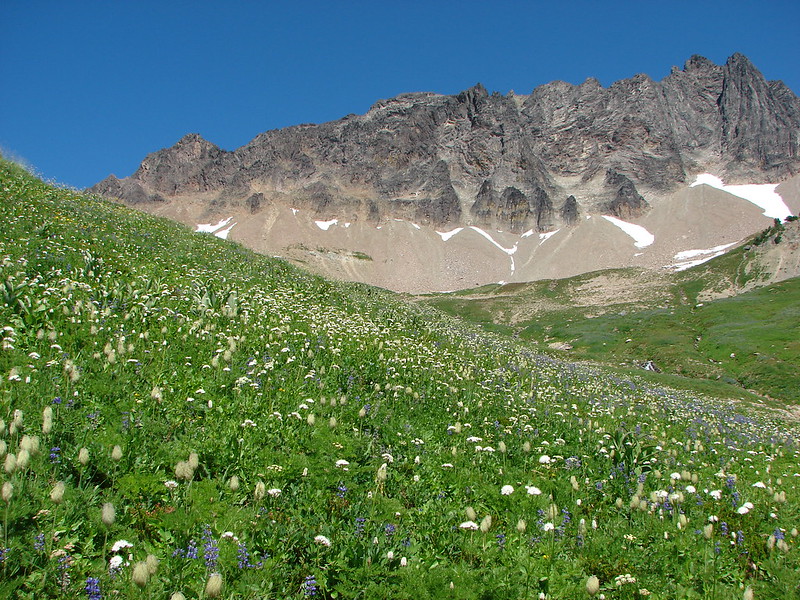
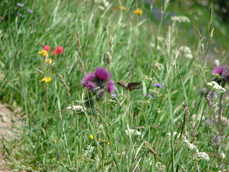
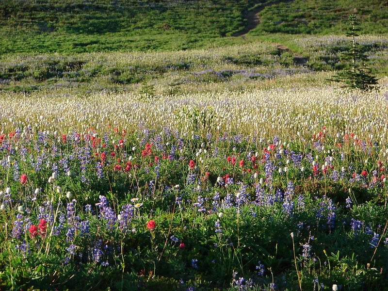
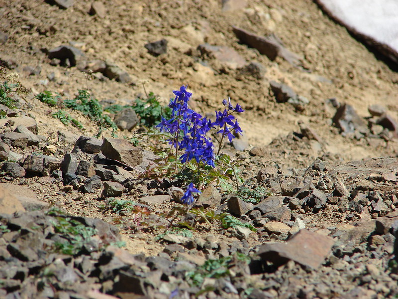
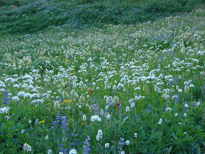
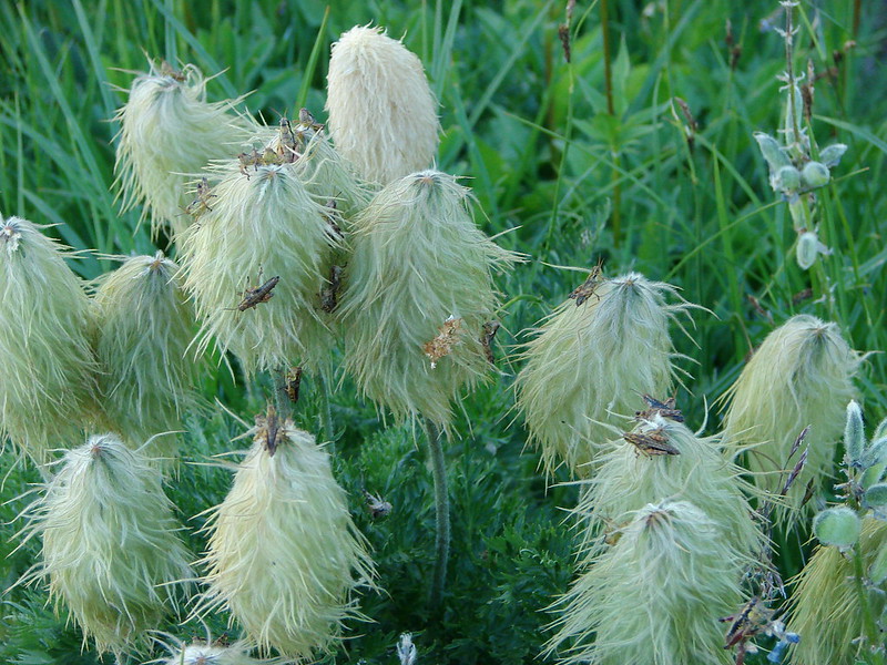
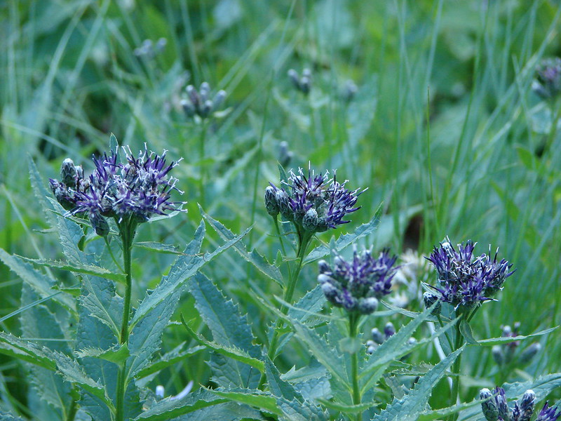
Everything was so impressive but most of all were the wildflowers. The variety and amounts of them were unbelievable. Entire hillsides were covered in colors.

DSC03124

DSC03152

DSC03144

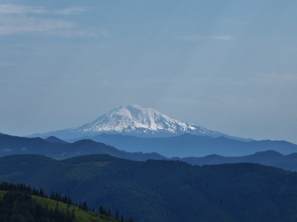
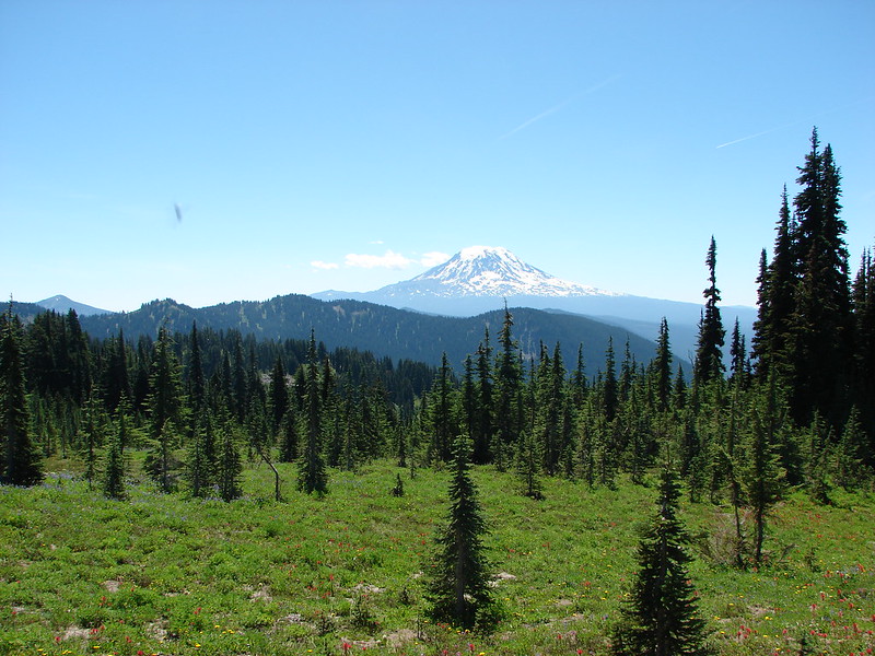
And to top it off Mt. Adams loomed behind us.

DSC03130

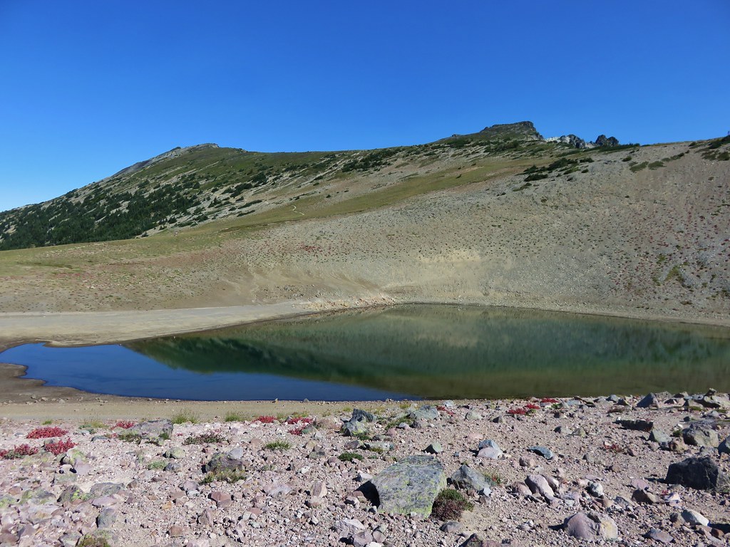
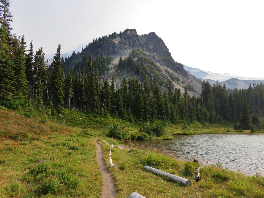
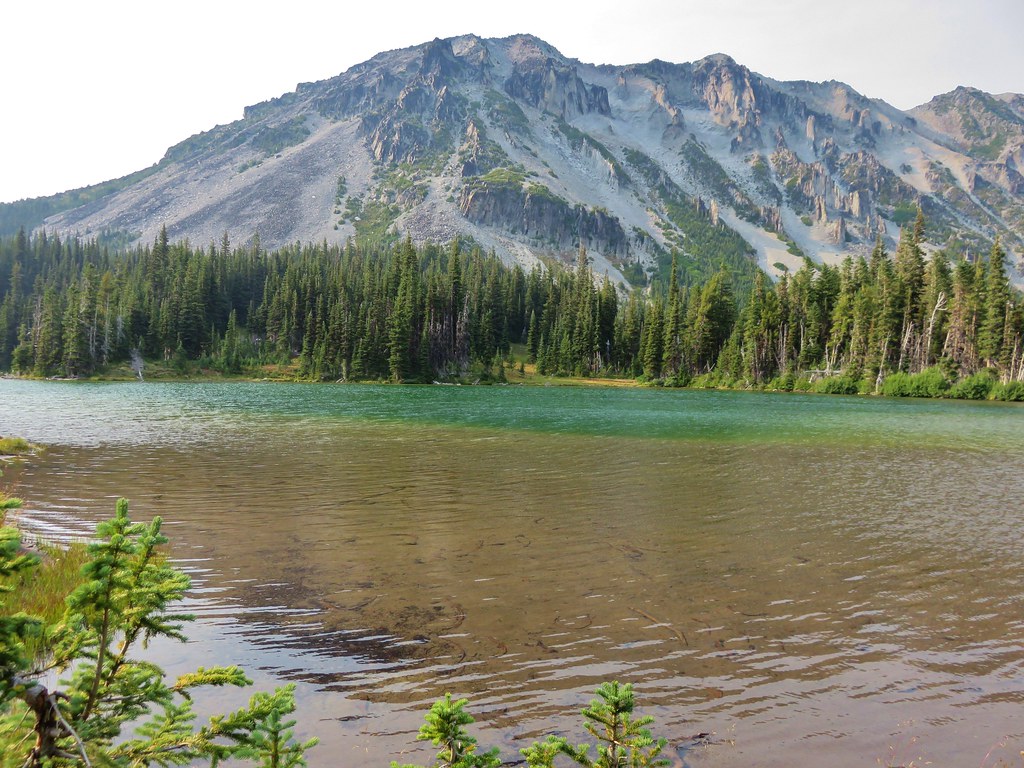
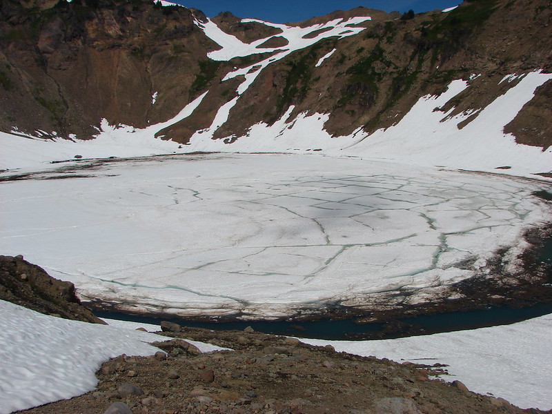
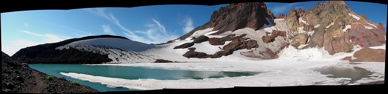
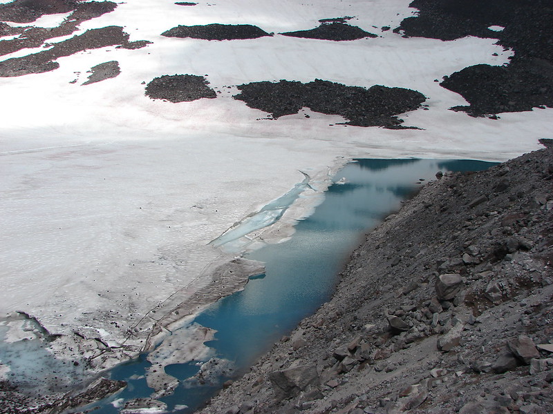
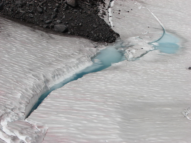
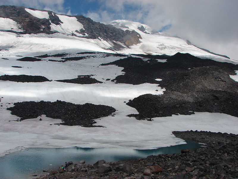
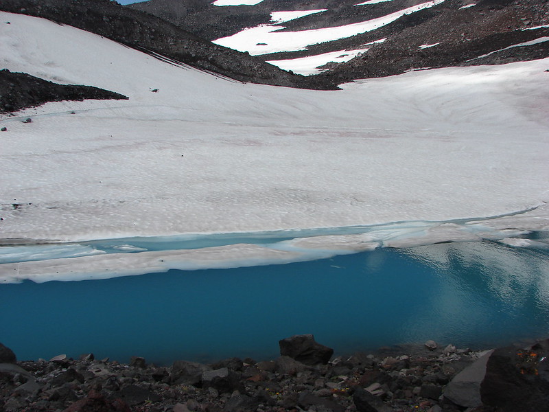
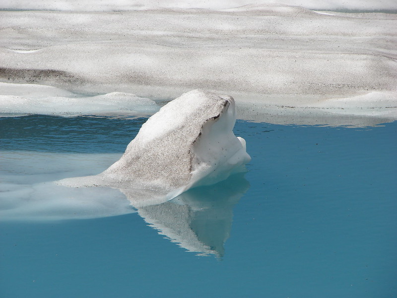
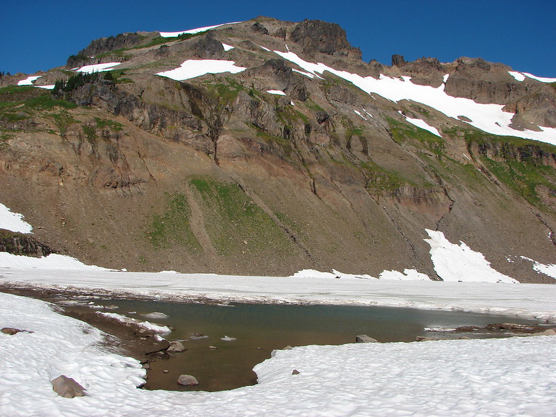
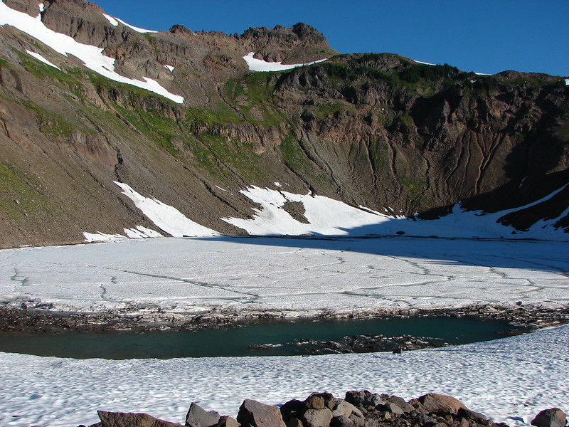
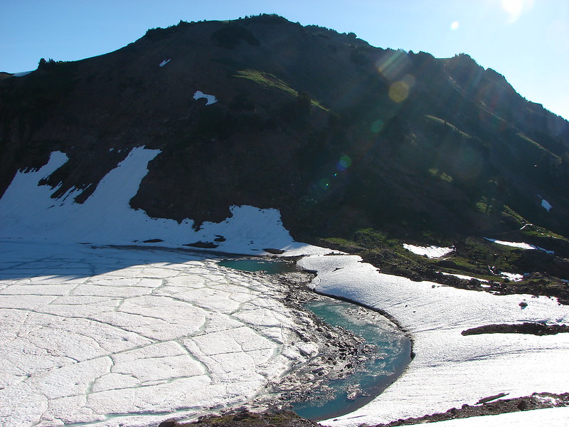
When we arrived at Goat Lake it was mostly frozen as we had expected. The lake rarely ever thaws out completely sitting in a bowl beneath Hawkeyepoint.

DSC03168

DSC03191

From the lake the trail climbed to a ridge crest junction with the Goat Ridge Trail. Again the wildflowers were profuse.

DSC03232

DSC03227

DSC03230

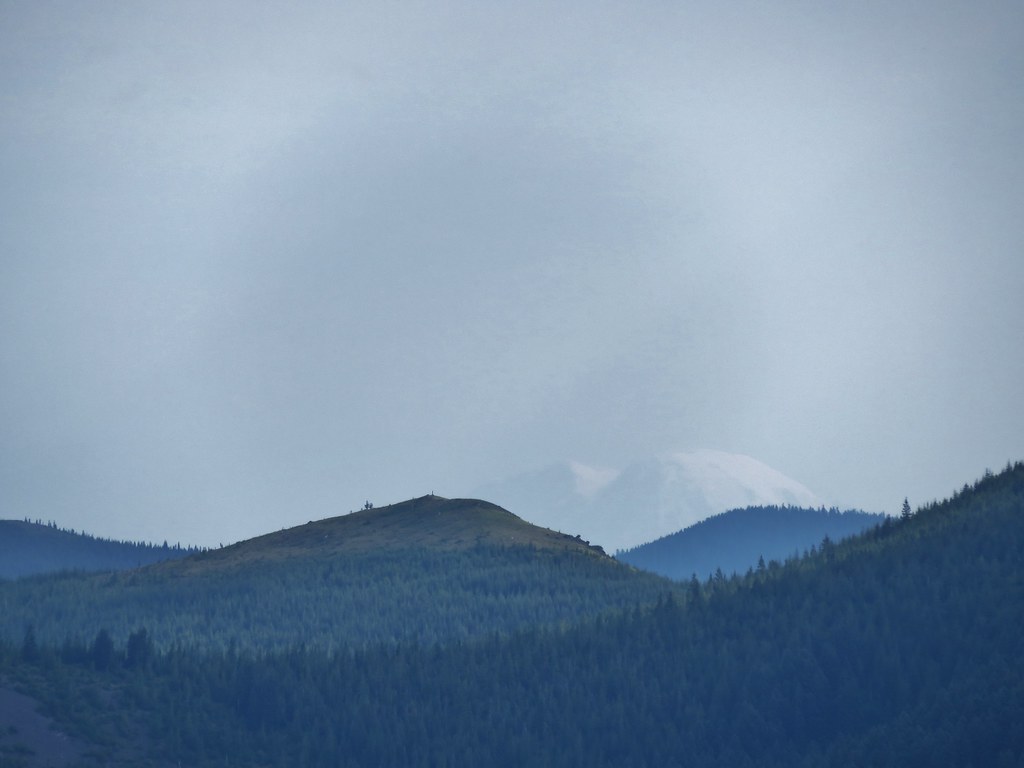
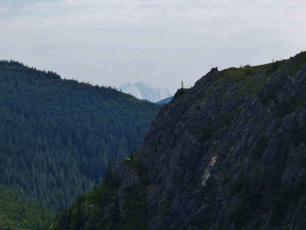
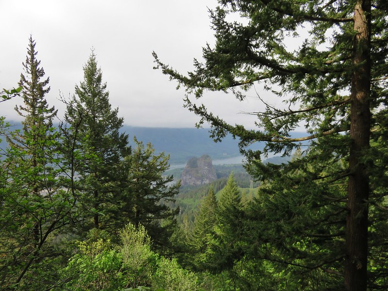
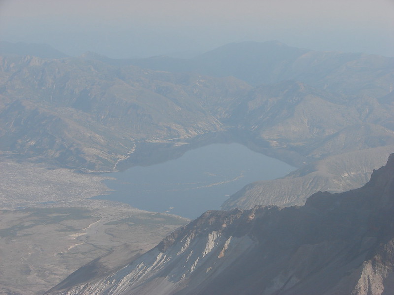
When we reached the junction Mt. St. Helens came into view beyond the Jordan Basin.

DSC03244

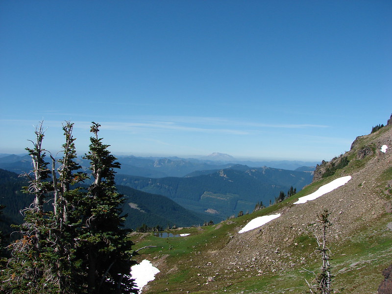
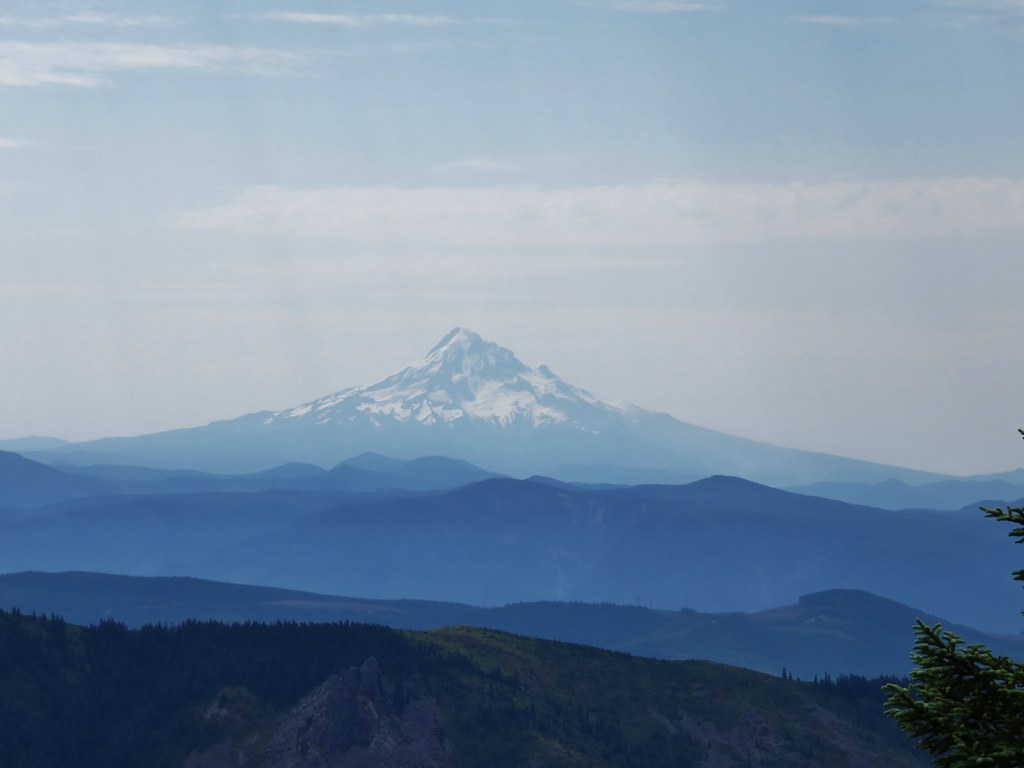
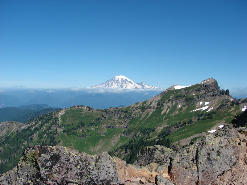
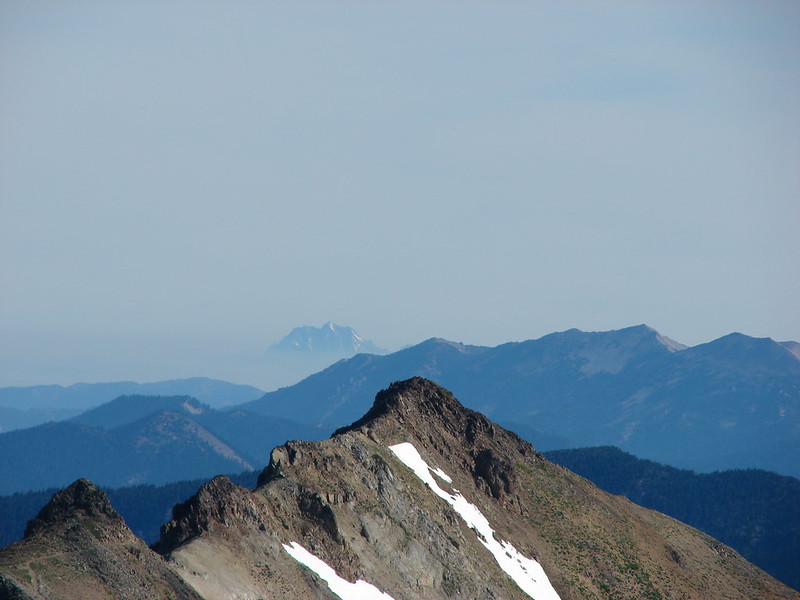
We left the Lily Basin Trail to attempt to climb Hawkeye Point. As we climbed the tip of Mt. Hood could be seen over the shoulder of Mt. Adams.

DSC03266

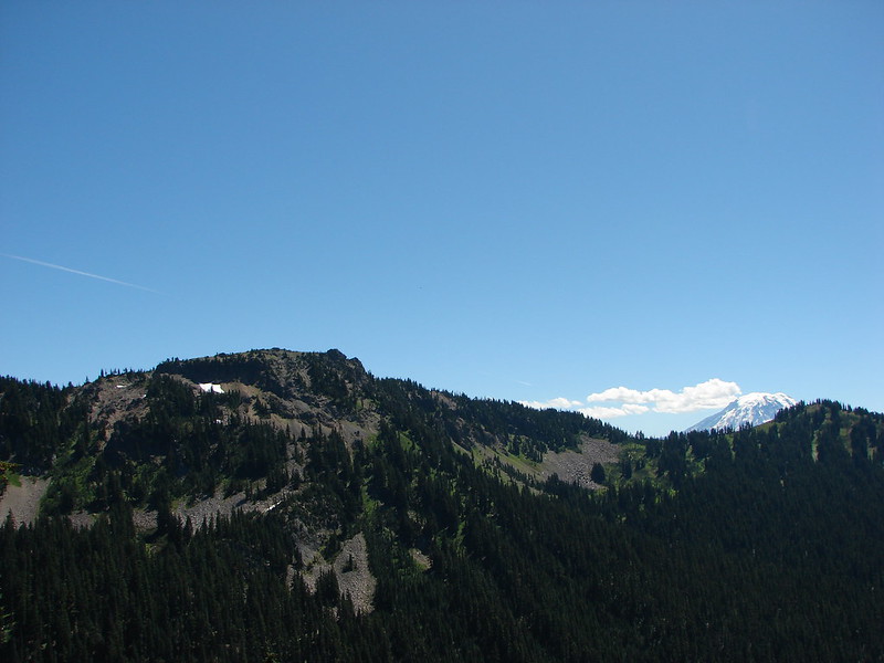
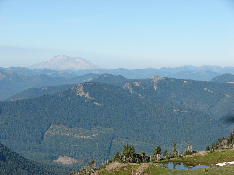
Then came Mt. Rainier beyond Johnson Peak.

DSC03268

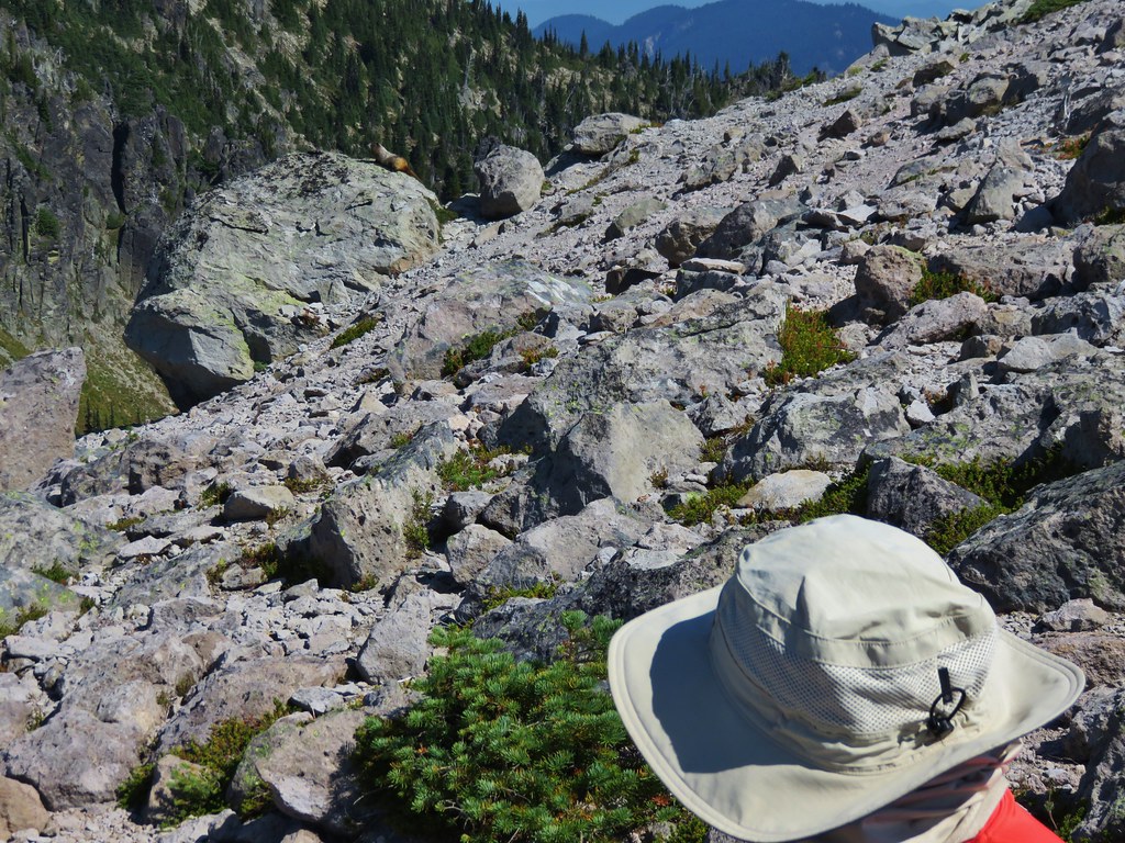
We followed a clear path to a rocky knob where we discovered a large snowfield lying between us and the visible trail up to the summit of Hawkeye Point.

DSC03282

There was a steep drop part way out on the snowfield and no visible tracks so we decided to declare victory where we were and see if there was a different route to the trail we could see on the far side so we climbed back down to the Lily Basin Trail and started to head toward Heart Lake. We didn’t get far though before we were stymied by another snowfield.

DSC03301

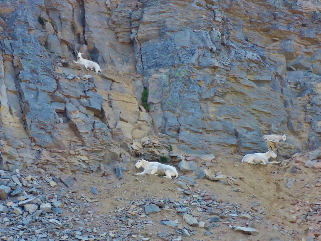
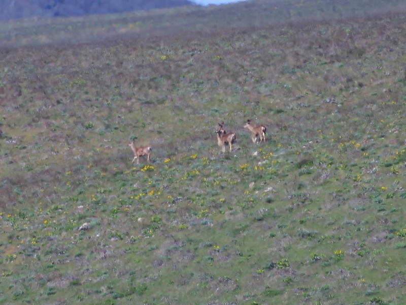
We decided to take a short break before heading back to search for a different route to Hawkeye Point. While we were resting Heather spotted the one thing I was really hoping to see on the trip – Mountain Goats! There was a pair of them near the top of the ridge across the basin.

DSC03318

Mountain Goats were on top of my list of animals we hadn’t seen yet while hiking so even though they were a long way away it was exciting.

After they disappeared over the ridge we started our search for a path around the snowfield to Hawkeye Point. We managed to find what turned out to be a goat path that got us around the snowfield, but we were too far down a steep hill with no visible route up to reach the continuation of the real trail. Instead we followed the goat trail passing some beds complete with goat fur to a view of Goat Lake below.

DSC03335

DSC03336

DSC03342

Satisfied with the view we began our return trip to camp. It was such a pretty trail that was just as spectacular the second time through.

DSC03383

DSC03407

DSC03411

DSC03488

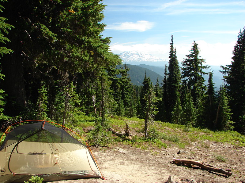
When we got back to camp we noticed that the family who had been camped further back in the same area as us had left. We took the opportunity to switch sites and moved to a spot with a view of Mt. Adams.

DSC03525

After getting our new site set up we decided to go up to the PCT junction to catch the sunset. When we reached the junction with the Snowgrass Trail in Snowgrass Flat Heather noticed a large animal emerging from the trees on our right. We could see dark brown and my first thought was Elk but then it stepped out into the sunlight on the trial.

DSC03539

It was a llama and it looked mighty proud of itself.

DSC03545

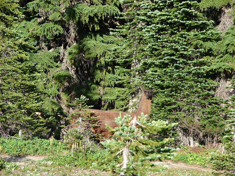
We didn’t see anyone around but someone must have been using it as a pack animal. It rolled in the dirt for a moment then got up and then disappeared into another camp site. It was so unexpected all we could do was laugh all the way up to the PCT.

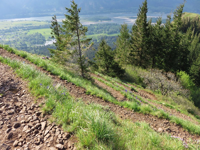
Meanwhile the setting Sun was bringing out the best in the wildflowers on the PCT.

DSC03556

DSC03555

DSC03553

We found an open site and watched the Sun disappear behind a bank of clouds that was hanging over Goat Ridge before returning to our tent and putting day 2 to bed.

DSC03568

DSC03579

Goat Rocks - Mt. Adams sunset

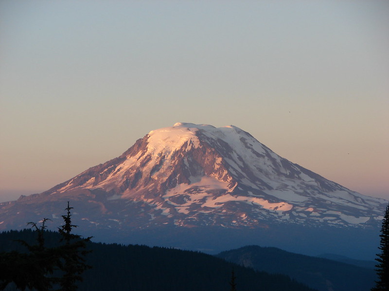
The third day started much like the previous day with a pretty Mt. Adams sunrise.

DSC03593

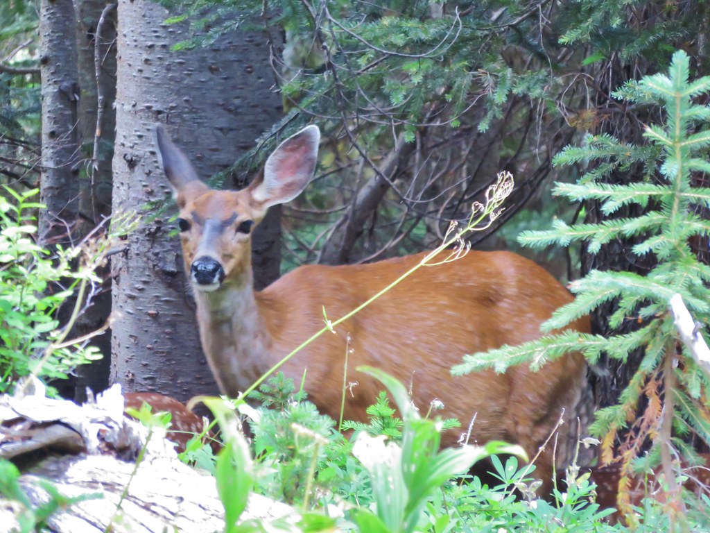
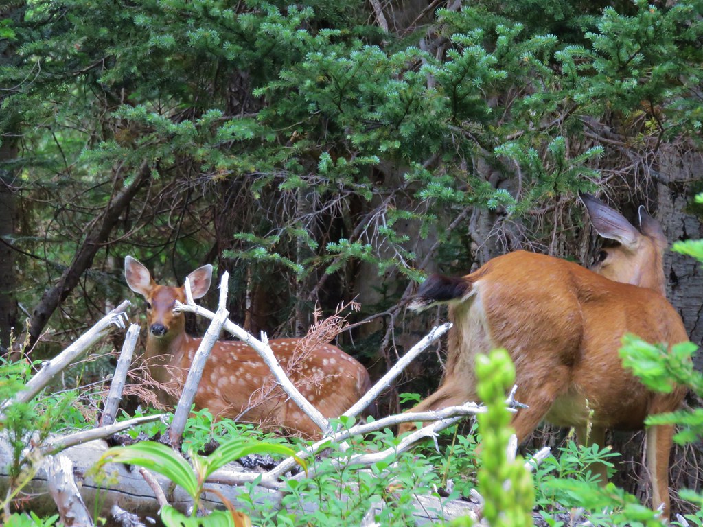
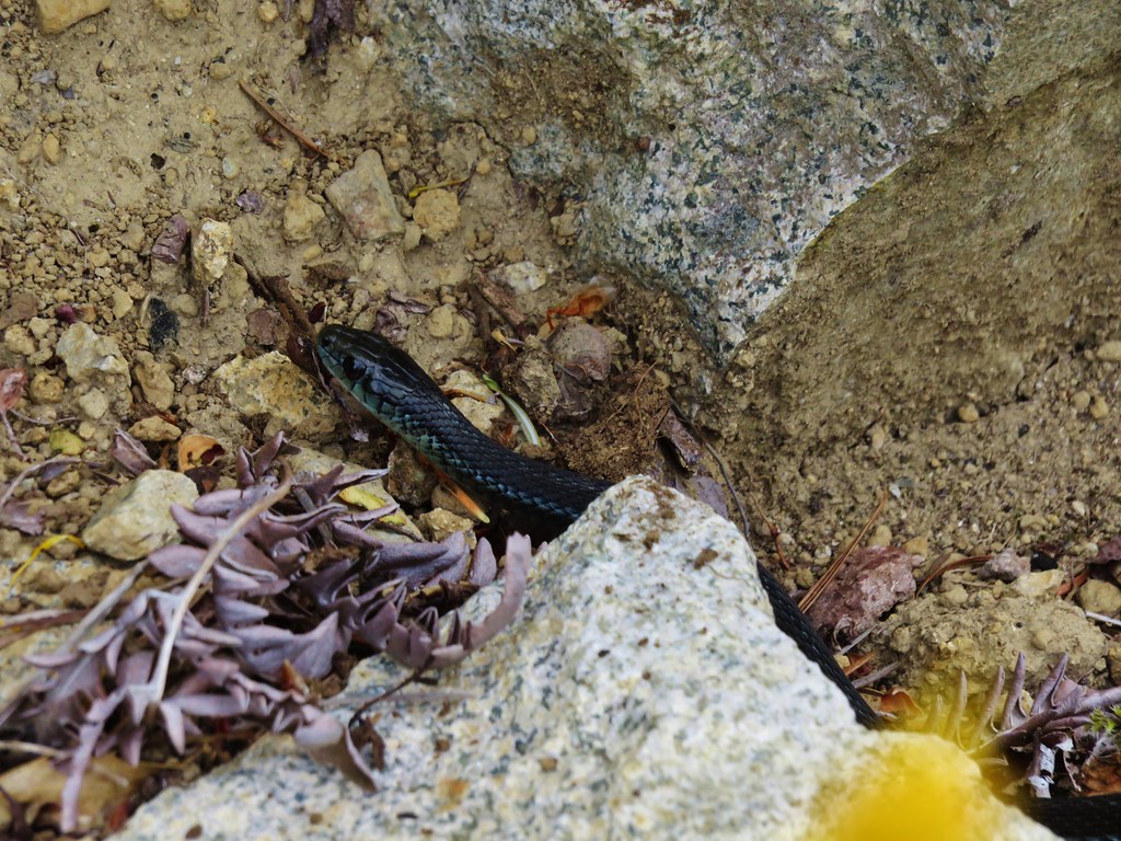
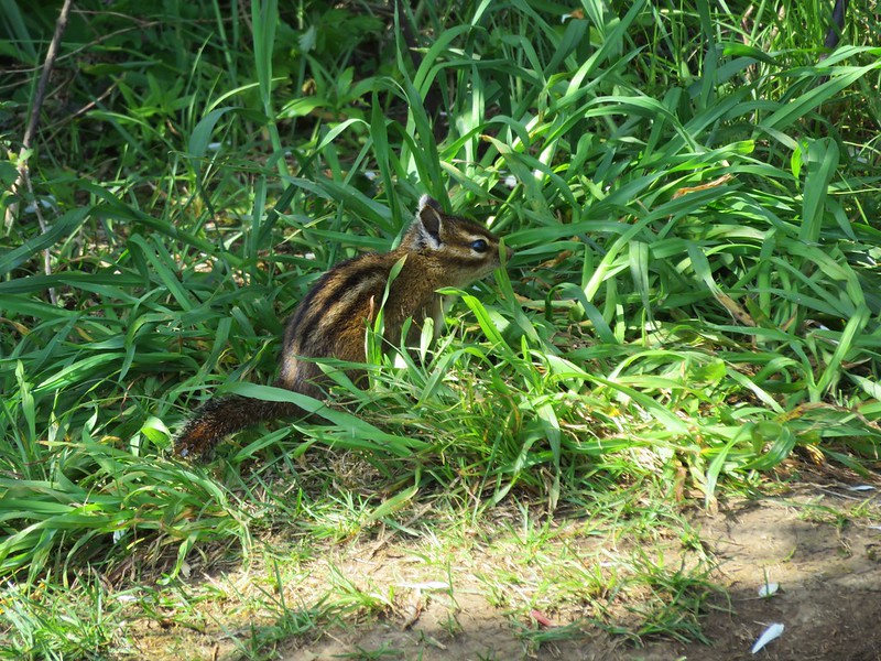
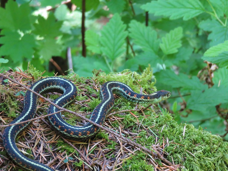
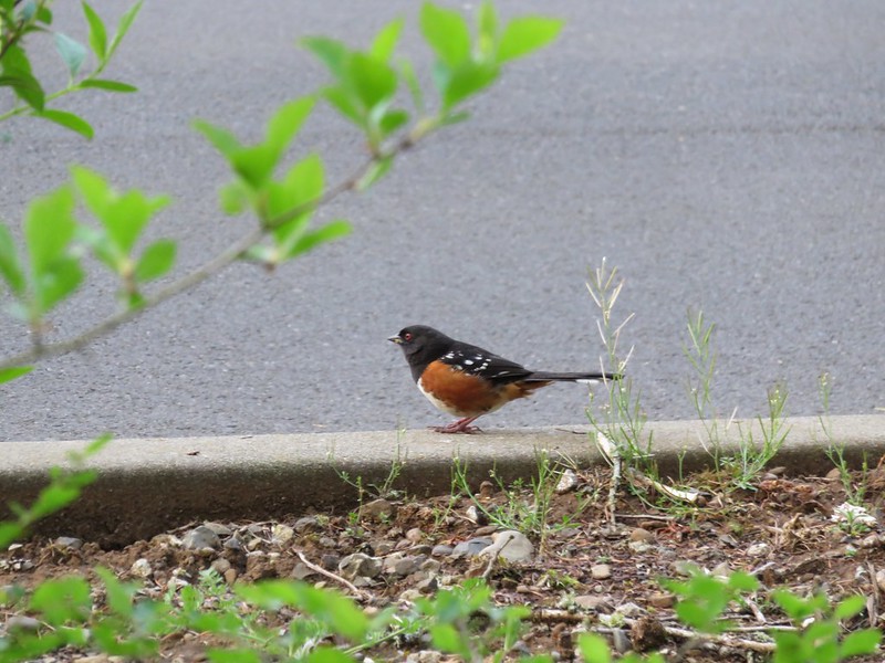
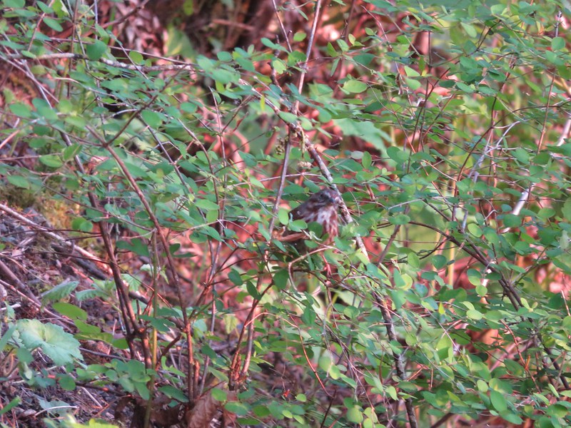
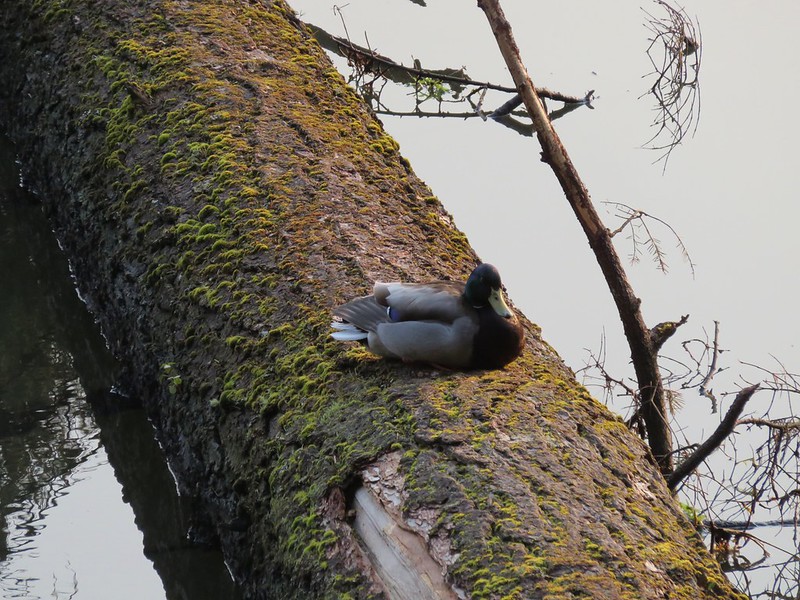
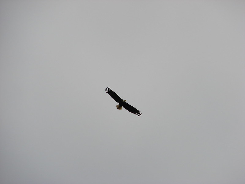
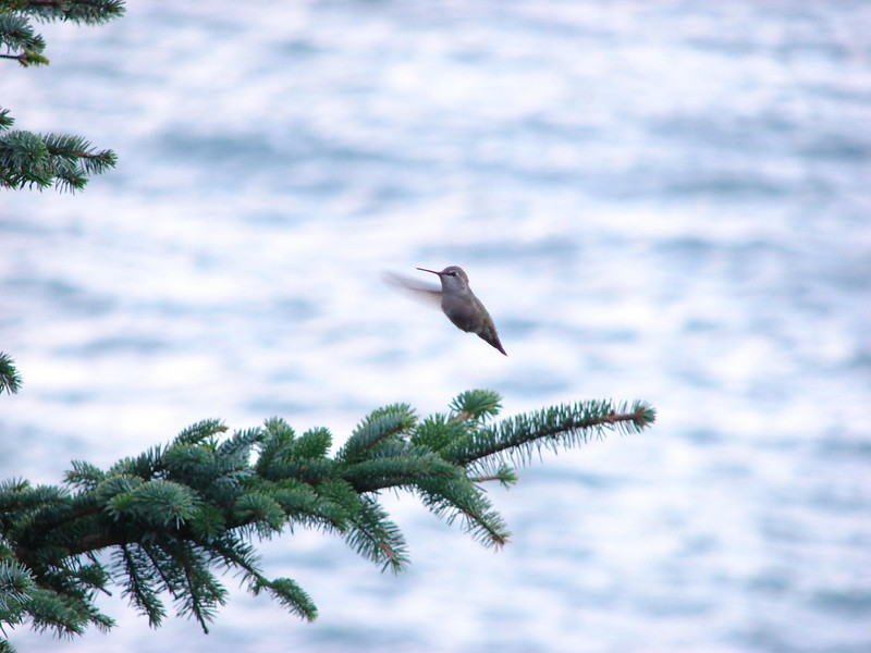
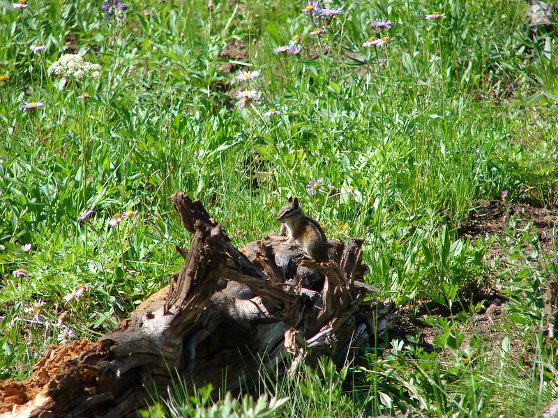
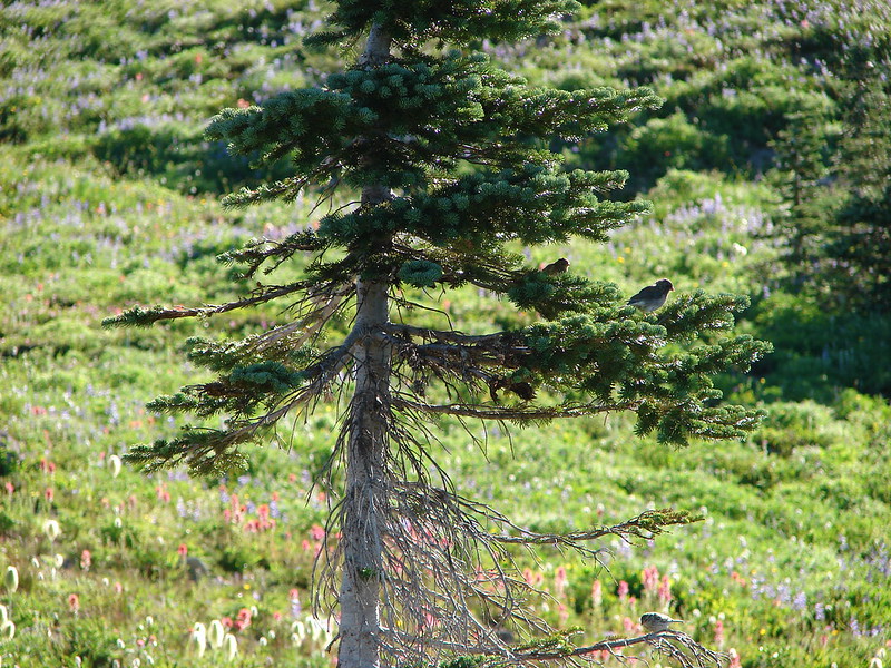
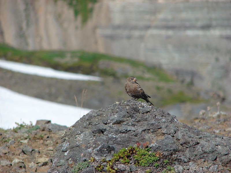
The animals were up early too.

DSC03595

DSC03601

DSC03606

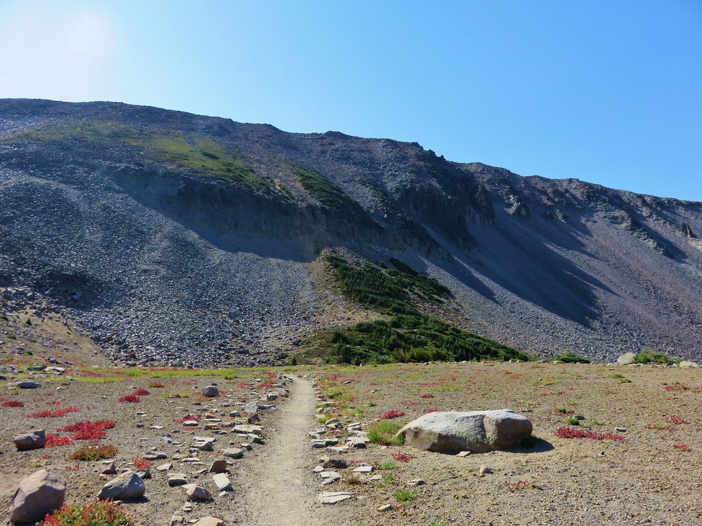
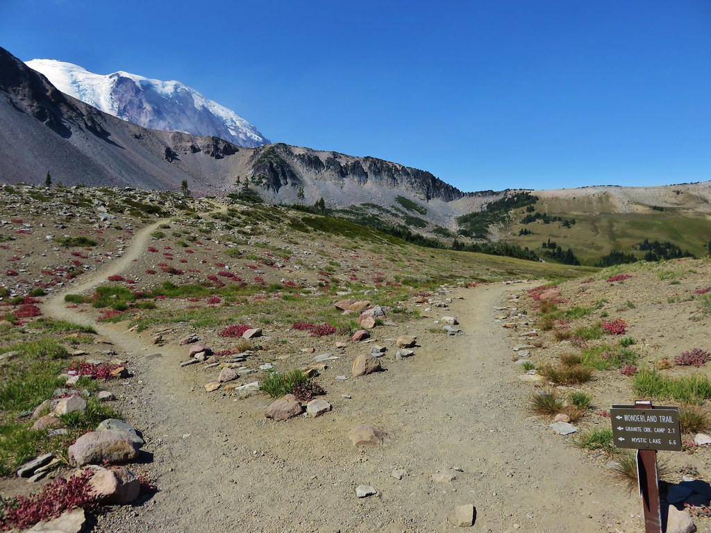
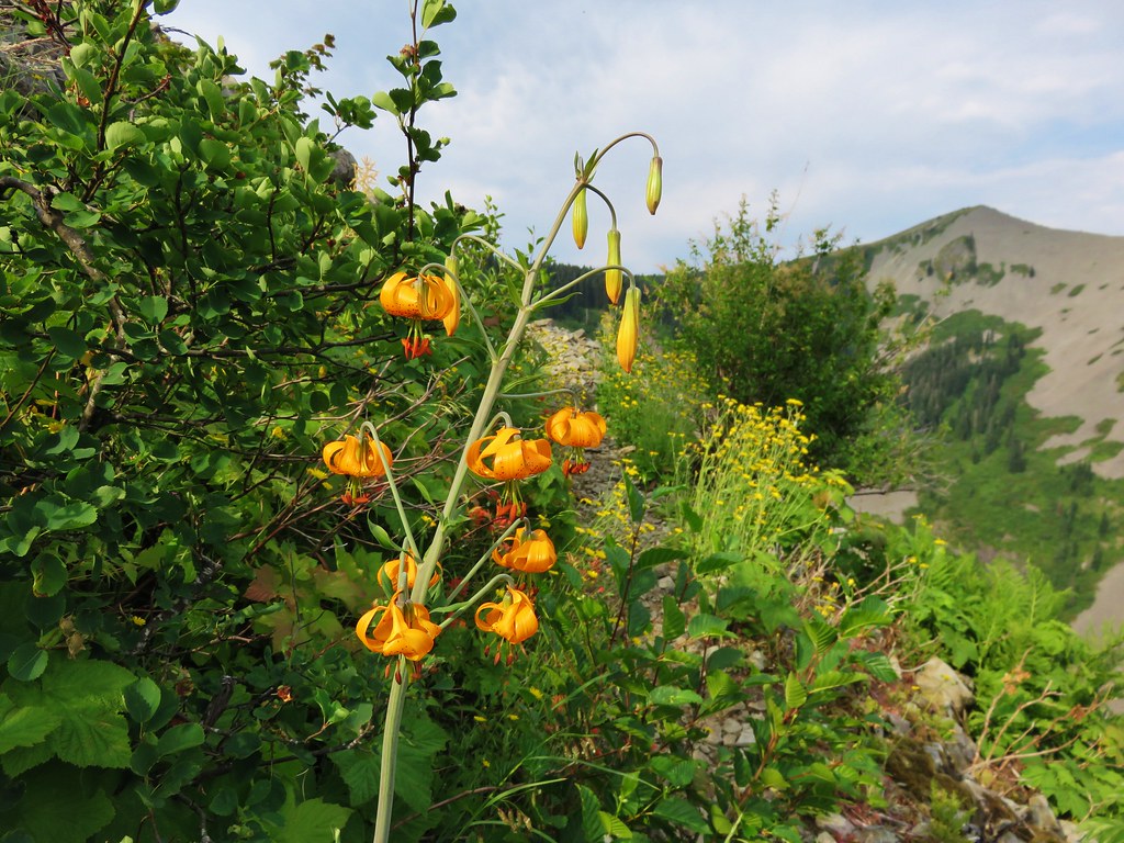
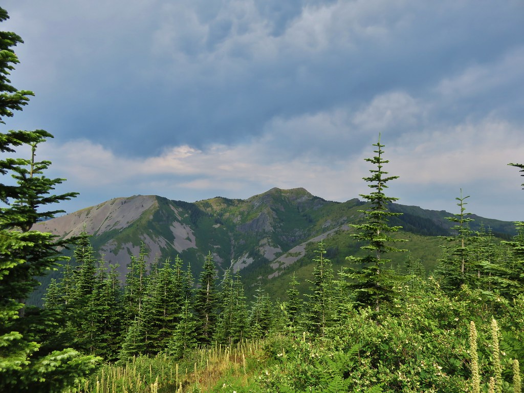
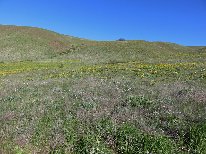
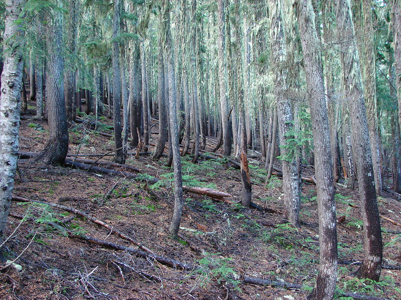
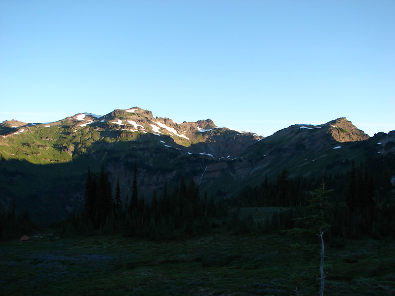
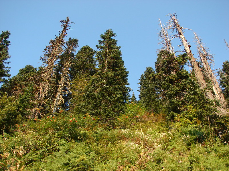
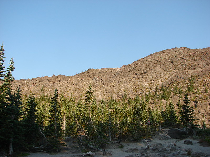
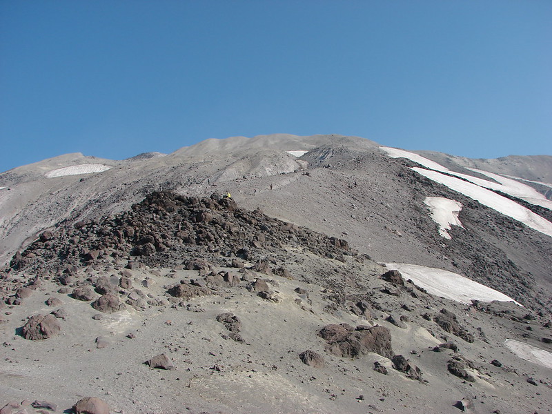
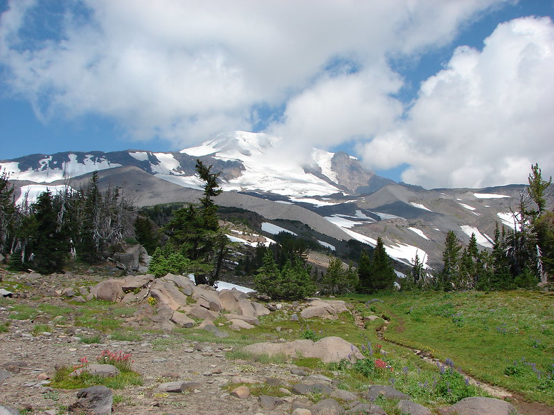
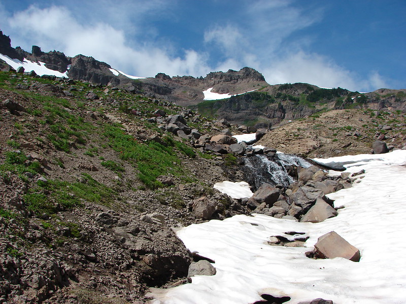
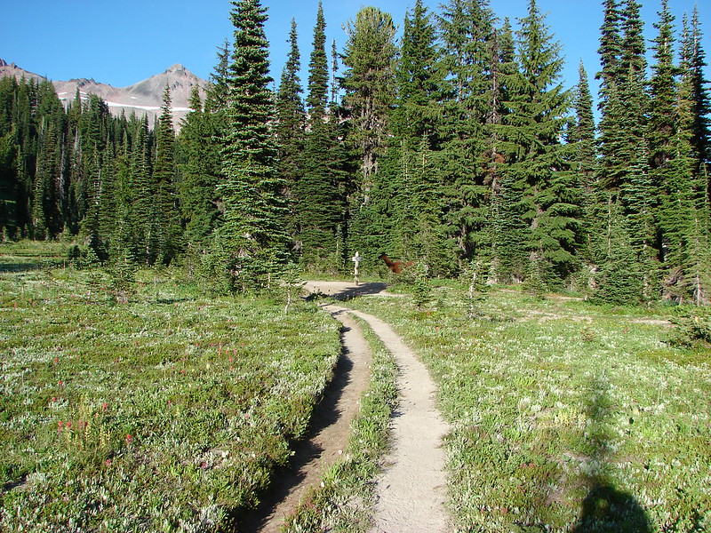
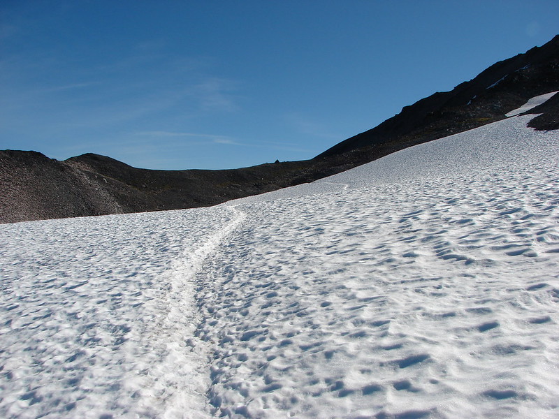
After a yummy breakfast of Mountain House Biscuits and Gravy we headed up to the PCT once again but this time headed left (North) toward Old Snowy Mountain. As we approached the mountain we left the meadows behind for more rocky terrain dotted with lingering snowfields. The flowers were not completely left behind though.

DSC03632

DSC03636

DSC03637

We spotted a ground squirrel that appeared to be sitting on a ledge enjoying the view along with its breakfast. The ledge it was on looked out over Goat Lake to Hawkeye Point with Mt. Rainier towering behind.

DSC03639

DSC03642

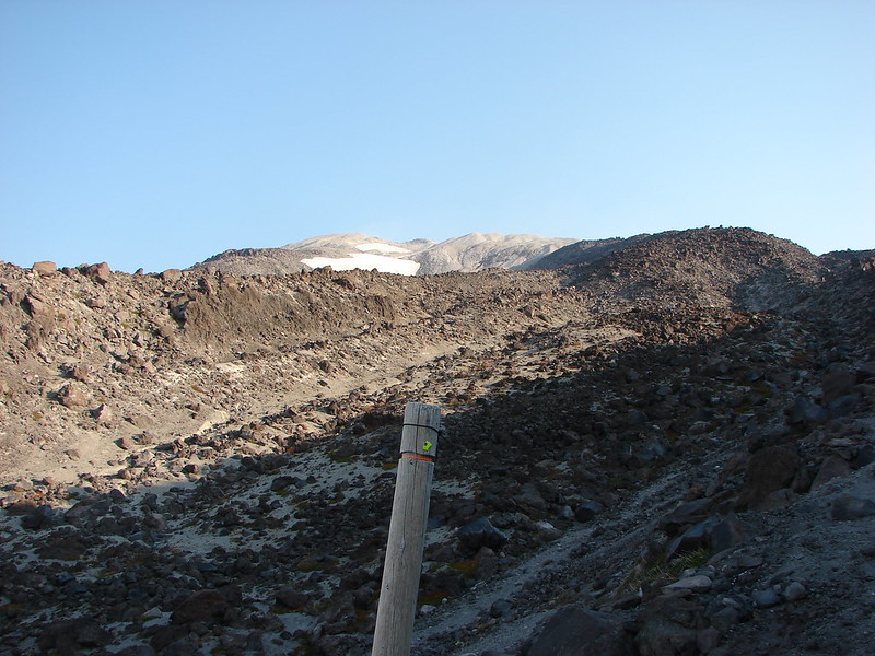
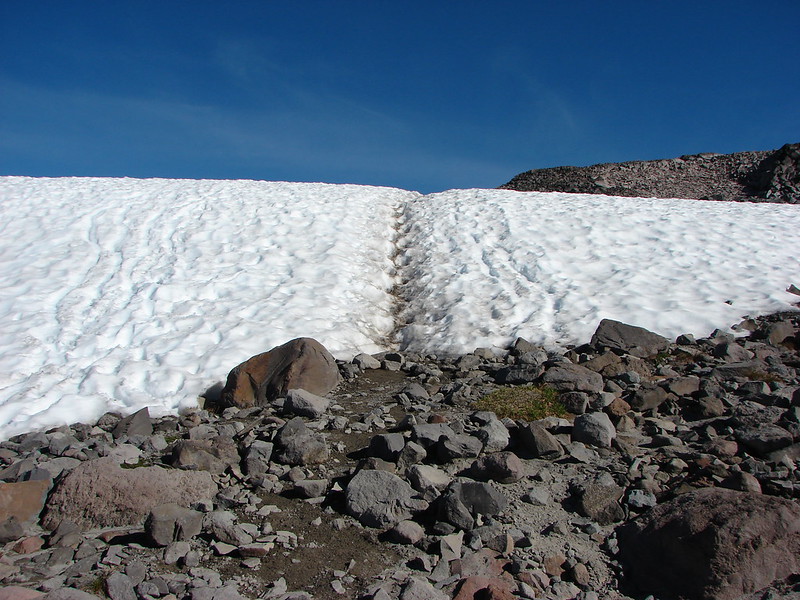
The trail crossed several snowfields but unlike those we encountered the day before the trail was easy to follow and none were too steep.

DSC03655

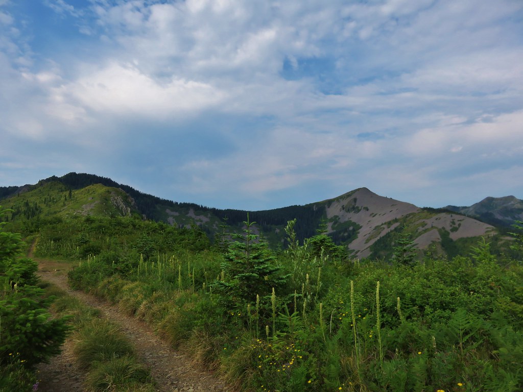
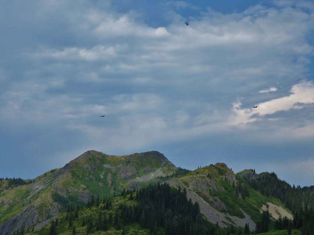
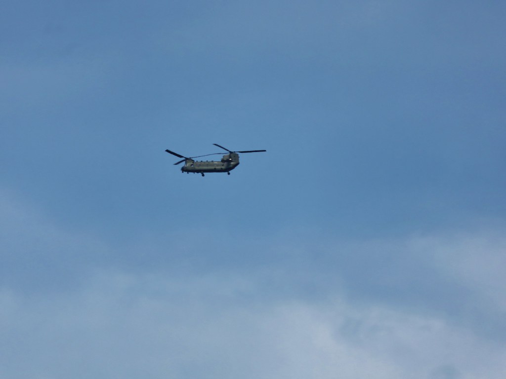
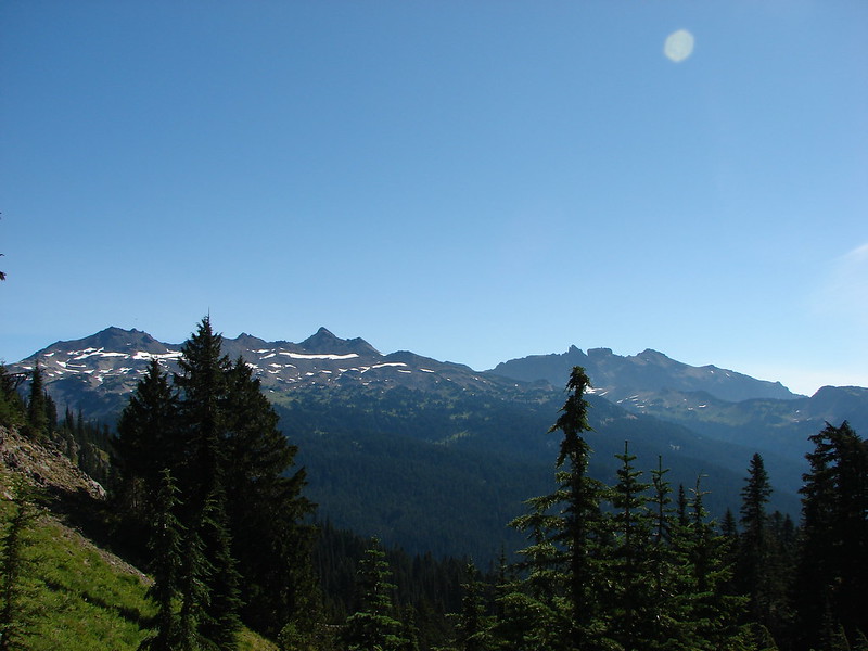
The views were great in every direction and we were able to spot a new mountain to the North – Mt. Stuart.

DSC03659

DSC03669

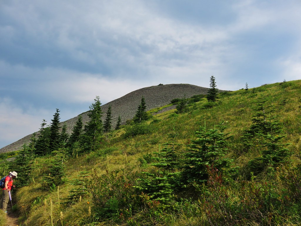
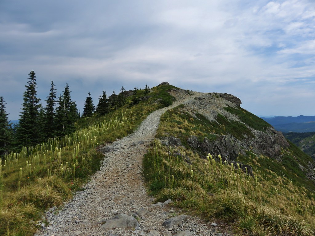
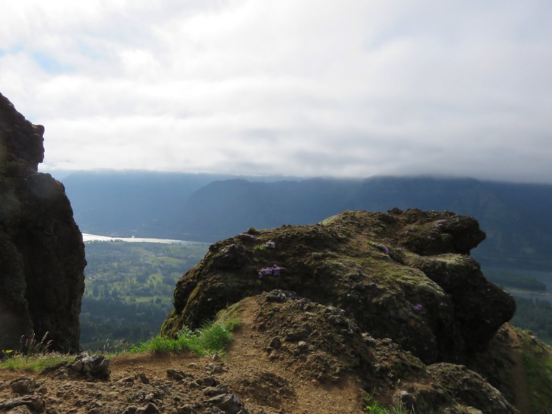
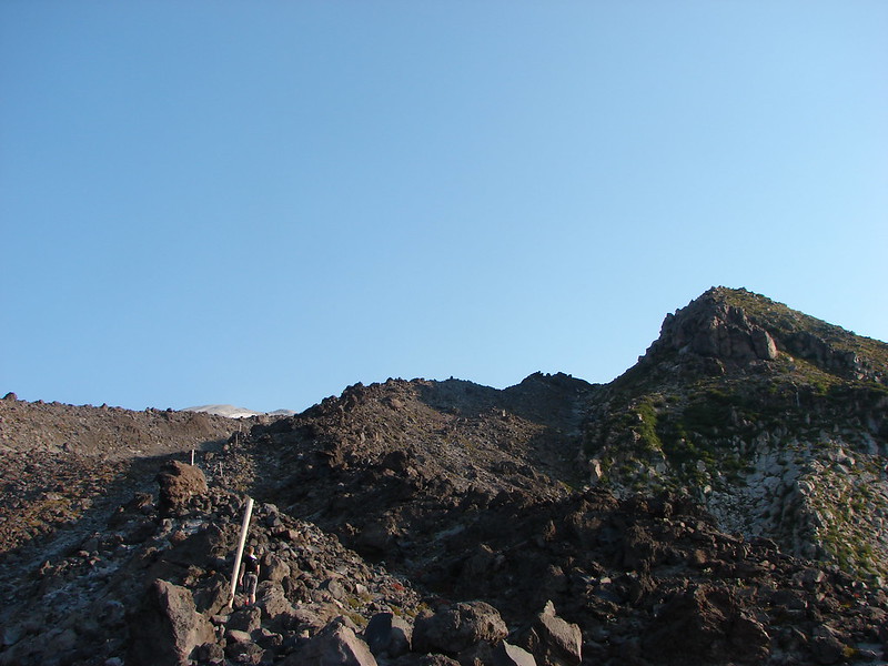
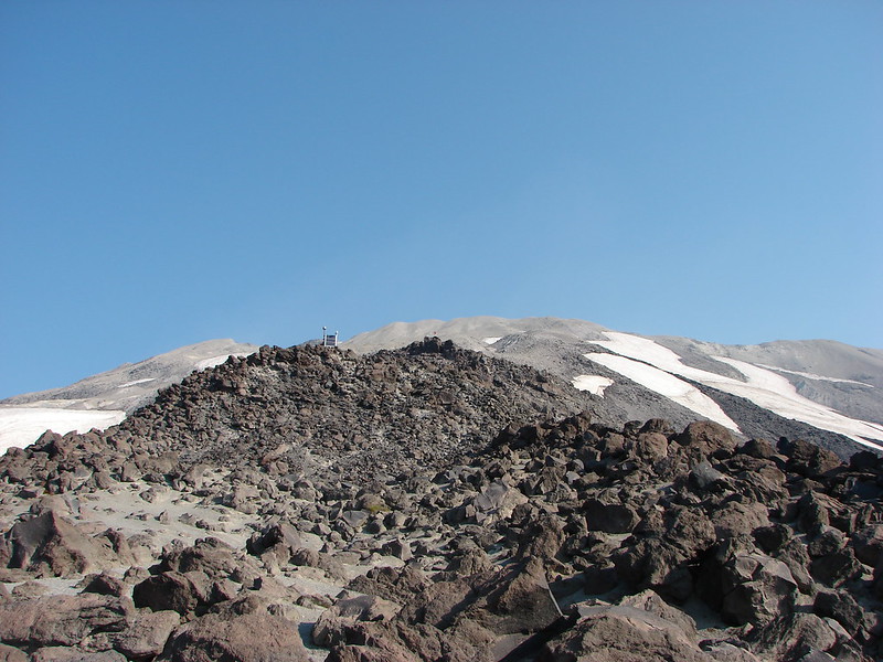
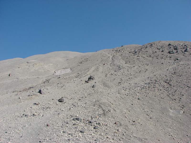
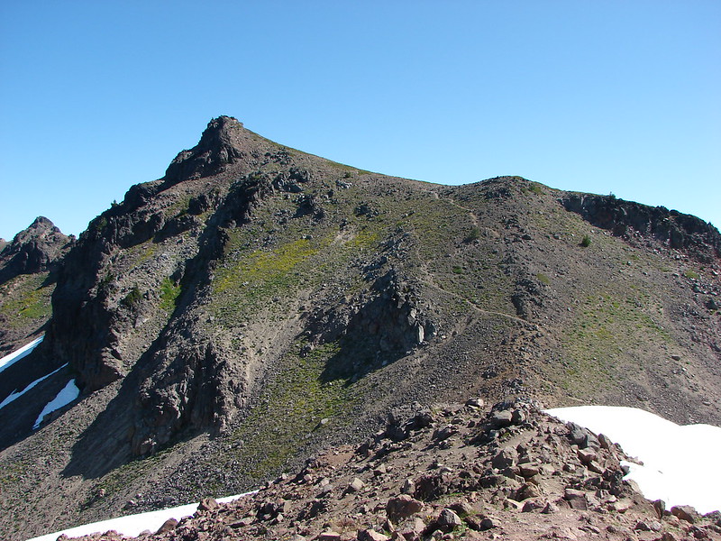
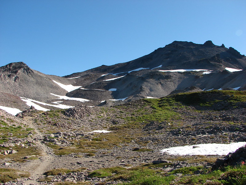
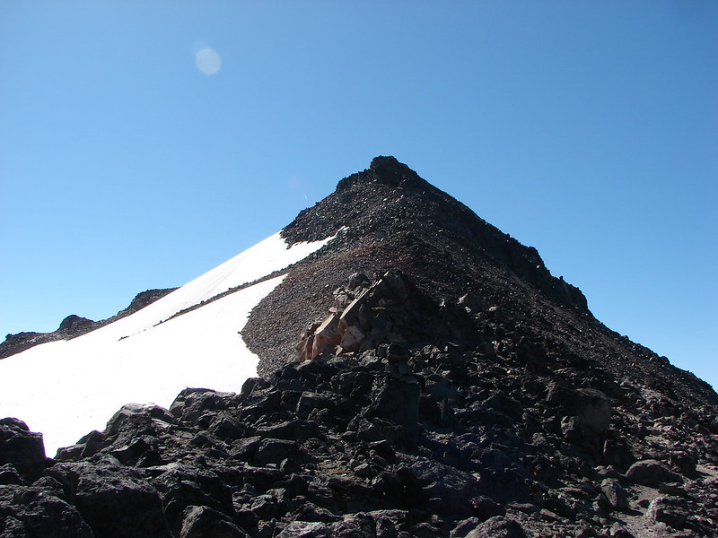
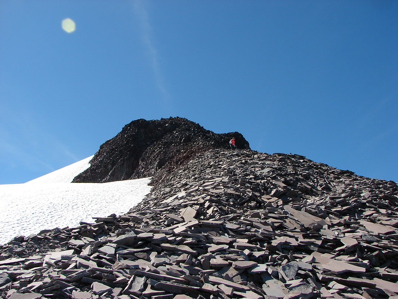
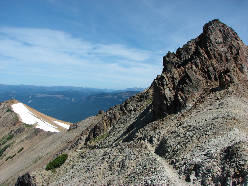
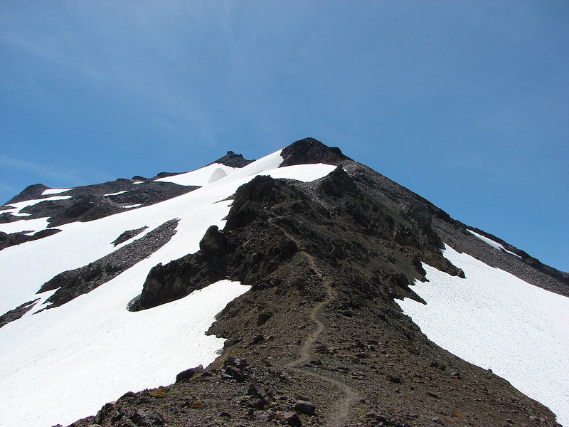
The PCT eventually splits with a hiker bypass climbing up higher on the side of Old Snowy to avoid lingering snowfields on a steep, exposed hillside. We took the bypass having seen the snow fields from our exploration of Hawkeye Point the day before, plus we had considered climbing Old Snowy Mountain and the bypass would lead past that trail. When we reached the junction for the summit of Old Snowy we could only make out the lower portion of trail. After the previous days exploits we decided against trying to climb it then and figured we could always try it on the way back past.

DSC03683

We found out later that the crest of the bypass trail is the highest point of the Pacific Crest Trail in the state of Washington at 7230′.

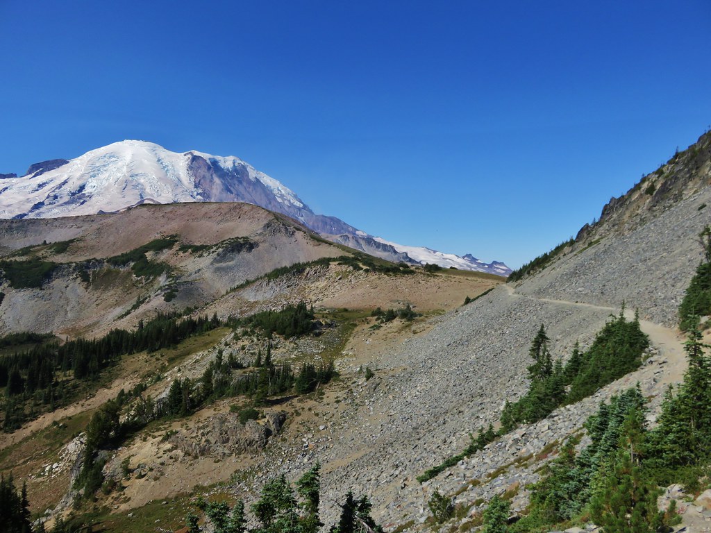
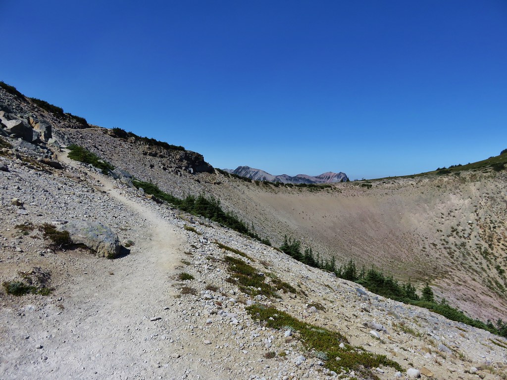
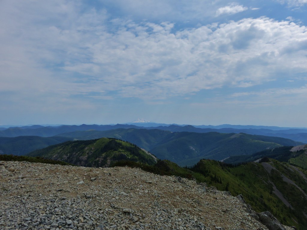
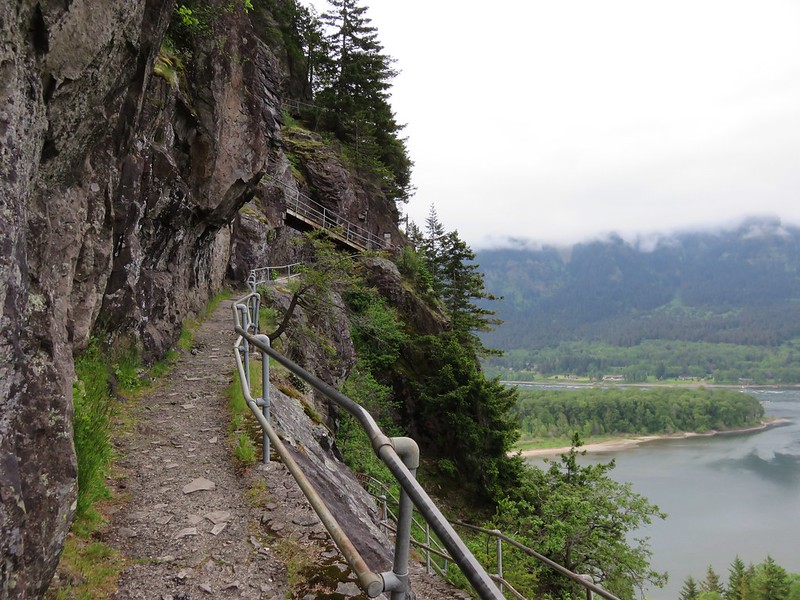
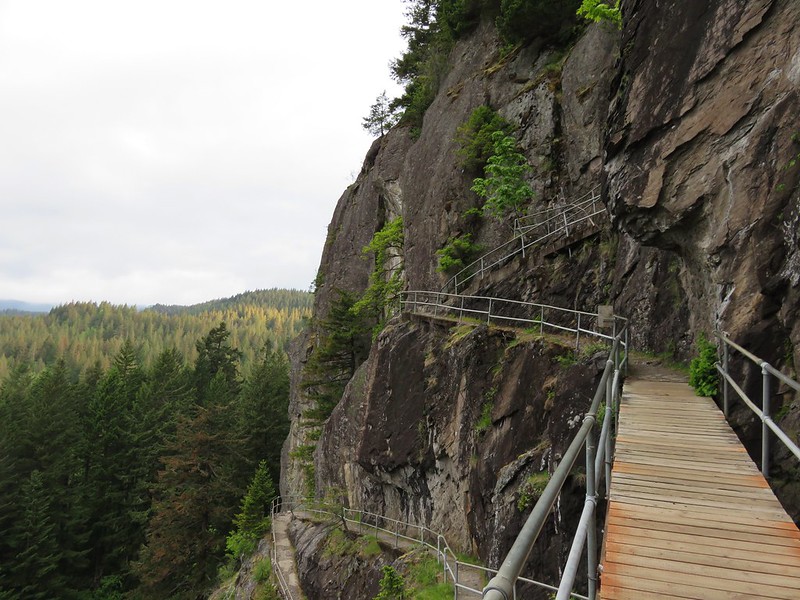
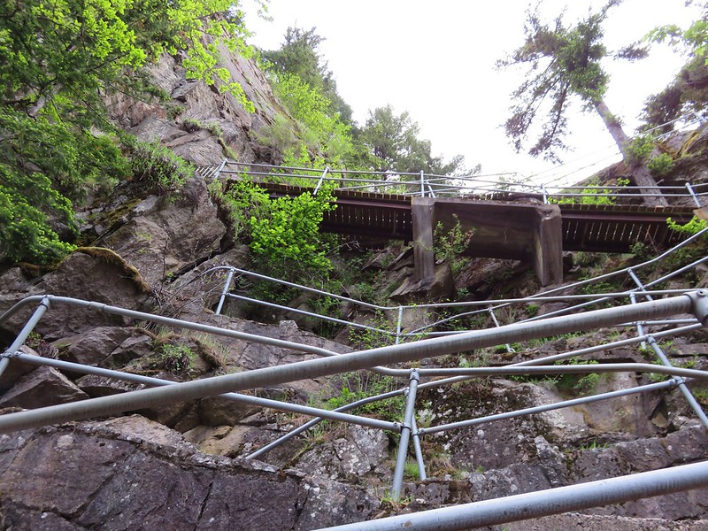
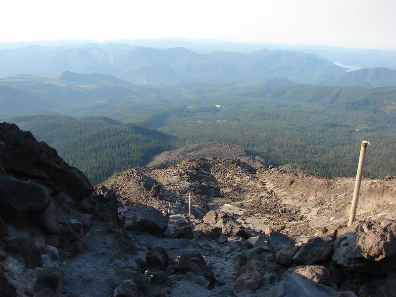
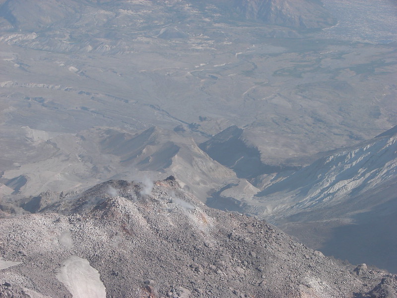
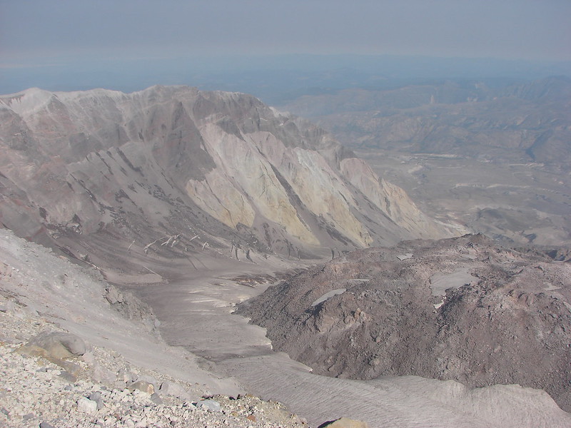
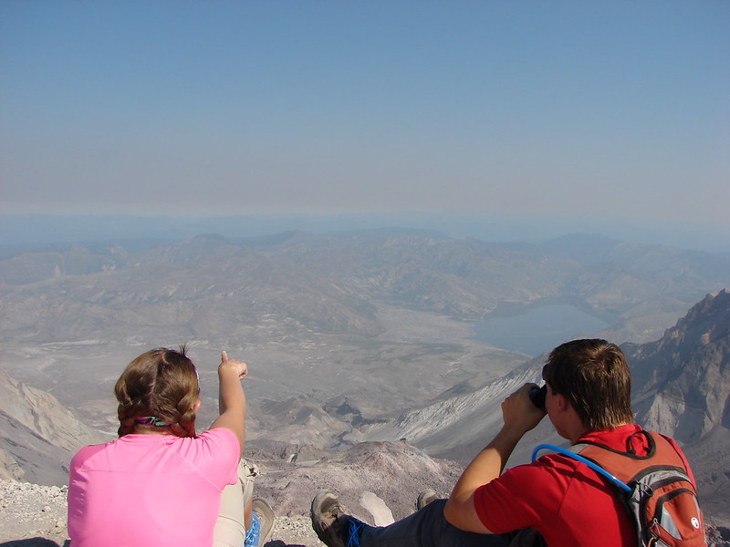
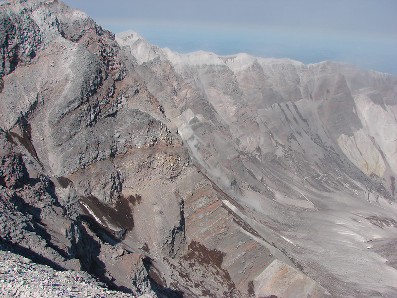
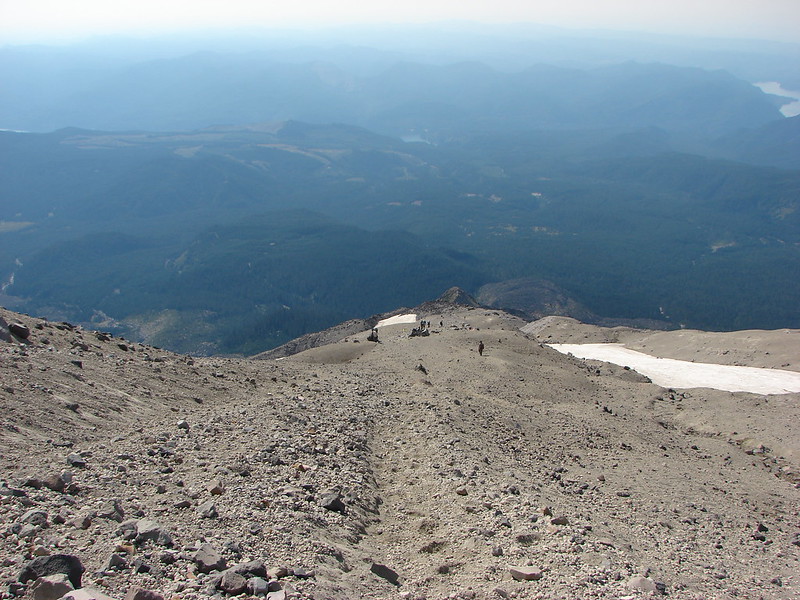
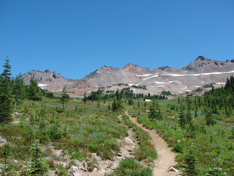
From the crest the PCT descends to “The Knife” before reaching Elk Pass where we had planned to turn around. As we began to descend though we got a good look at the trail ahead.

DSC03691

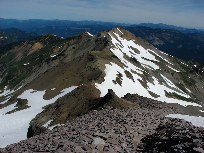
It was the freakiest looking trail we had encountered and for the first time I wasn’t sure I could do it, but after having a couple of thru-hikers pass by and survive we decided to go for it.

DSC03692

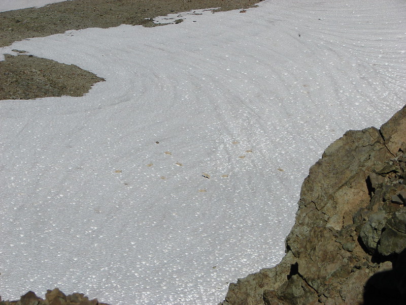
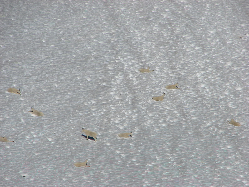
It was nerve racking at first but the trail was good and the views better. We spotted flowers and wildlife all around including a large group of mountain goats in the valley to our right.

DSC03698

DSC03705

DSC03725

DSC03709

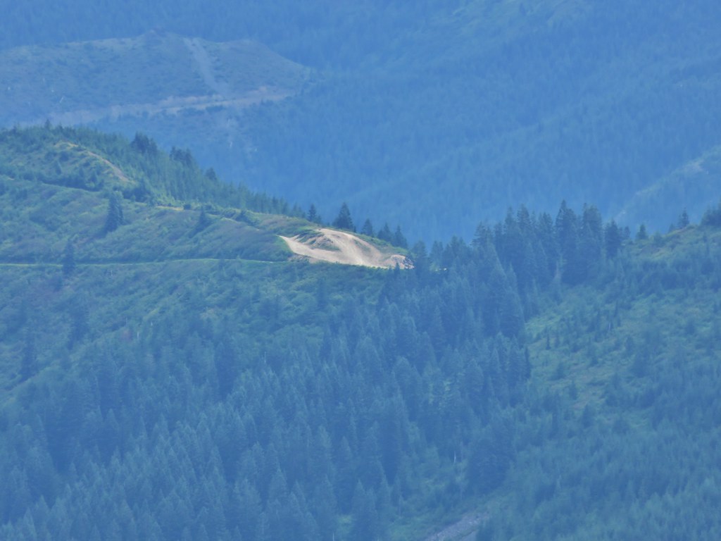
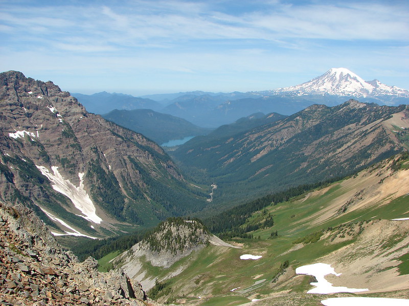
Soon we could see Packwood Lake in the valley to our left.

DSC03758

Also in that valley was another herd of goats.

DSC03769

DSC03772

We decided to turn around prior to reaching Elk Pass when we reached a crest and realized that we’d have to climb back up several hundred feet if we continued on and we already had a good climb ahead of us to get back up to the PCT high point.

PCT down to Elk Pass

DSC03830

PCT up to the crest

DSC03906

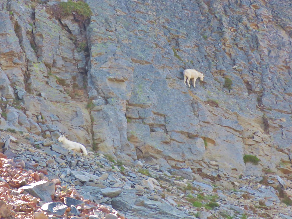
As we were returning the first group of goats we had seen suddenly started to dash across the snow. A second group came racing down from a higher meadow joining the first group.

DSC03887

DSC03895

DSC03900

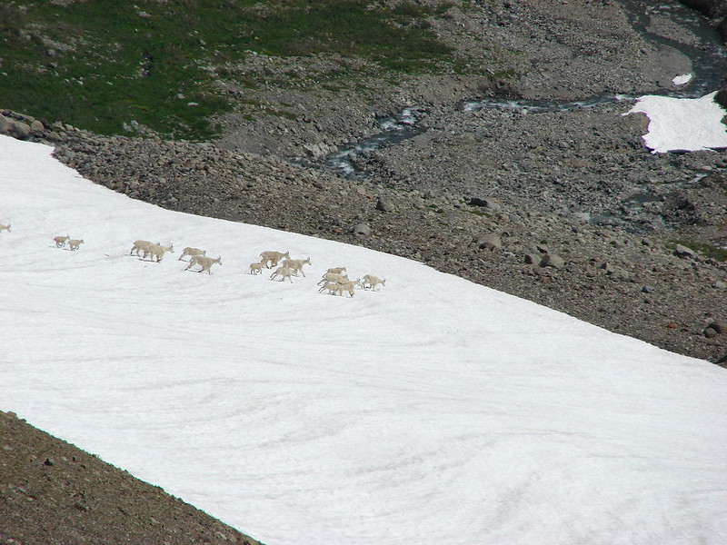
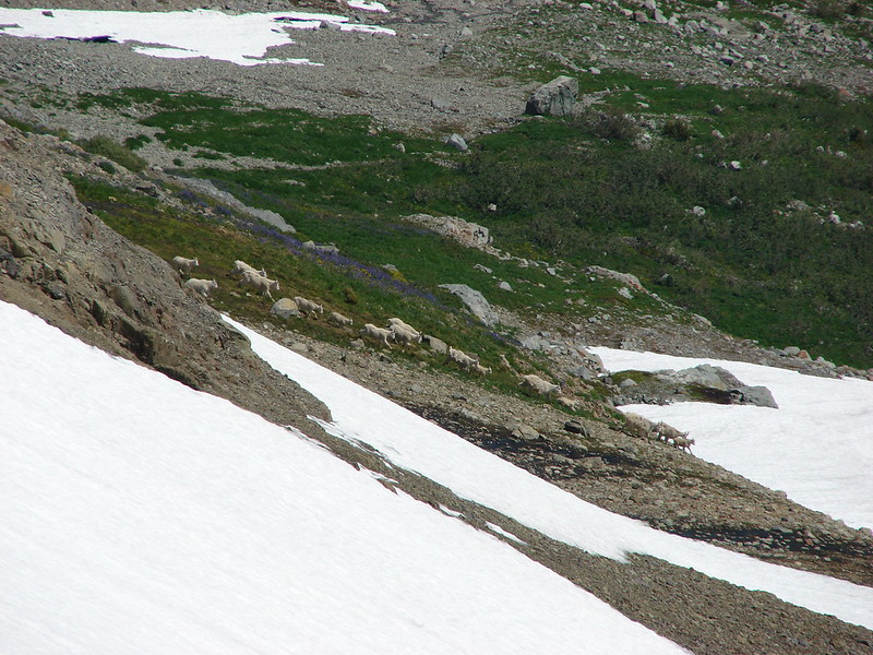
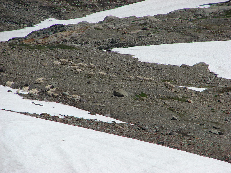
We don’t know what spooked them but it was fun to watch them run.

When we finally got back up to the crest the trail up Old Snowy was easy to see. There was a line of people hiking up and down. Between the crowds and our tired legs we decided we’d done enough climbing for the day and headed back to Alpine. Things had gotten crowded in the wilderness as it was the weekend and a lot of people had shown up. Most of the camp sites were now taken so we stuck close to ours until we turned in for the night after the Moon had risen.

DSC04013

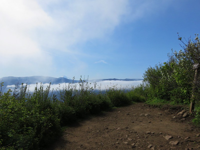
We set our phones to wake us at 5am on our last day so we could get a nice early start. Another amazing sunrise greeted us as we packed up our gear.

DSC04018

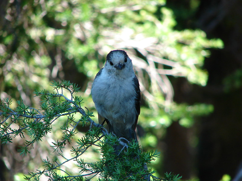
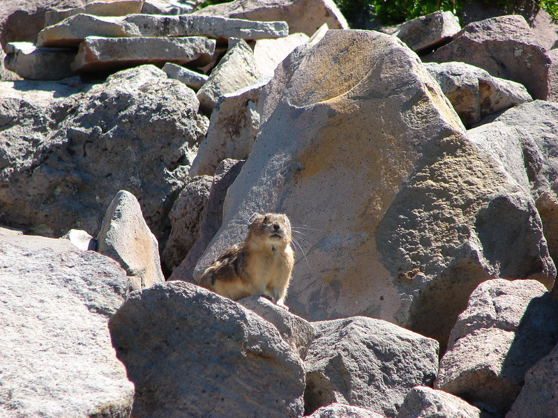
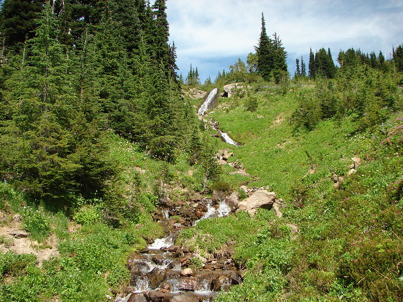
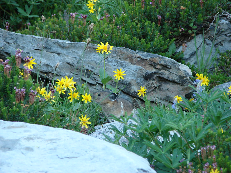
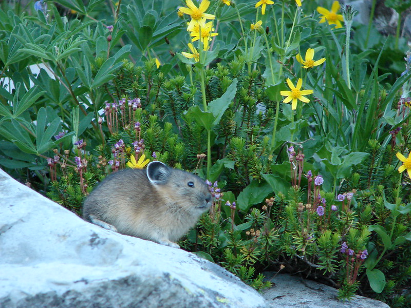
We took the Lily Basin Trail toward Goat Lake and were greeted by a friendly little Pika near Slide Falls.

DSC04026

DSC04030

The marmots were also out to send us off.

DSC04036

DSC04037

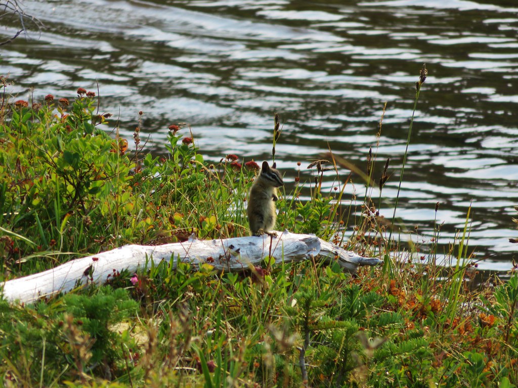
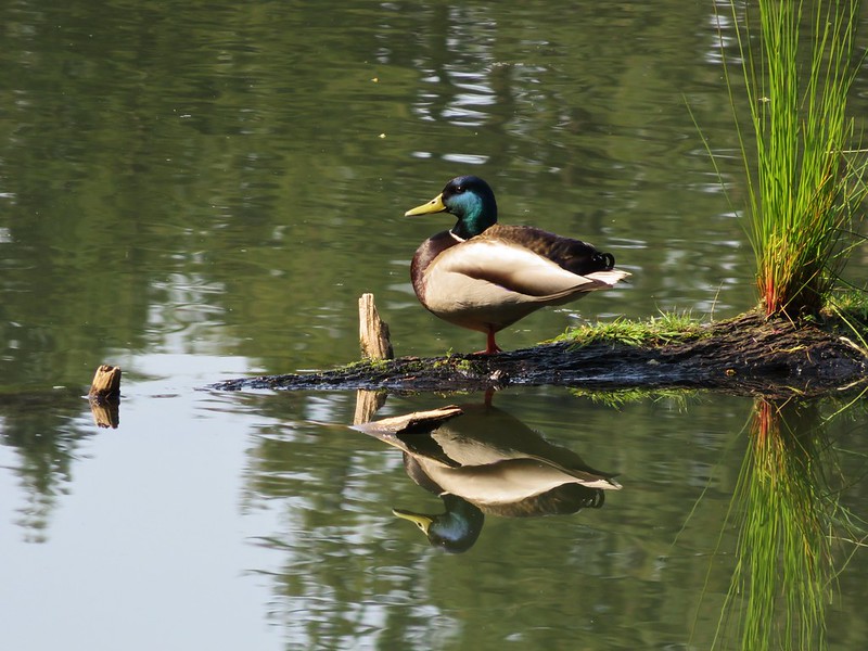
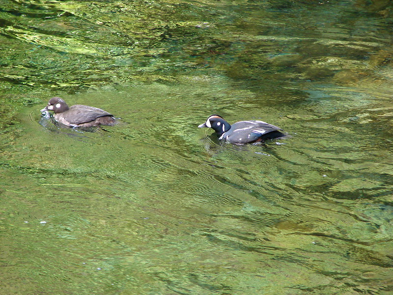
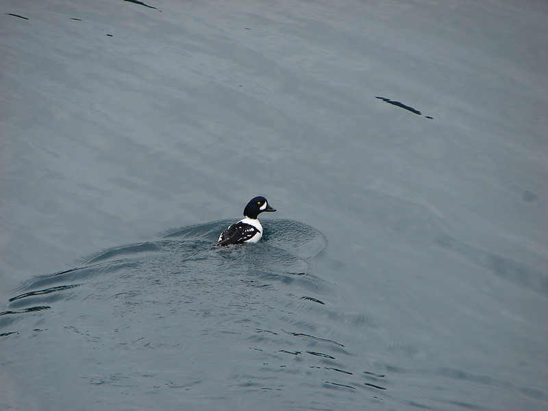
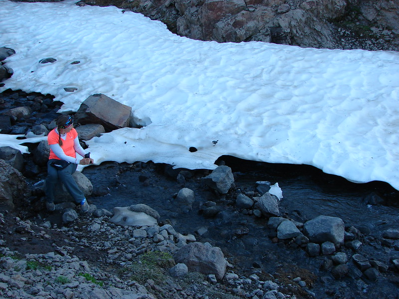
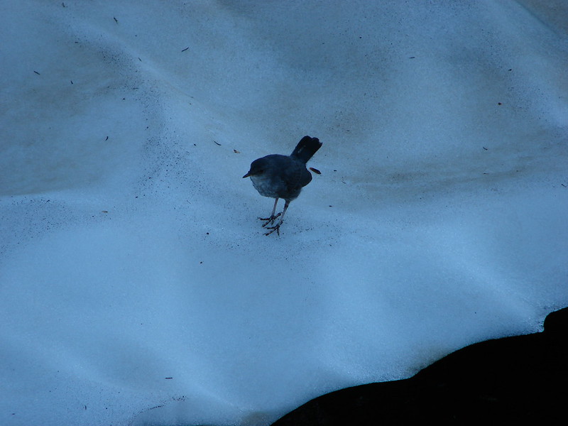
We stopped at the lake to get some water out of Goat Creek and were paid a visit by a pair of Ouzels.

DSC04057

DSC04053

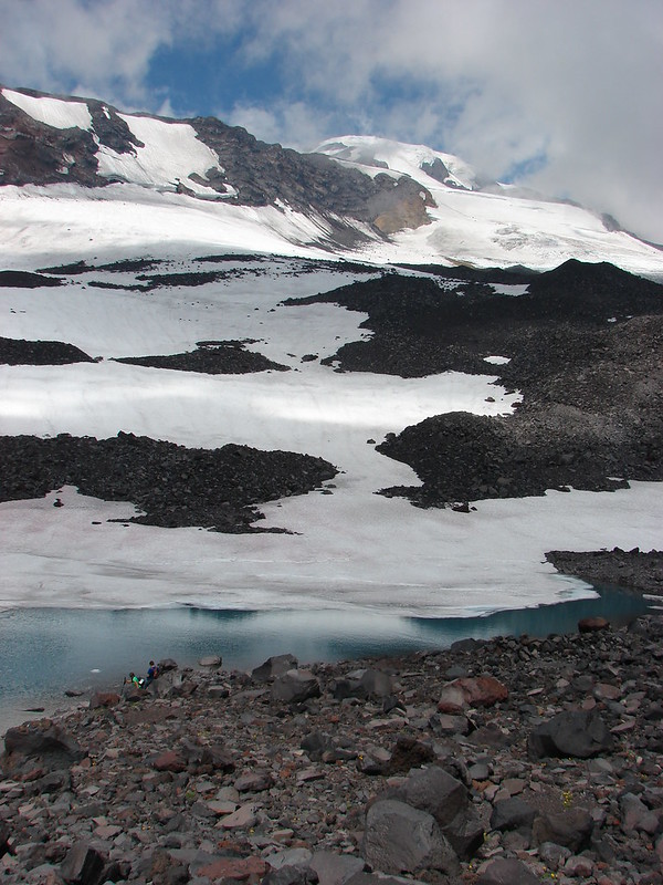
Goat Lake had refrozen a little overnight.

DSC04058

DSC04059

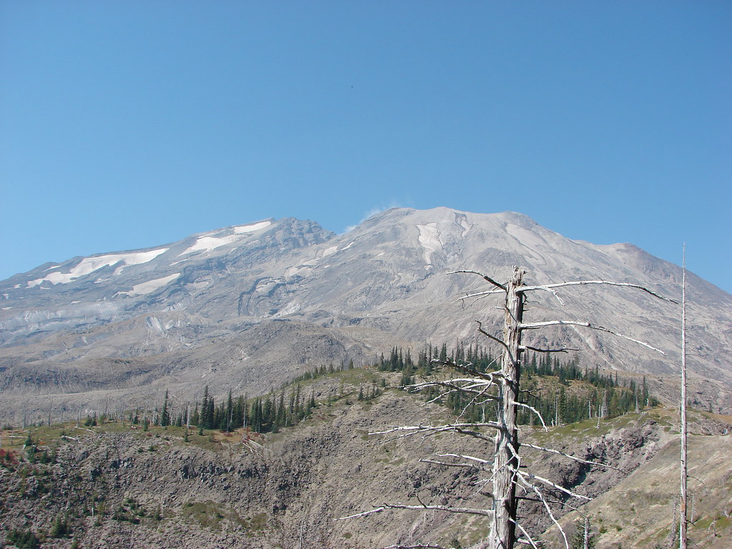
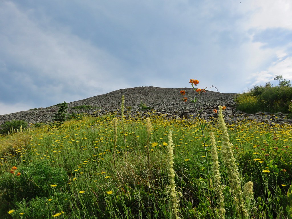
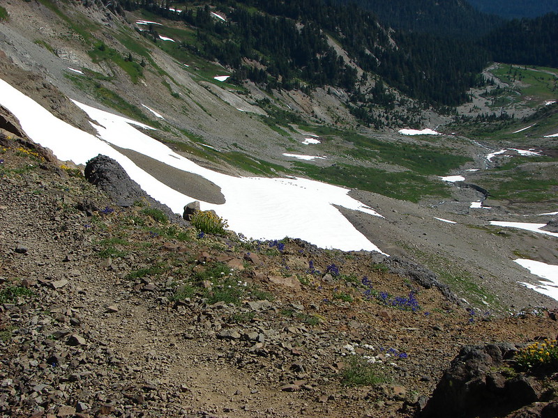
At the junction with the Goat Ridge Trail we took it and dropped down into the Jordan Basin. The best views we’d had of Mt. St. Helens were had as we descended into the basin.

DSC04075

Of course there were wildflowers.

DSC04081

And a lot of crickets or grasshoppers.

DSC04082

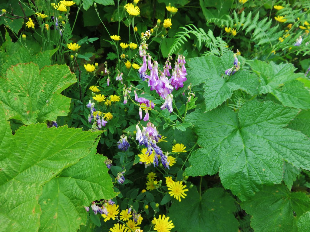
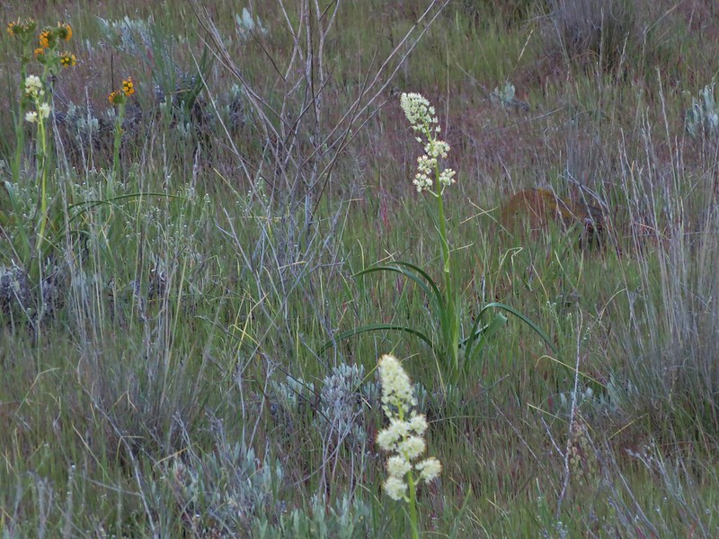
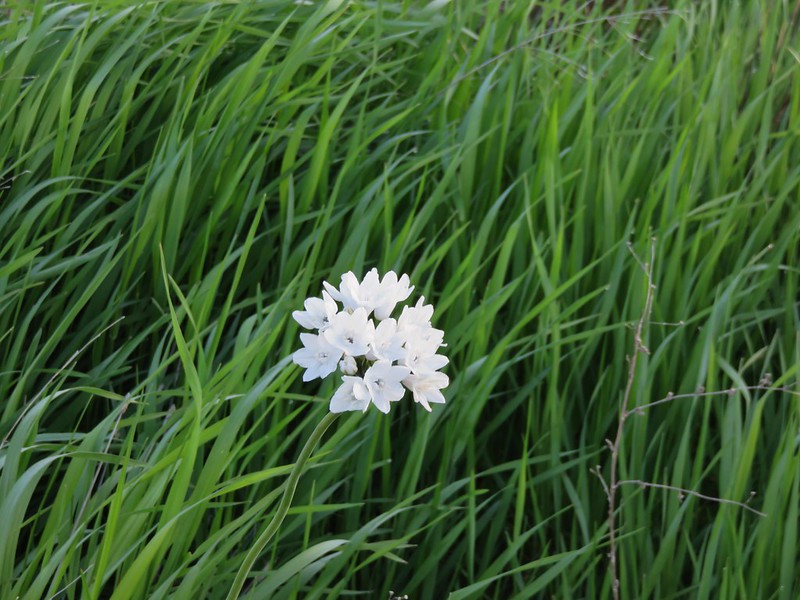
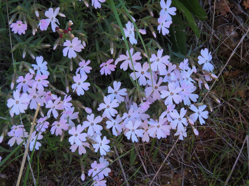
There were flowers in this basin that we hadn’t seen at all in the other parts of Goat Rocks.

DSC04105

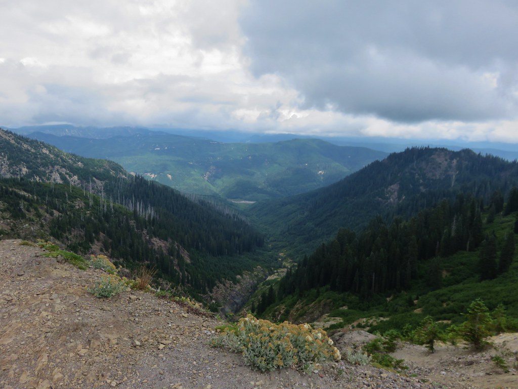
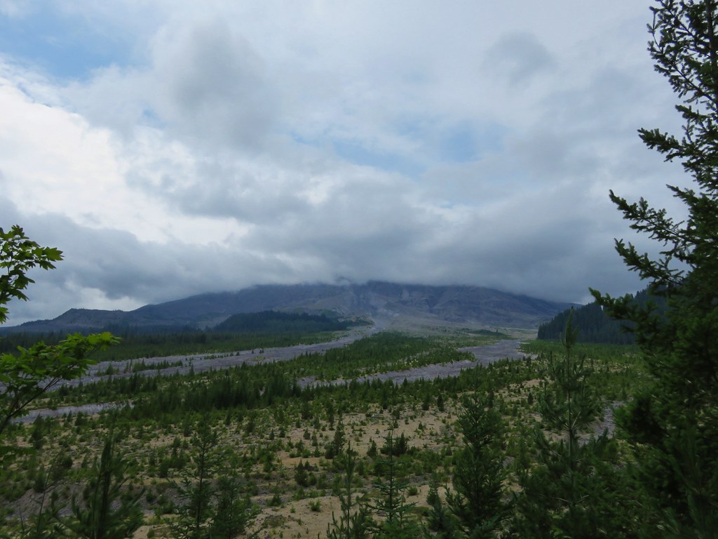
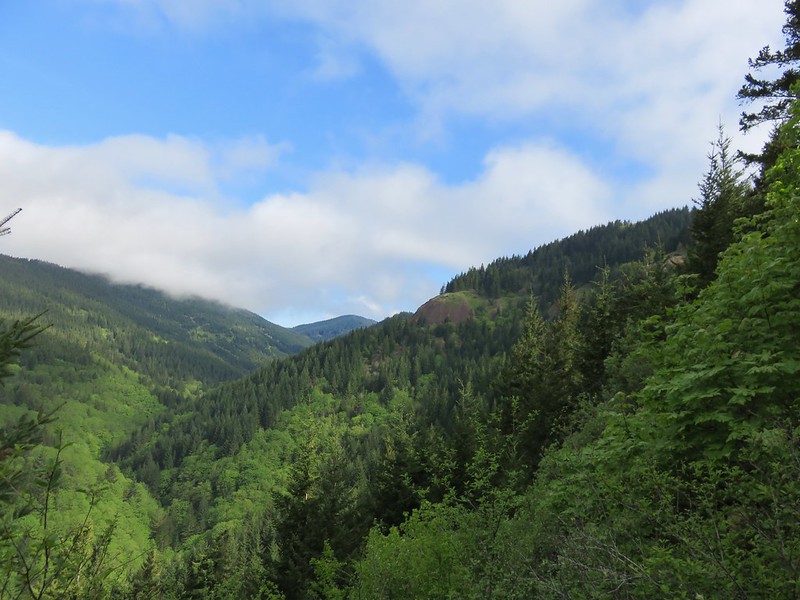
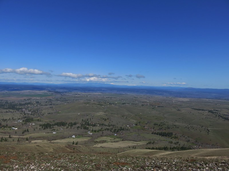
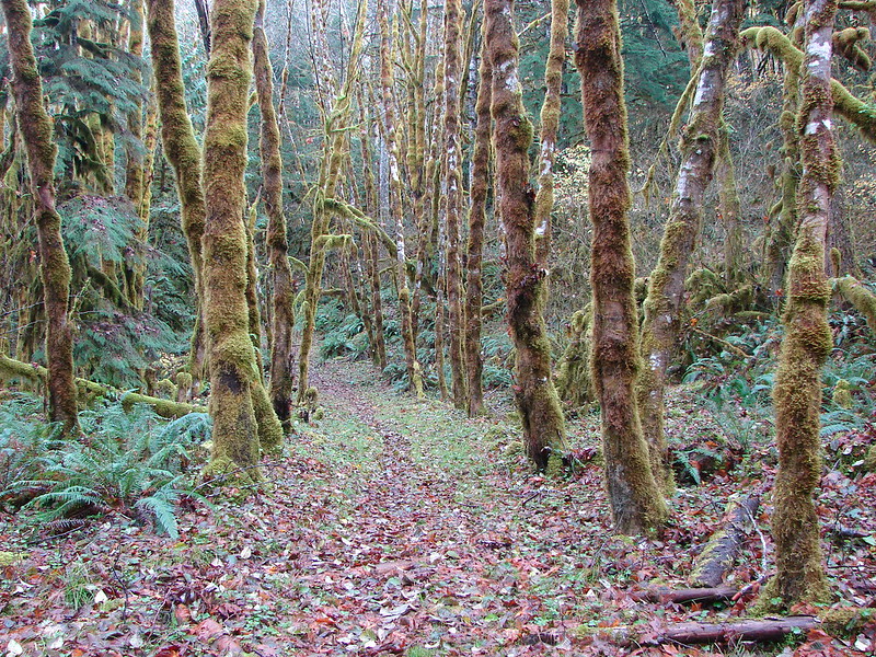
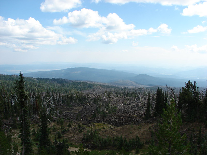
Soon we were far enough down to no longer be able to see the mountains. It was a bittersweet hike as we hated to leave this beautiful place but after four days a shower was sounding real nice. We got one last glimpse of Mt. Rainier, Mt. Adams, and Goat Rocks before entering the trees for good.

DSC04158

DSC04172

DSC04170

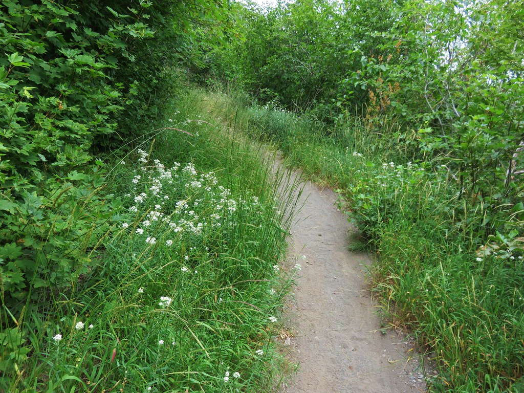
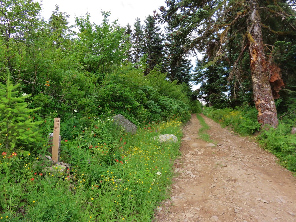
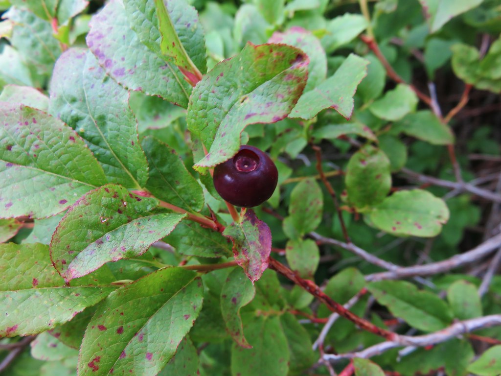
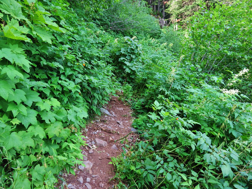
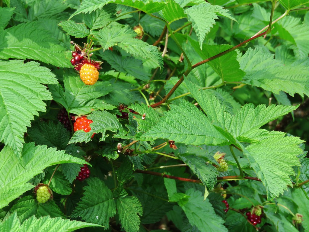
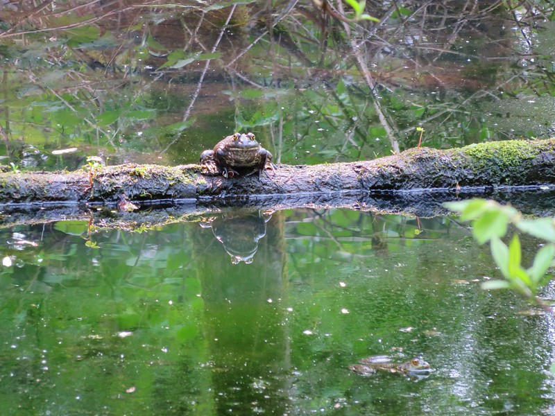
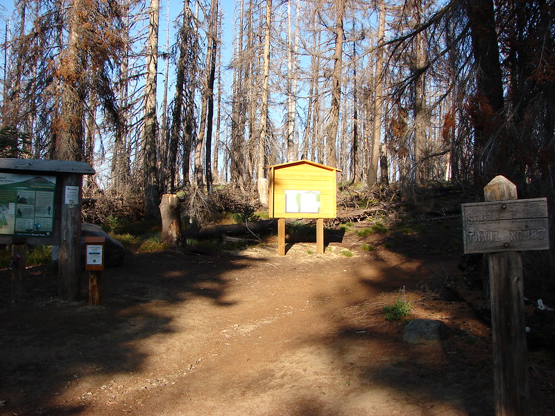
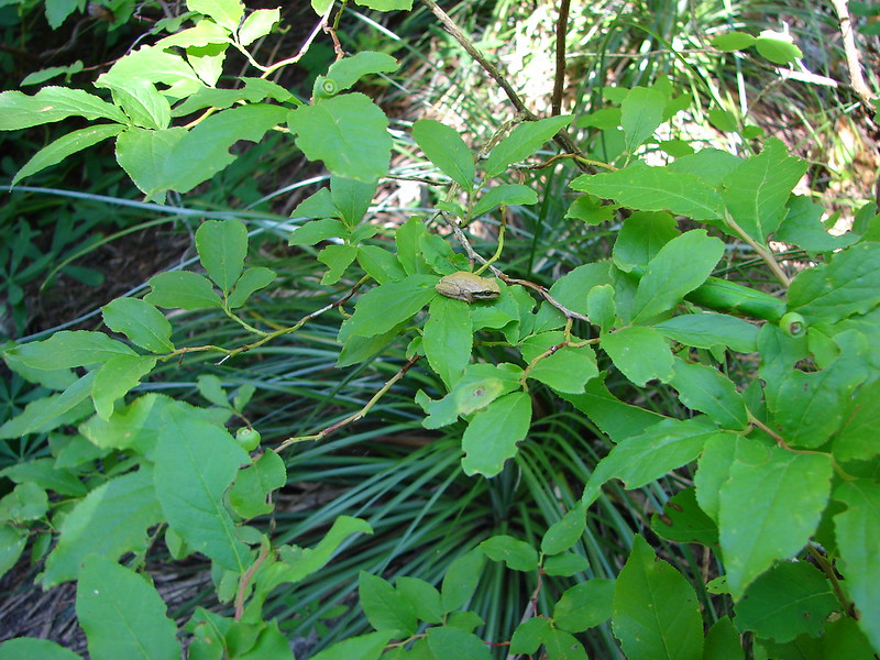
The Goat Ridge Trail would take us to the Berrypatch Trailhead and from there a .6 mile connector trail would bring us back to the Snowgrass Trail just .1 miles from our car. We were moving quickly along the connector trail when the wilderness gave us one last surprise. A small tree frog sitting on a huckleberry bush next to the trail.

DSC04199

Our time was up but we were already thinking of our next visit. We can’t wait to go back and explore more of the wilderness. The only negative to the entire trip was witnessing the disregard for the area that some of the people showed. There were people traipsing through the meadows and setting up tents on the vegetation. Such a beautiful place to visit will only stay that way if people take care of it so please go and visit but stay on the trails and camp on the brown ground not the green. Happy Trails.

UPDATE on the llama.  The llama had indeed either been left or escaped and was seen multiple times throughout the summer.  She was finally rescued this fall and is safe and doing well according to this report: http://www.rattlesnakeridgeranch.com/documents/Rescue_in_the_Goat_Rocks_Wilderness.pdf


Flickr albums: Day 1-https://www.flickr.com/photos/9319235@N02/sets/72157646295294436/

Day 2-https://www.flickr.com/photos/9319235@N02/sets/72157646295758026/

Day 3-https://www.flickr.com/photos/9319235@N02/sets/72157645936565989/

Day 4-https://www.flickr.com/photos/9319235@N02/sets/72157645937647578/