Categories
High Cascades Hiking Oregon Three Sisters Area Throwback Thursday Trip report

Throwback Thursday – Horse Lake

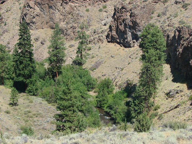
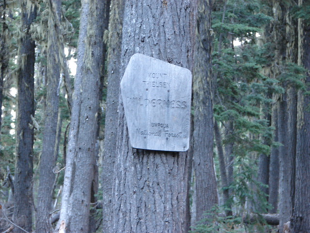
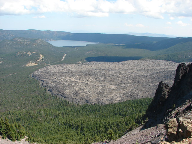
We are throwing back once again to our August 2011 vacation in Central Oregon.  On 8/4/11, the day after our mosquito infested attempted hike at Benson Lake, we were headed back out to another lake. We had originally planned on visiting the Green Lakes but after reading the snow report and our experience on the previous day we turned our attention to Horse Lake instead.  Although the elevation for the Horse Lake hike was only slightly lower than that of the Benson Lake Trail it’s location on the east side of the Cascade Crest meant less snow.

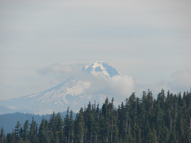
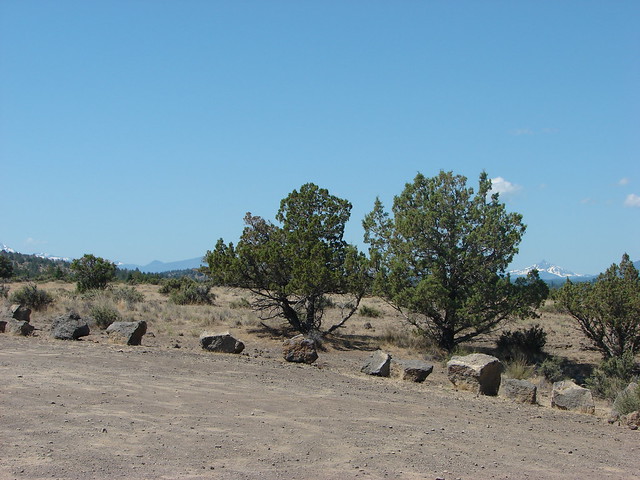
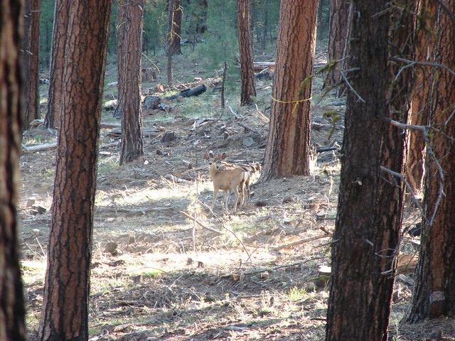
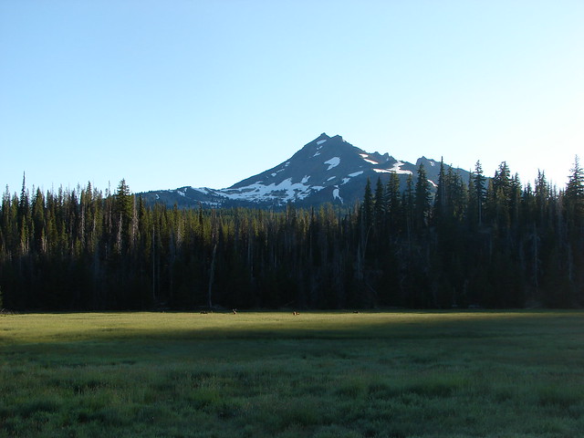
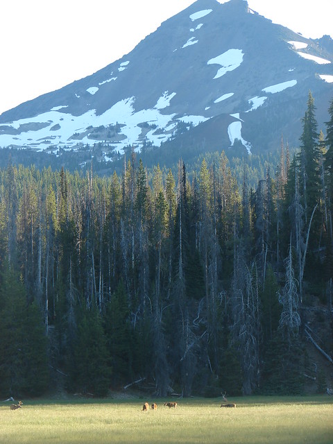
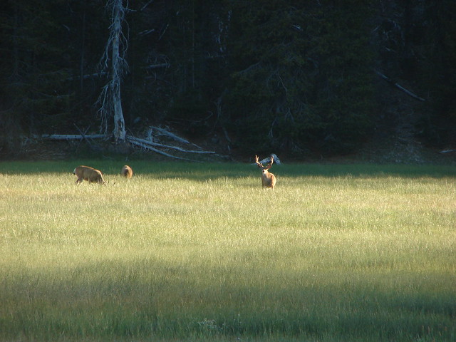
The trailhead is located across the Cascade Lakes Highway from the Elk Lake Resort just under 33 miles from Bend. On the drive that morning from Bend we spotted a number of deer in a meadow along the highway near Sparks Lake. Broken Top rose behind the trees completing an amazing scene.
Deer in a meadow below Broken Top

Deer in a meadow below Broken Top

Mule Deer

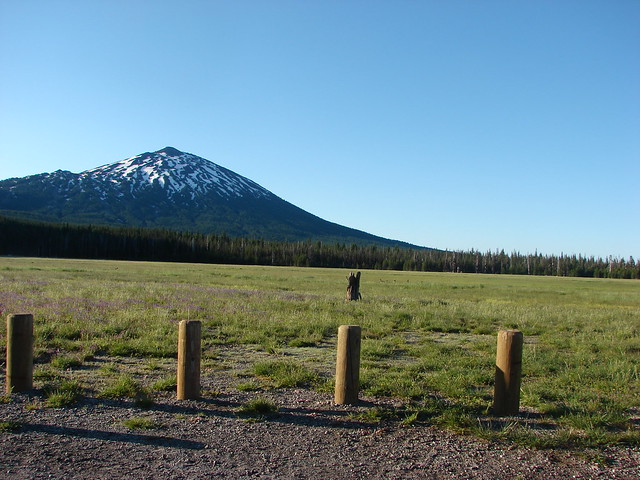
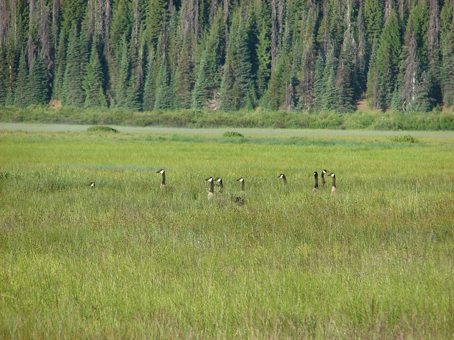
On the south side of the highway Mt. Bachelor loomed over the meadows around Sparks Lake where the heads of canada geese popped up out of the grasses.
Mt. Bachelor

Canada Geese

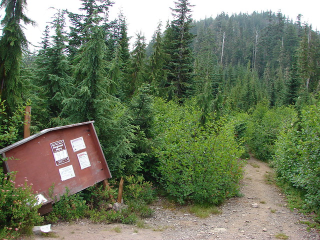
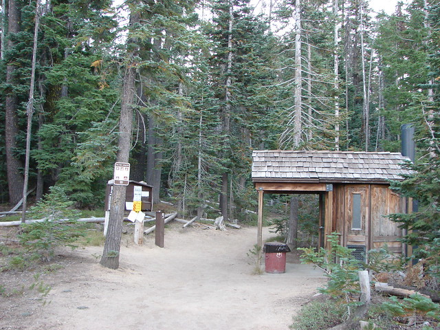
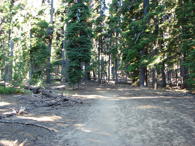
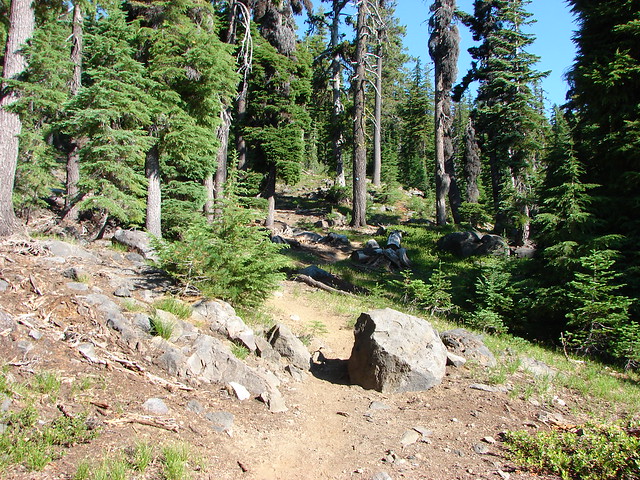
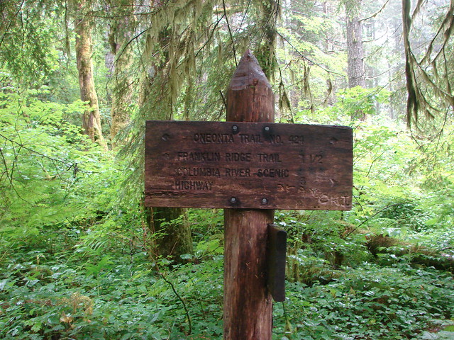
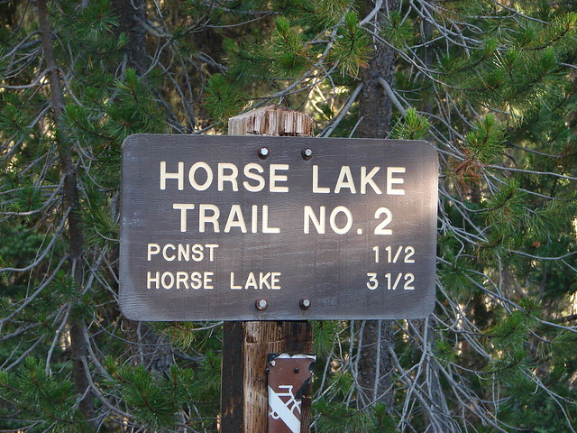
After enjoying the impromptu wildlife show we continued to the trailhead where we set off on the Horse Lake Trail.
Horse Lake Trail sign

Horse Lake Trail

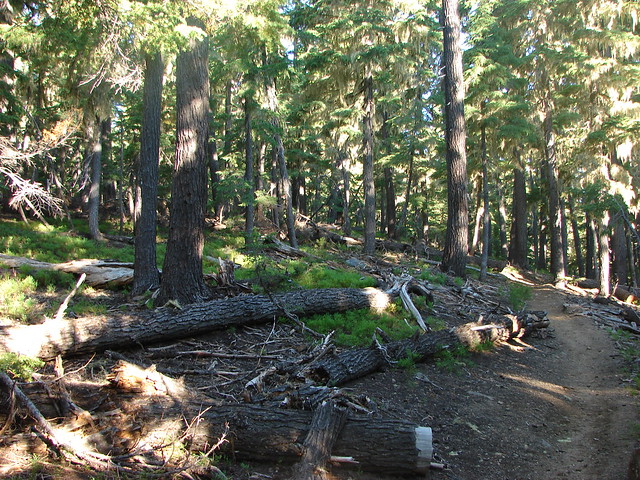
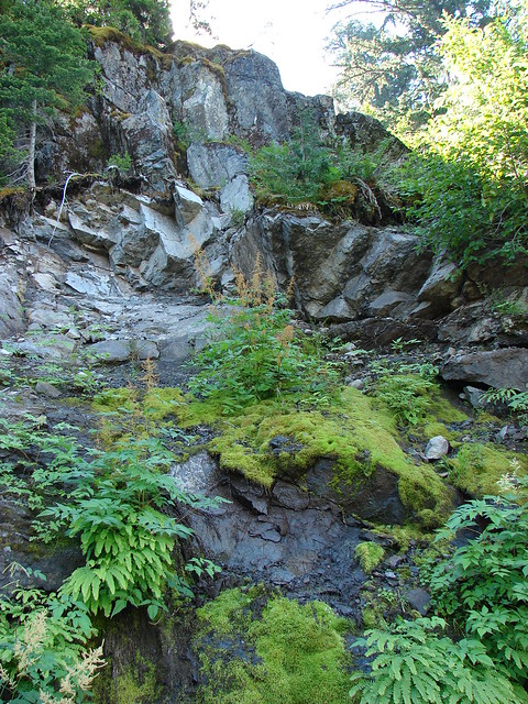
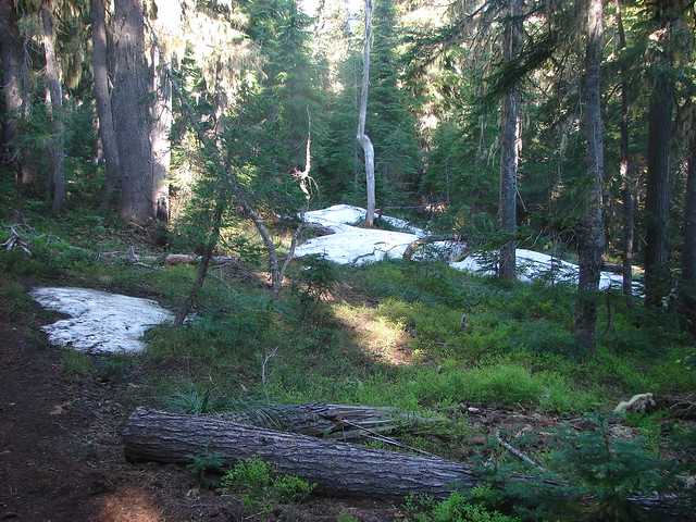
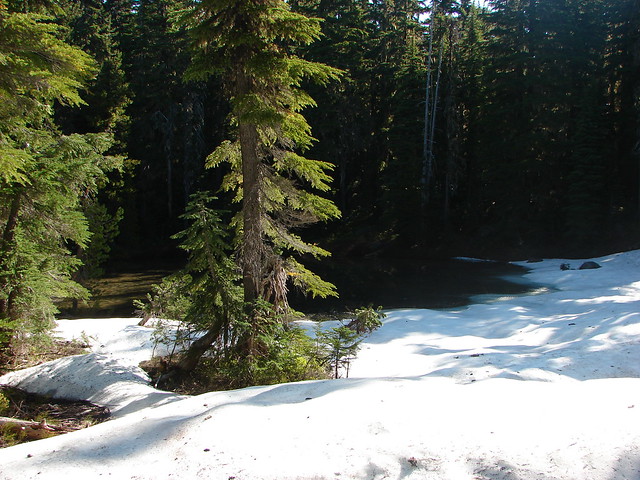
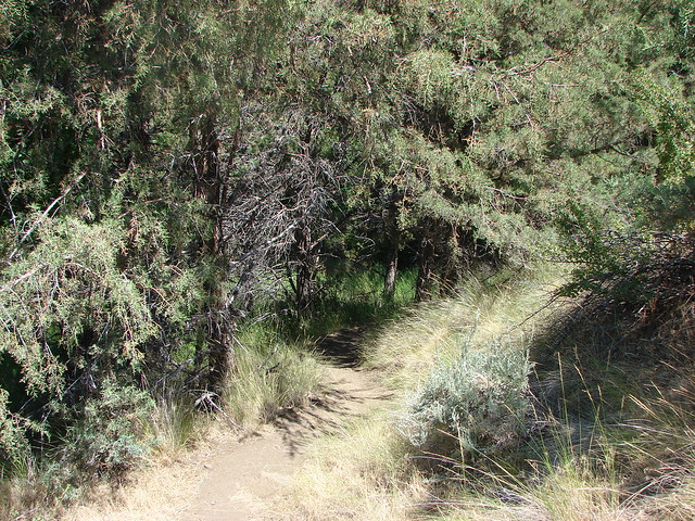
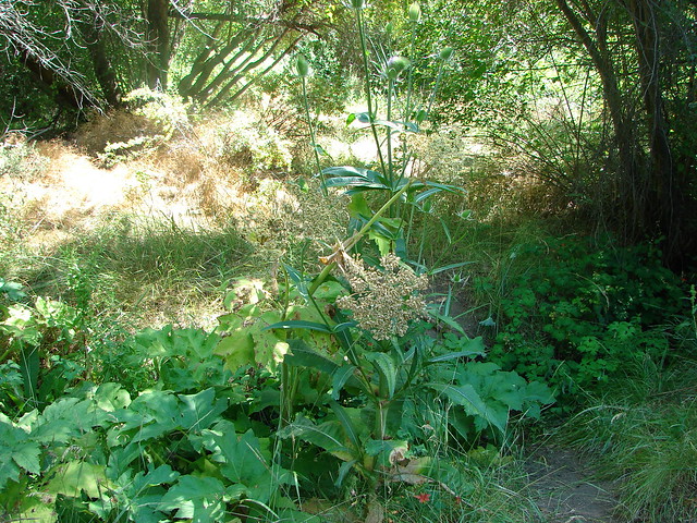
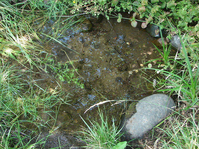
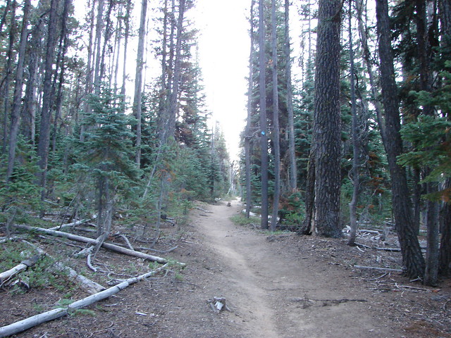
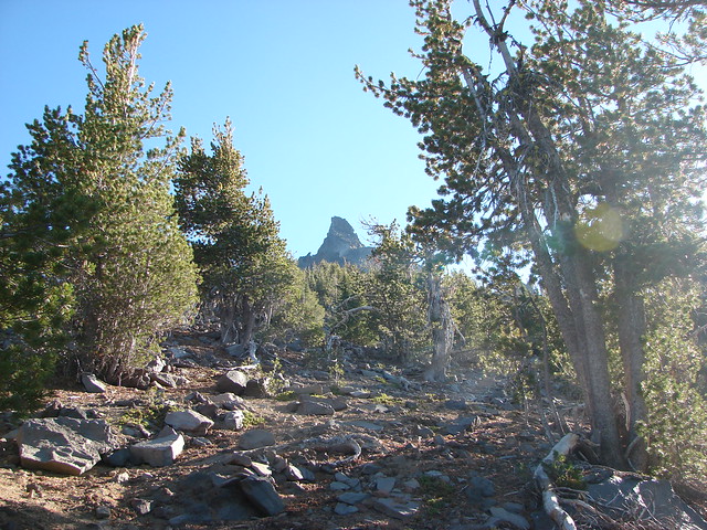
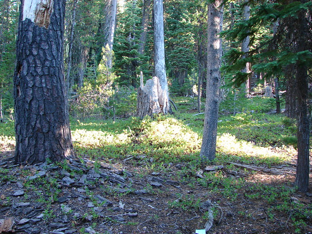
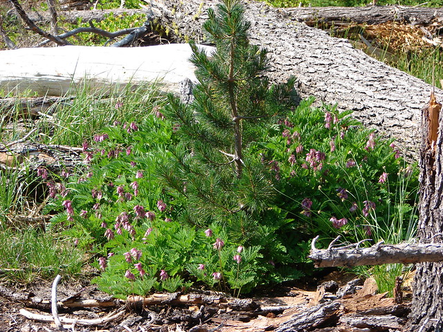
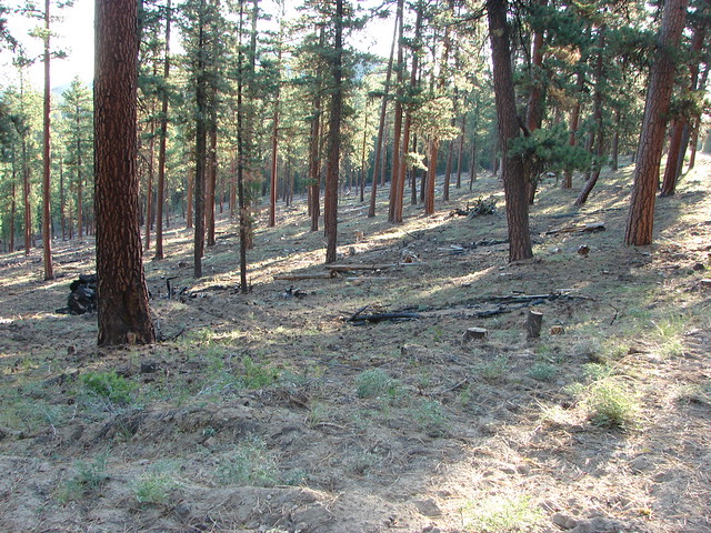
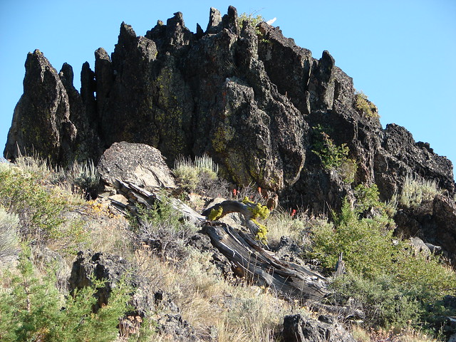
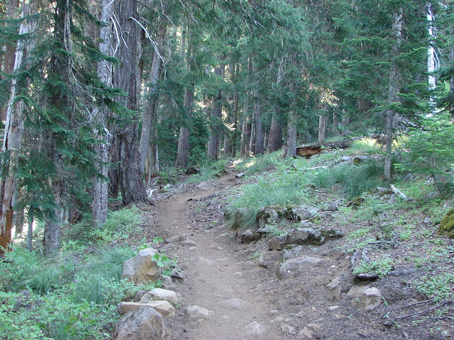
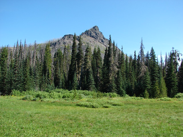
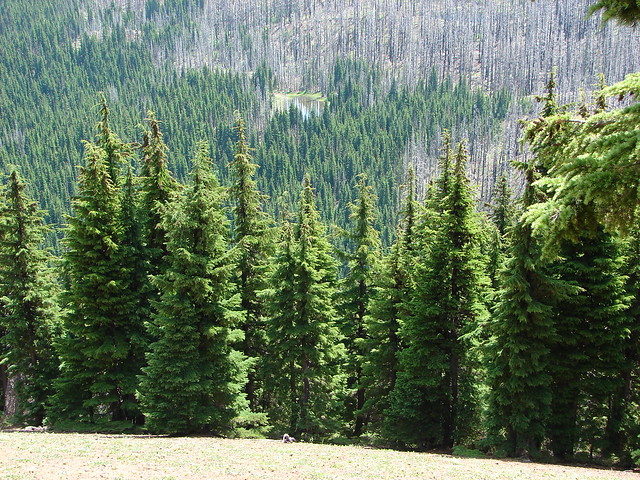
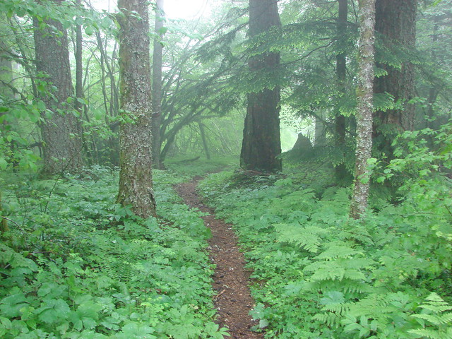
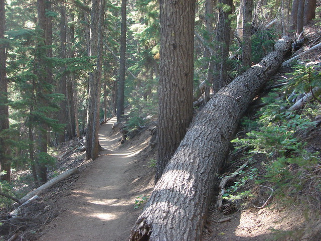
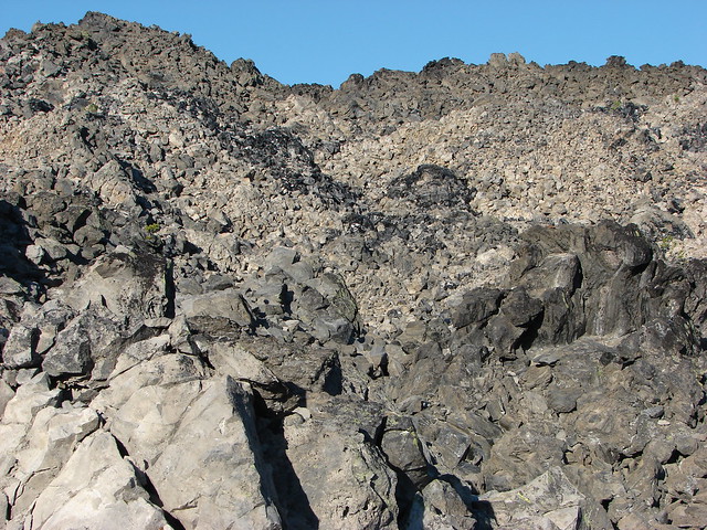
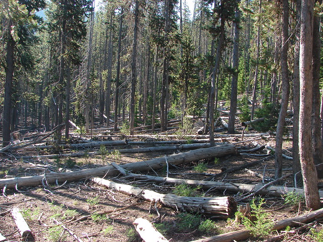
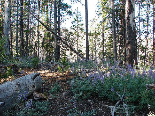
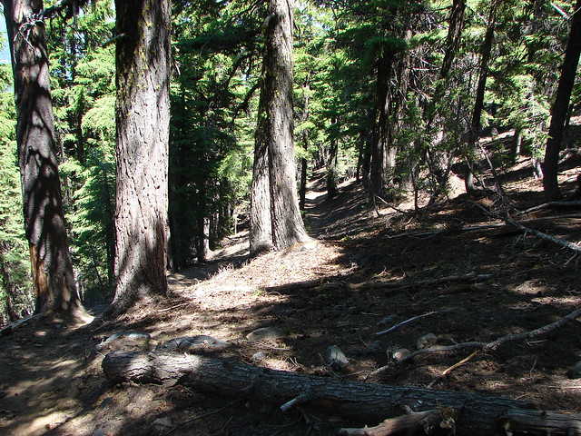
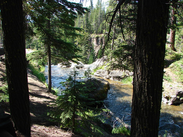
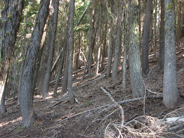
The trail passed through a nice forest gaining 300′ in just under a mile and a half to a junction with the Pacific Crest Trail then lost 350′ over the next 2 miles to another trail junction near Horse Lake. We were not able to take many pictures along this first portion of the hike. Although there was much less snow along this trail there were just as many mosquitoes. Their high pitched whinny buzz was an ever present annoyance, and after Heather’s experience of having one fly into her eye neither of us wanted them anywhere near our heads. We hurried along and came upon a pair of Forest Service employees doing some trail maintenance decked out in mosquito netting. We paused for just a second and they asked us how we were able to deal with the bugs to which we answered that we were covered in Deet and moving as quickly as possible.
Snow on the Horse Lake Trail

Horse Lake Trail

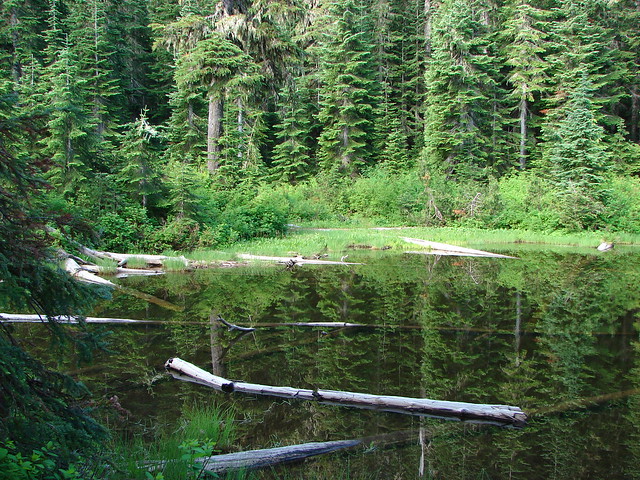
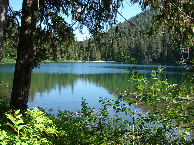
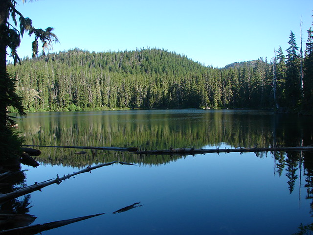
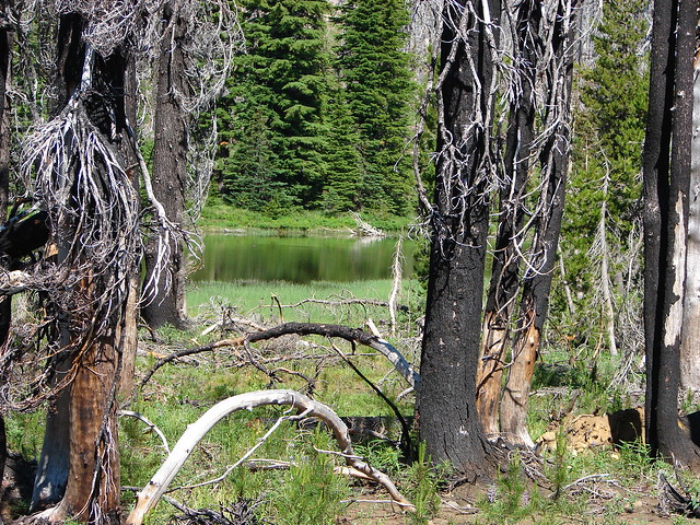
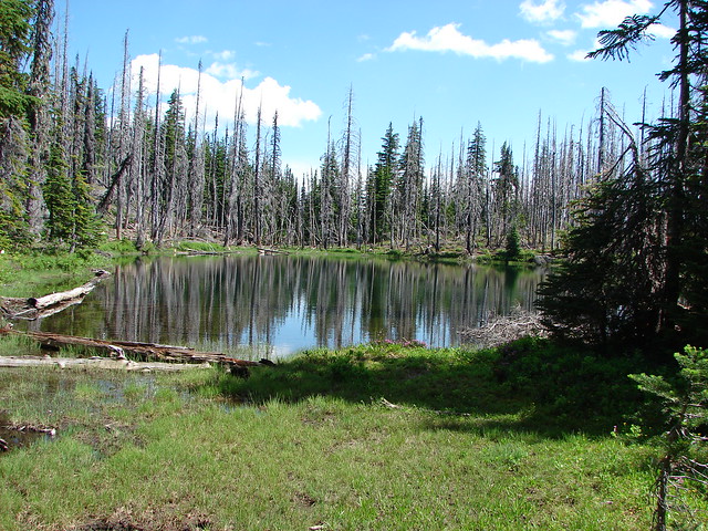
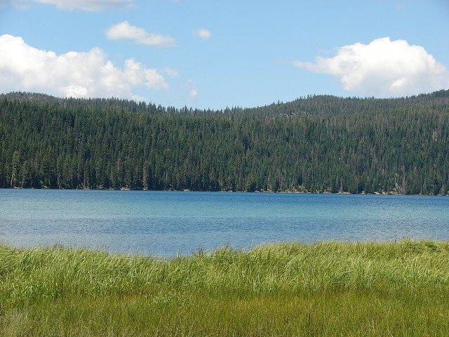
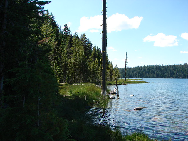
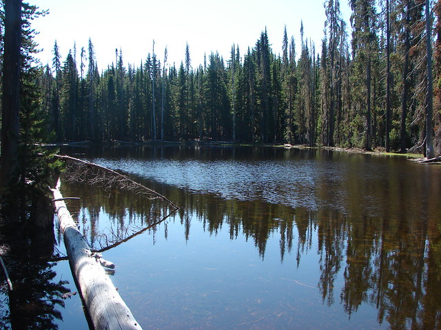
At the junction near Horse Lake the lake was not readily visible. We turned right watching for the lake on our left following a boot path to the water after we spotted it.
Horse Lake

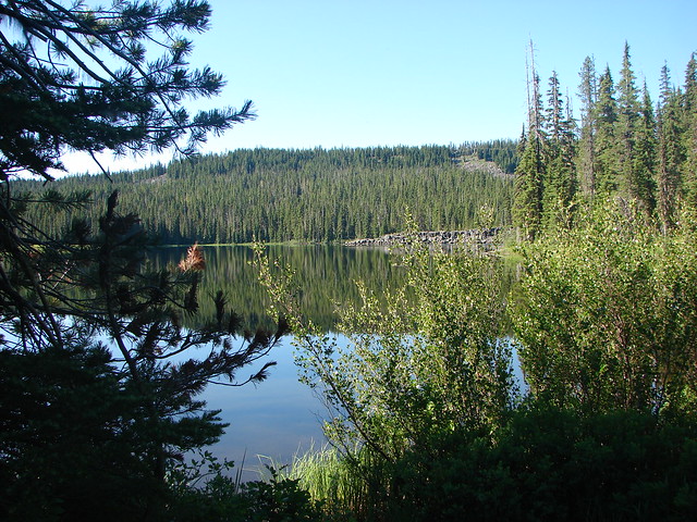
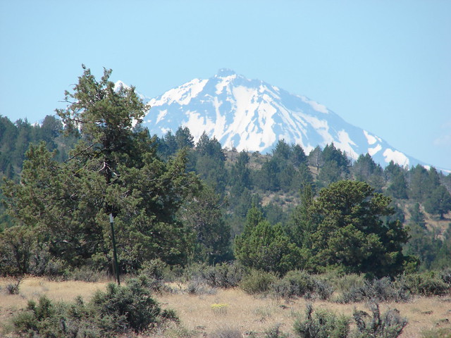
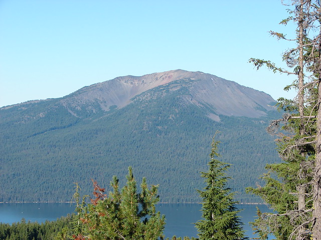
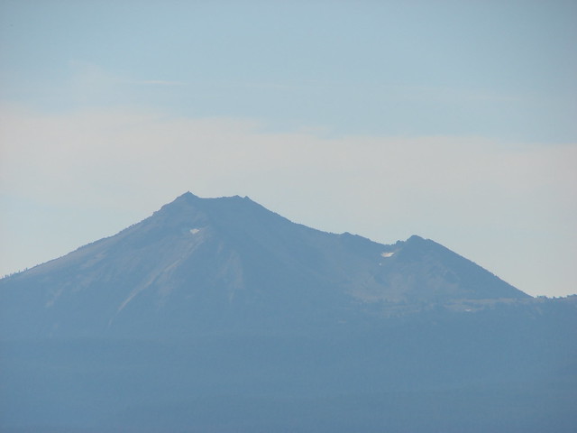
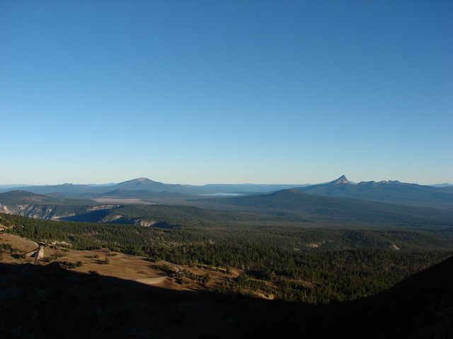
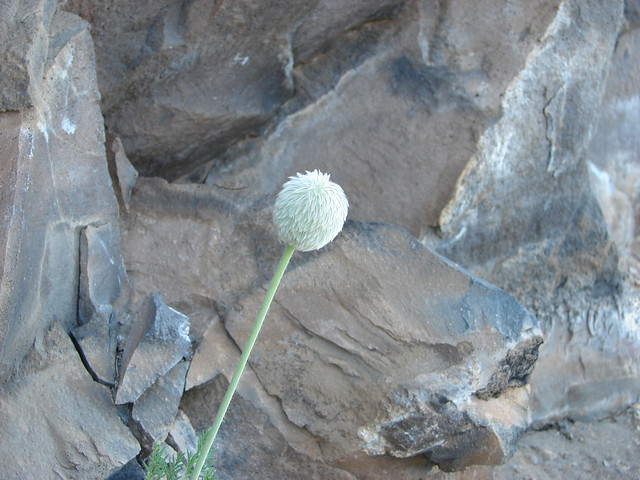
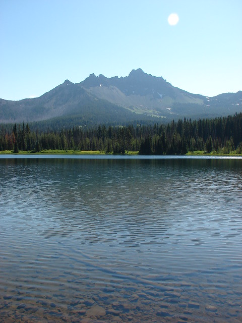
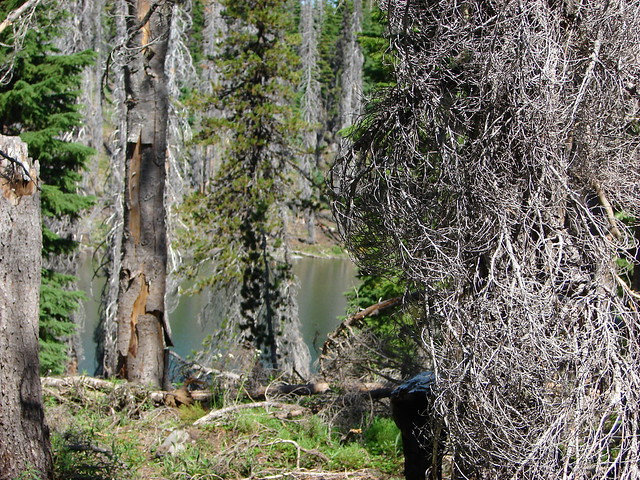
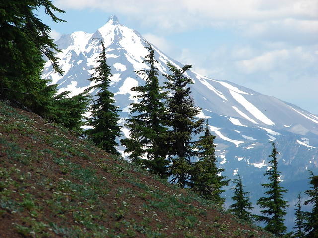
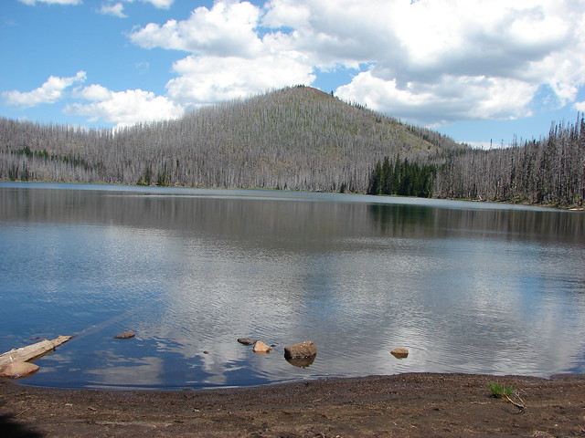
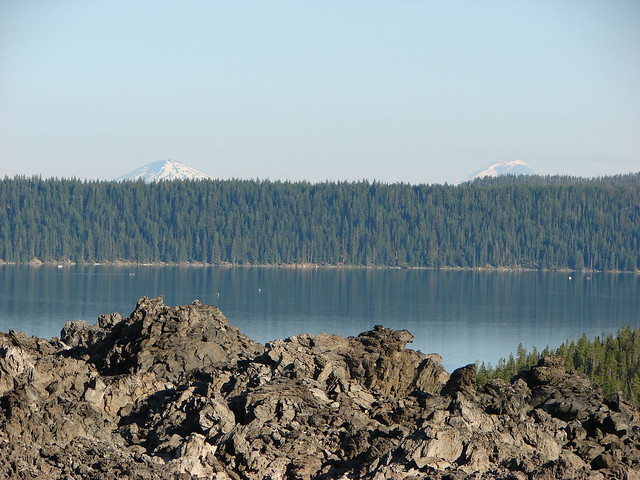
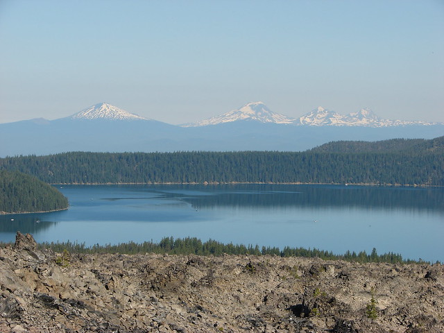
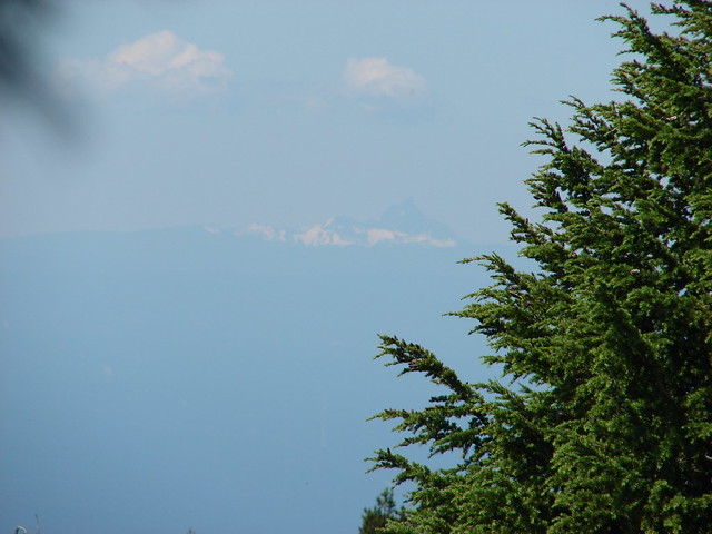
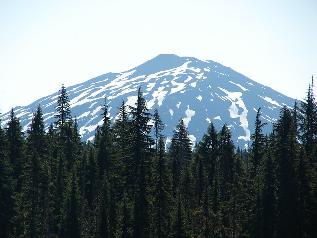
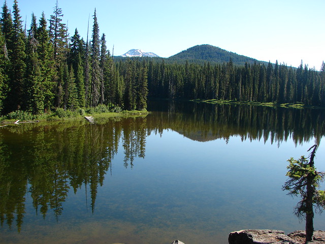
Thankfully the mosquitoes were not nearly as bad at the lake and we were able to take our time and enjoy it. Mt. Bachelor was visible from the NW side of the lake.
Mt. Bachelor from Horse Lake

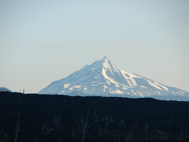
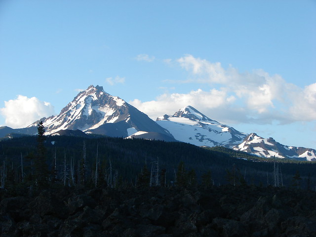
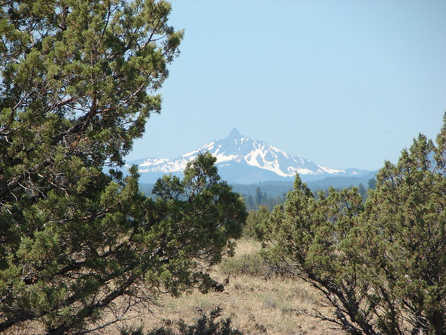
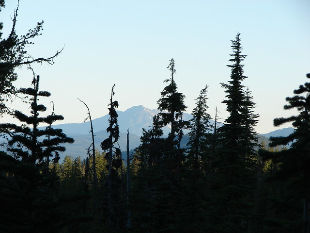
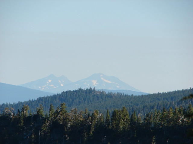
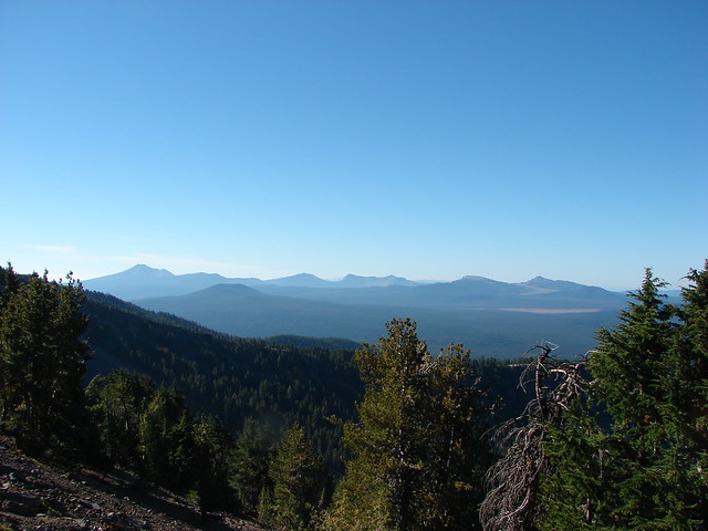
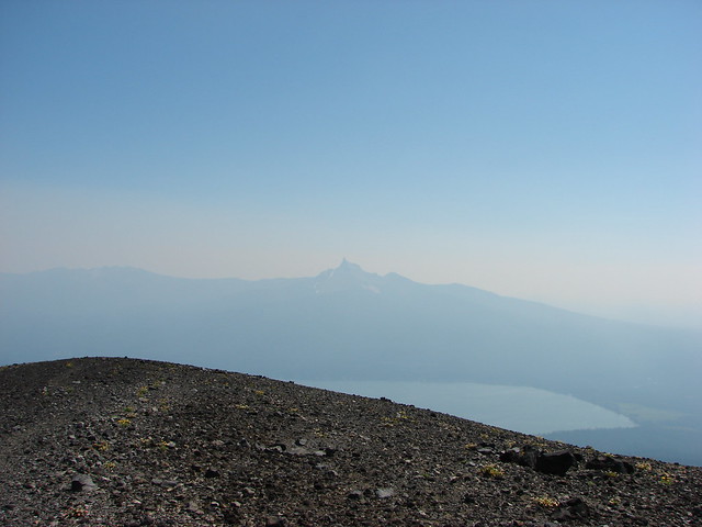
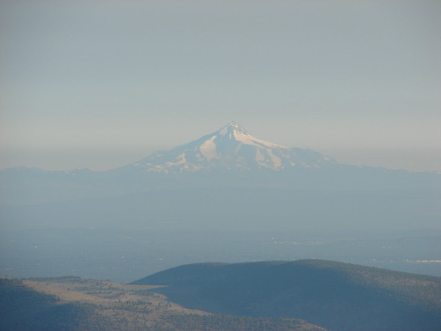
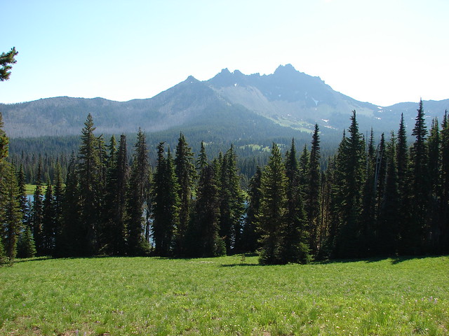
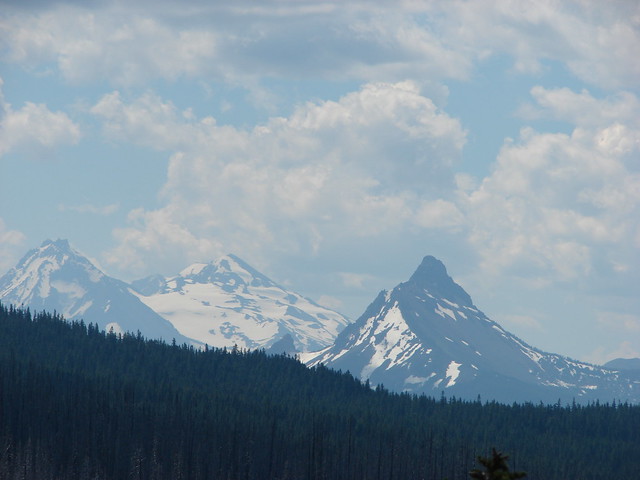
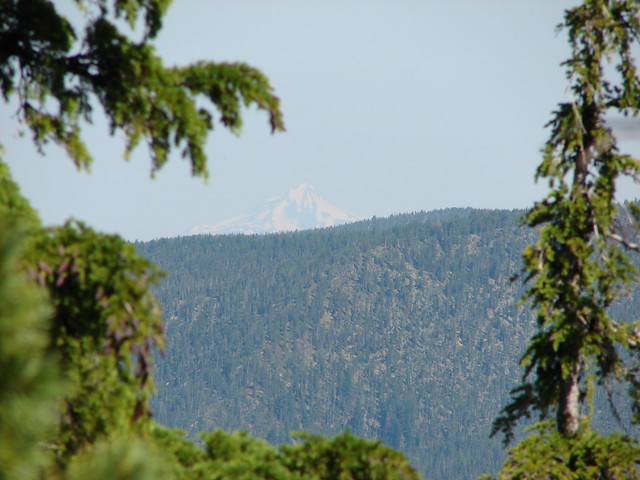
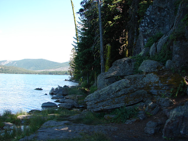
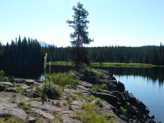
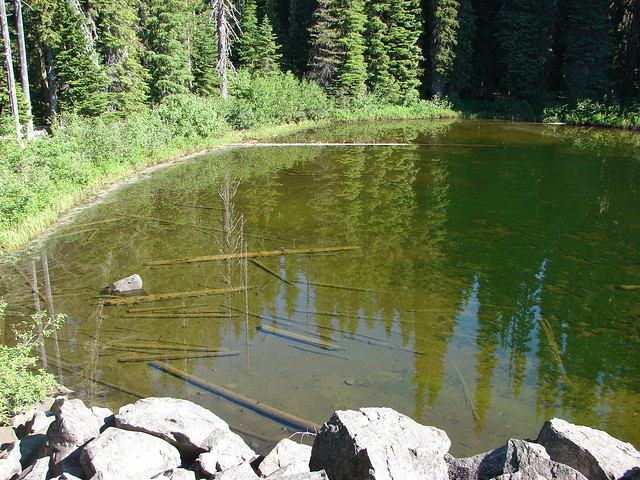
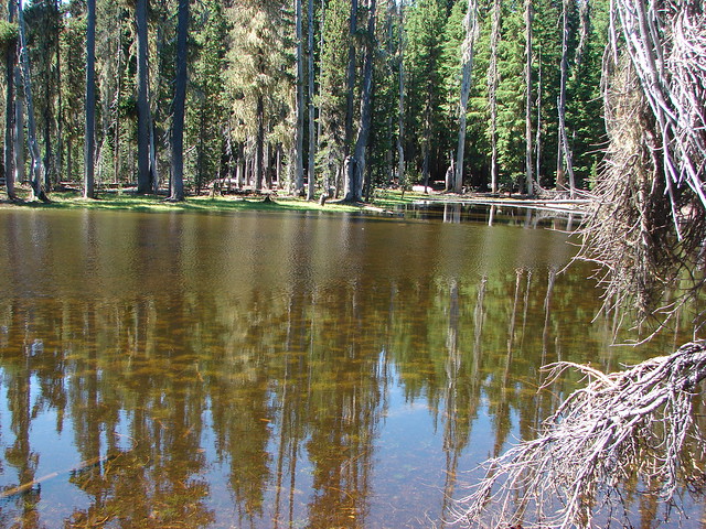
We followed a fisherman’s path around the lake which brought us to a rocky peninsula with a view of the South Sister as well.
Horse Lake

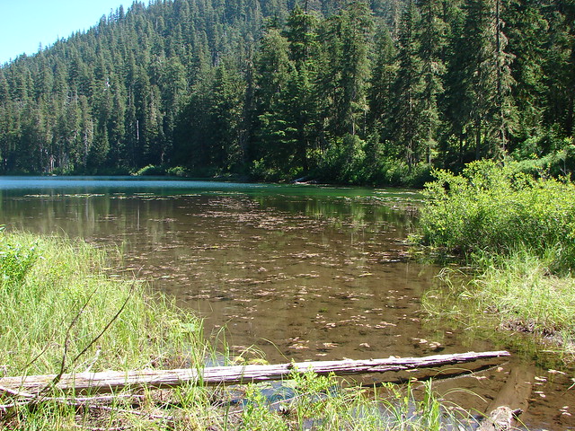
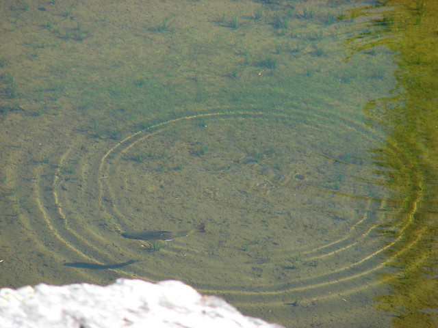
We spent some time on the peninsula eating lunch and watching fish swim by.
Me. Bachelor form the Horse Lake peninsula

Island in Horse Lake

Horse Lake

Trout in Horse Lake

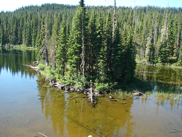
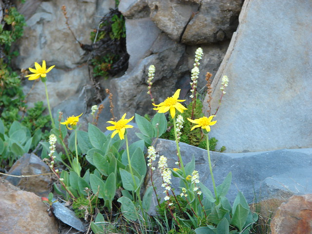
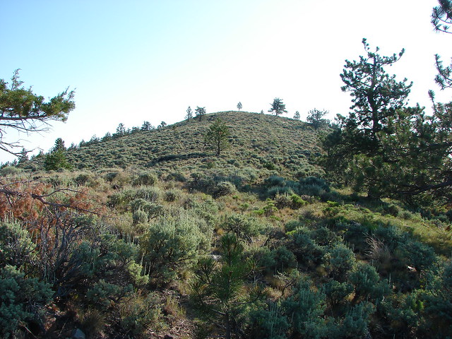
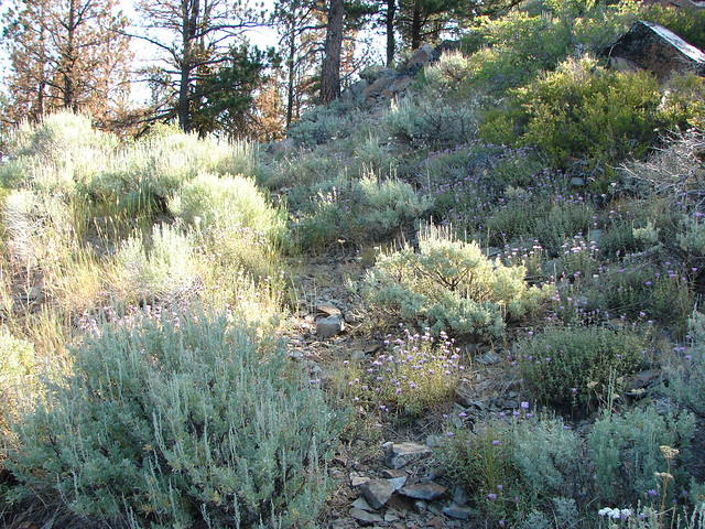
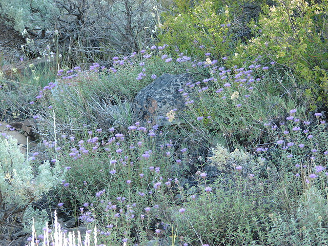
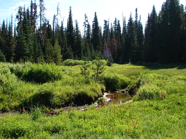
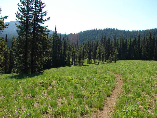
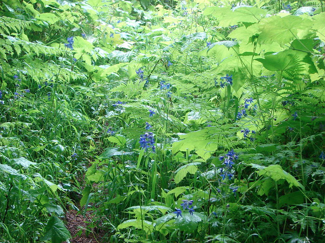
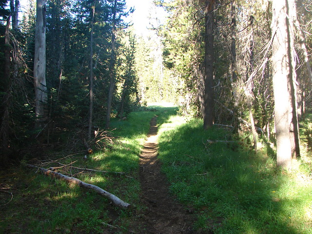
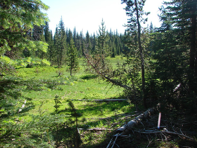
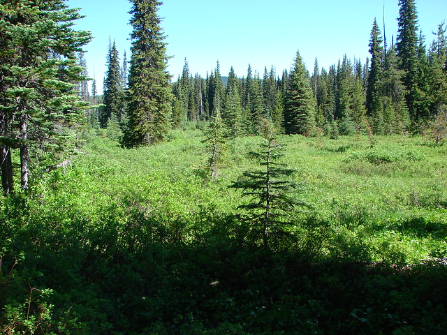
After lunch we finished going around the lake turning left on a good trail past some nice meadows.
Horse Creek

Meadow near Horse Lake

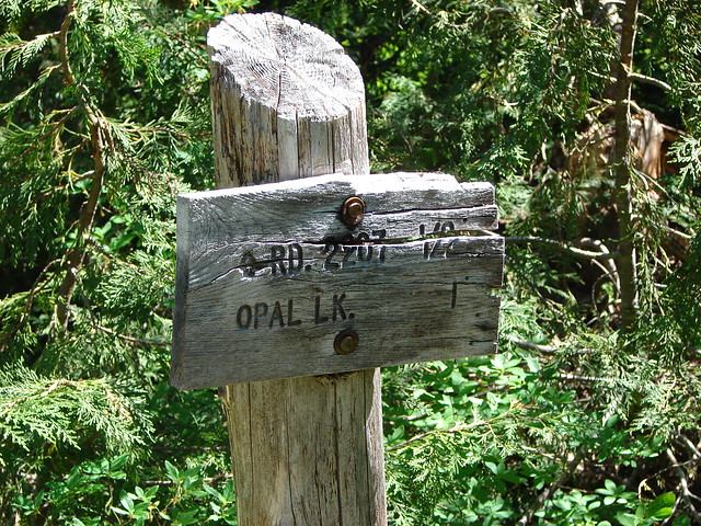
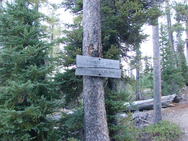
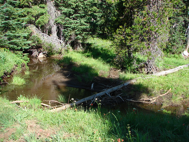
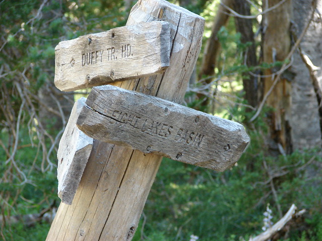
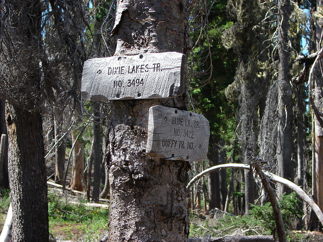
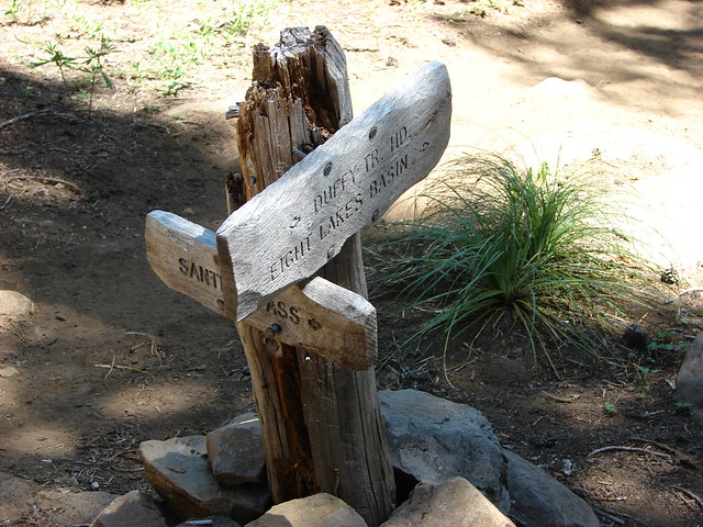
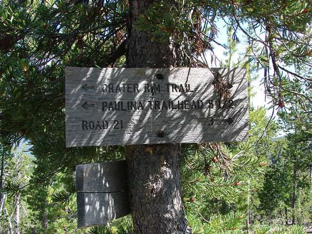
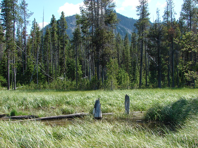
We quickly came to another trail junction and turned right following a sign for Dumbbell Lake. About a quarter mile later we came to yet another junction. This time we did not follow the pointer for Dumbbell Lake which was to our right but instead stayed straight following a pointer fro Sunset Lake. A short distance from this junction an unmarked path to the left led to little Colt Lake.
Colt Lake

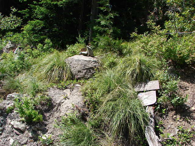
We had found the mosquitoes again so we stopped at Colt Lake just long enough to get a picture then hurried on. Sunset Lake was off the trail to our right and once again we were not able to stop for long.
Sunset Lake

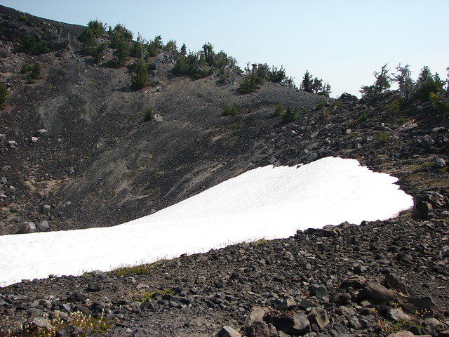
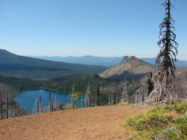
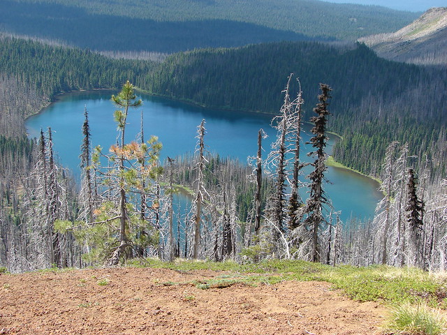
Beyond Sunset Lake the trail passed several (mosquito producing) ponds before joining the Pacific Crest Trail.
Unnamed snowmelt lake

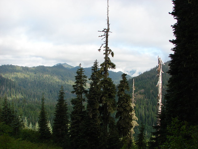
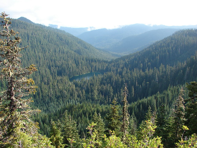
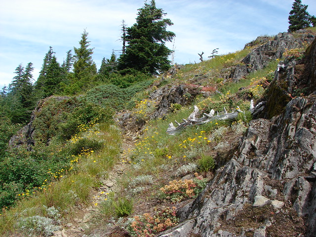
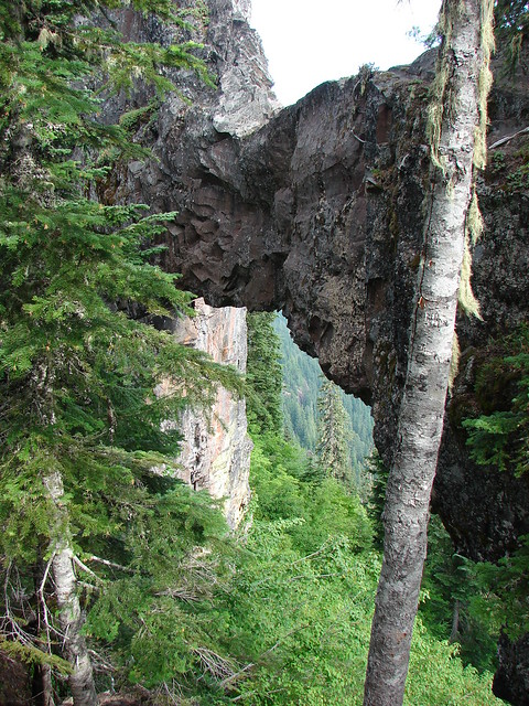
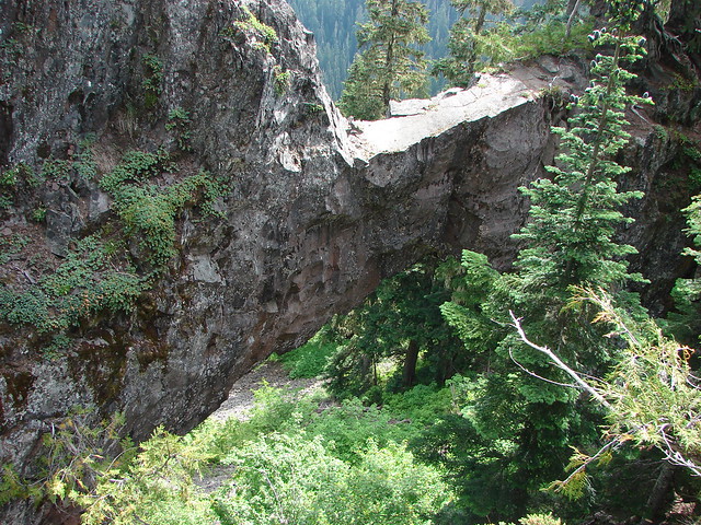
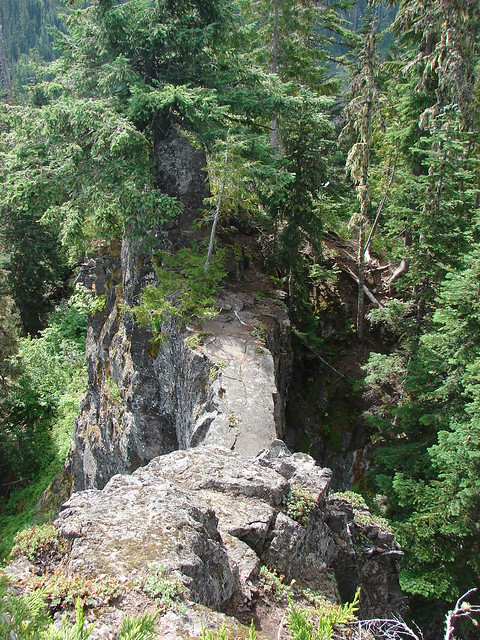
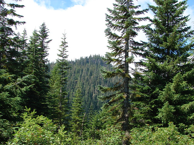
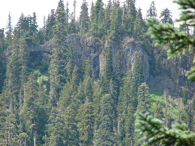
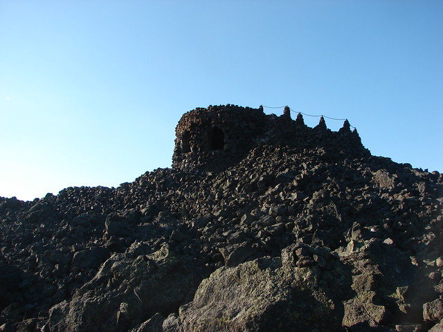
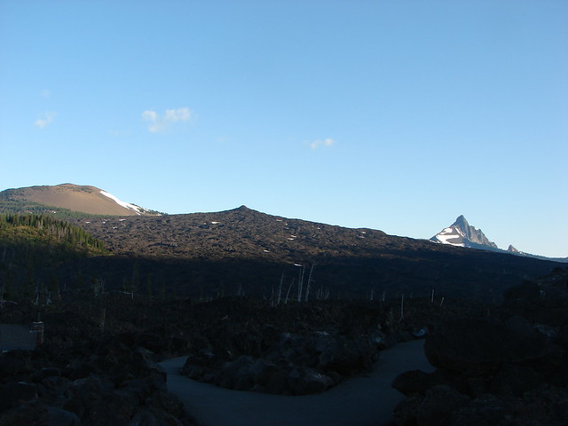
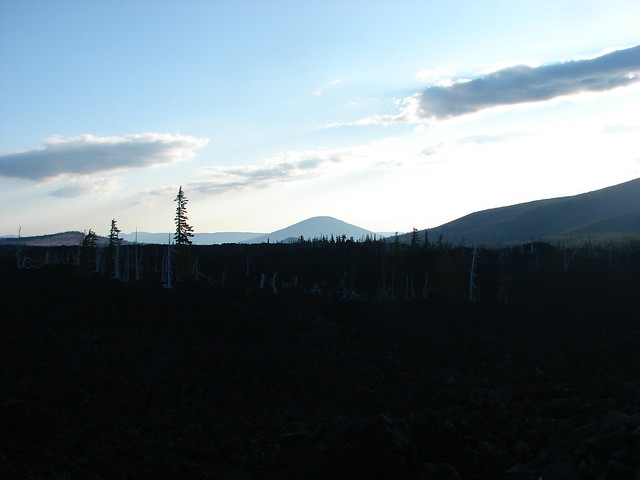
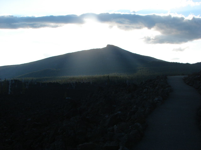
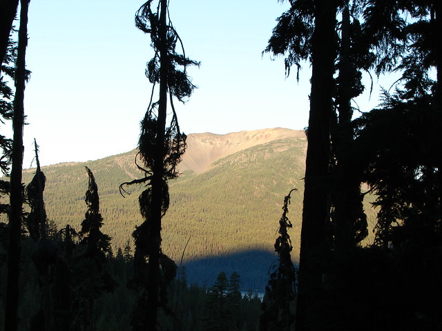
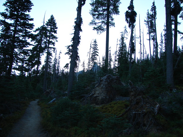
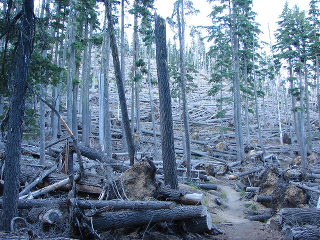
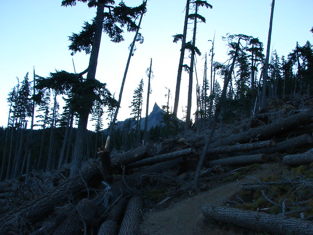
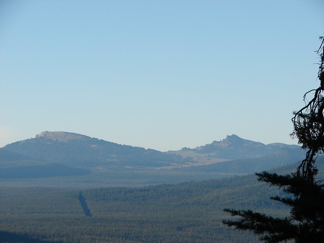
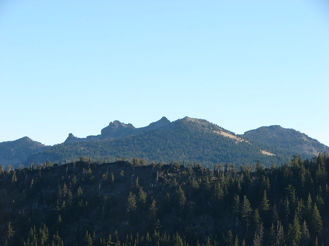
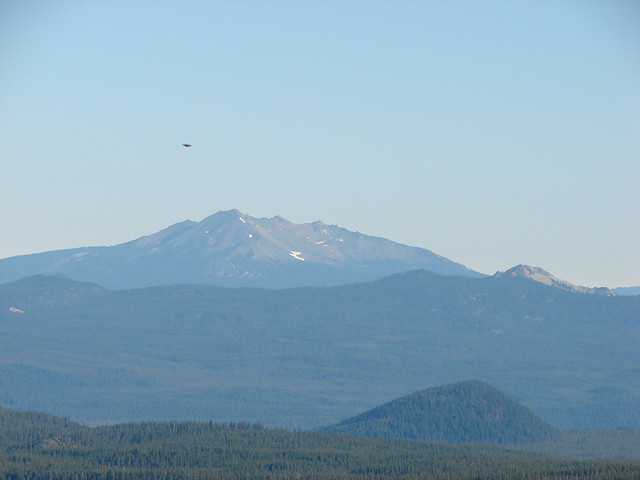
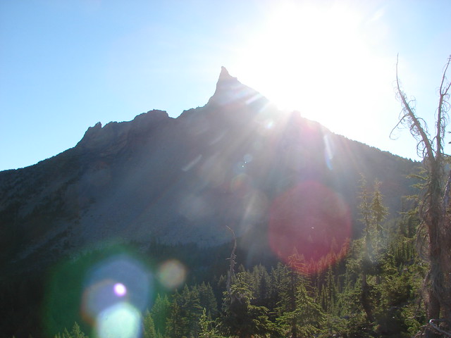
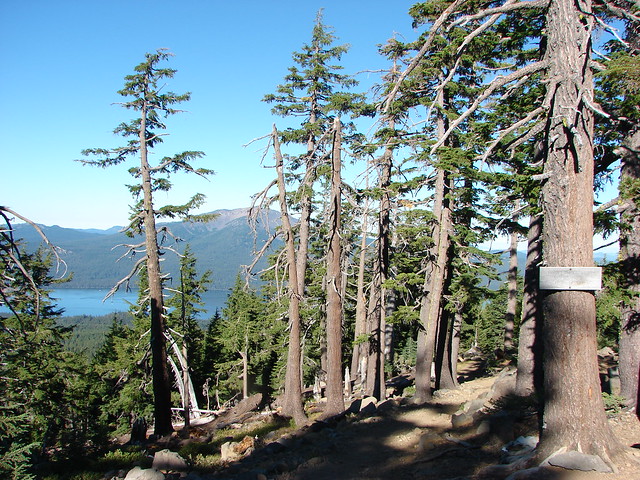
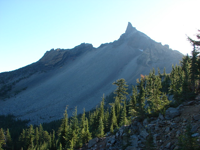
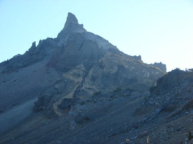
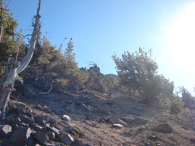
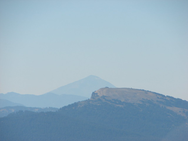
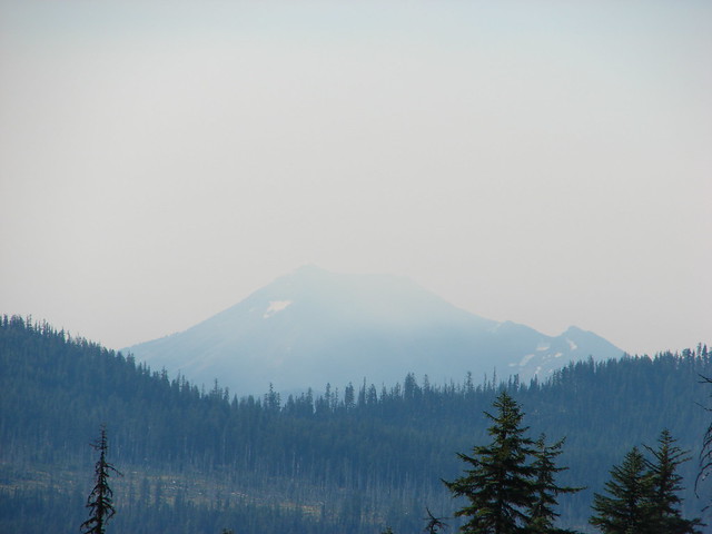
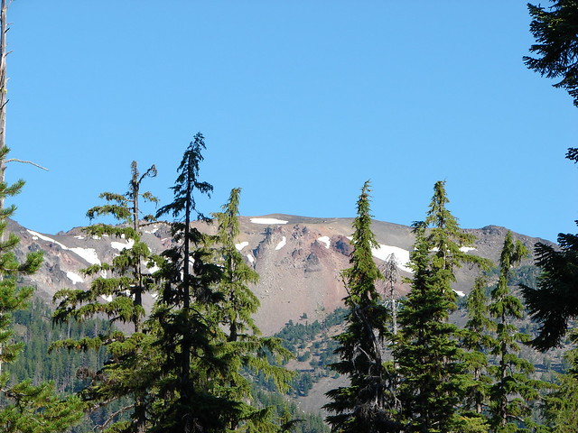
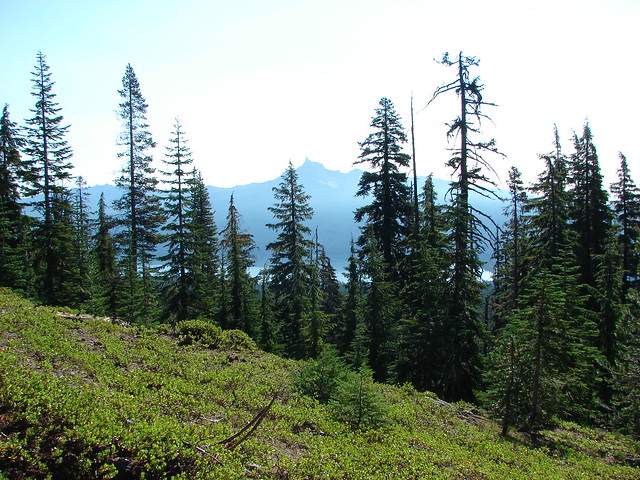
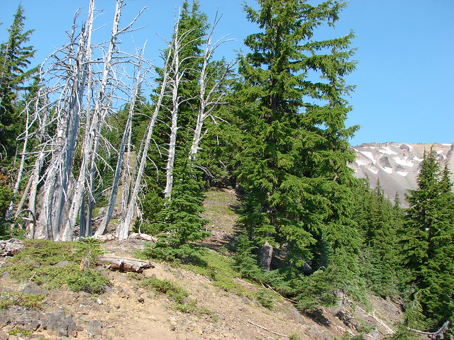
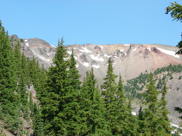
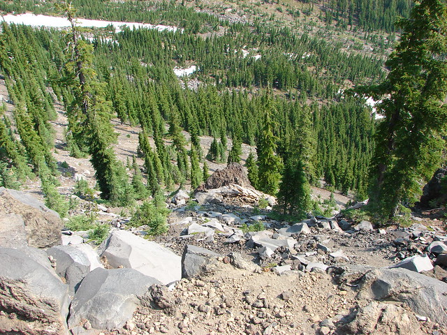
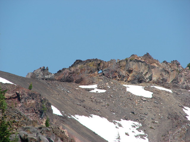
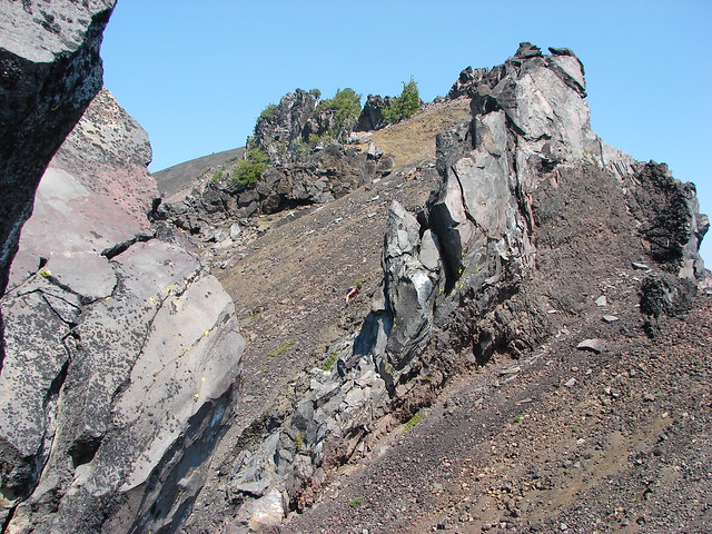
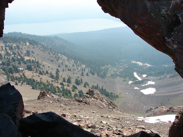
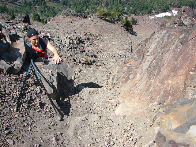
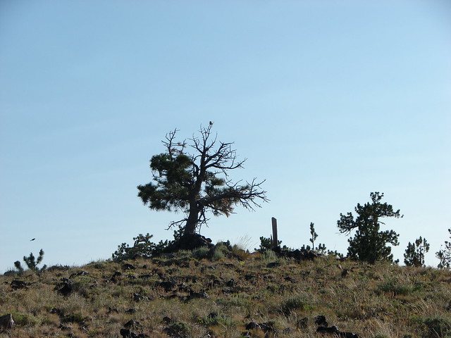
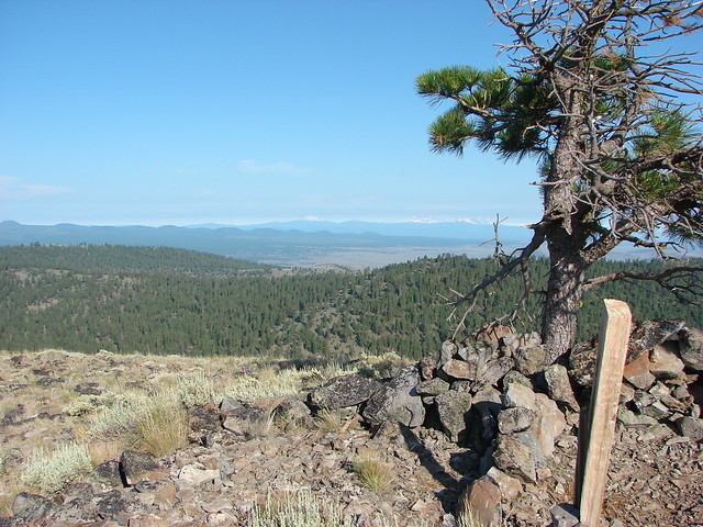
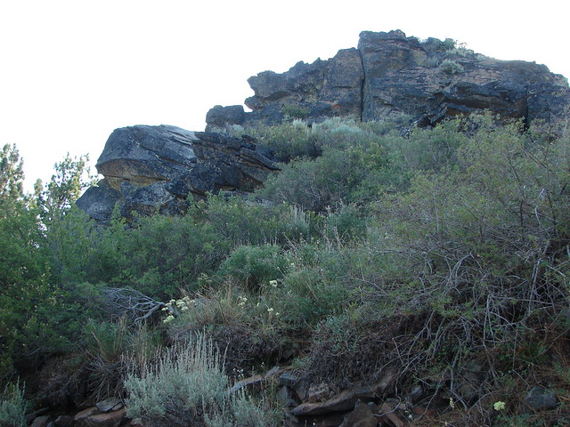
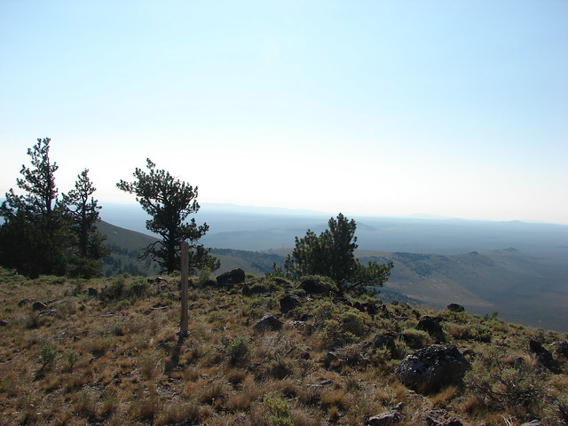
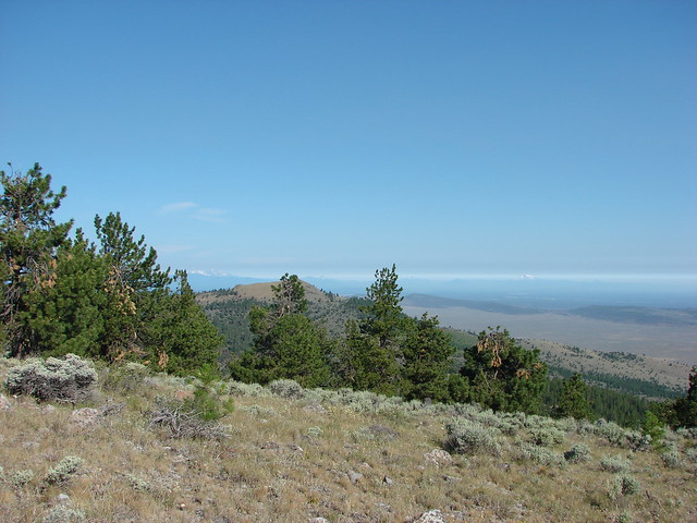
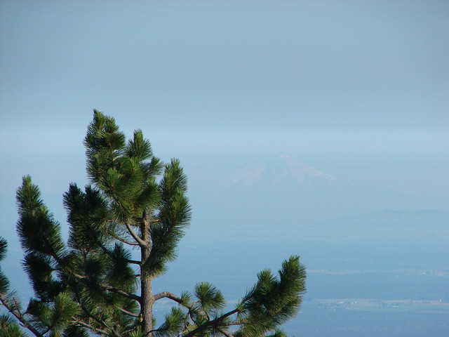
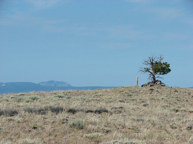
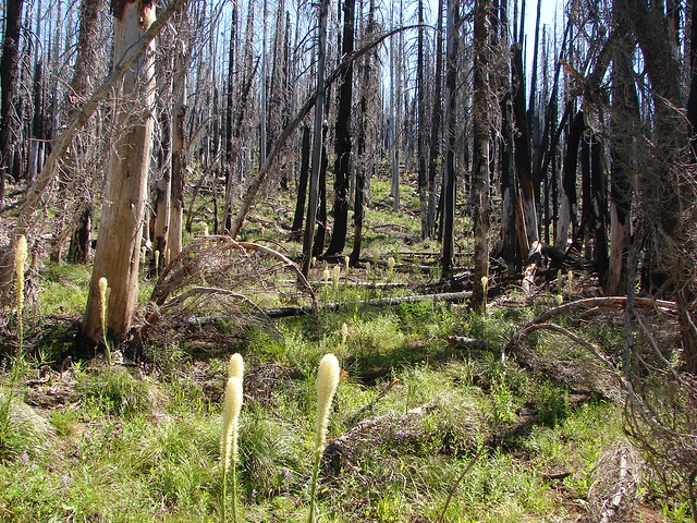
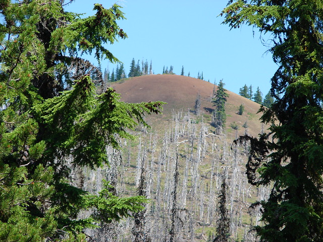
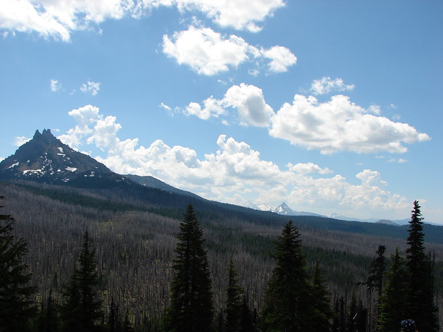
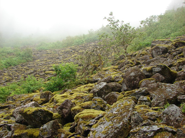
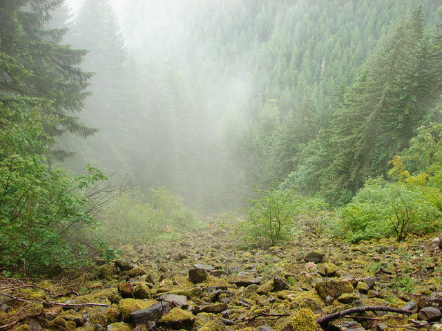
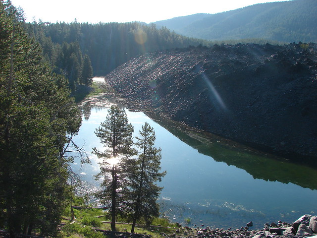
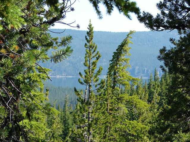
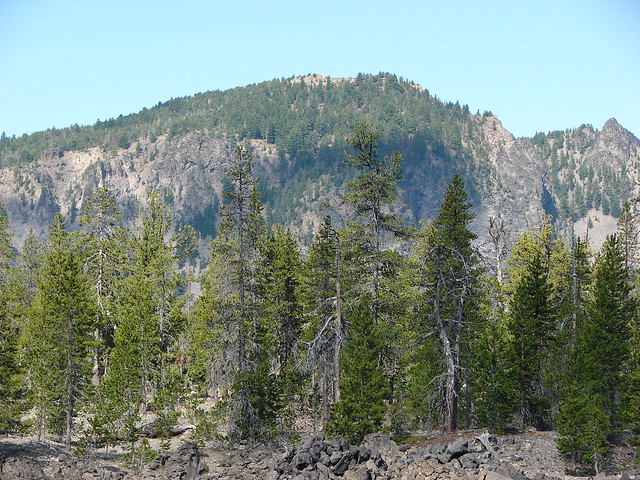
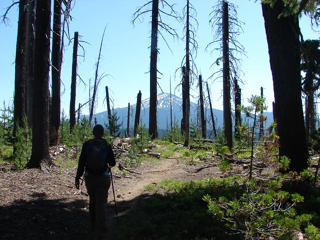
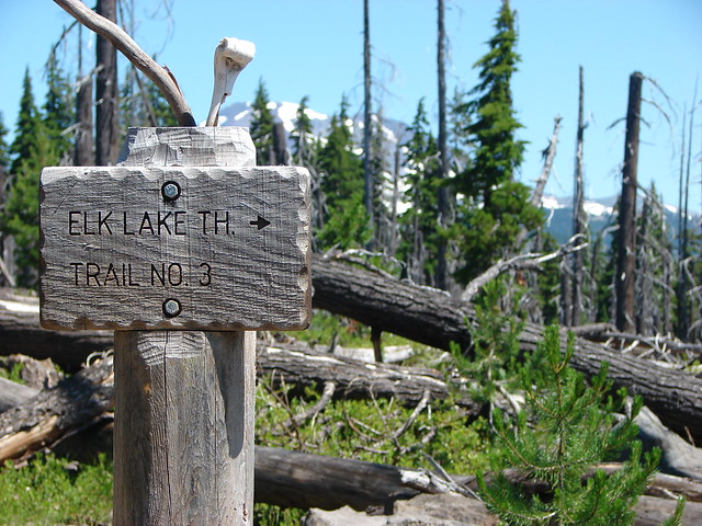
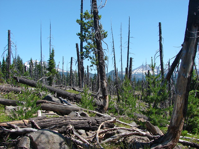
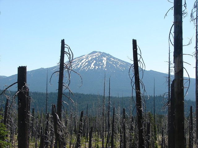
We turned left on the PCT for just over a mile to a trail junction where we followed a point for the Elk Lake Trailhead. Just before the junction the PCT entered a burn area where the mosquitoes once again relented. We were able to enjoy the mountain views as we passed through the burn which took up the majority of the final mile of trail back to the trailhead.
Mt. Bachelor

Trail sign for the Elk Lake Trailhead

South Sister and Broken Top

Mt. Bachelor

Middle and South Sister

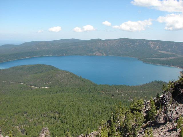
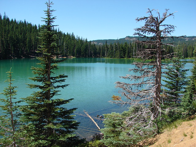
We made two stops on the way back to my parents house. The first was along the Cascade Lakes Highway near Devils Lake to look at its spectacularly green water
Devil's Lake

The second was at REI to by Heather a mosquito head net. Happy Trails!

Flickr: Horse Lake

Categories
Bull of the Woods/Opal Creek Hiking Old Cascades Oregon Throwback Thursday Trip report

Throwback Thursday – Phantom Bridge & Opal Lake

**Note the 2020 Beachie Creek Fire burned the area covered by this hike.**

This week were covering a 8/14/2011 visit to Phantom Bridge and Opal Lake located at the southern end of the Opal Creek Wilderness. Our main focus on this hike was to finally make it to Phantom Bridge. We had tried twice before having failed first in 2010 to find an alternate trailhead due to washouts along the roads to the trailhead we would use on this hike. A month prior to this hike we attempted to come from the west along the Elkhorn Ridge Trail, a trip that will be covered in a later throwback post.

The third time was the charm though as Road 2207 had been reopened and we were able to drive from Detroit, OR to the French Creek Ridge Trailhead.
French Creek Ridge Trailhead

The French Creek Trail extended to both the east and west from the trailhead. Phantom Bridge lay to the west so we crossed Road 2207 and picked up the trail at a downed trail sign.
French Creek Ridge Trail sign

We followed the trail for 1.3 miles to small forest Cedar Lake passing Dog Tooth Rock and views of Opal Lake and the Opal Creek Wilderness.
Dog Tooth Rock

View from the French Creek Ridge Trail

Opal Lake

Cedar Lake

Near Cedar Lake a connector trail from Road 2207 near Opal Lake was marked by a trail sign.
Trail sign for Opal Lake

We decided that on the way back we’d take that trail down to visit Opal Lake before heading back to our car. For now though we continued west on what had become the Elkhorn Ridge Trail.
Elkhorn Ridge Trail

We came to a second possible trailhead .7 miles from Cedar Lake on Road 2223. This trailhead just a quarter mile from Phantom Bridge the road has a reputation for being a nasty drive so the 2 mile hike from the French Creek Ridge Trailhead was preferable to us. Along this stretch wildflowers lined the trail and views extended from Mt. Hood to the Three Sisters.
Elkhorn Ridge Trail

Mt. Hood

Mt. Jefferson, Three Fingered Jack and The Three Sisters

Phantom Bride spanned a 50′ wide chasm to the right (north) of the trail.
Phantom Bridge

A short side path led out to the rock arch (on the right hand side in the photo below).
Phantom Bridge

I walked out onto the arch and took a picture looking back toward the side path.
Phantom Bridge

After admiring this geologic feature we returned to Cedar Lake and headed steeply downhill toward Road 2207 at the trail sign we’d passed earlier. The steep trail was rather brushy and we decided not to return up it after visiting Opal Lake opting instead to walk Road 2207 up to the trailhead. From the road Phantom Bridge was visible high up on the hillside.
Phantom Bridge form road 2207 near Opal Lake

Phantom Bridge

Blank signboards marked the half mile trail down to Opal Lake.
Opal Lake Trail

The trail was basically a runoff stream bed which made it rather rocky and uneven.
Opal Lake Trail

Opal Lake Trail

The brush rimmed lake was very pretty and it teemed with activity.
Opal Lake

Opal Lake

Swallowtail butterfly on a bog orchid

Lorquin's admiral butterfly

Dragonfly

Rough skinned newt in Opal Lake

After watching the butterflies, dragonflies and newts at the lake we returned to the road and followed it uphill to our waiting car. It was a fairly steep walk but not as steep as it would have been going back up to Cedar Lake and the road was lined with wildflowers which made it a little nicer than some road walks.
Paintbrush and penstemon

Happy Trails!

Flickr: Phantom Bridge & Opal Lake

Categories
Bend/Redmond Central Oregon High Cascades Hiking Mt. Washington Area Oregon Throwback Thursday Trip report

Throwback Thursday – Alder Springs

**In 2025 the Alder Springs Fired burned over the Alder Springs Trail.**

This week we’re going to throwback to a hike that had a profound impact on how we hike. In 2011 the snow melt was unusually late and wound up impacting us on our vacation in Central Oregon during the first week of August. On 8/3/2011 we had planned on hiking the Benson Lake Loop. We took the McKenzie Highway (Hwy 242) from Sisters and headed for the trailhead.  It was a beautiful morning and we stopped at the Dee Wright Observatory to take in the spectacular views.

Dee Wright Observatory

Belknap Crater, Little Belknap Crater and Mt. Washington

Belknap Crater, Little Belknap Crater and Mt. Washington

Mt. Jefferson

Mt. Jefferson

Black Butte

Black Butte

Black Crater

Black Crater

North & Middle Sister

North and Middle Sister with the Little Brother

We continued on to the trailhead near Scott Lake and set off on the Benson Lake Trail.

Benson Lake Trailhead

In the mile and a half to Benson Lake we encountered a few snow patches and lots of mosquitoes.
Snow along the Benson Lake Trail

From Benson Lake we could see our next planned stop,Scott Mountain which appeared relatively snow free.

Benson Lake

The trail conditions deteriorated quickly beyond Benson Lake as the mosquitoes were thick and relentless and the trail was covered in snow.

Snowmelt pond near Benson Lake

Snow along the Benson Lake Trail

We were still quite inexperienced hikers with raw map skills, no GPS, and we hadn’t learned to look for blazes yet so we were relegated to following a lone set of footprints which worked until they disappeared. While we struggled to locate the trail Heather had a mosquito fly directly into her eye where it stuck. It remains the most disgusting hiking moment ever for us.

After extracting the kamikaze mosquito we surrendered and turned back while we knew we could still find the trail back.

We had only hiked around 4 miles by the time we were driving back toward Sisters and began looking for another hike that we might be able to do. We landed on the Alder Springs trail which would be snow free being in the high desert and at an elevation of only 2600′. Even better the trailhead was less than 20 miles from Sisters.

From the trailhead parking area Mt. Washington and the North Sister were visible. It was odd to think we’d just been forced by snow to turn back from a hike on the other side of those two mountains and now we were standing amid the sagebrush and juniper in the high desert. Not only was it a drastic change in scenery but it was also a lot warmer.

Alder Springs Trailhead

Mt. Washington

Middle and North Sister

The view here also included a look down the Wychus Creek Canyon which is where the trail would be leading us.

Wychus Creek Canyon

The Alder Springs Trail descended .2 miles to a fork where the Old Bridge Trail split to the left.

Old Bridge Trail sign

We took this .4 mile path down to the site of a former bridge and then down to the bank of Wychus Creek.

Site of a former bridge over Wychus Creek

Whychus Creek

Wychus Creek

We then returned to the Alder Springs Trail and followed it 1.2 miles to Alder Springs. This section of trail provided some nice views of the canyon before descending to the creek.

Wychus Creek Canyon

Wychus Creek

Whychus Creek Canyon

Rock formations along the Whychus Creek Canyon

A short narrow slot in the canyon wall was a neat little detour along the way.

Whychus Creek Canyon

Dry waterfall

The scenery became a little greener as the trail dropped to creek level and neared Alder Springs.

Alder Springs Trail

Alder Springs Trail

Interpretive sign at Alder Springs

We faced a choice here, turn back or ford the creek and continue a little over a mile and a half to the Deschutes River at its confluence with Wychus Creek. It was too nice a day and the scenery was too good to turn back so we forded the shin deep creek. Downstream the creek seemed to flow right into the canyon wall.

Whychus Creek

Whychus Creek

Springs bubbled up in several spots joining the waters of Wychus Creek along the far bank.

Alder Springs

Alder Springs

Beyond the springs the trail stuck fairly close to the creek as it met the canyon wall and turned north.

Whychus Creek

Soon we were once again traversing the hillside a bit above the creek due to the thick vegetation along the creeks banks.

Whychus Creek Canyon

Whychus Creek

At one point the trail split with the right hand fork dropping down near to the creek in a thistle filled meadow. We took this path thinking it would be fun to be in the thistle and closer to the creek but as we made our way into the meadow the a distinctive sound of a rattle rose up.

Thistle meadow along the Alder Springs Trail

We slowed up and realized that there were at least two maybe three alarms being raised from different sides. We proceeded slowly making plenty of noise ourselves keeping our trekking poles ahead to give any snakes plenty of time to leave the area. We never saw any but they made plenty of noise. On the way back we skipped the meadow and stayed on the path that passed higher up the hillside.

We continued on, now on high alert, to the confluence of the river and creek. On the far side of the water rose a spectacular striped rock fin.

Rock fin near the Wychus Creek and Deschutes River confluence

Rock fin

A sign on a ponderosa announced the end of the maintained trail.

End of the Alder Springs Trail

A rock ledge along the Deschutes River provided a perfect lunch spot across from the fin where we could watch the river as it headed further down the canyon.

Deschutes River

Deschutes River

Rock fin from the Deschutes River

Having arrived at this spot from the Alder Springs Trailhead gave this spot a real feeling of remoteness. The fact that we hadn’t seen any other hikers since the parking area and having to ford the creek added to the sensation of solitude. In actuality the homes of Crooked River Ranch were not far away on the other side of the river and the Scout Camp Trail loops around the fin that seems so remote.

The Alder Springs Hike was a little over 6 miles round trip with about 650′ of elevation gain.

The experience at Benson Lake was a key motivating factor in our decision to make getting a GPS unit before the 2012 hiking season a top priority. It also reminded us that we needed to improve our map and navigational skills which we began to focus more on. Happy Trails!

Flickr: Benson Lake & Alder Springs

Categories
High Cascades Hiking Mt. Theilsen/Mt. Bailey Area Oregon Throwback Thursday Trip report

Throwback Thursday – Mt. Thielsen

**Note the 2024 Trail Fire burned over a portion of this hike.**

For this week’s throwback we’re going back to September 22, 2012 for our visit to Mt. Thielsen. When we had summited Mt. Bailey a little over a month before when we had been on the opposite side of Diamond Lake. These two mountains couldn’t look much different. The summit of Mt. Bailey was a walk up, albeit a steep one while the pointy summit of Mt. Thielsen is only accessible via a final 80′ vertical class 4 scramble. We weren’t planning on even attempting the summit, we just wanted to go as far as possible which would be a higher elevation than we had been at on Mt. Bailey.

We parked at the Mt. Thielsen Trailhead off of Highway 138 and set off toward the old volcano.

Mt. Thielsen Trailhead

The trail climbed through a forest filled with blowdown for 1.4 miles to a junction with the Spruce Ridge Trail.

Mt. Thielsen Trail

Junction with the Spurce Ridge Trail

Mt. Thielsen was hidden from view along this section but looking back across the highway we had a decent view of Mt. Bailey in the morning sunlight.

Mt. Bailey

We continued past the Spruce Ridge Trail gaining a view of Diamond Peak to the north.

Diamond Peak

Soon the spire of Mt. Thielsen came into view through the trees ahead.

Mt. Thielsen Trail

The trail then entered the Mt. Thielsen Wilderness and a section of forest that had been struck by massive blowdown.

Mt. Thielsen Wilderness sign

Mt. Thielsen Trail

Mt. Thielsen Trail

After passing through the blowdown the trail followed a ridge with increasingly better views to the Pacific Crest Trail 3.8 miles from the Trailhead.

Llao Rock and Hillman Peak

Llao Rock and Hillman Peak along the rim of Crater Lake

Diamond Lake and Mt. Bailey

Mt. Bailey and Diamond Lake

Howlock Mountain

Howlock Mountain

The Three Sisters

The Three Sisters

Diamond Peak and Sawtooth Mountain

Diamond Peak and Sawtooth Mountain

Mt. Thielsen

Mt. Thielsen

Diamond Lake and Mt. Bailey

Junction with the Pacific Crest Trail

The official trail ends at the PCT but a clear climbers trail continued on the other side and we followed that further up along the ridge. The first part of the path led along the ridge with views of west face of the mountain revealing it’s swirling volcanic rock.

Mt. Thielsen

Mt. Thielsen

The path then bent slightly SE away from the sheer drop of the north side of the ridge and up a very steep slope of increasingly slippery scree.

Mt. Thielsen Trail

Mt. Thielsen Trail

Mt. Thielsen Trail

To the south the entire rim of Crater Lake was visible including Mt. Scott.

Crater Lake's Rim

Mt. Scott

Braided trails crisscrossed up through the loose rock and every step seemed to come with a complimentary slide backward. Although the hike to Mt. Bailey had been steep it hadn’t been this steep nor slick and the drop offs along the way not nearly as daunting.

Mt. Bailey and Diamond Lake from the Mt. Thielsen Trail

Looking down from the Mt. Thielsen Trail

Mt. Thielsen

We were the first hikers up the trail that morning and at an elevation of a little over 8700′ I came to, what looked to me, to be an impassable wall of rock.

Where we stopped climbing

As I waited for Heather and Dominique I searched for signs of where to go from there. I was unsure of the correct route and the longer I stood in the same spot the more I took inventory of my surroundings. The view was quite impressive having now climbed high enough that Mt. McLoughlin was visible to the south of Crater Lake.

Mt. McLoughlin and Llao Rock

It wasn’t long before I started to feel just how high up we were and how steep the mountain was. At that point the nerves kicked in and butterflies filled my stomach. Apparently Heather and Dominique had begun feeling the same thing and when they were close enough to talk to we made a unanimous decision to turn back.

Shortly after starting back down a lone female hiker passed us going up. We stopped to watch her as she made her way to the point where I had turned around. We were curious to see how she would navigate the section. She didn’t miss a beat and was quickly above the spot and continuing on. We were only about a hundred yards down and I had to fight the urge not to go back and try again after she’d made it look so easy but I was apparently the only one fighting that urge so reason won the day and we continued our descent.

On the way down Dominique and I wound up too far to the north on the ridge and found ourselves near the edge of a vertical shaft

Patch of snow on Mt. Thielsen

Not liking how close we were to the edge we veered back to the south having to cross a very loos section of scree where Dominique slipped and scratched himself up pretty good. That was the only incident though and we made it back to the trailhead in relatively good shape.

At the time it was the most nerve wracking hike we’d done. Not making it as far up as we’d hoped was a bit of a disappointment but it was a good reminder that knowing when to turn around (and being willing to do so)is important. After all if you keep yourself safe there’s always next time. Happy Trails!

Flickr: https://www.flickr.com/photos/9319235@N02/albums/72157632958248940

Categories
Crater Lake Area High Cascades Hiking Mt. Theilsen/Mt. Bailey Area Throwback Thursday Trip report

Throwback Thursday – Mt. Bailey and The Watchman

Today’s Throwback Thursday hike took place on 8/11/2012 and featured our first summit of one of the Cascade Mountains – Mt. Bailey. The 8368′ summit would also mark the highest elevation we’d reached surpassing that of Paulina Peak.

Mt. Bailey is located north of Crater Lake National Park on the west side of Diamond Lake across from the taller, pointier Mt. Thielsen.
Mt. Bailey and Mt. Thielsen

Mt. Bailey to the left of Diamond Lake with Mt. Thielsen on the right as seen from Mount Scott, Crater Lake National Park

There are two trailheads to choose from. From Diamond Lake’s South Shore Picnic Area turn onto Road 4795 and drive just past Silent Creek to Road 300 and turn left. The lower trailhead is just .4 miles further and suitable for passenger vehicles. The road to the upper trailhead was reportedly rough and although starting there would cut 4.4 miles off the hike it would still be under 10 miles round trip from the lower starting point so we parked there and set off.
Mt. Bailey Trailhead

The trail climbed through a somewhat sparse forest, typical for this part of the Cascades due to the presence of a thick layer of ash and pumice which covered the area following the eruption of Mt. Mazama.
Mt. Bailey Trail

Forest along the Mt. Bailey Trail

As we neared the 1.5 mile mark a somewhat hazy view of Hillman Peak and The Watchman on the west side of Crater Lake’s rim opened up.
Hillman Peak and The Watchman

A couple of hundred yards later we came to a viewpoint of Diamond Lake and Mt. Thielsen.
Diamond Lake with Tipsoo Butte, Howlock Mountain, and Mt. Thielsen

Mt. Scott was also visible to the south on the east side of Crater Lake, but the view wasn’t great due to smoke from forest fires.
Mt. Scott

We also had a good look at our ultimate goal, the summit of Mt. Bailey.
Mt. Bailey

The trail had climbed approximately 750′ from the trailhead to the viewpoint but beyond the viewpoint it leveled off for the next .5 plus miles before reaching the upper trailhead. Along the way we kept watch for the Hemlock Butte Shelter which was off-trail on our left. When we spotted it we headed cross country to check it out.
Hemlock Butte Cabin

Inside the Hemlock Butte Cabin

Inside the Hemlock Butte Cabin

After signing the register in the shelter we made our way to the upper trailhead where the Mt. Bailey Trail began to climb again. At first the trail remained in the hemlock forest but before long we’d reached a ridge crest where the trees thinned and views opened up.
Mt. Bailey Trail

Mt. Bailey Trail

Mt. Thielsen

View from the Mt. Bailey Trail

Small meadows along the trail were homes to a few wildflowers.
Paintbrush

Penstemon

Bleeding Heart

The trail followed the ridge uphill which curved to the NW around a large glacier carved valley on the mountain’s east side. The angle of ridge provided excellent views of the mountain ahead.
Mt. Bailey Trail

Mt. Bailey

Small patches of snow lingered along the trail at higher elevations and the views opened up even more as we climbed. Unfortunately the smoke was also getting worse further limiting the visibility.
Snow along the Mt. Bailey Trail

Diamond Lake, Tipsoo Peak, Howlock Mountain, and Mt. Thielsen

The trail passed a viewpoint down into the glacial-valley and up to a window in a rock wall along the mountain’s summit ridge which we would pass later.
View from the Mt. Bailey Trail

Mt. Bailey

Beyond this viewpoint the trail passed by a 300′ snowy crater as it turned northward nearing the southern summit of the mountain.
Snow field along the Mt. Bailey Trail

Snow field along the Mt. Bailey Trail

From the lower southern summit the actual summit was a half mile away and another 220′ up.
Mt. Bailey Trail

The trail crossed a cinder saddle which wasn’t too narrow but not too wide either. Then we passed along the left side of the rock wall pausing to peep through the window we’d seen from below. The smoke had gotten so bad that Mt. Thielsen was nearly hidden on the other side of Diamond Lake now.
Mt. Bailey Trail

Rock window along the Mt. Bailey Trail

Diamond Lake and a faint Mt. Thielsen

The rock wall was also home to some flowers.
Western Pasque Flower

Arnica and partridge foot

The trail passed over the rock wall on the far end at a low point which did require the us of our hands.
Mt. Bailey Trail

A final steep climb brought us to the bare, rocky summit of Mt. Bailey.
Summit of Mt. Bailey

The smoke wasn’t too bad where we were, but with fires burning to both the north and south there was little view to speak of.
Mt. Thielsen and Diamond Lake from the summit of Mt. Bailey

View from the summit of Mt. Bailey

View from the summit of Mt. Bailey

We explored the broad summit which sported some wildflowers and a snowfield.
Summit of Mt. Bailey

Summit of Mt. Bailey

Snowmelt on the summit of Mt. Bailey

View from the summit of Mt. Bailey

Partridge foot

After resting atop the mountain for a bit we returned the way we’d come. When we’d gotten back to the car we decided to drive down to Crater Lake since it was only 15 minutes away. Neither of us had been there for years so why not take advantage of being so close. We parked at a large parking area 2.2 miles after turning right onto Rim Drive from the North Entrance Road.

From here a .8 mile climb led to a lookout tower on The Watchman.
Interpretive sign

We had really been looking forward to seeing Crater Lake again but the smoke was thick over the water leaving us with a very limited view. At least we could see Wizard Island, a cinder cone that formed after the eruption of Mt. Mazama creating Crater Lake.
Crater Lake

Wizard Island in Crater Lake

The Watchman Trail led right along Rim Drive for .4 miles to a junction where we turned left and began the steep climb to the lookout.
Lookout at the summit of The Watchman

From the lookout Hillman Peak and Wizard Island were about the only landmarks visible. Interpretive signs at the summit showed us what we were missing.
Hillman Peak and Llao Rock

Crater Lake and Wizard Island

Interpretive sign on The Watchman

Sign near the lookout tower on The Watchman

Despite the smoke it was well worth the stop but we did feel bad for the many tourists that might not get another chance to see this amazing place. We knew we’d be back and hopefully the conditions would be better the next time. Happy Trails!

Flickr: https://www.flickr.com/photos/9319235@N02/albums/72157632957911480

Categories
Bend/Redmond Central Oregon Hiking Oregon Throwback Thursday Trip report

Throwback Thursday – Pine Mountain

Welcome to another installment of Throwback Thursday. Today we’re covering a 7/30/2012 visit to Pine Mountain east of Bend. This mostly trail-less hike started at the Pine Mountain Observatory.

We walked past the domes housing the telescopes and took a trail near the white dome uphill to a stone windbreak.

Pine Mountain Observatory

Pine Mountain Observatory

Stone windbreak on Pine Mountain

The high point of this first hill has an elevation of 6349′, 160′ lower than the actual summit of Pine Mountain. The view from the first shelter was good nonetheless with Mt. Bachelor, Broken Top and the Three Sisters lining the horizon to the NW.

Mt. Bachelor, Tumalo Mountain, Broken Top and the Three Sisters from Pine Mountain

Further north was Black Crater, Mt. Washington, and Three Fingered Jack

Black Crater, Mt. Washington and Three Fingered Jack

The view extended NW to Mt. Jefferson.

Mt. Jefferson

From the stone shelter we followed a faint path downhill to the east (away from the observatory) which brought us to gravel road where we turned left. For the next half mile we remained on the road staying left at all times. The thinned forest along the road was mostly Ponderosa Pines. The open forest allowed us to spot several deer along the way.

Deer on Pine Mountain

Deer on Pine Mountain

Deer on Pine Mountain

We left the road at a sharp right turn on a wide saddle. When the road turned we stayed straight following faint cattle trails through a level ponderosa forest for approximately 200 yards to a rock knoll. Wildflowers amid the sagebrush here included mountain coyote mint, paintbrush, and catchfly.

Coyote mint on Pine Mountain

Paintbrush

Catchfly

We approached the knoll on it’s right side passing it on a gentle sagebrush covered slope.

Offtrail on Pine Mountain

Rock outcrop on Pine Mountain

Occasionally we would come across a sagebrush mariposa lily as we traveled the 1.2 miles from the road to the true summit.

Mariposa lily

Mariposa Lily

The open ridge crest provided constant views.

Paintbrush on Pine Mountain with Broken Top and The Three Sisters in the distance

Offtrail on Pine Mountain

View from Pine Mountain

View from Pine Mountain

The 6509′ summit of Pine Mountain was marked by a single wooden post.

Pine Mountain summit

View from the summit of Pine Mountain

We continued on from the summit following a ridge NE. Near the base of another rocky outcrop we picked up an old cat track that wound around the left side of the rocks. Here the mountain coyote mint fairly blooming nicely.

wildflowers on Pine Mountain

Wildflowers on Pine Mountain

Buckwheat

Just .7 miles from the summit we reached the top of another rise on the mountain and another wooden post.

View from Pine Mountain

For some reason the view here was a little better than the previous two high points and we could make out a faint Mt. Hood far to the NW.

View from Pine Mountain

Mt. Hood

A ridge extended even further east which we could have followed a little over a mile and a half further to a final hilltop with some radio towers, but we were trying to keep the mileage down and it would have meant an additional 500′ of elevation gain so after a nice break we started back.

On the way back up to the summit one of my favorite scenes occurred. The wooden post and a single tree stood alone on the sagebrush summit with the rocky face of Paulina Peak on the horizon.

Paulina Peak to the left of the Pine Mountain summit

We returned to the gravel road which we then followed all the way back to the parking lot at the observatory instead of climbing back up and over the first hill. The round trip was a little over 5.5 miles with around 1100′ of elevation gain. We were in the midst of a week long hiking vacation and had wanted something scenic but not too taxing and Pine Mountain had delivered. Happy Trails!

Flickr: Pine Mountain

Categories
High Cascades Hiking Mt. Jefferson Area Oregon Throwback Thursday Trip report

Throwback Thursday – Duffy Lake

We’re going all the way back to July 28, 2010 for this weeks throwback hike. This was our first visit to the Mt. Jefferson Wilderness as well as the first time we attempted an off-trail scramble. We started at the Duffy Lake Trailhead taking the Duffy Lake Trail toward Duffy Lake.

Duffy Lake Trail

The trail followed along the North Santiam River which was running real low but not yet dry for the season.

Wildflowers along the North Santiam River

North Santiam River

We passed the a junction with the Turpentine Trail at the 1.5 mile mark and crossed the river just over a mile later before reaching another junction in a meadow near Duffy Lake. Although we couldn’t see the lake from there Duffy Butte rose above the trees.

Duffy Butte

A number of trails were present in the Duffy Lake area. The first junction after crossing the river was with the Maxwell Butte Trail which forked to the right. Before reaching Duffy Lakes outlet creek we took the next fork to thw right which was a short connector trail to the Santiam Lake Trail which we then turned right on following it for about 3/4 of a mile through wildflower meadows to Santiam Lake and a great view of Three Fingered Jack.

Santiam Lake Trail

Three Fingered Jack and Santiam Lake

Three Fingered Jack from Santiam Lake

After visiting the lake shore we headed back the way we had come for .6 miles then turning right on the Dixie Lakes Trail at a pointer for the Eight Lakes Basin.

Trail sign at the Dixie Lakes Trail

This 1.8 mile trail would lead us pass the small Dixie Lakes before joining the Blue Lake Trail. Much of the trail passed through forest burned in the massive 2003 B&B Fire.

A Dixie Lake

South Dixie Lake

A Dixie Lake

North Dixie Lake

Beargrass

Junction with the Blue Lake Trail

The trail junction was near Alice Lake which was where our off-trail scramble up Red Butte would start.

Red Butte

Red Butte

Alice Lake

Alice Lake

Being our first off-trail experience we weren’t exactly sure what we were supposed to be looking for but we knew that the route started on the west side of the lake and headed up the butte. It was quite the adventure. Just when we thought we might be following a use trail we’d lose it. Some of the butte had been burned in the fire so there was plenty of downed trees and limbs to navigate. The good news with that was we knew we could follow the edge of the burn downhill and we’d wind up back on the trail near Alice Lake so we weren’t too concerned with getting lost. As we neared the summit of Red Butte the vegetation began to give way to more and more cinder where it was much easier to pick out the use trail.

Snow on Red Butte

Looking down from the summit we could see little Alice Lake below.

Alice Lake from Red Butte

To the south we had a great view of Three Fingered Jack and beyond that loomed Mt. Washington, North Sister, Middle Sister, and The Husband.

Three Fingered Jack, Mt. Washington, The Three Sisters and The Husband

The Three Sisters and Mt. Washington

Mt. Washington in front of the North & Middle Sister (with the summit of South Sister behind them all)

Around to the north was Mt. Jefferson.

Mt. Jefferson

Just to the SW of Red Butte was Duffy Butte and Mowich Lake.

Mowich Lake and Duffy Butte

Mowich Lake

We had a much easier time following the use path on the way down and successfully completed our first scramble. We turned right when we arrived back at the Blue Lake Trail and followed it for a mile to the southern end of Mowich Lake where we could look back across the water to Red Butte.

Mowich Lake

Another 3/4 miles along the trail brought us a junction with the Santiam Lake and Duffy Lake Trails.

Trail junction near Duffy Lake

We took a moment to visit Duffy Lake and Duffy Butte.

Duffy Butte from Duffy Lake

We walked along the lake to its outlet where we picked up the Duffy Lake Trail and headed back toward the trailhead. A nice lollipop loop with a couple of side trips to Santiam Lake and up Red Butte the total distance was a little over 13 miles with approx 2000′ elevation gain. Happy Trails!

Flickr: https://www.flickr.com/photos/9319235@N02/albums/72157632953676368

Categories
Columbia River Gorge South Hiking Oregon Throwback Thursday Trip report

Throwback Thursday – Oneonta Falls

**Note the 2017 Eagle Creek Fire burned over much of this hike.**

This weeks Throwback Thursday hike took place on 7/2/2012 and holds the distinction of being our first in the Columbia Gorge as well as the first for which we used our “100 Hikes in Northwest Oregon & Southwest Washington” guidebook by William L. Sullivan.

One of the many reasons that we appreciate his guidebooks so much is the number of options he provides. In addition to the 100 featured hikes each book lists several barrier free options and contain up to 108 additional hikes with much briefer descriptions in the back of the book. To top it off he often provides information on multiple options within a featured hike which is what we followed on this trip.

The hike to Oneonta and Horsetail Falls is listed as a 2.7 mile loop in our 2011 3rd edition of the NW guidebook which would have been too short a loop to warrant our drive to the trailhead but another option was listed at the end of the hike description, a 12.2 mile loop passing more waterfalls including Multnomah Falls, Oregon’s tallest waterfall.

Our hike started at the Horestail Falls Trailhead along the Historic Columbia River Highway. Horestail Falls is literally right there and the trail starts beside it.

Horsetail Falls

Horsetail Falls

The trail climbed for .2 miles to a junction with the Gorge Trail where we turned right promptly arriving at Ponytail Falls.

Horsetail Falls Trail

Ponytail Falls

We followed the Gorge Trail behind the falls, which is always a fun thing to do, and continued to a viewpoint overlooking the cloud covered Columbia River.

Ponytail Falls

Ponytail Falls

Columbia River and Beacon Rock

The trail then followed the Oneonta Gorge to a footbridge over the creek near Oneonta Falls.

Oneonta Gorge

Footbridge over Oneonta Creek

Oneonta Falls

On the far side of the bridge the trail climbed to a junction with the Oneonta Trail. The short 2.7 mile loop described in the guide book turned right here and descended .9 miles to the old highway for a half mile road walk back to the trailhead. The other option had us turn left on the Oneonta Trail and climb up along Oneonta Creek where in just under a mile we came to the aptly named Triple Falls.

Triple Falls

We followed the Oneonta Trail along the creek for nearly 3 more miles passing a junction with the Horestail Creek Trail just over a mile from Triple Falls. The forest was wonderfully green surrounding the creek with smaller side creeks all around.

Oneonta Creek

Small fall along the Oneonta Trail

Oneonta Creek

Creek along the Oneonta Trail

Junction with the Horsetail Creek Trail

Beyond the junction with the Horestail Creek Trail the Oneonta Trail veered away from the creek and began to climb up to Franklin Ridge. We were headed into the clouds as we climbed past some talus slopes to the next trail junction.

Talus

Forest along the Oneonta Trail

At the junction with the Franklin Ridge Trail we found ourselves in a forest wholly different than the lush green one we’d climbed from.

Forest along the Oneonta Trail

We turned right onto the Franklin Ridge Trail and began passing through the cold gray forest. It didn’t stay gray forever though and we soon found ourselves on an overgrown trail in a meadow full of purple larkspur.

Franklin Ridge Trail

Larkspur along the Franklin Ridge Trail

Near the end of Franklin Ridge the trail descended to a junction with the Larch Mountain Trail, just over two miles from where we had picked up the trail and 3 miles from the Multnomah Lodge.

Larch Mountain Trail sign

The hike down the Larch Mountain Trail along Multnomah Creek was gorgeous. Green forests and a series of waterfalls awaited as we made our way down to the top of Multnomah Falls.

Multnomah Creek

Multnomah Creek

Multnomah Creek

Multnomah Creek

Ecola Falls

Ecola Falls

Weisendanger Falls

Weisendanger Falls

Middle and Lower Dutchman Falls

Dutchman Falls

As we got closer to the upper viewpoint the number of other hikers grew exponentially. The upper viewpoint was closed off but as we made our way further down toward the lodge the falls came into view.

Multnomah Falls

To finish our loop we would need to take the Gorge Trail which split off from the Larch Mountain Trail .6 miles from the upper viewpoint. That split was before the Larch Mountain Trail reached the Benson Bridge below Multnomah Falls and since we were that close to the bridge and the lodge we decided to check them out before completing the loop.

Crossing the Benson Bridge was a nightmare. A mass of humanity was stopped on the bridge trying to get pictures while others were trying to get across it to go up the trail, we were salmon swimming against the current and by the time we’d made it down to the lodge I was done with people. I took a couple of photos, used the facilities inside the lodge, then we headed back up through the quagmire of bodies to the Gorge Trail.

Multnomah Falls

What the Gorge Trail lacked in scenic creeks and waterfalls it made up for in solitude. We followed it to a junction with the return route of the 2.7 mile loop option where we forked left and followed it down to the old highway. As we followed the highway the number of people began to increase, especially as we neared the Oneonta Gorge. Unfortunately this beautiful canyon was already becoming and now is too popular for it’s own good. It’s possible to wade upstream and so many people do so now that lines form as people wait to clamber over a resident log jam. We skipped the side trip that day and have yet to venture in.

After passing the mouth of the gorge the path passed through a tunnel left over from the early days of the old highway. A bridge later replaced the tunnel but it was reopened for foot traffic.

Oneonta Gorge tunnel

Our first hike in the Columbia River Gorge had given us a taste of a little of everything the area has to offer. Amazing waterfalls, lush green forests, talus slopes, wildflower meadows, massive crowds at popular spots, and wonderful solitude further up trail. It’s an amazing area in an amazing state. Happy Trails!

Flickr: https://www.flickr.com/photos/9319235@N02/albums/72157632954287431

Categories
Bend/Redmond Central Oregon Hiking Oregon Throwback Thursday Trip report

Throwback Thursday – Tumalo Falls

On 8/2/2011 during a week of vacation in Central Oregon we did a 6.8 mile loop hike visiting several waterfalls, most notably Tumalo Falls.

We began at an interpretive sign at the end of Tumalo Falls Road (Road 4603) on the North Fork Trail.
Tumalo Falls trailhead

North Fork Trail sign

We kept right at junctions passing the lower viewpoint with its straight ahead look at the falls and continued to the upper viewpoint beside the falls which is less than a quarter mile from the trailhead.
Tumalo Falls

Tumalo Falls

Tumalo Falls

Tumalo Falls

The beauty of the falls and the easy access make it a very popular destination but we were there early and had the view to ourselves. Most people turn back after reaching the upper viewpoint but we continued on the North Fork Trail further into the forest.
North Fork Trail

The trail stuck close to Tumalo Creek passing Double Falls after .8 miles followed by Middle Tumalo Falls .9 miles later.
Double Falls

Middle Tumalo Falls

After passing a spring the trail crossed the Middle Fork Tumalo Creek on a footbridge.
North Fork Trail

Smaller fork of Tumalo Creek

Beyond the footbridge we took a brief detour toward the North Fork Tumalo Creek to see Lower North Fork Tumalo Falls.
Lower North Fork Tumalo Falls

After returning to the North Fork Trail we continued to follow the Middle Fork Tumalo Creek passing several more nice waterfalls. The names of some of which we are not certain of.
Small waterfall on Tumalo Creek

Middle Fork Tumalo Falls

Lower Middle Fork Tumalo Falls

Middle Fork Tumalo Falls

Shortly beyond Middle Fork Tumalo Falls we arrived at a junction with the Swampy Lakes Trail which we turned left on and promptly crossed the creek on a log.
Tumalo Creek Crossing

From this trail we could see part of snowy Tam McArthur Rim where the headwaters of Tumalo Creek originate.
Tam McArthur Rim

We followed the Swampy Lakes Trail just over 2 miles from the creek crossing to a junction with the Bridge Creek Trail where we turned left along Bridge Creek to complete the loop. One final waterfall awaited along this final 1.3 mile section – Bridge Creek Falls.
Bridge Creek Falls

A moderate to easy hike the loop is a great option for waterfall lovers spending time in the Bend area. Happy Trails!

Flickr: Tumalo Falls

Categories
Central Oregon Hiking Newberry Crater Oregon Throwback Thursday Trip report

Throwback Thursday – Paulina Peak

With the frequency of our hikes down during our off-season we’ve decided to go back and write up some of our outings from before we started this blog. We’re hoping to have Throwback Thursday posts during those weeks that we don’t have a new trip report to write. We’ll start with hikes that we haven’t repeated since starting the blog and, at least to begin with, are not in our plans to be hiked again in the foreseeable future. That is not to say that they are not worthwhile hikes, they all are. In our attempt to take as many different trails as possible we rarely repeat hikes, and when we do it has typically been because we missed something the first time such as a view or blooming wildflowers.

Please keep in mind that we completed all of the throwback hikes at least 4 years ago so before visiting any of the trails be sure to check with the managing agency on their current condition and availability.

With that disclaimer we’d like to start off with one of the most diverse hikes in terms of scenery that we’ve taken – Paulina Peak in the Newberry National Volcanic Monument. This hike was done on 8/6/2011 during a week long vacation in Central Oregon.

There are a number of hiking options in the monument and our visit consisted of a loop using several different trails allowing us to visit several different worthwhile goals. We began our hike by parking at the Big Obsidian Flow Trailhead.
Big Obsidian Flow

Big Obsidian Flow Amphitheater sign at the trailhead

We started with the .8 mile interpretive Big Obsidian Trail which took us into the obsidian flow passing numerous information signs along the way.
Interpretive sign at the Big Obsidian Flow

Obsidian

Big Obsidian Flow

In addition to the interpretive signs and cool rock formations the trail offers views of Paulina Peak, Paulina Lake, and Lost Lake.
Paulina Peak from the Big Obsidian Flow Trail

Paulina Lake
Paulina Lake with Mt. Bachelor and the South Sister beyond.

Lost Lake

A great option for kids this proved to be perfect warm up for the longer loop we had planned. After returning to the parking area we followed the Silica Trail for 100 yards to a junction with the Newberry Crater Trail where we turned right.
Newberry Crater Trail sign

We followed this trail for another half mile to the Lost Lake Trail where we once again turned right following a pointer for the Crater Rim Trail.
Lost Lake Trail sign

The Lost Lake Trail passed near Lost Lake but not close enough to get a look although occasional hints of sulfur in the air gave it’s presence away. After passing Lost Lake the trail began switching back uphill alongside the Big Obsidian Flow. The open forest sported a number of blooming lupine plants.
Forest along the Lost Lake Trail

Lupine

Snow along the Lost Lake Trail

As we climbed we gained views of both of the large lakes in the Newberry Caldera.
Paulina Lake
Paulina Lake

East Lake
East Lake

After nearly 3 miles on the Lost Lake Trail the trail leveled out after cresting a knoll. Here the trail forked. The left fork led a quarter mile to the Pumice Flat and then on to the Crater Rim in another 3/4 of a mile while the right hand fork reached the Crater Rim Trail in only a half mile (and at a much closer point to Paulina Peak).
Trail signs along the Lost Lake Trail

Before taking the right hand fork we visited the Pumice Flat which was dotted with purple dwarf lupine blossoms.
Lupine near the Pumice Flat

Pumice Flat

Pumice Flat

From the junction near the Pumice Flat the trail climbed almost 350′ to the rim of the caldera and the Crater Rim Trail. This section of trail offered a nice view of our goal, Paulina Peak, as well as a look down on the Pumice Flat from above.
Paulina Peak

Pumice Flat near the Crater Rim Trail junction

Junction with the Crater Rim Trail

We turned right on the Crater Rim Trail and headed toward Paulina Peak. Although it was a little hazy out due to smoke form a couple of forest fires the views along this section extended from Mt. Jefferson in the north to Mt. Thielsen in the South.
Mt. Jefferson
Mt. Jefferson

Mt. Thielsen
Mt. Thielsen

The views back down into the caldera where less affected by the haze.
Pumice Flat and the Big Obsidian Flow from the Crater Rim Trail
Pumice Flat

East Lake and the Big Obsidian Flow
East Lake

Paulina Lake
Paulina Lake

The trail traversed around the south side of Paulina Peak meeting up with Road 500 two and a half miles from where we had turned onto the Crater Rim Trail.
Crater Rim Trail

Crater Rim Trail

Road 500 allows people to drive up to the 7984′ summit of Paulina Peak which makes it accessible to anyone. The Crater Rim Trail picked up on the far side of Road 500 at a trail sign after a 100′ jog to the left.
Crater Rim Trail

Crater Rim Trail

We followed the Crater Rim Trail for an additional .9 miles where we arrived at a junction with the Paulina Peak Trail.
Paulina Peak Trail

We followed this trail to the parking area atop Paulina Peak at the end of Road 500.
Paulina Peak summit sign

Despite the haze the 360 degree view was spectacular.
Diamond Peak
Diamond Peak to the SW

View from Paulina Peak
Mt. Bachelor, Broken Top, and The Three Sisters to the NW

Mt. Bachelor, Broken Top and the Three Sisters
Closer look at the mountains

Paulina Lake
Paulina Lake to the north.

East Lake
East Lake and the Big Obsidian Flow to the NE

Big Obsidian Flow and the Pumice Flat from Paulina Peak
Pumice Flat to the East

After a nice break at the summit we returned to the Crater Rim Trail and continued on our loop. The trail headed down into the forest passing a view back to Paulina Peaks cliffy north face before recrossing Road 500 after 1.8 miles.
Crater Rim Trail

Paulina Peak

After another mile we reached a junction near Road 21 and the Paulina Visitor Center. Here we faced a choice. We could have turned right on a horse path for 3 miles back to the Big Obsidian Trailhead or we could cross Road 21 and take a slightly longer route along the shore of Paulina Lake. Of course we chose option C which was to take the lake shore trail but only after detouring to visit Paulina Falls.
Trail sign along the Crater Rim Trail

We followed the Crater Rim Trail across Road 21 and briefly along the entrance road to the Paulina Lake Lodge then turned left on the Paulina Falls Trail which followed Pualina Creek .3 miles to a picnic area at the falls viewpoint.
Paulina Creek

Paulina Creek

The twin falls were beautiful and quite a change from the other scenery we had encountered so far during the hike.
Paulina Falls

After a taking advantage of the cooler air by the falls to recharge we set off on the final leg our our hike. We crossed the lodge entrance road where we picked up the Paulina Lake Shore Loop Trail.
Trail sign for the Paulina Lake Shore Loop Trail

This 7.5 mile trail loops around Paulina Lake and is on our schedule for this year along with the upper portion of the Peter Skene Ogden Trail.  To complete our loop for this trip we would follow the lake shore for roughly 2.5 miles to the Silica Trail.

The scenery along this section of the lake shore varied quite a bit changing from grassy marsh to forest to rocky shore line and back.
Paulina Lake

Forest along the Paulina Lake Shore Loop Trail

Paulina Lake

Paulina Lake

Paulina Peak

BIg Obsidian Flow from Paulina Lake

After all the different views and scenery the hiked had provided up to the point when we arrived at the Silica Trail the final half mile paled in comparison.
Trial sign for the Silica Trail

The Silica Trail led away from Paulina Lake through a mostly viewless, dusty lodgepole pine forest before crossing Road 21 and bringing us back to the Big Obsidian Flow Trailhead.
Big Obsidian Flow sign

Our hike was somewhere around 15 miles (pre GPS) with approx 2500′ of elevation gain so it’s not for everyone, but everyone of the highlights of this hike are accessible via shorter options. This and the availability of numerous other recreational activities make the Newberry National Volcanic Monument a great place to visit. Happy Trails!

Flickr: https://www.flickr.com/photos/9319235@N02/albums/72157632954961759