Categories
Hiking Mt. St. Helens Trip report Washington Washington Cascades

Ape Cave and Ape Canyon

We are in the midst of revisiting several trails that we first hiked in 2012. Next up after our return trip to the Table Rock Wilderness we headed to the Mt. St. Helens National Volcanic Monument for a second hike on the Ape Canyon Trail. In 2012 we had done a second short hike along Lava Canyon after finishing the Ape Canyon Trail and this time we decided to add a visit to Ape Cave to the agenda.

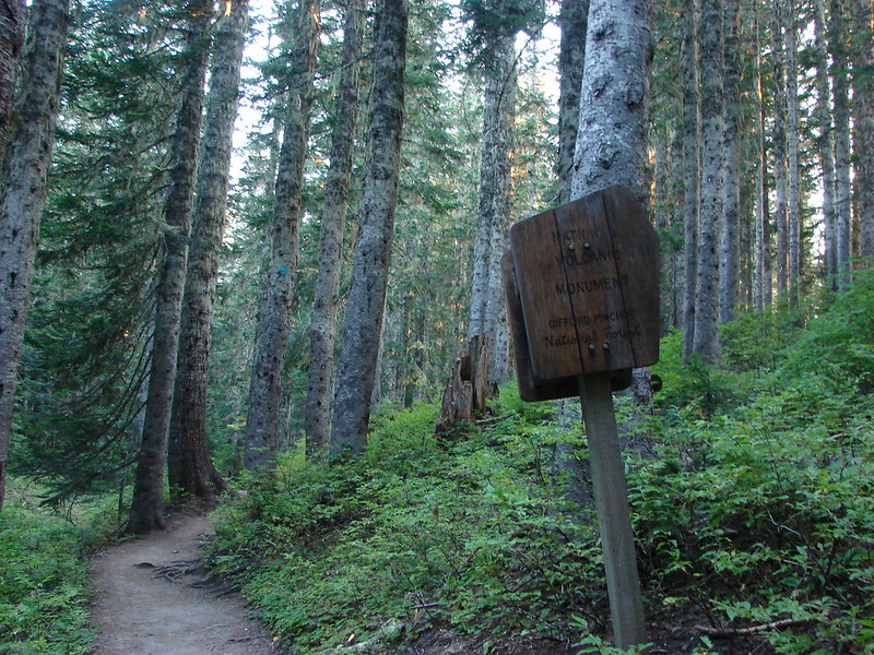
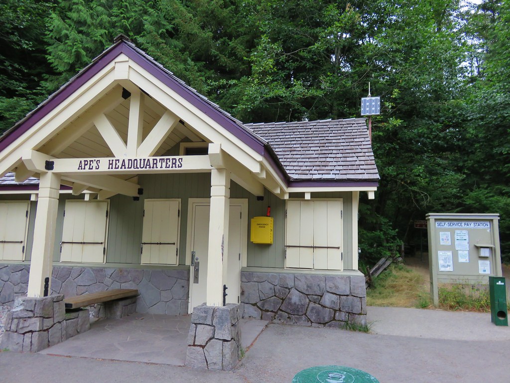
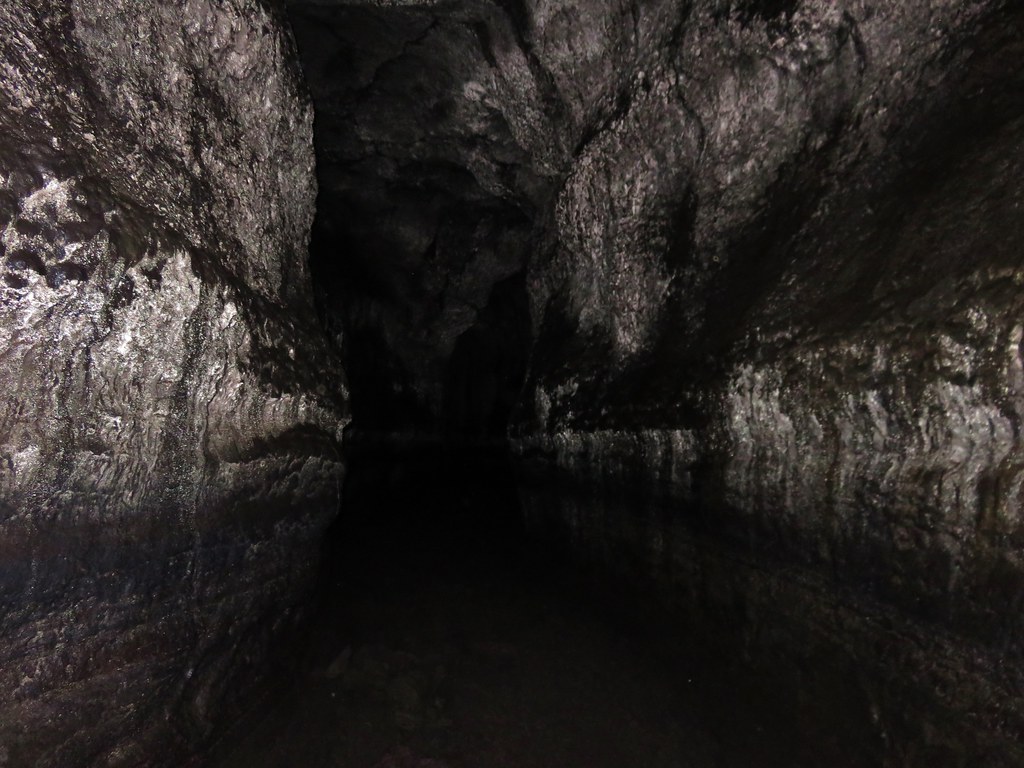
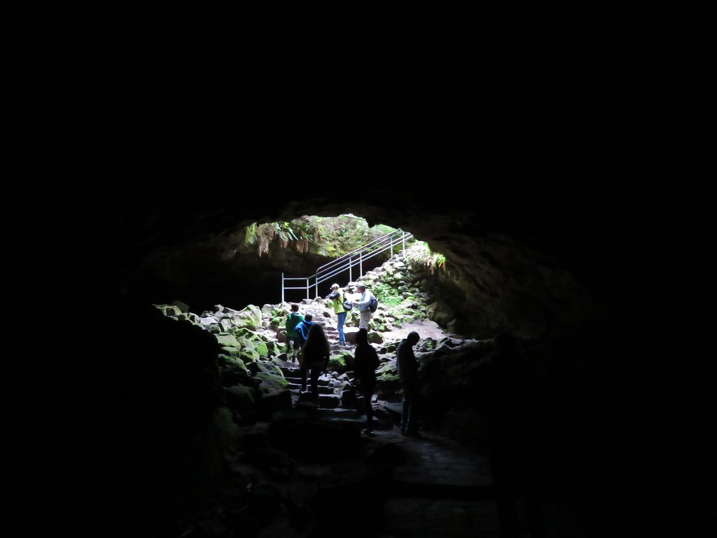
At 12,810 feet long Ape Cave is the longest known Lava Tube in North America. It is also one of the more popular places to visit in the monument so we decided to tackle this trail first in an attempt to beat the crowds. A staffed information booth awaits at the trailhead, but we had arrived before it opened for the day.
IMG_5518

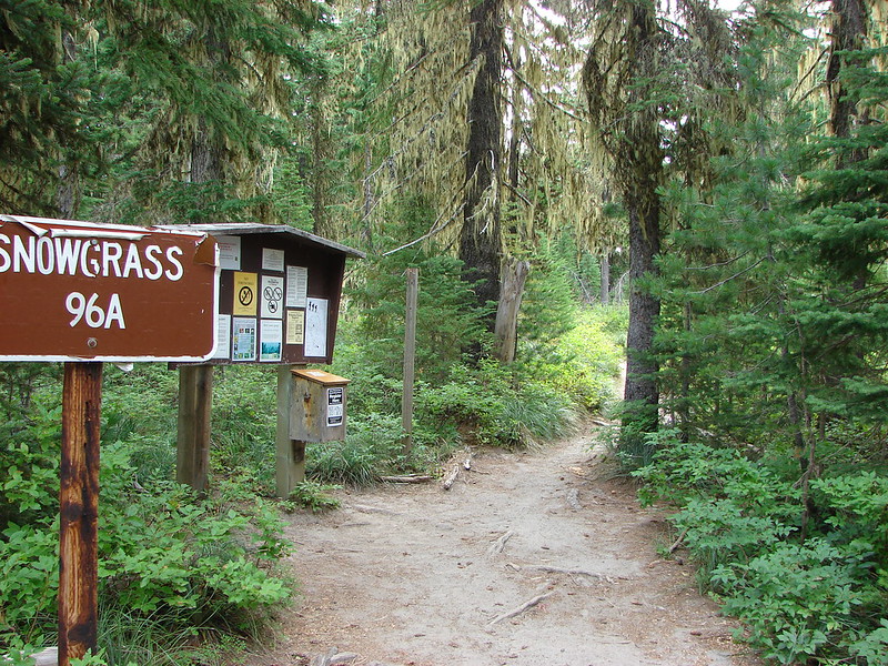
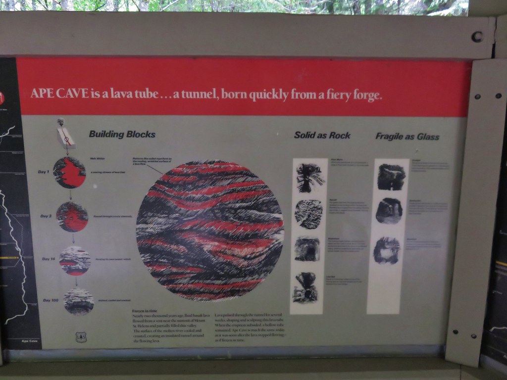
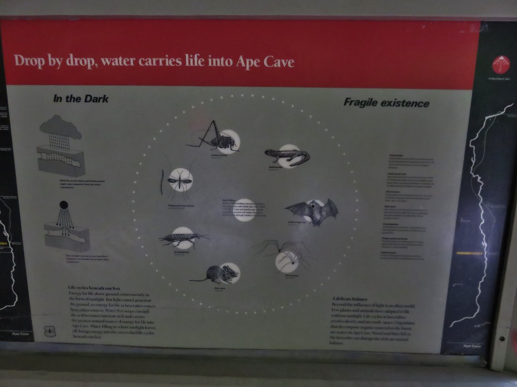
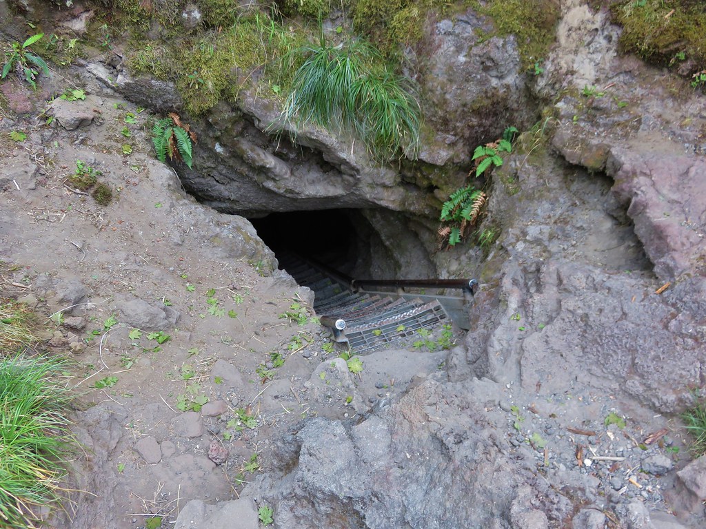
A short paved trail leads to an kiosk with signboards and the lower cave entrance.
IMG_5521

IMG_5593

IMG_5594

IMG_5595

IMG_5523

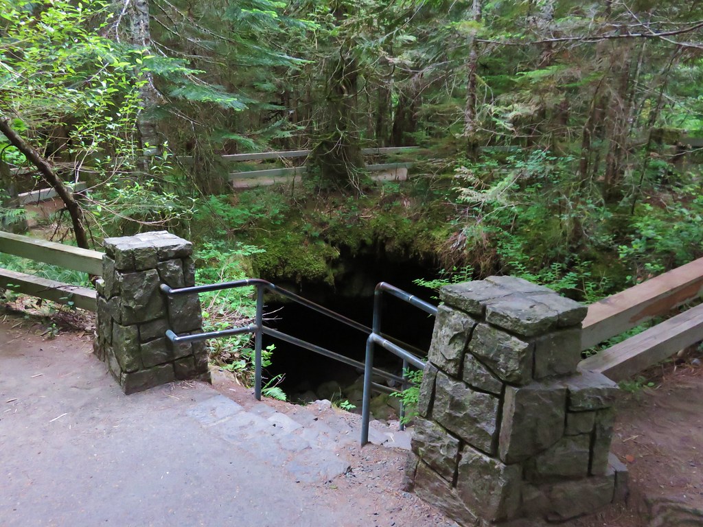
An above ground trail leads past the lower entrance to an upper entrance (or exit).
IMG_5525

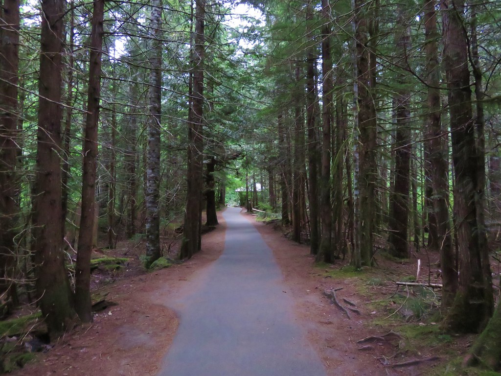
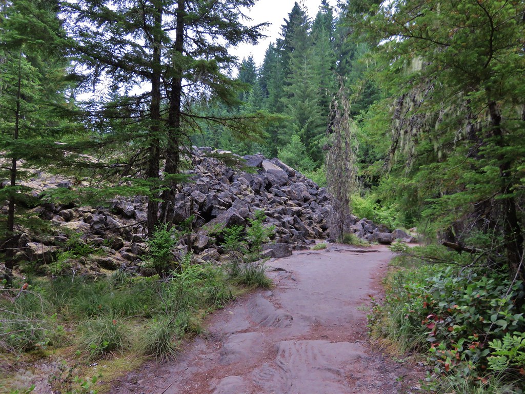
We decided to hike up to the upper entrance and then descend down the lava tube to it’s end 3/4miles past the lower cave entrance. The trail to the upper entrance passed through the forest before skirting a lava flow and passing some smaller lava tubes that were not part of the cave.
IMG_5526

IMG_5527

IMG_5528

IMG_5529

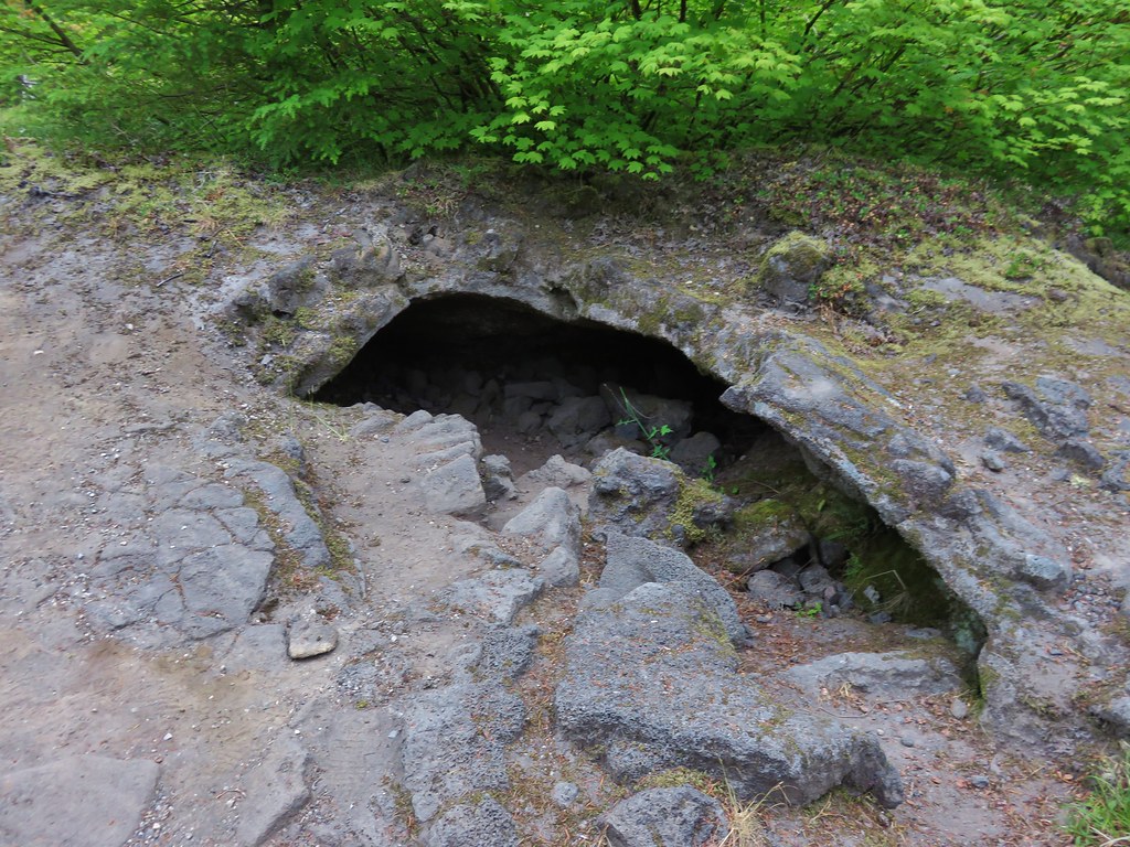
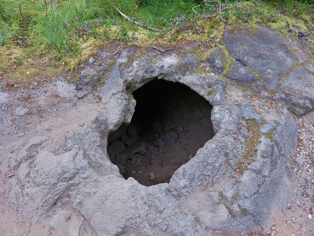
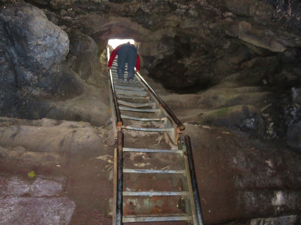
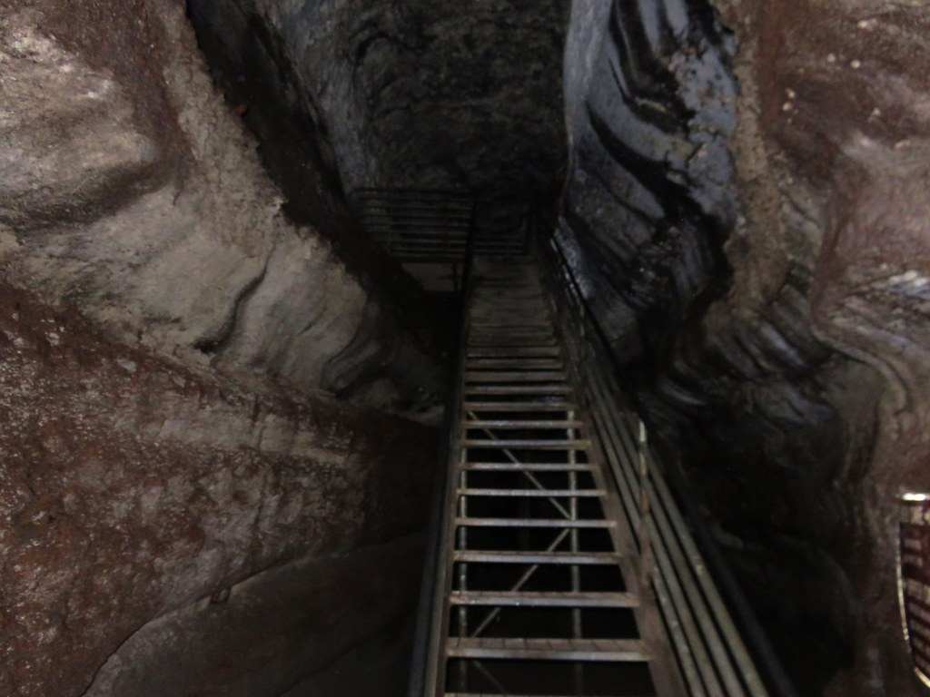
The trail actually did pass over the cave three times before arriving at the site of the upper entrance. We walked passed the entrance initially following a well used path about 50 yards too far before realizing our mistake. There was no sign marking the upper entrance and the hole was much smaller than the lower entrance. It took a moment for us to spot the metal ladder barely sticking up from out of the dark hole.
IMG_5531

IMG_5533

Climbing down the ladder was interesting as the first 17 steps angled downward before the ladder suddenly dropped straight down for the final 10 or 12 rungs.
IMG_5536

The cave extends another .1 miles or so beyond the upper entrance so we turned north and walked to the end before turning around and heading for the lower entrance.
IMG_5537

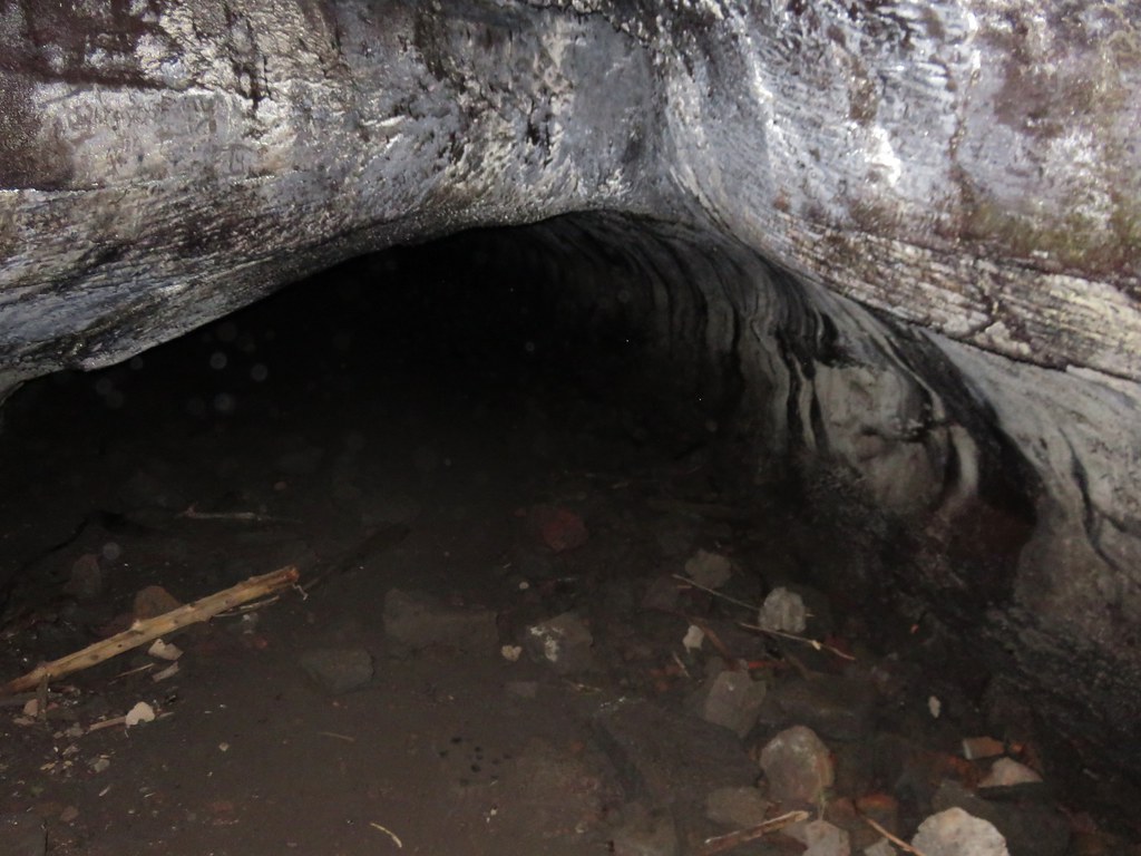
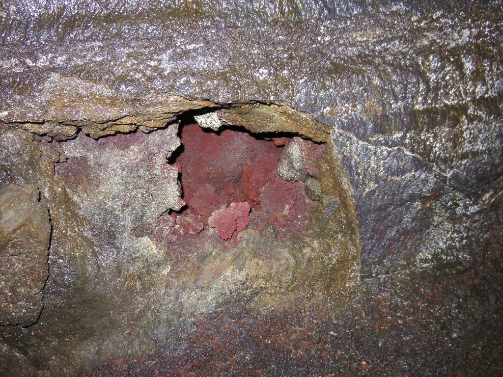
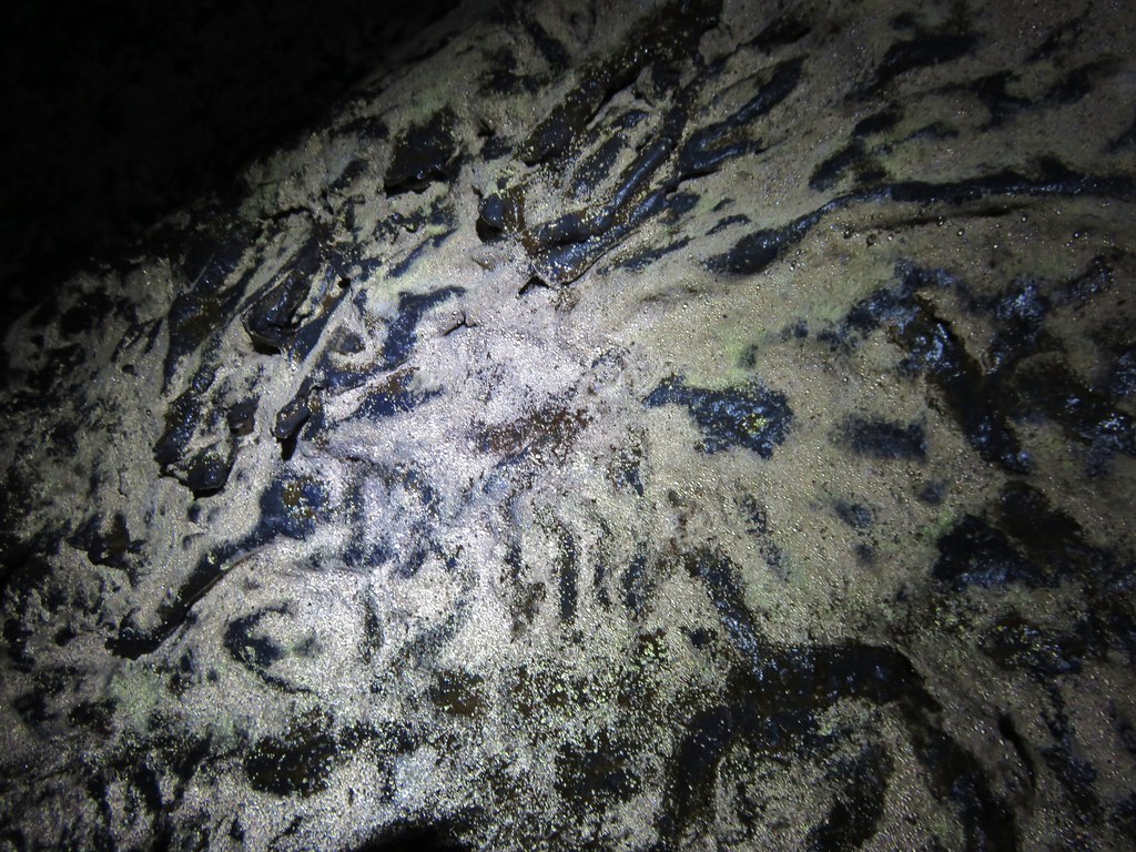
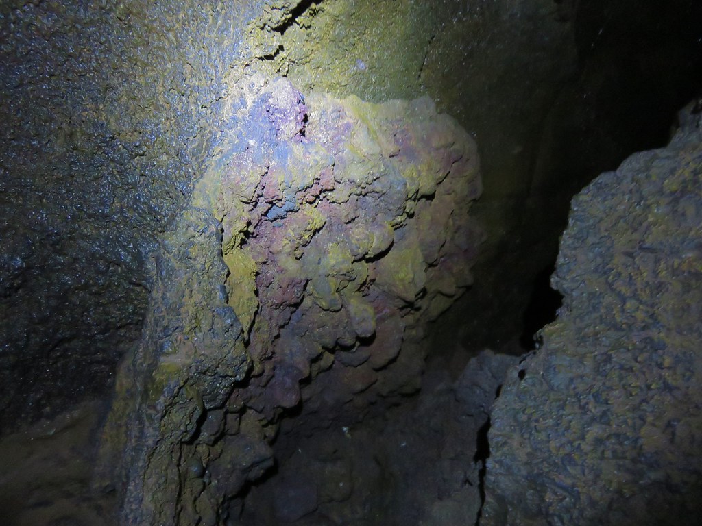
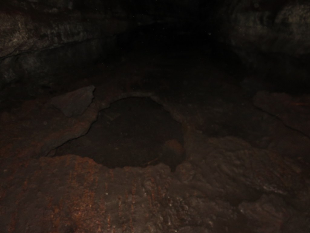
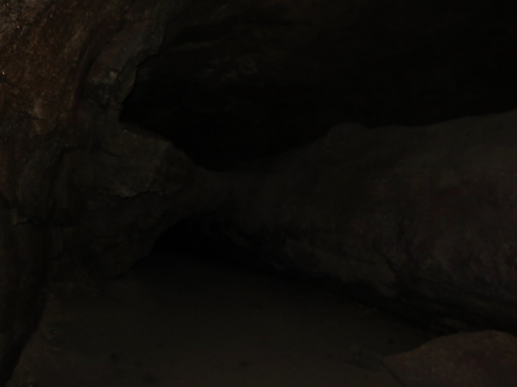
The cave was really neat. The rock surrounding the tube was full of colors and different textures. White portions of rock reflected our headlamps imitating rays of sunlight along the walls and ceiling.
IMG_5541

IMG_5544

IMG_5547

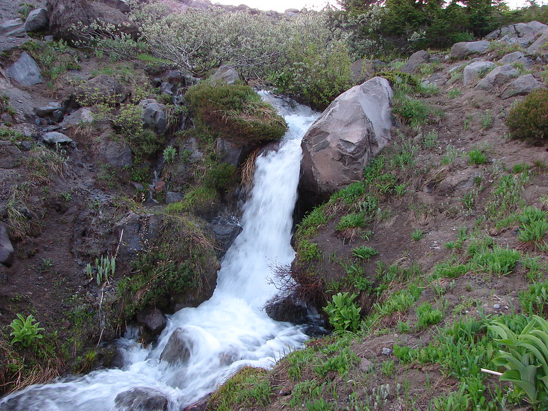
A third of a mile from the upper entrance the trail past under a skylight where green ferns and mosses grew on the rocks.
IMG_5553

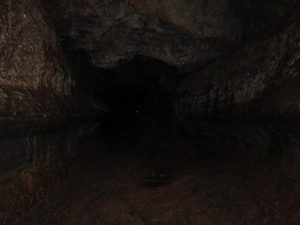
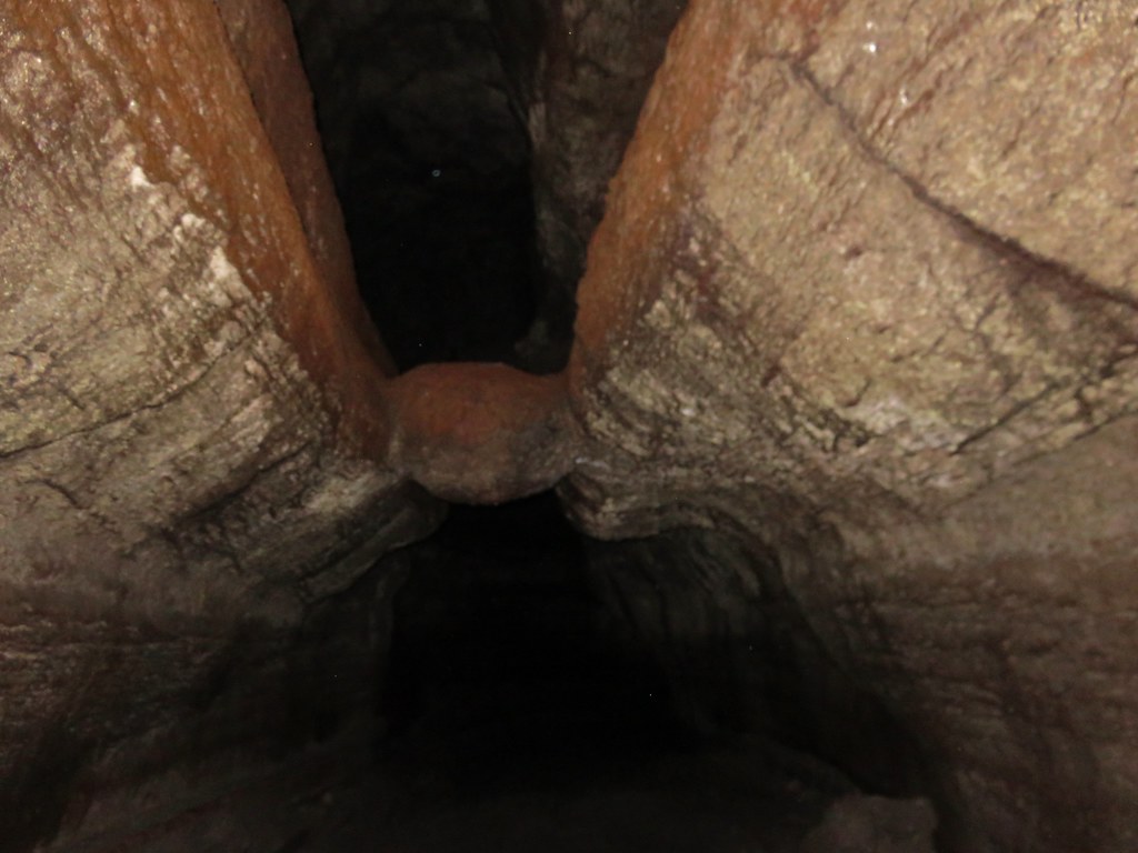
The lower entrance was another 1.1 miles beyond the skylight. This section of the lava tube was a workout. Ten different rock falls required scrambling over and around piles of lava rock and a pair of lava falls, drops of around 8 feet, proved a challenge to descend. The second lava fall was particularly difficult requiring us to slowly lower ourselves down using small nubs on the cave floor as handholds. The scenery of the cave was worth the effort and we wondered if climbing up would have been easier than coming down as we had.
IMG_5557

IMG_5563

IMG_5565

IMG_5577

It was fairly slow going but we eventually made it to the base of the staircase leading down from the lower entrance.
IMG_5582

IMG_5579

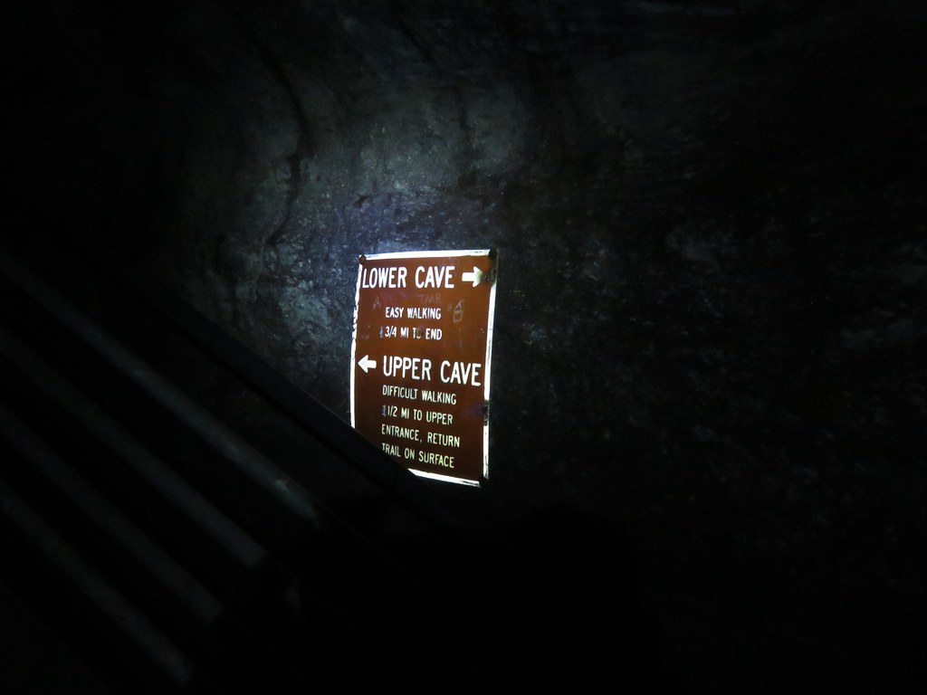
We headed down the lower end of the cave which was, as the sign said, a relatively easy walk. We turned around when the cave had become small enough that we would have had to crawl to continue any further.
IMG_5584

IMG_5586

IMG_5588

We had started to run into a few more people near the end of the lower cave and on the way back to the lower entrance the number of people increased dramatically. We exited up through the lower entrance and headed for the car.
IMG_5590

In hindsight we should have descended through the lower entrance as it seemed like it would have been easier to ascend up through the cave and it would likely have avoided the crowds that had formed later in the morning in the lower cave.

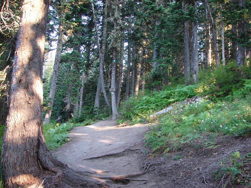
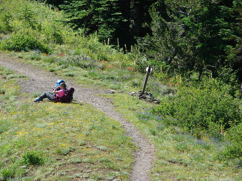
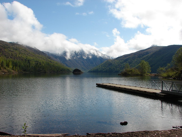
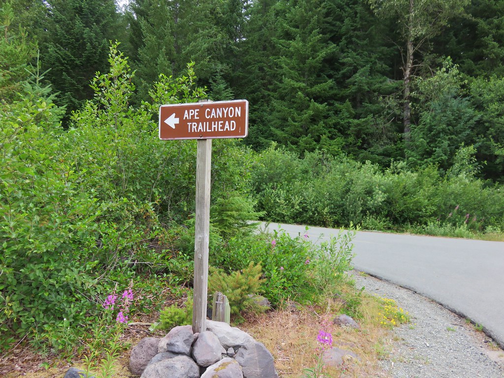
We drove from the Ape Cave parking area to the Ape Canyon Trailhead for our second hike of the day. On our previous visit we had taken the Ape Canyon Trail to the Loowit Trail and then followed that trail to a junction with the Abraham Trail which covered a total of 12.7 miles. Our second hike that day at Lava Canyon was only 1.3 miles for a 14 mile total. This time around we had already done nearly 5 miles at Ape Cave so the plan was to stop at a spring along the Loowit Trail in the Plains of Abraham. The small parking lot at the Ape Canyon Trailhead was full so we parked along road 83 and walked to the start of the trail.
IMG_5596

IMG_5598

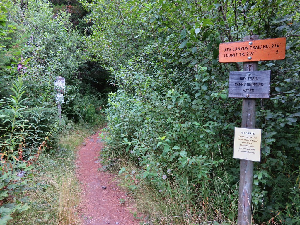
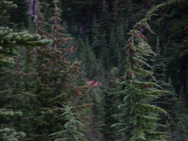
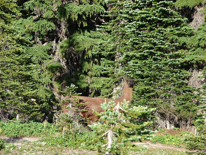
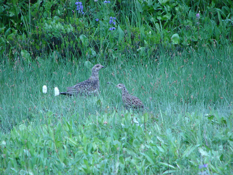
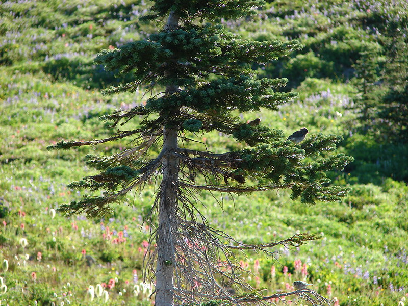
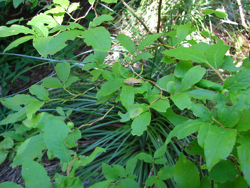
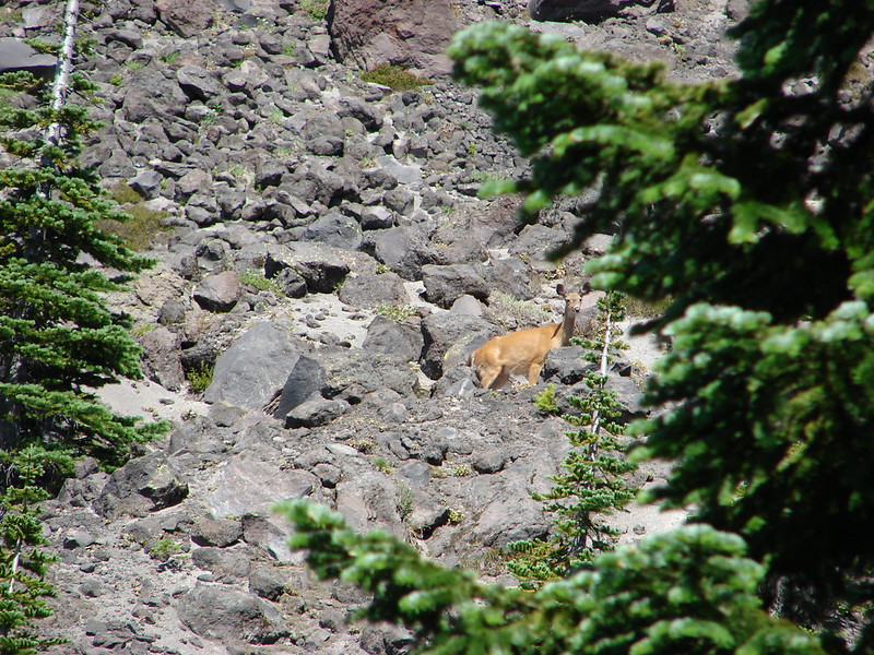
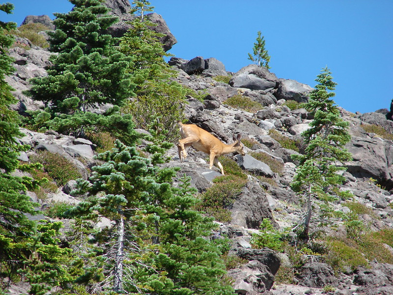
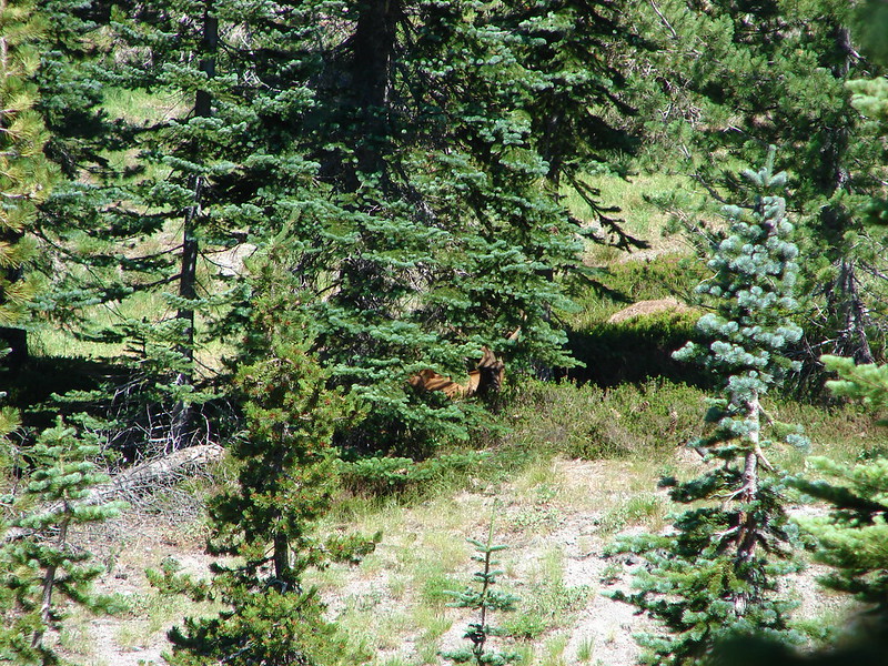
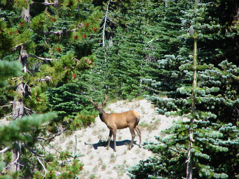
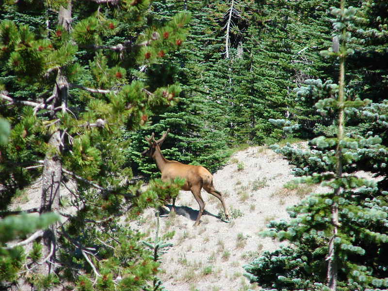
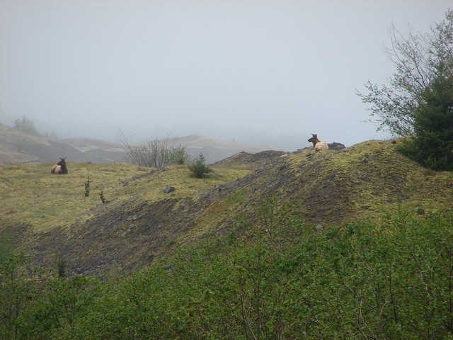
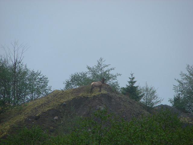
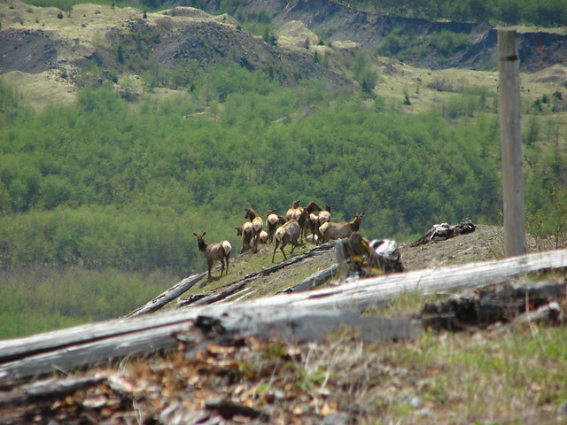
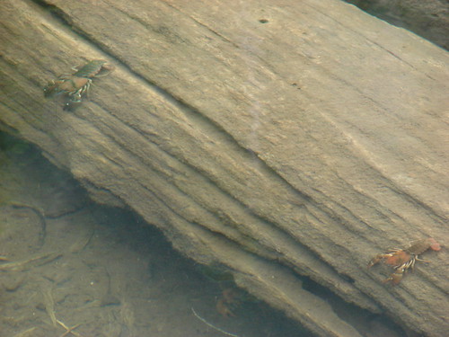
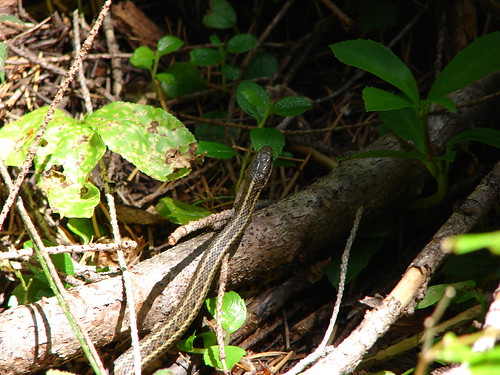
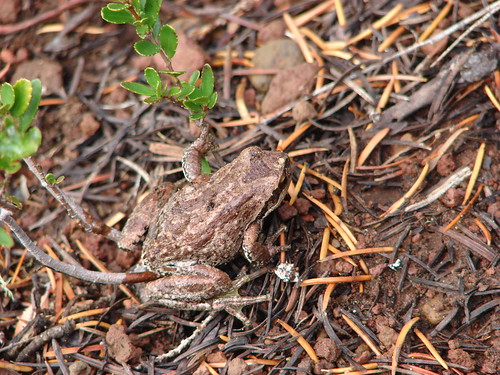
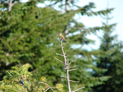
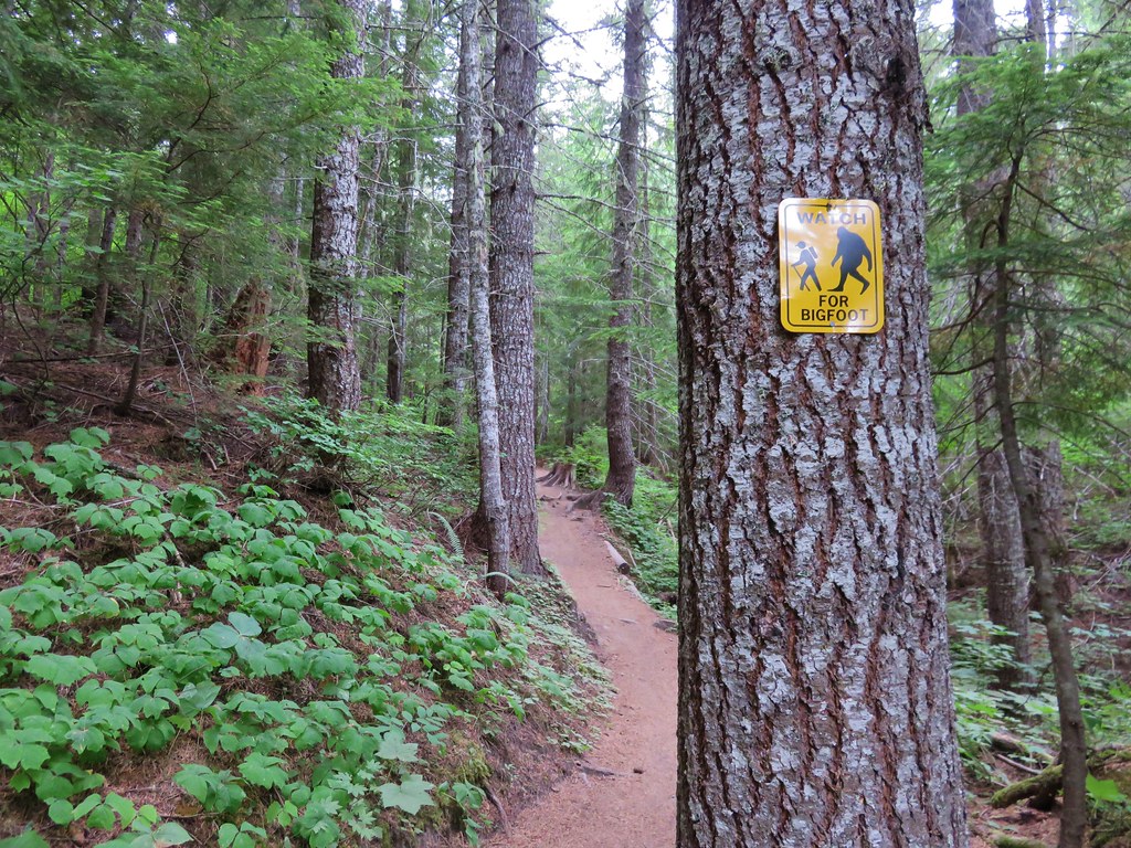
We were on high alert as we started the trail due to warnings about local wildlife.
IMG_5601

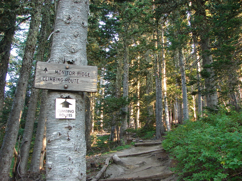
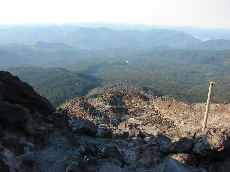
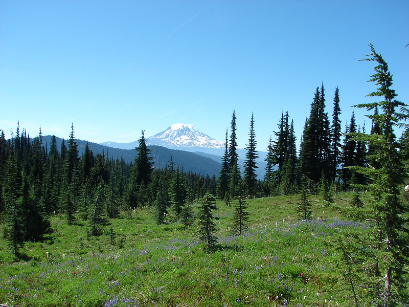
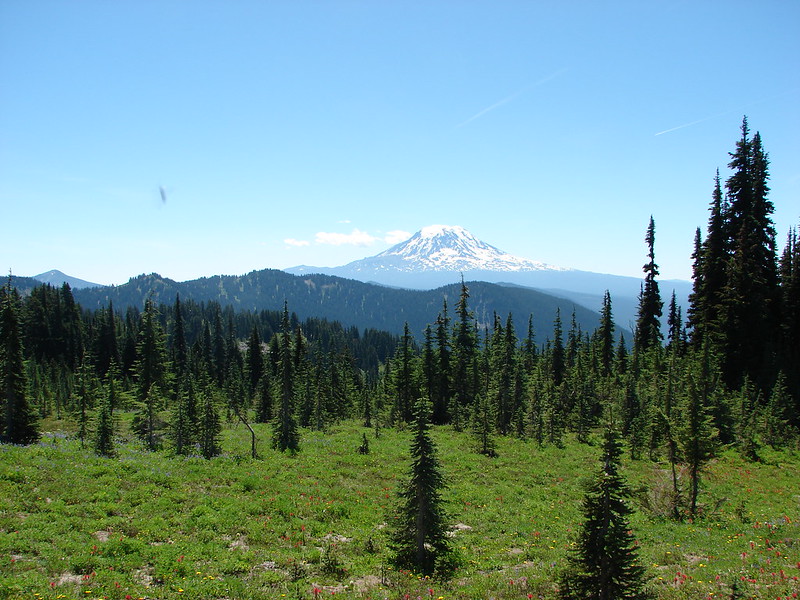
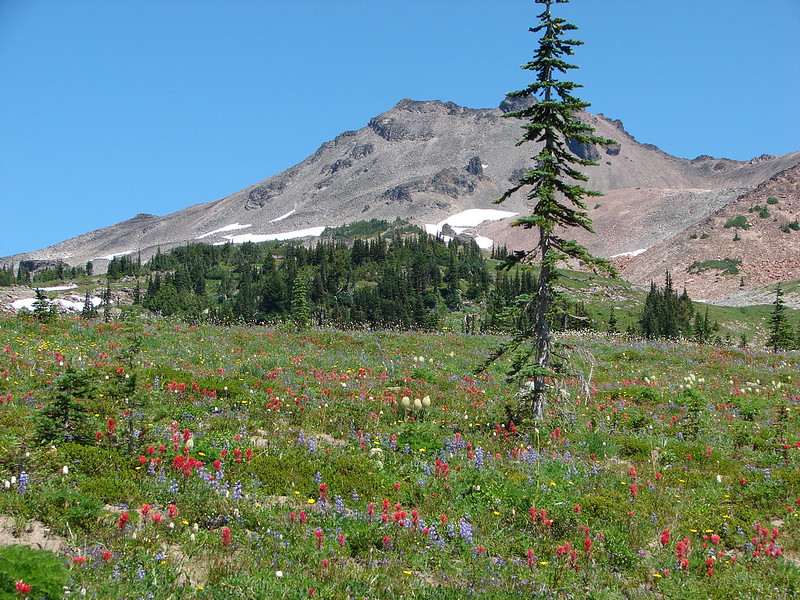
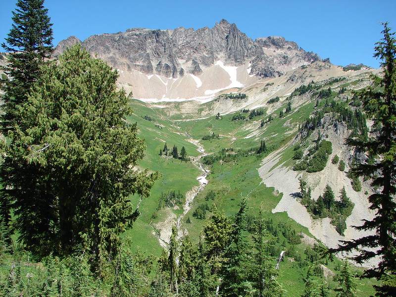
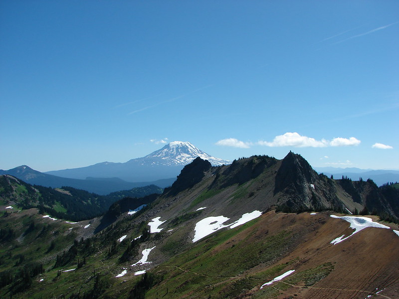
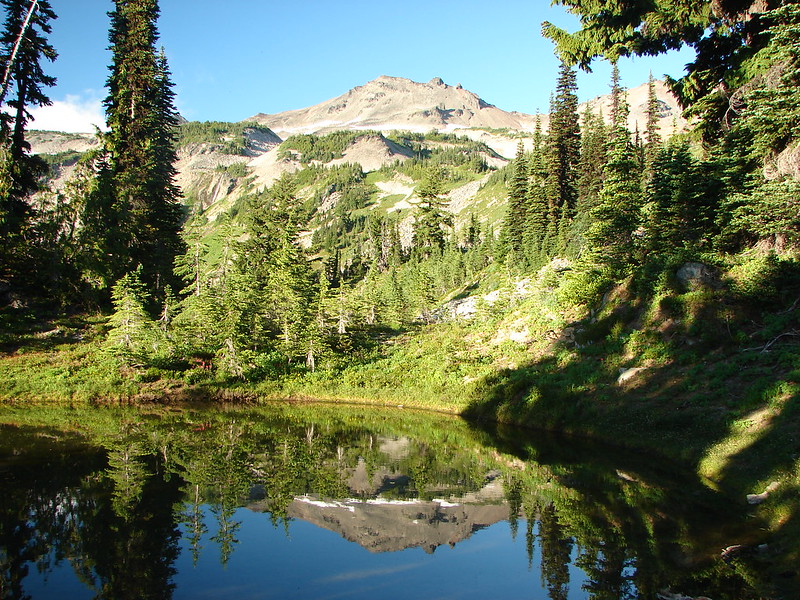
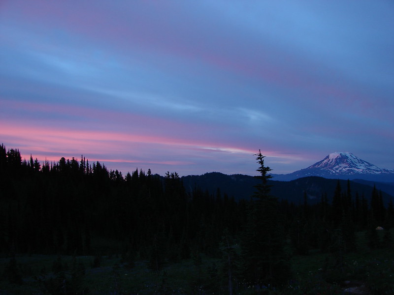
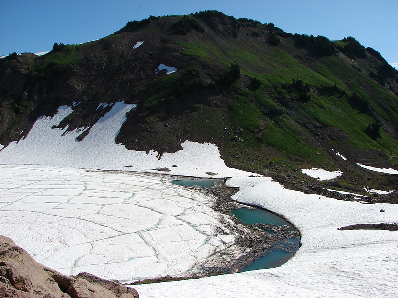
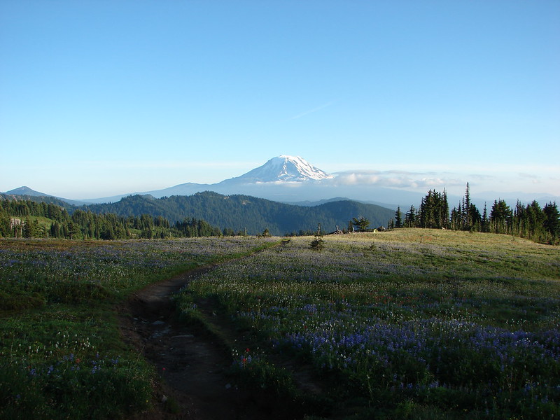
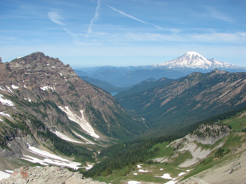
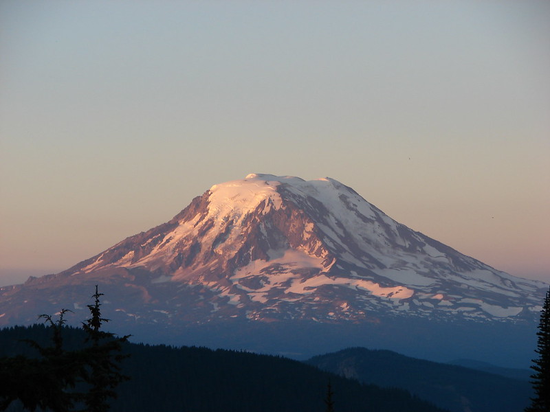
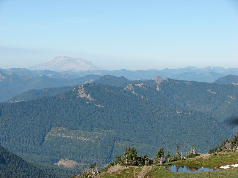
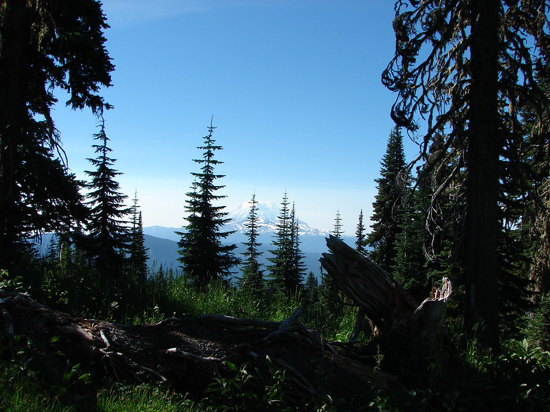
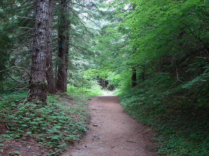
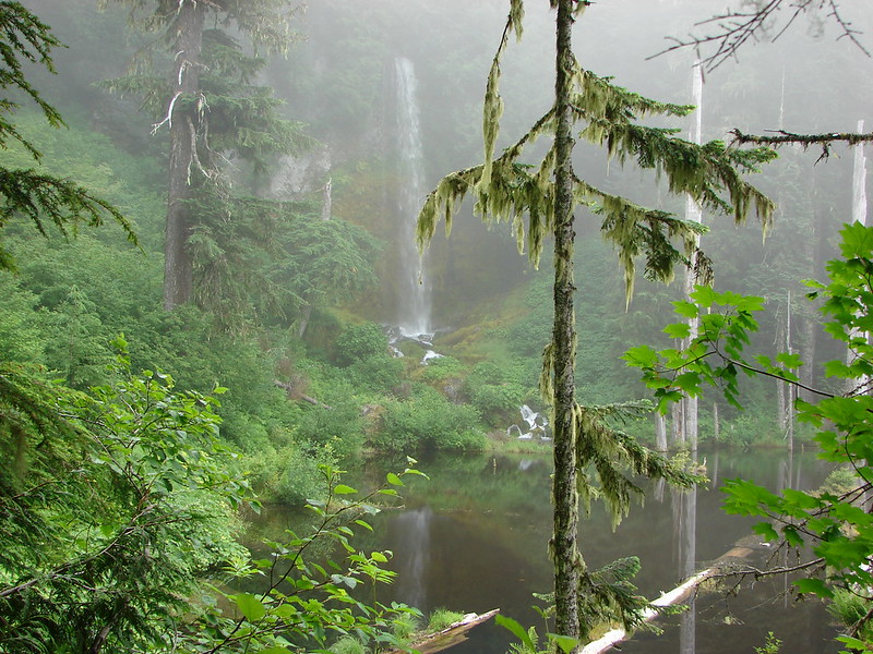
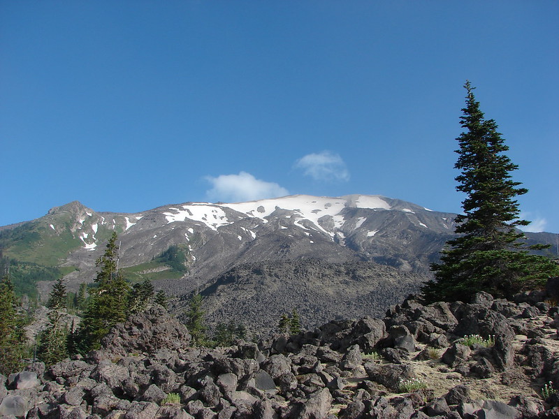
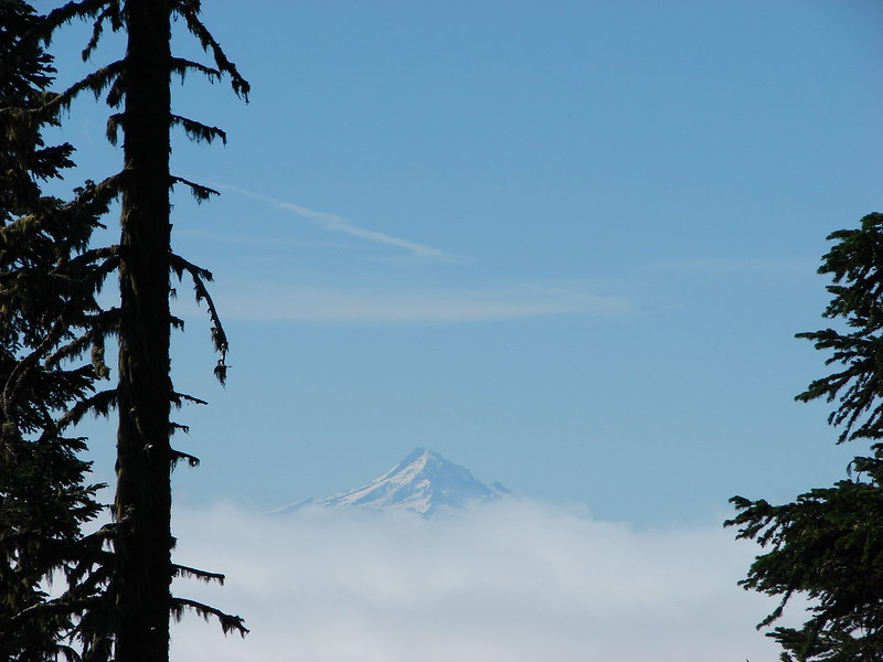
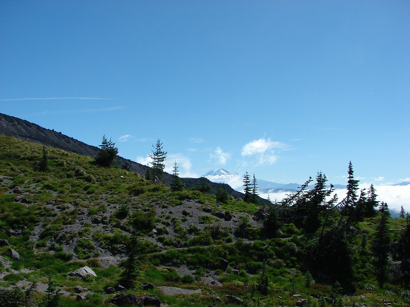
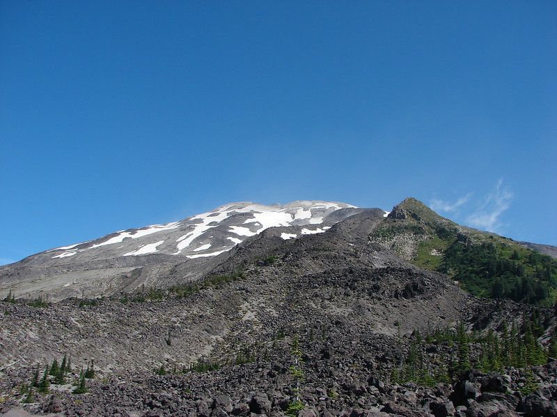
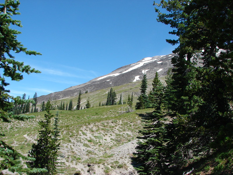
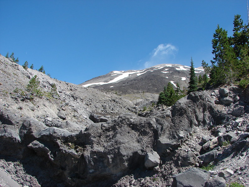
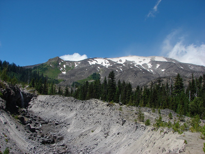
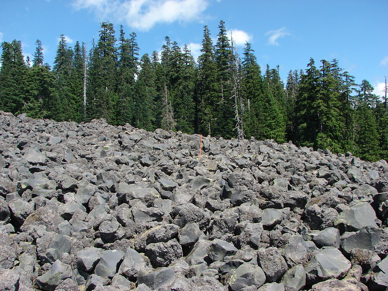
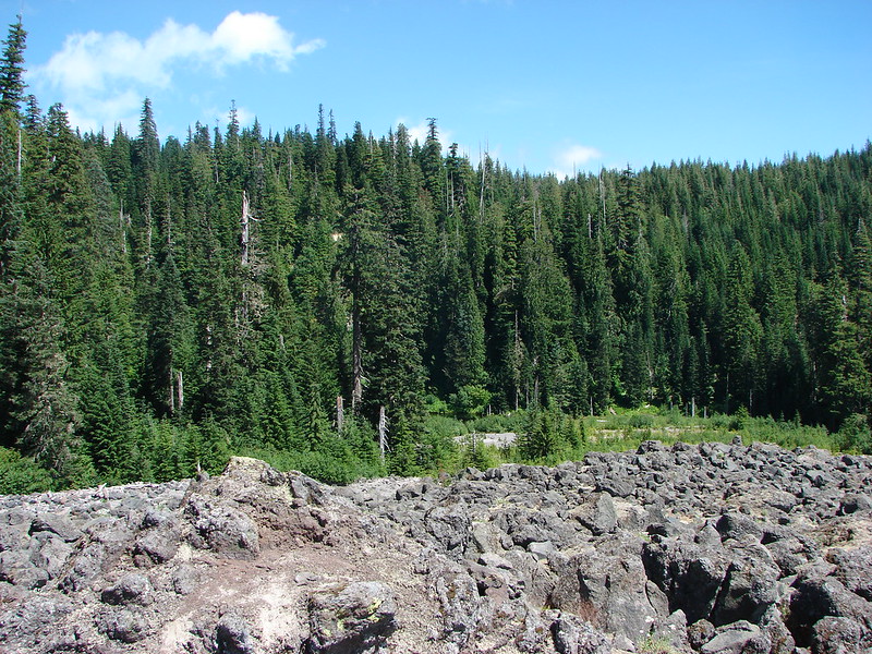
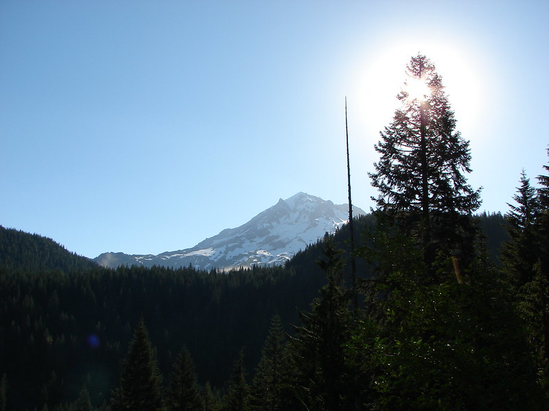
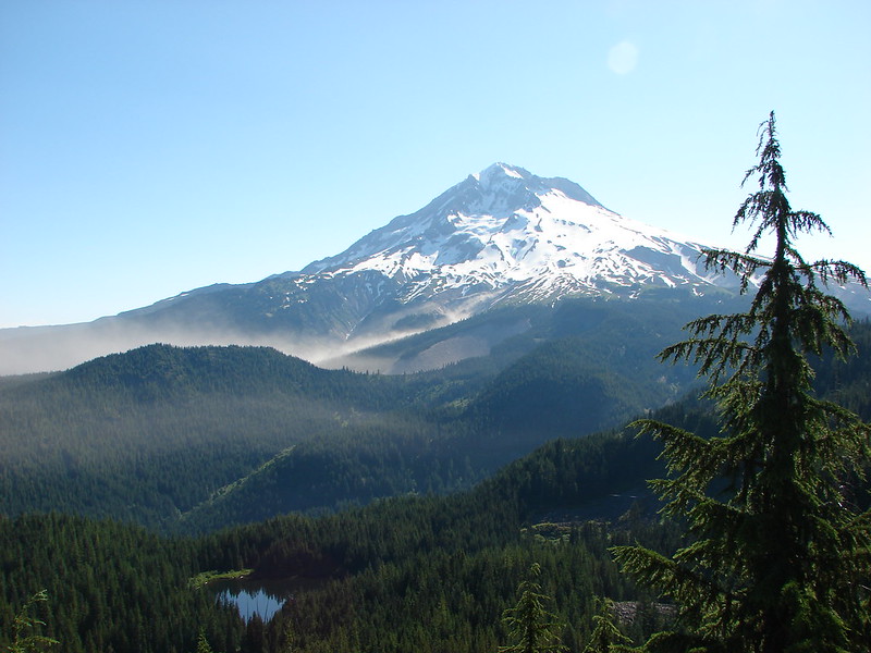
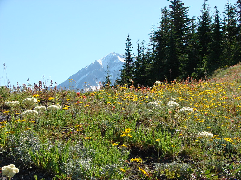
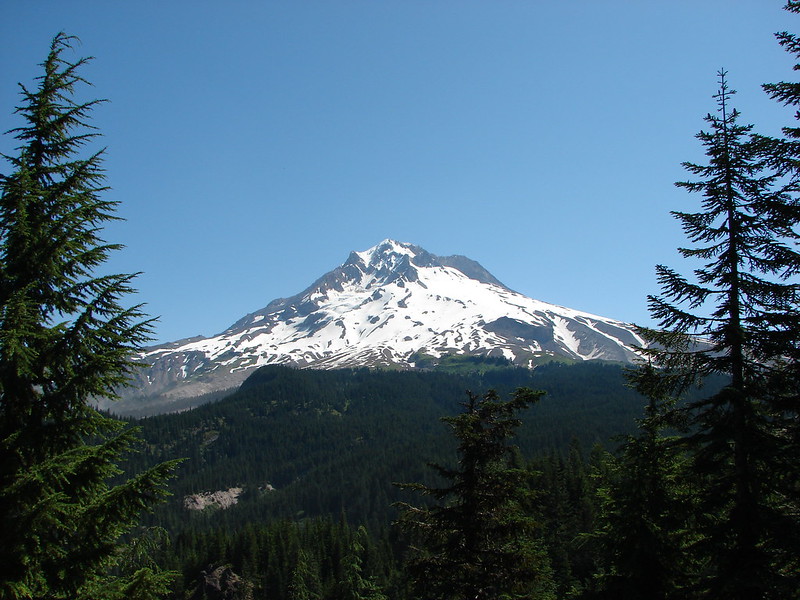
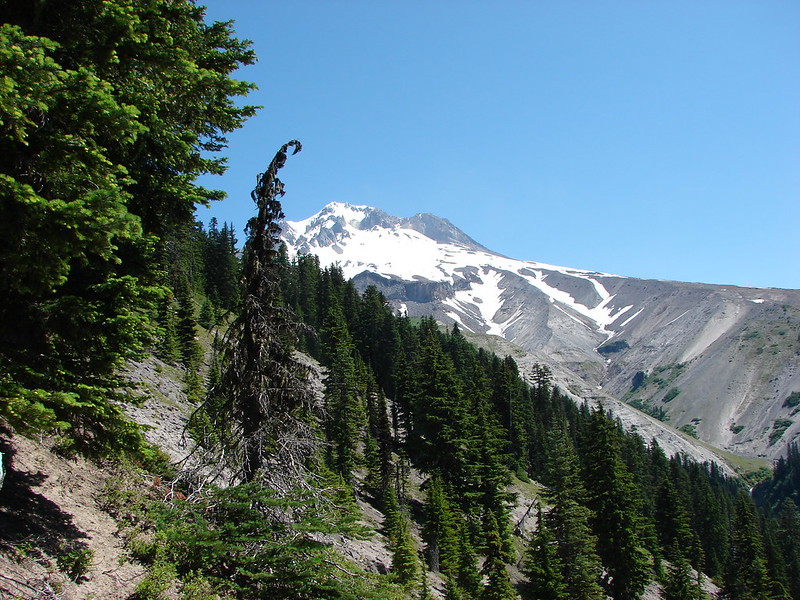
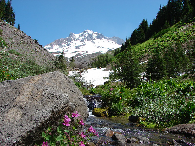
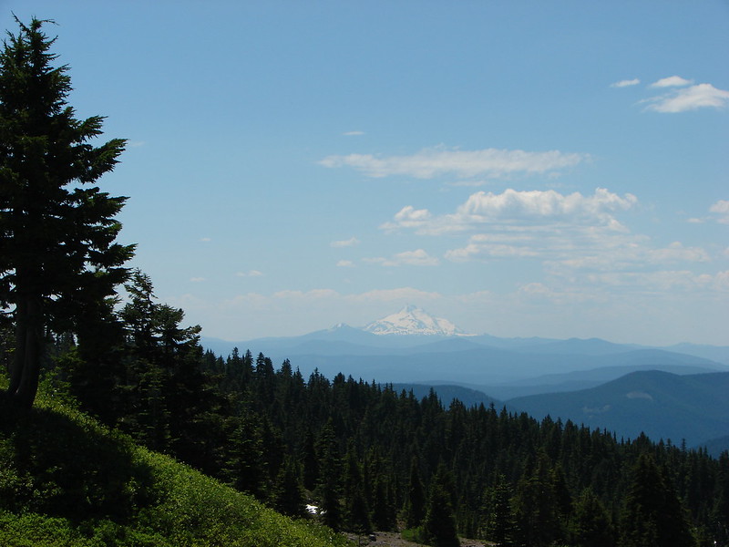
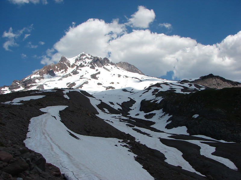
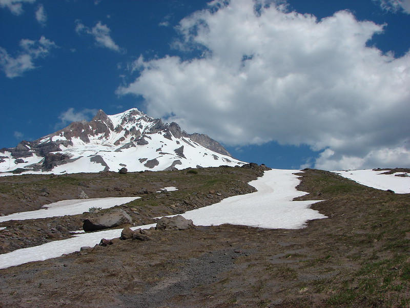
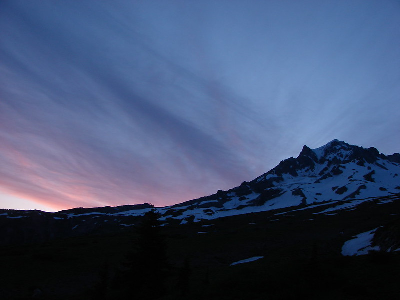
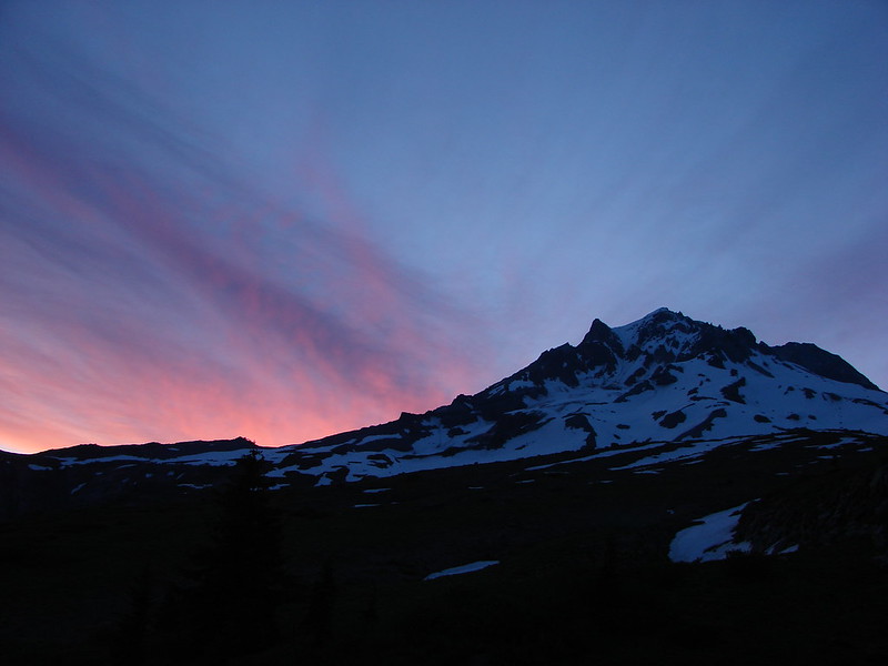
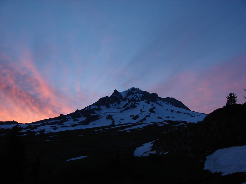
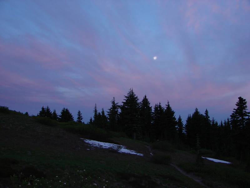
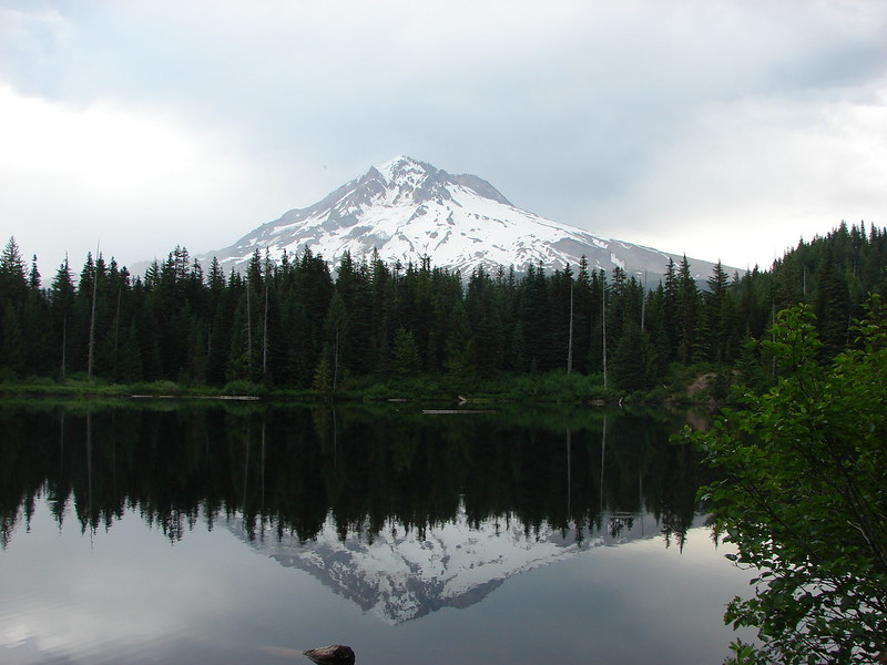
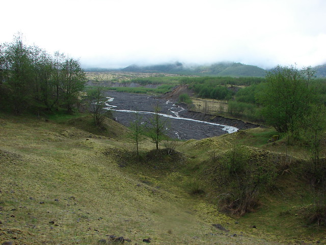
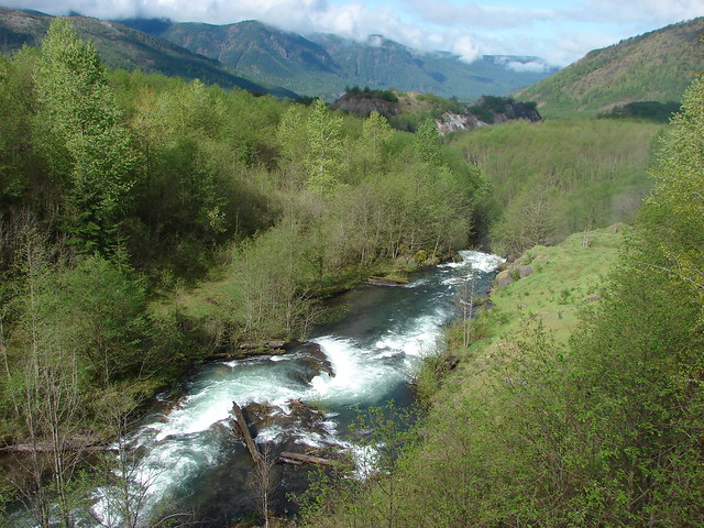
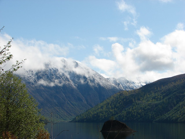
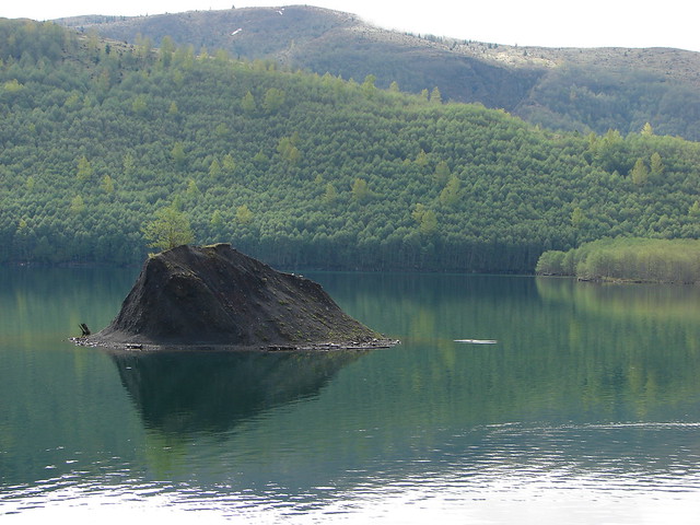
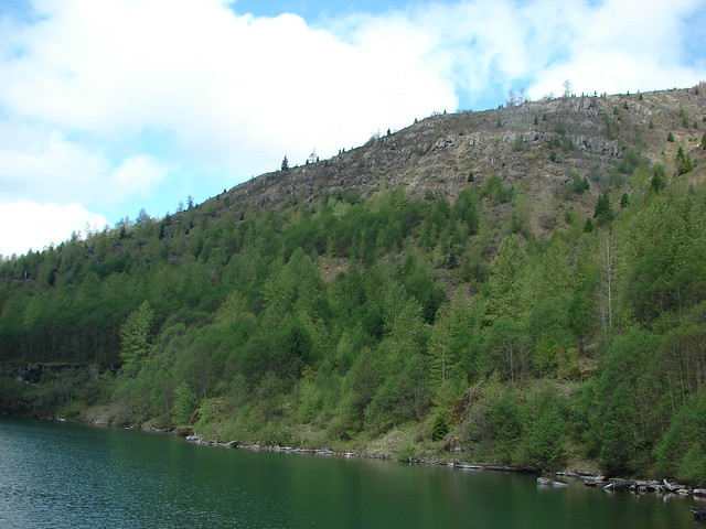
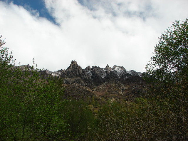
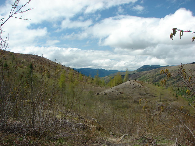
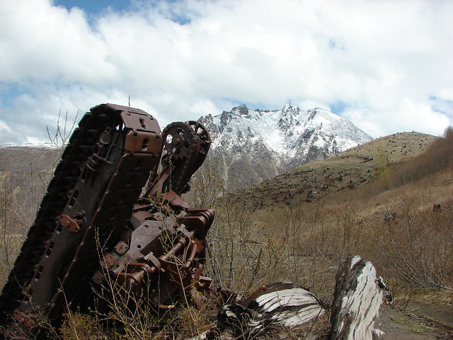
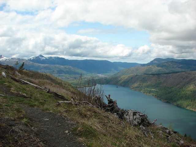
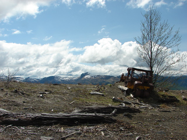
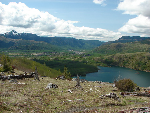
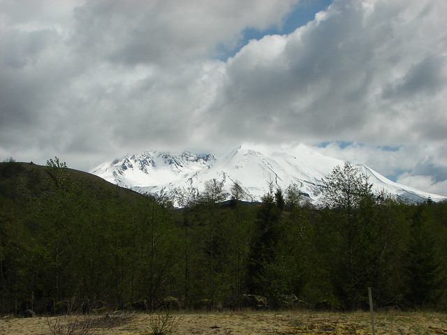
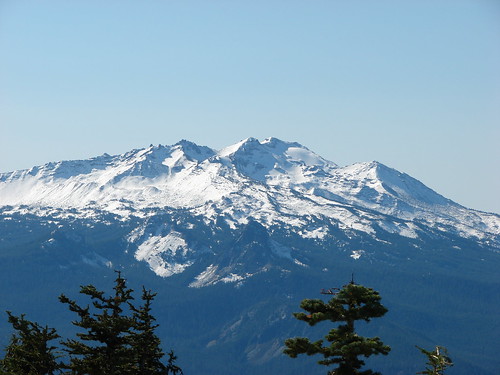
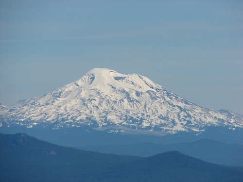
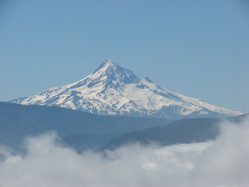
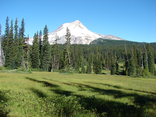
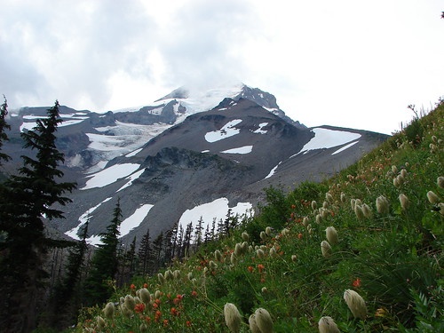
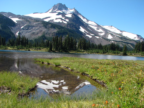
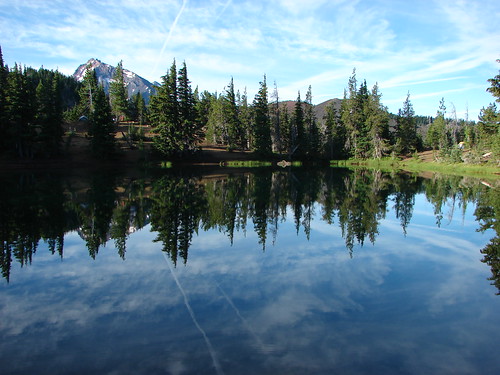
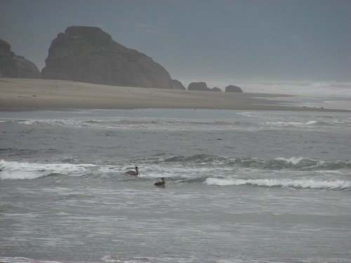
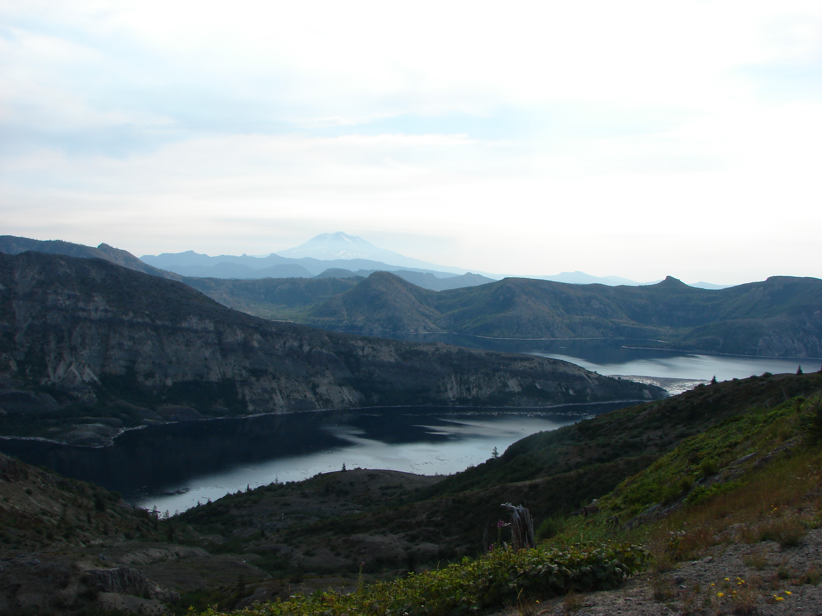
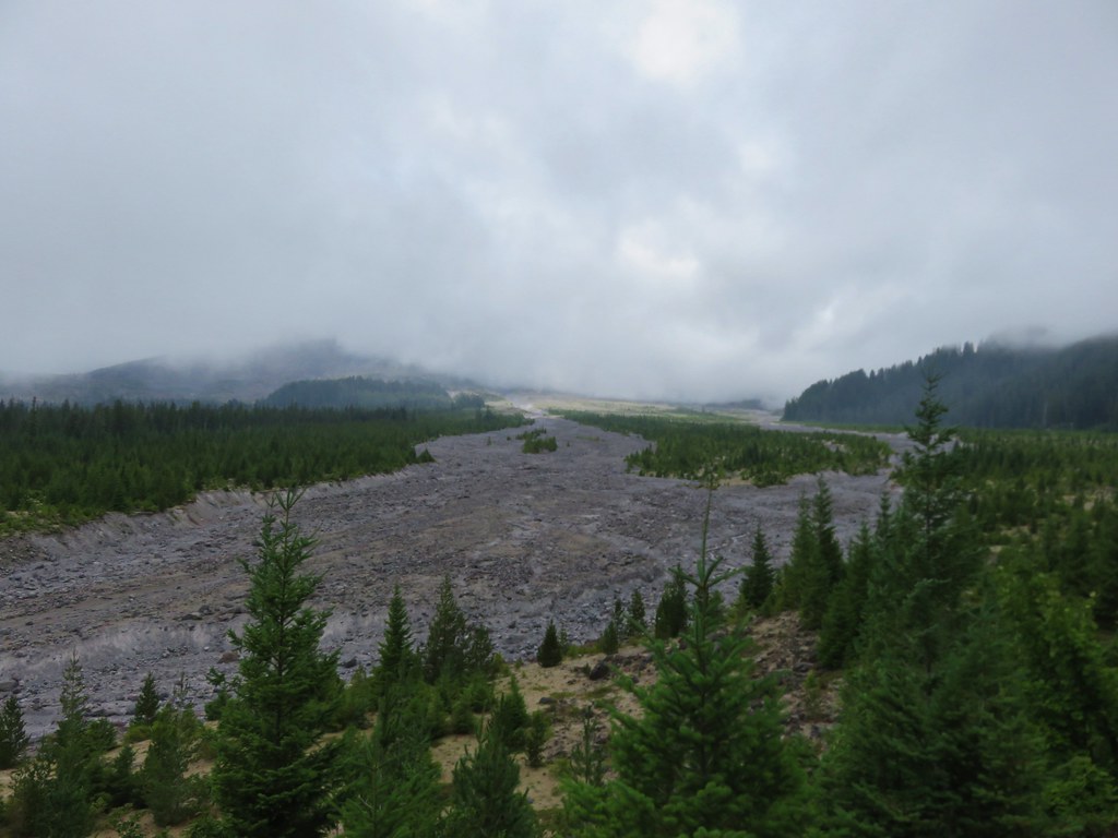
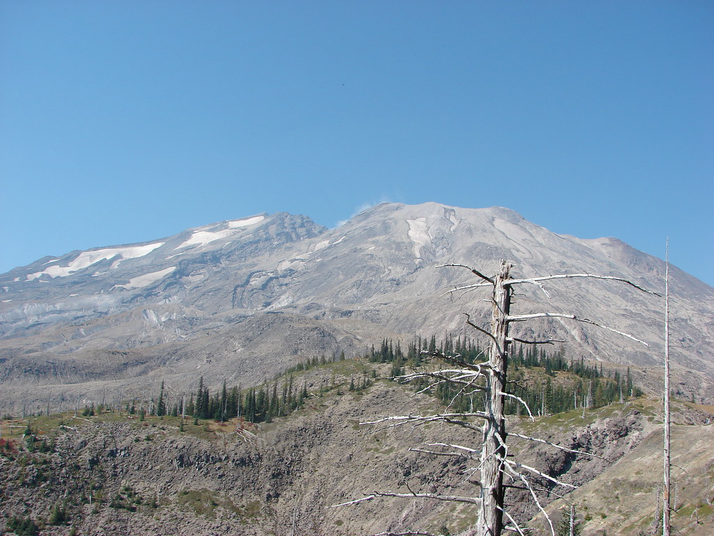
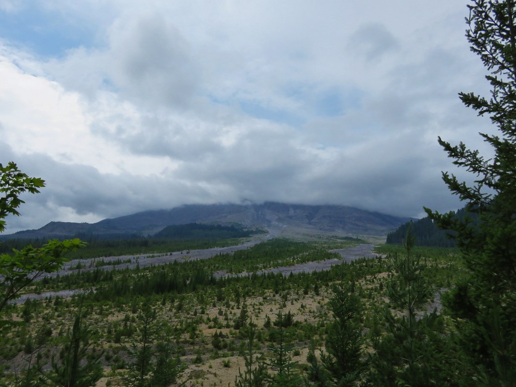
The Ape Canyon Trail starts in the forest next to a lahar created by the Muddy River when the mountains 1980 eruption sent a large portion of the Shoestring Glacier down the valley. Our previous visit had been on a clear day in Mid-September where the views across the lahar to Mt. St. Helens were spectacular.
021

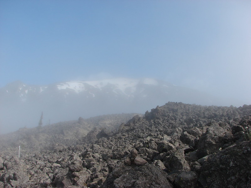
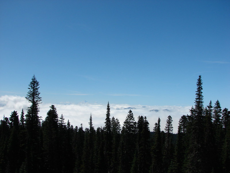
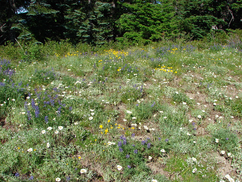
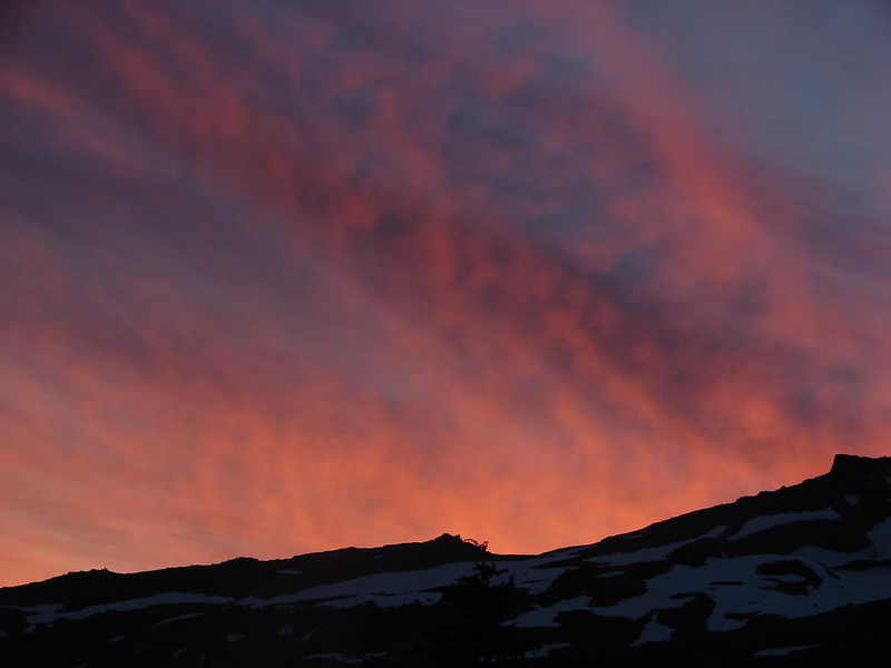
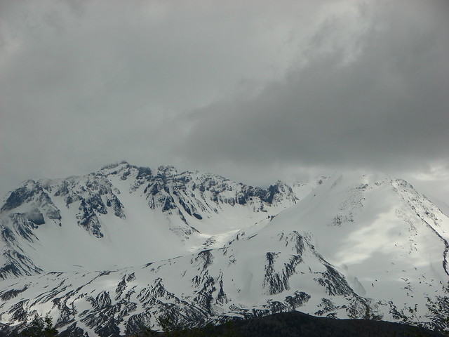
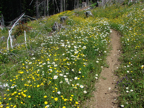
We were not to be so lucky on this day with our Mt. St. Helens views but the temperature was pleasant and we hoped to see more flowers this time than we had previously.
IMG_5602

IMG_5606

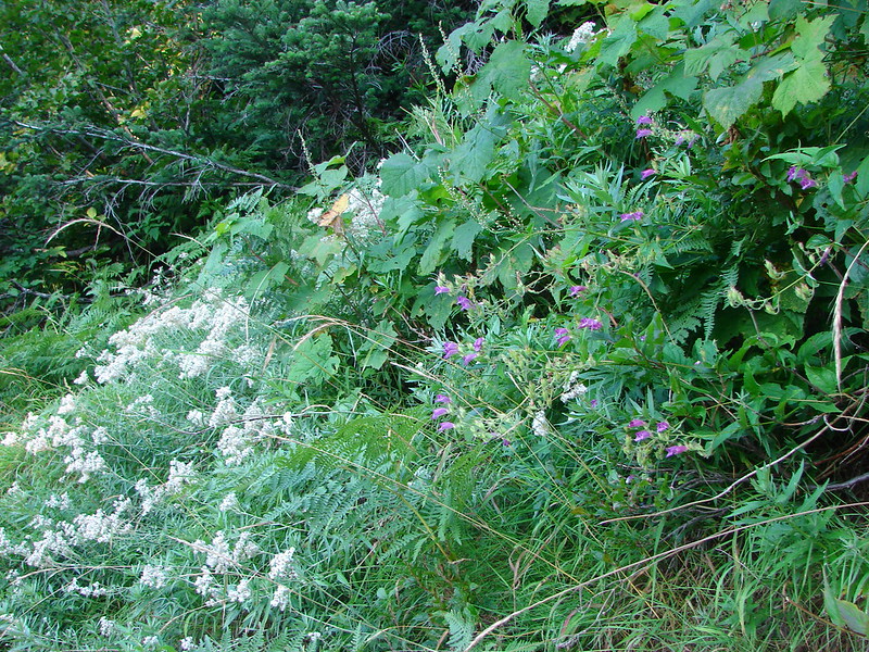
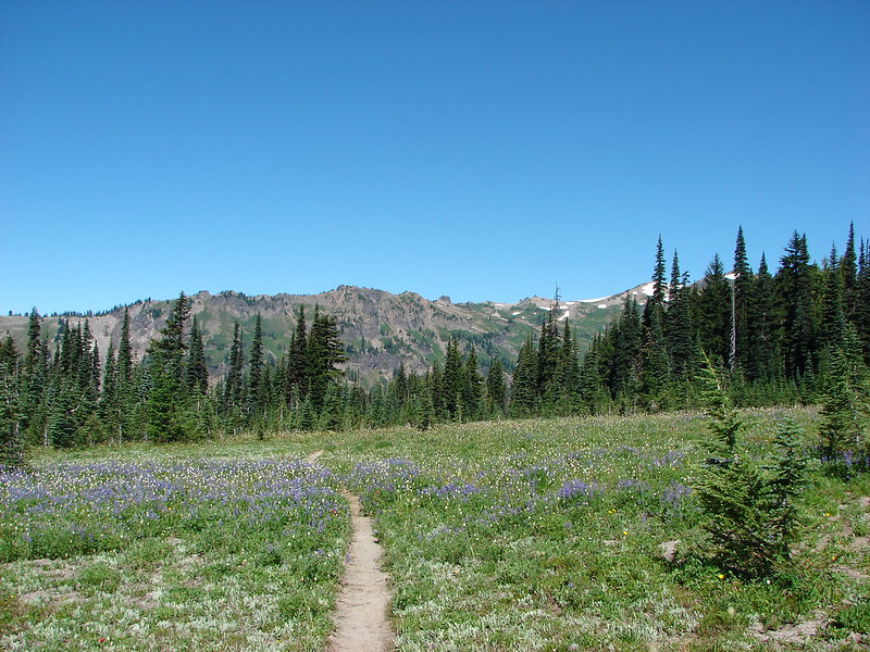
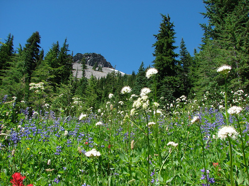
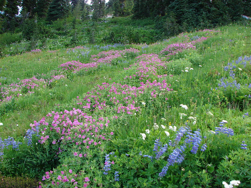
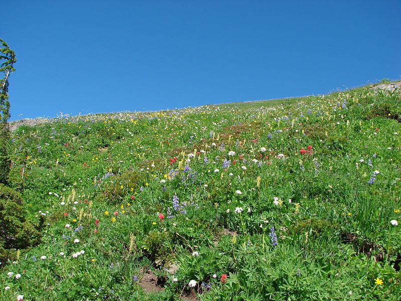
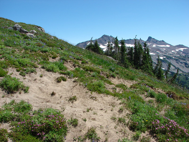
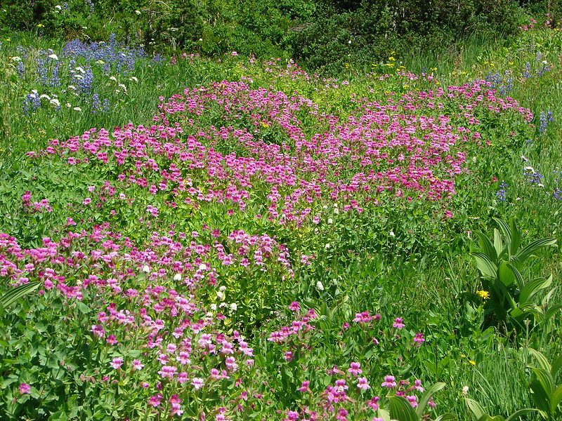
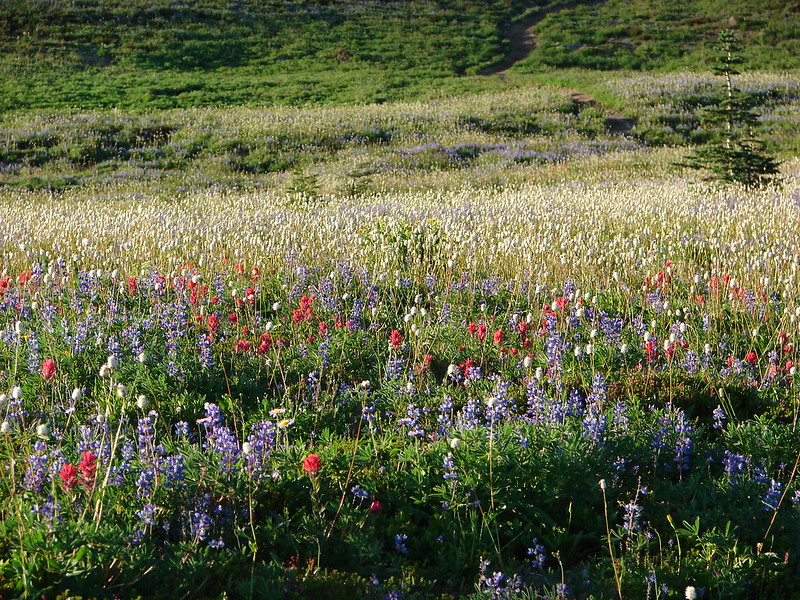
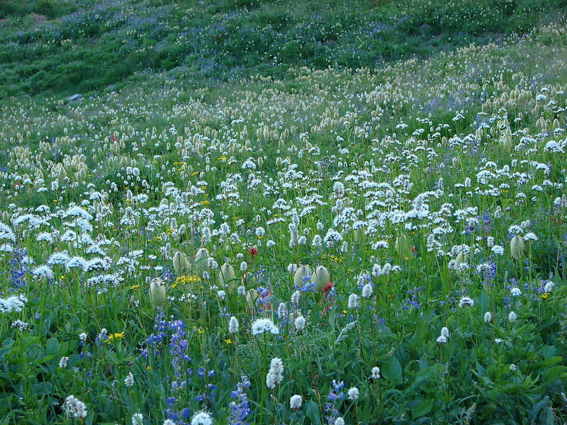
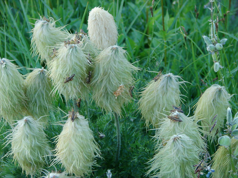
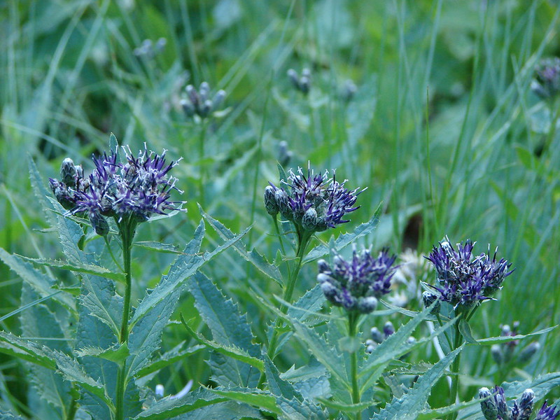
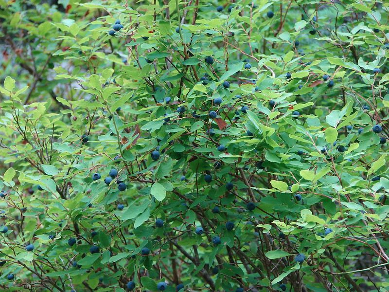
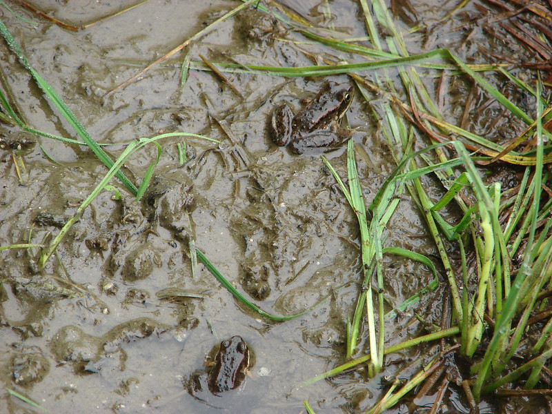
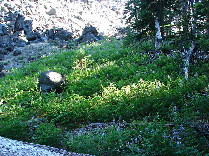
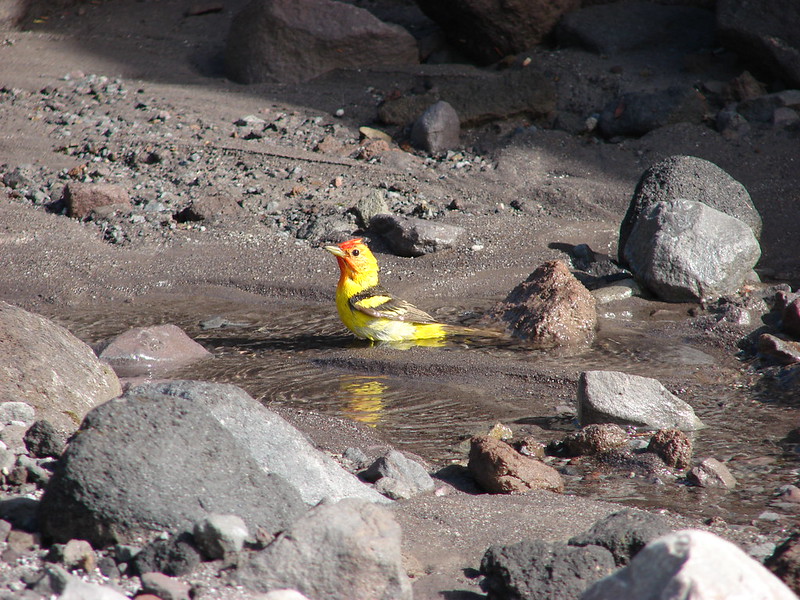
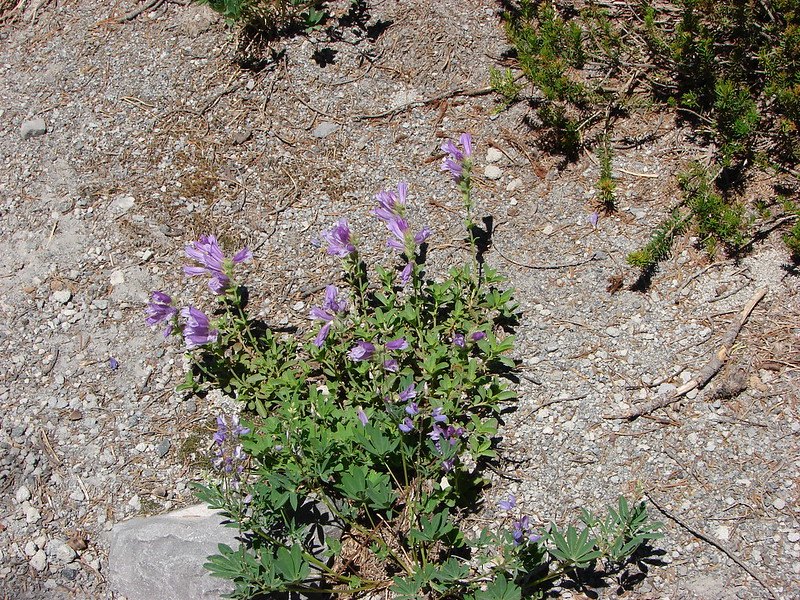
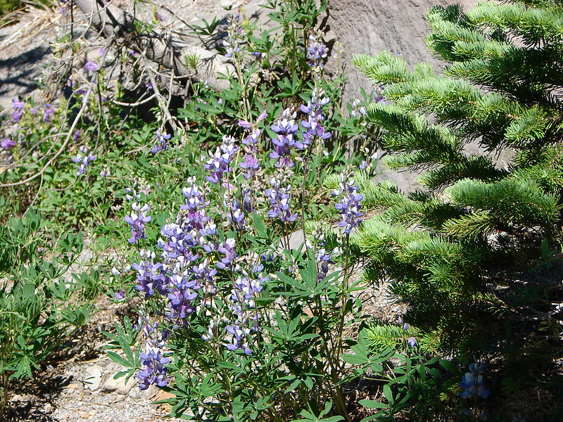
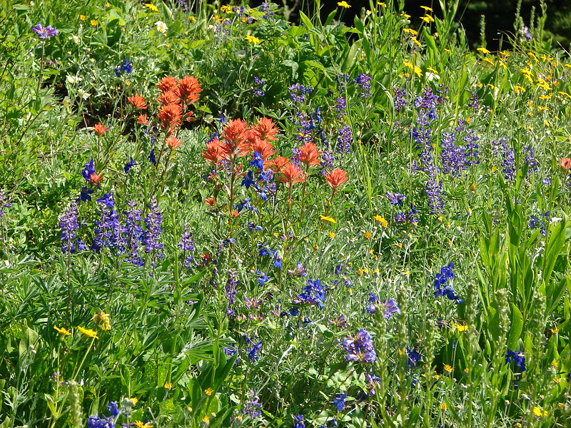
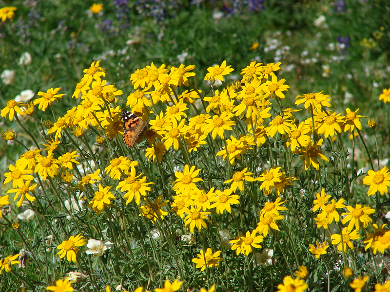
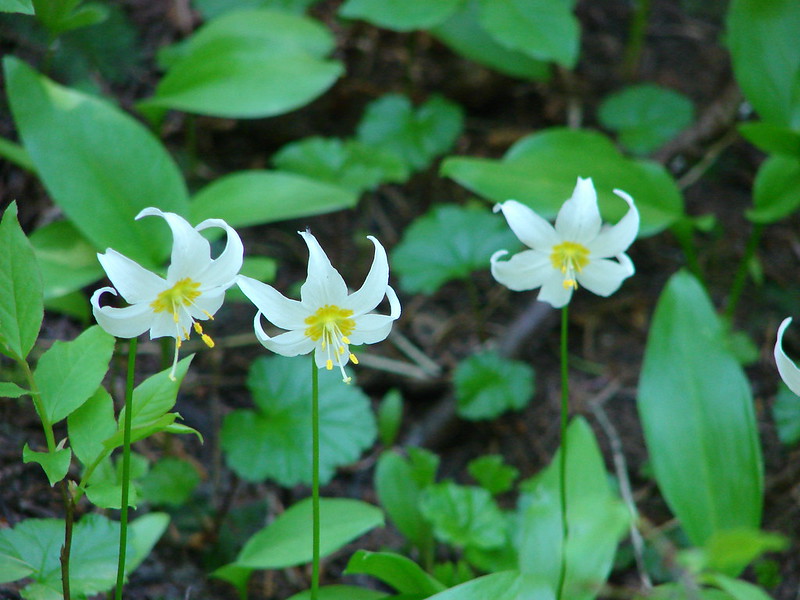
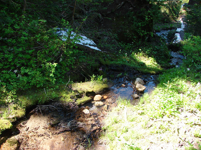
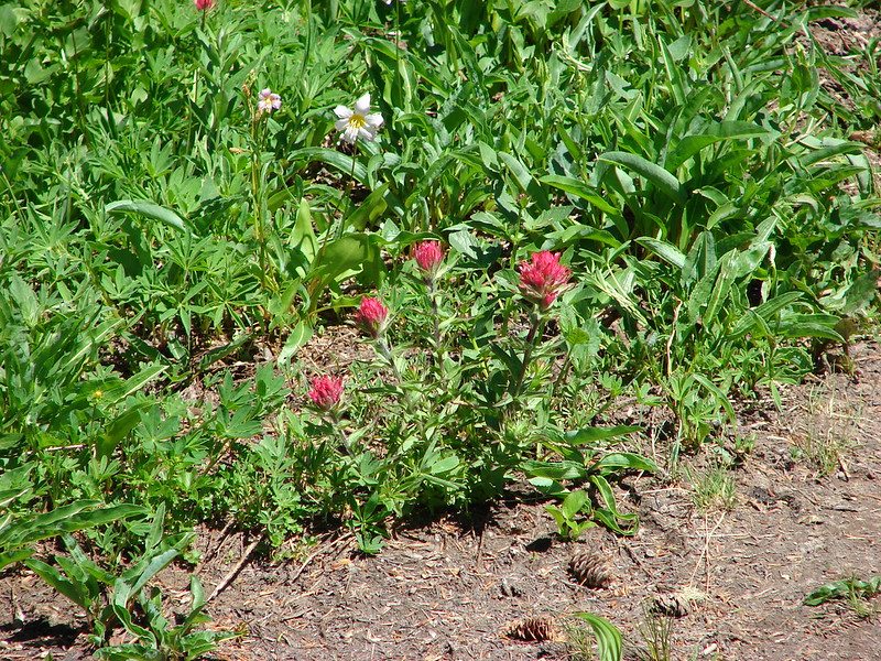
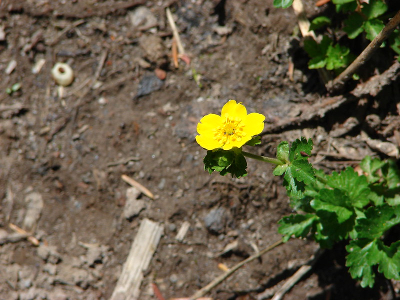
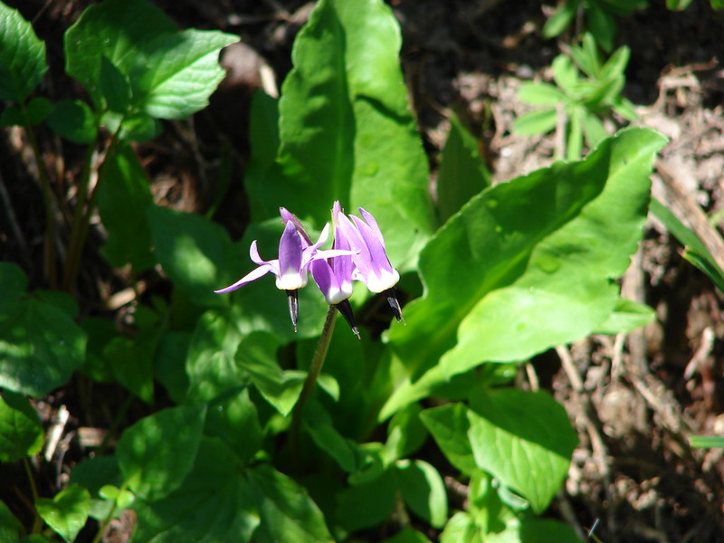
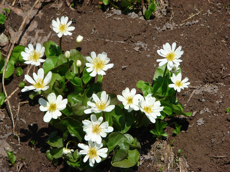
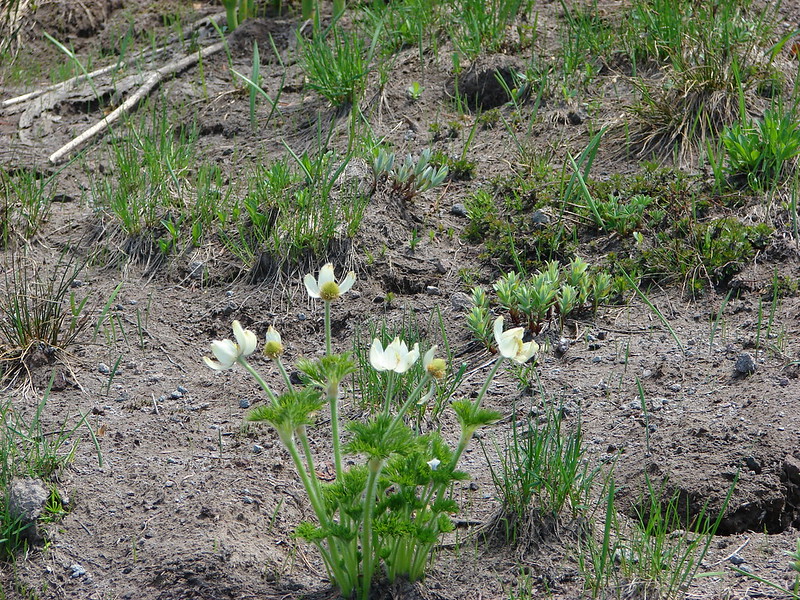
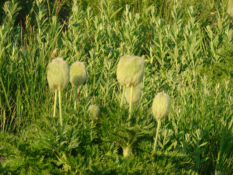
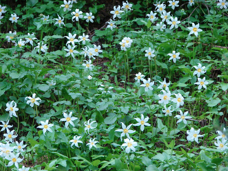
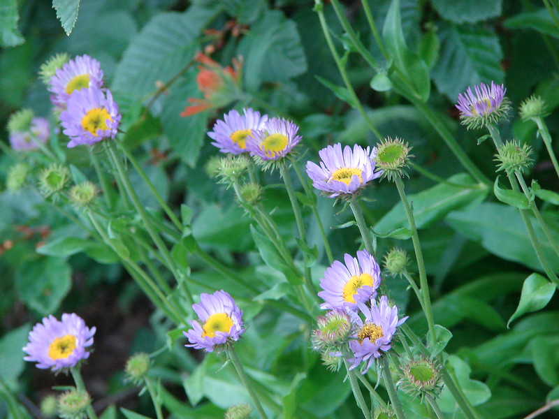
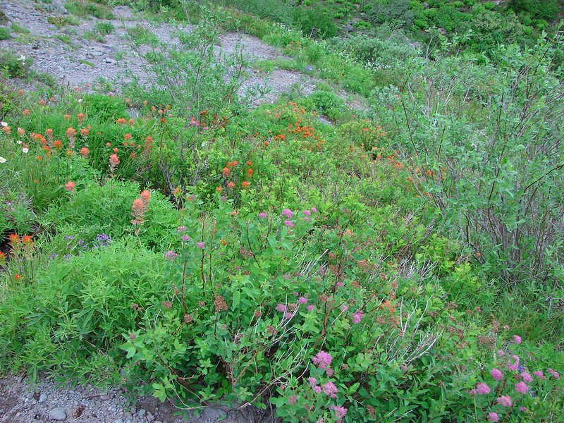
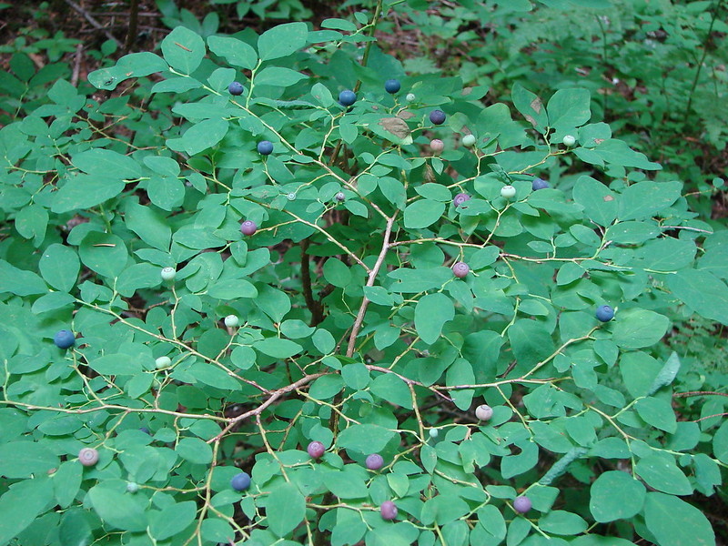
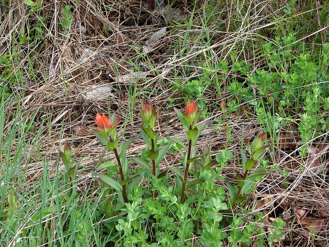
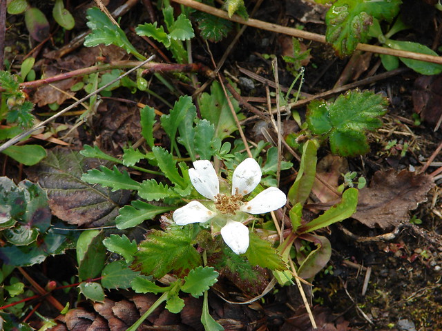
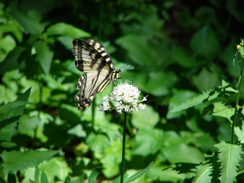
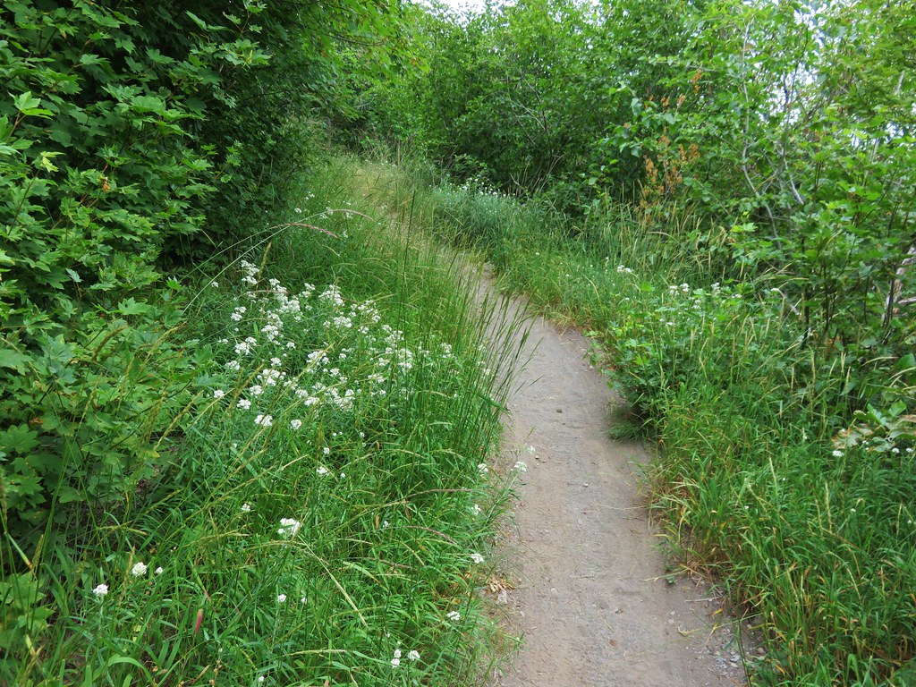
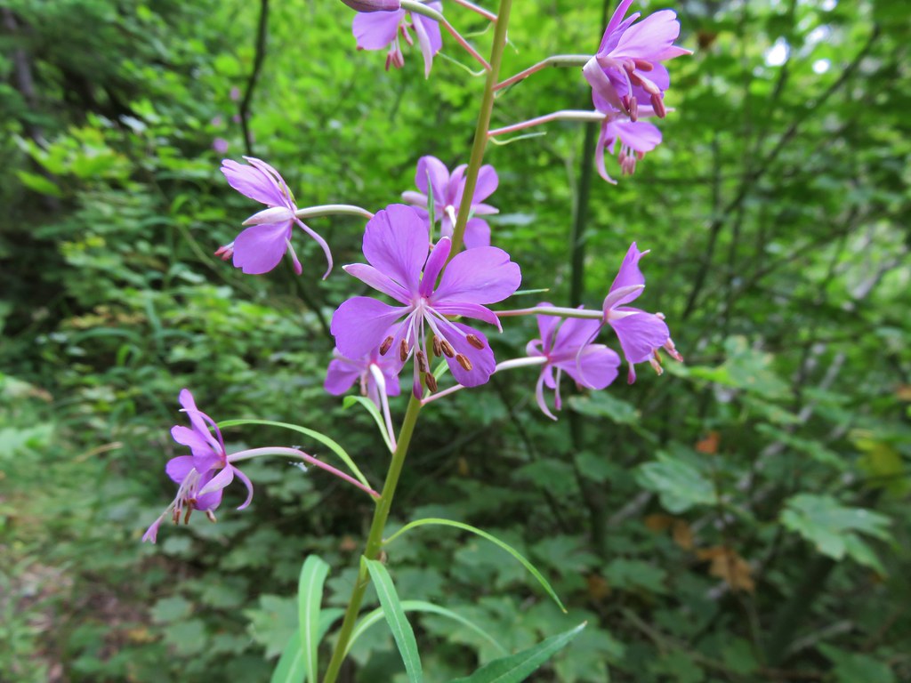
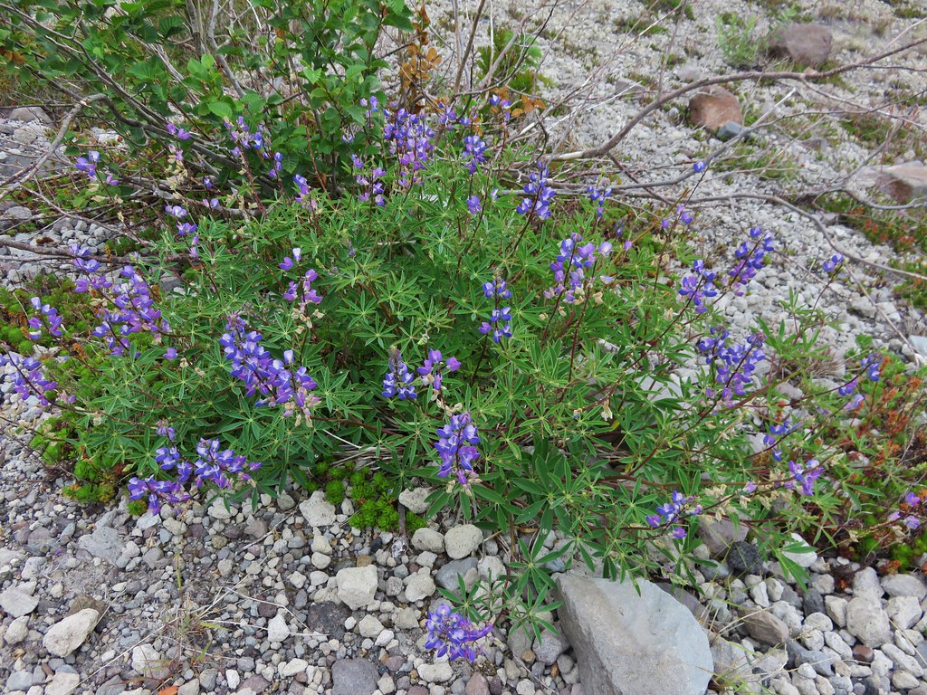
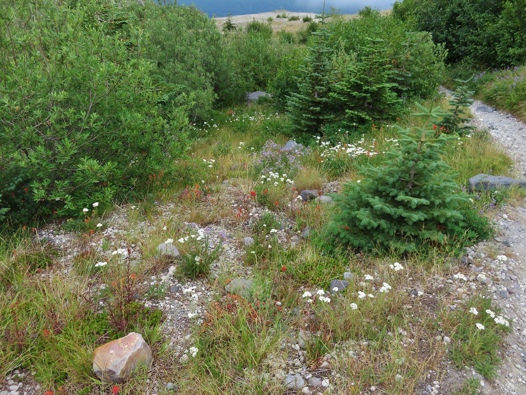
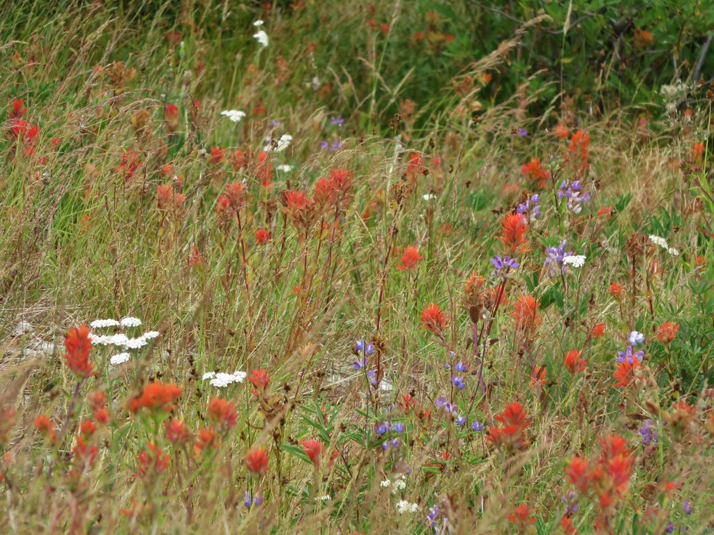
We did see more flowers along the lower section but we were a little late due to the weather we’d been having this year.
IMG_5614

IMG_5619

IMG_5620

IMG_5635

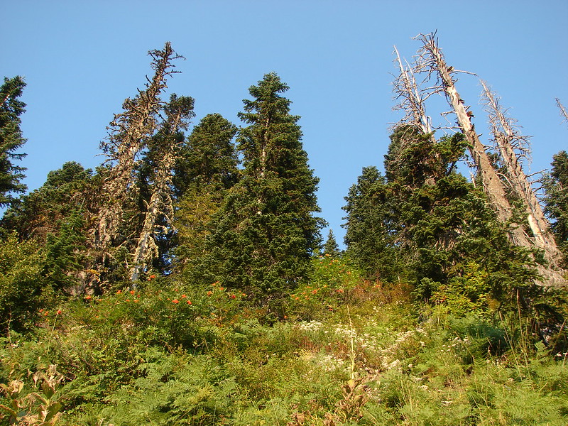
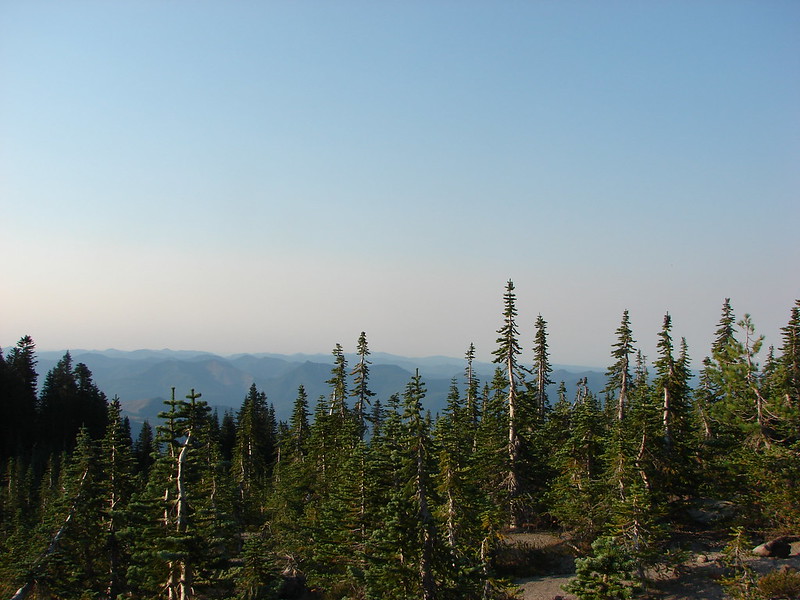
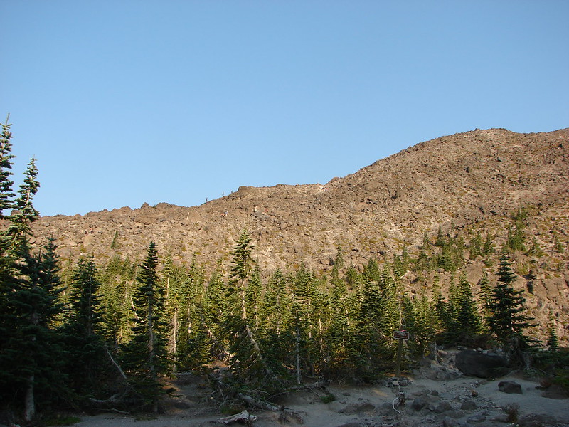
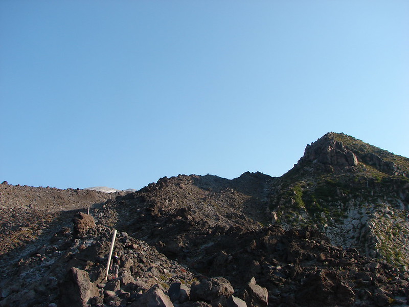
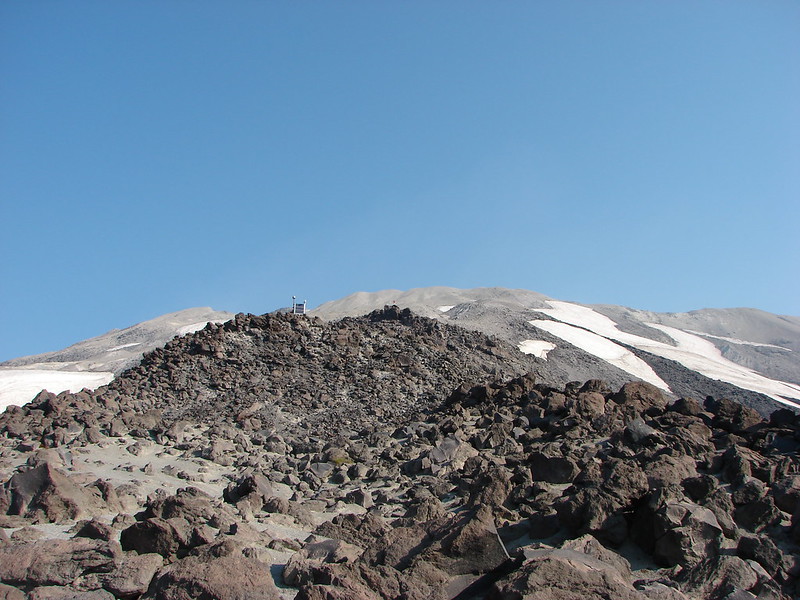
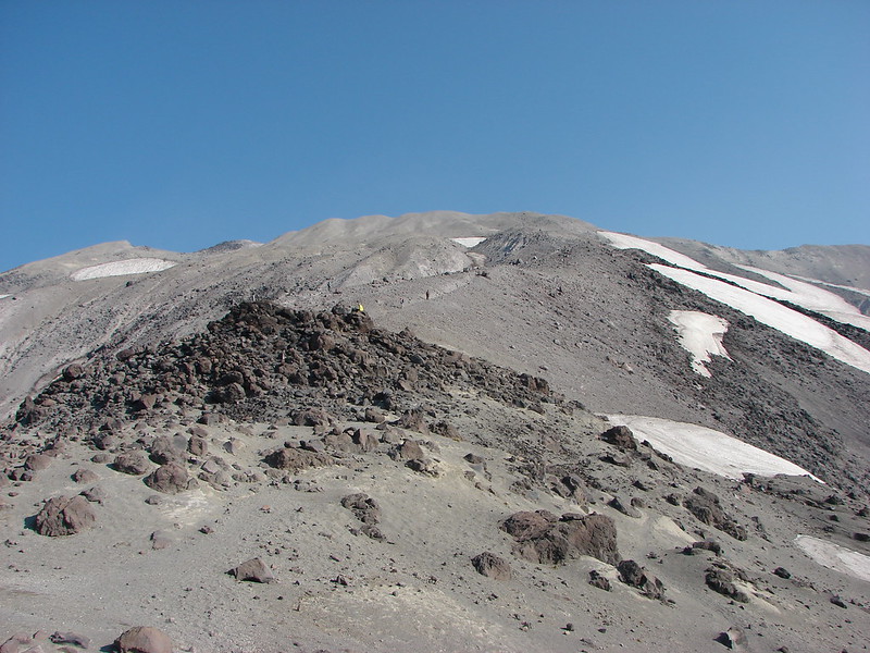
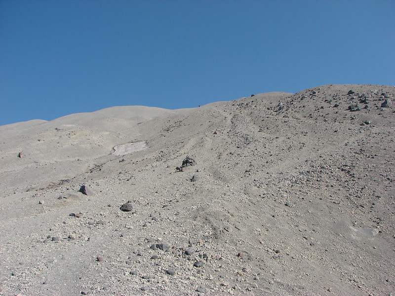
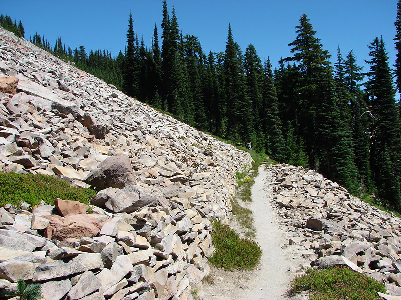
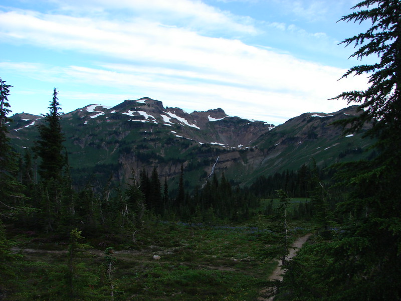
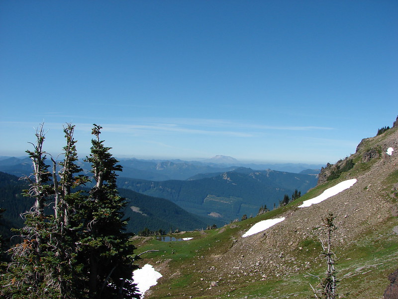
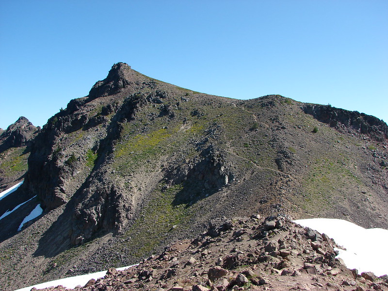
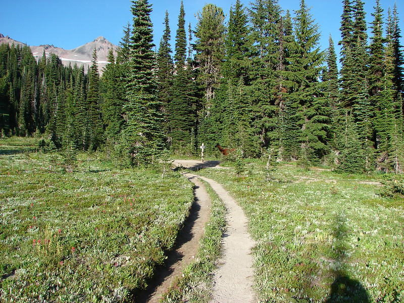
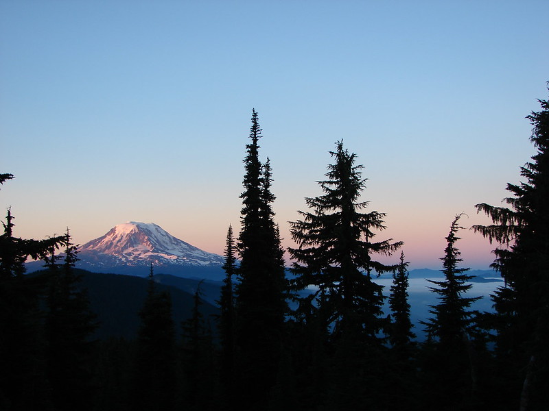
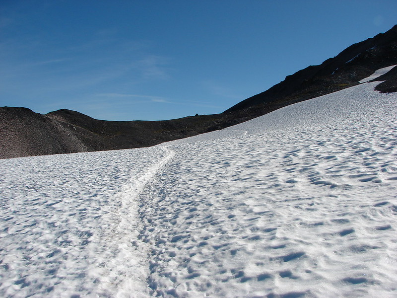
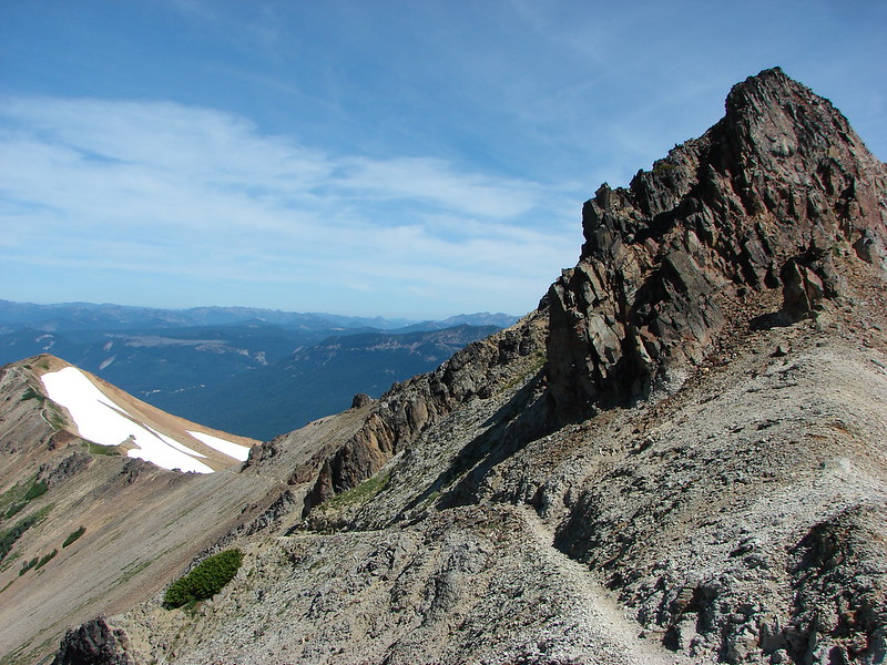
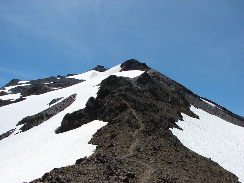
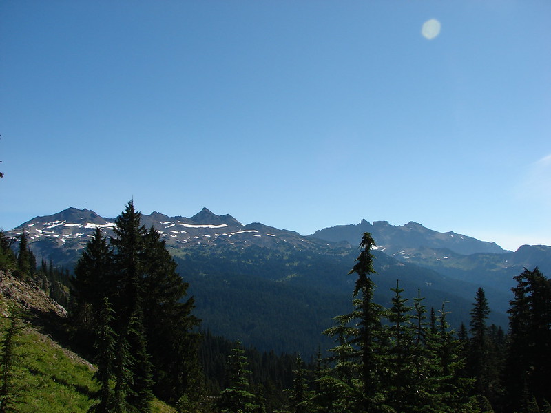
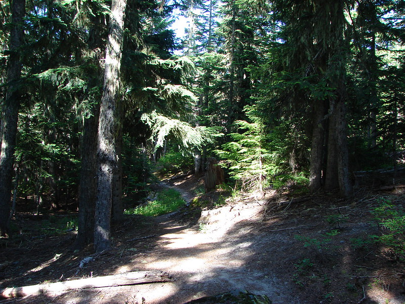
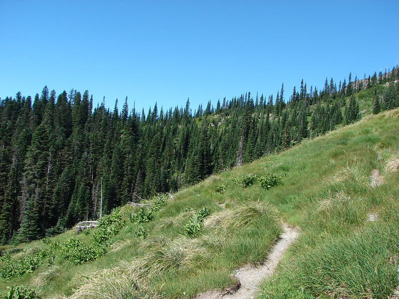
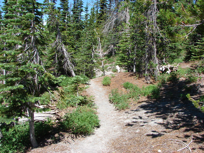
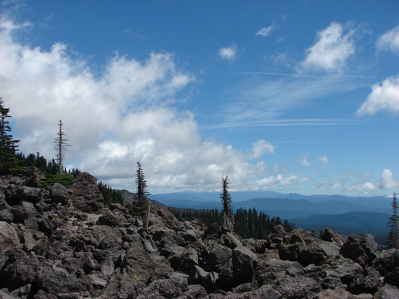
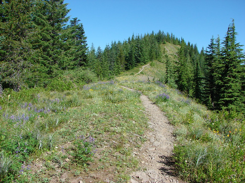
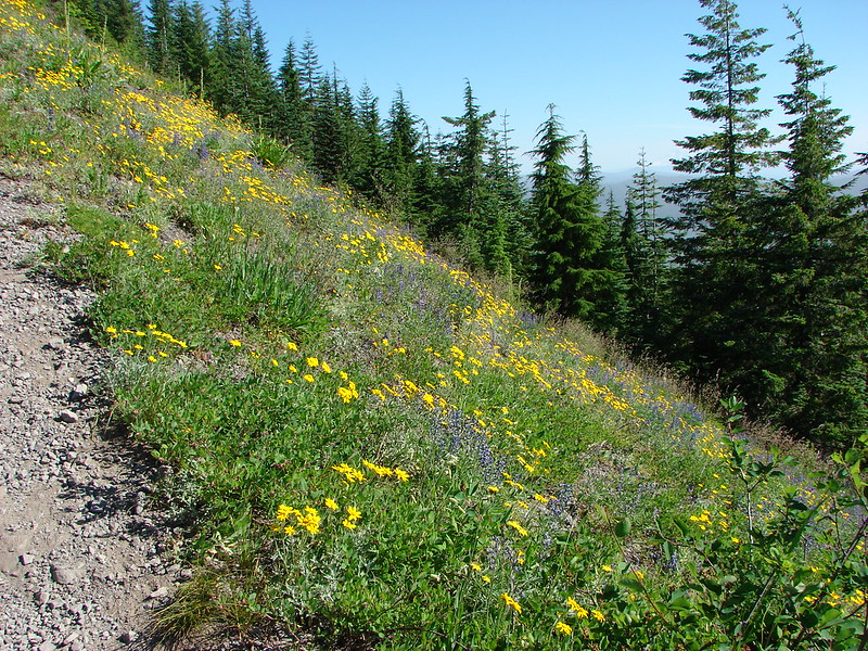
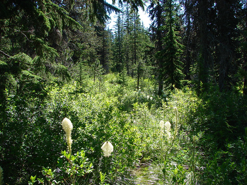
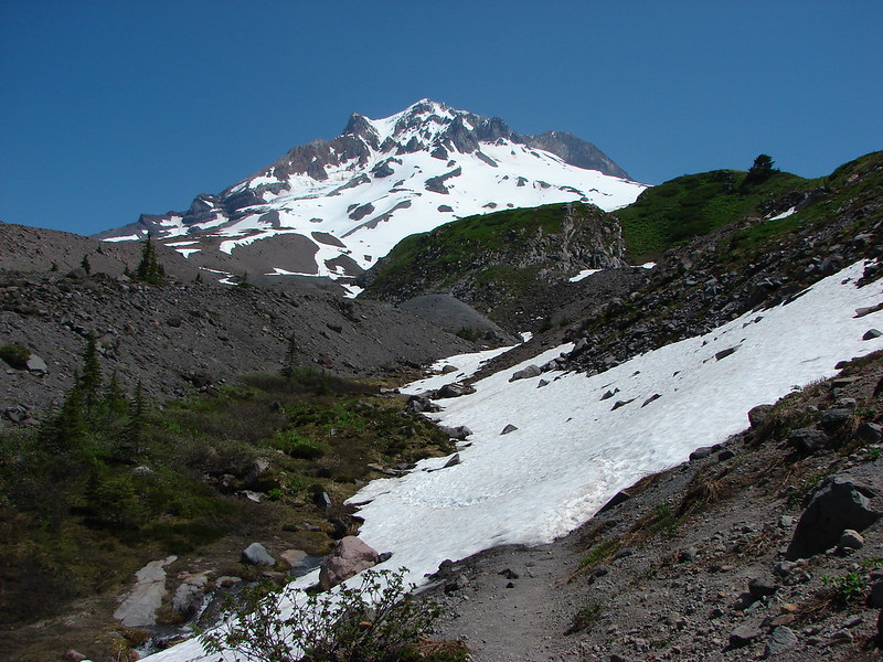
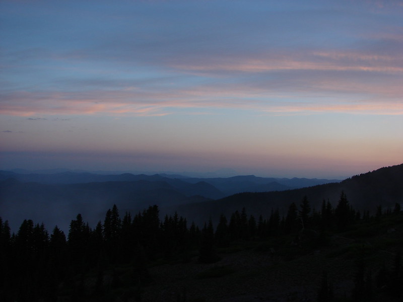
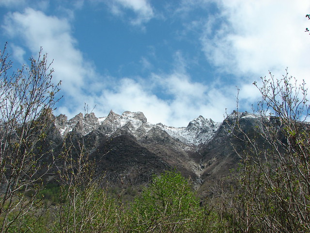
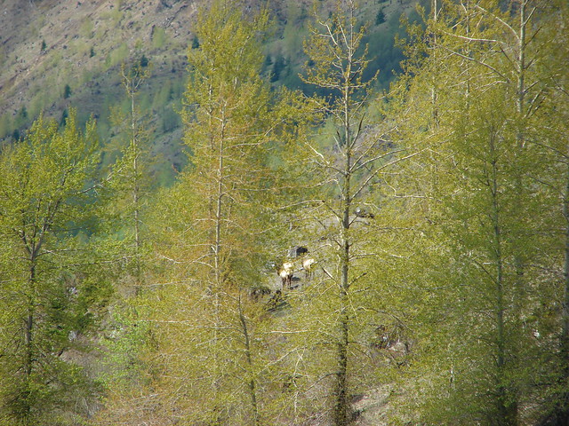
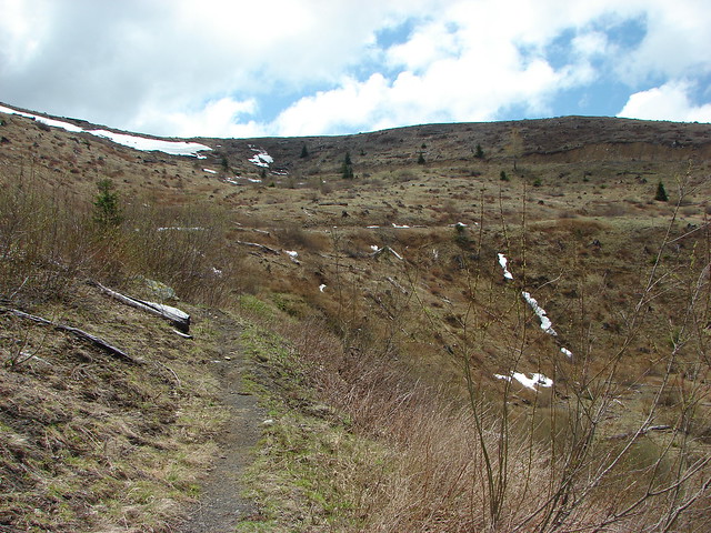
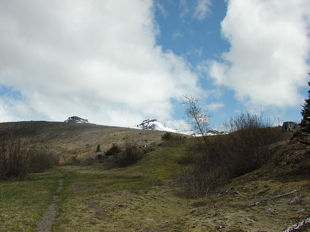
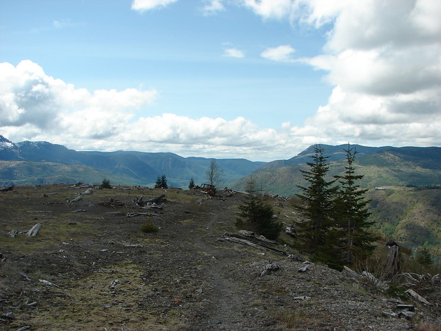
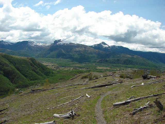
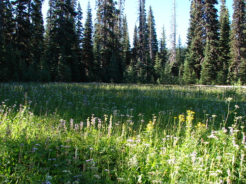
The trail passes through an old growth forest starting at the 1.4 mile mark then climbs a series of switchbacks as it heads up a ridge toward the Loowit Trail. We passed a few viewpoints that had provided impressive views on our first visit but today we had to rely on those memories to picture the mountain.
157

IMG_5633

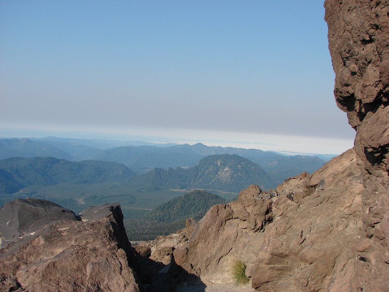
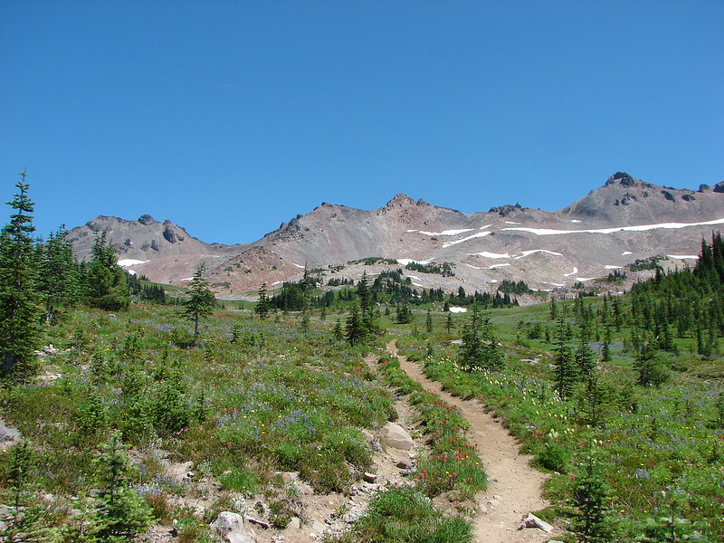
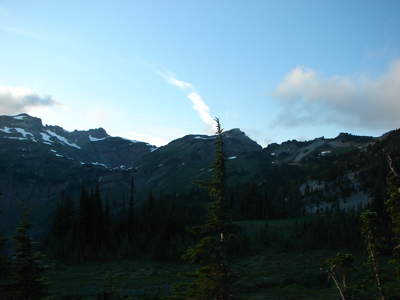
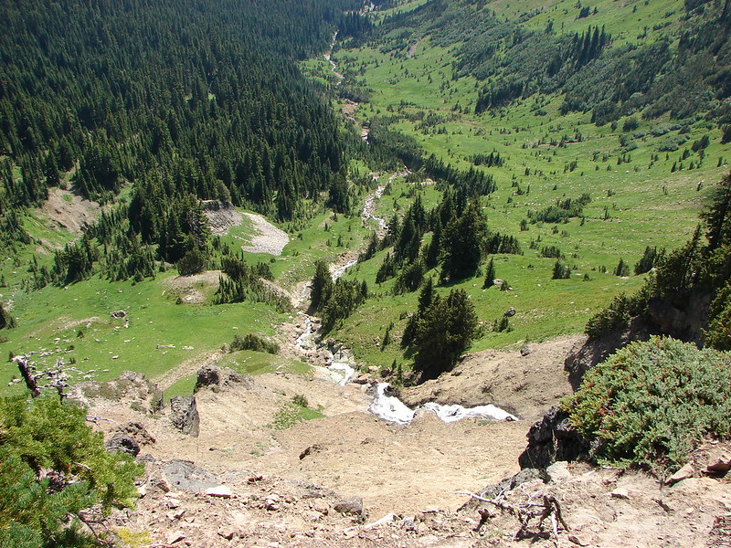
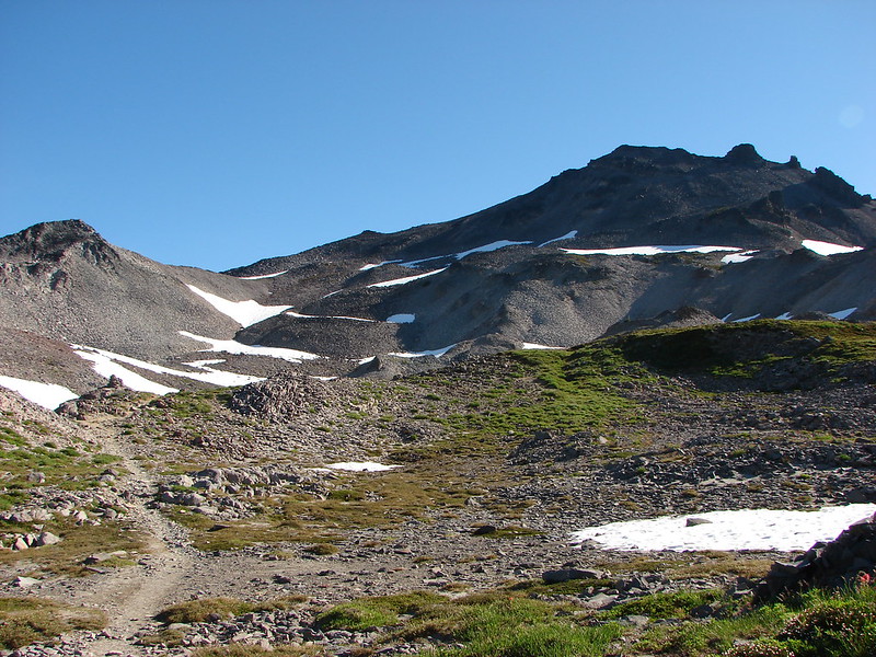
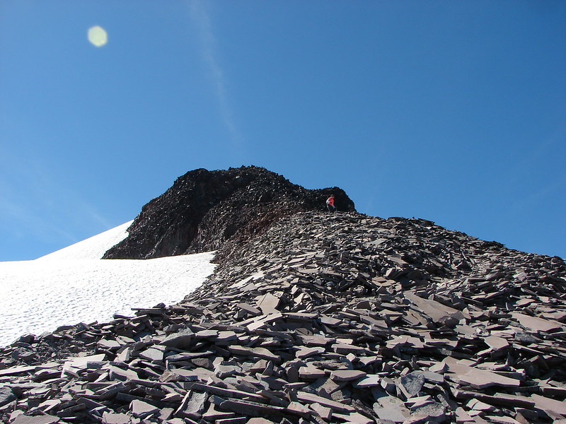
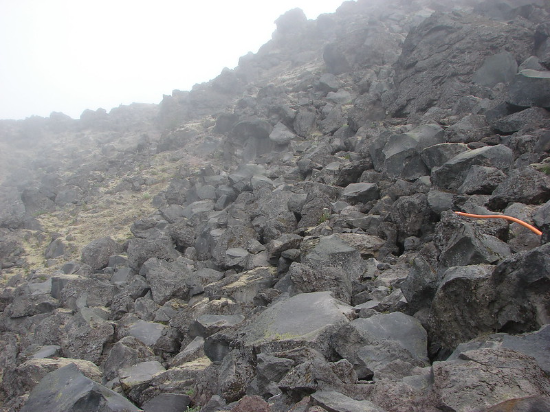
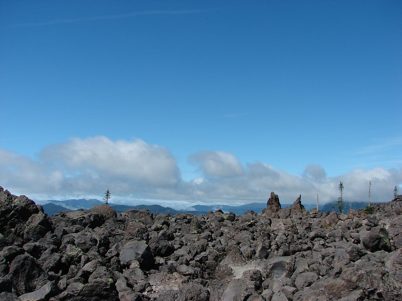
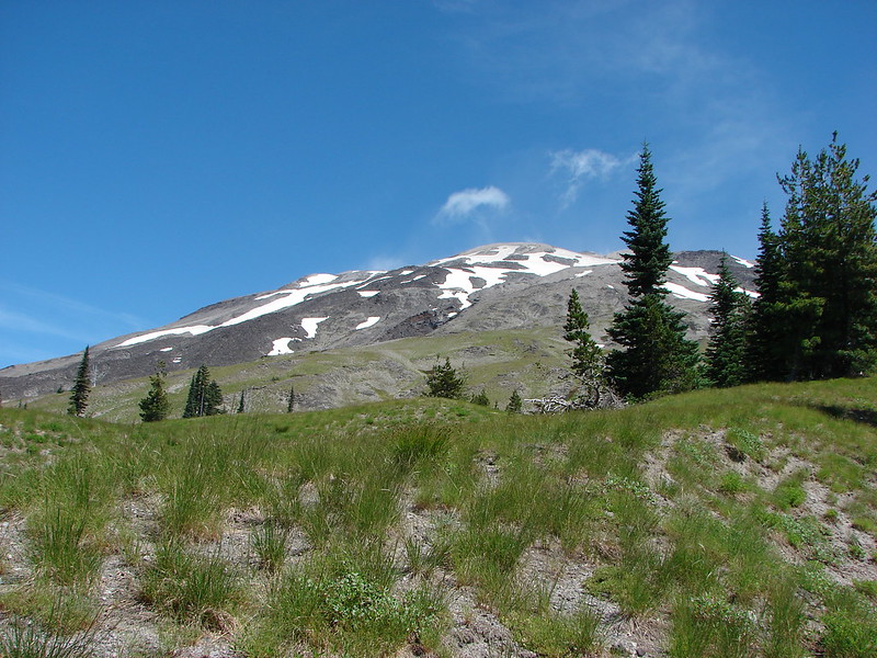
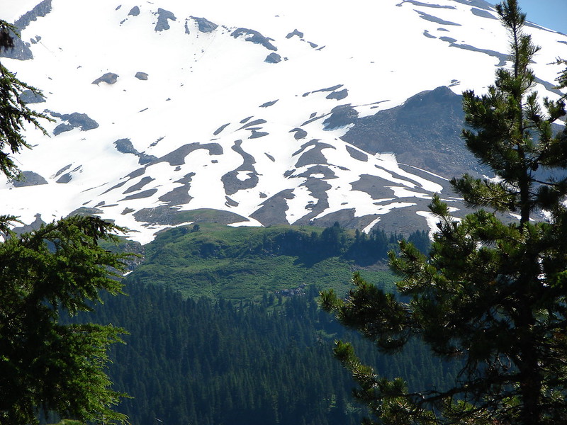
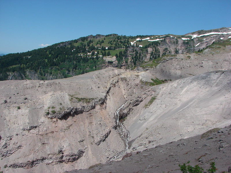
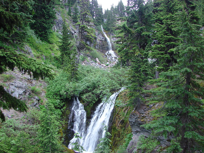
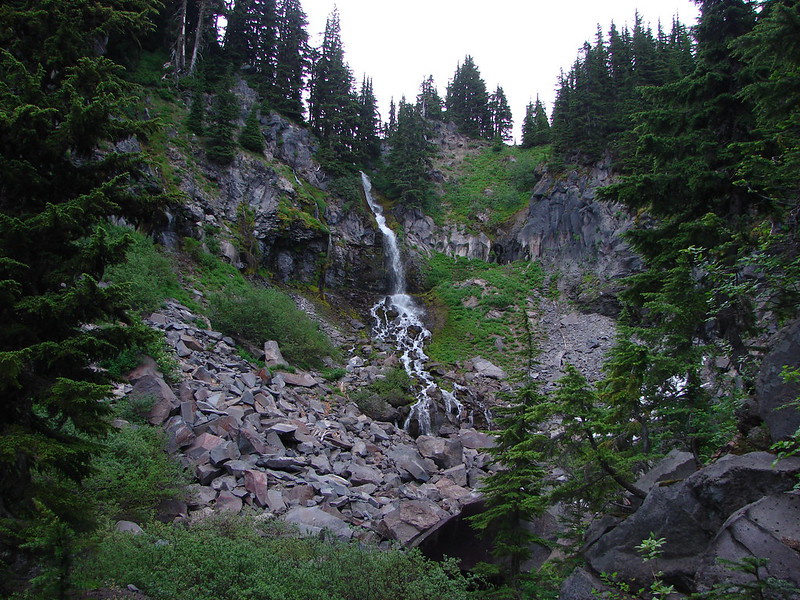
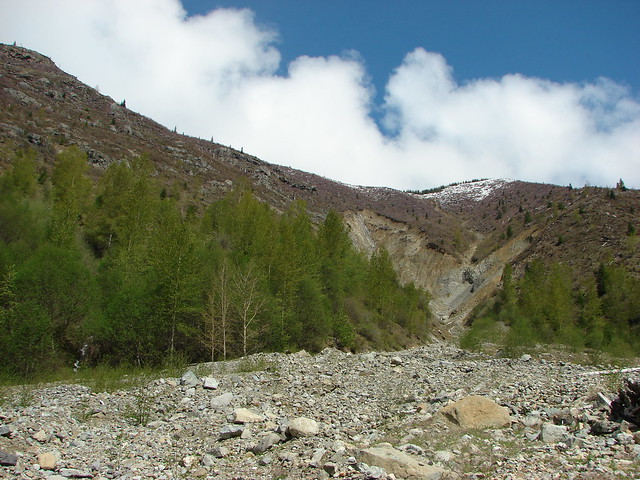
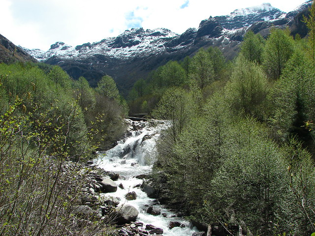
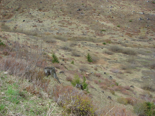
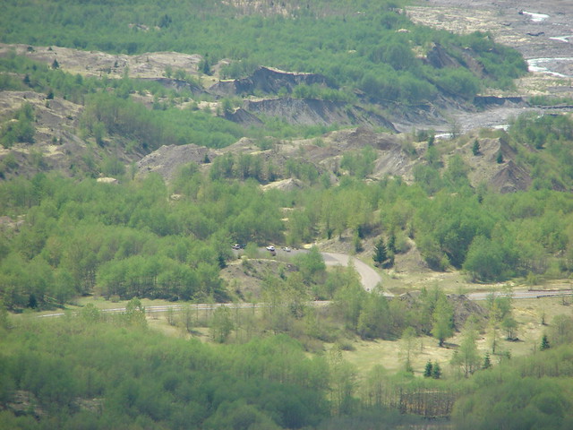
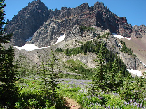
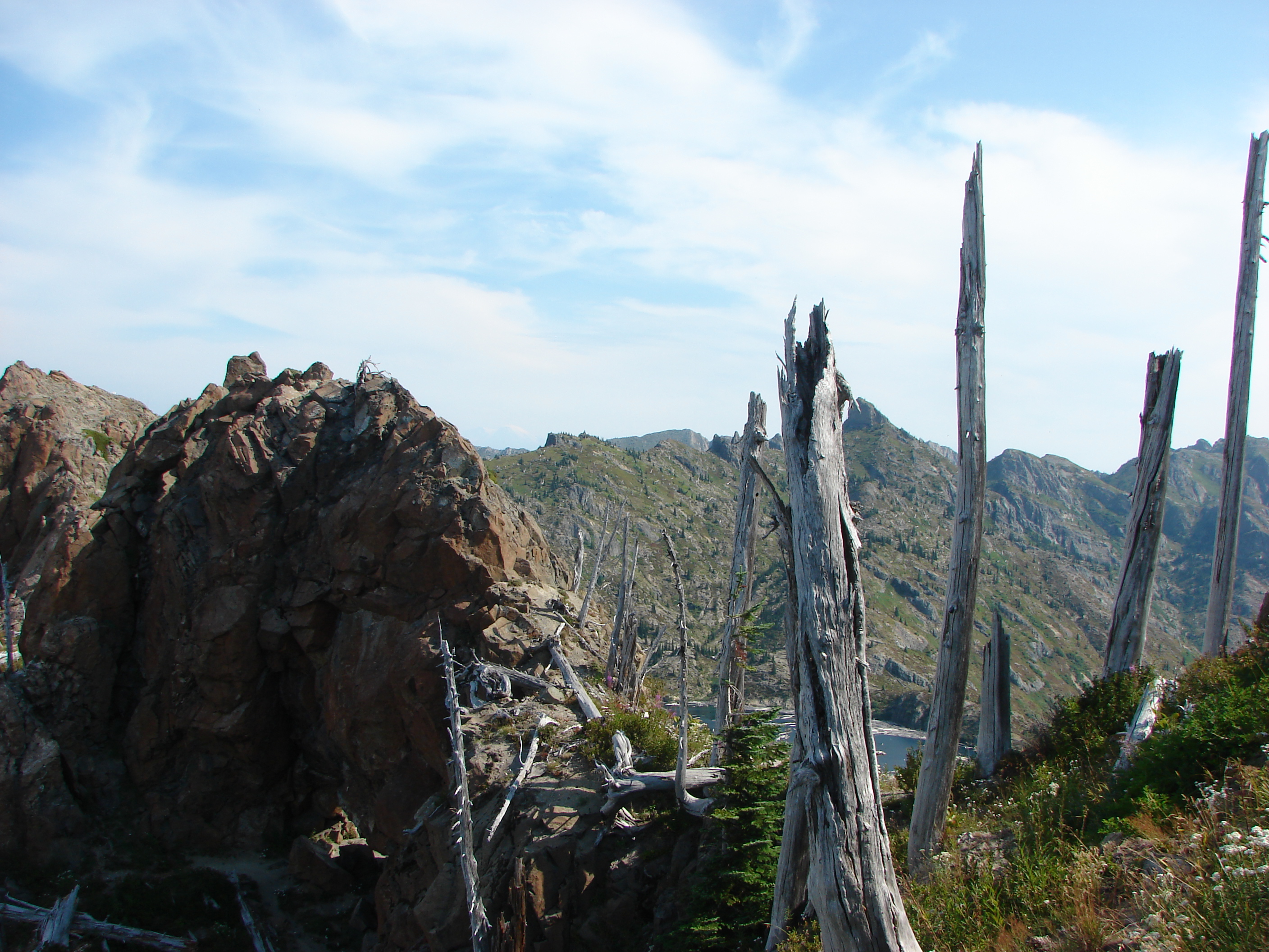
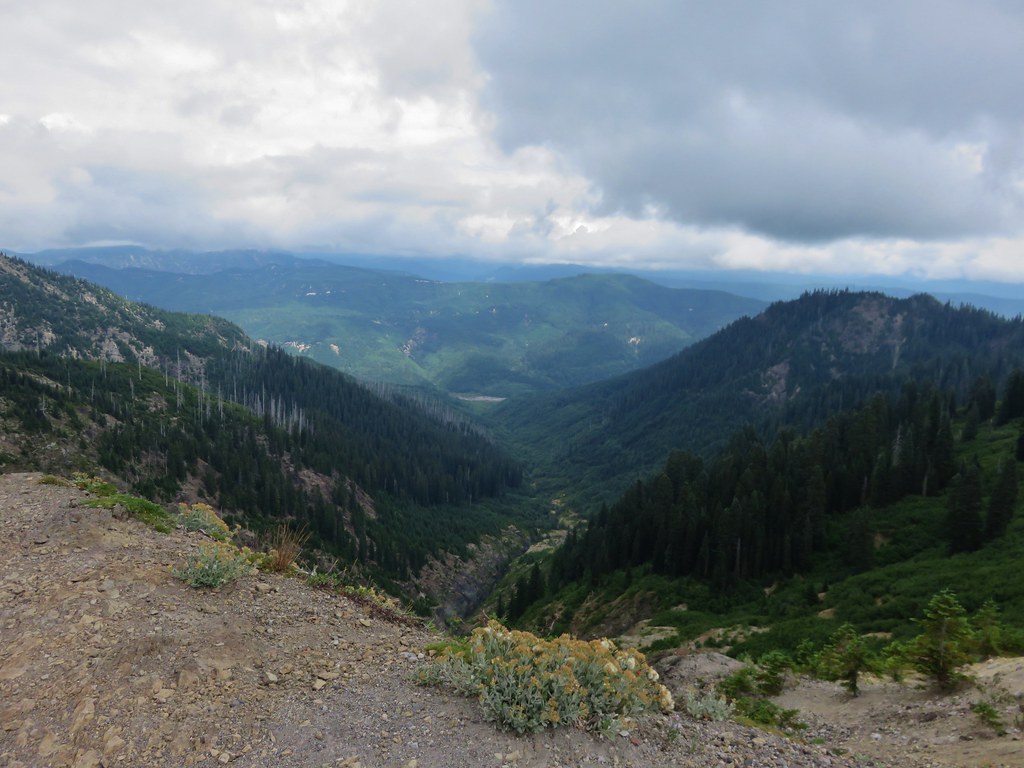
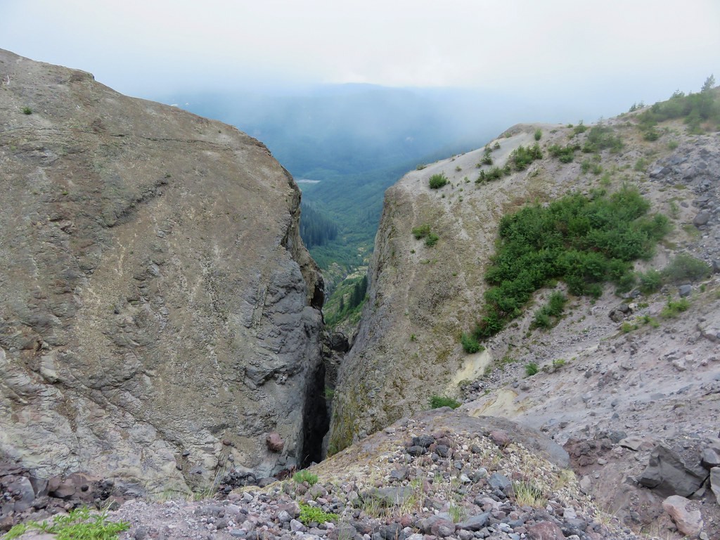
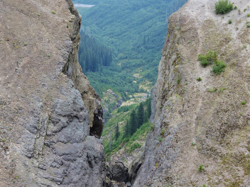
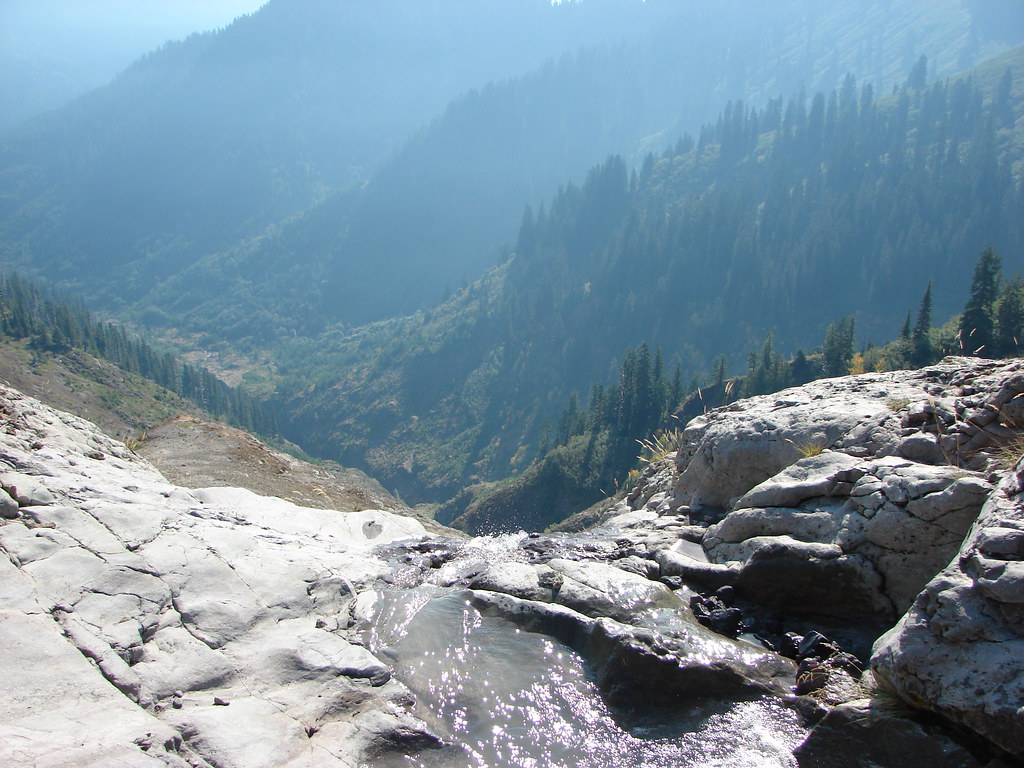
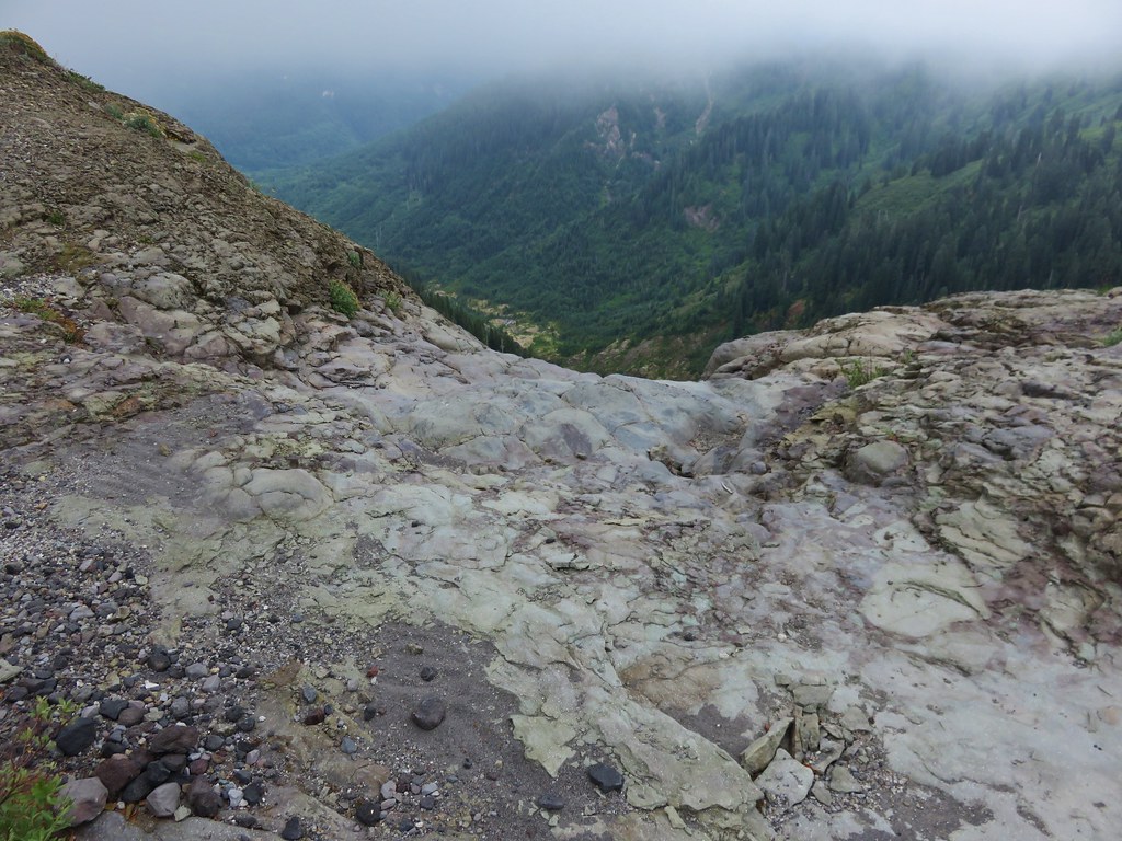
After 4 miles the trail enters the blast zone from the 1980 eruption. The trail spends winds a half mile through the blast zone above forested Ape Canyon.
IMG_5712

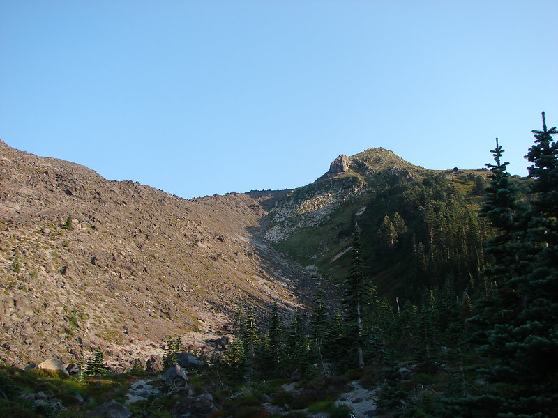
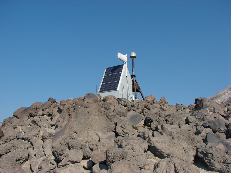
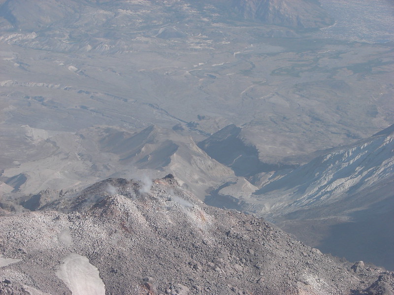
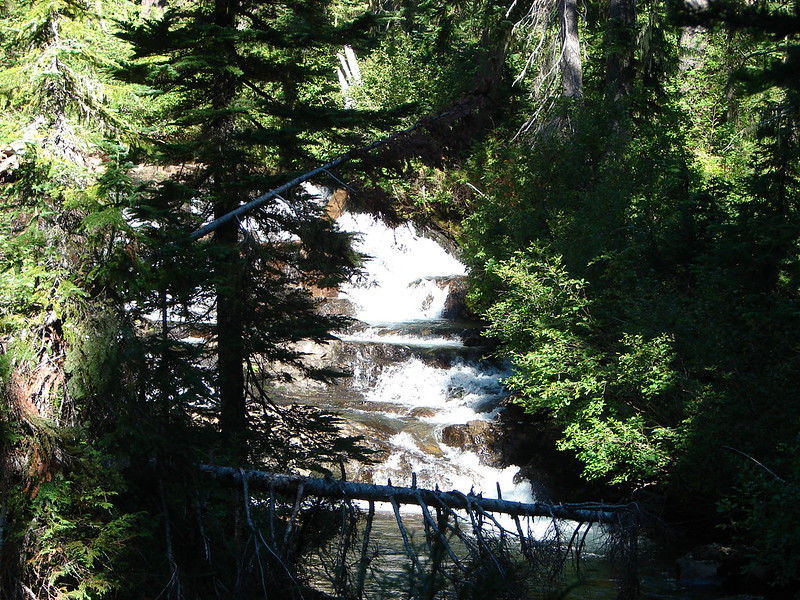
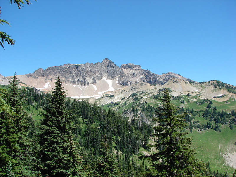
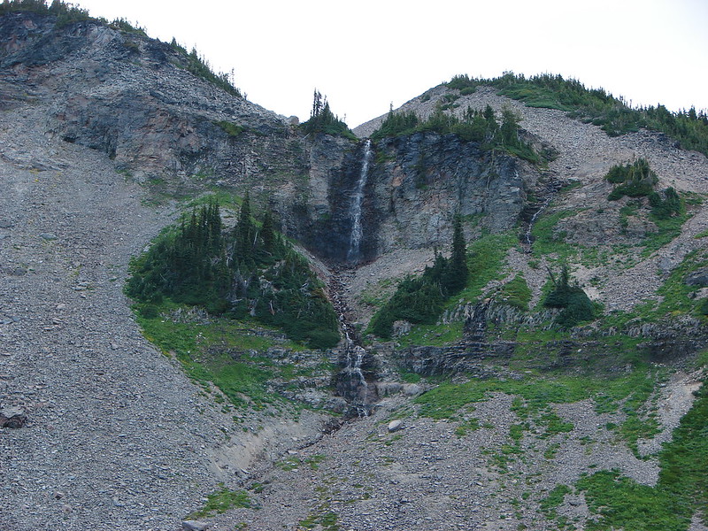
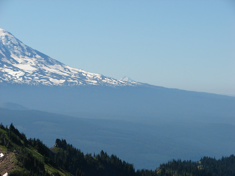
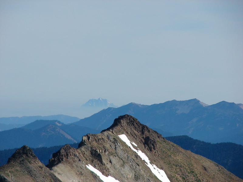
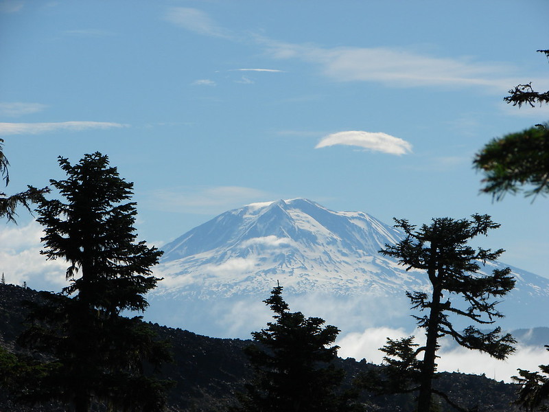
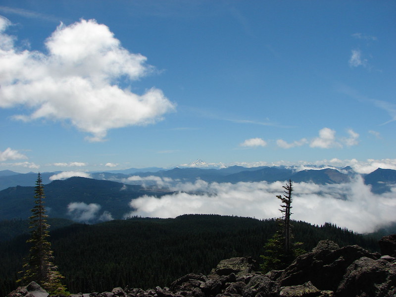
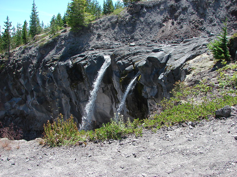
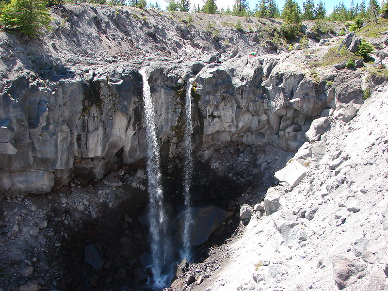
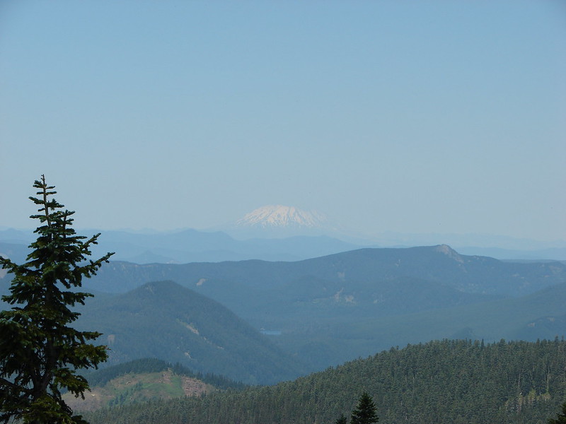
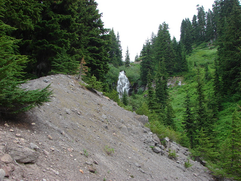
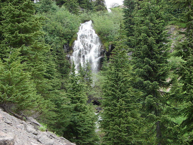
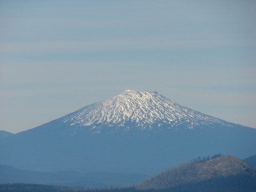
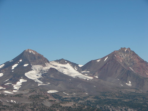
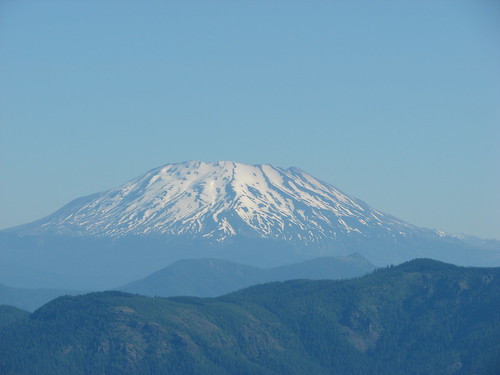
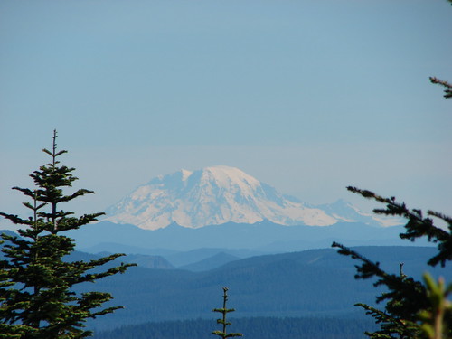
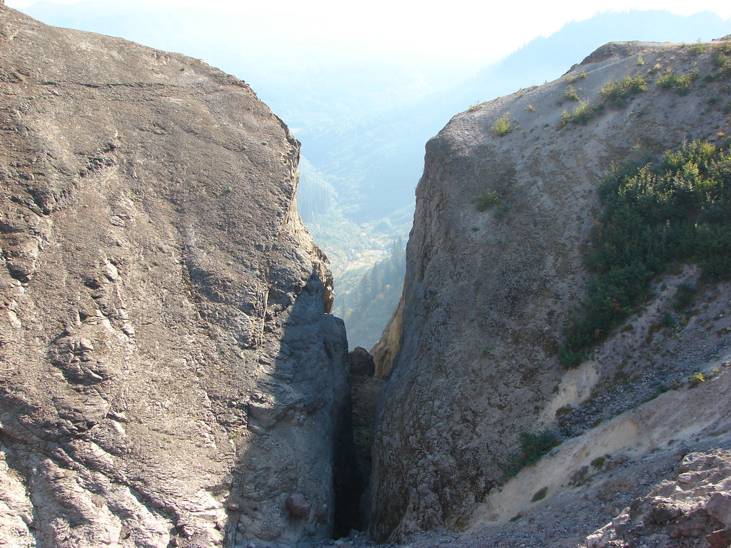
A narrow slot at the top of the Canyon frames the creek below and apparently Mt. Adams in the distance. I say apparently because we have not been able to confirm this on either of our visits. In 2012 the Cascade Creek Fire was burning on the slopes of Mt. Adams filling the sky with smoke and clouds were now playing the same role on this day.
087

IMG_5645

IMG_5647

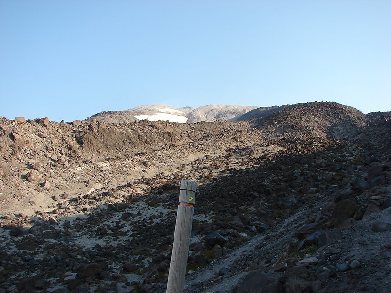
The trail ends after 4.5 miles at the Loowit Trail which circles the entire mountain.
IMG_5650

IMG_5651

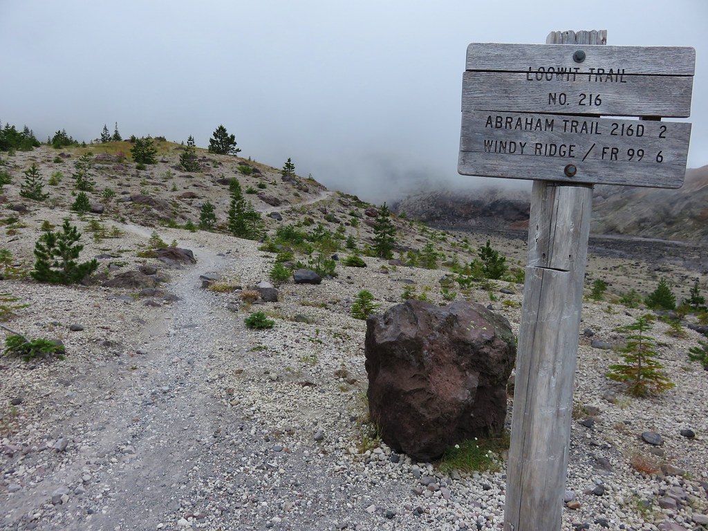
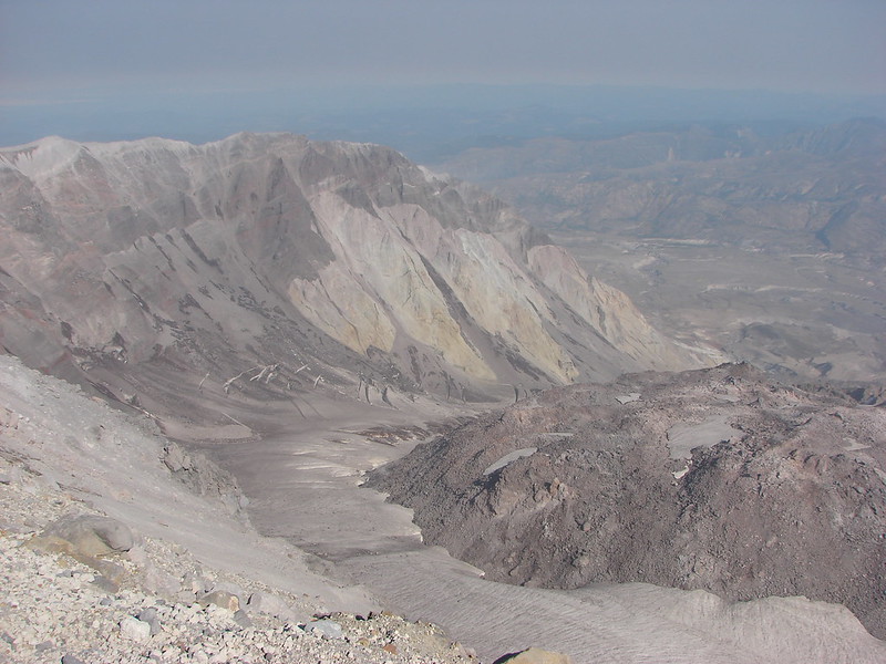
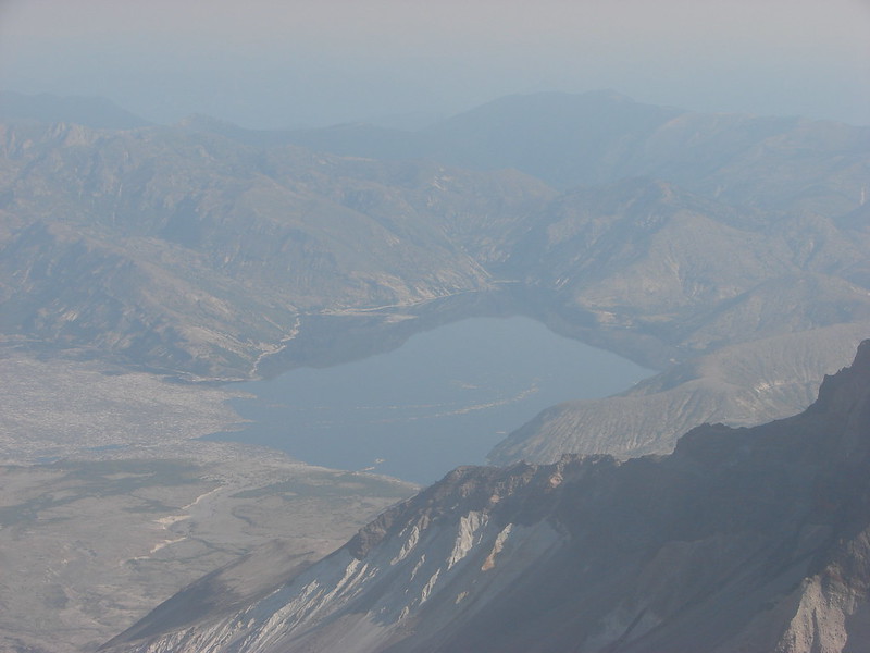
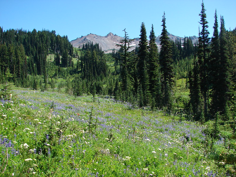
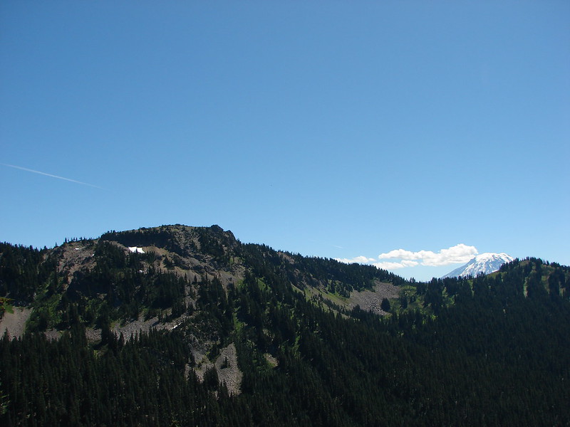
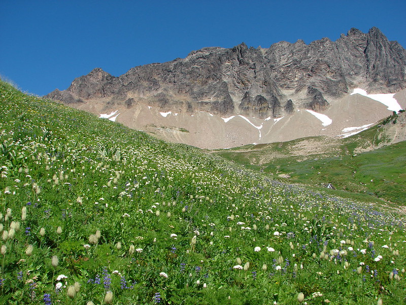
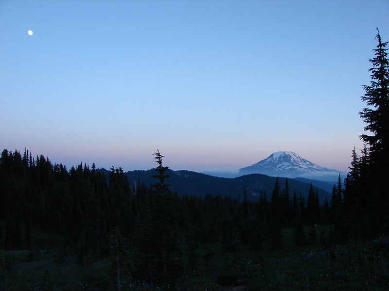
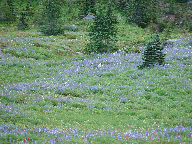
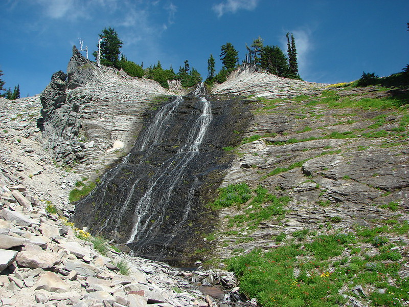
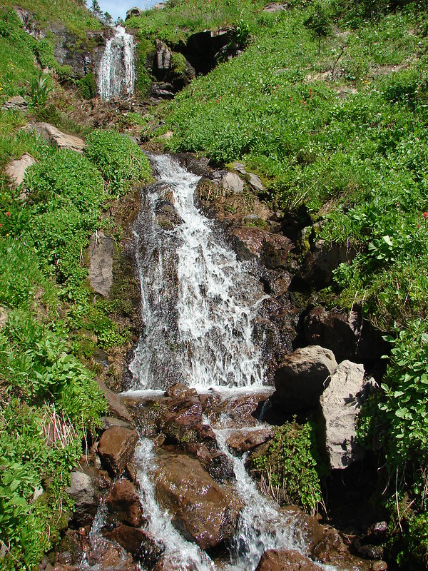
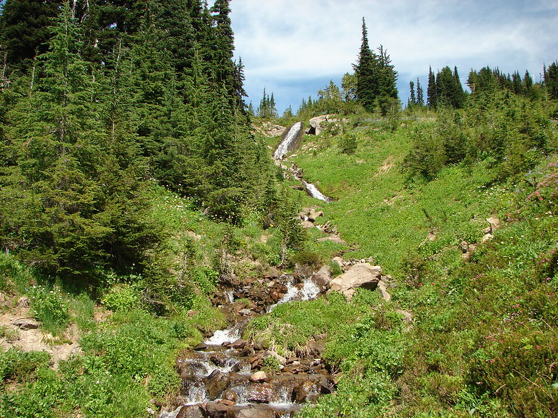
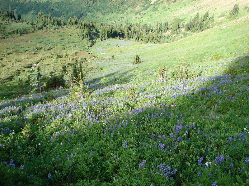
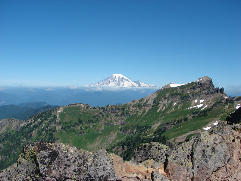
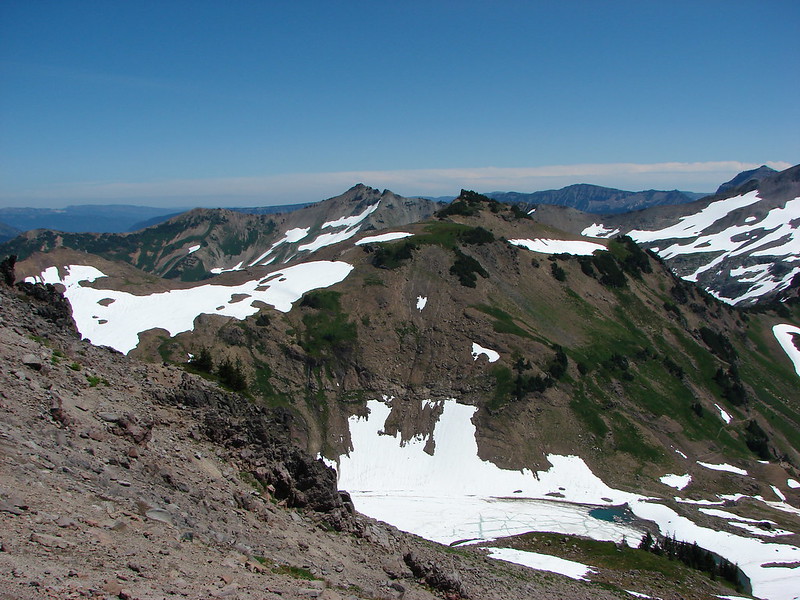
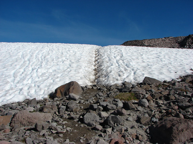
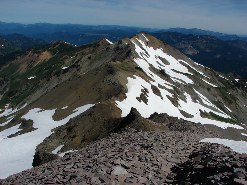
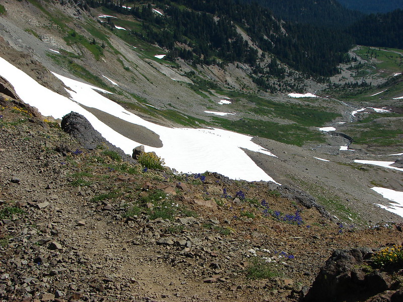
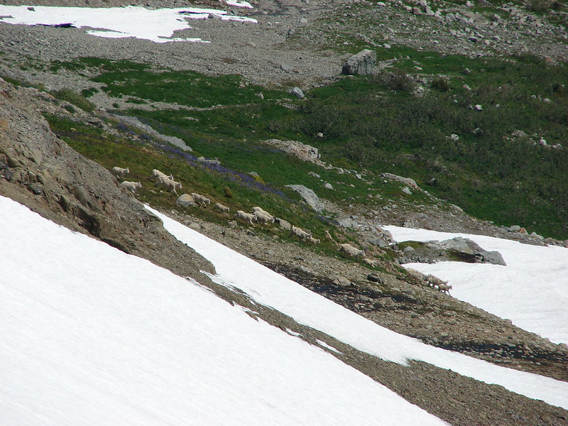
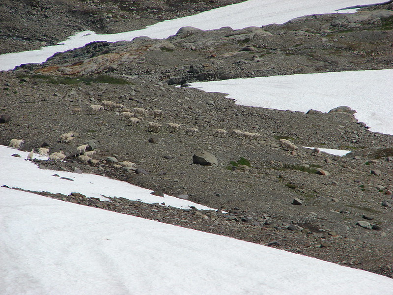
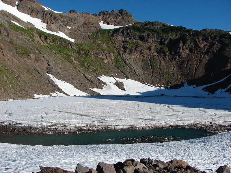
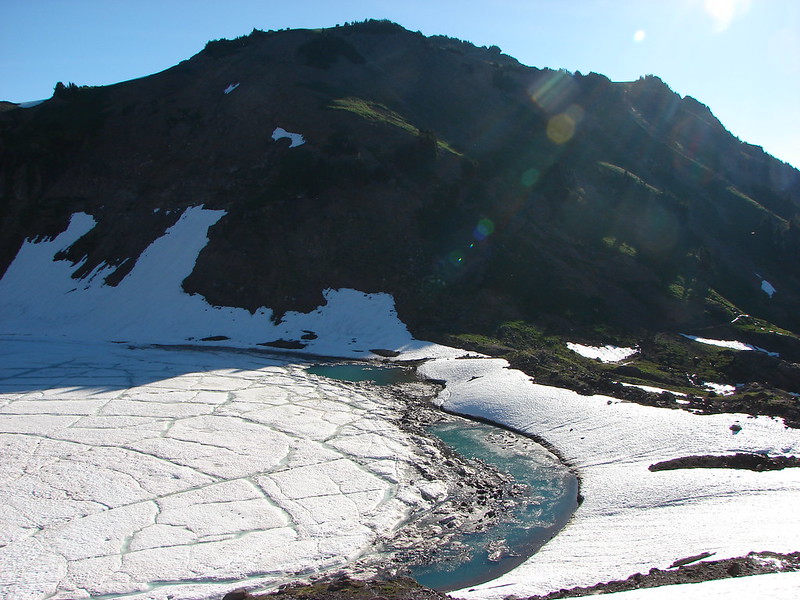
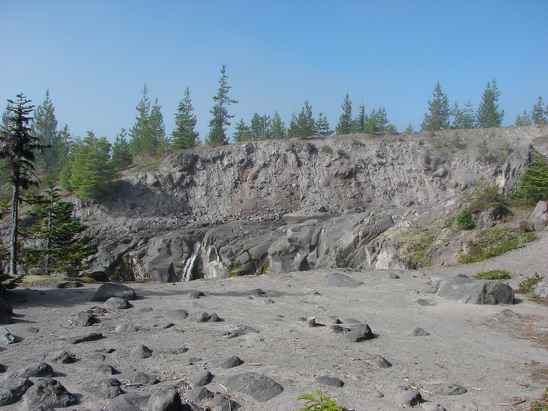
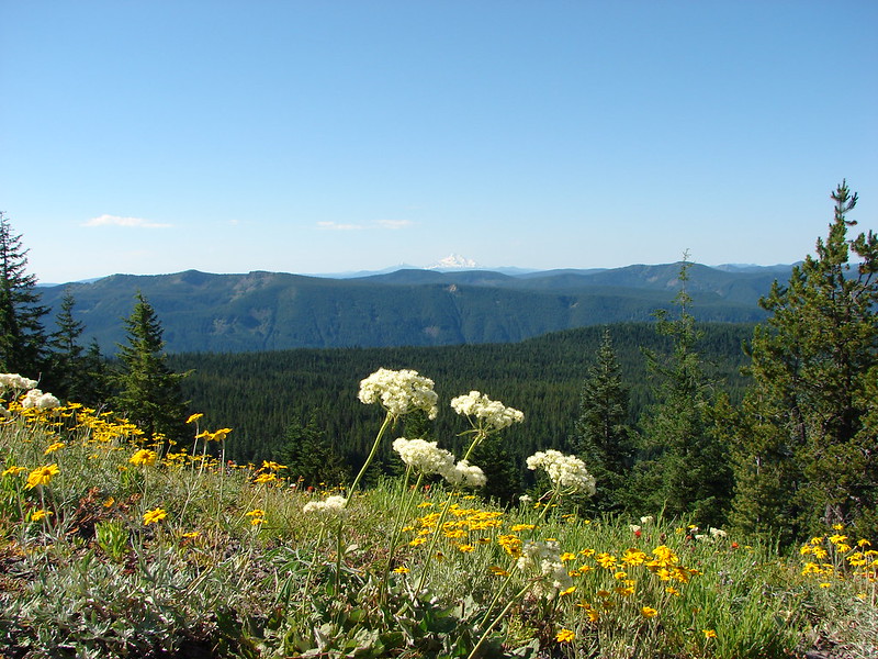
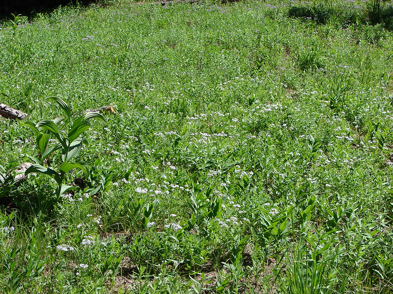
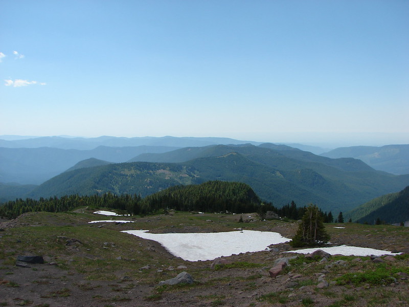
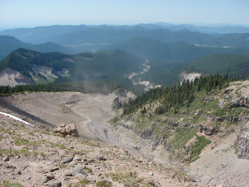
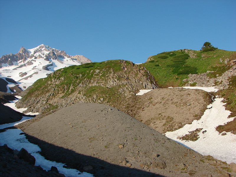
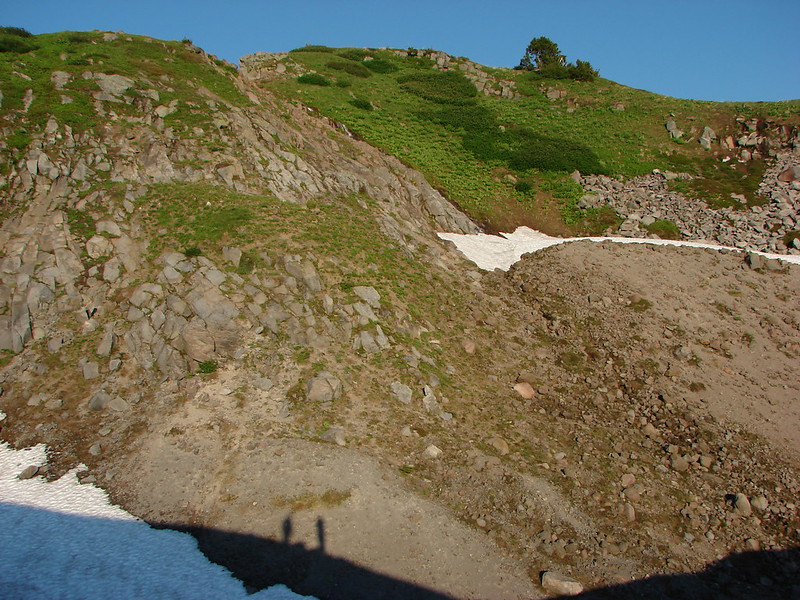
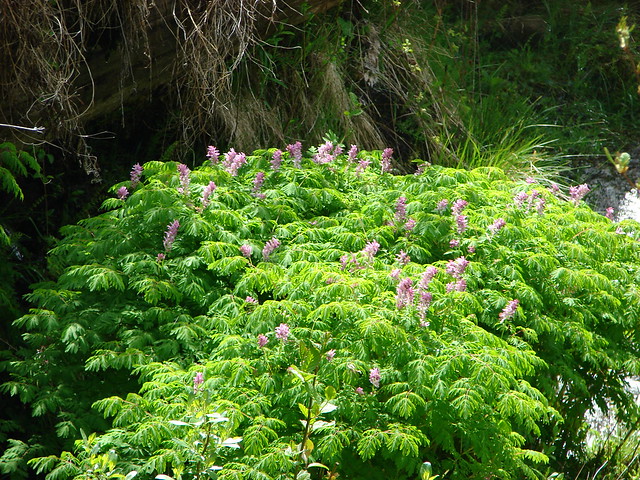
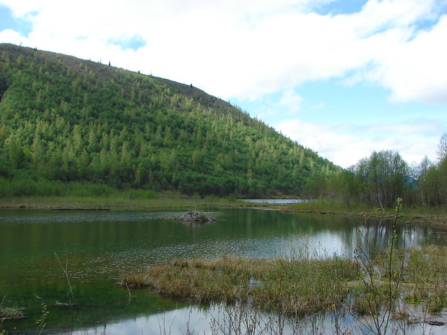
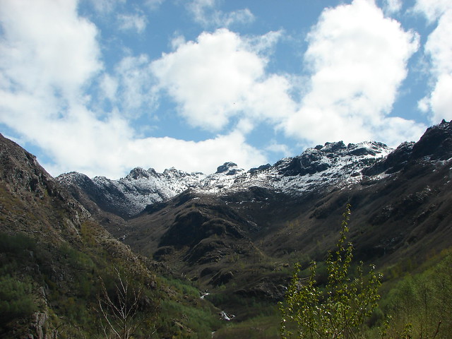
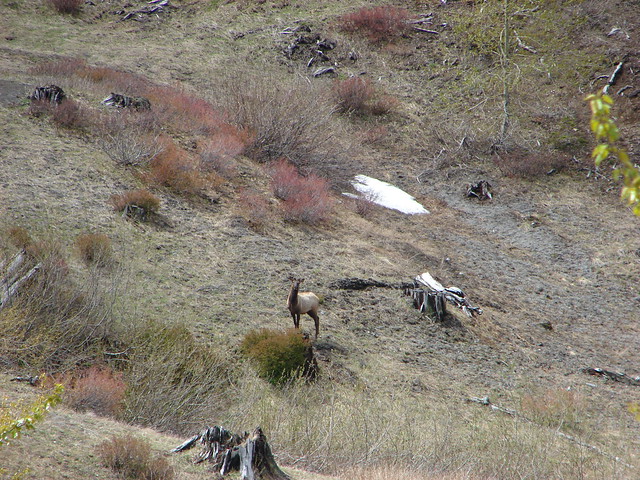
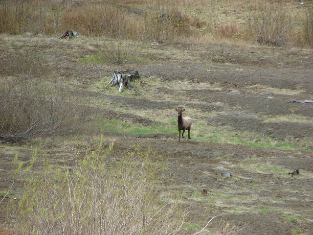
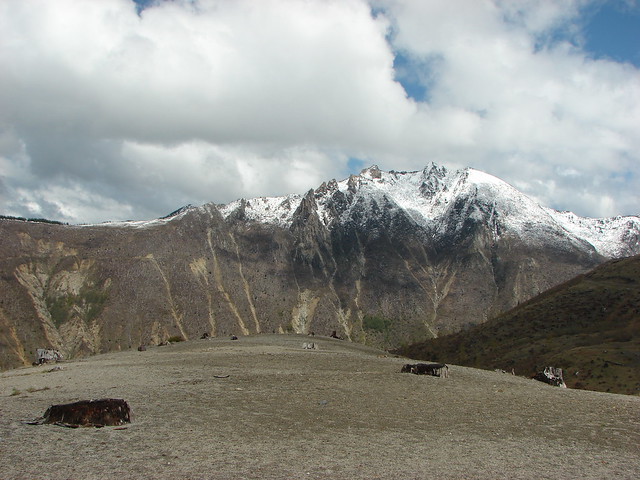
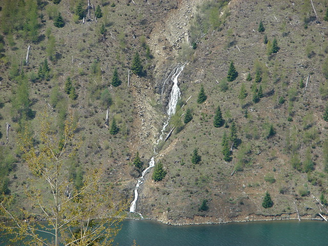
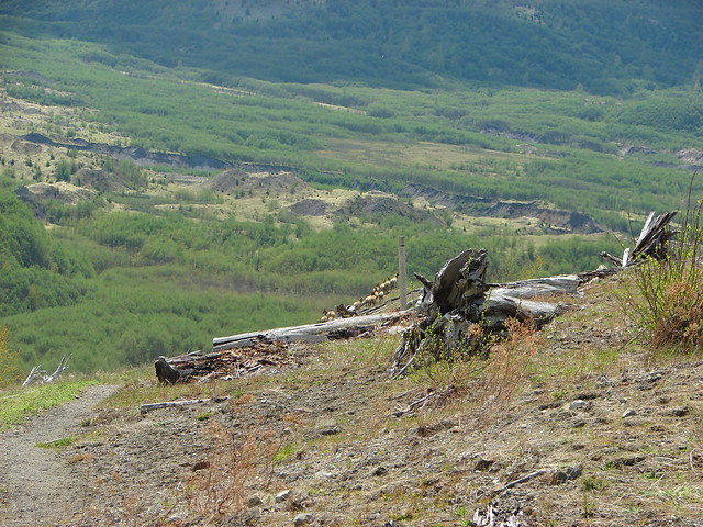
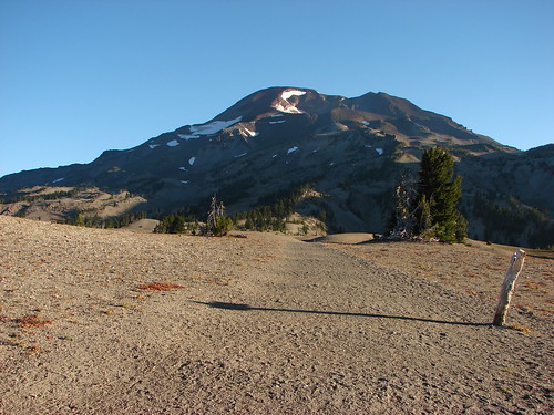
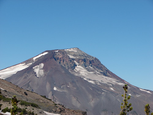
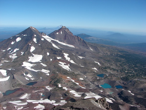
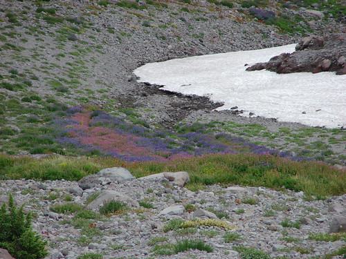
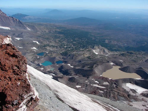
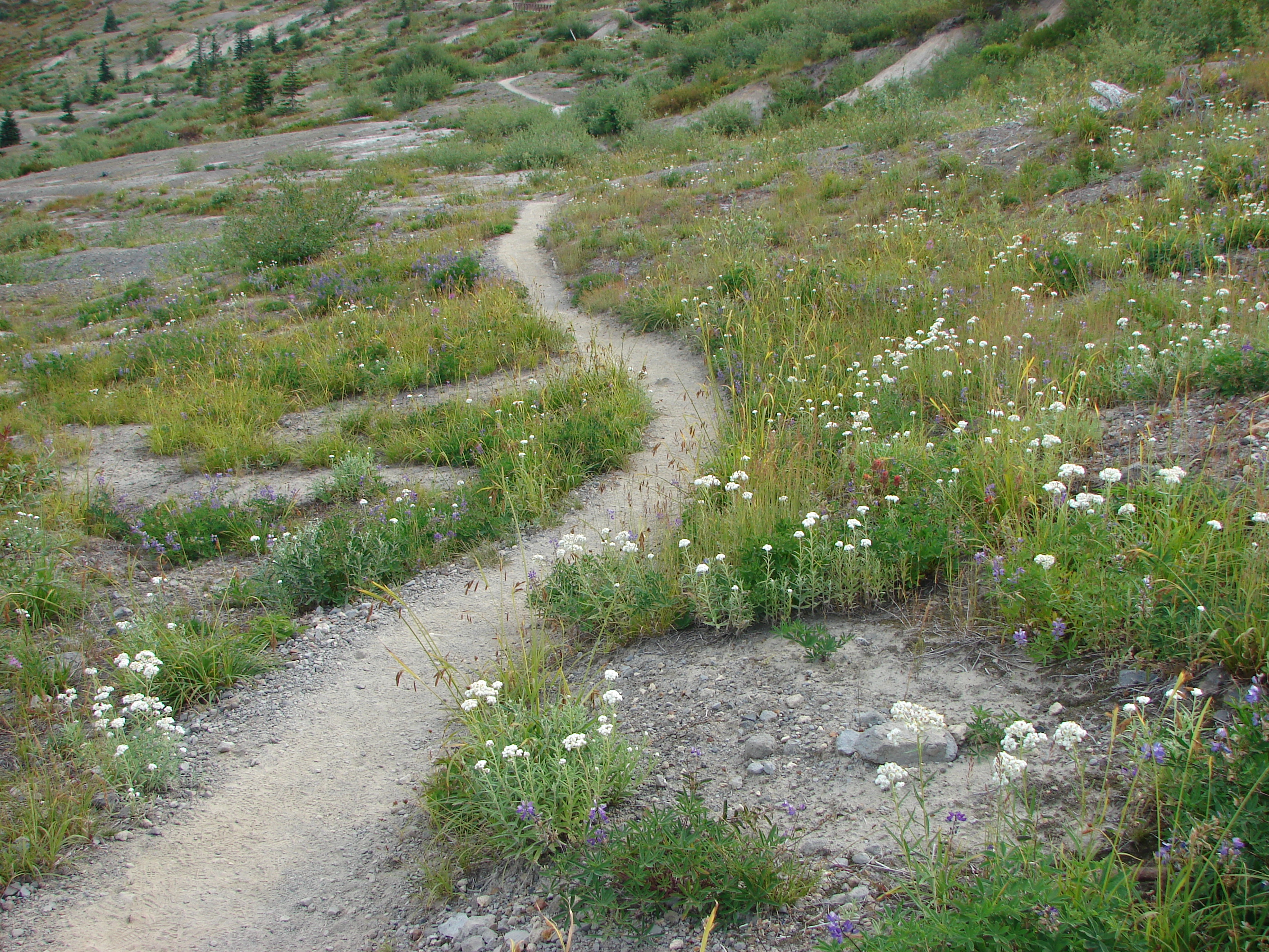
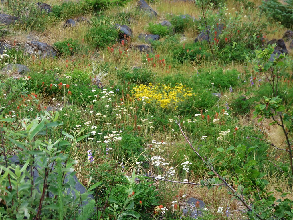
We turned right here heading for the Spring .8 miles away. This section of the Loowit Trail passes through the Plains of Abraham, a pumice plain with a barren looking landscape which is really fascinating. Heading NE Mt. St. Helens looms on the left across the broad plain while hills on the right reveal the force of mountains eruption. Trees lay blown down on the hillsides facing the mountain while other sides are striped away exposing various layers of rock. Other areas green with trees and other vegetation.
IMG_5657

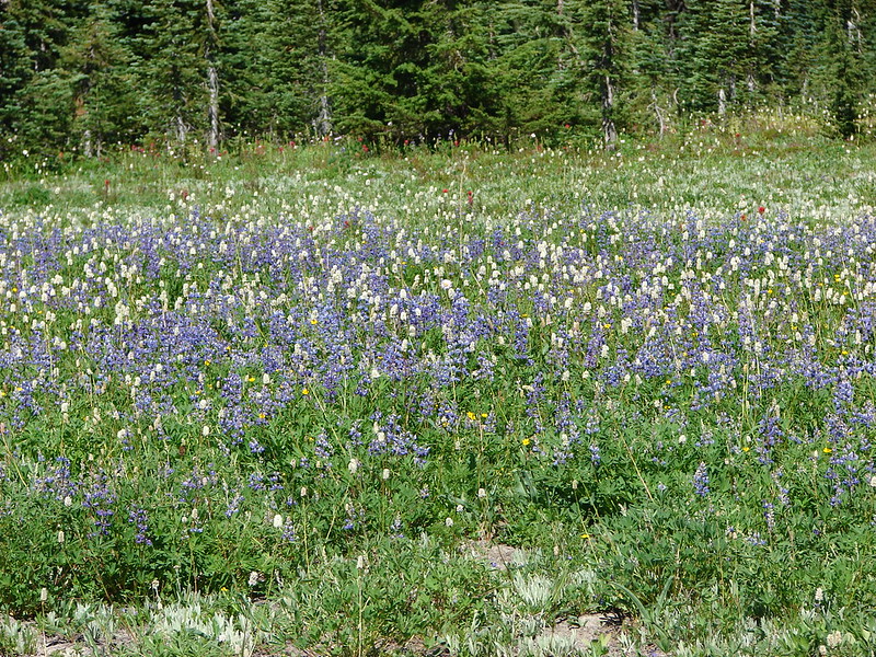
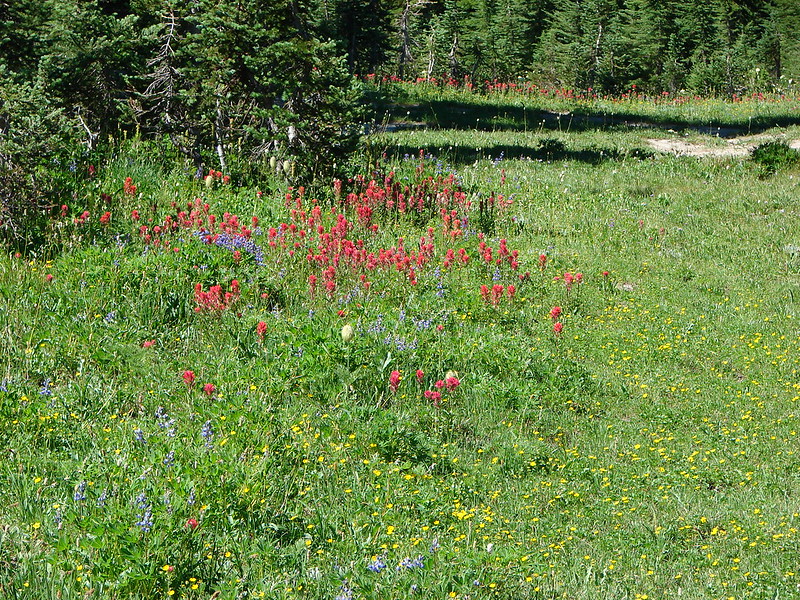
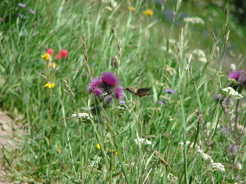
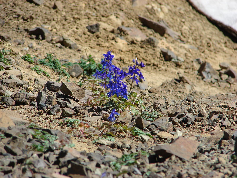
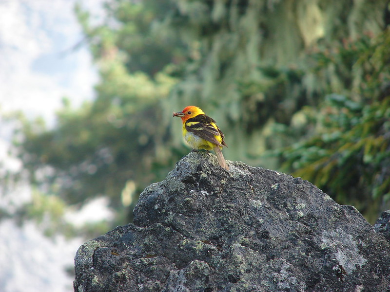
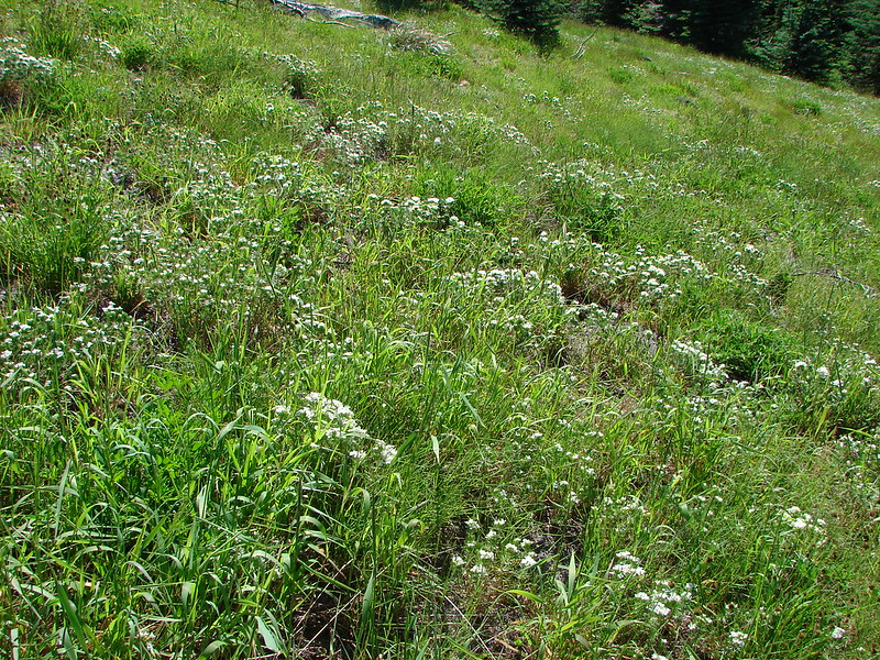
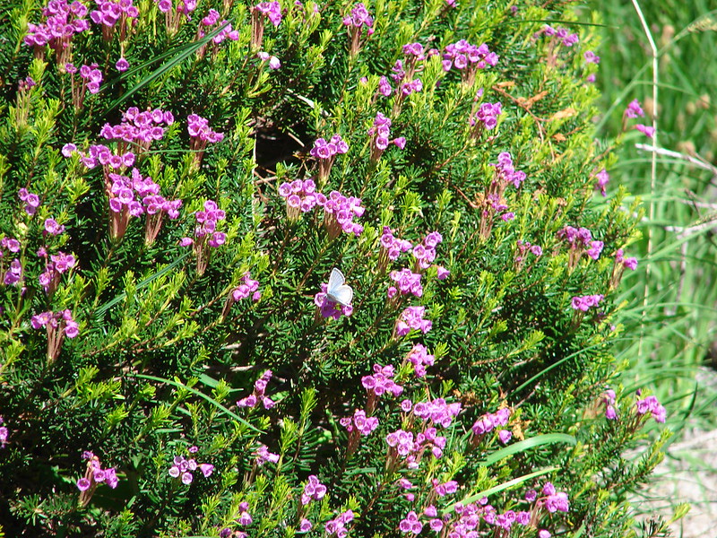
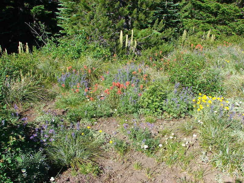
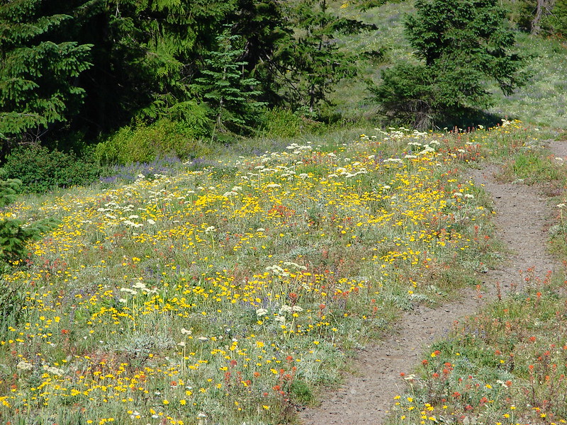
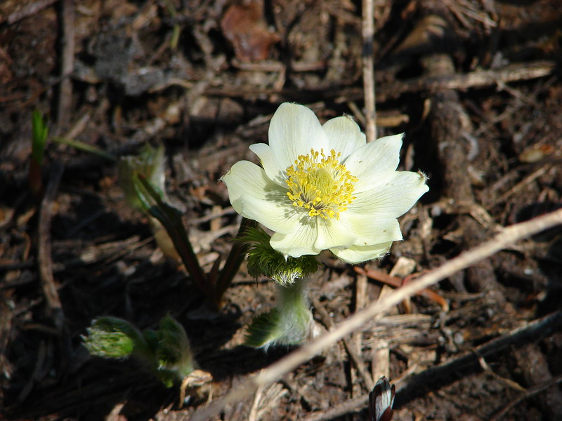
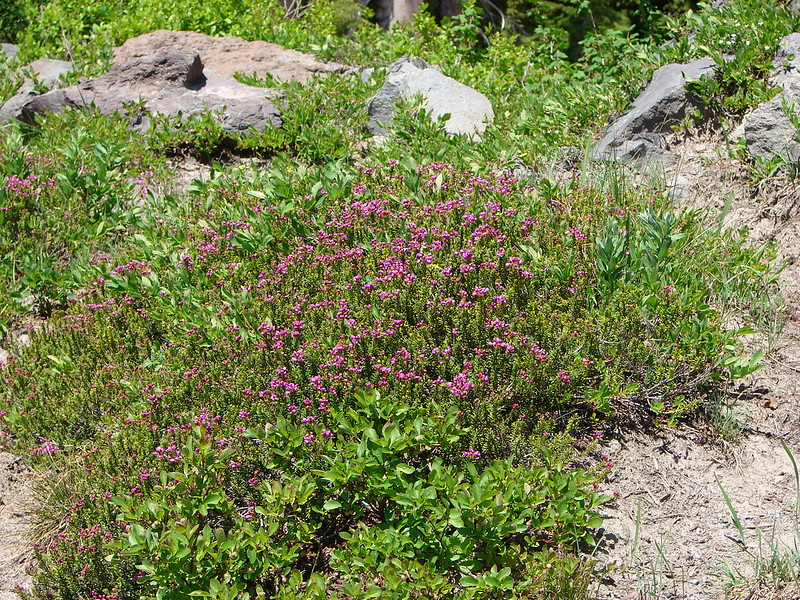
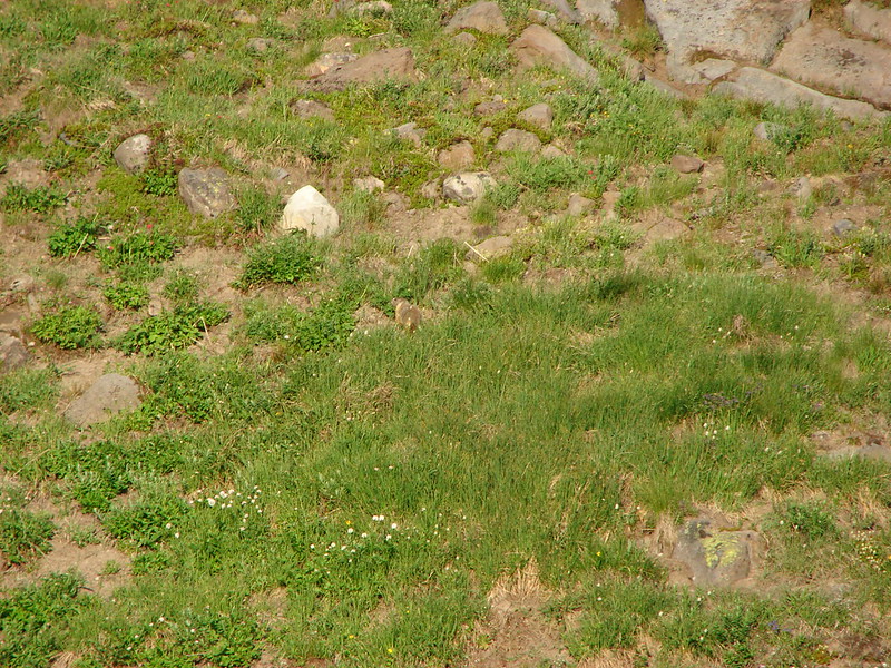
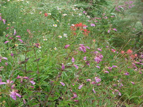
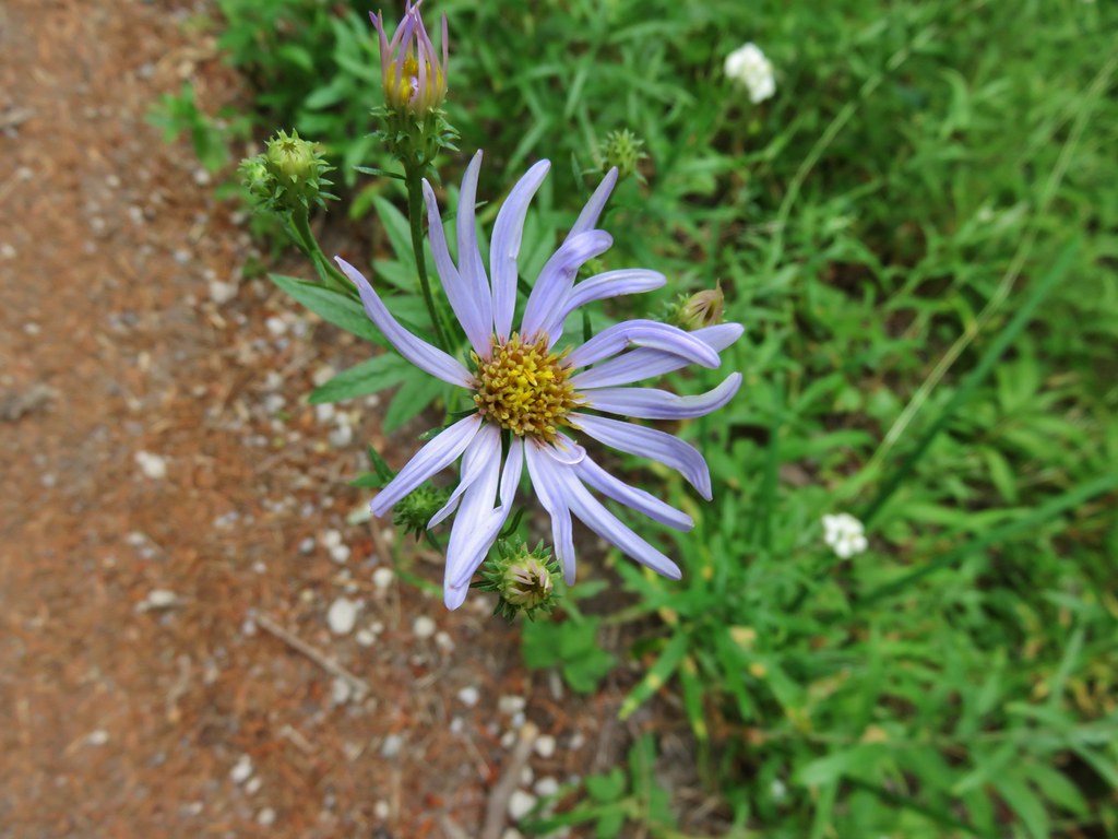
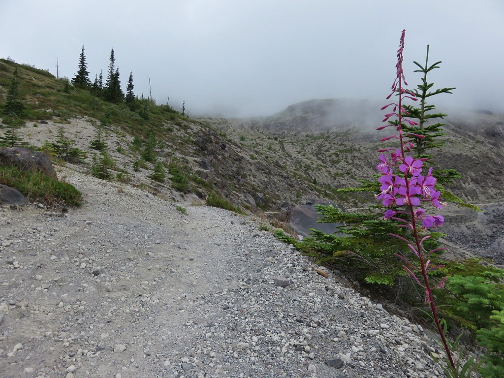
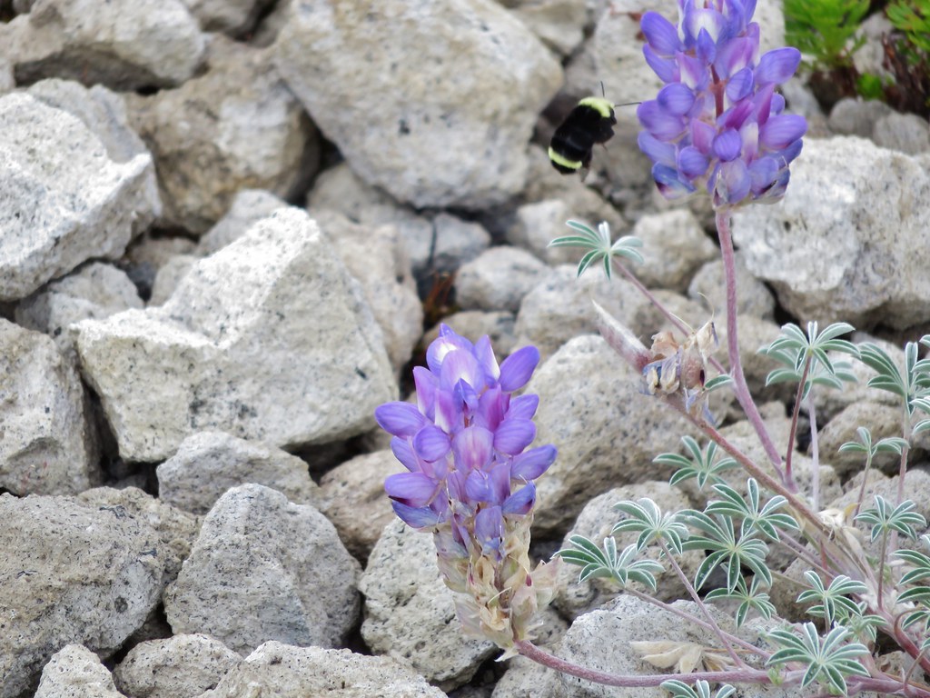
Flowers are sparse but some still manage to bloom in what looks like the most improbably conditions.
IMG_5653

IMG_5654

IMG_5656

IMG_5659

IMG_5679

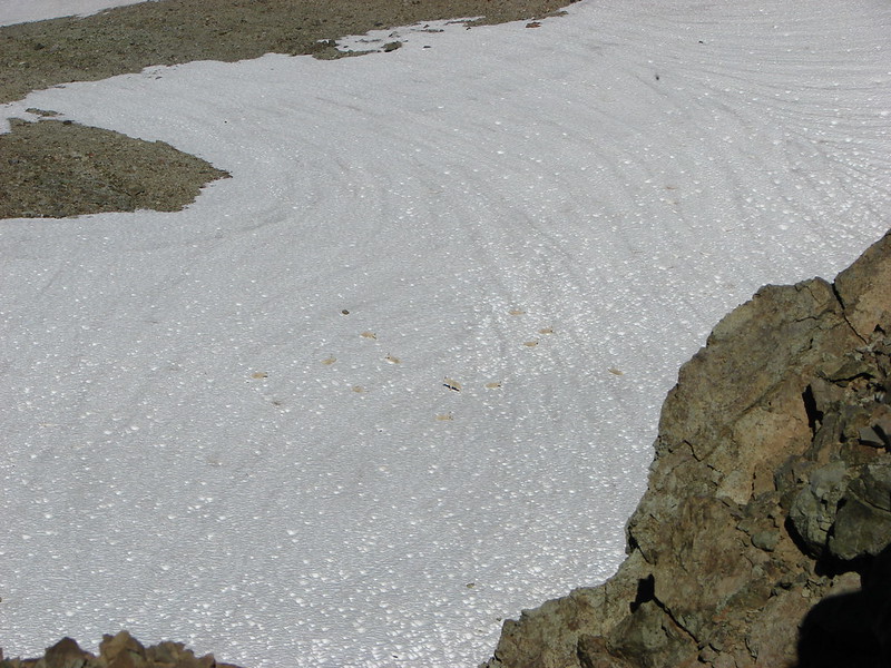
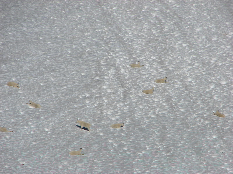
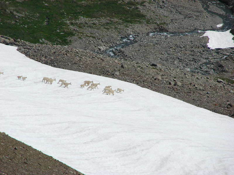
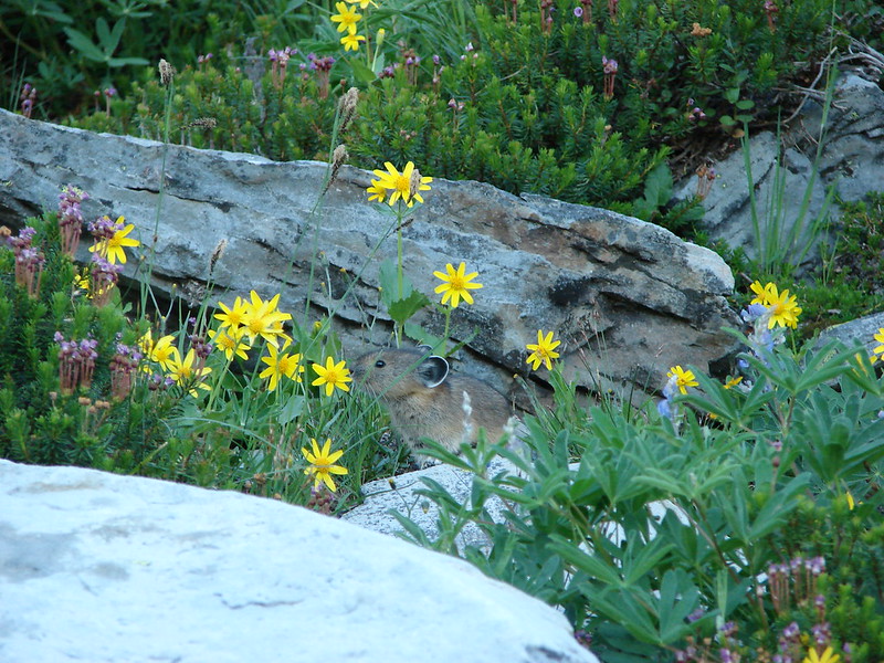
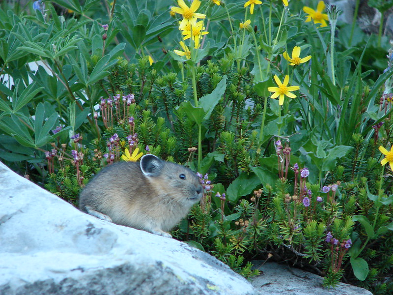
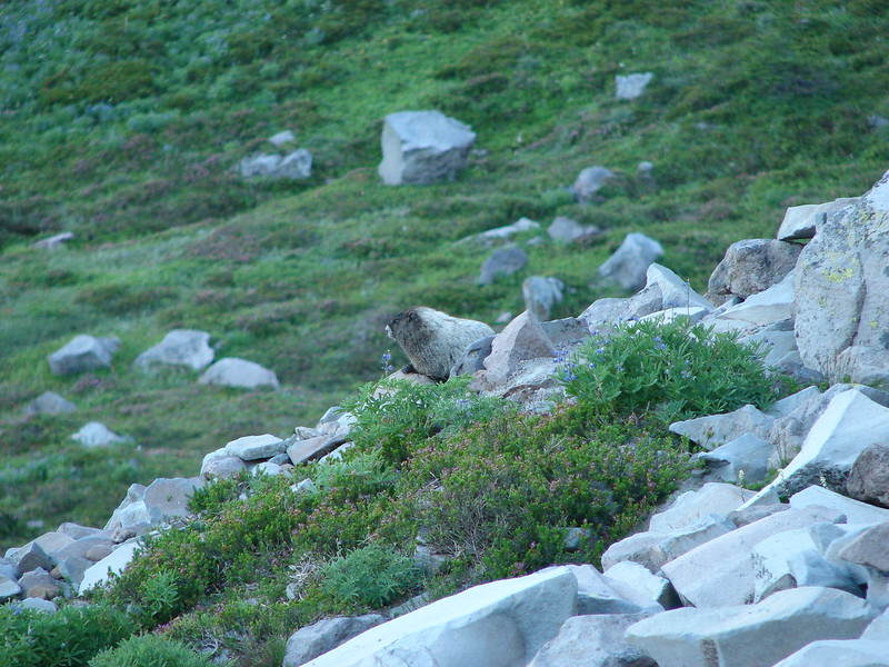
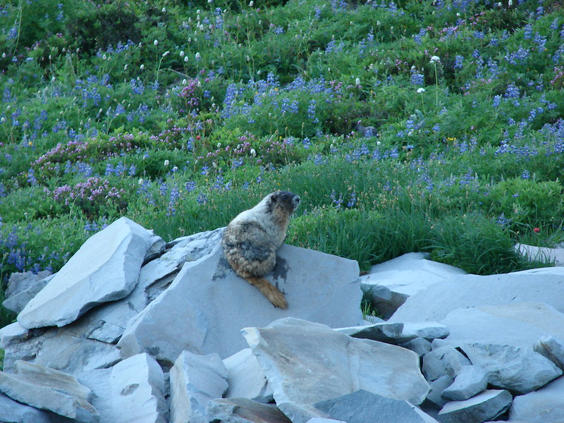
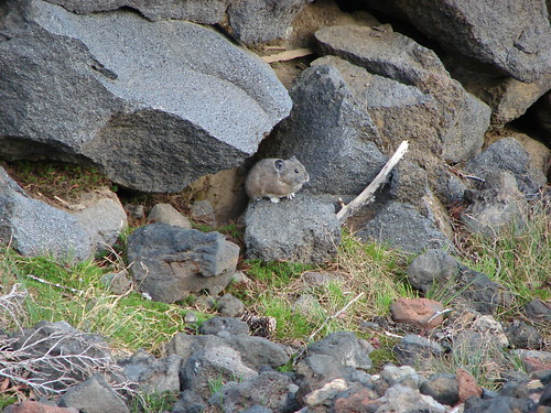
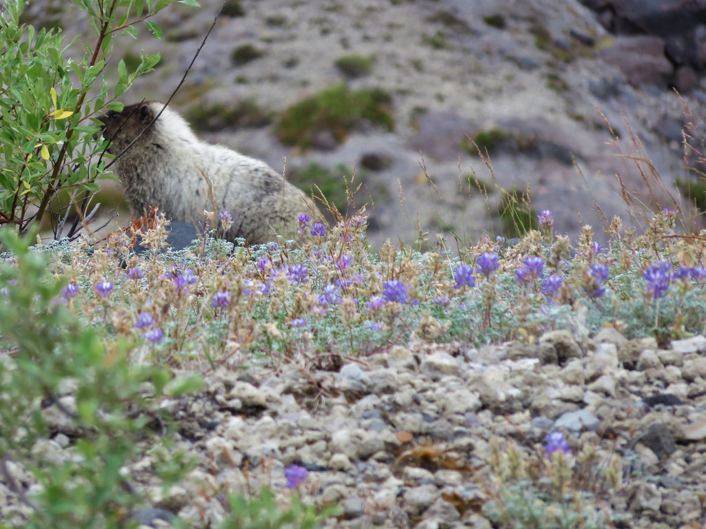
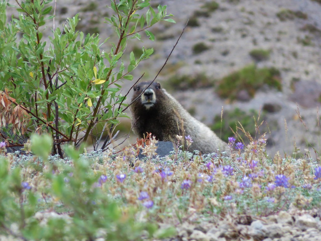
One thing that didn’t change from our previous visit was being greeted by a marmot as we crossed this section. We couldn’t help but wonder if it was the same furry little guy.
IMG_5661

IMG_5664

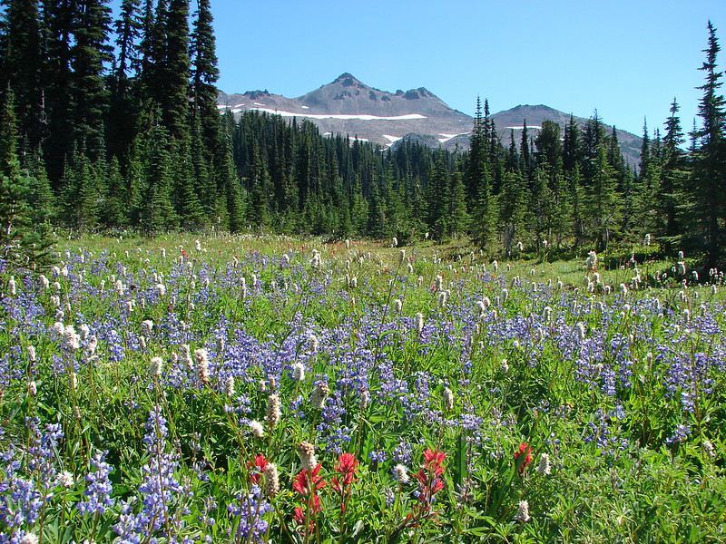
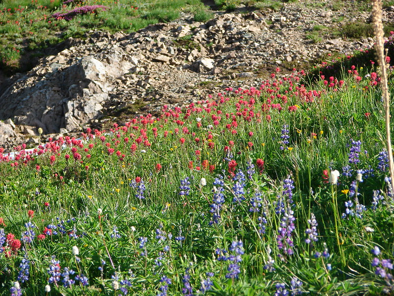
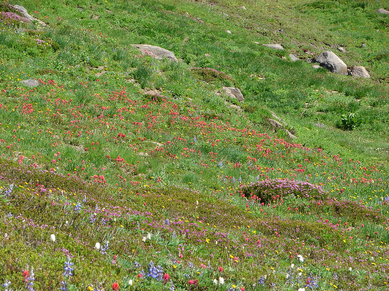
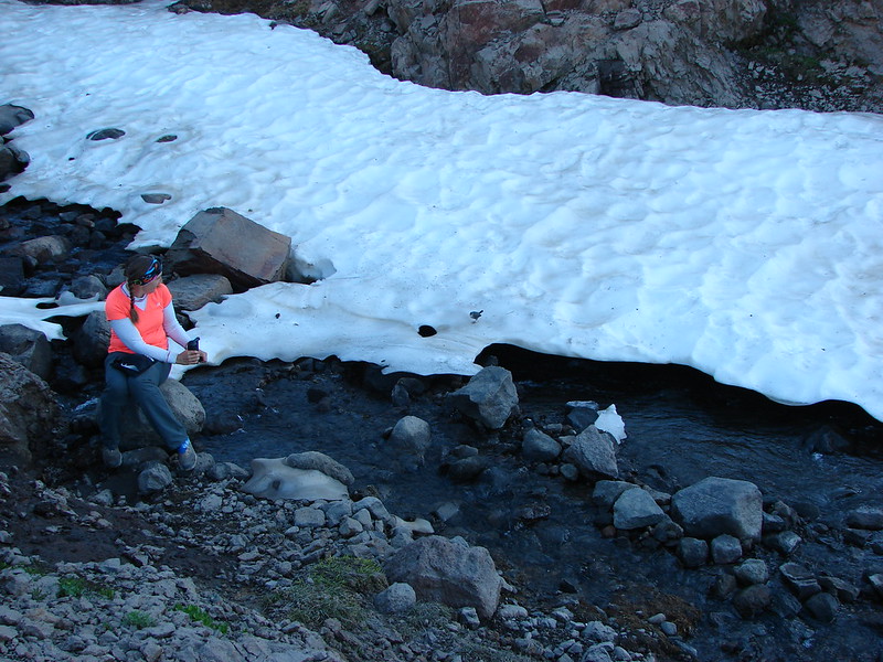
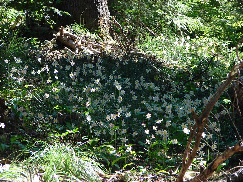
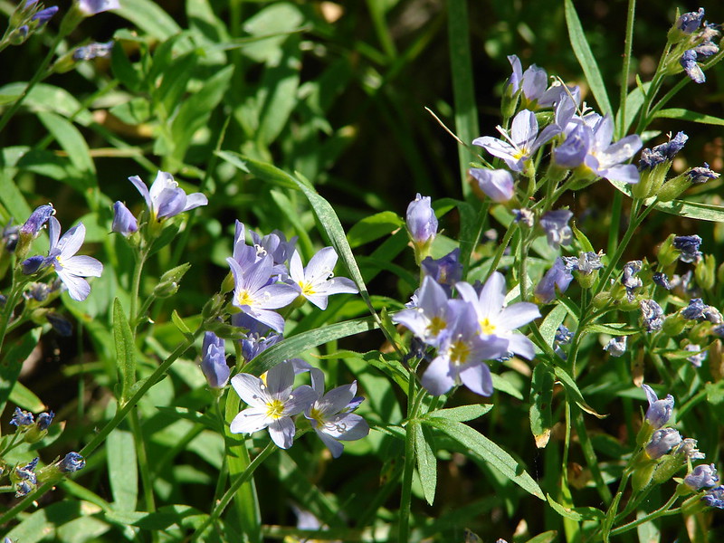
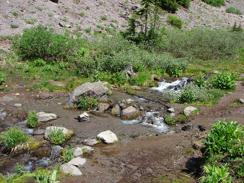
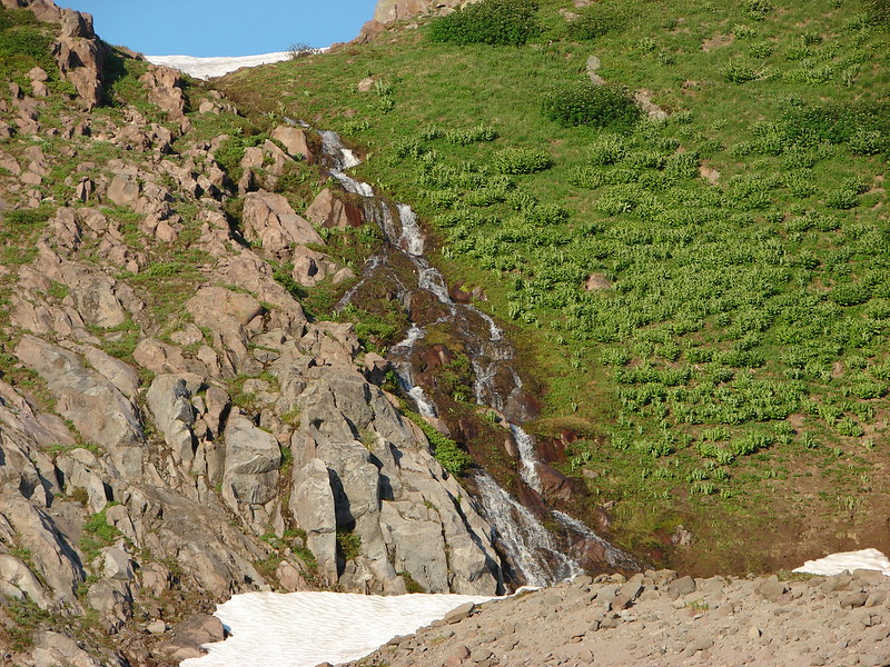
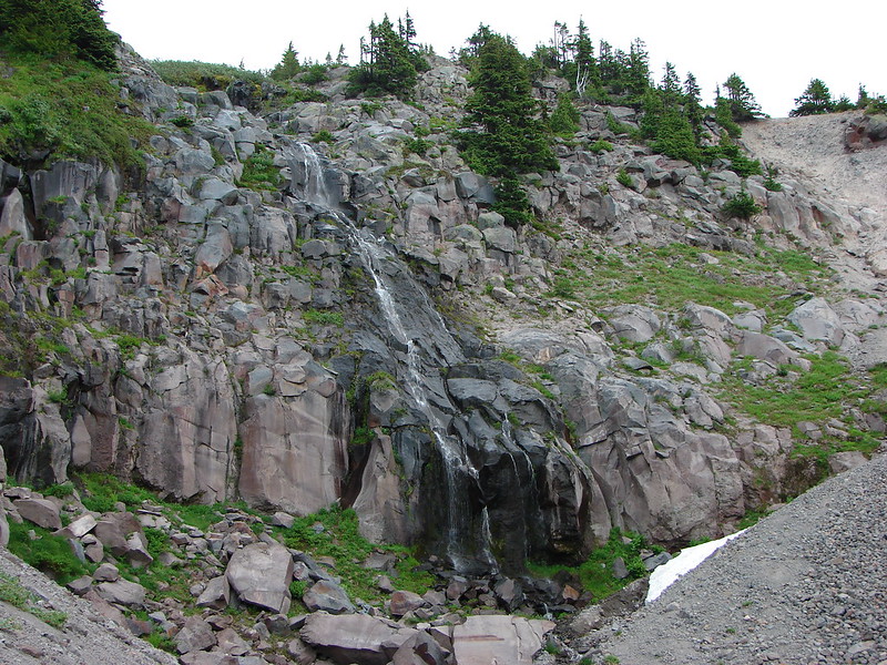
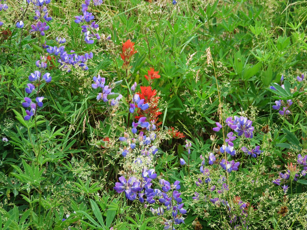
When I had added this hike to the schedule I had hoped to find flowers near the spring where we would turn around, but with the timing being so far off this year due to the weather I wasn’t sure what we’d find. It wound up working out even though things were beginning to dry out. We spoted several different types of flowers including a nice clump of bluebell-of-Scotland.
IMG_5694

IMG_5690

IMG_5706

IMG_5693

IMG_5700

IMG_5688

IMG_5685

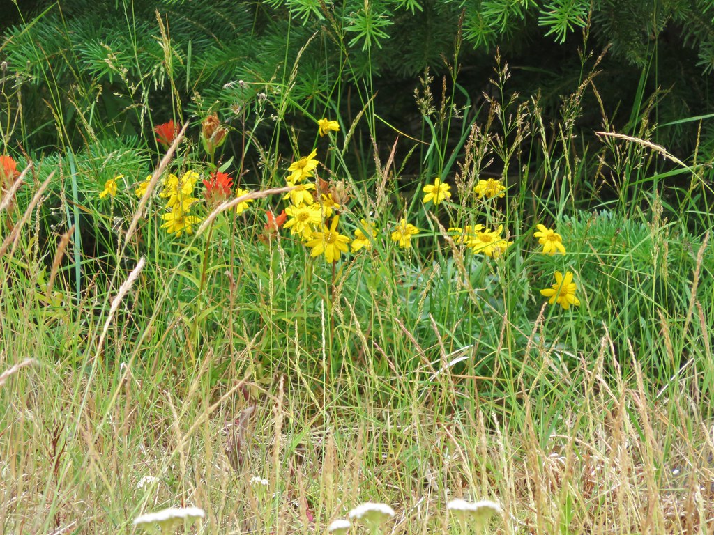
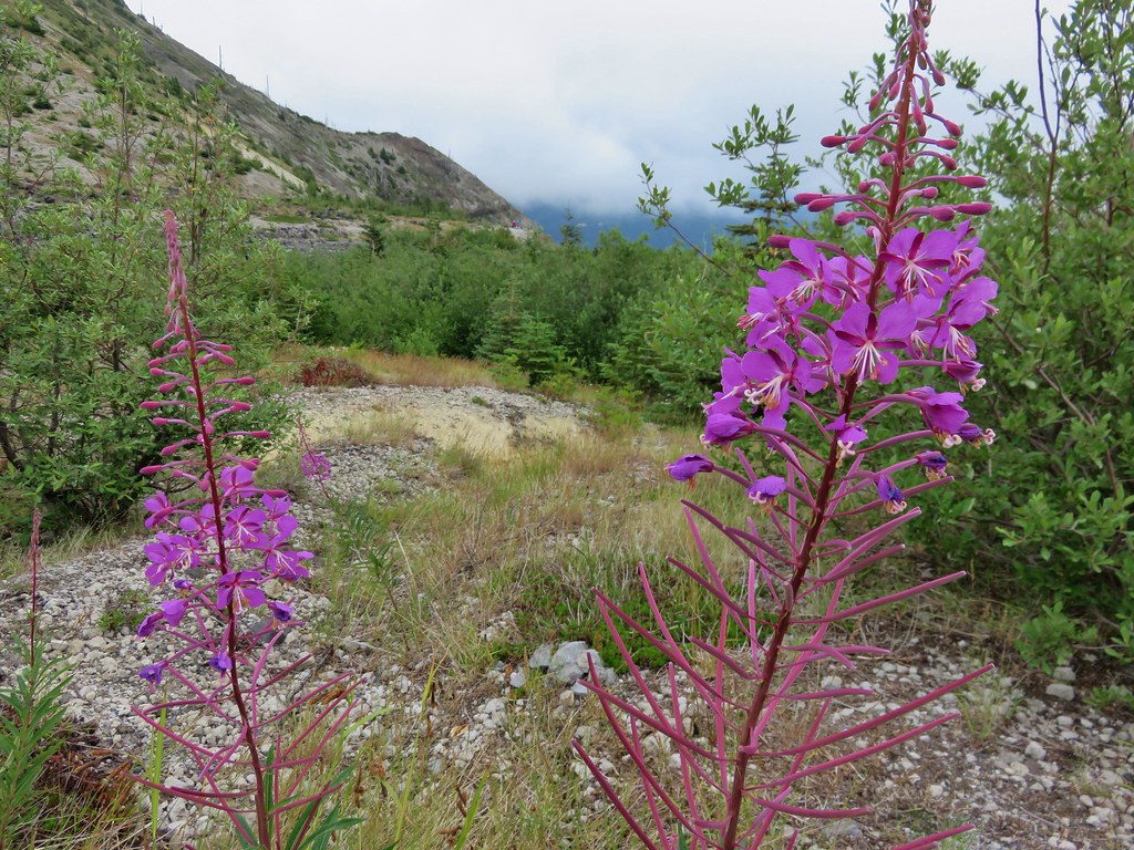
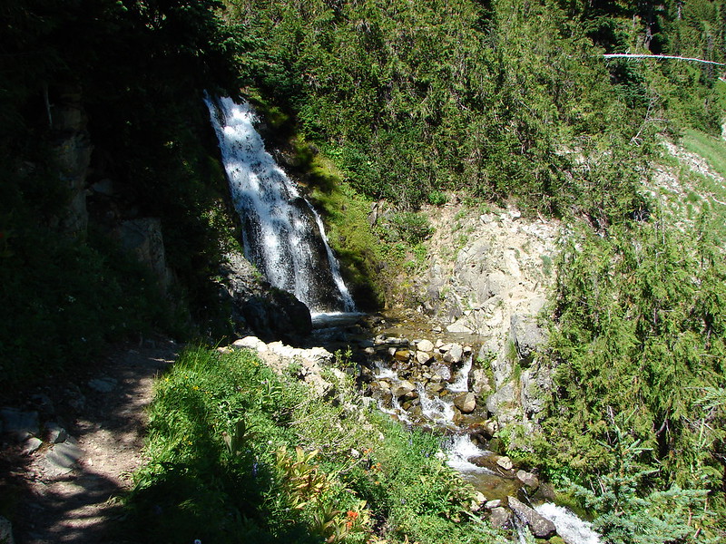
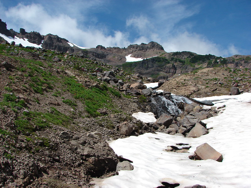
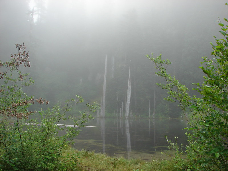
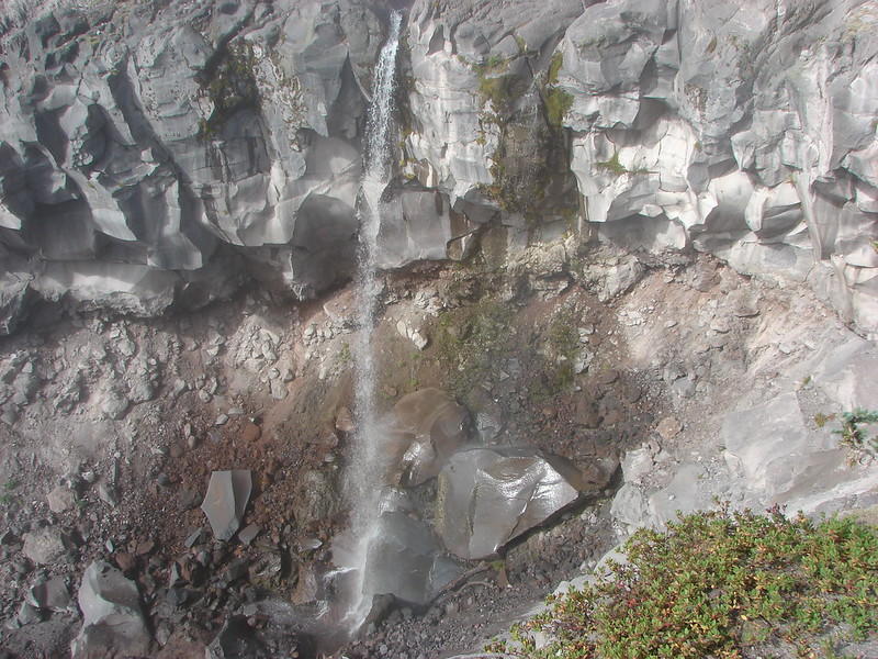
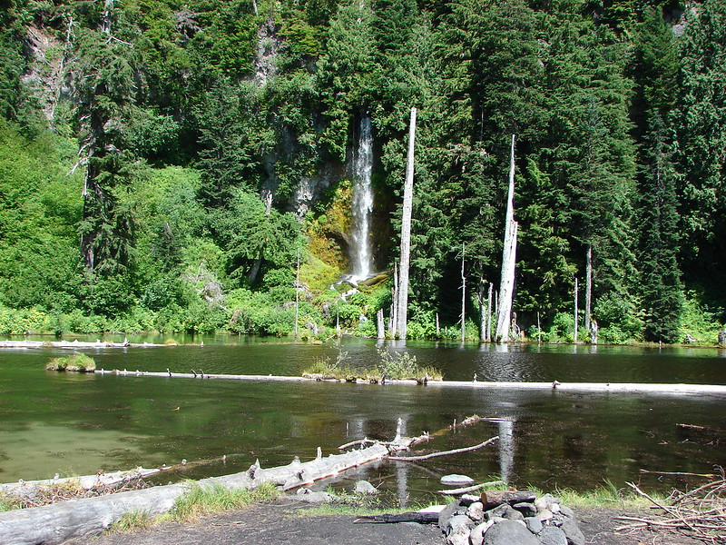
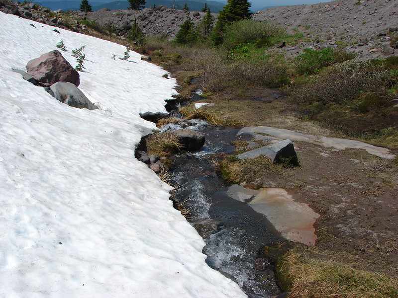
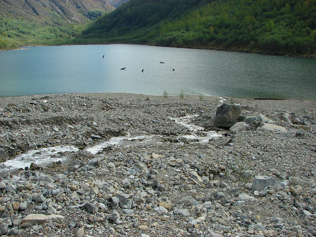
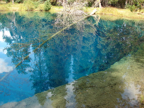
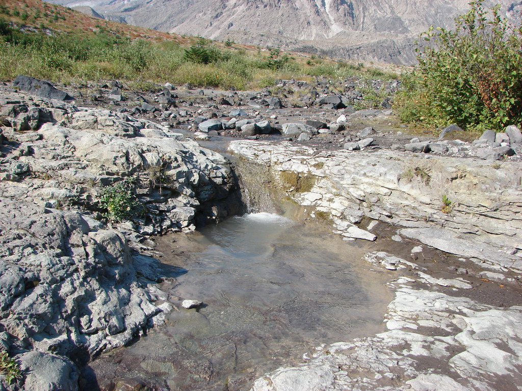
It was no apline wildflower meadow but considering the area it was an impressive display. What surprised us was the lack of water from the spring. Despite it being September on our previous visit a small steady stream of water was flowing down the rocks and into Ape Canyon, but this time the only water was a small pool left filling a depression in the rock.

2012
Spring fed stream

119

2015
IMG_5705

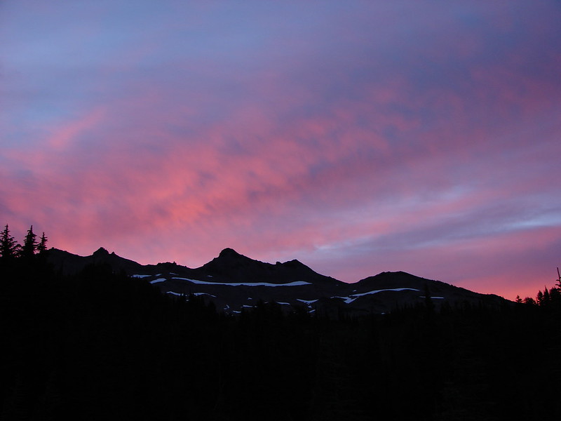
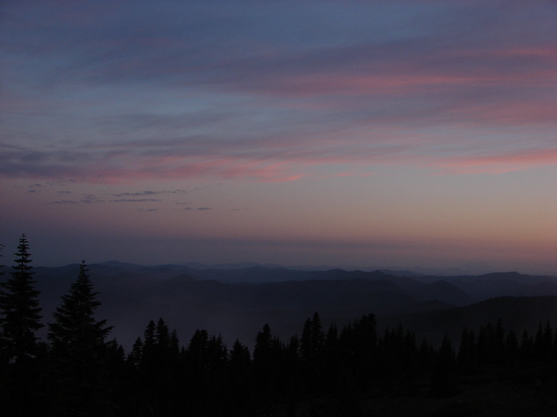
After resting a bit, and starting to get chilly due to a nice breeze and cooling our sweat, we headed back down. The clouds had only lifted a little as we passed the lower viewpoints and small pockets of blue sky teased us from above the mountain.
IMG_5730

It had been a long but interesting day of hiking. It was also our first visit of the year to one of the major Cascade mountains and it had been a good reminder of just how much we enjoyed our hikes on them. Happy Trails!

Flickr: https://www.flickr.com/photos/9319235@N02/sets/72157655789278375

Categories
Hiking Mt. St. Helens Trip report Washington Washington Cascades

Mt. St. Helens Rim

We kicked off our September hiking with the steep rocky climb to the rim of Mt. St. Helens. After missing out on climbing permits last year (The passes are limited to 100 per day from April 1st through October.) we had scooped up this years permits as soon as they went on sale in February. We were fortunate to have wound up picking a day with a forecast for clear skies and mild temperatures.

After picking up our permits and signing the climbers register at the Lone Fir Resort in Cougar, WA we drove up to the Climbers Bivouac and got ready to climb. The first 2 miles of trail climbed gradually through a forest. There were just a few flowers and a couple of berries left here and there. We had blue skies above us but the sky was hazy to the East and South hiding Mt. Hood and Mt. Adams from view.
DSC06250
DSC06253
DSC06254
DSC06263

At the 2 mile mark we crossed over the Loowit Trail and continued up the mountain.
DSC06255
Going up

The trail quickly emerged from the trees and headed for the lava flow on Monitor Ridge.
DSC06261
DSC06262

Posts indicated the general path to follow up the lava, but it was nearly impossible to tell where the optimal route was. It seemed like no matter where we were a better looking route was just to the left or right.
Following the posts up Monitor Ridge
DSC06269
DSC06272

We picked our way up and over the rocks as best as we could passing the first monitor (yes there are actually monitors on monitor ridge) and gaining ever better views of Goat Mountain just to the SE of Mt. St. Helens.
DSC06266
DSC06275

Just under 2 miles from the Loowit Trail we found the second monitor. Used for monitoring any swelling of the mountain we used it as proof that we were actually getting somewhere.
The 2nd of the two monitors
DSC06289
DSC06292

From the second monitor there was one final pile of lava rocks before a final stretch of loose rock and ash.
DSC06295
Final stretch up to the rim of Mt. St. Helens

The sky above the rim was a clear blue and we had hopes that maybe the view North would be clearer than the rest of the horizon, but from the rim the view in that direction looked like the others.
Mt. St. Helens Rim 2

There was one big difference, the view down into the crater was unobstructed and Spirit Lake lay beyond with its flotilla of logs.
Lava dome in the crater of Mt. St. Helens
DSC06319
More of the crater
DSC06351

We sat on the rim for awhile catching our breath and resting our legs. The steam rising from the lava dome coupled with the nearly constant sound of rocks falling down into the crater gave us plenty of entertainment.
Somewhere out there is Mt. Rainier
DSC06364
DSC06371

Once we had sufficiently recovered we began our descent.
DSC06372

Going down was just as difficult as climbing up. We slowly made our way back down though and wound up back in the trees. The final 2 miles seemed to fly by compared to how long it took to come down the lava flow and we were soon leaving the volcanic monument.
DSC06404

Back at the car we had one final look at the rim we had been on just a few hours earlier. It had been an interesting hike, arguably the most difficult we’ve done, but worth the effort.
Mt. St. Helens from the parking lot

Happy Trail!

Flickr:https://www.flickr.com/photos/9319235@N02/sets/72157647296074376/
Facebook:https://www.facebook.com/media/set/?set=a.10204963823042484.1073741907.1448521051&type=1

Categories
Goat Rocks Hiking Trip report Washington Washington Cascades

Goat Rocks Wilderness

We just returned from our longest backpacking trip to date, a three night, four day stay in the Goat Rocks Wilderness in Washington. What an amazing place. Located between Mt. Adams and Mt. Rainier the Goat Rocks Wilderness sports spectacular views, vast meadows of wildflowers, and plenty of wildlife. A number of trails including the Pacific Crest Trail provide 120 miles of hiking opportunities to explore this special place. Our plan was to establish a base camp at Alpine and then explore in all directions from there.

We started our trip at the popular Snowgrass Trailhead and quickly entered the wilderness.

DSC02449

DSC02450

A little over 1.5 miles we crossed Goat Creek on a footbridge.

DSC02466

DSC02469

In another 2 miles we came to a trail junction where Bypass Trail 97 split off on its way up to the Pacific Crest Trail. Staying left on the Snowgrass Trail we climbed .7 miles to a trail junction.

DSC02534

DSC02535

DSC02550

DSC02557

The Lily Basin Trail meets the Snowgrass Trail at this junction amid a wildflower meadow. Just a short distance away was Alpine where we began searching for a tent site. The views and wildflowers at Alpine were simply amazing. We ended up deciding on a small site with a view of Old Snowy Mountain.

DSC02582

DSC02575

DSC02578

DSC02928

After setting up camp we loaded up our daypacks and headed back to the Snowgrass Trail and climbed to the Pacific Crest Trail. The scenery just kept getting better as we approached the PCT. Mt. Adams was standing tall to the SE, Mt. St. Helens sat in the distance to the SW and Old Snowy Mountain & Ives Peak lay dead ahead.

DSC02641

DSC02664

DSC02642

DSC02647

DSC02668

We turned right (south) on the PCT and headed toward the Cispus Basin planning to go as far as Cispus Pass before turning around. After a mile the Bypass Trail 97 joined the PCT which we would take on the way back. After crossing a large rock slide we got our first view across the Cispus Basin to Mt. Adams peaking over the far ridge.

DSC02722

DSC02729

The Cispus River begins at the top of the basin underneath more jagged peaks of the Goat Rocks.

DSC02728

DSC02750

There had been wildflowers all along the trail but as we entered the basin they increased. Adding to the scenery was a waterfall that the PCT passed below.

DSC02740

DSC02757

DSC02786

The trail continued around the basin crossing the Cispus River and then heading up the eastern side of the basin.

DSC02789

DSC02804

At the top of the ridge was Cispus Pass and the border of the Yakima Indian Reservation. The Klickitat River flowed below and Mt. Adams was again visible to the SE.

DSC02825

DSC02828

DSC02835

We returned to Alpine via the Bypass Trail 97 and took a short rest before heading back out to catch the sunset. We decided to try heading further out on the Lily Basin Trail since the Sun would be setting over the ridges in that direction. We passed a small pond with a big reflection before finding an unoccupied camp site where we settled in.

DSC02935

DSC02968

DSC02964

Clouds started to move in and cover some of the higher points though so we headed back toward Alpine to check on Mt. Adams. The Moon had risen over the ridges to the North of Mt. Adams making for a perfect ending to our first day.

DSC03004

I was up early on day 2 and was able to catch the sunrise which lit up the clouds over Ives Peak and Mt. Adams.

DSC03037

DSC03029

Several elk were passing through the trees on the far side of Alpine but the low amount of light left me with a single picture worthy of a bigfoot sighting. 🙂

DSC03068

We set off early on the Lily Basin Trail planning on passing Goat Lake then continuing on the trail to Heart Lake with a possible side trip up Hawkeye Point. As we headed in that direction the view of Hawkeye Point and Goat Creek falling from the rocky ledge below Goat Lake was another stunner.

DSC03075

The trail passed through some large wildflower meadows where marmots could be seen scurrying about in the lupine.

DSC03080

DSC03085

We also passed several waterfalls. The first just disappeared into a rock slide while the second slid down the rocks.

DSC03090

DSC03514

DSC03490

DSC03493

Everything was so impressive but most of all were the wildflowers. The variety and amounts of them were unbelievable. Entire hillsides were covered in colors.

DSC03124

DSC03152

DSC03144

And to top it off Mt. Adams loomed behind us.

DSC03130

When we arrived at Goat Lake it was mostly frozen as we had expected. The lake rarely ever thaws out completely sitting in a bowl beneath Hawkeyepoint.

DSC03168

DSC03191

From the lake the trail climbed to a ridge crest junction with the Goat Ridge Trail. Again the wildflowers were profuse.

DSC03232

DSC03227

DSC03230

When we reached the junction Mt. St. Helens came into view beyond the Jordan Basin.

DSC03244

We left the Lily Basin Trail to attempt to climb Hawkeye Point. As we climbed the tip of Mt. Hood could be seen over the shoulder of Mt. Adams.

DSC03266

Then came Mt. Rainier beyond Johnson Peak.

DSC03268

We followed a clear path to a rocky knob where we discovered a large snowfield lying between us and the visible trail up to the summit of Hawkeye Point.

DSC03282

There was a steep drop part way out on the snowfield and no visible tracks so we decided to declare victory where we were and see if there was a different route to the trail we could see on the far side so we climbed back down to the Lily Basin Trail and started to head toward Heart Lake. We didn’t get far though before we were stymied by another snowfield.

DSC03301

We decided to take a short break before heading back to search for a different route to Hawkeye Point. While we were resting Heather spotted the one thing I was really hoping to see on the trip – Mountain Goats! There was a pair of them near the top of the ridge across the basin.

DSC03318

Mountain Goats were on top of my list of animals we hadn’t seen yet while hiking so even though they were a long way away it was exciting.

After they disappeared over the ridge we started our search for a path around the snowfield to Hawkeye Point. We managed to find what turned out to be a goat path that got us around the snowfield, but we were too far down a steep hill with no visible route up to reach the continuation of the real trail. Instead we followed the goat trail passing some beds complete with goat fur to a view of Goat Lake below.

DSC03335

DSC03336

DSC03342

Satisfied with the view we began our return trip to camp. It was such a pretty trail that was just as spectacular the second time through.

DSC03383

DSC03407

DSC03411

DSC03488

When we got back to camp we noticed that the family who had been camped further back in the same area as us had left. We took the opportunity to switch sites and moved to a spot with a view of Mt. Adams.

DSC03525

After getting our new site set up we decided to go up to the PCT junction to catch the sunset. When we reached the junction with the Snowgrass Trail in Snowgrass Flat Heather noticed a large animal emerging from the trees on our right. We could see dark brown and my first thought was Elk but then it stepped out into the sunlight on the trial.

DSC03539

It was a llama and it looked mighty proud of itself.

DSC03545

We didn’t see anyone around but someone must have been using it as a pack animal. It rolled in the dirt for a moment then got up and then disappeared into another camp site. It was so unexpected all we could do was laugh all the way up to the PCT.

Meanwhile the setting Sun was bringing out the best in the wildflowers on the PCT.

DSC03556

DSC03555

DSC03553

We found an open site and watched the Sun disappear behind a bank of clouds that was hanging over Goat Ridge before returning to our tent and putting day 2 to bed.

DSC03568

DSC03579

Goat Rocks - Mt. Adams sunset

The third day started much like the previous day with a pretty Mt. Adams sunrise.

DSC03593

The animals were up early too.

DSC03595

DSC03601

DSC03606

After a yummy breakfast of Mountain House Biscuits and Gravy we headed up to the PCT once again but this time headed left (North) toward Old Snowy Mountain. As we approached the mountain we left the meadows behind for more rocky terrain dotted with lingering snowfields. The flowers were not completely left behind though.

DSC03632

DSC03636

DSC03637

We spotted a ground squirrel that appeared to be sitting on a ledge enjoying the view along with its breakfast. The ledge it was on looked out over Goat Lake to Hawkeye Point with Mt. Rainier towering behind.

DSC03639

DSC03642

The trail crossed several snowfields but unlike those we encountered the day before the trail was easy to follow and none were too steep.

DSC03655

The views were great in every direction and we were able to spot a new mountain to the North – Mt. Stuart.

DSC03659

DSC03669

The PCT eventually splits with a hiker bypass climbing up higher on the side of Old Snowy to avoid lingering snowfields on a steep, exposed hillside. We took the bypass having seen the snow fields from our exploration of Hawkeye Point the day before, plus we had considered climbing Old Snowy Mountain and the bypass would lead past that trail. When we reached the junction for the summit of Old Snowy we could only make out the lower portion of trail. After the previous days exploits we decided against trying to climb it then and figured we could always try it on the way back past.

DSC03683

We found out later that the crest of the bypass trail is the highest point of the Pacific Crest Trail in the state of Washington at 7230′.

From the crest the PCT descends to “The Knife” before reaching Elk Pass where we had planned to turn around. As we began to descend though we got a good look at the trail ahead.

DSC03691

It was the freakiest looking trail we had encountered and for the first time I wasn’t sure I could do it, but after having a couple of thru-hikers pass by and survive we decided to go for it.

DSC03692

It was nerve racking at first but the trail was good and the views better. We spotted flowers and wildlife all around including a large group of mountain goats in the valley to our right.

DSC03698

DSC03705

DSC03725

DSC03709

Soon we could see Packwood Lake in the valley to our left.

DSC03758

Also in that valley was another herd of goats.

DSC03769

DSC03772

We decided to turn around prior to reaching Elk Pass when we reached a crest and realized that we’d have to climb back up several hundred feet if we continued on and we already had a good climb ahead of us to get back up to the PCT high point.

PCT down to Elk Pass

DSC03830

PCT up to the crest

DSC03906

As we were returning the first group of goats we had seen suddenly started to dash across the snow. A second group came racing down from a higher meadow joining the first group.

DSC03887

DSC03895

DSC03900

We don’t know what spooked them but it was fun to watch them run.

When we finally got back up to the crest the trail up Old Snowy was easy to see. There was a line of people hiking up and down. Between the crowds and our tired legs we decided we’d done enough climbing for the day and headed back to Alpine. Things had gotten crowded in the wilderness as it was the weekend and a lot of people had shown up. Most of the camp sites were now taken so we stuck close to ours until we turned in for the night after the Moon had risen.

DSC04013

We set our phones to wake us at 5am on our last day so we could get a nice early start. Another amazing sunrise greeted us as we packed up our gear.

DSC04018

We took the Lily Basin Trail toward Goat Lake and were greeted by a friendly little Pika near Slide Falls.

DSC04026

DSC04030

The marmots were also out to send us off.

DSC04036

DSC04037

We stopped at the lake to get some water out of Goat Creek and were paid a visit by a pair of Ouzels.

DSC04057

DSC04053

Goat Lake had refrozen a little overnight.

DSC04058

DSC04059

At the junction with the Goat Ridge Trail we took it and dropped down into the Jordan Basin. The best views we’d had of Mt. St. Helens were had as we descended into the basin.

DSC04075

Of course there were wildflowers.

DSC04081

And a lot of crickets or grasshoppers.

DSC04082

There were flowers in this basin that we hadn’t seen at all in the other parts of Goat Rocks.

DSC04105

Soon we were far enough down to no longer be able to see the mountains. It was a bittersweet hike as we hated to leave this beautiful place but after four days a shower was sounding real nice. We got one last glimpse of Mt. Rainier, Mt. Adams, and Goat Rocks before entering the trees for good.

DSC04158

DSC04172

DSC04170

The Goat Ridge Trail would take us to the Berrypatch Trailhead and from there a .6 mile connector trail would bring us back to the Snowgrass Trail just .1 miles from our car. We were moving quickly along the connector trail when the wilderness gave us one last surprise. A small tree frog sitting on a huckleberry bush next to the trail.

DSC04199

Our time was up but we were already thinking of our next visit. We can’t wait to go back and explore more of the wilderness. The only negative to the entire trip was witnessing the disregard for the area that some of the people showed. There were people traipsing through the meadows and setting up tents on the vegetation. Such a beautiful place to visit will only stay that way if people take care of it so please go and visit but stay on the trails and camp on the brown ground not the green. Happy Trails.

UPDATE on the llama.  The llama had indeed either been left or escaped and was seen multiple times throughout the summer.  She was finally rescued this fall and is safe and doing well according to this report: http://www.rattlesnakeridgeranch.com/documents/Rescue_in_the_Goat_Rocks_Wilderness.pdf


Flickr albums: Day 1-https://www.flickr.com/photos/9319235@N02/sets/72157646295294436/

Day 2-https://www.flickr.com/photos/9319235@N02/sets/72157646295758026/

Day 3-https://www.flickr.com/photos/9319235@N02/sets/72157645936565989/

Day 4-https://www.flickr.com/photos/9319235@N02/sets/72157645937647578/

Categories
Hiking Mt. St. Helens Trip report Washington Washington Cascades

June Lake

One of the things that makes for a good hike is variety. We have often commented on how much variety can be packed into just several miles of hiking. The terrain, vegetation, wildlife and views can vary drastically in a relatively short distance. That was the case on our most recent hike in the Mt. St. Helens National Volcanic Monument.

We had toyed with the idea of making this an overnight trip but the uncertainty of suitable water sources gave us pause so we amended our plans to make a day hike out of it. We stuck with our original plan to start at the June Lake trail head and headed up to the Loowit Trail from there. Originally we planed on turning right on the Loowit and heading over to the Plains of Abraham to find a camp spot and then explore further on down to Loowit Falls, but that would be too far for a day hike so instead we decided to go left and check out Dryer Creek Meadows.

It was a cloudy morning as we set off on the June Lake Trail. From the trail head it was a mere 1.3 miles to June Lake on a nice wide trail that gently climbed through a forest with plenty of ripe berries to snack on.
DSC01371
DSC01354

We were surrounded by fog when we arrived at June Lake which made it difficult to get a good view of the 40′ waterfall that falls on the far shore of the lake.
DSC01385

While exploring the small lakes shore we spotted a couple of frogs in the muddy water.
Frogs at June Lake

The best view of the falls came from a side trail at the north end of the lake shortly after a switchback. The reflection of the falls created the illusion of water both falling and rising to the surface of the lake.
DSC01396

About a quarter mile from the side trail we arrived at the junction with the Loowit Trail which circles the entire mountain on a 29.5 mile loop. We turned right and quickly emerged from the forest and began crossing the first of three lava flows that make up the “Worm Flows”. Unlike some of the other lava fields we have hiked over there was no visible trail in many places, just a series of posts and rock cairns to aim for.
DSC01408

It meant a lot of rock hopping and scouting for the best looking route to the next marker. While we were working on making our way over the lava the clouds began to give way and we were treated to a clear view of Mt. St. Helens.
DSC01432
Mt. St. Helens

After crossing the Worm Flows the trail began descending into Swift Creeks canyon where we would find Chocolate Falls. On our way down a colorful western tanager posed for some pictures.
Western Tanager
DSC01474

Before reaching swift creek we passed through a small pocket of vegetation.
DSC01479
DSC01478

We were happy to find water flowing over Chocolate Falls as Swift Creek often dries up overnight and doesn’t begin flowing again until after 11AM on some days.
DSC01481
DSC01482

We took a snack break at the falls and while we were relaxing we were joined by what I think was the same western tanager who decided it was time for a bath.
Western Tanager
Western Tanager

We continued on the Loowit Trail from Swift Creek and began a steep climb that passed through forest and meadows. We also were treated to a great view of Mt. Adams and a descent view of Mt. Hood looming above the clouds.
Mt. Adams
Mt. Adams
Mt. Hood
DSC01550
Meadow filled with nuttall’s linanthus
DSC01585
Mt. Adams from one of the meadows
DSC01611
Passing through a meadow
DSC01612
Mt. Hood from the meadow
DSC01613
Mountain heather and a blue copper butterfly
DSC01608

Two miles from Chocolate Falls we crossed the Ptarmigan Trail which climbs up Monitor Ridge to the Rim of Mt. St. Helens.
DSC01620
We have a date with that trail later this year.

We crossed the trail and shortly came to the edge of another lava flow. A doe was making her way up toward Monitor Ridge showing off her superior rock hopping skills.
Doe
DSC01635

This crossing was .9 miles of post to post travel.
DSC01646
From this section we had a great view of Mt. St. Helens, Monitor Ridge, and the Green Knob.
DSC01648

After navigating the lava flow we were once again in a forest. This one was drier and the trees more sparse than the previous sections we’d passed through. Cicadas chirped loudly from the pine trees and scattered flowers dotted the sandy landscape.
DSC01664
DSC01665
DSC01666

The trail then began alternating between trees and meadows.
DSC01673
DSC01674

As we came around a corner I noticed something peering out of a tree further up along the trail.
DSC01680
A bull elk emerged and gave us a quick look before heading downhill deeper into the trees.
DSC01683
Elk

We turned around at the dry Dryers Creek and retraced our steps back toward Chocolate Falls.
Mt. St. Helens from the dry bed of Dryers Creek
DSC01692

Mt. Adams had been hidden by clouds while Mt. Hood had nearly fully emerged from them.
DSC01715
DSC01716

There was evidence of the increased afternoon snow melt when we arrived back at Chocolate Falls.
DSC01740
Chocolate Falls
We took our shoes and socks off and soaked our feet for a bit in the creek before setting off from the falls. When we did get going we left the Loowit Trail and turned right along Swift Creek on the Swift Ski Trail.
DSC01754
Chocolate Falls and Mt. St. Helens

It was an easy trail to follow and we quickly descended .5 miles to the Pika Ski Trail which we took and headed back toward June Lake.
DSC01764

The Pika Trail was easy to follow for the first few tenths of a mile plus it was lined with ripe blueberries, huckleberries, and a few strawberries.
DSC01770
DSC01772
DSC01761

The easy trail didn’t last long though as we still had to cross part of the Worm Flows to return to June Lake. The crossing here was the most difficult of the day as there was no sign of any trail at all and the few orange poles ended halfway across the lava flow.
DSC01774

Luckily from the final pole June Lake was visible on the other side of the flow.
DSC01776

We headed for the lake and eventually made it down to the sandy bed of a dry creek which we climbed out of and returned to the June Lake Trail. The lake was clear now so we stopped to get some unobstructed photos of the waterfall and lake before beginning the final leg of our hike.
June Lake

We took our time on the final 1.3 miles partly due to being tired from all the rock hopping and partly because we were picking berries as we went. The hike had totaled 13.4 miles and in that distance we’d passed two waterfalls, a lake, several creeks (dry and flowing), through several sections of forest, multiple meadows, and over four different lava flows. We’d seen an elk, a deer, chipmunks, golden-mantled squirrels, frogs, and various birds. We sampled at least 6 different kinds of berries, saw a variety of wildflowers, and had views of three cascade volcanoes. It had been worth the effort. Happy Trails!

flickr: https://www.flickr.com/photos/9319235@N02/sets/72157645372723387/
Facebook: https://www.facebook.com/media/set/?set=a.10204499327590388.1073741894.1448521051&type=1

Categories
High Cascades Hiking Mt. Hood Area Oregon Trip report

Burnt Lake to Paradise Park Overnight

Our latest overnight trip brought us to the Mt. Hood Wilderness where we planned to continue honing our backpacking skills. We plotted out a trip that would bring us to some new places as well as some previous favorites. The plan was to start at the northern trail head of the Burnt Lake Trail, pass Burnt Lake and climb up to East Zig Zag Mountain where we would take the Zig Zag Mountain Trail up to the Paradise Park Trail. From there we would head up to Paradise Park and camp somewhere along the Paradise Park Loop Trail near Split Rock. We’d been to East Zig Zag Mountain and Paradise Park in 2012 on separate hikes, but we had come in on different trails for those trips.

We set off from the Burnt Lake trail head shortly before 7am and quickly entered the Mt. Hood Wilderness.
DSC01348

The trail climbed between Burnt Lake Creek and Lost Creek for 1.9 miles before crossing and then recrossing Burnt Lake Creek. Near the 2.5 mile mark an unmarked side trail to the left led downhill to Lost Creek Falls. (Waterfalls on Lost Creek became a theme for this trip.)
DSC00785

The trail then veered away from Lost Creek and climbed for a mile up to Burnt Lake. Along the way we got our first glimpses of Mt. Hood.
DSC00792

We stopped briefly to check out Burnt Lake but decided to wait until the return trip to locate the best viewpoint of Mt. Hood from the lake shore.
DSC00797
DSC00800

From Burnt Lake the trail climbed up to the Zig Zag Mountain Trail where we took a brief detour to visit the summit of East Zig Zag Mountain. Heather decided to remain amid the wildflowers at the junction with the southern portion of the Burnt Lake Trail while I climbed up to the former lookout site.
Mt. Hood and Burnt Lake from the south trail junction:
DSC00818

Trail heading up East Zig Zag Mountain:
DSC00830

Wildflowers:
DSC00835
DSC00836
DSC00838
DSC00843
DSC00854

Mt. Jefferson:
DSC00856

Mt. Hood:
DSC00859

Butterfly:
DSC00867

Heather waiting at the junction:
DSC00866

After getting my wildflower fix we headed East on the Zig Zag Mountain Trail and began climbing towards Paradise Park. The trail began with a nice gradual ascent through open meadows of beargrass, huckleberry, and other bushes. It was fairly overgrown but easy enough to follow.
DSC00876

We then came to a forested ridge where the trail suddenly steepened – downhill! We had been at 4600′ when we joined the Zig Zag Mountain Trail and needed to get up to 5800′ in 3.7 miles to reach Paradise Park. Going down meant more climbing on the way up as well as having to climb up on the way back down the following day. There were at least 4 fairly brief but steep descents before we began climbing again. At least were some nice views of the mountain ahead of us and a view of our goal.
Paradise Park is the light green areas just above the tree line:
DSC00890
The Paradise Park Loop Trail passed just below the pile of boulders:
DSC00894

As we neared the Paradise Park Trail Junction we began to see lots of avalanche lilies, a telling sign of recent snow melt, and a few patches of snow still hanging on.
DSC00897
DSC00911
DSC00907

After joining the Paradise Park Trail we passed through several meadows and a nice viewpoint of the Zig Zag River before arriving at the Pacific Crest Trail in a mere .2 miles.
DSC00922
DSC00923
Zig Zag River Canyon and Mississippi Head (the rock outcropping at the center of Mt. Hood):
DSC00916
Oh the choices!
DSC00925

We crossed over the the PCT and climbed up to the Paradise Park Loop Trail which was a fairly steep .5 miles and 400′ above us. It was late August when we visited in 2012 and to this day the wildflowers in the meadow at the junction of these two trails remains the best display we’ve seen. There was little indication of the scene to come this trip as the snow was still melting off and only a few early flowers could be found. The view of Mt. Hood was still top notch though.
Late August 2012
173
Mid July 2014
DSC00935
Western Pasque Flower
DSC00932
Avalanche lilies and paint
DSC00939

We headed left at the junction and started looking for our tent site. We passed several good locations but had something specific in mind. We were looking for a site close to a water source, with a good view, but also with some shade as it was quite warm. We made our way North passing the remains of the Paradise Park Shelter, crossing both branches of Lost Creek, and passing Split Rock before we found what we had been looking for.
South Branch Lost Creek crossing
DSC00945
Mt. Hood from the crossing
DSC00950

North Branch Lost Creek crossing – The snow shelf made this one tricky as the creek was flowing under the edge of the snow.
DSC00960
DSC00963

Split Rock
DSC01002

Camp
DSC01000

After setting up camp we spent the rest of the afternoon and evening alternating between exploring the area and relaxing as we waited for sunset.
Mountain heather beginning to bloom
DSC00970

Cinquefoil
DSC00982

Shooting Star
DSC00989

Marsh marigolds
DSC01040

Western pasque flowers
DSC00991
DSC01066

Mt. Jefferson
DSC00972

Mt. St. Helens
DSC00990

East Zig Zag Mountain and some of our route from earlier in the day
DSC01012

DSC01009
DSC01023

Yocum Ridge on the other side of the Sandy River. The waterfall is on what appears to be an unnamed fork of the Sandy River but I’ve seen it referred to as Paradise Park Creek.
DSC01024

The Sandy River
DSC01031

Waterfall flowing down into Lost Creek
DSC01052
DSC01055

Marmot in the grass near the falls
DSC01061

Our shadows as the Sun was getting lower
DSC01064

Small waterfall on Lost Creek
DSC01073

Sunset
DSC01082
DSC01090
DSC01104
DSC01124

After watching the Sun go down we turned in. For some reason I wound up awake shortly after 4am so I grabbed the camera again and waited for the sunrise.
The Moon was super bright all night and a few clouds had moved in to the South by the morning
DSC01151

Starting to get some sunlight
DSC01180
DSC01184

Then came the colors
DSC01195
DSC01205
DSC01213
DSC01210DSC01224
DSC01227

After a breakfast of Mountain House freeze dried scrambled eggs and bacon (yes we managed to use our stove this trip 🙂 ) we packed up camp and began our return trip. We decided to continue on the loop which would bring us back to the PCT which we could then take South back to the Paradise Park Trail junction. This would allow us to visit a few waterfalls on the way back. The first of the falls is on Rushing Water Creek as it comes down from Paradise Park. There was a nice display of wildflowers just before the falls here.
DSC01272
DSC01278
DSC01294
DSC01297

There was a trail crew from the Pacific Crest Trail Association gathered at the base of the falls that was out doing some trail maintenance.
DSC01300

It had clouded up and as we were passing the falls rain began to fall lightly. We decided to stop at the next set of falls to waterproof our sleeping bags just in case it started to rain harder. The next set of falls were on Lost Creek. Both branches come down within a short distance of each other and both in scenic waterfalls.
North Branch Lost Creek
DSC01303
DSC01305

South Branch Lost Creek
DSC01313
DSC01317

It was raining off and on but not very hard but then we began to hear thunder. We picked up our pace as best we could as the thunder became steadier and we started to see the flashes of lighting. We had made it to the Paradise Park Trail and were back on the Zig Zag Mountain Trail when the hike got really interesting. We came around a bend in the trail and less than 20 yards ahead of us was a black bear. We all instantly froze, even the bear for a split second before it turned in bolted back into the forest. All I’d had time to do was say “bear” before it had vanished. I had just put the lens cap back on the camera and tucked it under my shirt to keep the rain off of it so I had no chance at getting a picture. Heather went for the bear spray just to be safe but it was long gone.

We made it back to the steep sections that we were dreading without further incidents. The climb was pretty much as ugly as we’d expected but the rain had let up without ever getting too heavy so we were dry at least. Dry until we reached the overgrown section of trail that is. By the time we emerged from that section we looked and felt like we’d forded a thigh-high creek. 🙂

When we got back to Burnt Lake we headed down past campsite C where there is a great view of Mt. Hood from the lake shore.
DSC01337

We ticked off the remaining 3.5 miles at a brisk pace pausing occasionally to sample the salmon and blueberries that were ripening nicely along the trail.
Oval-leaf blueberries
DSC01346

Mt. Hood had delivered another amazing adventure. Happy Trails!

flickr: https://www.flickr.com/photos/9319235@N02/sets/72157645261769389/
Facebook: https://www.facebook.com/media/set/?set=a.10204454188061928.1073741893.1448521051&type=1

Categories
Hiking Mt. St. Helens Trip report Washington Washington Cascades

Coldwater Lake & The Hummocks

We ended our “Creek Week” vacation by changing things up a bit and heading to the Mt. St. Helens National Volcanic Monument hoping to see some snowy mountains. Our creek theme wasn’t totally abandoned though. Our destination was Coldwater Lake which was formed during the 1980 Mt. St. Helens eruption when Coldwater Creek was blocked by debris from the mountain. The creek still flows into and out of the lake on it’s way to the North Fork Toutle River.

The slide that created Coldwater Lake also created the Hummocks which are piles of rock, ash, and other debris that was washed down and deposited along the Toutle River. A 2.5 mile trail loops through these mounds and that was where we decided to start our hike. Our plan was to hit that popular trail first before it got crowded then walk back along the shoulder of Highway 504 for a quarter mile to the entrance to Coldwater Lake and once there either do an 8.8mi out and back to a footbridge over Coldwater Creek or continue over the bridge on a longer loop up and around the lake. We decided to wait until we got closer to the bridge before choosing which option we would take.

It was quite foggy when we arrived at the trailhead for the Hummocks loop making it pretty clear that we wouldn’t be seeing Mt. St. Helens for awhile at least.
The Hummocks trailhead

The scenery along the trail deserved our attention anyway with many ponds and streams nestled between the various mounds.
Ducklings on one of the ponds
DSC04973

As we were making our way through the strange landscape we spotted some elk on one of the Hummocks a short distance away.
DSC04984
DSC04989
They didn’t seem to be the least bit concerned with us. There were also numerous ducks, geese, and other birds enjoying the ponds and marshes along the trail.
DSC05009
DSC05040
DSC05057
DSC05059
DSC05069

The trail also passes a nice viewpoint above the North Fork Toutle River where Mt. St. Helens would be visible on a clear day. We settled for the river and another group of elk grazing on the far bank.
DSC05032
DSC05026
Shortly after leaving the viewpoint we were passing through a wooded area when I noticed an elk around 30′ away standing in the trees. Before I could get the camera up it disappeared but that had been the closest we’d come to an elk yet.

The clouds were beginning to clear up when we made it back to the parking lot and set off along the highway toward the Coldwater Lake entrance. We passed over Coldwater Creek on it’s way from the lake down into the Toutle Valley and then crossed the road and headed down to the lake.
Coldwater Creek

The view across the lake was spectacular from the trailhead. Minnie Peak lay ahead with a dusting of snow and a misty covering of clouds.
Coldwater Lake
DSC05091

A little island was a popular spot for geese and ducks. I am sure they were there for the views.
DSC05102

As we traveled along the north shore of the lake the views both ahead and behind kept getting better. The clouds were lifting revealing more and more snow covered peaks.
Coldwater Lake
DSC05110

A few flowers were ahead of schedule giving us a taste of what will be coming in the next few weeks.
DSC05115
DSC05106
DSC05117
Scouler's Cordaylis

I had my eyes on Minnie Peak waiting for the last cloud to finally let go. It was a stubborn one though and just wouldn’t quite disappear.

DSC05149

The trail crosses several small streams before reaching what was a very nice waterfall on this day. Rock Gully Falls, as it’s called in Sullivan’s book, was swollen with melt water making it a damp crossing since there is no bridge.
Rock Gully Falls
The crossing
DSC05166

We spotted several more elk above us on the hillside as we rounded a small peninsula shortly after passing the falls. It was amazing watching them quickly traverse the steep hillside.
DSC05188
Can you spot them here?
DSC05192

The next marker along the trail was a fan of rocks that had been part of a slide into the lake.
DSC05222
DSC05227

Near the end of Coldwater Lake we came to a shallow pool of water that was, at least at one time, home to a beaver. We didn’t see one but we did see plenty of ducks and geese here.
DSC05276
DSC05269
Evidence of Beaver work
DSC05272

The cloud had finally left Minnie Peak revealing the craggy mountain top by the time we reached the trail junction just above the bridge over Coldwater Creek.
DSC05284
DSC05306
Coldwater Creek came raging down the valley putting on an impressive show.
DSC05297

We had decided to do the full loop as it appeared that snow would not be an issue and loops are generally more fun than retracing your steps so we crossed the bridge and began to climb the ridge on the south side of Coldwater Lake. The views behind us as we climbed just kept getting better.
DSC05315
DSC05318
DSC05332
The rock fan
DSC05362

It was a stiff climb but the views eased the pain some. As the trail began to become more gradual, we could see the Coldwater Visitor Center far off in the distance on the opposite hillside.
DSC05369
Down in the little valley Heather spotted more elk moving in the trees.
DSC05377

Just a short while later she spotted another elk heading our way. It stopped in a little bowl below us to check us out.
DSC05396
Nique correctly identified it as a young bull as it began to come toward us again.
DSC05400
He then veered slightly away from us and crossed the trail a ways ahead and disappeared behind a small rise. I kept looking up the hillside to see if I could see where he was heading.
DSC05404
Just moments after taking the above picture he popped his head up over the rise and looked right down at us. As I fumbled with the camera he jumped down onto the trail no more than 10 yards in front of us and sped off back the way he had come originally. By the time I got a picture he was quite a ways down the into the bowl.
DSC05407

That had gotten my heart racing as I wasn’t sure if he had decided to turn aggressive. I had been expecting him to run away from us not at us. After the excitement we continued on to tractor junction where a trail leads up to Coldwater Peak. The junction is named for the piece of logging equipment that was laid to rest there by the eruption.
DSC05415

We had finally found a little snow in this area but not much was left.
DSC05418
After curving around the trail came to a great open viewpoint.
DSC05432
DSC05446
DSC05455

We could see Rock Gully Falls and the North Coldwater Lake trail really well.
Rock Gully Falls

We had heard a lot of croaking on the Hummocks trail but hadn’t seen any frogs or toads there or along the lake, but now at almost 3500′ Nique spotted one.
DSC05490

Coldwater Peak became visible as we made our way back toward the west end of the lake. It was interesting to see this side of it after having hiked up it last year.
DSC05500
DSC05508

Just as the trail began to descend we came to more logging equipment that didn’t survive the eruption.
DSC05533
DSC05550
DSC05555
DSC05558

From here we could also see the Hummocks parking lot and our car.
DSC05563
DSC05564
We still had a ways to go.

Our last elk sighting was a big one. As we were coming down, the largest herd we’d seen was scrambling to stay ahead of us and dropping down over the hillside.
DSC05571
DSC05578
What a sight 🙂
DSC05584

We made it down to the South Trailhead and began our road walk back to our car. Mt. St. Helens finally decided to make an appearance at this point.
DSC05600
When we got back to the car I dropped off my pack and jogged down the Hummocks Trail to the first good viewpoint to get my volcano pictures.
DSC05607
DSC05614
Now that’s the way to end a hike – Happy Trails indeed! 🙂

flickr: https://www.flickr.com/photos/9319235@N02/sets/72157644218596998/
facebook: https://www.facebook.com/deryl.yunck/media_set?set=a.10203973677849473.1073741876.1448521051&type=1

Categories
Year-end wrap up

The hikes of 2013 – A year in review.

What an amazing year of hiking it was! As we reach then end of 2013 we thought we’d make one final entry recapping the beautiful areas and unique features we were blessed enough to encounter while out on our “wanderings”. We began the year in February at the Oregon Coast, hiking at Gwynn Creek and Cape Perpetua then finished up just a couple of weeks ago, once again on the Oregon Coast at Tillamook Head, 140 miles north of where we had started. Sandwiched in between these two hikes were 40 other adventures in which we climbed mountains, crossed rivers, and scrambled cross-country to explore a small sampling of the trails of NW Oregon and SW Washington. We put together a map of the approximate location of the trailheads for each of the hikes.
2013 Trailheads
An interactive version can be viewed on mapquest using the following link.
http://mapq.st/1bQXoXo

I’ve always been interested in numbers so I have kept quite a few statistics regarding these 42 hikes. Here are some of those that I found most interesting. We visited 10 wilderness and 2 scenic areas in 8 different national forests. In addition to the national forests we hiked in 4 state parks and at a national volcanic monument. Some of the other numbers are as follows:
Total Miles (according to the Garmin) – 515.2
Cumulative Elevation Gained (approx.) – 88,000′
Minimum/Maximum Elevation – sea level/10,358′
Total Moving Time (per the Garmin) – 240hrs 36min
Total Time on the Trails (per the Garmin) – 280hrs 6min
Total Miles Driven (approx.) – 7550 miles

For the most part the weather was good. We had a warm, dry end to Winter which carried into Spring clearing many trails of snow earlier than normal. This allowed for some earlier visits to some of the higher elevation areas and also an early bloom for most of the wildflowers including the bear grass which only blooms every 2nd or 3rd year. A mild summer kept temperatures bearable and despite the dry beginning to the year the fire season wasn’t too bad. Fall brought an early snowstorm and left an early winter wonderland at mid-elevations and some unusually cold temperatures of late created some interesting ice displays.

Words can’t do justice to the beauty of God’s creation that we experienced this so year I’ll try to keep them to a minimum and attempt to let pictures show what they can.
I have to start with the Cascade Mountains. The most awe inspiring creations, these steadfast beacons that on clear days dot the horizon always seem to draw our attention.

From the rim of Crater Lake in the south to Mt. Rainier in the north they rise above the other ridges, rooted in their positions, yet ever changing in order or varying in appearance depending on what our location was. Some of the views we had were amazing.

Mt. Scott, Mt. Thielsen, Mt. Baily, & Diamond Peak from the South Sister Summit
View from the South Sister
Cascade Peaks from Mt. Bachelor to Mt. Hood (minus the North Sister which was hidden behind the Middle) from Mt. Fuji
Waldo Lake
Mt. Washington to Mt. Hood from the Pacfic Crest Trail near Yapoah Crater
Belknap Crater, Mt. Washington, Three Fingered Jack, Mt. Jefferson & Mt. Hood
Mt. Washington to Mt. Bachelor from Three Fingered Jack
Broken Top, Mt. Bachelor, The Three Sisters, Mt. Washington and The Husband
Mt. Rainier, The Goat Rocks, and Mt. Adams from Wildcat Mountain
Mr. Rainier, The Goat Rocks, and Mt. Adams
Mt. St. Helens, Mt. Rainier, and Mt. Adams from Silver Star Mountain
View from Ed' Trail

Individual peaks working from the south to the north.
Mt. Thielsen:
From Fuji Mountian
Mt. Thielsen

Diamond Peak:
From Waldo Mountain
Fuji Mountain and Diamond Peak
From Fuji Mountain
Diamond Peak

Mt. Bachelor:
From Fuji Mountain
Mt. Bachelor
From Tam MacArthur Rim
Mt. Bachelor

Broken Top:
From above Moraine Lake
Broken Top and Moraine Lake
From Fuji Mountain
Broken Top and Ball Butte
From Tam MacArthur Rim
Broken Top

South Sister:
From above Moraine Lake
South Sister Climbers Trail
From Tam MacArthur Rim
South Sister
From Fuji Mountain
South Sister

Middle & North Sister
From Tam MacArthur Rim
Middle and North Sister
From Scott Meadow
North & Middle Sister and Little Brother from Scott Meadow
From the South Sister
South Sister summit view

Mt. Washington
From the Matthieu Lakes Trail
Mt. Washington
From Fuji Mountain
Mt. Washington and Belknap Crater
From Three Fingered Jack
Mt. Washington and The Husband

Three Fingered Jack:

From the Matthieu Lakes Trail
Three Fingered Jack
From Canyon Creek Meadows
Three Fingered Jack from the upper meadow

Mt. Jefferson:
From Fuji Mountain (Dwarfing Three Fingered Jack)
Mt. Jefferson and Three Fingered Jack
From Hanks Lake
Hank's Lake
From Three Fingered Jack
Looking back down
From Bays Lake in Jefferson Park
Bays Lake in Jefferson Park

Mt. Hood:
From Barrett Spur
Mt. Hood from Barrett Spur
From Table Mountain
Mt. Hood from Table Mountain
From Elk Meadows
Mt. Hood from Elk Meadows
From Lamberson Butte
Mt. Hood
From Youcum Ridge
Mt. Hood from Yocum Ridge
From Timothy Lake
Mt. Hood from Timothy Lake

Mt. St. Helens:
Mt. St. Helens
From the Loowit Trail on Mt. St. Helens
Mt. St. Helens from the Loowit Trail
From Johnston Ridge
Mt. St. Helens

Mt. Adams:
From Silver Star Mountain
Paintbrush, penstemon and Mt. Adams

Mt. Rainier:
From Wildcat Mountain
Mt. Rainier

From the giant rock towers of the mountains we move on to the delicate meadows full of wildflowers that often times call the mountains home. We visited amazing wildflower displays near Mt. Hood, Mt. Jefferson, and Three Fingered Jack but the Cascades were possibly outdone by Silver Star Mountain in Washington.
Bear Grass on Mt. St. Helens
Mt. St. Helens from a beargrass meadow along the Loowit Trail
Balsam Root and Paintbrush in the Ochoco National Forest
Paintbrush and balsamroot
Clearcut on Silver Star Mountain
Tarabell Trail
Meadow on Salmon Butte
An arnica in  a meadow of plectritis, larkspur and monkeyflower
Elk Meadows
Elk Meadows
Near Heather Creek on Mt. Hood
Wildflowers along the Timberline Trail at Heather Creek
Mt. Hood Meadows
Wildflowers in Mt. Hood Meadows
Lupine in Canyon Creek Meadows
Three Fingered Jack
On Coffin Mountain
Aster, penstemon and paintbrush
Avalanche Lilies on the Timberline Trail
Avalanche lilies
Western Pasque flowers and Paintbrush near Elk Cove
Mt. Hood from the Timberline Trail near Elk Cove
Barret Spur on Mt. Hood
Lupine and monkeyflower
Gentians in Jefferson Park
Gentians
Jefferson Park
Wildflowers along the South Breitbenbush Trail
Along the South Brietenbush River in Jefferson Park
Wildflowers along the South Breitenbush River
Aster on Yocum Ridge
Aster field on Yocum Ridge
On Yocum Ridge
Wildflowers along the Yocum Ridge Trail
More from Yocum Ridge
Paintbrush and aster

There weren’t many hikes where the presence of water was not felt. We encountered it in various forms and in an array of colors. There were lakes, creeks, rivers, waterfalls, springs, and the Pacific Ocean adding sights and sounds to our hikes.
Roaring Creek
Roaring Creek
McKenzie River
Mckenzie River
Tamolitch Pool
Tamolitch Pool
Russell Lake
Mt. Jefferson from Russell Lake
Umbrella Falls
Umbrella Falls
Diamond Creek Falls
Diamond Creek Falls
Heather Creek
Waterfall on Heather Creek
South Matthieu Lake
South Mattieu Lake
Benham Falls
Benham Falls
Carver, Camp, and the Chambers Lakes
Carver, Camp and some of the Chambers Lakes
Lewis Tarn
Lewis Tarn
Creek near Pamelia Lake
Waterfall near Pamelia Lake
Timothy Lake
Timothy Lake
Little Crater Lake
Little Crater Lake
Frozen pond near Fuji Mountain
Half frozen pond
Birthday Lake
Birthday Lake
Ramona Falls
Ramona Falls
Pacific Ocean at Tillamook Head
View from Ecola State Park
Pacific Ocean from Cape Perpetua
Looking south from Cape Perpetua
Last but not least the most unpredictable of the sights out on the trails are the creatures that call these places home. From flying ants on Coldwater Peak to the black bear who left its tracks in the snow on Fuji Mountain we were the tourists traipsing through their neighborhoods. We spotted our first elk, snow shoe hare, and sooty grouse this year. We also had the mysterious case of “mouse rain” on Salmon Butte which you can read about here:https://wanderingyuncks.wordpress.com/2013/06/20/salmon-butte/
Crawdads in Middle Rock Lake
Tide pool at Cape Kiwanda
Snail
Rough skinned newt
Snake
Tree frog
Spider along the Tam McArthur Rim Trail
Bug on Fuji Mountain
Frog
Butterflies
Zerene fritillary butterfly
Swallowtail butterfly
Edith's checkerspot
Milbert's Tortoiseshell Butterfly on the way up Coldwater Peak
Hoary Comma
Hoary Comma
Clodius parnassian
Birds
Bald eagle
Seagull buffet
Yellow-Rumped Warbler
Owl
Gray jay taking a bath
Duck family
Northern Flicker
Osprey
Hummingbird
Red Crossbill
Osprey flying over ducks on Timothy Lake
Hummingbird
Canada geese
Pelicans
Common goldeneyes on Wall Lake
Great Blue Heron
Little guys
Chipmunk
Pika
Douglas squirrel
Golden Mantled Squirrels
Snowshoe hare

Big Guys
Our first elk sighting. Near the Observation Peak Trailhead
Columbia Black Tailed Deer
Elk herd on the far shore of the Deschutes River
Elk
Deer near the Lower Black Butte Trailhead

We’d like to leave you with what each of us found to be their favorite hike and the most difficult. For myself Elk Meadows was my favorite. https://wanderingyuncks.wordpress.com/2013/07/24/elk-meadows/ The variety and beauty we encountered on that hike put it atop my list. As for the most difficult I chose Silver Star Mountain https://wanderingyuncks.wordpress.com/2013/07/04/silver-star-mountain/ which was also in the running for my favorite. The heat on that day made it the hardest one for me.

After much deliberation Heather chose the same hike as I did her favorite, Elk Meadows; something about that day had her mesmerized as we traveled up Gnarl Ridge towards Mt. Hood. For the most difficult she picked Observation Peak due in part to having fallen shortly after we stared the hike and spraining her hand and wrist. It made for a more challenging and uncomfortable hike as she endeavored to keep her injury elevated above her heart during most of the journey. https://wanderingyuncks.wordpress.com/2013/07/09/observation-peak/

Dominique chose Fuji Mountain for his favorite. There was snow and a great view with a reasonable amount of distance. https://wanderingyuncks.wordpress.com/2013/10/09/fuji-mountain/ For the most difficult he picked Table Mountain and the climb up Heartbreak Ridge. https://wanderingyuncks.wordpress.com/2013/06/14/table-mountain/

I am already hard at work putting together a 2014 itinerary which will include some overnight backpacking trips and hopefully visits to the Goat Rocks Wilderness and Mt. Adams in Washington. If all goes as planned we will kick things off in January, take things slow until we’ve recovered from our April half or full marathons, and then be ready to crank things up in May. Until 2014 here is a link to a 2013 hikes in pictures album on Flickr http://www.flickr.com/photos/9319235@N02/sets/72157635497870439/

Merry Christmas & Happy Trails!

Categories
Hiking Mt. St. Helens Trip report Washington Washington Cascades

Johnston Ridge Observatory & Coldwater Peak

We took advantage of a day off recently and headed up to the Johnston Ridge Observatory at Mt. St. Helens. This was the farthest north we have traveled for a hike and would be the first time we would be able to see the collapsed side of the volcano. We were a bit disappointed when we arrived and realized that the winds had shifted and were blowing from the south east causing a hazy sky due to smoke from a wildfire near The Dalles Oregon. We parked in the observatory parking lot and surveyed our hike’s destination, Coldwater Peak.

Coldwater Peak from the parking lot.

The observatory was not open yet (It opens at 10:00am) but we walked around the paved loop trail there before setting off on the boundary trail. Good views of Mt. St. Helens were plentiful despite the blue haze from the smoke.
004
I had us all on the lookout for elk down in the valley below and it wasn’t long before we spotted a small group.
030
It appeared to be a small heard of about 15 elk but as we worked our way along the trail and got a better view of the valley below we saw the rest of the heard.
041

As we rounded a ridge end we got our first view of Spirit Lake and it’s floating trees. Mt. Adams was visible through the haze further to the east.
082
The trail then dipped slightly to a jct with the Truman Trail and continued on behind Harry’s Ridge. Here there was a decent variety of flowers that were growing in the mud and ash that had spilled over the ridge here during the 1980 eruption.
106
We also began to find berries :). Here were mostly thimble and huckleberries but we even found a few ripe salmon berries.

Thimble & huckleberries

Later we would add strawberries to the menu.

Just after we had reached the Harry’s Ridge trail we spotted another half dozen elk running up a game trail below us. The trail was now gaining elevation providing better views of Spirit Lake and distant Mt. Adams.
133
When the trail crested we had a nice view of St. Helens Lake below. The trail then drops down in order to pass through a rock arch before continuing above the west side of the lake.

The rock arch that the trail passes through and St. Helens Lake

Near the north end of St. Helens Lake was the sign for the Coldwater Peak Trail which we turned up to begin our climb. We were so busy looking for berries (which we had all been snacking on as we hiked) that we somehow walked right off the trail at a switchback. It took a moment but I finally spotted it across the hillside going up so we headed cross country until we intersected it. Back on the trail we continued our climb up amid an increasing number of flowers (and plenty of berries).
266

The views from the summit were good despite the persistent haze which had now completely hidden Mt. Adams.

Mt. St. Helens from Coldwater Peak


Johnston Ridge Observatory from Coldwater Peak


Mt. Rainier from Coldwater Peak

We couldn’t get to the highest point on the rocks of Coldwater Peak though. We found that we were greatly outnumbered on the summit by flying ants!

Flying ants filling the sky and covering the rocks on Coldwater Peak

They were sticking to the west side of the peak and as long as we remained a few feet from that edge they left us alone so we were able to eat in peace.

We headed back down the trail and tried to figure out where we had lost it on the way up but we never did figure that mystery out. The smoke had gotten worse and it could now be faintly smelled in the air. We ate more berries on the way back and stopped to watch the elk heard again before dropping our packs off at the car and heading to the now open observatory to pay for the passes that we were supposed to have in order to hike in the area. Since we were there we took a tour around the small but interesting observatory before getting in the car and daring Portland’s rush hour traffic. Happy Trails

Facebook photos: https://www.facebook.com/media/set/?set=a.10201951052645107.1073741851.1448521051&type=1
Flickr: http://www.flickr.com/photos/9319235@N02/sets/72157635195793722/

Categories
Hiking Mt. St. Helens Trip report Washington Washington Cascades

Sheep Canyon

So after a couple of months of taking pictures of the major Cascade peaks it was finally time to visit one. Our most recent hike brought us to the volcanic landscape of Mt. St. Helens. Our plan was to hike a loop on the SW side of the mountain starting at the Blue Lake trail head.

For the second week in a row we spotted elk from the car on the way to the trail, but were skunked while actually hiking. We arrived at the current Blue Lake trail head (washouts occasionally relocate it) and headed across a rocky washout to the Toutle Trail. The washout provided a view ahead to the mountain while forest lined each side. At the Toutle Trail we turned left and headed toward Blue Lake. Coldspring Creek flowed along the edge of the washout creating a dividing line between the grey rocks and old growth forest on the other side. Shortly after crossing the creek and entering the forest we came within sight of Blue Lake. The forest here survived the 1980 eruption leaving old growth trees, but a mudflow dammed the creek creating the lake. The forest was peaceful and carpets of white flowers covered much of the ground.

After 2.5 miles in the forest we began to descend into Sheep Canyon. Here the Toutle Trail intersects the Sheep Canyon trail which climbs the mountain on the south side of Sheep Canyon up to the Loowit Trail which circles the entire mountain. We continued on the Toutle and crossed Sheep Canyon on a scenic footbridge and continued on toward the South Fork Toutle River.
056

This section of trail was not very well maintained so we had to do a lot of stepping over and under along the way. After 1.5 miles we made it to the Toutle Trail’s own jct with the Loowit Trail at the edge of the S. Fork Toutle River’s canyon. This wide canyon was affected by the eruption when snow from Mt. St. Helens’ glaciers rapidly melted sending a huge mudslide down the valley. The river now is a small ribbon of water in the wide canyon. Here we turned right on the Loowit and started to climb the side of the mountain.
096

As we climbed we left the forest and entered the blast zone where the trees did not survive the eruption. Here increasingly better views opened up of the mountains rim and to the north the top of Mt. Rainier. Wildflowers surrounded the trail taking advantage of the clearings created by the blast. We passed through some excellent bear grass stands and large numbers of orange tiger lilies, purple penstemon, red columbine & paintbrush, and various colors of phlox. Some small patches of snow lingered in gullies along the way.
170

The trail eventually leveled out and began traversing along the mountains flank to the south. We dipped in and out of the tree line passing a number of different landscapes. We passed the Sheep Canyon Trail choosing instead to continue to the Butte Camp Trail. As we traveled on we crossed several rocky outwash gullies and eventually worked our way far enough around to the south to see Mt. Hood and Mt. Jefferson in the distance. Pink mountain-heather and dwarf lupine bloomed along this portion of the trail.
277

When we reached the Butte Camp Trail we turned right and started our descent back to the Toutle Trail. This trail passed through a dry lodgepole pine forest before reaching the meadow at Butte Camp. Recent snow melt had left the meadow flooded. The trail got us down fairly quickly without being steep and soon we were back on the Toutle Trail ready for the last leg of our hike.

The Toutle Trail was mostly level as it passed through the forest which was nice because we were all starting to feel tired. We pressed on and eventually reached the washout and the junction with the Blue Lake Trail and hustled the final 3/4 miles back to the car. I had chalked our fatigue up to the 10k we had all run the day before, as we seemed to have been much slower than normal. I got a possible answer to why when we got home and I checked the GPS which had us going a total of 16.1 miles :). I’m still not quite sure where the extra 2.6 miles came in but the track from the gps looks right so all I know to say is “Happy Trails”.

Photos -Facebook: https://www.facebook.com/media/set/?set=a.10201590209464253.1073741842.1448521051&type=1
Flickr: http://www.flickr.com/photos/9319235@N02/sets/72157634653720111/

Categories
Hiking Silver Star Mountain SW Washington Trip report Washington

Silver Star Mountain

HOT! That certainly describes our recent visit to Silver Star Mountain, but that would be doing this hike a great disservice. Despite the 90 degree temperatures better descriptions would be amazing flowers, great views, and beautiful scenery. Silver Star Mountain is located in Washington State’s Gifford-Pinchot National Forest between Mt. St. Helens and Portland, OR.

I’d been wanting to visit Silver Star for a long time, but the timing hadn’t been right until now. I had seen a number of trip reports which indicated now was a good time to catch many of the wildflowers that fill the meadows and the weather called for clear skies, the perfect combo. There are a number of possible approaches to the 4390′ summit but for our hike we chose to approach from the north via Ed’s Trail.

The drive to the trail head was tedious with the last 9 miles taking a good 45 minutes due to poor road conditions. Our plan was to hike a big loop sampling as much of the area as we could so we knew we had a long day ahead of us. It was already over 60 when we arrived at the parking area at 7:15. The sky was clear and the birds were out in force as we headed up the north flank towards the junction with Ed’s Trail. Mt. St. Helens loomed behind us and as we climbed Mt. Rainier and later Mt. Adams joined the horizon. As we approached the junction with Ed’s Trail Mt. Hood appeared through a gap ahead surrounding us in Cascade peaks.

Mt. St. Helens & Mt. Rainier from the jct with Ed's Trail
Mt. St. Helens & Mt. Rainier from the jct with Ed’s Trail

Already the flower display had been amazing. The variety of flowers was one of the best we’d seen. There was red paintbrush and columbine, pink nootka rose, purple lupine and iris, orange tiger lilies, white beargrass and thimbleberry, and (new to us) yellow lupine. The meadows here are due in large part to the 1902 Yacolt fire which swept over Silver Star Mountain removing the trees and clearing the way for the flowers. I could easily fill this whole trip report attempting to describe the flowers we saw on this day but the hike had other things to offer as well so I will have to let our photos do much of the flower reporting.
056

Ed’s trail was truly scenic as it traversed the NE side of the ridge through wildflower meadows with views of the 4 snowy Cascade peaks. Soon the path passed some rocky areas and passed through a natural rock doorway. Not long after passing through the doorway we scrambled up a short, steep section of the trail as it passed through a rocky slot up to a great viewpoint. A small patch of snow remained surrounded by avalanche lilies.

When Ed’s trail met an old road we took it up to the twin summits of Silver Star mountain. The view from the north summit was a true 360 degree panorama. Mt. St. Helens, Mt. Rainier, and Mt. Adams were joined by snow covered Goat Rocks to the north while Mt. Hood, Mt. Jefferson, and the faint Three Sisters rose to the south. The Columbia River and Portland, OR lay to the SW while the ridges and meadows of Silver Star Mountain surrounded us in every direction.

Washington Cascades form the summit

After leaving the summit we continued on to the Indian Pits trail to visit a series of rock pits used as vision quest sights at one time. More wildflower meadows awaited on this trail which ended at a rocky ridge endge with yet another set of wonderful views. As an added bonus we were serenaded by a resident swallow who appeared to be enjoying the view from the top of the rocks as much as we were. It was really starting to warm up as we left the pits and continued on our loop down an abandoned road past sturgeon rock. The old road was actually lined with trees but it was wide enough to remain in the sunlight.

We made our way down the road to the Tarbell Trail which we then turned right (north) on and momentarily entered the forest. The trees didn’t extend far to our left and we could see that much of the hillside below had been clearcut. It is a sight that I don’t particularly enjoy seeing. The stark contrast of the stumps and piles of slash next to the still standing forest always leaves me imagining what it must have once looked like. We were on a collision course with the cut though and soon emerged to the treeless hillside. One of the first things we noticed were the butterflies. They were everywhere and flitting above a vast array of wildflowers. Even the clearcut couldn’t spoil the areas scenery 🙂
604

The lack of trees did mean we were once again exposed to the sun and for about 2 miles we switchbacked down and across the hillside before again reaching the forest on the other side. We were greeted by the first sound of water on the hike. The source was Coyote Creek and that was where we would find our next destination, Hidden Falls. What a welcome change to the heat Hidden Falls was. A bench near the 92′ cascade gave us a place to rest while we cooled off courtesy of the breeze created by the falls.
653

After another mile and a half on the Tarbell Trail we arrived at the Chinook Trail which would take us up Kloochman Ridge and back to the road we had been on early in the morning. The Chinook trail spent a short time climbing in the forest before emerging in some of the hikes best wildflower meadows. The number and variety of flowers on this ridge trumped all the others we had been through on this day.
747
This was also the steepest trail we’d been on and with the temperatures hitting the 90s we needed all the distraction the flowers could provide.

We eventually made it up Kloochman Ridge and then headed back down the road to our car and the extra water that was stashed in our cooler. This was one of the rare occasion when I actually finished off all the water in my Camelbak (1/4mi from the car). Silver Star Mountain had lived up to all the hype I’d seen in the trip reports. With a little something for everyone it’s an amazing area and I highly recommend exploring any of the areas trails. If you’re a fan of beargrass skip next year since it only blooms every 2nd or 3rd year and this year it was on, or better yet go both years and see the difference. Happy Trails and have a safe 4th of July.

Facebook album https://www.facebook.com/media/set/?set=a.10201492927112255.1073741839.1448521051&type=1
Flickr photos -http://www.flickr.com/photos/9319235@N02/sets/72157634416726411/