I began my final solo vacation of the year with a visit to the Columbia River Gorge National Recreation Area and the Mark O. Hatfield Wilderness. My plan was based on an entry in Matt Reeder’s “PDX Hiking 365” (1st edition) guidebook.
He describes a 14-mile out and back hike to the Plateau starting at the Herman Creek Trailhead with a cumulative elevation gain of 3800′. Most of the hike passes through the 2017 Eagle Creek Fire scar using the Herman Creek, Herman Creek Bridge, and Pacific Crest Trails.
I arrived at the trailhead before sunrise due to wanting to get through Portland traffic before 6am.

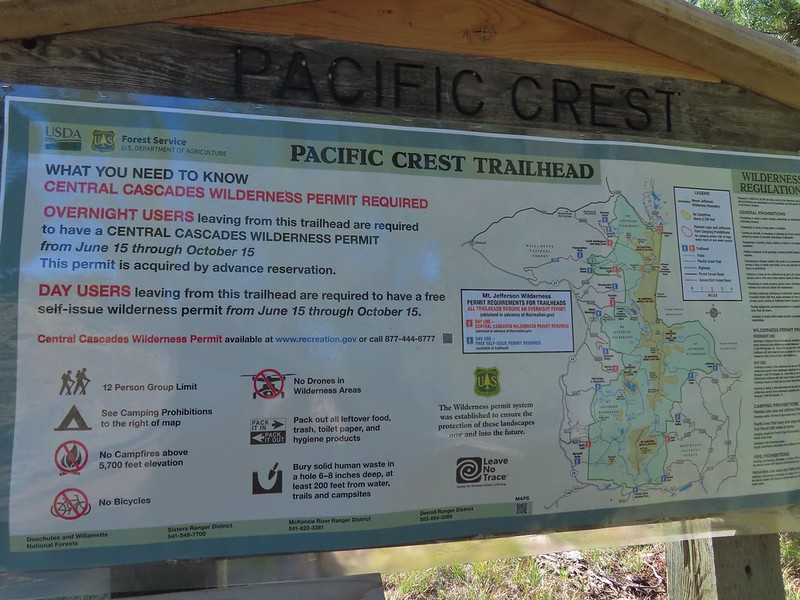
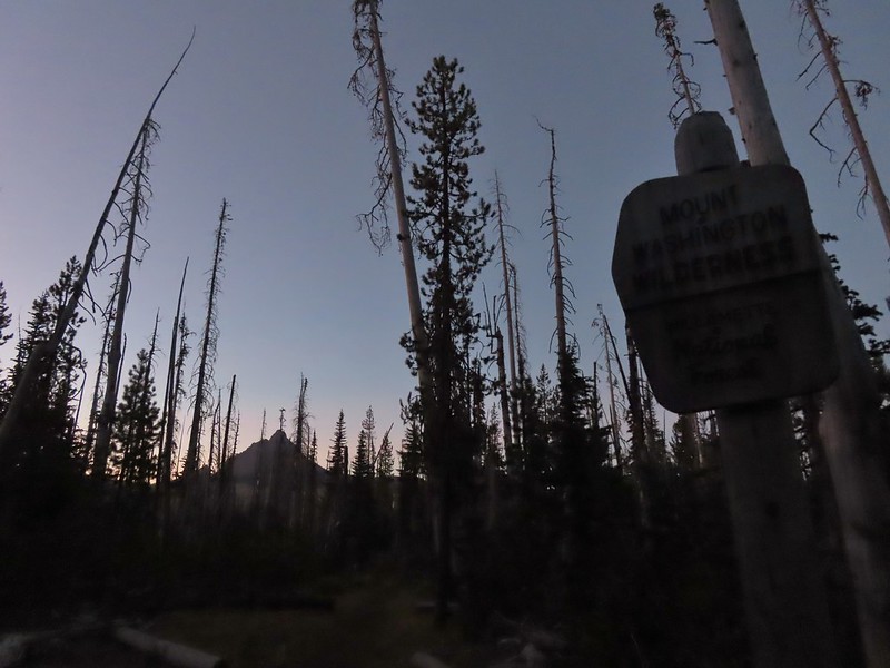
There were a few important pieces of information at the trailhead signboard.

Important information included the need of a NW Forest Pass to park at the trailhead, that there is currently a campfire ban, and no fireworks are allowed (illegal use of fireworks started the Eagle Creek Fire).
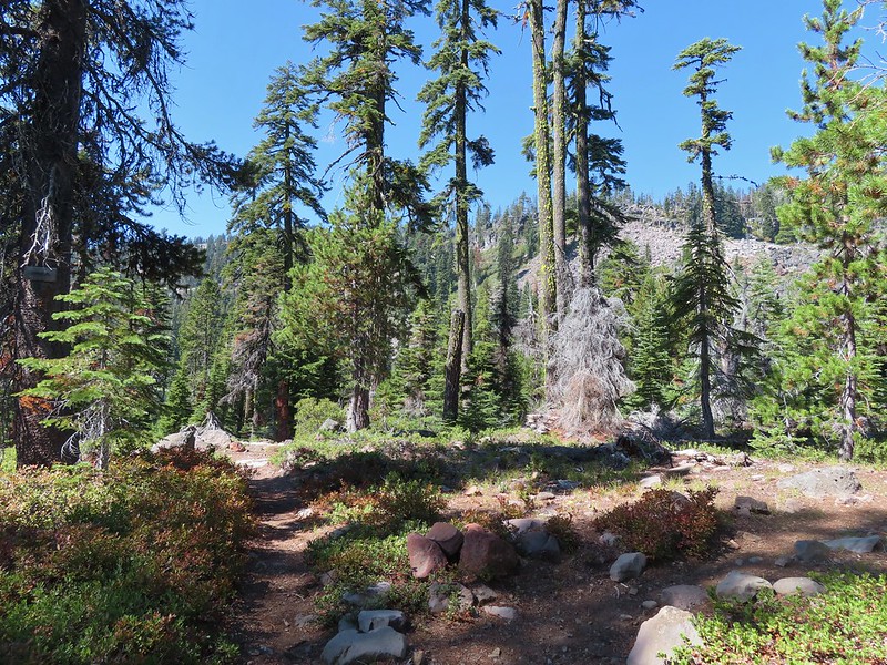
I set off on the Herman Creek Trail and followed it uphill passing under a powerline corridor to a junction with the Herman Creek Bridge Trail at the 0.6-mile mark.


I forked right onto the 1.1-mile-long Herman Creek Bridge Trail which descended to the Herman Creek Bridge then climbed to a junction with the Pacific Crest Trail (PCT).


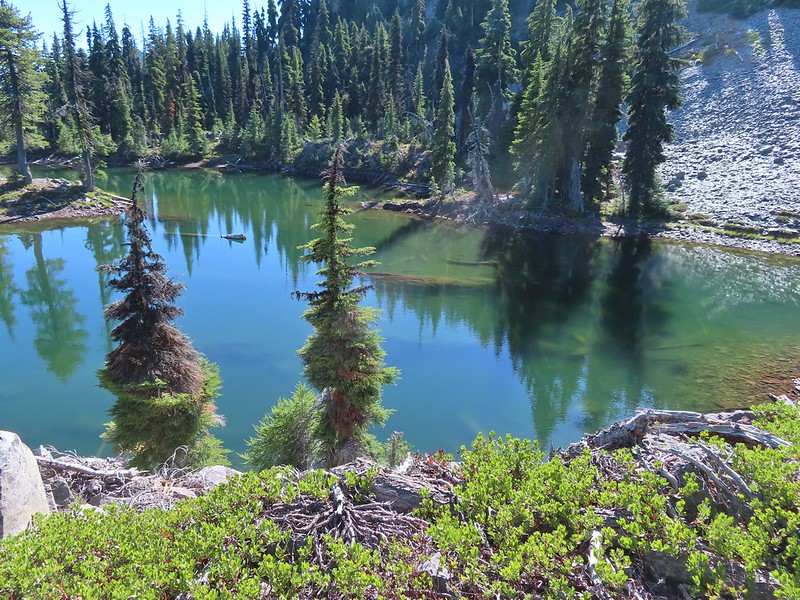
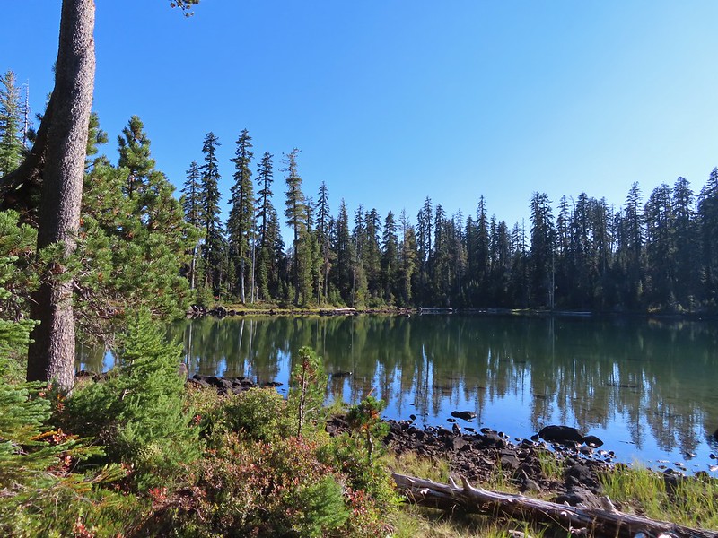
Herman Creek

Climbing toward the PCT. Note the red leaves on the left which is poison oak. There was a fair amount of poison oak along the lower portion of this hike. There were a couple of spots where I had to get small to squeeze between some of it, but I was able to avoid it by staying alert.

Beardtongue

More poison oak. With it turning red for the Fall most of it was easy to spot.

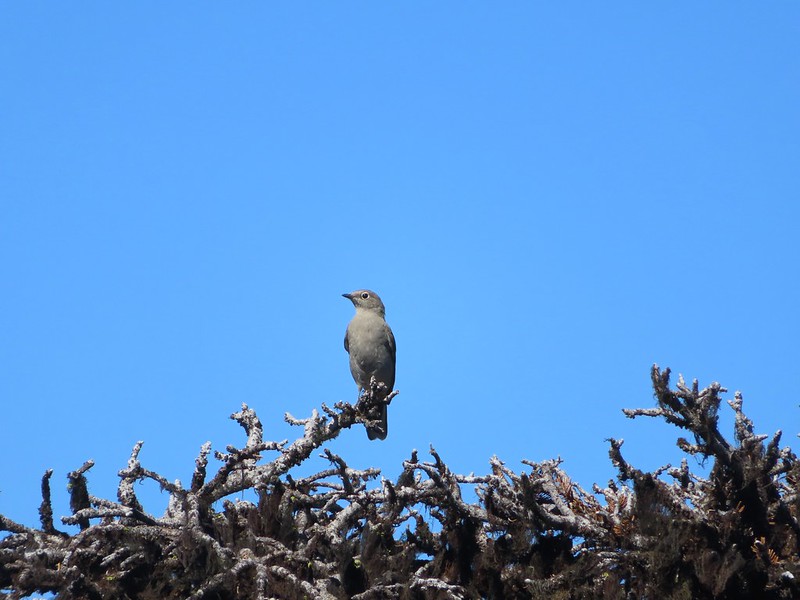
First pika sighting of the day. (Can you spot it?)

The Columbia River Gorge is the lowest elevation at which pikas live. These members of the rabbit family require temperatures below 78 degrees and primarily live at higher elevations with longer snowy seasons during which they live underground surviving on greens collected during summer months.

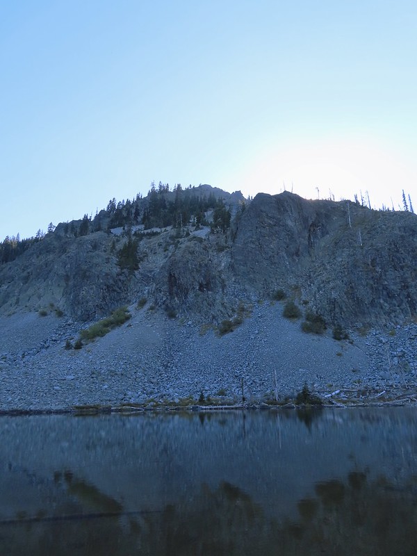
The Moon above cliffs.

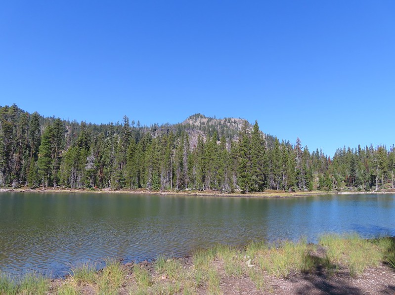
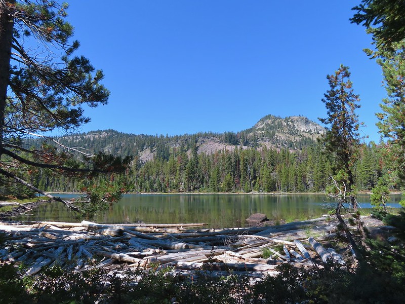
The junction with the PCT. The hike up to this point had retraced part of our 2015 to Pacific Crest Falls (post).
In 2015 we had gone right to visit the waterfall, but this time I turned left on the PCT which quickly entered the Mark O. Hatfield Wilderness.

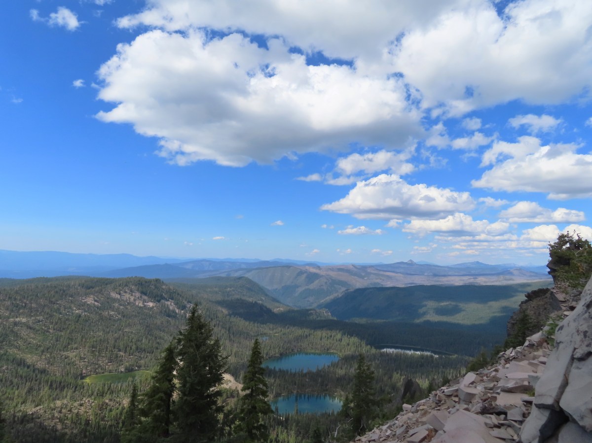
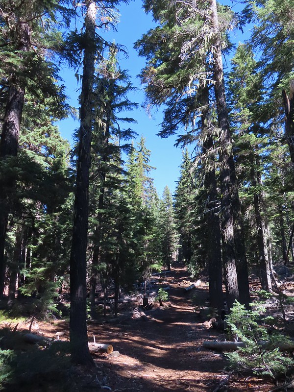
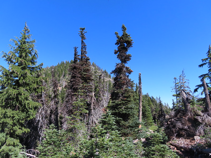
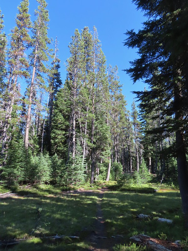
From the junction it was a nearly constant 5-mile climb to Benson Plateau. There were a couple of small saddles that provided a little up and down near the plateau but otherwise it was a steady but never steep climb.

First good viewpoint across the Columbia River.

Another pika. I heard several but only spotted three or four.

The summit of Mt. Adams peaking over the ridge across the river.

Table Mountain (post) on the left and Greenleaf Peak (post) on the right.

The amount of poison oak lessened as the trail climbed giving way to friendlier greenery.

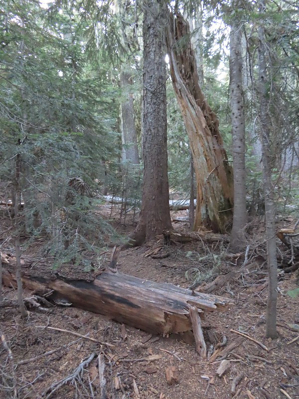
One of two large trees over the trail. This one required the removal of my pack so that I could crawl under. The other one was just enough smaller that it could be climbed over.

View along the trail.


A little more of Mt. Adams showing.

Heading into the sunlight.

Grouse on the PCT. There wound up being at least 5 or 6 grouse nearby.

Grouse in a tree.

The tree I climbed over.

There were a few overgrown sections, but fortunately they were high enough up that the poison oak was no longer an issue.

Up, up, up through the forest.

Strategic use of switchbacks helped keep the trail from being too steep.
Near the switchback above I caught a strong whiff of fire. Not smoke in the air, but the unmistakable smell of fire. It made me a little uneasy because there weren’t any nearby fires showing on the online maps I’d checked before leaving. After climbing another switchback the trail gained a ridgetop, and I discovered the source of the smell. A pair of bow hunters had set up a fire ring and built a fire right next to the trail and a tree. They had their tent, sleeping bags and gear strewn about and when they spotted me they explained they were trying to “dry out” their gear. It was obvious from their need to quickly explain why they had a fire that they knew it wasn’t okay. I didn’t feel comfortable calling them out on it so I made my way around their gear and continued on.

The ridgetop. The bow hunters were about 100 yards behind me at this point.
I continued on getting a view of Mt. St. Helens through the snags.


Another grouse. This was one of 8 to 10 that were in this area.

The cliffy Hamilton Mountain (post) on the Washington side of the gorge.

Explorer’s gentian
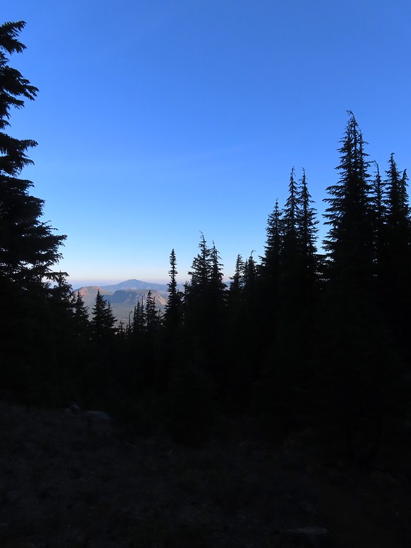
After another switchback the trail arrived at an open viewpoint.

The PCT continuing uphill.

Mt. Adams

Closer look at Mt. Adams

Mt. Hood partially hidden by trees.

Mt. Hood


Approximately a half mile from the illegal campfire I arrived at Teakettle Spring.


It was good to know that there was water available here as the only other source I’d passed was Herman Creek. I was carrying an extra Hydroflask full of water just in case, and after seeing the campfire I came up with another use for it. I decided that I would add that water to my pack bladder when I reached the plateau and then refill the Hydroflask from the spring on the way down to use on the fire pit if necessary.
The trail continued to climb beyond the spring before crossing two saddles along a ridge. In the second saddle the Benson Way Trail arrived on the right.

Beargrass along the trail is much better than poison oak.

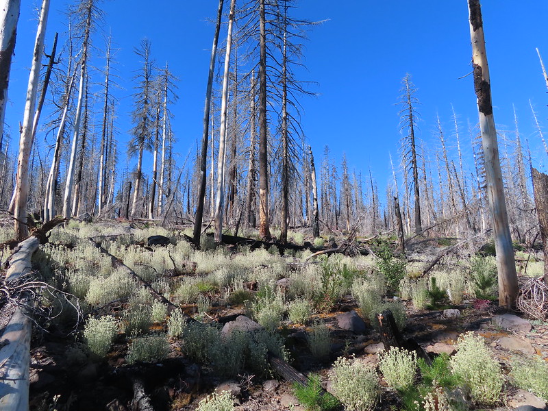
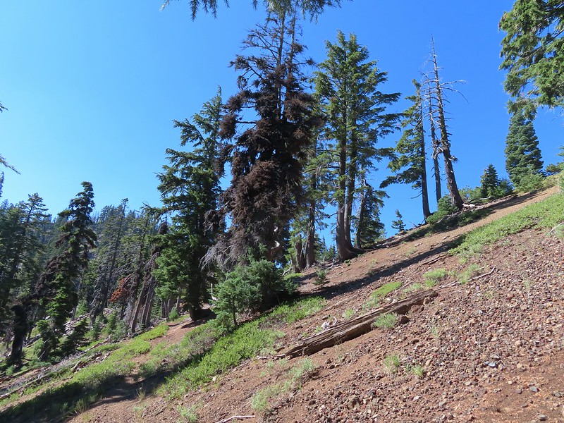
Sections of the ridge burned intensely in 2017.

Near the second saddle the trail left the 2017 fire scar, although a very small section did burn in the 2024 Whiskey Creek Fire.

The Benson Way Trail on the right.

The final climb to the Benson Plateau.
The trail eventually leveled out on the plateau.


Approximately three quarters of a mile from the Benson Way junction I passed the Benson-Ruckle Trail, again on the right.
 Trail signs for the Benson-Ruckle Trail.
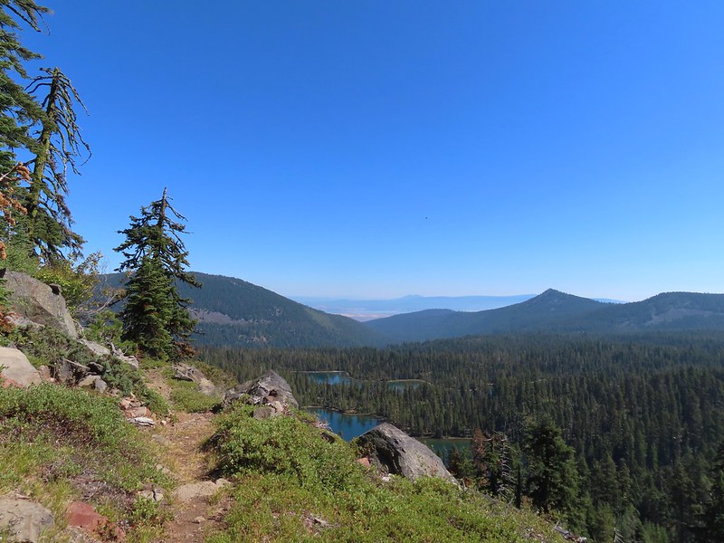
Reeder mentioned a campsite near the junction, but I didn’t see an obvious one. I continued on looking for the campsite but after a tenth of a mile I instead spotted a short use trail to a rocky viewpoint. I decided that would make for a good spot for a break.

It wasn’t a huge view, but it was nice and the rocks made for a great spot to sit down, have a snack, add the remaining Hydroflask water to my pack, and then change into dry socks.
After the break I headed back the way I’d come. It would have been possible to use the network of trail on the plateau to make a loop around it, but 14-miles was enough for me today.
I made my way back down to Teakettle Spring and refilled the Hydroflask as planned.


The hump with radio towers behind the ridge is Mt. Defiance (post).
Not long after leaving the springs I encountered the bow hunters who were standing in the trail looking at their phone. They asked me if I knew where the spring was because they were “plumb out of water”. I informed them it was about 100 yards further up the trail and continued on now wondering if they were out of water due to dousing the campfire or if they had had enough water to do that in the first place.

Approaching the best viewpoint.

Not only was Mt. Adams a little clearer but I realized the top of Mt. Rainier was visible from the viewpoint as well.

Mt. Rainier behind Red Mountain (post).

Huckleberry leaves.

Vine maple
When I arrived at the site of the fire pit I could tell that they had at least attempt to extinguish the fire.

The fire pit. In no way is this acceptable, even if fires weren’t currently banned. If it is legal to have a fire and you feel you must please follow Leave No Trace Principles.
Even though there was no visible smoke I knew that fires can easily burn underground, sometimes for days until they reach a tree or stump at which point they can reemerge above ground causing a full-on wildfire. I felt the dirt over the fire and sure enough it was still putting off heat so I exposed some of the coals and poured the Hydroflask out over them. This produced a lot of hissing so I did a little stirring and added more water from my bladder attempting to make “campfire soup”. After doing what I could with what I was carrying I marked the location with the GPS so I could report it to the Forest Service when I had the chance which I did later.
I continued down the trail and when I neared the tree that required crawling under met a pair of backpackers heading up to the plateau. I described the fire pit to them, and they indicated that they were carrying extra water and would add some if necessary.
Other than that it was an uneventful downhill until I reached the rocky hillsides where I once again had some luck spotting pikas.

This one was more than happy to pose for me for a bit.

At the end of the day my GPS read 14.2-miles with the 3800′ of elevation gain as advertised.

Despite the issue with the illegal fire this was a nice, challenging hike. There really isn’t anything that will blow you away scenery wise, but there is enough of a mix to keep it interesting. While the upper portion of the trails can get pretty snowy from November through late April/early May this would be a great training hike while waiting for the higher elevations to become snow free. Happy Trails!
Flickr: Benson Plateau


 We had also parked here in 2021 for our Barlow Butte hike (


 The colors of Fall.
 Tom, Dick, and Harry Mountain (
 Mt. Hood teased an appearance a couple of times along the lower portion of the PCT. It was enough to see that there was a dusting of fresh snow on the mountain.
 The signed junction with the Yellowjacket Trail.
 The wet brush had me whishing I’d worn boots.
 The Yellowjacket Trail passing a small meadow.
 Makeshift footbridge along the trail.


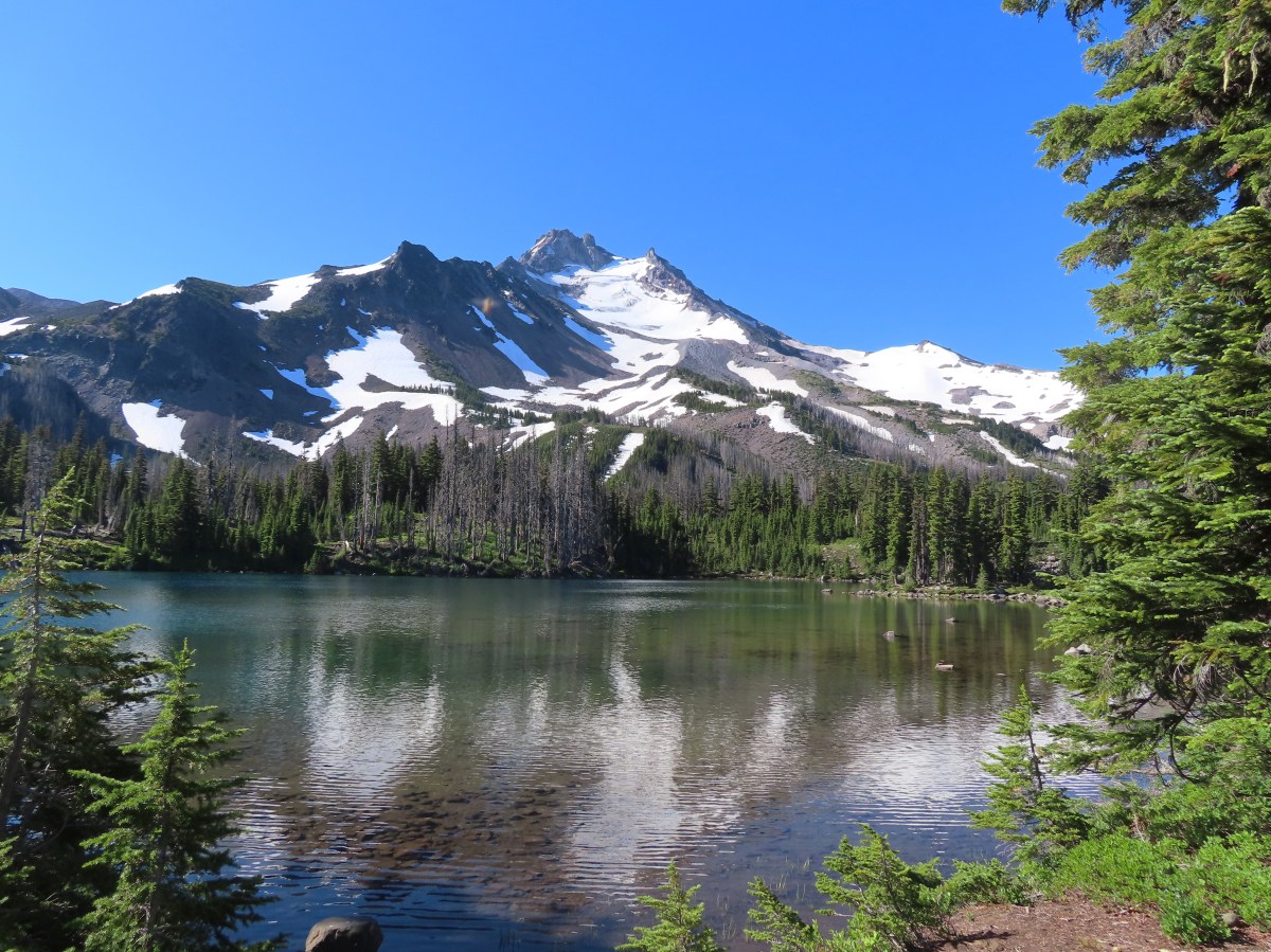
 New snow on Mt. Hood.
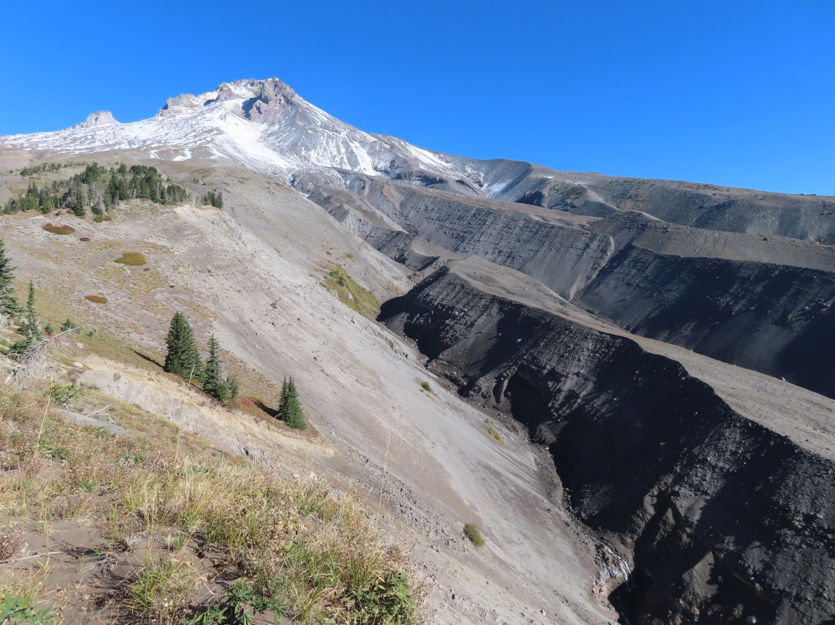
 The valley is the result of an eruption around 250 years ago.
 Pacific lupine
 At the end of the levee the route climbed a moraine then continued its gradual ascent to the Timberline Trail.
 Dark-eyed junco. There was a good variety of birds along the moraine, but this was the only one that sat still long enough to have its picture taken.
 Frost on a log. It was really nice to be hiking in the crisp cool air.
 Boy Scout Ridge from the moraine.
 The unsigned junction with the Timberline Trail.
 Mt. Hood from the junction.
 Sign for the PCT nearly absorbed by the tree.
 Lupine (broadleaf?)
 A few remaining blooms on the goldenrod.
 Signpost at the PCT junction ahead.


 The coyote with Mt. Hood looming behind.
 Mt. Jefferson to the south with the Three Sisters behind to the left.
 The Three Sisters and Mt. Jefferson
 The round peak along the far ridge is Gunsight Butte (
 We’d lost sight of the coyote until it ran across the trail not too far in front of us.
 More lupine
 A few remaining aster blossoms in the foreground.
 Timberline Lodge across the Salmon River Canyon.
 Looking back down the White River Valley. Barlow Ridge is the near hump on the right.
 Another look at Timberline Lodge.
 Despite all the cars at the lodge we would only encounter a half dozen other trail users until we were back at the Barlow Pass Trailhead.
 Small waterfall below the ridge.
 I turned around here where the Timberline Trail headed across the Salmon River drainage. The Silcox Hut is straight ahead on the side of the mountain.
 Looking back at the high point where Heather had stopped.
 Mt. Hood’s summit.
 The waterfall looking pretty small far below the mountain.
 It took us a moment to decide what the dark rounded peak straight ahead in the distance was. We eventually correctly identified it as Black Butte (
 Olallie Butte (
 Birds on mountain ash.
 The Timberline Trail junction.
 Beargrass meadow, there hadn’t been any blooms this year.
 Lousewort
 It was nearly 2-miles between the Timberline and Yellowjacket trail junctions.
 We were shocked to see a bunchberry that still had some petals, even if they were in sad shape.
 Mushrooms and fungi are not surprising this time of year.
 Highway 35
 Arriving at the Barlow Road.
 Our various hikes around the mountain. There are still a few areas where we could add a track or two. Happy Trails!

 Another reminder that overnight permits are required in the wilderness.
 Low clouds in the valley.
 Mt. Jefferson through some of the snags with a few surviving trees on the right.
 Mt. Jefferson from the junction, note the rock cairn on the left marking the PCT.
 The cairn at the junction.
 Triangulation Peak (
 Whitewater Lake
 Triangulation Point and Bocca Cave (Trailheads still closed.)
 Tarn 0.3-miles from the junction.
 Mt. Jefferson reflecting in the tarn.
 Ducks on the tarn.
 The Sentinel Hills with Park Butte behind to the right. The Whitewater Trail (
 The fires did open up fairly consistent views of the mountain.
 A few remaining penstemon blossoms.
 Heading down to the Russell Creek crossing.
 This can be a tricky crossing at times, but there was a makeshift bridge which made it fairly easy this time.
 Aster and pearly everlasting near the creek.
 We started seeing more trees that had survived the fire as we got closer to Jefferson Park.
 Gentians and aster
 Grass-of-parnassus
 There were patches of burned forest along this stretch.
 Approximately 0.4-miles from the junction the trail crosses Whitewater Creek.
 From the other side of Whitewater Creek the views of Mt. Jefferson are amazing.
 Based on the barred sides I believe this is a black-backed woodpecker.
 Unofficial use trails are an issue in Jefferson Park which has prompted the Forest Service to install a number of “Closed for Rehabilitation” sign such as the one on the left side of the trail.
 They’ve also added quite a few signs to indicated sanctioned trails. Typically in wilderness areas the Forest Service tries to keep signage to a minimum, but overuse has led them to add additional signs.
 Another sign with Park Butte in background.
 The last of the pointers for Scout Lake.
 PCT heading for Park Butte and Park Ridge.
 Russell Lake pointer.
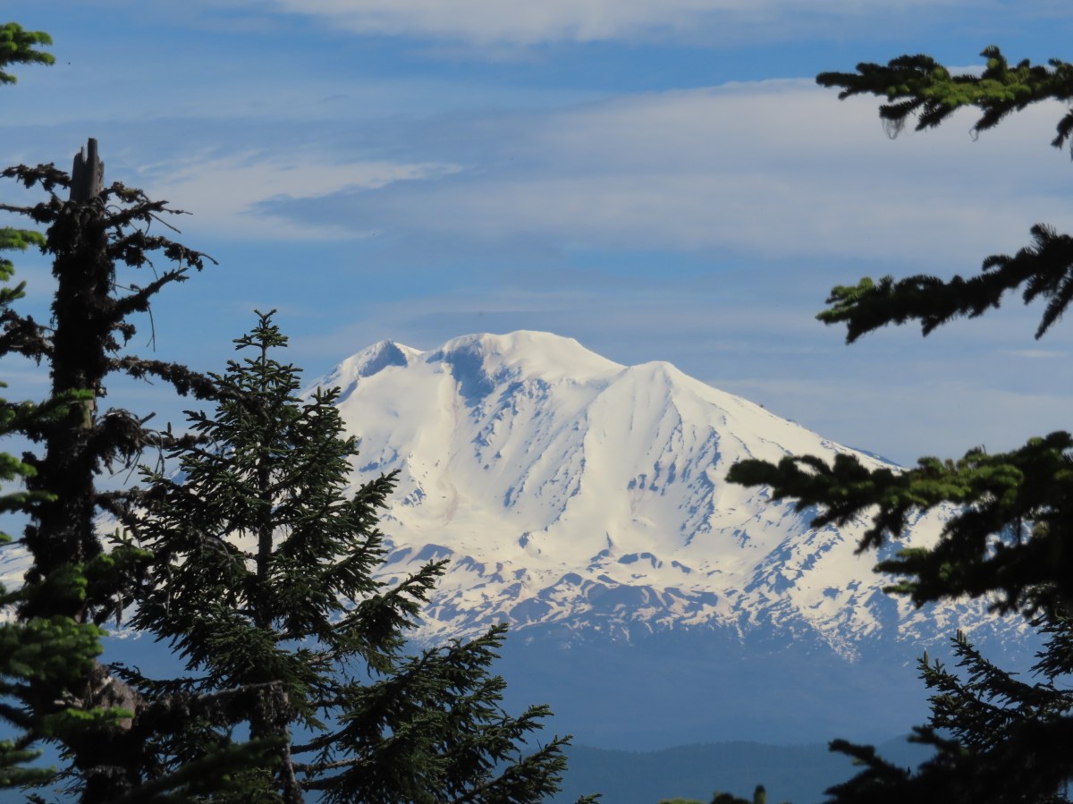
 Looking down at the pullout from the PCT on the way back.


 Phantom orchid
 Spotted coralroot
 Finetooth beardtongue
 Mt. Hood through a window in the trees.
 Finetooth beardtongue along the trail.
 White spiraea
 Bluehead gilia
 Paintbrush
 Some yellow balsamroot along the trail.
 Columbine
 Inside-out flower
 Queen’s cup
 Bunchberry
 Vanilla leaf
 Arnica
 Approaching the landslide area.
 Starting at the green up to the left is Augspurger Mountain (
 Mt. Hood from the viewpoint.
 Lomatium, bluehead gilia, and arrowleaf buckwheat in the bowl.
 Honeysuckle


 Wild onion mixed in with bluehead gilia.
 Bluehead gilia
 Lupine
 Catchfly
 Arnica and beargrass in the forest.
 Nearing one of the little meadows.

 Sub-alpine mariposa lilies
 Bluehead gilia
 Sub-alpine mariposa lilies
 A closer look shows why these are also known as cat’s ear lilies.
 Buckwheat
 Onion
Onion
 Bastard toadflax behind a cat’s ear lily.
 Rosy pussytoes
 Yarrow
 Looking back from the meadow.
 I believe these are some type of microseris.
 Boundary sign for the
  Broadleaf arnica
 Star-flowered false solomonseal
 The Cedar Creek Trail coming up from the right.
 Anemones
 Wallflower
 White groundsel
 Cliff beardtongue
 Cliff beardtongue
 Wild rose
 Larkspur
 Mt. Hood from the viewpoint.
 Spotted coralroot
 Oregon sunshine and wild onions
 Chickweed
 Arriving at another small clearing with flowers.
 Phlox, penstemon, lomatium, onion, and mariposa lilies.
 Another little meadow.
 Larkspur and balsamroot
 This was the only time we spotted Mt. St. Helens on the hike.


 Mt. Adams from the former lookout site.
 There was a lot of phlox in bloom.
 Table Mountain (
 Mt. Hood
 Mt. Hood with Mt. Jefferson behind to the right.
 Balsamroot and groundsel
 Mt. Adams
 Phlox
Phlox
 Paintbrush and cliff beardtongue
 Another view of Mt. Hood.

 Sandwort
 Chickweed
 Balsamroot
 Some of the smaller flowers present on the summit.
 Finetooth beardtongue
 Wallflower
 Wild onion
 The end of the ridge is about three quarters of a mile from the lookout site.
 Heather on the outcrop.
 Painted lady
 Larkspur
 Swallowtail
 Chickweed in some phlox.

 Wallflower
 Colubmine
 Bluehead gilia
 Beargrass along the PCT.
 Heading down to the trailhead.
 Sevenmile Marsh Trailhead
 Sevenmile Creek
 Entering the wilderness
 Sevenmile Marsh
 Lodgepole pines were the dominate trees along the first part of the trail.
 Mountain hemlock took over as the trail gained elevation.
 Junction with the PCT.
 There were a few downed trees along this section but nothing difficult to get around.
 This twisted tree caught our attention.
 Nice blue sky.
 Lewis’s woodpecker way up in a snag.
 Tadpoles
 Frog in the water.
 Trail sign ahead on the right.
 Unnamed creek along the PCT. We were surprised at how many of the seasonal creeks still had flowing water.
 Grass-of-parnassus
 Huckleberries, there were a lot of these around the basin which we happily sampled.
 Devil’s Peak poking up above the trees.
 The Cliff Lake Trail.
 Prince’s pine
 Another flowing seasonal creek.
 Crater Lake collomia (Collomia mazama)
 The Seven Lakes Trail arriving on the right.
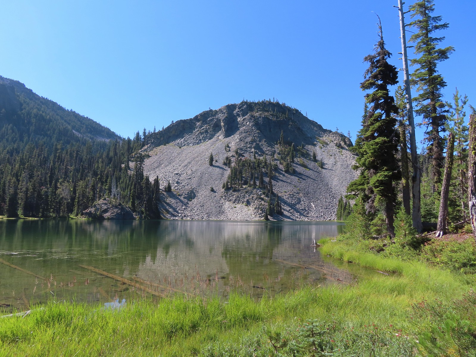 Cliff Lake
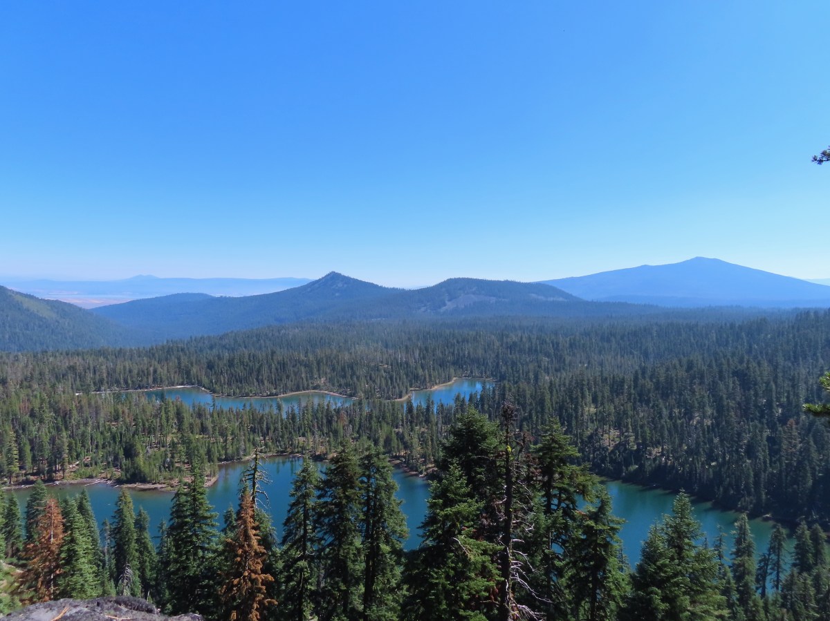
 Arnica
 Aster
Aster
 Splash in Cliff Lake from one of many fish that were feeding on insects.
 Camp
Camp Huckleberry bushes along the Cliff Lake Trail.
 Anywhere there was water nearby there were lots of tiny Cascade toads to watch out for.
 Back at the PCT.
 Larger frog
 Monkshood
 More grass-of-parnassus
 Not only were the toads tiny, they also were well camouflaged.
 Mount Scott (
 Mount Scott
 The Watchman (
 The Watchman and Hillman Peak
 Devil’s Peak
 Union Peak (
 Cliff Lake with Violet Hill beyond.
 Black backed woodpecker
 Getting closer to Devil’s Peak.
 A much bigger Cascade toad.


 Mt. Thielsen (
 Union Peak with Mt. Bailey (
 Lots of neat rock formation on Devil’s Peak.
 Western pasque flower seed heads.
 Buckwheat
 Views to the South opened up at the pass including Klamath Lake and Pelican Butte.
 Klamath Lake
 Devil’s Peak and the PCT coming up to the pass from the North.
 Klamath Lake, Pelican Butte, Aspen Butte (
 Mt. McLoughlin
 A faint Mt. Shasta which, given the wildfires burning in NW California was a bit of a surprise to be able to see.
 The view North.
 Goose Egg and Ethel Mountain in the forefront with Llao Rock, Mt. Thielsen, and Garfield Peak (
 Devil’s Peak
 We were a little concerned at first that it might be picking up water for a new fire but there wasn’t anything hanging from the helicopter so we have no idea what it was actually doing.
 The use path to Devil’s Peak on the right and the PCT on the left.
 The rather ominously named Lucifer from the use trail.
 A second use trail coming up from the opposite side.
 Western pasque flowers on the hillside above the use trails.
 The summit of Devil’s Peak ahead.
 Looking North toward Crater Lake and Mt. Thielsen
 Lucifer, Jupiter, and Venus
 Lee Peak above the pass.
 Luther Mountain (
 Remains of a former lookout.
 The PCT below Devil’s and Lee Peaks.
 Goose Egg, Llao Rock, and Mt. Thielsen
 Mt. Scott
 Mt. Shasta to South through a little smoke but again we felt fortunate to be able to see the mountain at all.
 Colorful grasshopper at the summit.
 American pipit
 The Seven Lakes Basin from the use trail down.
 South, Middle, North, and Grass Lakes
 Heading down the use trail.
 Looking back up the use trail.
 Western snakeroot along the PCT.
 A comma butterfly on western snakeroot.
 Painted lady
 Venus from the Devil’s Peak Trail.
 Looking back at Devil’s Peak.
 Looking North across the Seven Lakes Basin.
 Lake Alta in a bowl below Violet Hill.
 Pond along the Devil’s Peak Trail.
 Coming up to the Seven Lakes Trail junction. A rock cairn was the only marker.


 I was still only about halfway along the lake after the quarter mile. There used to be a campground at the North end.
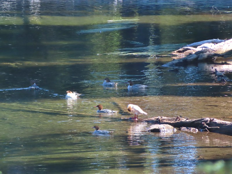
 Common merganser
 The southern end of Lake Alta.
 Cliff Lake below Devil’s Peak and Middle Lake.
 Middle and Grass Lakes
 I could hear several pikas in the rocks below the cliffs but the only thing I spotted was a chipmunk.
 Chipmunk
 Sulphur butterfly on aster.
 Gentian
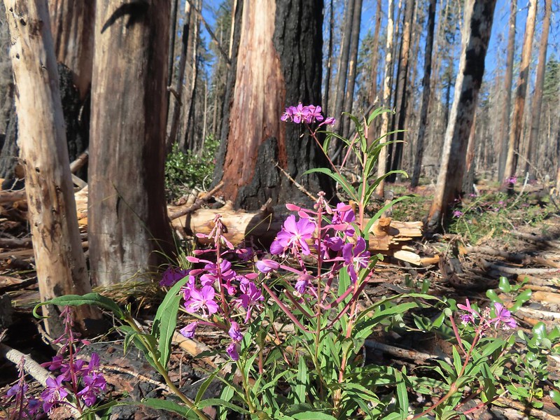
 Fireweed
 South Lake
 Devil’s Peak from the trail. There were more pikas “meeping” from the rocks here but again we failed to spot any of them.

 Devil’s Peak in the evening.
 So many fish in the evening.
 Devil’s Peak in the morning.
 Seven Lakes and Cliff Lake Trail junction.

 We detoured left at the northern end of the lake following a pointer for Lake Ivern to find a view back across Middle Lake.
 Devil’s Peak from Middle Lake.
 Stream crossing.
 Monkshood and grass-of-parnassus
 Grass Lake
 Arriving at the PCT.

 Golden-mantled ground squirrel
 Sevenmile Trail at the PCT to return to the Sevenmile Marsh Trailhead.
 Exiting the Sky Lakes Wilderness.

 Mount Washington from the
  Three Fingered Jack to the North from the PCT.
 From left to right – Sand Mountain (
 Mount Washington
 Sunrise on Hoodoo Butte.
 Sunlight hitting the spire of Mount Washington.
 Hayrick Butte and Three Fingered Jack at sunrise.
 Big Lake, Hoodoo, Hayrick Butte, and Three Fingered Jack.
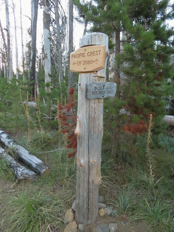 Just over two miles from the trailhead I passed a sign for the non-maintained use trail from the private
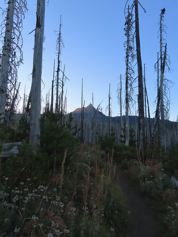
 Shortly before reaching the climbers trail the PCT left the 2011 Shadow Lake Fire scar.
 The cairn and climbers trail from the PCT.
 Huckleberry leaves turning color.

 There were a few logs to navigate and keeping an eye on the tread was helpful.
 Maxwell Butte (
 Mount Washington
 The only movement that I could see was when it tilted its tail feathers which would catch the sunlight.
 First view of Mt. Jefferson behind Three Fingered Jack.
 Coming up on the ridge.
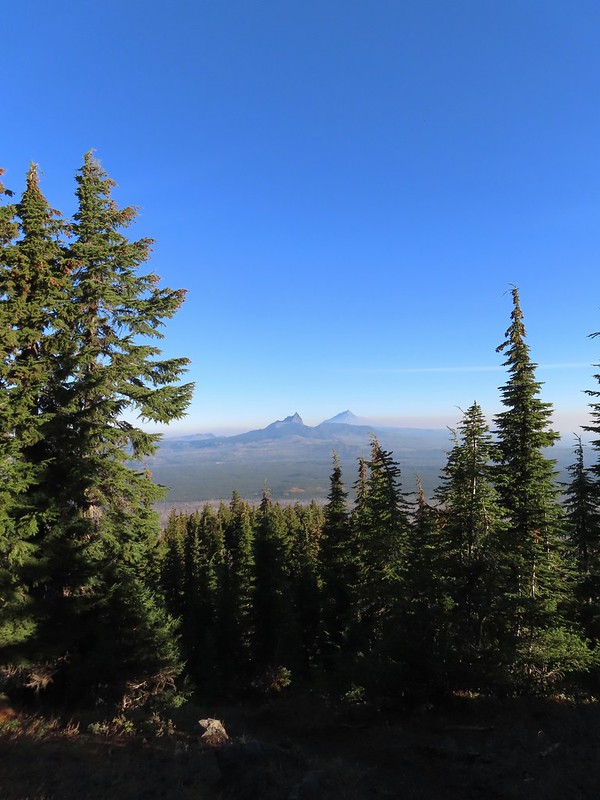 Three Fingered Jack, Mt. Jefferson, and a lot of smoke to the North.
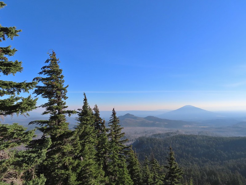 Cache Mountain and Black Butte (
 View along the ridge to Mount Washington.
 That East wind was really noticeable as I made my way along the open ridge crest.
 Three Fingered Jack and Mt. Jefferson to the left. Green Ridge (
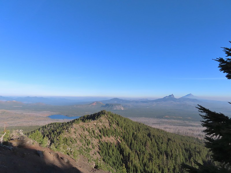 Big Lake came into view as I climbed.
 One of the steeper sections I went up. The spire is poking up on the right.
 Mount Washington’s shadow.
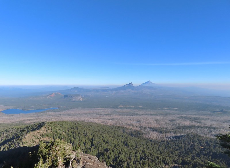 View back down the ridge.
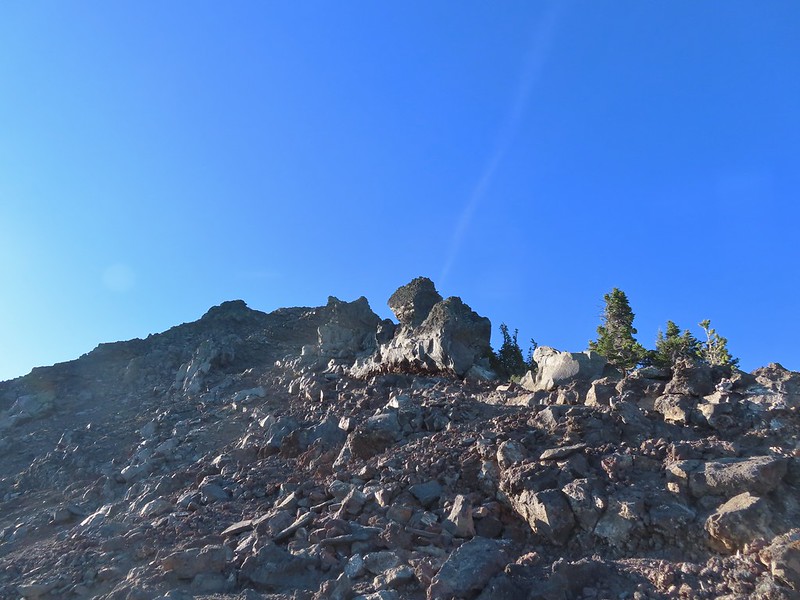 I was hoping to get up and over these rocks where the map showed a more level bench but I wound up reaching a chute where I was unsure of the correct route. The further up I’d gone the more braided the trail became and I may have been too far left. A climber had passed me way back on the PCT but if I had been able to watch him go up here I may have found a better route.
 The chute that turned me back. It’s a bit hidden by the rocks in the foreground but there was no way across that I would have been comfortable with and scrambling up looked way too sketchy for my taste (especially w/o a helmet).
 My shadow on the left from my break spot.
 This was the place I’d come up.
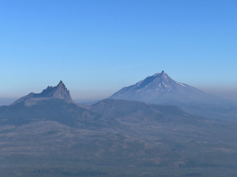 Zoom of Three Fingered Jack and Mt. Jefferson
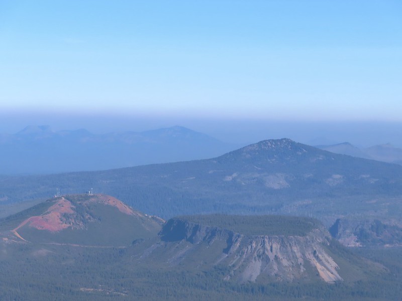 With all the smoke I hadn’t noticed Coffin (flat top) and Bachelor Mountains (
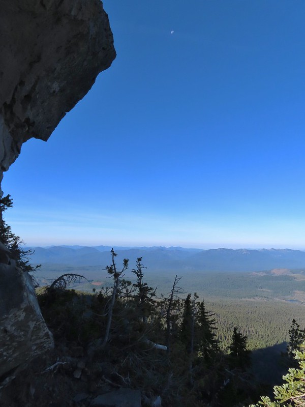 The Moon overhead to the West.
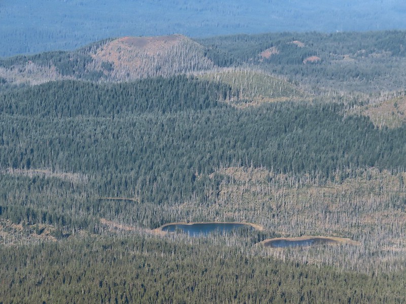 Patjens Lakes (
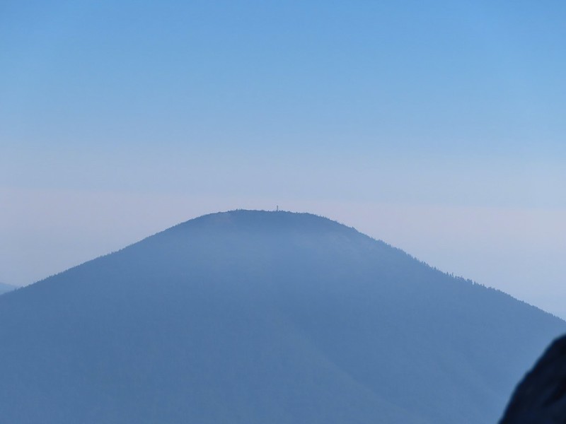 Lookout tower on Black Butte.
 Unfortunate that my timing once again put the Sun directly in line with my view.
 Using a tree to try and get a better view.
 A framed Mt. Jefferson.
 Sometimes it’s the little things, like these bent trees that I really appreciate on a hike.
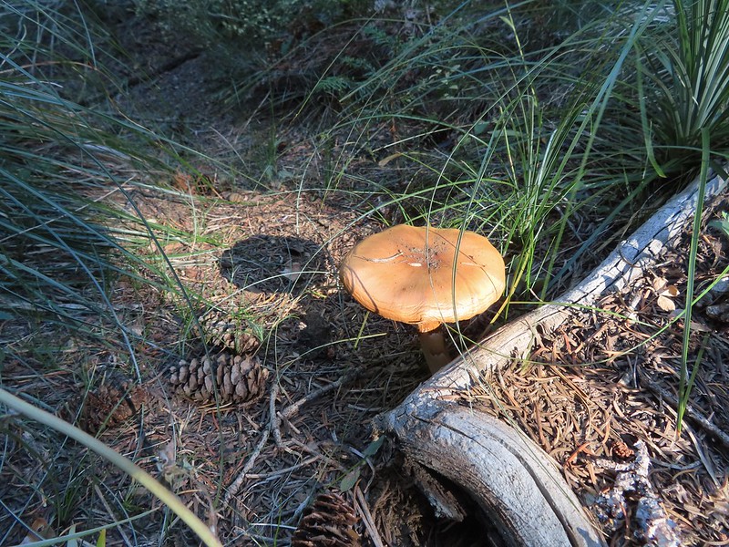 This mushroom casting a shadow was another one.

 Looking back at Mount Washington from the PCT.
 Three Fingered Jack
 Hoodoo and Hayrick Buttes behind Big Lake.
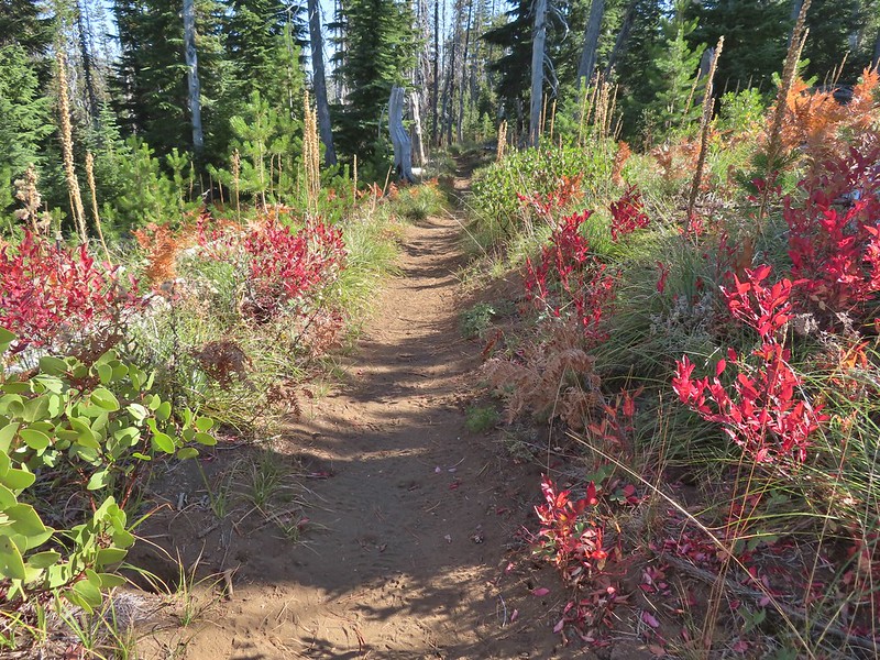 Huckleberry bushes and ferns adding some Fall colors.
 The best Fall colors were near the trailhead.
 The trailhead from the wilderness boundary sign.

 Shelter at the trailhead.

 Aster
Aster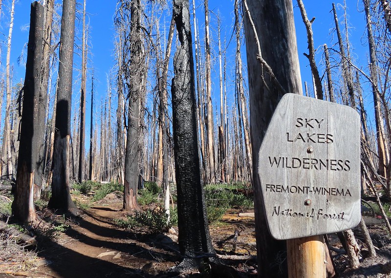
 Fireweed

 Comma butterfly
 Exiting the fire scar.
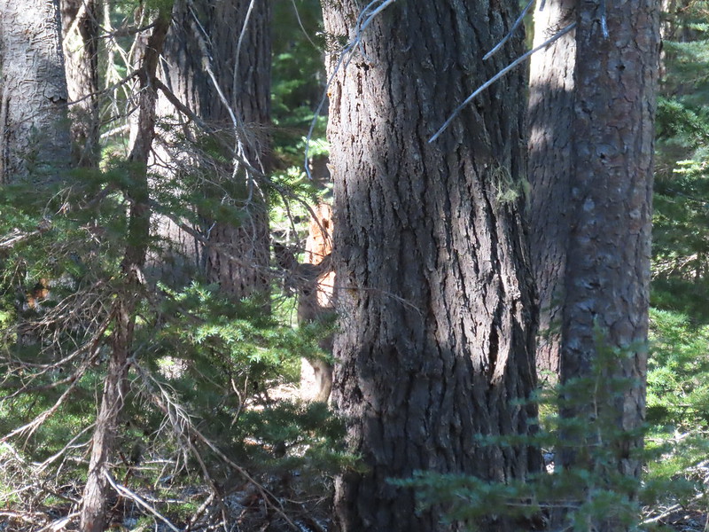 Doe watching us through the trees.


 Luther Mountain on the left and Lee Peak on the right.
 Sign for the Sky Lakes Trail.
 Isherwood Trail junction.
 Lake Land
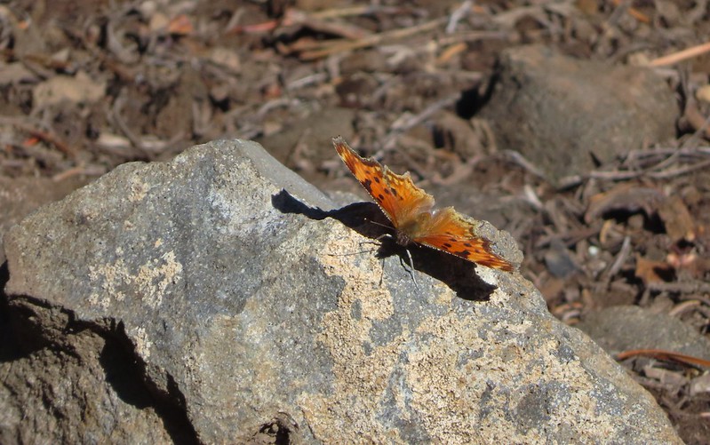

 Luther Mountain from Trapper Lake.
 View along the trail.
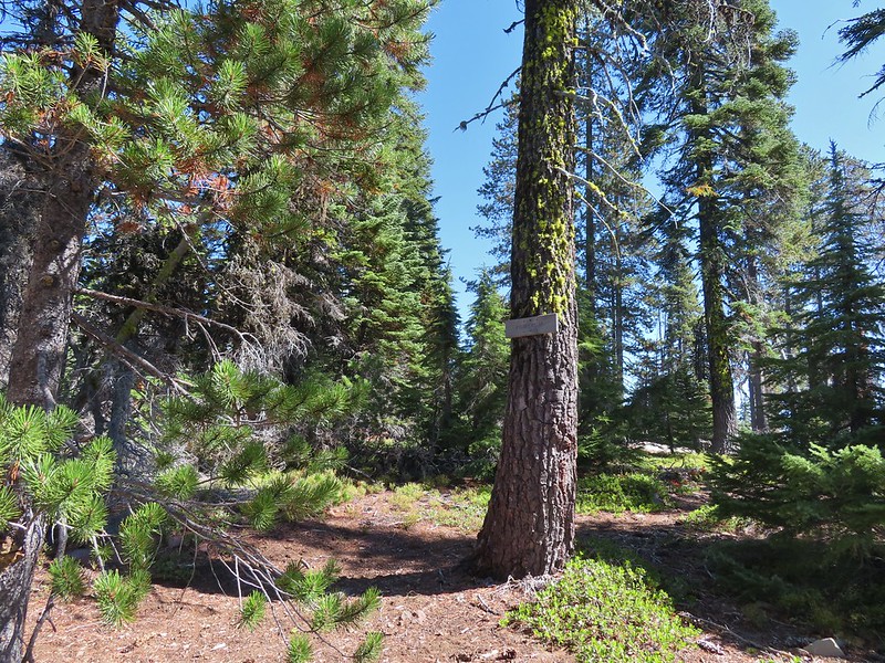 Sign for the Cherry Creek Trail.
 Sky Lakes Trail sign.
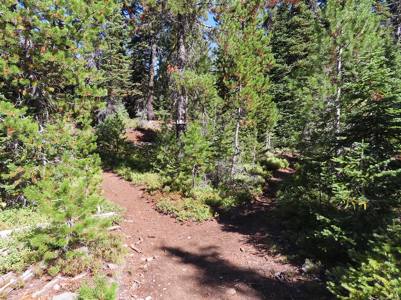 Donna Lake Trail to the right.
 Divide Trail junction.


 Saddle Mountain is in the distance with pointy Cherry Peak in the foreground. I believe that is Agency Lake visible in the Valley.
 Pelican Butte to the right.
 Mt. McLoughlin (
 Eagle flyby.
 Lather Peak with several more lakes below.
 In the distance to the left is Aspen Butte (
 Fall is in the air.
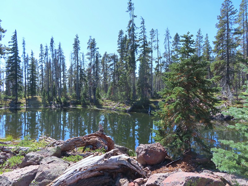 On of several small bodies of water along the shelf.
 We know there were pikas out there because we heard their “meeps” off and on all day but with so many rocks we were never able to spot one.
 Heading toward Luther Mountain.
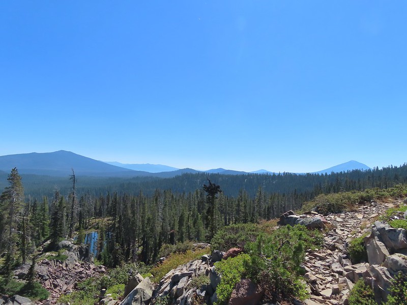 Pelican Butte on the left and Mt. McLoughlin on the right. The peaks in the Mountain Lakes Wilderness are behind and to the right of Pelican Butte then the small, closer hump is Imagination Peak. To the right of Imagination Peak and slightly further back is Lost Peak and then further to the right (left of Mt. McLoughlin) is Brown Mountain (

 Luther Mountain from the saddle.
 The Pacific Crest Trail.
 Lucifer Peak directly behind Shale Butte.
 Lucifer Peak, Shale Butte, Devil’s Peak and Lee Peak.
 Blowdown on the PCT.
 Luther Mountain
 Luther Mountain and Mt. McLoughlin behind us.
 Lots of little birds along the ridge but most didn’t stop long enough for even a poor picture.
 Sign at the Snow Lakes Trail junction.
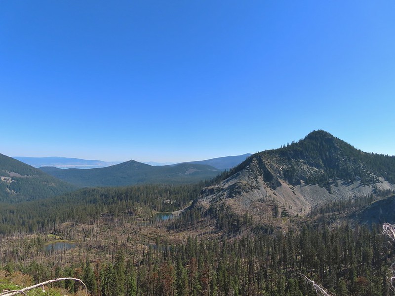 Martin, Wind and a Snow Lake from the Snow Lakes Trail.
 Hawk circling overhead.
 While I was trying to keep track of the hawk this Bald Eagle flew over.
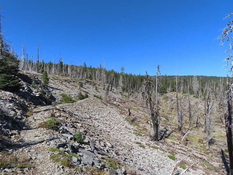 Nearing the end of the 2014 fire scar.
 Luther Mountain from one of the Snow Lakes.
 Another of the lakes.
 Tree on the edge of the shelf.
 View from the shelf.
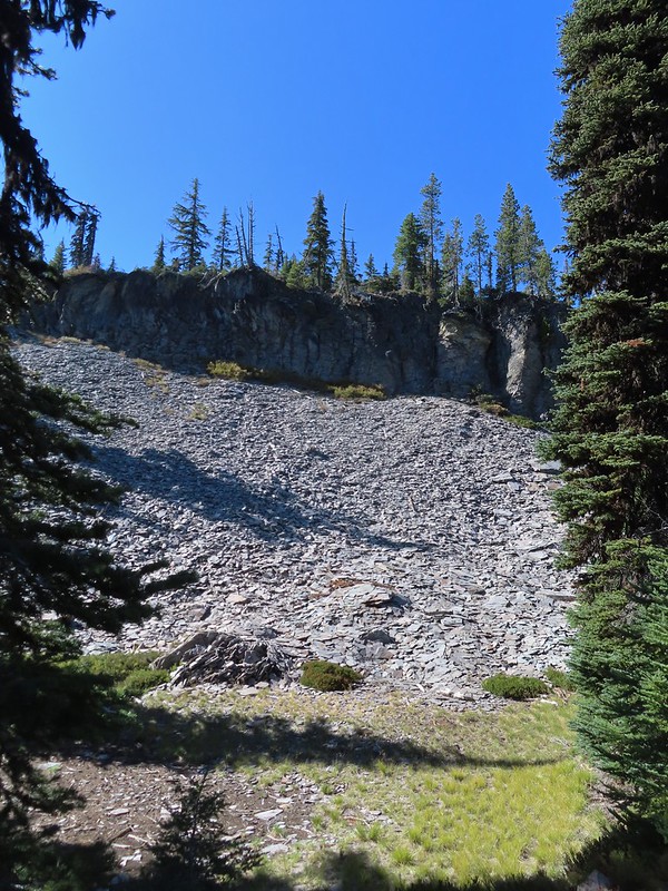 There were many cool rock features along the trail.
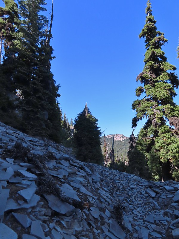 Devil’s Peak
 Lee Peak and another of the Snow Lakes.
 A tree had fallen over the Snow Lakes Trail hiding it right where a use trail veered off to the lake. Only seeing the use trail we followed it along the lake until it petered out. A quick look at the map showed we were off-trail so we made our way back finding the downed tree covering the actual trail.
 The worst obstacle for the day.
 Pelican Butte from the trail.
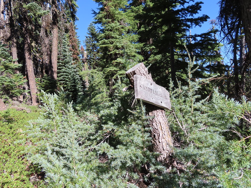 Sign at the Nannie Creek Trail junction.
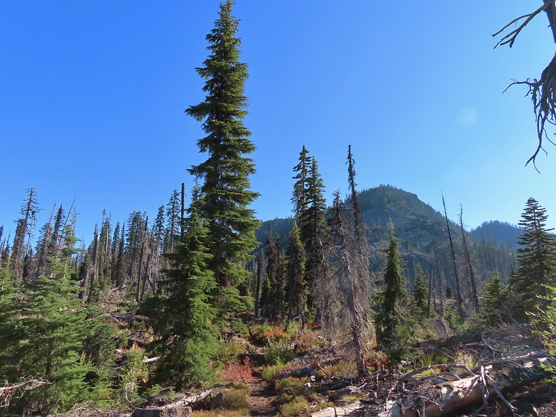 Luther Mountain as we neared Martin Lake.
 Dragon fly blending in with the huckleberry leaves.
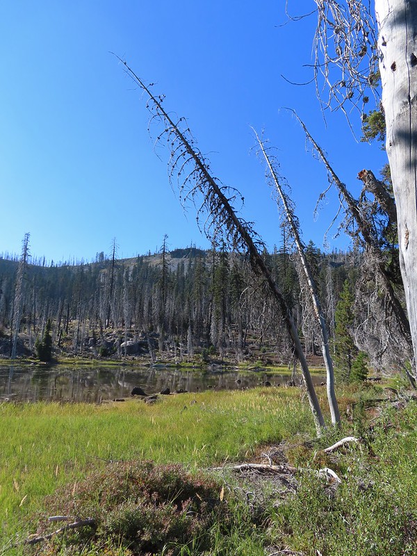 Martin Lake with a view of the shelf that we’d been on.
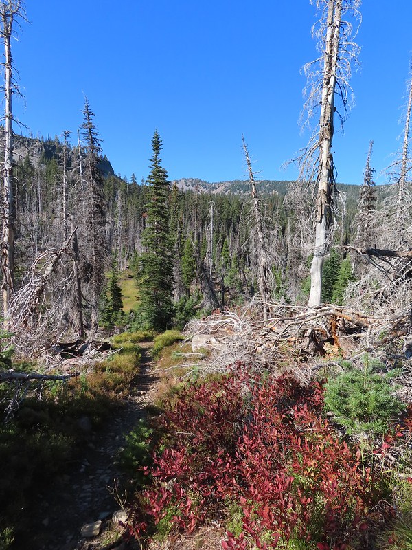 Red huckleberry leaves


 Deep Lake was up first, just a tenth of a mile down the trail.
 Donna Lake was only two tenths further.
 Donna Lake Trail
 Back at Trapper Lake.
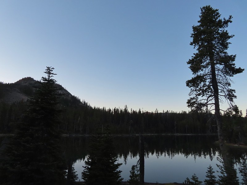