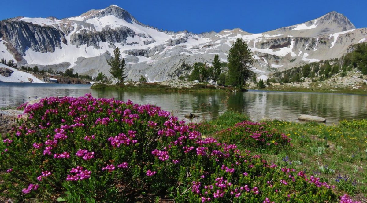
Back in 2016 we set a goal for ourselves to hike all 500 featured hikes in William L. Sullivan’s “100 Hikes…” series of guidebooks post. In 2020 we completed the first of these books covering the Central Oregon Cascades (post). We followed that up by completing a pair of books in 2021 starting with Sullivan’s “100 Hikes/Travel Guide Oregon Coast and Coast Range” 3rd edition (post) followed up by “100 HIkes/Travel Guide Northwest Oregon & Southwest Washington” 4th edition (post). Southern Oregon & Northern California was completed in 2023 leaving us with Eastern Oregon.
In 2023 we pivoted from the 3rd edition of Sullivan’s “100 Hikes/Travel Guide Eastern Oregon” to his renamed 2022 1st edition “100 Hikes Eastern Oregon” book. This was to avoid needing to make the tedious drive on horrible roads to Dug Bar in Hells Canyon which had been replaced as a featured hike in the newer edition.
The criteria for checking a hike off our list is to hike a portion of Sullivan’s described hike or, at least visit the main attraction(s) he identifies for the hike. For 67 of the hikes we completed the books described route. For the other 33 hikes various factors contributed to us not completing every option of each featured hike. For some we started at a different trailhead, others had portions of trail(s) closed when we visited, and several had additional options that we did not do.
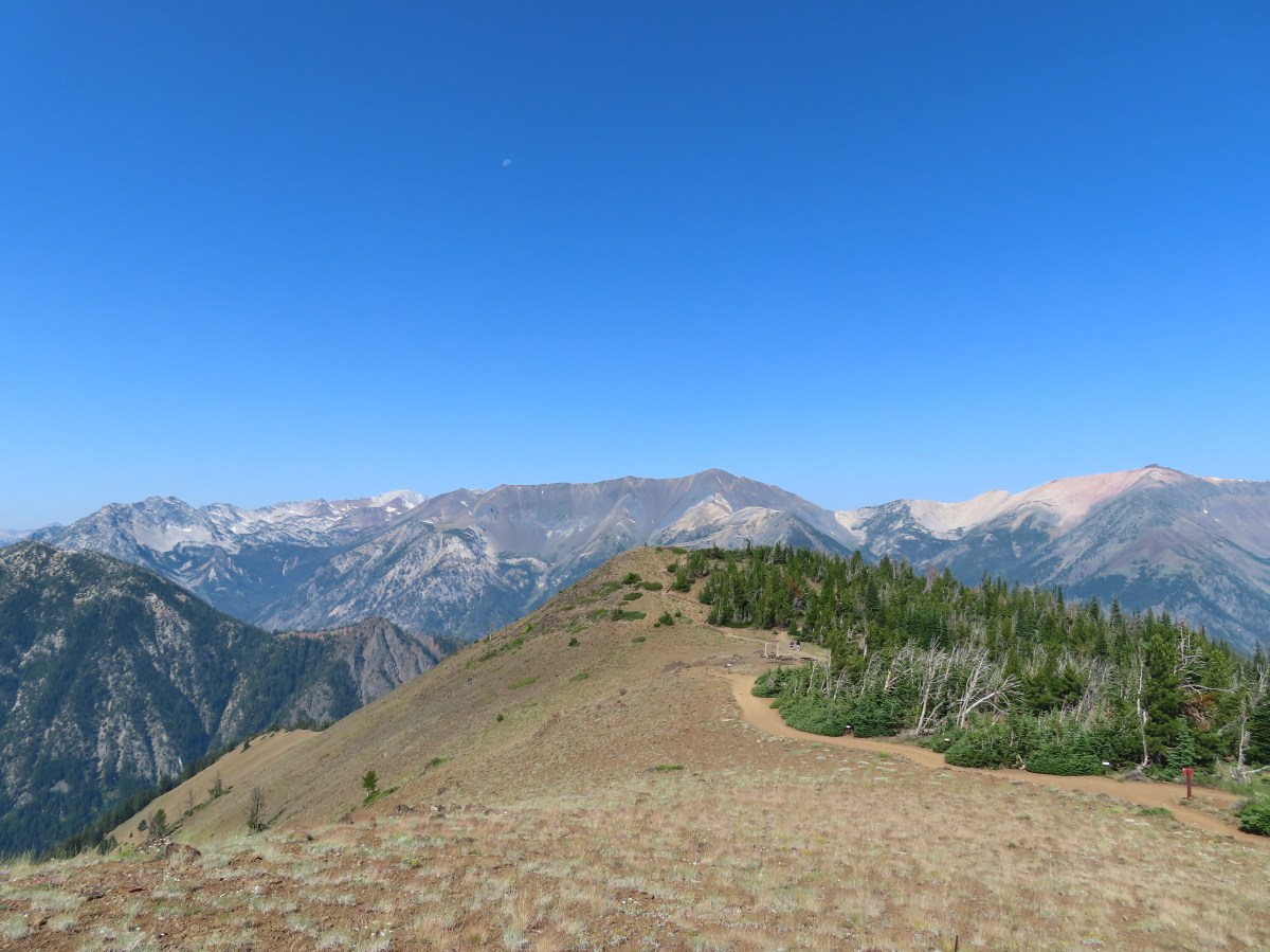
Of the five regions Sullivan breaks his guidebooks into, the Eastern Oregon region is the largest and most diverse. The area covered in this book includes hikes in Oregon east of the Deschutes River in Central Oregon and from Klamath Falls (western most hike) east to the Idaho border. There is however one hike in Washington west of the Deschutes across the Columbia River from The Dalles, OR. It also includes one short option in Idaho (eastern most), one featured hike in California (southern most) making it his only book with hikes in more than two different States. The northern most hike is not the one in Washington. That honor belongs to the Wenaha River near Troy in NE Oregon.

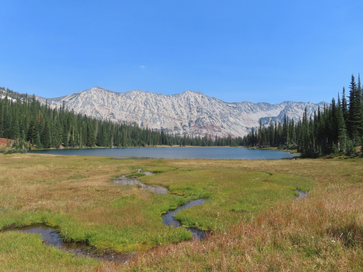
The hikes involved several wilderness areas: Oregon Badlands, Mill Creek, Spring Basin, Strawberry Mountain, North Fork John Day, North Fork Umatilla, Wenaha-Tucannon, Eagle Cap, Hells Canyon, Monument Rock, and Steens Mountain. Missing from this list are the Black Canyon (post) and Gearhart Mountain (post) wilderness areas which had featured hikes in earlier versions of Sullivan’s book that we’d completed, but were removed in the 2022 edition due to wildfire damage.
In addition to the 11 designated wilderness areas there were hikes in two National Monuments, the John Day Fossil Beds National Monument in Oregon and the Lava Beds National Monument in California, and one National Volcanic Monument, the Newberry National Volcanic Monument.
Following is a list of the 100 featured hikes and the dates we visited.
#1 Cottonwood Canyon – Hiked 5/27/2017

#2 Columbia Hills – Hiked 4/4/2015 & 4/17/2021

#3 Lower Deschutes River – Hiked 6/9/2018

#4 Macks Canyon – Hiked 5/26/2018

#5 Criterion Tract – Hiked 05/28/2023

#6 Trout Creek – Hiked 10/12/2013

#7 Willow Creek at Madras – Hiked 5/27/2024

#8 Cove Palisades – Hiked 6/16/2018

#9 Gray Butte – Hiked 6/13/2015

#10 Oregon Badlands – Hiked 5/15/2016 & 12/24/2016

#11 Pine Mountain – Hiked 7/30/2012

#12 Paulina Falls – Hiked 8/9/2011 & 9/16/2017

#13 Paulina Lake – Hiked 8/9/2011 & 9/16/2017

#14 Obsidian Flow – Hiked 8/9/2011

#15 Crooked River Wetlands – Hiked 5/29/2024

#16 Chimney Rock – Hiked 9/22/2017

#17 Steins Pillar – Hiked 5/8/2013

#18 Juniper Hill – Visited* 5/27/2024

#19 Mill Creek – Hiked 7/31/2012

#20 Lookout Mountain – Hiked 6/12/2014

#21 Walton Lake – Hiked 6/17/2017 & 6/18/2021

#22 Spring Basin – Hiked 4/22/2017

#23 John Day Fossil Beds – Hiked 4/30/2016, 4/22/2017 & 9/17/2017
 Painted Hills Unit
 Clarno Unit
 Blue Basin Unit
#24 Sutton Mountain – Hiked 4/30/2016

#25 Spanish Peak – Hiked 7/19/2021 & 7/20/2021

#26 Madison Butte – Hiked 5/28/2024

#27 Wildcat Basin – Hiked 7/24/2018

#28 High Lake – Hiked 7/26/2018

#29 Strawberry Lake – Hiked 7/25/2018

#30 Malheur River – Hiked 6/17/2021

#31 Canyon Mountain – Hiked 7/22/2021

#32 Monument Rock – Hiked 7/21/2021

#33 Bates and Sumpter – Hiked 9/17/2017

#34 Olive Lake – Hiked 9/18/2017

#35 Granite Creek – Hiked 9/21/2017

#36 North Fork John Day River – Hiked 9/19/2017

#37 Mount Ireland – Hiked 7/9/2022

#38 Baldy Lake – Hiked 9/20/2017

#39 Crawfish Lake – Hiked 8/16/2018

#40 Anothony Lake – Hiked 8/16/2018

#41 Elkhorn Crest – Hiked 8/12/2018, 8/13/2018, 8/14/2018, 8/15/2018 & 08/16/2018

#42 Twin Lakes – Hiked 8/13/2018

#43 North Fork Umatilla River – Hiked 6/14/2021

#44 Jubilee Lake – Hiked 9/12/2021

#45 Wenaha River – Hiked 5/25/2019

#46 Zumwalt Prairie – Hiked 5/26/2019

#47 Buckhorn Lookout – Hiked 6/15/2023

#48 Eureka Bar – Hiked 6/14/2023

#49 Hat Point – Hiked 7/21/2024

#50 Freezeout Saddle – Hiked 5/24/2019

#51 Hells Canyon Dam – Hiked 6/16/2023

#52 Hells Canyon Reservoir – Hiked 6/16/2023

#53 Imnaha Falls – Hiked 6/12/2023

#54 Bonny Lakes – Hiked 7/24/2024

#55 McCully Basin – Hiked 7/23/2024

#56 Mount Howard – Hiked 7/26/2024

#57 Aneroid Lake – Hiked 8/22/2024

#58 Wallowa Lake – Hiked 5/23/2019
 B.C. Falls
#59 Ice Lake – Hiked 7/31/2016

#60 Horseshoe Lake – Hiked 8/3/2016 & 8/04/2016

#61 Hurricane Creek – Hiked 7/22/2024

#62 Eagle Cap – Hiked 8/3/2016

#63 Minam Lake – Hiked 7/25/2024

#64 Maxwell Lake – Hiked 8/21/2024

#65 Chimney Lake – Hiked 8/20/2024

#66 Wallowa Homeland – Hiked 7/14/2022

#67 Bear Creek – Hiked 7/14/2022

#68 Rock Springs – Hiked 7/11/2022

#69 Moss Springs – Hiked 7/13/2022

#70 Catherine Creek Meadows – Hiked 7/10/2022

#71 Burger Pass – Hiked 7/12/2022

#72 Tombstone Lake – Hiked 8/16/2023 & 8/17/2023

#73 Eagle Lake – Hiked 8/13/2023

#74 Bear Lake – Hiked 8/14/2023

#75 Hidden Lake – Hiked 9/9/2024

#76 Summit Point Lookout – Hiked 8/18/2024

#77 Pine Lakes – Hiked 8/19/2024

#78 Fort Rock – Hiked 6/14/2014 & 5/28/2017

#79 Fort Rock Valley – Hiked 5/28/2017

#80 Hager Mountain – Hiked 7/30/2013 & 6/14/2014

#81 Summer Lake – Hiked 7/24/2020

#82 Winter Ridge – Hiked 7/19/2020

#83 OC&E Railroad – Hiked 10/5/2018

#84 Klamath Falls – Hiked 10/20/2018

#85 Modoc Lava Beds – Hiked 10/6/2018

#86 DeGarmo Canyon – Hiked 7/22/2020

#87 Hart Mountain Hot Springs – Hiked 7/21/2020

#88 Petroglyph Lake – Hiked 7/22/2020

#89 Steens Summit – Hiked 8/18/2021

#90 Little Blitzen River – Hiked 8/19/2021

#91 Big Indian Gorge – Hiked 8/17/2021

#92 Threemile Canyon – Hiked 9/3/2023

#93 Pike Creek – Hiked 6/14/2018

#94 Big Sand Gap – Hiked 6/14/2018

#95 Borax Hot Springs – Hiked 6/14/2018

#96 Pueblo Mountains – Hiked 8/20/2021

#97 Leslie Gulch – Hiked 6/11/2018

#98 Coffeepot Crater – Hiked 6/11/2018

#99 Chalk Basin – Hiked 6/13/2018

#100 Three Forks – Hiked 6/12/2018

*The Juniper Hills Preserve is owned by the Nature Conservancy and had been closed to public entry in 2023, so we were unable to hike the trails. We parked and walked to the gates to take photos. If they ever reopen it to the public we will go back.
Completing our featured hike goals provided a sense of relief. While we thoroughly enjoyed all of the hikes, and the Wallowa Mountains became our favorite destination in Oregon, we had begun to put pressure on ourselves to finish. That pressure had begun following the September 2020 wildfires that ravaged parts of the Central Cascades and left many trails closed for years. We had just finished the featured hikes in that area earlier that year and realized how close we’d come to having to put our goal on hold. In the grand scheme of things reaching 500 featured hikes is irrelevant but having worked on it for several years it was something we didn’t want to abandon. We will gig deeper into that in a later post covering finishing the 500, but it’s nice to have the urgency to get to specific places removed.
Setting the goal did provide us with an excuse to visit parts of Oregon that we’d never seen before. While we were checking off the 100 featured hikes we stopped at over three dozen additional spots including eight previously featured hikes. There are still numerous trails left for us to explore so we will almost certainly be heading back to Eastern Oregon from time to time to see new sights and possibly revisit some familiar ones. Happy Trails!

 The first 0.2-miles followed a rough spur road.
 The trail starting at the 0.2-mile mark.


 An aster or fleabane
 Nettle-leaf giant hyssop
 Haze from wildfires burning in the Pacific Northwest.

 Corkscrew Falls
 One of the few trees that proved a little tricky.

 Smoke hanging over the East Fork Eagle Creek Valley.
 Penstemon
 The different shapes and colors of the peaks in the Wallowa Mountains never cease to impress.
 This section of trail appeared to have fallen victim to an avalanche that came down from the far side of the creek then up this one.
 Paintbrush
 Unnamed waterfall along East Fork Eagle Creek.
 The view improved a little as the day progressed.
 Coneflower along the trail.
 Fireweed
 Last of the mountain coyote mint.


 California tortoiseshell
 Fritillary butterfly
 Post marking the junction with the Hidden Lake Trail.


 View back across the East Fork Eagle Creek Valley.
 More obstacles were present along the Hidden Lake Trail.
 More trail damage.


 Gentians

 Looking back down at Moon Lake.

 On the other side of the ridge is Eagle Lake which we visited in 2023 (


 The Hidden Lake Trail continuing along the unnamed creek.
 There were still a few mountain heather blossoms.
 The unnamed lake.
 Heading cross country looking for the path of least resistance.
 My first view of Hidden Lake.
 Eagle Cap (

 Monkeyflower
 We set up for the afternoon.
 The lake looked to get pretty deep quickly.
 View from our dinner area.


 Gentians
 Last look at the lake.
 Grass of parnassus
 Hawkins Point on the left and Jackson Peak on the right.
 Moon Lake
 Big cricket
 Doe
Doe
 Unnamed creek near our campsite.
 View from camp in the morning. The eyes were looking at me from near the tree in the foreground to the left.
 Recrossing East Fork Eagle Creek.
 Heading into the haze.
 A healthy looking paintbrush.
 The bear had been walking up the outcrop in the shade in the middle of the picture.
 The bear is the black blotch on the rock in front of the tree at center.
 The bear just before it vanished behind the outcrop.
 Hawk in a snag.
 Corkscrew Falls
 Granite Cliff
 “Papa’s Camp” was located at the end of the 0.2-mile spur road.
 East Fork Eagle Creek from an old bridge near Papa’s Camp.
 Granite Cliff rising above East Fork Eagle Creek from the spur road to the trailhead.


 Map at the trailhead signboard and wilderness permit station.
 Trail sign at the split of the East and West Fork trails.

 Trail sign for the East Fork Wallowa Trail at a junction with a gravel road.
 Ghost pipe
 Entering into the Wallowa-Whitman National Forest.

 Chief Joseph Mountain and Wallowa Lake
 I never saw any but I heard a number of pikas in the rock fields.
 Switchback
 Rock clematis seed heads.
 Bridge at the upper end of the access road that I had passed earlier.
 The lower section of the waterfall from the bridge.

 The access road bridge from the switchback.
 East Fork Wallowa River Forebay
 Interpretive sign at the forebay.
 Aster
Aster The trail entering the

 Elderberry and baneberry
 Zoomed in photo.
 Small meadow along the trail.
 Aneroid Mountain in the distance.
 Mountain larkspur
 Pika underneath some raspberries.
 Pika
Pika A few lupine were still blooming along the trail.
 Doe in a small meadow along the trail.
 Tall mountain bluebells
 The damaged footbridge.


 East Fork Wallowa River
 The inbound and outbound forks rejoining.
 East Fork Wallowa River flowing through a meadow along the trail.
 Goldenrod
 Unnamed creek crossing.
 American sawort
 Another doe in a meadow.
 A hazy view of Aneroid Mountain.
 Pearly everlasting along the trail.
 East Peak (
 A closer look at East Peak.


 The benches.
 Groundsel along the trail.
 A boat docked on the lakeshore in the distance.
 An inlet creek to the lake near the boat dock.
 East Peak from Aneroid Lake.


 Signs for Camp Halton at the actual junction with the East Fork Wallowa Trail.

 Hammond’s flycatcher
 East Peak
 Lewis monkeyflower
 Aneroid Mountain
 Pollinator on a flower.
 The split trail.
 The outbound trail dropped quite steeply before meeting back up with the inbound trail.
 The damaged bridge from the other side.
 Fritillary butterfly
 A comma butterfly
 Golden-mantled ground squirrel
 Mount Howard
 Coneflower
 Wallowa Lake
 Quaking aspen
 Arriving back at the trailhead.


 The trail passes through the Shady Campground.
 Lostine River
 Unnamed creek crossing.

 Thimbleberry
 One of the switchbacks.
 Climbing into the sunlight.
 Possibly a Cassin’s vireo.
 Another switchback.
 Fireweed
 Monkshood
 Twisted stalk
 Eagle Cap (
 Looking down from the trail.
 Paintbrush
 Chipmunk
 The trail turning uphill ahead to start the steep climb.
 Meadow along a brief section of reasonably graded trail.
 Nuttal’s linanthus


 The pass in view.
 Twin Peaks to the left over the shoulder of the ridge.
 The trail down to Maxwell Lake.
 Ground squirrel on alert.
 Maxwell Lake

 Aster along the outlet creek.
 Gentians
 Island in Maxwell Lake.
 The view from the granite outcrop.
 Looking back at the pass from the outcrop.
 Last of the snow at Maxwell Lake.
 Trail along Maxwell Lake.
 Trail to Jackson Lake.
 Jackson Lake
 False hellebore
 Pika raising a warning call. Interestingly the pikas in the Wallowas make a sound that we don’t recall hearing from pikas in other areas. It was almost as if they had their own regional dialect.
 Passing back over the granite outcrop.
 Maxwell Lake’s outlet creek.
 Trout in the outlet stream.
 One last look at Maxwell Lake.
 The view from the pass on the way back.
 Heading down the steep section.
 The afternoon lighting on the ridge across the Lostine River really brought out the colors.
 Eagle Cap way up the valley.
 Heather counted at least seven significant drops on a creek cascading down the far hillside.
 Fritillary
 Canada jay
 Police car moth
 Back at the bridge over the Lostine River.
 Lostine River
 The Maxwell Lake Trailhead in the afternoon.


 The trail entered the

 Lewis monkeyflower
 Eagle Cap (
 Chipmunk
 One of the switchbacks.
 Western tanager
 Pearly everlasting
 Paintbrush
 Baneberry
 Pika
Pika
 Bowman Creek
 Grass of parnassus
 The trail crossing Bowman Creek.
 Arnica
 Monkeyflower
 Bees on American sawort.


 Golden-mantled ground squirrel
 Another pika.
 Elderberry
 The lefthand fork led to a campsite and meadows in the basin.
 Gentians
 Meadow in Brownie Basin.
 The junction with the Chimney-Wood Trail.

 One of several pine siskins that were in these plants.
 Aster
Aster
 Fritillary
 Lupine and aster
 Butterfly on pearly everlasting

 Another western tanager.
 Gentians and St. Johnswort
 Lower Laverty Lake
 A patch of fireweed above the lake.
 Hooded ladies’-tresses
 American kestral
 Lower Laverty Lake
 Twin Peaks across the Lostine River valley.
 Eagle Cap at the far end of the valley.
 Heading for Chimney Lake.
 Chimney Lake
 Gentians along the lakeshore.
 The rocks ahead where we took our break.
 Islands in Chimney Lake.
 No matter how cute they are, please don’t feed the wildlife (
 Sulphur butterfly
 We heard more pikas than we saw. Here is the one, blurry, photo I managed to get.
 Milbert’s tortoiseshell
 Golden-mantle managing to feed itself.
 Twin Peaks
 Aster
Aster
 California tortoiseshell
 Grouse
 A comma, possible green comma.
 Back at the bridge over the Lostine River.
 Lostine River in the afternoon.


 This pointer refers to trail 1880 as “Pine Creek” but other signs and the Forest Service website refer to it as “Pine Lakes”.
 This one says Pine Lakes.
 Sign for the Packstation.
 Squirrel with breakfast at the packstation.
 Old footbridge over a dry creek bed. It didn’t look particularly safe so I stuck to the road.
 The dry creek bed crossing.
 Black cows on the trail ahead.
 Coneflower
 Snowberry
 West Fork Pine Creek
 Formation on the hillside.
 Western clematis
 Paintbrush
 Fireweed
 The bridge felt stable despite being slanted at a 45-degree angle.
 View from the trail.

 The second bridge.
 West Fork Pine Creek
 Heather caught this cool cloud from her currently cow free hike. (She would run into them later where they’d ducked off the trail in front of me.)
 Looking back down at the campsite.
 The use trail straight ahead at the switchback.

 The base of Chute Falls.


 Looking back down the valley.
 View up the valley.
 Wilderness sign on the tree marking the boundary.
 The Pine Lakes are back up there somewhere.
 Somewhere on the other side of the peaks on the left is the Schneider Cabin where we’d hiked the day before.
 Cliffs above the trail.
 I spy mountain goats!
 A zoomed in photo of the mountain goats.


 I believe that is Cornucopia Peak on the left.
 Going up.
 Fireweed above the trail.
 Paintbrush along the trail.
 The forest on the other side of the pass.
 West Fork Pine Creek
 There was a large waterfall flowing down from the outlet of the Pine Lakes. (Not West Fork Pine Creek whose headwaters were beyond the meadowed basin.
 West Fork Pine Creek begins somewhere above the basin at the far end.
 Rock formations along the cliffs.
 Arnica and pearly everlasting
 I tried to get a clearer look at the large waterfall but couldn’t find a clear line of sight.

 Gentians along the trail.
 Evidence of an avalanche at the far end of this meadow. It took a lot of trail maintenance to clear the snapped trees from the trail.
 Wildflowers lining the trail.
 A doe that turned out to be on the trail above me. There was a switchback just ahead of where I was.


 The forest in the basin.
 The Pine Lakes are in the basin ahead.
 Arnica and aster?
 Monkshood
 Seep along the trail.
 Grass of parnassus
 American sawort
 Something had been bedded down in this little bowl below the trail.
 Goldenrod
 The valley I’d come up to the right.
 Nearly 5-miles from Chute Falls I arrived at the dam at the outlet of Lower Pine Lake. A number of lakes in the Wallows were dammed to control water flow to the surrounding communities.
 Lower Pine Lake

 Lower Pine Lake
 Lower Pine Lake from between the two lakes.
 Upper Pine Lake from the same spot.


 The view from my break spot.
 Shrubby cinquefoil
 White mariposa lily, the only one I spotted, and I’d missed it on the way up.
 Yellow columbine, I also missed this on the first pass.
 Dusky flycacther
 A meadow and the forest in the lower basin.
 Fritillary on pearly everlasting
 Trail maintenance in the avalanche section.
 Loved the rock colors in the area.
 I’m guessing some sort of wren.
 Caterpillers
 Herding the cattle back past the damaged bridge.
 West Fork Pine Creek.
 The footbridge across the East Fork Pine Creek ahead. We’d left the cows behind here and made our way back to the trailhead.


 Smoke rising from the Town Gulch fire to the south.
 Scarlet gilia
 Paintbrush
 Town Gulch Fire
 Penstemon
 Pearly everlasting and aster
 Big Lookout Mountain
 Summit Point Lookout from below.
 At the 0.7-mile mark the Cliff Creek Trail split off to the left while FR 7715 continued right.
 Cornucopia Peak
 The Summit Point Lookout with the Town Gulch Fire behind the forest below.


 The Elkhorn Range (
 The Elkhorns
 Finch
Finch The trail crossed a fence at the southern end of Little Eagle Meadows.
 Little Eagle Meadows and Cornucopia Peak.
 The wilderness sign in the distance.
 Birds on a wire.
 The views along the trail were amazing. In later July there is also a plethora of wildflowers along the route.
 Trail marker
 Ground squirrels
 We veered right here but had to be careful not to follow one of the many cow trails leading off into the meadows. Our GPS maps were helpful.
 Looking back up the hillside.
 Dry pond along the trail.
  Savage Peak is the round peak at the center.
 Heading toward Cornucopia Peak.
 The cabin was visible in the distance at times from the trail.
 Yarrow along the trail.
 Green around a small stream.
 The Schneider Cabin
 Cow at the cabin.


 View from the loft.

 Summit Point from the cabin.
 Summit Point Lookout
 Torn up trail tread.
 Cricket
 Tree full of mountain bluebirds.
 Arriving back at the fence.
 Hawk
Hawk Northern flicker
 Butterflies on Greene’s goldenweed.
 Fritillary butterfly
 Becker’s white
 Smoke from the Town Gulch fire.
 Insect on chicory.
 Arriving back at the trailhead.


 View after coming back down.

 The tramway from the top.
 Pointer for the Royal Purple Overlook (right) and Summit Overlook (left).
 Penstemon
 Heading out to the Royal Purple Overlook.
 They do hold weddings up on the mountain.
 Lewis flax
 Mountain coyote mint
 The Hurwal Divide, Point Joseph and Ruby Peak from left to right.
 Pete’s Point, West Aneroid Peak, Eagle Cap the furthest away (
 Closer look at Eagle Cap.
 Craig Mountain and the Matterhorn (
 East Peak
 Pano that Heather took with her phone.
 Buckwheat
 Pointer for the Summit Overlook.
 View from the Summit Overlook. Heather is standing on the Royal Purple Overlook.
 Buek’s groundsel
 Point Joseph
 East Peak as I neared the Summit Overlook.
 The Seven Devils poking up above the smoke from Idaho.
 Seven Devils
 Mount Melissa to the left and East Peak straight ahead.
 The 4-way junction.
 East Peak from the 4-way junction.

 Mountain bluebird
 Climbing to the saddle.
 The view from the saddle.
 Wood blocking the lower end of the “short-cut”.
 Looking back at the Summit Overlook during one of my several breaks during the climb up.
 There were a few obstacles to avoid along the climb as well.
 The Royal Purple Overlook from the trail.
 Up, up I go.
 Golden-mantled ground squirrel watching me navigate some blowdown.
 The views helped keep my mind off the climbing.
 The second saddle in sight.
 The angle was enough different from the saddle that I could see a couple of additional peaks.
 The Matterhorn on the left and now Sacajawea Peak behind the Hurwal Divide to the Matterhorns right.
 The saddle provided a brief level stretch before the trail launched steeply uphill again.

 East Peak
 Lots of buckwheat along this section.
 Buckwheat and lupine above the trail.
 The fork. According to Sullivan the righthand fork peters out in about 0.2-miles and then it’s possible to scramble up East Peak in another three quarters of a mile. I went left heading for the spring.
 The McCully Creek Trail which we hiked a couple of days earlier (
 A phacelia
 Lyall’s Goldenweed
 Wallflower
 Looking back at the trail.
 Flowers near the springs.
 Shrubby cinquefoil surrounded by bistort and mountain death-camas.
 Mountain death-camas and bistort
 Looking up at the springs.
 Monkeyflower
 There were several smaller streams below East Peak.
 Aneroid Mountain
 Ground squirrel
 View from my turn around point.
 Looking back at my route to the second saddle.

 Dusty maidens near the springs.
 Heading down to the saddle.
 Cairn at the saddle.
 Milbert’s tortoiseshell
 Pale agoseris
 Climbing back up to the 4-way junction.
 Back on the Summit Loop.
 Crossing the service road coming up from McCully Creek.
 Mountain Heather
 Pointer for the Valley Overlook.
 Spur trail to the Valley Overlook.
 Flag at the Valley Overlook.
 Wallowa Lake below the Valley Overlook.
 Wallowa Lake
 East Peak peaking up over the trees.

 Wallowa Paintbrush
 The upper terminal.
 Apparently Heather was busy making a friend while I was visiting the springs even though she did not feed any animals.
 The straight line is the tram ride.

 Even at 6am on a Thursday the trailhead parking was nearly full.
 This was a neat feature.
 We both counted our steps, for me it was 50 and Heather 60.
 The Lostine River.
 Entering the Eagle Cap Wilderness just before the trails split.
 Trail sign at the fork.
 Bridge over the East Fork Lostine River.
 East Fork Lostine River
 The storm overnight had provided a little much needed rain.
 Huckleberries (I’d already picked the ripe ones.)

 Elkhorn Peak
 Monkshood

 Some of the river channels were very calm and crystal clear.
 We passed through a section of bent and snapped trees which were probably a result of an avalanche.

 Glacier Mountain
 Looking back at the other side of Elkhorn Peak.
 Nuttal’s linanthus
 Looking back down one of the steeper sections. We passed another couple heading out along this section.
 Looking up the Copper Creek drainage. Glacier Mountain on the left and Elkhorn Peak on the right.
 Off-trail waterfall. We could hear this from the trail, and it was a fairly easy bushwack to get a good view.
 The river crossing.

 Yellow columbine
 A little hazy looking toward the Sun.

 Elephants head
 Unnamed creek
 An easier crossing of the river here.


 First view of Minam Lake.
 Minam Lake
 Common mergansers
 Shooting stars
 We could have stared at the rocks along the ridges for hours.
 Heading back.
 Violet
 Groundsquirrel
 Robin
Robin Fritillary
 Orange agoseris
 The fire was burning up in that basin somewhere.
 The talus section in the afternoon.
 Spirea

 Butterflies and moths were out in force.
 Police car moth and another interesting looking pollinator (out of focus).

 Prince’s pine
 Back at the junction with the East Fork Lostine River Trail.
 Left for hikers and right for stock.

 We managed to get started about ten minutes before 6am.


 Bugbane and paintbrush
 A 2022 wildfire burned the first 3-miles of the trail and left the old footbridge damaged. A steep scramble trail led down to it.
 Big Sheep Creek

 Paintbrush and lupine
 Wildfire smoke filling the valley behind us.


 Phacelia
 Butterfly on buckwheat.
 Some of the trees survived the fire.
 White mariposa lilies in a meadow along the trail.
 Junction with the Wing Ridge Trail.
 North Fork Big Sheep Creek
 Lewis Monkeyflower along the creek.


 Canada milk-vetch
 Grass-of-parnassus
 Bog orchid
 Checker-mallow
 Bee heading for some monkshood.
 Me in some fireweed.

 Getting eyed by a western tanager.


 When fires burn too hot they damage the soil which makes it difficult for all plants to obtain the necessary nutrients to grow.
 A few plants had been able to take hold.
 A healthy patch of paintbrush.
 Middle Fork Big Sheep Creek
 Monkeyflower
 Brook saxifrage
 Another severely burned section.
 The Bonny Lakes Trail forking to the right off of the Tenderfoot Wagon Road Trail.
 Wildflowers along the Bonny Lakes Trail.
 The wildflowers were profuse along this stretch of trail.
 American sawwort
 Police car moths
 Larkspur and fleabane
 The trail recrossed the Middle Fork Big Sheep Creek.
 Orange agoseris


 Taper tip onions
 White mariposa lilies


 False hellebore
 Checker-mallow
 Penstemon on the outcrop.
 Mountain larkspur
 Pika!
Pika! Gathering plants for the Winter store.


 On the steep climb.
 Mountain heather
 Ground squirrel
 The creek was below between the ridges here.

 Stonecrop
 Swamp onions

 Wallowa paintbrush
 Aneroid Mountain and Lower Bonny Lake.
 Aneroid Mountain to the right and an unnamed peak on the left.


 Shrubby cinquefoil
 Cutleaf anemone seed heads.
 Possibly a sandwort.

 Upper Bonny Lake
 Lower Bonny Lake
 Aneroid Mountain from the knoll.

 Spotted sandpiper
 Elephants head

 White mariposa lily and buckwheat
 Jacob’s ladder
 Checker-mallow and white mariposa lilies along the trail.
 Scouler’s woolly-weed

 Gentians

 Goldenrod and yarrow
 Nuttal’s linanthus


 North Fork Big Sheep Creek
 The haze from the morning had improved now that the Sun had moved on from the east.
 Looking down at the un-damaged bridge over a side stream.
 Yellow columbine
 Big Sheep Creek.
