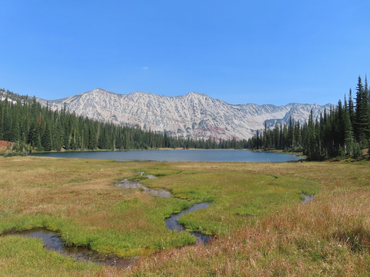
After delaying the start of our planned backpack to Hidden Lake by a day (post) due to a Fire Weather Warning we had a two-day window of sunny, but smokey, weather before the next chance of thunderstorms was forecast to roll in. That was all the time we needed though to allow us to finish the 100th featured hike from William L. Sullivan’s “100 Hikes Eastern Oregon” (2022 1st edition).
It would also mark the culmination of our goal of hiking at least a portion of all 100 featured hikes from a single edition of each of the five areas Sullivan splits his guidebooks into: Eastern Oregon, Central Oregon Cascades, Oregon Coast & Coast Range, Northwest Oregon & Southwest Washington, and Southern Oregon & Northern California (post). We set our sights on that goal way back in 2016, but we started using Sullivan’s guidebooks six years earlier. We will be covering completing the Eastern Oregon book and completing our goal in separate posts later, but first we needed to hike the East Eagle Trail.
Our plan was to begin at the East Eagle Trailhead and follow the East Eagle Trail to the Hidden Lake Trail (approx. 7 miles) where we would look for a campsite not far after crossing East Fork Eagle Creek. We had been told that there was a spot or two there by a fellow hiker we’d run into during our Maxwell Lake hike in August (post). While camping at the lake sounded nice climbing 1000′ in 1.4 miles with full packs on didn’t.
We arrived at the trailhead to find a few cars parked along the turnaround loop. After filling out a free wilderness permit we followed a pointer for the East Eagle Trail.

 The first 0.2-miles followed a rough spur road.
 The trail starting at the 0.2-mile mark.
The trail quickly entered the Eagle Cap Wilderness as it gradually climbed, with a few short downhills, along East Fork Eagle Creek.


It was evident that Winter avalanches are common in this valley based on the amount of downed and damaged trees. Despite that the trail was in pretty good condition although there were a few obstacles to detour around.

There were still a few flowers blooming along the way.
 An aster or fleabane
 Nettle-leaf giant hyssop

 Haze from wildfires burning in the Pacific Northwest.


A little over 2.5-miles from the trailhead we passed small corkscrew falls.
 Corkscrew Falls
 One of the few trees that proved a little tricky.
We also had to be wary of falling fir cones. The resident squirrels were busy dropping them to the ground to add to their Winter stores.


 Smoke hanging over the East Fork Eagle Creek Valley.
 Penstemon
 The different shapes and colors of the peaks in the Wallowa Mountains never cease to impress.
 This section of trail appeared to have fallen victim to an avalanche that came down from the far side of the creek then up this one.

 Paintbrush

 Unnamed waterfall along East Fork Eagle Creek.
 The view improved a little as the day progressed.
 Coneflower along the trail.
 Fireweed
 Last of the mountain coyote mint.


 California tortoiseshell

 Fritillary butterfly
 Post marking the junction with the Hidden Lake Trail.
We turned down the Hidden Lake Trail and rock hopped across the creek. After navigating through some more downed trees we spotted an established campsite a little off the trail.


After setting up camp we switched to our day packs and started the climb up to Hidden Lake.

 View back across the East Fork Eagle Creek Valley.
 More obstacles were present along the Hidden Lake Trail.

 More trail damage.
A mile and a quarter from our camp we arrived at Moon Lake.


 Gentians
After a brief break at Moon Lake we followed the trail steeply uphill to a pass.


 Looking back down at Moon Lake.
The trail leveled out for a bit at the pass and a short spur trail on the left led to an unnamed lake.


 On the other side of the ridge is Eagle Lake which we visited in 2023 (post).
Beyond the pass the trail descended briefly to an unnamed creek.


Sullivan’s description said to follow the trail to its end at the creek then cross the creek and head right over a small ridge to find Hidden Lake. I had gone ahead of Heather from Moon Lake so I arrived at the creek first and was a little confused to find a clear trail heading across but an even clearer tread continuing on the near side of the creek.

Since the Hidden Lake Trail didn’t appear to end here I thought the trail to the right simply went to a campsite and continued along the creek.
 The Hidden Lake Trail continuing along the unnamed creek.
The trail followed the creek through a meadow then curved away from Hidden Lake and petered out with a view of another unnamed lake.

 There were still a few mountain heather blossoms.
 The unnamed lake.
I took a quick look at the GPS and realized that I was almost past Hidden Lake now so I cut cross country and found myself on a ridge about 50′ above the lake.
 Heading cross country looking for the path of least resistance.
 My first view of Hidden Lake.
I made my way steeply down to the lake and picked up a use trail which led me to a meadow at its western end.

 Eagle Cap (post) on the left, Galcier Peak at center, and Hawkins Point to the right.
The views were amazing, but I quickly realized that Heather might have the same issue with deciding which fork to take when she arrived at the creek. We had planned to meet at the lake, but it was good sized with a network of user trails which would have made it pretty easy to miss each other. I hiked along the lake shore for a bit then cut away from the lake and made my way to the fork and waited there for Heather to arrive.

Luckily Heather had taken an extended break at Moon Lake so I hadn’t missed her. When she arrived we headed down to the lake together then I led her to the meadow so she could enjoy that view as well.

 Monkeyflower
We’d brought our dinner with us so we picked out a spot along the lake where we could relax and possibly prepare dinner when it was time. We had seen two people coming off the Hidden Lake Trail near the junction with the East Eagle Trail, but we appeared to be the only people at the lake so we had our pick of spots.

 We set up for the afternoon.
 The lake looked to get pretty deep quickly.
 View from our dinner area.
I followed a use trail to the eastern end of the lake before settling down.


 Gentians
We spent a little over 2:30 hours at Hidden Lake before starting back to camp.
 Last look at the lake.
 Grass of parnassus

 Hawkins Point on the left and Jackson Peak on the right.
 Moon Lake
 Big cricket

 Doe
Doe

We got back to camp at a quarter to six and relaxed there for a bit until we got too chilly and decided to turn in instead of adding more layers of clothing.
 Unnamed creek near our campsite.
Before we turned in we’d set up a trail cam that we’d finally remember to bring on a backpacking trip. Unfortunately we didn’t refamiliarize ourselves with how to operate it and we accidently switched it to “Test” mode instead of “On”. This turned out to be a real bummer because when nature called around 1:30am and I left the tent my headlamp picked up a pair of eyes at the far side of the small meadow that the camera was facing. It would have been fun to have gotten to see what was prowling around our camp, but at least we remembered to bring it this time.
When we got up at 5am there was no sign of the visitor as we began packing up for the hike out. It was quite a bit smokier as we set off.
 View from camp in the morning. The eyes were looking at me from near the tree in the foreground to the left.
 Recrossing East Fork Eagle Creek.
 Heading into the haze.
 A healthy looking paintbrush.
We spend a lot of time fruitlessly scanning terrain for wildlife, but every once in a while, it pays off. About ten minutes to 8am I spotted something crossing a granite outcrop across the creek. It was pretty far away, but it was clearly a black bear. I couldn’t explain to Heather where it was before it disappeared, but I did get a few very grainy photos.
 The bear had been walking up the outcrop in the shade in the middle of the picture.
 The bear is the black blotch on the rock in front of the tree at center.
 The bear just before it vanished behind the outcrop.
That was the last of the excitement for the morning. The views got a little better as the morning progressed.

 Hawk in a snag.

 Corkscrew Falls
 Granite Cliff
 “Papa’s Camp” was located at the end of the 0.2-mile spur road.
 East Fork Eagle Creek from an old bridge near Papa’s Camp.
 Granite Cliff rising above East Fork Eagle Creek from the spur road to the trailhead.
It was 10:30am when we finished the 7-mile hike back to our car. My first day had been just over 12-miles with approximately 2670′ of elevation gain giving us a little over 19-miles for the trip.

This was a good trip with nice scenery and Hidden Lake was beautiful despite the hazy conditions. We can always count on a nice variety of wildlife in the Wallowas, and this trip was no exception. It was a great way to cap off our 500 featured hike goal. Happy Trails!
Flickr: Hidden Lake Backpack


 Aster
Aster
 The kiosk is straight ahead in the small gully.
 Cottontail
 In 2023 we had reached the kiosk from the Oregon Trail Ruts Trailhead along Highway 86.


 Looking back toward Panorama Point.


 Dotted is this trip, solid is 2023.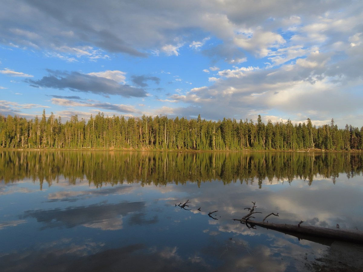


 There were hundreds of dragonflies along the trails which were much more welcome than the mosquitos that are a problem here in July and early August.
 The trail entering the wilderness.
 To the left through the trees is Mt. McLoughlin (
 The currently dry outlet creek of South Puck Lake.
 South Puck Lake from the Nannie Creek Trail.
 Someone had taken it upon themselves to craft their own sort of sign for the Puck Lakes Trail.

 The southern end of the lake was closed to camping for site restoration.
 South Puck Lake
 Use trail around the lake. The alignment of the former Puck Lakes Trail is further back from the lake.
 Two of three common mergansers that seemed to be calling the lake home for now.
 Our campsite for the night.
 Just after the trail began its descent it crossed a talus field.
 Mt. McLoughlin behind Luther Mountain.
 Shale Butte and Lucifer Peak (double hump is Lucifer).
 Pelican Butte straight ahead with peaks in the Mountain Lakes Wilderness (
 A faint Mt. Shasta through the haze.
 Agency Lake

 A good representation of the trail conditions between the talus slope and the Snow Lakes Trail. Nothing was overly problematic, but it did mean more effort on our part which in turn made it feel even warmer.
 Rock cairn marking the junction with the Snow Lake Trail.
 Looking back at the hillside we’d descended.
 One of several grouse that crossed the trail in front of us.
 Entering the fire scar from the 2014 “790 Fire”.
 Northwestern Rabbit-tobacco
 Martin Lake
 Pair of Lewis’s woodpeckers.
 One of the Snow Lakes below Luther Mountain.
 One of the Snow Lakes.
 After 1.4-miles we came to a junction with the Donna Lake Trail on the left. (Deep Lake is the lake visible below through the trees.) We’d turned down that trail on our previous visit, so we stayed right this time.
 One of several small, unnamed, bodies of water between the Donna Lake Trail junction and Margurette Lake.
 Blue beetle
 Hardhack
 Margurette Lake
 Margurette Lake
 Coming up on the junction.
 The Sky Lakes Trail.
 Trapper Lake
 The Donna Lake Trail to the right.
 Donna Lake

 Luther Mountain from Deep Lake.
 Tiny western toad
 Signs of Fall.
 Lousewort
 Young grouse

 Martin Lake
 Back at the Nannie Creek Trail junction.
 It was increasingly looking like a shower or two might happen.
 A deep zoom in at Mt. Shasta.

 Pine white
 Spotted sandpiper
 The three resident mergansers.
 The abandoned Puck Lakes Trail.
 A dark cloud passing over the Puck Lakes (no rain).
 North Puck Lake
 North Puck Lake


 Heather in the tent packing up.
 A sliver of the Moon reflecting in the lake at 5:48am.
 6:06am
 North Puck Lake at 6:22am as we set off.
 Luther Mountain from the Nannie Creek Trail in the morning.
 Dark blue = day one, magenta = day two, light blue = previous visit.

 Map at the trailhead signboard and wilderness permit station.
 Trail sign at the split of the East and West Fork trails.

 Trail sign for the East Fork Wallowa Trail at a junction with a gravel road.
 Ghost pipe
 Entering into the Wallowa-Whitman National Forest.

 Chief Joseph Mountain and Wallowa Lake
 I never saw any but I heard a number of pikas in the rock fields.
 Switchback
 Rock clematis seed heads.
 Bridge at the upper end of the access road that I had passed earlier.
 The lower section of the waterfall from the bridge.

 The access road bridge from the switchback.
 East Fork Wallowa River Forebay
 Interpretive sign at the forebay.
 Aster
Aster The trail entering the

 Elderberry and baneberry
 Zoomed in photo.
 Small meadow along the trail.
 Aneroid Mountain in the distance.
 Mountain larkspur
 Pika underneath some raspberries.
 Pika
Pika A few lupine were still blooming along the trail.
 Doe in a small meadow along the trail.
 Tall mountain bluebells
 The damaged footbridge.


 East Fork Wallowa River
 The inbound and outbound forks rejoining.
 East Fork Wallowa River flowing through a meadow along the trail.
 Goldenrod
 Unnamed creek crossing.
 American sawort
 Another doe in a meadow.
 A hazy view of Aneroid Mountain.
 Pearly everlasting along the trail.
 East Peak (
 A closer look at East Peak.


 The benches.
 Groundsel along the trail.
 A boat docked on the lakeshore in the distance.
 An inlet creek to the lake near the boat dock.
 East Peak from Aneroid Lake.


 Signs for Camp Halton at the actual junction with the East Fork Wallowa Trail.


 Hammond’s flycatcher
 East Peak
 Lewis monkeyflower
 Aneroid Mountain
 Pollinator on a flower.
 The split trail.
 The outbound trail dropped quite steeply before meeting back up with the inbound trail.
 The damaged bridge from the other side.
 Fritillary butterfly
 A comma butterfly
 Golden-mantled ground squirrel
 Mount Howard
 Coneflower
 Wallowa Lake
 Quaking aspen
 Arriving back at the trailhead.


 The trail passes through the Shady Campground.
 Lostine River
 Unnamed creek crossing.

 Thimbleberry
 One of the switchbacks.
 Climbing into the sunlight.
 Possibly a Cassin’s vireo.
 Another switchback.
 Fireweed
 Monkshood
 Twisted stalk
 Eagle Cap (
 Looking down from the trail.
 Paintbrush
 Chipmunk
 The trail turning uphill ahead to start the steep climb.
 Meadow along a brief section of reasonably graded trail.
 Nuttal’s linanthus


 The pass in view.
 Twin Peaks to the left over the shoulder of the ridge.
 The trail down to Maxwell Lake.
 Ground squirrel on alert.
 Maxwell Lake

 Aster along the outlet creek.
 Gentians
 Island in Maxwell Lake.
 The view from the granite outcrop.
 Looking back at the pass from the outcrop.
 Last of the snow at Maxwell Lake.
 Trail along Maxwell Lake.
 Trail to Jackson Lake.
 Jackson Lake
 False hellebore
 Pika raising a warning call. Interestingly the pikas in the Wallowas make a sound that we don’t recall hearing from pikas in other areas. It was almost as if they had their own regional dialect.
 Passing back over the granite outcrop.
 Maxwell Lake’s outlet creek.
 Trout in the outlet stream.
 One last look at Maxwell Lake.
 The view from the pass on the way back.
 Heading down the steep section.
 The afternoon lighting on the ridge across the Lostine River really brought out the colors.
 Eagle Cap way up the valley.
 Heather counted at least seven significant drops on a creek cascading down the far hillside.
 Fritillary
 Canada jay
 Police car moth
 Back at the bridge over the Lostine River.
 Lostine River
 The Maxwell Lake Trailhead in the afternoon.


 The trail entered the

 Lewis monkeyflower
 Eagle Cap (
 Chipmunk
 One of the switchbacks.
 Western tanager
 Pearly everlasting
 Paintbrush
 Baneberry
 Pika
Pika
 Bowman Creek
 Grass of parnassus
 The trail crossing Bowman Creek.
 Arnica
 Monkeyflower
 Bees on American sawort.


 Golden-mantled ground squirrel
 Another pika.
 Elderberry
 The lefthand fork led to a campsite and meadows in the basin.
 Gentians
 Meadow in Brownie Basin.
 The junction with the Chimney-Wood Trail.

 One of several pine siskins that were in these plants.
 Aster
Aster
 Fritillary
 Lupine and aster
 Butterfly on pearly everlasting

 Another western tanager.
 Gentians and St. Johnswort
 Lower Laverty Lake
 A patch of fireweed above the lake.
 Hooded ladies’-tresses
 American kestral
 Lower Laverty Lake
 Twin Peaks across the Lostine River valley.
 Eagle Cap at the far end of the valley.
 Heading for Chimney Lake.
 Chimney Lake
 Gentians along the lakeshore.
 The rocks ahead where we took our break.
 Islands in Chimney Lake.
 No matter how cute they are, please don’t feed the wildlife (
 Sulphur butterfly
 We heard more pikas than we saw. Here is the one, blurry, photo I managed to get.
 Milbert’s tortoiseshell
 Golden-mantle managing to feed itself.
 Twin Peaks
 Aster
Aster
 California tortoiseshell
 Grouse
 A comma, possible green comma.
 Back at the bridge over the Lostine River.
 Lostine River in the afternoon.


 This pointer refers to trail 1880 as “Pine Creek” but other signs and the Forest Service website refer to it as “Pine Lakes”.
 This one says Pine Lakes.
 Sign for the Packstation.
 Squirrel with breakfast at the packstation.
 Old footbridge over a dry creek bed. It didn’t look particularly safe so I stuck to the road.
 The dry creek bed crossing.
 Black cows on the trail ahead.
 Coneflower
 Snowberry
 West Fork Pine Creek
 Formation on the hillside.
 Western clematis
 Paintbrush
 Fireweed
 The bridge felt stable despite being slanted at a 45-degree angle.
 View from the trail.

 The second bridge.
 West Fork Pine Creek
 Heather caught this cool cloud from her currently cow free hike. (She would run into them later where they’d ducked off the trail in front of me.)
 Looking back down at the campsite.
 The use trail straight ahead at the switchback.

 The base of Chute Falls.


 Looking back down the valley.
 View up the valley.
 Wilderness sign on the tree marking the boundary.
 The Pine Lakes are back up there somewhere.
 Somewhere on the other side of the peaks on the left is the Schneider Cabin where we’d hiked the day before.
 Cliffs above the trail.
 I spy mountain goats!
 A zoomed in photo of the mountain goats.


 I believe that is Cornucopia Peak on the left.
 Going up.
 Fireweed above the trail.
 Paintbrush along the trail.
 The forest on the other side of the pass.
 West Fork Pine Creek
 There was a large waterfall flowing down from the outlet of the Pine Lakes. (Not West Fork Pine Creek whose headwaters were beyond the meadowed basin.
 West Fork Pine Creek begins somewhere above the basin at the far end.
 Rock formations along the cliffs.
 Arnica and pearly everlasting
 I tried to get a clearer look at the large waterfall but couldn’t find a clear line of sight.

 Gentians along the trail.
 Evidence of an avalanche at the far end of this meadow. It took a lot of trail maintenance to clear the snapped trees from the trail.
 Wildflowers lining the trail.
 A doe that turned out to be on the trail above me. There was a switchback just ahead of where I was.


 The forest in the basin.
 The Pine Lakes are in the basin ahead.
 Arnica and aster?
 Monkshood
 Seep along the trail.
 Grass of parnassus
 American sawort
 Something had been bedded down in this little bowl below the trail.
 Goldenrod
 The valley I’d come up to the right.
 Nearly 5-miles from Chute Falls I arrived at the dam at the outlet of Lower Pine Lake. A number of lakes in the Wallows were dammed to control water flow to the surrounding communities.
 Lower Pine Lake

 Lower Pine Lake
 Lower Pine Lake from between the two lakes.
 Upper Pine Lake from the same spot.
 Upper Pine Lake.


 The view from my break spot.
 Shrubby cinquefoil
 White mariposa lily, the only one I spotted, and I’d missed it on the way up.
 Yellow columbine, I also missed this on the first pass.
 Dusky flycacther
 A meadow and the forest in the lower basin.
 Fritillary on pearly everlasting
 Trail maintenance in the avalanche section.
 Loved the rock colors in the area.
 I’m guessing some sort of wren.
 Caterpillers
 Herding the cattle back past the damaged bridge.
 West Fork Pine Creek.
 The footbridge across the East Fork Pine Creek ahead. We’d left the cows behind here and made our way back to the trailhead.


 Smoke rising from the Town Gulch fire to the south.
 Scarlet gilia
 Paintbrush
 Town Gulch Fire
 Penstemon
 Pearly everlasting and aster
 Big Lookout Mountain
 Summit Point Lookout from below.
 At the 0.7-mile mark the Cliff Creek Trail split off to the left while FR 7715 continued right.
 Cornucopia Peak
 The Summit Point Lookout with the Town Gulch Fire behind the forest below.


 The Elkhorn Range (
 The Elkhorns
 Finch
Finch The trail crossed a fence at the southern end of Little Eagle Meadows.
 Little Eagle Meadows and Cornucopia Peak.
 The wilderness sign in the distance.
 Birds on a wire.
 The views along the trail were amazing. In later July there is also a plethora of wildflowers along the route.
 Trail marker
 Ground squirrels
 We veered right here but had to be careful not to follow one of the many cow trails leading off into the meadows. Our GPS maps were helpful.
 Looking back up the hillside.
 Dry pond along the trail.
  Savage Peak is the round peak at the center.
 Heading toward Cornucopia Peak.
 The cabin was visible in the distance at times from the trail.
 Yarrow along the trail.
 Green around a small stream.
 The Schneider Cabin
 Cow at the cabin.


 View from the loft.

 Summit Point from the cabin.
 Summit Point Lookout
 Torn up trail tread.
 Cricket
 Tree full of mountain bluebirds.
 Arriving back at the fence.
 Hawk
Hawk Northern flicker
 Butterflies on Greene’s goldenweed.
 Fritillary butterfly
 Becker’s white
 Smoke from the Town Gulch fire.
 Insect on chicory.
 Arriving back at the trailhead.


 Memorial to pioneers dedicated by President Harding in 1923.


 The Cabin Loop sign pointed up this hill.
 Thistle
 Foam flower
 Coneflower
 There were virtually no signs to indicate what any of the trails were or where they led.
 We had to duck under this tree.
 Mountain lady slippers that had bloomed many weeks ago.
 Pearly everlasting
 Paintbrush
 Thimbleberries
 Aster
Aster It was hot (pushing 90 Fahrenheit) which made the climbing less enjoyable.
 This was most likely the Nature Trail rejoining from the left.
 Not sure if this is native or invasive.
 Wedding set up behind the Community Building.
 Bee on fireweed.
 Horse Camp


 Gooch Falls
 The road widened briefly near the pullout that acts as the trailhead.
 Delicious red huckleberries provided morning snacks along much of the road and trail.

 We forked right when the ancient roadbed headed uphill.


 Not Downing Creek Falls, just one of many streams along the mossy hillside flowing into the creek.
 Downing Creek Falls


 The flat top of Coffin Mountain to the left of the tall trees at center and Bachelor Mountain to the right.
 Coffin Mountain
 It took us a bit to realize that this was indeed a really old roadbed.

 There was sporadic flagging along the creek.
 Another flag ahead.
 The faint trail running along Downing Creek.
 When I lost the path a couple times I just looked for signs like this old log cut for where the tread might be.
 I wasn’t expecting to see caution tape. Maybe that’s all the person had because I couldn’t identify any hazard here.
 A forested island in Downing Creek.
 It was a short climb back up to the road.
