In 2023 we took a trip to Crater Lake for a series of hikes as we pursued our goal of hiking at least some of all 100 featured hikes in William L. Sullivan’s “100 Hikes/Travel Guide Southern Oregon & Northern California” edition 4.2 (post). During that trip we were only able to complete part of three of the featured hikes due to two trail closures, The Pinnacles (post) and Lady of the Woods (post) and the boat tours to Wizard Island not operating (post). While we did check off those featured hikes for the purposes of our goal we vowed to return when the two trails reopened and the boat tours were operating.
The two trails reopened in 2024 and the company that had been contracted as the concessionaire for the park was replaced by ExploreUS. When the boat tours were announced for 2024 we planned a trip and made reservations. We scheduled a shuttle to Wizard Island for Sunday allowing us to do the other two trails on Saturday on the way to our lodging.
It was a smokey and overcast drive to park, but visibility was pretty good at the Pinnacles Trailhead.
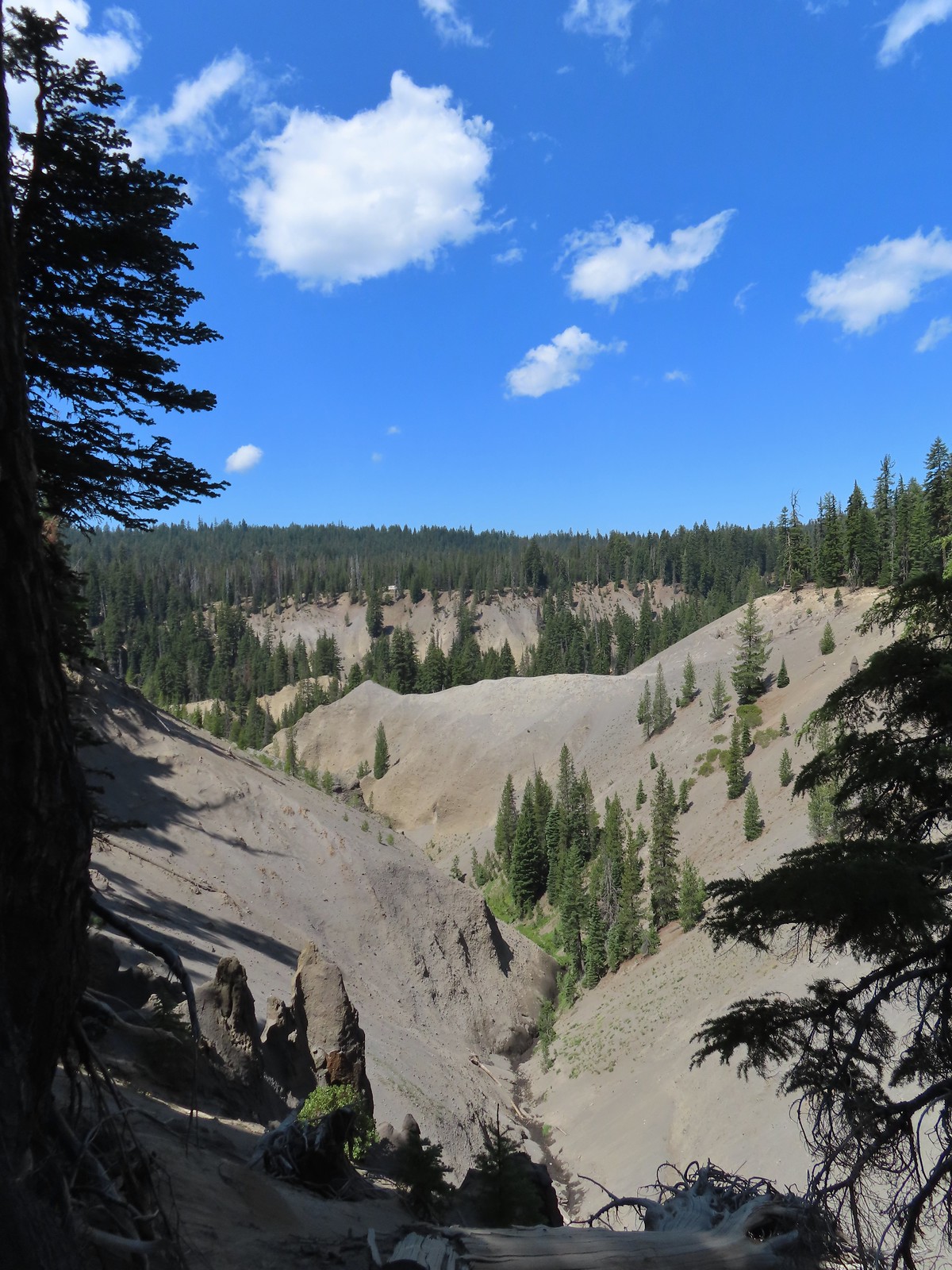
The pinnacles are a result of gasses escaping superheated rocks after a volcanic eruption through vents and welding the pyroclastic deposits in their immediate vicinity
We followed the trail nearly half a mile to the former East Entrance to Crater Lake National Park.
Wheeler Creek below the trail.
Golden-mantled ground squirrel
Coming up on the park boundary.
The former east entrance.
You can continue another half mile to FR 2304, but the best views are behind you at this point. We turned around here and returned to the car and headed for our next stop.
The second trail that had been closed in 2023 was the Lady of the Woods loop. The 0.7-mile loop starts at Park Headquarters, but we opted to park at the Castle Crest Trailhead instead.
Starting here allowed us to re-hike the 0.5-mile Castle Crest Wildflower loop then take a 0.4-mile connector trail to Park Headquarters for the Lady of the Woods loop.
Monkshood
Lewis monkeyflower
Monkeyflower
Lupine
Bistort
Hummingbird
Columbine and a visitor.
Fireweed
Bog orchid
Scarlet gilia
After completing the loop we headed for the headquarters.
Rim Drive and Park HQs.
Steele Visitors Center
We followed a pointer for the loop to the left of the visitors center.
Note the “The Lady of the Woods” sculpted in the boulder in 1917 next to the sign on the upper left side of the photo.
The loop climbed gradually through an open forest then passed an educational center that was formerly the superintendent’s residence.
Numbered posts were located along the interpretive loop.
Approaching the educational center.
Snow below the educational center.
Beyond the educational center the trail descended along a meadow and looped back to the Steele Center.
Arriving back at Park HQs.
Penstemon
Spirea
Completing the loop behind the visitor’s center.
We stopped in the visitor’s center for a moment then headed back to our car. The Pinnacles hike had been just under a mile and this hike came in at just 2.2-miles.
The Lady of the Woods and Castle Crest loops.
We had plenty of time and energy left for another hike and we’d chosen Pearsony Falls in Prospect, OR for our finale, but first we made a pit stop at Beckie’s Cafe in Union Creek for lunch. After our meal and securing a couple of slices of pie for later we drove to the Pearsony Falls Trailhead.
The trail starts at a large signboard and follows a wide path that soon reaches Mill Creek.
Oregon grape
We arrived at the falls approximately a third of a mile from the trailhead.
Pearsony Falls
The mist generated by the falls was hovering in front of them making it impossible to get a clear photo, but they were nice to look at none the less.
Random dude in front of the falls.
The trail continued beyond the falls another third of a mile to a viewpoint of the Avenue of Boulders on the Rogue River.
Madrones
We’d seen this feature from the other side during a hike to see Mill and Barr Creek Falls (post).
The trail continued beyond the viewpoint, so we did too, at least for another quarter mile. It was getting brushy and fainter as we neared Mill Creek again. When we looked at the GPS and saw that we had reached the end of the trail shown on that map. We turned back opting not to try and reach the lip of Mill Creek Falls.
Our turnaround spot.
We headed back passing quite a few other hikers along the way.
There was a slightly clearer view of the falls on the way back.
This hike came to 1.7-miles giving us a total of 4.8 for the day with just a little over 300′ of total elevation gain.
Ignore the “Barr Creek Falls” label to the upper left, the map has the placement wrong. Those falls are located along Barr Creek in the lower left corner.
We stayed in Shady Cove for the night with a view of the Rogue River. It was a little too smokey to sit out on the balcony, but we could see rafters drift by occasionally through the glass doors. Happy Trails!
Several years ago we set a goal for ourselves to hike all 500 featured hikes in William L. Sullivan’s “100 Hikes…” series of guidebooks (post). In 2020 we completed the first of these books covering the Central Oregon Cascades (post). We followed that up by completing a pair of books in 2021 starting with Sullivan’s “100 Hikes/Travel Guide Oregon Coast and Coast Range” 3rd edition (post) followed up by “100 HIkes/Travel Guide Northwest Oregon & Southwest Washington” 4th edition (post).
Generally speaking in order to check a hike off our list we need to have hiked a substantial portion of Sullivan’s described hike or visited the main attraction(s) he identifies for the hike. For 66 of the hikes we followed the books described route. For the other 34 hikes various factors contributed to us not completing all of each featured hike. For some we started at a different trailhead, others had portions of trail(s) closed when we visited, and several had longer options that would have required multiple days to complete. In some other cases we did slightly different routes, sometimes by accident.
The area covered by Sullivan in this book, as the title suggests includes parts of Southern Oregon and Northern California. It contains his southernmost featured hike, Caribou Lakes. In general the area covered in Oregon begins just North of Roseburg extending East to Highway 97 (with the exception being Klamath Falls which is included in his Eastern Oregon book), South to California, and West to Marial on the Rogue River. In California the area extends south to the Trinity Alps Wilderness, West to the Siskiyou Wilderness, and East to the Mount Shasta Wilderness.
The hikes inside the red lines represent the location of the featured hikes.A closer look at the area covered.
View from Upper Table Rock
#30 Lost Creek Lake-Hiked 6/9/2017
#31 Takelma Gorge-Hiked 10/15/2020
#32 Natural Bridge-Hiked 10/16/2020
#33 Union Creek-Hiked 10/17/20209/20/2022
#34 Abbott Butte-Hiked 10/17/2020
#35 Hershberger Mountain-Hiked 10/16/2020
#36 Muir Creek-Hiked 5/27/2018
#37 Rattlesnake Mountain-Hiked 9/6/2020
#38 Seven Lakes West-Hiked 9/9/2023
#39 Seven Lakes East-Hiked 9/9/2023
#40 Blue Lake Basin-Hiked 9/18/2022
#41 Mount McLoughlin-Hiked 8/27/2016
#42 Fourmile Lake-Hiked 8/26/2016
#43 Sky Lakes via Cold Springs-Hiked 9/24/2022
#44 Sky Lakes via Nannie Creek-Hiked 9/24/2022
#45 Fish Lake-Hiked 10/7/2018
#46 Brown Mountain Lava Flow-Hiked 8/28/2016
#47 Lake of the Woods-Hiked 10/7/2018
#48 Mountain Lakes-Hiked 8/25/2016
#49 Soda Mountain-Hiked 6/3/2015
#50 Pilot Rock-Hiked 7/29/2017
#51 Mount Ashland Meadows-Hiked 6/3/2015
#52 Lithia Park-Hiked 6/2/2015
#53 Bandersnatch Trail-Hiked 6/17/2022
#54 White Rabbit Trail-Hiked 6/17/2022
#55 Grizzly Peak-Hiked 6/5/2015
#56 Roxy Ann Peak-Hiked 5/30/2022
#57 Wagner Butte-Hiked 6/4/2015
#58 Siskiyou Gap-Hiked 6/16/2022
#59 Jack-Ash Trail-Hiked 5/27/2022
#60 Sterling Ditch Tunnel-Hiked 6/10/20175/2/2023
#61 Jacksonville-Hiked 6/8/2017
#62 Enchanted Forest-Hiked 6/11/2017
#63 Observation Peak-Hiked 6/15/2022
#64 Collings Mountain-Hiked 6/8/2017
#65 Applegate Lake-Hiked 6/8/2017 5/29/2022
#66 Red Buttes-Hiked 10/27/2015
#67 Frog Pond-Hiked 6/18/2022
#68 Azalea Lake-Hiked 10/26/2015
#69 Sturgis Fork-Hiked 10/7/2023
#70 Grayback Mountain-Hiked 10/9/2023
#71 Oregon Caves-Hiked 10/30/2015
#72 Mount Elijah-Hiked 10/7/2023
#73 Sucker Creek-Hiked 10/26/2015
#74 Tanner Lakes-Hiked 10/8/2023
#75 Bolan Lake-Hiked 10/8/2023
#76 Polar Bear Gap-Hiked 7/1/2022
#77 Raspberry Lake-Hiked 7/3/2022
#78 Devils Punchbowl-Hiked 7/2/2022
#79 Rough and Ready Creeks-Hiked 5/12/2017
#80 Babyfoot Lake-Hiked 10/9/2023
#81 Eight Dollar Mountain-Hiked 5/4/2023
#82 Illinois River Beaches-Hiked 5/4/2023
#83 Grants Pass Nature Trails 5/3/2023
#84 Rouge River Trail East-Hiked 5/1/2023
#85 Rogue River Trail West-Hiked 6/24/2023
#86 Paradise Lake-Hiked 6/28/2016
#87 Sky High Lakes-Hiked 6/29/2016
#88 Campbell Lake-Hiked 6/27/2016
#89 Paynes Lake-Hiked 7/24/2017
#90 Russian Lake-Hiked 8/24/2022
#91 Hidden & South Fork Lakes-Hiked 8/26/2022
#92 Trail Gulch Lake-Hiked 8/25/2022
#93 East Boulder Lake-Hiked 8/23/2022
#94 Kangaroo Lake-Hiked 7/23/2017
#95 Deadfall Lakes-Hiked 7/25/2017
#96 Caribou Lake-Hiked 7/27/2017
#97 Castle Lake-Hiked 7/26/2017
#98 Castle Crags-Hiked 7/26/2017
#99 Black Butte-Hiked 7/28/2017
#100 Mount Shasta Meadows-Hiked 8/22/2022
In our minds this was by far the most challenging area to finish even though we did so before completing Eastern Oregon. The difficulty with Eastern Oregon mostly revolves around distance from Salem and the size of the area covered. The Southern Oregon-Northern California area is smaller and the hikes not as far away, but it involved a lot of trails that frankly don’t see the level of maintenance that most of the other areas receive. While we’ve encountered rough trails, all over poison oak is much more prevalent down south which doesn’t invite pushing through overgrown tread or bushwacking around obstacles. This area has also been hit harder by fires over the last couple of decades leaving extra work to reopen them as well as remove additional blowdown as the dead trees fall over. When the conditions were good though the scenery and diverse plant and wildlife made for some spectacular hikes. There are many that we’d love to do again and several non-featured hikes that we have in our future plans, so we aren’t done with area yet. Happy Trails!
After skipping a planned hike due to illness (and some less-than-ideal weather) we got back on track with a trip to the Diamond Peak Wilderness. The plan for the day was to start by taking the Vivian Lake Trail to Vivian Lake in the wilderness then hike the nearby Hemlock Butte Trail up to a former lookout site followed by a second stop to visit Pool Creek Falls. We began at the Vivian Lake Trailhead following the Vivian Lake Trail past an empty wilderness registration box and gaining some views of Diamond Peak.
The trail climbed gradually for 0.6-miles to a junction with the Diamond Peak Tie Trail. We had been at this junction before when we backpacked around Diamond Peak (post).
Along the way we entered the wilderness area.
We continued on the Vivian Lake Trail arriving at Notch Lake after another quarter mile.
We continued beyond Notch Lake arriving at the Mt. Yoran Trail junction after another 0.2-miles.
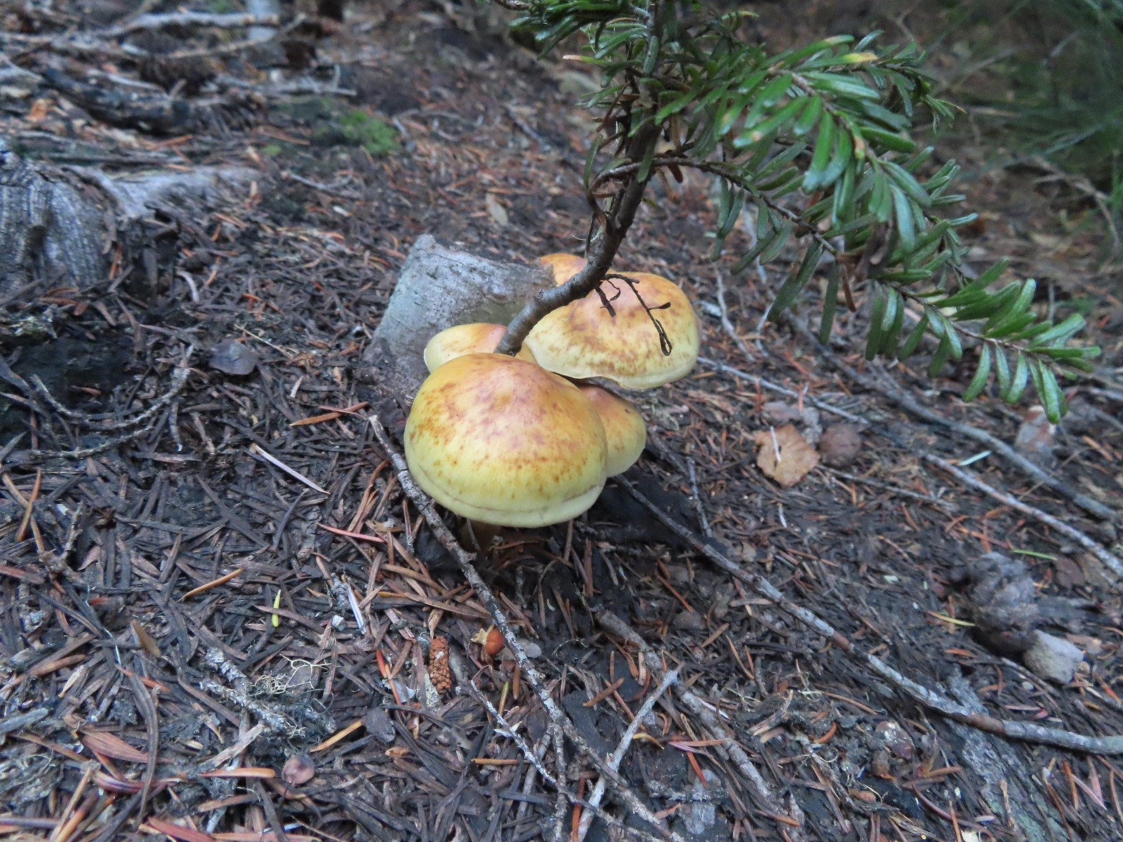
During our loop around Diamond Peak we’d turned onto the Mt. Yoran Trail here, but today we stuck to the Vivian Lake Trail which spent the next 1.2-miles climbing to a saddle. At times the trail was nearly level while at other times it launched steeply uphill. While it was too late in the year for flowers there were numerous colorful mushrooms and fungi along the way.
It looks to have been a good year for beargrass.
The trail was well maintained with only one small log across the entire route to Vivian Lake.
Another level section.
Pond along the trail.
The saddle at the high point of the trail.
After catching our breath at the saddle we began the mile and a half descent to Vivian Lake. The first two tenths of a mile the trail dropped steeply downhill to a shelf where it leveled out as it passed a pair of unnamed lakes. Maiden Peak (post) across Highway 58 through the trees.
We passed the smaller of the two lakes a half mile below the saddle.
The second lake, which was just 100 yards from the first, was much larger.
Mt. Yoran from the lake.
Ridge above the lakes.
A tenth of a mile from the lakes the trail began another steep descent along a trickling creek before leveling out next to a marsh. Just before beginning the descent the trail passed South of a third small pond/lake that was visible through the trees.
Heading down to the creek.
The marsh
Mt Yoran from the marsh. While it looks like a meadow, Fall Creek flows through here, and at times we could see water out in the grass.
Just 0.2-miles beyond the marsh we arrived at a junction with a spur trail to Vivian Lake.
We’d been to this junction before as well, in 2013 we had visited the lake as part of our Salt Creek Falls Hike (post). We turned left onto the spur trail and followed it a short distance to the lake.
We were able to use these rocks to hop across this narrow channel to the North shore of the lake where we were able to get a view of Mt. Yoran.
After exploring part of the northern shore I headed back across the channel and followed the trail around the South side of the lake until it petered out near a peninsula.
While I was exploring Heather was admiring the changing leaves.
When we headed back we took a brief off-trail detour from the Vivian Lake Trail to Fall Creek which we could hear from the junction with the spur trail.
After returning to the trail we headed back the way we’d come. The climb to the saddle was as steep as we’d expected so a rest was warranted prior to dropping down to Notch Lake where we stopped to watch several ducks enjoying the warm Autumn day. Varied thrush. These continue to be the most frustrating frequently seen bird to try and photograph.
I believe these were ring-necked ducks.
Beyond Notch Lake we finally ran into some other people. We passed a single hiker on the far end of the lake and a group of six near the wilderness boundary. Those were the only people we would see on the trails all day.
Diamond Peak from the trail on the way back.
When we made it back to the trailhead we had the choice of getting in our car and driving a tenth of a mile back up Forest Road 23 to the Hemlock Butte Trail or walk there. We opted to walk and hiked past our car and up the road to the well signed trail.
The Hemlock Butte Trail is just a half mile long but gains 500′ to the site of a former fire lookout. While it was well signed, this trail was not anywhere near as well maintained as the Vivian Lake Trail had been. A number of downed trees combined with overgrown sections and some poor tread made the short climb an adventure. Not all of the blowdown was as easy as this log to get over/under.
Multiple switchbacks kept the lower portion of the climb from feeling too steep.
The Hemlock Butte Trail succumbing to the vegetation.
The summit of Hemlock Butte is a rocky outcrop which required a fair amount of scrambling over the final 250′ to reach the small flat summit where the lookout once stood.
An obvious spur trail at the base of the rock outcrop leads to a view of Mt. Yoran and Diamond Peak. For those not comfortable with the scramble this is a good goal.
The trail to the summit at the junction with the spur.
Scrambling up
Mt. Yoran and Diamond Peak from the summit.
Wolf Mountain to the NW with clouds covering the Willamette Valley in the distance.
The view South.
Looking down from the summit. (The trail is to the right.)
Heather opted to stick to the spur trail viewpoint so after I’d taken in the view I headed back down. We decided that I would go ahead and bring the car up to the Hemlock Trail to pick her up. My hike here came in at 10.4 miles with approximately 2000′ of cumulative elevation gain.
After picking up Heather we headed for Pool Creek Falls which was located back off of Forest Road 23. The driving directions had been plugged into my phone but at some point during the first hike the route was lost and without signal we couldn’t use the phones to relocate Pool Creek. We had made note of it when we’d passed by that morning though so we started back trying to picture what the area/road had looked like because the creek was not visible from the road. Now the first 15.7 miles this road is paved (save for one very short gravel section) before turning to good gravel for the final 3.7 miles to the Vivian Lake Trailhead and we were both fairly certain that we had been on the gravel section when we’d passed by (wrong) so when we reached pavement we pulled over and used the GPS unit. We found Pool Creek on that map and confirmed that it was still about 2 miles away. We parked along the shoulder of FR23 across from the partially hidden sign announcing the trail. The “trailhead” was just under 14 miles from Highway 58 or just over 5.5 miles from the Vivian Lake Trailhead.
The trail sign on the right. The Pool Creek Trail #4228 shows up on the Forest Service map, but they don’t have a dedicated webpage for it. We were made aware of the trail by following Hike Oregon, a good resource both online and through several guidebooks.
We had a little trouble getting started as the Forest Service and GPS maps both showed the trail following the right (East) side of the creek for a short distance before crossing over and initially there was obvious tread heading in that direction. The canyon quickly narrowed though, and we came to a large log that would have to be the trail in order for us to proceed any further but it was obvious that it wasn’t really the trail.
What looks like it might be tread ahead is actually the log.
Looking across at the other side of the creek the canyon wall seemed too vertical to be supporting a trail but we weren’t going any further on this side, so we backtracked to what looked like a faint path we had passed near the beginning. We had taken it to be a use trail down to the creek but now that we looked closer, we could make out a trail covered in leaves switchbacking up on the far side. The Pool Creek Trail to the left of the creek. Here you can see the first switchback turning steeply uphill.
The makeshift creek crossing.
At the third switchback.
The trail was in reasonably good shape with a couple of larger logs to navigate. A little research showed that the Cascade Volunteers have this trail on their radar and had done some work on the trail in 2022.
The reason we hadn’t noticed the trail on the far side was because it climbed quite a bit in an initial series of short switchbacks so from where we had been the trail was already much higher than we’d expected it would be. In the photo Heather is coming up to the third switchback below.
These two trees are mentioned in the May 2022 trail update on the Cascade Volunteers webpage.
This one was high enough to easily pass under. On the far side are more cut logs.
Just under a half mile from the road we arrived below Pool Creek Falls. First view of the falls from the trail.
Pool Creek Falls
After navigating a slightly slick crossing of the creek I followed a trail up to and behind the falls. We were happy to find that there was enough water flowing this time of year to get to see the falls, but it would be much more impressive in wetter seasons.
We spent some time at the waterfall then headed back to the car and drove home. It had been just under a mile with a little over 200′ of elevation gain for Pool Creek Falls. It had been an interesting day with wilderness lakes, a summit viewpoint, and a waterfall on trails in various conditions. One word of warning regarding FR23 – the paved section has some massive holes/dips and a number of sunken sections requiring alert driving. For once I had actually been looking forward to reaching the gravel portion of the road. Happy Trails!
Some much-needed rain was forecast to arrive by Saturday afternoon. That combined with the presence of haze from the lingering wildfires had us looking for a shorter day that wasn’t focused on big views. We turned to a pair of hikes in the direction of Mt. Hood. (Originally the plan was for a third stop at Barlow Wayside Park, but it is currently closed due to the Camp Creek Fire.)
To start our day we drove to the West Zigzag Mountain Trailhead for the short, but steep, Castle Canyon Trail.
We’d parked here in 2020 when we hiked up to West Zigazag Mountian (post).
We followed the Barlow Wagon Road Trail until we spotted a barricade. Just before the barricade we spotted a trail heading into the forest on our left.
The barricade ahead.
The trail before the barricade.
We mistakenly turned up this use trail which sported clear tread but also a good deal of blowdown.
This trail had seen maintenance at some point.
As we picked our way over and around the obstacles it became clear that we were not on the Castle Canyon Trail. A quick check of the GPS unit showed that we had turned off the Barlow Road too early. Luckily this trail crossed the Castle Canyon Trail after 0.2-miles.
There was no signage at the junction and the map on the GPS showed the Castle Canyon Trail further ahead, so we turned right on this new trail and followed it back 400′ to the Barlow Road where we confirmed that it was indeed the Castle Canyon Trail. Trail sign along the road.
We turned around and headed up the Castle Canyon Trail arriving at signboard and wilderness registration box not far beyond the junction with the use trail.
While the Castle Canyon Trail is only about a mile long it gains over 800′ most of it over the final three quarters of a mile.
Toward the end of the trail, we began to pass a series of volcanic rock formations.
The official trail ends at the top of a rock fin with a partially obstructed view called the Pinnacles Viewpoint.
Another use trail headed left (West) from the top of the fin passing through the forest for approximately 300′ to a second rock fin with a better view but unbeknownst to me it was home to some rather inhospitable yellow jackets. The western fin.
Everything was fine while I was taking in the view but as I started back along the fin I felt a sharp prick on the back of my right hand. It took a moment to realize what had happened, but I quickly realized it was a ticked off yellow jacket. Given the terrain I was on I couldn’t move too quickly despite needing to get away from whatever nest was about. A second sting followed, this one on my calf and I was afraid one had gotten up may pant leg so I was now slapping my leg as I carefully (but quickly) retreated along the trail. By the time I’d made it back to the end of the official trail the pursuit seemed to have been abandoned and I took a moment to catch my breath. Just after taking this picture on my way back I received my first sting.
I actually followed a use trail several yards above the end of the trail just to make sure I wasn’t being followed.
I could see Heather on the trail below so I made my way out onto the other fin which was yellow jacket free and waited for her to make her way up.
The trail on the other fin.
The Castle Canyon Trail below the rock fin.
After taking in the view from this fin we headed back down to the Barlow Wagon Road Trail and followed it back to our car.
<
One of two red-breasted sapsuckers on the tree.
The Castle Canyon Trail was approximately 0.2-miles East of the barricade that we’d seen from the use trail we turned up.
We liked the colors of this plant carpeting the ground along the road.
Back at the West Zigzag Trailhead.
From the trailhead we headed back to Highway 26 and followed it West into Sandy and made our way to the Sandy River Trailhead.
There isn’t much parking here but it is possible to park at nearby Sandy High School.
The Sandy River Trail follows an old roadbed downhill for a mile to the Sandy River in this undeveloped park. The Jim Slagle Loop Trail allows for an optional loop. The upper junction with the loop trail was just 0.2-miles from the trailhead.
We stuck to the Sandy River Trail on the way down.
The Sandy River Midway Trail on the left was about 0.4 of a mile from the upper junction making a shorter loop (or figure 8) possible.
The lower junction with the Jim Slagle Trail was 0.6-miles from the upper junction.
Approximately 500′ from the lower junction we came to a trail pointer for a viewpoint.
We figured why not and followed the short path to the left to a rather obstructed view of the Sandy River. The river is behind the trees at the top while the Sandy River Trail is clearly visible below.
After the short detour we continued down to the river where trails went in either direction. There were numerous use trails down to the riverbank, all of which were occupied by fishermen.
Since there was no open space along the river we quickly turned around and started back up to the loop trail where we turned right.
This trail climbed through the forest for almost a mile to the upper junction. The forest was nice and we spotted a large frog along the way.
From the upper junction it was just a short climb back to the trailhead.
The two hikes combined were a just under 7-miles (4.3 & 2.5 respectively). Perhaps not the most exciting trails we’ve hiked. The scenery was nice and they had enough to offer for their lengths. Castle Canyon
Sandy River Park
I could have done without the stings, but it was a nice outing on a day when rain would finally be arriving. Hopefully it extends into Northern California to help with some of the fires down there. Happy Trails!
While we are focused on our quest to complete Sullivan’s featured hikes (post) we are also plugging away at several other guidebooks including Matt Reeder’s 2016 “101 Hikes in the Majestic Mount Jefferson Region”. It’s been a bit of a challenge to make much progress in this book since 2020 when wildfires burned much of the area it covers. In some cases the trails were burned and in others the access roads to the trailheads were closed for hazardous tree removal. The two stops we had planned for this outing were two such hikes.
Our first stop was to visit the viewpoint and lookout tower on Sisi Butte. The fires didn’t burn the butte, but until Forest Road 46 was reopened between Detroit and Estacada this past June it wasn’t accessible for us to reach the trailhead.
Our adventure actually began before reaching the trailhead. Over the final two miles of our drive we passed at least two dozen cars heading toward Olallie Lake (post). We guessed that there must be some sort of race happening which turned out to be correct, the 100-mile Mountain Lakes 100 to be exact. Luckily the racecourse wasn’t along either of the hikes we’d planned for the day, we’ve made that mistake before and it doesn’t make for the most enjoyable hike. (Someday I’ll learn to check for races/events at the same time I’m checking the managing agencies information on the trail conditions.) We eventually made it to the gated road and parked along the side of FR 4220 (Old Skyline Road).
This was about as straightforward as a hike can get. We followed the closed road up Sisi Butte for just under three miles to the lookout tower. There was a lock on the door to the observation deck, but we were able to climb up to that point to get views of Mt. Hood, Mt. Jefferson, and Three Fingered Jack. Dust from ultra runner’s cars hanging over the closed roadbed.
Mt. Jefferson in the monring.
The Summer haze we’ve grown to expect was back after having improved following a brief period of rain.
The smoke does make for some colorful sunrises though.
Scouler’s bluebells
There was a nice forest along the road. Much of the butte is within one of the five tracts making up the Clackamas Wilderness but being a man-made improvement the road itself is not part of the Sisi Butte tract.
Mt. Hood to the North.
Mt. Hood
Despite the surrounding haze the sky above the road was bright blue.
There were numerous good views of Mt. Jefferson from the road.
About 0.4 miles from the lookout an abandoned spur road splits off to the right toward the eastern summit which is just a couple of feet higher than the western.
The tower is still staffed at times, but it was empty today.
Penstemon
Olallie Butte, Mt. Jefferson and Three Fingered Jack from the lookout.
Mt. Jefferson and Three Fingered Jack
Mt. Hood, West Pinhead Butte, and the eastern summit.
A hazy Mt. Hood.
Flat topped Battle Ax Mountain (post), Silver King Mountain (post), Pansy Mountain, Bull-of-the Woods (post), Big Slide Mountain (post), and Schreiner Peak in the Bull-of-the Wilderness.
Bachelor and Coffin Mountains (post) in the Old Cascades.
After taking in the views we headed back down. We’d passed a pair of hunters on the way up and a pair of hikers on the way back down along with a few grouse. Grouse along the road.
Despite high temperatures around 80 the leaves reminded us that Fall would be arriving soon.
Canada jay checking us out.
The out-and-back was just shy of 6-miles with approximately 1400′ of elevation gain.
From the gated road we turned around and headed South on FR 4220 for a total of 6.5-miles to the Lower Lake Campground entrance.
While Sisi Butte had escaped the 2020 wildfires the Lionshead Fire had severely damaged the campground and the trail to Fish Lake. Lower Lake Campground, a work in progress.
While the campground was closed, the trail was open despite the fire damage.
The Fish Lake Trail at Lower Lake Campground.
While the sign at the trailhead said it was a half mile to Lower Lake we actually arrived at the eastern end of the lake after a third of a mile. Ferns creating a green hillside in the burn scar.
Lower Lake
The trail passed along the northern shore of Lower Lake without too much trouble. There was on small detour necessary to avoid some blowdown, but it was easily navigated. The water in Lower Lake was quite colorful.
We had detoured to Lower Lake prior to the fire during our Lodgepole Loop hike in 2019 (post).
Just a short distance from the western end of the lake we crossed the Lodgepole Trail.
For the next quarter of a mile the trail was fairly level. Sisi Butte off to the right.
Fireweed going to seed.
Buckwheat
The burn was intense along the trail, but it was in pretty good shape all things considered.
After a quarter mile the trail arrived at a cliff above Fish Lake and then began a steep descent dropping 400′ over the next half mile to the lake. Sisi Butte and Fish Lake from the cliff.
Mt. Hood peeking out from behind West Pinhead Butte.
Mt. Hood
The Fish Lake Trail switchbacked a few times before giving up on that and dropping steeply for the final 0.2 miles.
A beat up Lorquin’s admiral.
There were signs of somewhat recent trail maintenance, but given the severity of the burn and the steepness of the hillside the trail is going to need a lot of ongoing attention to keep it passable.
The trail disappeared a couple of times in brush and blowdown near the lake, but it was never hard to pick back up.
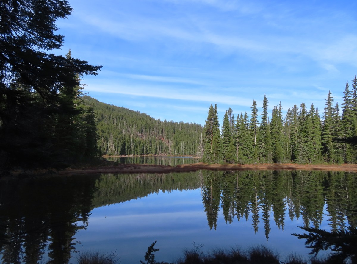
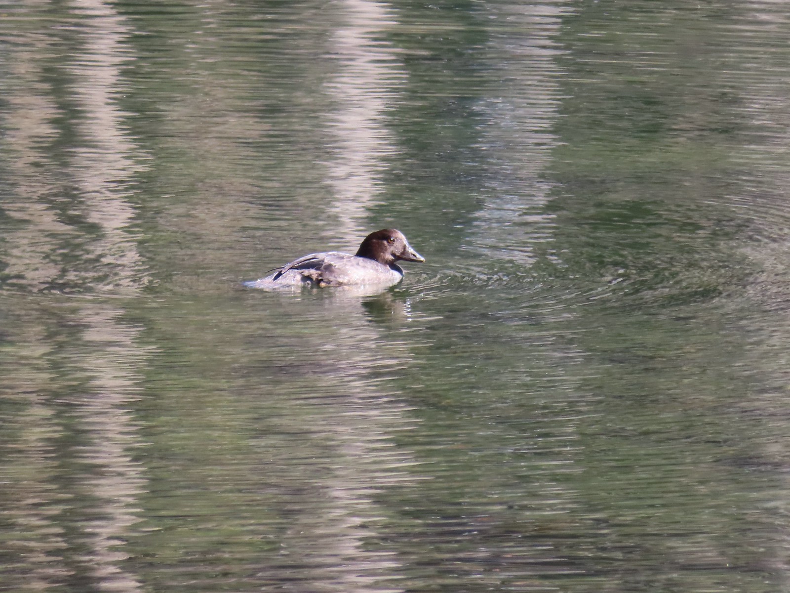
There were no people at the lake, just a pair of ducks enjoying the warm day.
Nap time.
Olallie Butte from Fish Lake.
After passing around the southern side of the lake we arrived at a nice campsite under some unburned trees.
Beyond Fish Lake the forest along the trail was mostly out of the fire scar. The trail followed along Squirrel Creek (currently dry) for 0.4-miles.
Just under a quarter of a mile from Fish Lake the trail crossing a road and under some power lines.
Four tenths of a mile from Fish Lake we came to a trail sign with a pointer to Surprise Lake. We passed a few of these “Spot Fire” flags, presumably left over from 2020.
The signed junction.
We detoured to check out the brushy lake and found it to be as Reeder reported, brushy had difficult to explore.
I had to walk out on a log and fight through some thick brush to reach a decent view of the water.
Surprise Lake
We returned to the Fish Lake Trail and continued another half mile to Si Lake. The trail between the junction and Si Lake got a little brushy.
Huckleberry leaves in their Fall colors.
Si Lake from the trail.
Si Lake.
Tortoiseshell butterfly
Si Lake was the smallest of the three lakes along the Fish Lake Trail (not counting Surprise Lake) and lacked a view of any of the surrounding peaks. The day was heating up quickly and we had a nearly 900′ climb over the three miles back to the car, so we took a short break and headed back.
A few clouds formed overhead and a slight breeze kicked up during our return which fortunately kept if from feeling too hot. Olallie Butte from Fish Lake.
Black bear print along the shore of Fish Lake.
White breasted nuthatch
Lower Lake from the Fish Lake Trail.
Olallie Butte from Lower Lake.
While parts of Lower Lake are shallow it actually reaches a depth of 73′ which is the reason it is so colorful.
Arriving back at Lower Lake Campground.
This hike came in just over 6-miles and 900′ of elevation gain making this a 12-mile, 2300′ elevation gain day.
The hikes were enjoyable and offered a lot of solitude, we only saw three people (all at Lower Lake) along the Fish Lake Trail in addition to the four at Sisi Butte. Cooler temperatures and less smoke would have been preferred but it was a great outing none the less. Happy Trails!
As we near our goal of finishing at least part of all 100 featured hikes in William L. Sullivans “100 Hikes/Travel Guide Southern Oregon & Northern California” edition 4.2 (post) there was one backpacking trip left. Sullivan’s Seven Lakes West and Seven Lakes East (hikes 38 & 39 in edition 4.2) start at trailheads on opposite side of the Cascade Crest but both contain a loop through the Seven Lakes Basin and a climb up Devil’s Peak in the Sky Lakes Wilderness. Aside from the different trailheads the only other difference is that he includes a visit to Lake Alta from the west trailhead.
We opted to begin from the eastern trailhead – Sevenmile Marsh. The primary reason for this was the trailhead is roughly half an hour closer to Salem but the Forest Service currently shows the status of the western trailhead (Seven Lakes) as unreachable. (This may simply be an oversight when updating their webpages, but it is a good reminder that it’s always a good idea to double check with the managing agencies before heading out.) Sevenmile Marsh Trailhead
The trail descended to a crossing of Sevenmile Creek then climbed gradually along a hillside above Sevenmile Marsh, entering the Sky Lakes Wilderness along the way.
Sevenmile Creek
Entering the wilderness
Sevenmile Marsh
The Sevenmile Trail climbed gradually through a nice forest for nearly two miles before joining the Pacific Crest Trail. Lodgepole pines were the dominate trees along the first part of the trail.
Mountain hemlock took over as the trail gained elevation.
Junction with the PCT.
We turned left onto the PCT and found ourselves losing a bit of elevation before beginning another gradual climb.
There were a few downed trees along this section but nothing difficult to get around.
This twisted tree caught our attention.
Nice blue sky.
Lewis’s woodpecker way up in a snag.
After two miles on the PCT we arrived at Honeymoon Creek which resembled a small pond. Tadpoles splashed around in the mud while larger frogs hung out around the water.
Tadpoles
Frog in the water.
After another 0.6-miles on the PCT we arrived at a signed junction with the Seven Lakes Trail. Trail sign ahead on the right.
Our plan was to set up camp at Cliff Lake then do the loop and summit Devil’s Peak as described by Sullivan. We could have turned right here and followed the Seven Lakes Trail 1.3-miles past Grass and Middle Lakes to Cliff Lake, but sticking to the PCT for another 0.7-miles then turning the Cliff Lake Trail would save us nearly a quarter of a mile. We decided to save Middle and Grass Lakes for our hike out the following morning and stayed straight on the PCT.
Unnamed creek along the PCT. We were surprised at how many of the seasonal creeks still had flowing water.
Grass-of-parnassus
Huckleberries, there were a lot of these around the basin which we happily sampled.
Devil’s Peak poking up above the trees.
The Cliff Lake Trail.
We turned right onto the Cliff Lake Trail and descended a third of a mile to rejoin the Seven Lakes Trail a tenth of a mile from Cliff Lake.
Prince’s pine
Another flowing seasonal creek.
Crater Lake collomia (Collomia mazama)
The Seven Lakes Trail arriving on the right.
Cliff Lake
At Cliff Lake we turned onto a use trail following it around the eastern side of the lake in search of a suitable campsite. While there were numerous sites most of the sites we were seeing were large enough for multiple tents. We didn’t want to take up one of the large sites with our single tent and we also didn’t want to wind up with neighbors if we could avoid it. We wound up getting separated in the process and after walking back and forth for a bit we found each other and settled on a campsite.
Arnica
Aster
Splash in Cliff Lake from one of many fish that were feeding on insects.
Camp
After getting set up we grabbed our daypacks and headed back to the Seven Lakes Trail. We decided to hike the loop clockwise which meant backtracking along the Seven Lakes and Cliff Lake Trails to the PCT and then turning right to continue southward. Huckleberry bushes along the Cliff Lake Trail.
Anywhere there was water nearby there were lots of tiny Cascade toads to watch out for.
Back at the PCT.
Larger frog
Monkshood
More grass-of-parnassus
Not only were the toads tiny, they also were well camouflaged.
The PCT climbed steadily providing the first glimpses of the peaks around Crater Lake. Mount Scott (post) between the trees.
Near Devil’s Peak the PCT left the trees and switchbacked up a talus field resulting on great view to the north toward Crater Lake and beyond.
Mt. Thielsen (post) in the center beyond the rim of Crater Lake.
Union Peak with Mt. Bailey (post) behind to the right.
Lots of neat rock formation on Devil’s Peak.
Western pasque flower seed heads.
Buckwheat
Two and a half miles from the Seven Lakes Trail junction the PCT arrived at a pass. The final climb was fairly steep even with switchbacks, so a brief rest was in order at the pass.
Views to the South opened up at the pass including Klamath Lake and Pelican Butte.
Klamath Lake
Devil’s Peak and the PCT coming up to the pass from the North.
Klamath Lake, Pelican Butte, Aspen Butte (post) over the right shoulder of Pelican, Brown Mountain (post) is the small cone on the right, and Mt. McLoughlin (post)
Mt. McLoughlin
A faint Mt. Shasta which, given the wildfires burning in NW California was a bit of a surprise to be able to see.
The view North.
Goose Egg and Ethel Mountain in the forefront with Llao Rock, Mt. Thielsen, and Garfield Peak (post) behind.
Devil’s Peak
While we were resting at the pass we heard a helicopter approaching from the NW. It wound up hovering low above the lakes basin before heading back the way it came. We were a little concerned at first that it might be picking up water for a new fire but there wasn’t anything hanging from the helicopter so we have no idea what it was actually doing.
A path headed uphill from the pass toward Devil’s Peak while the PCT headed slightly downhill. The use path to Devil’s Peak on the right and the PCT on the left.
We headed up the use trail which was fairly easy to follow with just one slightly sketchy narrow spot.
The rather ominously named Lucifer from the use trail.
A second use trail coming up from the opposite side.
Western pasque flowers on the hillside above the use trails.
The summit of Devil’s Peak ahead.
The views were excellent from the summit so we took another nice break to soak them in before heading down. Looking North toward Crater Lake and Mt. Thielsen
Lucifer, Jupiter, and Venus
Lee Peak above the pass.
Luther Mountain (post) in the foreground with Aspen Butte, Brown Mountain and Mt. McLoughlin.
Remains of a former lookout.
The PCT below Devil’s and Lee Peaks.
Goose Egg, Llao Rock, and Mt. Thielsen
Mt. Scott
Mt. Shasta to South through a little smoke but again we felt fortunate to be able to see the mountain at all.
Colorful grasshopper at the summit.
American pipit
We headed down taking the other use trail which angled down along a ridge to the PCT approximately a third of a mile from where we had left it to climb Devil’s Peak. The Seven Lakes Basin from the use trail down.
South, Middle, North, and Grass Lakes
Heading down the use trail.
Looking back up the use trail.
When we reached the PCT we turned right and headed toward Lucifer.
Western snakeroot along the PCT.
A comma butterfly on western snakeroot.
Painted lady
At a ridge below Lucifer we arrived at a signed trail junction.
Here the PCT forked left toward Luther Mountain while the Devil’s Peak Trail forked right. We took the Devil’s Peak Trail and followed it 1.3-miles to the Seven Lakes Trail. Passing below Jupiter and Venus along the way. Venus from the Devil’s Peak Trail.
Looking back at Devil’s Peak.
Looking North across the Seven Lakes Basin.
Lake Alta in a bowl below Violet Hill.
Pond along the Devil’s Peak Trail.
Coming up to the Seven Lakes Trail junction. A rock cairn was the only marker.
We turned right onto the Seven Lakes Trail and descended 0.2 miles to a signed junction with the Alta Lake Trail.
We turned left onto the Alta Lake Trail. We followed this trail for a fairly level half mile to the long lake.
Heather took another break at the South end of the lake while I hiked another quarter mile along the lake to get a better look at the northern end. I was still only about halfway along the lake after the quarter mile. There used to be a campground at the North end.
Common merganser
The southern end of Lake Alta.
On the way back to Heather I detoured to take in the view from the cliffs above the basin. Cliff Lake below Devil’s Peak and Middle Lake.
Middle and Grass Lakes
I could hear several pikas in the rocks below the cliffs but the only thing I spotted was a chipmunk.
Chipmunk
After rejoining Heather we headed back to the Seven Lakes Trail and continued descending into the basin. Sulphur butterfly on aster.
Gentian
Fireweed
A mile from the Alta Lake Trail we arrived at South Lake.
South Lake
Another quarter mile brought us to a view of Cliff Lake.
Devil’s Peak from the trail. There were more pikas “meeping” from the rocks here but again we failed to spot any of them.
We followed the trail around to the North side of Cliff Lake and then turned on the use trail to return to our campsite.
Back at camp we refilled our water supply and had dinner then relaxed a bit before turning in for the night. For me this had been a 15.3-mile hike with 2000′ of elevation gain. One and a quarter of those miles was hiking from the Seven Lakes Trail to our camp, and initially wandering around looking for a site and Heather. Devil’s Peak in the evening.
So many fish in the evening.
In the morning we packed up and headed back, this time sticking to the Seven Lakes Trail to visit Middle and Grass Lakes.
Devil’s Peak in the morning.
Seven Lakes and Cliff Lake Trail junction.
We reached Middle Lake in 0.4-miles.
We detoured left at the northern end of the lake following a pointer for Lake Ivern to find a view back across Middle Lake.
Devil’s Peak from Middle Lake.
We returned to the Seven Lakes Trail and in another half mile we passed views of Grass Lake. Stream crossing.
Monkshood and grass-of-parnassus
Grass Lake
We didn’t follow any of the use trails down to Grass Lake and instead stuck to the Seven Lakes Trail as it climbed for 0.2 miles to the Pacific Crest Trail.
Arriving at the PCT.
We turned left onto the PCT and returned to the Sevenmile Marsh Trailhead the way we’d come the day before. Of note were the ducks making use of the small pond along Honeymoon Creek.
Golden-mantled ground squirrel
Sevenmile Trail at the PCT to return to the Sevenmile Marsh Trailhead.
Exiting the Sky Lakes Wilderness.
The hike out came to 6.1-miles with just 200′ of elevation gain.
The red section marks our track out past Middle and Grass Lakes
This was a great trip. The temperatures were pleasant, the views great, lots of huckleberries and only a few mosquitos. We also only saw a total of eight other people all weekend. We are now down to a half dozen featured hikes from the Southern Oregon/Northern California book and if conditions cooperate we may well be finished by November. Happy Trails!
It had been a couple of years since we’d hiked in the Mt. Hood Wilderness so we were due for another visit. There were a few trails that lead to the Timber Line Trail that we hadn’t checked out yet so we chose the McGee Creek Trail and planned on visiting McNeil Point for the third time. The first two visits had been via the Top Spur Trailhead (Post.
The McGee Creek Trail is a fairly straight trail that climbs gradually a little more than a mile and a half to the Timberline Trail. The trail is completely forested and a bit brushy in places, but it was quiet, we only saw two other hikers on the trail and that was when we were on our way back down.
Registration box and signboard at the Mt. Hood Wilderness boundary.
There were a few downed trees but nothing too difficult to navigate.
The brush was mostly huckleberry bushes.
Trail side snacks.
McGee Creek Trail junction with the Timberline Trail.
We turned left onto the Timberline Trail and followed it for approximately 2.5-miles to the McNeil Point Trail. While the McGee Creek Trail had been quiet the Timberline Trail was an expressway, even early in the morning. There were a lot of wildflowers blooming but the number of people was honestly a bit of a distraction. Add in a lot of garbage (mostly unburied TP) and at least one pair of backpackers camped on a meadow that was clearly marked no camping and it wasn’t the best experience we’ve had on a trail.
Blowdown from the September 2020 storms that also flamed the destructive wildfires across the state. For more information on the storms impact on Mt. Hood check out this Wy’East Blog post.
Looking through the trees at one of the areas that suffered severe blowdown.
It was a cloudy day. We got sprinkled on briefly a couple of times.
Fireweed
Pinedrop
Avalanche lilies
Paintbrush
Valerian, spirea, and paintbrush
Gentians
Yellow monkeyflower
A tributary of McGee Creek.
Spirea along the Timberline Trail.
Shooting star
Pink monkeyflower
Fleabane
Beargrass
False hellebore
Partridge foot
Lupine
Lewis monkeyflower along a tributary of McGee Creek.
Beardstongue
Lousewort
Dry pond surrounded by beargrass.
The idiots camped in the meadow. There is even an arrow on the “Do not camp in meadow” sign pointing at the meadow. Please DON’T be these people.
The butterflies weren’t out today but the bees were.
The clouds just wouldn’t quite raise enough.
Mountain heather
Lupine and paintbrush
Beargrass along the Timberline Trail.
Paintbrush, partridge foot and lupine
Signpost for the McNeil Point Trail.
We followed the McNeil Point Trail uphill gaining a ridge above a branch of Ladd Creek.
We’d never seen a paint colored like this before.
Western pasque flower
Lupine and two types of monkeyflower
The trail eventually curved away from the ridge traversing a hillside above the headwaters of McGee Creek.
As the trail passed through a talus slope we heard several pikas and it didn’t take long to spot one dashing across the rocks with some greens in its mouth.
Pikas spend the Summer gathering greens for the rest of the year when they remain in their homes under the snows.
We wound up seeing at least three, one of which emerged to say “hi” to Heather.
Mountain heather and paintbrush.
Saxifrage
A variety of flowers.
Avalanche lilies
Sub-alpine fleabane
Western pasque flowers
Doe that was as surprised as we were when we spotted each other.
Lewis monkeyflower
The trail forks at a small plateau out of sight of the McNeil Point Shelter. The right fork is the most direct route to the shelter but we forked left thinking we might head further up the ridge toward the Glisan Glacier like we had done in 2015. The righthand fork.
View from the plateau.
Some low clouds to the East.
Dwarf lupine
A hiker on the righthand fork headed for the McNeil Point Shelter.
As we approached the ridge a large group of hikers headed up the ridge from the shelter. When we reached the ridge we decided not to follow them up and instead turned downhill to the shelter.
Caves below the Sandy Glacier.
Bluebells of Scotland
The shelter below to the right.
Muddy Fork
Goldenrod
With the clouds the view wouldn’t have been great from the ridge on this day.
It had been approximately 1.5 miles from the Timberline Trail to the shelter. After taking a short break at the shelter we had a choice to make. Retrace our steps or take a steep scramble trail directly below the shelter. On our previous visits we had returned the way we’d come but today we decided to try the scramble route.
It was less than half a mile and approximately 700′ down to the Timberline Trail. The views were good and despite the steepness and a couple of long step downs it wasn’t as bad as we’d pictured.
Patches of blowdown along Bald Mountain Ridge.
Columbine
Valerian
Paintbrush and bistort
Aster
Chipmunk snacking on huckleberries.
Meadow near the Timberline Trail.
Arriving back at the Timberline Trail.
By descending via the scramble route we cut approximately 1.7-miles from the hike and got to see some new scenery. We were a bit surprised by the number of hikers climbing up this way but it probably shouldn’t have been surprising given how busy the mountain was. We turned left on the Timberline Trail and followed it downhill 1.8 busy miles to the McGee Creek. Every once in awhile the trail was clear of other users.
We’re always drawn to this rock fin above the Muddy Fork.
Canada jay
McGee Creek Trail junction.
We turned right onto the McGee Creek Trail leaving the crowds behind and descended the 1.7-miles to our car.
Bunchberry
Is that sunlight?
While the clouds never lifted from Mt. Hood we did experience a window of blue sky near the end of our hike.
Our hike came in at 9.7 miles with approximately 2700′ feet of elevation gain.
It was a bit of a mixed hike for us. The wildflowers and wildlife were great but the number of other trail users, and some of the resulting trash and lack of etiquette prevented us from fully enjoying the experience. It has been quite a while since we’d been on such a consistently busy hike. That being said the McGee Creek Trail was a nice break from the crowds providing the type of solitude (and lots of berries) that we really enjoy. Happy Trails!
For our last morning in Crater Lake National Park we had one final stop planned before heading home. A hike down the Cleetwood Cove Trail to the lakeshore. The 1.1-mile trail is the only one in the park that takes you down to the water which we thought was a fitting way to end our trip. Sunrise behind Llao Rock on the way to the trailhead.
Crater Lake at sunrise.
Mt. Bailey, Diamond Peak, and Mt. Thielsen behind Red Cone.
Cowhorn Mountain (post), Maiden Peak (post), the Three Sisters, and Mt. Thielsen.
We were the first car at the large parking area along East Rim Drive.
When we’d originally planned it we were going to be taking a boat tour (or at least a shuttle) over to Wizard Island to hike to the top of that cinder cone, but the boat tours weren’t open yet this year.
We crossed East Rim Drive and started down the trail which losses 700′ via a series of switchbacks. Mt. Scott (post)
Dutton Cliffs, Sun Notch (post), Applegate Peak and Garfield Peak (post)
Looking down at the turnaround point.
Wouldn’t want a rock like this to come down on you.
Breakfast time.
There were “no stopping” signs at areas where the danger of rock fall was the greatest.
One of the tour boats.
Looking back at the dock area.
We took a break at the bottom enjoying the view and watching fish jump while we prepared to make the climb back up. Couldn’t get an actual fish in a photo but I barely missed this one.
We did visit the lakeshore and touch the water before heading back up.
The dock at Cleetwood Cove.
It was a stiff hike back up to the parking area. We had had the lake to ourselves but were now passing the occasional hiker and fisherman on their way down the trail. Not a hiker or fisherman.
Llao Rock from East Rim Drive.
We were back at the car before 8am and on our way back to Salem. It had been a wonderful trip. The weather had been good, the skies not too smokey, and the scenery spectacular. It was a bit of a bummer to have missed out on Wizard Island, Lady of the Woods and The Pinnacles trail due to the closures but that just gives us an excuse to return. In fact the closure didn’t impact our ability to check the featured hikes off our to-do list. We have now hiked at least part of 92 out of the 100 Southern Oregon/Northern California hikes with the remaining eight planned for later this year (post). Happy Trails!
For our third day in Crater Lake National Park we had another four hikes planned. We continued to try to limit the crowds we would experience so we decided on an order of the short Castle Crest Wildflower Loop first followed by Garfield Peak then a section of the Rim Trail around Hillman Peak and finally the 1-mile Godfrey Glen Loop.
The Castle Crest Wildflower Loop is part of Sullivan’s Park Headquarters featured hike along with the Lady of the Woods Trail. That latter trail was listed as closed while the Park performs renovations on the historic buildings at Park Headquarters. The trails can be connected using a tie trail which we skipped due to the closure.
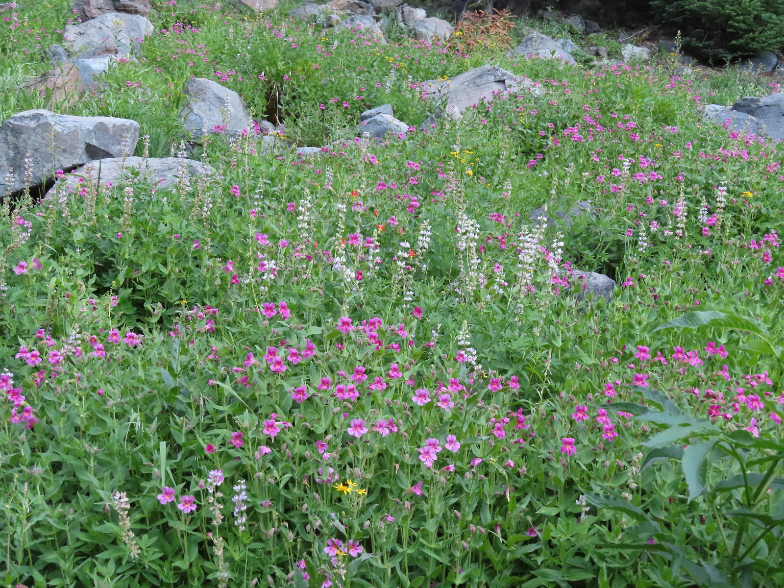
We hiked the loop counterclockwise. The wildflowers were in good shape and the pink monkeyflower was spectacular.
Bog Orchid
Bistort and monkeyflower
Some sort of orchid?
Yellow monkeyflower
Monkshood
Bistort
Not sure if this is a robin or ?
After the completing the loop we drove up to Rim Village where we parked between the Visitors Center and the Crater Lake Lodge. Crater Lake Lodge
We followed a paved path along the rim of Crater Lake behind the Lodge to signs for the Garfield Peak Trail.
Garfield Peak from behind the lodge.
The Watchman and Hillman Peak
Golden-mantled ground squirrel with a mouth full.
The trail passed a grassy meadow where a doe and her twin fawns were having breakfast.
The trail climbed steadily occasionally along the rim but more often along the cliffs below Garfield Peak.
Mt. McLoughlin (post) and Union Peak (post) to the south.
Mt. McLoughlin
Union Peak
Paintbrush
Reservoir structure (built 1931).
Mt. Bailey (post) to the left of Llao Rock and Mt. Thielsen to the right.
Mt. Bailey
Deer below the trail.
Western pasque flowers
Arnica
One of several patches of snow at the higher elevations.
Applegate Peak to the left and Crater Peak (post) to the right.
Arriving at the summit.
The 360-degree view from the summit was great even with a bit of haze from wildfire smoke. Mt. Scott above the Phantom Ship.
It was a bit hard to make out but Mt. Shasta was visible to the south.
Cowhorn Mountain (post) to the left of Mt. Thielsen and Howlock Mountain to the right.
Crater Lake from the summit of Garfield Peak.
We were scanning the meadows between Garfield and Applegate Peaks and spotted what we think was a large bull elk bedded down near the tree line.
Blurry photo due to the sheer distance away it was but it looked big.
We had the summit to ourselves, except for a few locals. Union Peak behind a marmot.
Penstemon
After a nice break at the summit we headed back down passing a few more hikers making their way up.
Painted lady
There were a lot of marmots out.
Paintbrush, phlox and buckwheat.
Stonecrop, paintbrush and pearly everlasting.
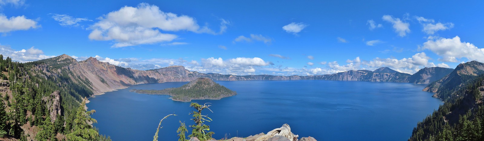
The clear blue water of the deepest lake in the United States.
Yellow-rumped warbler
Near where we had seen the doe and fawns earlier I was startled by a doe who popped out of some trees right in front of me.
False hellebore
After returning to the car we drove North on Rim Drive to The Watchman Trailhead. We’d started at this busy trailhead in 2012 when we visited the fire lookout atop The Watchman. Today we would be heading in the opposite direction hiking the Rim Trail around Hillman Peak. Viewpoint and The Watchman from the trailhead.
Western pasque flowers above Crater Lake.
It was a short, stiff climb to start before the trail began a gradual descent passing behind Hillman Peak.
Hillman Peak ahead.
There were quite a few different colors of paintbrush along the trail.
Lounging on a rock.
Shasta knotweed
Rim Drive below the Rim Trail.
Mt. Bailey and Diamond Peak with Diamond Lake (post) below.
Red Cone with Sawtooth Mountain (post), Cowhorn Mountain, and Mt. Thielsen beyond.
Although barely visible we could make out the South Sister (post) through the haze between Cowhorn Mountain and Mt. Thielsen.
Silvery Raillardella
Snow patch on Hillman Peak.
Penstemon
Llao Rock
It took us a moment to notice the two deer ahead along the tree line.
We spotted the doe but she also had a pair of fawns nearby that bounded off.
This buck had zero concern with us as we passed by.
Phlox
Dwarf lupine
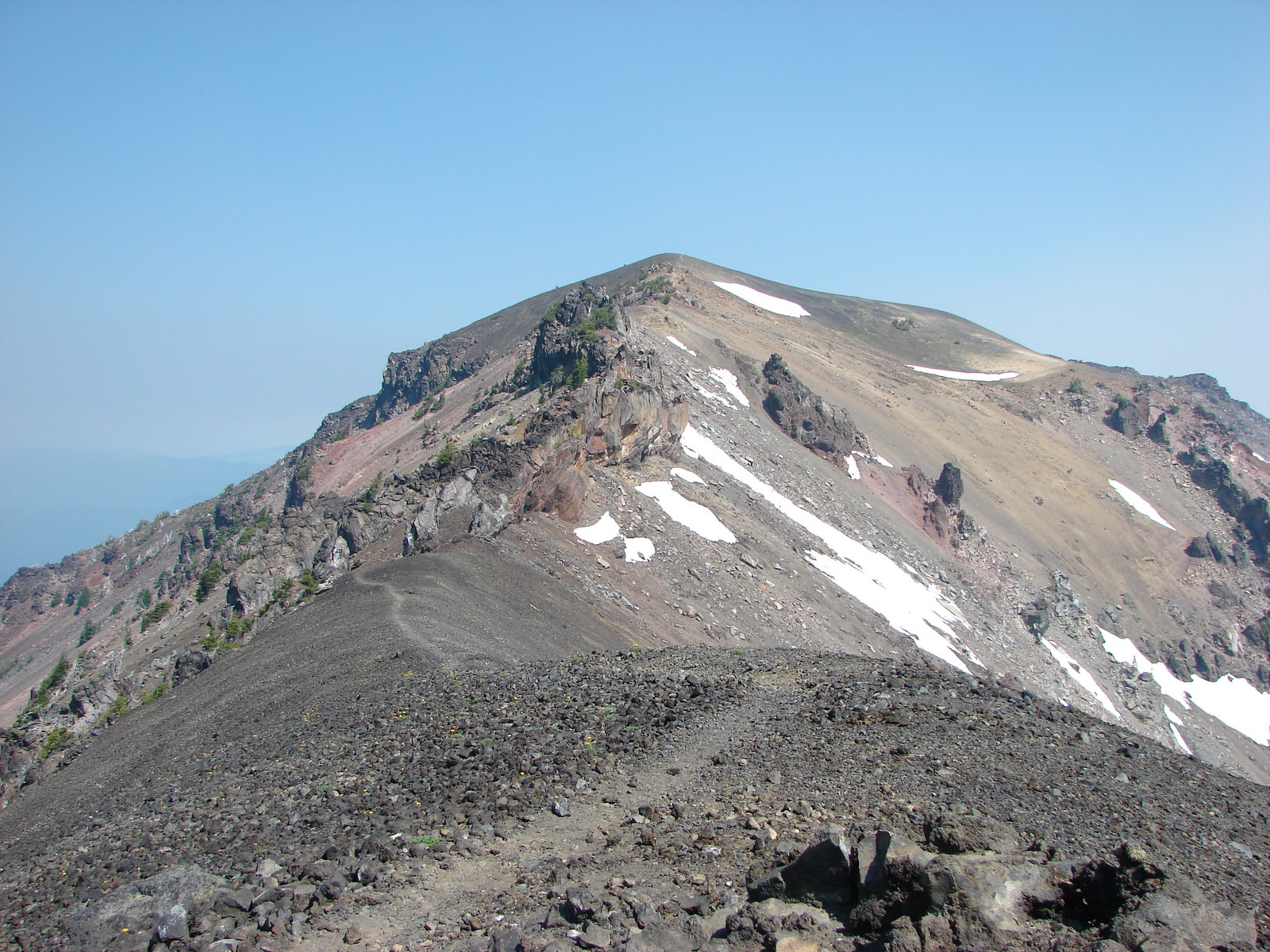
Devil’s Backbone with Mt. Scott behind.
We ended our hike at Devil’s Backbone, an exposed lava dike. Wizard Island
Devil’s Backbone
Hillman Peak from Devil’s Backbone.
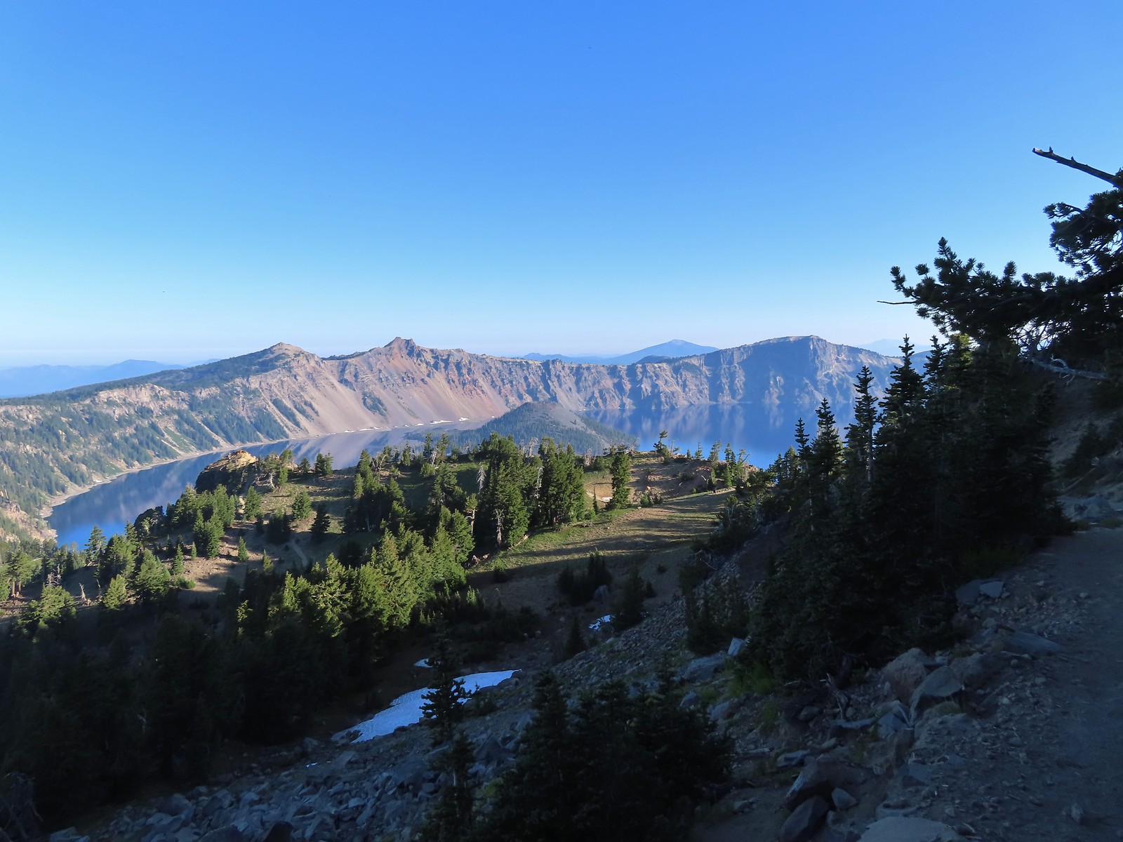
Garfield Peak across Crater Lake.
After a short break we headed back.
Saxifrage
The Watchman
If I stand perfectly still, they won’t see me.
Hillman Peak and Llao Rock from the viewpoint at The Watchman Trailhead.
Rock formations below Hillman Peak.
While the trailhead was packed with cars and people we only passed two others on our 3.7-mile hike to the Devil’s Backbone and back. We hopped back into our car and drove back toward Mazama Village stopping for one more short hike at Godfrey Glen. Godfrey Glen Trailhead
There were a couple of cars here but nothing like what we’d encountered at The Watchman. The 1-mile loop here passes views of Godfrey Glen and Annie Creek Canyon. Hiking clockwise is the shortest route to the viewpoints but we went the opposite direction to leave ourselves a shorter hike after finishing with the viewpoints.
The ADA accessible trail made for a nice easy walk.
Super-heated volcanic gas fused ash creating these pinnacles.
First viewpoint of Godfrey Glen above Munson Creek.
Godfrey Glen
Another viewpoint.
We could hear Munson Creek but it wasn’t visible in the canyon below.
Near the last viewpoint we could see just a bit of some falls on Munson Creek.
One waterfall.
Another waterfall in the canyon.
The end of the loop.
After finishing our hikes we returned to our cabin, showered, and changed then picked up a pizza from the Annie Creek Restaurant and took it back up to Rim Village. We hoped to visit the museum at the Visitor’s Center after eating some lunch but unfortunately it was closed. Instead we took the short paved path near the Center to the Sinnott Memorial Overlook.
We’d seen the overlook from the Garfield Peak Trail that morning. Sinnott Memorial Overlook on the rim to the left.
View from the overlook.
Mt. Scott and Garfield Peak from the overlook.
The overlook contained a number of informational signs including this one about the amount of water in the lake. These numbers blew our minds.
After reading all the signs in the overlook we climbed back up to Rim Village and made our way through the masses of tourists. We quickly decided that the crowds weren’t for us and retreated to the car and headed back toward our cabin. We did stop once more, at Park Headquarters since that was where the Lady of the Woods hike would have taken place if not for the construction.
Swallowtail and a painted lady on penstemon.
Our day, including the walk down to the overlook came to 9.7 miles and a little under 1500′ of elevation gain. The majority of the elevation gain came from the Garfield Peak hike (just over 1000′) and it was also our longest at 3.8-miles roundtrip. The hike around Hillman Peak was 3.7-miles but only 250′ of elevation gain while Godfrey Glen only gained 100′. The wildflower hike at Castle Crest was approximately a half mile with just 70′ of elevation gain and the short path to Sinnott Memorial Overlook was about a third of a mile roundtrip requiring around 150′ climb back up to the rim.
Garfield Peak and Sinnott MemorialHillman PeakGodfrey Glen
It had been a great day of hiking and the pizza was surprisingly good. We did however come to the conclusion that we just aren’t good tourists. Happy Trails!
After the difficult hike to Stuart and Red Blanket Falls (post) we had a three-stop day planned starting with Plaikni Falls. Plaikni Falls was one of two hikes included in Sullivan’s featured hike along with The Pinnacles Trail. Unfortunately Pinnacles Road was under construction and closed to any entry beyond the Plaikni Falls Trailhead.
While it was a bummer about the closure our criteria for checking off a featured hike has been hiking (or attempting) to hike just one of the options Sullivan lists in his featured hikes (post) meaning Plaikni Falls would satisfy our criteria.
We set off on the mile long ADA accessible trail just after 6:15am.
There were pikas out there in the rocks but we only heard them this time.
We did spot this western tanager though.
Pink monkeyflowers. One of our favorite wildflowers.
The trail climbed gradually along Sand Creek before rounding a corner to a view of Plaikni Falls.
Paintbrush and columbine along with lupine and groundsel.
Hummingbird visiting a paintbrush.
Monkshood
Yellow monkeyflower
We began here hoping to avoid any crowds and it worked. We were the only ones on the trail and had the falls to ourselves. The first person we saw was just getting ready to exit their car at the trailhead as we finished our hike.
From the parking area we hiked up the trail 0.2 to the start of a 0.6-mile loop which we hiked counter-clockwise.
There is a nice green meadow in the center of the loop.
The loop briefly follows the rim of Crater Lake passing several nice viewpoints.
The Phantom Ship.
Diamond Peak (post), Sawtooth Mountain (post), and Mt. Thielsen (post).
The Watchman (post) and Hillman Peak with Wizard Island below. Llao Rock in the center and Mt. Thielsen to the right.
Garfield Peak, The Watchman, and Hillman Peak.
Heading back down to the start of the loop.
Marmot
After completing the loop here we drove back toward Rim Village along East Rim Drive 1.4 miles to the Vidae Falls Picnic Area and parked in front of a signboard for the Crater Peak Trail.
The Crater Peak Trail travels 3.2-miles through the forest climbing to the rim of the peak’s crater. A 0.4-mile loop around the crater is possible on an unofficial but well-established path.
Vidae Creek
The first 0.6-miles paralleled East Rim Drive before turning South along a broad ridge toward Crater Peak. East Rim Drive was up above the trail.
Crater Peak through the trees on the left.
Paintbrush
Stonecrop
Setting off on the broad ridge.
The trail was in need of a little maintenance as there were several larger trees down along the ridge.
There was a very short steep climb to reach this small meadow with a view ahead to Crater Peak.
Female western tanager
Near the 2.5-mile mark we arrived at the base of Crater Peak where the trail suddenly steepened as it began its climb.
Mt. Shasta was visible, barely, through wildfire smoke.
Arriving at the crater.
We took a short break on a log to catch our breath after the climb then hiked clockwise around the crater gaining views of the peaks around Crater Lake. Scarlet gilia lining the trail around the crater.
The Watchman to the left and Garfield Peak.
Applegate Peak and Mt. Thielsen
View south to Mt. McLoughlin with the Goose Nest to the closer to the right.
Klamath Basin with haze from (most likely) the Golden Fire near Bonanza.
The Rabbitt Ears and Hershberger Mountain (post) along the Rogue-Umpqua Divide.
After completing the loop we headed back to the trailhead where we were stopped by a couple looking for Vidae Falls. Those falls are located along East Rim Drive, not near the picnic area so we let them know where to find the roadside pullout and then followed them to the small parking area.
It was well worth the quick stop before heading back to our cabin at Mazama Village. We had completed our hikes just after Noon and had plenty of day left so we decided to make the 30-minute drive to Union Creek and have a late lunch/early dinner at Beckie’s Cafe.
Beckie’s was busy but the food was great as usual. We each got a slice of pie to go for desert later and returned to Mazama Village. It was still pretty early so I was doing some research on our remaining hikes for our trip. Looking at the Park website I had noticed that in addition to The Pinnacles Trail two additional trails we were hoping to hike were listed as closed, Lady of the Woods and Annie Creek. Again these were both one of two featured hike options so they wouldn’t affect our ability to check off the featured hikes, but it would be a bummer to miss them nonetheless. I then looked at All Trails and saw that there were very recent trip reports from Annie Creek.
That trailhead was located next to the store in Mazama Village so after eating our pie we decided to make an evening hike out of it to see if the trail was indeed open.
We followed an unsigned path from the store/restaurant parking lot to a signed junction where we turned right.
The trail passed between Annie Creek Canyon and the Mazama Campground. We passed a junction where a 1.7-mile loop began/ends that would take us down to Annie Creek.
Signboard at the loop.
We stayed up and hiked the loop counterclockwise. Crater Peak from the trail.
Ash pinnacles
Getting ready to drop into the canyon.
The trail had been closed for hazard tree removal and we could see that there had been some big trees that had to be cleared.
Wildflowers in the meadows below.
Annie Creek
The trail crossed Annie Creek a couple of times on footbridges before climbing steeply back up to campground.
Monkeyflower and lupine
Final pitch to end the loop.
The Annie Creek Restaurant.
Unsurprisingly this had been the busiest hike of the day. After seeing no one on the Plaikni Falls and Sun Notch Trails we’d seen just four other hikers (2 pairs) on the Crater Peak Trail. Our total mileage for the day came in at 12.3 miles (2.2, 0.9, 6.8, and 2.4 miles respectively). Total elevation gain was 1525′ with over a thousand of that coming from the Crater Peak hike. Annie Creek and Plaikni Falls were each 200′ and Sun Notch a little over 100′.
Plaikni Falls, Sun Notch and Crater Peak tracksAnnie Creek
It was a great day of hiking and having a piece of pie from Beckie’s Cafe was the cherry on top. Happy Trails!


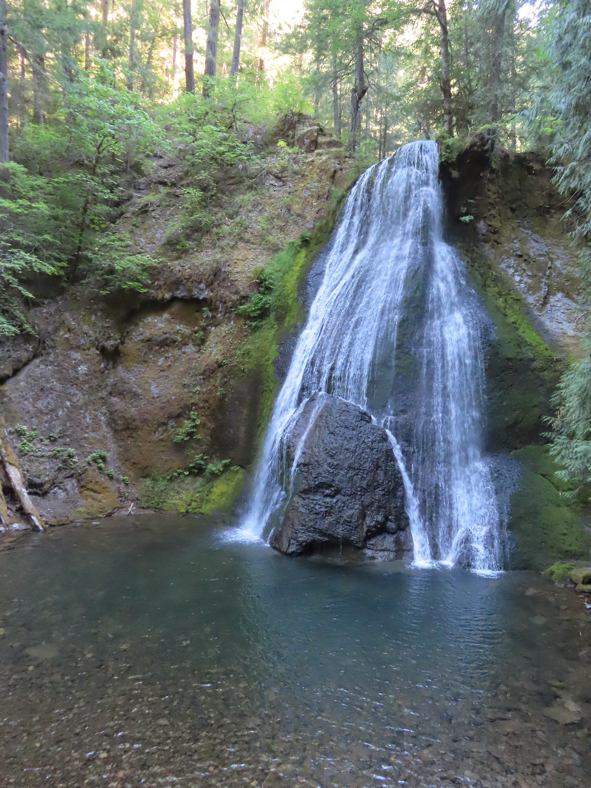
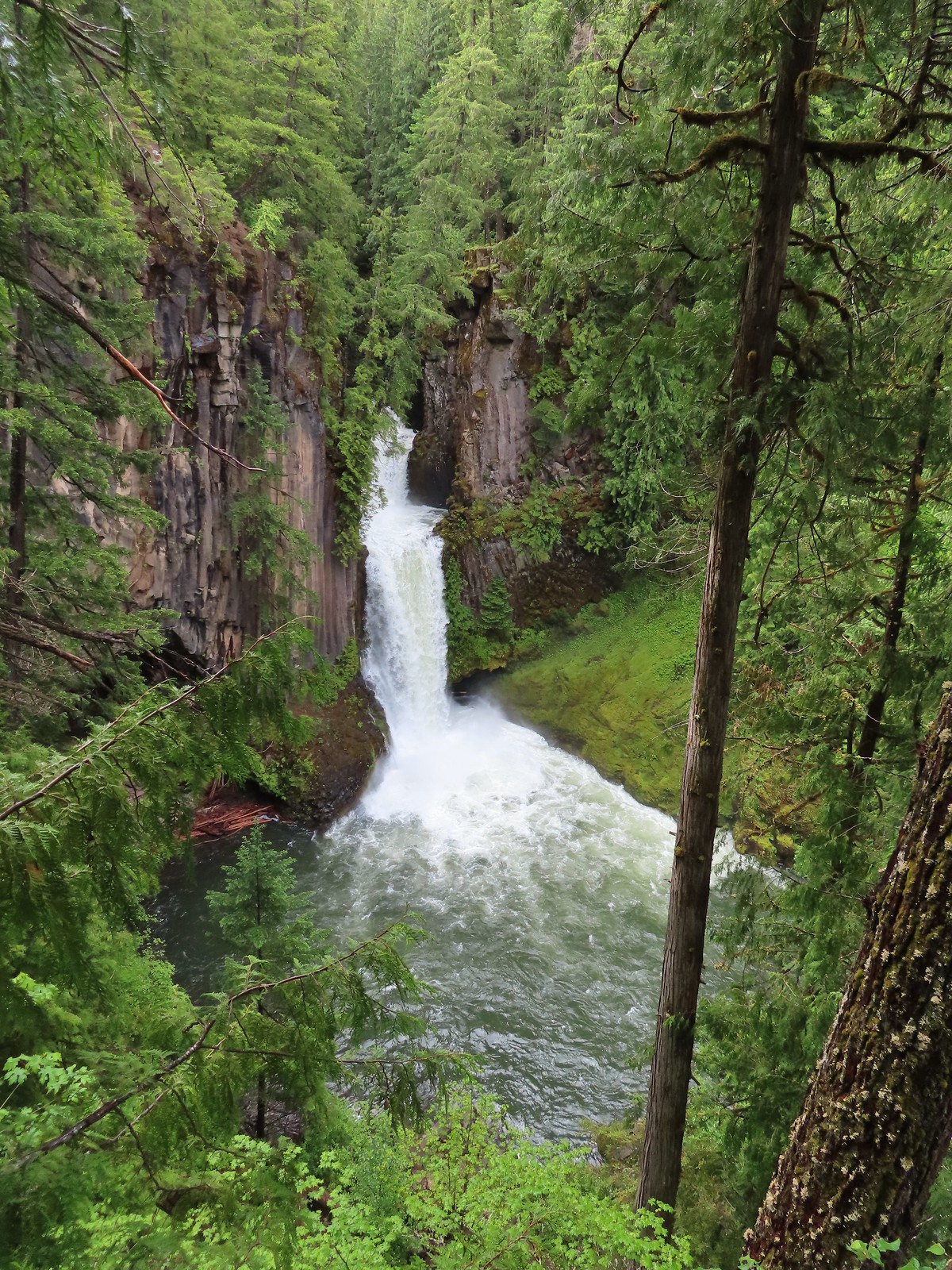
 Fall Creek Falls
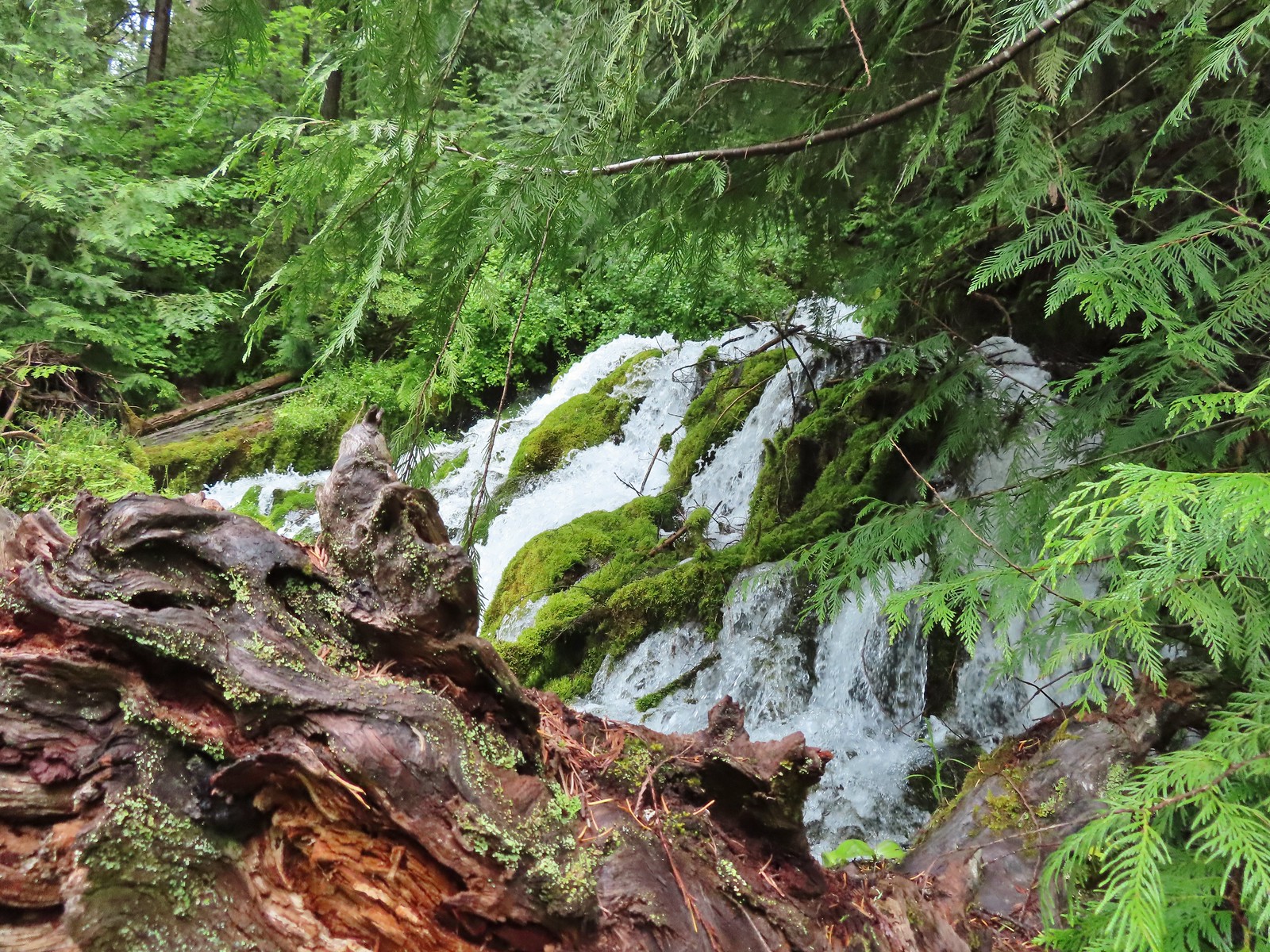
 Yasko Falls
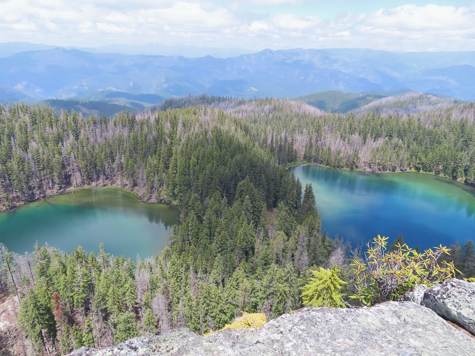









 Lower Table Rock
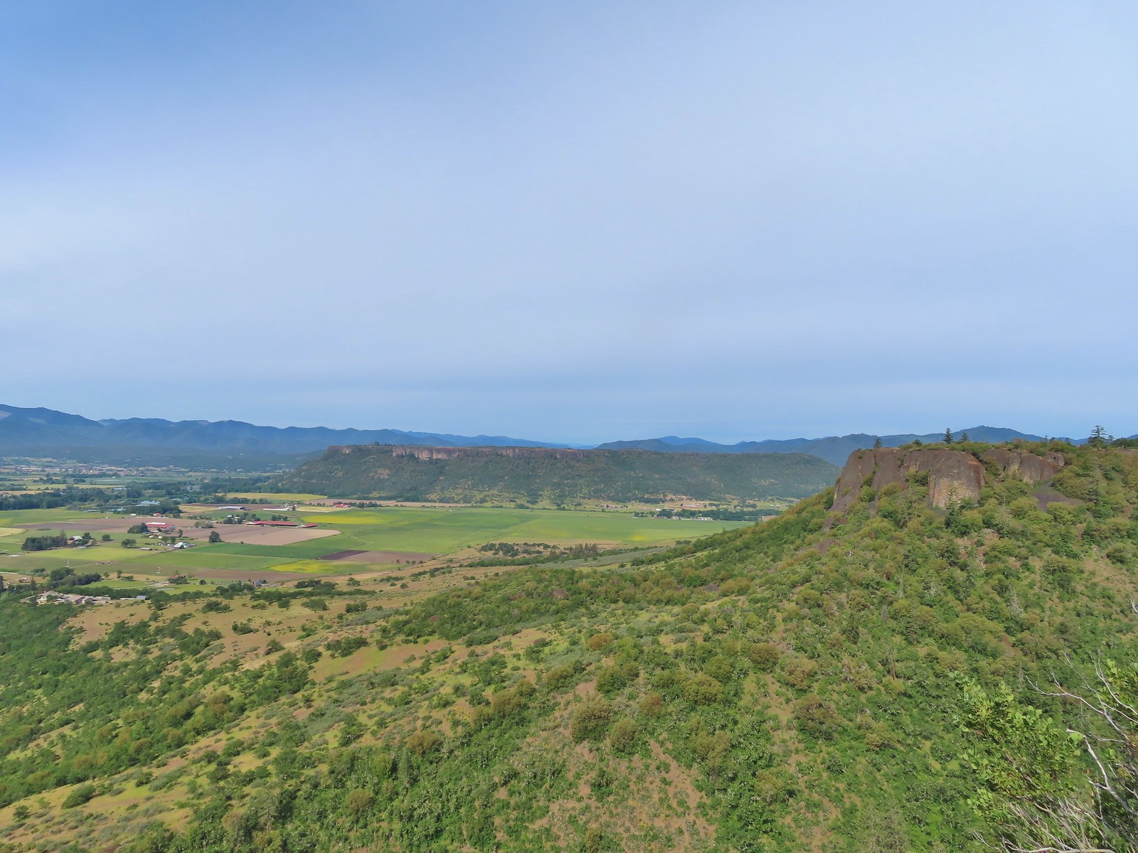 View from Upper Table Rock































 Along the way we entered the wilderness area.


 It looks to have been a good year for beargrass.


 The trail was well maintained with only one small log across the entire route to Vivian Lake.

 Another level section.
 Pond along the trail.
 The saddle at the high point of the trail.
 Maiden Peak (


 We passed the smaller of the two lakes a half mile below the saddle.
 The second lake, which was just 100 yards from the first, was much larger.
 Mt. Yoran from the lake.
 Ridge above the lakes.
 Just before beginning the descent the trail passed South of a third small pond/lake that was visible through the trees.
 Heading down to the creek.

 The marsh
 Mt Yoran from the marsh. While it looks like a meadow, Fall Creek flows through here, and at times we could see water out in the grass.


 We were able to use these rocks to hop across this narrow channel to the North shore of the lake where we were able to get a view of Mt. Yoran.


 Varied thrush. These continue to be the most frustrating frequently seen bird to try and photograph.


 I believe these were ring-necked ducks.
 Diamond Peak from the trail on the way back.

 Not all of the blowdown was as easy as this log to get over/under.
 Multiple switchbacks kept the lower portion of the climb from feeling too steep.
 The Hemlock Butte Trail succumbing to the vegetation.
 An obvious spur trail at the base of the rock outcrop leads to a view of Mt. Yoran and Diamond Peak. For those not comfortable with the scramble this is a good goal.
 The trail to the summit at the junction with the spur.
 Scrambling up
 Mt. Yoran and Diamond Peak from the summit.
 Wolf Mountain to the NW with clouds covering the Willamette Valley in the distance.
 The view South.
 Looking down from the summit. (The trail is to the right.)
 The “trailhead” was just under 14 miles from Highway 58 or just over 5.5 miles from the Vivian Lake Trailhead.
 The trail sign on the right. The Pool Creek Trail #4228 shows up on the Forest Service map, but they don’t have a dedicated webpage for it. We were made aware of the trail by following
 What looks like it might be tread ahead is actually the log.
 The Pool Creek Trail to the left of the creek. Here you can see the first switchback turning steeply uphill.
 The makeshift creek crossing.
 At the third switchback.
 The reason we hadn’t noticed the trail on the far side was because it climbed quite a bit in an initial series of short switchbacks so from where we had been the trail was already much higher than we’d expected it would be. In the photo Heather is coming up to the third switchback below.
 These two trees are mentioned in the May 2022 trail update on the Cascade Volunteers webpage.
 This one was high enough to easily pass under. On the far side are more cut logs.
 First view of the falls from the trail.
 Pool Creek Falls


 The barricade ahead.
 The trail before the barricade.
 This trail had seen maintenance at some point.
 Trail sign along the road.


 Toward the end of the trail, we began to pass a series of volcanic rock formations.


 The western fin.
 Use trail along the western fin.
 View up Castle Canyon.
 Rock pillar across Castle Canyon.
 Devil’s Peak (
 Looking down from the end of the rock fin.
 Just after taking this picture on my way back I received my first sting.
 I actually followed a use trail several yards above the end of the trail just to make sure I wasn’t being followed.
 The trail on the other fin.
 The Castle Canyon Trail below the rock fin.
 <
< One of two red-breasted sapsuckers on the tree.
 The Castle Canyon Trail was approximately 0.2-miles East of the barricade that we’d seen from the use trail we turned up.
 We liked the colors of this plant carpeting the ground along the road.
 Back at the West Zigzag Trailhead.
 The upper junction with the loop trail was just 0.2-miles from the trailhead.
 We stuck to the Sandy River Trail on the way down.
 The Sandy River Midway Trail on the left was about 0.4 of a mile from the upper junction making a shorter loop (or figure 8) possible.
 The lower junction with the Jim Slagle Trail was 0.6-miles from the upper junction.
 The river is behind the trees at the top while the Sandy River Trail is clearly visible below.


 Dust from ultra runner’s cars hanging over the closed roadbed.
 Mt. Jefferson in the monring.
 The Summer haze we’ve grown to expect was back after having improved following a brief period of rain.
 The smoke does make for some colorful sunrises though.
 Scouler’s bluebells
 There was a nice forest along the road. Much of the butte is within one of the five tracts making up the
  Mt. Hood to the North.
 Mt. Hood
 Despite the surrounding haze the sky above the road was bright blue.
 There were numerous good views of Mt. Jefferson from the road.
 Olallie Butte (
 About 0.4 miles from the lookout an abandoned spur road splits off to the right toward the eastern summit which is just a couple of feet higher than the western.
 The tower is still staffed at times, but it was empty today.
 Penstemon
 Olallie Butte, Mt. Jefferson and Three Fingered Jack from the lookout.
 Mt. Jefferson and Three Fingered Jack
 Mt. Hood, West Pinhead Butte, and the eastern summit.
 A hazy Mt. Hood.
 Flat topped Battle Ax Mountain (
 Bachelor and Coffin Mountains (
 Grouse along the road.
 Despite high temperatures around 80 the leaves reminded us that Fall would be arriving soon.
 Canada jay checking us out.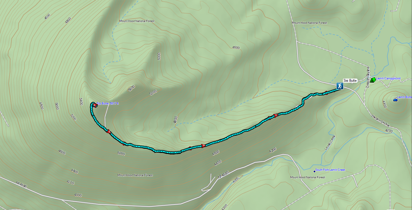

 Lower Lake Campground, a work in progress.
 While the campground was closed, the trail was open despite the fire damage.
 The Fish Lake Trail at Lower Lake Campground.
 Ferns creating a green hillside in the burn scar.
 Lower Lake
 The water in Lower Lake was quite colorful.
 Duck
Duck
 Most of the lakes in the
  Potato Butte (
 Olallie Butte
 Sisi Butte off to the right.
 Fireweed going to seed.
 Buckwheat
 The burn was intense along the trail, but it was in pretty good shape all things considered.
 Sisi Butte and Fish Lake from the cliff.
 Mt. Hood peeking out from behind West Pinhead Butte.
 Mt. Hood
 The Fish Lake Trail switchbacked a few times before giving up on that and dropping steeply for the final 0.2 miles.
 A beat up Lorquin’s admiral.
 There were signs of somewhat recent trail maintenance, but given the severity of the burn and the steepness of the hillside the trail is going to need a lot of ongoing attention to keep it passable.
 The trail disappeared a couple of times in brush and blowdown near the lake, but it was never hard to pick back up.


 Nap time.
 Olallie Butte from Fish Lake.
 The trail followed along Squirrel Creek (currently dry) for 0.4-miles.

 We passed a few of these “Spot Fire” flags, presumably left over from 2020.
 The signed junction.

 I had to walk out on a log and fight through some thick brush to reach a decent view of the water.
 Surprise Lake
 The trail between the junction and Si Lake got a little brushy.
 Huckleberry leaves in their Fall colors.
 Si Lake from the trail.
 Si Lake.
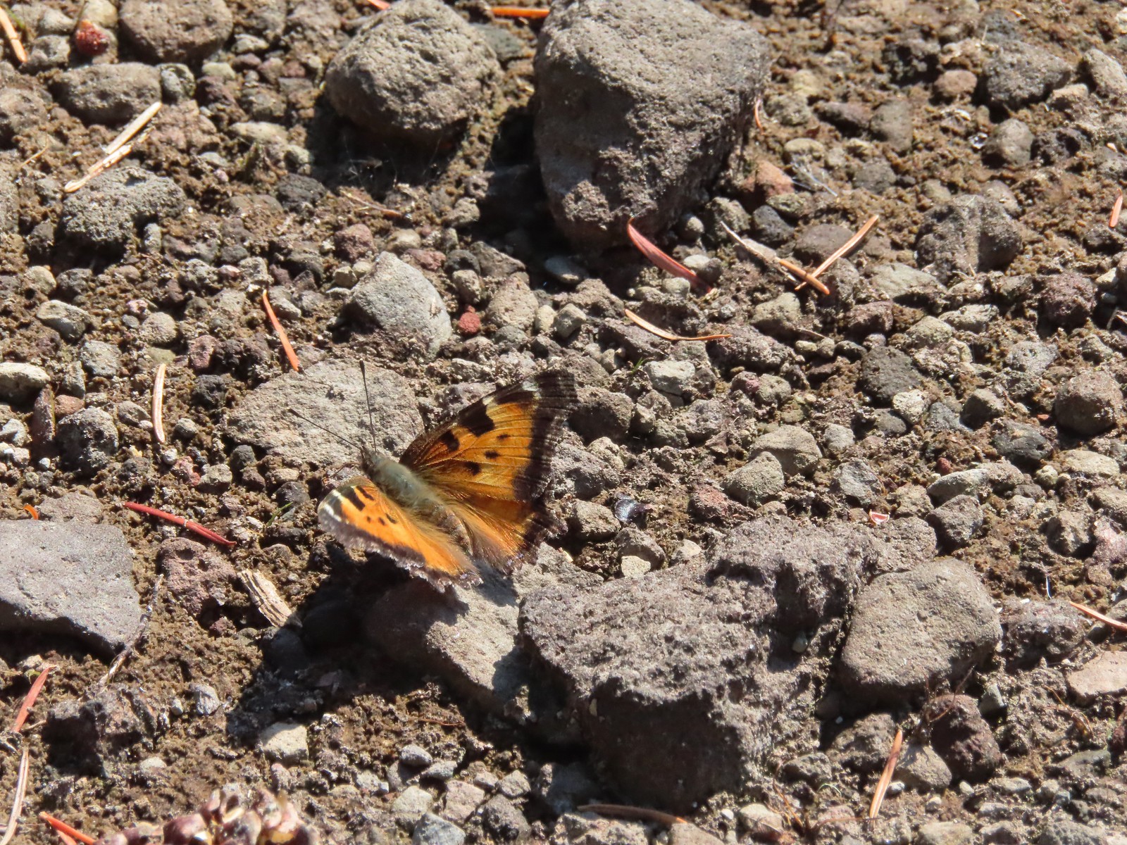 Tortoiseshell butterfly
 Olallie Butte from Fish Lake.
 Black bear print along the shore of Fish Lake.
 White breasted nuthatch
 Lower Lake from the Fish Lake Trail.
 Olallie Butte from Lower Lake.
 While parts of Lower Lake are shallow it actually reaches a depth of 73′ which is the reason it is so colorful.
 Arriving back at Lower Lake Campground.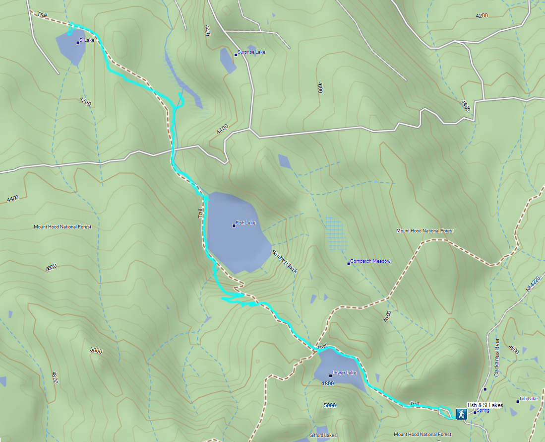
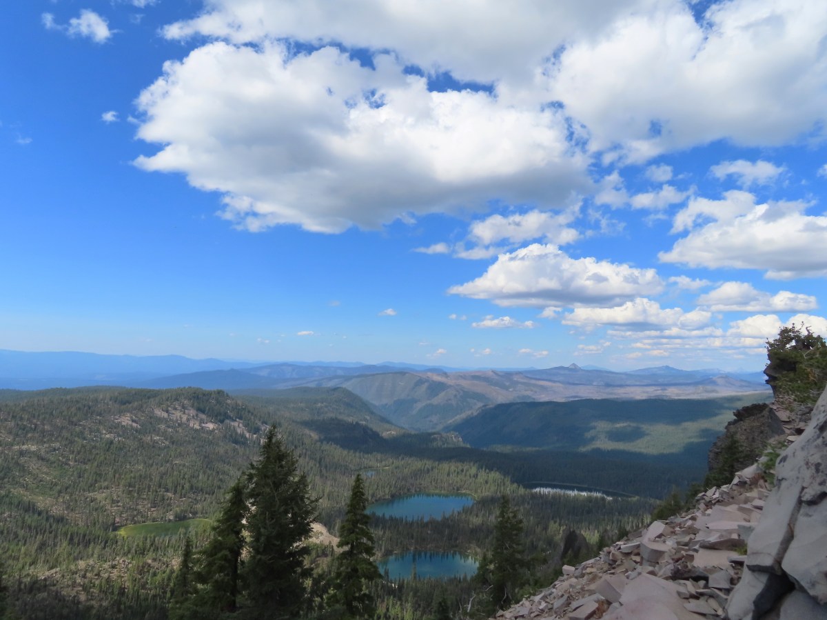
 Sevenmile Marsh Trailhead
 Sevenmile Creek
 Entering the wilderness
 Sevenmile Marsh
 Lodgepole pines were the dominate trees along the first part of the trail.
 Mountain hemlock took over as the trail gained elevation.
 Junction with the PCT.
 There were a few downed trees along this section but nothing difficult to get around.
 This twisted tree caught our attention.
 Nice blue sky.
 Lewis’s woodpecker way up in a snag.
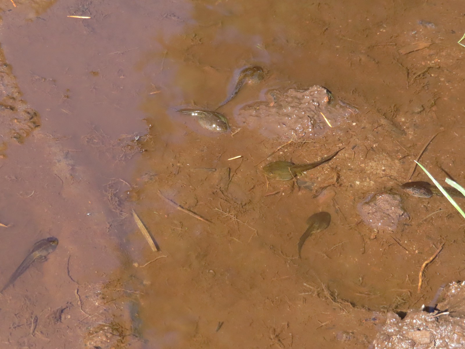 Tadpoles
 Frog in the water.
 Trail sign ahead on the right.
 Unnamed creek along the PCT. We were surprised at how many of the seasonal creeks still had flowing water.
 Grass-of-parnassus
 Huckleberries, there were a lot of these around the basin which we happily sampled.
 Devil’s Peak poking up above the trees.
 The Cliff Lake Trail.
 Prince’s pine
 Another flowing seasonal creek.
 Crater Lake collomia (Collomia mazama)
 The Seven Lakes Trail arriving on the right.
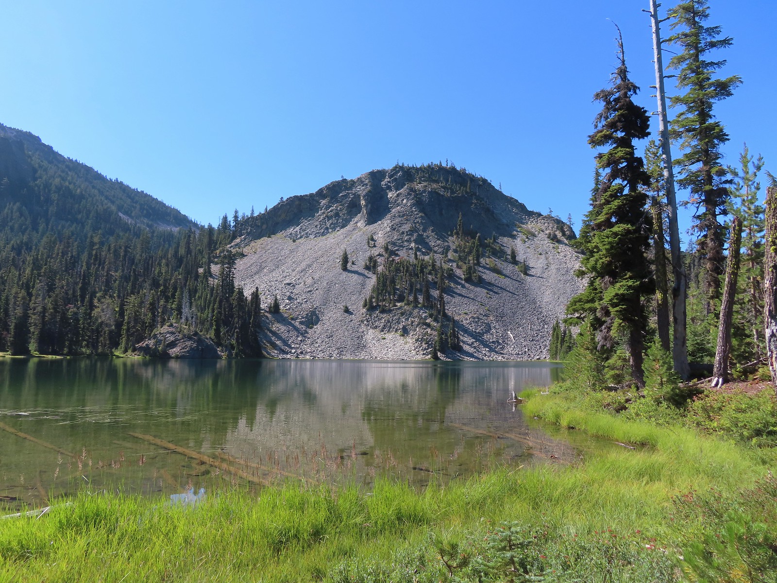 Cliff Lake
 Arnica
 Aster
Aster
 Splash in Cliff Lake from one of many fish that were feeding on insects.
 Camp
Camp Huckleberry bushes along the Cliff Lake Trail.
 Anywhere there was water nearby there were lots of tiny Cascade toads to watch out for.
 Back at the PCT.
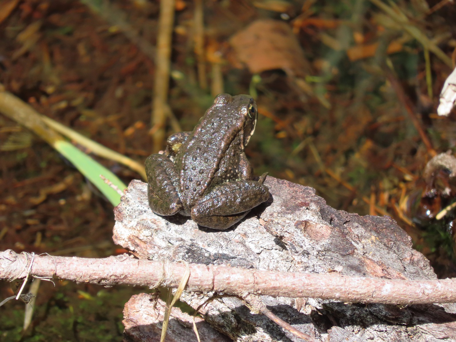 Larger frog
 Monkshood
 More grass-of-parnassus
 Not only were the toads tiny, they also were well camouflaged.
 Mount Scott (
 Mount Scott
 The Watchman (
 The Watchman and Hillman Peak
 Devil’s Peak
 Union Peak (
 Cliff Lake with Violet Hill beyond.
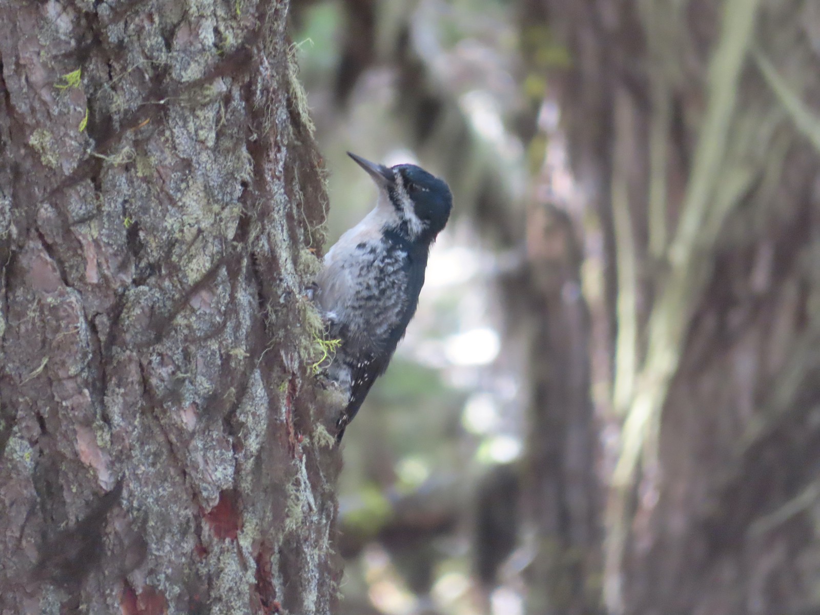 Black backed woodpecker
 Getting closer to Devil’s Peak.
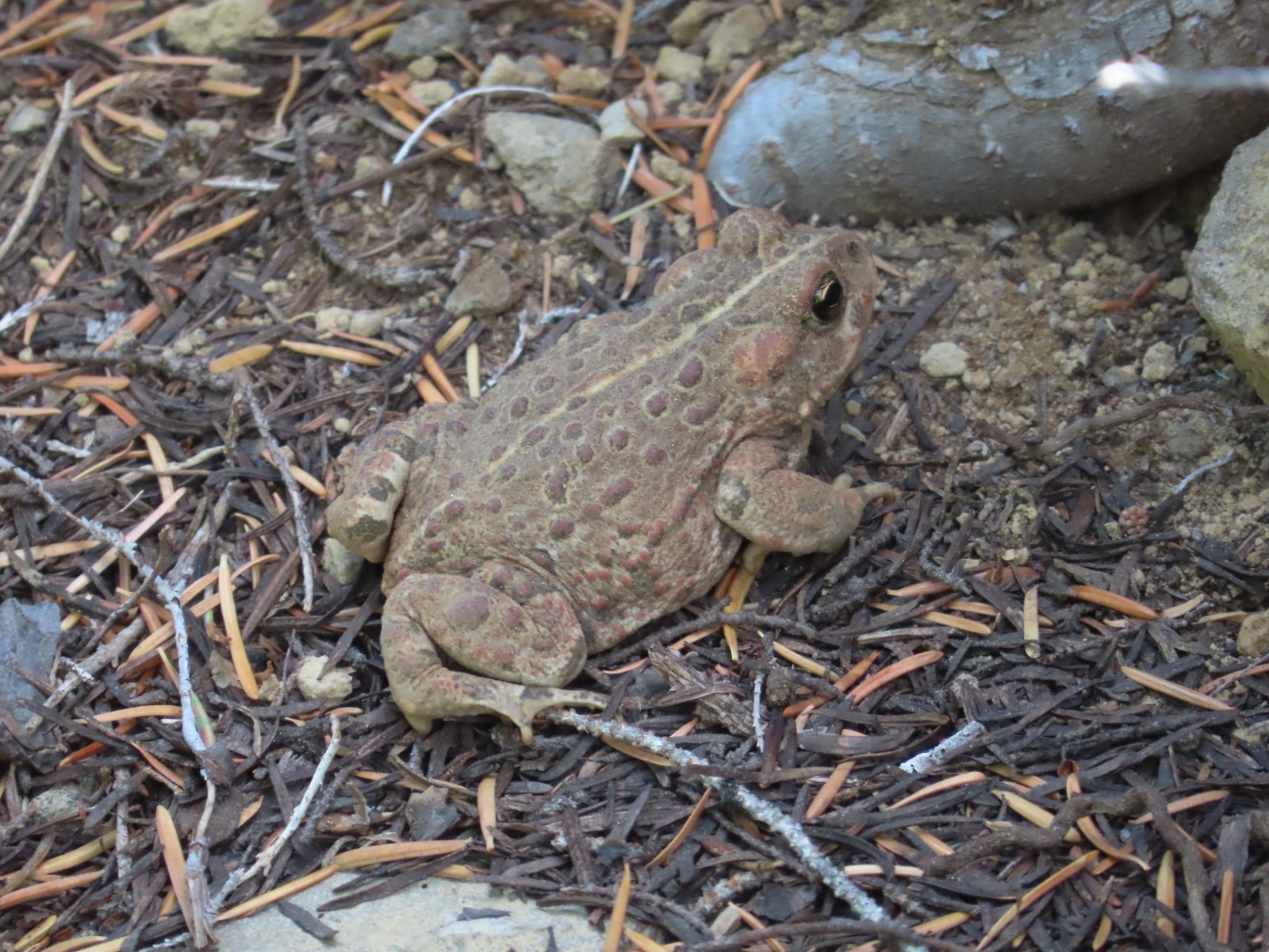 A much bigger Cascade toad.


 Mt. Thielsen (
 Union Peak with Mt. Bailey (
 Lots of neat rock formation on Devil’s Peak.
 Western pasque flower seed heads.
 Buckwheat
 Views to the South opened up at the pass including Klamath Lake and Pelican Butte.
 Klamath Lake
 Devil’s Peak and the PCT coming up to the pass from the North.
 Klamath Lake, Pelican Butte, Aspen Butte (
 Mt. McLoughlin
 A faint Mt. Shasta which, given the wildfires burning in NW California was a bit of a surprise to be able to see.
 The view North.
 Goose Egg and Ethel Mountain in the forefront with Llao Rock, Mt. Thielsen, and Garfield Peak (
 Devil’s Peak
 We were a little concerned at first that it might be picking up water for a new fire but there wasn’t anything hanging from the helicopter so we have no idea what it was actually doing.
 The use path to Devil’s Peak on the right and the PCT on the left.
 The rather ominously named Lucifer from the use trail.
 A second use trail coming up from the opposite side.
 Western pasque flowers on the hillside above the use trails.
 The summit of Devil’s Peak ahead.
 Looking North toward Crater Lake and Mt. Thielsen
 Lucifer, Jupiter, and Venus
 Lee Peak above the pass.
 Luther Mountain (
 Remains of a former lookout.
 The PCT below Devil’s and Lee Peaks.
 Goose Egg, Llao Rock, and Mt. Thielsen
 Mt. Scott
 Mt. Shasta to South through a little smoke but again we felt fortunate to be able to see the mountain at all.
 Colorful grasshopper at the summit.
 American pipit
 The Seven Lakes Basin from the use trail down.
 South, Middle, North, and Grass Lakes
 Heading down the use trail.
 Looking back up the use trail.
 Western snakeroot along the PCT.
 A comma butterfly on western snakeroot.
 Painted lady
 Venus from the Devil’s Peak Trail.
 Looking back at Devil’s Peak.
 Looking North across the Seven Lakes Basin.
 Lake Alta in a bowl below Violet Hill.
 Pond along the Devil’s Peak Trail.
 Coming up to the Seven Lakes Trail junction. A rock cairn was the only marker.


 I was still only about halfway along the lake after the quarter mile. There used to be a campground at the North end.
 Common merganser
 The southern end of Lake Alta.
 Cliff Lake below Devil’s Peak and Middle Lake.
 Middle and Grass Lakes
 I could hear several pikas in the rocks below the cliffs but the only thing I spotted was a chipmunk.
 Chipmunk
 Sulphur butterfly on aster.
 Gentian
 Fireweed
 South Lake
 Devil’s Peak from the trail. There were more pikas “meeping” from the rocks here but again we failed to spot any of them.

 Devil’s Peak in the evening.
 So many fish in the evening.
 Devil’s Peak in the morning.
 Seven Lakes and Cliff Lake Trail junction.

 We detoured left at the northern end of the lake following a pointer for Lake Ivern to find a view back across Middle Lake.
 Devil’s Peak from Middle Lake.
 Stream crossing.
 Monkshood and grass-of-parnassus
 Grass Lake
 Arriving at the PCT.

 Golden-mantled ground squirrel
 Sevenmile Trail at the PCT to return to the Sevenmile Marsh Trailhead.
 Exiting the Sky Lakes Wilderness.


 Registration box and signboard at the Mt. Hood Wilderness boundary.
 There were a few downed trees but nothing too difficult to navigate.
 The brush was mostly huckleberry bushes.
 Trail side snacks.
 McGee Creek Trail junction with the Timberline Trail.
 Blowdown from the September 2020 storms that also flamed the destructive wildfires across the state. For more information on the storms impact on Mt. Hood check out this Wy’East Blog
  Looking through the trees at one of the areas that suffered severe blowdown.
 It was a cloudy day. We got sprinkled on briefly a couple of times.
 Fireweed
 Pinedrop
 Avalanche lilies
 Paintbrush
 Valerian, spirea, and paintbrush
 Gentians
 Yellow monkeyflower
 A tributary of McGee Creek.
 Spirea along the Timberline Trail.
 Shooting star
 Pink monkeyflower
 Fleabane
 Beargrass
 False hellebore
 Partridge foot
 Lupine
 Lewis monkeyflower along a tributary of McGee Creek.
 Beardstongue
 Lousewort
 Dry pond surrounded by beargrass.
 The idiots camped in the meadow. There is even an arrow on the “Do not camp in meadow” sign pointing at the meadow. Please DON’T be these people.
 The second pond still had some water in it.
 Junction with the Mazama Trail (
 The butterflies weren’t out today but the bees were.
 The clouds just wouldn’t quite raise enough.
 Mountain heather
 Lupine and paintbrush
 Beargrass along the Timberline Trail.
 Paintbrush, partridge foot and lupine
 Signpost for the McNeil Point Trail.

 We’d never seen a paint colored like this before.


 Western pasque flower
 Lupine and two types of monkeyflower


 Pikas spend the Summer gathering greens for the rest of the year when they remain in their homes under the snows.

 Mountain heather and paintbrush.
 Saxifrage
 A variety of flowers.
 Avalanche lilies
 Sub-alpine fleabane
 Western pasque flowers
 Doe that was as surprised as we were when we spotted each other.

 Lewis monkeyflower
 The righthand fork.
 View from the plateau.
 Some low clouds to the East.
 Dwarf lupine
 A hiker on the righthand fork headed for the McNeil Point Shelter.

 Caves below the Sandy Glacier.
 Bluebells of Scotland
 The shelter below to the right.
 Muddy Fork
 Goldenrod
 With the clouds the view wouldn’t have been great from the ridge on this day.


 Patches of blowdown along Bald Mountain Ridge.

 Columbine
 Valerian
 Paintbrush and bistort
 Aster
Aster Chipmunk snacking on huckleberries.
 Meadow near the Timberline Trail.
 Arriving back at the Timberline Trail.
 Every once in awhile the trail was clear of other users.
 We’re always drawn to this rock fin above the Muddy Fork.
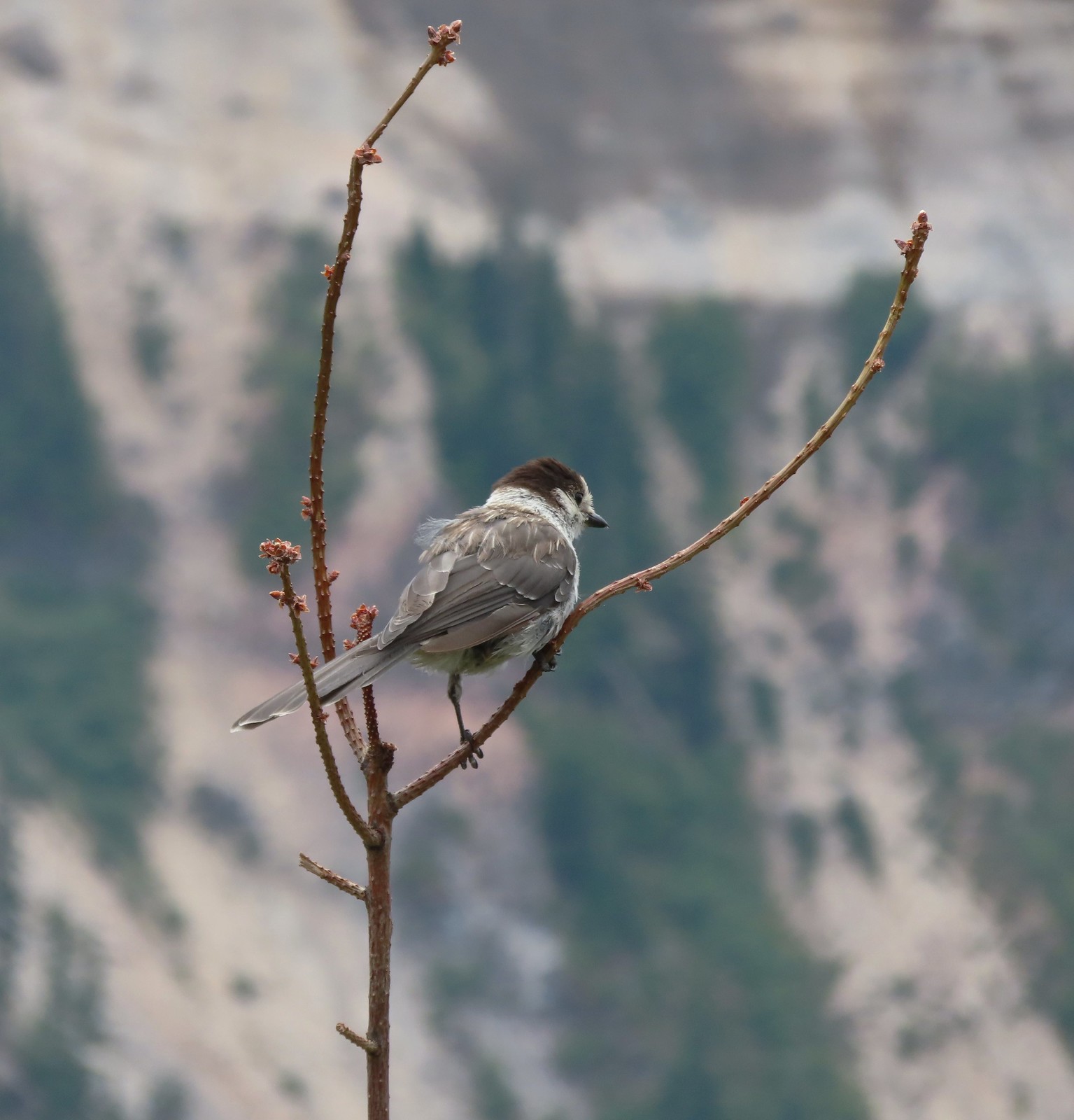 Canada jay
 McGee Creek Trail junction.
 Bunchberry
 Is that sunlight?
 While the clouds never lifted from Mt. Hood we did experience a window of blue sky near the end of our hike.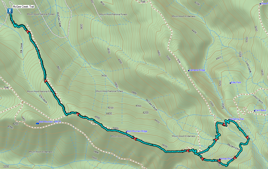
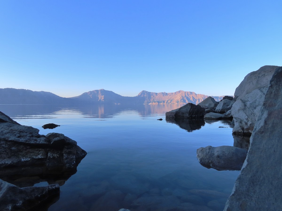
 Sunrise behind Llao Rock on the way to the trailhead.
 Crater Lake at sunrise.
 Mt. Bailey, Diamond Peak, and Mt. Thielsen behind Red Cone.
 Cowhorn Mountain (

 Mt. Scott (

 Dutton Cliffs, Sun Notch (
 Looking down at the turnaround point.
 Wouldn’t want a rock like this to come down on you.
 Breakfast time.
 There were “no stopping” signs at areas where the danger of rock fall was the greatest.
 One of the tour boats.

 Looking back at the dock area.
 Couldn’t get an actual fish in a photo but I barely missed this one.
 The dock at Cleetwood Cove.
 Not a hiker or fisherman.
 Llao Rock from East Rim Drive.


 Bog Orchid
 Bistort and monkeyflower

 Some sort of orchid?
 Yellow monkeyflower
 Monkshood


 Bistort
 Not sure if this is a robin or ?
 Crater Lake Lodge

 Garfield Peak from behind the lodge.
 The Watchman and Hillman Peak
 Golden-mantled ground squirrel with a mouth full.


 Mt. McLoughlin (
 Mt. McLoughlin
 Union Peak
 Paintbrush
 Reservoir structure (built 1931).
 Mt. Bailey (
 Mt. Bailey
 Deer below the trail.
 Western pasque flowers
 Arnica
 One of several patches of snow at the higher elevations.
 Crater Lake Lodge below to the left.
 Mt. Scott (
 Clark’s nutcracker
 Buckwheat
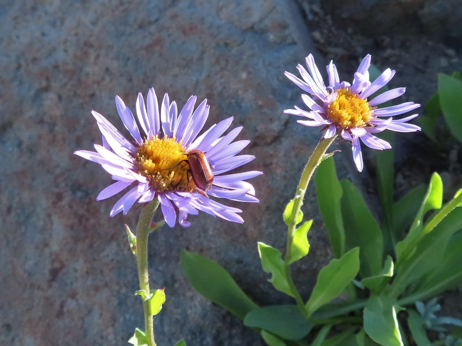 Beetle on sub-alpine fleabane.
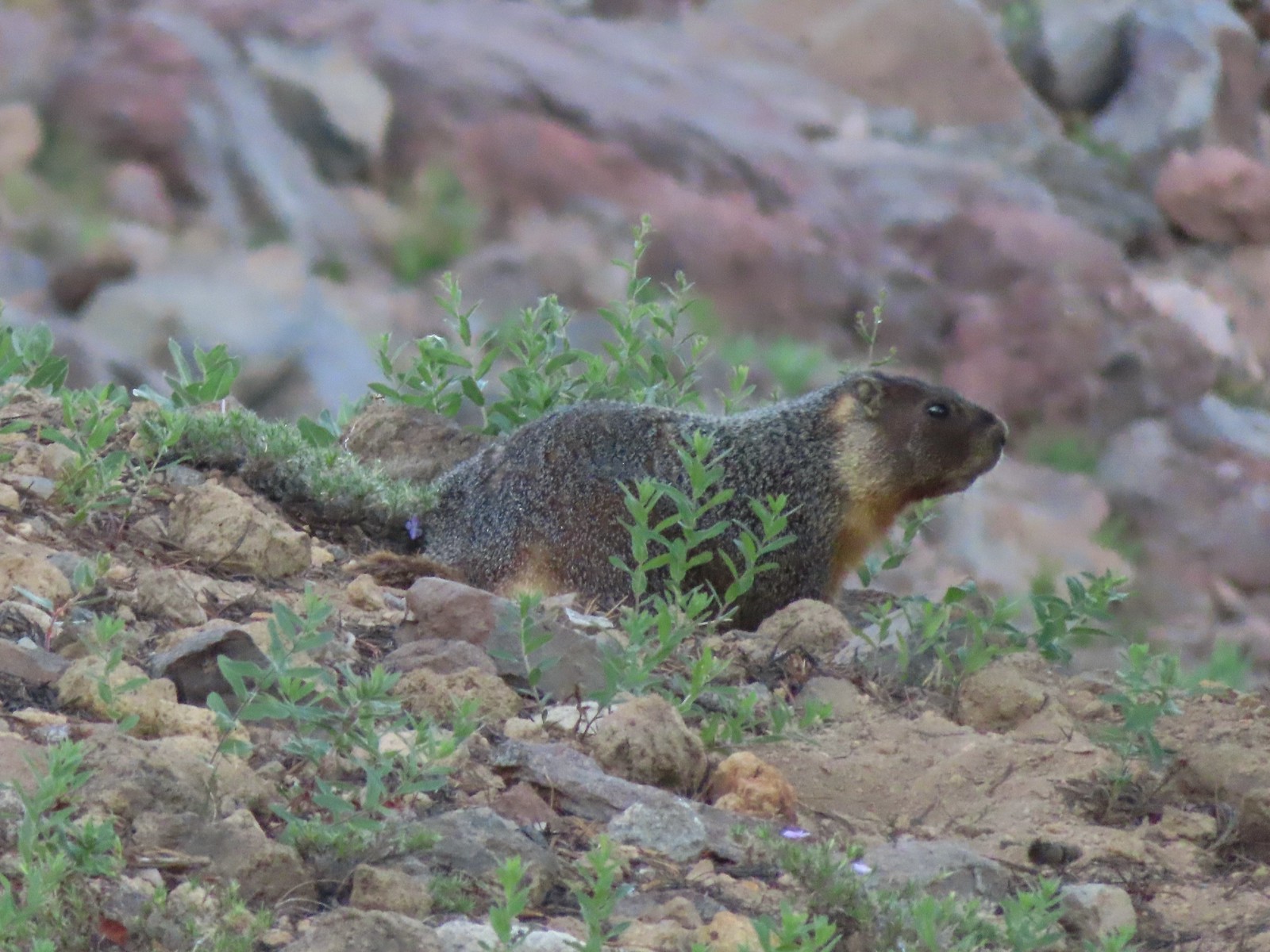 Yellow-bellied marmot
 Bench below the summit of Garfield Peak.
 Partridge foot
 Applegate Peak to the left and Crater Peak (
 Arriving at the summit.
 Mt. Scott above the Phantom Ship.

 It was a bit hard to make out but Mt. Shasta was visible to the south.
 Cowhorn Mountain (
 Crater Lake from the summit of Garfield Peak.
 Blurry photo due to the sheer distance away it was but it looked big.
 Union Peak behind a marmot.
 Penstemon
 Painted lady
 There were a lot of marmots out.
 Paintbrush, phlox and buckwheat.
 Stonecrop, paintbrush and pearly everlasting.
 The clear blue water of the deepest lake in the United States.
 Yellow-rumped warbler

 False hellebore
 Viewpoint and The Watchman from the trailhead.
 Western pasque flowers above Crater Lake.
 Hillman Peak ahead.


 Lounging on a rock.
 Shasta knotweed
 Rim Drive below the Rim Trail.
 Mt. Bailey and Diamond Peak with Diamond Lake (
 Red Cone with Sawtooth Mountain (
 Silvery Raillardella
 Snow patch on Hillman Peak.
 Penstemon
 Llao Rock
 It took us a moment to notice the two deer ahead along the tree line.
 We spotted the doe but she also had a pair of fawns nearby that bounded off.
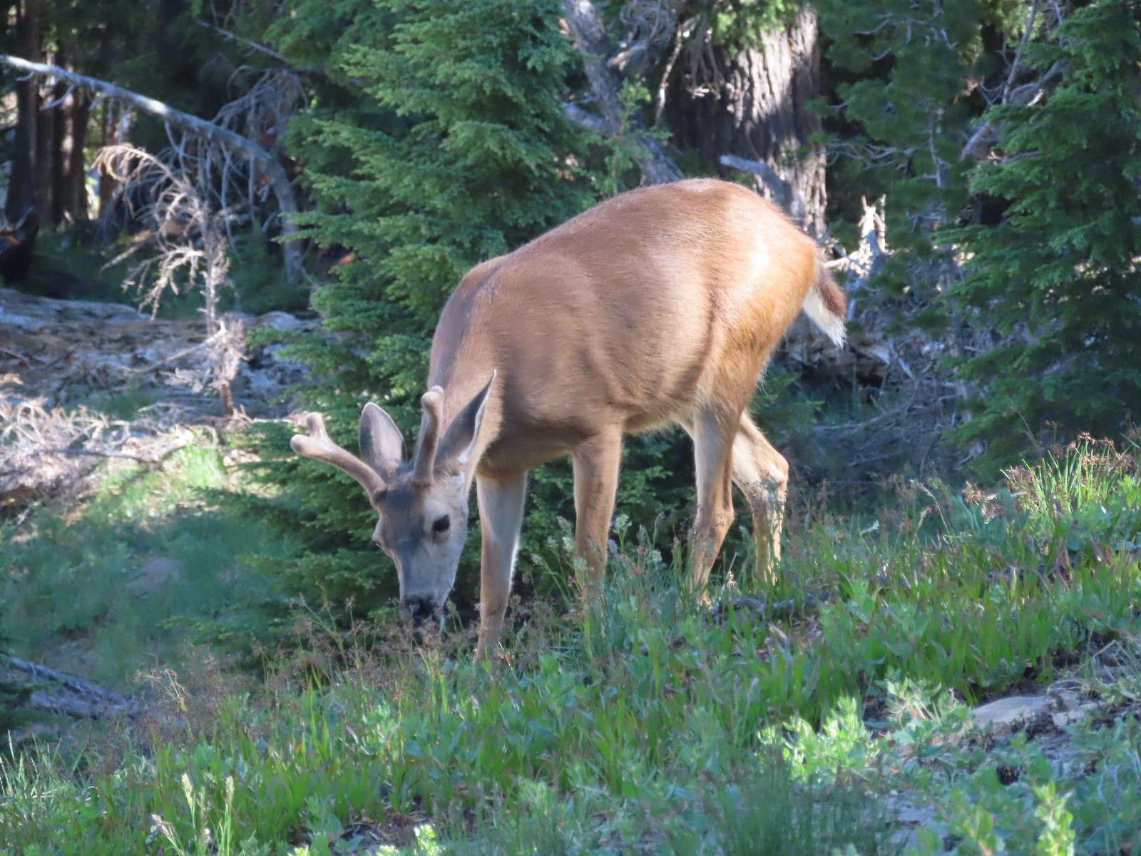 This buck had zero concern with us as we passed by.
 Phlox
Phlox Dwarf lupine
 Devil’s Backbone with Mt. Scott behind.
 Wizard Island
 Devil’s Backbone
 Hillman Peak from Devil’s Backbone.
 Garfield Peak across Crater Lake.

 Saxifrage
 The Watchman
 If I stand perfectly still, they won’t see me.
 Hillman Peak and Llao Rock from the viewpoint at The Watchman Trailhead.
 Rock formations below Hillman Peak.
 Godfrey Glen Trailhead
 The ADA accessible trail made for a nice easy walk.
 Super-heated volcanic gas fused ash creating these pinnacles.
 First viewpoint of Godfrey Glen above Munson Creek.
 Godfrey Glen
 Another viewpoint.
 We could hear Munson Creek but it wasn’t visible in the canyon below.
 One waterfall.
 Another waterfall in the canyon.
 The end of the loop.
 Sinnott Memorial Overlook on the rim to the left.
 View from the overlook.
 Mt. Scott and Garfield Peak from the overlook.
 These numbers blew our minds.

 Swallowtail and a painted lady on penstemon.


 There were pikas out there in the rocks but we only heard them this time.
 We did spot this western tanager though.
 Pink monkeyflowers. One of our favorite wildflowers.
 The trail climbed gradually along Sand Creek before rounding a corner to a view of Plaikni Falls.
 Paintbrush and columbine along with lupine and groundsel.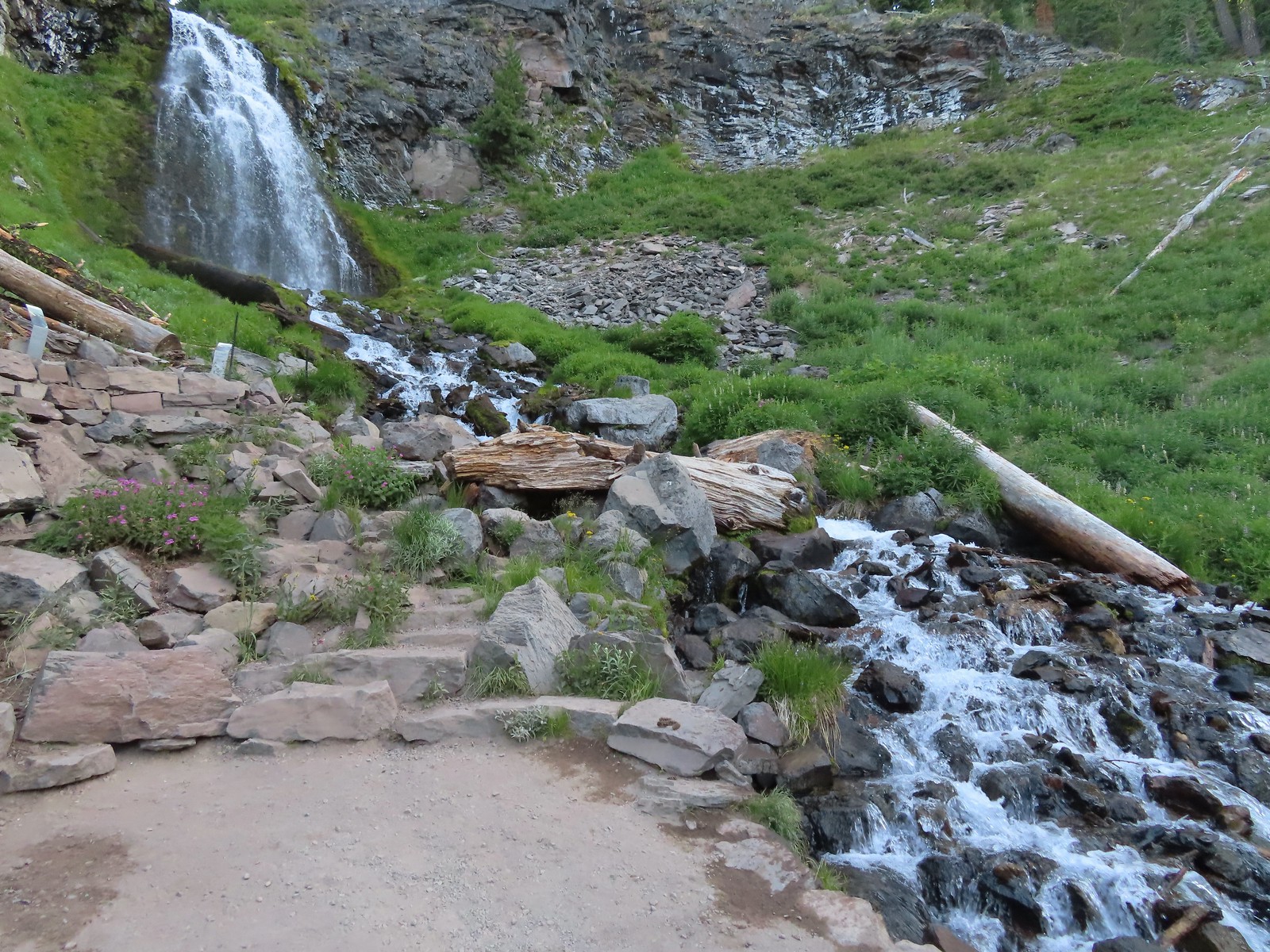

 Hummingbird visiting a paintbrush.
 Monkshood
 Yellow monkeyflower
 Applegate Peak from the Sun Notch Trailhead.

 There is a nice green meadow in the center of the loop.

 The Phantom Ship.
 Diamond Peak (
 The Watchman (

 Garfield Peak, The Watchman, and Hillman Peak.
 Heading back down to the start of the loop.
 Marmot

 Vidae Creek
 East Rim Drive was up above the trail.
 Crater Peak through the trees on the left.
 Paintbrush
 Stonecrop
 Setting off on the broad ridge.

 There was a very short steep climb to reach this small meadow with a view ahead to Crater Peak.
 Female western tanager
 Looking up Crater Peak.
 Little prince’s pine
 Union Peak (
 Mt. McLoughlin (
 Mt. McLoughlin behind Lee & Devil’s Peaks.
 Mt. Shasta was visible, barely, through wildfire smoke.
 Arriving at the crater.
 Scarlet gilia lining the trail around the crater.
 The Watchman to the left and Garfield Peak.
 Applegate Peak and Mt. Thielsen
 View south to Mt. McLoughlin with the Goose Nest to the closer to the right.
 Dutton Cliffs and Mt. Scott (
 Pussytoes
 Paintbrush
 Western pasque flowers
 Klamath Basin with haze from (most likely) the Golden Fire near Bonanza.
 The Rabbitt Ears and Hershberger Mountain (


 Signboard at the loop.
 Crater Peak from the trail.
 Ash pinnacles
 Getting ready to drop into the canyon.
 The trail had been closed for hazard tree removal and we could see that there had been some big trees that had to be cleared.
 Wildflowers in the meadows below.
 Annie Creek


 Monkeyflower and lupine
 Final pitch to end the loop.
 The Annie Creek Restaurant.


