
When we decided to try and hike all 100 featured hikes in a single edition of each of the five areas covered in William L. Sullivan’s 100 Hikes books (post) we decided that the criteria for being able to check off a hike was doing (or attempting to do) at least a portion of the hike. Sullivan often provides multiple options for each featured hike with some options being 20+ mile one-way trips or nearly 30-mile loops. Doing every option in their entirety just wasn’t feasible when you also factor in having to deal with trail closures due to fires, damage, or restricted access.
In 2023 we completed the southern Oregon & northern California area (post), but missed out on a portion of three hikes in Crater Lake National Park. On Saturday we’d finished up two of the hikes, The Pinnacles and Lady of the Woods (post). The third hike that we’d been unable to do in its entirety was on Wizard Island which requires taking a boat from Cleetwood Cove (post). The boats did not operate in 2023, an issue caused by the previous contracted concessionaire, so we were only able to hike down to the docks at the cove on that trip.
We reserved tickets ahead of time for the Wizard Island shuttle which is a 15-minute boat ride from Cleetwood Cove to Wizard Island. There were two other tours available, one a trip around the lake, and the other stops at Wizard Island on its way around the lake. Had we not needed to get home the same day we would have opted for the latter, but a tour around the lake would need to wait for another time. We nearly blew the whole thing though.
Somehow we got it into our heads that our shuttle left Cleetwood Cove at 12:30pm. We slept in and left our room so that we’d arrive at Beckie’s Cafe in Union Creek when it opened at 8am. After eating, and buying a whole blackberry pie to share with my parents, we made our way to the park and stopped at several viewpoints along the rim to admire the views. The overcast and smokey skies from the day before had given way to big fluffy white clouds and relatively blue sky.
 Llao Rock and Wizard Island
 The docks on Wizard Island.
 The views were so good even the golden-mantled ground squirrels were taking them in.
 Mt. McLoughlin (post) and Union Peak (post).
 Cassin’s finches
 Mount Scott (post) across the lake.
 Wizard Island’s Fumarole Bay
 The Watchman (post)
 Mt. Bailey on the left and Mt. Thielsen (post) on the right. You can’t really make it out in the photo but with the naked eye we could see Diamond Peak (post) in between the two in the distance.
 Smoke from the Middle Fork Fire burning inside the park boundary.

Fire information at one of the viewpoints.
 At this pull out we got out and hiked a little of the Rim Trail. I decided to just continue on to Merriam Point while Heather was nice enough to drive the car down and meet me.
 Western pasqueflower seed heads.
 Silvery raillardella
 Hillman Peak (post)
 The Watchman and Hillman Peak
 Dwarf lupine

We were intentionally taking our time so we wouldn’t arrive way too early for our boat tour. We had been targeting 11am to give us an hour and a half but wound up arriving a little before 10:30. That wound up being a good thing because when we went to check in we noticed that there were two shuttle times listed, 9am and 11:30. After some confusion with our tickets, Heather inadvertently pulled up our Wallow Lake Tram (post) tickets from 7/26 (issued by the same online company Fareharbor), the attendant was able to find our reservation. It had been for the 9am shuttle and there was never a 12:30 shuttle. We’d messed up pretty good. The young man was very understanding and let us know that they still had three openings on the 11:30 shuttle and that he could move us to two of those spots. We were very thankful and quickly headed down the 1.1-mile Cleetwood Cove Trail to the check in at the dock there.

 From left to right: Dutton Cliff, Applegate Peak, and Garfield Peak (post).
 Our shuttle arriving at the docks below.
We checked in and got our boarding instruction then spent some time watching people jump into the lake from the rocks.


When it was time we boarded the boat which zipped us over to the island.

 The boat traveled at about 35mph so I didn’t have too many chances to take photos. The exception was when we had to briefly circle back to retrieve someone’s hat that had flown off into the lake.
 Nearing the island.
There are two short trails on the island, one leads to Fumarole Bay and the other to the top of Wizard Island’s cone. Most of the people in our group headed for the cone with a few heading to the bay to either fish or swim. We were also going to head up the cone first and had decided to split up and do our own thing then meet back up at the docks later.
 The trails shared tread for the first tenth of a mile. (Toilets were to the right.)


In the line heading up to the cone.
Part of the reason we’d decided to hike our own hikes is because I have a slight competitive streak and tend to speed up when there are people ahead of us. It wasn’t long before I’d passed most of the other hikers and was just following a pair of younger guys from San Diego.

Looking up the cone.
 The Watchman and Hillman Peak from the trail.
 These two were setting a crisp pace and the only reason I was able to keep up was because they would occasionally stop for pictures and to admire the views.

Mount Scott
 The trail was well graded keeping the 750′ climb from ever feeling too steep.

Prince’s pine
 Buckwheat
 Paintbrush

I managed to pass the Sandiegans shortly below the summit while they were taking a few more photos. Just before the summit a hiker from a different tour passed me as she was descending and mentioned that there wasn’t anyone left at the summit.
 The summit crater also known as the Witches Cauldron.
A 0.3-mile loop circles the crater so I headed clockwise around the loop. The pair from San Diego caught up while I was taking photos and asked if I could take one of them before continuing on.
 Mt. Scott from the loop.
 Llao Rock
 Dutton Cliff, Applegate Peak, and Garfield Peak

 Crater Lake lodge on the rim to the right of Garfield Peak.
 Crater Lake lodge.
 Hikers across the crater starting the loop.

 Looking down toward the dock area.
 The Watchman and Hillman Peak.
 Looking toward Cleetwood Cove.

Fumarole Bay is to the left of lava flow.
 Pool in the lava flow.
After completing the loop I headed down for the Fumarole Bay Trail.

 Dwarf alpinegold
 Another boat tour heading around the island.


I had passed Heather on her way up and we spoke for a moment before going our separate ways.


 Heading toward Fumarole Bay.
It’s approximately a half mile to Fumarole Bay on a very rocky trail due to it being in a lava flow.


The Watchman from the trail.
 Fumarole Bay. Note the person fishing on the rocks to the right.
 Fumarole Bay
 Stream flowing into Crater Lake.
 Hillman Peak
The trail continued around the bay for almost another half mile.


 Bleeding heart

The Watchman

I believe this may be Felt-leaf everlasting.

An even fainter, rockier, trail continued beyond the sign marking the end of the maintained trail. I followed it for just a bit before losing it in the lava where I decided to turn around.

I made my way back around the bay and returned to the dock where I found Heather soaking her feet in the water.


Heather below at the edge of the lake. She had opted not to visit the bay.
I joined Heather as we waited for our return shuttle. In the meantime she took a quick dip in the lake to cool off.

 Here comes our ride.
Once they herded everyone back to the dock we boarded the boat and rode back to Cleetwood Cove.
 Arriving back at the cove.
We split up again on our way up the busy Cleetwood Cove Trail.


It got a little hazier as the day went on.
I was glad to make it back to the parking area where I changed into cooler clothes before using the restroom.

I ran into Heather as I came out of the restrooms so we walked back to the car together and prepared for our drive home. My Wizard Island hike came to 6.6 miles including 2.2 miles to and from Cleetwood Cove. Total elevation gain was a little over 1450′. Seven hundred of that was up from Cleetwood Cove which was steeper in sections than anything on Wizard Island had been.
 Track including the boat rides.
 My Wizard Island track.
It had been a beautiful day and a lot of fun to see the lake and surrounding peaks from the island. The smoke had somehow stayed away and so had the thunderstorms. Unfortunately storms did hit other parts of the Cascades along with central and eastern Oregon igniting more wildfires. We hit heavy smoke on our drive home between Odell Lake and Oakridge reminding us of just how bad this fire season has been. A big thank you to all the firefighters working hard to try and minimize the damage. Hopefully conditions will improve sooner rather than later. Happy Trails!
Flickr: Merriam Point and Wizard Island


 Fall Creek Falls
 Yasko Falls


 Lower Table Rock
 View from Upper Table Rock


 Along the way we entered the wilderness area.


 It looks to have been a good year for beargrass.


 The trail was well maintained with only one small log across the entire route to Vivian Lake.

 Another level section.
 Pond along the trail.
 The saddle at the high point of the trail.
 Maiden Peak (


 We passed the smaller of the two lakes a half mile below the saddle.
 The second lake, which was just 100 yards from the first, was much larger.
 Mt. Yoran from the lake.
 Ridge above the lakes.
 Just before beginning the descent the trail passed South of a third small pond/lake that was visible through the trees.
 Heading down to the creek.

 The marsh
 Mt Yoran from the marsh. While it looks like a meadow, Fall Creek flows through here, and at times we could see water out in the grass.


 We were able to use these rocks to hop across this narrow channel to the North shore of the lake where we were able to get a view of Mt. Yoran.


 Varied thrush. These continue to be the most frustrating frequently seen bird to try and photograph.


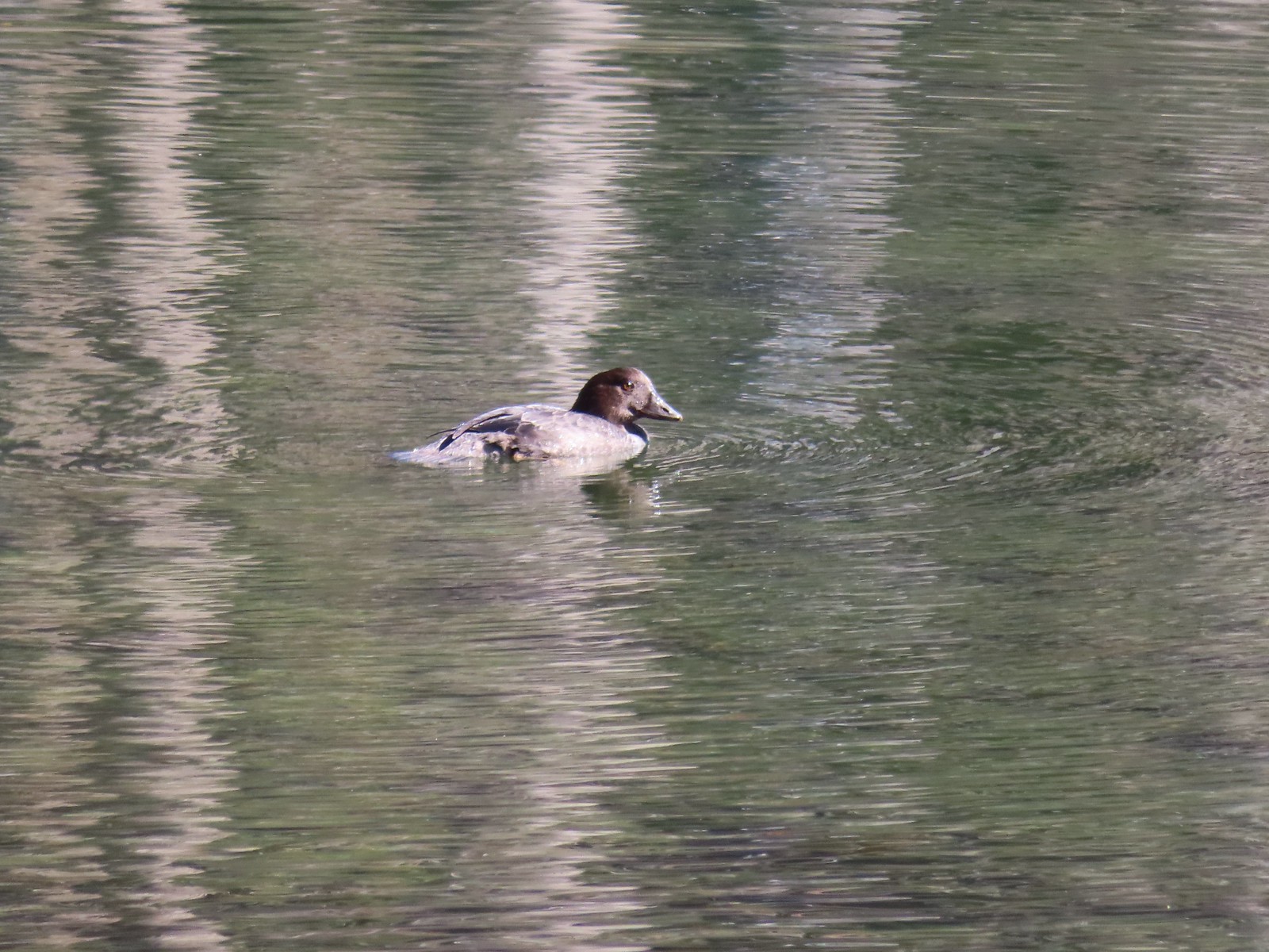
 I believe these were ring-necked ducks.
 Diamond Peak from the trail on the way back.

 Not all of the blowdown was as easy as this log to get over/under.
 Multiple switchbacks kept the lower portion of the climb from feeling too steep.
 The Hemlock Butte Trail succumbing to the vegetation.
 An obvious spur trail at the base of the rock outcrop leads to a view of Mt. Yoran and Diamond Peak. For those not comfortable with the scramble this is a good goal.
 The trail to the summit at the junction with the spur.
 Scrambling up
 Mt. Yoran and Diamond Peak from the summit.
 Wolf Mountain to the NW with clouds covering the Willamette Valley in the distance.
 The view South.
 Looking down from the summit. (The trail is to the right.)
 The “trailhead” was just under 14 miles from Highway 58 or just over 5.5 miles from the Vivian Lake Trailhead.
 The trail sign on the right. The Pool Creek Trail #4228 shows up on the Forest Service map, but they don’t have a dedicated webpage for it. We were made aware of the trail by following
 What looks like it might be tread ahead is actually the log.
 The Pool Creek Trail to the left of the creek. Here you can see the first switchback turning steeply uphill.
 The makeshift creek crossing.
 At the third switchback.
 The reason we hadn’t noticed the trail on the far side was because it climbed quite a bit in an initial series of short switchbacks so from where we had been the trail was already much higher than we’d expected it would be. In the photo Heather is coming up to the third switchback below.
 These two trees are mentioned in the May 2022 trail update on the Cascade Volunteers webpage.
 This one was high enough to easily pass under. On the far side are more cut logs.
 First view of the falls from the trail.
 Pool Creek Falls


 The barricade ahead.
 The trail before the barricade.
 This trail had seen maintenance at some point.
 Trail sign along the road.


 Toward the end of the trail, we began to pass a series of volcanic rock formations.


 The western fin.
 Use trail along the western fin.
 View up Castle Canyon.
 Rock pillar across Castle Canyon.
 Devil’s Peak (
 Looking down from the end of the rock fin.
 Just after taking this picture on my way back I received my first sting.
 I actually followed a use trail several yards above the end of the trail just to make sure I wasn’t being followed.
 The trail on the other fin.
 The Castle Canyon Trail below the rock fin.
 <
< One of two red-breasted sapsuckers on the tree.
 The Castle Canyon Trail was approximately 0.2-miles East of the barricade that we’d seen from the use trail we turned up.
 We liked the colors of this plant carpeting the ground along the road.
 Back at the West Zigzag Trailhead.
 The upper junction with the loop trail was just 0.2-miles from the trailhead.
 We stuck to the Sandy River Trail on the way down.
 The Sandy River Midway Trail on the left was about 0.4 of a mile from the upper junction making a shorter loop (or figure 8) possible.
 The lower junction with the Jim Slagle Trail was 0.6-miles from the upper junction.
 The river is behind the trees at the top while the Sandy River Trail is clearly visible below.


 Dust from ultra runner’s cars hanging over the closed roadbed.
 Mt. Jefferson in the monring.
 The Summer haze we’ve grown to expect was back after having improved following a brief period of rain.
 The smoke does make for some colorful sunrises though.
 Scouler’s bluebells
 There was a nice forest along the road. Much of the butte is within one of the five tracts making up the
  Mt. Hood to the North.
 Mt. Hood
 Despite the surrounding haze the sky above the road was bright blue.
 There were numerous good views of Mt. Jefferson from the road.
 Olallie Butte (
 About 0.4 miles from the lookout an abandoned spur road splits off to the right toward the eastern summit which is just a couple of feet higher than the western.
 The tower is still staffed at times, but it was empty today.
 Penstemon
 Olallie Butte, Mt. Jefferson and Three Fingered Jack from the lookout.
 Mt. Jefferson and Three Fingered Jack
 Mt. Hood, West Pinhead Butte, and the eastern summit.
 A hazy Mt. Hood.
 Flat topped Battle Ax Mountain (
 Bachelor and Coffin Mountains (
 Grouse along the road.
 Despite high temperatures around 80 the leaves reminded us that Fall would be arriving soon.
 Canada jay checking us out.
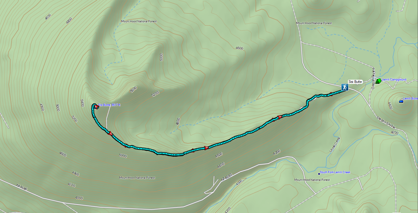

 Lower Lake Campground, a work in progress.
 While the campground was closed, the trail was open despite the fire damage.
 The Fish Lake Trail at Lower Lake Campground.
 Ferns creating a green hillside in the burn scar.
 Lower Lake
 The water in Lower Lake was quite colorful.
 Duck
Duck
 Most of the lakes in the
  Potato Butte (
 Olallie Butte
 Sisi Butte off to the right.
 Fireweed going to seed.
 Buckwheat
 The burn was intense along the trail, but it was in pretty good shape all things considered.
 Sisi Butte and Fish Lake from the cliff.
 Mt. Hood peeking out from behind West Pinhead Butte.
 Mt. Hood
 The Fish Lake Trail switchbacked a few times before giving up on that and dropping steeply for the final 0.2 miles.
 A beat up Lorquin’s admiral.
 There were signs of somewhat recent trail maintenance, but given the severity of the burn and the steepness of the hillside the trail is going to need a lot of ongoing attention to keep it passable.
 The trail disappeared a couple of times in brush and blowdown near the lake, but it was never hard to pick back up.


 Nap time.
 Olallie Butte from Fish Lake.
 The trail followed along Squirrel Creek (currently dry) for 0.4-miles.

 We passed a few of these “Spot Fire” flags, presumably left over from 2020.
 The signed junction.

 I had to walk out on a log and fight through some thick brush to reach a decent view of the water.
 Surprise Lake
 The trail between the junction and Si Lake got a little brushy.
 Huckleberry leaves in their Fall colors.
 Si Lake from the trail.
 Si Lake.
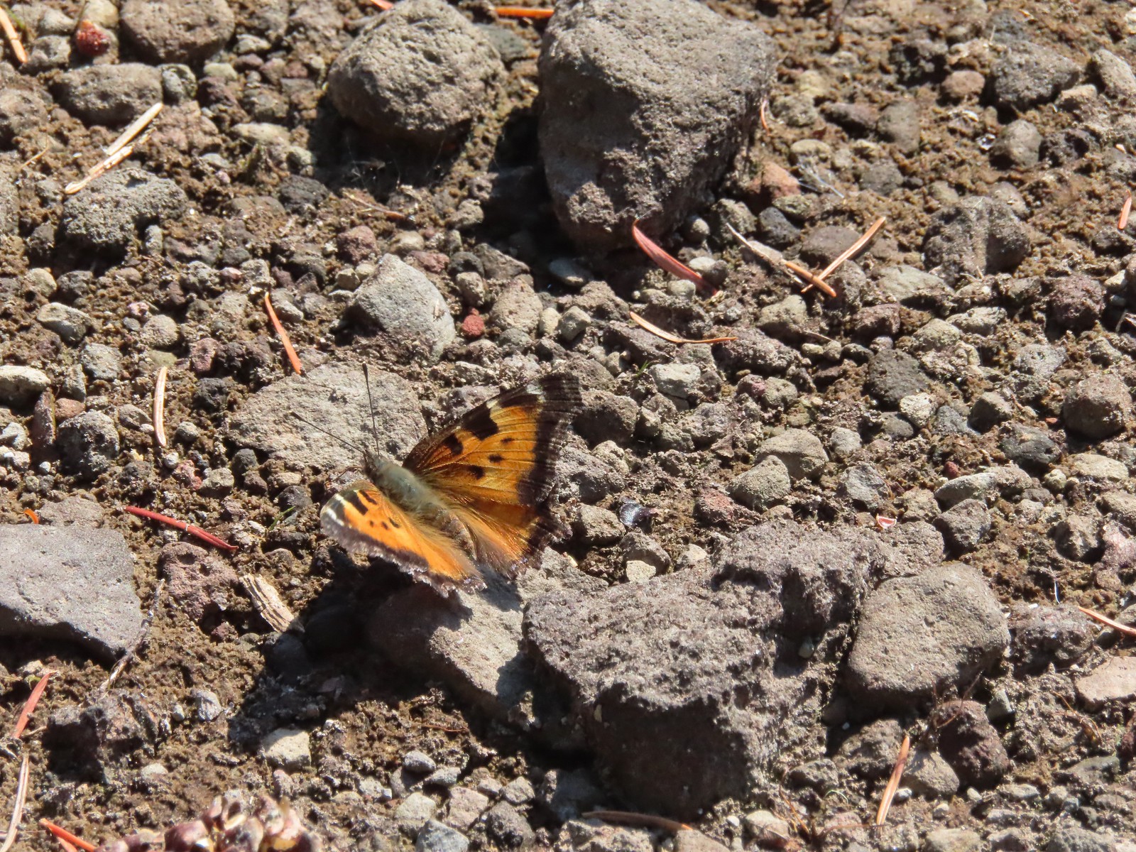 Tortoiseshell butterfly
 Olallie Butte from Fish Lake.
 Black bear print along the shore of Fish Lake.
 White breasted nuthatch
 Lower Lake from the Fish Lake Trail.
 Olallie Butte from Lower Lake.
 While parts of Lower Lake are shallow it actually reaches a depth of 73′ which is the reason it is so colorful.
 Arriving back at Lower Lake Campground.
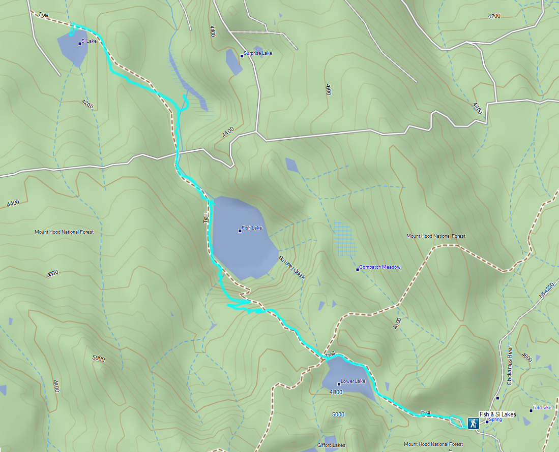
 Sevenmile Marsh Trailhead
 Sevenmile Creek
 Entering the wilderness
 Sevenmile Marsh
 Lodgepole pines were the dominate trees along the first part of the trail.
 Mountain hemlock took over as the trail gained elevation.
 Junction with the PCT.
 There were a few downed trees along this section but nothing difficult to get around.
 This twisted tree caught our attention.
 Nice blue sky.
 Lewis’s woodpecker way up in a snag.
 Tadpoles
 Frog in the water.
 Trail sign ahead on the right.
 Unnamed creek along the PCT. We were surprised at how many of the seasonal creeks still had flowing water.
 Grass-of-parnassus
 Huckleberries, there were a lot of these around the basin which we happily sampled.
 Devil’s Peak poking up above the trees.
 The Cliff Lake Trail.
 Prince’s pine
 Another flowing seasonal creek.
 Crater Lake collomia (Collomia mazama)
 The Seven Lakes Trail arriving on the right.
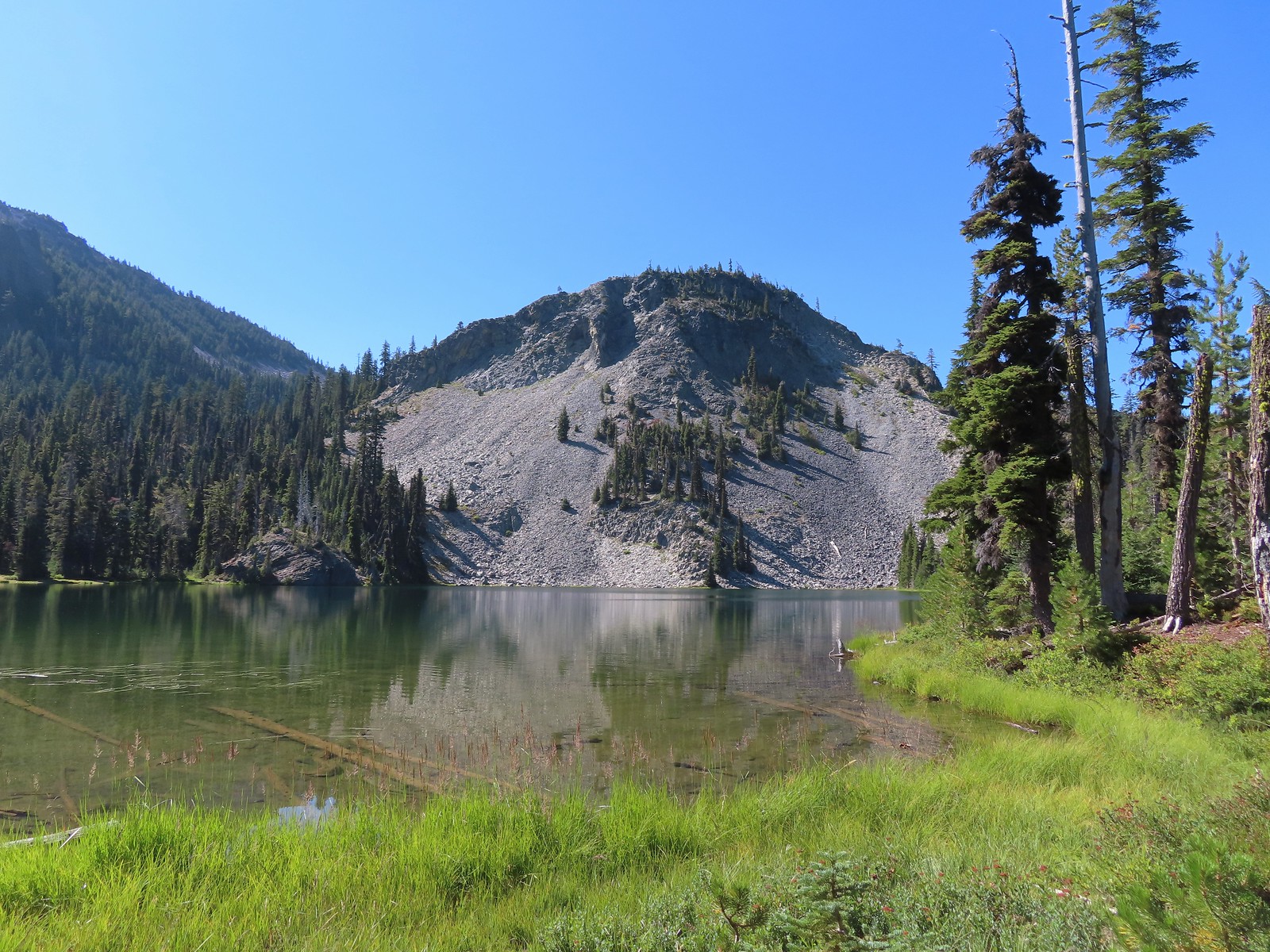 Cliff Lake
 Arnica
 Aster
Aster
 Splash in Cliff Lake from one of many fish that were feeding on insects.
 Camp
Camp Huckleberry bushes along the Cliff Lake Trail.
 Anywhere there was water nearby there were lots of tiny Cascade toads to watch out for.
 Back at the PCT.
 Larger frog
 Monkshood
 More grass-of-parnassus
 Not only were the toads tiny, they also were well camouflaged.
 Mount Scott (
 Mount Scott
 The Watchman (
 The Watchman and Hillman Peak
 Devil’s Peak
 Union Peak (
 Cliff Lake with Violet Hill beyond.
 Black backed woodpecker
 Getting closer to Devil’s Peak.
 A much bigger Cascade toad.


 Mt. Thielsen (
 Union Peak with Mt. Bailey (
 Lots of neat rock formation on Devil’s Peak.
 Western pasque flower seed heads.
 Buckwheat
 Views to the South opened up at the pass including Klamath Lake and Pelican Butte.
 Klamath Lake
 Devil’s Peak and the PCT coming up to the pass from the North.
 Klamath Lake, Pelican Butte, Aspen Butte (
 Mt. McLoughlin
 A faint Mt. Shasta which, given the wildfires burning in NW California was a bit of a surprise to be able to see.
 The view North.
 Goose Egg and Ethel Mountain in the forefront with Llao Rock, Mt. Thielsen, and Garfield Peak (
 Devil’s Peak
 We were a little concerned at first that it might be picking up water for a new fire but there wasn’t anything hanging from the helicopter so we have no idea what it was actually doing.
 The use path to Devil’s Peak on the right and the PCT on the left.
 The rather ominously named Lucifer from the use trail.
 A second use trail coming up from the opposite side.
 Western pasque flowers on the hillside above the use trails.
 The summit of Devil’s Peak ahead.
 Looking North toward Crater Lake and Mt. Thielsen
 Lucifer, Jupiter, and Venus
 Lee Peak above the pass.
 Luther Mountain (
 Remains of a former lookout.
 The PCT below Devil’s and Lee Peaks.
 Goose Egg, Llao Rock, and Mt. Thielsen
 Mt. Scott
 Mt. Shasta to South through a little smoke but again we felt fortunate to be able to see the mountain at all.
 Colorful grasshopper at the summit.
 American pipit
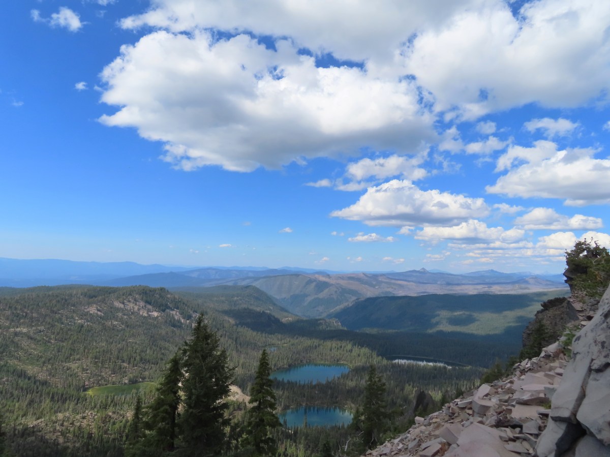
 The Seven Lakes Basin from the use trail down.
 South, Middle, North, and Grass Lakes
 Heading down the use trail.
 Looking back up the use trail.
 Western snakeroot along the PCT.
 A comma butterfly on western snakeroot.
 Painted lady
 Venus from the Devil’s Peak Trail.
 Looking back at Devil’s Peak.
 Looking North across the Seven Lakes Basin.
 Lake Alta in a bowl below Violet Hill.
 Pond along the Devil’s Peak Trail.
 Coming up to the Seven Lakes Trail junction. A rock cairn was the only marker.


 I was still only about halfway along the lake after the quarter mile. There used to be a campground at the North end.
 Common merganser
 The southern end of Lake Alta.
 Cliff Lake below Devil’s Peak and Middle Lake.
 Middle and Grass Lakes
 I could hear several pikas in the rocks below the cliffs but the only thing I spotted was a chipmunk.
 Chipmunk
 Sulphur butterfly on aster.
 Gentian
 Fireweed
 South Lake
 Devil’s Peak from the trail. There were more pikas “meeping” from the rocks here but again we failed to spot any of them.

 Devil’s Peak in the evening.
 So many fish in the evening.
 Devil’s Peak in the morning.
 Seven Lakes and Cliff Lake Trail junction.

 We detoured left at the northern end of the lake following a pointer for Lake Ivern to find a view back across Middle Lake.
 Devil’s Peak from Middle Lake.
 Stream crossing.
 Monkshood and grass-of-parnassus
 Grass Lake
 Arriving at the PCT.

 Golden-mantled ground squirrel
 Sevenmile Trail at the PCT to return to the Sevenmile Marsh Trailhead.
 Exiting the Sky Lakes Wilderness.


 Registration box and signboard at the Mt. Hood Wilderness boundary.
 There were a few downed trees but nothing too difficult to navigate.
 The brush was mostly huckleberry bushes.
 Trail side snacks.
 McGee Creek Trail junction with the Timberline Trail.
 Blowdown from the September 2020 storms that also flamed the destructive wildfires across the state. For more information on the storms impact on Mt. Hood check out this Wy’East Blog
  Looking through the trees at one of the areas that suffered severe blowdown.
 It was a cloudy day. We got sprinkled on briefly a couple of times.
 Fireweed
 Pinedrop
 Avalanche lilies
 Paintbrush
 Valerian, spirea, and paintbrush
 Gentians
 Yellow monkeyflower
 A tributary of McGee Creek.
 Spirea along the Timberline Trail.
 Shooting star
 Pink monkeyflower
 Fleabane
 Beargrass
 False hellebore
 Partridge foot
 Lupine
 Lewis monkeyflower along a tributary of McGee Creek.
 Beardstongue
 Lousewort
 Dry pond surrounded by beargrass.
 The idiots camped in the meadow. There is even an arrow on the “Do not camp in meadow” sign pointing at the meadow. Please DON’T be these people.
 The second pond still had some water in it.
 Junction with the Mazama Trail (
 The butterflies weren’t out today but the bees were.
 The clouds just wouldn’t quite raise enough.
 Mountain heather
 Lupine and paintbrush
 Beargrass along the Timberline Trail.
 Paintbrush, partridge foot and lupine
 Signpost for the McNeil Point Trail.

 We’d never seen a paint colored like this before.


 Western pasque flower
 Lupine and two types of monkeyflower


 Pikas spend the Summer gathering greens for the rest of the year when they remain in their homes under the snows.

 Mountain heather and paintbrush.
 Saxifrage
 A variety of flowers.
 Avalanche lilies
 Sub-alpine fleabane
 Western pasque flowers
 Doe that was as surprised as we were when we spotted each other.

 Lewis monkeyflower
 The righthand fork.
 View from the plateau.
 Some low clouds to the East.
 Dwarf lupine
 A hiker on the righthand fork headed for the McNeil Point Shelter.

 Caves below the Sandy Glacier.
 Bluebells of Scotland
 The shelter below to the right.
 Muddy Fork
 Goldenrod
 With the clouds the view wouldn’t have been great from the ridge on this day.


 Patches of blowdown along Bald Mountain Ridge.

 Columbine
 Valerian
 Paintbrush and bistort
 Aster
Aster Chipmunk snacking on huckleberries.
 Meadow near the Timberline Trail.
 Arriving back at the Timberline Trail.
 Every once in awhile the trail was clear of other users.
 We’re always drawn to this rock fin above the Muddy Fork.
 Canada jay
 McGee Creek Trail junction.
 Bunchberry
 Is that sunlight?
 While the clouds never lifted from Mt. Hood we did experience a window of blue sky near the end of our hike.
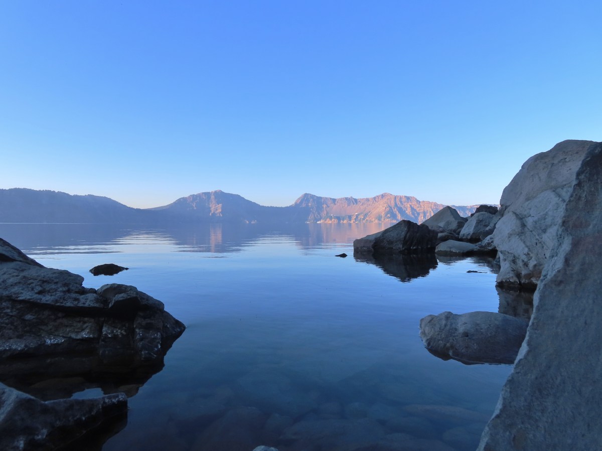
 Sunrise behind Llao Rock on the way to the trailhead.
 Crater Lake at sunrise.
 Mt. Bailey, Diamond Peak, and Mt. Thielsen behind Red Cone.
 Cowhorn Mountain (

 Mt. Scott (

 Dutton Cliffs, Sun Notch (
 Looking down at the turnaround point.
 Wouldn’t want a rock like this to come down on you.
 Breakfast time.
 There were “no stopping” signs at areas where the danger of rock fall was the greatest.
 One of the tour boats.

 Looking back at the dock area.
 Couldn’t get an actual fish in a photo but I barely missed this one.
 The dock at Cleetwood Cove.
 Not a hiker or fisherman.
 Llao Rock from East Rim Drive.


 Bog Orchid
 Bistort and monkeyflower

 Some sort of orchid?
 Yellow monkeyflower
 Monkshood


 Bistort
 Not sure if this is a robin or ?
 Crater Lake Lodge

 Garfield Peak from behind the lodge.
 The Watchman and Hillman Peak
 Golden-mantled ground squirrel with a mouth full.


 Mt. McLoughlin (
 Mt. McLoughlin
 Union Peak
 Paintbrush
 Reservoir structure (built 1931).
 Mt. Bailey (
 Mt. Bailey
 Deer below the trail.
 Western pasque flowers
 Arnica
 One of several patches of snow at the higher elevations.
 Crater Lake Lodge below to the left.
 Mt. Scott (
 Clark’s nutcracker
 Buckwheat
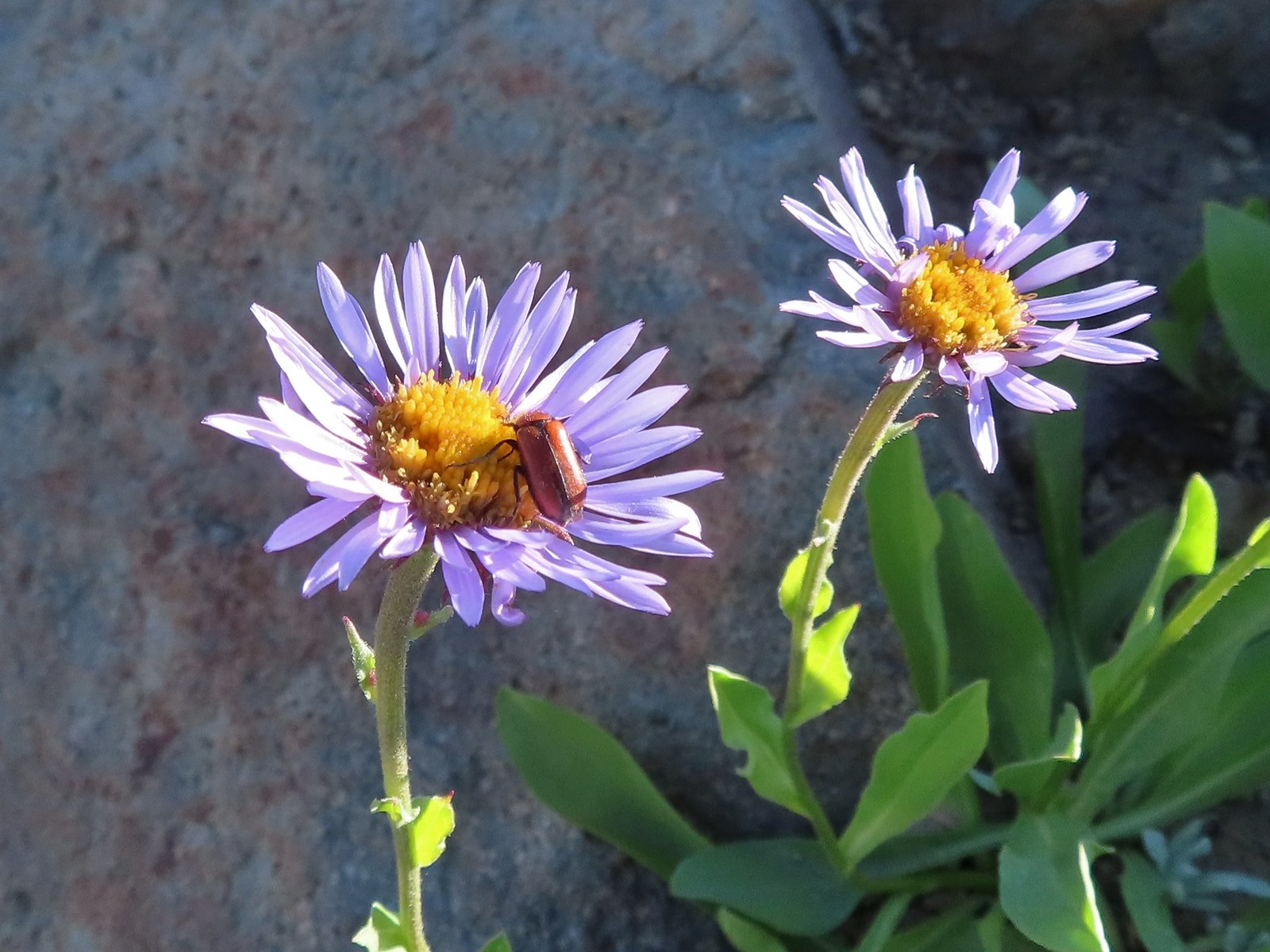 Beetle on sub-alpine fleabane.
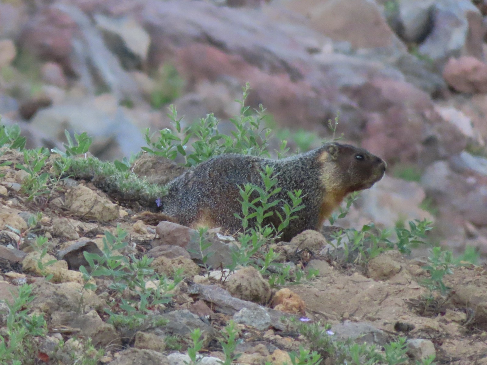 Yellow-bellied marmot
 Bench below the summit of Garfield Peak.
 Partridge foot
 Applegate Peak to the left and Crater Peak (
 Arriving at the summit.
 Mt. Scott above the Phantom Ship.

 It was a bit hard to make out but Mt. Shasta was visible to the south.
 Cowhorn Mountain (
 Crater Lake from the summit of Garfield Peak.
 Blurry photo due to the sheer distance away it was but it looked big.
 Union Peak behind a marmot.
 Penstemon
 Painted lady
 There were a lot of marmots out.
 Paintbrush, phlox and buckwheat.
 Stonecrop, paintbrush and pearly everlasting.
 The clear blue water of the deepest lake in the United States.
 Yellow-rumped warbler

 False hellebore
 Viewpoint and The Watchman from the trailhead.
 Western pasque flowers above Crater Lake.
 Hillman Peak ahead.


 Lounging on a rock.
 Shasta knotweed
 Rim Drive below the Rim Trail.
 Mt. Bailey and Diamond Peak with Diamond Lake (
 Red Cone with Sawtooth Mountain (
 Silvery Raillardella
 Snow patch on Hillman Peak.
 Penstemon
 Llao Rock
 It took us a moment to notice the two deer ahead along the tree line.
 We spotted the doe but she also had a pair of fawns nearby that bounded off.
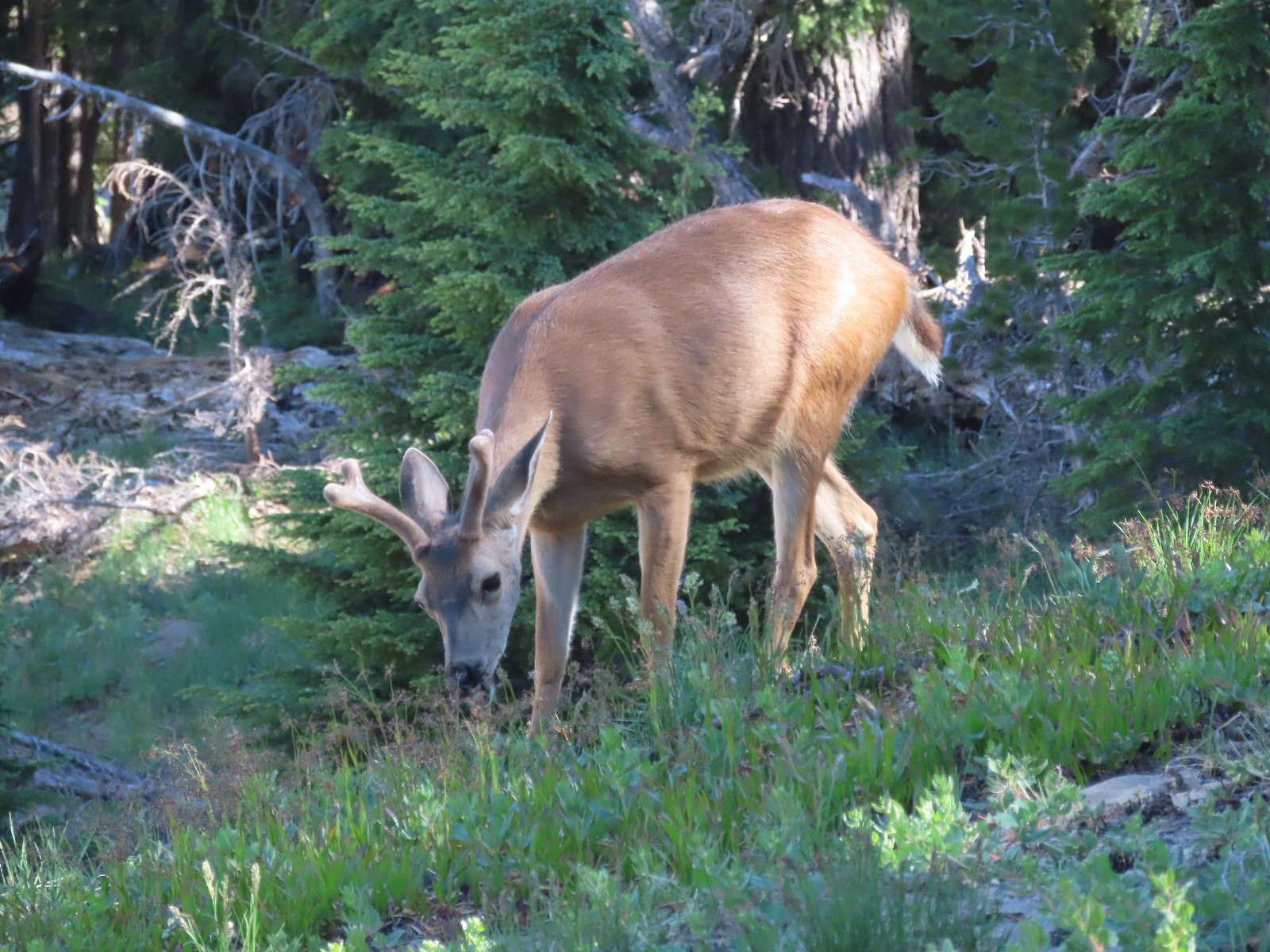 This buck had zero concern with us as we passed by.
 Phlox
Phlox Dwarf lupine
 Devil’s Backbone with Mt. Scott behind.
 Wizard Island
 Devil’s Backbone
 Hillman Peak from Devil’s Backbone.
 Garfield Peak across Crater Lake.

 Saxifrage
 The Watchman
 If I stand perfectly still, they won’t see me.
 Hillman Peak and Llao Rock from the viewpoint at The Watchman Trailhead.
 Rock formations below Hillman Peak.
 Godfrey Glen Trailhead
 The ADA accessible trail made for a nice easy walk.
 Super-heated volcanic gas fused ash creating these pinnacles.
 First viewpoint of Godfrey Glen above Munson Creek.
 Godfrey Glen
 Another viewpoint.
 We could hear Munson Creek but it wasn’t visible in the canyon below.
 One waterfall.
 Another waterfall in the canyon.
 The end of the loop.
 Sinnott Memorial Overlook on the rim to the left.
 View from the overlook.
 Mt. Scott and Garfield Peak from the overlook.
 These numbers blew our minds.

 Swallowtail and a painted lady on penstemon.


