A project at work had Heather occupied so I headed out on a rare solo hike to visit Chimney Peak in the Middle Santiam Wilderness. This would be just my second visit to this wilderness with the first being an overnight trip to Donaca Lake (post) in 2014.
For this outing I started at the McQuade Creek Trailhead. This is the shortest route to Chimney Peak. I actually parked on the shoulder of Forest Road 1142 and walked a tenth of a mile down a spur road to the start of the trail.
A note stating that access from the eastern side of the wilderness was still closed due to the Pyramid Fire.
The 5-mile long McQuade Creek Trail gains approximately 1600′ before ending at the Chimney Peak Trail. The trail is well graded, and as of my trip, free of any significant downed trees. The trail however is narrow, rough, and was overgrown in numerous places. Views are limited along the trail, but the forest is lovely. This combination is likely why I didn’t see another person all morning despite it being a warm, sunny day. It was early when I started so there wasn’t a lot of light and even on the way back there was a lot of shade.
A short distance from the trailhead is a crossing of West Fork McQuade Creek.
A third of a mile from the West Fork the trail crosses McQuade Creek.
Reportedly this crossing can be quite tricky early in the year, but there wasn’t much water this time of the year.
Based on trip reports from 2023 and recent cuts seen along the trail it appears that a trail crew passed through this year.
There are just 3 or 4 trees about this size left across the trail.
Big trees near a rock outcrop.
A good representation of the rough tread along parts of the trail.
A reminder that Fall is here.
The McQuade Creek Trail hidden by the underbrush.
Lousewort
Huckleberries
Views were limited to the nearby ridges and hillsides.
Chimney Peak straight ahead.
Vine maple along a rocky slope.
Pika watching me from behind some cover.
Flagging along a bit of a washout.
The damaged section of trail pictured above started a 0.4-mile stretch of overgrown trail which included devil’s club, currant, and other thorny bushes. It was by far the least enjoyable part of the hike.
Looking back at the final section of the overgrown trail.
The trail beyond the really overgrown section.
A little under half a mile later I entered the Middle Santiam Wilderness at the junction with the Chimney Peak Trail.
The McQuade Creek Shelter used to be located near here, but it had collapsed years ago, and I didn’t see any signs of the remains.
From the junction Donaca Lake is a little over 6-miles (left) while Chimney Peak is three-quarters of a mile in the other direction (right). Pointer for Chimney Peak.
I turned right on the Chimney Peak Trail which climbed gradually along a ridge for the first 0.2-miles before steeping significantly in the next half mile culminating in a brief class 3 scramble to reach the former lookout site atop Chimney Peak.
Looking up from the trail.
Mt. Jefferson
The trail heading steeply uphill towards the Sun.
The trail passing beneath the cliffs.
Initially I forked right here because the left hand fork didn’t appear to go anywhere.
I assume these are remains from the former lookout.
I followed a use trail to the end of the cliffs thinking that the scramble route up might be at the far end but it was not.
I headed back to the area where the fork I’d ignored earlier was and headed uphill toward the rocks. The start of the scramble route. The crack was too narrow to use but once I got to the top of this rock the route became much clearer.
Looking down at the first part of the route from above.
The top is in sight.
Clouds over Green Peter Lake.
Mt. Hood in the distance.
Zoomed in on Mt. Hood and some haze.
Mt. Jefferson
There was no sign of the 1934 lookout on the rocks where I’d come up, but there appeared to be another set of rocks to the east hidden by a tree and some brush.
After fighting my way through I popped out at the lookout site.
The Three Sisters
Three Fingered Jack to the left behind the Three Pyramids (post) and Mt. Washington (post) on the right.
Mt. Jefferson zoomed.
The view of the mountains would be better later in the day when the Sun would be more overhead or behind Chimney Peak, but that’s the price of getting an early start. I took a break at the summit and spent some time dealing with hot spots on my feet. I had worn a newer pair of boots, and the rough, uneven trail tread had created some issues. After putting on some blister aids, reapplying glide, and changing socks I headed back.
It was a pretty uneventful hike out, although the views were a little better along the McQuade Creek Trail now that there was more sunlight.
West Fork McQuade Creek
Back at the trailhead.
This hike came in at 11.8-miles with around 2500′ of elevation gain.
It was an enjoyable hike, but it felt harder than the stats would indicate. I believe the trail tread had a lot to do with that combined with it being a fairly warm and humid (by Oregon standards) day. It was encouraging to see that the trail had seen recent maintenance. Maybe that will encourage a little more use. Happy Trails!
Despite hiking regularly for a dozen years there are still plenty of places and trails close enough for a day trip that we’ve yet to make it to. We’ve made it a priority for our outings to involve such places when possible and was the purpose of our most recent outing. Matt Reeder’s “Off the Beaten Trail” (2nd edition) includes an entry for Black Wolf Meadows and High Rock (hike #39), a pair of short hikes in the Clackamas Foothills off of Forest Road 58. Combined, these hikes total right around 4-miles which prompted us to look for another stop we could add and landed on Pyramid Lake which I found using the Oregonhikers.org Field Guide.
We decided to start with the hike to Pyramid Lake and parked along FR 140 whish was the suggested trailhead in the Field Guide entry. This road is narrow and overgrown so expect to pick up some scratches from brush if you decide to drive it. We parked on the shoulder here and road walked three quarters of a mile to the official trailhead. This is a good example of why we parked where we did.
The official trailhead.
It’s just 0.2-miles to the lake from this trailhead, but the initial climb is pretty steep. The lake is located within the Roaring River Wilderness. This would be just our second time hiking in that wilderness area joining our 2013 Shellrock & Rock Lakes hike (post).
A pair of Barrow’s goldeneye ducks enjoying a morning swim on the far side of the lake.
We attempted to follow a use trail around the lake, but it quickly petered out in the brush so we called it good and headed back to our car. The use trail
Mushroom along the road walk back to the car.
This stop came in at 2.6-miles with a little over 300′ of elevation gain, primarily in the initial steep climb from the official trailhead. After returning to FR 58, where we turned left, we continued 1.2-miles to a sign for Anvil Lake. We turned right onto spur road 5800-160 and followed this narrow gravel road 0.4-miles to a pullout on the left at a closed road just beyond the signed Anvil Lake Trail. The somewhat obscured sign for the Anvil Lake Trail along spur road 5800-160.
The pullout where we parked.
The Anvil Lake Trail was historically part of a Native American route from the Cascade crest to the Estacada area. The trail is fairly level to start and reaches Black Wolf Meadows near the half mile mark.
Old growth cedar along the trail.
There was a variety of large mushrooms on the forest floor along the trail.
There was also a bit of blowdown to climb over.
The edge of Black Wolf Meadows.
Sign in Black Wolf Meadows.
Earlier in the year the meadows are rather wet, but today the only moisture was from the morning dew.
Explorers gentian. There were many of these gentians in the meadows, but they all appeared to have finished blooming weeks before.
The trail leaving the meadows.
Soon after leaving the meadows the trail began a gradual descent before reaching a signed junction with a short spur trail to Anvil Lake.
More mushrooms
Rough-skinned newt
Old sign near Anvil Creek.
The dry bed of Anvil Creek.
Coral fungus
The sign for the spur trail ahead on the left.
Pointer for Anvil Lake. According to the Oregon Hikers Field Guide this sign is likely over 50 years old based on the reference to S-502 which is currently known as FR 5820 which is another potential trailhead for this hike.
We turned down the spur trail which dropped somewhat steeply before arriving at the lake in just over 100 yards.
Anvil Lake
Wood duck house reflecting in the lake.
There is just one small campsite at the lake. We’d seen a gentleman heading toward FR 5820 just as the junction with the spur trail had come into view, but there was no one at the lake now. After a brief break we headed back. It was interesting to find that in the short amount of time that had passed since our first trip through Black Wolf Meadows nearly all of the dew was now gone.
This stop was just slightly longer than the hike at Pyramid Lake, coming in at 2.7-miles. The elevation gain was just 190′ and a lot more gradual than it had been at Pyramid Lake.
We hopped back in our car, returned to FR 58, and turned right to continue another 0.6-miles to a signed junction where we veered right following a pointer for High Rock. After another paved mile we turned into a large unsigned pullout for our final hike of the day to High Rock.
Mt. Hood from the pullout.
We started up a rough road on the eastern side of the pullout.
While open the road is rough and 4wd is almost certainly a must (there was one pickup up at the end of the road and Heather saw a Subaru turn around and head down while I was exploring the rock outcrops.)
At the 0.4-mile mark the road turns sharply left while a jeep track launches steeply up a hill (where it really shouldn’t).
The road continuing to the left.
Mt. Jefferson, the tops of the Three Sisters, and Three Fingered Jack from the road.
Olallie Butte (post), Mt. Jefferson, the Three Sisters, and Three Fingered Jack.
I decided to head straight uphill on the jeep track to see what the view was like from the rocks here while Heather continued on the road to the former lookout site. Mt. Hood with Mt. Adams behind to the left.
The view south toward Mt. Jefferson.
View along the rocky ridge.
I followed use trails along the ridge eventually gaining a view of the outcrop where the lookout site had been. Heather is the orange dot climbing up the side of the outcrop.
I had to drop down to a saddle where the road had ended. The pickup was parked here near a camp a couple of gentlemen had set up. Mt. Hood from the saddle.
I climbed up a fairly steep and rocky slope to join Heather at the former lookout site where we took a break and enjoyed the 360-degree view. Signal Buttes is the pointy peak on the left and Salmon Butte (post) is the rounded peak hump on the right.
Salmon Butte now in the middle with Linney Butte the hump on the right of the double humps in the foreground and Devil’s Peak (post) the high point to the right of Linney Butte.
Linney Butte, Devil’s Peak, Mt. Adams in the distance, and Mt. Hood.
Wolf Peak in the foreground which is above Black Wolf Meadows.
Mt. Jefferson from the former lookout site.
Peaks in the Bull-of-the-Woods and Opal Creek Wilderness areas in the distance to the left and Fish Creek Mountain (post) in the distance to the right behind a ridge.
The remains of the lookout on High Rock.
A zoomed in shot of Mt. Adams.
Mt. Rainier rising behind Devil’s Peak.
When it was time to head back we located a more gradual trail down to the saddle.
I stopped to take a picture of the golden-mantled ground squirrel posing on the large boulder. As I was taking the photo I noticed a pika dashing across the rocks. The pika is just barely visible below the lark dark rock to the left of the tree when zoomed in far enough.
The ground squirrel watching us as we passed below.
Skipper along the road on the way down.
Aster
Red huckleberry leaves with Mt. Jefferson beyond.
The GPS read 1.3-miles for my hike here with a little under 350′ of elevation gain. This made the total for the day 6.6-miles with right around 850′ of elevation gain.
These hikes offered a nice variety of scenery free of crowds. Combining them provided a moderate day with enough hiking to warrant the 90+ mile drive from Salem, and now we can add three more places to the list of where we’ve been. We were treated to an unexpected post hike scene when a young black bear crossed Highway 224 near Promontory Park. At 11:30am we weren’t even considering that a bear might be crossing the road, but that made the third bear I’ve seen in the last 30 days and Heather’s 2nd. Happy Trails!
Our quest to seek out new to us trails had us turning back to Matt Reeder’s “101 Hikes in the Majestic Mount Jefferson Region” (1st edition). Because the book was released in 2016 it pre-dates the 2020 Riverside and Beachie Creek Fires that devastated much of this region leaving many of the hike descriptions out-of-date. We were fortunate enough to experience most of the hikes, at least in part, prior to those fires.
One of the hikes that we had not yet gotten to was Reeder’s hike #4-Upper Molalla Divide. Reeder describes three options starting at two different trailheads ranging from a 0.7-mile loop at Joyce Lake and a 2.8-mile out-and-back to Nasty Rock. These hikes largely escaped the recent fires except for a couple of small sections of the trail to Nasty Rock scarred by the 2020 Beachie Creek Fire. On the other hand, other than the trail around Joyce Lake, the trails are rarely if ever maintained.
We decided to start our day at Joyce Lake when we found the trailhead parking area empty. Two of the three described hikes start from this trailhead, the very short loop around Joyce Lake, and a 2.6-mile loop combining the abandoned Baty Butte Trail and gravel roads. The unsigned trail enters the forest across from a small pullout.
The trail quickly arrives at a campsite where we then headed left on the loop around the lake which is stocked with fish.
Bunchberry
Fish
Rough skinned newt
After completing the loop around the lake we headed back toward the road from the campsite looking for the abandoned Baty Butte Trail. It wasn’t easy to spot but a metal diamond on a tree marked the start of this trail.
After pushing through some Rhododendron the trail became a little easier to follow.
We had hiked a portion of this old trail in 2019 to Baty Butte itself (post) and were hoping to get more of the trail in, but just under half a mile from the start of the trail we came to a small talus slope. Flagging and some old trail maintenance along the Baty Butte Trail.
On the far side of the talus a tree had fallen onto the thick vegetation creating a matt of leaves and branches that covered the tread. We could see the tread continuing on the other side of the thicket.
Vegetation covering the trail.
We initially thought that we might be able to dip below the downed tree, but the hillside below was covered with thorny devil’s club. Going up and around didn’t look any more promising, and even if we did find a way around this there was another mile of trail before reaching a powerline road that we would be turning onto. We accepted defeat here and turned back. Between Joyce Lake and the failed attempt at the longer loop our hike here was just 1.5-miles with a couple hundred feet of elevation gain.
From the Joyce Lake Trailhead we continued 3.9-miles to the trailhead for the Nasty Rock Hike. (Note that online searches and Google maps for the Nasty Rock Trailhead will provide results for the Willamette National Forest’s Nasty Rock Trailhead which is currently closed due to the Beachie Creek fire and does not actually lead to Nasty Rock.) The trailhead is located at a turnaround at the end of BLM road 7-4E-11.1.
The BLM refers the Nasty Rock Trail as “historic” and the area was part of a BLM study for addition to the adjacent Opal Creek Wilderness in 2013. That study found that the area met all the criteria and characteristics for a wilderness, but the addition never moved forward. The 2013 study mentioned that the trail was not being annually maintained but it was still “usable”. Having just been turned back on our earlier hike we were prepared for a similar experience here, although a 2022 trip report on Oregonhikers.org indicated that the trail was still passable at that time. While the trail itself still shows on the BLM’s recreation map there is no trailhead symbol shown.
Before setting off we took a moment to admire the roadside wildflowers.
Oregon sunshine, lupine and paintbrush.
Larkspur, paintbrush, and Oregon sunshine.
Penstemon, paintbrush, and valerian.
The Nasty Rock Trail, like the Baty Butte Trail, was not obvious from the parking area. Again a metal diamond on a tree helped us locate the trail heading uphill from the road below.
The trail initially climbs as it wraps around a shoulder of Burnt Mountain. The tread is narrow in places, and a bit overgrown.
Westen featherbells
Bistort
Arnica
Bear sign on the trail.
Paintbrush and lousewort
The trail then traversed the hillside below Burnt Mountain entering the Beachie Creek fire scar a third of a mile from the start of the trail. Nasty Rock from the trail.
Entering the fire scar.
The trail was especially overgrown in the fire scar.
Penstemon
Columbine along the trail.
Valerian
Exiting the fire scar after less than 100 yards.
The trail continued on a fairly level grade past Burnt Mountain then curving to the West as it followed a ridge toward Nasty Rock.
While none of the several downed trees posed much of an issue the condition of the trail made for slow going.
The trail crossed the ridge near the mile mark where views opened up. Nasty Rock sticking up ahead.
Not Nasty Rock further along the ridge and in the Beachie Creek fire scar.
Wildflowers were blooming in the openings along the ridge.
As the trail neared Nasty Rock it entered another section of forest burned in the Beachie Creek fire.
The trail steepened noticeably before effectively ending on the SW shoulder of Nasty Rock.
There were a lot of nice Washington lilies below Nasty Rock with more to come over the next week or two.
Wintergreen
Nasty Rock from the trail.
The trail below Nasty Rock.
Nasty Rock from the end of the “trail”. Prior to the 2020 fire a rougher use trail continued on to Not Nasty Rock, but we didn’t see any obvious tread. (We weren’t really looking though either.) We made the fairly easy scramble to the top of Nasty Rock and took a short break.
The view was all too familiar with the horizon filled with wildfire smoke. Mt. Jefferson and Mt. Hood were easy to see, but other Cascades such as Three Fingered Jack, Mt. Washington, and the Three Sisters were barely visible through the haze. Mt. Jefferson from Nasty Rock.
Mt. Jefferson with the flat-topped Battle Ax (post), and rounded Whetstone Mountain (post) to the right.
Mt. Hood in the distance.
French Creek Ridge with the rounded Marten Buttes (post) in the foreground. Behind is the flat-topped Coffin Mountain (post), Mt. Washington, and the Three Sisters.
Looking out across the Molalla River drainage to the Table Rock Wilderness.
Rooster Rock is the rock outcrop to the left with Table Rock the tall feature to the right. Pechuck Lookout can be seen on the lower hilltop in the center foreground.
Not Nasty Rock from Nasty Rock. The highest peak diagonally left of Not Nasty Rock is Rocky Top (post).
We were joined at the summit by a swarm of flying ants obsessed with this fir tree.
After our break we headed back. There were several breaks along the way as we stopped to watch the numerous butterflies visiting the flowers. Checkerspot on Oregon sunshine
Swallowtail resting on serviceberry.
Blue bells of Scotland
Fritillaries on mountain coyote mint
Clodius parnassian on mountain coyote mint.
Fleabane
Buckwheats, paintbrush, Oregon sunshine and at least one butterfly.
Scarlet gilia
Larkspur
Washington lily
Inside-out flower
Fritillary
Beardtongue
Pink pyrola
Bead lily a.k.a. Queen’s cup
Bunchberry
Cat’s ear mariposa lily
Approaching the road.
Another round of roadside flowers occurred before packing up and heading home.
Larkspur and yarrow
Checkerspots on Oregon sunshine
Including the roadside flower wanderings our hike here came to 3 miles with approximately 600′ of elevation gain.
At 4.5 miles total these two stops made for a fairly easy day despite the rough trail conditions. The roads were in good shape to both trailheads, but please note that the area sees heavy log truck traffic on weekdays. We didn’t see anyone during either stops and somewhat surprisingly still didn’t see anyone parked at the Joyce Lake Trailhead when we passed back by close to Noon.
Nasty Rock was a bit of a bittersweet hike seeing all of the familiar areas burned by the 2020 fires, but we were glad to have finally made it up there. Happy Trails!
**Note the 2024 Young Grasshopper Fire burned over a portion of this hike including Grasshopper Meadow.**
In 2017 we did an overnight backpack to Grasshopper Meadow via Chucksney Mountain (post). During that trip we hiked a 9.8-mile section of the 13.5-mile long Grasshopper Mountain Trail #3569. The section covered was from the Box Canyon Trailhead to the base of Grasshopper Mountain. The trail does not go up the mountain’s summit but instead from the saddle at the base heads around the mountain and then follows Hiyu Ridge down to the Grasshopper Trailhead (approx 4 miles from the saddle).
Grasshopper Meadow was a beautiful destination making a second visit appealing and including the remainder of the Grasshopper Mountain Trail pushed it up on our list of planned hikes. We had a decision to make regarding where to start for this second visit though. In his “100 Hikes Central Oregon Cascades” guidebook Sullivan includes the hike from the Grasshopper Trailhead along Hiyu Ridge in the more hikes section at the back of the book. He also includes a hike to Grasshopper Meadow via the Grasshopper Meadow Trail in the back of the book beginning 850′ below the ridge at the top of the meadow at what is marked on Google Maps as the Grasshopper Meadow Trailhead. Hike Oregon also covers the same hike on their website here. Interestingly the Forest Service map and website do not mention this trailhead, but they do show the Grasshopper Meadow Trail #3314. We opted to start at the Grasshopper Meadow Trailhead for two main reasons. First it would allow us to pass through Grasshopper Meadow at two different times of the day instead of it being our turnaround point. The second, and more important reason, was Sullivan’s description of the hike along Hiyu Ridge indicated that we should be prepared to step over some logs. That’s code for lack of trail maintenance which could mean that this section of the trail could be impassable. The Forest Service website didn’t provide any trail conditions. We could have called to check, but we figured worst case scenario we could redo some of the 2017 hike if necessary.
A word of warning regarding the drive to this trailhead. There was about a half mile section of Road 1929 where a good amount of gullying has occurred. We’d recommend high clearance, but somehow there was a Toyota Prius parked here (just out of frame).
The trail began with a gradual climb through a mixed conifer forest before steepening as the meadows began. Valerian along the trail.
Vanilla leaf and anemones carpeting the forest floor.
There were wildflowers along the vast majority of this hike which resulted in our taking way too many photos. I will try and limit what I include here, just know that what gets shared will be a small portion of what we saw. Star-flowered false solomonseal.
Coneflower with lupine behind.
Penstemon
Near the three-quarter mile mark we took a short spur trail to the left to visit a spring at the base of a post.
Monkeyflower
We continued steeply uphill from the spring for 0.3-miles where we took another short spur trail, this time to the right and a view of Diamond Peak.
Lupine
Sub-alpine mariposa lily
Moth on fleabane.
Waterleaf
Tiger lily
Pussytoes
From left to right the peaks with snow are: The Twins (post), Maiden Peak (post), Fuji Mountain (post), and Diamond Peak (post).
Diamond Peak
We continued uphill from the viewpoint following the trail to a post in a large rocky area that was filled with larkspur.
Grasshopper Mountain above the meadow.
The post in the rocky area.
When we visited in 2017 it had been mid-July, and the larkspur show was over.
The Grasshopper Meadow Trail ends at these rocks for all intents and purposes. There is no clear path from the post up to the Grasshopper Mountain Trail which is approximately 150′ above running along the ridge. We made our way uphill trying to avoid as many plants as possible and picked up the trail which was marked by periodic rock cairns. A cairn marks the Grasshopper Mountain Trail.
We turned left on the trail and headed toward Grasshopper Mountain.
Looking out over the meadow.
Fuji Mountain and Diamond Peak
The saddle below Grasshopper Mountain.
From the ridgetop we gained a view to the NE which included the Three Sisters, Broken Top, and Mt. Bachelor (post).
The Three Sisters and Broken Top
Mt. Bachelor
We crossed over the ridge and continued on the Grasshopper Mountain Trail which was, as we had suspected, in need of some trail maintenance. The last of the snow, at least it is all we saw.
Glacier lilies near the tiny snow patch.
It was evident that the trail does get maintained on occasion, but none of it appeared recent near Grasshopper Mountain.
Crossing over the ridge changed the mix of wildflowers we’d been seeing adding in some early season bloomers such as trillium.
Anemone
Violets
Bleeding heart
Oregon bluebells
The trail passed through a small fire scar on the backside of Grasshopper Mountain where we had to briefly leave the trail to find a way over and around blowdown.
The Three Sisters and Broken Top were visible from this area.
Back on the slightly overgrown trail.
As we made our way through the fire scar more mountains joined the view including Mt. Washington, Three Fingered Jack, and Mt. Jefferson.
Mt. Jefferson and Three Fingered Jack
Bears appear to use the trail more than hikers. This was the largest of three piles we’d pass on the day.
Arnica
After navigating the fire scar we were able to more or less stay on the tread save for a couple of brief detours around blowdown. That being said there were numerous trees that we had to step, or in some cases climb over. There were also numerous burrows to watch out for along with a lot of forest debris which made for a slow and hard hike. The other thing that slowed us down was the sheer number and variety of flowers. This is both the trail and a front (back) door.
Valerian and tall bluebells
Fairy bells
Meadowrue
Moth on valerian.
Jacob’s-ladder
While the trail was overgrown in places it was passable and the tread was in pretty good shape.
Fringecup
Possibly a speedwell but unsure and it was the only one we saw.
More blowdown to maneuver around.
Edith’s checkerspot
Trail passing through an area full of monkeyflower and larkspur.
Cinquefoil, larkspur, and buckwheat
Scarlet gilia
Paintbrush
Bluehead gilia and silverleaf phacelia
Approximately 1.5-miles from the saddle below Grasshopper Mountain the trail again crossed the ridge to avoid a rocky cliff area. The rocky area from the trail as it crossed the ridge.
We could see that there were a lot of flowers on the rocks, but the trail dropped below the ridge quickly and my first attempt to scramble up to see the flowers was too soon and I just ended up in the brush on the ridgetop. On our way back I tried again, this time finding the correct spot where I was awarded not only with the amazing flowers but also another great mountain view. Columbine crowding the trail.
The wildflower covered rocks on the way back.
Arrowleaf buckwheat and Oregon sunshine
The Three Sisters and Broken Top with some clouds moving in.
Paintbrush surrounded by buckwheat, bluehead gilia, and stonecrop.
Scarlet gilia
Wallflower
Wild rose
The trail stayed on the west side of the ridge for the remaining 2.3-miles. Just over a third of a mile from the rocky viewpoint the trail passed a small rock outcrop which we thought looked like and it might be a good spot for a break on the way back. Not far beyond the outcrop we came to another tricky downed log where Heather decided that was enough. She would go back to the outcrop and while I would continue. If the trail was passable I would continue for no more than 45 minutes as it looked like that would be enough time to reach the Grasshopper Trailhead based on the distance shown on the GPS.
Beargrass near the outcrop.
The outcrop from the trail.
Blowdown
More blowdown
Western meadow fritillary
Bunchberry
Recent trail maintenance! There were a couple of cut trees in the final mile, but there were also still many to step over.
I had misjudged two things when Heather and I had split up. One was just how far the trailhead was, and the other was how much elevation I would be losing to get there. The trail dropped low enough that there were several rhododendron blooming.
It turned out I had been almost 2-miles from the trailhead and needed to lose over 850′ of elevation to reach it. Luckily the trail was in a little better shape at this end again. I was able to keep a good pace and I arrived at Grasshopper Saddle with a couple of minutes to spare.
Given that the Forest Service lists this as an official trailhead I was expecting a little more than a post with a road number and a faded laminated sheet of paper. Had I not just come down the trail I might not have even noticed it was there.
Cardwell’s penstemon
I realized on my way down that while I was making good time going in that direction, I was going to be hard pressed to maintain the same pace going uphill. Fortunately for me it wasn’t a particularly warm day, so it only took me an extra five minutes to make it back to the outcrop. When I joined Heather on the outcrop she said she was just starting to wonder if she should start to worry. (I might have made a little better time had I not kept taking pictures, but then again, those breaks let me catch my breath.) Starflower
Ginger
Mt. Bachelor through the trees.
Musk monkeyflower
Grasshopper Mountain from the outcrop.
Cliff beardtongue
After I took a much-needed break we headed back. We kept our eyes out for flowers we’d missed on our first pass while we watched the various pollinators visiting the blossoms. Blue-eyed Mary
Cicada, not a pollinator but interesting to see.
Solomonseal
Variable-leaf collomia
Honeysuckle
Oregon grape
Pollinator 1
Pollinator 2
Pollinator 3 (Clodius parnassian)
Bees on bastard toadflax
Checkerspot on groundsel
Naked broomrape (Aphyllon purpureum)
Penstemon
Our guess is this is mile three from Grasshopper Saddle. We didn’t notice any other numbers and missed this one on our first pass.
Dwarf bramble
Strawberry
Cinquefoil
It started clouding up in the afternoon.
Back at the saddle below Grasshopper Mountain.
We took another break shortly after reaching Grasshopper Meadow then headed down to the spring where we both cooled off using the spring water.
Great artic butterfly. There were a lot of these flying about. Their dorsum is a bright orange, but they rarely would open their wings when they landed.
The checkerspots on the other hand are happy to open their wings.
False hellebore
It clouded up over Diamond Peak as well.
Lewis flax
Orange agoseris
A Lycaendae on a lupine leaf.
Moth on a mariposa lily.
Butterflies gathering at the spring.
After refreshing ourselves with the spring water we continued back to the trailhead where we found the Prius still there. We never saw or heard another person on this hike. Not seeing anyone along Hiyu Ridge isn’t all that surprising given the trail conditions, but not seeing anyone in the meadow was a little surprising.
The Prius at the TH. We parked on the shoulder in a pullout.
The hike from trailhead to trailhead came to 11.5-miles (according to the GPS) with a little over 2000′ of elevation gain (according to the topo maps, and my legs).
Despite the rough trail conditions this was a beautiful hike. The flowers were the highlight, but there were several good mountain views scattered throughout. Hopefully the gullies in FR 1929 can be repaired or at least kept from getting any worse. Forest Road 1927 at Grasshopper Saddle seemed to be a good gravel road, but for that to be a viable option for anyone other than those that don’t mind a challenge the trail needs to be cleaned up. Happy Trails!
A paved interpretive loop explores a riparian zone along the Middle Fork Willamette River.
Signboard about a tenth of a mile from the trailhead.
The loop began on the far side of the footbridge.
We hiked the loop clockwise and made our way back to the car. There were a few flowers and an obstructed view of the river. We didn’t see much in the way of wildlife save for a couple of birds and a snail.
As far as we could remember we’d never seen a bench on the other side of a fence before.
Middle Fork Willamette River through the vegetation.
Tiger lily
Self-heal
Snail
Mock orange
The hike here was a little over half a mile, a good warm-up for our next stop at the Deception Butte Trailhead which was only 3.5 miles away.
We had attempted this hike in October 2017 (post), but a 2014 wildfire had left the trail beyond the creek itself unpassable. The trail remained closed until 2022 when the Forest Service and volunteers were finally able to clear and make the necessary repairs to the fire damage.
The fire mostly spared the forest up to the footbridge crossing Deception Creek.
Anemone
There are a few junctions prior to reaching the footbridge. The first was the only one with any signage. We stayed on the correct trail by ignoring side trails to the left that headed uphill and on the right that led down to Deception Creek.
We turned left at the signed junction following half a sign for the Deception Butte Trail.
At the last unsigned junction there was a signboard, but with nothing on it. (We went straight.)
Warning sign for the burned area ahead.
The footbridge over Deception Creek.
Deception Creek
On the far side of the footbridge the trail entered the fire scar and climbed steeply up a small ridge.
The trail then dropped steeply down on the other side of the ridge.
Due to the fire damage the tread here and for much of the remainder of the trail is rocky and somewhat slick so trekking poles came in very handy. There were also a few spots where some of the tread was missing requiring care. The trail was free of any significant debris, and we only had to step over one small tree. From the bridge it was approximately 3 miles to the summit with around 2300′ of elevation gain. The trail used a combination of switchbacks and longer traverses to gain the elevation. The grade varied widely with a few steep sections and some gentler climbs The amount of trail work needed to clear the trail was evident by the sheer number of cut trees along the length of the trail.
This was from 2017 near the same stretch of trail.
View up the canyon from the trail.
Clodius parnassian
There was a lot of vegetation along the trail, so we had to keep an eye out for poison oak which was present at times on the lower two-thirds of the trail. It was never much of a problem, but there were a couple of plants crowding the trail that we had to maneuver around.
There was some forest that survived the fire starting near the 3.5-mile mark where the fire burned less intensely.
Townsend’s solitaire
Canada jay
There were a few views of the Three Sisters through the remaining trees. (Middle & South Sister here)
Inside-out flower
Looking up as the trail neared the summit.
Woodpecker
Common whipplea
Anemone
The Deception Butte Trail arriving at Deception Butte.
Beargrass
From the actual summit the view is limited in every direction save the south.
A user trail heads SW and drops to an open saddle where you can get an unobstructed view of Diamond Peak to the SE.
Looking down at the saddle and wondering if it was really worth having to climb back up.
I had arrived before Heather and decided I needed to see the view, so I headed down to the saddle where there were I found quite a bit of wildlife and a few flowers. Northern flicker
Lizard
Rock outcrop on the other side of the saddle.
Tolmie’s mariposa lilies
Bluehead gilia
Squirrel
Oakridge in the valley below with Diamond Peak (post) on the right. The smaller peak with snow to the left of Diamond is Mt. Yoran, the triangle shaped peak is Coyote Mountain, and the peak with a little snow to the left of that is Fuji Mountain (post).
Diamond Peak
Oakridge
Leafy fleabane
Oregon sunshine on the hillside looking up Deception Butte from the saddle.
Wild onion
One of the fritillary butterflies.
Fly inside a Tolmie’s mariposa lily.
Hether had joined me at the summit, and we took a nice break in the shade on the mossy ground before heading back down.
There is a very steep trail just below the summit that leads to an upper trailhead. The Forest Service does not recommend using these though as the trail is said to be slippery and steep. We can vouch for the steep just by having looked down from the Deception Butte Trail.
Plectris and stonecrop
It was warming up fast as we descended, a stark contrast to the cold wet descent on MacDuff Mountain (post) just four days prior. We had to be careful not to slip on the loose rocks in the steeper sections and were again thankful for our trekking poles.
Coralroot
The best view of the Three Sisters that we got all day.
Butterflies enjoying some vetch. There were at least a half dozen butterflies visiting this patch.
Brown creeper
Pink pyrola
Pearly everlasting
Turkey vulture
Fireweed
Entering the trees near the footbridge over Deception Creek.
Columbine
Tiger lilies
This was a challenging but nice hike. We only saw one other person all day, a trail runner, before reaching the footbridge in the morning. In addition to some poison oak along parts of the trail we did flick a total of three ticks off our clothing so that is something to be aware of. Our GPS track showed approximately 9.5 miles which is partially inflated by my wandering back and forth a bit at the summit.
While it’s not the most exciting hike you can find, there were enough views and variety of plants and wildlife to keep things interesting and the elevation gain made it a good training hike. Happy Trails!
Seemingly all of the upcoming hikes I have slated for June (this year and in the future) involve viewpoints, but after a week of mostly blue skies and warm weather rain showers arrived just in time for our day off. Our original plan had been a two-stop day near McKeznie Bridge, first to revisit Castle Rock where we’d missed the view in 2017 (post) due to clouds, then hike to MacDuff Mountain for the first time. When I checked Friday morning the forecast for this area called for a 60% chance of showers mainly before 11am, less than a tenth of an inch of precipitation, and partly sunny skies. I checked some other areas and unless we were willing to drive to Central Oregon none looked better than this.
The hike to MacDuff Mountain was brought to our attention by Hike Oregon who is a great resource for hiking and backpacking information and tips. The O’Leary Mountain Trail passes just below the rocky summit of MacDuff Mountain on its way to joining the 22.8-mile long Olallie Trail. This trail and a portion of the Olallie Trail are open to mountain bikes as well as hiking. The out-and-back to MacDuff Mountain is approximately 10.5 miles with over 2700′ of elevation gain. The well graded trail makes the climb feel like less than that number though.
From the trailhead we crossed FR 411 to a pointer for the Castle Rock and O’Leary Trails.
We quickly arrived at a junction where the Castle Rock Trail headed left.
From this junction it is approximately 5 miles to the summit of Castle Rock. We wouldn’t have gone that route even if we had stuck to the original plan to visit it first. We would have parked at the Castle Rock Trailhead which is only 1.2-miles from that peak’s summit.
We stayed straight on the O’Leary Trail and quickly became soaked by the damp vegetation along the trail.
There were some nice rhododendron blooms along the trail.
It was hard to tell if it was actually raining or if the low clouds/fog was just leaving the trees and plants damp but either way drops were falling from overhead as we climbed a series of switchbacks. These led us past some nice rock formations in the first mile and a half.
Spotted coralroot
The first of three crossings of FR 411, this is at the 0.4-mile mark.
Inside-out flower
Starflower
Yellowleaf iris
The trail is narrow at times but well maintiained.
Forest filled with rhododendron.
A closer look at the rhodies.
There were several madrones in the forest.
Little prince’s pine
Sugar sticks
There were a few places where we might have had a view if not for the clouds.
Stonecrop
Passing below some of the rock formations.
Anemones
Bleeding heart
The switchbacks became much rarer beyond the rock formations as the trail traversed the hillside below a ridgeline, and occasionally on the ridge.
The first small meadow that the trail passed through was full of blue-eyed Mary.
Northern phlox
Coming up on another small meadow.
Subalpine mariposa lily
Beargrass
A little under three miles from the trailhead the trail arrived at FR 411 for the second time.
We were briefly confused here because the Forest Service map showed the trail continuing straight across the road here, and the description from Hike Oregon was that you would cross the road here. There was no sign of the trail to be seen though. We wandered back and forth a bit then based on the topography decided that any continuation of the trail would be further up the road (to the right when arriving at the road). We walked approximately 100 yards to spot the continuation of the trail through the fog. The fog didn’t help with our trying to find the trail. There was enough room along this section of road that parking and starting the hike from here would be possible.
Back on trail.
The trail made one of its steepest climbs from the road here then after briefly leveling out dropped back down to the road again. Honeysuckle
More northern phlox
This meadow was full of bluehead gilia.
The trail dropped steeply as it rejoined FR 411.
Another brief road walk followed before the trail split off to the right at a pointer. There was no parking room that we could see near this area.
It was only about a quarter of a mile between the two road crossings and the steep up and down had us questioning if it wouldn’t have been better just to stay on the road, but then we’d have missed the meadow of bluehead gilia.
The trail continued its gradual but steady climb for two more miles before arriving below the rocky summit of MacDuff Mountain. Vanilla leaf along the trail.
Bunchberry
Trillium
We stopped when we spotted something in the trail ahead that looked like it might be an animal. Using the camera to zoom we realized it was a grouse hen with her little chicks.
The hen got up and then the chicks headed into the underbrush. We felt bad having disturbed them, but once they’d moved, we calmly passed by while momma came back to gather her little ones.
This was all beargrass, but none of the plants in this area appeared to be planning on blooming this year.
Hermit thrush
The rocky summit of MacDuff Mountain.
Our hopes that the clouds might break up or lift before our arrival at MacDuff Mountain were in vain. It was a little past 11am but partly sunny skies were a distant dream. While there wouldn’t be any mountain views today the wildflowers blooming on the rocks made for a worthy destination on their own. A lot of larkspur.
Subalpine mariposa lilies
Paintbrush and buckwheat
Cinquefoil
A penstemon
Before going up to the actual summit I passed beneath and back into the forest following the trail until it began to descend.
There is no trail to the summit, so I went up cross country along the forest border then across to a 1931 memorial plaque at the top.
The view from the top.
No blue sky that way.
No sign of clearing this way either.
Cliff beardtongue
Woodland-stars
Paintbrush
We didn’t stay at the summit long. There was a slight breeze and that combined with the damp conditions made things chilly. We were not as prepared for the chilly conditions as we probably should have been, but even after 14 years of hiking we occasionally do dumb stuff. We headed back down and along the way encountered the only other person we’d see all day, another hiker making good time going uphill. We got even wetter when an actual rain shower passed over (it was chunky rain and we both thought there might have been a little snow mixed in) before finally got to see at least a little blue sky.
Hey look, there is another ridge over there.
Ookow just starting to open up.
Steep climb or road walk? We chose the trail again on the way back.
A wetter road now thanks to the rain shower.
Blue sky, it does exist.
The clouds got a late start but eventually started lifting.
From this angle it looks like a statue.
Looking down from some of the switchbacks.
Cougar Reservoir
Pyrola
Sunlight!
Both of our GPS units experienced technical difficulties. Mine randomly decided I was going a different direction that wound up putting us almost 7 miles north of our actual position, and Heather’s track couldn’t be imported to Basecamp. From what I could piece together the hike was approximately 11.2 miles but would have been closer to 10.5 had I not gone past the summit. I’ve never seen a track this far off.
The track after manually editing it.
Despite the lack of views and not being prepared for it to be quite that chilly this was a good hike. The trail was in great condition with nice forest and wildflowers throughout. It may be a busier trail on nicer weekend days, but it didn’t appear that it sees a lot of usage regardless. Happy Trails!
Several years ago we set a goal for ourselves to hike all 500 featured hikes in William L. Sullivan’s “100 Hikes…” series of guidebooks (post). In 2020 we completed the first of these books covering the Central Oregon Cascades (post). We followed that up by completing a pair of books in 2021 starting with Sullivan’s “100 Hikes/Travel Guide Oregon Coast and Coast Range” 3rd edition (post) followed up by “100 HIkes/Travel Guide Northwest Oregon & Southwest Washington” 4th edition (post).
Generally speaking in order to check a hike off our list we need to have hiked a substantial portion of Sullivan’s described hike or visited the main attraction(s) he identifies for the hike. For 66 of the hikes we followed the books described route. For the other 34 hikes various factors contributed to us not completing all of each featured hike. For some we started at a different trailhead, others had portions of trail(s) closed when we visited, and several had longer options that would have required multiple days to complete. In some other cases we did slightly different routes, sometimes by accident.
The area covered by Sullivan in this book, as the title suggests includes parts of Southern Oregon and Northern California. It contains his southernmost featured hike, Caribou Lakes. In general the area covered in Oregon begins just North of Roseburg extending East to Highway 97 (with the exception being Klamath Falls which is included in his Eastern Oregon book), South to California, and West to Marial on the Rogue River. In California the area extends south to the Trinity Alps Wilderness, West to the Siskiyou Wilderness, and East to the Mount Shasta Wilderness.
The hikes inside the red lines represent the location of the featured hikes.A closer look at the area covered.
View from Upper Table Rock
#30 Lost Creek Lake-Hiked 6/9/2017
#31 Takelma Gorge-Hiked 10/15/2020
#32 Natural Bridge-Hiked 10/16/2020
#33 Union Creek-Hiked 10/17/20209/20/2022
#34 Abbott Butte-Hiked 10/17/2020
#35 Hershberger Mountain-Hiked 10/16/2020
#36 Muir Creek-Hiked 5/27/2018
#37 Rattlesnake Mountain-Hiked 9/6/2020
#38 Seven Lakes West-Hiked 9/9/2023
#39 Seven Lakes East-Hiked 9/9/2023
#40 Blue Lake Basin-Hiked 9/18/2022
#41 Mount McLoughlin-Hiked 8/27/2016
#42 Fourmile Lake-Hiked 8/26/2016
#43 Sky Lakes via Cold Springs-Hiked 9/24/2022
#44 Sky Lakes via Nannie Creek-Hiked 9/24/2022
#45 Fish Lake-Hiked 10/7/2018
#46 Brown Mountain Lava Flow-Hiked 8/28/2016
#47 Lake of the Woods-Hiked 10/7/2018
#48 Mountain Lakes-Hiked 8/25/2016
#49 Soda Mountain-Hiked 6/3/2015
#50 Pilot Rock-Hiked 7/29/2017
#51 Mount Ashland Meadows-Hiked 6/3/2015
#52 Lithia Park-Hiked 6/2/2015
#53 Bandersnatch Trail-Hiked 6/17/2022
#54 White Rabbit Trail-Hiked 6/17/2022
#55 Grizzly Peak-Hiked 6/5/2015
#56 Roxy Ann Peak-Hiked 5/30/2022
#57 Wagner Butte-Hiked 6/4/2015
#58 Siskiyou Gap-Hiked 6/16/2022
#59 Jack-Ash Trail-Hiked 5/27/2022
#60 Sterling Ditch Tunnel-Hiked 6/10/20175/2/2023
#61 Jacksonville-Hiked 6/8/2017
#62 Enchanted Forest-Hiked 6/11/2017
#63 Observation Peak-Hiked 6/15/2022
#64 Collings Mountain-Hiked 6/8/2017
#65 Applegate Lake-Hiked 6/8/2017 5/29/2022
#66 Red Buttes-Hiked 10/27/2015
#67 Frog Pond-Hiked 6/18/2022
#68 Azalea Lake-Hiked 10/26/2015
#69 Sturgis Fork-Hiked 10/7/2023
#70 Grayback Mountain-Hiked 10/9/2023
#71 Oregon Caves-Hiked 10/30/2015
#72 Mount Elijah-Hiked 10/7/2023
#73 Sucker Creek-Hiked 10/26/2015
#74 Tanner Lakes-Hiked 10/8/2023
#75 Bolan Lake-Hiked 10/8/2023
#76 Polar Bear Gap-Hiked 7/1/2022
#77 Raspberry Lake-Hiked 7/3/2022
#78 Devils Punchbowl-Hiked 7/2/2022
#79 Rough and Ready Creeks-Hiked 5/12/2017
#80 Babyfoot Lake-Hiked 10/9/2023
#81 Eight Dollar Mountain-Hiked 5/4/2023
#82 Illinois River Beaches-Hiked 5/4/2023
#83 Grants Pass Nature Trails 5/3/2023
#84 Rouge River Trail East-Hiked 5/1/2023
#85 Rogue River Trail West-Hiked 6/24/2023
#86 Paradise Lake-Hiked 6/28/2016
#87 Sky High Lakes-Hiked 6/29/2016
#88 Campbell Lake-Hiked 6/27/2016
#89 Paynes Lake-Hiked 7/24/2017
#90 Russian Lake-Hiked 8/24/2022
#91 Hidden & South Fork Lakes-Hiked 8/26/2022
#92 Trail Gulch Lake-Hiked 8/25/2022
#93 East Boulder Lake-Hiked 8/23/2022
#94 Kangaroo Lake-Hiked 7/23/2017
#95 Deadfall Lakes-Hiked 7/25/2017
#96 Caribou Lake-Hiked 7/27/2017
#97 Castle Lake-Hiked 7/26/2017
#98 Castle Crags-Hiked 7/26/2017
#99 Black Butte-Hiked 7/28/2017
#100 Mount Shasta Meadows-Hiked 8/22/2022
In our minds this was by far the most challenging area to finish even though we did so before completing Eastern Oregon. The difficulty with Eastern Oregon mostly revolves around distance from Salem and the size of the area covered. The Southern Oregon-Northern California area is smaller and the hikes not as far away, but it involved a lot of trails that frankly don’t see the level of maintenance that most of the other areas receive. While we’ve encountered rough trails, all over poison oak is much more prevalent down south which doesn’t invite pushing through overgrown tread or bushwacking around obstacles. This area has also been hit harder by fires over the last couple of decades leaving extra work to reopen them as well as remove additional blowdown as the dead trees fall over. When the conditions were good though the scenery and diverse plant and wildlife made for some spectacular hikes. There are many that we’d love to do again and several non-featured hikes that we have in our future plans, so we aren’t done with area yet. Happy Trails!
A heat wave arrived for the weekend which had me looking for a hike that might not be too warm. After checking the forecast for a few areas on NOAA the lowest high (78 degrees Fahrenheit) for hikes on our to-do list was in the Salmon-Huckleberry Wilderness near Sheepshead Rock and Plaza Lake.
My original plan for this hike was to start at the Twin Springs Trailhead aka Old Baldy East Trailhead and take the Plaza Trail past Sheepshead Rock to Salmon Mountain then drive (or road walk) on to the Plaza Lake Trailhead to visit the lake. As I was doing more research to prepare for the hike, I read a couple of different reports mentioning a rough 10.5-mile final stretch of road to that trailhead. An alternative was to drive to the Old Baldy West Trailhead, an entirely paved route which according to Google Maps was also an hour shorter drive from Salem. Starting here would put Salmon Mountain out of reach distance wise, but the route would pass the cutoff to Tumala Mountain which we had visited in 2019 (post).
The plan was now set but the day before the hike Heather started feeling a bit under the weather. With her not feeling 100% we decided she would skip this outing. I set off extra early hoping to keep things as cool as possible arriving at the trailhead a little after 6am.
Rhododendron at the trailhead.
I turned right on the Old Baldy Trail and after passing the Eagle Creek Cutoff Trail on my left I quickly remembered how steep some of the climbs were on this trail. Eagle Creek Cutoff Trail on the left just before the first steep climb.
Salmon-Huckleberry Wilderness sign. I would be in and out of the wilderness several times on my route.
Pictures rarely capture the actual steepness of the trails but the third of a mile past this trail sign had me wondering if I was going to be able to complete my planned hike.
The trail leveled out for a short distance allowing me to catch my breath and then dropped to a saddle before climbing again, but at a more reasonable grade.
Starting the descent to the saddle.
The Fanton Trail joins on the right from below around three-quarters of a mile from the Old Badly West Trailhead.
Coral fungus
Approximately 1.25-miles from the trailhead I arrived at a junction with the Tumala Mountain Trail. The Old Baldy Trail turns left here while the Tumala Mountain Trail continues straight.
A small unreadable sign was the only identifier for the continuation of the Old Baldy Trail. I was a little concerned seeing blowdown on this trail from the junction but as it turned out the trail was in good shape and the trees that were down were easily stepped over.
I had decided to save Tumala Mountain for later since I had already been up to the summit. While it was only a third of a mile, I wasn’t sure about adding the extra distance and elevation on what promised to be a warm day. The other reason for waiting was that the Sun wouldn’t be between myself and Mt. Hood later in the day, and it surely would have been this early.
The Old Baldy Trail descended for a mile losing roughly 500′, most of it in the first third of a mile.
One of four switchbacks in the first 0.3-miles.
Cat’s ear lily
Cascade lily
The trail leveled out as it passed under some rock outcroppings and crossed a scree slope where I heard the distinctive “meeps” of several pikas but was unable to spot any.
Oregon sunshine
Larkspur & ?
Paintbrush
Bunchberry, not sure what is causing the white at the end of the leaves. I’d never noticed that before.
Lupine
View at the scree slope
I’m pretty sure there were at least three pikas down there somewhere.
Tumala Mountain in the center.
From left to right is East Mountain, Thunder Mountain (post), Fish Creek Mountain (post), and Whaleshead. Sadly, all but Thunder Mountain were burned in the 2020 Riverside Fire.
Beyond the scree slope the trail began a gradual half mile climb to a ridge end where it then descended for a quarter mile to the Twin Springs Trailhead. Little prince’s pine
Cascade lilies, a few lupine and a paintbrush.
Carolina bugbane and foam flower.
Spur trail from the Twin Springs Trailhead (Old Baldy East) on the right.
To reach the Plaza Lake Trail I would need to hike Forest Road 4610 just under a mile from the Twin Springs Trailhead while Sheepshead Rock was another 1.5-miles along what was now the Plaza Trail.
I had been wrestling with whether to visit Sheepshead Rock or Plaza Lake first. It was still early enough that the Sun would likely be influencing the quality of view from Sheepshead Rock and the trail to Plaza Lake would require a 500′ climb back up the half mile Plaza Lake Trail. Visiting the lake first would give the Sun time to travel further West and mean I would be making that climb a little earlier in the day. The argument for Sheepshead Rock first was that the lake was the only source of water along my route and doing the 3.2-mile out-and-back to the viewpoint before the lake would give me a better idea of whether or not I would need to replenish any water for my return hike. (I had brought an extra Hydro Flask full of water along with my usual 3-liters.) In the end visiting Sheepshead Rock first won out due to the water so I stayed straight on the Plaza Trail.
The Plaza Trail climbed very gently through the forest, at first running somewhat parallel to FR 4610 before turning left (North) at an old roadbed. This was the sight of the former Plaza Guard Station. Supposedly there was an old stone fireplace here but I wasn’t able to spot it at all.
Part of the foundation at the former guard station site.
The old road.
The trail continued its gradual climb crossing the “Plaza”, a wide area along the ridge where avalanche lilies were blooming in large numbers.
Mosquitos had been a bit of a nuisance all morning and here every time I stopped for pictures a high-pitched whine reminded me of their presence, so I kept my stops to a minimum. Not a big beargrass year but there was a few blooming along the trail.
Beyond the Plaza the ridge narrowed and the trail dopped a little to traverse along its side.
I was watching for a small spur trail to the right for Sheepshead Rock and was fooled once. I went up this trail to find it just immediately dropped back down to the Plaza Trail.
The correct spur to Sheepshead Rock.
I turned up the spur trail and made my up Sheepshead Rock.
Mt. Hood
Mt. Adams and Mt. Hood
Some light scrambling brought me to the top of the rock.
Mt. St. Helens, Goat Rocks, and Mt. Adams in the distance. The high point to the left along the forested ridge is Wildcat Mountain (post).
Mt. St. Helens
Goat Rocks and Mt. Adams
Mt. Hood with the South Fork Salmon River valley below.
Orange agoseris
Oregon sunshine and yarrow
Saxifrage
Penstemon
Bluebells of Scotland
After a nice, albeit warm, break at the viewpoint I headed back toward the Twin Springs Trailhead. When I arrived back at the old roadbed I got a wild hair and decided to turn onto it. A quick check of the map showed that it was a more direct line to FR 4610 allowing me to cut some distance off total mileage for the day. There were a few downed trees along the way but for the most part it was easy walking and I arrived at FR 4610 in 0.3 miles.
I turned left on FR 4610 and followed it for 0.6 miles to a sign on the left for the Plaza Lake Trail Trail. Valerian
Moth on an arnica.
The Plaza Lake Trail sign on the left.
A very short, rough spur road led to a couple of parking spaces and the start of the Plaza Lake Trail.
The trail made seventeen switchbacks on the way down to the lake. I was thankful for these on the way back up as they kept the trail from ever being too steep. View from one of the switchbacks.
Pacific coralroot
Bunchberry with the more familiar all green leaves.
Plaza Lake below from the trail.
Twin flower
There were some nice big trees along the trail.
At one time the Plaza Trail continued beyond the lake all the way to the Salmon River but now it effectively ends at the lake. (Note that there didn’t seem to be any viable campsites at the lake which might be one reason there were signs of people having camped at the trailhead.)
I took another break at the lake to watch the dragonflies, change into dry socks, and check my water supply.
Looking up from the lakeshore.
After determining that I had sufficient water for the reminder of my hike I made the climb back up to FR 4610 and followed it back to the Twin Springs Trailhead. During the road walk I was passed by two OHVs, the first other people I had seen all morning.
I’d missed Mt. Hood on the way down.
Mt. Hood
Anemones
Spirea and lupine
A fritillary butterfly.
The former Twin Springs Campground was near the trailhead on the opposite side of FR 4610.
The Twin Springs Trailhead.
Old Baldy Trailhead sign at the Twin Springs Trailhead.
Salmon-Huckleberry Wilderness sign (straight ahead) at the Old Bald/Plaza Trail junction.
I turned left onto the Old Baldy Trail and followed it approximately 1.8 miles back up to the junction with Tumala Mountain Trail. I stopped again at the scree slope to look for pikas. All was quiet as they apparently had retreated underground to avoid the heat, but with more light in the valley below I could make out a green meadow in the trees.
Columbine along the trail.
Grey jay
Back at the Tumala Mountain Trail junction.
Having seen Mt. Hood from the Plaza Lake Trail and seeing that the view was indeed better than it had been earlier I turned left up the Tumala Mountain Trail and made the 0.3-mile climb to its summit.
My first view of Mt. Jefferson on the day.
Mt. Jefferson
A yet to blossom rhododendron.
Fading lousewort and valerian.
A blooming rohdodendron.
I ran into the first other hiker of the day at the former lookout site. She mentioned that she had planned on hiking from the Old Baldy East Trailhead but wound up at the Old Baldy West Trailhead instead. She had put Old Baldy Trailhead as her destination in her driving directions instead of Twin Springs so it took her to the same trailhead I’d started at. The view from the summit was clearer than it had been on my previous visit. Mt. Hood. The scree slope is also visible through the trees on the hillside to the lower right.
I wandered along the rocky summit a bit to get different views. Along with the hiker at the former lookout site there was a radio operator and another pair of hikers in the area. Mt. Jefferson in the distance.
Mt. Jefferson
Three Fingered Jack and the Three Sisters
More Cascade lilies.
Mt. St. Helens in the distance.
Mt. St. Helens
A better view of the scree field and the meadows below Tumala Mountain.
Parts of Mt. Adams were also visible, but I wasn’t able to find a spot without trees in the way to get a clear view. Satisfied with the views I headed back down to the Old Baldy Trail and then continued on returning to the trailhead. Penstemon and lupine.
Passing the Fanton Trail junction on the way back.
Looking at the final climb of the day from the saddle.
With most of the trails passing through forest there was a lot of shade so despite it reaching the 70s by the time I was finishing at Noon it never felt uncomfortably hot. I hadn’t needed all of my 3-liters of water, but I was close to needing to break into the Hydro Flask. The hike itself came in at 12.9 miles with 3240′ of elevation gain. {My shortcut on the closed road from the guard station site to FR 4610 cut 0.6-miles off.)
While I missed having Heather with me the combination of warm weather and mosquitos made this a good one for her to miss. She seemed to be feeling quite a bit better when I got home so hopefully I won’t be heading out solo again in the foreseeable future. Happy Trails!
Traditionally we take a hike on July 4th somewhere in the Cascade foothills. Last year we broke that tendency by spending an extended weekend in California’s Siskiyou Wilderness (post). This year we set our sights back on the Cascade foothills with plans to hike three short trails featured in a couple of Matt Reeder’s guidebooks. All of the trails we were visiting today were impacted by the 2020 Beachie Creek Fire.
Our first stop of the morning was at the Natural Rock Arch Trailhead. Located in the Santiam State Forest Reeder combines the Natural Rock Arch Trail and the Rocky Top Trail as hike #15 in his “101 Hikes in the Majestic Mount Jefferson Region” 2nd edition.
The forecast for Salem was for temps in the mid-90s so we got an early start.
The Natural Rock Arch Trail set off downhill from the small parking area through burned woods.
There were a number of wildflowers blooming along the trail including some impressive Cascade lilies. Bleeding heart and penstemon
Iris
Cascade lily
Scouler’s bluebell
Inside-out flower
A few green trees remain.
Another Cascade lily
The trail was in pretty good shape overall and we could tell there was ongoing trail work. It looked like there were some rock steps that were going be placed in this section.
Penstemon
Oregon sunshine
It was a half mile descent to the Natural Rock Arch.
View from the arch.
Fin below the arch.
The trail continues through the arch and uphill a short distance on the other side to a small cave/overhang.
After visiting the arch we hiked back up to the trailhead regaining the 500′ in elevation we’d lost on the way down. The climb was the main reason we’d started with this trail preferring to make the climb before it got too warm.
In the guidebook Reeder has you drive to the Rocky Top Trailhead which is just under 2 miles away. The last mile or so of the drive to the Natural Rock Arch Trailhead had been a little rough and I didn’t feel like two more miles of the same so we decided to walk the road instead. While there was another 500′ of elevation difference between the two trailheads the gain looked to be very gradual on the topographic map.
This wound up being a great choice as the road was lined with wildflowers for nearly its entire length, and we also spotted a pika along the way.
Snowberry checkerspot
Rocky Top straight ahead.
Penstemon and big deer vetch
Cascade lily
Oregon sunshine, penstemon, Oregon bedstraw, and a daisy or two.
Oregon sunshine and paintbrush
There was a fair amount of shade while the Sun was still low.
Paintbrush and penstemon
Thimbleberry
Bleeding heart. There was more bleeding heart on this hillside than we’d ever seen in one spot.
Eight-spotted Forester-Alypia octomaculata
Pika below the road.
Pika
Rhododendron
The Three Sisters on a hazy morning.
Anemone
Paintbrush and lupine
Beargrass
A few patches of green below Rocky Top.
This was probably the worst spot in the road in between the two trailheads.
Bunchberry
Trillium with a few petals yet to fall off.
Violets
Spirea and valerian
Large boykinia
Lots of lupine.
Larkspur and phacelia
Arriving at the Rocky Top Trailhead.
A Marion County Sherrif drove up in his pickup as I arrived at the trailhead. We had a nice talk before he started back down the road. Heather arrived shortly afterward and we started up the Rocky Top Trail together.
Clodius paranssian
More flowers awaited along the 0.7 climb to the former lookout site atop Rocky Top. Columbine
Beardstongue
Lupine
The road from the trail. The taller, rounded, peak in the center is Sardine Mountain (post). Sardine Mountain Road has yet to reopen after the 2020 fire.
Mt. Washington and the Three Sisters.
We decide the primary cause of the haze was smoke from the Tunnel 5 Fire on the Washington side of the Columbia River across from Hood River with the fires in Canada most likely adding their own smoke to the mix. The hazy view didn’t bother us though as the wildflowers and abundant pollinators held our attention.
Mt. Jefferson, Three Fingered Jack, Mt. Washington and the Three Sisters.
Mt. Jefferson through the haze.
Elkhorn Ridge (post) with Mt. Hood in the distance to the right. Elkhorn Ridge and Opal Creek Wilderness beyond were severely impacted by the fire and remain closed for now.
Mt. Hood above ridges of burned forest.
The loss of the trees did result in better views of the various rock formations in the area.
We’d never seen so many of these eight-spotted forester moths.
Hummingbird taking a rest from visiting the penstemon and paintbrush.
Another moth that had some excellent camo.
The moth putting its camouflage to use.
Penstemon
Rose
Rocky Top from the trail.
This was the only pink colored penstemon we spotted.
Lupine and beargrass
Not sure which of the Lycaenidae this is but it was pretty.
The spirea was popular.
Bumble bee
At one point it looked like Three Fingered Jack was sitting on top of Coffin Mountain (post).
Nice blue sky overhead.
Looking North. Henline Mountain (post) is the high peak on the other side of Elkhorn Ridge.
Bistort and penstemon
Haven’t been able to identify this one yet.
Beargrass
A snowberry checkerspot and some fried avalanche lilies.
The trail wound behind Rocky Top to come up the West ridge to the summit.
Arnica
Sub-alpine mariposa lily
Tiger lily and beardstongue
Catchfly
There was a 360-degree view from the summit which was of course impacted by the smoke. On a clear day we would have been able to see Mt. Adams and Mt. St. Helens in Washington but we settled for a string of Oregon Cascades and Mary’s Peak in the Coast Range. Not sure what the story is behind this chair, but we weren’t about to test its stability.
Detroit Lake
Mary’s Peak (post) is really hard to make out, but it is on the far left of the horizon.
Looking North we could see Table Rock (post), the high point in the center, behind Henline Mountain closer and to the left and Elkhorn Ridge nearest.
Closer look at Table Rock.
Henline Mountain, Table Rock, Mt. Hood, in front and just to the right of Mt. Hood is Whetstone Mountain (post) and the two humps in the distance to the far right are North and South Dickey Peaks.
Mountain bluebird checking us out.
Mt. Jefferson
Three Fingered Jack behind Coffin Mountain, Maxwell Butte (post), Mt. Washington, the Three Sisters, and The Husband.
While we were at the summit we spotted another car driving up the road to the trailhead so after a nice break we headed back to let the next visitor(s) have their turn.
Zerene fritillary
Beargrass
Moth and a checkerspot
We passed the couple from the car about halfway down the trail. It would be the only other hikers we would pass on the trails this day. (We did see a few others but not on the trails.)
The road walk between trailheads was a butterfly bonanza. The road was now in full sunlight and that had brought out hundreds of butterflies and moths.
A bee, a moth, and a butterfly land on some flowers…
Painted lady
Fireweed Clearwing Moth (Albuna pyramidalis).
A fritillary and a copper.
Two coppers and a bee.
Checkerspots, a bee, a copper and part of an eight-spotted forester moth.
Eight-spotted forester moth.
The previous four photos were all from this group of Oregon sunshine.
Bleeding heart, no butterfly but a nice group of blossoms.
More moths and butterflies.
Swallowtail on penstemon
One of the blues I think, but not sure which.
Lorquin’s admiral
With the road walk included our hike here came in at 6.4 miles with a little over 1800′ of cumulative elevation gain.
We headed back toward Salem and turned into the North Santiam State Recreation Area (3.8 miles West of Mill City or 28.6 miles East of Salem along Highway 22.) While this is a State Recreation Area Marion County is managing the park through at least 2024 following the 2020 fire. Reeder described a 2.3-mile loop here but we weren’t sure what we’d find with limited information available online. We parked near the day-use picnic area and followed the sidewalk left past a large signboard for the campground to a small “Trail” sign.
We turned onto a wide mowed path and followed it into the fire scar which was hosting masses of very tall fireweed.
Sparrow
Stellar’s jay
We almost missed the spur trail to the larger loop which was unsigned and hidden by some brush. The spur trail is to the right just ahead.
We turned right onto the spur and quickly came to a “T” junction where we turned right following a “To River” sign.
We watched a norther flicker fly into the snag ahead and it took a minute to figure out where he was.
The flicker
At the river the trail curved right following it to the camping area.
Trailing blackberries. We might have found a few ripe ones.
Arriving at the camping area.
North Santaim River
We continued on what was now a paved path to a road Oregon grape
Mock orange
The boat launch.
North Santiam River
It was a lot cooler by the river than it was on the paths so we lingered for a bit before heading back to the loop. Prior to the fire the loop crossed the road to the boat launch and continued in the forest eventually crossing the park entrance road and completing the loop near the “To River” sign. We quickly discovered that the loop no longer existed on the north side of the roads. We up the boat launch road past the trail we arrived on then past the park host. We could have just turned right at the parking lot, but we decided to see if any of the loop remained. A short way up the entrance road we spotted paint for a crosswalk. The park host on the left and the parking lot on the right.
Crosswalk for the pre-fire loop.
Looking North from the crosswalk there was zero sign of the former trail.
They had at least restored this short section of the loop so we were able to return to the spur trail and turn right then right again to complete the inner loop.
The “To River” sign at the spur trail junction.
Possibly a western wood pee-wee
Spotted towhee
Osprey
The park host from the trail.
The loop as we did it is now only 1.7-miles with 50′ of elevation gain.
The park wasn’t as crowded as we thought it might be on a hot holiday and there was no one else hiking the trails here. It was a nice enough end to a good day hiking and we had finished just after Noon so we had avoided the hottest parts of the day. To be honest we hadn’t expected a whole lot from any of these hikes and had chosen them primarily for their proximity to Salem, but the Natural Rock Arch and Rocky Top far exceeded our expectations. We were home around 1pm and had the rest of the afternoon to relax with the cats. Happy Trails!
For Labor Day Weekend we continued our focus on featured hikes from the Southern Oregon area and headed for the Rogue-Umpqua Divide Wilderness to visit several lakes. Our goal was to finish hikes #6 & 7, Fish Lake and Buckeye & Cliff Lakes respectively. To do this we planned hiking into Fish Lake from the Beaver Swamp Trailhead, setting up camp there, and then taking the Lakes Trail from there to the Buckeye and Cliff Lakes for a loop described by Sullivan visiting Grasshopper Mountain. We planned on hiking out the next day one of two ways, either by Rocky Ridge which Sullivan described as a rough route requiring route finding skills or back the way we’d come via the Beaver Swamp Trail.
We made an unscheduled stop on the drive to the trailhead at South Umpqua Falls (We used our NW Forest Pass to cover the $5 day use fee). My Mom had mentioned a water fall along the South Umpqua River that they had not made it to during their explorations and when I saw the sign for the South Umpqua Falls picnic area I thought this might be the falls she was talking about so we pulled in for a quick peek.
We had the popular swimming area that often draws large crowds all to ourselves. We began by visiting the base of the falls then hiked up above the falls.
Ouzel
In all our wanderings here came to 0.4 miles, a good leg stretcher after having driven for a little over 3 hours. We then continued on our drive to the Beaver Swamp Trailhead which we arrived at shortly after 9am.
We set off downhill on the Beaver Swamp Trail which promptly entered the Rogue-Umpqua Divide Wilderness.
It was surprisingly overcast and a light drizzle was falling as we hiked through a mixed forest with madrone trees and sporadic poison oak. When I’d checked the forecast the night before it simply called for “widespread haze” with Sunday showing as sunny.
After 1.4 miles on the Beaver Swamp Trail we arrived at the Fish Lake Trail where we turned left.
This trail followed Fish Lake Creek for 0.3 miles to Fish Lake.
Small cascade on Fish Lake Creek.
Logs at the outlet of Fish Lake. The Indian Trail can be seen on the far side. This junction was unmarked and you would have to cross the logs to reach it. In theory one could take this trail to the Lakes Trail near Buckeye Lake, but as we understand it the trail does not receive regular maintenance so we did not include it in our plans.
Arriving at Fish Lake
We continued around the northern shore of the lake for three quarters of a mile passing the one other family camped at the lake along the way (more on them later). Before reaching Highrock Creek we followed a use trail uphill to locate a suitable campsite. When we passed by the campers we caught the distinct smell of campfire smoke which, as of 7/22/2022 had been prohibited in Wilderness areas within the Umpqua National Forest. (Not a good start with this group.)
The clouds began burning off before we’d found our campsite.
We set up camp on a little knoll near an old stone foundation. We’re interested to know what used to be there but so far haven’t found any information on it.
After setting up camp we returned to the Fish Lake Trail which appears to have been rerouted through a large and elaborate campsite. A little too developed for Wilderness standards.
From the large campsite the trail followed Highrock Creek for 0.6 miles to a fork. The Fish Lake Trail actually veered uphill to the left and the Lakes Trail picked up to the right. A dry channel along Highrock Creek.
Crossing an unnamed creek.
The trail junction.
Just beyond the junction the Lakes Trail crossed Highrock Creek and began a steady climb along a hillside above Fish Lake. Highrock Creek. There were several nice pools here which we utilized to replenish our water on our way back to camp.
Foam flower and a few ripe thimbleberries, Heather’s favorite.
This trail was well maintained and after approximately 2 miles we arrived at a junction with the Grasshopper Trail. A couple of things to note about this segment of the Lakes Trail. Sullivan showed it as 1.7 miles so this was a little longer than we’d expected, but more importantly the trail alignment shown our GPS unit’s topographic map had the trail quite a bit higher on the hillside. (CalTopo agrees with our actual track so it appears to be accurate.) The junction with the Grasshopper Trail
We decided to make the climb to Grasshopper Mountain before visiting the two lakes so we turned right onto the Grasshopper Trail and trudged uphill gaining 860′ in the next 1.25 miles before arriving at a junction near Grasshopper Spring.
Pine white
Sign for the Gasshopper Mountain Trail.
Grasshopper Spring is out there somewhere.
We turned right onto the Grasshopper Mountain trail. This three quarters of a mile trail climbed another 350′ to the site of a former lookout. The climb was surprisingly gradual and passed through a variety of scenery along the way. We had to go around this big tree.
A few aster
There were some good sized cedars up here.
A fritillary
Another big cedar.
Fritillary on pearly everlasting.
The final stretch to the summit passed through a fire scar.
Highrock Mountain to the left, Hershberger Mountain in the middle, and the Rabbit Ears to the right (post).
Rabbit Ears closeup.
Fish Mountain (back left), Weaver Mountain, Highrock Mountain, and Hershberger Mountain with Grasshopper Meadow below.
Highrock Mountain
Owl’s clover.
Arriving at the old lookout site.
We spent some time enjoying the view but a lack of shade (and places to comfortably sit) kept us from taking a longer break at the summit.
Buckeye (left) and Cliff Lakes below Grasshopper Mountain. The broad hump beyond to the left is Twin Lakes Mountain. We had visited a viewpoint on the north side of that mountain back in June of this year (post).
Buckeye and Cliff Lakes
Smoke on the horizon to the NW. The Cedar Creek fire to the NE, Rum Creek Fire to the SW or several fires in Northern California could be the culprit(s). The peak with the white spot to the center right is Quartz Mountain which we recognized from our Hemlock Lake hike in August (post).
To the NE we got a glimpse of Rattlesnake Mountain (far left) which we’d climbed during Labor Day weekend in 2020 (post).
Rattlesnake Mountain behind Standoff Point.
We headed back down toward the Grasshopper Trail but instead of simply retracing our steps we veered right after 0.6 miles on a spur of the Grasshopper Mountain Trail that brought us to the Grasshopper Trail on the opposite side of a saddle from where we’d left it.
A skipper
We veered right here which kept us from dropping below the saddle that we otherwise would have had to climb over on the Grasshopper Trail.
Descending to the Grasshopper Trail.
Trail sign at the other junction.
We turned right again and continued on our loop following the Grasshopper Trail downhill to Grasshopper Meadow. Grasshopper Meadow through the trees.
Sign for a (faint) spur trail to a spring above the meadow.
The Grasshopper Trail skirted the meadow and a half mile from the saddle arrived at a signed junction with the Acker Divide Trail. Highrock Mountain from Grasshopper Meadow.
A few flowers hanging on to the last days of Summer.
Common wood nymph
The trail got pretty faint just before the junction but we could see the trail sign so we just headed for it.
Fleabane? and paintbrush.
Acker Divide Trail pointer.
Pointer for Cripple Camp (we visited the shelter there on our Hershberger Mountain hike) and the Rogue-Umpqua Divide Trail.
We turned right onto the Acker Divide Trail following this trail for a total of 3.2 miles (per our GPS, Sullivan had it as 3) passing a spur to the Acker Divide Trailhead at the 1 mile mark, Mosquito Camp at the 1.4 mark, and a pond labeled Little Fish Lake in the guidebook after 2.8 miles. This appeared to be the least utilized trail that we’d been on. It was fairly well maintained but there was a lot of debris on it and vegetation crowding the trail. It also left and reentered the wilderness area a couple of times.
This fuzzy caterpillar was in a hurry.
The trail along an old log.
Passing through a small meadow near the spur to the Acker Divide Trailhead.
Yarrow and goldenrod
The area was really well signed.
Sign for Mosquito Camp on the tree to the right. There was zero sign of any established campsites here.
Meadow at Mosquito Camp, it came complete with mosquitos (not too many though).
First of two times reentering the Rogue-Umpqua Divide Wilderness.
Scat on the trail, at least we knew something used it.
One of several very small bodies of water along Skimmerhorn Creek which may or may not be Little Fish Lake.
Overgrown trail near Skimmerhorn Creek.
Looking down at the pond? lake?
As we neared the Lakes Trail we began seeing more signs of what appeared to be an ancient lava flow.
Last of the lupine blooms.
Lots of these insect tents on the madrones in the area.
Arriving at the Lakes Trail.
At the Lakes Trail we again turned right following it briefly through a fire scar before reentering unburnt forest and arriving at Buckeye Lake after 0.4 miles.
First glimpse of Buckeye Lake
At this fork we detoured right to visit the lake shore.
A good reminder that far too many people tend to forget.
Grasshopper Mountain from Buckeye Lake.
We were surprised to find that there was no one at the lake given that it’s just a mile from the Skimmerhorn Trailhead. While there were no people to be seen we were not alone. Lizard
We had to really watch our step because these little guys were everywhere.
There is an smaller, unnamed lake just West of Buckeye Lake that we did not take the time to check out closer.
From the far end of Buckeye Lake we followed the Lakes Trail 0.2 mile through the old lava flow to a spur trail on the right that led to a large campsite along Cliff Lake. Someone had left (placed) a small BBQ and tarp here but we never saw anyone.
The spur trail to the campsite.
Attempted panorama.
The campsite provided a nice shaded place for a break free of mosquitos. After a nice long break we returned to the Lakes Trail and continued another 0.3 miles to the junction where we had earlier turned onto the Grasshopper Trail. We turned left at the junction and headed back toward Fish Lake. Footbridge over the outlet creek which flows into another small unnamed lake that we did not attempt to find.
Unfortunately the lighting made this tree very hard to photograph but it was the coolest tree/rock combination that we’ve encountered.
Fritillary on thistle.
Short climb back up to the junction.
We had considered having our dinner at Cliff Lake since it was close to 5pm but we had decided against it due to being low on water and preferring to refill from one of the creeks over the lakes. We followed the Lakes Trail back to Highrock Creek where I worked on dinner while Heather refilled our water. After enjoying some Mountain House creamy macaroni and cheese we hiked the final 0.6 miles back to our campsite. This slug was heading our way while we finished dinner.
The Sun was getting pretty low as we ended our hike.
A big nest atop a tree and the Moon above Fish Lake.
Zoomed in on the nest and Moon.
Fish Lake just before 7:30pm.
We were again surprised by the lack of people, it appeared that it was still just us and the campfire family. We turned in a little after 8pm to the welcome sound of crickets. Just before 9pm someone with the campfire family decided it was the perfect time to repeatedly fire a small caliber gun. It was both jarringly startling and disconcerting. We were not sure which direction they were firing in and we had no idea if the even knew we were camped there. As the shooting continued we began to consider our options. We couldn’t hike out because we’d need to pass them and that didn’t seem safe in the dark plus we guessed that whoever it was had been drinking. (Based on the four Coors cans we passed the next morning cooling in a stream we think that was probably the case.) The other option was to move camp further back, there was a site near Highrock Creek that was closer to the water than we would normally choose but given the choice of being struck by a stray bullet of camping closer than 200′ to water we were going to pick the water. During a break in the gunfire I quickly retrieved our bear bag and moved it downhill where we could easily access it if we needed move to the creek. We settled on moving camp if the shooting started again but fortunately it did not and we were able spend the rest of the night in relative peace.
The next morning we discussed our plan for the day. Neither of us were too keen on passing by what we were now referring to as the “mouth breathers” but we also both had the sneaking suspicion that the previous days hike was longer than the 13 miles we had come up with adding the distances in Sullivan’s book together. In the end though we both felt like we’d regret not trying the longer (and more elevation gain) return via Rocky Ridge. We decided that we would go ahead and give it a try knowing that we always had the option of turning around and hiking out the way we’d come in on the Beaver Swamp Trail given it was less than 2.5 miles to the trailhead from our campsite that way. We packed up camp and headed for Highrock Creek to top off our water. Campsite after packing up in the morning.
Passing our planned route for the day on the left. Highrock Creek was just a 20 yard detour to the right.
After replenishing our water supply we started up the Fish Lake Trail which climbed nearly 2200′ in three miles to its end at the Rogue-Umpqua Divide Trail near Highrock Meadows. This section of the trail had many signs of the 2017 Pup Fire scar which is the main reason we were uncertain whether or not we would be able to make it back to the trailhead this way. There were some signs of post fire trail maintenance, but we weren’t able to even make it a half mile before encountering a very large downed snag blocking the trail. It was too tall and at too steep of an angle to safely climb over and there wasn’t enough clearance to go under (we’d already done both options on other downed trees). The steep hillside was covered in downed trees and the fire had left the ground unstable making scrambling around too risky for our taste so we called it there and made our retreat. I think this was the third obstacle, one of several that was easy enough to get over.
Prior maintenance, the second log may have been cut post fire?
End of the line for us. Even if we somehow got around this one there was still 9.5 miles of burned trail from the trailhead and who knew how many obstacles like this one we might encounter or how long it would take us if we somehow were successful.
We had the privilege of navigating this one twice. Heather is on the other side coming through.
Back at the junction.
From the junction it was just under three miles back to the car. We hustled past the mouth breathers who seemed to still be asleep and said goodbye to Fish Lake. No clouds this morning.
Highrock Mountain behind Fish Lake. Seeing the vine maples turning colors reminded us that despite the heat Autumn was just around the corner.
Hiking along Fish Lake Creek.
Highrock Mountain from the Beaver Swamp Trail.
Leaving the Rogue-Umpqua Wilderness for the last time this trip.
Our suspicions about the length of our hike on Saturday were confirmed by our GPS showing a distance of 16.4 miles with approximately 3200′ of cumulative elevation gain.
Our tracks for the weekend. The solid light blue line was our attempt to reach Rocky Ridge
Given the previous days hike and how warm it was by 9am it was probably for the best that we were turned back from the longer return as quickly as we had been. It had been a bit of a mixed bag with some good weather, nice scenery mixed in with the gunfire and not being able to hike out via Rocky Ridge but overall it had been enjoyable. (Click here for a look at the Rocky Ridge route pre-fire courtesy of Boots-on-the-Trail.)
At the trailhead we encountered a Forest Service employee who had just arrived for a two night stay at the trailhead. They were there to perform a survey of recreation users so we spent about 10 minutes answering the questions before heading home.
Unfortunately for us our adventure wasn’t over. If you’ve been following our blog this year you’ll know that we’ve had the low tire pressure light come on three different times, each one a long way from home (Siskiyou Gap, Black Butte Trail, and Russian Lake) due to a nail, a screw, and a rock. The latter leaving us with a flat tire near Callahan, CA and requiring a purchase of four new tires. This time just outside of Roseburg instead of the low tire pressure light half our dashboard lit up. All at once the check engine light came on, the X-mode indicator began blinking, and the Eye Sight unavailable lights all came on. After further review it appears that when the check engine light comes on those other systems are disabled prompting those indicators to come on. Regardless it was a Sunday and we were over a hundred miles from home. We kept a close eye on all the gauges for the rest of the drive and will have to wait until the Tuesday after Labor Day to make an appointment to have the car checked out. What I wouldn’t give for a Star Trek transporter. Happy Trails!
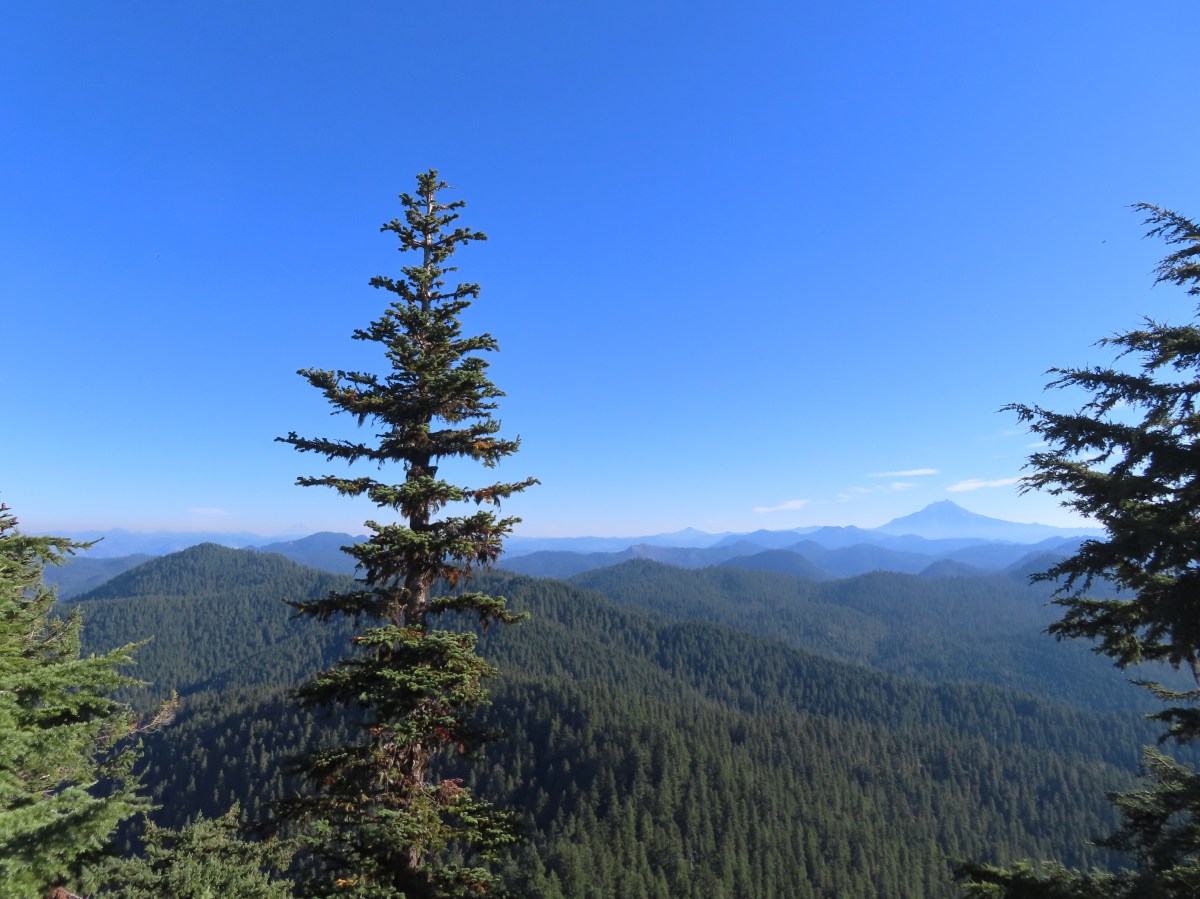
 I actually parked on the shoulder of Forest Road 1142 and walked a tenth of a mile down a spur road to the start of the trail.
 A note stating that access from the eastern side of the wilderness was still closed due to the Pyramid Fire.
 It was early when I started so there wasn’t a lot of light and even on the way back there was a lot of shade.
 A short distance from the trailhead is a crossing of West Fork McQuade Creek.
 A third of a mile from the West Fork the trail crosses McQuade Creek.
 Reportedly this crossing can be quite tricky early in the year, but there wasn’t much water this time of the year.


 Based on trip reports from 2023 and recent cuts seen along the trail it appears that a trail crew passed through this year.


 A reminder that Fall is here.
 The McQuade Creek Trail hidden by the underbrush.
 Lousewort
 Huckleberries
 Views were limited to the nearby ridges and hillsides.
 Vine maple along a rocky slope.
 Pika watching me from behind some cover.
 Flagging along a bit of a washout.


 The McQuade Creek Shelter used to be located near here, but it had collapsed years ago, and I didn’t see any signs of the remains.
 Pointer for Chimney Peak.


 Initially I forked right here because the left hand fork didn’t appear to go anywhere.
 I assume these are remains from the former lookout.
 The start of the scramble route. The crack was too narrow to use but once I got to the top of this rock the route became much clearer.
 Looking down at the first part of the route from above.
 The top is in sight.
 Clouds over Green Peter Lake.
 Mt. Hood in the distance.
 Zoomed in on Mt. Hood and some haze.


 The Three Sisters
 Three Fingered Jack to the left behind the Three Pyramids (post) and Mt. Washington (post) on the right.
 Mt. Jefferson zoomed.


 West Fork McQuade Creek
 Back at the trailhead.
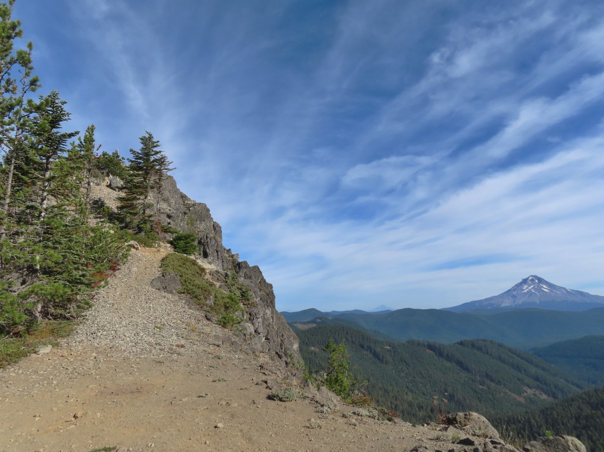
 We parked on the shoulder here and road walked three quarters of a mile to the official
  This is a good example of why we parked where we did.
 The official trailhead.


 A pair of Barrow’s goldeneye ducks enjoying a morning swim on the far side of the lake.
 The use trail
 Mushroom along the road walk back to the car.
 The somewhat obscured sign for the Anvil Lake Trail along spur road 5800-160.
 The pullout where we parked.


 The edge of Black Wolf Meadows.
 Sign in Black Wolf Meadows.


 The trail leaving the meadows.
 More mushrooms
 Rough-skinned newt

 Old sign near Anvil Creek.
 The dry bed of Anvil Creek.
 Coral fungus
 The sign for the spur trail ahead on the left.
 Pointer for Anvil Lake. According to the Oregon Hikers Field Guide this sign is likely over 50 years old based on the reference to S-502 which is currently known as FR 5820 which is another potential
 Anvil Lake


 Mt. Hood from the pullout.


 The road continuing to the left.
 Olallie Butte (
 Mt. Hood with Mt. Adams behind to the left.
 The view south toward Mt. Jefferson.
 Heather is the orange dot climbing up the side of the outcrop.
 Mt. Hood from the saddle.
 Signal Buttes is the pointy peak on the left and Salmon Butte (
 Salmon Butte now in the middle with Linney Butte the hump on the right of the double humps in the foreground and Devil’s Peak (
 Linney Butte, Devil’s Peak, Mt. Adams in the distance, and Mt. Hood.
 Wolf Peak in the foreground which is above Black Wolf Meadows.
 Mt. Jefferson from the former lookout site.
 Peaks in the Bull-of-the-Woods and Opal Creek Wilderness areas in the distance to the left and Fish Creek Mountain (
 The remains of the lookout on High Rock.
 A zoomed in shot of Mt. Adams.
 Mt. Rainier rising behind Devil’s Peak.

 The ground squirrel watching us as we passed below.
 Skipper along the road on the way down.
 Aster
Aster

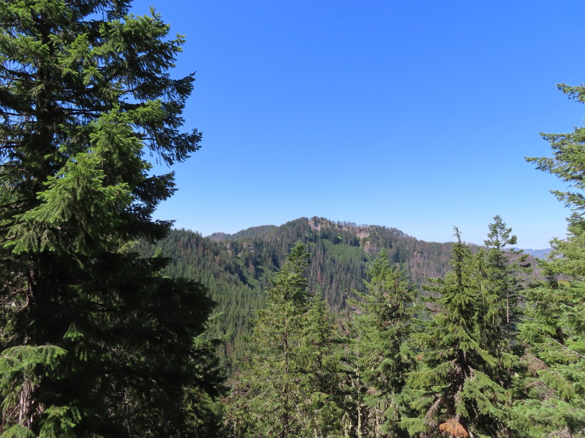
 The unsigned trail enters the forest across from a small pullout.
 Bunchberry


 Fish
Fish Rough skinned newt


 Flagging and some old trail maintenance along the Baty Butte Trail.
 We could see the tread continuing on the other side of the thicket.
 Vegetation covering the trail.
 The trailhead is located at a turnaround at the end of BLM road 7-4E-11.1.
 Oregon sunshine, lupine and paintbrush.
 Larkspur, paintbrush, and Oregon sunshine.
 Penstemon, paintbrush, and valerian.

 Westen featherbells
 Bistort
 Arnica

 Bear sign on the trail.
 Paintbrush and lousewort
 Nasty Rock from the trail.
 Entering the fire scar.
 The trail was especially overgrown in the fire scar.
 Penstemon
 Columbine along the trail.
 Valerian
 Exiting the fire scar after less than 100 yards.
 While none of the several downed trees posed much of an issue the condition of the trail made for slow going.

 Nasty Rock sticking up ahead.
 Not Nasty Rock further along the ridge and in the Beachie Creek fire scar.
 Wildflowers were blooming in the openings along the ridge.
 Arrowleaf buckwheat
 Checkerspot on Oregon sunshine
 Oregon sunshine
 Table Rock (
 Mt. Hood peecking up from behind a ridge.
 Scarlet gilia
 Nasty Rock from the trail.
 Flowers below the trail.
 Flowers above the trail.
 Buckwheat


 There were a lot of nice Washington lilies below Nasty Rock with more to come over the next week or two.
 Wintergreen
 Nasty Rock from the trail.
 The trail below Nasty Rock.
 Nasty Rock from the end of the “trail”. Prior to the 2020 fire a rougher use trail continued on to Not Nasty Rock, but we didn’t see any obvious tread. (We weren’t really looking though either.) We made the fairly easy scramble to the top of Nasty Rock and took a short break.
 Mt. Jefferson from Nasty Rock.
 Mt. Jefferson with the flat-topped Battle Ax (
 Mt. Hood in the distance.

 Looking out across the Molalla River drainage to the Table Rock Wilderness.
 Rooster Rock is the rock outcrop to the left with Table Rock the tall feature to the right. Pechuck Lookout can be seen on the lower hilltop in the center foreground.
 Not Nasty Rock from Nasty Rock. The highest peak diagonally left of Not Nasty Rock is Rocky Top (
 We were joined at the summit by a swarm of flying ants obsessed with this fir tree.
 Checkerspot on Oregon sunshine
 Swallowtail resting on serviceberry.
 Blue bells of Scotland
 Fritillaries on mountain coyote mint
 Clodius parnassian on mountain coyote mint.
 Fleabane
 Buckwheats, paintbrush, Oregon sunshine and at least one butterfly.
 Scarlet gilia
 Larkspur
 Washington lily
 Inside-out flower
 Fritillary
 Beardtongue
 Pink pyrola
 Bead lily a.k.a. Queen’s cup
 Bunchberry
 Cat’s ear mariposa lily
 Approaching the road.
 Larkspur and yarrow
 Checkerspots on Oregon sunshine


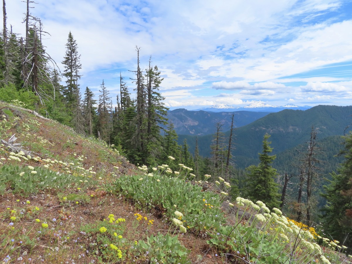

 Valerian along the trail.
 Vanilla leaf and anemones carpeting the forest floor.
 Star-flowered false solomonseal.
 Coneflower with lupine behind.
 Penstemon


 Monkeyflower
 Lupine
 Sub-alpine mariposa lily
 Moth on fleabane.
 Waterleaf
 Tiger lily
 Pussytoes
 From left to right the peaks with snow are: The Twins (
 Diamond Peak
 Grasshopper Mountain above the meadow.
 The post in the rocky area.
 When we visited in 2017 it had been mid-July, and the larkspur show was over.
 A cairn marks the Grasshopper Mountain Trail.

 Looking out over the meadow.
 Fuji Mountain and Diamond Peak
 The saddle below Grasshopper Mountain.
 The Three Sisters and Broken Top
 Mt. Bachelor
 The last of the snow, at least it is all we saw.
 Glacier lilies near the tiny snow patch.
 It was evident that the trail does get maintained on occasion, but none of it appeared recent near Grasshopper Mountain.
 Anemone
 Violets
 Bleeding heart
 Oregon bluebells
 The Three Sisters and Broken Top were visible from this area.
 Back on the slightly overgrown trail.
 Mt. Jefferson and Three Fingered Jack
 Bears appear to use the trail more than hikers. This was the largest of three piles we’d pass on the day.
 Arnica
 This is both the trail and a front (back) door.
 Valerian and tall bluebells
 Fairy bells
 Meadowrue
 Moth on valerian.
 Jacob’s-ladder
 While the trail was overgrown in places it was passable and the tread was in pretty good shape.
 Fringecup
 Possibly a speedwell but unsure and it was the only one we saw.
 More blowdown to maneuver around.
 Edith’s checkerspot
 Trail passing through an area full of monkeyflower and larkspur.
 Cinquefoil, larkspur, and buckwheat
 Scarlet gilia
 Paintbrush
 Bluehead gilia and silverleaf phacelia
 The rocky area from the trail as it crossed the ridge.
 Columbine crowding the trail.
 The wildflower covered rocks on the way back.
 Arrowleaf buckwheat and Oregon sunshine
 The Three Sisters and Broken Top with some clouds moving in.

 Paintbrush surrounded by buckwheat, bluehead gilia, and stonecrop.
 Scarlet gilia
 Wallflower
 Wild rose
 Beargrass near the outcrop.
 The outcrop from the trail.
 Blowdown
 More blowdown
 Western meadow fritillary
 Bunchberry
 Recent trail maintenance! There were a couple of cut trees in the final mile, but there were also still many to step over.
 The trail dropped low enough that there were several rhododendron blooming.
 Queen’s cup.
 South Sister (

 Had I not just come down the trail I might not have even noticed it was there.
 Cardwell’s penstemon
 Starflower
 Ginger
 Mt. Bachelor through the trees.
 Musk monkeyflower
 Grasshopper Mountain from the outcrop.
 Cliff beardtongue
 Blue-eyed Mary
 Cicada, not a pollinator but interesting to see.
 Solomonseal
 Variable-leaf collomia
 Honeysuckle
 Oregon grape
 Pollinator 1
 Pollinator 2
 Pollinator 3 (Clodius parnassian)
 Bees on bastard toadflax
 Checkerspot on groundsel
 Naked broomrape (Aphyllon purpureum)
 Penstemon
 Our guess is this is mile three from Grasshopper Saddle. We didn’t notice any other numbers and missed this one on our first pass.
 Dwarf bramble
 Strawberry
 Cinquefoil
 It started clouding up in the afternoon.
 Back at the saddle below Grasshopper Mountain.
 Great artic butterfly. There were a lot of these flying about. Their dorsum is a bright orange, but they rarely would open their wings when they landed.
 The checkerspots on the other hand are happy to open their wings.
 False hellebore
 It clouded up over Diamond Peak as well.
 Lewis flax
 Orange agoseris
 A Lycaendae on a lupine leaf.
 Moth on a mariposa lily.
 Butterflies gathering at the spring.
 The Prius at the TH. We parked on the shoulder in a pullout.


 Signboard about a tenth of a mile from the trailhead.
 The loop began on the far side of the footbridge.
 As far as we could remember we’d never seen a bench on the other side of a fence before.
 Middle Fork Willamette River through the vegetation.
 Tiger lily
 Self-heal
 Snail
Snail Mock orange

 Anemone
 There are a few junctions prior to reaching the footbridge. The first was the only one with any signage. We stayed on the correct trail by ignoring side trails to the left that headed uphill and on the right that led down to Deception Creek.
 We turned left at the signed junction following half a sign for the Deception Butte Trail.

 At the last unsigned junction there was a signboard, but with nothing on it. (We went straight.)
 Warning sign for the burned area ahead.
 The footbridge over Deception Creek.
 Deception Creek

 The amount of trail work needed to clear the trail was evident by the sheer number of cut trees along the length of the trail.
 This was from 2017 near the same stretch of trail.
 View up the canyon from the trail.
 Clodius parnassian
 There was a lot of vegetation along the trail, so we had to keep an eye out for poison oak which was present at times on the lower two-thirds of the trail. It was never much of a problem, but there were a couple of plants crowding the trail that we had to maneuver around.
 Moth
Moth Starflower
 Rhododendron
 Northern cloudywing
 Big deervetch
 Hummingbird
 Groundsel
 One of the damaged sections of trail.
 There was some forest that survived the fire starting near the 3.5-mile mark where the fire burned less intensely.
 Townsend’s solitaire
 Canada jay
 There were a few views of the Three Sisters through the remaining trees. (Middle & South Sister here)
 Inside-out flower
 Looking up as the trail neared the summit.
 Woodpecker
 Common whipplea
 Anemone
 The Deception Butte Trail arriving at Deception Butte.
 Beargrass


 Looking down at the saddle and wondering if it was really worth having to climb back up.
 Northern flicker
 Lizard
 Rock outcrop on the other side of the saddle.
 Tolmie’s mariposa lilies
 Bluehead gilia
 Squirrel
 Oakridge in the valley below with Diamond Peak (
 Diamond Peak
 Oakridge
 Leafy fleabane
 Oregon sunshine on the hillside looking up Deception Butte from the saddle.
 Wild onion
 One of the fritillary butterflies.
 Fly inside a Tolmie’s mariposa lily.
 There is a very steep trail just below the summit that leads to an upper trailhead. The Forest Service does not recommend using these though as the trail is said to be slippery and steep. We can vouch for the steep just by having looked down from the Deception Butte Trail.
 Plectris and stonecrop
 Coralroot
 The best view of the Three Sisters that we got all day.
 Butterflies enjoying some vetch. There were at least a half dozen butterflies visiting this patch.
 Brown creeper
 Pink pyrola

 Pearly everlasting
 Turkey vulture
 Fireweed
 Entering the trees near the footbridge over Deception Creek.
 Columbine
 Tiger lilies
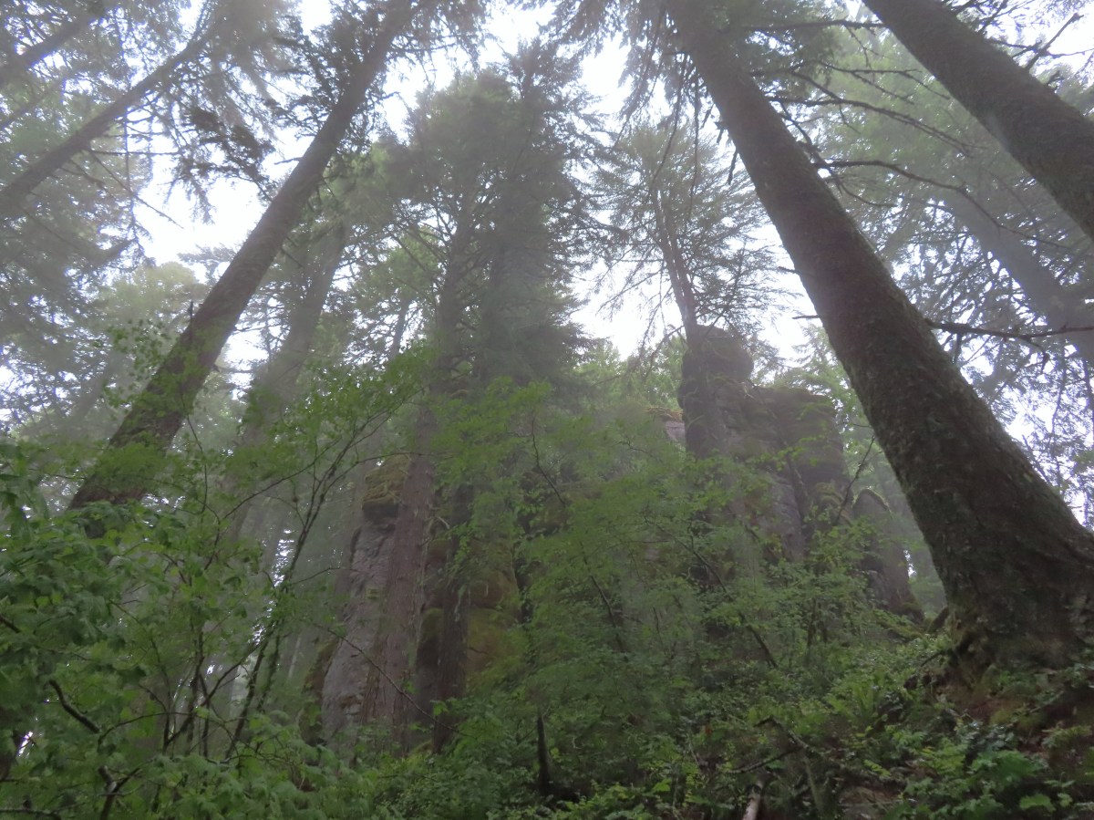


 There were some nice rhododendron blooms along the trail.
 Spotted coralroot
 The first of three crossings of FR 411, this is at the 0.4-mile mark.
 Inside-out flower
 Starflower
 Yellowleaf iris
 The trail is narrow at times but well maintiained.
 Forest filled with rhododendron.
 A closer look at the rhodies.
 There were several madrones in the forest.
 Little prince’s pine
 Sugar sticks
 There were a few places where we might have had a view if not for the clouds.
 Stonecrop
 Passing below some of the rock formations.


 Anemones
 Bleeding heart

 The first small meadow that the trail passed through was full of blue-eyed Mary.

 Northern phlox
 Coming up on another small meadow.
 Subalpine mariposa lily
 Beargrass
 The fog didn’t help with our trying to find the trail. There was enough room along this section of road that parking and starting the hike from here would be possible.
 Back on trail.
 Honeysuckle
 More northern phlox
 This meadow was full of bluehead gilia.


 The trail dropped steeply as it rejoined FR 411.
 There was no parking room that we could see near this area.
 Vanilla leaf along the trail.

 Bunchberry
 Trillium
 We stopped when we spotted something in the trail ahead that looked like it might be an animal. Using the camera to zoom we realized it was a grouse hen with her little chicks.
 The hen got up and then the chicks headed into the underbrush. We felt bad having disturbed them, but once they’d moved, we calmly passed by while momma came back to gather her little ones.
 This was all beargrass, but none of the plants in this area appeared to be planning on blooming this year.
 Hermit thrush
 The rocky summit of MacDuff Mountain.
 A lot of larkspur.
 Subalpine mariposa lilies
 Paintbrush and buckwheat
 Cinquefoil
 A penstemon


 The view from the top.
 No blue sky that way.
 No sign of clearing this way either.
 Cliff beardtongue
 Woodland-stars
 Paintbrush
 Hey look, there is another ridge over there.
 Ookow just starting to open up.
 Steep climb or road walk? We chose the trail again on the way back.
 A wetter road now thanks to the rain shower.
 Blue sky, it does exist.
 The clouds got a late start but eventually started lifting.
 From this angle it looks like a statue.
 Looking down from some of the switchbacks.
 Cougar Reservoir
 Pyrola
 Sunlight!
 I’ve never seen a track this far off.
 The track after manually editing it.


 Fall Creek Falls
 Yasko Falls


 Lower Table Rock
 View from Upper Table Rock


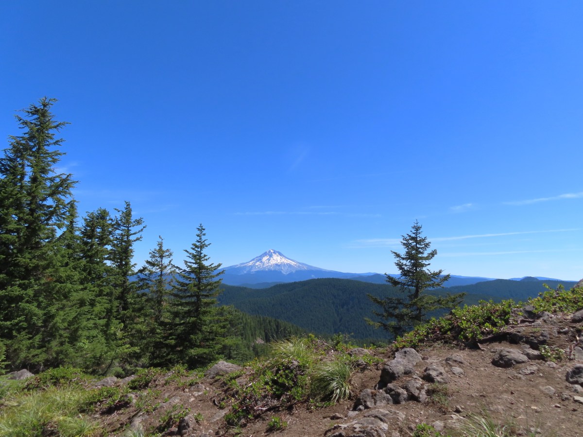

 Rhododendron at the trailhead.
 Eagle Creek Cutoff Trail on the left just before the first steep climb.
 Salmon-Huckleberry Wilderness sign. I would be in and out of the wilderness several times on my route.
 Pictures rarely capture the actual steepness of the trails but the third of a mile past this trail sign had me wondering if I was going to be able to complete my planned hike.
 Starting the descent to the saddle.
 The
The  Coral fungus
 The Old Baldy Trail turns left here while the Tumala Mountain Trail continues straight.
 A small unreadable sign was the only identifier for the continuation of the Old Baldy Trail. I was a little concerned seeing blowdown on this trail from the junction but as it turned out the trail was in good shape and the trees that were down were easily stepped over.
 One of four switchbacks in the first 0.3-miles.
 Cat’s ear lily
 Cascade lily
 Oregon sunshine
 Larkspur & ?
 Paintbrush
 Bunchberry, not sure what is causing the white at the end of the leaves. I’d never noticed that before.
 Lupine
 View at the scree slope
 I’m pretty sure there were at least three pikas down there somewhere.
 Tumala Mountain in the center.
 From left to right is East Mountain, Thunder Mountain (
 Little prince’s pine
 Cascade lilies, a few lupine and a paintbrush.
 Carolina bugbane and foam flower.
 Spur trail from the Twin Springs Trailhead (Old Baldy East) on the right.

 Part of the foundation at the former guard station site.
 The old road.


 Not a big beargrass year but there was a few blooming along the trail.
 I went up this trail to find it just immediately dropped back down to the Plaza Trail.
 The correct spur to Sheepshead Rock.
 Mt. Hood
 Mt. Adams and Mt. Hood
 Some light scrambling brought me to the top of the rock.
 Mt. St. Helens, Goat Rocks, and Mt. Adams in the distance. The high point to the left along the forested ridge is Wildcat Mountain (
 Mt. St. Helens
 Goat Rocks and Mt. Adams
 Mt. Hood with the South Fork Salmon River valley below.
 Orange agoseris
 Oregon sunshine and yarrow
 Saxifrage
 Penstemon
 Bluebells of Scotland

 Valerian
 Moth on an arnica.
 The Plaza Lake Trail sign on the left.
 View from one of the switchbacks.
 Pacific coralroot
 Bunchberry with the more familiar all green leaves.
 Plaza Lake below from the trail.
 Twin flower
 There were some nice big trees along the trail.

 Looking up from the lakeshore.


 I’d missed Mt. Hood on the way down.
 Mt. Hood
 Anemones
 Spirea and lupine
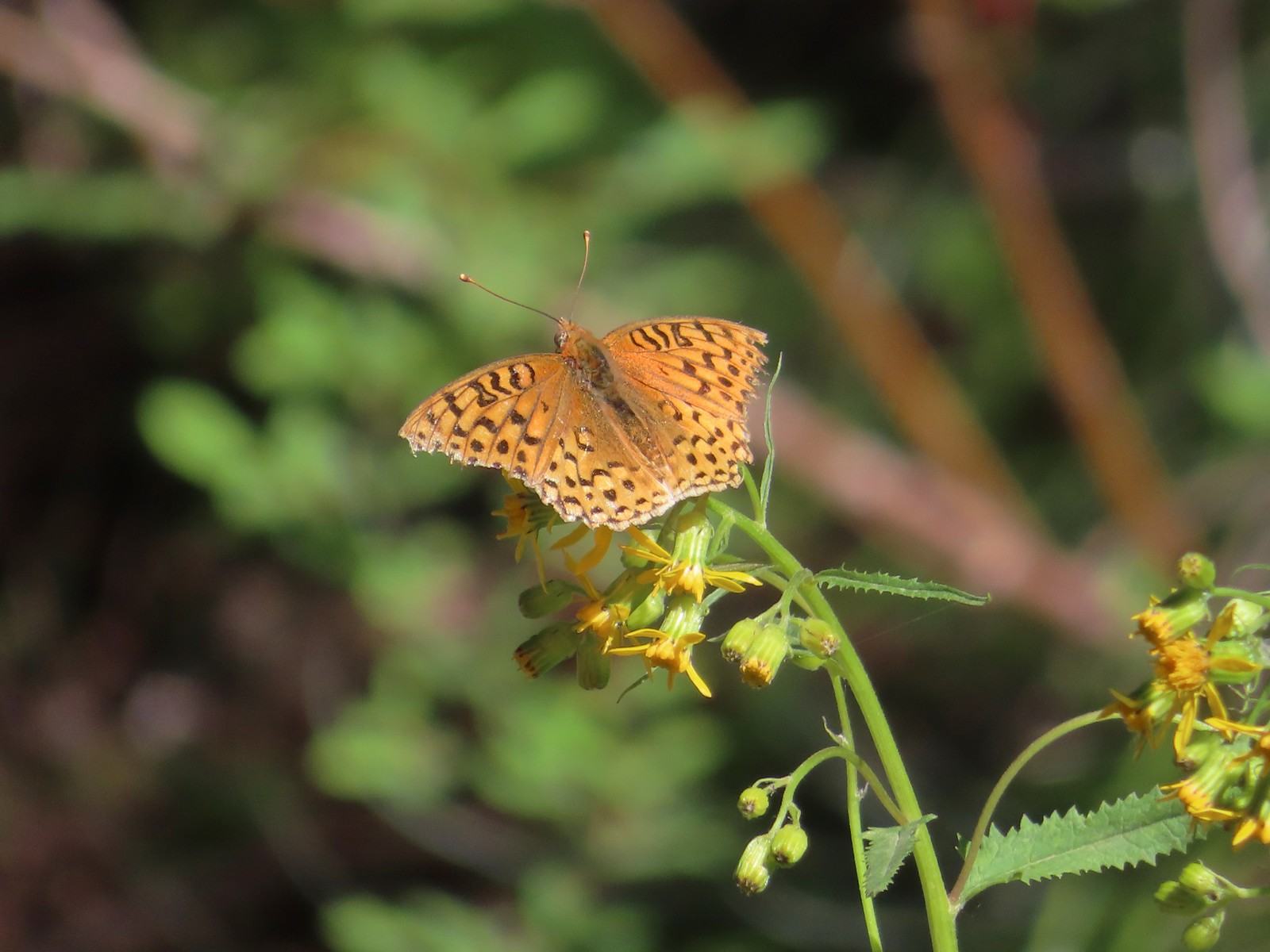 A fritillary butterfly.
 The former Twin Springs Campground was near the trailhead on the opposite side of FR 4610.
 The Twin Springs Trailhead.
 Old Baldy Trailhead sign at the Twin Springs Trailhead.
 Salmon-Huckleberry Wilderness sign (straight ahead) at the Old Bald/Plaza Trail junction.
 I stopped again at the scree slope to look for pikas. All was quiet as they apparently had retreated underground to avoid the heat, but with more light in the valley below I could make out a green meadow in the trees.
 Columbine along the trail.
 Grey jay
 Back at the Tumala Mountain Trail junction.
 My first view of Mt. Jefferson on the day.
 Mt. Jefferson
 A yet to blossom rhododendron.
 Fading lousewort and valerian.
 A blooming rohdodendron.
 Mt. Hood. The scree slope is also visible through the trees on the hillside to the lower right.
 Mt. Jefferson in the distance.
 Mt. Jefferson
 Three Fingered Jack and the Three Sisters
 More Cascade lilies.
 Mt. St. Helens in the distance.
 Mt. St. Helens
 A better view of the scree field and the meadows below Tumala Mountain.
 Penstemon and lupine.
 Passing the Fanton Trail junction on the way back.
 Looking at the final climb of the day from the saddle.
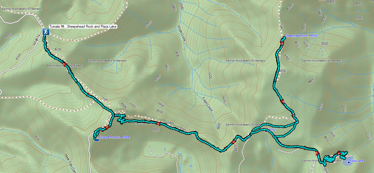


 The forecast for Salem was for temps in the mid-90s so we got an early start.
 Bleeding heart and penstemon
 Iris
Iris Cascade lily
 Scouler’s bluebell
 Inside-out flower
 A few green trees remain.
 Another Cascade lily
 The trail was in pretty good shape overall and we could tell there was ongoing trail work. It looked like there were some rock steps that were going be placed in this section.
 Penstemon
 Oregon sunshine
 View from the arch.
 Fin below the arch.


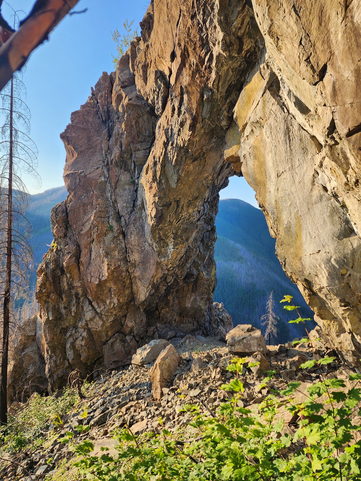


 Snowberry checkerspot
 Rocky Top straight ahead.
 Penstemon and big deer vetch
 Cascade lily
 Oregon sunshine, penstemon, Oregon bedstraw, and a daisy or two.
 Oregon sunshine and paintbrush
 There was a fair amount of shade while the Sun was still low.
 Paintbrush and penstemon
 Thimbleberry
 Bleeding heart. There was more bleeding heart on this hillside than we’d ever seen in one spot.
 Pika below the road.
 Pika
Pika Rhododendron
 The Three Sisters on a hazy morning.
 Anemone
 Paintbrush and lupine
 Beargrass
 A few patches of green below Rocky Top.
 This was probably the worst spot in the road in between the two trailheads.
 Bunchberry
 Trillium with a few petals yet to fall off.
 Violets
 Spirea and valerian

 Large boykinia
 Lots of lupine.
 Larkspur and phacelia
 Arriving at the Rocky Top Trailhead.

 Clodius paranssian
 Columbine
 Beardstongue
 Lupine
 The road from the trail. The taller, rounded, peak in the center is Sardine Mountain (
 Mt. Washington and the Three Sisters.

 Mt. Jefferson, Three Fingered Jack, Mt. Washington and the Three Sisters.
 Mt. Jefferson through the haze.
 Elkhorn Ridge (
 Mt. Hood above ridges of burned forest.
 The loss of the trees did result in better views of the various rock formations in the area.
 We’d never seen so many of these eight-spotted forester moths.
 Hummingbird taking a rest from visiting the penstemon and paintbrush.
 Another moth that had some excellent camo.
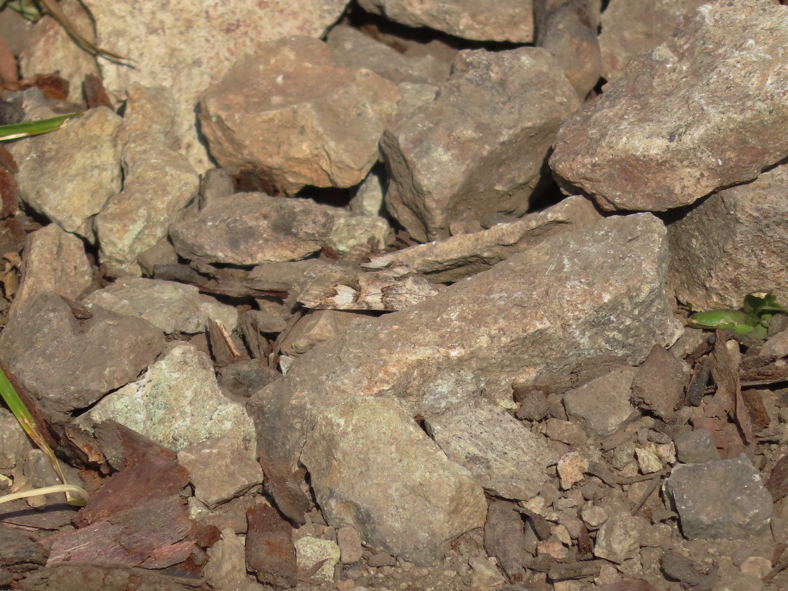 The moth putting its camouflage to use.
 Penstemon
 Rose
Rose
 Rocky Top from the trail.
 This was the only pink colored penstemon we spotted.
 Lupine and beargrass
 Not sure which of the Lycaenidae this is but it was pretty.
 The spirea was popular.
 Bumble bee
 At one point it looked like Three Fingered Jack was sitting on top of Coffin Mountain (
 Nice blue sky overhead.
 Looking North. Henline Mountain (
 Bistort and penstemon
 Haven’t been able to identify this one yet.
 Beargrass
 A snowberry checkerspot and some fried avalanche lilies.
 The trail wound behind Rocky Top to come up the West ridge to the summit.
 Arnica
 Sub-alpine mariposa lily
 Tiger lily and beardstongue
 Catchfly
 Not sure what the story is behind this chair, but we weren’t about to test its stability.
 Detroit Lake
 Mary’s Peak (
 Looking North we could see Table Rock (
 Closer look at Table Rock.
 Henline Mountain, Table Rock, Mt. Hood, in front and just to the right of Mt. Hood is Whetstone Mountain (
 Mountain bluebird checking us out.
 Mt. Jefferson
 Three Fingered Jack behind Coffin Mountain, Maxwell Butte (
 Zerene fritillary
 Beargrass
 Moth and a checkerspot
 A bee, a moth, and a butterfly land on some flowers…
 Painted lady
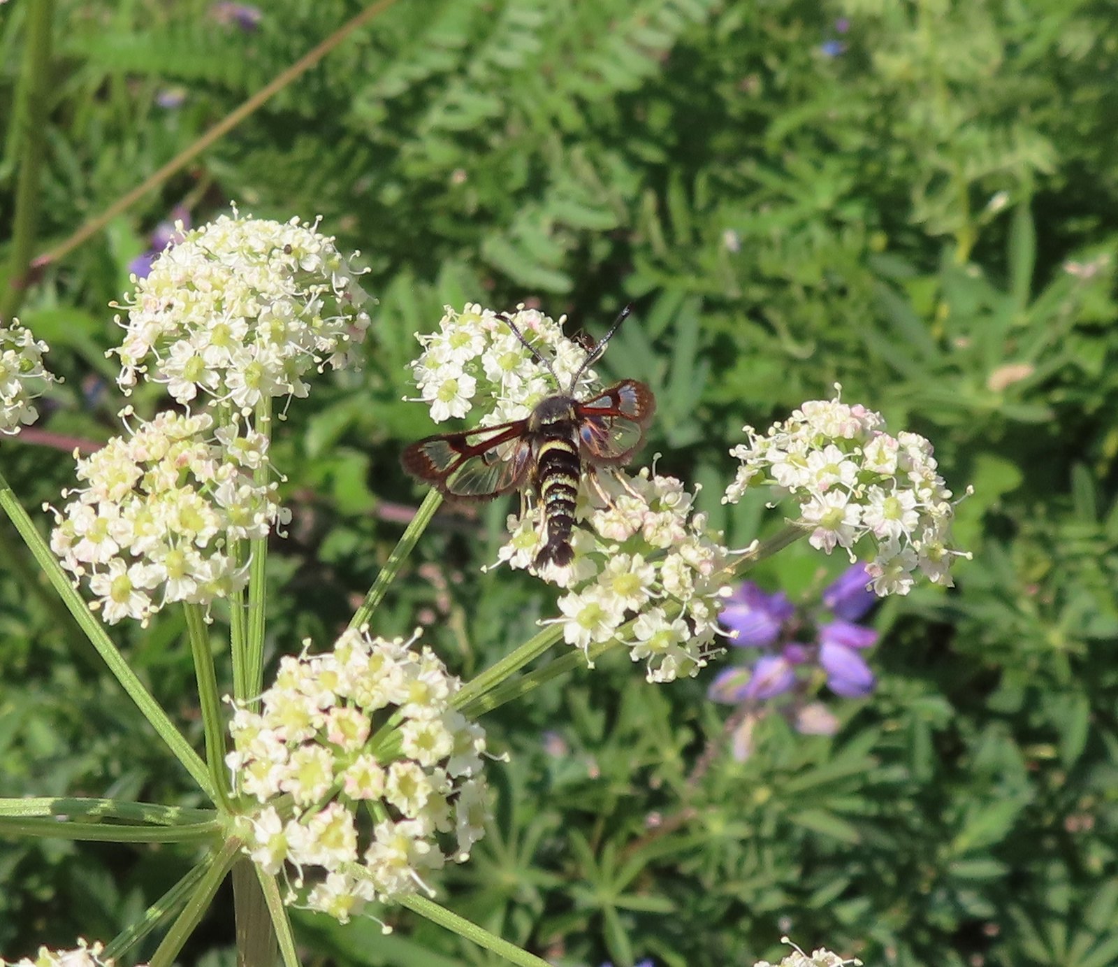 Fireweed Clearwing Moth (Albuna pyramidalis).
 A fritillary and a copper.
 Two coppers and a bee.
 Checkerspots, a bee, a copper and part of an eight-spotted forester moth.
 Eight-spotted forester moth.
 The previous four photos were all from this group of Oregon sunshine.
 Bleeding heart, no butterfly but a nice group of blossoms.
 More moths and butterflies.
 Swallowtail on penstemon
 One of the blues I think, but not sure which.
 Lorquin’s admiral


 Sparrow
 Stellar’s jay
 The spur trail is to the right just ahead.
 We watched a norther flicker fly into the snag ahead and it took a minute to figure out where he was.
 The flicker
 Trailing blackberries. We might have found a few ripe ones.
 Arriving at the camping area.
 North Santaim River
 Oregon grape
 Mock orange
 The boat launch.
 North Santiam River
 The park host on the left and the parking lot on the right.
 Crosswalk for the pre-fire loop.
 Looking North from the crosswalk there was zero sign of the former trail.
 They had at least restored this short section of the loop so we were able to return to the spur trail and turn right then right again to complete the inner loop.
 The “To River” sign at the spur trail junction.
 Possibly a western wood pee-wee
 Spotted towhee
 Osprey
 The park host from the trail.


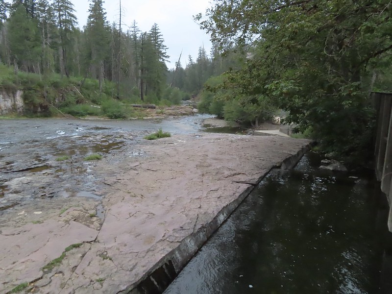
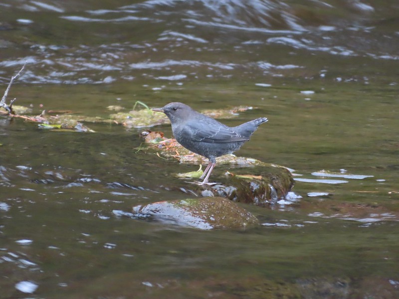 Ouzel
Ouzel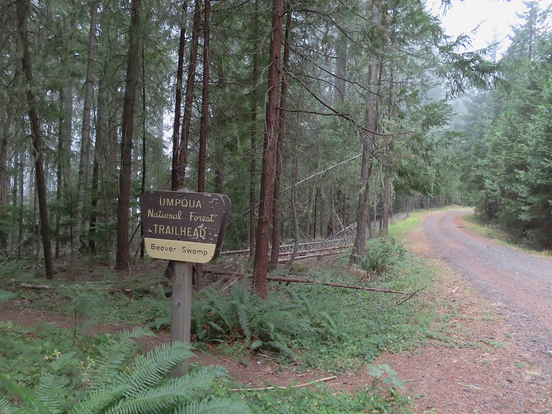
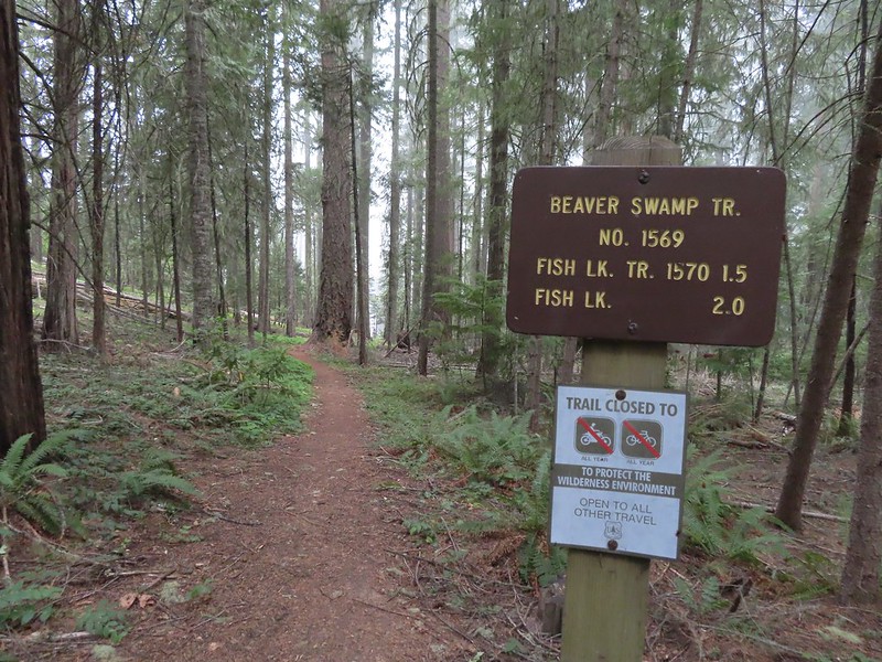


 Small cascade on Fish Lake Creek.
 Logs at the outlet of Fish Lake. The Indian Trail can be seen on the far side. This junction was unmarked and you would have to cross the logs to reach it. In theory one could take this trail to the Lakes Trail near Buckeye Lake, but as we understand it the trail does not receive regular maintenance so we did not include it in our plans.
 Arriving at Fish Lake

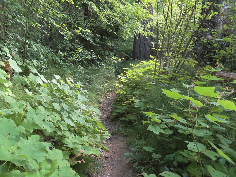
 The clouds began burning off before we’d found our campsite.
 We set up camp on a little knoll near an old stone foundation. We’re interested to know what used to be there but so far haven’t found any information on it.
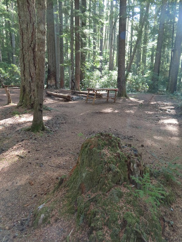 A little too developed for Wilderness standards.
 A dry channel along Highrock Creek.
 Crossing an unnamed creek.
 The trail junction.
 Highrock Creek. There were several nice pools here which we utilized to replenish our water on our way back to camp.
 Foam flower and a few ripe thimbleberries, Heather’s favorite.
 The junction with the Grasshopper Trail
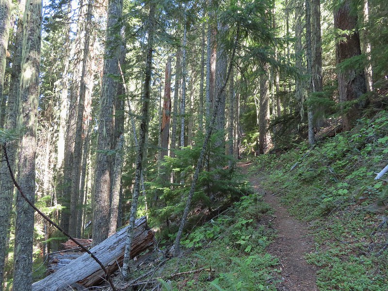
 Pine white
 Sign for the Gasshopper Mountain Trail.
 Grasshopper Spring is out there somewhere.
 We had to go around this big tree.
 A few aster
 There were some good sized cedars up here.
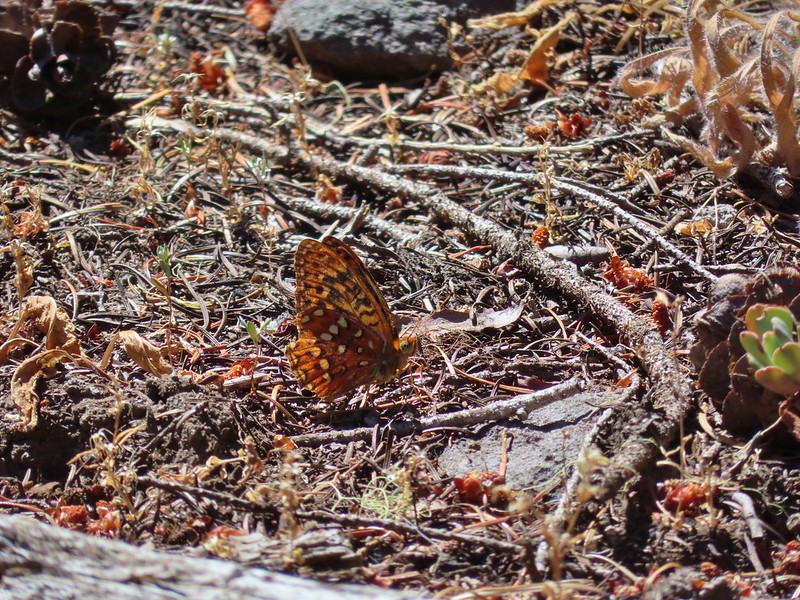 A fritillary
 Another big cedar.
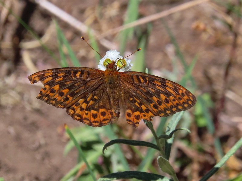 Fritillary on pearly everlasting.
 The final stretch to the summit passed through a fire scar.
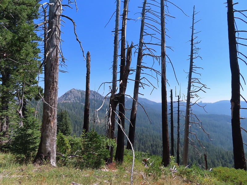 Highrock Mountain to the left, Hershberger Mountain in the middle, and the Rabbit Ears to the right (
 Rabbit Ears closeup.
 Fish Mountain (back left), Weaver Mountain, Highrock Mountain, and Hershberger Mountain with Grasshopper Meadow below.
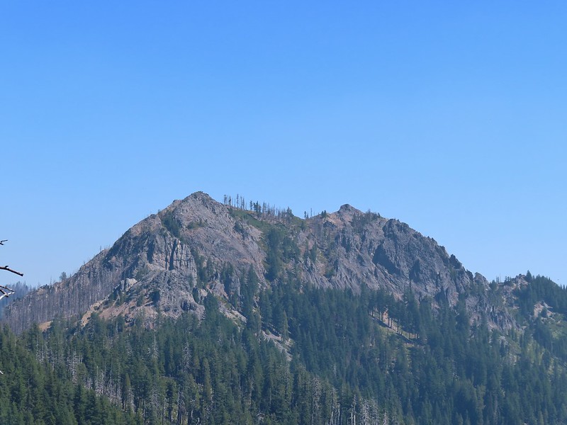 Highrock Mountain
 Owl’s clover.
 Arriving at the old lookout site.
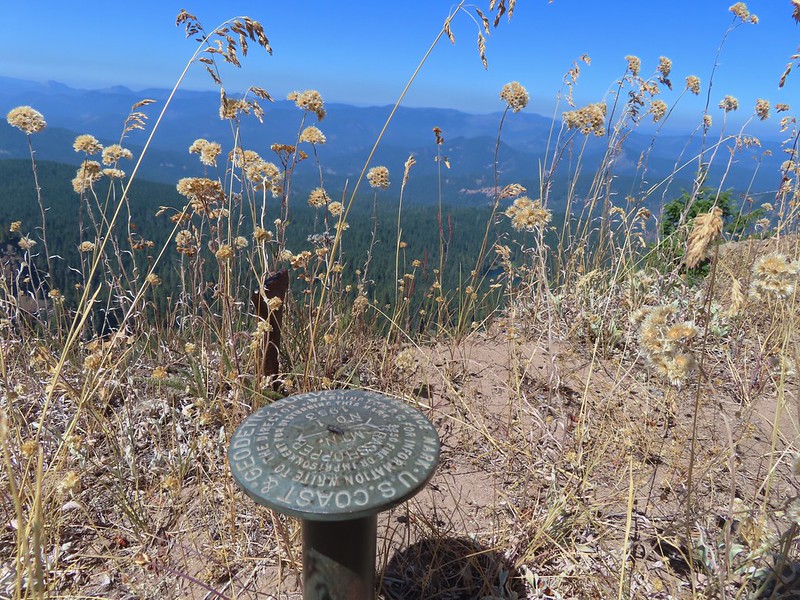
 Buckeye (left) and Cliff Lakes below Grasshopper Mountain. The broad hump beyond to the left is Twin Lakes Mountain. We had visited a viewpoint on the north side of that mountain back in June of this year (
 Buckeye and Cliff Lakes
 Smoke on the horizon to the NW. The Cedar Creek fire to the NE, Rum Creek Fire to the SW or several fires in Northern California could be the culprit(s). The peak with the white spot to the center right is Quartz Mountain which we recognized from our Hemlock Lake hike in August (
 To the NE we got a glimpse of Rattlesnake Mountain (far left) which we’d climbed during Labor Day weekend in 2020 (
 Rattlesnake Mountain behind Standoff Point.
 A skipper
 We veered right here which kept us from dropping below the saddle that we otherwise would have had to climb over on the Grasshopper Trail.
 Descending to the Grasshopper Trail.
 Trail sign at the other junction.
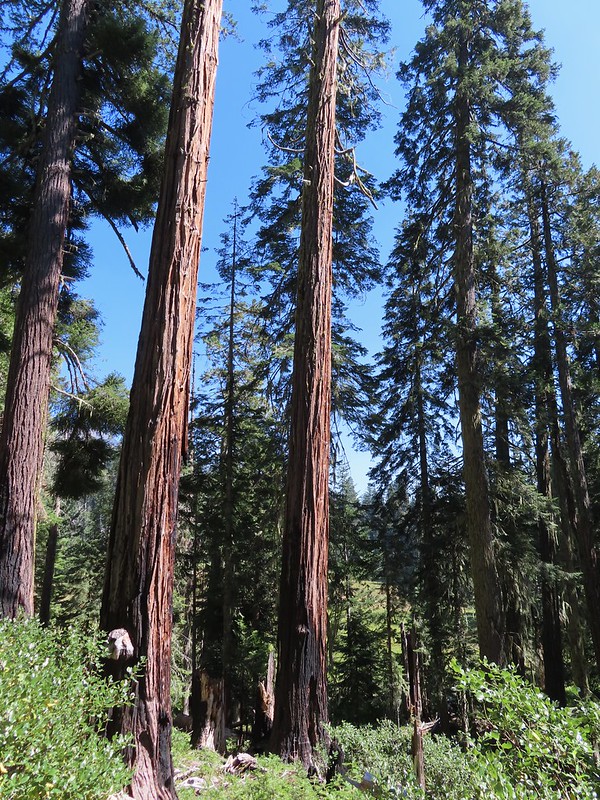 Grasshopper Meadow through the trees.
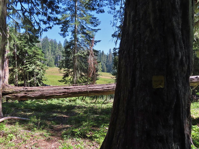 Sign for a (faint) spur trail to a spring above the meadow.
 Highrock Mountain from Grasshopper Meadow.
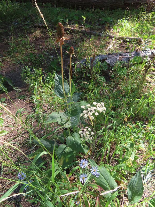 A few flowers hanging on to the last days of Summer.
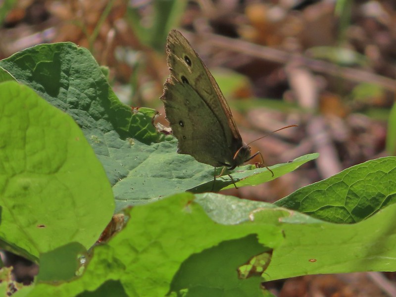 Common wood nymph
 The trail got pretty faint just before the junction but we could see the trail sign so we just headed for it.
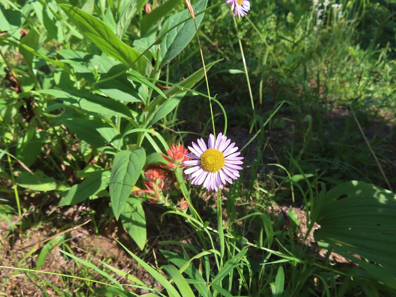 Fleabane? and paintbrush.
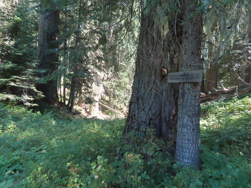 Acker Divide Trail pointer.
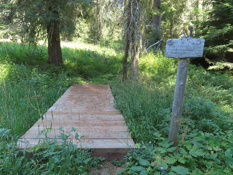 Pointer for Cripple Camp (we visited the shelter there on our Hershberger Mountain hike) and the Rogue-Umpqua Divide Trail.
 This fuzzy caterpillar was in a hurry.
 The trail along an old log.
 Passing through a small meadow near the spur to the Acker Divide Trailhead.
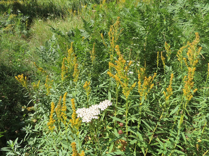 Yarrow and goldenrod
 The area was really well signed.
 Sign for Mosquito Camp on the tree to the right. There was zero sign of any established campsites here.
 Meadow at Mosquito Camp, it came complete with mosquitos (not too many though).
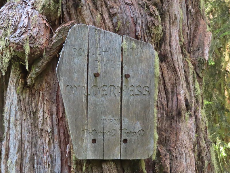 First of two times reentering the Rogue-Umpqua Divide Wilderness.
 Scat on the trail, at least we knew something used it.
 One of several very small bodies of water along Skimmerhorn Creek which may or may not be Little Fish Lake.
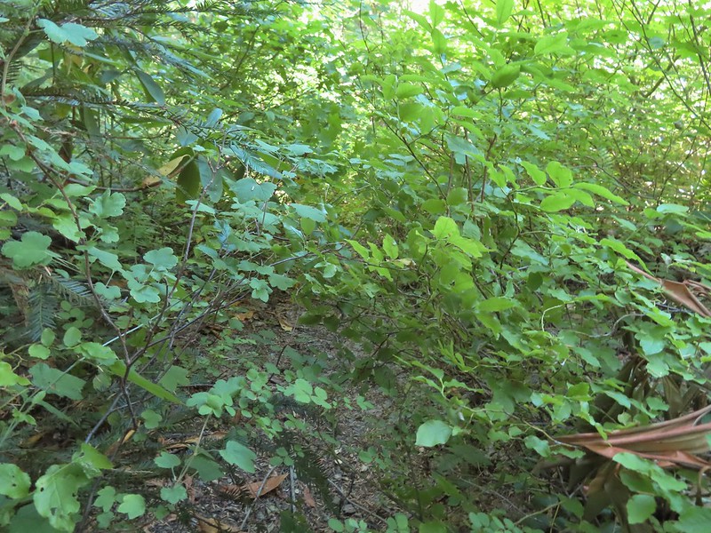 Overgrown trail near Skimmerhorn Creek.
 Looking down at the pond? lake?
 As we neared the Lakes Trail we began seeing more signs of what appeared to be an ancient lava flow.
 Last of the lupine blooms.
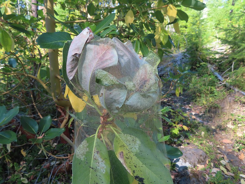 Lots of these insect tents on the madrones in the area.
 Arriving at the Lakes Trail.
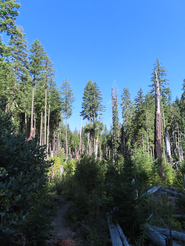

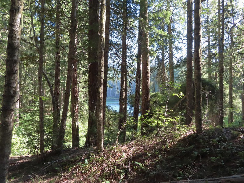 First glimpse of Buckeye Lake
 At this fork we detoured right to visit the lake shore.
 A good reminder that far too many people tend to forget.
 Grasshopper Mountain from Buckeye Lake.
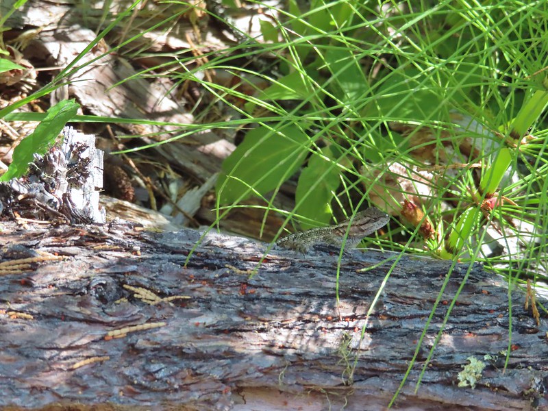 Lizard
 We had to really watch our step because these little guys were everywhere.
 There is an smaller, unnamed lake just West of Buckeye Lake that we did not take the time to check out closer.
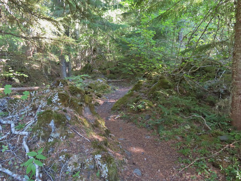
 The spur trail to the campsite.
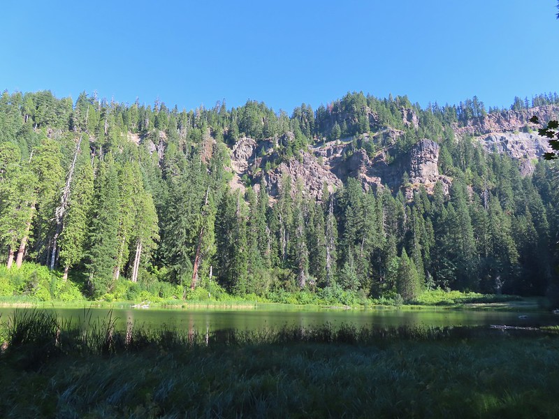
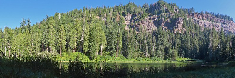 Attempted panorama.
 Footbridge over the outlet creek which flows into another small unnamed lake that we did not attempt to find.
 Unfortunately the lighting made this tree very hard to photograph but it was the coolest tree/rock combination that we’ve encountered.
 Fritillary on thistle.
 Short climb back up to the junction.
 This slug was heading our way while we finished dinner.
 The Sun was getting pretty low as we ended our hike.
 A big nest atop a tree and the Moon above Fish Lake.
 Zoomed in on the nest and Moon.
 Fish Lake just before 7:30pm.
 Campsite after packing up in the morning.
 Passing our planned route for the day on the left. Highrock Creek was just a 20 yard detour to the right.
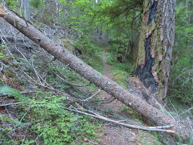 I think this was the third obstacle, one of several that was easy enough to get over.
 Prior maintenance, the second log may have been cut post fire?
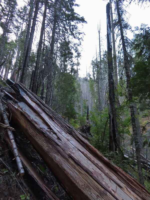 End of the line for us. Even if we somehow got around this one there was still 9.5 miles of burned trail from the trailhead and who knew how many obstacles like this one we might encounter or how long it would take us if we somehow were successful.
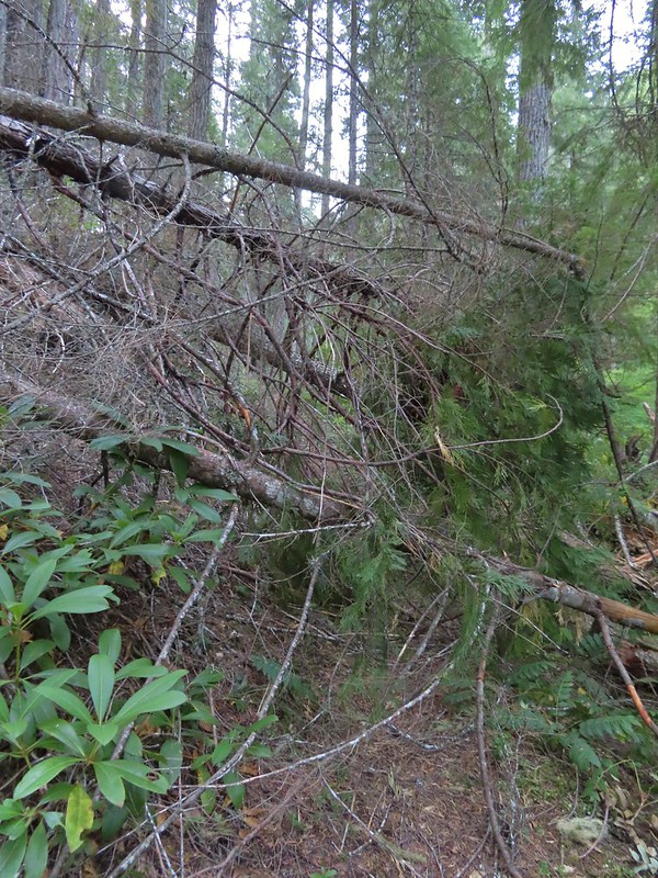 We had the privilege of navigating this one twice. Heather is on the other side coming through.
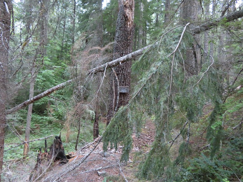 Back at the junction.
 No clouds this morning.
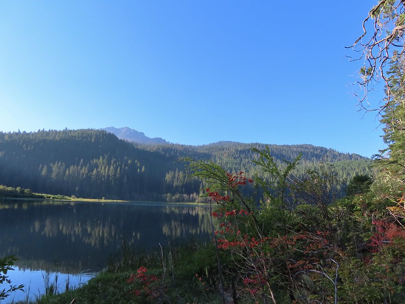 Highrock Mountain behind Fish Lake. Seeing the vine maples turning colors reminded us that despite the heat Autumn was just around the corner.
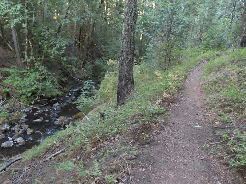 Hiking along Fish Lake Creek.
 Highrock Mountain from the Beaver Swamp Trail.
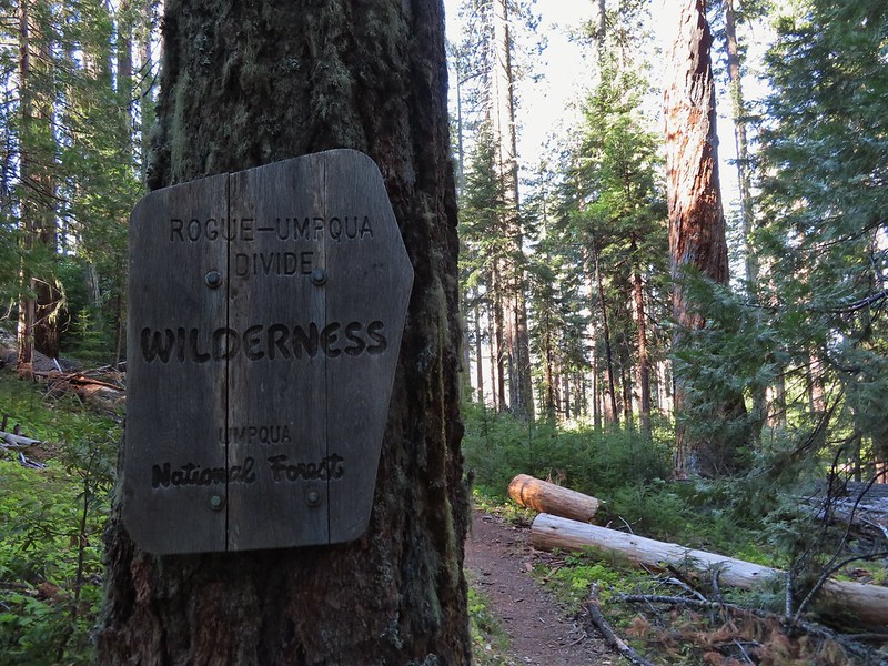 Leaving the Rogue-Umpqua Wilderness for the last time this trip.
