
After starting my week of vacation with back-to-back hikes with 4355′ and 5300′ of elevation gain, I took a day off and then picked a much more level hike to wrap up my week. I turned to the William L. Finley National Wildlife Refuge located just south of Corvallis, OR. Despite several visits there were still some portions of trails that I had yet to hike there. Heather and I first visited this refuge in 2017 to complete one of Sullivan’s featured hikes (post). We hiked the Homer Campbell Boardwalk, Woodpecker Loop, and Mill Hill Loop that day. We returned in 2020 to check out the SE corner of the refuge including Pigeon Butte. I returned in 2021 during a solo April vacation and re-hiked many of the trails we’d been on during our previous visits and adding a short section of trail/road that we hadn’t yet hiked. Our most recent visit was in 2023 to the Snag Boat Bend Unit which is located approximately 3-miles east of the main unit on the other side of the Willamette River.
For this visit I mapped out a route starting at the Turtle Flats Walkway Trail. This extremely short (0.02-mile) paved path was one of those trails I had not hiked, and the parking area had a restroom and was close to another trail I had not hiked in its entirety, the Prairie Trail.
 Hunting information kiosk across from the Turtle Flats parking area.
 The Turtle Flats restrooms. (Photo from the afternoon.)
 The entire Turtle Flats Trail in one photo.
 Viewpoint at the end of the trail.
From the viewpoint a mowed path continued on to Finley Refuge Road across from the start of the Prairie Trail.


The Prairie Trail starts on a roadbed for a short distance then changes to “native surface” as it follows the edge of open fields.


I had a copy of the refuge map with me which came in handy to make sure I stayed along the correct fields.
 I turned right here following said map through a small section of trees.
 Poison oak is hard to miss when it is sporting its Fall colors.
 Emerging from the trees and staying right.
The Prairie Trail turned East shortly after the trees and pointed me toward a pretty spectacular sunrise.


 McCulloch Peak (post), Dimple Hill (post), and Vineyard Mountain (post) in the McDonald-Dunn Forest to the North.
 Mary’s Peak (post) with a few clouds below its summit.
 One of several raptors hunting over the fields.
 Pigeon Butte to the left and Green Peak in the distance.
I thought I might see deer or even elk along the edges of the fields being fairly early in the morning, but aside from some fairly fresh deer sign the raptors and lots of smaller birds were all that seemed to be around. That was until I got to the northern end of McFadden Marsh. Still no deer or elk but I spotted the first great blue heron in a field just before arriving at the marsh.


The marsh itself was full of egrets, ducks and a few more herons.
 Fog and McFadden Marsh to the left.
 Mallards
 Geese flying overhead.
 Egret and ducks

 Egrets
 More egrets
 Heron with the egrets.
 McFadden Marsh
 Egrets and a murder of crows.
 Great blue heron
 Red-winged blackbird
 Prairie Trail along McFadden Marsh.
The Prairie Trail ends at a small pullout on Bruce Road which is where we’d parked for our 2020 hike here.
 I could just make out the railings along Bruce Road from here.
 Nutria family near Bruce Road.
 The nutria family.
 The Prairie Trail at Bruce Road.
I turned right onto gravel Bruce Road of 0.2-miles to a larger parking area on the others side of Muddy Creek.

 Northern flicker
 Starling
 Muddy Creek
 Interpretive signs at the larger parking area.
At this parking area I turned right onto the first mowed path which is the Cheadle Marsh Trail.

I followed this grassy track, between Cheadle Marsh on the left and Muddy Creek on the right, for almost a mile to a junction near the Cheadle Barn.

 California scrub-jay

 Peregrine falcon?
 Pigeon Butte across Cheadle Marsh.
 While I was photographing this egret I glanced to my left and noticed a buck staring back at me.

 Meanwhile a great blue heron decided it wanted the egret’s perch.

 The heron and egret
 American coot

 The roof of the Cheadle Barn poking up from the hill.
 California quail escaping into the blackberry bushes.
 The small hill up to the junction below the barn. My legs let me know that even this small hill was more than they were interested in today.
 Robin
Robin
 Spur trail to the Cheadle Barn.
I skipped the barn this time and continued on past a small pond to a junction with the Pigeon Butte Trail.

 Spotted towhee
 The pond and Cheadle Barn.
 Ducks in the pond.
 Pied-billed grebe. I also had a yellow-rumped warbler nearly land on me, but then it disappeared into the trees across the pond.
 The gravel road that serves as the Pigeon Butte Trail ahead.
I turned right on the Pigeon Butte Trail and reluctantly made the gradual climb to a junction on the shoulder of the butte.

 A successful egret and unfortunate rodent.
 The junction is located at the crest of the trail/road.
 Spur trail to the summit of Pigeon Butte.
My legs had already declared that they were not interested in going uphill and I’d already been up the butte twice, so I skipped the spur trail and continued downhill.

This section of trail passes the Finger Ponds which were almost completely dry this time of year.

 The dry ponds hosted a good number of songbirds.
 It appeared that there had been a number of controlled burns performed throughout the refuge.
 The 0.9-mile section ended at a junction with the Cattail Pond Trail.
I turned left onto that trail (also a roadbed) and followed it a mile to a pointer for Cattail Pond.

 Viewpoint bench looking toward Cabell Marsh.
 Woolly bear caterpillar sharing the trail.
 Gray Creek

At the pointer the Cattail Pond Trail turns left, and the road becomes the Mid-Refuge Connection Trail. I turned left at the pointer to visit the pond and hike a 0.6-mile section of the Cattail Pond Trail that I’d yet to hike.
 Mallards
 More mallards
 Maple Knoll on the far side of Cattail Pond.

 I’m assuming nutria but am not 100% convinced on this one.
The 0.6-mile section of trail looped around the pond and connected me to the Beaver Pond Trail which is the trail I’d taken on previous visits.
 This section was a mixture of the edge of fields and wooded trail.
 Follow the pointer.
 A cedar waxing joined by a pair of finches.


 I turned right at this sign onto the Beaver Pond Trail and followed it a half mile back to the gravel roadbed.

 Just under 100 yards from the Cattail Pond Trail is this unsigned junction. The left is a half mile out-and-back spur on along the side of Maple Knoll. I stayed right this time having done the spur in 2020 with Heather.
 The trail passes the Beaver Pond just before arriving at the roadbed.
 The Beaver Pond was pretty well deserted given its lack of water.
 I turned left onto the Mid-Refuge Connecting Trail.
The connector trail climbed gradually to a signed 4-way junction that serves as the start of the Mill Hill Loop.

 Authorized personnel only on the right-hand fork here.
 Arriving at the junction.
 The right fork is the trail I came up. The center fork is the Mill Hill Trail, and the left fork is the Mill Hill Loop Trail which loops around Mill Hill in 1.7-miles and arrives back at the junction where I took this photo from.
Having done the Mill Hill Loop twice before I decided to save myself the distance and more climbing and took the center fork which would lead me to the Intertie Trail and eventually the Woodpecker Loop Trail.

 There are several junctions along this stretch, most of which are well signed.
 This junction marks the start of the Intertie Trail.
 Crossing Finley Refuge Road.
I was moving pretty quickly through the forest here and startled a doe that came around a bend from the other direction. She bounded into the trees but didn’t go too far.


When I arrived at the Woodpecker Hill Loop I turned left. It meant a little bit of climbing, but going this direction would lead me past the Environmental Education Shelter on Woodpecker Hill.

 Signage at the Woodpecker Hill Loop.
 The Woodpecker Hill Loop is a well-developed interpretive trail.
 Stellar’s jay
 Each of these kiosks has an informational placard inside.
 Near the crest of the trail.
 The shelter on Woodpecker Hill.
I took a quick break on the shaded bench at the shelter then headed downhill to the Woodpecker Hill Trailhead.

 Dragon fly

 Signboard at the Woodpecker Hill Trailhead.
From the trailhead I walked down the entrance road to Finley Wildlife Refuge Road and turned left. I now had a 0.7-mile gravel road walk to reach the Cabell Barn.
 Yay, more uphill.
 The back of a killdeer.
 Bald Hill on the left.
 Winkle Butte is the near rise on the left. On a clearer day Mt. Jefferson would be visible in the distance to the right of Winkle Butte.
 Cabell Barn ahead.
I turned right across from the barn on Cabell Lodge Road following a pointer for the Cabell Marsh Overlook.

 Historic granary
The Cabell Lodge burned on December 13, 2023.

 The lodge in April, 2021.
From the parking area at the end of the road I followed a path to the overlook then descended to the marsh on the seasonal trail.


Cabell Marsh was busy with a lot of mallards and a few other species mixed in.


 Geese
Geese
 Pigeon Butte from the marsh.
 Great blue heron towering over the ducks.
 An egret along the shore to the right.
 The egret facing off with the heron. The mallard appeared to be ready to act as the referee.
 After a brief face off the egret moved on.
 Observation blind accessed via the Homer Campbell Boardwalk.
When I reached the boardwalk I turned left and followed it a little over a third of a mile to a parking area where I picked up Finely Refuge Road again. I turned right and followed the road a half mile back to the grassy path that led to the Turtle Flats viewpoint.


 Signboard at the boardwalk trailhead.
 Back on the refuge road.
 Muddy Creek
 The path to Turtle Flats on the left and the start of the Prairie Trail ahead on the right.
The loop today came in at 13.2-miles with maybe 400′ of total elevation gain.

This was a nice mix of trail types, and as always seems to be the case here, it was full of wildlife sightings. Much of the refuge is only open seasonally (April 1 through October 31) although the Woodpecker Hill, Intertie, Mill Hill trails and the Homer Campbell Boardwalk (only to the observation blind) are open year-round. It was great to be able to hike some new to me trail and there is still a small unhiked spur off the Prairie Trail for a future visit. Happy Trails!
Flickr: Finley Wildlife Refuge 2024

 This trail would eventually end at the LoneWolf/Patterson Mountain Trail (
 The small trailhead along Highway 58.
 Wrong way dummy.
 The South Willamette Trail to the right.

 It was clear that mountain bikers use this trail regularly.


 I actually waited until I was on my way down to step off trail and look at the arch.
 Eula Ridge Trail sign at the Hardesty Trail junction.
 The lefthand fork leads to the viewless summit while the right is the Hardesty Cutoff Trail which bypasses the summit.
 Forest below the Hardesty Cutoff Trail.
 The Sawtooth Trail dropping to the right.
 I was not looking forward to climbing back up some of these sections later.
 Another saddle.
 A view through the trees.
 I passed the Hardesty Way Trail 1.5-miles from the Hardesty Cutoff Trail.
 Mount June from the hillside.
 Wallflower
 Junction with the Lost Creek Trail.
 The pointer for Eagles Rest (
 I called this section “rhododendron ridge”.
 The Mt. June Trail coming up from the right.


 If you look closely, you can see the tops of the Three Sisters poking up over the smoke in the distance. The open hillside in the foreground is the meadow below Sawtooth Rock and the hump just behind is Hardesty Mountain.
 Heading down from the summit.
 Climbing the hillside below Sawtooth Rock.
 Sawtooth Rock
 There was just a little smoke now and then in the forest.
 The Eula Ridge Trail coming into view.
 There wasn’t much in the way of Fall colors along the trail, but these leaves really stood out.
 Lookout Point Lake (Middle Fork Willamette River) from the trail.
 There was one more small uphill on the far side of South Creek before dropping to the trailhead.
 South Creek

 Not having light until after 7am is rough for someone who likes to get an early start.
 The Salmon River Trail is located next to this interpretive sign near the trailhead.
 A flash was necessary as I set off.
 There was a very brief road walk along this section.
 There was also plenty of time along the Salmon River.
 I veered right at this picnic table to cross into the campground.
 The day use area at the campground.
 Water spigot at the day use area.
 It was hard to read the date for this cougar sighting, it appeared to be from June, but I couldn’t make out the year.
 Entering the Salmon-Huckleberry Wilderness
 One of the downed trees, this one covered both sides of a switchback.
 A rare viewpoint along the forested trail.
 A level stretch along a narrow ridge.
 A healthy looking paintbrush.
 The Sun rising above Hunchback Ridge.
 It was going to a be a bluebird day.
 Sign ahead marking the Hunchback Trail junction.

 One of the “downs”.
 This trail was also in good shape with just a few easy obstacles.
 I did not go investigate the source of the “water”, it could have been a trap (there is a spring shown on the map).
 Signs at the junction below Devil’s Peak.
 Mount Jefferson
 Olallie Butte (
 The lookout from the Mt. Jefferson viewpoint.
 Mt. Hood from the lookout.
 You can’t see Mt. Jefferson from the lookout due to trees.
 Trail signs at the Cool Creek Trail junction.
 Lookout Mountain(
 Mt. Hood from the Hunchback Trail.
 Arriving at the trailhead on FR 2613.
 It’s hard to make out in the photo but that is a giant pothole (crater) in the middle of the road seen from the trailhead.
 That is the trailhead at the end of the road on the right.


 There were some nice Fall colors along the Kinzel Lake Trail.
 There were also a few obstacles that were trickier than anything on the other trails involved in this loop.
 Salmon Butte (
 Nearing the Salmon River Trail.
 Trail sign at the Salmon River Trail junction.

 There wasn’t much water at all in any of the side creeks.
 There are several viewpoints just over 3.5-miles from the trailhead.
 The furtherst hump in the center is Huckleberry Mountain (
 Wilderness kiosk along the trail. There were self-issued permits here, but none at Green Canyon Way so I stopped and filled one out even though I was almost done with my hike (and out of the wilderness).

 Salmon River
 There were a couple of good-sized fish in the pool here.
 The trail arriving back at the trailhead.
 We had also parked here in 2021 for our Barlow Butte hike (


 The colors of Fall.
 Tom, Dick, and Harry Mountain (
 Mt. Hood teased an appearance a couple of times along the lower portion of the PCT. It was enough to see that there was a dusting of fresh snow on the mountain.
 The signed junction with the Yellowjacket Trail.
 The wet brush had me whishing I’d worn boots.
 The Yellowjacket Trail passing a small meadow.
 Makeshift footbridge along the trail.


 New snow on Mt. Hood.
 The valley is the result of an eruption around 250 years ago.
 Pacific lupine
 At the end of the levee the route climbed a moraine then continued its gradual ascent to the Timberline Trail.
 Dark-eyed junco. There was a good variety of birds along the moraine, but this was the only one that sat still long enough to have its picture taken.
 Frost on a log. It was really nice to be hiking in the crisp cool air.
 Boy Scout Ridge from the moraine.
 The unsigned junction with the Timberline Trail.
 Mt. Hood from the junction.
 Sign for the PCT nearly absorbed by the tree.
 Lupine (broadleaf?)
 A few remaining blooms on the goldenrod.
 Signpost at the PCT junction ahead.


 The coyote with Mt. Hood looming behind.
 Mt. Jefferson to the south with the Three Sisters behind to the left.
 The Three Sisters and Mt. Jefferson
 The round peak along the far ridge is Gunsight Butte (
 We’d lost sight of the coyote until it ran across the trail not too far in front of us.
 More lupine
 A few remaining aster blossoms in the foreground.
 Timberline Lodge across the Salmon River Canyon.
 Looking back down the White River Valley. Barlow Ridge is the near hump on the right.
 Another look at Timberline Lodge.
 Despite all the cars at the lodge we would only encounter a half dozen other trail users until we were back at the Barlow Pass Trailhead.
 Small waterfall below the ridge.
 I turned around here where the Timberline Trail headed across the Salmon River drainage. The Silcox Hut is straight ahead on the side of the mountain.
 Looking back at the high point where Heather had stopped.
 Mt. Hood’s summit.
 The waterfall looking pretty small far below the mountain.
 It took us a moment to decide what the dark rounded peak straight ahead in the distance was. We eventually correctly identified it as Black Butte (
 Olallie Butte (
 Birds on mountain ash.
 The Timberline Trail junction.
 Beargrass meadow, there hadn’t been any blooms this year.
 Lousewort
 It was nearly 2-miles between the Timberline and Yellowjacket trail junctions.
 We were shocked to see a bunchberry that still had some petals, even if they were in sad shape.
 Mushrooms and fungi are not surprising this time of year.
 Highway 35
 Arriving at the Barlow Road.
 Our various hikes around the mountain. There are still a few areas where we could add a track or two. Happy Trails!
 I actually parked on the shoulder of Forest Road 1142 and walked a tenth of a mile down a spur road to the start of the trail.
 A note stating that access from the eastern side of the wilderness was still closed due to the Pyramid Fire.
 It was early when I started so there wasn’t a lot of light and even on the way back there was a lot of shade.
 A short distance from the trailhead is a crossing of West Fork McQuade Creek.
 A third of a mile from the West Fork the trail crosses McQuade Creek.
 Reportedly this crossing can be quite tricky early in the year, but there wasn’t much water this time of the year.


 Based on trip reports from 2023 and recent cuts seen along the trail it appears that a trail crew passed through this year.


 A reminder that Fall is here.
 The McQuade Creek Trail hidden by the underbrush.
 Lousewort
 Huckleberries
 Views were limited to the nearby ridges and hillsides.
 Vine maple along a rocky slope.
 Pika watching me from behind some cover.
 Flagging along a bit of a washout.


 The McQuade Creek Shelter used to be located near here, but it had collapsed years ago, and I didn’t see any signs of the remains.
 Pointer for Chimney Peak.


 Initially I forked right here because the left hand fork didn’t appear to go anywhere.
 I assume these are remains from the former lookout.
 The start of the scramble route. The crack was too narrow to use but once I got to the top of this rock the route became much clearer.
 Looking down at the first part of the route from above.
 The top is in sight.
 Clouds over Green Peter Lake.
 Mt. Hood in the distance.
 Zoomed in on Mt. Hood and some haze.


 The Three Sisters
 Three Fingered Jack to the left behind the Three Pyramids (
 Mt. Jefferson zoomed.


 West Fork McQuade Creek
 Back at the trailhead.
 We parked on the shoulder here and road walked three quarters of a mile to the official
  This is a good example of why we parked where we did.
 The official trailhead.


 A pair of Barrow’s goldeneye ducks enjoying a morning swim on the far side of the lake.
 The use trail
 Mushroom along the road walk back to the car.
 The somewhat obscured sign for the Anvil Lake Trail along spur road 5800-160.
 The pullout where we parked.


 The edge of Black Wolf Meadows.
 Sign in Black Wolf Meadows.


 The trail leaving the meadows.
 More mushrooms
 Rough-skinned newt

 Old sign near Anvil Creek.
 The dry bed of Anvil Creek.
 Coral fungus
 The sign for the spur trail ahead on the left.
 Pointer for Anvil Lake. According to the Oregon Hikers Field Guide this sign is likely over 50 years old based on the reference to S-502 which is currently known as FR 5820 which is another potential
 Anvil Lake


 Mt. Hood from the pullout.


 The road continuing to the left.
 Olallie Butte (
 Mt. Hood with Mt. Adams behind to the left.
 The view south toward Mt. Jefferson.
 Heather is the orange dot climbing up the side of the outcrop.
 Mt. Hood from the saddle.
 Signal Buttes is the pointy peak on the left and Salmon Butte (
 Salmon Butte now in the middle with Linney Butte the hump on the right of the double humps in the foreground and Devil’s Peak (
 Linney Butte, Devil’s Peak, Mt. Adams in the distance, and Mt. Hood.
 Wolf Peak in the foreground which is above Black Wolf Meadows.
 Mt. Jefferson from the former lookout site.
 Peaks in the Bull-of-the-Woods and Opal Creek Wilderness areas in the distance to the left and Fish Creek Mountain (
 The remains of the lookout on High Rock.
 A zoomed in shot of Mt. Adams.
 Mt. Rainier rising behind Devil’s Peak.

 The ground squirrel watching us as we passed below.
 Skipper along the road on the way down.
 Aster
Aster


 Another reminder that overnight permits are required in the wilderness.
 Low clouds in the valley.
 Mt. Jefferson through some of the snags with a few surviving trees on the right.
 Mt. Jefferson from the junction, note the rock cairn on the left marking the PCT.
 The cairn at the junction.
 Triangulation Peak (
 Whitewater Lake
 Triangulation Point and Bocca Cave (Trailheads still closed.)
 Tarn 0.3-miles from the junction.
 Mt. Jefferson reflecting in the tarn.
 Ducks on the tarn.
 The Sentinel Hills with Park Butte behind to the right. The Whitewater Trail (
 The fires did open up fairly consistent views of the mountain.
 A few remaining penstemon blossoms.
 Heading down to the Russell Creek crossing.
 This can be a tricky crossing at times, but there was a makeshift bridge which made it fairly easy this time.
 Aster and pearly everlasting near the creek.
 We started seeing more trees that had survived the fire as we got closer to Jefferson Park.
 Gentians and aster
 Grass-of-parnassus
 There were patches of burned forest along this stretch.
 Approximately 0.4-miles from the junction the trail crosses Whitewater Creek.
 From the other side of Whitewater Creek the views of Mt. Jefferson are amazing.
 Based on the barred sides I believe this is a black-backed woodpecker.
 Unofficial use trails are an issue in Jefferson Park which has prompted the Forest Service to install a number of “Closed for Rehabilitation” sign such as the one on the left side of the trail.
 They’ve also added quite a few signs to indicated sanctioned trails. Typically in wilderness areas the Forest Service tries to keep signage to a minimum, but overuse has led them to add additional signs.
 Another sign with Park Butte in background.
 The last of the pointers for Scout Lake.
 PCT heading for Park Butte and Park Ridge.
 Russell Lake pointer.
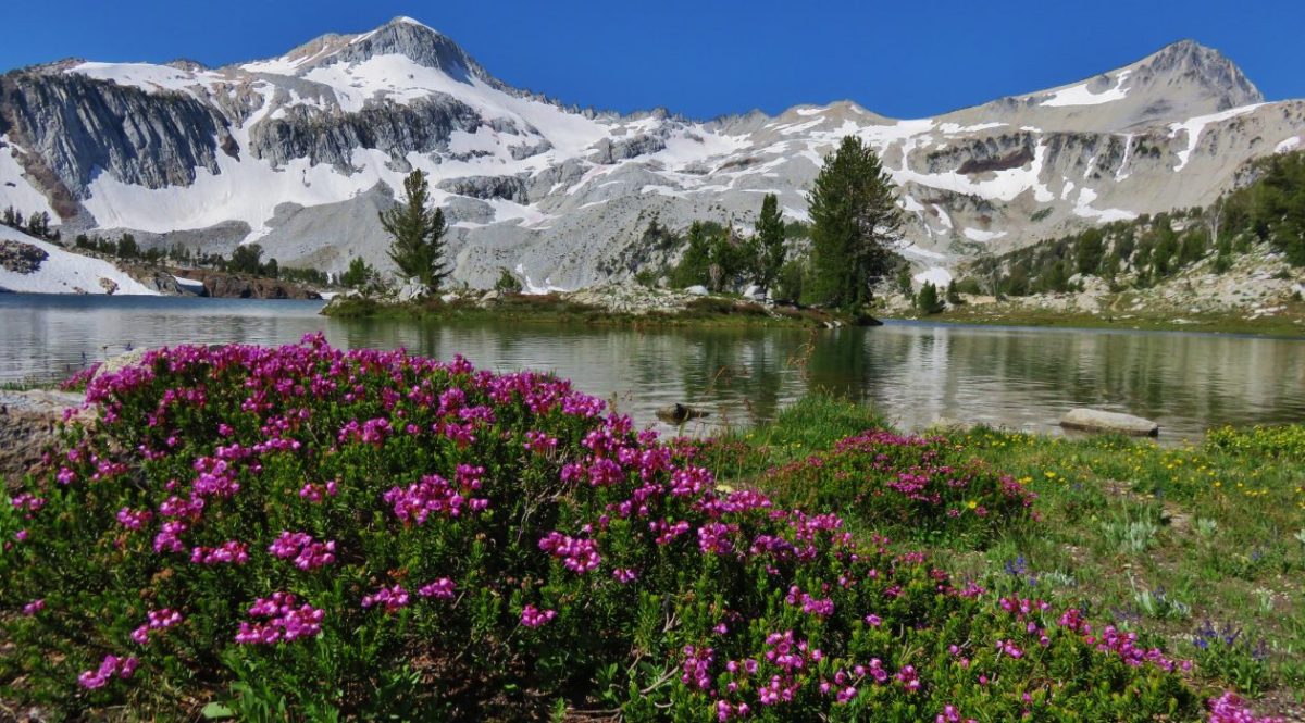


 Painted Hills Unit
 Clarno Unit
 Blue Basin Unit


 B.C. Falls


 The first 0.2-miles followed a rough spur road.
 The trail starting at the 0.2-mile mark.


 An aster or fleabane
 Nettle-leaf giant hyssop
 Haze from wildfires burning in the Pacific Northwest.

 Corkscrew Falls
 One of the few trees that proved a little tricky.

 Smoke hanging over the East Fork Eagle Creek Valley.
 Penstemon
 The different shapes and colors of the peaks in the Wallowa Mountains never cease to impress.
 This section of trail appeared to have fallen victim to an avalanche that came down from the far side of the creek then up this one.
 Paintbrush
 Unnamed waterfall along East Fork Eagle Creek.
 The view improved a little as the day progressed.
 Coneflower along the trail.
 Fireweed
 Last of the mountain coyote mint.


 California tortoiseshell
 Fritillary butterfly
 Post marking the junction with the Hidden Lake Trail.


 View back across the East Fork Eagle Creek Valley.
 More obstacles were present along the Hidden Lake Trail.
 More trail damage.


 Gentians

 Looking back down at Moon Lake.

 On the other side of the ridge is Eagle Lake which we visited in 2023 (


 The Hidden Lake Trail continuing along the unnamed creek.
 There were still a few mountain heather blossoms.
 The unnamed lake.
 Heading cross country looking for the path of least resistance.
 My first view of Hidden Lake.
 Eagle Cap (

 Monkeyflower
 We set up for the afternoon.
 The lake looked to get pretty deep quickly.
 View from our dinner area.


 Gentians
 Last look at the lake.
 Grass of parnassus
 Hawkins Point on the left and Jackson Peak on the right.
 Moon Lake
 Big cricket
 Doe
Doe
 Unnamed creek near our campsite.
 View from camp in the morning. The eyes were looking at me from near the tree in the foreground to the left.
 Recrossing East Fork Eagle Creek.
 Heading into the haze.
 A healthy looking paintbrush.
 The bear had been walking up the outcrop in the shade in the middle of the picture.
 The bear is the black blotch on the rock in front of the tree at center.
 The bear just before it vanished behind the outcrop.
 Hawk in a snag.
 Corkscrew Falls
 Granite Cliff
 “Papa’s Camp” was located at the end of the 0.2-mile spur road.
 East Fork Eagle Creek from an old bridge near Papa’s Camp.
 Granite Cliff rising above East Fork Eagle Creek from the spur road to the trailhead.


 Aster
Aster
 The kiosk is straight ahead in the small gully.
 Cottontail
 In 2023 we had reached the kiosk from the Oregon Trail Ruts Trailhead along Highway 86.


 Looking back toward Panorama Point.


 Dotted is this trip, solid is 2023.